Ordinary
Meeting of Council
TO
BE HELD ON Tuesday, 9 September 2014 AT 7.00pm
Level
3 Council Chambers
Agenda
** ** ** ** ** **
NOTE:
For Full Details, See Council’s Website –
www.kmc.nsw.gov.au
under the link to business papers
APOLOGIEs
DECLARATIONS OF INTEREST
Confirmation of Reports to be
Considered in Closed Meeting
NOTE:
That in
accordance with the provisions of Section 10 of the Local Government Act 1993,
all officers’ reports be released to the press and public, with the exception
of confidential attachments to the following General Business reports:
GB.4 Lindfield Community Hub -
Woodford Lane - Report on Progress
Attachment A2: . Lindfield
Feasibility Study - stage 1 report - FINAL
Attachment A3: Lindfield
Community Hub - Updated Scenarios - economic feasibility - Addendum - FINAL
GB.5 Lindfield Village Green - Confirmation
of Preliminary Scope of Works, Project Budget and Program
Attachment A1: . Lindfield
Village Green - Legal advice regarding use of development contributions
Attachment A2: . Lindfield
Village Green - Concept Estimate (Final) - Wilde and Woollard - July 2014
Attachment A3: . Lindfield
Village Green - cost estimate - Muller Partnership
Attachment A4: . Lindfield
Village Green - Project Cost Estimate - Option 1 and 2 - Altus Page Kirkland
Attachment A5: Lindfield
Village Green - cost of land acquisition versus cost of underground car park
construction
Address the Council
NOTE: Persons
who address the Council should be aware that their address will be tape
recorded.
Documents Circulated to Councillors
CONFIRMATION OF MINUTEs
Minutes of Ordinary Meeting of Council 5
File: S02131
Meeting held 26 August 2014
Minutes numbered 265 to 285
minutes from the Mayor
Petitions
GENERAL BUSINESS
i.
The Mayor to invite Councillors to
nominate any item(s) on the Agenda that they wish to have a site inspection.
ii.
The Mayor to invite Councillors to
nominate any item(s) on the Agenda that they wish to adopt in accordance with
the officer’s recommendation allowing for minor changes without debate.
GB.1 North
Connex Project Response to Environmental Impact Statement 61
File: S10082
For Council to endorse the
attached submission to the Department of Planning and Environment on the North
Connex Project Environmental Impact Statement.
Recommendation:
That Council endorse the attached
submission and covering letter for the North Connex Environmental Impact
Statement review for lodgement with the Department of Planning and Environment.
GB.2 Audited
General Purpose and Special Purpose Financial Reports for year ended 30 June
2014 and Auditor's Report 206
File: FY00259/7
To present to Council the Annual
Financial Statements and audit reports from Council’s external auditor, UHY
Haines Norton Chartered Accountants for the year ended 30 June 2014 and to
provide a summary of Council’s financial performance and financial position at
30 June 2014.
Recommendation:
That Council receives the audited
Financial Statements and the external auditor’s report from UHY Haines Norton
Chartered Accountants.
GB.3 Planning
Proposal - 20-28 Culworth Avenue and 17 Marian Street Killara - Report
following the Exhibition and Public Hearing 349
File: S10083
To have Council consider the
feedback following exhibition and public hearing for the Planning Proposal- 20-28 Culworth Avenue and 17 Marian Street,
Killara known as the Culworth Avenue car park.
Recommendation:
To proceed with the
reclassification of the property at 20-28 Culworth Avenue and 17 Marian Street
Killara known as the Culworth Avenue car park, subject to the detailed
recommendations in this report.
GB.4 Lindfield
Community Hub - Woodford Lane - Report on Progress 657
File: S09780
To seek Council’s approval of
three preferred land use scenarios for the Lindfield Community Hub as the basis
for engaging architectural consultants to prepare illustrative concept designs
for public engagement and exhibition.
Recommendation:
That Council proceed to engage an
architectural consultant to prepare illustrated concept plans, based on the
three preferred land use scenarios recommended in this report, and to seek the
community’s views on the options.
GB.5 Lindfield
Village Green - Confirmation of Preliminary Scope of Works, Project Budget and
Program 715
File: S09529
The purpose of this report is to
update Council on the progress of Lindfield Village Green project including recommending
a preliminary project construction budget, an updated project program and
clarification of scope of works.
Recommendation:
That Council adopts the
preliminary project budget, project program and scope of works as the basis for
moving forward with the project.
GB.6 Amendments
to Sports Facilities Plan of Management for Public Exhibition 739
File: S06604/2
To rectify an anomaly in the
Sports Facilities Plan of Management to bring the permitted hours of clubhouse
use in line with the permitted hours of sportsground use so that licence
agreements with sporting clubs can be negotiated in accordance with the Plan of
Management; and to permit earlier tennis court hire at appropriate locations.
Recommendation:
That Council place on public
exhibition an amendment to the SFPOM to permit the use of clubhouses and
amenities until 10pm on Fridays and Saturdays, and 12am when the club is
hosting a club function or special event and has given surrounding residents at
least seven days’ notice in writing and that Council also place on public
exhibition an amendment to permit tennis court hire from 7am at appropriate
locations.
GB.7 Draft
Policy for Overt Electronic Surveillance in Public Places 745
File: S10030
To consider the draft policy for
use of overt electronic surveillance in public places for crime prevention
associated with illegal dumping, littering, vandalism and graffiti.
Recommendation:
That Council place the draft
policy for the use of overt electronic surveillance in public places on public
exhibition for 28 days and that a further report be presented to Council on
completion of the exhibition period.
Extra Reports Circulated to Meeting
BUSINESS WITHOUT NOTICE – SUBJECT TO CLAUSE 241 OF
GENERAL REGULATIONS
Questions Without Notice
Inspections Committee – SETTING OF TIME, DATE AND
RENDEZVOUS
** ** ** ** ** **
Minute Ku-ring-gai
Council Page
MINUTES OF Ordinary Meeting of Council
HELD ON Tuesday, 26 August 2014
|
Present:
|
The Mayor, Councillor J Anderson (Chairperson) (Roseville
Ward)
Councillors E Malicki & J Pettett (Comenarra Ward)
Councillors D Citer & C Szatow (Gordon Ward)
Councillors C Berlioz & D Ossip (St Ives Ward)
Councillors C Fornari-Orsmond & D McDonald (Wahroonga
Ward)
|
|
|
|
|
Staff Present:
|
General Manager (John McKee)
Director Corporate (David Marshall)
Director Development & Regulation (Michael Miocic)
Director Operations (Greg Piconi)
Director Strategy & Environment (Andrew Watson)
Director Community (Janice Bevan)
Manager Corporate
Communications (Virginia Leafe)
Manager Finance (Angela Apostol)
Manager Records & Governance (Matt Ryan)
Minutes Secretary (Sigrid Banzer)
|
The Meeting
commenced at 7.00pm
The Mayor offered
the Prayer
|
265
|
Apologies
File: S02194
Councillor David Armstrong tendered an apology for
non-attendance [family commitments] and requested leave of absence.
|
|
|
Resolved:
(Moved: Councillors Berlioz/Pettett)
That the apologies from Councillor Armstrong be accepted
and leave of absence granted.
CARRIED
UNANIMOUSLY
|
DECLARATIONS OF
INTEREST
The Mayor
adverted to the necessity for Councillors and staff to declare a Pecuniary
Interest/Conflict of Interest in any item on the Business Paper.
Councillor Duncan McDonald
declared a less than significant non-pecuniary interest in GB.2 - Analysis of
Land and Environment Court Costs - 4th Quarter 2013 to 2014 - [his son is a
lawyer and works for Sparke Hill Moore which the Council may use from time to
time in a consulting and representative capacity]. He also declared that his
decisions tonight would not be influenced by the fact that his son works for
the firm and will be staying in the Chamber for debate and voting on the Item.
Councillor
David Citer declared a significant pecuniary interest in C.1 - T03-2014
Provision of Project Marketing and Sales Agency Services for the Former B2
Lands Subdivision (he declared that he doesn’t think it is in the public
interest for him to reveal the details of that tenderer but would just like to
say that one of the tenderers has been a sponsor of the service that he
manages, the Ku-ring-gai Youth Development Service, and that he has also used
one of the tenderers in the sale of one of his family properties) and that he
will leave the Chamber before the debate and voting on the item.
|
266
|
CONFIRMATION OF REPORTS TO BE
CONSIDERED IN CLOSED MEETING
File: S02499/8
Vide: BN.0
|
|
|
Resolved:
(Moved: Councillor Szatow/Councillor McDonald)
A. That
in accordance with the provisions of Section 10 of the Local Government Act
1993, all officers’ reports be released to the press and public, with the
exception of:
C.1 T03-2014 Provision of
Project Marketing and Sales Agency Services for the Former B2 Lands
Subdivision
C.2 General Manager's
Performance Review Period of review - 12 months to May 2014
B. That
in accordance with the provisions of Section 10 of the Local Government Act
1993, all officers’ reports be released to the press and public, with the
exception of confidential attachments to the following General Business
reports:
Refer GB.6 Engagement of Heritage
Consultants for Review of Heritage Properties and Heritage Conservation Areas
in Pymble
Attachment A2:. Consultants quotes - HCA Peer Review
2014 -
....................... Pymble East/West and Middle
Harbour Road Lindfield
Attachment A3:. Assessment of quotes - HCA Peer
Review 2014 –
Pymble East/West and
Middle Harbour Road Lindfield
CARRIED
UNANIMOUSLY
|
Address the Council
The following members of the
public addressed Council on items not on the Agenda:
M Inglis - Marian
Street Theatre
W Blaxland - Marian
Street Theatre
DOCUMENTS CIRCULATED
TO COUNCILLORS
The Mayor adverted to the
documents circulated in the Councillors’ papers and advised that the following
matters would be dealt with at the appropriate time during the meeting:
|
Memorandums:
|
Refer GB.4 - Draft General and Special Purpose
Financial Statements for the year ended 30 June 2014 – Memorandum
from Director Corporate dated 25 August 2014 advising that on page 110 of the
business paper under the sub-heading Other Expenses, the report should
read “favourable” variance of $891K rather than “unfavourable”.
|
|
Councillors Information:
|
15 Normac Street Roseville – STEP – Building Works
Encroaching Bushland Reserve – Memorandum from Director
Development and Regulation in answer to a Question Without Notice raised by
Councillor David Armstrong at the Ordinary Meeting of Council held 12 August
2014.
|
CONFIRMATION OF
MINUTEs
Standing Orders
were suspended to leave the matter of
Confirmation of
Ordinary Meeting of Council Minutes of 24 June 2014
to later on in the
Meeting
after a Motion
moved by Councillors Ossip and McDonald
For the
Motion: The Mayor, Councillor J Anderson, Councillors
Berlioz, Citer, Fornari-Orsmond, McDonald, Ossip and Szatow
Against
the Motion: Councillors Malicki and Pettett
|
267
|
Minutes of Ordinary
Meeting of Council
File: S02131
|
|
|
Meeting held 12 August 2014
Minutes numbered 247 to 264
|
|
|
Resolved:
(Moved: Councillors McDonald/Fornari-Orsmond)
That Minutes numbered 247 to 264 circulated to Councillors
were taken as read and confirmed as an accurate record of the proceedings of
the Meeting.
CARRIED
UNANIMOUSLY
|
GENERAL BUSINESS
|
268
|
Draft General and
Special Purpose Financial Statements for the year ended 30 June 2014
File: S05273
Vide: GB.4
|
|
|
To present to Council the draft Financial Statements for
the year ended 30 June 2014 for certification and referral to Council’s
external auditor, UHY Haines Norton Chartered Accountants and seek approval
to carry over budgets to fund incomplete works at 30 June 2014.
|
|
|
Resolved:
(Moved: Councillors Pettett/Szatow)
A. That
Council receive and certify the draft Financial Statements for the year ended
30 June 2014.
B. That
the draft Financial Statements be referred to Council’s external auditor, UHY
Haines Norton Chartered Accountants to provide an opinion on the draft
Financial Statements ended 30 June 2014 and to report to Council.
C. That
the draft Financial Statements ended 30 June 2014 be certified by the Mayor,
Deputy Mayor or one other Councillor, the General Manager and the Responsible
Accounting Officer in accordance with Section 413(2)(C) of the Local
Government Act 1993 and the Local Government Code of Accounting Practice and
Financial Reporting.
D. That 9
September 2014 be fixed as the date for the public meeting to present the
audited Financial Statements and the audit reports for the year ended 30 June
2014 as required by Section 419 of the Local Government Act 1993, and that
Council’s external auditor be present to answer questions.
E. That
Council adopt carry over expenditure of $18.006 million to carry forward to
the 2014/15 financial year, as listed in Attachment A1, and borrow $3.883
million for the external loan funded portion of these works.
CARRIED
UNANIMOUSLY
|
|
269
|
Draft Asset
Management Policy
File: S08989
Vide: GB.9
|
|
|
For Council to adopt the revised draft Asset Management
Policy.
|
|
|
Resolved:
(Moved: Councillors Szatow/Citer)
For Council to adopt the revised
draft Asset Management Policy.
CARRIED
UNANIMOUSLY
|
Councillor Citer
declared a significant pecuniary interest
in respect of the
following item – T03-2014 Provision of Project
Marketing and Sales
Agency Services for the Former B2
Lands Subdivision
and withdrew from the
Chamber taking no
partin discussion or voting on the item
|
270
|
T03-2014 Provision
of Project Marketing and Sales Agency Services for the Former B2 Lands Subdivision
File: S08281/4
Vide: C.1
|
|
|
In accordance with the Local
Government Act 1993 and the Local Government (General) Regulation 2005,
in the opinion of the General Manager, the following business is of a kind as
referred to in sections 10A(2)(c) 10A(2)(d)(i) & 10A(2)(d)(ii), of the
Act, and should be dealt with in a part of the meeting closed to the public.
Section 10A(2)(c) of the Act
permits the meeting to be closed to the public in respect of information that
would, if disclosed, confer a commercial advantage on a person with whom the
Council is conducting (or proposes to conduct) business.
The matter is classified
confidential because it deals with the proposed acquisition and/or disposal
of property.
It is not in the public interest
to release this information as it would prejudice Council’s ability to
acquire and/or dispose of the property on appropriate terms and conditions.
Section 10A(2)(d) of the Act
permits the meeting to be closed to the public for business relating to
commercial information of a confidential nature that would, if disclosed:
(i) prejudice
the commercial position of the person who supplied it, or
(ii) confer
a commercial advantage on a competitor of Council, or
(iii) reveal
a trade secret.
This matter is classified
confidential under section 10A(2)(d)(i) because it deals with tenders.
Tender details, should they be revealed, may result in commercial
disadvantage to parties involved in the tender process. Some information
provided to Council by tenderers is provided on the basis that Council will
treat it as commercial in confidence.
It is not in the public interest
to reveal details of these tenders or the assessment process. Tenderers have
provided sensitive information about their operations in the confidence that
their details will not be made public by Council. The practice of
publication of sensitive information provided by tenderers could result in
the withholding of such information by tenderers and reduction in the
provision of information relevant to Council’s decision.
Section 10A(2)(d) of the Act
permits the meeting to be closed to the public for business relating to
commercial information of a confidential nature that would, if disclosed:
(i)
prejudice the commercial position of the person who supplied it, or
(ii)
confer a commercial advantage on a competitor of Council, or
(iii) reveal
a trade secret.
This matter is classified
confidential under section 10A(2)(d)(ii) because it would confer a commercial
advantage on a competitor of the Council.
Report by Director Strategy and Environment and Manager
Strategic Projects dated
13 August 2014.
|
|
|
Resolved:
(Moved: Councillors Ossip/Malicki)
A. That
Council accept the Tender identified in the Tender Evaluation Committee
Recommendation outlined above for the provision of Project Marketing and
Sales Agency Services for the former B2 Lands subdivision at South
Turramurra.
B. That
the Mayor and General Manager be delegated authority to execute all tender
documents on Council’s behalf in relation to the contract.
C. That
the Seal of Council be affixed to all necessary documents.
D. That
all tenderers be advised of council’s decision in accordance with Clause 178
of the Local Government tendering Regulations.
CARRIED
UNANIMOUSLY by those present
|
Councillor Citer
returned
Standing Orders
were suspended to deal with items
where there are
speakers first after a
Motion moved by
Councillors Szatow and Berlioz
was CARRIED
UNANIMOUSLY
|
271
|
Engagement of
Heritage Consultants for Review of Heritage Properties and Heritage
Conservation Areas in Pymble
File: S10014
Vide: GB.6
|
|
|
The
following members of the public addressed Council:
G
Tabuteau
P Cooper
|
|
|
To report on quotations received for the preparation of an
additional HCA Peer Review in East and West Pymble.
|
|
|
Resolved:
(Moved: Councillors Berlioz/Szatow)
A. That
Council receive and note the quotations.
B. That
funds of $9,955 (including GST) be allocated to cover the cost of the
preferred consultant identified in the report, to undertake a review of HCAs
of the identified areas in East and West Pymble.
C. That
funds be identified in the first quarter budget review.
D. That
the commissioning of the preferred consultants for the HCA Review in Pymble
(East and West) be commenced as soon as practical and a further report
brought back to Council on completion of the studies.
CARRIED
UNANIMOUSLY
The above Resolution was
CARRIED as an Amendment to the Original Motion. The Original Motion was:
(Moved: Councillors
McDonald/Fornari-Orsmond)
That Council receive and
note the quotations.
|
|
272
|
Reclassification of
Council-owned land within Pymble, Wahroonga, East and West Pymble
File: S09769
Vide: GB.7
|
|
|
The
following members of the public addressed Council:
J
Clements
K Bevan
G Keating
|
|
|
To have Council consider the feedback following the
exhibition and public hearing for the Planning Proposal to reclassify six
sites within Pymble, Wahroonga, and East and West Lindfield from community to
operational land status.
|
|
|
Resolved:
(Moved: Councillors Berlioz/Szatow)
A. That 19
Hughes Place, East Lindfield be reclassified from Community land to
Operational and as per the planning proposal.
For the
Resolution: The Mayor, Councillor J Anderson, Councillors
Citer, Fornari-Orsmond, Malicki, McDonald, Ossip, Pettett and Szatow
Against
the Resolution: Councillor Berlioz
B. That
9 Eric Street, Wahroonga be reclassified from Community land to Operational
and as per the planning proposal.
CARRIED
UNANIMOUSLY
C. That
57 Merrivale Road, Pymble be reclassified from Community land to Operational
and as per the planning proposal.
For the
Resolution: The Mayor, Councillor J Anderson, Councillors
Fornari-Orsmond, Malicki, Ossip and Pettett
Against
the Resolution: Councillors Berlioz, Citer, McDonald and Szatow
D. That
57 Merrivale Road, Pymble be continued to be used to provide child care
services in the future.
CARRIED
UNANIMOUSLY
E. That
6A Peace Avenue, Pymble be reclassified from Community land to Operational
and as per the planning proposal.
CARRIED
UNANIMOUSLY
F. That
77A Bradfield Road, West Lindfield be reclassified from Community land to
Operational and as per the planning proposal.
CARRIED
UNANIMOUSLY
G. That
Edith Street (between 74/76 Bannock Burn Road), Pymble be reclassified from
Community land to Operational and as per the planning proposal.
CARRIED
UNANIMOUSLY
H. That
Council enter into an agreement with the NSW Office of Strategic Lands on the
process for the sharing of any proceeds from the potential development and
divestment of 9 Eric Street, Wahroonga, net of the costs of obtaining
reclassification and subdivision approvals.
CARRIED
UNANIMOUSLY
I. That
any existing lawfully established access which is currently enjoyed by
property owners for the Edith Street, Pymble site and the Eric Street,
Wahroonga site be protected by appropriate legal means upon reclassification
and divestment of the sites.
CARRIED
UNANIMOUSLY
J. That
the Planning Proposal be submitted to the Minister in accordance with
Division 4 of the Environmental Planning and Assessment Act 1979.
K. That
all persons who made a submission be notified of Council’s decision.
CARRIED
UNANIMOUSLY
|
|
273
|
Planning Proposal
to include ‘Hardware and Building Supplies’ as a Permissible Land Use with
Development Consent in Zone B7 (Business Park) - Consideration of Submissions
File: S10209
Vide: GB.10
|
|
|
The
following members of the public addressed Council:
A Grundy
G
Tabuteau
|
|
|
To consider the submissions arising from the public
exhibition of the planning proposal and request the Department of Planning
and Environment to make the plan in accordance with S59(2) of The EP&A
Act 1979.
|
|
|
Resolved:
(Moved: Councillors Malicki/Ossip)
That the decision be deferred for consideration after the
planning proposal for heritage listing the 3M building as it may become
necessary to excise the 3M building and curtilage from this planning
proposal.
For the
Resolution: The Mayor, Councillor J Anderson, Councillors
Berlioz, Malicki, McDonald, Ossip, Pettett and Szatow
Against
the Resolution: Councillors Citer and Fornari-Orsmond
The above Resolution was
CARRIED as an Amendment to the Original Motion. The Original Motion was:
(Moved: Councillors
Citer/Fornari-Orsmond)
A. That
the Planning Proposal to amend the Ku-ring-gai Planning Scheme Ordinance to
include ‘hardware and building supplies’ as a permissible land use with
development consent in Zone B7 (Business Park) proceed without variation.
B. That
Council proceed to make the Plan under delegated authority under Section
59(2) of the EP&A Act and Regulations.
C. That
those who made a submission be notified of Council’s resolution.
|
|
274
|
Economic
Development Projects - Strategy and Action Plans
File: S09436
Vide: GB.1
|
|
|
To outline to Council, the strategy, approach and budgets
for delivering economic and social development projects in Ku-ring-gai.
|
|
|
Resolved:
(Moved: Councillors Szatow/McDonald)
A. That
Council adopt the recommended programs, initiatives and budgets for ESDAC
projects for 2014/2015.
B. Any
subsequent proposals to expand monies currently included under the
unallocated amount of $24,300 be formally reported back to Council for
ratification throughout the financial year.
CARRIED
UNANIMOUSLY
|
|
275
|
Analysis of Land
and Environment Court Costs - 4th Quarter 2013 to 2014
File: S05273
Vide: GB.2
|
|
|
To report legal costs in relation to development control
matters in the Land and Environment Court for the year ended 30 June 2014.
|
|
|
Resolved:
(Moved: Councillors Fornari-Orsmond/McDonald)
That the
analysis of Land and Environment Court costs for the year ended 30 June 2014
be received and noted.
CARRIED
UNANIMOUSLY
|
|
276
|
Investment Report
as at 31 July 2014
File: S05273
Vide: GB.3
|
|
|
To present Council’s investment portfolio performance for
July 2014.
|
|
|
Resolved:
(Moved: Councillors Szatow/Pettett)
A. That
the summary of investments and performance for July 2014 be received and
noted.
B. That
the Certificate of the Responsible Accounting Officer be noted and the report
adopted.
CARRIED
UNANIMOUSLY
|
|
277
|
30-34 Henry Street
Gordon - Demolish Existing Structures and Construct a Residential Flat
Building containing 44 Units, Basement Parking and Landscaping
File: DA0264/13
Vide: GB.5
|
|
|
To determine Development Application DA0264/13 involving
demolition of existing structures and construction of a residential flat
building comprising 44 units, basement parking and landscaping.
|
|
|
Councillor Ossip
withdrew and was not present for voting on the item
|
|
|
Resolved:
(Moved: Councillors Szatow/Berlioz)
THAT the Council, as the
consent authority, grant deferred commencement development consent to DA
0264/13 for demolition of existing structures and construction of a
residential flat building containing 45 units, basement parking and
landscaping on land at No 30-34 Henry Street Gordon, for a period of two (2)
years from the date of the Notice of Determination, subject to the following:
SCHEDULE A – DEFERRED
COMMENCEMENT TERM:
This consent shall not operate
until the following deferred commencement term is satisfied:
A. Provision of a drainage easement
The applicant shall submit
documentary evidence that the Owners' Corporation of SP13053 (717 Pacific
Highway Gordon) has given written consent to the released of the
inter-allotment drainage easement C540229 and the creation of a new easement
over the renewed pipe shown on Whipps-Wood Drawing 2011-0281 HDA01/P2. This
consent will not operate until the documentary evidence has been submitted to
and approved by Council’s Development Engineer.
Reason: To ensure that provision is made for stormwater
drainage through the site in a proper manner that protects adjoining
properties.
NOTE: The
deferred commencement term must be satisfied within 2 years of the date that
the consent is granted. It the deferred commencement term is not satisfied
within 2 years, the consent will lapse.
Upon receipt of written notification from Council that
the abovementioned condition has been satisfied the consent will operate and
following conditions will apply:
SCHEDULE B – GENERAL CONDITIONS:
Conditions that
identify approved plans:
1. Approved architectural plans and documentation (new development)
The development must be
carried out in accordance with work shown in colour on the following plans
and documentation listed below and endorsed with Council’s stamp, except
where amended by other conditions of this consent.
|
Plan no.
|
Drawn by
|
Dated
|
|
D000
Drawing and Location Plan
|
Koichi
Takada Architects
|
Revision
C 19/05/2014
|
|
D001
Perspective 01
|
Koichi
Takada Architects
|
Revision
C 19/05/2014
|
|
D002
Perspective 02
|
Koichi
Takada Architects
|
Revision
C 19/05/2014
|
|
D003
Perspective 03
|
Koichi
Takada Architects
|
Revision
C 19/05/2014
|
|
D070
Demolition Plan
|
Koichi
Takada Architects
|
Revision
B 01/04/2014
|
|
D097
Basement 3 Floor Plan
|
Koichi
Takada Architects
|
Revision
B 01/04/2014
|
|
D098
Basement 2 Floor Plan
|
Koichi
Takada Architects
|
Revision
B 01/04/2014
|
|
D099
Basement 1 Floor Plan
|
Koichi
Takada Architects
|
Revision
B 01/04/2014
|
|
D101
Level 1 Floor Plan (Ground)
|
Koichi
Takada Architects
|
Revision
D 19/05/2014
|
|
D102
Level 2 Floor Plan
|
Koichi
Takada Architects
|
Revision
D 19/05/2014
|
|
D103
Level 3 Floor Plan
|
Koichi
Takada Architects
|
Revision
B 01/04/2014
|
|
D104
Level 4 Floor Plan
|
Koichi
Takada Architects
|
Revision
B 01/04/2014
|
|
D105
Level 5 Floor Plan
|
Koichi
Takada Architects
|
Revision
C 19/05/2014
|
|
D106
Level 6 Roof Plan
|
Koichi
Takada Architects
|
Revision
C 19/05/2014
|
|
D110
Adaptable Layout Plan 01
|
Koichi
Takada Architects
|
Revision
B 08/07/2014
|
|
D111
Adaptable Layout Plan 01
|
Koichi
Takada Architects
|
Revision
A 08/07/2014
|
|
D120
Proposed Driveway Detail
|
Koichi
Takada Architects
|
Revision
A 13/05/2014
|
|
D200
East & West Elevations
|
Koichi
Takada Architects
|
Revision
C 19/05/2014
|
|
D201
North & South Elevations
|
Koichi
Takada Architects
|
Revision
D 19/05/2014
|
|
D300
Section 01
|
Koichi
Takada Architects
|
Revision
D 19/05/2014
|
|
D301
Section 02
|
Koichi
Takada Architects
|
Revision
D 19/05/2014
|
|
D310
Rear Perspective
|
Koichi
Takada Architects
|
Revision
B 01/04/2014
|
|
D320
Common Areas Perspective
|
Koichi
Takada Architects
|
Revision
B 01/04/2014
|
|
D400
Setback Diagram
|
Koichi
Takada Architects
|
Revision
B 01/04/2014
|
|
D401
40% Site Coverage Diagram
|
Koichi
Takada Architects
|
Revision
B 01/04/2014
|
|
D402
30% Deep Soil Diagram
|
Koichi
Takada Architects
|
Revision
C 19/05/2014
|
|
D403
FSR Calculation
|
Koichi
Takada Architects
|
Revision
B 01/04/2014
|
|
D404
Natural Ventilation Diagram
|
Koichi
Takada Architects
|
Revision
B 01/04/2014
|
|
D406
Communal Open Space
|
Koichi
Takada Architects
|
Revision
B 01/04/2014
|
|
D407
Private Open Space
|
Koichi
Takada Architects
|
Revision
B 01/04/2014
|
|
D408
Apartment Mix
|
Koichi
Takada Architects
|
Revision
B 01/04/2014
|
|
D409
Elevation Diagram - Setback to Heritage Building
|
Koichi
Takada Architects
|
Revision
B 01/04/2014
|
|
D410
Storage Diagram
|
Koichi
Takada Architects
|
Revision
B 01/04/2014
|
|
D425
Planting Diagram
|
Koichi
Takada Architects
|
Revision
A 19/05/2014
|
|
D500
Waste Management and Preliminary Construction Plan
|
Koichi
Takada Architects
|
Revision
B 01/04/2014
|
|
D600
External Finishes
|
Koichi
Takada Architects
|
Revision
B 01/04/2014
|
|
2011-0281
HDA01/P2 Hydraulic Services Plan
|
AJ
Whipps Consulting Group
|
P2
13/05/2014
|
|
L001
Landscape Plan - Level 5
|
Peta
Gilliland Landscape Design
|
Revision
H 08/06/11
|
|
L002
Landscape Plan - Level 5
|
Peta
Gilliland Landscape Design
|
Revision
D 25/06/13
|
|
Document(s)
|
Dated
|
|
BASIX
certificate No. 491503M_03
|
14
May 2014
|
|
Waste
Management Plan - Ku-ring-gai Council Template
|
Unsigned
/ Undated
|
|
Noise
and Vibration Impact Assessment prepared by Acoustic Logic Ref 20130618.1/1207A/R0/JR
|
12/07/2013
|
|
Preliminary
Geotechnical Investigation prepared by JK Geotechnics Ref 2492Srptrev1
|
16/07/2013
|
|
Access
Report prepared by Mark Relf of Accessibility Solutions Pty Ltd
|
22/07/2013
|
|
Traffic
Impact Assessment prepared by Traffix Traffic & Transport Planners Ref11.093r01v03
|
Revision
3 19/07/2013
|
|
Arboricultural
Impact Report prepared by Guy Paroissien of Landscape Matrix Pty Ltd
|
Revised
04/07/2013
|
Reason: To
ensure that the development is in accordance with the determination.
2. Inconsistency between documents
In
the event of any inconsistency between conditions of this consent and the
drawings/documents referred to above, the conditions of this consent prevail.
Reason: To
ensure that the development is in accordance with the determination.
3. Approved landscape plans
Landscape
works shall be carried out in accordance with the following landscape
plan(s), listed below and endorsed with Council’s stamp, except where amended
by other conditions of this consent:
|
Plan
no.
|
Drawn
by
|
Dated
|
|
Landscape Plan L001/H and L002/D
|
Peta Gilliland Landscape Design
|
15/05/14
|
Reason: To
ensure that the development is in accordance with the determination.
Conditions to be
satisfied prior to demolition, excavation or construction:
4. Asbestos works
All
work involving asbestos products and materials, including
asbestos-cement-sheeting (ie Fibro), must be carried out in accordance with
the guidelines for asbestos work published by WorkCover Authority of NSW.
Reason: To
ensure public safety
5. Groundwater inflow predictions
1. The predicted instantaneous inflow rate
(expressed in litres per second) and the predicted groundwater extraction
volume (expressed in mega-litres) for the defined period of construction (expressed
in months) of the development shall be determined and advised to the NSW
Office of Water. The treatment, management and disposal of the pumped
groundwater will be subject to the approval of the appropriate regulatory
authority.
2. The predicted
instantaneous inflow rate (expressed in litres per second) and the predicted
groundwater extraction volume (expressed in mega-litres per year) for the
long-term operation of the development shall be determined and advised to
the NSW Office of Water. The treatment, management and disposal of the pumped
groundwater will be subject to the approval of the appropriate regulatory
authority.
Note: The appropriate regulatory authority may
be either Council, Sydney Water, the NSW Environmental Protection Authority
or the NSW Office fo Water, depending on the quality or contamination status
of the groundwater and the proposed method of disposal.
Reason: To protect the environment.
6. Notice of commencement
At least 48 hours prior to the
commencement of any development (including demolition, excavation, shoring or
underpinning works), a notice of commencement of building or subdivision work
form and appointment of the principal certifying authority form shall be
submitted to Council.
Reason: Statutory
requirement.
7. Notification of builder’s details
Prior
to the commencement of any development or excavation works, the Principal
Certifying Authority shall be notified in writing of the name and contractor
licence number of the owner/builder intending to carry out the approved
works.
Reason: Statutory requirement.
8. Dilapidation survey and report (public
infrastructure)
Prior to the commencement of
any development or excavation works on site, the Principal Certifying
Authority shall be satisfied that a dilapidation report on the visible and
structural condition of all structures of the following public
infrastructure, has been completed and submitted to Council:
Public infrastructure
Full road pavement width, including kerb and gutter,
of Henry Street over the site frontage.
The report must be completed
by a consulting structural/civil engineer. Particular attention must be paid
to accurately recording (both written and photographic) existing damaged
areas on the aforementioned infrastructure so that Council is fully informed
when assessing any damage to public infrastructure caused as a result of the
development.
The developer may be held
liable to any recent damage to public infrastructure in the vicinity of the
site, where such damage is not accurately recorded by the requirements of
this condition prior to the commencement of works.
Note: A written acknowledgment from Council must be
obtained (attesting to this condition being appropriately satisfied) and
submitted to the Principal Certifying Authority prior to the commencement of
any excavation works.
Reason: To record the structural condition of public
infrastructure before works commence.
9. Archival recording of buildings
Prior to the commencement of
any development or excavation works on site, the Principal Certifying
Authority shall be satisfied that an archival report has been submitted to
Council’s Heritage Advisor.
The report must consist of an
archival standard photographic record of the building (internally and
externally), its garden and views of it from the street illustrating its
relationship to neighbouring properties and the streetscape. Recording shall
be undertaken in accordance with the guidelines for “Photographic Recording
of Heritage Items Using Film or Digital Capture (2006)” prepared by the New
South Wales Heritage Office.
Information shall be bound in
an A4 report format. It shall include copies of photographs, referenced to
plans of the site. Two (2) copies (one (1) copy to include negatives or CD of
images shall be submitted to Council's Heritage Advisor. The recording
document will be held in the local studies collection of Ku-ring-gai Library,
the local historical society and Council’s files.
Note: A written acknowledgment from Council must be
obtained (attesting to this condition being appropriately satisfied) and
submitted to the Principal Certifying Authority prior to the commencement of
any works.
Reason: To ensure the proper management of historical
artefacts and to ensure their preservation.
10. Dilapidation survey and report
(private property)
Prior to the commencement of
any demolition or excavation works on site, the Principal Certifying
Authority shall be satisfied that a dilapidation report on the visible and
structural condition of all structures upon the following lands, has been
completed and submitted to Council:
|
Addresses:
|
|
Nos 28
and 36 Henry Street
|
|
Nos 713, 717 and 719 Pacific
Highway
|
|
|
The dilapidation report must
include a photographic survey of adjoining properties detailing their
physical condition, both internally and externally, including such items as
walls ceilings, roof and structural members. The report must be completed by
a consulting structural/geotechnical engineer as determined necessary by that
professional based on the excavations for the proposal and the recommendations
of the submitted geotechnical report.
In the event that access for
undertaking the dilapidation survey is denied by a property owner, the
applicant must demonstrate in writing to the satisfaction of the Principal
Certifying Authority that all reasonable steps have been taken to obtain
access and advise the affected property owner of the reason for the survey
and that these steps have failed.
Note: A copy of the dilapidation report is to be
provided to Council prior to any excavation works been undertaken. The
dilapidation report is for record keeping purposes only and may be used by an
applicant or affected property owner to assist in any civil action required
to resolve any dispute over damage to adjoining properties arising from
works.
Reason: To record the structural condition of likely
affected properties before works commence.
11. Geotechnical report
Prior to the commencement of
any bulk excavation works on site, the applicant shall submit to the
Principal Certifying Authority, the results of the detailed geotechnical
investigation recommended in JK Geotechnics report dated 16 July 2013.
The report is to address such matters as:
· appropriate excavation
methods and techniques
· vibration management and
monitoring
· dilapidation survey
· support and retention of
excavated faces
· hydrogeological
considerations
The recommendations of the
report are to be implemented during the course of the works.
Reason: To ensure the safety and protection of property.
12. Construction and traffic management
plan
The applicant must submit to
Council a Construction Traffic Management Plan (CTMP), which is to be approved
prior to the commencement of any works on site.
The plan is to consist of a
report with Traffic Control Plans attached.
The report is to contain
commitments which must be followed by the demolition and excavation
contractor, builder, owner and subcontractors. The CTMP applies to all
persons associated with demolition, excavation and construction of the
development.
The report is to contain
construction vehicle routes for approach and departure to and from all
directions.
The report is to contain a
site plan showing entry and exit points. Swept paths are to be shown on the
site plan showing access and egress for an 11 metre long heavy rigid vehicle.
The Traffic Control Plans are
to be prepared by a qualified person (red card holder). One must be provided
for each of the following stages of the works:
· Demolition
· Excavation
· Concrete pour
· Construction of vehicular
crossing and reinstatement of footpath
· Traffic control for
vehicles reversing into or out of the site.
Traffic controllers must be in
place at the site entry and exit points to control heavy vehicle movements in
order to maintain the safety of pedestrians and other road users.
For safety and amenity, no
heavy vehicle movements are to occur in Henry Street during school drop-off
(8.00am to 9.30am) and pick-up (2.30pm to 4.00pm) periods.
When a satisfactory CTMP is
received, a letter of approval will be issued with conditions attached.
Traffic management at the site must comply with the approved CTMP as well as
any conditions in the letter issued by Council. Council’s Rangers will be
patrolling the site regularly and fines may be issued for any non-compliance
with this condition.
Reason: To ensure that appropriate measures have been
considered during all phases of the construction process in a manner that
maintains the environmental amenity and ensures the ongoing safety and
protection of people.
13. Work zone
A Works Zone is to be provided
in Henry Street, subject to the approval of the Ku-ring-gai Local Traffic
Committee.
No loading or unloading must
be undertaken from the public road or nature strip unless within a Works Zone
which has been approved and paid for.
In the event the work zone is
required for a period beyond that initially approved by the Traffic
Committee, the applicant shall make a payment to Council for the extended
period in accordance with Council’s schedule of fees and charges for work
zones prior to the extended period commencing.
Reason: To ensure that appropriate measures have been
made for the operation of the site during the construction phase.
14. Erosion and drainage management
Earthworks and/or demolition
of any existing buildings shall not commence until an erosion and sediment
control plan is submitted to and approved by the Principal Certifying
Authority. The plan shall comply with the guidelines set out in the NSW
Department of Housing manual "Managing Urban Stormwater: Soils and
Construction" certificate. Erosion and sediment control works shall be
implemented in accordance with the erosion and sediment control plan.
Reason: To preserve and enhance the natural environment.
15. Marking of trees to be removed
All trees that are to be
removed are to be clearly marked on site by the project arborist in
accordance with the approved plans. All other trees are to be retained.
Reason: To protect
existing trees during the construction phase.
16. Tree protection fencing
To
preserve the following tree/s, no work shall commence until the area beneath their
canopy is fenced off at the specified radius from the trunk/s to prevent any
activities, storage or the disposal of materials within the fenced area. The
fence/s shall be maintained intact until the completion of all
demolition/building work on site.
|
Schedule
|
|
Tree/location
|
Radius from trunk
|
|
Tree 8/ Camellia sasanqua (Chinese Camellia) This tree
is located at the south-eastern corner of the site, within the adjacent
property
|
2m
|
|
Tree 10/ Eucalyptus microcorys (Tallowood) This tree is
located at the south-eastern corner of the site, within the adjacent
property
|
4m
|
|
Tree 13/ Livistona chinensis (Chinese Fan Palm) This
tree is located on the southern boundary of the site
|
2m
|
|
Tree 16/ Brachychiton acerifolius (Flame Tree) This
tree is located at the south-western corner of the site, within the
adjacent property
|
3m
|
|
Tree 17/ Pistacia chinensis (Pistacia) This tree is
located at the south-western corner of the site, within the adjacent
property.
|
3m
|
|
Tree 35/ Jacaranda mimosifolia (Jacaranda) This tree is
located on the western boundary of the site, within the adjacent property.
|
4m
|
|
Tree 45/ Euphorbia pulcherrima (Pointsettia) This tree
is located on the northern boundary of the site, within the adjacent
property
|
3.0m
|
|
Tree 46/ Jacaranda mimosifolia (Jacaranda) This tree is
located on the northern boundary of the site
|
3.0m
|
Reason: To
protect existing trees during the construction phase.
17. Tree protection fencing excluding
structure
To
preserve the following tree/s, no work shall commence until the area beneath
their canopy excluding that area of the approved driveway shall be fenced off
for the specified radius from the trunk to prevent any activities, storage or
the disposal of materials within the fenced area. The fence/s shall be
maintained intact until the completion of all demolition/building work on
site:
|
Schedule
|
|
Tree/location
|
Radius from trunk
|
|
Tree 2/ Castanospermum australe (Moreton Bay Chestnut)
This tree is located on the Henry Street nature reserve.
|
4.1m
|
|
Tree 4/ Castanospermum australe (Moreton Bay Chestnut)
This tree is located on the Henry Street frontage.
|
4.8m
|
Reason: To
protect existing trees during the construction phase.
18. Tree protection fencing excluding
structure
To
preserve the following tree/s, no work shall commence until the area beneath
their canopy excluding that area of the approved driveway shall be fenced off
for the specified radius from the trunk to prevent any activities, storage or
the disposal of materials within the fenced area. The fence/s shall be
maintained intact until the completion of all demolition/building work on
site:
|
Schedule
|
|
Tree/location
|
Radius from trunk
|
|
Tree 2/ Castanospermum australe (Moreton Bay Chestnut)
This tree is located on the Henry Street nature reserve.
|
4.1m
|
|
Tree 4/ Castanospermum australe (Moreton Bay Chestnut)
This tree is located on the Henry Street frontage.
|
4.8m
|
Reason: To
protect existing trees during the construction phase.
19. Tree protection signage
Prior
to works commencing, tree protection signage is to be attached to each tree
protection zone, displayed in a prominent position and the sign repeated at
10 metres intervals or closer where the fence changes direction. Each sign
shall contain in a clearly legible form, the following information:
Tree protection zone.
· This fence has been installed to prevent damage to the
trees and their growing environment both above and below ground and access is
restricted.
· Any encroachment not previously approved within the tree
protection zone shall be the subject of an arborist's report.
· The arborist's report shall provide proof that no other
alternative is available.
· The Arborist's report shall be submitted to the Principal
Certifying Authority for further consultation with Council.
· The name, address, and telephone number of the developer.
Reason: To
protect existing trees during the construction phase.
20. Tree protection mulching
Prior
to works commencing and throughout construction, the area of the tree
protection zone is to be mulched to a depth of 100mm with composted organic
material being 75% Eucalyptus leaf litter and 25% wood.
Reason: To
protect existing trees during the construction phase.
21. Ground protection - avoiding soil
compaction
To preserve the following
tree/s and avoid soil compaction, no work shall commence until temporary
ground protection measures to avoid soil compaction (eg rumble boards or
existing paving) beneath the canopy of the following tree/s and between the
proposed excavation works and the temporary fencing is/are installed.
|
Schedule
|
|
Tree/Location
|
|
Tree 46/ Jacaranda mimosifolia
(Jacaranda) This tree is located on the northern boundary of the site
|
Reason: To protect existing trees during the
construction phase.
22. Tree fencing inspection
Upon
installation of the required tree protection measures, an inspection of the
site by the Principal Certifying Authority is required to verify that tree
protection measures comply with all relevant conditions.
Reason: To
protect existing trees during the construction phase.
23. Construction waste management plan
Prior to the commencement of
any works, the Principal Certifying Authority shall be satisfied that a waste
management plan, prepared by a suitably qualified person, has been prepared
in accordance with Council’s DCP 40 - Construction and Demolition Waste Management.
The plan shall address all
issues identified in DCP 40, including but not limited to: the estimated
volume of waste and method for disposal for the construction and operation
phases of the development.
Note: The plan shall be provided to the Certifying
Authority.
Reason: To ensure appropriate management of construction
waste.
24. Noise and vibration management plan
Prior to the commencement of
any works, a noise and vibration management plan is to be prepared by a
suitably qualified expert addressing the likely noise and vibration from
demolition, excavation and construction of the proposed development and
provided to the Principal Certifying Authority. The
management plan is to identify amelioration measures to achieve the best
practice objectives of AS 2436-2010 and NSW Environment Protection Authority
Interim Construction Noise Guidelines. The report shall be prepared in
consultation with any geotechnical report that itemises equipment to be used
for excavation works.
The management plan shall
address, but not be limited to, the following matters:
· identification
of the specific activities that will be carried out and associated noise
sources;
· identification
of all potentially affected sensitive receivers, including residences,
commercial premises and properties containing noise sensitive equipment;
· the
construction noise objective specified in the conditions of this consent;
· the
construction vibration criteria specified in the conditions of this consent;
· determination
of appropriate noise and vibration objectives for each identified sensitive
receiver;
· noise
and vibration monitoring, reporting and response procedures;
· assessment
of potential noise and vibration from the proposed demolition, excavation and
construction activities, including noise from construction vehicles and any
traffic diversions;
· description
of specific mitigation treatments, management methods and procedures that
will be implemented to control noise and vibration during construction;
· construction
timetabling to minimise noise impacts including time and duration
restrictions, respite periods and frequency;
· procedures
for notifying surrounding occupants of construction activities that are
likely to affect their amenity through noise and vibration;
· contingency
plans to be implemented in the event of non-compliances and/or noise
complaints;
Reason: To protect the amenity afforded to surrounding
residents and commercial occupants during the construction process.
25. Support for Council roads,
footpaths, drainage reserves
Council property adjoining the
construction site must be fully supported at all times during all excavation
and construction works. Details of shoring, propping and anchoring of works
adjoining Council property, prepared by a qualified structural engineer or
geotechnical engineer, must be submitted to and approved by the Principal
Certifying Authority (PCA), before the commencement of the works. A copy of
these details must be forwarded to Council. Backfilling of excavations
adjoining Council property or any void remaining at completion of
construction between the building and Council property must be fully
compacted prior to the completion of works.
Reason: To protect Council’s infrastructure.
Conditions to be
satisfied prior to the issue of the construction certificate:
26. Consolidation of allotments
The three allotments subject
of this development application shall be consolidated into one allotment and
registered with the Department of Property and Information prior to the issue
of a construction certificate.
The
lots to be consolidated are:
· 30 Henry Street, Gordon Lot B in DP
945897
· 32 Henry Street, Gordon Lot 1 in DP
940309
· 34 Henry Street, Gordon Lot 1 in DP
178704
Reason: To ensure
orderly development of land.
27. Design elements of building
The Certifying Authority shall
ensure that the integrated shading devices as indicated on the perspective
drawings nominated in the approved plan set are maintained on the
Construction Certificate drawings to ensure the development provides for satisfactory
privacy and environmental design.
Reason: Compliance
with the principles of SEPP 65.
28. Ventilation of kitchens
Unit kitchens shall be
provided with mechanical ventilation to ensure appropriate amenity is
maintained for residents.
Reason: To ensure
adequate ventilation is provided.
29. Adaptable units
Prior to the issue of a
Construction Certificate, the Certifying Authority shall be satisfied that a
minimum of four units are designed as adaptable housing on accordance with
the provisions of Australian Standard AS4299-1995: Adaptable Housing.
Note: Evidence
from an appropriately qualified professional demonstrating compliance with
this control is to be submitted to and approved by the Certifying Authority
prior to the issue of a Construction Certificate.
Reason: Statutory
requirement.
30. Car wash
One visitors car parking space
shall be equipped with a tap and appropriately drained (to the sewer) to
provide for appropriate facilities for car washing.
Reason: Compliance
with DCP (Local Centres)
31. Long service levy
In accordance with Section 109F(i)
of the Environmental Planning and Assessment Act a Construction Certificate
shall not be issued until any long service levy payable under Section 34 of
the Building and Construction Industry Long Service Payments Act 1986 (or
where such levy is payable by instalments, the first instalment of the levy)
has been paid. Council is authorised to accept payment. Where payment has
been made elsewhere, proof of payment is to be provided to Council.
Reason: Statutory requirement.
32. Builder’s indemnity insurance
The applicant, builder,
developer or person who does the work on this development, must arrange
builder’s indemnity insurance and submit the certificate of insurance in
accordance with the requirements of Part 6 of the Home Building Act 1989 to the
Certifying Authority for endorsement of the plans accompanying the
Construction Certificate.
It is the responsibility of
the applicant, builder or developer to arrange the builder's indemnity
insurance for residential building work over the value of $20,000. The
builder's indemnity insurance does not apply to commercial or industrial
building work or to residential work valued at less than $20,000, nor to work
undertaken by persons holding an owner/builder's permit issued by the
Department of Fair Trading (unless the owner/builder's property is sold
within 7 years of the commencement of the work).
Reason: Statutory
requirement.
33. Outdoor lighting
Prior to the issue of a
Construction Certificate, the Certifying Authority shall be satisfied that
all outdoor lighting will comply with AS/NZ1158.3: 1999 Pedestrian Area
(Category P) Lighting and AS4282: 1997 Control of the Obtrusive Effects of
Outdoor Lighting.
Note: Details demonstrating compliance with these
requirements are to be submitted prior to the issue of a Construction
Certificate.
Reason: To provide high quality external lighting for
security without adverse affects on public amenity from excessive
illumination levels.
34. Air drying facilities
Prior to the issue of the
Construction Certificate, the Certifying Authority shall be satisfied that a
common open space area dedicated for open air drying of clothes is provided.
This area is to be located at ground level behind the building line and in a
position not visible from the public domain.
In
lieu of the above, written confirmation that all units will be provided with
internal clothes drying facilities prior to the Occupation Certificate is to
be submitted to the Certifying Authority prior to the issue of the
Construction Certificate.
Reason: Amenity & energy efficiency.
35. External service pipes and the like
prohibited
Proposed water pipes, waste
pipes, stack work, duct work, mechanical ventilation plant and the like must
be located within the building. Details confirming compliance with this
condition must be shown on construction certificate plans and detailed with
construction certificate specifications. Required external vents or vent
pipes on the roof or above the eaves must be shown on construction
certificate plans and detailed with construction certificate specifications.
External vents or roof vent pipes must not be visible from any place unless
detailed upon development consent plans. Where there is any proposal to fit
external service pipes or the like this must be detailed in an amended
development (S96) application and submitted to Council for determination.
Vent pipes required by Sydney
Water must not be placed on the front elevation of the building or front roof
elevation. The applicant, owner and builder must protect the appearance of
the building from the public place and the appearance of the streetscape by
elimination of all external services excluding vent pipes required by Sydney
Water and those detailed upon development consent plans.
Reason: To protect the
streetscape and the integrity of the approved development.
36. Access for people with disabilities
(residential)
Prior to the issue of the Construction
Certificate, the Certifying Authority shall be satisfied that access for
people with disabilities to and from and between the public domain,
residential units and all common open space areas is provided. Consideration
must be given to the means of dignified and equitable access.
Compliant access provisions
for people with disabilities shall be clearly shown on the plans submitted
with the Construction Certificate. All details shall be provided to the
Principal Certifying Authority prior to the issue of the Construction
Certificate. All details shall be prepared in consideration of the Disability
Discrimination Act, and the relevant provisions of AS1428.1, AS1428.2,
AS1428.4 and AS 1735.12.
Access is to be provided to
the court yard located at the western end of the entry foyer by way of a
stair lift or alternate compliant solution.
Reason: To ensure the provision of equitable and
dignified access for all people in accordance with disability discrimination
legislation and relevant Australian Standards.
37. Excavation for services
Prior
to the issue of the Construction Certificate, the Principal Certifying
Authority shall be satisfied that no proposed underground services (ie:
water, sewerage, drainage, gas or other service) unless previously approved
by conditions of consent, are located beneath the canopy of any tree
protected under Council’s Tree Preservation Order, located on the subject
allotment and adjoining allotments.
Note: A
plan detailing the routes of these services and trees protected under the
Tree Preservation Order shall be submitted to the Principal Certifying
Authority.
Reason: To
ensure the protection of trees.
38. Recycling and waste management
Prior to the issue of the
Construction Certificate, the Certifying Authority shall be satisfied that
the development provides a common garbage collection/separation area
sufficient in size to store all wheelie garbage bins and recycling bins
provided by Council for the number of units in the development in accordance
with DCP 40. The garbage collection point is to be accessible by Council’s
Waste Collection Services.
The responsibility for:
· the cleaning of waste
rooms and waste service compartments; and
· the transfer of bins
within the property, and to the collection point once the development is in
use;
shall be determined when
designing the system and clearly stated in the Waste Management Plan.
Note: The architectural plans are to be amended and
provided to the Certifying Authority.
Reason: Environmental protection.
39. Noise from plant in residential zone
Prior to the issue of the
Construction Certificate an acoustic design report shall be prepared by an
appropriately qualified acoustic consultant identifying all mechanical
ventilation equipment and other noise generating plant including, but not
limited to car park and garbage room exhaust, roller shutter doors, air
conditioners and lifts proposed as part of the development. The report shall
provide acoustic design detailing and recommendations to address any
potential noise impacts to ensure that the operation of an individual piece
of equipment or operation of equipment in combination will not exceed more
than 5dB(A) above the background (LA90, 15 min) level during the day when
measured at the nearest adjoining property boundary and shall not be audible
within a habitable room in any residential premises between the hours of
10.00pm and 7.00am.
Reason: To comply with best practice standards for
residential acoustic amenity.
40. Location of plant (residential flat
buildings)
Prior to the issue of the
Construction Certificate, the Certifying Authority shall be satisfied that
all plant and equipment (including but not limited to air conditioning
equipment) is located within the basement or plant room as shown on the
approved plans.
Note: Architectural plans identifying the location
of all plant and equipment shall be provided to the Certifying Authority.
Reason: To minimise impact on surrounding properties,
improved visual appearance and amenity for locality.
41. Driveway crossing levels
Prior to issue of the
Construction Certificate, driveway and associated footpath levels for any
new, reconstructed or extended sections of driveway crossings between the
property boundary and road alignment must be obtained from Ku-ring-gai
Council. Such levels are only able to be issued by Council under the Roads
Act 1993. All footpath crossings, laybacks and driveways are to be
constructed according to Council's specifications "Construction of
Gutter Crossings and Footpath Crossings".
Specifications are issued with
alignment levels after completing the necessary application form at Customer
Services and payment of the assessment fee. When completing the request for
driveway levels application from Council, the applicant must attach a copy of
the relevant development application drawing which indicates the position and
proposed level of the proposed driveway at the boundary alignment.
This development consent is
for works wholly within the property. Development consent does not imply
approval of footpath or driveway levels, materials or location within the
road reserve, regardless of whether this information is shown on the
development application plans. The grading of such footpaths or driveways
outside the property shall comply with Council's standard requirements. The
suitability of the grade of such paths or driveways inside the property is
the sole responsibility of the applicant and the required alignment levels
fixed by Council may impact upon these levels.
The construction of footpaths
and driveways outside the property in materials other than those approved by
Council is not permitted.
Reason: To provide suitable vehicular access without disruption
to pedestrian and vehicular traffic.
42. Driveway grades - basement car parks
Prior to the issue of the
Construction Certificate, longitudinal driveway sections are to be prepared
by a qualified civil/traffic engineer and be submitted for to and approved by
the Certifying Authority. These profiles are to be at 1:100 scale along both
edges of the proposed driveway, starting from the centreline of the frontage
street carriageway to the proposed basement floor level. The traffic engineer
shall provide specific written certification on the plans that:
· vehicular access can be
obtained using grades of 20% (1 in 5) maximum and
· all changes in grade
(transitions) comply with Australian Standard 2890.1 -“Off-street car
parking” (refer clause 2.5.3) to prevent the scraping of the underside of
vehicles.
If a new driveway crossing is
proposed, the longitudinal sections must incorporate the driveway crossing
levels as issued by Council upon prior application.
Reason: To provide suitable vehicular access without
disruption to pedestrian and vehicular traffic.
43. Basement car parking details
Prior to issue of the
Construction Certificate, certified parking layout plan(s) to scale showing
all aspects of the vehicle access and accommodation arrangements must be
submitted to and approved by the Certifying Authority. A qualified
civil/traffic engineer must review the proposed vehicle access and
accommodation layout and provide written certification on the plans that:
· all parking space
dimensions, driveway and aisle widths, driveway grades, transitions,
circulation ramps, blind aisle situations and other trafficked areas comply
with Australian Standard 2890.1 - 2004 “Off-street car parking”
· a clear height clearance
of 2.6 metres (required for waste collection trucks) is provided over
the designated garbage collection truck manoeuvring areas within the basement
· no doors or gates are
provided in the access driveways to the basement carpark which would prevent
unrestricted access for internal garbage collection at any time from the
basement garbage storage and collection area
· the vehicle access and
accommodation arrangements are to be constructed and marked in accordance
with the certified plans
Reason: To ensure that parking spaces are in accordance
with the approved development.
44. Drainage of paved areas
All new exposed impervious
areas graded towards adjacent property and/or habitable areas are to be
drained via the main drainage system. This may require the installation of
suitable inlets pits, cut-off structures (e.g. kerb), and/or barriers that
direct such runoff to the formal drainage system. Details of such measures
shall be shown on the Construction Certificate drawings, to the satisfaction
of the Certifying Authority.
Reason: To control surface run off and protect the
environment.
45. Car parking allocation
Car parking within the
development shall be allocated in the following way:
|
Resident car spaces
|
53
|
|
Visitor spaces
|
11
|
|
Total spaces
|
64
|
Each adaptable dwelling must
be provided with car parking complying with the dimensional and location
requirements of AS2890.1 - parking spaces for people with disabilities.
At least one visitor space
shall also comply with the dimensional and location requirements of AS2890.1
- parking spaces for people with disabilities.
Consideration must be given to
the means of access from disabled car parking spaces to other areas within
the building and to footpath and roads and shall be clearly shown on the
plans submitted with the Construction Certificate.
Reason: To ensure equity of access and appropriate
facilities are available for people with disabilities in accordance with
federal legislation.
46. Number of bicycle spaces
The basement car park shall be
adapted to provide 14 bicycle spaces in accordance with DCP (Local Centres).
The bicycle parking spaces shall be designed in accordance with AS2890.3.
Details shall be submitted to the satisfaction of the Certifying Authority
prior to the issue of a Construction Certificate.
Reason: To provide alternative modes of transport to and
from the site.
47. Energy Australia requirements
Prior to issue of the
Construction Certificate, the applicant must contact Energy Australia
regarding power supply for the subject development. A written response
detailing the full requirements of Energy Australia (including any need for
underground cabling, substations or similar within or in the vicinity the
development) shall be submitted to the Principal Certifying Authority for
approval prior to issue of the Construction Certificate.
Any structures or other
requirements of Energy Australia shall be indicated on the plans issued with
the Construction Certificate, to the satisfaction of the Principal Certifying
Authority and Energy Australia. The requirements of Energy Australia must be
met in full prior to issue of the Occupation Certificate.
Reason: To ensure compliance with the requirements of
Energy Australia.
48. Utility provider requirements
Prior to issue of the
Construction Certificate, the applicant must make contact with all relevant
utility providers whose services will be impacted upon by the development. A
written copy of the requirements of each provider, as determined necessary by
the Certifying Authority, must be obtained. All utility services or
appropriate conduits for the same must be provided by the developer in
accordance with the specifications of the utility providers.
Reason: To ensure compliance with the requirements of
relevant utility providers.
49. Underground services
All electrical services
(existing and proposed) shall be undergrounded from the proposed building on
the site to the appropriate power pole(s) or other connection point.
Undergrounding of services must not disturb the root system of existing trees
and shall be undertaken in accordance with the requirements of the relevant
service provided. Documentary evidence that the relevant service provider has
been consulted and that their requirements have been met are to be provided
to the Certifying Authority prior to the issue of the Construction
Certificate. All electrical and telephone services to the subject property must
be placed underground and any redundant poles are to be removed at the
expense of the applicant.
Reason: To provide infrastructure that facilitates the
future improvement of the streetscape by relocation of overhead lines below
ground.
Conditions to be
satisfied prior to the issue of the construction certificate or prior
to demolition, excavation or
construction (whichever comes first):
50. Infrastructure restorations fee
To ensure that damage to
Council Property as a result of construction activity is rectified in a
timely matter:
a) All work or activity taken in furtherance of the development
the subject of this approval must be undertaken in a manner to avoid damage
to Council Property and must not jeopardise the safety of any person using or
occupying the adjacent public areas.
b) The applicant, builder, developer or any person acting in
reliance on this approval shall be responsible for making good any damage to
Council Property, and for the removal from Council Property of any waste bin,
building materials, sediment, silt, or any other material or article.
c) The Infrastructure Restoration Fee must be paid to the Council
by the applicant prior to both the issue of the Construction Certificate and
the commencement of any earthworks or construction.
d) In consideration of payment of the Infrastructure Restorations
Fee, Council will undertake such inspections of Council Property as Council
considers necessary and also undertake, on behalf of the applicant, such
restoration work to Council Property, if any, that Council considers
necessary as a consequence of the development. The provision of such
restoration work by the Council does not absolve any person of the
responsibilities contained in (a) to (b) above. Restoration work to be
undertaken by the Council referred to in this condition is limited to work
that can be undertaken by Council at a cost of not more than the
Infrastructure Restorations Fee payable pursuant to this condition.
e) In this condition:
“Council
Property” includes any road, footway, footpath paving, kerbing, guttering,
crossings, street furniture, seats, letter bins, trees, shrubs, lawns,
mounds, bushland, and similar structures or features on any road or public
road within the meaning of the Local Government Act 1993 (NSW) or any public
place; and
“Infrastructure
Restoration Fee” means the Infrastructure Restorations Fee calculated in
accordance with the Schedule of Fees & Charges adopted by Council as at
the date of payment and the cost of any inspections required by the Council
of Council Property associated with this condition.
Reason: To maintain
public infrastructure.
51. Section 94 Contributions - Centres.
(For DAs determined on or after 19 December 2010)
This
development is subject to a development contribution calculated in accordance
with Ku-ring-gai Contributions Plan 2010, being a s94 Contributions Plan in
effect under the Environmental Planning and Assessment Act, as follows:
|
Key
Community Infrastructure
|
Amount
|
|
Local parks and local sporting facilities
|
$460,706.97
|
|
Local recreation and cultural facilities; Local social
facilities
|
$79,636.58
|
|
Local roads, local bus facilities & local drainage
facilities (new roads and road modifications)
|
$145,576.33
|
|
Local roads, local bus facilities & local drainage facilities
(townscape, transport & pedestrian facilities)
|
$284,607.47
|
|
Total:
|
$970,527.35
|
The
contribution shall be paid to Council prior to the issue of any Construction
Certificate, Linen Plan, Certificate of Subdivision or Occupation Certificate
whichever comes first in accordance with Ku-ring-gai Contributions
Plan 2010.
The
contributions specified above are subject to indexation and will continue to
be indexed to reflect changes in the consumer price index and housing price
index until they are paid in accordance with Ku-ring-gai Contributions Plan
2010 to reflect changes in the consumer price index and housing price index.
Prior to payment, please contact Council directly to verify the current
payable contributions.
Copies
of Council’s Contribution Plans can be viewed at Council Chambers, 818
Pacific Hwy Gordon or on Council’s website at www.kmc.nsw.gov.au.
Reason: To ensure the provision, extension or augmentation of the
Key Community Infrastructure identified in Ku-ring-gai Contributions Plan
2010 that will, or is likely to be, required as a consequence of the
development.
Conditions to be
satisfied during the demolition, excavation and construction phases:
52. Road opening permit
The opening of any footway, roadway, road shoulder or any
part of the road reserve shall not be carried out without a road opening
permit being obtained from Council (upon payment of the required fee)
beforehand.
Reason: Statutory
requirement (Roads Act 1993 Section 138) and to maintain the integrity of
Council’s infrastructure.
53. Prescribed conditions
The applicant shall comply
with any relevant prescribed conditions of development consent under clause
98 of the Environmental Planning and Assessment Regulation. For the purposes
of section 80A (11) of the Environmental Planning and Assessment Act, the following
conditions are prescribed in relation to a development consent for
development that involves any building work:
· The work must be carried
out in accordance with the requirements of the Building Code of Australia
· In the case of residential
building work for which the Home Building Act 1989 requires there to be a
contract of insurance in force in accordance with Part 6 of that Act, that
such a contract of insurance is in force before any works commence.
Reason: Statutory requirement.
54. Hours of work
Demolition, excavation,
construction work and deliveries of building material and equipment must not
take place outside the hours of 7.00am to 5.00pm Monday to Friday and 8.00am
to 12 noon Saturday. No work and no deliveries are to take place on Sundays
and public holidays.
Excavation or removal of any
materials using machinery of any kind, including compressors and jack
hammers, must be limited to between 7.30am and 5.00pm Monday to Friday, with
a respite break of 45 minutes between 12 noon 1.00pm.
Where it is necessary for
works to occur outside of these hours (ie) placement of concrete for large
floor areas on large residential/commercial developments or where building
processes require the use of oversized trucks and/or cranes that are restricted
by the RTA from travelling during daylight hours to deliver, erect or remove
machinery, tower cranes, pre-cast panels, beams, tanks or service equipment
to or from the site, approval for such activities will be subject to the
issue of an "outside of hours works permit" from Council as well as
notification of the surrounding properties likely to be affected by the
proposed works.
Note: Failure to obtain a permit to work outside of
the approved hours will result in on the spot fines being issued.
Reason: To ensure reasonable standards of amenity for
occupants of neighbouring properties.
55. Vibration
Vibration
emitted from activities associated with the demolition, excavation,
construction and fitout of buildings and associated infrastructure shall
satisfy the values referenced in Table 2.2 of the Environment Protection
Authority Assessing Vibration - a Technical Guideline.
Reason: To protect the amenity of surrounding residents
during the construction process.
56. Reduction or elimination of
groundwater impact
If,
during the detailed design of the development or during construction,
significant quantities of groundwater are identified or encountered, the NSW
Office of Water shall be consulted. Any measures as directed or agreed to by
the NSW Office of Water to reduce or eliminate the inflow of groundwater to
the construction site shall be incorporated into the detailed design and/or
construction of the development.
Note: The NSW Office of Water shall determine the
significance of any extraction volume and the need for an authorisation to
account for the take of water so identified. Where an authorisation is deemed
to be required, the applicant shall procure an entitlement from the relevant
water source(s) appropriate to account for the extraction of groundwater. The
authorisation shall be subject to prescribed assessment fees and
administrative charges as determined from time-to-time by the Independent
Pricing and Regulatory Tribunal (IPART).
Reason: To
protect the environment.
57. Temporary irrigation
Temporary irrigation within
the Tree Protection Fencing is to be provided. Irrigation volumes are to be
determined by the Project Arborist.
Reason: To protect trees to be retained on site.
58. Demolition of existing site
structures
To preserve the health and
condition of existing trees to be retained, all demolition of existing
building and landscape structures including tree removal, are to be
undertaken within the access restricted to the existing driveways and
building platforms. Where vehicular access is required across existing soft
landscape area, temporary ground protection capable of supporting the
vehicles is to be constructed in accordance with Section 4.5.3, AS4970-2009
Protection of trees on development sites.
Reason: To protect trees to be retained on site.
59. Approved plans to be on site
A
copy of all approved and certified plans, specifications and documents
incorporating conditions of consent and certification (including the
Construction Certificate if required for the work) shall be kept on site at
all times during the demolition, excavation and construction phases and must
be readily available to any officer of Council or the Principal Certifying
Authority.
Reason: To
ensure that the development is in accordance with the determination.
60. Engineering fees
For the purpose of any development
related inspections by Ku-ring-gai Council engineers, the corresponding fees
set out in Councils adopted Schedule of Fees and Charges are payable to
Council. A re-inspection fee per visit may be charged where work is
unprepared at the requested time of inspection, or where remedial work is
unsatisfactory and a further inspection is required. Engineering fees must be
paid in full prior to any final consent from Council.
Reason: To protect public infrastructure.
61. Statement of compliance with Australian
Standards
The demolition work shall
comply with the provisions of Australian Standard AS2601: 2001 The Demolition
of Structures. The work plans required by AS2601: 2001 shall be accompanied
by a written statement from a suitably qualified person that the proposal
contained in the work plan comply with the safety requirements of the
Standard. The work plan and the statement of compliance shall be submitted to
the satisfaction of the Principal Certifying Authority prior to the
commencement of any works.
Reason: To ensure compliance with the Australian
Standards.
62. Construction noise
During excavation, demolition
and construction phases, noise generated from the site shall be controlled in
accordance with best practice objectives of AS 2436-2010 and NSW Environment
Protection Authority Interim Construction Noise Guidelines and the
recommendations of the approved noise and vibration management plan.
Reason: To protect the amenity of surrounding residents
during the construction process.
63. Site notice
A site notice shall be erected
on the site prior to any work commencing and shall be displayed throughout
the works period.
The site notice must:
· be prominently displayed
at the boundaries of the site for the purposes of informing the public that
unauthorised entry to the site is not permitted
· display project details
including, but not limited to the details of the builder, Principal
Certifying Authority and structural engineer
· be durable and
weatherproof
· display the approved hours
of work, the name of the site/project manager, the responsible managing
company (if any), its address and 24 hour contact phone number for any
inquiries, including construction/noise complaint are to be displayed on the
site notice
· be mounted at eye level on
the perimeter hoardings/fencing and is to state that unauthorised entry to
the site is not permitted
Reason: To ensure public safety and public information.
64. Dust control
During excavation, demolition
and construction, adequate measures shall be taken to prevent dust from
affecting the amenity of the neighbourhood. The following measures must be
adopted:
· physical barriers shall be
erected at right angles to the prevailing wind direction or shall be placed
around or over dust sources to prevent wind or activity from generating dust
· earthworks and scheduling
activities shall be managed to coincide with the next stage of development to
minimise the amount of time the site is left cut or exposed
· all materials shall be
stored or stockpiled at the best locations
· the ground surface should
be dampened slightly to prevent dust from becoming airborne but should not be
wet to the extent that run-off occurs
· all vehicles carrying
spoil or rubble to or from the site shall at all times be covered to prevent
the escape of dust
· all equipment wheels shall
be washed before exiting the site using manual or automated sprayers and
drive-through washing bays
· gates shall be closed
between vehicle movements and shall be fitted with shade cloth
· cleaning of footpaths and
roadways shall be carried out daily
Reason: To protect the environment and amenity of
surrounding properties.
65. Post-construction dilapidation
report
The applicant shall engage a
suitably qualified person to prepare a post construction dilapidation report
at the completion of the construction works. This report is to ascertain
whether the construction works created any structural damage to adjoining
buildings, infrastructure and roads. The report is to be submitted to the
Principal Certifying Authority. In ascertaining whether adverse structural
damage has occurred to adjoining buildings, infrastructure and roads, the
Principal Certifying Authority must:
· compare the
post-construction dilapidation report with the pre-construction dilapidation
report
· have written confirmation
from the relevant authority that there is no adverse structural damage to
their infrastructure and roads.
A copy of this report is to be
forwarded to Council at the completion of the construction works.
Reason: Management of records.
66. Further geotechnical input
The geotechnical and
hydro-geological works implementation, inspection, testing and monitoring
program for the excavation and construction works must be in accordance with
the report by JK Geotechnics dated 16 July 2013 and the report
submitted prior to commencement of works. Over the course of the works, a
qualified geotechnical/
hydrogeological engineer must complete the following:
· further geotechnical
investigations and testing recommended in the above report(s) and as
determined necessary
· further monitoring and
inspection at the hold points recommended in the above report(s) and as
determined necessary
· written report(s)
including certification(s) of the geotechnical inspection, testing and monitoring
programs
Reason: To ensure the safety and protection of property.
67. Compliance with submitted
geotechnical report
A contractor with specialist
excavation experience must undertake the excavations for the development and
a suitably qualified and consulting geotechnical engineer must oversee
excavation.
Geotechnical aspects of the
development work, namely:
· appropriate excavation
method and vibration control
· support and retention of
excavated faces
· hydrogeological
considerations
must be undertaken in
accordance with the recommendations of the geotechnical report prepared by JK
Geotechnics dated 16 July 2013 and the report submitted prior to
commencement of works. Approval must be obtained from all affected property
owners, including Ku-ring-gai Council, where rock anchors (both temporary and
permanent) are proposed below adjoining property(ies).
Reason: To ensure the safety and protection of property.
68. Use of road or footpath
During excavation, demolition
and construction phases, no building materials, plant or the like are to be
stored on the road or footpath without written approval being obtained from
Council beforehand. The pathway shall be kept in a clean, tidy and safe
condition during building operations. Council reserves the right, without
notice, to rectify any such breach and to charge the cost against the
applicant/owner/builder, as the case may be.
Reason: To ensure safety and amenity of the area.
69. Guarding excavations
All excavation, demolition and
construction works shall be properly guarded and protected with hoardings or
fencing to prevent them from being dangerous to life and property.
Reason: To ensure public safety.
70. Toilet facilities
During excavation, demolition
and construction phases, toilet facilities are to be provided, on the work
site, at the rate of one toilet for every 20 persons or part of 20 persons
employed at the site.
Reason: Statutory requirement.
71. Protection of public places
If the work involved in the
erection, demolition or construction of the development is likely to cause
pedestrian or vehicular traffic in a public place to be obstructed or
rendered inconvenient, or building involves the enclosure of a public place,
a hoarding or fence must be erected between the work site and the public
place.
If necessary, a hoarding is to
be erected, sufficient to prevent any substance from, or in connection with,
the work falling into the public place.
The work site must be kept lit
between sunset and sunrise if it is likely to be hazardous to persons in the
public place.
Any hoarding, fence or awning
is to be removed when the work has been completed.
Reason: To protect public places.
72. Recycling of building material
(general)
During demolition and
construction, the Principal Certifying Authority shall be satisfied that
building materials suitable for recycling have been forwarded to an
appropriate registered business dealing in recycling of materials. Materials
to be recycled must be kept in good order.
Reason: To facilitate recycling of materials.
73. Construction signage
All construction signs must
comply with the following requirements:
· are not to cover any
mechanical ventilation inlet or outlet vent
· are not illuminated,
self-illuminated or flashing at any time
· are located wholly within
a property where construction is being undertaken
· refer only to the
business(es) undertaking the construction and/or the site at which the
construction is being undertaken
· are restricted to one such
sign per property
· do not exceed 2.5m2
· are removed within 14 days
of the completion of all construction works
Reason: To ensure compliance with Council's controls
regarding signage.
74. Approval for rock anchors
Approval
is to be obtained from the property owner for any anchors proposed beneath
adjoining private property. If such approval cannot be obtained, then the
excavated faces are to be shored or propped in accordance with the
recommendations of the geotechnical and structural engineers.
Reason: To ensure the ongoing safety and protection of
property.
75. Maintenance period for works in
public road
A maintenance period of six
(6) months applies to all work in the public road reserve carried out by the
applicant - after the works have been completed to the satisfaction of
Ku-ring-gai Council. In that maintenance period, the applicant shall be
liable for any section of the public infrastructure work which fails to
perform in the designed manner, or as would reasonably be expected under the
operating conditions. The maintenance period shall commence once the
applicant receives a formal letter from Council stating that the works
involving public infrastructure have been completed satisfactorily.
Reason: To protect public infrastructure.
76. Road reserve safety
All public footways and
roadways fronting and adjacent to the site must be maintained in a safe
condition at all times during the course of the development works.
Construction materials must not be stored in the road reserve. A safe
pedestrian circulation route and a pavement/route free of trip hazards must
be maintained at all times on or adjacent to any public access ways fronting
the construction site. Where public infrastructure is damaged, repair works
must be carried out when and as directed by Council officers. Where
pedestrian circulation is diverted on to the roadway or verge areas, clear
directional signage and protective barricades must be installed in accordance
with AS1742-3 (1996) “Traffic Control Devices for Work on Roads”. If
pedestrian circulation is not satisfactorily maintained across the site
frontage, and action is not taken promptly to rectify the defects, Council
may undertake proceedings to stop work.
Reason: To ensure safe public footways and roadways
during construction.
77. Road repairs necessitated by
excavation and construction works
It is highly likely that
damage will be caused to the roadway at or near the subject site as a result
of the construction (or demolition or excavation) works. The applicant, owner
and builder (and demolition or excavation contractor as appropriate) will be
held responsible for repair of such damage, regardless of the Infrastructure
Restorations Fee paid (this fee is to cover wear and tear on Council's wider
road network due to heavy vehicle traffic, not actual major damage).
Section 102(1) of the Roads
Act states “A person who causes damage to a public road is liable to pay to
the appropriate roads authority the cost incurred by that authority in making
good the damage.”
Council will notify when road
repairs are needed, and if they are not carried out within 48 hours, then
Council will proceed with the repairs, and will invoice the applicant, owner
and relevant contractor for the balance.
Reason: To protect public infrastructure.
78. Services
Where required, the adjustment
or inclusion of any new utility service facilities must be carried out by the
applicant and in accordance with the requirements of the relevant utility
authority. These works shall be at no cost to Council. It is the applicants’
full responsibility to make contact with the relevant utility authorities to
ascertain the impacts of the proposal upon utility services (including water,
phone, gas and the like). Council accepts no responsibility for any matter
arising from its approval to this application involving any influence upon
utility services provided by another authority.
Reason: Provision of utility services.
79. Temporary rock anchors
If
the use of temporary rock anchors extending into the road reserve is
proposed, then approval must be obtained from Council and/or the Roads and
Traffic Authority in accordance with Section 138 of the Roads Act 1993. The
Applicant is to submit details of all the work that is to be considered, and
the works are not to commence until approval has been granted. The designs
are to include details of the following:
· How the temporary rock anchors will be left in a way that
they will not harm or interfere with any future excavation in the public road
· That the locations of the rock anchors are registered
with Dial Before You Dig
· That approval of all utility authorities likely to use
the public road has been obtained. All temporary rock anchors are located outside
the allocations for the various utilities as adopted by the Streets Opening
Conference.
· That any remaining de-stressed rock anchors are
sufficiently isolated from the structure that they cannot damage the
structure if pulled during future excavations or work in the public road.
· That signs will be placed and maintained on the building
stating that de-stressed rock anchors remain in the public road and include a
contact number for the building manager. The signs are to be at least 600mm x
450mm with lettering on the signs is to be no less than 75mm high. The signs
are to be at not more than 60m spacing. At least one sign must be visible
from all locations on the footpath outside the property. The wording on the
signs is to be submitted to Council’s Director Technical Services for
approval before any signs are installed.
Permanent
rock anchors are not to be used where any part of the anchor extends outside
the development site into public areas or road reserves.
All
works in the public road are to be carried out in accordance with the
Conditions of Construction issued with any approval of works granted under
Section 138 of the Roads Act 1993.
Reason: To ensure the ongoing safety and protection of
property.
80. Temporary disposal of stormwater
runoff
During construction,
stormwater runoff must be disposed of in a controlled manner that is
compatible with the erosion and sediment controls on the site. Immediately
upon completion of any impervious areas on the site (including roofs,
driveways, paving) and where the final drainage system is incomplete, the
necessary temporary drainage systems must be installed to manage and control
runoff as far as the approved point of stormwater discharge. Such measures
shall be to the satisfaction of the Principal Certifying Authority.
Reason: To preserve and enhance the natural environment.
81. Erosion control
Temporary sediment and erosion
control and measures are to be installed prior to the commencement of any
works on the site. These measures must be maintained in working order during
construction works up to completion. All sediment traps must be cleared on a
regular basis and after each major storm and/or as directed by the Principal
Certifying Authority and Council officers.
Reason: To protect the environment from erosion and
sedimentation.
82. Drainage to interallotment easement
Stormwater runoff from all new
impervious areas and subsoil drainage systems shall be piped and connected to
the interallotment stormwater drainage line benefiting the site. The
interallotment line must be covered by the necessary easement for drainage
which may exist or need to be created under this consent.
Reason: To protect the environment.
83. Grated drain at garage
A 200mm wide grated
channel/trench drain, with a heavy-duty removable galvanised grate is to be
provided in front of the garage door/basement parking slab to collect
driveway runoff. The channel drain shall be connected to the main drainage
system and must have an outlet of minimum diameter 150mm to prevent blockage
by silt and debris.
Reason: Stormwater control.
84. Sydney Water Section 73 Compliance
Certificate
The applicant must obtain a Section
73 Compliance Certificate under the Sydney Water Act 1994. An
application must be made through an authorised Water Servicing Co-ordinator.
The applicant is to refer to “Your Business” section of Sydney Water’s web
site at www.sydneywater.com.au
<http://www.sydneywater.com.au> then the “e-develop” icon or
telephone 13 20 92. Following application a “Notice of Requirements” will
detail water and sewer extensions to be built and charges to be paid. Please
make early contact with the Co-ordinator, since building of water/sewer
extensions can be time consuming and may impact on other services and
building, driveway or landscape design.
Reason: Statutory requirement.
85. Arborist’s report
The
trees to be retained shall be inspected and monitored by an AQF Level 5
arborist in accordance with AS4970-2009 during and after completion of
development works to ensure their long term survival. Regular inspections and
documentation from the project arborist to the Principal Certifying Authority
are required at the following times or phases of work. All reports should
include dated, a brief description of the trees inspected, and any mitigation
works prescribed. An arborist report prepared by Landscape Matrix, dated
4/07/13, has been submitted. The tree numbers refer to this report.
|
Schedule
|
|
Tree/location
|
Time of inspection
|
|
Tree 2/ Castanospermum australe (Moreton Bay Chestnut)
This tree is located on the Henry Street nature reserve.
|
Excavation
for driveway
|
|
Tree 4/ Castanospermum australe (Moreton Bay Chestnut)
This tree is located on the Henry Street frontage.
|
Excavation
for driveway
|
|
Tree 31/ Xylosma senticosa (Xylosma) This tree is
located on the southern boundary of the site, within the adjacent property.
|
Excavation
for retaining walls
|
|
Tree 32/ Macadamia tetraphylla (Macadamia) This tree is
located on the southern boundary of the site, within the adjacent property
|
Excavation
for retaining walls
|
|
Tree 35/ Jacaranda mimosifolia (Jacaranda) This tree is
located on the southern boundary of the site, within the adjacent property.
|
Excavation
for retaining walls. Proposed arborist to ensure all existing levels are
retained between the tree and the retaining wall.
|
|
Tree 46/ Jacaranda mimosifolia (Jacaranda) This tree is
located on the northern boundary of the site.
|
Minor ground modification and all excavation for play
equipment and seating.
|
All works as recommended by
the project arborist are to be undertaken by an experienced arborist with a
minimum AQF Level 3 qualification.
Reason: To ensure
protection of existing trees.
86. Stockpiling of top soil
Top
soil shall be stripped from areas to be developed and stock-piled within the
site. Stock-piled topsoil must be located outside drainage lines and tree
canopies and be protected from run-on water by suitably positioned diversion
banks. Where the period of storage will exceed fourteen (14) days,
stock-piles are to be seeded or sprayed with an appropriate emulsion solution
to minimise particle movement.
Reason: To
protect the environment.
87. Treatment of tree roots
If
tree roots are required to be severed for the purposes of constructing the
approved works, they shall be cut cleanly by hand, by an experienced
arborist/horticulturist with a minimum qualification of Horticulture
Certificate or Tree Surgery Certificate. All pruning works shall be
undertaken as specified in Australian Standard 4373-2007 - Pruning of Amenity
Trees.
Reason: To
protect existing trees.
88. Hand excavation
All excavation, excluding for
basement, within the specified radius of the trunk(s) of the following
tree(s) shall be hand dug. No tree roots of 50mm or greater in diameter
located within the specified radius of the trunk(s) of the following, tree(s)
shall be severed or injured in the process of any hand excavation.
|
Schedule
|
|
Tree/location
|
Radius from trunk
|
|
Tree 2/ Castanospermum australe (Moreton Bay Chestnut)
This tree is located on the Henry Street nature reserve.
|
4.1m
|
|
Tree 4/ Castanospermum australe (Moreton Bay Chestnut)
This tree is located on the Henry Street frontage.
|
4.8m
|
|
Tree 31/ Xylosma senticosa (Xylosma) This tree is
located on the southern boundary of the site, within the adjacent property.
|
6.4m
|
|
Tree 32/ Macadamia tetraphylla (Macadamia) This tree is
located on the southern boundary of the site, within the adjacent property
|
6.6m
|
|
Tree 35/ Jacaranda mimosifolia (Jacaranda) This tree is
located on the southern boundary of the site, within the adjacent property.
|
9.8m
|
|
Tree 46/ Jacaranda mimosifolia (Jacaranda) This tree is
located on the northern boundary of the site.
|
5.5m
|
Reason: To protect
existing trees.
89. No storage of materials beneath
trees
No
activities, storage or disposal of materials shall take place beneath the
canopy of any tree protected under Council's Tree Preservation Order at any
time.
Reason: To
protect existing trees.
90. Removal of refuse
All
builders' refuse, spoil and/or material unsuitable for use in landscape areas
shall be removed from the site on completion of the building works.
Reason: To
protect the environment.
91. Removal of noxious plants &
weeds
All noxious and/or
environmental weed species shall be removed from the property prior to
completion of building works:
Reason: To protect
the environment.
92. Survey and inspection of waste
collection clearance and path of travel
At the stage when formwork for
the ground floor slab is in place and prior to concrete being poured, a
registered surveyor is to:
· ascertain the reduced
level of the underside of the slab at the driveway entry,
· certify that the level is
not lower than the level shown on the approved DA plans; and
· certify that the minimum
headroom of 2.6 metres will be available for the full path of travel of the
small waste collection vehicle from the street to the collection area.
· This certification is to
be provided to Council’s Development Engineer prior to any concrete being
poured for the ground floor slab.
· No work is to proceed
until Council has undertaken an inspection to determine clearance and path of
travel.
At the stage when formwork for
the ground floor slab is in place and prior to concrete being poured,
Council’s Development Engineer and Manager Waste Services are to carry out an
inspection of the site to confirm the clearance available for the full path
of travel of the small waste collection vehicle from the street to the
collection area. This inspection may not be carried out by a private
certifier because waste management is not a matter listed in Clause 161 of
the Environmental Planning and Assessment Regulation 2000.
Reason: To ensure access will be available for Council’s
contractors to collect waste from the collection point.
93. On site retention of waste dockets
All demolition, excavation and
construction waste dockets are to be retained on site, or at suitable
location, in order to confirm which facility received materials generated
from the site for recycling or disposal.
· Each docket is to be an
official receipt from a facility authorised to accept the material type, for
disposal or processing.
· This information is to be
made available at the request of an Authorised Officer of Council.
Reason: To protect the environment.
Conditions to be satisfied prior to the issue of an Occupation
Certificate:
94. Easement for waste collection
Prior
to the issue of the Occupation Certificate, an easement for waste collection
is to be created under Section 88B of the Conveyancing Act 1919. This is to
permit legal access for Council, Council's contractors and their vehicles
over the subject property for the purpose of collecting waste from the
property. The terms of the easement are to be generally in accordance with
Council's draft terms for an easement for waste collection and shall be to
the satisfaction of Council's Development Engineer.
Reason: To permit legal access for Council, Council's
contractors and their vehicles over the subject site for waste collection.
95. Compliance with BASIX Certificate
Prior to the issue of an
Occupation Certificate, the Principal Certifying Authority shall be satisfied
that all commitments listed in BASIX Certificate No. 491503M_03 dated 14 May
2014 have been complied with.
Reason: Statutory requirement.
96. Clotheslines and clothes dryers
Prior
to the issue of the Occupation Certificate, the Principal Certifying
Authority shall be satisfied that the units either have access to an external
clothes line located in common open space or have a mechanical clothes dryer
installed.
Reason: To provide access to clothes drying facilities.
97. Mechanical ventilation
Following
completion, installation and testing of all the mechanical ventilation
systems, the Principal Certifying Authority shall be satisfied of the
following prior to the issue of any Occupation Certificate:
1. The installation and performance of the
mechanical systems complies with:
· The Building Code of Australia
· Australian Standard AS1668
· Australian Standard AS3666 where applicable
2. The
operation of the mechanical ventilation systems and other noise
generating plant in isolation or in association
with other equipment will not be audible within a habitable room in
any residential premises between the hours of 10.00pm and 7.00am. The
operation of the equipment outside these restricted hours shall emit a noise
level of not greater than 5dB(A) above background when measured at the
nearest adjoining residential boundary. The background (LA90, 15 min) level
is to be determined without the source noise present.
Note: Written
confirmation from an acoustic engineer that the development achieves the
above requirements is to be submitted to the Principal Certifying Authority
prior to the issue of the Occupation Certificate.
Reason: To protect the amenity of surrounding
properties.
98. Completion of landscape works
Prior to the release of the
Occupation Certificate, the Principal Certifying Authority is to be satisfied
that all landscape works have been undertaken in accordance with the approved
plan(s) and conditions of consent.
Reason: To ensure that the landscape works are
consistent with the development consent.
99. Completion of tree works
Prior to the release of the
Occupation Certificate, the Principal Certifying Authority is to be satisfied
that all tree works, including pruning in accordance with AS4373-2007 or
remediation works in accordance with AS4370-2009, have been undertaken in
accordance with the approved plan(s) and conditions of consent. All
monitoring reports shall be provided to the Principal Certifying Authority
prior to the release of the Occupation Certificate.
Reason: To ensure that the tree works are consistent
with the development consent.
100. Accessibility
Prior to
the issue of an Occupation Certificate, the Principal Certifying Authority
shall be satisfied that:
· the lift design and
associated functions are compliant with AS 1735.12 & AS 1428.2
· the level and direction of
travel, both in lifts and lift lobbies, is audible and visible
· the controls for lifts are
accessible to all persons and control buttons and lettering are raised
· international symbols have
been used with specifications relating to signs, symbols and size of
lettering complying with AS 1428.2
· the height of lettering on
signage is in accordance with AS 1428.1 - 1993
· the signs and other
information indicating access and services incorporate tactile communication
methods in addition to the visual methods
Reason: Disabled access & services.
101. Retention and re-use positive
covenant
Prior to issue of the
Occupation Certificate, the applicant must create a positive covenant and
restriction on the use of land under Section 88B or 88E of the Conveyancing
Act 1919, burdening the property with the requirement to maintain the site
stormwater retention and re-use facilities on the property.
The terms of the instruments
are to be generally in accordance with the Council's "draft terms of
Section 88B instruments for protection of retention and re-use
facilities" and to the satisfaction of Council (refer to Volume C Part
4R.9 of Ku-ring-gai Local Centres Development Control Plan). For existing
titles, the positive covenant and the restriction on the use of land is to be
created through an application to the Land Titles Office in the form of a
request using forms 13PC and 13RPA. The relative location of the reuse and
retention facility, in relation to the building footprint, must be shown on a
scale sketch, attached as an annexure to the request forms.
Registered title documents
showing the covenants and restrictions must be submitted to and approved by
the Principal Certifying Authority prior to issue of an Occupation
Certificate.
Reason: To protect the environment.
102. Provision of copy of OSD designs if
Council is not the PCA
Prior to issue of the
Occupation Certificate, the following must be provided to Council’s
Development Engineer:
· a copy of the approved
Construction Certificate stormwater detention/retention design for the site
· A copy of any
works-as-executed drawings required by this consent
· The Engineer’s
certification of the as-built system.
Reason: For Council to maintain its database of
as-constructed on-site stormwater detention systems.
103. Certification of drainage works (dual
occupancies and above)
Prior to issue of the
Occupation Certificate, the Principal Certifying Authority is to be satisfied
that:
· the stormwater drainage
works have been satisfactorily completed in accordance with the approved
Construction Certificate drainage plans
· the minimum retention and
on-site detention storage volume requirements of Ku-ring-gai Local Centres
Development Control Plan have been achieved
· retained water is
connected and available for use
· all grates potentially
accessible by children are secured
· components of the new
drainage system have been installed by a licensed plumbing contractor in
accordance with the Plumbing and Drainage Code AS3500.3 2003 and the Building
Code of Australia
· all enclosed floor areas,
including habitable and garage floor levels, are safeguarded from outside
stormwater runoff ingress by suitable differences in finished levels,
gradings and provision of stormwater collection devices
Note: Evidence from a qualified and experienced
consulting civil/hydraulic engineer documenting compliance with the above is
to be provided to Council prior to the issue of an Occupation Certificate.
Reason: To protect the environment.
104. WAE plans for stormwater management
and disposal (dual occupancy and above)
Prior to issue of the
Occupation Certificate, a registered surveyor must provide a works as
executed survey of the completed stormwater drainage and management systems.
The survey must be submitted to and approved by the Principal Certifying
Authority prior to issue of the Occupation Certificate. The survey must
indicate:
· as built (reduced) surface
and invert levels for all drainage pits
· gradients of drainage
lines, materials and dimensions
· as built (reduced) level(s)
at the approved point of discharge to the public drainage system
· as built location and
internal dimensions of all detention and retention structures on the property
(in plan view) and horizontal distances to nearest adjacent boundaries and
structures on site
· the achieved storage
volumes of the installed retention and detention storages and derivative
calculations
· as built locations of all
access pits and grates in the detention and retention system(s), including
dimensions
· the size of the orifice or
control fitted to any on-site detention system
· dimensions of the
discharge control pit and access grates
· the maximum depth of
storage possible over the outlet control
· top water levels of
storage areas and indicative RL’s through the overland flow path in the event
of blockage of the on-site detention system
The works as executed plan(s)
must show the as built details above in comparison to those shown on the
drainage plans approved with the Construction Certificate prior to
commencement of works. All relevant levels and details indicated must be
marked in red on a copy of the Principal Certifying Authority stamped
construction certificate stormwater plans.
Reason: To protect the environment.
105. Basement pump-out maintenance
Prior to issue of the
Occupation Certificate, the Principal Certifying Authority shall be satisfied
that a maintenance regime has been prepared for the basement stormwater
pump-out system.
Note: A maintenance regime specifying that the
system is to be regularly inspected and checked by qualified practitioners is
to be prepared by a suitable qualified professional and provided to the
Principal Certifying Authority.
Reason: To protect the environment.
106. OSD positive covenant/restriction
Prior to issue of the
Occupation Certificate, the applicant must create a positive covenant and
restriction on the use of land under Section 88B or 88E of the Conveyancing
Act 1919, burdening the owner with the requirement to maintain the on-site
stormwater detention facilities on the lot.
The terms of the instruments
are to be generally in accordance with the Council's "draft terms of
Section 88B instrument for protection of on-site detention facilities"
and to the satisfaction of Council (refer to Volume C Part 4R.9 of
Ku-ring-gai Local Centres DCP). For existing titles, the positive covenant
and the restriction on the use of land is to be created through an
application to the Land Titles Office in the form of a request using forms
13PC and 13RPA. The relative location of the on-site detention facility, in
relation to the building footprint, must be shown on a scale sketch, attached
as an annexure to the request forms.
Registered title documents,
showing the covenants and restrictions, must be submitted and approved by the
Principal Certifying Authority prior to issue of an Occupation Certificate.
Reason: To protect the environment.
107. Easement registration and drainage
line construction
Prior to issue of the
Occupation Certificate, the Principal Certifying Authority shall be satisfied
that the new interallotment drainage system serving 717 Pacific Highway has
been installed and surveyed under the supervision of a designing engineer or
equivalent professional, and that an easement has been created over the pipe
to benefit 717 Pacific Highway. Council is to be named as the authority to
release, vary or modify the easement.
Note: At the completion of the interallotment
works, the following must be submitted to the Principal Certifying Authority
for approval:
· details from
the supervising engineer that that the as-constructed works comply with the
approved interallotment design documentation
· a full works
as executed drawing of the as built interallotment drainage line (dimensions,
grades, materials, invert levels) prepared by a registered surveyor, and
details from the surveyor that all drainage structures are wholly contained
within the drainage easement(s)
Reason: To protect the environment.
108. Sydney Water Section 73 Compliance
Certificate
Prior to issue of an
Occupation Certificate the Section 73 Sydney water Compliance Certificate
must be obtained and submitted to the Principal Certifying Authority
Reason: Statutory requirement.
109. Certification of as-constructed
driveway/car park - RFB
Prior to issue of an
Occupation Certificate, the Principal Certifying Authority is to be satisfied
that:
· the as-constructed car park
complies with the approved Construction Certificate plans
· the completed vehicle
access and accommodation arrangements comply with Australian Standard 2890.1
- 2004 “Off-Street car parking" in terms of minimum parking space
dimensions
· finished driveway gradients
and transitions will not result in the scraping of the underside of cars
· no doors, gates, grilles or
other structures have been provided in the access driveways to the basement
car park, which would prevent unrestricted access for internal garbage
collection from the basement garbage storage and collection area
· the vehicular headroom
requirements of:
o Australian Standard
2890.1 - “Off-street car parking”,
o 2.6 metres
height clearance for waste collection trucks are met from the public street
into and within the applicable areas of the basement carpark.
Note: Evidence from a suitably qualified and
experienced traffic/civil engineer indicating compliance with the above is to
be provided to and approved by the Principal Certifying Authority prior to
the issue of an Occupation Certificate.
Reason: To ensure that vehicular access and
accommodation areas are compliant with the consent.
110. Reinstatement of redundant crossings
and completion of infrastructure works
Prior to issue of the
Occupation Certificate, and upon completion of all work which may cause
damage to Council's infrastructure, the Principal Certifying Authority must
be satisfied that he or she has received a signed inspection form from
Council which states that the following works in the road reserve have been
completed:
· new concrete driveway
crossing in accordance with levels and specifications issued by Council
· removal of all redundant
driveway crossings and kerb laybacks (or sections thereof) and reinstatement
of these areas to footpath, turfed verge and upright kerb and gutter
(reinstatement works to match surrounding adjacent infrastructure with
respect to integration of levels and materials)
· full repair and resealing
of any road surface damaged during construction
· full replacement of
damaged sections of grass verge to match existing
This inspection may not be
carried out by the Private Certifier because restoration of Council property
outside the boundary of the site is not a matter listed in Clause 161 of the
Environmental Planning and Assessment Regulation 2000.
All works must be completed in
accordance with the General Specification for the Construction of Road and
Drainage Works in Ku-ring-gai Council, dated November 2004. The Occupation
Certificate must not be issued until all damaged public infrastructure caused
as a result of construction works on the subject site (including damage
caused by, but not limited to, delivery vehicles, waste collection,
contractors, sub contractors, concrete vehicles) is fully repaired to the
satisfaction of Council. Repair works shall be at no cost to Council.
Reason: To protect the streetscape.
111. Construction of works in public road
- approved plans
Prior to issue of the
Occupation Certificate, the Principal Certifying Authority must be satisfied
that all approved road, footpath and/or drainage works have been completed in
the road reserve in accordance with the Council Roads Act approval and
accompanying drawings, conditions and specifications.
The works must be supervised
by the applicant’s designing engineer and completed and approved to the
satisfaction of Ku-ring-gai Council.
The supervising consulting
engineer is to provide certification upon completion that the works were
constructed in accordance with the Council approved stamped drawings. The
works must be subject to inspections by Council at the hold points noted on
the Roads Act approval. All conditions attached to the approved drawings for
these works must be met prior to the Occupation Certificate being issued.
Reason: To ensure that works undertaken in the road
reserve are to the satisfaction of Council.
112. Fire safety certificate
Prior to the issue of the
Occupation Certificate, the Principal Certifying Authority shall be satisfied
that a Fire Safety Certificate for all the essential fire or other safety
measures forming part of this consent has been completed and provided to Council.
Note: A copy of the Fire Safety Certificate must be
submitted to Council.
Reason: To ensure suitable fire safety measures are in
place.
Conditions to be
satisfied at all times:
113. Outdoor lighting
At all times for the life of
the approved development, all outdoor lighting shall not detrimentally impact
upon the amenity of other premises and adjacent dwellings and shall comply
with, where relevant, AS/NZ1158.3: 1999 Pedestrian Area (Category P) Lighting
and AS4282: 1997 Control of the Obtrusive Effects of Outdoor Lighting.
Reason: To protect the amenity of surrounding properties.
114. Encroachment over burdens
At all times for the life of
the approved development, no part of any structure shall encroach over any
easement and no loadings shall be imposed to utilities within any easement
unless approved by the owner(s) appurtenant to the burden.
This development consent does
not set aside or affect in any way the exercise of any rights-at-law which
may be conferred upon any parties by the existence and/or terms of the grant
of any easements or rights-of-carriageway on or over the subject lot(s). It
is the applicant’s full responsibility to ensure that any rights-at-law are
investigated and upheld. Council accepts no responsibility whatsoever, at any
time, for any claim for any matter or thing arising from its approval to this
application involving any encroachment or other influence upon any easement
or right-of-carriageway.
The applicant’s attention is
directed to the rights of persons benefited by any easement or
right-of-carriageway concerning the entry and breaking up of a structure
approved by this consent. In the event that such a structure causes damage,
blockage or other thing requiring maintenance to infrastructure within the
easement or right-of-carriageway, or access is required to carry out
maintenance, Council accepts no responsibility in this regard.
Reason: To ensure compliance with the development
consent.
115. No door restricting internal waste
collection in basement
At all times, the basement
garbage storage and collection area is to be accessible by Council’s Waste
Collection Services. No doors, grilles, gates or other devices shall be
provided in any location which would prevent this service. Where a gate, door
or the like is to be erected, unimpeded access to the garbage collection
point is to be provided by other means through written agreement with
Council’s Waste Collection Services.
Reason: To facilitate access to the garbage collection
point.
116. Noise control - plant and machinery
All noise generating equipment
associated with mechanical ventilation systems, plant and machinery shall be
located and/or soundproofed so the equipment is not audible within a
habitable room in any residential premises between the hours of 10.00pm and
7am. The operation of the equipment outside these restricted hours shall emit
a noise level of not greater than 5dB(A) above the background when measured
at the nearest adjoining boundary. The background (LA90, 15 min) level is to
be determined without the source noise present.
Reason: To protect
the amenity of surrounding residents.
117. Noise control - rainwater re-use
system
All noise generating
equipment, such as pumps, associated with any proposed rainwater re-use
system/s shall be located and/or soundproofed so the equipment is not audible
within a habitable room in any other residential premises before 7am and
after 10pm Monday to Friday and before 8am and after 10pm Saturday, Sunday
and public holidays. The operation of the pump/s outside these restricted
hours shall emit a noise level of not greater than 5dbA above the background
when measured at the nearest boundary.
Reason: To protect the
amenity of surrounding residents.
118. Car parking
At all times, the visitor car
parking spaces are to be clearly identified and are to be for the exclusive
use of visitors to the site. On site permanent car parking spaces are not to
be used by those other than an occupant or tenant of the subject building.
Any occupant, tenant, lessee or registered proprietor of the development site
or part thereof shall not enter into an agreement to lease, license or transfer
ownership of any car parking spaces to those other than an occupant, tenant
or lessee of the building. These requirements are to be enforced through the
following:
· restrictive covenant
placed on title pursuant to Section 88B of the Conveyancing Act, 1919
· restriction on use under
Section 68 of the Strata Schemes (Leasehold Development) Act, 1986 to all
lots comprising in part or whole car parking spaces
Reason: To ensure adequate provision of visitor parking
spaces.
119. Loading and unloading
At all times, all loading and
unloading of service vehicles in connection with the use of the premises
shall be carried out wholly within the site.
Reason: To ensure safe traffic movement.
120. Unobstructed driveways and parking
areas
At all times, all driveways
and parking areas shall be unobstructed. Driveways and car spaces shall not
be used for the manufacture, storage or display of goods, materials or any
other equipment and shall be used solely for vehicular access and for the
parking of vehicles associated with the use of the premises.
Reason: To ensure safe traffic movement.
CARRIED
UNANIMOUSLY by those present
|
Councillor Ossip
returned
|
278
|
Delivery Program
2013-2017 & Operational Plan 2013-2014 - Bi-annual Report
File: FY00382/6
Vide: GB.8
|
|
|
To report to Council on the progress of the Revised
Delivery Program 2013/2017 and Operational Plan 2013/2014, for the period
January 2014 to June 2014.
|
|
|
Resolved:
(Moved: Mayor, Councillor Anderson/Councillor Ossip)
A. That
the report on the six (6) monthly progress review of the Revised Delivery
Program, 2013/2017 and Operational Plan 2013/2014 for the period of January
2014 to June 2014 be received and noted.
B. That
2013/2014 Tasks as listed in the report be carried over for completion in
Council’s 2014/2015 Operational Plan.
For the
Resolution: The Mayor, Councillor J Anderson, Councillors
Citer, Fornari-Orsmond, McDonald, Ossip and Szatow
Against
the Resolution: Councillors Berlioz, Malicki and Pettett
The above Resolution was
CARRIED as an Amendment to the Original Motion. The Original Motion was:
(Moved: Councillors
Malicki/Pettett)
A. That
the report on the six (6) monthly progress review of the Revised Delivery
Program, 2013/2017 and Operational Plan 2013/2014 for the period of January
2014 to June 2014 be received and noted.
B. That
2013/2014 Tasks as listed in the report be carried over for completion in
Council’s 2014/2015 Operational Plan.
C. That
P4.1.2.1.1, on page 614, the Term of achievement be carried out as soon as
possible as per the resolution of Council dated 10/12/2013.
|
|
279
|
Minutes of Ordinary Meeting of
Council
File: S02131
|
|
|
Meeting held 24 June 2014
Minutes numbered 187 to 210
|
|
|
Resolved:
(Moved: Councillors Fornari-Orsmond/Ossip)
That Minutes numbered 187 to 210 circulated to Councillors
were taken as read and confirmed as an accurate record of the proceedings of
the Meeting with the exception of the Urgency Motion before Minute No 210 –
Staff Matter – General Manager’s Performance Review and that the Urgency
Motion and voting be amended as follows:
A. That
Councillor Berlioz voted for the motion of urgency and Councillors Pettett
and Szatow voted against the motion of urgency.
B. That
Councillor Szatow departed during discussion of the below item.
For the
Resolution: The Mayor, Councillor J Anderson, Councillors
Citer, Fornari-Orsmond, McDonald and Ossip
Against
the Resolution: Councillors Berlioz, Malicki, Pettett and Szatow
The above Resolution was
subject to an Amendment which was LOST. The Lost Amendment was:
(Moved: Councillors
Malicki/Pettett)
A.
That all the Councillors who
gave personal explanations – Councillors Malicki, Berlioz, Armstrong, Szatow
and Pettett were not in the room for any formal vote and therefore there was
no quorum and therefore no decision.
B.
That Councillor Berlioz voted for the motion of urgency
and Councillors Pettett and Szatow voted against the motion of urgency.
C.
That Councillor Szatow departed during discussion of the
below item.
|
QUESTIONS WITHOUT
NOTICE
|
280
|
Graffiti on Utilities in the Area –
Henry Street Gordon
File: S05122
Vide: QN.1
|
|
|
Question
Without Notice from Councillor Cheryl Szatow
At least 3 months ago, the
Operations Department alerted Railcorp to the ugly graffiti on the doors of
its sub-station in Henry Street. The mess is still there. What can be done
about this?
Answer by Director Operations
I’ll take it on notice and I
will refer it to Railcorp to see what they are doing.
|
|
281
|
Letter to the Minister of Transport
– Culworth Avenue Car Park Killara
File: S10007
Vide: QN.2
|
|
|
Question
Without Notice from Councillor Cheryl Szatow
At the last Council Meeting,
Councillors voted unanimously for the General Manager to write to the
Minister for Transport to offer the Culworth Avenue Car Park in Killara, the
second portion on Culworth Avenue, to Transport of NSW.
Has this been done and could
Councillors have a copy of the letter, please?
Answer by Director Strategy and Environment
The answer to both questions
is yes and I will provide a copy of the letter tomorrow.
|
|
282
|
Meals on Wheels – Display of
Promotional Banner at Council Events
File: CY00377/3
Vide: QN.3
|
|
|
Question
Without Notice from Councillor Duncan McDonald
At a recent Meals on Wheels
(MOW) Board Meeting, it was raised that as a means to increase awareness to
this Non for Profit Organisation that they display promotional banners and
distribute marketing information and things like edible treats at major
Council events such as the Wahroonga Park Music in The Park series.
Would this pose an issue for
Council to allow this and is it necessary that it be approved by way of a
Notice of Motion given the awareness campaign would not require Staff to do
anything but it would be located in or next to the Ku-ring-gai stall?
Answer by Director Community
We can certainly talk with
Meals on Wheels about giving them a higher exposure at the events and that
type of thing.
|
|
283
|
Land and Environment Court Costs –
Comparison to Councils in NSW
File: S05948
Vide: QN.4
|
|
|
Question
Without Notice from Councillors Chantelle Fornari-Orsmond
Could the General Manager or
the Director Development and Regulation please provide comparison figures for
Land and Environment Court costs for all NSW Councils for last financial year
when they are available from the State Government, please?
Answer by the General Manager
As soon as the comparative
data report comes out, we will send that through to Councillors.
|
|
284
|
10/50 Legislation
File: S10321
Vide: QN.5
|
|
|
Question
Without Notice from Councillor Elaine Malicki
What
action, if any, is Council taking on the 10/50 Legislation?
Answer by Director Strategy and
Environment
Council
doesn’t have a position on the 10/50 Legislation other than the submission
adopted by Council several weeks ago.
|
Council resolved that the meeting be closed during
the discussion of the matter -C.2 - General Manager's Performance
Review Period of review - 12 months to May 2014 in accordance with section
10A(2)(a) of the Local Government Act 1993 on the basis that the item involves
the receipt and discussion of information that would, if disclosed, relate to
the discussion of personnel matters concerning particular individuals.
This
resolution was moved by Councillors Fornari-Orsmond and McDonald.
For the
Motion: The Mayor, Councillor J Anderson, Councillors Citer, Ossip,
McDonald and Fornari-Orsmond
Against
the Motion: Councillors Malicki, Pettett, Szatow and Berlioz
The above Resolution was
subject to an Amendment which was LOST. The Lost Amendment was:
(Moved: Councillors
Malicki/Pettett)
Council resolved that the
meeting be closed during the discussion of the matter -C.2 - General Manager's
Performance Review Period of review - 12 months to May 2014 in accordance with
section 10A(2)(a) of the Local Government Act 1993 on the basis that the item
involves the receipt and discussion of information that would, if disclosed,
relate to the discussion of personnel matters concerning particular individuals
and that the Mayor’s Personal Assistant remain in the Chamber to take the
Minutes of
C.2 - General Manager's Performance Review Period of Review - 12 months to May
2014
|
285
|
General Manager's
Performance Review Period of Review - 12 months to May 2014
File: CY00254/6
Vide: C.2
|
|
|
In accordance with the Local
Government Act 1993 and the Local Government (General) Regulation 2005,
in the opinion of the General Manager, the following business is of a kind as
referred to in section 10A(2)(a), of the Act, and should be dealt with in a
part of the meeting closed to the public.
Section 10A(2)(a) of the Act
permits the meeting to be closed to the public for business relating to
personnel matters concerning particular individuals (other than Councillors).
Confidential Mayoral Minute by the Mayor, Councillor
Jennifer Anderson dated 15 August 2014.
|
|
|
Resolved:
A. That
Council recognises that overall the General Manager’s performance achieved a
MORE THAN SATISFACTORY result for the 2013/2014 performance cycle.
B. That
in accordance with the provisions of the General Manager’s contract, Council
approve an increase to the total remuneration package, as determined by the
Statutory and Other Officers Remuneration Tribunal (SOORT), being 1.88%
effective on and from 1 July 2014.
C. That
the General Manager be formally advised of Council’s decision.
D. That
reviews are to be conducted twice yearly in November and May with both
reviews to be reported back to full Council.
E. That
all Councillors must be given an opportunity to put forward their views for
consideration by the Panel.
F. That
the Panel give consideration to the weighting of each KPI.
G. That
the full comments prepared by the Consultant be provided to full Council.
H. That
a portion of each Performance Review be conducted without the General Manager
in attendance.
I. That
a date be confirmed with the Consultant to progress the KPIs.
J. That
the Mayor contact Gregor Ptok to inquire as to his availability for
performance reviews and if he is not available, that the Mayor contact
Employment Solutions to inquire about an alternative consultant.
CARRIED UNANIMOUSLY
|
Council resolved
to return to Open Council
after a Motion
moved by Councillors Fornari-Orsmond and McDonald
was CARRIED
UNANIMOUSLY
The Mayor adverted to the
consideration of the matter referred to in the Minute numbered 285, and to the
resolutions contained in such Minute.
The Meeting closed
at 11.45pm
The Minutes of the
Ordinary Meeting of Council held on 26 August 2014 (Pages 1 - 57) were
confirmed as a full and accurate record of proceedings on 9 September 2014.
__________________________ __________________________
General Manager Mayor
/ Chairperson
|
Ordinary
Meeting of Council - 9 September 2014
|
GB.1 / 58
|
|
|
|
|
Item
GB.1
|
S10082
|
|
|
13 August 2014
|
North Connex Project Response to
Environmental Impact Statement
EXECUTIVE
SUMMARY
|
purpose of report:
|
For Council to endorse
the attached submission to the Department of Planning and Environment on the
North Connex Project Environmental Impact Statement.
|
|
|
|
|
background:
|
The NSW Government announced the preferred scheme for the
North Connex tunnel on 16 March 2014. The Environmental Impact Statement
(EIS) was placed on public exhibition from 15 July 2014 to 12 September 2014.
|
|
|
|
|
comments:
|
As there are a number of environmental aspects associated
with the North Connex project, it was necessary to engage consultants for air
quality, noise and vibration and heritage. While Council has heritage
advisers on staff, they were not available to assist with Council’s
submission due to existing workloads. However, Council’s Strategic Traffic
Engineer and Ecological Assessment Adviser were able to provide information
to be included in Council’s submission.
|
|
|
|
|
recommendation:
|
That Council
endorse the attached submission and covering letter for the North Connex
Environmental Impact Statement review for lodgement with the Department of
Planning and Environment.
|
Purpose of Report
For Council to endorse the attached submission to the
Department of Planning and Environment on the North Connex Project
Environmental Impact Statement.
Background
Council considered a Notice of Motion from Councillor
Fornari- Orsmond regarding the exhibition of the Environmental Impact Statement
at its meeting of 15 July 2014 and resolved as follows:
A. That
Council approve the engagement of suitably qualified consultants to assist with
Council’s submission on the EIS for the North Connex project.
B. That
any funding required for the engagement of consultants be referred to Council
at the first quarter budget review for 2014/2015.
The NSW Government announced the preferred scheme for the
North Connex tunnel on 16 March 2014. The Environmental Impact Statement (EIS)
was placed on public exhibition from 15 July 2014 to 12 September 2014.
A letter was sent to the Department of Planning and
Environment seeking an extension to the exhibition period but at the time of
writing, no response has been received. Consequently, this report and attached
submission is being prepared to meet the 12 September 2014 closing date.
Prior to the EIS being placed on public exhibition, Council
had received a number of emails providing information and support for Council
in a response to the EIS. A number of issues from nearby residents have also
been provided.
Comments
As there are a number of environmental aspects associated
with the North Connex project, it was necessary to engage consultants for air
quality, noise and vibration and heritage. While Council has heritage advisers
on staff, they were not available to assist with Council’s submission due to
existing workloads. However, Council’s Strategic Traffic Engineer and
Ecological Assessment Adviser were able to provide information to be included
in Council’s submission.
On 18 August 2014, Council held a workshop with interested
residents to provide Council and its consultants with a list of concerns they
wish to be considered as part of Council’s submission. A copy of the Workshop
Summary Notes is included in Section 11 of Council’s submission.
It should be noted that while a number of issues were
raised, Council’s submission will focus mainly on errors and omissions
associated with the EIS. Residents who attended the workshop were requested to
make their own submissions to the EIS.
Council’s covering letter and proposed submission to the
Director-General of the Department of Planning and Environment is attached as Attachment
A1 and A2 including the consultant reports in Appendices A, B and C. This
will be uploaded to the Department of Planning and Environment website prior to
the closing of submissions before 12 September 2014.
Council’s submission mainly concentrates on the northern
portal of the proposed project. This section of the project relates directly to
Ku-ring-gai Council. As the project will assist with improvements to traffic
flow on the major arterial roads and possibly some local roads, the submission
did not object to the project being constructed but mainly focused on the
impacts the project will have on the environment and local residents adjacent to
the proposed northern entrance to the tunnel.
The major concerns of Council and
the local community are summarised below:
· Number of stacks compared to Lane
Cove Tunnel
The Lane Cove
tunnel is 3.6km long and has two (2) ventilation stacks. The proposed North
Connex tunnel is 9km long and only has two (2) proposed ventilation stacks.
Consequently, it is considered unacceptable for such a long tunnel to only have
two (2) ventilation stacks and serious consideration should be given to
including at least one (1) additional ventilation stack at the mid-point of the
tunnel to assist with the dispersion of pollutants over a broader area.
· Location of stacks in industrial
areas
The Lane Cove
Tunnel ventilation stacks are located in industrial areas of the North Shore,
therefore, away from residential areas. As the ventilation stacks are not
proposed to be filtered, they should at least be located in industrial areas.
There is an opportunity to locate the northern ventilation stacks in the
industrial areas of Hornsby and therefore minimise the impact on the
residential areas of Hornsby and Wahroonga.
· Consider extending tunnel
To assist with
improving the ventilation stack location, tunnel gradients and noise impacts of
the tunnel, consideration should be given to extending the tunnel northerly to
avoid locating the northern portals near residential areas.
· Height
of stacks
The height of
the ventilation stacks, where proposed, is identified as being 15 metres tall.
This will have a negative impact on the visual character and Heritage
Conservation Area of Wahroonga.
· Background
air stations and atmospheric conditions
The differences between modelled
and actual terrain need to be explained, in terms of whether the simulated
meteorological conditions in the vicinity of the northern ventilation outlet
will change because of the data source (SRTM) and selected resolution.
The comparison of modelled and
measured (Lindfield) wind speeds suggests the CALMET simulation of conditions
in the vicinity of the northern ventilation outlet needs further verification.
A comparison between the modelled and measured (for example, James Park) wind
patterns is required in order to demonstrate the CALMET output is
representative of local conditions.
· Air quality assessment
and ongoing monitoring
The recommended concentrations of
pollutants in the in-coming air are estimated and included in the emission
calculations, with ventilation outlet emission estimates updated as
appropriate. Additional information is required to demonstrate the northern
ventilation outlet emissions and resultant concentrations in the vicinity of
the northern ventilation outlet are not underestimated because of the assumed concentrations
in the intake air.
The difference between the
estimated in-tunnel concentrations for North Connex and measured concentrations
from other tunnels should be explained, with consideration of differences
between traffic volumes, ventilation flow rates and tunnel lengths to make sure
modelled emissions for North Connex have not been under-estimated.
It is recommended the Department
of Planning and Environment consider the predicted ambient concentrations in
light of the modelled source concentrations, if concentration limits are to be
set.
With regard to ongoing monitoring
of the air quality, there needs to be consideration to consent requirements for
the air quality to be measured over a five (5) year period to ensure emissions
are within acceptable levels. If they are outside acceptable levels, then
filtering may be required.
· Construction issues
As indicated in the
EIS, the project is to operate 24 hours per day, seven (7) days per week. Where
there are residential dwellings in close proximity to the worksite, it is
considered the working hours are totally unreasonable and should be restricted
to working days, Monday to Friday, between the hours of 7am to 5pm and
Saturdays 8am to 1pm.
To minimise
noise, the access road off Eastbourne Avenue should not be used between the
hours of 8.00 pm and 7.00 am. A suitable intersection arrangement will need
to be provided at Eastbourne Avenue to ensure traffic on Eastbourne Avenue is
not disrupted by construction vehicles and safety on Eastbourne Avenue is not
compromised.
To minimise
noise, the access road off Coonanbarra Road should not be used between the
hours of 8.00 pm and 7.00 am. A suitable intersection arrangement will need to
be provided at Coonanbarra Road to ensure traffic on Coonanbarra Road is not
disrupted by construction vehicles and safety on Coonanbarra Road and
Carrington Street is not compromised.
A road
condition report is requested for Coonanbarra Road and Junction Road (between
Coonanbarra Road and the M1 Motorway), to ensure any damage to Council’s roads
used by construction traffic for the North Connex project, during the life of
the project, is identified and repaired to Council’s satisfaction.
Council should
be consulted on Construction Traffic Management Plans prior to any approval of
the project.
A Construction Noise and Vibration
Management Plan (CNVMP) will need to provide details and protocols for
minimising and managing the risk of noise and vibration impacts from
construction activity. Construction noise management and mitigation measures
will have to be comprehensively covered within the CNVMP.
· Design issues
There is concern
one (1) northbound lane on the M1 Motorway does not provide sufficient capacity
for northbound traffic. This would result in traffic congestion back into
Pennant Hills Road. An extra northbound lane should be provided at this
location to maintain satisfactory levels of service.
In the
northbound carriageway, under existing Edgeworth David Avenue / Junction Road
bridge, there are currently three (3) northbound lanes with associated
shoulders between the bridge abutment and the central bridge support. It is
difficult to see how four (4) northbound lanes, nominal shoulders and a
separation space could be accommodated without major modifications to the
abutments and central support at the Edgeworth David Avenue / Junction Road
bridge. This has not been identified or analysed. Modifications to the bridge
would have significant impacts to Edgeworth David Avenue, Junction Road and the
Regional Road 2043 route between Roseville and Hornsby.
· Ecology impacts
The Northern Interchange Compound
Site (NICS) will result in the removal of 1.14ha of Critically Endangered Blue
Gum High Forest (BGHF) (Eco Logical Australia 2013) which is listed under the Threatened
Species Conservation Act 1995 (TSC Act).
The 1.14ha of BGHF which is
proposed to be removed to establish the NCIS is one of the largest stands of
critically endangered BGHF outside of local bushland reserves (Dalrymple Hay,
Sheldon Forest, Brown’s Forest & Clive Evatt).
No BGHF biodiversity credit sites
have been identified in the North Connex Technical Working Paper: Biodiversity.
The Technical Working Paper Biodiversity fails to demonstrate compliance with
the Director General Requirements (DGR) –biodiversity, and fulfil its
requirements to offset in accordance with the NSW offset principles for Major
projects.
The project, if approved, would
require 10% or 17.52ha of all the remaining BGHF to be protected and conserved.
In accordance with the Office of Environmental Heritage (OEH) principles, the
project should not be approved until such time the offset of 163 BGHF
Biodiversity credits can be demonstrated for the loss of 2.81ha of BGHF.
· Heritage impacts
Some of the
information used for the Statements of Significance and Statement of Heritage
Impacts was out-dated. However, it is recognised these oversights do not
substantially alter the substance of the Heritage Impact Assessment in relation
to most of the items (except 11A Lucinda Avenue) and the Heritage Conservation
Area within the Ku-ring-gai Council LGA.
11A Lucinda Avenue
(Hindfell) is a substantially intact property of potential state significance.
It is appropriate a more detailed impact assessment and vibration monitoring
program be established for 11A Lucinda Avenue. The issue of acoustic treatment
needs to be addressed with regard to the intactness of the property and its
aesthetic significance.
The EIS assesses
four (4) potential impacts to heritage items as confirmed by this review. They
include:
1.
vibration impacts,
2. settlement
impacts,
3. visual
impacts and
4. impacts
from acoustic treatments.
In summary the
following can be summarised:
Vibration
impacts – The EIS does not define the scope of vibration monitoring works
to be undertaken. In particular, how impacts would be addressed if they arise.
The assessment does not take into account the fabric of the property in its
assessment. The vibration assessment on page 78 of the EIS notes the individual
features of the property need to be factored into impact assessments. This
should be considered to confirm potential degree of impact and ensure adequate
measures are put in place to protect the properties.
Settlement
impacts – The EIS determined some properties have the potential to be
subject to, at most, minor cosmetic damage. However, the assessment did not
take into account the fabric of the property in its assessment. The vibration
assessment on page 78 of the EIS notes the individual features of the property
need to be factored into impact assessments. This should be considered to
confirm potential degree of impact and ensure adequate measures are put in
place to protect the properties.
Visual impacts
– The EIS, as confirmed by our review, has determined the majority of visual
impact to heritage items would be negligible due to the plan for the
replacement of noise walls and revegetation once construction is completed.
However, it is noted for 4 Burns Road, the potential visual impact described in
the EIS will not be screened by neighbouring properties, as these properties
are marked for acquisition and demolition. The EIS should be amended to address
this potential impact.
Acoustic
treatment impacts – The EIS for heritage recommends one property for
potential acoustic treatment. The reasons for the selection of this property
and the exclusion of neighbouring properties is not stated in the heritage
chapter of the EIS and is not made clear in the noise chapter of the EIS.
Community consultation has raised the possibility acoustic treatment is being
considered for other properties. If this is the case, the appropriate heritage
assessments should be carried out.
The heritage chapter of the EIS
has inconsistencies and in some cases uses out-dated significance assessments
as the basis for investigation of impacts, but the general thrust of the
document is considered to be accurate. The project will avoid direct impacts to
heritage properties and the Heritage Conservation Area. However, the potential
for impacts has not been adequately addressed.
The EIS has left many aspects of
future planning to detailed design. This has created confusion and uncertainty
in the community and has made it difficult for the community to understand the
ongoing process. In addition, the low legibility of the document, cross
referencing to technical papers that are not interpreted and difficult to read
maps has made it difficult to clarify points of confusion.
· Noise impacts
Additional noise monitoring should
be carried out to determine representative background levels (RBLs) for the
revised noise catchment areas (NCAs).
Additional noise monitoring should
be carried out, where required, to determine existing traffic noise levels for
the revised NCAs.
Further information should be
provided regarding the Northern Ventilation Facility and tunnel portal jet fans
and a review of potential sleep disturbance from the operation of the Northern
Ventilation facility.
Details should be provided to
clarify how the study area was derived (i.e. how was it calculated the Project
adds no more than 2.0 dB(A) to the total noise level) and the boundary of the
study area should be defined.
Operational daytime LAeq,15hr
and night-time LAeq,9hr traffic noise contours should be
provided.
Details should be provided to
clarify what receiver heights were assessed as part of the operational
assessment. Confirmation will be required if this affects the outcomes of the
noise barrier assessment.
More information is required as to
how the open graded asphalt (OGA) corrections for the M1 southbound carriageway
were derived.
With regard to pavement
corrections, it should be clarified whether the corrections were applied
equally for each vehicle emission string (car exhaust/engine; car/truck tyre
noise; truck engines and truck exhaust) or just for the car/truck tyre noise
emission string.
It is not clear why the southbound
carriageway of the M1 Motorway has assumed to be resurfaced with open graded
asphalt (OGA) for the No Build Opening year and Design year scenarios. This
would imply the resurfacing is not project related and has perhaps already been
undertaken post EIS noise monitoring (i.e. after December 2013).
Details should be provided to
clarify whether Australian Road Research Board (ARRB) corrections or any other
calibration corrections and safety factors have been applied to operational
traffic noise predictions.
More information is required with
regard to the portal correction used in noise assessment.
More
detailed assessment of maximum noise level impacts associated with the Northern
Interchange should be provided.
A reasonable and feasible noise
barrier analysis in accordance with Environment Noise Management Manual (ENMM )
-Practice Note (iv) should be conducted for Lucinda Avenue properties
(including IDs 1617, 1626, 1648, 1656 & 1661) which are located north-east
of the on and off-ramp portals.
The Environment Impact Statement
–Noise and Vibration (EIS-NV) needs to provide more information to ensure the
receivers affected by the Northern Interchange, where noise barriers are to be
replaced, are provided with replacement noise barriers of at least the
equivalent performance of the existing barriers.
A cumulative noise assessment
should be included in the EIS to address operational Northern Ventilation
Facility - portal noise and operational traffic noise.
Details should be provided to
clarify whether the property treatments identified within Table 59 of the EIS
are applicable to the ground floor and/or first floor of multi-storey
dwellings.
The EIS-NV should include a
commitment to provide a road surface with similar acoustic performance to OGA
when the road is resurfaced in future.
· Traffic issues
The use of the compounds in Ku-ring-gai
will have a significant impact on local traffic conditions. They need to be
managed to reduce the impact on the local community. There are local schools in
the vicinity of these compounds and road and traffic safety will need to be
included in any consent conditions. This needs to be heavily consulted with
Council and representatives of the local schools to ensure the safety of school
children.
· Construction vibration
impacts
Tunnelling work under the
properties in Lucinda and Eastbourne Avenues will have an impact on the
structural integrity of the properties. A dilapidation survey is required for
all properties within a 100 metre zone of any construction work. The proposal
to undertake tunnelling work 24 hours per day is expected to cause vibration to
properties. Any activity should be limited to standard working hours. This
needs to be addressed in the Construction Noise and Vibration Management Plan.
integrated planning and reporting
Places, Spaces and Infrastructure
|
Community Strategic Plan Long Term Objective
|
Delivery Program
Term Achievement
|
Operational Plan
Task
|
|
P2.1.1
Land use strategies, plans and processes are in place to effectively manage
the impact of new development.
|
Develop
plans and strategies that respond to the impacts of urban development.
|
Respond
to State Government Planning initiatives and reforms – including the new
Planning Legislation.
|
Governance Matters
Council’s submission is regarded as one of Council’s general
governance requirements.
Risk Management
The construction and ongoing operation may involve risks to
Council’s environment and ecological communities with possible impacts on the
health and well-being of the local community. To help overcome some of these
risks, Council has sought additional information which needs to be provided and
assessed as well as included in draft Conditions of Consent for this state
significant project.
Financial Considerations
To assist with Council’s submission, a number of specialist
consultants were engaged. The cost of the engagement for the consultants will
be reported to Council in the first quarter review of the budget as well as an
indication of the likely source of funding for this work. When the budget was
originally being prepared, it was not possible to identify what was required
for this project as the announcement was not made public until March 2016.
Social Considerations
The project will have some social benefits in terms of
improved travel times but may have negative impacts on property values
particularly with those properties in close proximity to the ventilation
stacks. It may have an impact on the Heritage Conservation Area of Wahroonga.
Environmental Considerations
The purpose of this report is to address the environmental
considerations associated with the project and its impact on the community in
terms of health and well-being, threats to vegetation, threatened species and
fauna.
Community Consultation
Consultation has been undertaken with the local community
with regard to concerns associated with the project by responding to emails and
holding a workshop with local residents to allow issues to be raised and
considered by Council and its consultants in the preparation of Council’s
submission.
Internal Consultation
Consultation has been undertaken with representatives of the
Development and Regulation department and the Strategy and Environment
department on this project. Representatives of these departments have provided
comments on various aspects of the submission.
Summary
The NSW Government announced the preferred scheme for the
North Connex tunnel on 16 March 2014. The Environmental Impact Statement (EIS)
was placed on public exhibition from 15 July 2014 to 12 September 2014.
Prior to the EIS being placed on public exhibition, Council
received a number of emails providing information and support for Council to
respond to the EIS. A number of issues from nearby residents have also been
provided.
As there are a number of environmental aspects associated
with the North Connex project, it was necessary to engage consultants for air
quality, noise and vibration and heritage. On 18 August 2014, Council held a
workshop with interested residents to provide Council and its consultants with
a list of concerns they wish to be considered as part of Council’s submission.
Council’s submission mainly concentrates on the northern
portal of the proposed project as this section of the project relates directly
to Ku-ring-gai Council. As the project will assist with improvements to traffic
flow on the major arterial roads and possibly some local roads, the submission
did not object to the project from being constructed and mainly focused on the
impacts the project will have on the environment and local residents adjacent
to the proposed northern entrance to the tunnel.
In order to verify the issues are being addressed, Council
is seeking an opportunity to comment on the draft Conditions of Consent prior
to the determination being made by the Director-General of the Department of
Planning and Environment.
|
RECOMMENDATION:
That Council endorse the attached submission and covering
letter for the North Connex Environmental Impact Statement review for
lodgement with the Department of Planning and Environment.
|
|
Greg Piconi
Director Operations
|
|
|
Attachments:
|
A1View
|
Letter
to accompany submission
|
|
2014/216987
|
|
|
A2View
|
Submission
- response to Environmental Impact Statement - North Connex project
|
|
2014/213843
|
|
|
A3View
|
Appendix
A - consultant review - Air Quality Review
|
|
2014/217255
|
|
|
A4View
|
Appendix
B - consultant review - Noise and vibration
|
|
2014/217251
|
|
|
A5View
|
Appendix
C - consultant review - Heritage
|
|
2014/216945
|
|
APPENDIX
No: 1 - Letter
to accompany submission
|
|
Item No: GB.1
|
Contact:
Greg
Piconi Reference:
S10082 / 2014/216987
1
September 2014
1301012011022212001212300030212222013
Assessing Officer
Department of Planning and Environment
Application number - SS 13_6136
Major Projects Assessment
GPO Box 39
SYDNEY NSW 2001
Submission to the
Environmental Impact Statement
for the North Connex
Tunnel Project
Please
find attached Ku-ring-gai Council’s submission to the Environmental Impact
Statement (EIS) for the North Connex tuner project.
Council
has engaged suitably qualified consultants to review and assess the EIS and
have found the EIS does not provide sufficient information to fully assess the
impacts on the local community. The consultants, along with Council staff, have
highlighted a number of areas where additional information is required. These
are detailed in Council’s submission.
It
would be appreciated if the Department of Planning and Environment seek
responses from Transurban and the Roads and Maritime Services prior to any
determination of the EIS. Council understand the Department is obtaining its
own independent analysis of several environmental aspects associated with the
project. This action is supported.
Council
held a forum with local residents. Their concerns with the project have been
included in Council’s submission.
Council
and the local community have raised a number of concerns with the proposed
project particularly with regard to the location of the northern ventilation
stack and its likely impact on the local community. There are a number of other
concerns relating to construction traffic, noise and vibration, loss of
property values and heritage impacts.
Council
requests it be consulted on any proposed conditions of consent prior to
determination of the EIS.
Yours
faithfully
Clr
Jennifer Anderson
Mayor
|
APPENDIX No: 2 - Submission
- response to Environmental Impact Statement - North Connex project
|
|
Item No: GB.1
|

KU-RING-GAI COUNCIL
SUBMISSION IN RESPONSE TO ENVIRONMENTAL IMPACT STATEMENT
FOR THE NORTH CONNEX TUNNEL PROJECT

9 September 2014
Contents
1. Executive summary. 2
2. Air quality issues. 8
2.1 Existing Air Quality Data
(“Background” levels). 8
2.2
Meteorological Data. 8
2.3 Emission Calculations. 10
2.4 Model Selection. 13
2.5 Receptor Data. 13
2.6
Assessment Criteria. 14
2.7 Construction. 14
2.8 Air Quality Impacts of an
Alternative. 14
2.9 Summary. 16
3. Construction issues. 17
3.1 Northern Construction Compound (off
Eastbourne Avenue). 17
3.2 Junction Road compound (off Coonanbarra
Road, Wahroonga). 19
4. Design issues. 20
4.1 Pacific Highway / Pennant Hills
Road / M1 Motorway Interchange. 20
4.2 Edgeworth David Avenue/Junction Road
bridge. 20
4.3 Lane Configuration at Northern
Portals/Northern Ventilation Facility. 21
5. Ecological issues. 22
5.1 Ecological Impact. 22
5.2 Offsets for BGHF. 22
5.3 Biodiversity Credits. 23
5.4 Key Issue. 23
6. Heritage issues. 24
7. Noise issues. 26
8 Property value issues. 27
9 Traffic issues. 28
10 Vibration issues. 29
11 Workshop forum summary. 30
12. Conclusion. 33
1. Executive
summary
Council
has undertaken a review of the Environmental Impact Statement and has engaged
suitably qualified consultants to assist with the review. Council held an
issues workshop with representatives of the local community and their concerns
are in Section 11 of this report.
The
major concerns of Council and the local community are summarised below:
· Number of stacks compared to Lane Cove
Tunnel
The
Lane Cove tunnel is 3.6km long and has two (2) ventilation stacks. The proposed
North Connex tunnel is 9km long and has only two (2) proposed ventilation
stacks. Consequently, it is considered unacceptable for such a long tunnel to
only have two (2) ventilation stacks. Serious consideration should be given to
including at least one (1) additional ventilation stack at the mid-point of the
tunnel to assist with the dispersion of pollutants over a broader area.
· Location of stacks in industrial areas
The
Lane Cove Tunnel ventilation stacks are located in industrial areas of the
North Shore and therefore away from residential areas. As the ventilation
stacks for the North Connex project are not proposed to be filtered, they
should at least be located in industrial areas. There is an opportunity to
locate the northern ventilation stack in the industrial area of Hornsby. This
relocation would minimise the impact on the residential areas of Hornsby and
Wahroonga.
· Consider extending tunnel
To
assist with improving the ventilation stack location, tunnel gradients and
noise impacts of the tunnel, consideration should be given to extending the
tunnel in the north direction to avoid the northern portals being located near
residential areas.
· Height of stacks
The
height of the ventilation stacks, where proposed, is identified as being 15
metres tall. This will have a negative impact on the visual character and
Heritage Conservation Area of Wahroonga.
· Background air stations and
atmospheric conditions
The
differences between modelled and actual terrain need to be explained,
particularly in terms of whether the simulated meteorological conditions in the
vicinity of the northern ventilation outlet will change because of the data
source (SRTM) and selected resolution.
The
comparison of modelled and measured (Lindfield) wind speeds suggests the CALMET
simulation of conditions in the vicinity of the northern ventilation outlet
needs further verification. A comparison between the modelled and measured (for
example, James Park) wind patterns is required in order to demonstrate the
CALMET output is representative of local conditions.
· Air quality assessment and ongoing
monitoring
It
is recommended concentrations of pollutants in the in-coming air are estimated
and included in the emission calculations, with ventilation outlet emission
estimates updated as appropriate. Additional information is required to
demonstrate the northern ventilation outlet emissions and resultant
concentrations in the vicinity of the northern ventilation outlet are not
underestimated because of the assumed concentrations in the intake air.
The
difference between the estimated in-tunnel concentrations for North Connex and
measured concentrations from other tunnels should be explained, with
consideration of differences between traffic volumes, ventilation flow rates
and tunnel lengths to make sure modelled emissions for North Connex have not
been under-estimated.
It
is recommended the Department of Planning and Environment consider the
predicted ambient concentrations in light of the modelled source
concentrations, if concentration limits are to be set.
With
regard to ongoing monitoring of the air quality, there needs to be
consideration to consent requirements for the air quality to be measured over a
five (5) year period to ensure emissions are within acceptable levels. If they
are outside acceptable levels then filtering may be required.
· Construction issues
As indicated in the EIS, the project is to operate 24
hours per day, seven (7) days per week. Where there are residential dwellings
in close proximity to the worksite, it is considered the working hours are
unreasonable and should be restricted to working days, Monday to Friday,
between the hours of 7am to 5pm and Saturdays 8am to 1pm.
To
minimise noise, the access road off Eastbourne Avenue should not be used
between the hours of 8.00 pm and 7.00 am. A suitable intersection arrangement
will need to be provided at Eastbourne Avenue to ensure traffic on Eastbourne
Avenue is not disrupted by construction vehicles and safety on Eastbourne
Avenue is not compromised.
To
minimise noise, the access road off Coonanbarra Road should not be used between
the hours of 8.00 pm and 7.00 am. A suitable intersection arrangement will need
to be provided at Coonanbarra Road to ensure traffic on Coonanbarra Road is not
disrupted by construction vehicles and safety on Coonanbarra Road and
Carrington Street is not compromised.
A
road condition report is requested for Coonanbarra Road and Junction Road
(between Coonanbarra Road and the M1 Motorway), to ensure any damage to
Council’s roads used by construction traffic for the North Connex project,
during the life of the project, is identified and repaired to Council’s
satisfaction.
Council
should be consulted on Construction Traffic Management Plans prior to any
approval of the project.
A
Construction Noise and Vibration Management Plan (CNVMP) will need to provide
details and protocols for minimising and managing the risk of noise and
vibration impacts from construction activity. Construction noise management
and mitigation measures will have to be comprehensively covered within the
CNVMP.
· Design issues
There
is concern one (1) northbound lane on the M1 Motorway does not provide
sufficient capacity for northbound traffic. This would result in traffic
congestion back into Pennant Hills Road. An extra northbound lane should be provided
at this location to maintain satisfactory levels of service.
In
the northbound carriageway, under existing Edgeworth David Avenue / Junction
Road bridge, there are currently three (3) northbound lanes with associated
shoulders between the bridge abutment and the central bridge support. It is
difficult to see how four (4) northbound lanes, nominal shoulders and a
separation space could be accommodated without major modifications to the
abutments and central support at the Edgeworth David Avenue / Junction Road
bridge. This has not been identified or analysed. Modifications to the bridge
would have significant impacts to Edgeworth David Avenue, Junction Road and the
Regional Road 2043 route between Roseville and Hornsby.
· Ecology impacts
The
Northern Interchange Compound Site (NICS) will result in the removal of 1.14ha
of Critically Endangered Blue Gum High Forest (BGHF) (Eco Logical Australia
2013) which is listed under the Threatened Species Conservation Act 1995 (TSC
Act).
The
1.14ha of BGHF which is proposed to be removed to establish the NICS is one of
the largest stands of critically endangered BGHF outside of local bushland
reserves. These reserves are Dalrymple Hay, Sheldon Forest, Brown’s Forest
& Clive Evatt.
No
BGHF biodiversity credits sites have been identified in the North Connex
Technical Working Paper: Biodiversity. The Technical Working Paper Biodiversity
fails to demonstrate compliance with the Director General’s Requirement
(biodiversity) and fulfil its requirements to offset in accordance with the NSW
offset principles for major projects. The project, if approved, would require
10% or 17.52ha of all the remaining BGHF to be protected and conserved. In
accordance with the Office of Environment and Heritage (OEH) principles the
project should not be approved until such time the offset of 163 BGHF
biodiversity credits can be demonstrated for the loss of 2.81ha of BGHF.
· Heritage impacts
Some of the information used for the
Statements of Significance and Statement of Heritage Impacts was out-dated.
However, it is recognised these oversights do not substantially alter the
substance of the Heritage Impact Assessment in relation to most of the items
(except 11A Lucinda Avenue) and the Heritage Conservation Area within the
Ku-ring-gai Council LGA.
11A Lucinda Avenue (Hindfell) is a
substantially intact property of potential State significance. It is
appropriate a more detailed impact assessment and vibration monitoring program
be established for 11A Lucinda Avenue. The issue of acoustic treatment needs to
be addressed with regard to the intactness of the property and its aesthetic
significance.
The Environment Impact Statement (EIS)
assesses four (4) potential impacts to heritage items as confirmed by this
review. They include:
1. Vibration impacts,
2. Settlement impacts,
3. Visual impacts and
4. Impact from acoustic treatments.
In summary:
Vibration impacts – The EIS does not define the scope
of vibration monitoring works that would be undertaken or how any impacts would
be addressed if they arise. The assessment does not take into account the
fabric of the property in its assessment. The vibration assessment on page 78
of the EIS notes the individual features of the property would need to be
factored into impact assessments. This should be considered to confirm the
potential degree of impact and ensure adequate measures are put in place to
protect properties.
Settlement impacts – The EIS determined some properties
have the potential to be subjected to, at most, minor cosmetic damage. However,
the assessment does not take into account the fabric of the property in its
assessment. The vibration assessment on page 78 of the EIS notes individual
features of the property need to be factored into impact assessments. This
should be considered to confirm potential degree of impact and ensure adequate
measures are put in place to protect the properties.
Visual impacts – The EIS determined the majority of
the visual impact to heritage items would be negligible due to the plan for the
replacement of noise walls and revegetation once construction is completed.
However, it is noted the property known as 4 Burns Road will not be screened by
neighbouring properties, as these properties are marked for acquisition and
demolition. The EIS should be amended to address this potential impact.
Acoustic treatment impacts – The EIS for heritage recommends one
property for potential acoustic treatment. The reasons for the selection of
this property and the exclusion of neighbouring properties are not stated in
the heritage chapter of the EIS. It is not clear either in the noise chapter of
the EIS. Community consultation has raised the possibility acoustic treatment
is being considered for other properties. If this is the case, the appropriate
heritage assessments should be carried out.
The
heritage chapter of the EIS has inconsistencies. In some cases it uses
out-dated significance assessments as the basis for investigation of impacts.
However, the general thrust of the document is considered to be accurate. The
project will avoid direct impacts to heritage properties and the Heritage
Conservation Area. However, the potential for impacts has not been adequately
addressed. The EIS has left many aspects of future planning to detailed design.
This has created confusion and uncertainty in the community and has made it
difficult for the community to understand the ongoing process. In addition, the
low legibility of the document, cross referencing to technical papers which are
not interpreted and difficult to read maps has made it difficult to clarify
points of confusion.
· Noise impacts
Additional noise monitoring should be carried out to
determine the representative background levels (RBLs) for the revised noise
catchment areas (NCAs).
Additional noise monitoring should be carried out, where
required, to determine existing traffic noise levels for the revised NCAs.
Further information should be provided regarding the northern
ventilation facility and tunnel portal jet fans and a review of potential sleep
disturbance from the operation of the northern ventilation facility.
Details should be provided to clarify how the study area
was derived (i.e. how was it calculated the project adds no more than 2.0 dB(A)
to the total noise level) and the boundary of the study area should be defined.
Operational daytime LAeq,15hr and night-time
LAeq,9hr traffic noise contours should be provided.
Details should be provided to clarify what receiver
heights were assessed as part of the operational assessment. Confirmation will
be required as to whether this affects the outcomes of the noise barrier
assessment.
More information is required as to how the open graded
asphalt (OGA) corrections for the M1 southbound carriageway were derived.
With regard to pavement corrections, it should be
clarified whether the corrections were applied equally for each vehicle
emission string:
· car
exhaust/engine;
· car/truck
tyre noise;
· truck
engines and truck exhaust or
· just
for the car/truck tyre noise emission string.
It is not clear why the southbound carriageway of the M1
Motorway has been assumed to be resurfaced with open graded asphalt (OGA) for
the No Build Opening year and Design year scenarios. This would imply the
resurfacing is not project related and has perhaps already been undertaken post
EIS noise monitoring (i.e. after December 2013).
Details should be provided to clarify whether Australian
Road Research Board (ARRB) corrections or any other calibration corrections and
safety factors have been applied to operational traffic noise predictions.
More information is required with regard to the portal
correction used in noise assessment.
More detailed assessment of maximum
noise level impacts associated with the Northern Interchange should be
provided.
A reasonable and feasible noise barrier analysis in
accordance with Environment Noise Management Manual (ENMM) Practice Note (iv)
should be conducted for Lucinda Avenue properties (including IDs 1617, 1626,
1648, 1656 & 1661) which are located north-east of the on and off-ramp
portals.
The Environmental Impact Statement -Noise and Vibration
(EIS-NV) needs to provide more information to ensure the receivers affected by
the Northern Interchange, where noise barriers are to be replaced, are provided
with replacement noise barriers of at least the equivalent performance of the
existing barriers.
A cumulative noise assessment should be included in the
EIS to address operational Northern Ventilation Facility - portal noise and
operational traffic noise.
Details should be provided to clarify whether the
property treatments identified within table 59 of the EIS are applicable to the
ground floor and/or first floor of multi-storey dwellings.
The
EIS-NV should include a commitment to provide a road surface with similar
acoustic performance to OGA when the road is resurfaced in future.
· Traffic issues
The
use of the compounds in Ku-ring-gai will have a significant impact on local
traffic conditions. This is required to be managed to reduce the impact on the
local community. There are local schools in the vicinity of these compounds.
Road and traffic safety concerns will need to be included in any consent
conditions. This needs to be heavily consulted with Council and representatives
of the local schools to ensure the safety of school children.
· Vibration impacts
Tunnelling work under the properties in Lucinda and
Eastbourne Avenues will have an impact on the structural integrity of the
properties. A dilapidation survey is required for all properties within a 100
metre zone of any construction work.
The proposal to undertake tunnelling work 24 hours per
day is expected to cause vibration to properties. This activity should be
limited to standard working hours. This needs to be addressed in the
Construction Noise and Vibration Management Plan.
2. Air
quality issues
This
section documents the main outcomes of the independent review undertaken by
Jacobs Group (Australia) Pty Ltd on behalf of Council, including elements of
the study which have been found to be acceptable as well as those which need
more information or correction.
The review has been carried out by checking the main
factors which could affect the conclusions of the assessment such as:
· choice
of models and model setup,
· mission
calculations,
· meteorological
data,
· ambient
air quality data and interpretation.
In addition, the review has checked for consistency with
the NSW Environmental Protection Authority’s Approved Methods of the
Modelling and Assessment of Air Pollutants in New South Wales (DEC, 2005)
and whether the assessment has addressed the Director-General’s Requirements.
Review outcomes are provided below.
2.1 Existing
Air Quality Data (“Background” levels)
AECOM Pty Ltd quantified the background levels by
adopting either the maximum predicted roadside concentrations by the CAL3QHCR model
or from maximum levels recorded by the Office of Environment and Heritage (OEH)
monitoring stations at Prospect and Lindfield. The derived levels were then
added to model predictions to determine cumulative impacts. These cumulative
predictions were compared to the EPA’s air quality assessment criteria.
Five (5) air quality monitoring stations were installed
in December 2013 specifically for this Project at Headon Sports Park, James
Park, Observatory Park, Brickpit Park and Rainbow Farm reserve). Monitored
levels from these sites for the period between December 2013 and March 2014
were reported.
AECOM Pty Ltd adopted a generally conservative approach
to the quantification of existing air quality. Based on a comparison between
the assumed background levels and the measured concentrations at James Park,
the assumed background levels are conservative for nitrogen dioxide (NO2)
although potentially underestimated for particulate matter of 10 micrometers or less in diameter( PM10)) and particulate matter 2.5
micrometers or less in diameter.
(PM2.5). The differences between the assumed air quality and the air
quality in the vicinity of the northern ventilation outlet, as measured at
James Park, are not significant in terms of affecting the conclusions of the assessment.
2.2 Meteorological
Data
AECOM Pty Ltd has used a meteorological model (CALMET) to
simulate conditions across an area of 60km by 62.5 km, at a resolution of 250
m. The model used hourly meteorological records from weather stations located
at Lindfield, Terrey Hills, Richmond, Prospect and Sydney Airport, in addition
to prognostic data from the M5 model. Terrain data was sourced from the Shutter
Radar Topography Mission (SRTM) database. Terrain data from weather station to
the Project corridor is not necessarily an issue, so long as the modelled local
meteorological conditions are representative of measured local meteorological
conditions.
Potential issues with the meteorological data,
meteorological modelling and terrain data have been identified below.
· Modelled
wind speeds: AECOM
Pty Ltd has provided wind-roses showing the CALMET simulated wind patterns in
the vicinity of the northern ventilation outlet (refer to Appendix F of the Air
Quality Impact Assessment of the EIS). From these wind-roses, CALMET has
simulated calm conditions occur at this location for around 1% of the time. At
Lindfield, the percentage of calm conditions is 27%. Wind speed is important
for determining the amount of dispersion. It is important the meteorological
data are representative of the area around the modelled emission sources.
Recommendation
The comparison of modelled and measured (Lindfield) wind
speeds suggests the CALMET simulation of conditions in the vicinity of the
northern ventilation outlet needs further verification. A comparison between
the modelled and measured (for example, James Park) wind patterns are required
in order to demonstrate the CALMET output is representative of local
conditions.
· Terrain
source and resolution:
Figure 2.1 shows the area around the proposed northern ventilation outlet,
overlayed with the SRTM terrain data, and including three (3) assumptions on
terrain resolution; 50 m, 150 m and 250 m.
CALMET Pty Ltd has used the SRTM data,
gridded at 250 m resolution.
From this figure, it can be seen there
are differences between the modelled terrain (250 m resolution) and the
“actual” terrain (assuming the 50 m resolution is closest to the actual
terrain).
Differences are in the order of 5 to
10 m depending on the location. The SRTM data has a limitation as the radar
imaging technique does not always map the true surface, especially when the
ground is covered by dense vegetation.
Recommendation
The differences between modelled and actual terrain need
to be explained, in terms of whether the simulated meteorological conditions in
the vicinity of the northern ventilation outlet will change because of the data
source (SRTM) and selected resolution.

Figure
2.1 :
Comparison of assumed SRTM data resolutions
2.3 Emission
Calculations
Emissions of key
pollutants (CO, NO2 and PM10) from the tunnel ventilation
outlets have been estimated using forecast traffic volumes, tunnel grade,
vehicle speed, and traffic mix, combined with emission factors from the World
Road Association (PIARC 2012). Emissions from motor vehicles using surface
roads have been estimated using the PIARC emission factors. PM2.5, volatile organic compounds
(VOC) and polycyclic aromatic hydrocarbons (PAH)
emissions were calculated from the PIARC data using emission factor relationships from the National Pollutant Inventory (NPI).
Pacific Environment
Limited undertook independent emission calculations. These calculations were
compared to the AECOM calculations and consistency was demonstrated.
Potential issues with the
emission calculations have been identified below.
· Pollutant
concentrations in the intake air:
Table 18 (from Technical Working Paper: Air Quality) shows the estimated
in-tunnel pollutant concentrations at 1 km increments along each tunnel, for
peak hours of 9 am and 6 pm. From provided data, it appears the assumed
pollutant concentrations of the incoming air are zero. The southern portal of
the northbound tunnel is located in the vicinity of Pennant Hills Road and M2
Motorway interchange where CO, NO2 and PM10
concentrations will not be zero but generally higher than at ambient monitoring
stations.
PIARC (2012) recommends the
concentrations in the ambient air supplied to the tunnel be considered for
emission calculations and ventilation requirements.
Recommendation
Concentrations of pollutants in the in-coming air should
be estimated and included in the emission calculations, with ventilation outlet
emission estimates updated as appropriate. Additional information is required
to demonstrate the northern ventilation outlet emissions and resultant
concentrations in the vicinity of the northern ventilation outlet are not
underestimated because of the assumed concentrations in the intake air.
· In-tunnel
concentration comparisons:
From Table 18, the estimated in-tunnel pollutant concentrations in the
northbound tunnel at 6 pm by 2019, are up to 6.26, 0.86 and 0.504 mg/m3
for CO, NO2 and PM10 respectively.
In-tunnel monitoring for the Lane Cove
Tunnel (see for example Ecotech April 2014 report from http://www.lanecovemotorways.com.au) shows 30-minute average CO
concentrations up to around 25 mg/m3 during peak hours.
Online in-tunnel 15-minute average, CO
concentration data for the Brisbane Airport Link tunnel (6.7 km long and in the
order of 50,000 vehicles per day) are typically[1]
20 to 30mg/m3.
These measurements are higher than the
6.26 mg/m3 estimated for NorthConnex.
Recommendation
The difference between the estimated in-tunnel
concentrations for NorthConnex and measured concentrations from other tunnels
should be explained, with consideration of differences between traffic volumes,
ventilation flow rates and tunnel lengths to make sure modelled emissions for
NorthConnex have not been under-estimated.
· Assumed
heavy goods vehicle mass:
The emission calculations are based on an average heavy goods vehicle (HGV)
mass of 23 tonnes (a typical fleet consisting of single lorries, trailer trucks
and coaches).
Traffic forecasts for NorthConnex
indicate the proportion of HGVs will range from 28 to 28.5 per cent northbound
by 2019, which means total emissions from the tunnel will be sensitive to the
HGV mass assumptions.
AECOM Pty Ltd has not discussed the
variation in different sized HGVs. The emissions are strongly related to the
total vehicle mass and different vehicle masses may need to be considered by
using PIARCs vehicle mass factors.
Recommendation
The air quality assessment should document the variation
in different sized HGVs (single lorries, trailer trucks and coaches) to support
the use of the average HGV mass of 23 t.
· Traffic
speed assumptions:
In-tunnel vehicle speed data for each hour of the day, and assumptions on
congestion during peak hours, are not documented in the air quality assessment.
These assumptions are important for the emission calculations.
Recommendation
This data should be documented in order to verify the
northern ventilation outlet emissions and resultant concentrations in the
vicinity of the northern ventilation outlet are not underestimated.
· Emission
source concentrations:
Peak hour (6 pm) emissions from the northern ventilation outlet for Design
Analysis A (2019) are estimated to be 7.31, 10.9 and 0.67 g/s for CO, total NOx and PM10 respectively (refer to Appendix
H).
Based on a flow rate of 700 m3/s,
these mass emission rates correspond to concentrations of 10, 16 and 1 mg/m3
for CO, total NOx and PM10 respectively.
The same calculations have been done
for Design Analysis B. The estimated concentrations are shown in the table
below, and compared to data and limits from the Lane Cove Tunnel (LCT) and
Airport Link Tunnel.
The calculations show the modelled
in-tunnel concentrations for North Connex are lower than typical maximum
measured concentrations from the Lane Cove Tunnel and Airport Link Tunnel.
|
Pollutant
|
NorthConnex estimated concentrations, (northbound, 2019, 6 pm,
hourly, mg/m3)
|
Typical maximum measured concentrations (mg/m3)
|
Concentration limits (mg/m3)
|
|
Design analysis A
|
Design analysis B
|
LCT (30 min)
|
Airport Link (15min)
|
LCT
|
Airport Link tunnel
|
|
CO
|
10
|
6
|
~25
|
20-30
|
62.5
(50 ppm)
|
87
(70 ppm)
|
|
NOx
|
16
|
8
|
NA
|
NA
|
32.8
(in-stack)
|
20
(1 ppm NO2, 10% NOx is NO2)
|
|
PM10
|
1
|
0.4
|
NA
|
NA
|
1.6
(in-stack)
|
None
(0.005 m-1 visibility)
|
Recommendation
It is recommended the Department of Planning and
Environment consider the predicted ambient concentrations in light of the
modelled source concentrations, if concentration limits are to be set.
2.4 Model Selection
AECOM Pty Ltd has used CAL3QHR to model emissions from
surface roads and CALPUFF to model emissions from ventilation outlets. CALPUFF
is a model which is listed by the EPA as an approved model for these types of
assessments (DEC 2005). CAL3QHCR is not listed by the EPA in their Approved
Methods but is listed by the US EPA as a recommended model for simulating
air quality in the vicinity of roadways.
2.5 Receptor Data
AECOM has used CALPUFF to predict ambient pollutant
concentrations across an area of approximately 15 km by 10 km (Table 17). Potential
issues with the receptor data have been identified below:
· Receptor
resolution: In the
vicinity of the ventilation outlets, predictions were made at discrete
receptors with a grid resolution of 150 m, up to 2.5 km from each outlet.
Additional receptors were added along the project corridor, spaced 10, 35, 60,
105, 160 and 225 m from the road centreline (refer to page 45 of the Technical
Working Paper: Air Quality). Figure 2.2 shows the location of the
CALPUFF model receptors in the vicinity of the proposed northern ventilation
outlet.
From this
figure it can be seen there are areas of very little receptor coverage in the
model (see for example area circled). This means maximum ground level
concentrations, due to emissions from the 15 m high ventilation outlet, may not
be identified by the model.


Figure
2.2
: Receiver locations, Figure 8 extract from Technical Working Paper: Air
Quality
Recommendation
The proponent should demonstrate maximum ground level
concentrations have not been under-estimated because of the selected receptor
resolution around the ventilation outlets.
· Elevated
sensitive receptors:
The EPA’s air quality impact assessment criteria apply to existing or likely
future off-site sensitive receptors. The AECOM assessment provides model
predictions for ground-level locations but does not comment on likely future
sensitive receptors or elevated locations.
A multi (5) storey residential
development is proposed for 11-21 Woniora Avenue, approximately 200 m to the
south of the proposed northern ventilation outlet.
No predictions of concentrations at
elevated locations are available in order to check compliance with air quality
criteria can be achieved at this proposed development (for example, at 15 m
above ground level).
Recommendation
The air quality impact assessment should demonstrate air
quality criteria will not be exceeded at elevated sensitive receptor locations,
such as at the proposed multi (5) storey residential development proposed at
11-21 Woniora Avenue.
2.6
Assessment Criteria
AECOM Pty Ltd has referenced the air quality impact
assessment criteria from the EPA’s Approved Methods for the Modelling and
Assessment of Air Pollutants in NSW (DEC 2005). In the absence of air
quality impact assessment criteria for PM2.5, AECOM has adopted the PM2.5
standards from the National Environment Protection Measure (NEPM). The adopted
criteria are appropriate.
2.7 Construction
In terms of construction impacts, the Director General’s
Requirements state:
“The assessment should provide an assessment of risk
associated with potential discharges of fugitive and point source emissions,
and include: details of the proposed methods to minimise adverse impacts on air
quality during construction, particularly in relation to mobile plant…”.
Sections 5 and 7.1 of the assessment have addressed the
Director General’s Requirements in relation to construction.
2.8 Air
Quality Impacts of an Alternative
This section provides a discussion on the likely air
quality impacts due to two (2) project alternatives which have been raised by
the community.
· Moving
Ventilation Outlet to Industrial Area
Moving the northern ventilation outlet
to the industrial area located approximately 1.6 kilometres to the north has
been raised as an alternative by the community.
Section 6 from AECOM’s
assessment included predictions of ground level air pollutant concentrations
due to emissions from the northern ventilation outlet. The potential air
quality impacts of moving the ventilation outlet to the industrial area can be
estimated by shifting the isopleths from their current position, to match a
shift in the location of the ventilation outlet.
As can be seen from some
of AECOM’s model predictions (for example Figure 27), the highest ground level
concentrations are not necessarily close to the ventilation outlet. In some
circumstances, moving the source to a new location may lead to higher
concentrations in the vicinity of the original location. This would need to be
confirmed by a quantitative assessment.
As noted in Section 1 AECOM
concluded the Project would not cause any greater excess of ambient air quality
criteria (pending responses to the issues raised in Section 2.
It is likely moving the
ventilation outlet to the industrial area can also demonstrate this outcome;
however the level of compliance with air quality criteria would need to be
confirmed by site-specific dispersion modelling or similar assessment
technique.
In addition; the net
effect of changes in ventilation outlet contributions and changes in emissions
from motor vehicles using the surface roads needs to be considered.
The likely net change in
air quality cannot be quantified without detailed modelling but, in a general
sense, emissions from motor vehicles using surface roads would continue to be
the more significant factor for determining ambient air quality, based on the
information provided in AECOM’s assessment.
· Moving
Tunnel Portal to the North
Another Project alternative raised by the community,
during the NorthConnex Information session and workshop held 18 August 2014,
was the relocation of the northern tunnel portals.
Conceptually, the proposed alternative would include:
· Extending
the length of the tunnel to the north by approximately one kilometre.
· Relocating
the proposed northern ventilation outlet to the north by approximately one
kilometre.
· Adjusting
the grade of the tunnel to minimise the northbound exit grade, currently at 4%.
The relative effect on total tunnel emissions due to the
concept outlined above has been quantified using “TRAQ” (Tool for Roadside Air
Quality, developed by the Roads and Maritime Services). TRAQ uses information
on the traffic volume, fleet composition, road grade, traffic speed and section
length, combined with EPA-derived vehicle emission factors to estimate
emissions of CO, NOx and PM10.
Two (2)
emission scenarios have been compared, as follows:
· Project
scenario: 1000
vehicles per hour (hypothetical), 8.75 km section of 0% grade and 250 m section
of 4% grade. Default fleet mix and peak speeds.
· Alternative
scenario: 1000
vehicles per hour (hypothetical), 10 km section of 0% grade. Default fleet mix
and peak speeds.
The calculated mass emission rates in kilograms per hour
(kg/h) are shown in the table below. While these results are based on a
hypothetical peak hour traffic volume (1000 vehicles per hour) the relative change
in emissions provides a useful comparison. Based on these results it can be
seen the alternative scenario would lead to mass emission rates that are in the
order of 5 to 10 per cent higher than the project scenario (because of the
longer tunnel), depending on the pollutant. This increase is indicative of the
potential change in emissions from the northern ventilation outlet.
|
Pollutant
|
Calculated mass emission rate by TRAQ (kg/h)
|
|
Project scenario (9 km section)
|
Alternative scenario (10 km section)
|
|
CO
|
7.99
|
8.43
|
|
NO2
|
7.96
|
8.53
|
|
PM10
|
0.57
|
0.63
|
From AECOM’s modelling, the potential air quality impacts
of this alternative scenario can be estimated by shifting the isopleths one
kilometre to the north of their current position, to match a shift in the
location of the ventilation outlet.
It is likely this alternative scenario could demonstrate
no additional excesses of ambient air quality criteria, even with some
increases in emissions from the northern ventilation outlet.
However, the level of compliance with air quality
criteria would need to be confirmed by site-specific dispersion modelling or
similar assessment technique.
2.9 Summary
Based on the assessment of the air
quality, it is recommended the assessment review the following:
· Modelled meteorological
conditions and terrain data, in particular, Issues 1 and 2 from Section Error! Reference source not
found. above.
· Emission calculations and
comparisons between NorthConnex in-tunnel concentrations and measurements from
other tunnels. Refer to Issues 3 to 7 from Section Error! Reference source not
found. above.
· Model receptor resolution
and elevated sensitive receptors in the vicinity of the ventilation outlets.
Refer to Issues 8 to 9 from Section Error! Reference source not found. above.
All recommendations should
be addressed to make sure that the conclusions of AECOM’s assessment remain
valid, and that air quality criteria can be achieved at all sensitive receptor
locations.
· Model
receptor resolution and elevated sensitive receptors in the vicinity of the
ventilation outlets. Refer to two (2) from Section 2.5
· All
recommendations should be addressed to make sure the conclusions of AECOM’s
assessment remain valid, and air quality criteria can be achieved at all
sensitive receptor locations.
References
AECOM (2014) “NorthConnex Environmental Impact
Statement – Volume 3, Appendix G – Technical Working Paper: Air Quality”.
Prepared by AECOM Australia Pty Ltd for the Roads and Maritime Services, report
dated 1 July 2014.
DEC (2005) “Approved Methods of the Modelling and
Assessment of Air Pollutants in New South Wales “ August 2005.
PIARC (2012) “ROAD TUNNELS: VEHICLE EMISSIONS AND AIR
DEMAND FOR VENTILATION” PIARC Technical Committee C4 Road Tunnels
Operation.
3. Construction
issues
General
As indicated in the EIS, the project is to operate 24
hours per day, seven (7) days per week. Where there are residential dwellings
in close proximity to the worksite, it is considered the working hours are
totally unreasonable and should be restricted to working days, Monday to
Friday, between the hours of 7am to 5pm and Saturdays 8am to 1pm.
3.1 Northern Construction Compound
(off Eastbourne Avenue)
A site construction compound is proposed near the
project’s northern interchange, on an area of motorway road reservation,
located between the M1 Motorway and Eastbourne Avenue. Eastbourne Avenue is a
quiet residential street within Ku-ring-gai LGA. The location of the compound
and access to/ from the site by both light and heavy vehicles is shown in the diagram
below. The area of the compound appears to be around one (1) hectare. The
compound will accommodate a range of construction related activities.

The compound is proposed to contain:
· a
large storage area,
· large
compressor,
· acoustic
shed,
· workshop,
· double
stacked office/ site amenity buildings,
· water
treatment plant and
· Substation.
The compound is expected to operate 24 hours a day, seven
(7) days per week. This will include, at all hours, of the equipment referred
to above. Access to/ from the site by heavy vehicles is expected during all
hours. Activities on the construction compound can be expected to result in
constant significant impacts on hundreds of nearby residents, some whose houses
border the proposed compound. Impacts are expected to include noise from a
range of sources as well as fumes and dust.
Access to the construction compound by heavy vehicles,
will in effect, be left in/ left out from the M1 Motorway. This means heavy
vehicles with the compound as their destination, will have to access the M1
Motorway from further north, at either Ku-ring-gai Chase Road at Asquith, or
further north, at Berowra. It is requested access to the compound for heavy
vehicles be restricted to / from the M1 Motorway only, as shown in the proposal,
with no access to the site from any Council controlled roads, including
Eastbourne Avenue and Lucinda Avenue.
It is estimated 1,140 heavy vehicle movements a day are
expected to / from the compound, all directly to / from the M1 Motorway. If
excavated material is taken to either Hornsby Quarry, or to the Central Coast,
as proposed, there will be no need for heavy vehicles to use Pacific Highway,
south of Pearce’s Corner and, in fact, movement should be banned.
Details of types of heavy vehicles to be used on the
project are not provided, but vehicles are likely to include a large fleet of
large tippers with dog trailers, each truck having an aggregate mass exceeding
42 tonnes.
It is noted an enforceable three (3) tonne gross mass
limit is applicable to traffic on Fox Valley Road, between Pacific Highway and
The Comenarra Parkway, Wahroonga.
Light vehicles are to gain access directly off Eastbourne
Avenue and other local streets, including Lucinda Avenue, within Ku-ring-gai
LGA. Eastbourne Avenue and Lucinda Avenue have steep grades, of up to 20%.
This means those streets and their residents, will be impacted by noise at all
times of day and night by the approximate additional 200 vehicle movements
expected to / from the construction compound.
Direct access to the site to /from the M1 Motorway, for
light vehicles only is suggested. This will minimise impacts on local
residential streets, particularly during night hours.
It is not clear whether the access road for light
vehicles, from Eastbourne Avenue to the construction compound, will be sealed
and/or if it will provide for two (2) way traffic movements. Details of the
arrangements for traffic movement at Eastbourne Avenue are required. Due of
the number of traffic movements and proximity to houses, it is considered the
access road should be two (2) lanes in width (minimum of 7.5 metres) and be
sealed to minimise dust. To minimise noise, the access road off Eastbourne
Avenue should not be used between the hours of 8.00 pm and 7.00 am daily. A suitable
intersection arrangement will need to be provided at Eastbourne Avenue to
ensure traffic on Eastbourne Avenue is not disrupted by construction vehicles
and safety is not compromised.
Traffic movements onto / off the access road to the
northern compound will be hazardous, because of a pronounced crest in
Eastbourne Avenue, approximately 50 metres east of the access road. Some
motorists speed on Eastbourne Avenue and such vehicles could come into conflict
with slow travelling, entering / exiting vehicles to / from the compound site.
A road dilapidation report is requested for Eastbourne
Avenue, Fox Valley Road and Junction Road, if this road is used. This to ensure
any damage, to Council’s roads used by construction traffic for the NorthConnex
project, during the life of the project, is identified and repaired to
Council’s satisfaction.
It is expected any temporary works, including the
northern compound and all access roads will be removed at the end of the
project. This includes, in consultation with Council, any bushland area.
3.2 Junction Road compound (off
Coonanbarra Road, Wahroonga)
A parking area and site office compound is proposed north
of the Northern Interchange, near the Junction Road /Edgeworth David Avenue
bridge, on an area of motorway road reservation between the M1 Motorway and
Coonanbarra Road. Coonanbarra Road, north of Junction Road is a quiet local
residential street within Ku-ring-gai LGA.
The compound is proposed be used as a parking area and
site office facility only. Parking for approximately 50 cars is to be provided
at the northern end of the compound. The office facilities will be located at
the southern end of the compound. Access to the compound would be via an access
road off Coonanbarra Road (opposite Carrington Road) which is currently an
unformed road. Private property access to 152 Coonanbarra Road is currently
provided through this unformed section of road. An open stormwater drain /
creek run on the southern side and are parallel to the unformed road.
The compound is expected to operate 24 hours a day, seven
(7) days per week. Tunnelling works are expected to occur continuously.
Movements to and from the construction compound can be expected to result in
impacts to residents in Coonanbarra Road (north of Junction Road). Some of the
houses adjoin the proposed compound. Temporary crossing of Cockle Creek is
proposed as part of the site works.
Access to the construction compound by vehicles will be
from Junction Road. Heavy vehicles would only need to access the site during
establishment and dismantling / rehabilitation of the compound. Approximately
15 heavy vehicles are expected per day for 3-6 months during site
establishment, with the same number for dismantling / rehabilitation. Table
7-15 from Volume 1B of the EIS suggests heavy vehicles involved in the
establishment and subsequent dismantling /rehabilitation of the site would
access the site from Myra Street / Ingram Road / Edgeworth David Avenue /
Junction Road. It is requested access to the compound for heavy vehicles be
restricted to / from this route only, as shown in the proposal, with no access
to the site from any Council controlled roads including Eastern Road / Burns
Road and the remainder of Regional Road 2043. It should be noted an enforceable
three (3) tonne gross mass limit is applicable to Regional Road 2043.
Approximately 100 light vehicle movements a day or around
16 movements during the am / pm peak hour are expected to / from the compound,
to / from Coonanbarra Road and Junction Road. While this is not a significant
amount, it probably represents a doubling of existing traffic volumes in
Coonanbarra Road. It is suggested light vehicles be made to use the same route
to access the site as the heavy vehicles to minimise the impact on Regional
Road 2043.
It is not clear whether the access road to the compound
will provide for two-way traffic movements. Because of the number of traffic
movements and proximity to houses, it is considered the access road should be
two (2) lanes with minimum width of 7.5 metres and be sealed to minimise dust.
To minimise noise, the access road off Coonanbarra Road should not be used
between the hours of 8.00 pm and 7.00 am daily. A suitable intersection
arrangement will need to be provided at Coonanbarra Road to ensure traffic on
Coonanbarra Road is not disrupted by construction vehicles and safety on
Coonanbarra Road and Carrington Street is not compromised.
A road condition report is requested for Coonanbarra Road
and Junction Road (between Coonanbarra Road and the M1 Motorway), to ensure any
damage to Council’s roads used by construction traffic for the NorthConnex
project, during the life of the project, is identified and repaired to
Council’s satisfaction.
It is expected the compound and all access roads will be
removed at the end of the project and this should considered as a consent
condition.
4. Design
issues
4.1 Pacific Highway / Pennant
Hills Road / M1 Motorway Interchange
The artist’s impression of the Northern Interchange (view
looking Northwest) in Volume 4 of the EIS shows two (2) eastbound / northbound
lanes on the M1 immediately beside the tunnel entrance. As the northbound lanes
on the M1 Motorway pass under the Pacific Highway bridge, the number of lanes
are shown as two (2) lanes, merging to one (1) lane north of the Pacific
Highway bridge.
There is concern one (1) northbound lane on the M1
Motorway does not provide sufficient capacity for northbound traffic. This would
result in traffic congestion back into Pennant Hills Road. An extra northbound
lane should be provided at this location to maintain satisfactory levels of
service.
4.2 Edgeworth David
Avenue/Junction Road bridge
Figure 5-21 in Volume 1A of the EIS shows the M1 Motorway
tie-in works. In particular, under the existing Edgeworth David Avenue bridge,
there are four (4) northbound lanes shown in the proposed layout, as well as
nominal shoulders and a separation space between the traffic lanes from the northbound
tunnel and the northbound M1 Motorway lanes.
In the northbound carriageway, under existing Edgeworth
David Avenue / Junction Road bridge, there are currently three (3) northbound
lanes with associated shoulders between the bridge abutment and the central
bridge support. It is difficult to see how four (4) northbound lanes, nominal
shoulders and a separation space could be accommodated without major
modifications to the abutments and central support at the Edgeworth David
Avenue / Junction Road bridge. This has not been identified or analysed.
Modifications to the bridge would have significant impacts to Edgeworth David
Avenue, Junction Road and the Regional Road 2043 route between Roseville and
Hornsby.
4.3 Lane Configuration at Northern Portals/Northern
Ventilation Facility
The documentation describes tunnels with two (2) lanes in
each direction, with the provision for three (3) lanes in each direction to
cater for future traffic demand.
It is unclear from the EIS if the southbound entry
portal, shown as two (2) lanes wide as part of the current proposal, would need
to be widened to three (3) lanes as well. If this is the case, then the
proposed southbound bicycle overpass at the southbound entry portal would be
impacted and possibly be made redundant. The provision of cycling facilities on
the M1 Motorway is questioned, as cyclists tend not to cycle this route.
The following link shows of indications of proposed /
existing cycle use in the area:
http://labs.strava.com/heatmap/#15/151.12133/-33.71034/yellow/bike
It would be preferable to improve conditions for cyclists
on Pacific Highway at the Northern Interchange as well as at the Millewa Avenue
/ Alexandria Avenue overbridge, and at the Junction Road / Edgeworth David
Avenue overbridge. These are the routes more used by cyclists and roads in the
Ku-ring-gai Bicycle Plan which features cycling routes.
Council’s Noise and Vibration consultant has made some
recommendations for detailed design considerations. Those being:
Detailed Design Stage
Recommendations and Information Requests
· A
detailed design stage background noise monitoring at a receiver located west of
the Bareena Avenue Compound should be conducted.
· Care
will need to be taken when installing the Northern ventilation Facility and
supporting structure to ensure ground-borne noise is not an issue.
· For
the ventilation fans and jet fans, an assessment to identify any "annoying
characterises" such as tonality / low frequency noise will need to be
undertaken.
· Detailed
Design stage ground-borne noise predictions will need to be more comprehensive
and include predictions associated with cross passage excavation and rock
hammers.
· It
is recommended existing noise walls within the Project area, which are not
proposed to be replaced with new walls, undergo a condition report and be
repaired.
· EIS
should clarify if Woonoona Avenue will be utilised for access to Barenna Avenue
compound. If so, a construction traffic noise assessment should be undertaken.
· The
Construction Noise and Vibration Management Plan (CNVMP) will need to provide
details and protocols for minimising and managing the risk of noise and
vibration impacts from construction activity. Construction noise management and
mitigation measures will have to be comprehensively covered within the plan.
· Assessment of impact on heritage
properties should be included in the Conditions of Approval.
5. Ecological
issues
A review has been undertaken of an environmental impact
statement, more specifically the NorthConnex Technical Working Paper:
Biodiversity (Eco Logical Australia 2013) which has been prepared.
An assessment of the potential ecological impacts of the
project, with specific reference to vegetation and habitat clearing,
connectivity, edge effects, weed dispersal, bushfire risk, riparian and aquatic
habitat impacts and soil and water quality impacts.
The
assessment must:
· make
specific reference to impacts on threatened species and endangered ecological
communities.
· have
reference to the Draft Guidelines for Threatened Species Assessment (DEC/DPI,
2005), Threatened Biodiversity Survey and Assessment: Guidelines for
Developments and Activities (DEC), the Guidelines for Aquatic Habitat
Management and Fish Conservation (DPI, 1999) and any relevant draft or final
recovery plans.
· include
details of any offset measures required, including demonstration that the
measures are consistent with the NSW offset principles for major projects
(state significant development and state significant infrastructure) (OEH,
2013c).
5.1 Ecological Impact
The Northern Interchange Compound Site will result in the
removal of 1.14ha of Critically Endangered Blue Gum High Forest (BGHF) (Eco
Logical Australia 2013) which is listed under the Threatened Species
Conservation Act 1995 (TSC Act).
The 1.14ha of BGHF which is proposed to be removed to
establish the NICS is one of the largest stands of critically endangered BGHF
outside of local bushland reserves (Dalrymple Hay, Sheldon Forest, Brown’s
Forest & Clive Evatt).
The area remaining of BGHF is less than 170ha (OEH 2013c).
The project as a whole will result in the removal of approximately 2.81ha or
1.5% of the remainder of BGHF (Eco Logical Australia 2013).
5.2 Offsets for BGHF
Offsets are areas of land protected and managed to
improve biodiversity values. Requirements for offsets are determined using an objective
assessment of predicted loss of biodiversity at the development site and
expected gain in biodiversity to be achieved at the offset site.
5.3 Biodiversity
Credits
Biodiversity credits created for the
Biobank site for management actions improve biodiversity values. The number and
class of credits created for the Biobank site will be specified in the
Biobanking Agreement.
To offset the impacts of the loss of 2.81ha of BGHF as a
result of the Project, 163 biodiversity offset credits are required (Eco
Logical Australia 2013).
The Office of Environment & Heritage (OEH) principles
for the use of biodiversity offsets in NSW have been reviewed with
consideration to achieving the requirement of 163 biodiversity offset credits
for the loss of BGHF.
Principle 8 of the principles for the use of biodiversity
offsets states:
“Offsets should be agreed prior to
the impact occurring.
Offsets should minimise ecological risks from time-lags. The feasibility and
in-principle agreements to the necessary offset actions should be demonstrated
prior to the approval of the impact. Legal commitments to the offset actions
should be entered into prior to the commencement of works under approval”.
No details have been provided to demonstrate offsets can
be secured for the loss of BGHF.
Page 124 of the Technical Working Paper: Biodiversity
states the following:
“The credit report identifies that
280 ecosystem credits are required for the clearance associated with the
project (Table 16). Based on an average 9.3 credits generated per
hectare of Biobank site (based on the OEH credit converter), this would require
an estimated 30.1 hectares of offset lands. The quantum and location of offsets
would be confirmed in the Offset Strategy”.
Based upon the above assumptions to offset 163 BGHF
Biodiversity credits, approximately 17.52ha BGHF is required to be secured and
protected as a result of the project.
The NICS within Ku-ring-gai will result in the loss of
1.14ha BGHF. Therefore the requirement of approximately 65 biodiversity
credits, which equates to area of approximately 6.56ha.
5.4 Key Issue
No BGHF biodiversity credits sites have been identified
in the NorthConnex Technical Working Paper: Biodiversity. The Technical Working
Paper Biodiversity fails to demonstrate compliance with Director General
Requirements - (Biodiversity) and fulfil its requirements to offset in
accordance with the NSW offset principles for major projects. The project, if
approved, would require 10% or 17.52ha of all the remaining BGHF to be
protected and conserved. In accordance with the OEH principles, the project
should not be approved until such time the offset of 163 BGHF Biodiversity
credits can be demonstrated for the loss of 2.81ha of BGHF.
References:
Department of Environment and Climate Change NSW (DECC)
2008b. Biobanking Assessment Methodology.
Department of Environment and Climate Change (DECC)
2009a. BioBanking Assessment Methodology and Credit Calculator Operational
Manual.
Department of Environment and Climate Change (DECC)
2009b. Biobanking Credit Calculator.
Department of Environment and Climate Change NSW and
Water (DECCW) 2008. Principles for the use of Biodiversity Offsets in NSW.
Eco Logical Australia Pty Ltd 2012b. North Wahroonga
B2-B3 Corridor – Draft Flora and Fauna Assessment. Prepared for Office of
Strategic Lands and Roads and Maritime Services.
NSW Department of Planning and Infrastructure, 2013, DGRs
for F3 to M2 project SSI – 13_6103 (Ref:13/14378), Director Generals
Requirements letter addressed to Roads and Maritime Services.
Office of Environment and Heritage (OEH), 2012. Draft
Operational Manual for using the Biobanking Credit Calculator v2.0. NSW Office
of Environment and Heritage.
Office of Environment and Heritage (OEH). 2013c ‘Blue Gum
High Forest in the Sydney Basin Bioregion - Determination to make a minor
amendment to Part 2 of Schedule 1A of the Threatened Species Conservation Act’.
http://www.environment.nsw.gov.au/determinations/bluegumhighforest36a.htm
[Accessed December 2013].
Office of Environment and Heritage (OEH). 2013d. ‘Blue
Gum High Forest in the Sydney Basin Bioregion - critically endangered
ecological community listing’. http://www.environment.nsw.gov.au/determinations/BlueGumHighForestEndSpListing.htm
Office of Environment and Heritage (OEH) 2013n. NSW
offsets principles for major projects (State significant development and State
significant infrastructure.
6. Heritage
issues
Council engaged NGHEnvironmental Pty Ltd to undertake a
review of the heritage impacts on heritage listed properties and the impact on
the Heritage Conservation Area of Wahroonga. The report is included in Appendix
C of this report. A summary of their findings is as follows:
· Some
of the information used for the Statements of Significance and Statement of
Heritage Impacts was outdated. However, it is recognised these oversights do
not substantially alter the substance of the heritage impact assessment in
relation to most of the items (except 11A Lucinda Avenue) and the Heritage
Conservation Area within the Ku-ring-gai Council LGA.
· 11A
Lucinda Avenue (Hindfell) is a substantially intact property of potential state
significance. It is appropriate a more detail impact assessment and vibration
monitoring program be established for 11A Lucinda Avenue. The issue of acoustic
treatment needs to be addressed with regard to the intactness of the property
and its aesthetic significance.
The EIS assesses four (4) potential impacts to heritage
items. They include:
i) vibration impacts,
ii) settlement impacts,
iii) visual impacts and
iv) impacts from acoustic treatments.
In summary the following can be summarised:
i. Vibration impacts
– The EIS does not define the scope of vibration monitoring works that would be
undertaken, in particular how impacts would be addressed if they arise. Also
the assessment did not take into account the fabric of the property in its
assessment. The vibration assessment on page 78 of the EIS notes that the
individual features of the property need to be factored into impact
assessments. This should be considered to confirm potential degree of impact
and ensure adequate measures are put in place to protect the properties.
ii. Settlement
impacts – The EIS determined some properties have the potential to be
subject to at most minor cosmetic damage. However, the assessment did not take
into account the fabric of the property in its assessment. The vibration assessment
on page 78 of the EIS notes the individual features of the property need to be
factored into impact assessments. This should be considered to confirm
potential degree of impact and ensure adequate measures are put in place to
protect the properties.
iii. Visual impacts
– The EIS as confirmed by our review has determined the majority of the visual
impact to heritage items would be negligible due to the plan for the
replacement of noise walls and revegetation once construction is completed.
However, it is noted for 4 Burns Road the potential visual impact described in
the EIS will not be screened by neighbouring properties, as these properties
are marked for acquisition and demolition. The EIS should be amended to address
this potential impact.
iv. Acoustic treatment impacts
– The EIS for heritage recommends one property for potential acoustic
treatment. The reasons for the selection of this property and the exclusion of
neighbouring properties is not stated in the heritage chapter of the EIS and is
not made clear in the noise chapter of the EIS. Community consultation has
raised the possibility that acoustic treatment is being considered for other
properties. If this is the case, the appropriate heritage assessments should be
carried out.
The heritage chapter of the EIS has inconsistencies and
in some cases uses out-dated significance assessments as the basis for
investigation of impacts, but the general thrust of the document is considered
to be accurate. The project will avoid direct impacts to heritage properties
and the Heritage Conservation Area.
However, the potential for impacts has not been
adequately addressed. The EIS has left many aspects of future planning to
detailed design. This has created confusion and uncertainty in the community
and has made it difficult for the community to understand the ongoing process.
In addition, the low legibility of the document, cross
referencing to technical papers are not interpreted and difficult to read maps
has made it difficult to clarify points of confusion.
7. Noise
issues
Please refer to independent assessment prepared for
Council by Renzo Tonin and Associates attached as Appendix B to this
submission.
The main recommendations of their report relating to
noise issues are as follows:
EIS
Submission Recommendations and Information Requests
Noise
Monitoring & Assessment
· NCAs
defined in the EIS-NV should be further subdivided to ensure that each
catchment represents a similar existing acoustic environment.
· Additional
noise monitoring should be carried out to determine RBLs for the revised NCAs;
· Additional
noise monitoring should be carried out, where required, to determine existing
traffic noise levels for the revised NCAs.
Operational Noise Impacts
· Further
information should be provided regarding the Northern Ventilation Facility and
tunnel portal jet fans and a review of potential sleep disturbance from the
operation of the Northern Ventilation facility.
· Details
should be provided to clarify how the study area was derived (i.e. how was it
calculated that the Project adds no more than 2.0 dB(A) to the total noise
level) and the boundary of the study area should be defined.
· Operational
daytime LAeq,15hr and night-time LAeq,9hr traffic noise
contours should be provided.
· Detail
should be provided to clarify what receiver heights were assessed as part of
the operational assessment. Confirmation will be required as to whether this
affects the outcomes of the noise barrier assessment.
· More
information is required as to how the open graded asphalt (OGA) corrections for
the M1 southbound carriageway were derived.
· With
regard to pavement corrections it should be clarified whether the corrections
were applied equally for each vehicle emission string (car exhaust/engine;
car/truck tyre noise; truck engines and truck exhaust) or just for the
car/truck tyre noise emission string.
· It
is not clear why the southbound carriageway of the M1 Motorway has assumed to
be resurfaced with open graded asphalt (OGA) for the No Build Opening year and
Design year scenarios. This would imply that the resurfacing is not project
related and has perhaps already been undertaken post EIS noise monitoring (i.e.
after December 2013).
· Details
should be provided to clarify whether ARRB corrections or any other calibration
corrections and safety factors have been applied to operational traffic noise
predictions.
· More
information is required with regard to the portal correction used in noise
assessment.
· More detailed assessment of maximum noise level impacts
associated with the Northern Interchange should be provided.
· A
reasonable and feasible noise barrier analysis in accordance with ENMM Practice
Note (iv) should be conducted for Lucinda Avenue properties (including IDs
1617, 1626, 1648, 1656 & 1661) which are located north-east of the on and
off-ramp portals.
· The
EIS-NV needs to provide more information to ensure the receivers affected by
the Northern Interchange where noise barriers are to be replaced are provided
with replacement noise barriers of at least the equivalent performance of the
existing barriers
· A
cumulative noise assessment should be included in the EIS to address
operational (Northern Ventilation Facility, portal noise) and operational
traffic noise.
· Details
should be provided to clarify whether the property treatments identified within
Table 59 of the EIS are applicable to the ground floor and/or first floor of
multi-storey dwellings.
· The
EIS-NV should include a commitment to provide a road surface with similar
acoustic performance to OGA when the road is resurfaced in future.
8 Property
value issues
There are a number of properties likely to be impacted on
by the Project. The main area of concern would be those properties in Lucinda
and Eastbourne Avenues where the tunnel will be directly under the properties
and fairly close to the surface. The owners of these properties need to be
consulted with regard to the possibility of any impacts the tunnel works will
have on the structural integrity of the properties and whether any covenants are
required.
There is a need to consult with all property owners on
what avenues are available for compensation should any damage be caused to
properties and what impacts the project will have on property values.
Independent valuations need to be sought to determine the effects the project
will have on property values that are directly affected by the project and
construction compounds.
9 Traffic
issues
While the project when completed will assist congestion
on Pennant Hills Road, there is a four (4) year period of construction that
will add additional traffic on the local road network. Council will require
consultation on any Traffic Management Plans to ensure residential amenity is
protected during construction and Council’s infrastructure is maintained and
restored to Council’s satisfaction at the completion of the project.
The use of the compounds in Ku-ring-gai will have a
significant impact on local traffic conditions and they need to be managed to
reduce the impact on the local community. There are local schools in the
vicinity of these compounds and road and traffic safety will need to be
included in any consent conditions. This needs to be heavily consulted with
Council and representatives of the local schools to ensure the safety of school
children.
Incentivise connection between M2 Motorway (east of
Pennant Hills Road) to the NorthConnex
From a Ku-ring-gai perspective, the notion of a link
between the M1 and M2 Motorway could have had the potential to reduce through
vehicle movements through the LGA. However, it’s connection to the M2 Motorway
at Pennant Hills Road favours traffic west of Pennant Hills Road, targeting the
main north-south heavy vehicle route, and clearly the analysis in section 8.5
of Volume 2 of the EIS indicates reductions in traffic volumes on Pacific
Highway (between the M1 Motorway and A3 Ryde Road) are expected to be modest at
best. Some increases in heavy vehicles are expected southbound on Pacific
Highway (south of the M1 Motorway interchange) due to the North Connex, probably
as a result of heavy vehicles avoiding the toll.
While there is provision for stubs at the southern end of
the North Connex to permit future connection to the M2 Motorway to the east,
under the proposed configuration there would be no incentive for motorists to
connect between the North Connex and the M2 Motorway east of the Pennant Hills
Road interchange. In particular, the movement from the M2 Motorway (westbound)
to the North Connex (northbound) would require traffic to exit the M2 Motorway
and be subjected to the traffic signal intersection at Pennant Hills Road and
its associated delays. In the reverse, the movement from North Connex
(southbound) to the M2 Motorway (eastbound) would be subject to slightly less
delays as this would involve a left turn movement which would only be held
during certain turning movements.
The proposal should incorporate incentives to facilitate
these movements, as this has the potential to further reduce traffic volumes
(and heavy vehicles) on the A1 Pacific Highway/A3 Ryde Road-Lane Cove Road
route.
Once the North Connex is completed, there would be a
significant portion of Sydney’s motorway network managed and operated by
Transurban. From the M7 Motorway at Casula, this would incorporate the M2 to
North Ryde and the Lane Cove Tunnel to Artarmon.
There is the opportunity, therefore, for Transurban to
implement distance-based tolling (as currently applies to the M7 Motorway) to
these other sections managed and operated by Transurban. This would provide an
incentive for motorists to use a short section of the M2 Motorway to access the
North Connex (and vice-versa) and pay a fair amount for doing so, rather than
paying a flat fee for the current use of the M2 Motorway. Alternatively, a
discount could apply for a vehicle logged using the eastern portion of the M2
Motorway and the North Connex in close time proximity.
10
Vibration issues
Please refer to independent assessment prepared for
Council by Renzo Tonin and Associates attached as Appendix B to this
submission.
Construction Noise and Vibration Impacts
· The
literature source of the sound power level (SWL) of 98 LAeq dB(A)
adopted for delivery trucks, truck and dogs and articulated dump trucks should
be stated. Justification should be provided as to why this seeming low SWL is
applicable.
· Confirmation
is required as to whether a penalty has been applied to noise sources
identified in the ICNG (p16) as having particularly annoying characteristics,
including jackhammering, rock hammering or rock breaking.
· The
number of spoil truck movements proposed to occur during the daytime, evening
and night-time for the Northern Interchange compound should be quantified. The
number of spoil truck movements which have been assumed for the construction
noise predictions should be clearly stated. Deciphering the data within the
construction road traffic noise assessment, section 4.3 of the EIS, shouldn’t
have to be relied on to acquire this information.
· Review
of the EIS-NV found that has not been provided. Further information is required
regarding the excavation methodology for the construction of the tunnels near
portals. Due to the close proximity of these works to residential receivers,
this stage of construction may cause significant noise impact.
· It
is not clear in the EIS-NV whether existing noise walls earmarked for
replacement have been included in the construction noise assessment. There
should be a commitment in the EIS-NV that where possible, new noise walls
should be constructed prior to or as soon as practical after the commencement
of construction.
· Further
consideration of the noise benefits of increasing the height of compound
perimeter barriers to be explored to address the high level of construction
noise impacts predicted within the EIS-NV.
· A
review of on-site heavy vehicle movements at the Northern Interchange compound
outside of standard construction hours required to identify potential impacts
and confirm that proposed compound mitigation and shed structure will
satisfactorily mitigate noise.
11 Workshop
forum summary
Council held a workshop forum with local residents on 18th
August 2014 and below is a summary of the issues raised that need to be
addressed in the assessment of the EIS.
|
TOPIC
|
ISSUES
|
REASONS FOR CONCERNS
|
POSSIBLE SOLUTIONS
|
|
AIR
QUALITY
|
Pollution
from vehicle emissions
|
Inside
the tunnel and outside from the stacks
|
Filtering
of stacks
|
|
AIR
QUALITY
|
Is the
air from the stacks clean
|
1.4
tonnes of pollution per day and 15 metres from road
|
Filtering
of stacks
|
|
AIR
QUALITY
|
Stack emissions
|
Level of
noise and frequency of emissions
|
Definite
calculations required.
|
|
AIR
QUALITY
|
|
Is it
achievable to have zero reading
|
Independent
engineer to assess
Move
stacks
Monitor
emissions permanently
Extra
ventilation and noise monitoring
|
|
AIR QUALITY
|
Are the
proposed height of stacks sufficient
|
Dispersion
is too low
|
Raise the
heights
|
|
AIR
QUALITY
|
Does it
require more stacks
|
More
stacks would disperse and dilute pollution over larger area
|
Add extra
stack in midpoint of tunnel
|
|
AIR
QUALITY
|
Asbestos
pollution while constructing
|
Airborne
particles
|
Move
stack, filter and monitor
|
|
AIR
QUALITY
|
During
construction, 56.5 million m3 is expected to be removed
|
High
crystalline free silica in sandstone will this be monitored for cacogenic
poisoning
|
Construction
monitoring
|
|
AIR
QUALITY
|
Ventilation
|
Data
reflects outputs of Lane Cove Tunnel & M5 with poor results
|
|
|
HERITAGE
|
Location
of stacks
|
Heritage
impacts, close to houses and schools
|
Move the
stacks
|
|
AIR
QUALITY
|
Atmosphere
at M2 entry
|
Pollution
from different locations entering tunnel
|
|
|
AIR
QUALITY
|
Prevailing
weather conditions
|
Weather
conditions are known to be different at Wahroonga than presented in EIS
|
|
|
AIR
QUALITY
|
Monitoring
for 12months after construction considered to be too short
|
Given all
weather and traffic variables, more time would be required.
|
Monitoring
should be longer than proposed.
|
|
BIODIVERSITY
|
Impact on
BGHF and riparian zones
|
Loss of
threatened species
|
Relocate
exit and compound
|
|
GEOLOGY
|
At
northern entrance there is shale soil
|
Possible
unstable terrain under homes
|
Risk
management strategy for locations of potential impact.
|
|
BIODIVERSITY
|
Head of
Cockle Creek is a riparian zone
|
Pollution,
degradation, erosion and vegetation removal
|
Measures
needed to address this issue
|
|
BIODIVERSITY
|
Reserve
located at Junction Rd & Burns Rd – how much trees/vegetation to be
removed
|
Definite
details on tree / vegetation are required.
|
Measures
needed to address this issue
|
|
BIODIVERSITY
|
Identified
construction compound – Junction Road
|
What are
the plans for restoration as there is a waterway within this compound? Is it
to be piped?
|
Measures
needed to address this issue
|
|
BIODIVERSITY
|
Known
wild life corridors
|
Has there been a frog/red crowned toadlet survey done in this
area? There is other wildlife such as lyrebirds and swamp wallabies
|
Measures
needed to address this issue
|
|
DESIGN
|
Slope of
highway rising some 8 metres before exiting at northern exit
|
Increased
vehicle acceleration causing extra emissions
|
Move the
highway exit and location of stacks, achievable 1/5th less
emissions
|
|
DESIGN
|
More
lanes are required in the tunnel.
|
Number of
lanes leading from feeder roads into tunnel would create traffic congestion.
|
Construct
extra lanes
|
|
PROPERTY
|
Acquisition
of property
|
Compulsory
acquisition
|
Relocate
exit
|
|
NOISE
|
Is the
ventilation noise in addition to traffic noise
|
Additional
and constant noise
|
Noise
attenuation measures required
|
|
NOISE
|
Construction
noise is expected for 4 years
|
Hours of
construction noise
|
Noise
attenuation measures required
|
|
NOISE
AND VIBRATION
|
Tunnel
located under residential properties
|
Noise and
vibration within residential homes
|
Dilapidation
surveys required
|
|
NOISE
|
Proposed
night work for road integration at M1/Pacific Highway junction
|
Constant
noise, lights and traffic
|
Reduce
working hours at this location
|
|
NOISE
|
Will
existing noise walls be removed during construction
|
|
Build new
acoustic walls before removing old existing ones
|
|
NOISE
|
Traffic
noise
|
Heading
south – gradient steep, possible increase in air braking.
Heading
north – heavy acceleration
|
|
|
NOISE
|
Road
surface
|
Surface
required to reduce tyre noise and continued maintenance
|
Open
grade asphalt pavement required.
|
|
PROPERTY
|
Property
values
|
Decrease
in real estate property $ values
|
|
|
PROPERTY
|
Development
opportunities
|
Building
restrictions within the vicinity of the stacks
|
|
|
PROPERTY
|
Visual
impact
|
Not
addressed in EIS
|
|
|
TRAFFIC
|
Truck
movements
|
Size of
trucks to be used, times of movement, location of spoil
|
|
|
TRAFFIC
|
Provisions
of cycleways
|
Danger to
cyclists and exposure to vehicle emissions
|
Do not
acquire land for cycleways
|
|
LIGHTING
|
What is
the final lighting to be used on
|
Illumination
concerns
|
|
|
LIGHTING
|
What
lighting is to be used during construction and when.
|
Constant
brightness of lights
|
|
12. Conclusion
While Council is not objecting to the project proceeding,
there are a number of issues of concern to Council and the local community
relating to both construction and post construction operations.
Council will require a draft copy of the proposed
conditions of consent for review and comment prior to the release of any
approval.
The main areas of concern are:
· Construction
traffic
· Impact
on residential properties during construction and post construction
· Monitoring
of pollution from ventilation stacks
· Treatment
of ecological communities
· Traffic
noise and height of noise walls
· Visual
impact of ventilation stacks
· Location
of ventilation stacks
APPENDIX
A
AIR
QUALITY REVIEW
APPENDIX
B –
NOISE
AND VIBRATION CONSULTANT REPORT
APPENDIX
C –
HERITAGE
CONSULTANT REPORT
|
APPENDIX No: 3 - Appendix
A - consultant review - Air Quality Review
|
|
Item No: GB.1
|


|
APPENDIX No: 4 - Appendix
B - consultant review - Noise and vibration
|
|
Item No: GB.1
|


|
APPENDIX No: 5 - Appendix
C - consultant review - Heritage
|
|
Item No: GB.1
|


|
Ordinary
Meeting of Council - 9 September 2014
|
GB.2 / 200
|
|
|
|
|
Item
GB.2
|
FY00259/7
|
|
|
29 August 2014
|
Audited General Purpose and Special
Purpose Financial Reports for year ended
30 June 2014 and Auditor's Report
EXECUTIVE
SUMMARY
|
purpose of report:
|
To present to Council the Annual Financial Statements
and audit reports from Council’s external auditor, UHY Haines Norton
Chartered Accountants for the year ended 30 June 2014 and to provide a
summary of Council’s financial performance and financial position at 30 June
2014.
|
|
|
|
|
background:
|
On 26 August 2014 Council resolved to receive and
certify the Draft Financial Statements for 2013/2014 and to refer them to the
external auditor. Council also resolved to fix 9 September 2014 as the date
for the public meeting to present the statements and audit reports in
accordance with Section 419(1) and 419(2) of the Local Government Act.
|
|
|
|
|
comments:
|
This is the final stage of the process of adopting
Council’s Annual Financial Statements for 2013/2014.
|
|
|
|
|
recommendation:
|
That Council receives the audited Financial Statements
and the external auditor’s report from UHY Haines Norton Chartered Accountants.
|
Purpose of Report
To present to Council the Annual Financial Statements and
audit reports from Council’s external auditor, UHY Haines Norton Chartered
Accountants for the year ended 30 June 2014 and to provide a summary of
Council’s financial performance and financial position at 30 June 2014.
Background
In accordance with Section 413(2)(C) of the Local Government
Act 1993, Council must prepare a statement on the General Purpose Financial
Reports as to its opinion on the reports prior to referring them to audit.
On 26 August 2014 Council resolved to receive and certify
the Draft Financial Statements for 2013/2014 and to refer them to the external
auditor. The following certifications were made
by the Mayor, Deputy Mayor, the General Manager and Responsible Accounting Officer:
That Council’s Annual Financial Statements have been
prepared in accordance with:
* The Local Government Act
1993 (as amended) and Regulations made thereunder
* The Australian Accounting
Standards and professional pronouncements
* The Local Government Code
of Accounting Practice and Financial Reporting
And that to the best of Council’s knowledge and belief
that the statements:
* present fairly the
Council’s operating result and financial position for the year; and
* are in accordance with Council’s
accounting and other records.
That Council’s Special Purpose Financial Statements have
been prepared in accordance with:
* The
NSW Government Policy Statement “Application of National Competition policy to Local
Government”.
* The
Division of Local Government Guidelines “Pricing and Costing for Council
Businesses – A Guide to Competitive Neutrality”.
* The Local Government Code
of Accounting Practice and Financial Reporting
And that to the best of Council’s knowledge and belief
that the statements:
* present
fairly the Council’s operating result and financial position for each of
Council’s declared Business Activities for the year, and
* are in accordance with
Council’s accounting and other records.
Comments
Council’s external auditor, UHY Haines Norton Chartered
Accountants audited the General Purpose Financial Statements and Special
Purpose Financial Statements for the financial year ended 30 June 2014 and
expressed an opinion on the financial statements based on their audit. The
Auditor’s letter forms part of the Annual Financial Statements and includes the
following opinion:
Auditor’s opinion
In our opinion,
(a) the Council’s
accounting records have been kept in accordance with the requirements of the
Local Government Act 1993, Chapter 13 part 3, Division 2;and
(b) the financial
reports:
(i) have
been presented in accordance with the requirements of this Division;
(ii) are
consistent with the Council’s accounting records
(iii) present
fairly the Council’s financial position as at 30 June 2014 and the results of
its operations for the year then ended; and
(iv) are in
accordance with applicable Australian Accounting Standards and the Local
Government (General) Regulations 2005..
(c) all
information relevant to the conduct of the audit has been obtained; and
(d) there are no
material deficiencies in the accounting records or financial reports that have
come to light during the course of the audit.
Subsequent to the meeting on 26 August 2014 and the receipt
of the Auditor’s letter, the Annual Financial Statements were placed on public
exhibition. Written submissions from the public were invited, but at the time
of writing this report none were received. Submissions received up to 4.30pm
on 9 September 2014 will be circulated to Councillors on the night of the
meeting. Section 420 of the Act requires that all submissions in respect of
the audited Financial Statements must be in writing and must be lodged with the
Council within 7 days after this meeting. Public submissions may be made up to
16 September 2014. Copies of all submissions received must be referred to
Council’s external auditor.
This is the final stage of the process of adopting the
Financial Statements for 2013/2014.
The audited Financial Statements, together with the audited
reports for the year ended 30 June 2014 are hereby presented to Council (Attachment
A1). The Financial Statements are also provided under separate cover.
Financial
Position of Council as at 30 June 2014
The comments below provide highlights of Council’s financial
performance during 2013/14 and financial position at 30 June 2014.
A summary of the financial results from the Financial
Statements 2013/14 is presented below:
|
Income Statement
‘000
|
Actual
2014
|
Actual
2013
|
|
Income from Continuing
Operations
|
116,869
|
111,550
|
|
Expenses from Continuing
Operations
|
100,828
|
95,744
|
|
Net Operating Result for
the Year
|
16,041
|
15,806
|
|
Net Operating Result for
the year before Grants and Contributions for Capital purposes
|
3,117
|
4,815
|
|
Statement of Financial Position
‘000
|
Actual
2014
|
Actual
2013
|
|
Current Assets
|
59,425
|
64,819
|
|
Non-Current Assets
|
1,028,224
|
995,186
|
|
Total Assets
|
1,087,649
|
1,060,005
|
|
Current Liabilities
|
25,759
|
23,641
|
|
Non-Current Liabilities
|
39,630
|
32,015
|
|
Total Liabilities
|
65,389
|
55,656
|
|
Net Assets
|
1,022,260
|
1,004,349
|
|
Total Equity
|
1,022,260
|
1,004,349
|
|
Statement of Cash Flows
‘000
|
Actual
2014
|
Actual
2013
|
|
Net Cash Flow from
Operating Activities
|
34,768
|
32,559
|
|
Net Cash Flow from
Investing Activities
|
(55,922)
|
(46,456)
|
|
Net Cash Flow from
Financing Activities
|
8,076
|
26,721
|
|
Net Decrease in Cash
|
(13,078)
|
12,824
|
|
Plus: Cash at beginning
of year
|
13,028
|
204
|
|
Cash at end of Year
|
(50)
|
13,028
|
|
Plus: Investments on
hand at end of year
|
92,462
|
77,875
|
|
Total Cash &
Investments
|
92,412
|
90,903
|
Income
from Continuing Operations
During the 2013/14 financial year Council received $116.87m
in income from Continuing Operations from the following sources:
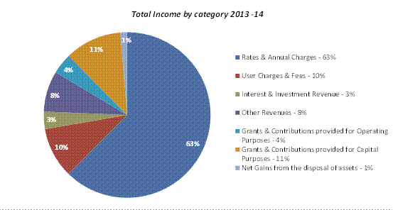
Rates & Annual Charges
Rates and Annual Charges contributed $72.97m or 63%
in 2013/14 ($68.8m in 2012/13). Rates and Annual charges income increased by a
total of 6% from the last financial year taking into consideration the approved
rate peg increase of 3.4%, as well as supplementary rates during the year from
increase in residential properties (503 new residential properties ) and 2 new
business properties. Annual Charges, which are predominantly represented by
domestic waste charges increased by 10%. This reflects the provision of funds
towards the cost of remediating the former tip site at the North Turramurra
Recreation Area. Whilst a major component of these costs was chargeable to the
Domestic Waste Management reserve, it is necessary in the short term to fund
part of this project from the Infrastructure and Facilities reserve and recover
costs in future from increased Domestic Waste charges. No major variance was
noted in Rates and Annual charges when compared to original budget.
User Charges & Fees
User Charges and Fees totalled $11.48m (10%) compared to
$12.34m in 2012/13, a decrease of 7%. This category of income includes
regulatory/statutory fees and community facilities hire. The principal
decreases from 2012/13 were lower income from restoration charges by
approximately $1m due to major debtors undertaking self-restorations, as well
as decrease in income from North Turramurra Golf Course by approximately $300k
principally due to partial closure of the course for construction works. Main
increases in income by approximately $200k were from Parks & Sports field
income. When compared to original budget the decrease in User Charges &
Fees was $705k due to the same factors mentioned above.
Interest & Investment Revenue
A total of $3.96m (3%) compared to $4.55m in 2012/13 was
received from Interest & Investment revenue. The decrease in investment
earnings was largely due to lower interest rates (RBA cut the official cash
rate by 25bp in August 2013) and lower average invested portfolio during the
year.
Council’s Cash and Investments at the end of the financial
year totalled $92.41m. Notwithstanding the decrease in income from 2012/13,
Council ended the year with a strong investment performance which exceeded the
bank bill benchmark by 1.59% (the weighted average return for the total
portfolio as at end of year was 4.27% compared to the benchmark of the UBS Bank
Bill Index of 2.68%). The original budget was reviewed during the year and
decreased to reflect the lower interest rates. Compared to revised budget, the
net return on investments at the end of June 2014 recorded a favourable
variance of $50k.
Other Revenue
Income from “Other Revenue “totalled $9.31m (8%) compared to
$8.25m in 2012/13.
Other Revenue increased by 12.9% compared to 2012/13 which
is principally due to higher income from rental properties, parking, licence
income and a one-off payment of $345k for surrender lease for 904-914 Pacific
Highway.
Compared to original budget a favourable variance of $1.3
million against budget was identified in Other revenue. This was achieved primarily
due to increased rental income from various projects, including additional
Childcare Facilities due to new KU rental agreements, community halls and other
properties.
Operating Grants and Contributions
A total of $4.70m (4%) compared
to $6.58m in previous year was received by Council during 2013/14. Grants &
Contributions provided for Operating Purposes decreased by 28% on the previous
financial year. This was largely due to lower income from the Financial
Assistance Grant. The Financial Assistance Grant for 2013/14 reflects a one off
reduction due to the fact that this grant is no longer being paid in advance.
This does not represent a loss of income but is instead a timing variance.
Operating Grants & Contributions income was down compared to original
budget by $1.6 million, mainly due to the Financial Assistant Grant no longer
being paid in advance.
Capital Grants & Contributions
Grants & Contributions
provided for Capital Purposes increased by 17.6% on the previous financial
year with $12.92m received in
2013/14 compared to $10.99m in 2012/13. This was largely due to increased
Section 94 contributions from developers and additional contribution received
from NSW Department of Planning and Infrastructure for the B2 Land subdivision.
When compared to original budget, Capital Grants &
Contributions income was down by $2.6m mainly due to lower than anticipated
Section 94 income received during the financial year.
Net Gains from Disposal of Assets
Net Gains from Disposal of Assets were $1.51m (loss of
$1.22m in 2012/13) largely due to the sale of 9, Havilah Avenue, Lindfield
(proceeds -$4.5m) and 12A Park Crescent, Pymble (proceeds - $1.35m) The net
gain represents the gross sale price (proceeds) less the written down value of
assets.
When compared to original budget the Net Gain from Disposal
of Assets was lower than budget primarily due to book value of assets sold
being higher than anticipated. This occurred as a result of reclassification of
community land to operational land for one of Council’s assets that was
disposed during 2013/14.
Expenses
from Continuing Operations
Total Operating Expenses for the financial year ended 30
June 2014 were $100.82m, compared to $95.74m in 2012/13, this is an increase of
5% on the previous financial year.
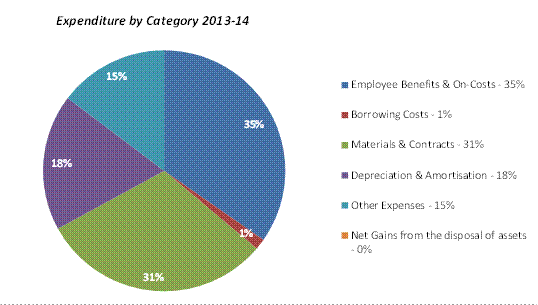
Employee Benefits & On
costs
Employee Costs were $35.01m
compared to $34.57m in 2012/13, which is an increase of 1.3% on the previous
financial year. Major increases relate to higher superannuation guarantee levy
and an
increase in fringe benefits tax
as a result of a flat statutory rate charged ( 20%) to motor vehicles. Overall
the increase in 2013/14 was less than that budgeted by 8%, mainly due to
savings across all departments, but partially offset by increased agency and
contractor costs.
Borrowing Costs
Borrowing Costs totalled $1.46m compared to $453k in
2012/13. This was one of the most significant increases in all expense
categories (223% on previous financial year) which is largely related to the
loan associated with the purchase of the new administration building at 828
Pacific Hwy. A total of $938k, in addition to existing loans, has been accrued
/recognised in the accounts during the financial year which was not a cash
outflow, but rather an increase in the outstanding balance of the loan. As per
the loan agreement Council is required to start interest and principal
repayments by 2016/17.
When compared to original budget, a favourable variance of
$541k in borrowing costs was identified, mainly due to lower actual interest
rates compared to forecast rates.
Materials & Contracts
Materials & Contracts is the second largest category of
expenditure representing 31% of the total expenditure after employee costs. A
total of $31.10m compared to $28.99m in 2012/13 was spent on Materials &
Contracts during 2012/13. This is an increase of 7.2% on the previous financial
year. The principal components of this increase are within Contractor &
Consultancy costs, in particular, higher Domestic Waste contractor costs,
street sweeping, tree maintenance and others. When compared to original budget,
a positive variance of $994k was recorded primarily due to lower than budgeted
charges for waste collection and savings in legal costs.
Depreciation and Amortisation
Depreciation and Amortisation
has risen by $2.66m or 16.9% on previous year from$15.79m in 2012/13 to $18.45m
in 2013/14, primarily due to additional assets recognised in the Recreational
Facilities asset class. An audit and inspection of all Recreational Facilities
assets to coincide with the implementation of a new Asset Management System was
undertaken during the year. This resulted in additional assets being recorded
in the Financial Assets Register not previously recognised, thus causing an increase
in depreciation expense. An unfavourable budget variance of $1.9m was also
recorded due to the factors mentioned above.
Other Expenses
Material expenditure items in
this category include electricity costs, insurance, street lighting, rental
rebates and various other expenses. Other Expenses have increased marginally
(by $86k or 0.6%) compared to previous financial year. When compared to
original budget, a favourable variance of $891k was identified due to an
inconsistent breakdown of expenditure categories in the original budget
compared to actual. The expenditure categories were realigned in the revised
budget.
Operating
result
The operating result is a measure of the increase in the
value of Council’s net assets. It takes into account the income received by
Council less the expenses from operations including depreciation of assets. The
operating result excludes capital expenditure (expenditure on assets).
Council’s net operating result for the 2013/14 financial
year is disclosed in the Income Statement. For the financial year ended 30 June
2014 Council had an operating surplus excluding revenue from capital grants and
contributions of $3.11m compared to an original budget of $1.67m. The operating
result including capital grants and contributions is $16.04m, a variance of
$1.2m in comparison to an original budget of $17.24m. The variance is mainly
due to lower than anticipated capital grants and Section 94 contributions
income received during the year and higher depreciation expense due to new assets
being recognised during the year.
A comparison of Operating Result for 2013/14 to original
budget and 2012/13 financial year is provided in the table below:
|
$’000
|
2013/14
Actual
|
2013/14
Original Budget
|
2012/13
Actual
|
|
Net Operating
Result
( Surplus)
|
16,041
|
17,241
|
15,806
|
|
Net Operating
Result
(before Capital grants & contributions)
|
3,117
|
1,678
|
4,815
|
Council’s operating result is strong. The operating surplus
means that Council’s revenue exceeds both the cost of running its day to day operations
and the depreciation of its assets. This surplus is available for capital
works.
The operating result (shown separately as including and
excluding capital grants and contributions) is provided in the chart below.
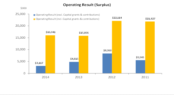
Working
Capital
Working capital is a measure of
Council’s liquidity and ability to meet its obligations as they fall due. It is
one of the primary measures of the overall financial position of Council, which
allows for unforeseen expenditure or reductions in revenue.
Working capital represents Council’s net current assets,
after deducting internal and external restrictions.
The available working capital at the end of 2013/14
financial year is $4.69m, marginally above the target of $4.64m as set in
Council’s Long Term Financial Plan. This level of working capital highlights an
adequate liquidity position with Council being able to meet its short term
liabilities when they fall due.
Chart below provides a comparison of Council’s working
capital for the last 4 financial years.
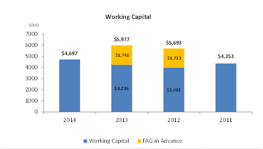
Performance
Measurement Indicators
The Statement
of Performance Measurement (Note 13 of the Draft Financial Statements and
Special Schedule 7) provide ratios used to assess various aspects of Council’s
financial performance. New performance ratios have been prescribed by the Code
of Accounting Practice for 2013/14, which are mainly the financial ratios
identified in T-Corp’s Financial Assessment and Benchmarking Report. Four new
asset ratios, mainly Building & Infrastructure Renewal Ratio, Infrastructure
Backlog Ratio, Asset Maintenance Ratio and Capital Expenditure Ratio have also
been reported for the first time and disclosed in Special Schedule 7 “Report on
Infrastructure Assets”.
The results
for all financial indicators, including asset ratios, providing previous year
comparisons and commentary are detailed in the table and charts below. Please
note Asset Ratios are provided for two years only.
|
Financial Indicator
|
|
2013/14
|
2012/13
|
2011/12
|
|
Operating Performance Ratio
Total Operating Revenue
(excl Capital grants & Contrib) – Operating Expense
Total Operating Revenue
|
1.56%
|
5.84%
|
8.42%
|
|
Own Source Operating
Revenue
Total Operating Revenue (
less all Grants & Contributions)
Total Operating Revenue
|
84.72%
|
84.22%
|
81.80%
|
|
Unrestricted Current Ratio
Current Assets( less all
External Restrictions)
Current Liabilities (less
Specific Purpose Liabilities)
|
2.88:1*
|
2.04
|
2.05
|
|
Debt Service Cover Ratio
Operating Result before
capital excl interest & depreciation
Principal repayments plus
borrowing costs
|
4.82
|
10.88
|
10.69
|
|
Rates, Annual charges,
Interest outstanding Percentage
Rates, Annual Charges
Outstanding
Rates, Annual Charges
Collectible
|
3.25%
|
3.47%
|
3.39%
|
|
Cash Expense Cover Ratio (
expressed in months)
(Current Years cash & Cash Equivalents ( incl.
Term Deposits))
Payments from cash flow of
operating and financing activities) X 12
|
8.01
|
7.68
|
5.92
|
|
Asset Ratios
|
|
|
|
|
Building &
Infrastructure Renewal Ratio
Asset Renewals (Building
& Infrastructure)
Depreciation, Amortisation
& Impairment
|
104.46%
|
94.06%
|
|
|
Infrastructure Backlog
Ratio
Estimated cost to bring
Assets to a satisfactory condition
Total value of
Infrastructure, Building, Other Structure and Land Imp Assets
|
0.32
|
0.30
|
|
|
Asset Maintenance Ratio
Actual Asset Maintenance
Required Asset Maintenance
|
0.95
|
0.81
|
|
|
Capital Expenditure Ratio
Annual Capital
Expenditure
Annual Depreciation
|
2.29
|
4.05
|
|
*The
ratio includes $8.7m of current Assets held for sale
Operating
Performance Ratio
|
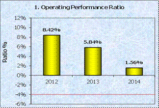
|
This ratio
measures Council’s achievement of containing operating expenditure within
operating revenue. It is important to distinguish that this ratio is
focussing on operating performance and hence capital grants and
contributions, fair value adjustments and reversal of revaluation decrements
are excluded. The benchmark is greater than (-4%).
Council
performance ratio is above the benchmark of (-4%), which means that Council
can easily contain operating expenditure (excluding capital grants and
contributions) within its operating revenue. The ratio has been above
benchmark for the last three years.
|
Own Source Operating Revenue
|
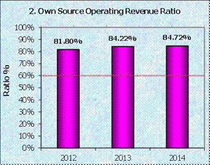
|
This ratio
measures fiscal flexibility. It is the degree of reliance on external funding
sources such as operating grants and contributions. Council’s financial
flexibility improves the higher the level of its own source revenue. The
benchmark is “greater than 60%”.
Council’s
Own Source Operating Revenue Ratio has remained above the benchmark of
(>60%)
in the last three years. Council has sufficient level of fiscal
flexibility, in the event of being faced with unforseen events.
|
Unrestricted
Current Ratio
|
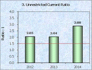
|
The
Unrestricted Current Ratio is specific to local government and is designed to
represent a Council’s ability to meet short term obligations as they fall
due. Restrictions placed on various funding sources (e.g. Section 94
development contributions, RMS contributions) complicate the traditional
current ratio used to assess liquidity of businesses as cash allocated to
specific project is restricted and cannot be used to meet Council’s other
operating and borrowing costs. The benchmark is “greater than 1.5”.
Council’s
Unrestricted Current Ratio is above benchmark of >1.5% and has been
outperforming benchmark for the last three years. Council’s liquidity is good
and it can readily pay its debts as they fall due.
|
Debt Service Cover Ratio
|
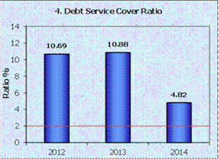
|
This ratio
measures the availability of operating cash to service debt including
interest and principal. The benchmark is “greater than 2”.
The Debt
Service Cover Ratio has been above benchmark, however it has decreased
compared to previous years due to higher principal and interest repayments
during the financial year.
|
Rates,
Annual Charges, Interest & Extra Outstanding Percentage
|
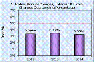
|
The purpose
of this ratio is to assess the impact of uncollected rates and annual charges
on liquidity and the adequacy of recovery efforts.
The
percentage of rates and annual charges that are unpaid at the end of the
financial year is a measure of how well Council is managing debt recovery.
Council’s ratio of 3.25% is satisfactory and is better than benchmark of
“less than 5%”.
|
Cash Expense Cover Ratio
|
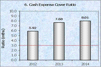
|
This
liquidity ratio indicates the number of months a Council can continue paying
for its immediate expenses without additional cash inflow.
Council’s
Cash Expense Cover Ratio is satisfactory and above benchmark of “greater than
3 months”.
|
Building
and Infrastructure Renewal Expenditure
|
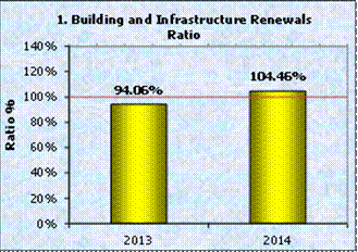
|
This
indicator assesses Council’s rate at which buildings and infrastructure
assets are being renewed against the rate at which they are depreciating. A
ratio of 1:1 indicates that the amount spent on asset renewal equals the
amount of depreciation.
Council’s
ratio increased to 104.46% in 2013/14, which means that Council is spending
sufficient funds to cover Depreciation expense on its assets. Council
continues its commitment to maintain financial sustainability and decrease
the infrastructure backlog.
|
Infrastructure
Backlog Ratio
|
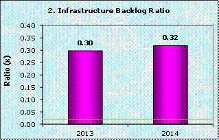
|
This ratio
shows what proportion of the backlog is against the total value of a
Council’s infrastructure.
Council’s
Infrastructure Backlog Ratio has been on a downward trend in the last 5 years
(0.65x in 2008/09), however, the ratio of 0.32x achieved in 2013/14 indicates
that Council still has a sizeable infrastructure backlog. Council is
continuing to focus on appropriate asset standards for renewal and
maintenance.
|
Asset
Maintenance Ratio
|
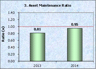
|
This ratio
compares actual versus required annual asset maintenance. A ratio of above
1.0
indicates
that the Council is investing enough funds within the year to stop the
Infrastructure
Backlog
from growing. The benchmark is “greater than 1.0x”.
Council’s
Asset Maintenance Ratio of 0.95x is marginally lower than the benchmark ratio
of “greater than 1.0x”, which indicates that the level of expenditure on the
maintenance of infrastructure assets is not sufficient to prevent the
infrastructure backlog from growing. Council is committed to increase
expenditure on asset maintenance in future to stop the infrastructure backlog
from growing.
|
Capital
Expenditure Ratio
|
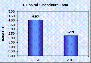
|
This
indicates the extent to which a Council is forecasting to expand its asset
base with capital expenditure spent on both new assets, and replacement and
renewal of existing assets. The benchmark is “greater than 1.1x”.
Council’s
Capital Expenditure Ratio of 2.29x continues to be above the benchmark of
1.1x reflecting its significant capital expenditure program on new assets and
the renewal of existing assets compared to their depreciation.
|
integrated planning and reporting
Leadership and Governance
|
Community Strategic Plan Long Term Objective
|
Delivery Program
Term Achievement
|
Operational Plan
Task
|
|
L3.1 The organisation is recognised and distinguished by
its ethical decision-making,
efficient management, innovation and quality, customer
service.
|
L3.1.1 Council’s integrity and operating effectiveness is
continually being improved through its leadership,
decision-making and policies.
|
Complete all statutory
reporting required under the Local Government Act
and Integrated Planning and
Reporting framework.
|
Governance Matters
In accordance with Section 419(1) and 419(2) of the Act:
A council must present its
audited financial reports together with the auditor’s reports at a meeting of
Council held on the date fixed for the meeting; and
The council’s auditor may, and
if so required in writing by the council must, attend the meeting at which the
financial reports are presented.
In addition, Section 417(5) of the Act states that:
As soon as practicable after
receiving the auditor’s reports, the council must send a copy of the auditor’s
report on the council’s financial reports, together with a copy of the
council’s audited financial reports, to the Director General – Office of Local
Government and to the Australian Bureau of Statistics.
Risk Management
Council is financially sound which
positions it well to deal with unforseen events as they arise.
The Financial Statements are
audited by the external auditors who, amongst other things, form an opinion on
the Financial Statements whether:
· the
Council’s accounting records have been kept in accordance with the requirements
of the Local Government Act 1993, Chapter 13 part 3 Division 2; and
· the
Financial Statements:
o have been presented in accordance with the requirements of this Division;
o are consistent with the Council’s accounting records;
o present fairly the Council’s financial position, the results of its
operations and its cash flows; and
o are in accordance with applicable Accounting Standards and other
mandatory professional reporting requirements in Australia.
· all
information relevant to the conduct of the audit has been obtained; and
· there
are no material deficiencies in the accounting records or financial statements
that the auditors have become aware of during the course of the audit.
In accordance with s. 419 (1) of the Act, a council
must present its audited financial reports together with the auditor’s reports
at a meeting of Council held on the date fixed for the meeting. If Council does
not consider the Financial Statements at the appropriate time, it does not
comply with the requirements of the Act.
Financial Considerations
Council has achieved a sound financial result for 2013/14.
Council’s net operating result for the financial year ended 30 June 2014 was a
surplus of $16.04m including Grants and Contributions for capital purposes.
After adjusting for Capital Grants and Contributions, the net operating result
was $3.11m.The actual working capital as at 2013/14 is $4.69m marginally above
the target identified in Council’s Long Term Financial Plan.
Social Considerations
None undertaken or required.
Environmental Considerations
None undertaken or required.
Community Consultation
Council’s Financial Statements were on public exhibition
from 29 August 2014 seeking comments from the community on the Statements and
the Auditor’s Reports. Section 420 of the Act requires that all submissions in
respect of the audited Financial Reports must be in writing and must be lodged
with the Council within 7 days after this meeting. Public submissions may be
made up to 16 September 2014. Copies of all submissions received must be
referred to Council’s Auditor.
Internal Consultation
All departments have been consulted on the end of year
financial results for 2013/14.
Summary
The Annual Financial Statements for the year ended 30 June
2014 and audit reports from Council’s external auditor, UHY Haines Norton
Chartered Accountants are presented to Council. Written submissions from the
public have been invited, and may be made up to 16 September 2014. Copies of
all submissions must be referred to Council’s auditor. This is the final stage
of the process of adopting Council’s Annual Financial Statements for 2013/2014.
|
Recommendation:
That Council receives the audited Financial Statements and
the external auditor’s report from UHY Haines Norton Chartered Accountants.
|
|
Angela Apostol
Manager Finance
|
David Marshall
Director Corporate
|
|
Attachments:
|
A1View
|
Audited
Financial Statements for the year ended 30 June 2014
|
|
2014/215095
|
|
APPENDIX
No: 1 - Audited
Financial Statements for the year ended 30 June 2014
|
|
Item No: GB.2
|


|
Ordinary
Meeting of Council - 9 September 2014
|
GB.3 / 342
|
|
|
|
|
Item
GB.3
|
S10083
|
|
|
15 July 2014
|
Planning Proposal - 20-28 Culworth Avenue
and 17 Marian Street Killara - Report following the Exhibition and Public
Hearing
EXECUTIVE
SUMMARY
|
purpose of report:
|
To have Council consider the feedback following
exhibition and public hearing for the Planning Proposal- 20-28 Culworth Avenue and 17 Marian Street, Killara
known as the Culworth Avenue car park.
|
|
|
|
|
background:
|
The planning proposal for the subject site was
exhibited from 28 March to 30 April 2014
and a public hearing was held on 26 May 2014. The Chairperson’s report on the
public hearing was received on 30 June 2014 and placed on Council’s website
on 2 July 2014.
|
|
|
|
|
comments:
|
In response to the community submissions made during
the 2013 reclassification process and arising from the report of the
Chairperson following the Public Hearing held in October 2013, a series of
additional studies and research were completed to respond to the key issues
that were raised. The community was then given an opportunity to review and
provide additional comment on the additional material before a second Public
Hearing was held on 26 May 2014.
|
|
|
|
|
recommendation:
|
To proceed with the reclassification of the property
at
20-28 Culworth Avenue and 17 Marian Street Killara known as the Culworth
Avenue car park, subject to the detailed recommendations in the report.
|
Purpose of Report
To have Council consider the feedback following exhibition
and public hearing for the Planning Proposal- 20-28
Culworth Avenue and 17 Marian Street, Killara known as the Culworth Avenue car
park.
Background
About the
project
This is a planning
proposal to reclassify 20-28 Culworth Avenue and 17 Marian Street, Killara from
Community Land to Operational Land. It is one of a series of reclassifications
processes currently being undertaken to facilitate the strategic management of
Council owned land to underpin the delivery and development of new community
assets to support the growing population and changing demographics of the area.
What is Community
Classified Land?
Community Classified
Land is a land classification that essentially holds land in a restrictive
trust. Community classification prohibits a Council from
selling, exchanging or granting an interest to another party other than in
accordance with the provisions of the Local Government Act 1993.
What is Operational
Classified Land?
Operational Classified
Land is a land classification that facilitates active management of land for a
variety of purposes. An operational classification permits
Council to sell, exchange, or grant an interest to another party other than in
accordance with the provisions of the Local Government Act 1993.
Exhibition
and Public Hearing
The planning proposal
and supporting documentation was exhibited from Friday 28 March to Wednesday 30 April 2014 inclusive (being five
days in addition to the statutory 28 period).
A public hearing was held at Ku-ring-gai Council on Monday
26 May 2014.
Statutory Framework
The relevant environmental planning instruments applying to
the site of the Culworth Avenue car park, being 20-28 Culworth Avenue and 17
Marian Street, Killara are:
· Ku-ring-gai Planning Scheme
Ordinance 1971 (KPSO)
· Draft Ku-ring-gai Local
Environmental Plan 2013
Below is an outline of how these planning instruments apply
to the Culworth Avenue car park site. It should be noted that the
reclassification of the land from community to operational will not affect
application of any of the planning provisions under the existing or proposed
planning instruments.
Ku-ring-gai Planning Scheme
Ordinance 1971 (KPSO)
Under the KPSO:
· The site is currently zoned part
5(a) Special Uses (Municipal Purposes) and part 2(d) Residential under the
KPSO.
· There are no development standards
applying to that part of the site zoned 5(a) Special Uses (Municipal Purposes).
· That part of the site zoned 2(d)
Residential has a maximum floor space ratio (FSR) of 0.85:1 and a maximum
height of buildings of 3 storeys.
· The site is identified within
Heritage Conservation Area C24 – “Marian Street Conservation Area”.
· Part of the site is identified as
“Areas of Biodiversity Significance” on the Natural Resource Biodiversity Map.
Draft Ku-ring-gai Local
Environmental Plan 2013 (KLEP)
The final Draft Ku-ring-gai Local Environmental Plan 2013
(KLEP) was adopted by Council on 26 November 2013 and will replace the
current KPSO. The draft KLEP is currently with the Department of Planning and
Environment to be made. Under the draft KLEP:
· The site is to be zoned part R4 -
high density residential and part B1 – neighbourhood centre (17 Marian street).
· That part of the site zoned R4 has a
maximum FSR of 1:1 and a maximum height of 14.5m (4 storeys).
· That part of the site zoned B1 has a
maximum FSR of 0.75:1 and a maximum height of 9.5m (2 to 3 Storeys)
· The site is identified within
Heritage Conservation Area C24 – “Marian Street Conservation Area”.
· Part of the site is identified as
“Areas of Biodiversity Significance” on the Natural Resource Biodiversity Map.
· The site is listed in Schedule 1 –
Additional permitted uses to permit car parking with consent.
When Council considered the final draft KLEP on 26 November
2013, it also resolved to prepare a planning proposal to make a number of
additional changes to the final adopted KLEP. In regard to the Culworth Avenue
car park site, Council resolved to:
· Amend the FSR for 20-28 Culworth
Avenue to 1.3:1 and the Height of buildings to 17.5m (5 storeys).
· Amend the Heritage Map to alter the
boundaries of the Marian Street Conservation Area (C24) to exclude the Culworth
Avenue car park and adjoining sites at 18 Culworth Avenue and 1 and 3 Marian
Street.
The planning proposal for these amendments to the KLEP is
currently with the Department of Planning and Environment for a Gateway
Determination. Should a gateway be issued, then the proposed amendments will be
subject to further community consultation and consideration by Council prior to
any amendments to the KLEP being made.
Comments
This section of the report covers the issues arising from -
and responses to - the public consultation of the Planning Proposal (Attachment
A7) to reclassify the land at 20-28 Culworth Avenue and 17 Marian Street
Killara to operational land. It addresses the issues raised by the submissions
and, as a component of those responses, outlines the role the reclassification
of this site plays in the comprehensive community asset renewal and
infrastructure delivery programme that is currently underway in Ku-ring-gai.
Public consultation for
the reclassification of the Culworth Avenue car park
In connection with the proposed reclassification of the
properties at 20-28 Culworth Avenue and 17 Marian Street Killara, there
were two distinct periods of consultation. All submissions arising from both
exhibitions of the planning proposals and the public hearing processes have
been considered and incorporated as part of the preparation of this report.
For purposes of clarity and distinction, these are referred to as the 2013 and
the 2014 processes respectively.
Additionally many pages of a petition containing several
thousand signatures were received progressively over the consultation period.
The petition is specifically addressed in the Community Consultation
section of the report.
Overview of the 2014 exhibition and reclassification
process
In response to the community submissions made during the
2013 reclassification process and arising from the report of the Chairperson
following the Public Hearing held in October 2013, a series of additional
studies and research was undertaken.
The primary purpose of these was to address the key issues
that were raised within the context of the current Guidelines for Planning
Proposals and to place the Planning Proposal for the Culworth Avenue car park
within a wider strategic planning and asset management and renewal process.
The community was then given an opportunity to review and
provide comment on this new material during a second formal exhibition period.
All material available during exhibition of
the first planning proposal was also made available during the second
exhibition. The second exhibition process replaced the 2013 exhibition
and submissions were sought to respond the exhibited planning proposal and
supporting material.
The second Public Hearing was
held on Monday 26 May 2014.
Key themes arising from the 2014 planning proposal
exhibition process
The key themes arising from the submissions for the 2014
process are as follows:
· Ongoing need for the provision of
commuter parking
· Ongoing need for the provision of
non-commuter car parking (around four to six hours)
· Ongoing need for availability of
weekend parking and evening use
· Ongoing need for the provision of
accessible car parking for aged and disabled users
· Disputing of utilisation figures /
assessment of under-utilisation
· Adverse effect on nearby streets of
any loss of car parking
· Support for use of public transport
(trains) through provision of car parking at stations
· Rezoning of site under Draft
Ku-ring-gai LEP 2013 / Potential for high rise development
· Perceived overdevelopment / concerns
with redevelopment for units
· Heritage Conservation Area /
Biodiversity / Protected trees
· Excessive consultation /
Insufficient consultation / Manner of Public Consultation
· Council’s presentation of options
for consultation as opposed to a single vision
· Council’s presentation of a fait de
compli without consultation
· Site benefits / impacts compared to
Ku-ring-gai area-wide benefits / impacts
· Retention of infrastructure vs
provision of infrastructure
· Council responsibility to provide
infrastructure / community facilities
· Alternatives for funding Gordon
Civic and Community Precinct
· Labelling of the purchase of the
building at 828 Pacific Highway, Gordon as a ‘Taj Mahal’
See Attachment A10 for the Submission Summary Table
from the 2014 exhibition.
Overview of the 2013 exhibition and reclassification
process
The 2014 public consultation processes were preceded by an
earlier process in 2013 which culminated in a report by the Chairperson, Peter
Walsh, received on 6 January 2014. This report recommended additional
information be prepared, collated and presented to the community. While the
subsequent process supersedes the preceding process, the submissions made to the
2013 process have been fully considered as part of the present process.
All submissions arising from both
exhibitions of the planning proposals and the public hearing processes have
been considered and incorporated as part of the preparation of this report.
See Attachment A9 for the Submission Summary Table
from the 2013 exhibition.
Key themes and issues in
the proposed reclassification of the Culworth Avenue car park
All the submissions that were made during both the 2013 and
the 2014 exhibitions and public hearings for the reclassification of the
Culworth Avenue car park have been considered and the issues and themes raised
are addressed in the sections below. For readability and coherence, these have
been grouped.
Themes and Issues: The
Demand for Car Parking – Car Park Occupancy – Survey Data
Many submissions commented on the ongoing demand for car
parking, by a range of people with different needs. Many submissions also
challenged the utilisation rates of car park and disputed that it was
underutilised, at least in terms of car parking utilisation.
Issue: Insufficient car parking in the area;
reclassification will lead to an inadequate provision of parking in the local
area; reclassification will lead to a loss of commuter car parking.
Issue: There is little or no car parking available in
Killara or Gordon after peak commuting times.
Issue: Reclassification and sale (loss) of the car
park will discourage the use of public transport; lead to loss of facility for
park-and-ride.
Issue: Loss of the car park would exacerbate mobility
issues for elderly and infirm residents.
Issue: Detail lacking on replacement car parking
strategies. Replacement of the car park is impossible.
Issue: Role for Council
and State Government for provision of car parking.
Issue: Council should
produce statistics of car parking use from revenue collection.
Issue: Continued demand
for car parking arising from Selkirk Park and Marian Street Theatre.
Issue: Disputes occupancy statistics and definition
of ‘under-utilisation’ and disagrees that it is under-utilised.
Response
Overview of the Methodology
In order to achieve a clear picture of the utilisation of
the car park over period of the day, on weekdays and on weekends, extensive
surveys were undertaken as follows:
· Tuesday 4 February
2014;
· Wednesday 5 February
2014;
· Tuesday 11 February
2014;
· Thursday 13 February
2014; and
· Saturday 5 April 2014 (to capture
utilisation from Saturday sports at Regimental Park which are scheduled from
8am to 12.30pm).
The weekday surveys were undertaken from 8am-6pm, while the
Saturday survey was undertaken from 9am-3pm. The surveys measured utilisation
records taken across each nominated day every 30 minutes. This
methodology creates a very comprehensive picture of utilisation over the course
of each survey day as opposed to taking single snapshots at random times; it
also permits additional data such as the length of stay of each surveyed
vehicle present in the car park. On Tuesday 15 April 2014, an additional
utilisation survey, this time in the form of spot checks, was taken as this
date was during the school holidays and concurrent with the Royal Easter Show.
The data collected during the survey included car park
occupancy, turnover/length of stay and the number of vehicles with mobility
permits displayed. Results appear in Summary of Weekday Results and Summary
of Saturday Results below. Independent traffic and transport data
specialist Austraffic Pty Ltd was engaged to undertake the data
collection as well as conduct a number of survey interviews with commuters.
Individual surveys of car park users
Commuter interview surveys were conducted on Wednesday 12
February 2014 between 6am and 12pm. Interviewers were located on Werona Avenue
and Culworth Avenue just outside the station entrance. Data collected during
the interview surveys included age group; mode of travel to the station, and if
the interviewee drove to the station; their postcode of origin; if they
displayed a mobility permit; and whether they had parked in the Culworth Avenue
car park.
Summary of weekday results
The weekday occupancy surveys
showed the following characteristics:
· average weekday peak occupancy
across the 4 week days of surveys was 106 vehicles, or approximately 61% of
total capacity (173 vehicles);
· the maximum number of vehicles
recorded at any one time during the 4 weekdays was 113 vehicles;
· an average of 31 vehicles stayed
less than 4.5hrs, while an average of 89 vehicles stayed longer than 4.5hrs
across the 4 weekdays surveyed. Short stays represent approximately 25% of
total weekday stays;
· 3 mobility permits were recorded
being displayed in the car park over the course of the surveys.
These occupancy results were found to be broadly consistent
with the spot surveys undertaken by Council in July 2002 which was the data
exhibited as part of the 2013 exhibition process and updated in response to the
first Public Hearing report.
Spot checks were undertaken on Tuesday 15 April 2014, which,
although also a weekday, was during school holidays and concurrent with the
Royal Easter Show. At midday, 113 vehicles were recorded, which is consistent
with the highest reading during the weekday surveys.
Summary of Saturday results
The Saturday occupancy surveys showed the following
characteristics:
· peak occupancy was 86 vehicles at
10.30am, or approximately 50% of total capacity;
· occupancy after 11.30am was 33
vehicles or less (approximately 19%);
· Approximately 78% of vehicles stayed
less than 1.5hrs;
The short duration of stay together with the concentration
of use prior to 11.30am, is considered reasonably consistent with the expected
pattern of short term sports use by parents, carers and spectators at
Regimental Park.
Summary of commuter interviews
On the day of the commuter interview survey, a total of 903
commuters were interviewed, which represents approximately a 40% sample size
(based on 2012 barrier counts into Killara station, NSW Bureau of Transport
Statistics). The results of the interview surveys are as follows:
· 52% of commuters arriving at Killara
railway station walked, 28% drove, 18% were a car passenger and 0.6% rode a
bicycle;
· over 96% of commuters parking at
Killara station originated from Ku-ring-gai;
· 104 commuters said they parked in
the Culworth Avenue car park, and one of these said they displayed a mobility
permit; and
· over 97% of commuters parking in the
Culworth Avenue car park originated from Ku-ring-gai.
Age profiles of the 104 users of the Culworth Avenue car
park on the day of the interview surveys are shown in the table below:
|
Age group*
|
Under 18
|
18-24
|
25-34
|
35-49
|
50-59
|
60-69
|
70-84
|
85 & over
|
|
%
|
-
|
1.0%
|
22.1%
|
33.7%
|
22.1%
|
15.4%
|
5.8%
|
-
|
|
#
|
0
|
1
|
23
|
35
|
23
|
16
|
6
|
0
|
*Age
brackets same as those used in Census
The most represented age group was the 35-49 year old group,
with thirty-five users. Eighty-one were aged between 25 and 59 in the peak
commuter age groups. Twenty-two users were aged 60 and over. These results suggest
that while older users have been recorded using the car park, they have not
emerged as the major users. This is not intended to diminish the importance of
the car park to members of the community in this age group but the low overall
numbers do suggest that this demand can be provided for in time-limited
on-street spaces close to the station.
Future car parking provision
To provide for the current weekday use profile and
characteristics, the occupancy survey results indicate that up 120 spaces would
be adequate to cater for the average weekday demand of 106 spaces.
Furthermore, the duration of stay results suggest that 25% stays at the car
park are shorter stay parking (4hrs-4.5hrs or less), and these could be
provided on-street in Culworth Avenue and Lorne Avenue (near the station
entrance) with 4 hour restrictions.
It is important to emphasise that the demand for car parking
at public transport inter-modal hubs such as railway stations, in Ku-ring-gai
in general and in the Gordon-Killara-Lindfield area in particular, can be
provided in a variety of ways that do not rely on the status quo – i.e. the
retention unchanged of the whole of the current site as an at-grade car park,
while the surrounding area continues to redevelop to higher density.
The surveys clearly revealed a variety of users with a
number of reasons for accessing Killara Station and differing needs in relation
to access. Such demand can best be catered for by a mix of car parking
provision including:
· The Gordon commuter
car park (currently under construction by TfNSW).
· The Lindfield commuter car park
(currently being master planned by TfNSW with Ku-ring-gai Council as part of
the linked Lindfield Community Hub and Lindfield Village Green projects which
will provide car parking, community facilities and open space in an accessible,
central area).
· A Killara commuter car park (on that
part of the Culworth Avenue car park to be compulsorily acquired by TfNSW).
· Shorter-term (four hour) spaces on
the streets immediately adjacent to Killara Station.
· On-going liaison with TfNSW to
provide additional car parking, either informal, or formal, paved spaces
including accessible spaces, on the railway corridor land within the rail
corridor along the streets which run parallel to the rail line. This option
was investigated in response to a Notice of Motion in February 2014 which is
discussed in detail later in the report.
· On-going liaison with TfNSW to
provide an improved zone for a ‘kiss-and-ride’ drop-off and pick-up area on the
railway corridor land immediately adjacent to Killara Station.
The demand for short term parking currently provided by the
Culworth Avenue car park, could be replaced by implementing paid parking (at a
flat rate) in approximately 15 unrestricted spaces on one side of Culworth
Avenue (adjacent to the station entrance) with 4hr restrictions, from 6am-6pm,
Monday-Friday. Paid parking would mirror the short term characteristics and
availability that the fee in the Culworth Avenue car park is providing. During
the 6am-6pm period, these spaces could turn over 2-3 times a day, resulting in
short stay parking availability for 30-45 vehicles per day. If additional
demand is demonstrated, the on-street time-limited paid-parking system could be
extended to Lorne Avenue.
Other rail centres such as Gordon have similar 4hr parking
restrictions near the railway station for this purpose. The existing P15 minute
parking on street in Culworth Avenue would be retained, for passenger drop-off
and pick-up or enhanced if TfNSW facilitates the use of the land on the other
side of Culworth Avenue.
In addition to the 15 spaces above, a further 20 spaces
(distributed between Culworth Avenue and Lorne Avenue) could be reallocated
from unrestricted parking to longer-stay paid parking (flat rate) from 9am-6pm
on weekdays, in order to provide opportunities for longer stays for those
commuters who arrive after 9am.
Alternatively, all 35 spaces suggested above could be
reallocated to paid parking (flat rate) from 9am-6pm on weekdays. The 35
unrestricted spaces re-allocated to paid parking would be offset by increased
free all-day parking in the part of the Culworth Avenue car park that TfNSW
have recently acquired.
The existing unrestricted spaces in such close proximity to
the railway station entrance are too important to remain as unrestricted
all-day parking. A pay-and-display system would provide increased flexibility
and turnover for shorter term and elderly parkers. Many council areas provide
specific seniors parking; this could also be considered to cater for this age
group. Current users of these unrestricted spaces would likely be longer stay
commuters and would be arriving early at the station - these users could likely
find commuter parking in the section of the Culworth Avenue car park acquired
by TfNSW, or at other nearby locations including the additional spaces being
provided at Gordon railway station as part of the Gordon Bus Interchange and
Commuter Car Park project (approximately 165 additional commuter car parking
spaces), and, later, in Lindfield, as these projects are progressively
delivered.
Lastly, there is also an opportunity for sections of the
western side of Culworth Avenue (between Stanhope Road and Marian Street),
which become unrestricted after 10am on weekdays, to be reallocated for
time-limited paid car parking. This would also suit the short stay
characteristics of the users of the Culworth Avenue car park.
Demand from Saturday winter sports at nearby Regimental Park
would continue to be catered for in the section of the Culworth Avenue car park
to be acquired by TfNSW, as well as the opportunity for tailored on-street
parking restrictions for Saturday morning to recognise this usage. There is
also scope for out-of-hours use by patrons of the Marian Street Theatre at such
time as it is reopened to the public.
The Report into the Assessment of Parking utilisation at the
Culworth Avenue car park are Attachments A1 and A2 to this
report.
Themes and Issues:
Accessibility for all
Many submissions were specifically concerned with role the
car park plays in facilitating accessibility for the elderly and infirm as well
families with school children to public transport.
Issue: Querying degree of integration of car parking
strategies by Council and TfNSW at Gordon, Killara and Lindfield.
Issue: Loss of the car
park would exacerbate mobility issues for elderly and infirm residents.
Issue: Reclassification and sale (loss) of the car
park will discourage the use of public transport; lead to loss of facility for
park-and-ride.
Response
Accessibility - Killara railway station and nearby
stations on the North Shore line
With respect for the demand for access to Killara Railway
station by the elderly and infirm, which was raised by a number of submissions,
it should be noted that Killara, unlike the two adjoining stations of Gordon to
the north and Lindfield to the south, is not classed as an accessible station.
Information from the NSW State Government’s property data
sheets notes:
Killara Railway station is not wheelchair accessible;
it is accessed by stairs which are not complemented by a lift or escalator or
ramp. It does not have platform tactile tiles for the benefit of the visually
impaired. It does, however, have hearing loop.
Gordon Railway station is wheelchair accessible; it
has a lift and a ramp (1:14 gradient). It also has a wheelchair accessible
toilet and payphone and wheelchair accessible car spaces nearby. The platforms
have platform tactile tiles for the benefit of the visually impaired and a
hearing loop. There is a kiss-and-ride for passenger drop-off.
Lindfield Railway station is wheelchair accessible;
it has a lift and a ramp (1:20 gradient). It also has a wheelchair accessible
toilet. The platforms have platform tactile tiles for the benefit of the
visually impaired and a hearing loop.
Gordon Bus-Rail Interchange with additional commuter car
parking is currently under construction by TfNSW and due to open in June 2015.
TfNSW is also planning to deliver commuter car parking at Lindfield and is
working with Ku-ring-gai Council to incorporate the delivery of community
facilities and urban parks both west and east of the railway line. This master
planning process follows on from the recent reclassification and divestment of
the car park at 9 Havilah Lane and the reclassification of the car park at
Woodford Lane. Together with the acquisition of 2-12 Bent Street and 1A
Woodford Lane Lindfield for open space and road realignment, this consolidation
of land holdings facilitates important infrastructure upgrades for Ku-ring-gai
and are expected to be delivered in 2016 and 2019.
When these projects are complete, both commuter and short
stay accessible car parking with much better access and facilities will be
available at Lindfield Station compared to Killara Station. Additional longer
stay commuter car parking will be available at Gordon supported by the
kiss-and-ride facility. The acquisition of part of the Culworth Avenue car
park by TfNSW and the availability of on-street car parking and the potential
for additional accessible parking in the railway corridor combine to support
ongoing car parking provision at Killara.
All these facilities providing off-street car parking,
together with complementary on-street time-limited (with a range of times),
free and paid-parking spaces, combine to address the full range of different
car parking and accessibility demands into the future. The provision of short
term (around four hour) paid on-street car parking, with regulatory support,
will continue to provide accessible spaces close to the station for older and
less mobile patrons of Killara station.
This provision of a variety of types of car parking for both
commuters and shorter stay patrons, including accessible spaces, at Gordon,
Killara and Lindfield Stations, both by TfNSW and by Council also addresses
many of the issues raised by the submissions concerned that the effect of the
reclassification would be to discourage the use of public transport. The
potential for further spaces and an enhanced drop off/pick up area at Killara
on the railway corridor adjacent to Culworth Avenue, would be in addition to
the many spaces already anticipated under planned provision by Council and
TfNSW.
Lastly, the impending acquisition of part of the property
for commuter car parking by TfNSW, is considered more likely than not to ensure
that the number of trains stopping at Killara is not further reduced as a
result of the dominance of investment at Lindfield and Gordon stations. The
on-going commitment of the NSW State Government for access to Killara station
could also lead to future accessibility improvements within the hierarchy of
staged improvements to Sydney’s stations.
Themes
and Issues: Future uses of the Culworth Avenue and Marian Street car park
Issue: Local
infrastructure is inadequate to cope with the influx of cars and people.
Issue: Reclassification
will lead to sale of car park and the development of high rise apartments.
Issue: Reclassification
will lead to traffic and congestion around the car park.
Issue: Disagrees that a
supermarket or additional retail is needed or wanted or would add value.
Issue: The planning
proposal will impact on the Heritage Conservation Area.
Issue: Significant trees will be threatened / lost as
a result of the proposal including Blue Gum, Blackbutt and Grey Ironbark.
Issue: Concerned about the loss of open space in
Killara.
A number of submissions directly addressed the effects of
prospective redevelopment of the current site on the community and the
surrounding area.
Response
Effect of potential redevelopment on the surrounding area
On gazettal of Draft Ku-ring-gai Local Environmental Plan
2013, the Culworth Avenue site will be partly zoned R4 - High density
residential and partly zoned B1 - Neighbourhood centre. The surrounding areas
in Lorne Avenue, Marian Street and Culworth Avenue are zoned R4- High density
residential and are currently undergoing redevelopment for units. The adjacent
small-row-shops are also zoned B1 - Neighbourhood centre. Local open space in
Selkirk Park is zoned RE1 and the Marian Street Theatre is Zoned B1 -
Neighbourhood centre, complete the precinct west of the station. Any future
re-development on the car park site for residential purpose would be of a form
and scale consistent with the surrounding development patterns.
The land adjoining the site immediately to the west is zoned
R2 low density residential with the adjoining property in Lorne Avenue being a
heritage item. Any development of the site would be bound by the provisions in
the LEP relating to development adjacent to or in the vicinity of heritage
items and heritage conservation areas.
While the intensification of density may generate additional
vehicular traffic for discretionary trips, commuting is facilitated by the
immediate proximity of Killara station within walking distance. Redevelopment
around railway stations is supported by successive NSW Government metro
strategies. The increasing numbers of people resident in the area in the units
recently built and currently under construction as well as more allowed for by
the existing zoning, are also likely to support businesses in the local shops.
It is acknowledged that several submissions and a couple of speakers to the
Public Hearing argued that more than one business in these shops had previously
failed in disagreement with the highest and best use report prepared by
HillPDA, it should be noted that this report focused on the future potential
inclusive of future population growth rather than being an immediate prospect.
Highest and Best Use Report by
HillPDA (Attachment A3)
In response to issues and concerns raised during the 2013
process and in the first Public Hearing Report, Council sought specialist
advice from land economists on the possible range of land uses that would be
viable on the Culworth Avenue and Marian Street sites, particularly those that
would provide some community benefit. HillPDA considered the feasibility of
speciality retail shops; a small supermarket (such as an IGA); high density
residential uses; and child care facilities.
The community benefit associated with retail on the site
relates to the provision of services for local residents and commuters although
consideration must be given to any negative impacts on existing businesses on
the Pacific Highway at Killara. The community benefit of high density
residential is associated at a broad level with State planning objectives and
the Metropolitan Strategy for higher densities around train stations; at a
local scale apartments on this site would help to activate the rail station
precinct and provide passive surveillance of surrounding streets. The benefit
of child care facilities relates again to the provision of services in a highly
accessible location for local residents and commuters.
Currently Killara has no village centre for regular food and
grocery shopping. Killara residents, and also to a large extent East Killara
residents, undertake the majority of their “core” shopping in Lindfield and
Gordon. Within walking distance (800m to 1km) of the station the population is
expected to grow from around 6,000 residents to around 7,700 residents by 2031
due to the development of apartment buildings in the R4 high density zones.
HillPDA found that retail expenditure forecasting suggests that there could be
sufficient demand to warrant a small supermarket of around 2,000sqm with
supportive speciality stores. It should be noted that any future proposal
would be subject to a more detailed analysis and would be unlikely to be
considered until further redevelopment in the surrounding area was complete and
the strength of Lindfield as a shopping destination after the completion of the
Lindfield Community Hub and Lindfield Village Green was known.
HillPDA found that the residential market is clearly strong
in the Ku-ring-gai area due to the area’s amenity and appeal and that
apartments are popular with several markets; in particular young professionals
looking for place rather than space; to lesser extent older persons looking to
downsize closer to public transport; and finally migrants, also have a strong
preference for place over space. HillPDA note that demand appears to be
equally strong for 1, 2 and 3 bedrooms.
With respect to childcare, the study notes that population
growth in family age-cohorts has resulted in a growing demand for child care.
There are no vacancies in all four child care places in Killara and the waiting
times are considerable. As evident through market data, enquiries, census and
population forecasts Hill PDA find there is a strong need for one or more
additional child care centres in the locality.
In summary, the Highest and Best Use Study found that
there is capacity to support retail, residential and/or childcare uses on the
site. Spatially there are restrictions placed on where these can be located
and by the size of the land parcels. Draft Ku-ring-gai LEP 2013 proposes two
land use zones across the site being R4 on the main Culworth Avenue site
frontages and B1 for 17 Marian Street which adjoins the existing terrace
shops as well as the land behind these shops.
Heritage and Biodiversity
Eleven submissions made specific reference to the
biodiversity of the site including the presence of Bluegums, Blackbutts and
Ironbarks. Several submissions also referred to the impact of the loss of the
trees and amenity on the Heritage Conservation Area.
Response
The Planning Proposal to reclassify the car park from
Community land to Operational land status will not affect or remove the
application of any current or future planning provision applying to the site.
This includes the application of biodiversity protection and heritage
provisions under the KPSO or Draft Ku-ring-gai Local Environmental Plan 2013.
Any future development on the site would be subject to those provisions
regardless of classification of the land.
Response
Changes to the Heritage conservation area have been outlined
under the heading Draft Ku-ring-gai Local Environmental Plan 2013
at the beginning of this report. Further community consultation in relation to
changes to heritage provisions will occur when the matter is formally
exhibited.
The Planning Proposal does not alter or affect any of the
Biodiversity or Heritage Provision that apply to the site under the KPSO or
Draft KLEP 2013.
Impact on the adjoining property at 18 Culworth Avenue
Killara
A matter raised in submissions and at the Public Hearing, is
the impact on the adjoining property to the south of the main car park area
located at 18 Culworth Avenue Killara.
Response
This property is too small to be redeveloped on its own and
the only practical option for redevelopment is amalgamation with at least part
of the car park. It is also located south of the car park and, therefore,
there is the potential for significant impact on the amenity of the two
dwellings in the duplex through overshadowing from any redevelopment on the
northern boundary. In addition to the real impact on the amenity of the
property, it is also not desirable that any properties should be isolated with
limited development potential. This has been the subject of specific
submissions and representations made at the public hearing. The Chairperson of
the Public Hearing also made specific reference to the need to correct the
unfair treatment of 18 Culworth Avenue (p.30).
Since the compulsory acquisition of part of the Culworth
Avenue car park by TfNSW is underway, there is an increased likelihood that any
prospective purchaser of the area adjoining the southern site would also rely
on site amalgamation to achieve a viable development site.
Issue – Loss of Open space in
Killara
Response
The site is not zoned under the planning instruments or used
for open space purposes, nor was it acquired for open space purposes.
Ku-ring-gai Council has recently acquired and opened a new local park and
playground, Greengate Park in Bruce Avenue, Killara as part of the ongoing
delivery of new parks under the Open Space Acquisition Strategy. The Culworth
Avenue car park is located in close proximity to two existing parks: Selkirk
Park and Regimental Park.
Themes and Issues:
Procedures and community consultation
A number of submissions raised concerns about the process of
notification and consultation.
Issue: A large amount of money has already been spent
on the first reclassification process.
Issue: Council appears to be ignoring the
recommendations arising from the first Walsh Report.
Issue: Concerns about a lack of community
consultation about the proposal.
Issue: Inconsistent with NSW State Government
requirements and policy.
Issue: Communication was confusing and unclear.
Response
Cost and extent of consultation
Ku-ring-gai Council is bound by statutory notification
requirements and recommendations from the NSW State Government. The cost of
community consultation is an integral part of the core business of Council’s
community engagement and is budgeted for annually.
There is a statutory exhibition period of 28 days for
planning proposals however, in the case of the second exhibition, this period
was extended by five additional days due to the Easter Period. A minimum of 21
days notification must be provided prior to a public hearing. These
notifications cannot be parallel. While this may have generated confusion or a
perception of duplication, Council cannot set aside these statutory
requirements. Details and dates of the exhibitions and hearings appear in the Community
Consultation section of this report.
Response
Ku-ring-gai Council is ignoring ‘the Walsh Report’
The report, dated 6 January 2014, by the Chairperson, Peter
Walsh, arising from the first Public Hearing on 24 October 2013, made a number
of recommendations for Council to act upon. These recommendations were acted
upon and additional supporting information was presented to a second exhibition
process and a second Public Hearing, chaired by the same Chairperson.
Themes and Issues: Nett
Community Benefit Test / 828 Pacific Highway Gordon
Issue: No evidence of Council demonstrating a nett
community benefit.
Issue: Council should consider alternative funding
for a new Chambers / the Sun Building
Issue: Council should sell the Sun Building
Issue: Council is not being honest about its
intentions for the sale of the site.
Response
Nett Community Benefit - Demonstration
There have been submissions made regarding the specific
requirement under the planning guidelines to address the nett community benefit
of the proposal. In this context it needs to be made clear that there is no
current legal requirement for a site-specific nett community benefit test –
either with respect to the subject site or in the context of the LGA as a
whole. The requirement for a test of nett community benefit was included
within earlier policy documents issued by the former Department of Planning,
however the latest Guide for Planning Proposals for reclassification,
issued in October 2012 includes no reference to nett community benefit either
on a site-specific or LGA wide basis. This is a quite recent change and it is
understandable that this distinction has given rise to some confusion.
Notwithstanding the removal of a formal requirement, the
level of community concern over the Culworth Avenue car park evident from the
first exhibition and public hearing process was considered to warrant the provision
of further information as part of the second exhibition. Information
concerning how Council’s considerably varied land holdings enable Ku-ring-gai
as a whole to move forward with community and civic asset renewal was included
as follows:
· an overview document which included
options for master planning the Gordon site for civic, community and cultural
purposes;
· car park occupancy and interview
surveys;
· Draft Ku-ring-gai Community
Facilities Strategy 2014;
· Highest and Best Use Study;
· valuation report; and
· a phase one
environmental report.
There is a great deal more information in the public realm
on the overall strategy for supporting the future needs of Ku-ring-gai’s
residents and businesses through infrastructure provision at: http://www.kmc.nsw.gov.au/Plans_and_regulations/Building_and_development/Town_planning
including:
· Ku-ring-gai Local Environmental Plan
(Local Centres) 2012;
· Ku-ring-gai Development Control Plan
(Local Centres);
· Draft Ku-ring-gai Local
Environmental Plan 2013;
· Ku-ring-gai Public Domain Plan 2010;
· Ku-ring-gai Contributions Plan 2010;
· Ku-ring-gai Town
Centres Parking Management Plan;
· Ku-ring-gai Open Space
Acquisition Strategy 2006.
These documents (and their predecessors) continue to outline
a long-term strategy for the provision of infrastructure to support
redevelopment. Especially in the case of infrastructure funding, it must be
emphasised that new development can only be required to contribute a fair and
reasonable proportion of the cost that arises from the nett additional demand;
it cannot lawfully be levied for the cost of replacing existing assets or that
proportional part of an asset that is solely for the existing population. In
the case of existing facilities that are at the end of their economic life
and/or by their structural design or location cannot feasibly be extended, a
co-contribution is created that Council must fund on behalf of the existing
residents for the replacement community asset.
Ku-ring-gai is at a point in time when many structural
assets – in particular the Council Chambers at 818 Pacific Highway Gordon – are
reaching the end of their economic life and many other structural assets are
unsuited to the demands of a changing population as we move further into the
twenty-first century and a period of intensive urban renewal and demographic
change.
Ku-ring-gai Council cannot ignore these critical
infrastructure issues, in the full knowledge that eventually some of the ageing
community assets will fail, in which case Council would have failed to serve
both the short and long-term interests of all the residents of Ku-ring-gai both
now and future.
Gordon Civic Precinct
The issue of future library facilities for Lindfield is
incorporated within the twin Lindfield projects previously discussed. The
other critical asset, Gordon Council Chambers, is directly related to the
property whose reclassification is the subject of this report. The following
information is in two parts: firstly, addressing the issues raised in
submissions that direct relate to reasons for the acquisition of the property
at 828 Pacific Highway Gordon and, secondly, to the future provision of
community facilities and public open space together with civic functions in
this precinct.
Response
Options for alternate accommodation
Many of the submissions that elected to use ‘labelling’ in
order to diminish and negate Ku-ring-gai’s strategic acquisition of 828 Pacific
Highway Gordon as a ‘Taj Mahal’ also proposed a number of options, all of which
Council has already considered – and placed the demonstration that it has
considered them, over a number of years – in the public realm on its website
with direct links from the main Ku-ring-gai webpage at www.kmc.nsw.gov.au.
These documents provide volumes of comprehensive background information which
can only be summarised here within another report.
Option: Lease office space
Gordon is the largest town centre in Ku-ring-gai. It
possesses approximately 133,642sqm of employment floor space – both retail and
commercial – and, more remote from railway station access, Pymble (inclusive of
the Business Park) possesses 144,480sqm of employment floorspace. However
vacancy rates for consolidated areas of office space of around 3,000sqm or more
are not common. Recently vacated office buildings have been sold to developers
for mixed use (predominantly residential) development in Gordon removing them
from the office leasing market and, in Pymble, the 3M building on the corner of
Mona Vale Road, Ryde Road and Pacific Highway, sold for $16.25M to Bunnings on
21 December 2012. Ku-ring-gai Council would have required approximately
3,000sqm of consolidated space including capacity to include a Chambers
and public / community space as well as office space on a long-term stable
lease in an area easily accessible to all the members of the public who do
business at Council Offices.
Two office properties currently being offered for lease in
the Pymble Business Park indicate that the required floor area would be available
at an average annual rent in the vicinity of $1,000,000 for properties that are
not easily accessible by public transport for many residents. Leasing office
space also represents a considerable ongoing commitment for ratepayers without
the future return of community, civic and cultural assets.
The opportunity which arose from acquiring the whole of the
adjoining property at 828 Pacific Highway Gordon (Council owned the ground
lease) would be unlikely to arise again before the present building condition
and accommodation issues reached a critical point. It should also be noted
that Council can continue to lease out the floorspace which is not required for
Council use to commercial tenants thus generating an income stream to further
assist ongoing infrastructure delivery and asset renewal.
Option: Wait until funding was
fully in place
As noted above, the availability of the building at 828
Pacific Highway Gordon was a once in a generation opportunity.
Reclassification and leverage/divestment processes take several years. The
current condition of the dual extensions behind the historic 1928 Council
Chambers at 818 Pacific Highway makes it clear that this building does not have
a remaining asset life of another generation. There
is more detail on the condition of 818 Pacific Highway later in this report.
Council demonstrated its processes, intentions and funding
strategies to the DLG prior to committing to the purchase and has further
communicated this to the community in releasing formerly commercial in
confidence documents on its website. Ku-ring-gai Council acted lawfully,
decisively and strategically to address a pressing asset issue which has the
additional benefits of supporting the timely delivery and co-location of
community facilities and open space for Ku-ring-gai as a whole – addressing
community infrastructure demands arising from new development and emphasised in
submissions as part of the Local Centres LEP exhibition.
It is reiterated that substantial information covering investigations
and actions from 2008 onwards is in the public domain directly accessible from
a link on Ku-ring-gai Council’s main webpage to any reader.
Option: A new building isn’t
needed …
The physical state and economic viability of the current
premises at 818 Pacific Highway Gordon is a relevant matter for consideration.
Local Government has a legal responsibility to manage and maintain its assets,
provide safe public access that complies with the legislation for access and to
provide a safe working environment. Failure in any of these areas may create
liabilities. In context it is noted that information on the state of the
current chambers has been on the website for some years including former
Mayoral communications, from well prior to the release of information on the
processes that lead to the acquisition of the adjoining premises. More
detailed information is contained in the section titled Total Asset
Management.
Theme
and Issues: Strategic Management of Community Assets for all Ku-ring-gai
Issue: Council is ignoring the wishes of the public.
Issue: Council elected to govern for all the
ratepayers.
Issue: There is no recognition of the broader
community impacts of the planning proposal.
Issue: Council should be recycling assets rather than
selling.
Another key theme in the submissions was the place of the
land holding at Culworth Avenue in a wider system of community facility
provision for the whole of Ku-ring-gai. A couple of submissions (both to the
exhibition and directly to the public hearing) summarised parts of the
Council’s Charter from the Local Government Act. In particular those clauses
requiring a council to:
· provide directly or on behalf of
other levels of government, after due consultation, adequate, equitable and
appropriate services and facilities for the community and to ensure that those
services and facilities are managed efficiently and effectively;
· exercise community leadership;
· have regard to the long term and
cumulative effects of its decisions;
· bear in mind that it is the
custodian and trustee of public assets and to effectively plan for, account for
and manage the assets for which it is responsible; and
· engage in long-term strategic
planning on behalf of the local community.
Response
A responsible local council planning for the future
The submissions imply that Ku-ring-gai is not doing these
things outlined above by proposing to reclassify the Culworth Avenue car park.
Several also perceived this proposal to be a ‘knee-jerk’ response to one event
(the acquisition of 828 Pacific Highway Gordon).
It is important to consider the Culworth Avenue car park in
its broad strategic context and in the context of all the strategic planning,
asset management, asset renewal strategies and Long Term Financial Planning
that collectively seeks to ensure that facilities for the growing and changing
community are provided in a timely manner for the current and the next generation
of Ku-ring-gai residents, visitors, shoppers and workers. Detailed strategic
planning, with costed infrastructure delivery programmes and asset renewal,
extends to the 2030s with broader visioning beyond that.
Many of the community assets built in the 1950s to the 1970s
are ageing, reaching the end of their economic lives and are difficult to adapt
to changing usage patterns. In undertaking comprehensive planning for their
replacement - including the funding thereof - Ku-ring-gai Council is engaging
in long-term strategic planning, managing community assets for the future
public benefit and having regard to the long term effects of its decisions in
the context of planning for asset renewal and the continued provision of
community services through quality facilities. Ku-ring-gai Council can
exercise leadership in planning for infrastructure delivery and asset renewal
in a rolling staged delivery programme, in a timely manner ahead of the time
where many of the present community assets will actually reach the end of their
economic lives, and before the increasing cost of maintaining and repairing
those ageing assets begins to seriously impact on Council’s annual maintenance
budget.
The present time, while additional funding is also being
levied from new development to address its proportional demand, makes this the
critical window to ensure that Ku-ring-gai consolidates and continues to
deliver community assets over the next 10-20 years for the 21st
Century. Many are already well underway, particularly in Lindfield, with
comprehensive planning commencing for Turramurra.
It is recognised and acknowledged that the 173 car parking
spaces at Killara are very valuable to the people who use them regularly. The
impending acquisition of part of the property by TfNSW and the reallocation of
on-street time-limited car parking by Council, taken in conjunction with works
at Gordon and Lindfield, can cater to this demand while allowing the latent
value in a property asset, to be leveraged to support further community asset
renewal and infrastructure delivery.
Purpose of land holding
The land at 20-28 Culworth Avenue and 17 Marian Street
Killara was progressively acquired from 1956 to 1959 specifically for the
purposes of a new civic centre, baby health centre and possible library. In
1965, Council determined not to use the property for which it had been acquired
and to establish, in 1966, a temporary car park. The temporary nature of this
use has been reiterated in several reports of the intervening period since. It
is now required for the purposes for which it was originally acquired.
Ku-ring-gai Council seeks to utilise the full value inherent
in the current locational position of the property within a major redevelopment
corridor, opposite a railway station and leverage that value to address
multiple competing demands including: the retention and provision of commuter
and short-stay car parking and divestment for future development and
reinvestment in civic and community facilities (realising the vision of the
strategic acquisitions of the Ku-ring-gai Council of the 1950s).
The subject property is owned collectively by all the
ratepayers of Ku-ring-gai. The 2011 census showed 39,658 dwellings where
109,297 ratepayers and tenant residents lived, and more dwellings have been
constructed since leading to an estimated resident population in June 2013 of
119,027. There are 173 car parking spaces in the Culworth Avenue carpark of
which 106 are in regular demand (peaking at 113). TfNSW has commenced the
process to acquire part of the site for car parking, which can, in the future,
accommodate additional levels of car parking. Accessible on-street spaces for
elderly drivers and other shorter-term parking can be accommodated with the
required regulatory framework to ensure spaces are not taken up by long-term
parkers. The remainder of the property can be divested to support the original
reason for its purchase and investment.
Agency consultation
The following agencies were
notified of the Planning Proposal on 13 August 2013 in accordance with the
Gateway Determination:
· Transport for NSW;
· Railcorp;
· Office of Environment
and Heritage (Environment Branch);
· Office of Environment
and Heritage (Heritage Branch);
· Roads and Maritime
Services (RMS).
Only one formal response was
received, from the RMS, although TfNSW has been closely involved in the
progression of the matter. RMS raised no objection to the proposed
reclassification and is noted that they did not have any additional
requirements to be addressed arising from it. No further formal responses were
received.
Recommendation
of the First Public Hearing on held 24 October 2013
Public
Hearing Report received 6 January 2014
The 2014 exhibition and public
hearing process followed an earlier process of exhibition and public hearing.
In the recommendation arising from the initial report, Mr Walsh recommended as
follows:
That the
reclassification not proceed until and unless the four requirements outlined in
Section 4.2 are addressed, as expanded upon in Section 3 of the
report.
1. More genuinely recognise the community benefits of the
current site use, especially in regard to those with disability and seniors, a
growing group as identified in the Community Strategic Plan.
2. Provide an enhanced picture of the overall community benefit
of a reclassification and sale (noting the discussion at Sections 3.2 and
3.3 and the need for iteration with regard to conditional factors
nominated below).
3. Demonstrate how this exceeds the current community benefit,
for example by drawing relationships to Council’s wider program of planning and
community service (including but not necessarily limited to the future project
at 828 Pacific Highway). This is concerned with demonstrating there is a long
term benefit to the wider Ku-ring-gai community.
4. Detail any conditions which would be pre-requisites
for the land sale, including in regard to local community considerations such
as replacement parking strategies, support for higher needs groups (here or
relocated elsewhere), special planning controls, processes for preparation of
development strategy/masterplan, phasing of parking availability, strategy for
providing line of sight between goals and implementation, continuing civic
engagement on this matter, and expected fiscal outcomes.
In this initial report, Mr Walsh, also discussed the matter
of utilisation of the current car parking site:
“For the writer then, if the bead is drawn
on the large policy challenges facing the city as many submissions do, the
current status of the subject site as land at Killara Station noting its
existing open space resources, no matter if usage levels are 65% or 85% or 100%
at-grade usage, is prima facie one of underutilisation. This was also
recognised in submissions (around 5%) which suggested the preference here was
for multi-level carparking at the site, often suggested as funded by State
government. It is accepted that this may not be favoured by some local
residents, but a wider community interest may be served. My own view is that
the challenge is more so how to retain and/or
deliver good levels of amenity and convenience, while also now including the
intensity of development which I’m afraid needs to be part of the outlook for
urban land near railway stations in Sydney, especially in areas like this which
have good levels of accessible employment. So in my view the wider policy
questions, and thus interests around overall community benefit, would be more
inclined to this strategic site at Killara railway station, being classified as
operational land rather than community land, given the improved flexibility for
creative community or commercial or housing design and development by public
and private sector interests which it provides.”
As part of his recommendations, Mr Walsh advised Council to
further demonstrate to the community the rationale for seeking to leverage the
value of assets for the benefit of with wider community of residents and
ratepayers.
Following receipt of this
report, additional studies were commissioned to demonstrate the broader
strategic infrastructure planning context. This gave rise to the second
exhibition and a Public Hearing held on Monday 26 May 2014 which wholly
supersedes the first process. It is emphasised, however, that all submissions
to both the 2013 and the 2014 processes have been considered as part of this
report and in the responses outlined above.
Recommendation
of the Second Public Hearing – held Monday 26 May 2014
Public
Hearing Report received 30 June 2014 (Attachment A6)
In respect of the second Public
Hearing held on 26 May 2014, the Chairperson, Mr Walsh, at the conclusion of
his report dated 30 June 2014, recommends as follows:
“1. Councillors note the report and numerous
submissions outlined herein.
2. With any decision to reclassify Council adopt
an approach and timeline for outline planning for the site with a view to its
strategic location and the possibilities for it to meet the needs of a growing
future community for activities and facilities, as outlined in Section 4.1 and
4.2
3. A “threshold” approach for the site outline
planning be adopted as indicated in Section 4.2 involving high quality urban
design expertise, development finance advice and a deliberative process
involving residents and the wider community. This approach would culminate
with the preparation of a masterplan for the local precinct as the thresholds
are met.
4. Subject to the above, the proposed
reclassification is seen to have merits and warrant support.”
Mr Walsh further emphasises the
appropriateness of more detailed site planning within the body of the report as
follows:
“A view to the future and the
introduction of design excellence into what happens next can assist in
clarifying the potential to secure a number of additional parts of the project.
These include: supply of additional parking eg another layer or half layer on
the proposed commuter carpark to assist in the “transport interchange” role,
linking in a prospectively significant scale supermarket perhaps under housing,
detailed variations to the heritage provisions, design for all construction
which is less concerned about absolute height and more about its effects eg
privacy, overshadowing and visual impact, correction of the current unfair
treatment of 18 Culworth Ave, public domain improvements including highlighting
the magnificent tree stand at the site’s north, modifications to zoning as
necessary, designing in matters like bus pick-up set-down, with maximising
short term fiscal returns to Council important but only part of the equation.
In my view the next stage of analysis is best done in partnership with TfNSW
rather than excluding that portion of the site now intended for parking only. I
believe the classification decision can be taken now, but only with commitment
to further efforts to deliver on these higher order benefits for the community.
The reason that reclassification can occur now is that for me the benefits of
classification are stronger than the need to wait the outcome of the further
deliberations described above, and reclassification can provide the required
platform and surety for further public investment in a design led process
ahead. The first step would be about establishing an approach for Council
endorsement.”
Site master planning
To a significant extent, as is
recognised, the recommendation has been impacted by the compulsory acquisition
of part of the site by TfNSW. Ku-ring-gai Council is willing in principle to
engage with TfNSW in integrating master planning for the Culworth Avenue car
park, as, is already the case for the master planning for the delivery of car
parking, community facilities and parkland at Lindfield.
Present status of the residual of the Culworth Avenue car
park site
Culworth Avenue car park is made up of a number of land
parcels and, in particular, 17 Marian Street is physically separated from the
main car park by a narrow strip of land which is also made up of separate
allotments. Ku-ring-gai Council needs to consider the subdivision and capacity
of the land and surrounding streets as a whole to derive the best value for all
ratepayers.
Of the three master plan concepts for the site exhibited as
part of the second exhibition of the Planning Proposal, only a modified Option
Three reasonably reflects the acquisition of part of the site acquired by TfNSW
and is suitable to carry forward.
This includes:
· the creation of a separate lot, with
an area of approximately 3,667sqm through the compulsorily acquisition process
by TfNSW for use as a public commuter car park;
· 15 metre landscape setbacks to Lorne
and Culworth Avenues to protect the existing trees (this would exceed the
setbacks for the existing car park); as this requirement exceeds Council’s DCP
requirements a Heads of Agreement would be required between Council and TfNSW;
· the creation of a residual site of
2,480sqm which would allow a 4-storey residential apartment building under the
draft KLEP 2013. It is noted the site is large enough to achieve a 5-storey
apartment building which would require Council to amend the draft KLEP 2013.
This potential should be managed to encourage site amalgamation with 18
Culworth Avenue through the supporting DCP. Site controls required to protect
the amenity of 18 Culworth Avenue if it is not incorporated in a development
site, could also act as an incentive to consolidation;
· the provision of 15 to 35 short-stay
paid parking spaces on-street in Culworth Avenue (particularly near the station
entrance) with 4 hour restrictions. Extension of this system to Lorne Avenue
and Marian Street should also be investigated (refer to detail earlier in this
report); and
· the creation of a separate parcel
comprising the B1 zoned properties for future commercial or retail use. The
area could be a suitable site for a childcare centre noting the additional
potential play area at the rear of the property and pedestrian access from
Marian Street via an existing right of way.

Context
– Clarification of the acquisition by TfNSW of part of Culworth Avenue
For the purposes of clarity and transparency, the following
timeline on the interaction of Ku-ring-gai Council and Transport for NSW is
presented as follows:
1. Transport
for NSW (TfNSW) first approached Ku-ring-gai Council with the concept, in
principle, of purchasing part of the site around the time immediately following
the publicity surrounding the first Public Hearing which was held on 24 October
2013;
1. Ku-ring-gai
Council advised Transport for NSW (TfNSW) that, so long as the land remained
community classified, formal negotiations were of questionable legality given
the inability to reach to a conclusion;
2. Ku-ring-gai
Council obtained legal advice to the effect that it was possible to commence
‘in principle’ discussions provided it was demonstrably clear that nothing
could be concluded for so long as the land retained a community classification;
3. On
Thursday 13 February 2014, Councillors were briefed by Council staff outlining
possible scenarios for the divestment of all or part of the site to TfNSW for a
commuter car park;
4. At the
OMC of 25 February 2014, Council considered a confidential report to authorise
the formal commencement of in principle discussions including the preparation
of a Heads of Agreement;
5. At the
OMC of 13 May 2014, Council received a report on the current status of
discussions and unanimously agreed to further discussions on the potential
divestment of part of the land subject to the reclassification of the land to
Operational Land and that a further report be brought back following those discussions.
It should be noted that this resolution clearly puts the parties on notice that
Council cannot be committed while the land retains a community classification.
6. At the
OMC of 27 May 2014, Council received a report concerning advice from TfNSW that
they intended to compulsorily acquire part of the subject land.
7. In
compliance with the resolution of 27 May 2014, the process of divestment of the
identified site area to TfNSW as part of a compulsory acquisition process has
commenced.
Concurrent
Council resolutions
There are two Council
resolutions in relation to the Culworth Avenue car park which have been passed
during the reclassification process that need to be addressed. These are
considered below.
Future car parking provision on railway corridor land
A Notice of Motion was considered at the Ordinary Meeting of
Council of 25 February 2014 to investigate possible future commuter car parking
on Rail Corp land adjacent to Killara Train Station.
Council
Resolved: That consideration of Possible Future Commuter Car
Parking on Railcorp Land adjacent to Killara Train Station be deferred pending
a site inspection.
A site inspection took place on 6 March 2014 attended by the
Mayor, several Councillors and Council staff. The site inspection observed site
conditions and opportunities and constraints for the provision of additional
parking in the road corridor of Culworth Avenue and on adjoining railway land
between Powell Street and Stanhope Road. That matter has not been considered
any further by Council following that site inspection, accordingly the matter
is included as part of this report.
Total asset management in
the strategic context
Ku-ring-gai Council has a comprehensive Asset Management
Strategy which enables Council to manage how its asset portfolio will meet the
service delivery needs of its community into the future and ensure that
Council’s asset management programme is integrated into its long term strategic
plan. Ku-ring-gai Council takes a life cycle management approach to all its
assets to optimise asset acquisition, maintenance, service and operational
costs, and disposal. The Asset Management Strategy was built on a
comprehensive condition audit of assets and a Risk Management Framework in 2011
(meeting the requirements of ISO31000). Asset Management represents a
considerable risk to Council presented by the age of assets, condition and
available resources for asset maintenance and renewal.
Within the Asset Management Strategy, critical assets are those
on which public health and safety, business continuity and the impact of
emergencies are most critical. There are three such assets: the current
administration building at 818 Pacific Highway Gordon, the future
administration building at 828 Pacific Highway Gordon and the Works depot at 5
Suakin Street Pymble. Of these, 818 Pacific Highway Gordon is in poor
condition and rapidly reaching the end of its economic life.
In this context the following should be noted:
|
Event
|
Date
|
Effects
|
|
Flooding Event following heavy rain which also impacted on
residential areas in Ku-ring-gai.
|
February 2010
|
Water ingress at the junction of the historic building and
the first extension though levels 5, 4, 3 and down to 2; Loss of furniture,
fittings, carpets, technology; hire of large drying fans; archival recovery
for paper records; relocation of staff from Levels 4 and 5 for three months.
|
|
Air conditioning unit failure, flooding
|
January 2011
|
Flooding in Chambers
|
|
Flooding Event
|
June 2012
|
Flooding to lower entry level
|
|
Lift failures
|
2014 – 4 events to May 2014
2013 – 10 events
2012 – 12 events
|
Limited accessibility to the building
|
The purchase of 828 Pacific Highway, Gordon can enable a
fit-out to 4-star Green Star rating substantially reducing the environmental footprint
of Council’s civic and cultural activities as well as day-to-day maintenance
and running costs. It will further enable Ku-ring-gai to lead by example for
other development in the area. The demolition of the 1960s and 1980s rear
extensions to 818 Pacific Highway facilitates the delivery of a civic and
cultural hub for the community. The reclassification and potential divestment
of a proportion of the properties identified in the report to the OMC of 30
April 2013 is an essential component of achieving this objective.
Council’s adopted resourcing
strategy – key challenges
Since 2009 Council has undertaken a
proactive approach to Strategic Asset Management. This has included the
development of an Asset Management Policy, Asset Management Strategy and Asset
Management Plans for all asset classes so they can be sustained in the future
to meet needs and expectations of the community as identified in our Community
Strategic Plan (CSP) and Delivery Program and Operational Plan (DPOP).
Council’s adopted an Asset Management Strategy integrates with the CSP, DPOP
and Long Term Financial Plan to ensure that adequate funds are allocated and
that maintenance and upgrades are scheduled into annual work programs. A recent NSW Government report completed Treasury
Corporation (TCorp) has assessed Council’s infrastructure management and
infrastructure financial planning. This independent report has determined
Council’s infrastructure management as Strong.
Council delivers a variety of
services to the community and in doing so, must ensure that the assets
supporting these services are managed with a whole of life asset management
approach. The life cycle management approach optimises asset acquisition,
maximises use of assets and manages service and operational costs. Ku-ring-gai
Council’s infrastructure assets represent a vast investment over many
generations that support modern living in the community. Millions of dollars
are spent annually managing Council’s infrastructure and it is imperative that
Council employs the best asset management skills and practices to ensure that
related services are delivered economically and sustainably.
Council has resolved to fund
specific civic and community projects through the sale of underutilised or
surplus assets (property). These projects are intent on delivering new civic
and community assets and infrastructure either through the acquisition and
development of new facilities and/or through Council’s co-contribution to
deliver facilities and infrastructure identified in Ku-ring-gai
Contributions Plan 2010. The Contributions Plan works program for the next
10 years requires substantial Council co-contributions, arising from legally
required apportionment, in the order of $54M which has been included in the
LTFP.
In addition, Council has
resolved to progress and fund the following projects through assets sales:
· acquisition of 828
Pacific Highway Gordon as Council’s new Civic and Administration Centre; and
· redevelopment of West
Pymble Outdoor Pool as Ku-ring-gai Fitness and Aquatic Centre.
The reasoning for Council to
divest of these assets is to ensure that our financial sustainability is
maintained without the dependency on large long term borrowings and associated
interest expense, that adequate funding is invested into asset renewal and
upgrade of existing assets, and to reduce the impact of the financial burden on
the community through additional levies.
The LTFP identifies assets sales
as a medium to long term funding strategy which relies on the reclassification
of land from Community to Operational. This will require current and future
councils to sustain decisions made by previous Councils to ensure our fiscal
sustainability identified in the LTFP is achieved.
Responding to population
growth and demographic change
With population growth, there
will be an increasing demand for new and enhanced assets and services. Council
spends approximately $22M per annum to fund new and upgraded assets which are
funded to a significant degree through the development contributions system
under s94 of the Environmental Planning and Assessment Act. These
assets will require maintenance and renewal in the future, exacerbating the
funding shortfall and backlog of asset renewal. As cultural diversity and
demographic change continues, there will be competing and changing demands for
services, programs and access to community facilities.
integrated planning and reporting
Leadership and Governance
|
Community Strategic Plan Long Term Objective
|
Delivery Program
Term Achievement
|
Operational Plan
Task
|
|
L2.1 Council rigorously
manages its financial resources and assets to maximise delivery of services.
|
Council maintains and improves its long term financial
position and performance.
|
Appropriate assets are identified for disposal to
discharge loan by 2016-17.
|
Access, Traffic and Transport
|
Community Strategic Plan Long Term Objective
|
Delivery Program
Term Achievement
|
Operational Plan
Task
|
|
T1.1 A range of integrated transport choices are available
to enable effective movement to, from and around Ku-ring-gai.
|
Advocate to relevant Government agencies and private
companies for integrated public transport facilities and service improvements
that meet community needs.
|
Participate with TfNSW in the provision of additional
commuter car parking at priority rail stations.
|
Governance Matters
The process for the preparation and implementation of
planning proposals to reclassify land is governed by the provisions of the Environmental
Planning and Assessment Act, 1979 and the Local Government Act, 1993
(where relevant).
The Gateway Determination (Attachment A8) and the
Gateway Extension (Attachment A4) for the Planning Proposal authorised
Council to exercise the functions of the Minister under section 59 of the Environmental
Planning and Assessment Act 1979 to finalise the Planning Proposal. In
cases where the reclassification of land is not seeking to extinguish any
interests in the land, Council can resolve to make the plan in accordance with
Section 59(2) of the Act and liaise with the Parliamentary Counsel’s Office
(PCO) to draft the required local environmental plan to give effect to the
Planning Proposal as well the Minister’s function in making the Plan.
Subsequent to the public exhibition of the Planning
Proposal, an agreement has been executed between Council and Transport for NSW
(TfNSW) for compensation for the acquisition of part of the site under the Land
Acquisition (Just Terms Compensation) Act 1991. The transfer of the land to
TfNSW will be complete upon the publication of a notice in the Government
Gazette and the registration of new land titles by LPI. Should this process be
completed prior to the finalising of the planning proposal and associated
amending local environmental plan, it would require a minor amendment to the
Planning Proposal in order to incorporate the new property descriptions.
Under section 58 of the EP&A Act, if a planning proposal
is varied the relevant planning authority is to forward a revised planning
proposal to the Minister, who will then determine whether further community
consultation under section 57 of the Act is required. It is not clear if
Council’s delegated plan making functions apply to section 58 of the Act. As
such it would be prudent, for this planning proposal, for Council to decline
the delegated plan making functions under section 59, and request that the
Minster make the plan, giving consideration, under section 58, to the potential
variation to the property descriptions in the Planning Proposal.
A key aspect of Governance is Council’s Asset Management
Strategy. This issue has been covered in some detail under Total Asset
Management in the main body of the report.
Risk ManagemeNT
Council is obligated to review and manage all its land
holdings in orderly and efficient manner. There may be a risk to Council’s
reputation and a potential risk to it financially by not using its land
holdings for the highest and best use. This is of particular note for this site
that was originally acquired specifically for the purposes of a new civic
centre, baby health centre and possible library. In 1965, Council determined
not to use the property for which it had been acquired and to establish, in
1966, a temporary car park. The temporary nature of this use has been
reiterated in several reports of the intervening period since. It is now
required for the purposes for which it was acquired.
Financial Considerations
Council delivers a variety of
services to the community and in doing so, must ensure that the assets
supporting these services are managed with a whole of life asset management
approach.
To ensure the long-term financial sustainability of Council,
it is essential to balance the community’s expectations for services with their
ability to pay for the infrastructure assets used to provide the services.
Maintenance of service levels for infrastructure services requires appropriate
investment over the whole of the asset life cycle.
The reclassification of the sites to Operational land
provides Council with the flexibility required to respond to new development
opportunities and provide a range of other community facilities and services.
The co-ordinated and orderly use of the land would be best facilitated by
classifying the sites as Operational land to enable Council to respond to new
opportunities to implement planning strategies contained within the Ku-ring-gai
LEP (Local Centres) 2012 and supporting studies such as the Ku-ring-gai
Community Facilities Strategy 2014 in particular for the Gordon Civic Hub.
In January 2010 the Division of
Local Government released its Promoting Better Practice Review Report on
Ku-ring-gai Council. Such reviews are “designed to act as a ‘health check’,
giving confidence about what is being done well and helping to focus attention
on key priorities”. In relation to Council infrastructure and accommodation,
the report says:
“Council
has recently built a new depot and purchased a significant amount of public
open space in the last two years, to meet the needs of the developing town
centres. While this is commendable, much of the Council control/owned
infrastructure is relatively old. The need to replace or renew aging
infrastructure is a key issue to be addressed by Council, particularly given
the prospect of having to serve a larger population with different needs. The
quality of the working environment in the Ku-ring-gai Council Chambers and
Customer Service Centre needs to be considered by the Council in its strategic
planning. Some work areas appear to be very crowded and staff amenities we
observed are old and not of a standard one might expect to see in a modern
office environment…”
Prior to acquisition of the
building at 828 Pacific Highway Gordon, Council’s funding strategy was
submitted to the NSW Department of Local Government, as required before
significant capital expenditure. The new premises provide significant opportunities
for an amalgamated site to deliver identified community facilities for the
growing population in a central accessible location near Gordon railway station
and bus-stops. This process will involve extensive consultation with the
community of Ku-ring-gai as a whole through a master planning process.
The acquisition of building as a
whole also has the additional benefit of allowing Council to sublet any areas
not required for its immediate needs to provide a continuing income stream.
The Council building is a space
much used by residents who are active in community groups and in local
programmes. Every week volunteer community groups use the building and many
community services are provided there. Just a few examples include talks on
youth suicide, depression and drugs prevention, seniors lectures on subjects
like men’s health, Meals on Wheels, non-profit organisations and aged care
providers support, vaccination clinics for babies, citizenship ceremonies,
inter-school debating competitions and many more.
In July, the Office of
Local Government released its annual survey rating all NSW councils on their
financial viability, ability to deliver essential services, long term strategic
planning and efficiency in processing development applications, among others.
It also incorporates Census data showing comparisons in local populations and
demographics. The survey found that
Ku-ring-gai Council is performing well on the key performance indicators for
NSW councils.
Key outcomes of the report
are as follows:
· Ku-ring-gai has experienced a higher than state average for
population increases over the last five years, with a 10.4% increase compared
with the average of 9.1%. It also has a higher than average number of residents
aged less than 19 years old and those aged over 60 years.
· The infrastructure audit rated the Council as ‘strong’,
acknowledging Ku-ring-gai’s $80 million budget set aside during 2012-2013 for
capital works and the large building program it has embarked on. Ku-ring-gai
is also spending $112 per capita on roads and footpaths compared with the
average of $86. Ku-ring-gai has an infrastructure backlog of 31%, compared
with 6.8% in the rest of the state. Ku-ring-gai also has lower than average
Council administration costs of $199 per capita, compared with the average of
$233.
· Ku-ring-gai Council’s financial sustainability is rated as
‘sound with a neutral outlook’, meaning that its financial position is stable
and not expected to change in the near future.
Ku-ring-gai is continuing
to deliver a rolling program of infrastructure delivery on a comprehensive
twenty year delivery program funded from a variety of sources including the
sale of under-utilised assets to support the delivery of new community assets
into the future.
Social Considerations
Ku-ring-gai Community Facilities Strategy 2014
(Attachment A5)
Ku-ring-gai Council is currently
investigating the creation of a community, civic and cultural precinct in
Gordon local centre; the new facility could include:
· Central Library;
· Council
Administration;
· Council
Chambers;
· Civic and
Cultural Centre including:
o a
generous, open foyer space with Council customer service point;
o space
for gathering and temporary displays;
o large
hall/auditorium;
o gallery
and exhibition space for permanent and temporary exhibitions;
o larger
meeting/activity spaces;
o studios
and workshop space;
o potential
inclusion of retail space (e.g. a café); and
o connection
to an outdoor public space (e.g. town plaza).
The reclassification and sale of the Culworth Avenue car
park site is indirectly linked to the provision of these new community
facilities in Gordon. The sale of the land would help to fund the purchase of
828 Pacific Highway Gordon which would allow the Council administration offices
to move from the existing building at 818 Pacific Highway. This relocation
would allow the demolition of the 1960s and 1980s extensions (which are in poor
condition) to the rear of the heritage building. The enlarged site at the rear
of the heritage listed former chambers building would be suitable for the
provision of a new community and cultural centre.
An indicative layout for the Gordon Civic Hub is illustrated
below showing scope for a new public park or civic space located on the site of
the existing Council car park. The present car park could be rendered
redundant with the move to 828 Pacific Highway although additional public car
parking could be provided underneath a civic park.

Indicative layout of potential Gordon Civic Hub
Ku-ring-gai Public Domain Plan 2010 illustrates the
possible character of a new park on the site:
· generally
flat open area with northern aspect;
· stepped
terrace linking with civic building;
· series of
retaining walls, levelled terrace areas and gardens;
· relocation
of War Memorial from Pacific Highway;
· large
open formal area for civic ceremonies and community events; and
· possible
public car park under park.
In order to more clearly define
and document Council plans to deliver new community facilities across the LGA,
which to some degree are already defined in the Ku-ring-gai Contributions
Plan 2010, Council engaged Elton Consulting to develop a strategy for the
provision of community facilities across the Ku-ring-gai LGA by Ku-ring-gai
Council. The Ku-ring-gai Community Facilities Strategy 2014 at Attachment
A5 provides a framework for the future provision of community facilities.
It aims to assist Council to take an integrated, strategic approach to the
planning and provision of community facilities and to deliver a network of
facilities that collectively meet the needs of the Ku-ring-gai community into
the future.
This strategy will provide
Council with a blueprint for the future provision of community facilities
across the Ku-ring-gai LGA. It will provide a long term and strategic direction
that considers the needs of the whole LGA over the next 20 years.
The strategy includes analysis
of existing facility provision, identification of gaps, and an analysis of
population growth and change to determine future needs and community facility
requirements. The study also involved consideration of key trends in community
facility provision, development of guiding principles and a proposed hierarchy
and standards for community facilities. These principles, hierarchy and
standards were then applied to the Ku-ring-gai LGA context to formulate a
strategy for community facility provision in the Ku-ring-gai LGA.
The Ku-ring-gai Community
Facilities Strategy 2014 supports Council’s proposal for a community, civic
and cultural hub in Gordon. It finds that based on the 2011 resident population
of Ku-ring-gai which is 109,146 people (and without taking into account future
population growth), the data suggests there is a current and immediate need for
a sub-regional level cultural facility to serve the LGA.
The study further notes:
“As the
primary local centre in the LGA, Gordon is the most suitable location for this
regional level facility. It offers opportunities for the co-location with other
facilities in the local centre”.
“A regional
level cultural facility presents a more sustainable approach, with resources
focused on the provision of a high quality, activated, purpose-built and
managed facility with a range of offerings. Future planning works should
consider the potential rationalisation of some facilities with suitable uses
relocated to the proposed regional cultural facility in Gordon”.
The strategy describes the potential
character of the new civic hub as a place that:
· offers
civic engagement, community pride and celebration;
· is
welcoming, inviting, accessible – a people place not bureaucratic;
· provides
good integration with outdoor/public/civic space;
· is for
community gathering, events, celebrations, performance; and
· is
active, vibrant atmosphere.
The map of Ku-ring-gai below,
shows a potential new regional civic / cultural facility is shown as R01 in
Gordon; district level community hubs are proposed for Lindfield, Turramurra
and St Ives (D03, D01 and D02 respectively); and possible new neighbourhood
facilities are proposed for Wahroonga and Pymble. In addition the study notes
that Council is planning for a new regional outdoor events / entertainment precinct
at St Ives Showground (S01)
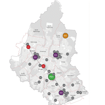
Source: Draft Ku-ring-gai Community Facilities Strategy
In summary, if the site was available for sale and
redevelopment, which is not now possible under community land classification,
this would provide the opportunity for a higher order of benefits for the
Ku-ring-gai community as a whole in the form of a site/location for a new
cultural facility located in Gordon. This central location in the main centre
of Ku-ring-gai, ensures that the area is accessible to all Ku-ring-gai
residents, of all ages and transport dependencies.
It must be emphasised that Ku-ring-gai is not attempting to
compete with Willoughby City Council or duplicate the facilities available at
the Chatswood Concourse, as has been suggested by a number of people. The
Concourse is an accessible location not far from the boundary between
Ku-ring-gai and Willoughby at Roseville and will continue to provide services
for the residents of Ku-ring-gai and other local areas.
Provision of cultural community facilities at Gordon relates
to the provision of complementary facilities that reflect the values of
Ku-ring-gai residents. This includes the provision of community space
adaptable for cultural use including:
· provision of community display space
for key Ku-ring-gai collections including but not limited to Cavalcade of
Fashion;
· provision of community display space
for local artists; and
· provision of a small
scale modern performance space / auditorium.
Environmental Considerations
The site is shown on a biodiversity layer with a number of
stands of trees including Blue Gum High Forest, Blackbutt and Ironbark. There
is no change to the Biodiversity status of the site proposed by the
reclassification process and Tree Preservation Orders remain in effect.
Community Consultation
The proposed reclassification of the Culworth Avenue car
park has been the subject of two exhibitions and two public hearings. The
second process included additional material to clarify many of the key issues
those arose as part of the first process. The key dates in the community
consultation process were as follows:
First Public Exhibition: Friday 30
August 2013 – Friday 27 September 2013
First Public Hearing: Thursday 24
October 2013 – 5pm-7pm
Second Public Exhibition: Friday 28 March 2014 – Wednesday
30 April 2014
Second Public Hearing: Monday 26 May 2014 – 5pm-7:30pm
Both Public Hearings were chaired by the same Chairperson:
Mr Peter Walsh.
For the 2013 process notification, letters were sent to
affected resident properties in the locality and for the 2014 process, letters
were sent to all these addresses (on an updated address list) as well as
persons who had made submissions as part of the 2013 process. Advertisements
were also included in the Ku-ring-gai Council corporate advertisement in the
North Shore Times.
All submissions, both to the first and to the second
exhibition and both public hearing processes have been assessed and reported as
part of this report to Council.
All persons who made formal submissions to both the
exhibitions of the Planning Proposals and the Public Hearing have been advised
of this matter coming back to Council.
Petitions
A series of petition pages have been received by Council and
reported to Council in batches over the course of the exhibition period some of
which were under the title Petition to STOP Culworth Avenue Car Park being
SOLD for High Rise Residential Development by Council. The wording
of the petitions changed over the period of collection and the two main
wordings are presented below:
“We the undersigned residents of Ku-ring-gai strongly oppose Council's planned rezoning/ reclassification of 20
- 28 Culworth Avenue. This will result in high rise residential development within a local, heritage
conservation area; and the loss of 204 commuter
car park spaces at Killara Station
within a large area of declared biologically significant open space.”
and
"We,
the undersigned, petition Ku-ring-gal Council to STOP Culworth Avenue Car Park
being SOLD for High Rise Residential Development by Council. By signing this
petition we are indicating our strong opposition to Ku-ring-gal Council's
planned rezoning / reclassification of 20-28 Culworth Avenue. This will result
in high rise residential development within a local heritage conservation
area; and the loss of 204 [174] commuter car park spaces at Killara Station
within a large area of declared biologically significant open space."
Response
It is noted that no rezoning is proposed as part of this
proposal; this proposal relates only to the reclassification of the land from
community land to operational land. There is no sale proposed as part of this
proposal; part of the site is under compulsory acquisition by TfNSW during the
reclassification process, a fact in the public realm since the time of the
first public hearing. With respect to the residual area of the site, any such
proposal in the future would need to be the subject of a separate report to
Council. The car park is not a heritage item and any future redevelopment
would be subject to the same controls as any other development within a
heritage conservation area.
Whether additional public car parking is included on the
site as part of any future divestment or redevelopment of the site, and how
much car parking is required for current and future demands, are matters for
Council at such time any proposal were available for consideration however the
acquisition of part of the site by TfNSW for commuter car parking is an effective
guarantee of continued parking on the site. Should the need for additional
commuter parking arise, then it is open to TfNSW to build a multi-deck
carpark.
Existing significant areas of biodiversity and vegetation on
the site remain subject to specific development controls as do similar areas of
development; this is not changing as a result of this proposal. The potential
to include additional residential development, together with such neighbourhood
shops and facilities that befit a neighbourhood centre, accords with the Metro
Strategy to provide greater densities around railway stations.
Analysis of petition
The receipt of pages of the petitions in batches and
periodic reporting to Council resulted in some duplication of reporting and of
signatories and a resulting lack of clarity on both the total number of
petitioners and their origin.
The petition has been analysed and is summarised as follows:
There were a total of 4,849 individual signatories of which
4,255 (88%) resided within the Ku-ring-gai area, 537 (11%) resided outside the
Ku-ring-gai area and 57 (1%) provided incomplete addresses that were
insufficient to confirm whether or not they lived within the Ku-ring-gai area.
Figures of over 5,000 and even 6,000 signatories have been reported
however after full data entry, including identification of duplicate pages, the
count of individuals was as above (4,849) with a further 476 signatures
discovered to be duplications.
In context it should be noted that the resident population
of Ku-ring-gai is 119,027 (as of June 2013) and growing rapidly having been
counted at 109,297 in the census two years before. Approximately 75% of the
population is of voting age. The Culworth Avenue car park provides 173
off-street spaces of which average weekday peak occupancy has been demonstrated
to be 106 spaces; a maximum of 113 spaces. With reclassification, Ku-ring-gai
Council gains the potential, subject to further reporting, to utilise the value
of the subject site to continue the program of infrastructure provision and
asset renewal for the whole and growing population of Ku-ring-gai LGA. Car
parking will be retained on the site through the compulsory acquisition of part
of the site by TfNSW.
A change.org petition was also presented to Council. As of
late August 2014, it contains 731 signatures. These have not been checked for
duplication with the above petition due to the nature of online petitions. The
petition contains the following wording and was instigated concurrent with the
first exhibition and public hearing process around September 2013:
“Since 1981, every time
Ku-ring-gai Council has a need for money, it tries to rezone and sell the
Culworth Avenue Carpark at Killara Station. Five times, since 1981, the voice
of the local residents has defeated the proposition.
Now Council seeks to reclassify the land, such that it will be sold to
developers who will replace a vital community facility with another five storey
apartment block with more traffic on our already congested and inadequate local
streets.
We residents need once more to send a clear message to those elected to
represent us that our wish is to retain that land for the benefit of the
community for ever.
By signing up to this petition you can send a clear message to the council that
we want this land kept for our benefit and not reclassified and sold.”
Response
Since 2004, Ku-ring-gai has been undergoing significant
population growth and redevelopment of traditional low-density areas along the
northern railway line. The ongoing use of this site as an at-grade car park
while the area around it intensifies represents an under-utilisation of the
site which can, at higher density, provide for additional infrastructure. Part
of the site is to be compulsorily acquired by TfNSW to provide for car parking
on an ongoing basis; the option for a future below or above ground multi-deck
car park potentially associated with small-scale neighbourhood shops is retained
subject to future demand.
The site is large enough to cater for this use as well as
provide funding for other community infrastructure projects in Ku-ring-gai
specifically the Gordon community, civic and cultural hub. Ku-ring-gai has an
extensive delivery program of new community assets and asset renewal both in
response to new development and as part of the strategic management process of
a large portfolio of ageing community assets. These concepts have already been
expanded upon in the section of the report responding to the individual
submissions.
Internal Consultation
All Departments of Council have been consulted (where
relevant) in the preparation of this report.
Summary
The land at 20-28 Culworth Avenue and 17 Marian Street
Killara was progressively acquired between 1955 and 1959 for the purposes of a
Civic Centre. In 1965 Ku-ring-gai Council resolved to utilise the property as
a temporary car park which commenced from 1966. The property is currently
zoned Special Uses (Municipal Purposes) and has been for many decades. That
the use of the property for car parking was always intended to be an interim
use until such time as the property was required for its original purpose has
been reiterated on many occasions over the intervening years. The provision of
commuter car parking is a core responsibility of the NSW State Government. The
property is located directly opposite a railway station in an area that is
rapidly transitioning from low-rise to medium density units and has a latent
capacity beyond the present at-grade car park. The compulsory acquisition of
part of the site by TfNSW for commuter parking, noting that the area acquired
has potential for more than one level of car parking, ensures the retention of
car parking on the site. The foregoing report outlines a suite of mechanisms
to ensure that both commuter and short-term car parking, with easy access to
modal interchange, can be provided in Gordon, Killara and Lindfield via both on
and off street parking provision. The latent value in the property is now
required to support ongoing infrastructure delivery in Ku-ring-gai in
accordance with adopted strategic plans, asset renewal strategies, asset
management plans and the Long Term Financial Plan.
It is recommended that the reclassification of the car park
at 20-28 Culworth Avenue and 17 Marian Street Killara to operational land
status proceed in accordance with the Planning Proposal.
Any decision to dispose of any of the subject land will be
subject to separate specific reporting to Council.
|
Recommendation:
A. That
the properties at 20-28 Culworth Avenue and 17 Marian Street Killara,
collectively known and utilised as ‘the Culworth Avenue car park’ be
reclassified from community land to operational land as per the Planning
Proposal.
B. That
Council declines to use its plan making delegations under Section 59 of the
EP&A Act and the Planning Proposal be submitted to the Department of
Planning and Environment in accordance with section 58 of the EP&A Act,
and request that the Minister make the plan.
C. That
delegation be granted to the General Manager to make all necessary
corrections and amendments to the planning proposal for drafting
inconsistencies, or minor amendments as necessary to ensure consistency with
Department of Planning & Environment policy.
D. That,
prior to, or concurrent with, any reduction of public car parking
availability on the Culworth Avenue site, facilities for short term paid car
parking be installed in Culworth Avenue and Lorne Avenue and, if required,
Marian Street.
E. That
all persons who made a submission be notified of Council’s decision.
|
|
Kate Paterson
Infrastructure Co-ordinator
|
Antony Fabbro
Manager Urban & Heritage Planning
|
|
Joseph Piccoli
Strategic Traffic Engineer
|
Craige Wyse
Team Leader Urban Planning
|
|
Andrew Watson
Director Strategy & Environment
|
|
|
Attachments:
|
A1View
|
Culworth
Avenue Carpark - Weekday Occupancy and Interview Surveys Summary Report
|
|
2014/074050
|
|
|
A2View
|
Culworth
Avenue Carpark Weekend Occupancy Survey
|
|
2014/091409
|
|
|
A3View
|
Culworth
Avenue - Highest and Best Use Report
|
|
2014/071537
|
|
|
A4View
|
Gateway
Extension
|
|
2014/066390
|
|
|
A5View
|
Draft
Ku-ring-gai Community Facilities Strategy 2014
|
|
2014/065798
|
|
|
A6View
|
Chairpersons
Report dated 30 June 2014 for Public Hearing 26 May 2014
|
|
2014/158540
|
|
|
A7View
|
Planning
Proposal
|
|
2014/073484
|
|
|
A8View
|
Gateway
Determination
|
|
2013/207344
|
|
|
A9View
|
Submission
summary table 2013 exhibition
|
|
2014/215550
|
|
|
A10View
|
Submission
summary table 2014 exhibition
|
|
2014/215141
|
|
APPENDIX
No: 1 - Culworth
Avenue Carpark - Weekday Occupancy and Interview Surveys Summary Report
|
|
Item No: GB.3
|


|
APPENDIX No: 2 - Culworth
Avenue Carpark Weekend Occupancy Survey
|
|
Item No: GB.3
|

|
APPENDIX No: 3 - Culworth
Avenue - Highest and Best Use Report
|
|
Item No: GB.3
|


|
APPENDIX No: 4 - Gateway
Extension
|
|
Item No: GB.3
|

|
APPENDIX No: 5 - Draft
Ku-ring-gai Community Facilities Strategy 2014
|
|
Item No: GB.3
|


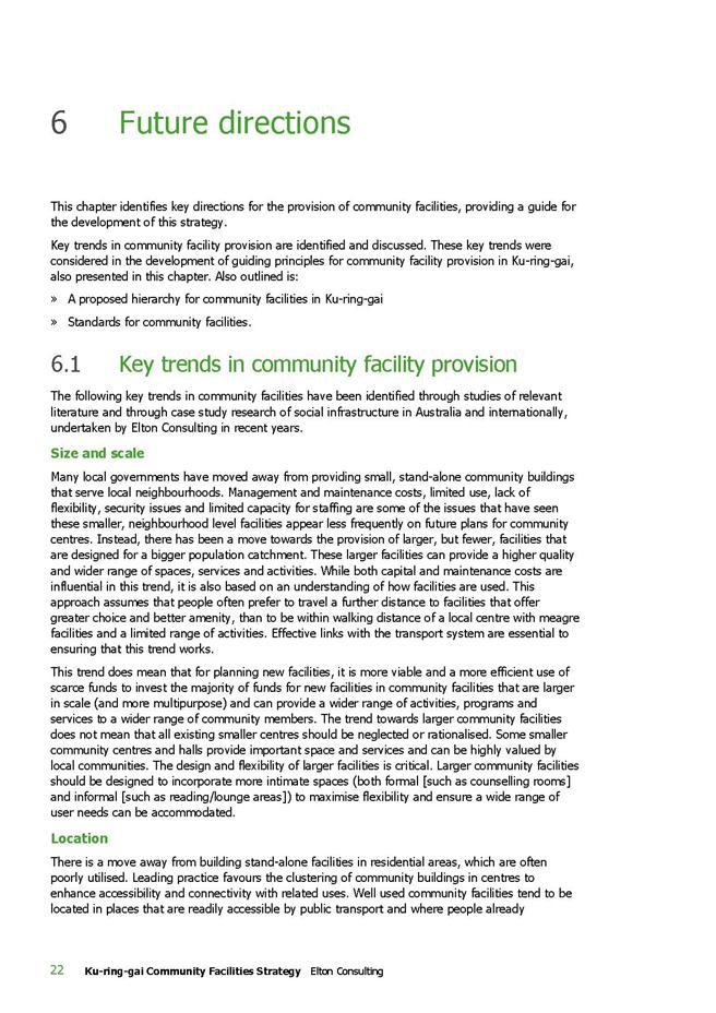



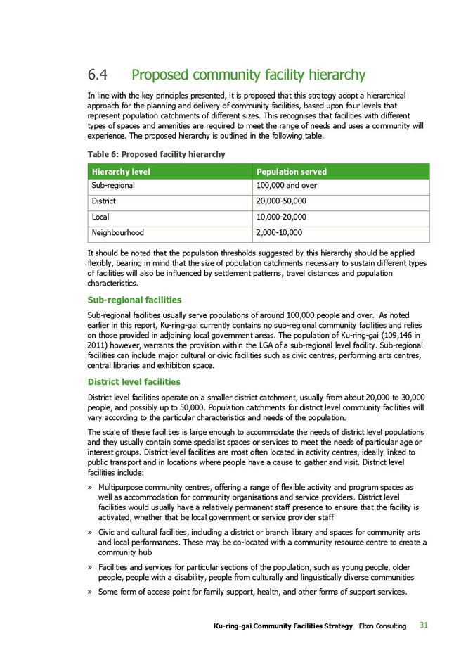
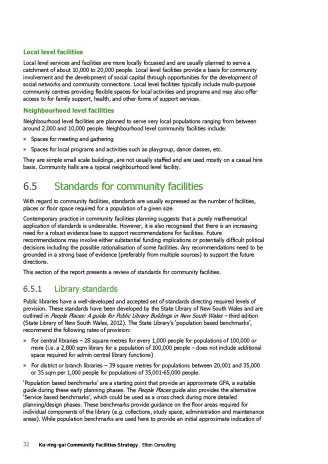


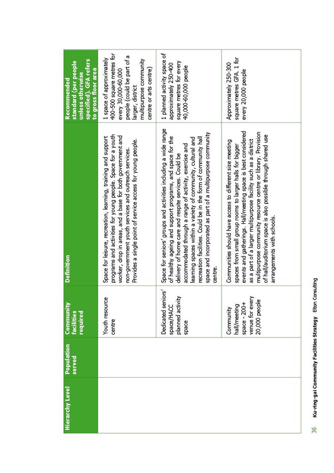

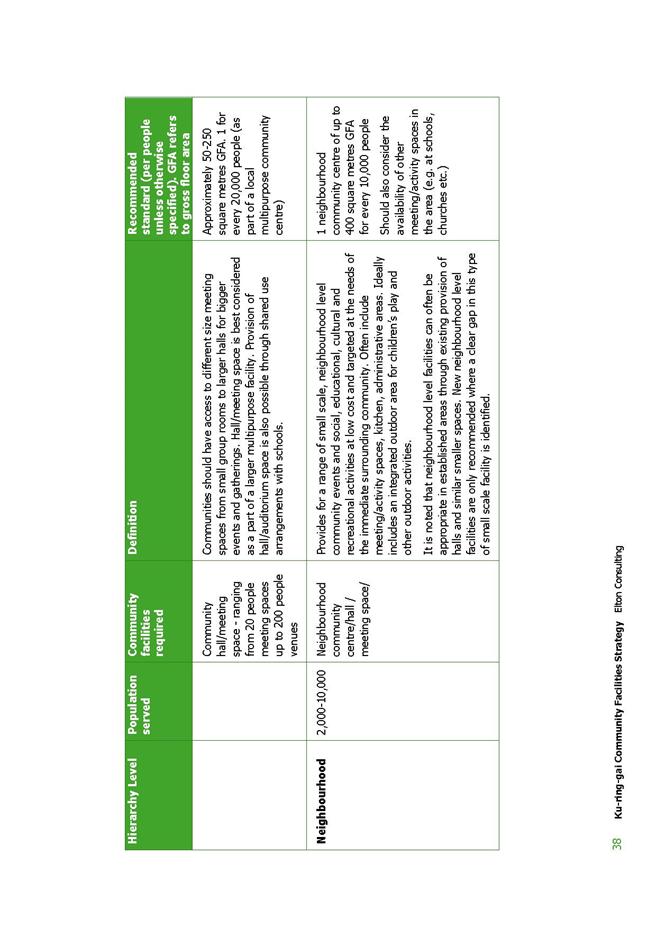


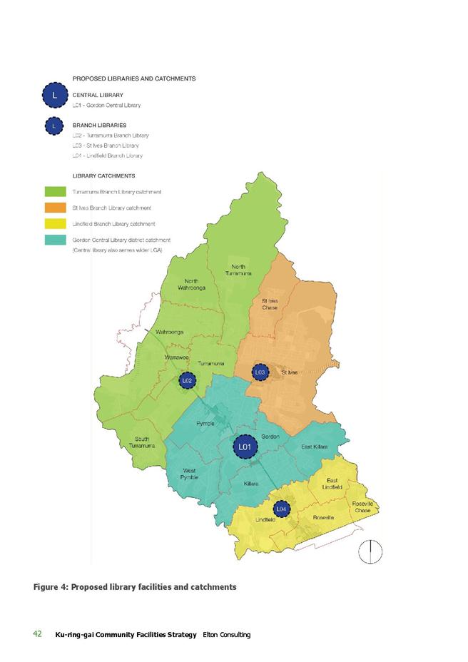
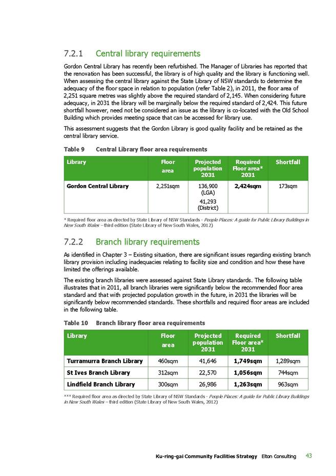
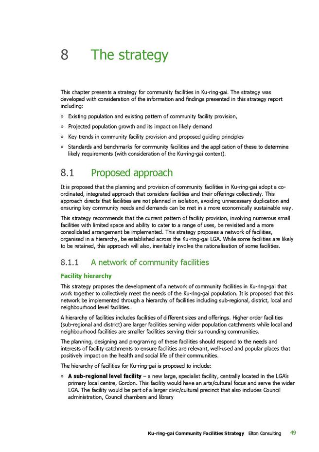
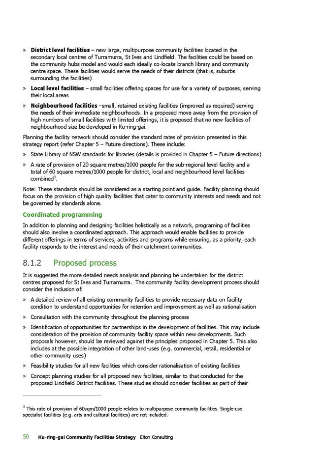
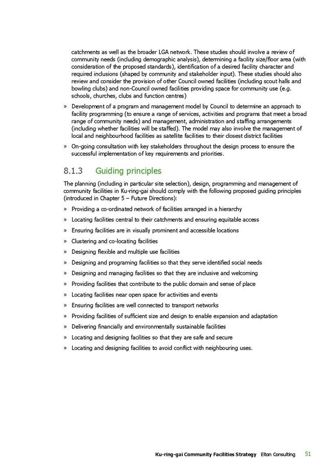
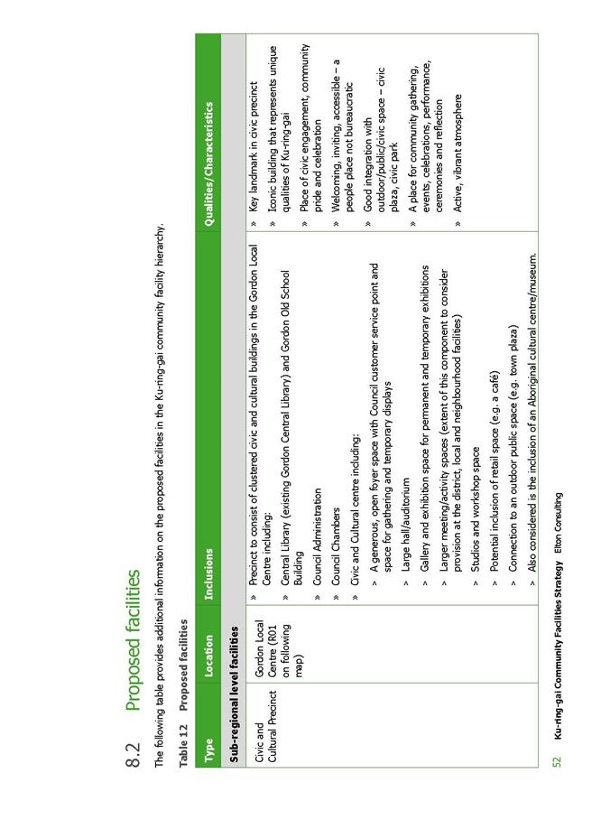
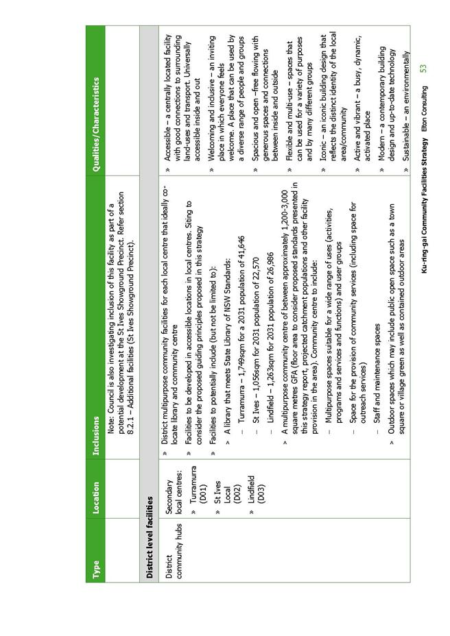
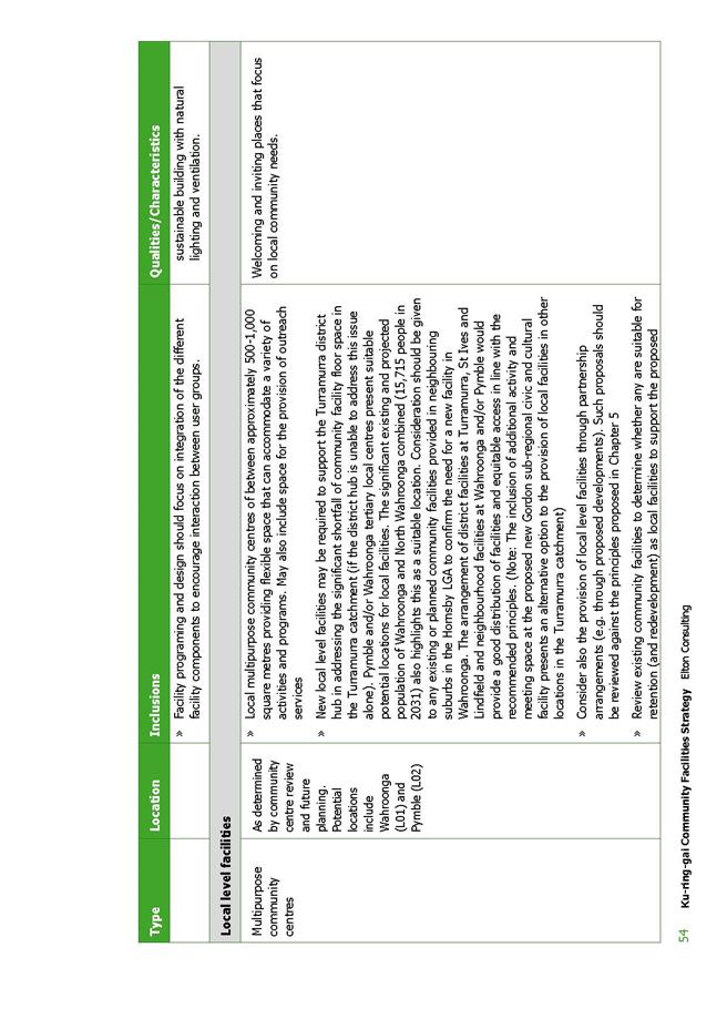
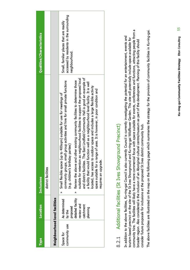
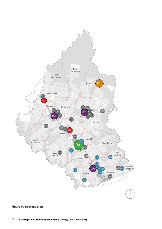
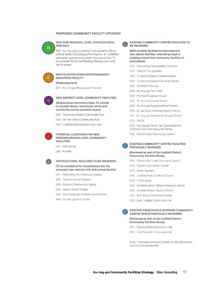

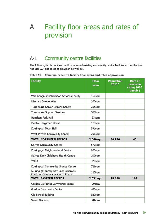
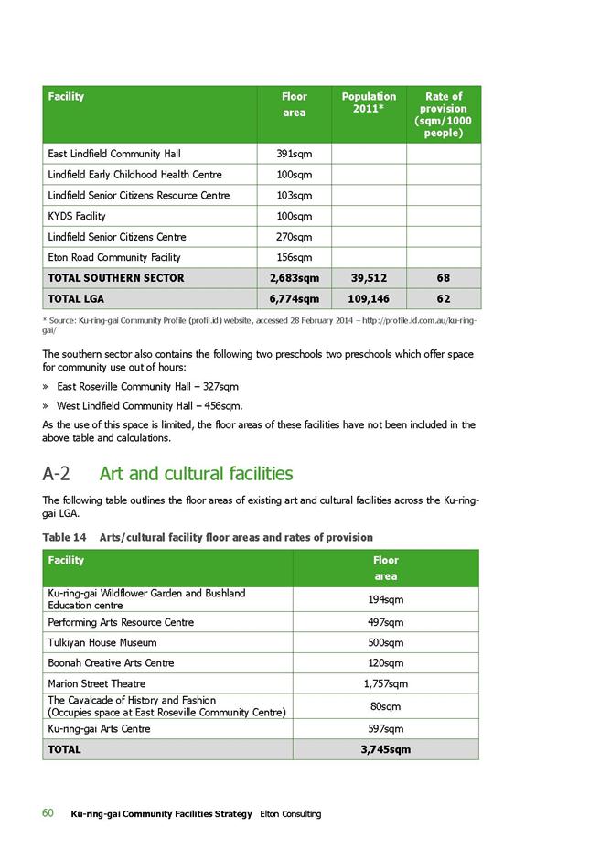
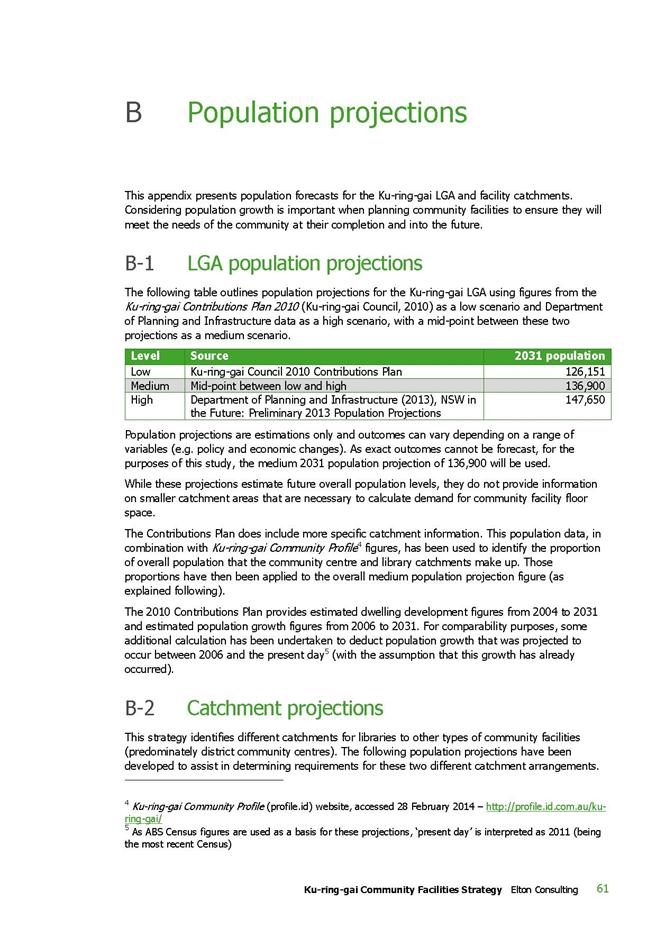
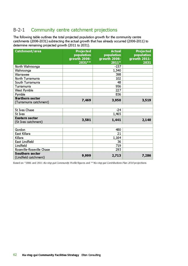
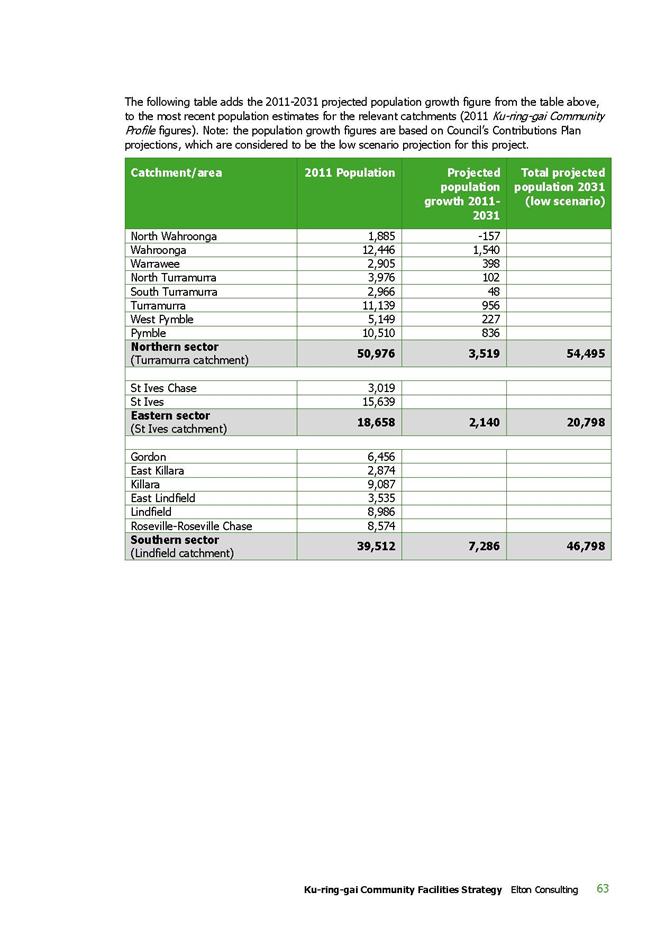
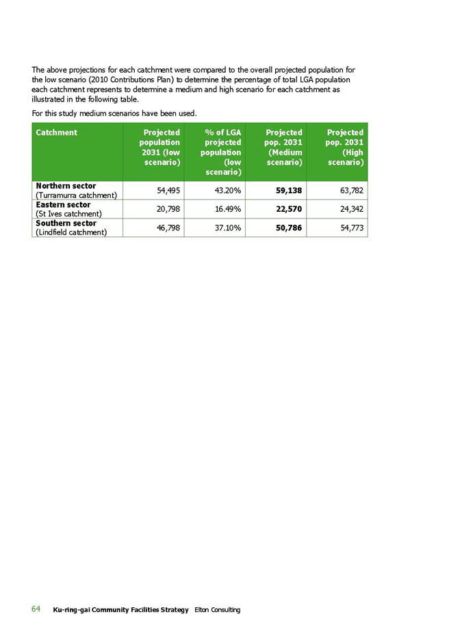
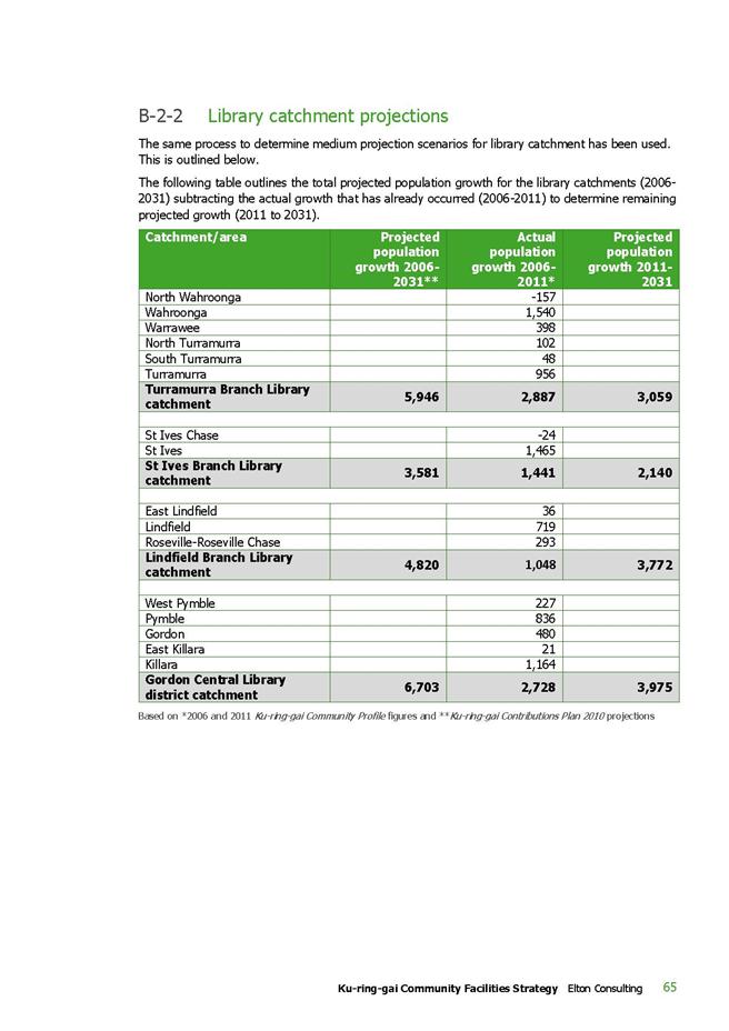
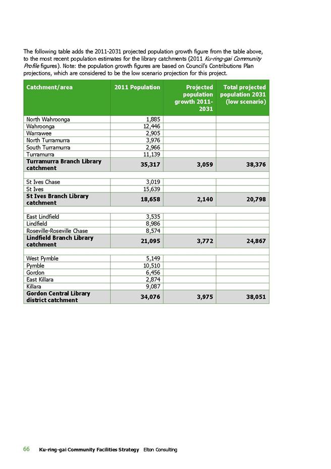
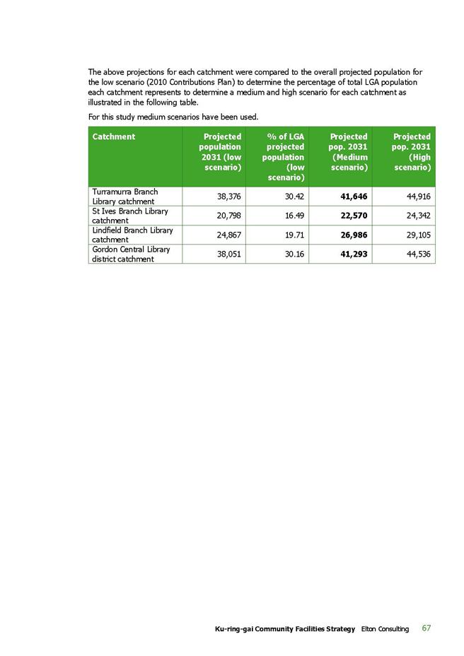

|
APPENDIX No: 6 - Chairpersons
Report dated 30 June 2014 for Public Hearing 26 May 2014
|
|
Item No: GB.3
|
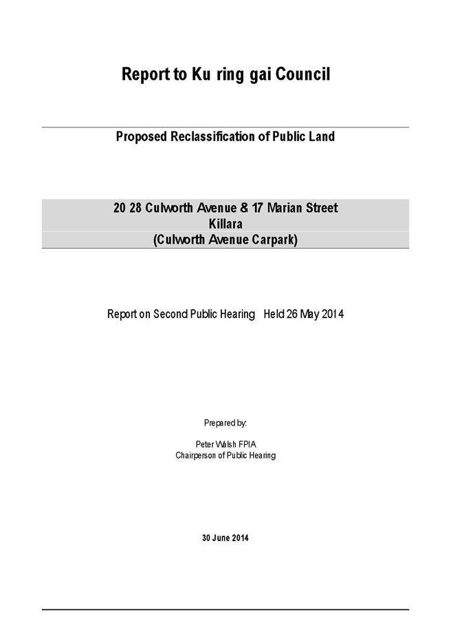
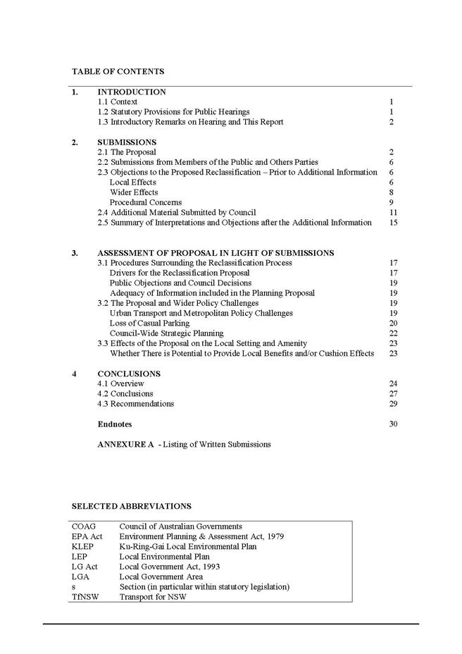
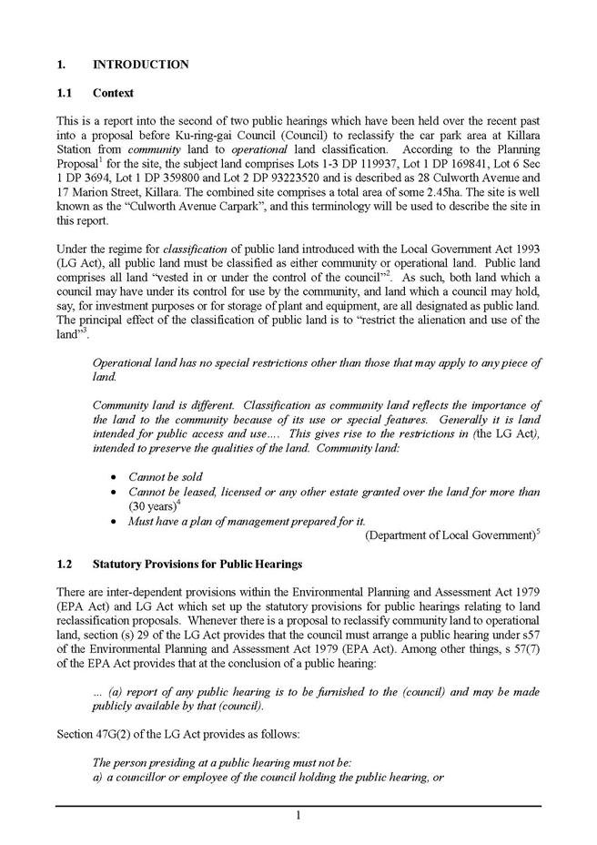
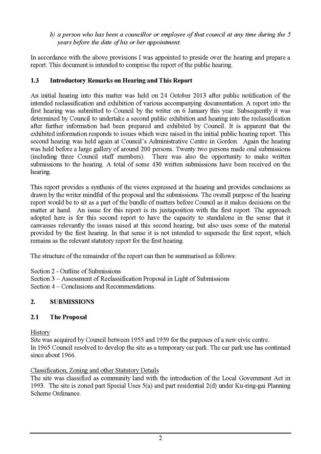
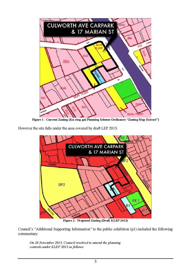
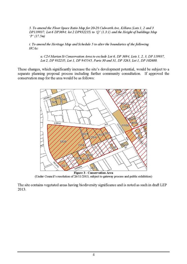
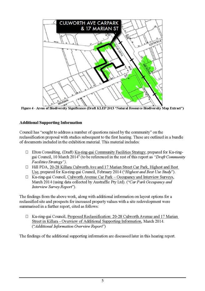
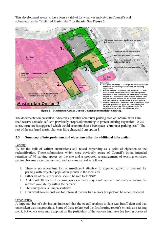
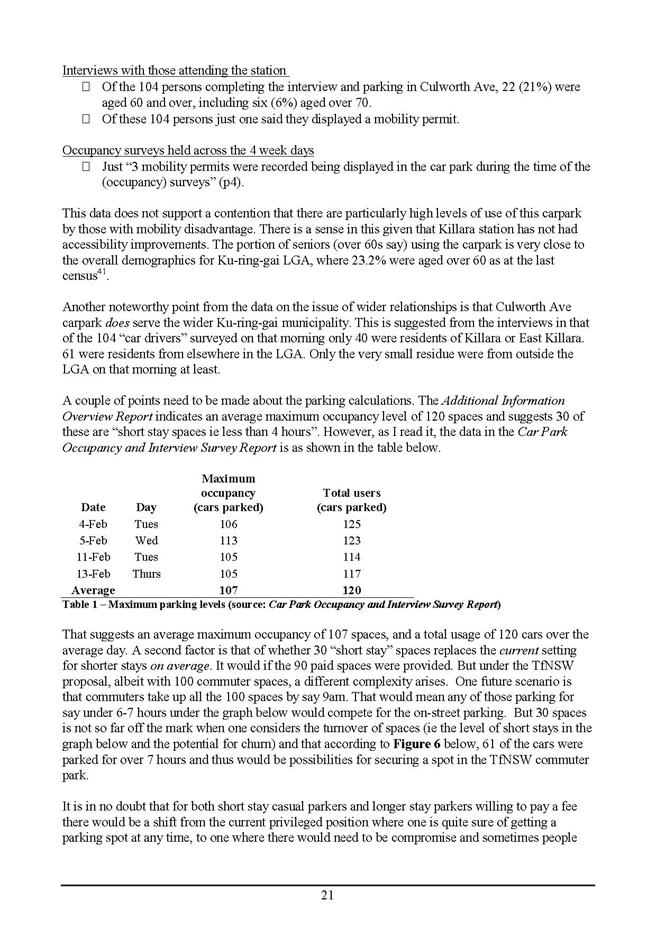
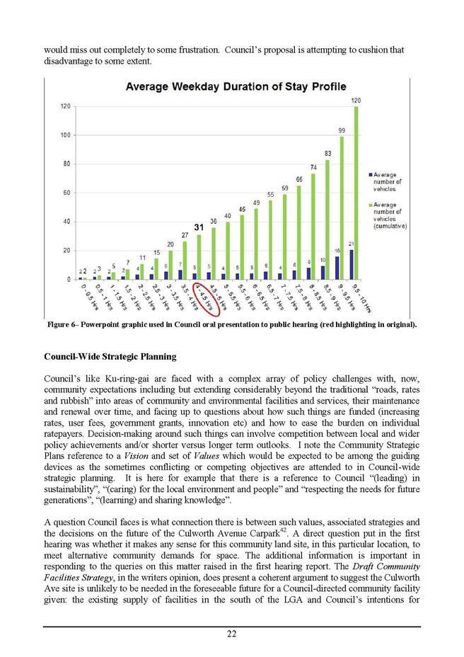
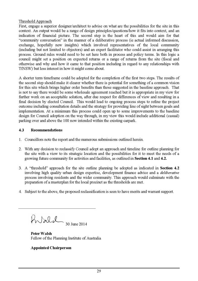
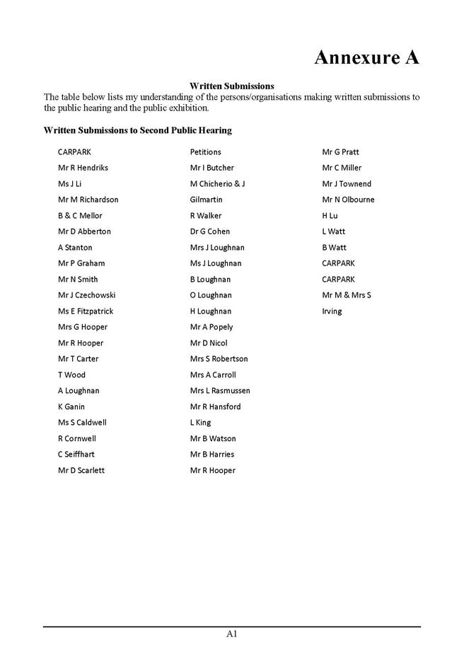
|
APPENDIX No: 7 - Planning
Proposal
|
|
Item No: GB.3
|
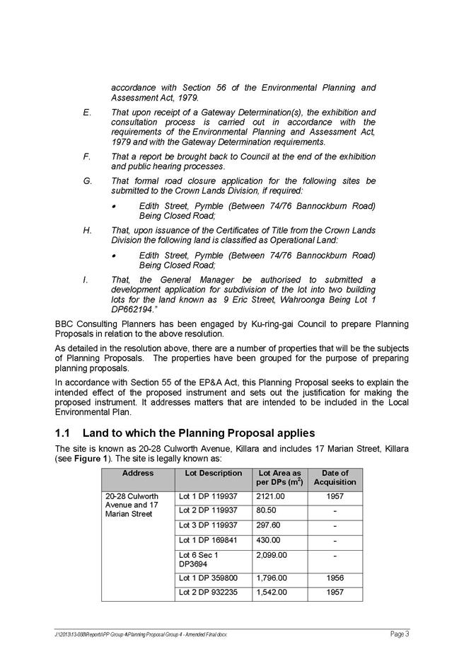
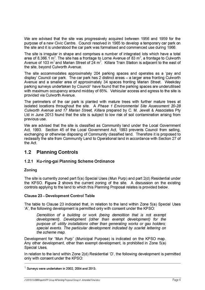
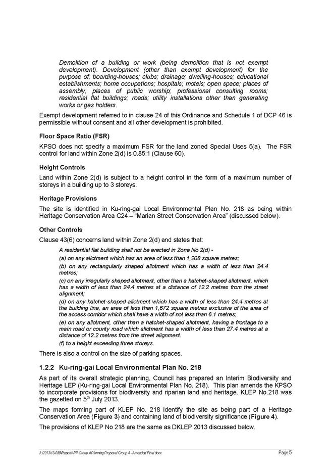
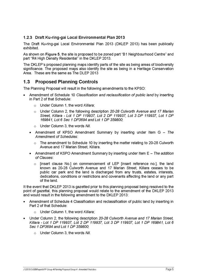
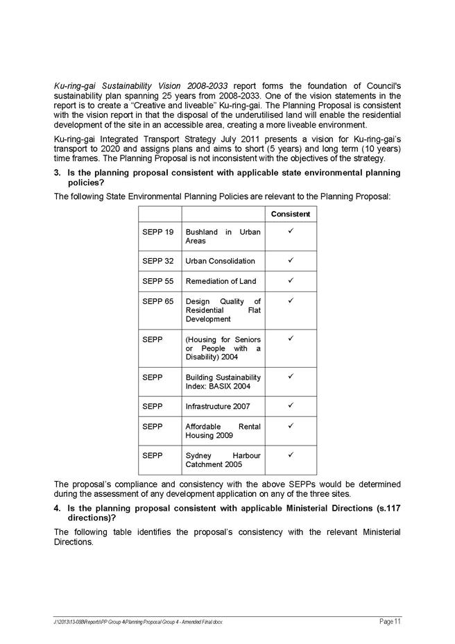
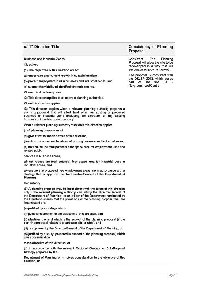
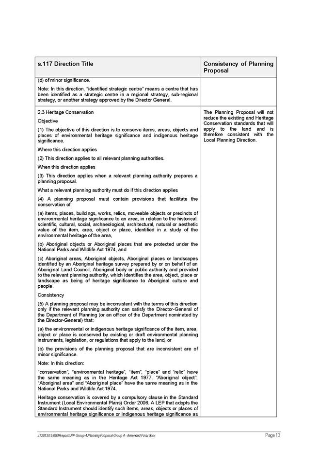
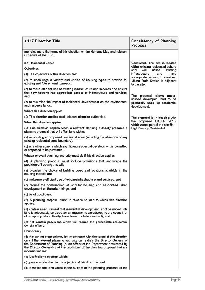
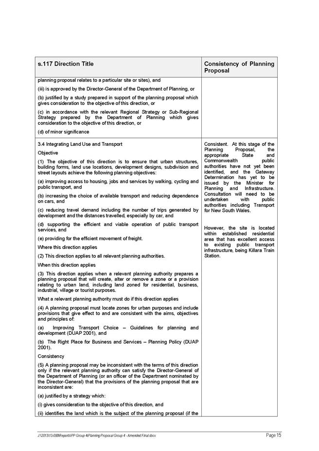
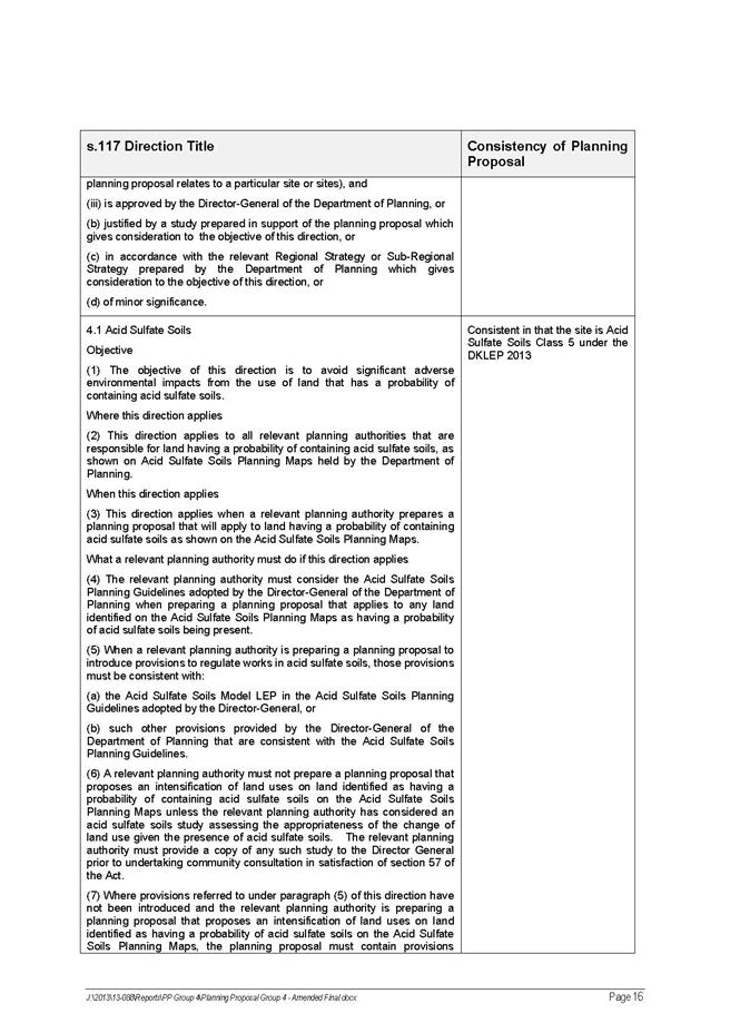
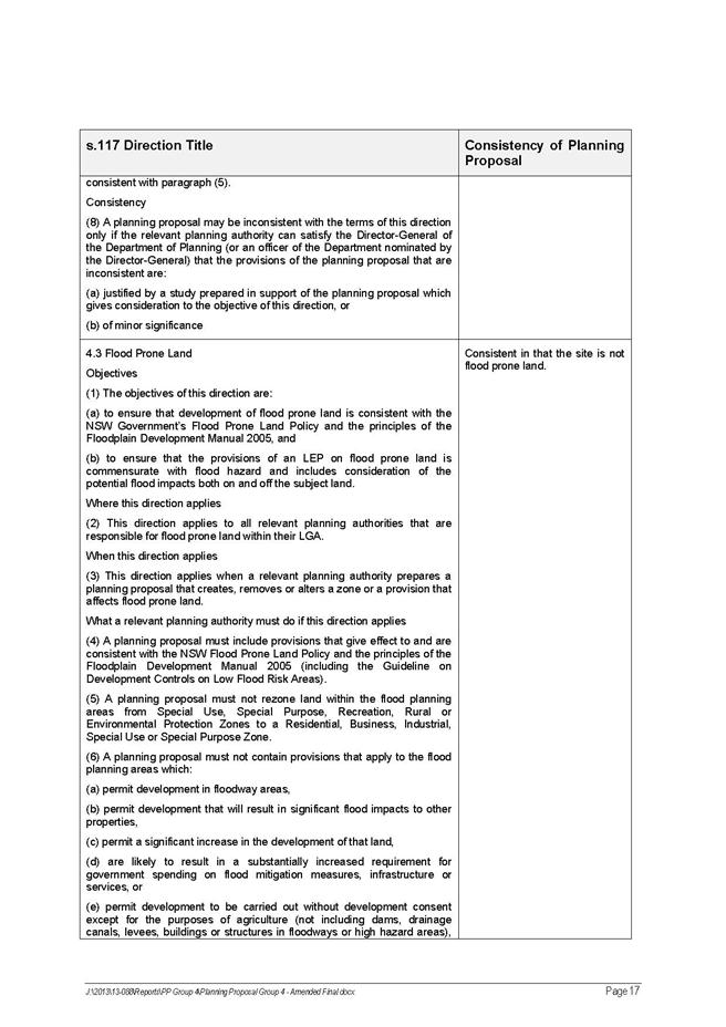
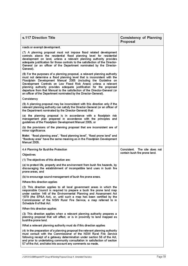
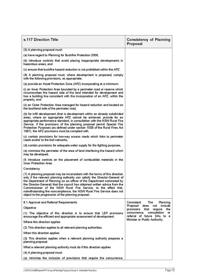
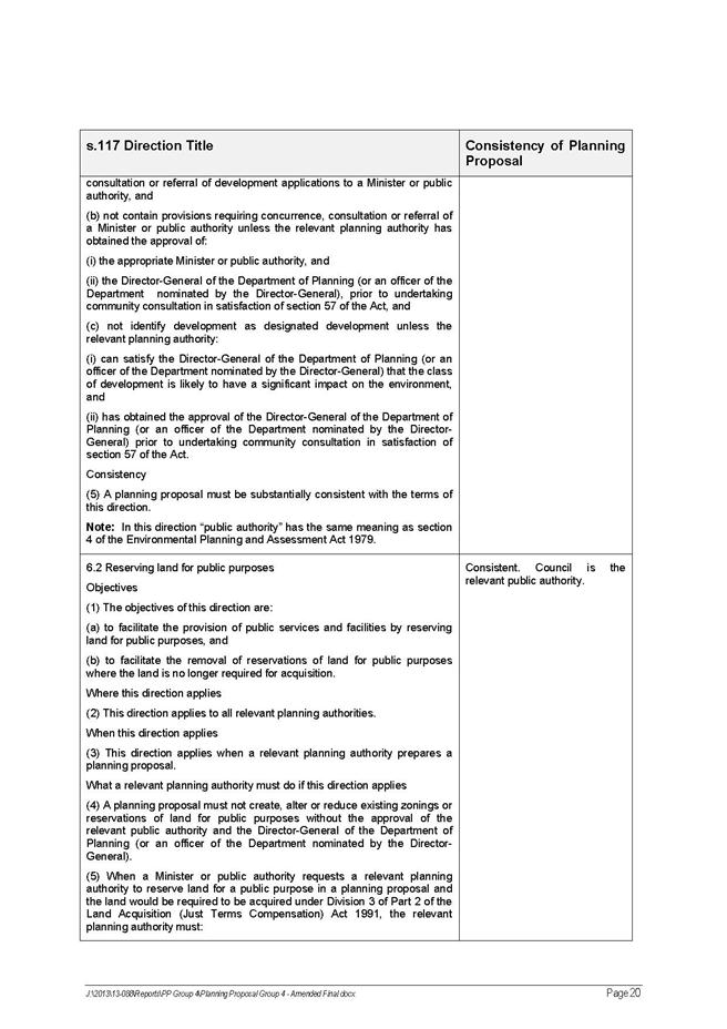
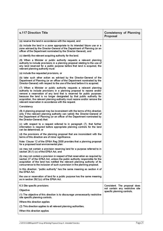
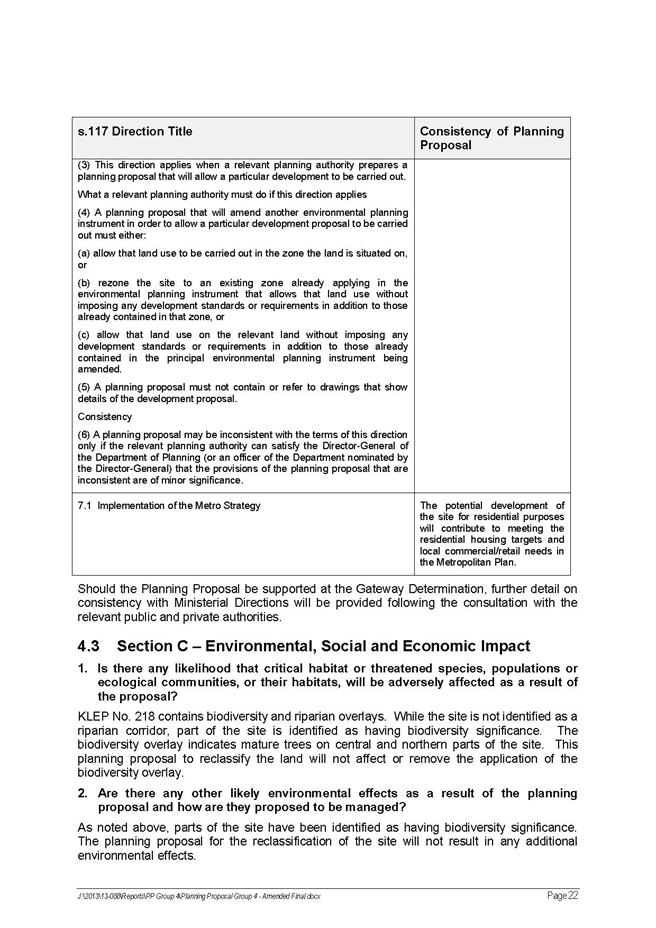

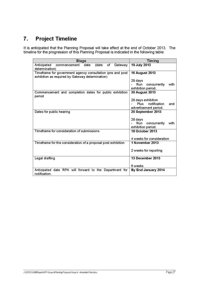

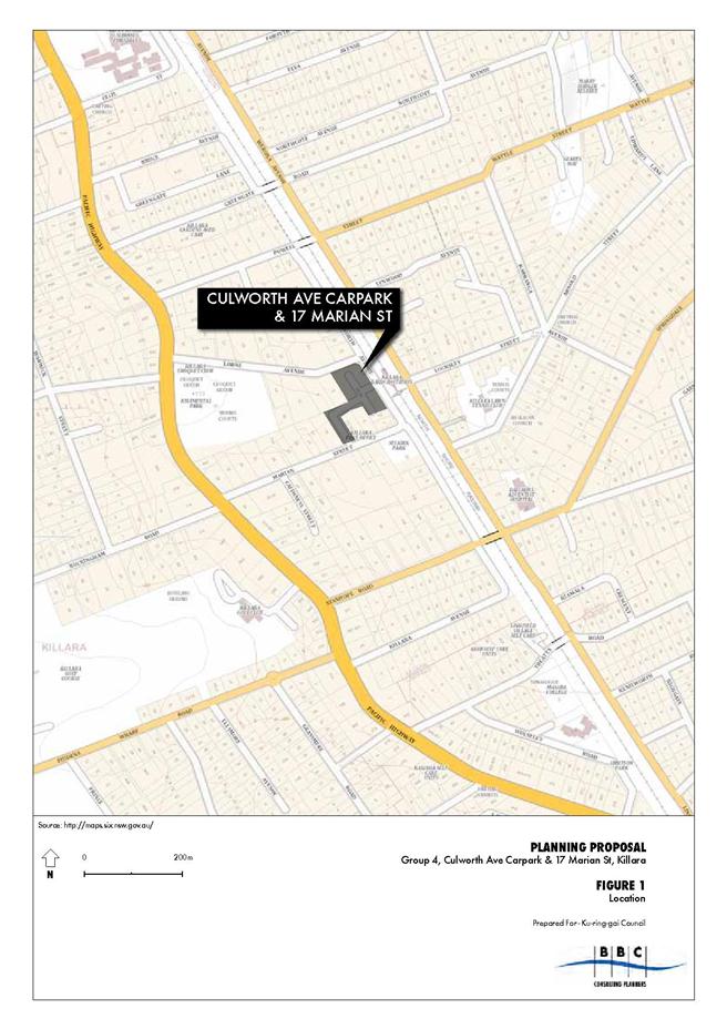
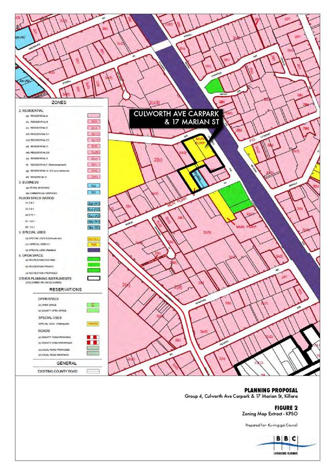
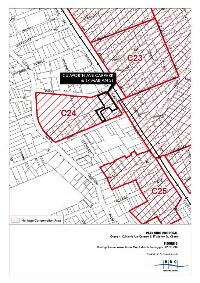
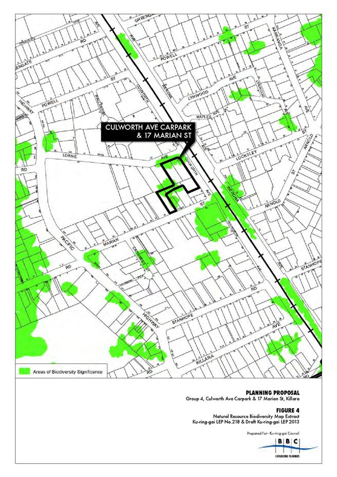
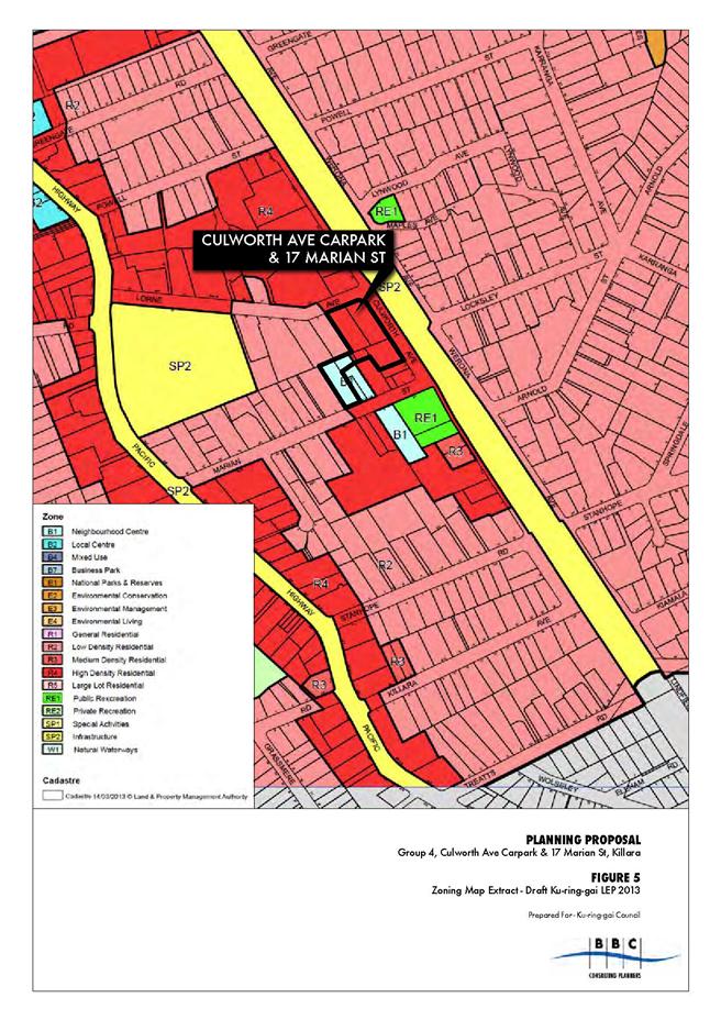

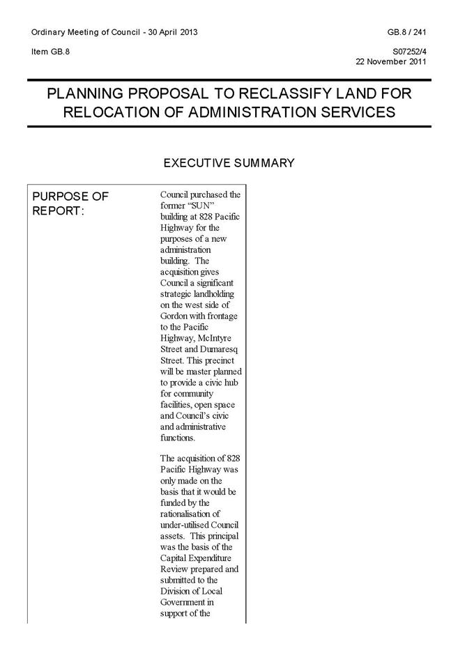
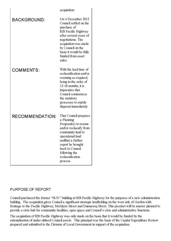
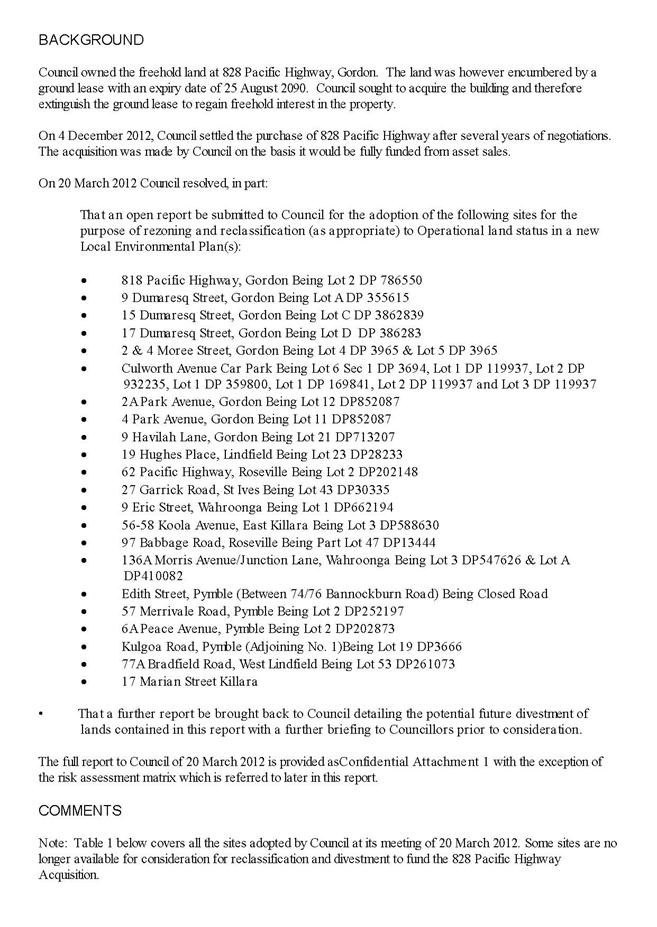
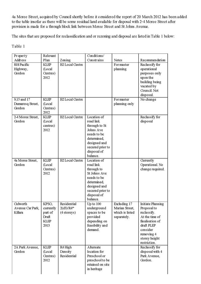
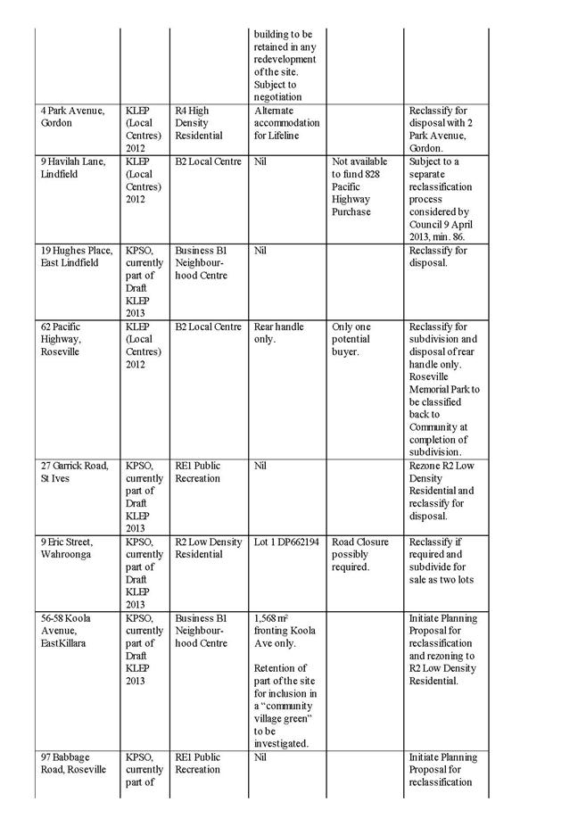
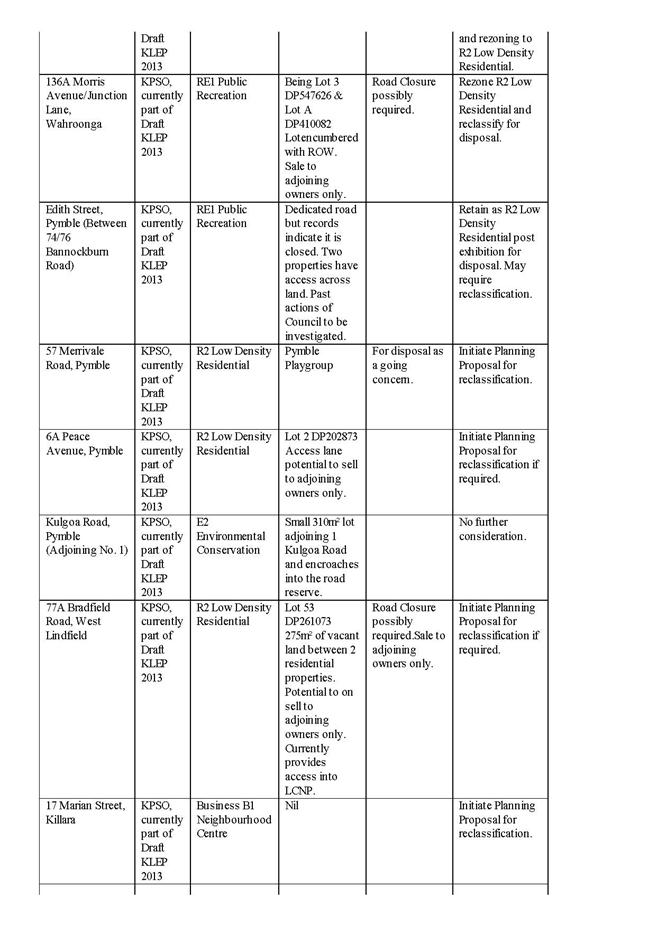
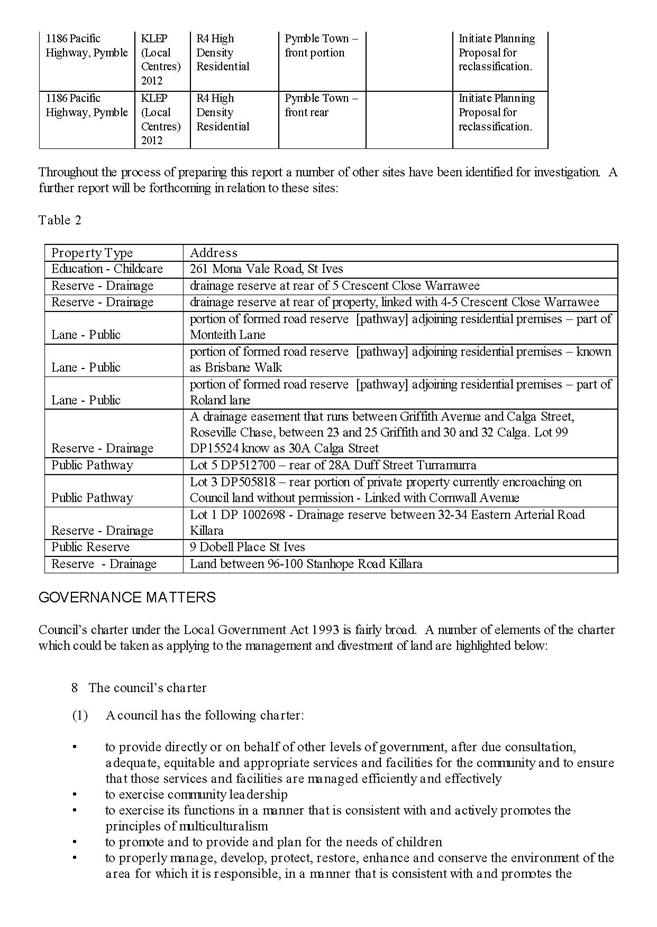
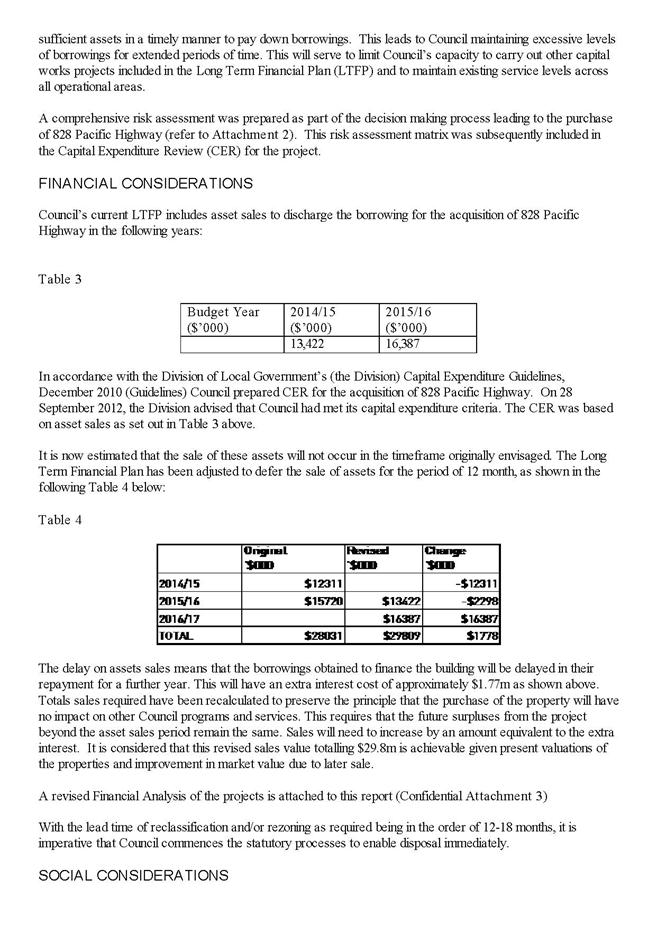
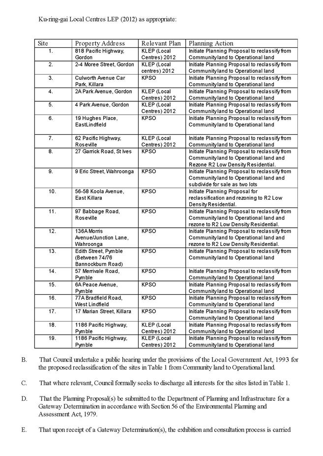
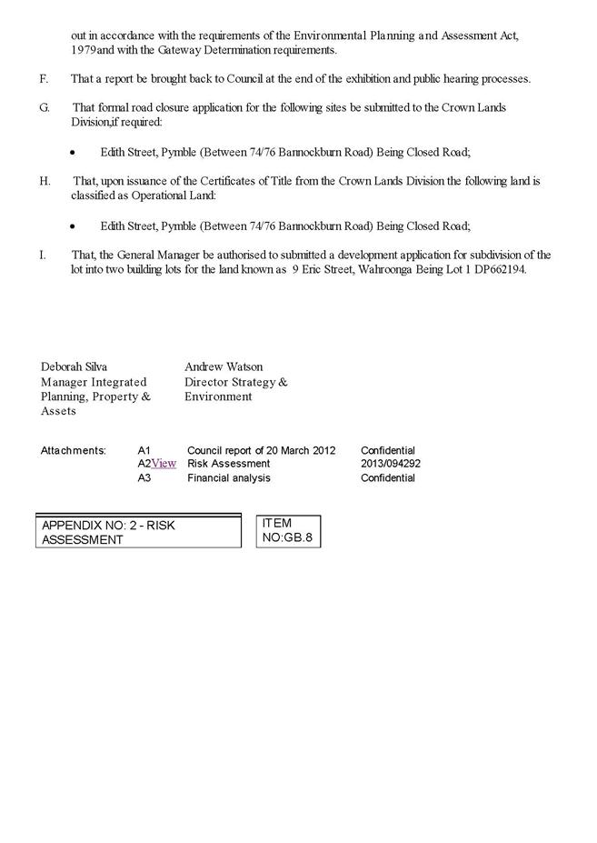
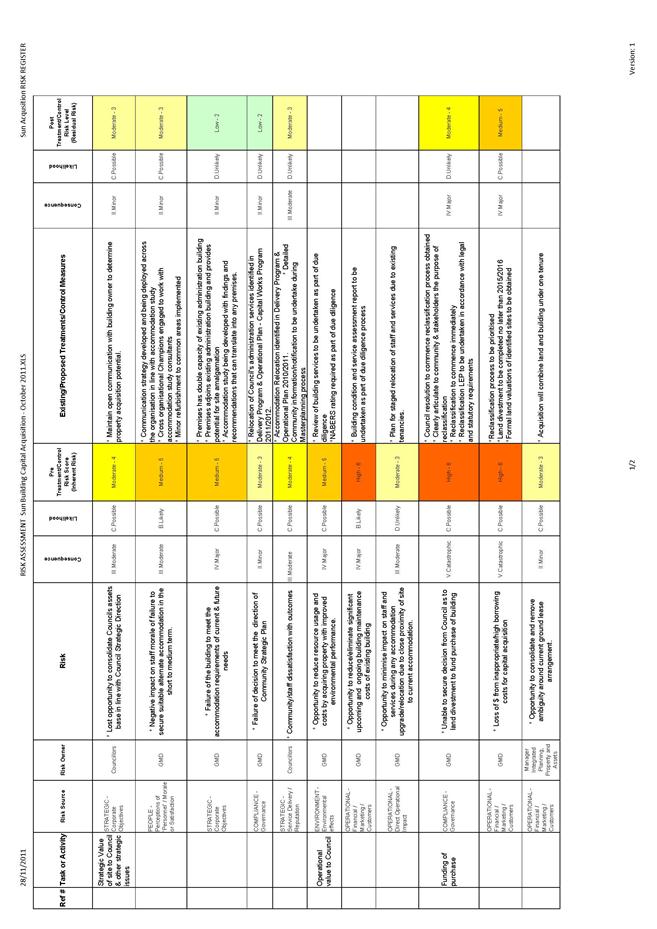
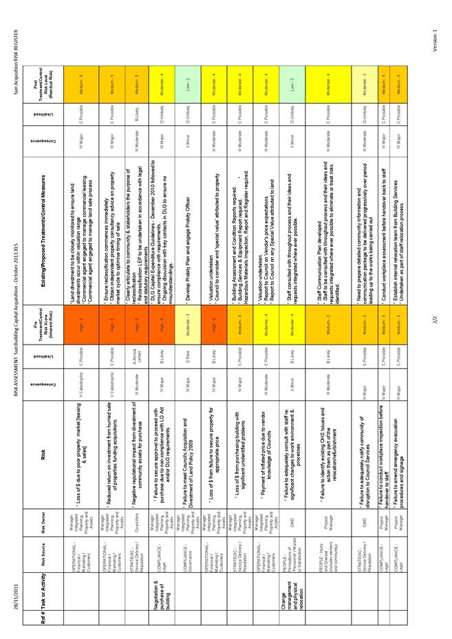
|
APPENDIX No: 8 - Gateway
Determination
|
|
Item No: GB.3
|
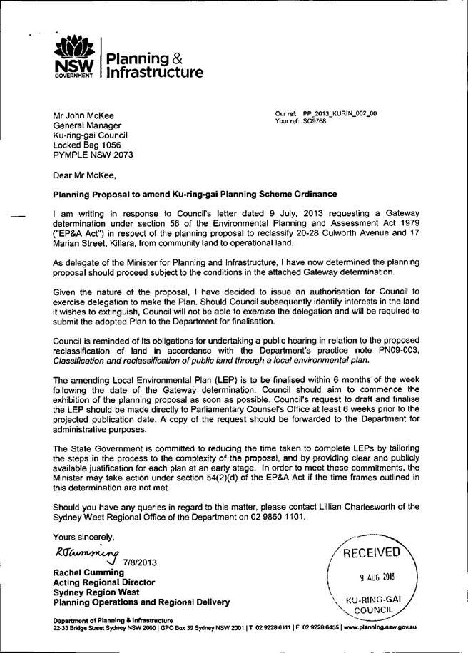
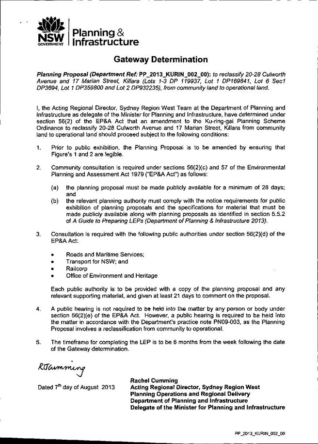
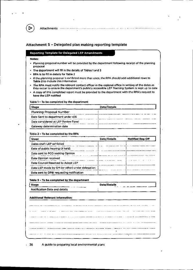
|
APPENDIX No: 9 - Submission
summary table 2013 exhibition
|
|
Item No: GB.3
|
20-28 CULWORTH AVENUE & 17
MARIAN STREET, KILLARA
SUBMISSION SUMMARY TABLE
2013
Key themes arising from the 2013/ 2014
Planning Proposal Exhibition Process
In connection with the proposed
reclassification of the properties at 20-28 Culworth Avenue and 17 Marian
Street Killara, there were two distinct periods of consultation. All
submissions arising from both exhibitions of the planning proposals and the
public hearing processes have been considered and incorporated as part of the
preparation of this report. For purposes of clarity and distinction, these are
referred to as the 2013 and the 2014 processes respectively. It became
apparent that submissions for both rounds of exhibition raised the same issues
and concerns and for purposes of consistency, the issues in this table have
been addressed in the 2014 Submission table – which encompasses all key themes arising
from both periods.
The key themes arising from the submissions
for the 2014 process are as follows:
· On-going
need for the provision of commuter parking
· On-going
need for the provision of non-commuter car parking (around four to six hours)
· On-going
need for availability of weekend parking
· On-going
need for the provision of accessible car parking for aged and disabled users
· Disputing of
utilisation figures / assessment of under-utilisation
· Adverse
effect on nearby streets of any loss of car parking
· Support for
use of public transport (trains) through provision of car parking at stations
· Rezoning of
site under Draft Ku-ring-gai LEP 2013 / Potential for high rise development
· Heritage and
Biodiversity / Protected trees
· Perceived
overdevelopment / concerns with redevelopment for units
· Council’s
presentation of options for consultation as opposed to a single vision
· Council’s
presentation of a fait de compli without consultation
· Excessive consultation
/ Insufficient consultation / Manner of Public Consultation
· Labelling of
the purchase of floor space at 828 Pacific Highway as a ‘Taj Mahal’
· Site
benefits / impacts compared to Ku-ring-gai area-wide benefits / impacts
· Retention of
infrastructure vs provision of infrastructure
· Alternatives
for funding Gordon Civic and Community Precinct
|
APPENDIX
No: 9 - Submission
summary table 2013 exhibition
|
|
Item No: GB.3
|
|
TRAFFIC/PARKING
|
|
Issue/Concern
|
|
Submission is
opposed to the proposal.
Submission
raises a concern over the loss of parking and argues that there is already
traffic and safety issues around the area because of the car park has
restricted 2 way traffic.
Local
residents are already dealing with an issue related to unauthorised parking
by non-residents.
|
|
Submission
strongly objects to the reclassification of Culworth Avenue carpark in
Killara for reasons including:
· Argues the carpark is
frequently heavily used
· The alternative all-day
commuter car parks at Gordon are always full. They are being refurbished but
it will be many years before they are extended in capacity.
· The reason for selling the
site is not sufficient to justify the loss of community owned land which can
never be replaced. Council should find other ways to limit its expenditure
and its need of evermore office space.
|
|
Submission
also argues that if the land was sold off to Developers it would allow
further development of an already over developed area of Killara, increasing
traffic, noise & lack of natural light due to the shadows 4 & 5 story
buildings cast. It is well documented that medium to high density living is
in fact killing of communities & civic pride, not enhancing it,
neighbours no longer see neighbours to meet and chat.
|
|
Submission
strongly objects to the planning proposal to reclassify Culworth Avenue
Carpark as it would lead to high rise apartments to an already overdeveloped
area. Local infrastructure is inadequate to cope with the influx of cars and
people.
|
|
Submission
highlights that the train station and its parking supply is a large draw card
for residents who chose to move to the area. The submission also observes
that the car park is regularly 70% full.
|
|
Submission
raises concern over an increase in vandalism and safety as a result of the
proposal and a reduction in people using Killara Train station.
|
|
Submission
objects to the reclassification of 20-28 Culworth Avenue and 17 Marian
Street, Killara for three reasons:
· It would
impact commuters’ ability to get to work each day
· Residents
would feel a lot safer having the car park directly opposite the station.
Submission
highlights factors not given adequate consideration in the reclassification
planning proposal
documentation:
1. Increase in demand for use of public transport and commuter car
parking
2. Loss of commuter car parking
|
|
Submission
identifies factors not evaluated which have a negative impact on the
reclassification planning proposal:
· Current Usage
of the car park: On Saturdays, when junior soccer is played on Regimental
Park the entire car park is full and the available parking in the surrounding
streets is saturated
· Transport for
NSW Plans: The proposed increase in commuter car parking at Gordon and
Lindfield by Transport for NSW does not take into account the impact of the
loss of commuter car parking at Culworth Avenue, Killara.
|
|
Submission
strongly objects to the reclassification of Culworth Avenue carpark in
Killara for reasons including:
· Loss of commuter car
parking.
· Increased street parking
leading to congestion and traffic issues.
|
|
Submission
raises concern that it will enable the development of high-rise residential
accommodation.
|
|
Submission
raises the concern of the loss in parking and the subsequent impact on
commuters.
|
|
Submission
raises the concern of the loss in parking and the subsequent impact on
commuters.
|
|
Submission
raises concern that Planning proposal will lead to high rise development with
no need for low cost parking.
|
|
Submission
raises concern over loss of car parking for commuters.
|
|
Submission
objects to the planning proposal to reclassify Culworth Avenue Carpark due to
the loss of commuter car parking.
|
|
Submission
raises concern over loss of commuter carparking and already existing traffic
and congestion around the carpark.
|
|
Loss of
commuter car parking
· Council should be planning
for the future when there will be many more commuters.
· Making people drive to
Gordon or Lindfield to the new (not yet built) car parks will just increase traffic
problems in these areas.
· This car park is fully
utilized when matches and games are being played at the Regimental park
sporting field - there would then be no parking for the sporting field
· Displaced commuters and
users of the sporting ground will be forced to park in the residential
streets surrounding the station, causing problems to residents.
|
|
The
government is encouraging one and all to use the public transport system. It
is important to keep such a valuable community asset which is so useful to so
many residents.
|
|
There is
limited long day street parking of Lorne Ave, Culworth Avenue and Marion St
as well as Werona Ave, Locksley St, Arnold St, and Lynwood Ave
|
|
Submission
is against proposal and highlights that it would ultimately increase demand
for on-street parking by commuters which will add to already existing
congestion.
|
|
Submission
also states that the Government is going to great lengths to get residents to
use public transport and that council is being short-sighted with taking away
a facility that supports that.
|
|
Submission
highlights scarcity of parking between 8am and 9 and in general.
|
|
Submission
strongly objects to the proposal as it is an important transport facility for
families in Killara.
|
|
Submission
is concerned for the loss of commuter car parking.
|
|
Submission
strongly objects to the reclassification of 20-28 Culworth Avenue Killara for
reasons including:
· Increasing pressure on the
already limited street parking in the vicinity of Killara Station.
· Loss of the car parking
spaces.
· This is the only paid car
park in the vicinity. The advantage is that it doesn’t fill early unlike the
free commuter car parks notably at Gordon station. This is a great boon for
people travelling a little later in the day – particularly of the elderly and
parents who start later after dropping children off at school.
|
|
Submission
strongly objects to the reclassification of 20-28 Culworth Avenue Killara for
reasons including:
· It means a huge
inconvenience to parents having to use the carpark whilst they wait for a
childcare to open – as such – by 8.15am – the car park is full.
· The buses to do not run at
a convenient frequency and train is really the only option.
Submission requests
that Council consider keeping the car park open as residents would even be
open to paying higher fees to help with keeping the car park open.
|
|
Submission
objects to the planning proposal to reclassify 20-28 Culworth Avenue and 17
Marian Street for the following reasons:
· Discourages use of public
transport.
· With the increased
densities and increased population there is a greater need for dedicated car
parking.
· The subject site is not an
underused site
The
surrounding roads are narrow. The traffic demands on them are already high.
There is some restricted car parking on these roads already.
Both 20-28 Culworth Avenue and 17 Marian Street currently serve a real
community purpose by providing car parks for:
· rail commuters
· people attending the
multiple activities at the nearby Regimental Park
· people attending the
activities at the Marian Street Theatre for the Young
· people using the local
commercial centre on Marian Street and for
· people visiting the area
with its increased residential densities.
|
|
Submission
strongly objects to the reclassification of Culworth Avenue carpark in
Killara for reasons including:
· Loss of commuter car
parking.
· Increased street parking
leading to congestion and traffic issues.
· Discourages use of public
transport.
· Lack of parking anywhere
else on weekday mornings within a reasonable distance.
· It would lead to increased
high rise development.
|
|
Submission
strongly objects to the reclassification of Culworth Avenue carpark in
Killara for reasons including:
· Increased congestion on
roads already choked due to increased development on Culworth Avenue
· Reduced parking for
residents commuting during the week
· Reduced parking for locals
when Saturday morning sports are held at Regimental Park
· Increased hazard due to
heavy machinery for the multiple school children using Killara Station to get
to school. Many are dropped off and picked up on the Culworth Avenue side of
the station.
· Severe disruption to the traffic
flow during construction
|
|
Submission
is against the planning proposal and argues that it should be retained for
car parking purposes.
|
|
Submission
argues that by 8am the Gordon carparks are full, and so there is no real
alternative when travelling to the city by rail after the peak hour. Submission
raises concern over loss of commuter carparking and it is not consistent with
public transport initiatives set out by the State Government
Submission
argues that, at a minimum, space needs to be retained for 200 cars, even if
part of the site is to be reclassified and subsequently sold.
|
|
Submission
argues that the fact that the Culworth Avenue Car Park is less than full is
due to it being the only Car Park in Ku-ring-gai that charges a $5 fee,
Monday - Friday.
Submission
highlights that to fill the carpark, council should allow free commuter
parking.
|
|
Submission
strongly objects to the reclassification of Culworth Avenue carpark in
Killara for reasons including:
· Loss of commuter car
parking.
· Increased street parking
leading to congestion and traffic issues.
· Discourages use of public
transport.
· Lack of parking anywhere
else on weekday mornings within a reasonable distance.
|
|
Submission
strongly objects to the reclassification of Culworth Avenue carpark in
Killara due to the change in the flow of traffic caused by the
reclassification/ redevelopment will decrease the level of safety for
pedestrians and drivers.
|
|
Submission
raises objection to reclassify 20-28 Culworth Avenue Killara from Community
Land to Operational Land. The decision will leave the Killara area without a
parking area and the railway commuters will have to park in the narrow
streets.
|
|
Submission
strongly objects to the proposed reclassification of the subject property
from community land to operational land for the following reasons:
· The car park offers an
amenity to residents of the local area.
· The comment about the
provision of car parks at Gordon and Lindfield is misleading as it fails to
mention that those car parks are filled to capacity on weekdays. It also
fails to address the reduction of 77 parking spaces during the construction
phase of the Gordon interchange. The proposal also fails to mention that the
council limited on street car parking along one side of Lorne Ave, denying
parking to commuters. Colossal
· The reclassification and
sale of land will result in an increase in traffic and congestion in
surrounding areas.
· mobility impaired parking
will be lost should the site be altered.
|
|
Submission
strongly objects to the reclassification of Culworth Avenue carpark in
Killara for reasons including:
· It is unsafe at night for
women to have to walk further to their cars than the car park. There have
been a number of attacks in this area on women over the years.
Encouragement
should be given to people to use public transport – the alternative is that
people are forced to use their cars to travel to work because there is no
parking.
|
|
Submission
strongly objects to the reclassification of Culworth Avenue carpark in
Killara for reasons including:
· Loss of commuter car
parking
· Discourages use of public
transport
|
|
Submission
strongly objects to the reclassification of Culworth Avenue carpark in
Killara for reasons including:
· There are no other areas
to park between 8-9am on weekdays.
· It will force more cars
onto the street creating congestion
· There is no infrastructure
to support a population increase.
|
|
Submission
strongly objects to the reclassification of Culworth Avenue carpark in Killara
for reasons including:
· Loss of commuter car
parking
· Discourages use of public
transport
|
|
Submission is
against the planning proposal.
Submission
does not raise any concern over the $5 parking fee.
|
|
Submission
strongly objects to the reclassification of Culworth Avenue carpark in
Killara for reasons including:
· Loss of commuter car
parking.
· Increased street parking
leading to congestion and traffic issues.
· Discourages use of public
transport.
· Lack of parking anywhere
else on weekday mornings within a reasonable distance.
· Creation of one way
streets around Killara Station.
· There should be no change
to the existing facility in Culworth Avenue until these new facilities are
built
|
|
Submission
strongly objects to the reclassification of Culworth Avenue carpark in
Killara for reasons including:
· Loss of commuter car
parking
· Discourages use of public
transport
|
|
Submission
strongly objects to the reclassification of Culworth Avenue carpark in
Killara for reasons including:
· Loss of commuter car
parking
· Discourages use of public
transport
· Killara parking is the
only people friendly parking available, especially for seniors or retired
people that use the parking daily to be able to catch trains to city and
elsewhere and happy to pay parking fees.
· Impacts upon parking
issues for friends of local residents.
· Roads cannot cope with the
volume of traffic now and state govt. want more use of trains.
· When any major events are
held in our city, Killara car park is full and needed.
|
|
Submission
strongly objects to the reclassification of Culworth Avenue carpark in
Killara for reasons including:
· Loss of commuter car
parking.
· Increased street parking
leading to congestion and traffic issues.
· Discourages use of public
transport.
· Lack of parking anywhere
else on weekday mornings within a reasonable distance.
|
|
Submission
proposes an adjustment in the pricing of the carpark to increase car park use
and revenue. It is underutilised for a reason. This carpark could be full
everyday if Council took the simple decision to change the fee from
$5 a day to
$2 or $3 a day.
|
|
Submission
strongly objects to the reclassification of Culworth Avenue carpark in
Killara for reasons including:
· Loss of commuter car
parking
· Discourages use of public
transport
|
|
Submission
strongly objects to the reclassification of Culworth Avenue carpark in
Killara for reasons including:
· Loss of commuter car
parking.
· Increased street parking
leading to congestion and traffic issues.
· Discourages use of public
transport.
· Lack of parking anywhere
else on weekday mornings within a reasonable distance.
· Creation of one way
streets around Killara Station.
|
|
Submission
strongly objects to the reclassification of Culworth Avenue carpark in
Killara for reasons including:
· Loss of commuter car
parking.
· Increased street parking
leading to congestion and traffic issues.
· Discourages use of public
transport.
· Lack of parking anywhere
else on weekday mornings within a reasonable distance.
Submission
states that Council should put the charge up to $6.00 if it saves the car
park.
|
|
Submission
strongly objects to the reclassification of Culworth Avenue carpark in
Killara for reasons including:
· Loss of commuter car
parking.
· Increased street parking
leading to congestion and traffic issues.
· Discourages use of public
transport.
· Fears that the development
on the land would not be of great quality.
|
|
Submission
strongly objects to the reclassification of Culworth Avenue carpark in
Killara for reasons including:
· Loss of commuter car
parking.
· Increased street parking
leading to congestion and traffic issues.
· Discourages use of public
transport.
· Lack of parking anywhere
else on weekday mornings within a reasonable distance.
|
|
Submission
believes the carpark should be retained for commuter parking.
|
|
Submission
strongly objects to the reclassification of Culworth Avenue carpark in
Killara for reasons including:
· Loss of commuter car
parking.
· Increased street parking
leading to congestion and traffic issues.
· Discourages use of public
transport.
· Lack of parking anywhere
else on weekday mornings within a reasonable distance.
|
|
Submission
objects to the above reclassification of Council property for the following
reasons:
1. There are not enough car parking facilities within a reasonable
distance from Killara Station given the number of residents who wish to take
trains to their place of work or leisure.
2. The removal of this area from public access would extend street
parking much further from the station. It is already hard for visitors to
residents who live near the station to find suitable parking, and this can
include tradespeople who would have materials and equipment on board that
could not be conveyed some distance on foot.
|
|
Submission
is concerned about the impacts the proposal will have on the availability of
commuter carparking in Killara. The submission also argues that the disabled
and the elderly, many of whom may have restricted range driving licences will
be greatly impacted.
|
|
Submission
objects to this proposal based on the following reasoning:
· Concerns over high rise
development
· Loss of commuter car
parking
· No alternative car park
for the elderly and retired community.
|
|
Submission is
strongly opposed to the sale of the Culworth Avenue car park at Killara
station.
This car
park is used not only by residents across Ku-Ring-Gai but also by residents
from as far away as the northern beaches.
After that
time commuters use the car park which, most days is 70% full.
Submission
raises question:
Has the
RTA and Sydney Trains been informed of the plan?
Government
policy was to get the cars off the road and people in to public transport.
|
|
Submission raises two factors
relating to the proposed development of the land now containing the current
Culworth Ave carpark and that both of these factors can be satisfied by sound
planning and administration. The factors are:
(1) The
land is grossly under-capitalised in its present state. Clearly this is an
obvious and valuable development site and as such high rise residential
development should be allowed to go ahead.
(2) There
is a fundamental need for commuter parking spaces near to railway stations
and it is a clear responsibility of all levels of government to provide such
facilities. There can be no excuse for existing commuter car parking spaces
to be removed.
Fortunately the above factors are not mutually exclusive
and with a genuine regard for community welfare, the land can be developed,
with an appropriate caveat, so as to provide the same number of underground
commuter car spaces as currently exist above ground.
Obviously this caveat would
require a larger and deeper excavation and it might be necessary to lower the
sale price of the land to offset the added cost of construction.
|
|
Submission raises strong objection to the proposed
reclassification of the commuter car park at Culworth Avenue in Killara.
The amenity of the area will only be preserved if public
transport infrastructure is maintained and improved. This includes commuter
parking facilities.
Better utilisation of the car park could be readily
encouraged – The car park at Culworth Avenue has an old coin operated ticket
system that precludes parking if the commuter does not have the correct
change available.
Submission is concerned that the proposal will have an
adverse impact on the safety of the elderly residents.
The failure to invest in improvements to the car park
suggests a view of community land as a dormant asset rather than essential
infrastructure. What is not clear is where the 132 cars that currently
utilise the car park will go when it is no longer available.
|
|
Submission
raises strong objection to the reclassification of 20-28 Culworth Avenue from
Community to Operational (i.e. High Rise Development) Land.
The sale of
this land will leave 4 major groups seriously disadvantaged. These include:
1. Regular commuters who travel from many suburbs and hence reduce
congestion on our major (and city) streets.
2. Folk (especially seniors who find this location so convenient) who
travel by train for medical or social reasons.
3. Major events attendees who take advice and travel by train.
Local
residents who already suffer from limited street parking - the closure of
this carpark facility will really exacerbate things for us.
|
|
Submission
objects to the planning proposal for the following reasons:
· Increase in demand for
commuter car parking
· Increase in traffic and
congestion
· What are council’s plans
for replacement car parking?
The proposed
sale funds should not go to the cost of the West Pymble Aquatic Centre.
|
|
Reclassifying
the car park will increase congestion and traffic.
|
|
Submission
raises strong objection to the sale of Culworth avenue carpark based on loss
of commuter car parking.
|
|
Submission
strongly urges Council to reject any such proposal.
Submission
highlights importance of Killara train station as a major hub for commuters
and as such adequate parking is provided.
Additional
cars driving around seeking street parking (which would otherwise park in the
subject carpark) would put at risk the large number of these children who
walk from the station to school each day.
|
|
The car
parking should remain available to encourage train travel
|
|
Submission
raises concern over the loss of car parking. One hundred car parking spaces
in the proposed development is not enough to accommodate residents and their
guests resulting in increased congestion
|
|
Submission
objects to the reclassification.
1. In the
documentation provided by Council there is no mention of the strategy to put
in Place substitute car parking at Killara except for the possible provision
of 100 underground spaces. Resulting in a loss of 204 parking spaces.
2. Increased
local traffic, parking problems and a detrimental change to this quiet
residential area..
|
|
Submission is
against the reclassification of the site. The reclassification will reduce
the available car parking near the railway station.
|
|
Submission
raises concern over the reclassification of the site. There has been an
increase of housing density which results in a decrease of all day parking
for commuters. The reclassification reduces the use of public transport and
managing the increase of urban density.
|
|
Submission
raises concern over the reclassification. The loss of a car park spaces at
Killara station will result in more cars being parked in the surrounding
streets. The construction of high or even medium density commercial or
residential property on the site will result in increased local traffic
|
|
Submission is
against the reclassification for a number of reasons
· The car park has operated
on the land since the 1960's.
· Gordon and Lindfield car
parks are filled to capacity on weekdays. Also there will be a reduction of
77 parking spaces during the construction phase of the Gordon interchange.
· There is limited street
parking along one site of Lorne Ave.
· There will be increase of
traffic resulting in decrease in safety of pedestrians.
· Mobility impaired parking
will be lost should the site be altered.
· Sale of the property will
reduce recurrent council income and forfeit a community asset.
Submission
raises concern over the reclassification.
Presently
approximately 200 commuting cars can use the space each day. The car park
would be full everyday if the surrounding streets were signposted
appropriately. At present, commuter cars clog the southern end of Culworth
Avenue such that opposing vehicles cannot pass in safety. The State Rail
Authority owns the Gordon railway car park. It is free and full by 7am during
the week. The streets adjacent to Killara station are parked out each day.
Rezoning would increase the local traffic and congestion. Council has
proposed sale of the site 5 times since 1983 and each time the motion to
rezone has been declined
|
|
Submission
is against the reclassification. Commuters who utilise the parking area are
required to seek parking elsewhere in nearby roads such as Culworth Ave,
Marian Street, and Lorne Ave which results in increased traffic.
|
|
Submission
objects to the reclassification of the site. The car park allows spaces for
customers of Marian St theatre.
|
|
Submission
is against the reclassification of the site and questions the future plans to
provide parking for commuter who use the train.
|
|
Submission
objects to the reclassification of the site.
Increased
use of public transport is becoming a key solution to road traffic congestion
and pollution in
NSW.
Provision of accessible parking near to rail stations at reasonable cost is
to encouraging use of public transport and is a solution to road traffic
congestion and pollution
|
|
Submission
is against the reclassification of the site.
As the
volume of cars using the car park and surrounding streets has increased
substantially over the last few years and further high rise development is
planned for Killara the suburb needs more not less car parking space.
|
|
Submission
is against the reclassification. To eliminate this car parking facility would
create difficulty for people wishing to park within close proximity of a
station. At 9.30am it is estimated to be 50% full and at 3.00pm it is
normally over 90% full. All the surrounding streets are occupied by 7 or
8.00am. The car park is used by the older community who need a car park close
to a station. In addition, most of the footpaths are unsafe for the elderly
to walk. The cost at $5.00 is reasonable and could be increased.
|
|
Submission
objects to the reclassification of the site. Removing the car park would
potentially add to the already overcrowded street parking.
|
|
Submission
objects to the reclassification of the site
The car park
currently offers an amenity to the residents of the local area. Without the
car park, pressure for car parking will increase on Lorne Ave. Lorne Ave is
already utilised by Regimental Park (sports oval) as parking space. The
comment about the provision of car parks at Gordon and Lindfield is misleading
as it fails to mention that those car parks are absolutely filled and at
capacity on weekdays. It also fails to address the reduction of 77 parking
spaces during the construction phase of the Gordon interchange. In addition,
there are already enough high rise developments in the area. The car park is
a rare amenity that should be preserved for community use. It encourages
public transportation and sustainable practices.
|
|
Submission
raises concern over the reclassification.
Council is
considering eliminating 204 commuter parking spaces when our state government
is trying to reduce the number of cars entering the Sydney CBD.
· Council should be
encouraging commuter parking and increasing existing car parks not
eliminating them.
· Council claim the car park
averages 65% occupancy. This is due to the cost of the parking.
· There is no condition to
developer that they will add 100 public parking spaces to the new
development.
There should
be an overall master plan taking into consideration the increase in
population density and the necessary infrastructure to accommodate such
increase by a future development.
|
|
Submission
expresses concern over the reclassification. Commuters are encouraged to
"park and ride" however new multi storey car parks at Gordon and
Lindfield will relieve the congestion of commuter car parking in streets in
those suburbs; losing the car parking. Older residents are assured of finding
an available car space when they travel later in the day. Although a survey
concludes that the car park's maximum usage is 65%, Council's responsibility
is to plan for future usage.
|
|
Submission
is against the reclassification of the site. For a number of reasons.
1. The car park encourages the use of public transport. As it is, on
weekdays, this car park and all the surrounding streets are full with
commuters' cars. The removal of this car park will make on-street parking
congested and the old and the handicapped will be forced to abandon public
transport.
2. Culworth Avenue is a narrow street and there are already a number
of large high-rise residential developments. Further development of this kind
will create even more serious traffic and parking problems.
3. Council should be looking at increasing parking facilities and not
reducing them. Council may in fact consider constructing a multi-level public
parking station on this site to increase parking capacity and, if a moderate
fee is charged, increase revenue.
4. To sell and reclassify the Culworth Avenue Car park site will
benefit no one except the developers.
|
|
Submission
objects to the reclassification of the site. Council has tried to sell the
car park approximately three times and the local community has opposed this
without success each time. Residents use this car park for conveniences of
public transport access and attending the Marian Street theatre during school
holidays and other functions.
|
|
Submission
is against the reclassification. Encouragement of the use of public transport
is a government objective to reduce increasing congestion on Sydney’s roads
and to minimise carbon emissions.
The car
parking areas in Gordon are often at capacity and with increased density of
population through high rise developments the need for commuter parking will
increase exponentially. If existing parking facilities are converted to other
use, more vehicles will be forced to park along the streets at Killara.
|
|
Submission
objects to the reclassification of the site and sale of community asset.
· The car park is a
community asset is regularly used by many in the area. The ticket issuing
machines are often not functioning properly; the revenue raised does not
reflect the actual use.
· As early as 8.30 am street
parking at Killara Station is difficult.
· Those who wish to park
after 10.00 am at present have the choice of Culworth Avenue or the car park.
With the car park gone Culworth Avenue will be full. Users of the station
will be forced to walk the length of Arnold and Locksley Streets as closer
parking will not be available.
· Killara Station may
experience a reduction in users because of the lack of available parking.
· There is overwhelming
support for the improvement of Public Transport. Closure of the car park goes
against this.
|
|
Submission
objects to planning proposal to reclassify 20-28 Culworth Avenue and requests
to maintain Culworth Avenue for commuter parking. The car parks at Gordon
&
Lindfield
fill very quickly and there is limited street parking around Killara station.
The available street parking has been reduced by the increase in the number
of apartments that have been built in recent years and the increase in
resident cars in the vicinity
|
|
Submission
objects to the reclassification for a number of reasons:
· the current land use is as
a commuter car park
· outside of school
holidays, the car park currently runs at around 70-85% capacity
· the local area continues
to increase its household density
· increased need to access
public transport
· increase the traffic
volume on surrounding roads
· regular track work already
increases traffic flows on weekends via replacement commuter buses and the
SRA work teams.
· Marian St theatre
generates significant traffic flows (and car parking need) during school
holidays, especially with charter bus groups.
Traffic
management – local
· Culworth Ave is a narrow
one lane between Stanhope Rd and Marian St
· The size of the parcel of
land proposed for reclassification indicates more than 100 residential
dwellings could be constructed.
· Increased noise from
traffic movements along Marian St and Culworth Ave.
|
|
Submission
is against the reclassification and removal of a car park opposite a railway
station when they are constantly being told to use public transport to ease
the terrible congestion on our roads and in particular the Pacific Highway.
|
|
Submission
is against the rezoning of the site. The car park facilitates commuter use of
public transport. Rezoning the car park is not worth the funds it would
generate.
|
|
Submission
objects to the reclassification of the site.
The Culworth
Avenue car park serves the general community and people wishing to travel by
train into the city and elsewhere. The Marian Street Theatre premise, has a
car park, has a capacity of 38 parking spaces. In addition, the theatre is
also right next door to Selkirk Park and this increase the number of car
spaces taken up. Ku-ring-gai Council is now considering expanding the use of
Marian Street Theatre to allow other theatre companies to bring adult theatre
to the area. This will result in an increase in demand for car spaces.
Ku-ring-gai
Council is also holding its very first Twilight Concert in Selkirk Park on 19
October this year. This will possibly become a yearly event. The Marian
Street car park will not be available for this increase in commuters.
The safety
of children will be compromised if cars are forced to park on streets.
Killara is already overcrowded and overpopulated and residents need an
increase in facilities not a decrease
|
|
Submission
request to retain the site as public land. There is a suggestion that because
State Railways will be increasing parking at Gordon and Lindfield stations at
some unspecified time, the Killara parking will not be required. To encourage
more public transport usage more parking will be required in Killara. Unless
the site is used to provide several levels of underground parking for public
use, the streets around Killara station will become more congested.
|
|
Submission
objects to rezoning of the site for residential development.
1. There is a need to encourage people to use public transport. The
car park provides easy access to a railway for the ageing population.
2. The car park is used extensively for sport on the weekends,
particularly soccer played on Regimental Park. Often it is completely full.
|
|
1. Commuter parking already utilizes all of the long stay parking
spaces in Lorne Avenue, Marian Street and Culworth Avenue. If the existing
65% utilization of the Council car park is forced out on to the surrounding
streets there will be no capacity for local residents to park in the street.
2. Council should maintain the existing public parking capacity of
200+ spaces in underground car parking.
|
|
Submission
is against the reclassification of the site. If the car park is lost, more
cars will be on the streets. Children’s safety will be compromised by the
traffic. When parking is difficult it discourages residents to use public
transport and result in increased congestion on roads.
|
|
Submission
request the site remain as community land and as a car park for local
community. Council did not consider the benefits and impact of the community.
The Culworth Ave car park is well patronised and provides significant utility
to our aged members who find the level surface and access to the railway station
safe and convenient. The planning proposal does not mention the replacement
of parking space in new development. The sale of Culworth Car Park is
disconnected with the state government transport policy of providing commuter
parking adjacent to train stations.
|
|
Submission
requests that the new home unit development to include a car park for 204 car
spaces if the land were to be sold and redeveloped. The property has 3 street
frontages which would enable separation of traffic from the public car park and
the private car parking areas Council would retain the rights to charge
commuters.
|
|
Submission
is against the reclassification of the site for the following reasons:
1. Loss of disabled parking.
2. Services such as road sweeping and garbage collection will be
compromised because of the parked cars.
3. Stanhope Rd is already affected. Gutters, full of leaves and bark
cannot be cleared because of all day parking by commuters.
4. Culworth Avenue, between Stanhope Rd and Marian St is already a
difficult road, especially after 10 am when parking is permitted it virtually
becomes a single lane of traffic.
|
|
Submission
objects to the reclassification of the site. The current amenity keeps cars
off the narrow streets. The car park is only 60% utilised due to Lorne Avenue
offers free street parking. If Council were to allow commuters the same free
parking as Gordon, there will be an increase in usage.
|
|
Submission
is against the reclassification of the site.
The new
apartments in the area have given Killara lots of traffic problems. There
will be loss of parking space for commuters.
|
|
Submission
does not support the reclassification of the site. It currently provides a
very useful backup to the Gordon rail car park which is typically filled
early by city workers. Culworth Ave and Lorne Ave in particular, are being
filled with multiple high rise apartments. Part of the Culworth parking area
could therefore be converted to a community park for recreational use by
adjacent apartment dwellers. Continued Council ownership of this area and its
use as a community facility is compatible with its location within a Heritage
Conservation Area.
|
|
Submission
objects to the reclassification of the site as it is used a commuter’s car
park. It is the only place where residents can park on the North shore with
convenience & safety and in the hours without an exorbitant rate.
|
|
Submission
is also concerned about the loss of parking and increase in congestion on
roads.
The planning
proposal does not provide evidence to support the survey on the maximum
occupancy of the car park. The car park is not only used by commuters but by
those visiting Regimental Park.
|
|
Submission
is against the reclassification of the site. Commuters would be deprived of
car parking spaces and cause overflow of parking in the surrounding streets.
Many 5 storey apartments have been built which increases congestion in
Killara.
|
|
The current
planning proposal will result in the loss of 170 commuter car parking spaces
at Killara. The car park generates $100,000 per year to Council. It is also
used heavily on weekends. All available parking in the streets surrounding
the Railway is full during weekdays affecting traffic flow
|
|
The road
Culworth Avenue is already too narrow, and the Pacific Highway is too busy.
Residents will suffer traffic congestion at all times.
|
|
Residents
regularly rely on it, being the only zoned parking area. Street parking along
Lorne Avenue, Marian Street, and Culworth Avenue are already regularly in
high occupancy and the loss of car parking will increase congestion
|
|
Submission
raises concern over the loss of car parking for commuters. There needs to be
access to a car park to encourage commuters to take public transport.
|
|
Submission
expresses concern over loss of parking. The car park will be of further use
when huge new units are sold.
|
|
Submission is
against the reclassification. The car park is well used and used to be free
parking. The community is deprived and is a violation of the Charter of Human
Rights. The loss of parking would be discouraging for the residents with
mobility impairment, and commuters in general. In return, this would act as
an incentive to drive to work, and add more cars to the road, just the
opposite effect to what the Government is trying to implement.
|
|
Submission
objects to the reclassification. Disabled residents will be forced to use
shop front parking if there is loss of parking at Culworth. The car park is
essential for commuters who use the train to travel. In addition, visitors to
Regimental Park and Marian Street Theatre will suffer from the loss of
parking space. Parking is full during peak hours and spills into Marian
Street. An underground car park is not secure for commuters. There are enough
unit blocks around already. The biodiversity around the car park needs to be
conserved.
|
|
Submission
raises concern over the reclassification for the following reasons:
· The proposal states the
site is not being used in as its original purpose. However the car park has
operated on the land since the 1960's and that the council has charged for
its usage.
· Gordon and Lindfield
parking is filled to capacity on weekdays. The reduction of 77 parking spaces
during the construction phase of the Gordon interchange needs to be addressed
· Safety of residents will
be compromised by the increase in traffic.
· Mobility impaired parking
will be lost
· Sale of the property will
reduce recurrent council income and forfeit a community asset.
· Lorne Ave does not have
adequate parking
· Loss of parking for
sporting events
|
|
Submission is
concerned with the loss of parking. Surrounding roads are already filled
with cars using free car parking. Having more apartment blocks will limit
visitor car parking in the area. The increase in population also increases
the demand for facilities.
|
|
Submission
objects to the reclassification due to the loss of parking. Retired residents
that live around the area use the car park frequently. Submission disagrees
that the car park is underutilised and questions that other community
facilities such as the tennis courts and netball courts are underutilised
|
|
Submission
request that Culworth Car park be retained for commuter parking. There is
limited commuter parking around Turramurra and Pymble and impossible to find
parking at Gordon.
|
|
Submission
objects the reclassification of the site to allow residential development.
There is a need for parking close to railway stations. Submission suggests a
multi-storey car park being built on the site.
|
|
Submission
objects to the reclassification for the following reasons:
1. There is no public transport alternative for people to commute to
the Killara station
2. The parking and facilities at the Gordon and Lindfield station
will be pressured
3. In the documentation provided by Council there is no mention of
the strategy to put in place substitute car parking at Killara except for the
possible provision of 100 underground spaces
4. Increase in local traffic.
|
|
Submission
does not support the reclassification for the following reasons
· The purpose of purchase
was relevant since 1966.
· Culworth car park is the
only council car park with a parking charge. If the charge was lifted then
the car park wouldn’t become underutilised.
· Surveys conducted in 2002
and 2004 would not be relevant since a number of dwellings and units have
been constructed since 2004.
· The proposal states that
there are 204 parking spaces whereas the ‘Car Parks- Generic Plan of
Management’ (Feb 2009) states there are only 173 spaces with 2 disabled.
· Reduction of amenity in
adjacent streets from the loss of parking.
The area in
the vicinity has had a rapid increase of high density building in recent
years and many building sites are vacant and abandoned. Council has a
responsibility and duty to protect the amenity of the area.
|
|
Submission
raises concern over the reclassification. Providing "Park and Ride"
at suitable points in the district encourages the use of public transport.
The car park at present is always full during the week days, as are the
surrounding streets including the upper part of Spencer Road. The removal of
the car-park will also increase the current amount of curb-side parking in
the area making access more difficult for the local residents and raising
safety issues for pedestrians crossing roads.
|
|
Submission
objects to the reclassification.
Residents
use the car park to park their cars and catch the train to work. To reclassify
to the land it would deny residents the opportunity to catch the train to
work. Submission questions the need to reclassify the land when there is
already been a large number of developmental sites in Killara.
|
|
It is the
only facility that older residents who still drive can use to park near
enough to the railway station. This parking is also for the support of those
who access the Marian St Theatre.
|
|
There is a
need to ensure that support of public transport is maintained by providing
parking and commuter ‘drop off/pickup’ facilities at railway stations.
|
|
Submission
objects to the reclassification of the site due to the loss of parking. The
car park is used by residents that park their cars and use the train. Street
parking is impossible during the day.
|
|
APPENDIX
No: 9 - Submission
summary table 2013 exhibition
|
|
Item No: GB.3
|
|
PROCESS
|
|
Issue/Concern
|
|
Submission
objects to the proposal arguing that it is inappropriate to alter the zoning
of this property. The asset should remain as a facility for the residents of
the area.
|
|
Submission
raises objection to the proposal to reclassify 20 – 28 Culworth & 17
Marian St Killara from “Community land” to “operational land” as it would
allow the council to sell it or change its use without consulting ratepayers.
|
|
Submission is
against planning proposal. Removing this car park opposite a train station
for a short term financial gain to pay for new council offices would be a
ridiculous decision, and I would expect better from elected council members.
|
|
Submission
advises that Council, in consultation with ratepayers, develop an overall
master plan for this Marian Street precinct which incorporates a strategy for
the future use and improvement of its facilities, attributes and the needs of
ratepayers given the significant increase in population density as a result
of the high rise residential development which has taken place in the
immediate vicinity.
|
|
Submission
identifies factors not evaluated which have a negative impact on the
reclassification planning proposal:
· $100,000 a year
in revenue to Council from parking costs
· The subject site was
progressively acquired by Council using ratepayer’s funds from 1956- 1959 for
a proposed new Civic Centre. However, this concept did not proceed and in
1965 Council developed the site for what has been termed a ‘temporary’ car
park. This car park over nearly 50 years has been formalised as a permanent
‘pay and display’ commuter car park for commuters catching trains at Killara
Station.
No
explanation of development opportunities to raise funds for the purchase of
the “SUN” building
|
|
This is
community land and should remain available for use by the community.
|
|
Submission
strongly objects to the proposed reclassification of the subject property
from community land to operational land for the following reasons:
· sale of the property will
reduce recurrent council income and forfeit a community asset.
· a sale and development may
take place resulting in shadowing of community areas.
· it is financially
imprudent to sell the asset into a market that already has one stalled
development over the road
|
|
Submission
raises concern over the timing of a public meeting to be 5pm. Most affected
by this possible sale are still at work at that time.
|
|
Submission
objects to this proposal. The submission also suggests that the proposal has
to be seen as a seemingly easy way to dress up the Council’s budget in utter
disregard of the need to provide vital transport services.
|
|
Submission
strongly opposes this planning proposal. It argues that although Council
needs funds, no doubt, the car park is such a valuable amenity for
Ku-ring-gai rail travellers that its retention is essential.
|
|
Submission
suggest Council’s priority should be to maintain the land opposite 30-40
Culworth Avenue by removing all rubbish, noxious vegetation, installation of
stormwater drainage and installation of pedestrian lighting
|
|
Council in
consultation with ratepayers should develop an overall master plan for this
Marian Street precinct that incorporates improvement of its facilities
|
|
Submission
objects to rezoning of the site for residential development.
1. Why did the Council buy the adjacent building when there was no
certainty that if the Councils were amalgamated?
2. The impact to future generations needs to be addressed.
3. Could the State Government buy the land from Council and maintain
the car park?
4. Because of poor financial management, the Council appears to be in
need of selling under-utilised assets.
Submission
suggests that there should be a subsidy for residents that are impacted by
this.
|
|
Submission
objects to the reclassification of the site.
1. In the documentation provided by Council there is no mention of
the strategy to put in place substitute public car parking except for the
possible provision of 100 underground spaces. It seems inevitable that there
will be a loss of 204 car park spaces.
2. The BBC Consultant Planners report dated July 2013 claims midday,
weekday utilization of the existing car park to be around 65%. This totally
ignores the high utilization on weekends when Regimental Park is in use
3. The Business B1 Neighbourhood Centre zoned land certainly
requires the provision of car parking for both owners/tenants and customers
4. Council in consultation with ratepayers should develop an overall
master plan for this Marian Street precinct that incorporates improvement of
its facilities and consideration of development codes and building covenants
to achieve ‘Mirvac quality and style’.
|
|
Submission is
concerned that the community was not properly informed about the
reclassification. There needs to be improvement in community facilities.
Submission questions the short term gain of removing the car park and future
revenues. In addition, feedback was given by a member of council that the
Marian Street streetscape would not be impacted but if the entire street was
rezoned then changes would happen. The value of property will be affected
along with stamp duty payments.
There are
many other ways which the Council can seek to finance and develop their new
chambers.
Council in
consultation with the ratepayers should develop an overall master plan for
Marian Street precinct. This should incorporate a strategy for the future use
and improvement of its facilities.
|
|
Submission
indicates that there has been no discussion of this proposed rezoning in the
local press.
|
|
Submission
raises concern over the reclassification of the site. When consulted with a
planning officer from Council a couple months ago, no change to the usage of
the site was advised. Submission suggests that money should be raised
elsewhere, not selling off community assets.
The topography of the land would appear to allow for two levels of commuter
parking plus one for the residents of any development without a deep/major
excavation.
|
|
APPENDIX
No: 9 - Submission
summary table 2013 exhibition
|
|
Item No: GB.3
|
|
HERITAGE/BIODIVERISTY
|
|
Issue/Concern
|
|
Heritage
significance: the site is within a heritage conservation area C24.
|
|
Biodiversity
Significance: The Culworth Avenue Car Park contains a number of significant
mature trees scattered throughout the car park
|
|
Loss of a
beautiful area with many important trees and native plants.
|
|
Submission
objects to the planning proposal to reclassify 20-28 Culworth Avenue and 17 Marian
Street for the following reasons:
· The Gordon
Henry Street site is severely constrained by the presence of the Annie Wyatt
Garden land mark Lemon Scented Gum, the roots of which will be impacted by
the excavation required for the proposed underground parking.
· The site is
graced by significant mature canopied trees
· Past Land &
Environment Court Judgment pertaining to development in Ku-ring-gai has
recorded the importance of individual Blue Gums and the need to retain
individual trees.
· The subject
site lies within Heritage Conservation Area [C24].
|
|
Submission
indicates gum trees that surround the car park will be damaged or poisoned to
improve the views of residents or damaged by developers.
|
|
Submission
notes that the Culworth Avenue Car Park presently is included in the C24
Marian Street Conservation Area and I strongly request that if the
reclassification takes place it should remain in the Heritage Area. If it is
removed from the Heritage Area I request that the property at 18 Culworth
Avenue should also be removed from the Heritage Area.
|
|
Two of these
unit blocks (18 Culworth Ave and 1 Marian St) have been classified as
Heritage under the Local Environment Plan of 2012. The heritage value of
these unit blocks would be diminished if they were overshadowed by unit
blocks that are effectively 7stories tall.
|
|
It would lead
to loss of heritage
Submission is
against the reclassification of the site. The natural environment of
Ku-ring-gai should be preserved.
|
|
There are
significant trees surrounding the site
|
|
Lorne Avenue
possesses significant trees which would be threatened.
|
|
The car park
contains a number of significant mature trees such as Blue gum, Blackbutt and
Grey Ironbark.
|
|
The current
car park has a number of mature trees including Blue gum, Blackbutt and Grey
Ironbark which will be lost if the site if redeveloped. Should Council decide
to proceed with any form of reclassification it will do so in consultation
with local ratepayers.
|
|
Submission is
also concern about the native environment nearby. The gum trees in area the
will be threatened.
|
|
The housing
around the car park has heritage orders on them, and this needs to be
preserved.
|
|
Native
landscape such as gum trees that surround the car park may be damaged or lost
with any change of use.
|
|
There is a
need for tree preservation
|
|
The Culworth
Avenue Car Park contains a number of significant mature trees such as Blue
gum, Blackbutt and Grey Ironbark.
|
|
Submission
does not support the reclassification. The car park provides 204 car spaces
and the current use also preserves biodiversity in the area.
|
|
It is also
within a declared Local Heritage Conservation Area (C24).
|
|
Gum trees
will be threatened
|
|
Submission is
against the removal of heritage items and iconic residential streets.
Submission mentions plans to renovate a property however it was denied by
Council under the grounds of biodiversity and streetscape impacts. However
there are a number of semi complete buildings in the area that have impacts
to streetscape. Submission questions the equality in this.
|
|
The Culworth
Ave car Park contains a number of significant mature trees such as Blue gum,
Blackbutt and Grey Ironbark
|
|
APPENDIX
No: 9 - Submission
summary table 2013 exhibition
|
|
Item No: GB.3
|
|
COMMUNITY BENEFIT
|
|
Issue/Concern
|
|
Submission
indicates the net benefit to the community is unclear
|
|
There is
little benefit to ratepayers and residents for this new building, only the
council. Selling off the car park just means more profits to developers.
|
|
The proposal
is not in the best interest of the residents and ratepayers.
|
|
There is no
recognition of the broader community impacts of this proposed planning
decision. It is unclear whether the loss of a revenue stream to Council,
increased commuter travel time and travel costs to access
|
|
The car park
is a useful amenity for residents, especially the elderly. The council should
act in the best interest of the ratepayers.
|
|
Greater
transparency is need from the Council in terms of consultation with the rate
payers and any cost benefit analysis that was conducted. In addition, council
should address the significant increase in population density and lack of
parking in the vicinity of Killara Station
|
|
Submission
objects to the reclassification.
The proposal
does not meet NSW Department of Planning requirements and is inconsistent with
the NSW Government’s Metropolitan Plan for Sydney 2036
There is no
reference at any point in the entire Planning Proposal to the Net Community
Benefit Test. The proposal does not provide a valuation of the car park land
or a projection of its eventual sale price, nor provide figures for the
current and possible future revenue from the car park.
|
|
There is no
recognition in the council documentation of the impacts of this proposed
planning decision on the broader community.
|
|
There is no
recognition in the supporting documentation of the broader community impacts
of this proposed planning decision.
|
|
APPENDIX
No: 9 - Submission
summary table 2013 exhibition
|
|
Item No: GB.3
|
|
ACCESSIBILITY
|
|
Issue/Concern
|
|
Submission is
against the planning proposal and argues that it should be retained for car
parking purposes. It should be in close proximity to the station to allow
those wishing to catch a train, especially the elderly, the handicapped and
families with small children, easy access to the station.
|
|
Submission
strongly objects to the planning proposal to reclassify Culworth Avenue
Carpark as it would lead to high rise apartments and discourage residents to
use public transport.
|
|
Submission
strongly objects to the reclassification of Culworth Avenue carpark in
Killara for it is ideal for people who only occasionally use the train
station for a day trip to the city
|
|
Submission
feels that Council is very short sighted and without thought for its older
residents.
The car park
is the remaining central parking to gather for outings both by coach and
train.
|
|
There are
many elderly or infirm residents who, if able to use the train, still need to
drive and park as close as possible to the station, and restricted times in
street parking are not always adequate.
|
|
Submission strongly objects to the Council’s proposal
to sell the Culworth Car Park and describes the reclassification as ‘lunacy’.
Argues that the car park is well used already and an honest study will show
that its use is increasing annually over the past 5 years. Furthermore the
car park is used extensively on weekends when children's sport is played on
Regimental Park. Elderly residents of Ku-ring-Gai make regular use of the car
park. It is the closest Council owned car park to a train station, and
although there is not a lift at present, many elderly residents who can
slowly use the steps find the car park to be valuable
|
|
Submission
objects to the reclassification of the site. Residents who park for close
access to Killara station will be disadvantaged. People should be encouraged
to use public transport & avoid using their cars to travel to work
|
|
Submission is
against the reclassification. The site provides access to dedicated parking
close to the station for effective access to public transport, and residents
living close to the station need to retain access and safe road conditions in
their locality. It is not sufficient to rely on parking space being available
in the street. Some of the available street parking is quite dangerous it
eliminates visibility for oncoming traffic. Elderly members of community use
the car park to access the train, particularly during the day. If the car
park is currently being underutilised perhaps the car park charges are too
high.
|
|
Killara
Railway Station can only be accessed via stairs, which creates access
problems for the elderly, families with young children and prams and people
with limited mobility. In addition, the lack of community facilities for the
increased number of children living in this area. Selkirk Park is already in
urgent need of an upgrade to both the play equipment and seating areas. The
provision of a small park in Bruce Avenue does not address nor solve the
problems with Selkirk Park.
|
|
The three
hour parking period at Gordon car park is not sufficient for commuters
travelling to the city. Culworth car park provides an easy access to the
train station for elderly residents.
|
|
APPENDIX
No: 9 - Submission
summary table 2013 exhibition
|
|
Item No: GB.3
|
|
INFRASTRUCTURE/OPEN SPACE
|
|
Issue/Concern
|
|
Submission is
concerned over loss of open community space as there is already limited
supply available.
|
|
Infrastructure
does not adequately support the current level of high density living.
|
|
Too many
blocks of units in Culworth Street already. Some have only just been
completed (others yet to be built) and are not yet occupied. Council should
wait to see the impact of these fully occupied unit blocks has on the road,
traffic and services like sewage, water, electricity etc. before allowing
more to be built in this immediate area. Spread the units out more.
|
|
Submission
highlights that the carpark also provides useful public open space and is
concerned that its loss will be detrimental to families around the area.
|
|
Submission is
against the reclassification of the public land occupied by the car park at
Killara Station. This car park is an important facility for commuters who
live in the area and there inadequate infrastructure to support increased
population density.
|
|
Submission
raises concern over loss of green spaces.
|
|
Reclassification
will allow the council to sell the land for the development of home units.
Inadequate infrastructure to support increased population density
|
|
Lack of
infrastructure to support growing population.
|
|
Submission
takes no issue with increasing the density of housing around public transport
nodes. That said, it is the government's responsibility to ensure that the
level of amenity improves in line with the density, not decrease it.
|
|
Submission
also raises concerns about loss of open space.
|
|
Killara’s
infrastructure does not facilitate for the increase of housing density.
Killara public school has seen an increase in enrolments of circa 30% in the
last 7 years.
|
|
Submission is
against the plan to increase the population of Sydney any further without
increasing the infrastructure.
|
|
The
infrastructure is hardly able to support the population already. Street
parking is already a major problem.
|
|
There is a
significant rise in development activity in the area which has resulted in a
percentage of unsold apartments. Residents have not seen an increase in
infrastructure to support these developments.
|
|
The current
infrastructure cannot support the increase in housing.
|
|
There is
increasing population demands for new and denser housing however more
infrastructures were never addressed. Once this land is sold off it will lose
its income generating capacity, other than for rates and levies. Submission
suggests that the parking rate could be increased to $10 a day.
|
|
APPENDIX
No: 9 - Submission
summary table 2013 exhibition
|
|
Item No: GB.3
|
|
OVERDEVELOPMENT/HIGH
RISE DEVELOPMENT
|
|
Issue/Concern
|
|
Submission in concerned about the
increase in development.
|
|
Submission
strongly objects to the planning proposal due to the development of high rise
residential developments.
|
|
Submission is against the proposal to
reclassify 20-28 Culworth Ave car park and supports the concern and actions
proposed by Mr Brian Watson in his petition or letter to Council and the
consequences thereof.
|
|
Submission
strongly objects to the proposal and argues that it will lead to undesired
high rise development.
|
|
Submission
strongly objects to the reclassification of 20-28 Culworth Avenue Killara as
it is totally commercially driven and will turn Killara into a ‘concrete
jungle’.
|
|
Submission
concerned that adjacent Lorne Avenue, Marian Street and Culworth Avenue are
bulging with over-development apartment blocks already; yet have never
enjoyed full occupancy. The vacant lot still stands empty, directly opposite
the Car Park on the Lorne Avenue side. Fraser Construction Company completed
their first venture at 29 Lorne Avenue, demolished and dug further down Lorne
Avenue, then walked off that job. The entire 'aspect' of one of Killara's
most pleasant streets was ruined.
|
|
Submission is
against the reclassification of 20-28 Culworth Avenue, Killara from community
land to operational land as proposed by Kuring-gai council in order for more
high rise apartments to be developed.
|
|
Submission
strongly objects to the reclassification of Culworth Avenue carpark in
Killara for it will lead to an increase in high rise development.
|
|
The area
already has enough recently build home units while no further provision of
local amenities to those new residents has been provided.
|
|
Submission
raises concern that the planning proposal will lead to additional unnecessary
high rise development and is a “money grabbing exercise” by Council.
|
|
Submission
raises concern that the planning proposal will lead increased high rise
development.
|
|
Submission is
against the reclassification if the intention is to saturate the existing
area with five storey units, this would create an eyesore which would
generate other unwanted vehicles on local street places. Also if, as proposed
on No.17 Marian Street, Council allowed the creation of a mini supermarket or
similar food store, the submission would strongly oppose such a plan.
|
|
Submission
raises concern that the planning proposal will lead to unsightly high rise
development.
|
|
Submission
raises concern that the planning proposal will lead increased high rise
development
|
|
The
multi-level apartments have turned our area into an eye sore.
|
|
Submission
raises concern that the planning proposal will lead to unsightly high rise development.
|
|
It is against
Liberal party promises of no more high rise development in this area.
|
|
Submission
strongly objects to the reclassification of Culworth Avenue carpark in
Killara for reasons including:
· Overshadowing: existing
unit blocks would be significantly overshadowed by any new development.
· The impact of higher
density development
· It would lead to increased
high rise development
|
|
Unsightly
high rise development.
|
|
It would lead
to increased high rise development
|
|
Submission
is against council's proposal to sell then rezone for high rise development
the public car park in Culworth
Avenue for
the purpose of financing the acquisition of extra accommodation for council
staff on the highway at
Gordon.
|
|
It would lead
to increased high rise development
|
|
It would lead
to increased high rise development
|
|
More unit
blocks may be convenient for those who happen to live there, but this
convenience would be at the expense of other residents of Killara and
elsewhere who need the use of daylong parking space, which also is not
available at Lindfield Station.
|
|
Submission raises concerns over reclassification
leading to an increase in high density residential developments around the
area.
The area around Killara station has been infiltrated by
many high rise blocks of unit
|
|
Submission strongly objects to the selling by the
Council of the Culworth Avenue Car Park.
Submission asks:
If the Council is prepared to sell the land for
highrise development, why not sell it for a high-rise car park?
Submission is concerned about the impacts on the
elderly community who rely on the carpark.
|
|
Submission argues the proposal will lead to intensive
development of units between the train line and place pressure on local
roads, schools and facilities.
|
|
Submission is
opposed to high rise development replacing the car park and the loss of
commuter car parking will discourage people from using public transport.
|
|
Submission
opposes to the reclassification of 20-28 Culworth Avenue, Killara. Several
units have been built in the area already and there is already limited street
parking.
|
|
Submission is
opposed to high rise residential development in Culworth Ave car park.
|
|
The
surrounding area has already been overdeveloped.
|
|
Submission is
against the reclassification. Parking fees are a stable income for the
council. There is plenty of other land in the area that could be redeveloped
as high density housing.
|
|
Submission
is against the reclassification for a number of reasons:
· The area
already has enough recently build home units while no further provision of
local amenities to those new residents has been provided.
· It is
financially imprudent to sell the asset into a market that already has one
stalled development over the road.
· A sale and
development may take place resulting in shadowing of community areas.
|
|
Submission
objects to the reclassification and the development of high density
residential.
|
|
Submission is
against the reclassification. New apartment blocks will add to the congestion
on the streets.
|
|
Submission is
against the reclassification and rezoning of the site to R4 high density
residential. However submission has no problem with the proposal to rezone 17
Marian Street as B1 (neighbourhood centre).
|
|
Submission
suggests high rise development will ruin the aesthetics of the area.
|
|
Submission
objects to the reclassification of the site.
Council and
our local NSW Liberal government members want to minimise the higher density
living. There is enough high density housing in Marian and Lorne Ave already.
There needs to be more parking to accommodate the increase in population.
There is an increase of traffic and congestion on street parking.
|
|
Submission
suggests high rise apartment blocks should be discouraged.
|
|
Over the last
decade rate payers are aware of large amounts of council funds being used to
oppose the destruction of older properties in favour of high rise
developments.
|
|
Submission
objects to the reclassification of the site. Overdevelopment will ruin the
beautiful surrounding in Ku-ring-gai and the car park is used by elderly
residents who take public transport
|
|
Submission
indicated new development will cause overshadowing and intrusion on privacy
|
|
There are
already enough 5 storey high rise developments in the area.
|
|
High density
residential development will increase local traffic and be a detrimental
change to this quiet residential area.
|
|
Submission
objects to the reclassification of the site. The increase of units in the
area is possibly due to the increases of revenue brought about in the
increased number of dwellings.
|
|
Submission is
against the reclassification and rezoning to R4 high density residential.
High density residential development increases demand for the use of public transport
and access to commuter car parking in and around railway stations. The site
adjoins R2 development which has interface issues. The development of another
high density residential building will put further pressure on trains in this
area.
|
|
Submission
objects the reclassification of the land and subsequent use for high rise
development. The land should be maintained for car-parking purposes for
people travelling by train from Killara Station.
|
|
Submission
objects to the reclassification of the land to be sold to build high rise
residential development
|
|
Submission is
against the reclassification. There is already an overabundance of
developments within the suburb during recent times.
|
|
Submission
expresses opposition to the re-zoning and potential conversion of the
Culworth Avenue Car Park into a high rise residential lot
|
|
Submission
raises concern over the reclassification for the following reasons:
· There are already enough
home units in the area.
· Shadowing of community
areas.
|
|
Submission is
concerned with the increase in high density residential development in the
area. There are three large residential apartments that are empty near
Culworth car park. There is no need for further development.
|
|
Submission
objects to Culworth Ave Car Park being planned for high rise residential
development
|
|
Submission
objects to the reclassification for the following reasons:
· Increase in density with
new development and the reduction of public space and amenity available.
· Council does
not need to add into the redevelopment of buildings
|
|
APPENDIX
No: 9 - Submission
summary table 2013 exhibition
|
|
Item No: GB.3
|
|
GENERAL OBJECTION
|
|
Issue/Concern
|
|
Submission
strongly opposes the redevelopment of Culworth carpark and highlights how
often it is used by nearby residents who are commuting to the city
|
|
Submission wishes to second the
sentiments (objection to planning proposal) expressed by Mr Brian Watson in
his petition or letter to Council concerning the reclassification of the
Culworth Ave Carpark land and the consequences thereof.
|
|
Submission is
against the planning proposal by Ku-ring-gai Council to reclassify 20-28
Culworth Avenue, Killara from ‘community land’ to ‘operational land’ and its
rezoning to R4 [high density residential].
|
|
Submission
strongly objects to the reclassification of Culworth Avenue carpark in
Killara.
|
|
Submission
strongly opposes the planning proposal to reclassify Culworth Avenue carpark.
|
|
Submission
strongly opposes the planning proposal to reclassify Culworth Avenue carpark.
|
|
Submission is
against development of Culworth Avenue Car Park.
|
|
Submission
requests that council keep Culworth Ave car park for commuter parking.
|
|
Submission
objects to the reclassification of 20-28 Culworth Avenue Killara NSW and
requests it be retained for commuter parking.
|
|
Submission would like to register
objection to the reclassification of 20-28 Culworth Avenue Killara NSW and
requests it be retained for commuter parking.
|
|
Submission
raises strong objections to the current proposal for reclassification of
20-28 Culworth Avenue from community to operational land.
|
|
Submission raises objection to reclassify
20-28 Culworth Avenue Killara from Community Land to Operational Land.
|
|
Submission is
against planning proposal
|
|
Submission strongly objects to the
proposal to re-classify the Culworth avenue car park.
|
|
Submission is
against the proposal to reclassify the said land.
|
|
Submission is
against the proposal and argues that it will seriously disadvantage elderly/
pensioners.
|
|
Submission
strongly objects to the rezoning of the Culworth Avenue carpark. Submission
argues that rezoning the carpark is not worth the funds it would generate.
|
|
Submission is
against the reclassification of the Culworth avenue car park.
|
|
Submission is
against the reclassification. The car park is used by senior citizens and
work commuters.
|
|
Submission is
against the reclassification.
|
|
APPENDIX
No: 9 - Submission
summary table 2013 exhibition
|
|
Item No: GB.3
|
|
SUPPORT
|
|
Issue/Concern
|
|
Submission
supports the planning proposal to reclassify 17 Marian Street, Killara from
‘community land’ to ‘operational land’ and its rezoning to B1 [neighbourhood
centre].
|
|
Submission
supports the planning proposal if the intention is to park commuter vehicles
in an underground car park as current commuter vehicles have no other place
to park.
|
|
APPENDIX No: 10 - Submission
summary table 2014 exhibition
|
|
Item No: GB.3
|
20-28 CULWORTH AVENUE & 17
MARIAN STREET, KILLARA
SUBMISSION SUMMARY TABLE
2014
Traffic/ Parking
|
Traffic/ Parking
|
|
Issue/Concern
|
Comment
|
|
Submission
argues that all levels of government should promote the use of public
transport. Local and state government should promote the use of the railway
by providing car parking close to railway stations that is easy to access and
free or at low cost.
|
Transport for
NSW has recently acquired part of the Culworth Avenue car park site, so
commuter parking will be maintained on the site. Council proposes to
reallocate some on-street parking around Killara railway station to shorter
stay parking, to allow for short trips to Chatswood/City etc.
|
|
It IS the role
of Council to provide parking for residents. Examples include Wade Lane Car
park, St Ives Village Shopping Centre and smaller centres in Turramurra, West
Pymble etc.
|
|
Council should
produce these statistics from the revenue collected, and if they are not
readily available, then the financial system must be able to produce them. If
not, then why not?
|
All information
relating to council’s revenue and other financial statements is made
available as part of Council's annual reporting process as required by the
NSW Local Government Act.
|
|
Council will lose weekly revenue that
the carpark generates.
|
Council proposes to
reallocate some on-street parking around Killara railway station to shorter
stay parking, to allow for short trips to Chatswood/City etc. This
re-allocated parking could even be in the form of paid parking option
(subject to consultation and council approval), to mirror the characteristics
that the $5 fee currently provides on the Culworth Avenue car park site
|
|
I question, has this been taken into account in the valuation
obtained by Council? Also, has the Council obtained advice from a qualified
Quantity Surveyor?
|
A valuation
report on 20-28 Culworth Avenue & 17 Marian Street, Killara, was
conducted by Corporeal Pty Ltd on the 19th December 2013 and provided as
supporting documentation in the 2014 Public Exhibition of the planning
proposal to reclassify Culworth avenue carpark.
|
|
Submission does
not agree that the carpark is “underutilised”
|
Surveys
undertaken by independent traffic and parking consultants demonstrate that
the car park is typically about 60% utilised, with about 40% of the spaces
vacant during weekdays
|
|
What is the
plan for council for additional car parks?
|
Transport for
NSW has recently acquired part of the Culworth Avenue car park site, so
commuter parking will be maintained on the site. Council proposes to
reallocate some on-street parking around Killara railway station to shorter
stay parking, to allow for short trips to Chatswood/City etc.
|
|
|
Submission asks
council to provide information on replacement car parking if the sale goes
ahead.
|
|
|
Submission
argues that for years residents have been ‘extorted’ to park their cars then
use public transport and thus relieve traffic and congestion.
|
The $5
charge was in place during the surveys, and the results of the surveys
reflect the fact that the parking fee results in commuters being selective as
to where they park.
|
|
|
Submission
argues that if the pay structure on the car park was changed so that it was
more affordable for regular commuters to use, with some system set up so that
only local residents could use it, the car park would be 100% full every week
day.
|
|
|
Submission
argues that residents do not mind paying the $5 required as it ensures there
will be a spare parking place for them. A 100 space car park, half what we
have now, 3 or 4 floors below ground level will NOT suffice.
|
|
|
Submission
argues that the car parking spaces should be at no charge or at a very low
charge.
|
|
|
Submission
argues that underground carparking should be made a condition of development
approval for any building that may be erected on the said land and this
should be made clear to any developer.
|
Transport
for NSW has recently acquired part of the Culworth Avenue car park site, so
commuter parking will be maintained on the site. Council proposes to
reallocate some on-street parking around Killara railway station to shorter
stay parking, to allow for short trips to Chatswood/City etc.
|
|
|
No
mention in proposal documentation of substitute car parking at Killara except
for the possible provision of 100 underground spaces.
|
Transport
for NSW has recently acquired part of the Culworth Avenue car park site, so
commuter parking will be maintained on the site. Council proposes to
reallocate some on-street parking around Killara railway station to shorter
stay parking, to allow for short trips to Chatswood/City etc.
|
|
Replacement
parking strategies
|
|
There
is no mention of the strategy to put in place substitute car parking at
Killara except for the possible provision of 100 underground spaces. It seems
inevitable that the loss of nearly 200 car park spaces will result in more
cars being parked on the streets around Killara station.
|
|
Submission
argues that given the reasoning in the rest of the paper and the absence of
any reference to replacement parking, this means that there will be no
replacement parking as this would lessen the value of the site to a
developer.
|
|
Already traffic
and congestion / Reclassification will lead to existing traffic and
congestion around the carpark
Submission
highlights that the lack of parking and increasing congestion in the area is
making Culworth avenue an unsafe place that proposes threats to pedestrians
and driver safety
|
Reclassification process
itself would not lead to traffic and congestion. This would depend on any
future uses on the site.
The NSW Roads
& Maritime Service raised no objection to the proposed reclassification.
Any potential redevelopment will be dealt with under the draft KLEP 2013 and
draft KDCP 2014 local traffic considerations and ultimately any matters
identified at the development application stages
Since Transport for NSW has acquired part of the site for commuter car
parking, the traffic characteristics would not be expected to significantly
change. Should a proposal for residential flat buildings be considered on the
site, then close proximity to Killara railway station suggests that traffic
generation of would not be significant and unlikely to impact on the
operation of the surrounding road network.
Interview surveys by independent traffic and parking consultants reveal that
approximately 50% of commuters arriving at Killara station on weekdays
walked, which indicates that residents living in apartments near railway
stations access the station by walking due to their close proximity.
|
|
|
Already/
Reclassification will lead to shortage/ inadequate/ insufficient parking in
local area.
|
Transport for
NSW has recently acquired part of the Culworth Avenue car park site, so a
significant part of the site will remain commuter parking. Council also has
local parking plans in place that can reallocate some on-street parking
around Killara railway station to shorter stay parking, to allow for short
trips to Chatswood/City etc.
|
|
|
There is no /
inadequate parking available at Killara or Gordon after
7.00am/7.30am/8.00am/8.30am.
|
Council can
manage local parking demand through reallocating some on-street parking
around Killara railway station to shorter stay parking, to allow for short
trips to Chatswood/City etc.
|
|
|
Transport
for NSW
|
|
|
Issue/Concern
|
Comment
|
|
|
Submission
argues that Transport NSW is only focusing on the major stations. If our own
council does not continue to service our needs at Killara station, are we now
saying that Killara train station is no longer of importance so we have no
need to provide parking there?
|
Transport for
NSW has recently acquired part of the Culworth Avenue car park site, so
commuter parking will be maintained on the site. Council proposes to
reallocate some on-street parking around Killara railway station to shorter
stay parking, to allow for short trips to Chatswood/City etc.
.
|
|
|
Submission
challenges how Council’s plans strategically tie into those of Transport for NSW
and planned parking improvements around Gordon and Lindfield Stations, if at
all and if not, why not?
|
|
|
Reclassification
will lead to loss of commuter carparking
|
|
|
Submission
argues replacement of car park is an impossibility.
|
|
|
Council
would remove a net 84 spaces around the station, and with the clause “if
economically feasible”, most likely many more.
|
|
|
The
Council referring to the possible provision of “up to 100 car spaces”
in the development with the let-out clause of “if economically feasible”
– this is a total cop out. With the costs of constructing underground carpark
- it would be at least $50,000 per car space.
|
|
|
Submission
argues that Council stating that the new spaces under the units are subject
to "economic feasibility" sounds like a get-out clause – a very
flimsy offer to placate the community.
|
|
|
Submission
argues there is virtually no parking provided that is over 2 hours per day.
Any person who was not capable of walking more than 300 metres to the station
was greatly disadvantaged.
|
|
|
Local
businesses rely on the car park for their viability
|
|
|
Reclassification
and sale (loss) of the carpark will discourage use of public transport.
|
Commuter
parking will be maintained on the site, and the proposal to re-allocate some
on-street parking in close proximity to Killara station would still encourage
use of public transport.
|
|
|
|
|
|
Process and Procedures
|
Process and procedure
|
|
Issue/Concern
|
Comment
|
|
Submission
highlights concern with lack of community consultation for the proposal
|
Council has conducted
the planning proposal, including community and agency consultation, in
accordance with relevant NSW planning guidelines.
This includes, but is not limited to,
2013:
· An advertisement in the North Shore times advising of the 2013
Public Exhibition.
· A public exhibition between Friday 30th August 2013 to Friday
27th September 2013 and local resident notification.
· All Planning proposal documents and supporting documentation
being made available on Council’s website.
· An advertisement in the North Shore times on advising of the
2013 Public Hearing.
· An independent Public hearing held on Thursday 24 October 2013
· Staff have been made available to answer enquiries over the
phone throughout this period.
2014:
· An advertisement in the North Shore times advising of the 2014
Public Exhibition and local resident notification.
· A public exhibition between Friday 28th March and Wednesday 30th
April 2014
· All planning proposal documents and supporting documentation
being made available on Council’s website.
· An advertisement in the North Shore times on advising of the
Public Hearing.
· An independent Public hearing held on Wednesday 28th May 2014
· Staff have been made available to answer enquiries over the
phone throughout this period.
|
|
Council is
ignoring the wishes of the public
|
|
There is no
transparency with the proposal
|
|
Submission
concerned that the report justifying the purchase of 828 Pacific Highway,
Gordon is misleading to the councillors and public.
|
The process for
planning proposals to reclassify land is established by the provisions of the
Environmental Planning and Assessment Act, 1979 and the Local
Government Act, 1993. Council is bound by these processes and is required
to comply with the relevant NSW planning proposal guidelines and practice
notes
Council has conducted the
planning proposal, including community and agency consultation, in accordance
with relevant NSW planning guidelines.
|
|
|
There is no recognition of the impacts
upon surrounding residents within the planning proposal
|
|
Issue/Concern
|
Comment
|
|
There is no
recognition in the supporting documentation of the broader community impacts
of this proposed planning decision.
|
The Planning
Proposal to reclassify the carpark from Community land to Operational land
status will not affect or remove the application of any current or future
planning provision applying to the site. This includes zoning, development
standards and the application of biodiversity protection and heritage
provisions.
Any
re-development that may occur on the site will be dealt with accordingly
under relevant LEP's and DCP's and at the development assessment stage.
|
|
No attempt is
made to evaluate the cost to the community of the loss
|
|
Submission
argues that more attention needs to be given to how this plan will affect the
people who live, work and are part of the Killara community.
|
|
Submission
argues that this land use change will adversely impact the character of the
suburb.
|
|
Submission
highlights the vast demographic profile of people it services for varying
purposes.
|
|
Large amount of money already spent on
first planning proposal for the reclassification.
|
|
|
Issue/Concern
|
Comment
|
|
|
Large amount of
money already spent on first planning proposal for the reclassification.
|
The process for
planning proposals to reclassify land is established by the provisions of the
Environmental Planning and Assessment Act, 1979 and the Local
Government Act, 1993. Council is bound by these processes and is required
to comply with the relevant NSW planning proposal guidelines and practice
notes. The costs of the reclassification process is covered by Council’s
Urban Planning budget..
|
|
|
Council seems to be ignoring the
recommendations from the Walsh Report / Public Hearing in Oct 2013
|
|
Issue/Concern
|
Comment
|
|
Council seems
to be ignoring the recommendations from the Walsh Report of the Public
Hearing last October
|
The report, dated 6 January 2014, by the Chairperson, Peter
Walsh, arising from the first Public Hearing on 24 October 2013, made a
number of recommendations for Council to act upon. These recommendations
were acted upon and additional supporting information was presented to a
second exhibition process and a second Public hearing, chaired by the same
Chairperson.
|
|
Various procedural & consultation
issues
|
|
Issue/Concern
|
Comment
|
|
Council’s
letter to the Department of Planning dated 20 February 2014 requesting an
extension of time for the Gateway determination was 10 days out of time for
the original Gateway determination completion (10 February 2014).
|
The process for
planning proposals to reclassify Council land is established by the
provisions of the Environmental Planning and Assessment Act, 1979 and
the Local Government Act, 1993. Council is bound by these processes
and is required to comply with the relevant NSW planning proposal guidelines
and practice notes.
The planning
proposal submitted to the Department of Planning and Infrastructure was
required to demonstrate compliance with the statutory requirements relevant
planning guidelines including consistency with state government planning
policies and strategies. The issuing of the Gateway Determination to proceed
with the planning proposal indicates a view by the Department and the
Minister’s delegates that the Planning Proposal does comply with the relevant
statutory requirements state government planning guidelines, policies and
practice notes. Similarly, the issuing of the gateway extension demonstrated
that the Departments requirements were satisfied.
Council has
conducted the planning proposal, including community and agency consultation,
in accordance with relevant NSW planning guidelines.
The Gateway
Determination authorised Council to exercise the functions of the Minister
under section 59 of the Environmental Planning and Assessment Act 1979 to
finalise the planning proposal. As the reclassification is not seeking to
extinguish any interests in the land, Council can resolve to make the plan in
accordance with Section 59(2) of the Act and liaise with the Parliamentary
Counsel’s Office (PCO) to draft the required local environmental plan to give
effect to the Planning Proposal as well the Minister’s function in making the
Plan
|
|
Failure to meet
NSW Department of Planning requirements
|
|
Inconsistent with the NSW government
metropolitan plan for Sydney 2031 and 2031
|
|
Submission does
not believe Council has complied with a ‘guide for the preparation of a local
environmental plans’ and a ‘guide to preparing planning proposals’.
|
|
It is
inconsistent with the NSW Government’s Metropolitan Plan for Sydney.
|
|
Submission also
argues that Council does not have the authority to conduct this process
without the consent of the community elected councillors.
|
|
Submission also
argues that the NSW Government encourages commuters to use public transport
to avoid clogging the already overloaded roads.
|
|
Submission
suggests that an independent body without a conflict of interest such as the
Minister of Planning and Infrastructure should make the final determination
of the application.
|
|
Submission also
states that prior mistakes should not be compounded by poor decision making
in disposing of key community assets.
|
|
Inconsistent
with the State Government's Business Plan NSW 2021 Goals 7 & 8.
|
|
Submission
argues that Part 3 ‘Justification’ section for the proposal is deficient in
that it fails to identify this as the justification for the proposed
reclassification.
|
|
Submission
argues that planning proposal is inconsistent with the State Government's
'rail corridor' development plans.
|
|
Submission
argues that the removal of the car park is contradictory of every local and
state initiative to encourage residents to use public transport.
|
|
Submission
argues exhibition material was irrelevant and unhelpful and that council has
handled the matter poorly.
|
|
Council seems
to go to extreme lengths to refute the argument that these car parks and
indeed Killara Station are popular with an older demographic – this almost
verges on offensive.
|
|
Potential
development options for the site are not well thought through and unnecessary
in the area
|
|
Submission
believes the issues to be adequately covered by other submissions but makes
comment on the cynical determination with which Council has continued to
pursue its goals.
|
|
Submission
believes the proposal to be in complete contradiction to the recent awards of
recognition of Parks and Leisure Australia Awards of Excellence – in
particular the award for Greengate Park.
|
|
Submission
demands that an independent body/tribunal rule on the this proposal, or if
not, that it be put to a proper vote by all resident rate payers of
Ku-ring-gai Council.
|
|
Submission
highlights concern with the wording of the letter to residents regarding the
planning proposal – as to what Council has or has no power to do is at
first instance curious and on further reading almost incomprehensible.
|
|
Submission
highlights obscurities in councils planning proposal and areas that are still
unclear:
|
|
Submission
highlights the difficulty in obtaining exhibition documents and requests a
copy of the “overview of additional supporting information (march 2014)’.
|
|
Submission concerned Council not being
honest about intentions for the sale of the site and the impartiality of the
background report
|
|
Issue/Concern
|
Comment
|
|
Submission
concerned Council not being honest about intentions for the sale of the site
and the impartiality of the background report
|
Council has
been clear with its intentions since the April 30th 2013 Council report where
it was resolved to commence the process to reclassify 17 sites including
Culworth Avenue carpark.
|
|
|
|
|
Heritage/Biodiversity
|
Heritage/Biodiversity
|
|
Issue/Concern
|
Comment
|
|
Submission
argues that planning proposal will impact upon heritage conservation areas
within the area.
|
The
Planning Proposal to reclassify the carpark from Community land to
Operational land status will not affect or remove the application of any
current or future planning provision applying to the site. This includes
zoning, development standards and the application of biodiversity protection
and heritage provisions
|
|
Submission
also has concerns that there are a large number of mature trees on the site,
and these are subject to Council’s own tree preservation order. If Council
re-classified the site and then sold the site those trees would be lost.
|
|
Submission
notes that setbacks are planned to accommodate the trees on site.
|
|
There
are significant trees on the site that will be removed if the land is sold.
|
|
Submission
has raised concerns over the impact of the planning proposal upon heritage
and endangered tree species in the local area.
|
|
Submission
has raised concerns over the impact of the planning proposal upon heritage in
the local area by having no regard to the traditions of the community.
|
|
Submission
is concerned with the loss of local amenity, character and environment in the
area.
|
|
Council
is proposing to remove its own substantial properties but leave our small
property within the C24 Heritage Conservation Area. Our property will then be
the only piece of land in Culworth Avenue included in a Heritage Conservation
Area.
|
|
Planning
proposal indicating that the reclassification to operational status will not
reduce the heritage conservation standards is contrary to the amendment to
the boundary of Marian Street Heritage Conservation Area.
|
|
This
area has been identified as an area of biodiversity. Mature trees include
Bluegum, Blackbutt and Grey Ironbark. These would be destroyed as part of a
redevelopment – the planning proposal requires additional tree planning
documentation.
|
Community Benefit
|
Community Benefit
|
|
Issue/Concern
|
Comment
|
|
No evidence of
Council demonstrating the net community benefit associated with the proposed
reclassification.
|
Notwithstanding
the removal of a formal requirement, the level of community concern over the
Culworth Avenue carpark evident from the first exhibition and public hearing
process was considered to warrant the provision of further information as
part of the second exhibition.
Information concerning how Council’s considerably varied land holdings enable
Ku-ring-gai as a whole to move forward with community and civic asset renewal
was included as follows:
• An overview document which included options for Masterplanning the Gordon
site for civic, community and cultural purposes;
• Car Park occupancy and interview surveys;
• Draft Ku-ring-gai Community Facilities Strategy 2014;
• Highest and Best Use Study;
• Valuation Report;
• Phase One Environmental Report.
There is a great deal more information in the public realm on the overall
strategy for supporting the future needs of Ku-ring-gai’s residents and
businesses through infrastructure provision at:
http://www.kmc.nsw.gov.au/Plans_and_regulations/Building_and_development/Town_planning
including:
• Ku-ring-gai Local Environmental Plan (Local Centres) 2012
• Ku-ring-gai Local Environmental Plan (Local Centres) 2012
• Draft Ku-ring-gai Local Environmental Plan 2013
• Ku-ring-gai Public Domain Plan 2010
• Ku-ring-gai Contributions Plan 2010
• Ku-ring-gai Town Centres Parking Management Plan
• Ku-ring-gai Open Space Acquisition Strategy 2006
These documents (and their predecessors) continue to outline a long-term
strategy of the provision of infrastructure to support redevelopment.
Especially in the case of infrastructure funding, it must be emphasised that
new development can only be required to contribute a fair and reasonable
proportion of the cost that arises from the nett additional demand; it cannot
lawfully be levied for the cost of replacing existing assets or that
proportional part of an asset that is solely for the existing population. In
the case of existing facilities that are at the end of their economic life
and/or by their structural design or location cannot feasibly be extended, a
co-contribution is created that council must fund on behalf of the existing
residents for the replacement community asset.
Ku-ring-gai is at a point in time when many structural assets – in particular
the council chambers at 818 Pacific Highway Gordon and the Library at
Lindfield – are reaching the end of their economic life and many other
structural assets are unsuited to the demands of a changing population as we
move further into the twenty-first century and a period of intensive urban
renewal and demographic change.
Ku-ring-gai Council cannot ignore the issues, in the full knowledge that
eventually some of the ageing community assets will fail, in which case
Council would have failed to serve both the short and long-term interests of
all the residents of Ku-ring-gai both now and future.
|
Accessibility
|
Accessibility
|
|
Issue/Concern
|
Comment
|
|
Reclassification
and sale of land would severely disadvantage the disabled, families with
children, and the elderly community.
|
Surveys
undertaken by an independent traffic and parking consultant indicate that
elderly and disabled users are not significant users of the car park.
Nonetheless, a proposal to reallocate existing unrestricted on-street spaces
in close proximity to the station entrance to shorter term parking would
maintain a degree of easier access and proximity to the railway station
entrance.
|
|
There is no public transport alternative for people
to commute to the Killara station.
|
Commuter parking would still be maintained in close
proximity to Killara station
|
Redevelopment
|
Alternative development options
|
|
Issue/Concern
|
Comment
|
|
There are other
options for the development of the site that do not involve the sale of the
land. These should be considered
|
To a
significant extent, as is recognised, the recommendation has been impacted by
the compulsory acquisition of part of the site by TfNSW. Ku-ring-gai Council
is willing in principle to engage with TfNSW in integrating master planning
for the Culworth Avenue car park, as, is already the case for the master
planning for the delivery of car parking, community facilities and parkland
at Lindfield.
Any
re-development that may occur on the site will be dealt with accordingly
under relevant LEP's and DCP's and at the development assessment stage.
|
|
Submission
argues that an alternative might be to sell the CONCESSION (along with say a
50 year lease) on the site for a commercially operated car park and cafe.
|
|
Submission
argues that council should be spending money on is a tunnel under Werona Ave
from 60 metres down Locksley Street, to provide ramp access to the station.
Currently we have infrastructure from 1910 – sixty two steep steps to access
the train station.
|
|
Submission
argues that Council should talk about "recycling" infrastructure
rather than simply of sales for alternative uses which are not consistent
with the neighbourhoods or current residents it is there to serve.
|
|
Submission
advocates further options being explored, such as a partial sell-off that
might satisfy Council's apparent need for funds, yet still leave significant
parking space for local residents.
|
|
An upgraded
town hall
|
|
Better location
of parks
|
|
Increased
facilities and services
|
|
More commuter
parking
|
|
Retail
facilities including a new supermarket
|
|
A garden park
for the disable & local residents to use as it is flat
|
|
Community
Garden
|
|
Reclassification
will lead to sale of car park and the development of the high rise apartments
|
Any future
divestment of the site would be subject to Council’s adopted Acquisition and
Divestment of Land Policy September 2009. However, it would be considered on
its merits and would be dealt with in a separate process with further Council
reporting and consideration.
|
Infrastructure
|
Infrastructure
|
|
Issue/Concern
|
Comment
|
|
Submission does
not agree that the valuation commissioned by Council for our Car Park that
suggested that the addition of a supermarket would add value to the project.
|
Objection
noted.
|
|
Local infrastructure is inadequate to cope with the
influx of cars and people.
|
Both NSW Roads & Maritime Services, and Transport
for New South Wales have raised no objection to the proposed
reclassification.
It should also be noted that the reclassification will not result in any
change to the carpark or the surrounding infrastructure. Any potential
redevelopment will be dealt with under the draft KLEP 2013 and draft KDCP and
ultimately at the development application stages.
|
|
Submission
argues that with the increasing population any public amenities there are
need to be maintained, not decreased.
|
Transport for
NSW has recently acquired part of the Culworth Avenue car park site, so
commuter parking will be maintained on the site. Council proposes to
reallocate some on-street parking around Killara railway station to shorter
stay parking, to allow for short trips to Chatswood/City etc.
|
Submissions
of support
|
Submissions of support
|
|
Issue/Concern
|
Comment
|
|
Submission
agrees with and supports all the reasons put forward by the thousands of
Ku-ring-gai residents opposed to the planned sell-off.
|
Support noted.
|
|
Supports the
option of high rise development on the site
|
|
Submission
supports reclassification of Culworth Avenue Carpark:
|
|
Submission
supports the planning proposal to reclassify Culworth Avenue Carpark.
|
|
Submission
supports the planning proposal by Ku-ring-gai Council to reclassify 17 Marian
Street, Killara from ‘community land to ‘operational land’.
|
|
Submission
supports the proposal with conditions.
|
|
As the land
was originally purchased to build a new chambers I believe it is most
appropriate to sell this land in order to fund the new council building.
|
|
Submission is
in favour of redevelopment of Killara carpark as long as it is done in
sympathy with its surrounds e.g. maximum 5 storeys and combination of
business and residential with same number of cheap public car spaces.
|
Miscellaneous
|
Miscellaneous
|
|
|
Issue/Concern
|
Comment
|
|
|
Submission
strongly objects to the planning proposal to reclassify Culworth Avenue
Carpark and the creation of a ‘Taj Mahal’
|
Council notes
that this has been a recurrent theme in a number of submissions though few of
these also demonstrate any knowledge or understanding of the physical state
and economic viability of the current premises at 818 Pacific Highway Gordon
or acknowledge that Local Government has a legal responsibility to manage and
maintain its assets, provide safe public access that complies with the
Disability Discrimination Act and to provide a safe working environment.
Failure in any of these areas would create significant financial liabilities
for all current and future ratepayers. The office accommodation at 828
Pacific Highway, Godon is of a normal standard expected for a modern
workplace that complies with the Building Code of Australia.
In context it is noted that information on the state of the current chambers
has been on the website over time including former Mayoral communications,
from well prior to the release of information on the processes that lead to
the acquisition of the adjoining premises.
|
|
|
Submission
quotes a Council report of “Occupancy and Interview Surveys’ dated March
2014. The charge of $5 all day parking has an adverse impact on usage of the
car park when compared to Gordon station. In addition The new railway
timetable introduced in spring 2013 has reduced the number of services
available at Killara station thus creating a disincentive to park at Killara.
Furthermore to the report, there is no mention of a proposed restoration of
Marian Street Theatre. The parking for staff, performers and patrons are
hardly satisfied with the 35 spaces at the rear of the theatre building.
|
The $5 charge
was in place during the surveys, and the results of the surveys reflect the
fact that the parking fee results in commuters being selective as to where they
park.
|
|
Local community
considerations not addressed:
· continuing civic engagement on this
matter
· expected fiscal outcomes
· processes for preparation of development
strategy/masterplan
· special planning controls
· strategy for providing line of sight
between goals and implementation
· support for higher needs groups
|
Three master
plan concepts for the were site exhibited as part of the second exhibition of
the Planning Proposal, only a modified Option Three reasonably reflects the
acquisition of part of the site acquired by TfNSW and is suitable to carry
forward. Development of the precinct will be guided by the relevant
Ku-ring-gai Principal LEP's and DCP and there will be further opportunities
for local consultation during the development assessment stage.
|
|
Council can
reduce its needs for new office space:
· elimination of non-value adding
activities, processes and functions; and
· improved IT systems and platforms
|
Local
Government has a legal responsibility to manage and maintain its assets,
provide safe public access that complies with the Disability Discrimination
Act and to provide a safe working environment. Failure in any of these areas
would create significant financial liabilities for all current and future
ratepayers. In context it is noted that information on the state of the
current chambers has been on the website over time including former Mayoral
communications, from well prior to the release of information on the
processes that lead to the acquisition of the adjoining premises.
|
|
Submission highlights that over 5000
local residents and rate payers have signed a petition calling for the
retention of the car park.
|
Council has acknowledged the
petition in along with all of the submissions. Additionally, the petition and
all submissions were provided to the chairperson at the time of the public
hearing and assisted in the delivery of the chairperson’s report.
|
|
Submission
argues that council should find an alternative source of funds if it needs to
raise money for a new chambers.
|
Ku-ring-gai is continuing
to deliver a rolling program of infrastructure delivery on a comprehensive
twenty year delivery program funded from a variety of sources including the
sale of under-utilised assets to support the delivery of new community assets
into the future.
The report to Council on
30/4/2013 outlined the relevant funding strategies for the acquisition of 828
Pacific Highway Gordon.
|
|
Submission argues that council should find an
alternative source of funds if it needs to raise money for the new SUN
Building
|
|
Submission is
concern about the sale and loss of open space within Killara.
|
The land is
currently zoned under the Ku-ring-gai Planning Scheme Ordinance as Part
Residential 2(d) & Part Special Uses 5(a) (Municipal Purposes). It is
proposed as R4 residential under the Draft KLEP 2013. The site has never been
zoned for open space. The reclassification of the site will have no effect on
the provisions of the draft KLEP – as such, there will be no loss of
parkland, open space, or green spaces.
|
|
Ordinary
Meeting of Council - 9 September 2014
|
GB.4 / 647
|
|
|
|
|
Item
GB.4
|
S09780
|
|
|
2 December 2013
|
Lindfield Community Hub - Woodford Lane -
Report on Progress
EXECUTIVE
SUMMARY
|
purpose of report:
|
To seek Council’s approval of three preferred land use
scenarios for the Lindfield Community Hub as the basis for engaging
architectural consultants to prepare illustrative concept designs for public
engagement and exhibition.
|
|
|
|
|
background:
|
At the Ordinary
Meeting of Council on 28 May 2013 Council resolved to undertake a master
planning process for a site on the western side of the Pacific Highway,
Lindfield, in the vicinity of Woodford Lane, known as the Lindfield Community
Hub.
The planning process for this
project is underway and a Project Working Group (PWG) has been established
with representatives of Council and Transport for NSW (TFNSW) to inform the
preparation of the master plan. This report will summarise the planning
process to date and recommending the next steps.
|
|
|
|
|
comments:
|
The primary objective of the
project is to create a new community hub consisting of a multi-purpose
community centre, a branch library, a new park and town square and public car
parking.
Jones Lang LaSalle Pty. Ltd. were engaged to undertake
preliminary economic feasibility assessment of development scenarios for the
site, with a range of building heights and densities, which incorporate
residential and retail uses as well as the proposed community infrastructure.
|
|
|
|
|
recommendation:
|
That Council proceed to engage an architectural
consultant to prepare illustrated concept plans, based on the three preferred
land use scenarios recommended in this report, and to seek the community’s
views on the options.
|
Purpose of Report
To seek Council’s approval of three preferred land use
scenarios for the Lindfield Community Hub as the basis for engaging
architectural consultants to prepare illustrative concept designs for public
engagement and exhibition.
Background
At the Ordinary Meeting of
Council on 28 May 2013 Council resolved to undertake a master planning process
on the western side of the Pacific Highway, Lindfield, in the vicinity of
Woodford Lane. The area, henceforth known as the Woodford Lane Site, consists
of the following lands:
· a public car park at
8-10 Tryon Road; and 3 and 5 Kochia Lane, Lindfield;
· a public car park at 19
Drovers Way and 1B Beaconsfield Parade, Lindfield;
· 2-12 Bent Street,
Lindfield;
· 1 Woodford Lane,
Lindfield; and
· Drovers Way (part)
public road.
At the Ordinary Meeting of
Council on 10 December 2013 a report to Council gave an update on the Lindfield
Community Facilities Study and Council resolved to locate the proposed
Lindfield branch library on the Woodford Lane Site.
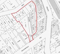
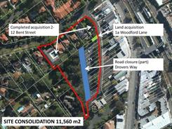
Figure 1– Woodford Lane Site Figure
2 – Woodford Lane Site
The planning process for this
project is well underway and a Project Working Group (PWG) has been established
with representatives of Council and Transport for NSW (TFNSW) to inform the
preparation of the master plan. This report will address Resolution D by
summarising the planning process to date and recommending the next steps.
This project has been largely on hold since December 2013
for two reasons:
· uncertainty regarding the Minister
for Transport’s commitment to funding commuter car parking on the site; and
· the acquisition of lands zoned
RE1-Public Recreation and identified in the KLEP (Local Centres) 2012 Land
Acquisition Map was not complete.
With regard the former, funding has now been clarified with
Transport for NSW following a meeting with Council staff and the Mayor on 27
February 2014. TFNSW have indicated they will fund up to 240 commuter car parks
on the site, this does not include replacement of 40 existing Council managed
commuter spaces. Further discussions are currently occurring as to whether a
portion of this parking (approximately 100 spaces) will be provided on the
eastern side of the centre below the proposed Lindfield Village Green. This is
anticipated to be resolved over the coming months.
With regard the former, Council resolved on 24 June 2014 to
proceed with the acquisition of the final parcel of land identified in the KLEP
(Local Centres) 2012 Land Acquisition Map; settlement is anticipated to be
finalised over the next few months. Council will soon be the owner of all lands
within the site and be in a better position to develop a master plan for the
site.
The only remaining requirement for Council to fully
consolidate the site into one lot is the closure of the portion of Drovers Way
north of Beaconsfield Parade which is a public road. Council’s DCP and
contribution plan proposes to replace this road with a new public road along
the western boundary of the site. It is therefore recommended that the Council
compulsorily acquires the portion of Drovers Way north of Beaconsfield Parade
for the purpose of creating the Lindfield Community Hub in accordance with the Land
Acquisition (Just Terms Compensation) Act 1991. The section of road is
shown on Figure 3 below.
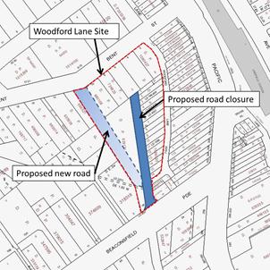
Figure 3 – Proposed road closure and road realignment
Comments
As discussed in previous reports to Council the primary
objective of the project is to create a new community hub consisting of a
multi-purpose community centre, a branch library, a new park and town square
and public car parking. The key community infrastructure components of the
project are listed below with the associated funding source, where applicable.
|
New Community Infrastructure
|
Size
|
Funding source
|
S94 % funded
|
|
New Public park and town square
|
3,800m2
|
Fully funded by Development Contributions (S94)
|
100%
|
|
New Branch library
|
1,265m2
|
Part funded by Development Contributions (S94) & part
funded by Council co-contribution/project funded
|
Approximately 33%
|
|
New Multi-purpose community centre
|
1,190m2
|
Part funded by Development Contributions (S94) & part
funded by Council co-contribution/project funded
|
Approximately 33%
|
|
New commuter car park
(excluding replacement of 40 existing council managed
commuter spaces)
|
up to 240 spaces
|
Fully funded by Transport for NSW
|
0%
|
|
Replacement of Council’s existing short stay car spaces in
new basement parking.
|
up to 72 in total
|
Development Contributions (S94) funds parking for
community facilities requirement only
Part funded by Council co-contribution/project funded
|
Approximately 70%
|
|
Pedestrian bridge over Pacific Highway
|
|
Fully funded by Council co-contribution/project funded
|
0%
|
In relation to funding the following is noted:
· Ku-ring-gai Contributions Plan,
2010 - Works Programmes: Local recreational and cultural facilities, and Local
social facilities allocates funding for a new multi-purpose community
building and a new branch library. Due to apportionment, about 33% of the cost
of the community buildings would be funded by development contributions the
remainder would be required to be funded by Council from other sources; this
results in a funding shortfall for the buildings in the order of $8.7 million
(or 77%) based on the estimated construction cost in Council’s contribution
plan.
· The Ku-ring-gai Contributions
Plan, 2010 (KCP) allocates funding of $2.49 million for the design and
construction of 50 basement car park spaces required for library and community
facilities (KCP, page 210). This will go part way to replacing Council’s
existing car parking on the site. There is likely to remain an estimated
shortfall of over $1 million.
· Consultation to date has indicated
that the community would like to see a pedestrian bridge connecting the west
side of Lindfield to the rail station over the Pacific Highway. A feasibility
study has been completed and the estimated cost is expected to be in the range
of $2.7 million to $4.6 million; this project is unfunded (refer Attachment
A1 for full study).
Jones Lang LaSalle P/L (JLL) have been engaged to undertake
preliminary economic feasibility assessment of a range of development
scenarios, with a range of building heights and densities, that incorporate
residential and retail uses as well as the proposed community infrastructure;
and to assess the scenarios for their potential financial return/loss to
Council.
Jones Lang LaSalle has prepared a Stage 1 report (Confidential
Attachment A2) which was completed in December 2013 and the Addendum (Confidential
Attachment A3) which was completed in August 2014; the results of these are
summarised below.
Lindfield Community Hub - preliminary feasibility
assessment
The study was broken down into the following tasks:
· Market appraisal – review of market
demand for retail, commercial and residential uses and provision of advice on
the potential mix of floor space for the subject site.
· Preliminary economic feasibility
assessment - conduct preliminary assessment of land use scenarios for the
subject site including a preliminary financial appraisal of each option.
· Preferred option - assist Council
with the development of a preferred option balancing the requirements of
traffic, urban design and community.
· Preliminary economic feasibility
assessments – undertake preliminary assessment of the preferred option and
recommend modifications as required.
· Delivery method – provide advice on
the preferred delivery method for the project which will maximise the economic,
social, and environmental outcomes for Council.
Methodology
The consultant commenced the project with a full review of background
material on the project, including Council reports, previous feasibility and
market appraisal studies as well as Council’s Development Contributions Plan.
In conjunction with the review, the consultant conducted a market appraisal on
the current economic conditions to determine the mix of uses that could be
supported on the Woodford Lane site.
Upon completion of the market appraisal, Jones Lang LaSalle
prepared a 3 stage financial analysis of land use scenarios:
Stage 1 – Five preliminary land use scenarios (completed
December 2013)
Stage 2 – Refinement of scenarios (completed December 2013)
Stage 3 – Final land use scenarios (completed August 2014)
Stage 1 – Five preliminary land use scenarios
The five scenarios were developed through discussions
between Council staff and the consultants; the aim was to test a wide range of
possible scenarios.
It is important to note that this analysis was based on
current zoning under the KLEP 2012 which restricts the development footprint to
the southern portion of the site as the northern portion, fronting Bent Street,
is zoned RE1 – Public Recreation.
The options analysed are as follows:
· Option 1 - Community facility with
secondary/specialty retail and residential; new park on Bent Street; and three
storey height limit.
· Option 2 - Community facility with
major and secondary/specialty retail as well as residential; new park on Bent
Street; and three storey height limit.
· Option 3b - Community facility with
major, mini-major and secondary/specialty retail as well as residential; new
park on Bent Street; and five storey height limit.
· Option 4 - Community facility with
residential only; new park on Bent Street; and five storey height limit.
· Option 5 - Full line supermarket
(4,200sqm) with community facility, secondary/specialty retail, additional car
spaces and no residential accommodation; new park on retail podium; and three
storey height limit.
Analysis revealed that only one
of these options would give a return to Council, all other options represent a
financial loss to Council.
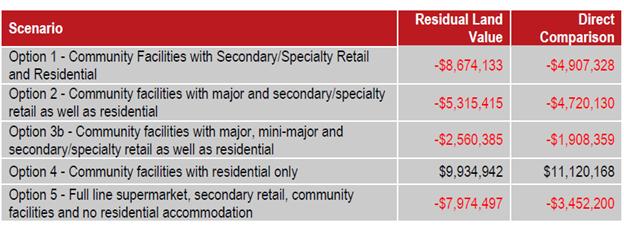
Figure
4 – Summary of preliminary Land Use Scenarios assessment
Stage 2 – Refinement of
scenarios
Based on further market analysis and discussions with
Council these options were further refined and three preferred scenarios were
developed. The preferred scenarios are:
· Option 1 (Version 2) - Community
facilities with reduced secondary/specialty retail; new park on Bent Street;
residential uses; and three storey height limit.
· Option 3b (Version 2) -
Community facilities with major retail (supermarket 3,400sqm in size), reduced
secondary/specialty retail as well as residential; new park on Bent Street; and
five storey height limit.
· Option 4 (Version 2) -
Community facilities with residential only; new park on Bent Street; and five
storey height limit.
Refinement of the options involved reduction in retail floor
space and an increase in community floor space to include both a community
facility and a branch library to be consistent with findings from the Lindfield
Community Facilities Study; Option 5 was deleted as a full-line supermarket
(4000sqm +) was found to not fit on the site when taking into account the
current RE1 zone; Option 2 was deleted as it is similar to Option 3b
(Version 2).
The gross floor areas of the
refined options are set out in the Table below; in all cases a park of 3,800sqm
is provided on Bent Street.
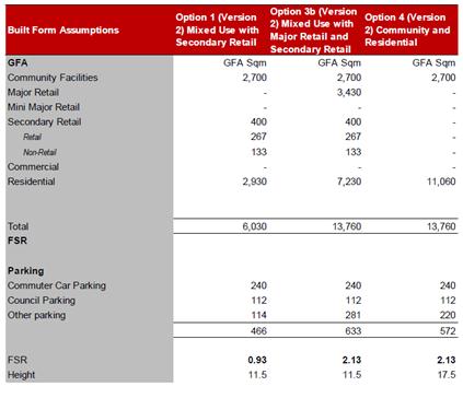
Figure 5 – Gross floor areas, building heights and FSRs
for refined options
The findings of the feasibility analysis are set out in the
Table below

Figure 6 – Summary of
results of preliminary feasibility assessment – refined options (version 2)
In summary:
· Option 1v2 may represent a
significant loss to Council. This means that Council would need to make a
monetary contribution in the order of $10 million to make the development
economically feasible. In other words this option would not fund the proposed
community facilities.
· Option 3b v2 may provide a small
return to Council or a small loss depending on the economic analysis method
used.
· Option 4v2 may provide a substantial
return to Council.
Stage 3 – Final land use scenarios
Given that the earlier analyses
were undertaken in December 2013, a review and update of the feasibility study
was warranted in addition a number of other matters had arisen in the meantime
that required consideration, these include:
· updated assumption on
the income or equity contribution from Council (total of $6,223,138 from S94)
which has not been escalated;
· inclusion of the
development costs associated with the pedestrian bridge ($3,275,000);
· updated market based
considerations inclusive of updated gross realisations;
· updated car parking
assumptions i.e. 79 spaces for the Council car parking provision down 40 from
our earlier analysis; and
· inclusion of a 5%
construction contingency across the whole development.
The details of the final land
use scenarios are set out below.
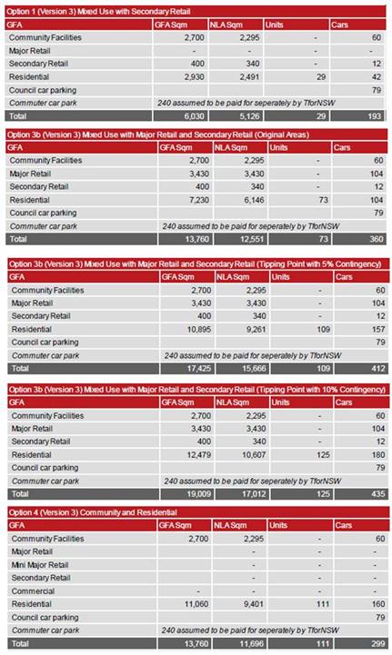
Figure 7 – Gross floor areas, building heights and FSRs
for final land use scenarios
Three variations of Option 3b
have been considered; the first is a five storey scenario with 73 residential
units; the second is a 7 storey scenario with 109 residential units and the
third is 7 storeys with 125 residential units. The latter two variations consider
an additional contingency of between 5-10%
Provided below is the financial
outcomes of the three scenarios tested. The objective of undertaking this
analysis is to provide Council with an understanding of the viability of these
options to a developer – with any shortfall requiring top up contribution from
Council.
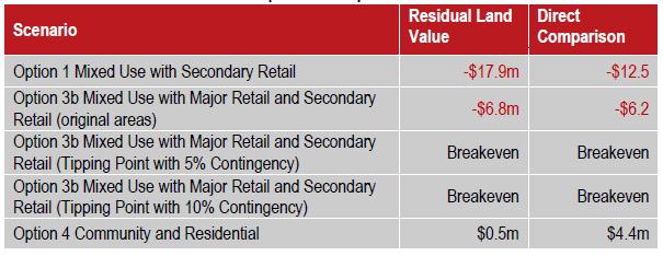
Figure 8 – Summary of results of preliminary
feasibility assessment – final land use scenarios (version 3)
Staff commentary and recommendations
Council is required to consider a broad range of factors,
not just financial, in order to determine a preferred option, including
importantly community consultation. As this master planning process is still in
its early stages it is considered too early to determine a preferred option. It
is therefore recommended that Council proceed to a community consultation stage
with the three land use scenarios. The benefit of this approach is that it
would allow the community to compare the advantages and disadvantages of each
option; some of these are described below:
Option 1 - Version 3 – Residential / community / park
/ speciality retail / 3 storeys
Advantages
· Limits building heights to 3 storeys
which is likely to be supported by the community;
· No requirement for rezoning /
planning proposal as it complies with existing height and FSR controls on the
site in the local centres KLEP 2012; and
· Would likely present the least
impact on surrounding residents in terms of traffic.
Disadvantages
· represents a very significant
financial loss to Council ($17-18 million) which would need to be supplemented
by funds from other sources such as asset divestment;
· includes residential uses which may
not be supported by the community;
· does not take advantage of the
proximity to the rail station by optimising residential or retail uses;
· will not encourage a significant
revitalisation of western side of Lindfield due to lack of retail;
· would not provide full replacement
of Council’s existing short stay car spaces;
· would not fund a pedestrian bridge
over Pacific Highway; and
· would not fund the funding shortfall
for proposed new community facilities.
Option 3b - Version 3 (tipping point 5% contingency)
– Supermarket / community / speciality retail / residential / new park / 7
storeys
Advantages
· no financial loss to Council;
· provides Council with two new
community facilities;
· would fund replacement of Council’s
existing short stay car spaces;
· would fund a pedestrian bridge over
Pacific Highway;
· optimises location in terms of
residential and retail uses;
· includes a supermarket which may be
supported by the community;
· potential for another significant
retail anchor which is a desirable planning outcome in a centre with an
undersupply of supermarket floor space; and
· potential for increased exposure to
Council facilities by way of passing trade visiting a supermarket;
· TFNSW support for a supermarket
associated with commuter parking as this allows commuters to park and shop in
on location.
Disadvantages
· Increases building heights to 7
storeys which may be unpopular with the community and would a require rezoning
process;
· increases density (FSR) on the site
which would a require rezoning process;
· potential for impact on surrounding
residents as a result of building height;
· potential for higher traffic impacts
on local streets as a result of supermarket.
Option 4 - Version 3 – residential / community / 5
storeys
Advantages
· provides Council with two new
community facilities;
· provides a small financial return to
Council;
· would fund replacement of Council’s
existing short stay car spaces
· would fund a pedestrian bridge over
Pacific Highway;
· moderate visual impact on
surrounding residents; and
· low traffic impacts on local streets
(no major retail use).
Disadvantages
· Building heights up to 5 storeys may
be unpopular with the community;
· predominantly residential uses may
be unpopular with the community;
· requires a rezoning / planning
proposal to provide additional height and FSR on the site;
· may not encourage a significant
revitalisation of the area due to lack of retail; and
· does not take advantage of the site
location.
These options will provide the community the opportunity to
weigh up the pros and cons of each option. For example option 1 may maintain
low building heights but would require a significant sale of land or other
assets to make the project viable; comparing this to option 3b which may be
feasible but has greater building heights and a new supermarket which may have
traffic impacts on local streets; and option 4 which would allow 5 storey
buildings and may result in a net financial gain but may not meet the objective
of activating Lindfield.
Next Steps
The following indicative programme is proposed for the
master plan process.
|
Task Name
|
Date
|
|
OMC - Report to Council -
approval of land use scenarios
|
9 Sept 2014
|
|
Advertise tender – design
consultant services
|
Sept-Oct 2014
|
|
Assess tender
|
Oct-Nov 2014
|
|
Report to Council
|
09 Dec 2014
|
|
Consultant – Preparation of 3
concept plans
|
Jan-Feb 2015
|
|
Exhibition and community
workshops
|
February 2015
|
|
Consultant - Economic
Feasibility Assessment - Stage 2
|
March 2015
|
|
Consultant - traffic assessment
- final
|
March 2015
|
|
Consultant – community
assessment - final
|
March 2015
|
|
OMC - Report
to Council - preferred concept plan for exhibition / commence planning
proposal
|
April 2015
|
|
Consultant – Preparation of
draft illustrative master plan
|
Apr-May 2015
|
|
Public Exhibition and
information sessions - draft master plan
|
June 2015
|
|
Council - assessment of public
submissions
|
July 2015
|
|
OMC - Report
to Council – final master plan
|
August 2015
|
integrated planning and reporting
|
Theme - Places, Spaces and Infrastructure - P4
Revitalisation of our centres
|
|
Community Strategic Plan Long Term Objective
|
Delivery Program Term Achievement
|
Operational Plan Task
|
|
A range of well planned, clean and safe neighbourhoods
and public spaces designed with a strong sense of identity and place.
|
Plans to revitalise local centres are being
progressively implemented and achieve quality design outcomes in
collaboration with key agencies, landholders and the community.
|
Implement a place management approach for the local
centre improvements to coordinate works and achieve quality outcomes.
|
|
|
An improvement plan for Lindfield
centre is being progressively implemented in collaboration with owners,
businesses and state agencies.
|
Engage with relevant stakeholders to establish timing,
extent and partnership opportunities.
Undertake due diligence and undertake project scope.
Identify and engage with the key stakeholders.
|
|
Theme - Community People Culture - C4 Healthy
lifestyles
|
|
Community Strategic Plan Long Term Objective
|
Delivery Program Term Achievement
|
Operational Plan Task
|
|
A healthy, safe, and diverse community that respects
our history, and celebrates our differences in a vibrant culture of learning.
|
New and enhanced open space and
recreational facilities have been delivered to increase community use and
enjoyment.
|
Complete the design for identified
parks and include design principles which facilitate passive recreation
activities.
Construct Parks at identified
locations and include design principles which facilitate passive recreation
activities.
|
Governance Matters
A Project Working Group has been established for the
Lindfield Community Hub which includes representatives from Transport for NSW.
The Roads and Maritime Service (RMS) have been engaged through the Lindfield
traffic study.
A probity consultant has been engaged and is currently
preparing a probity plan for the project.
Senior Council staff have visited and met with the General
Manager and Director of Planning from North Sydney Council to discuss and learn
from their experiences in managing similar projects.
Risk Management
This project is in the early planning stages and a full risk
management plan is yet to be prepared; the key risks identified at this stage
are:
· Council does not progress the
project as quickly as is practicable to meet community expectations;
· Council does not progress the
project as quickly as is practicable and TFNSW decide not to withdraw funding
for a commuter car park; and
· The Woolworths proposal gains
community support without discussion of alternatives and impacts.
The greatest risk at this stage in the project is to
Council’s reputation. There is significant interest in the project from
‘Support Lindfield’ a community group with a large membership and an active
voice in the community around the project. Support Lindfield are keen to see
the project proceed as quickly as possible. To mitigate the risk of loss of
reputation it is recommended that Council proceed to the next stage of the
project as recommended in this report and that Council adopt the proposed
project programme/timeline.
With TFNSW as a significant partner in the project there is
a risk that funding for commuter car parking is lost should the project
timeframe be significantly extended for the Community Hub project. The
provision of commuter parking is strongly supported by the community and the
loss of it represents a reputational risk. To mitigate this risk, Council has
written both to the Minister for Transport and the Premier to ensure that the
funding is available and remains available for the duration of the project (Attachment
A4). A response from the Minister for Transport, the Hon. Gladys
Berejiklian was received on 19 November 2013 and 28 November 2013; the letters
are attached to this report as Attachment A5 & A6. In the letter the
Minister confirms that
“Council may be assured that
the NSW Government will honour its $34 million commitment to this project.
However, I do wish to stress the importance to our customers of having these
additional parking spaces delivered sooner rather than later”.
In the second letter the Minister states:
“…the approximate cost of the Lindfield
commuter car park project is now estimated at $12 million, and therefore
the NSW Government commits that amount of money to this project.”
A follow-up meeting was held on 27 February 2014 with the General
Manager, Land Use and Integrated Transport Planning and Programs, from
Transport for NSW who confirmed that there was some flexibility in the proposed
funding for commuter parking.
In the same meeting TFNSW also confirmed they will consider
Council’s proposal for providing some of the commuter parking on the Tryon Road
site on the eastern side of the rail line. A copy of the email is attached Attachment
A7.
Woolworths is actively engaging with the local community and
promoting their proposal for Council’s land which involves:
· a community centre of 1284sqm;
· a library of 892sqm (approximately
370sqm smaller than Council’s requirements);
· scout hall of 176sqm;
· over 8,000sqm of retail including a
supermarket of 4,000sqm; and
· 675 public car parking spaces.
The risk to Council is that the community have seen only one
possibility at this stage and to manage this risk it is important that Council
independently prepare development options for the site that are realistic
alternatives to the Woolworth’s proposal and offer the community an opportunity
to consider the costs and benefits of all options. It is therefore recommended
that Council proceed to the next stage of the project as set out in this
report.
Financial Considerations
As the project is still in the early planning and
development stage the financial considerations relate to the funding of
background studies and master planning. At the OMC 28 May 2013 Council
allocated funds of $250,000 to the project for the year 2013-2014. To date most
of these funds have been used to prepare a traffic study, an economic
feasibility study, a community facilities study as well as staff time.
The next stage of work will involve a tender process to
select a consultant team lead by an architect to prepare master plan options
based on the land use scenarios described in this report. Additional funds are
required to progress to the next stage and it is recommended that $250,000 are
allocated to the project for the year 2014-2015 from the S94 reserve – pre-1993
and 1993 Plan - car parking.
In terms of the full project it is intended that it be
financially feasible; assumptions at this stage are as follows:
· the construction of the public
parkland and town square will be fully funded by development contributions;
· the cost of construction of an underground
car park to accommodate up to 240 commuter car spaces will be funded by TFNSW;
· relocation of Council’s existing
short stay car spaces (up to 72 in total) to a new basement parking will be
partly funded by development contributions and partly project funded;
· the new community facilities will be
partially (33%) funded by development contributions and partly project funded;
and
· uses such as residential, retail
and/or commercial will be included in the master plan to provide additional
funds to cover part or all shortfalls related to community infrastructure;
· where this does not satisfy
community expectations other funding sources, such as asset divestment, will be
identified as an alternative; and
· funding of a pedestrian bridge over
the Pacific Highway, if found to be required, is unfunded and will need to be
project funded or funded by other sources, such as asset divestment.
Social Considerations
Currently the site is utilised for car parking by shoppers,
commuters and local business owners, beyond this function the sites provide
very little social benefit to the community. The site has the potential to
provide new community infrastructure that will provide high levels of social
benefit to the community.
A Lindfield community facilities strategy undertaken on
behalf of Council by Elton Consulting P/L in 2014 prepared an audit of the
existing community facilities in Lindfield. The study found that both of
Council’s facilities require replacement. An extract of the findings, from page
31, is below in Figure 9.
Discussions with Council’s library staff identified a number
of gaps that prevent the library from delivering modern services to meet the
needs of the community including:
· inadequate
space for all activities and collections;
· a shortage
of shelving;
· lack of
study and reading spaces;
· an
inadequate children's area and lack of separation of this area;
· inadequate
space for events; and
· a lack of
contemporary technology inclusions.
Council’s Library and Cultural Services Manager also
identified a lack of adequate parking as well as issues relating to access,
with vehicular access to the library from the Pacific Highway viewed as unsafe,
particularly by older people.
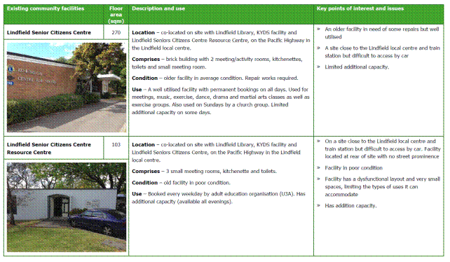
Figure 9 – Extract Lindfield Community Facilities
Study, Elton Consulting, 2014
The Lindfield Community Facilities Study, 2014 recommends a
new community hub be located on the western side of Lindfield combining a
branch library and community centre with a total area of over 2,455 square
metres. This proposal was adopted by Council at the Ordinary Meeting of Council
on 10 December 2013.
Environmental Considerations
The development of the Lindfield Community Hub may lead to
impacts on a stand of trees (5 x Eucalyptus paniculata, 1 x Eucalyptus
punctata). The Local Centres LEP 2012 Natural Resources Biodiversity Map
shows the stand of trees as having biodiversity significance (refer Figure 10).
The trees are mapped on Council’s GIS as Sydney Turpentine-Ironbark Forest
(STIF). The mapping and vegetation conformity has been verified by staff
inspections.
Whilst the trees in question do not conform to EPBC- STIF
condition criteria they nevertheless require threatened species assessment of
significance under TSC Act, EPA Act (Part 4, 5) and consideration under EPBC
with reference to the condition criteria for exemption. Council may explore
options for recognising the environmental attributes of the trees and look at
appropriate offsets, or as a second alternative Council may consider one
development option that will protect the stand of trees within the proposed
parkland.
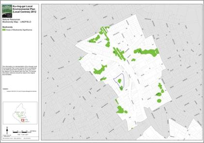
Figure
10 – Areas of biodiversity significance – Woodford Lane site
Community Consultation
Council will need to be seen to have a high standard of
consultation with the community; in conjunction with a well-executed
communications strategy demonstrating Council’s pursuit of the best community
outcomes. An engagement strategy has been prepared and is discussed in detail
below.
Work undertaken to date by Council includes:
· workshops
and interviews associated with the Lindfield Community Facilities Strategy;
· workshops
and meetings with key stakeholders – TFNSW and RMS;
· attendance
and presentation at a Support Lindfield Forum April 2014;
· a new
website for ‘Activate Lindfield’; and
· telephone
calls and emails addressing enquiries.
Consultation is planned as part of the next stage of the
process. An engagement strategy has been prepared by council’s community
engagement and research planner and is outlined below.
Engagement strategy – Activate Lindfield
Ku-ring-gai Council will undertake extensive and multi-modal
consultation to ensure all community stakeholders are informed, engaged and
collaborate on Activate Lindfield.
The Woodford Lane site represents a distinct opportunity for
our community; it will have its own unique functions, uses and aesthetics. To
ensure we comprehensively examine the site, we propose a strategy to engage the
site separately from the Tryon Road site.
The objectives of our engagement strategy are to:
· increase community awareness of
Activate Lindfield and the benefits the project will bring to the local and
broader community;
· tap into local knowledge and
expertise on Lindfield including local businesses, residents and community
groups;
· deliver creative and engaging
opportunities for stakeholders to collaborate with Council in designing,
delivering and managing the Activate Lindfield sites;
· determine community priorities for
Activate Lindfield including the negotiable and non-negotiable for each site;
and
· meet TFNSW and Council requirements
in delivering Activate Lindfield, including commuter car parking, new parks and
civic spaces and community facilities.
The community engagement process will be divided into a
series of phases:
1. Multi-channel
communications to inform stakeholders on the Activate Lindfield project and
possible options for the site. Activities will include:
· local newspapers;
· letterbox drop;
· website – Council and Have Your Say
Ku-ring-gai; and
· Email newsletters;
· community networks – organisations,
associations, staff networks;
· rates notice; and
· social media campaign.
2. Online discussion forum – open to all community
stakeholders prior to formal consultation
3. Concept design workshops and place performance
evaluations:
· deliberative workshops to examine
options for Woodford Lane site;
· education workshop on site – review
options; presentation from technical experts (including TFNSW);
· deliberative forum to examine
options and opportunity for the site;
· final option review and agreements;
and
· examination of most preferred
option.
4. Place making and partnership forums to set the way
forward for Lindfield
Internal Consultation
Extensive internal consultation has occurred as part of the
Lindfield Community Facilities Study including staff from Operations,
Community, Strategy and Environment, Corporate and Development and Regulation.
Summary
Council has resolved to
undertake a master planning process for the Woodford Lane Site in Lindfield. On
the site it is proposed to place the existing car parking underground and
construct a new “community hub”.
To date Council has engaged consultants to provide
background studies:
· Lindfield Local Centre Transport
Network Model Study;
· Lindfield Community Hub -
Preliminary Feasibility Assessment (stage 1 complete); and
· Lindfield Community Facilities Study
(complete).
This report provides an update
on the results to date of the economic feasibility study and makes a range of
recommendations for moving forward on each project. This report recommends the
following:
· That council prepare three
illustrative options for Lindfield Community Hub for public comment being:
- Option
A (the same as option 1 version 3) – residential / community / specialty retail
/ park / 3 storey height limit;
- Option
B (the same as option 3b version 3, 5% contingency) – supermarket / community /
specialty retail / residential / park / 7 storey height limit; and
- Option
C (the same as option 4 version 3) – residential / community / park / 5 storey
height limit.
The next steps in the process are:
· prepare a design services consultant
brief and advertise a Request for Tender (RFT) and select consultant by
December 2014;
· selected consultant team will
prepare three draft illustrative concepts during January – February 2014;
· community consultation on the
options will take place in February 2015, guided and facilitated by Council;
· consultation will be conducted on
the three illustrative master plans focusing on the costs and benefits of each
option to inform a preferred community outcome;
· in April 2015 a report to Council
will be prepared recommending a preferred option to form the basis of further
planning and detailed development of the project; and
· the preferred master plan for the
Lindfield Community Hub to be placed on public exhibition by June 2015.
The master plan will inform the principles and criteria upon
which Council may undertake an Expression of Interest (EOI) process seeking
private sector interest in the delivery of the project including the funding of
new community infrastructure. The master plan would also form the basis of a
Capital Expenditure Review and Department of Local Government submission.
Additional funds are required to
progress to the next stage and it is recommended that $250,000 are allocated to
the project for the year 2014-2015 from the S94 reserve – pre-1993 and 1993
Plan - car parking.
|
Recommendation:
That Council:
A. Adopts
the following land use scenarios as the basis for preparing illustrative
concept plans for community consultation and further technical assessment:
· Option A (the same as
option 1 version 3) - Community facilities with secondary/specialty retail
and residential; a new park; and three storey height limit.
· Option B (the same as
option 3b version 3 & 5% contingency) - Community facilities with major
retail/secondary/specialty retail as well as residential; a new park; and seven
storey height limit.
· Option C (the same
as option 4 version 3) - Community facilities with residential only; a new
park; and five storey height limit.
B. Adopts
the preliminary project programme as follows:
· Advertise tender for design
services and assess tender, Sept-Nov 2014
· Report to Council preferred
tender, Dec 2014
· Preparation of 3 concept options,
Jan-Feb 2015
· Exhibition and community
workshops, February 2015
· Assessment of options, March 2015
· Report to Council - preferred
concept plan for exhibition, April 2015
· Consultant – preparation of draft
illustrative master plan, Apr-May 2015
· Public Exhibition and information sessions,
June 2015
· Assessment of public submissions,
July 2015
· Report to Council – final master
plan and planning proposal, August 2015
C. That
pursuant to sections 186(1) and 187(1) of the Local Government Act 1993,
the Council compulsorily acquires the portion of Drovers Way north of
Beaconsfield Parade for the purpose of creating the Lindfield Community Hub
in accordance with the Land Acquisition (Just Terms Compensation) Act 1991.\
D. That
for the purposes of section 30 of the Land Acquisition (Just Terms
Compensation) Act 1991, the Council, as the owner of the road, agrees to
the road being acquired for compensation in the amount of $1.00.
E. That
Council delegate to the General Manager or his delegate the power to do
anything further as necessary to give effect to the compulsory acquisition
including obtaining any necessary approvals and publishing any necessary
notices in the Gazette.
G. That
$250,000 be allocated to the project for the year 2014-2015 from the S94
reserve – pre-1993 and 1993 Plan - car parking.
|
|
Bill Royal
Team Leader Urban Design
|
Antony Fabbro
Manager Urban & Heritage Planning
|
|
Andrew Watson
Director Strategy & Environment
|
|
|
Attachments:
|
A1View
|
Lindfield
Community Hub - Pedestrian Overbridge Feasibility Study - final report
|
|
2014/202614
|
|
|
A2
|
Lindfield
Feasibility Study - stage 1 report - FINAL
|
|
Confidential
|
|
|
A3
|
Lindfield
Community Hub - Updated Scenarios - economic feasibility - Addendum - FINAL
|
|
Confidential
|
|
|
A4View
|
Letters
to Minister for Transport and Premier regarding proposed commuter car park at
Lindfield
|
|
2013/302259
|
|
|
A5View
|
Response
from the Minister regarding the proposed commuter car park at Lindfield
|
|
2013/302784
|
|
|
A6View
|
Advise
- NSW Government commits 12 million to car park project - Commuter car park
at Lindfield
|
|
2013/310141
|
|
|
A7View
|
Lindfield
Community Hub - TFNSW - possible commuter car park on Tryon Road site
|
|
2014/203173
|
|
APPENDIX
No: 1 - Lindfield
Community Hub - Pedestrian Overbridge Feasibility Study - final report
|
|
Item No: GB.4
|
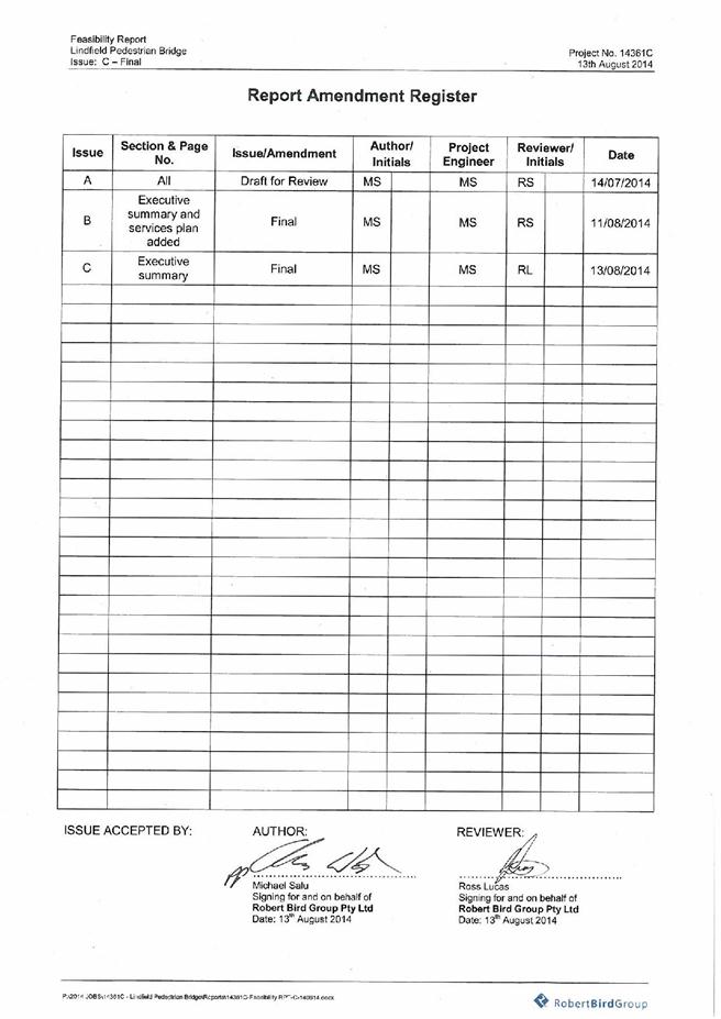
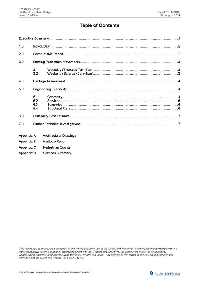
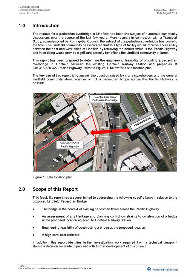
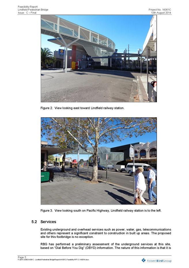
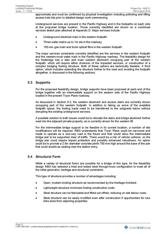
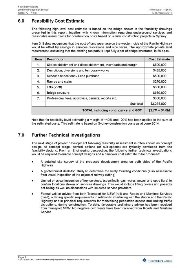

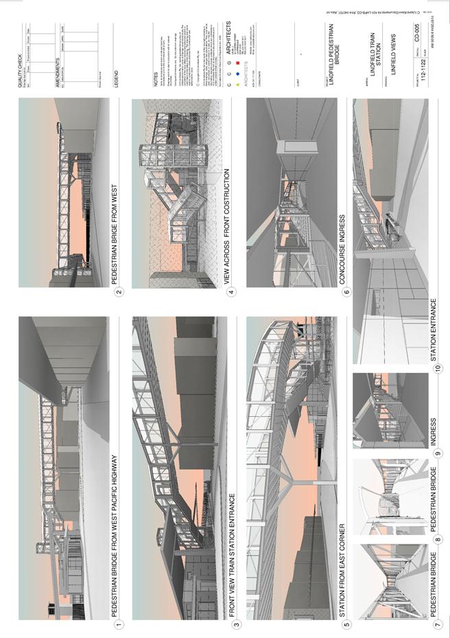
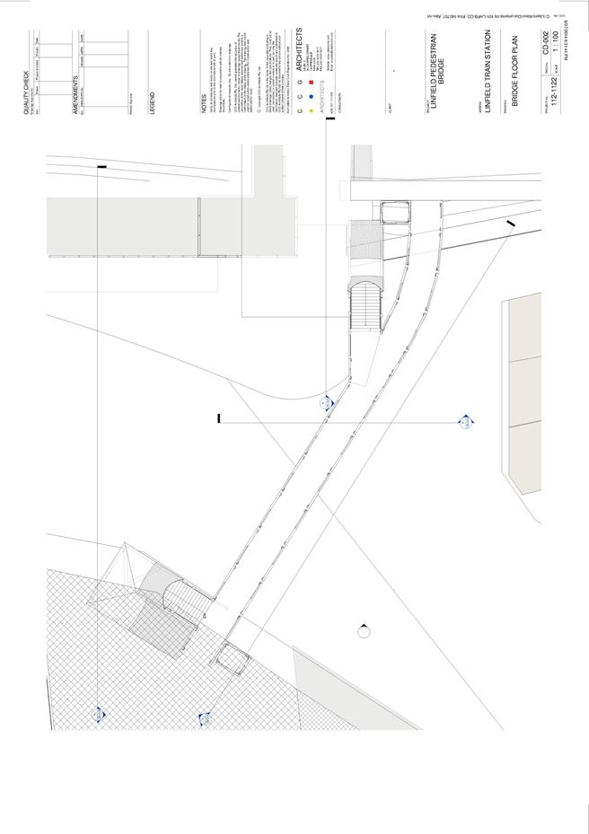

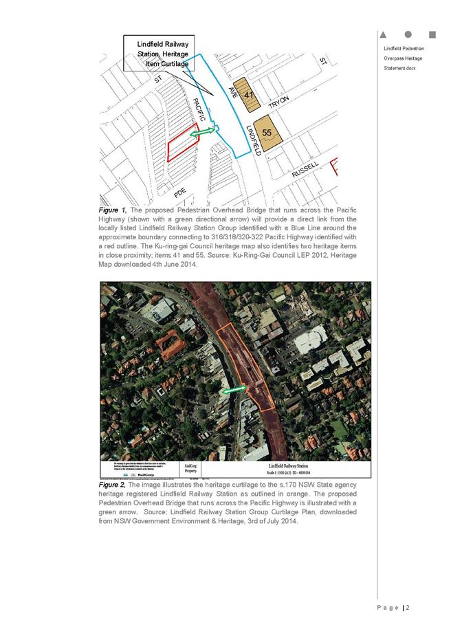
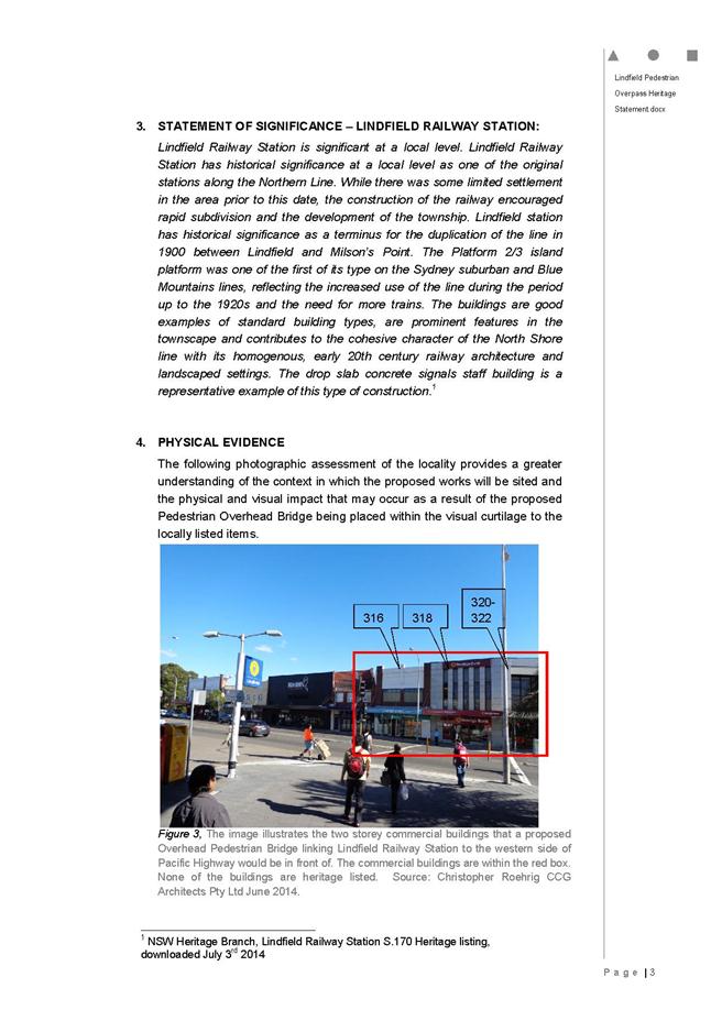
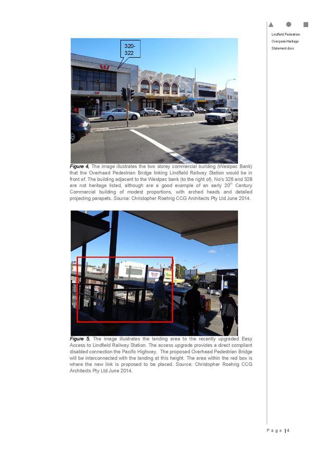
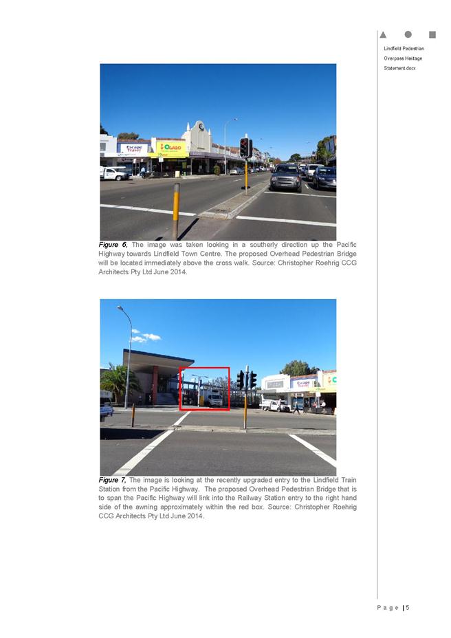
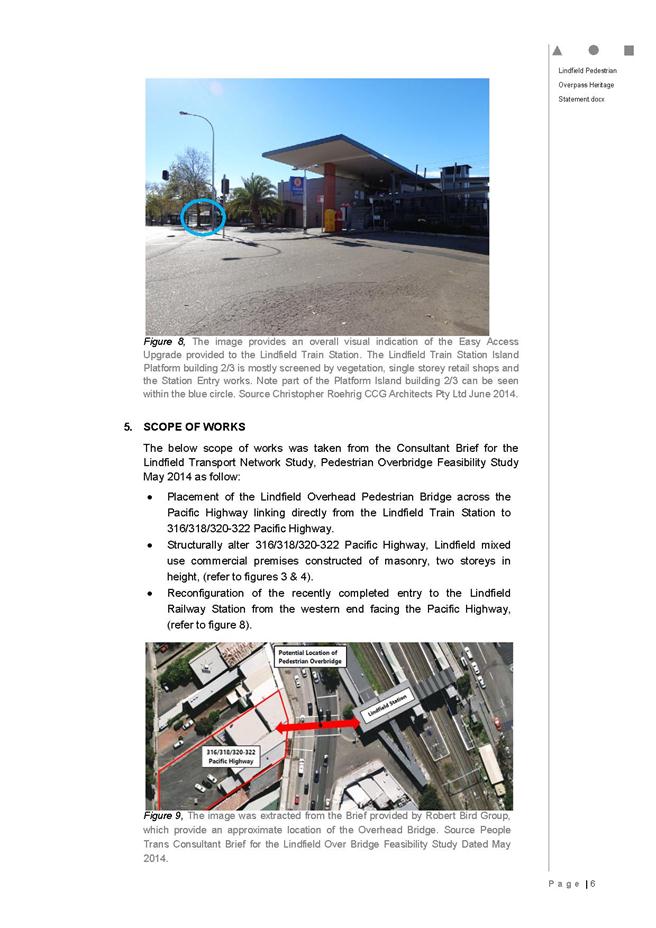
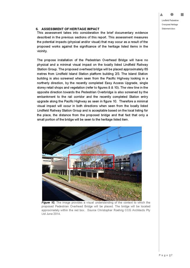
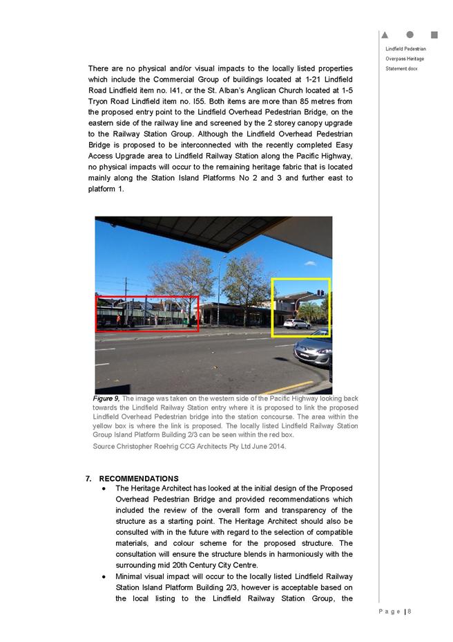
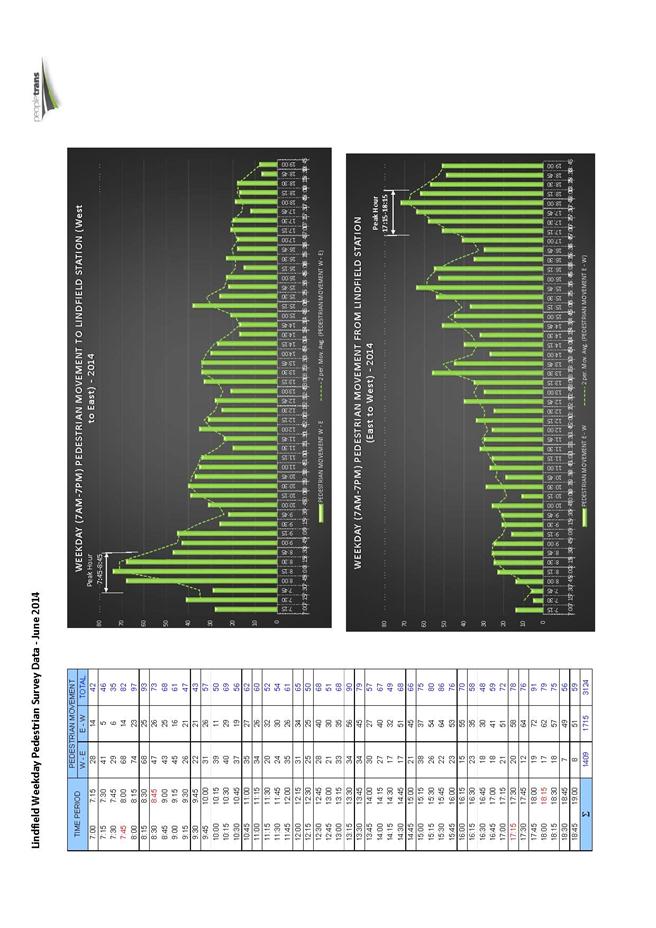
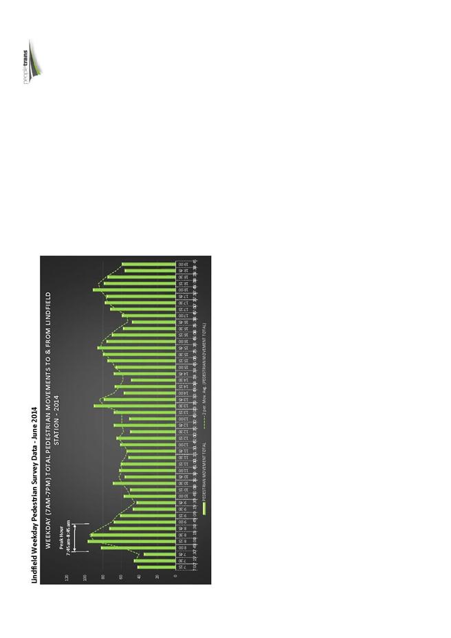
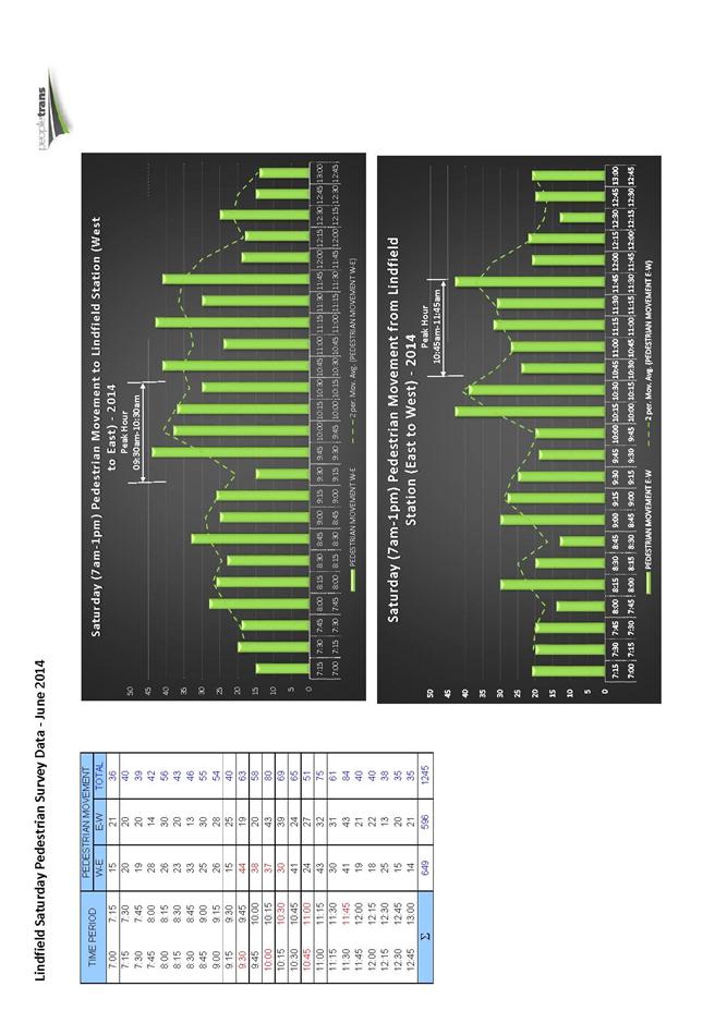
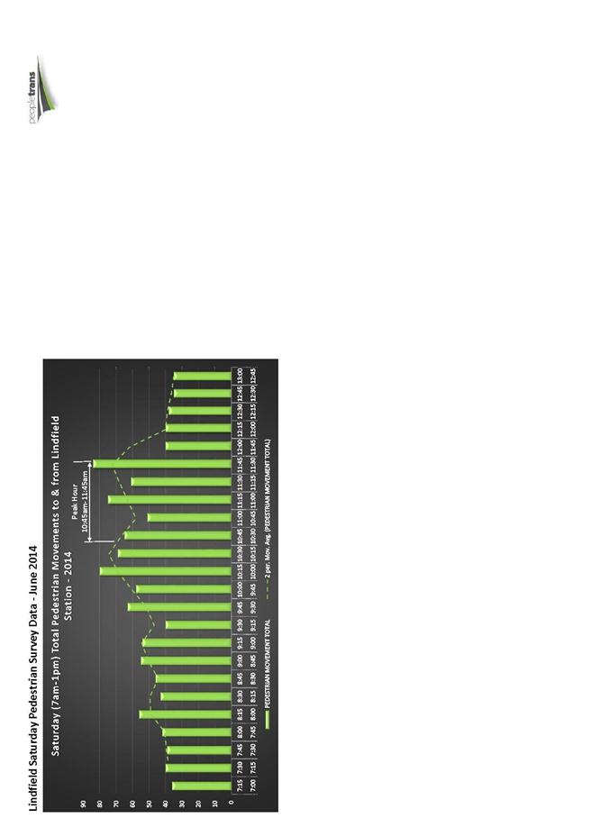
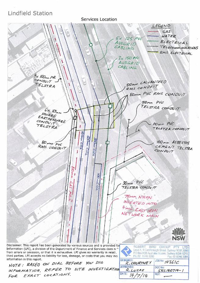

|
APPENDIX No: 4 - Letters
to Minister for Transport and Premier regarding proposed commuter car park at
Lindfield
|
|
Item No: GB.4
|
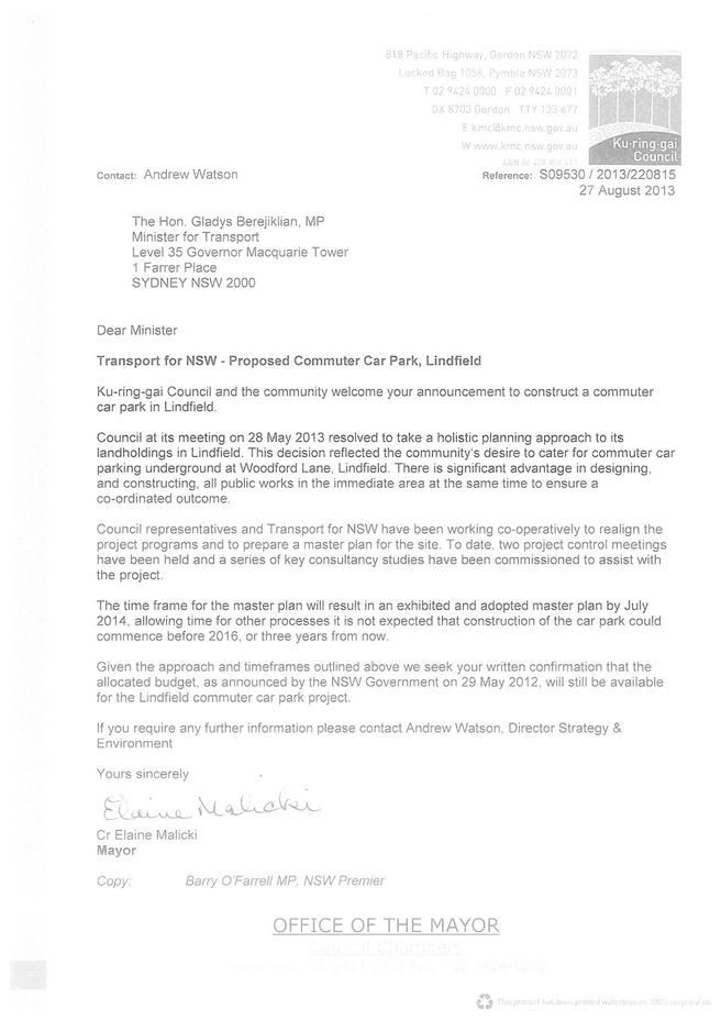
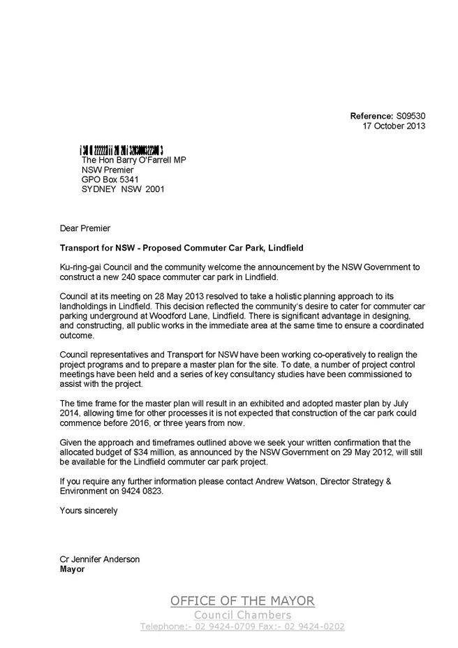
|
APPENDIX No: 5 - Response
from the Minister regarding the proposed commuter car park at Lindfield
|
|
Item No: GB.4
|
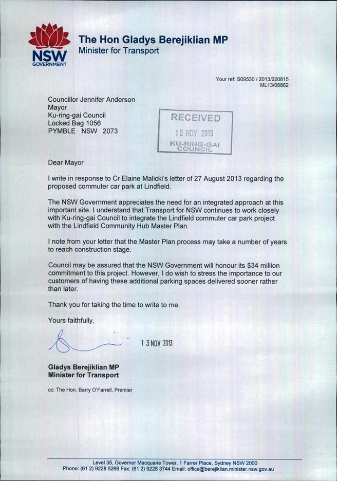
|
APPENDIX No: 6 - Advise
- NSW Government commits 12 million to car park project - Commuter car park
at Lindfield
|
|
Item No: GB.4
|
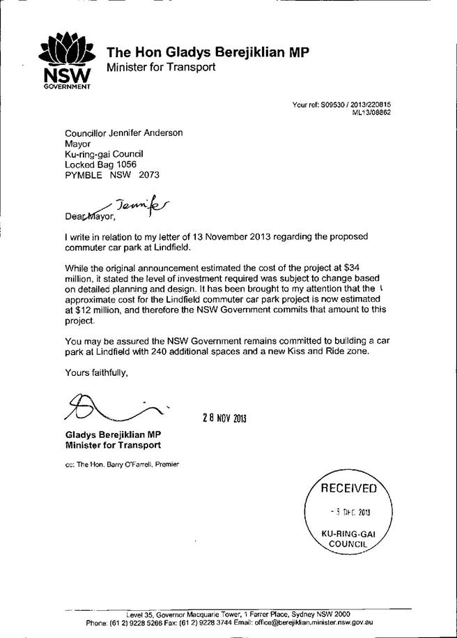
|
APPENDIX No: 7 - Lindfield
Community Hub - TFNSW - possible commuter car park on Tryon Road site
|
|
Item No: GB.4
|
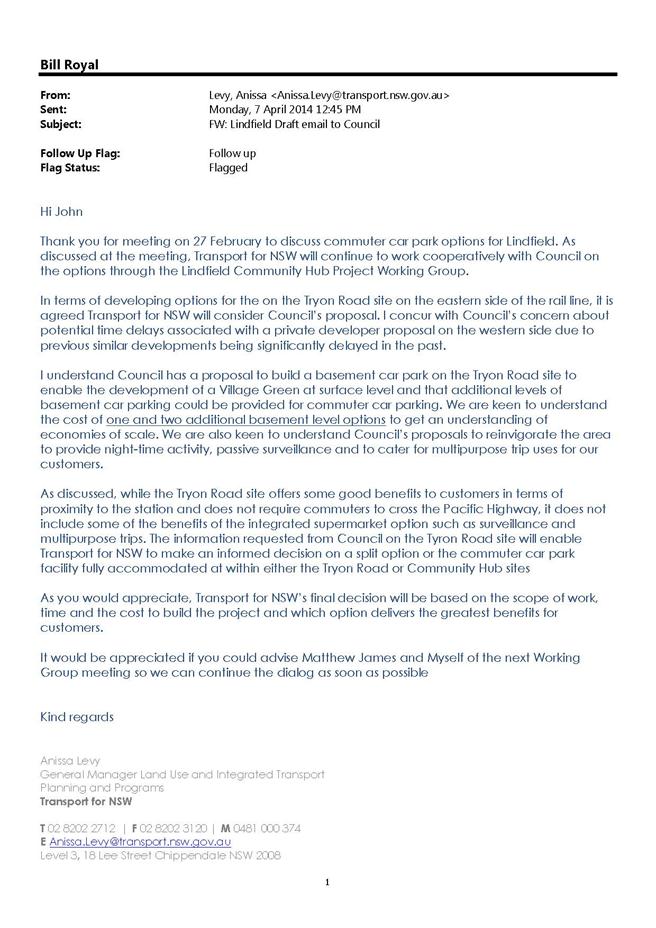
|
Ordinary
Meeting of Council - 9 September 2014
|
GB.5 / 703
|
|
|
|
|
Item
GB.5
|
S09529
|
|
|
7 March 2014
|
Lindfield Village Green - Confirmation of
Preliminary Scope of Works, Project Budget and Program
EXECUTIVE
SUMMARY
|
purpose of report:
|
The purpose of this report is to update Council on the
progress of Lindfield Village Green project including recommending a
preliminary project construction budget, an updated project program and
clarification of scope of works.
|
|
|
|
|
background:
|
A total of six reports have come
to Council since December 2011 regarding this project; key resolutions of
Council include the following:
· adoption of an open space
acquisition strategy for Lindfield which includes the Lindfield Village
Green;
· in-principle support for the
project to proceed;
· allocation of seed funding to
commence the project planning stage;
· allocation of proceeds from the
sale of no. 9 Havilah Lane, Lindfield to the project budget;
· commencement of a concept plan and
community consultation; and
· approval to commence compulsory
acquisition of the unnamed lane forming part of the site.
|
|
|
|
|
comments:
|
Many aspects of the project have
already been reported to Council and have Council approval, key outstanding
aspects are:
· basement car park construction
funding;
· project scope and program; and
· project budget.
|
|
|
|
|
recommendation:
|
That Council adopts the preliminary project budget,
project program and scope of works as the basis for moving forward with the
project.
|
Purpose of Report
The purpose of this report is to update Council on the
progress of Lindfield Village Green project including recommending a
preliminary project construction budget, an updated project program and
clarification of scope of works.
Background
A total of six reports have come to Council since 2011
regarding this project; the reports are summarised below.
a) Ordinary
Meeting of Council 13 December 2011 - Confidential item C.1 – Open Space
Acquisition - Lindfield
The purpose of this report was to
review open space acquisition in Lindfield and recommend an acquisition program
which is consistent with the funds available from the Ku-ring-gai Contributions
Plan 2010 and with the acquisition criteria within the Ku-ring-gai Open Space
Acquisition Strategy 2007. Council resolved as follows:
“That
Council proceeds in the manner outlined in the report.”
The open space acquisition
strategy for Lindfield includes the Lindfield Village Green; planning for the
project has proceeded on this basis.
b) Ordinary
Meeting of Council 9 April 2013 - GB.6 - Lindfield Village Green - Stage
1 - Project Commencement
The purpose of this report was to
seek Council’s commitment to commencing the first stage of the Lindfield
Village Green project; Council resolved as follows:
“A. That
Council confirm their in principle support for the proposed location of the new
Lindfield Village Green.
B. That
$100,000 from development contributions (local parks) is allocated as seed
funding to undertake stage 1 of the project for the year 2012-2013.
C. That
Council advertise an Expression of Interest seeking potential joint venture
partners for the project.
D. That
a report be brought back to Council on the results of the EOI with
recommendations for funding of the project.
E. That
a consultant be engaged to prepare Community Consultation Strategy for
Council’s approval.”
These resolutions have all been
actioned and completed. Studies recently completed include preparation of a
land survey, geotechnical investigations and a contamination assessment.
c) Ordinary
Meeting of Council 9 April 2013 - GB.5 - Reclassification of Council
Land – 9 Havilah Lane, Lindfield - Report following Exhibition and Public
Hearing
This report provided a summary of
the public exhibition of the Planning Proposal, and the outcome of the Public
Hearing for the proposed reclassification of 9 Havilah Lane, Lindfield.
Specifically in regard the Lindfield Village Green Council resolved:
“C.
That, in the event that, following this reclassification process, there is a
future divestment of Lot 21 DP 713207 known as 9 Havilah Lane Lindfield, that
any proceeds from such a sale be held as a restricted asset and directed to the
project budget for the provision of underground car parking and a civic square
/ village green precinct in Lindfield east of the railway line in the immediate
environs of this site.”
This resolution has been actioned.
d) Ordinary
Meeting of Council 13 August 2013 - GB.6 - Update Report on the Development
Contributions System
The purpose of this report was to
provide Council with an overview of key activities and highlights in the
development contributions system over the past six months and anticipated
highlights for the coming twelve months. The report provided an update on the Lindfield
Village Green EOI; in this regard Council resolved:
“B. That
Council does not progress the Lindfield Village Green EOI process due to the
non-compliant nature of the submissions and that those persons who made
submissions are notified of Council’s decision.”
This resolution has been
completed. The implication of not proceeding with the EOI is that Council will
fully fund the project; this will be further discussed later in this report.
e) Ordinary
Meeting of Council 10 December 2013 - GB.19 - Lindfield Village Green - Tryon
Road - Project Update
This report provided an update to
Council on the progress of the master planning for Lindfield Village Green and
outlines the next steps for the project. Council resolved:
“A.
That the proposed Lindfield branch library and the proposed Lindfield Community
Centre are to be co-located on the Woodford Lane site.
B.
That Council continues to actively investigate the potential to provide some of
the commuter car parking proposed by Transport for NSW under the proposed
Lindfield Village Green.
C.
That Council prepares an illustrative concept design for the Lindfield Village
Green and proceed to public engagement and, following this, the draft concept
is to be reported to Council for their endorsement prior to public exhibition.
D.
That pursuant to sections 186(1) and 187(1) of the Local Government Act 1993,
the Council compulsorily acquire the unnamed public road shaded in grey and
marked as ‘Proposed partial road closure’ in Figure 2 of the report to the
Council dated 10 December 2013 for the purpose of creating the Lindfield
Village Green in accordance with the Land Acquisition (Just Terms Compensation)
Act 1991.
E.
That for the purposes of section 30 of the Land Acquisition (Just Terms
Compensation) Act 1991, the Council, as the owner of the road, agree to the
road being acquired for compensation in the amount of $1.00.
F.
That Council delegate to the General Manager or his delegate the power to do
anything further as necessary to give effect to the compulsory acquisition
including obtaining any necessary approvals and publishing any necessary
notices in the Gazette.”
These resolutions are currently
being actioned. This report provides more detail in relation to resolutions A
and D.
f) Ordinary
Meeting of Council 4 February 2014 - GB.11 - Update Report on the Development
Contributions System
The purpose of this report was to
provide Council with an overview of key activities and highlights in the
development contributions system over the past six months and anticipated
highlights for the coming twelve months. With regard the Lindfield Village
Green matters reiterated include community facilities planning, road closures,
the sale of no.9 Havilah Lane and next steps. Council resolved:
“…That the latest update
report on the development contributions system in Ku-ring-gai be received and
noted.”
This resolution is noted.
Project Status
In summary Council has resolved the following in relation to
the Lindfield Village Green project:
· an open space acquisition strategy
for Lindfield which includes the Lindfield Village Green;
· in-principle support for the project
to proceed;
· allocation of seed funding to
commence the project;
· allocation of proceeds from the sale
of no.9 Havilah Lane Lindfield, to be held as a restricted asset to contribute
to the project budget;
· to locate the Lindfield branch
library on the western side of Lindfield;
· to prepare a concept plan and
undertake community consultation;
· to undertake compulsory acquisition
of the unnamed lane that forms part of the site; and
· to investigate the potential for
commuter car parking on the site in consultation with TfNSW.
Comments
Many aspects of the project, as noted above, have already
been reported to Council and have Council approval, key outstanding aspects
are:
· Basement car park construction
funding – the key factor influencing this is the number of car spaces to be
provided on the site.
· Project scope – two aspects
require further resolution which will in part affect the project budget.
· Project program –
particularly in relation to construction timing, Council elections and other
developments on adjoining sites.
· Project budget – the Tender
will require a project construction budget to allow consultants to quote on the
various stages of work involved. Council has engaged a quantity surveyor to
provide a preliminary cost report to confirm the project budget.
Basement car park construction funding
Council intends to utilise development contributions funds (Local
Parks & Sporting Facilities - South) collected under the Ku-ring-gai
Contributions Plan 2010 (KCP) to fund the construction works associated
with the new underground car park. The use of development contribution funds in
this project differs to other situations, such as the new Greengate Park in
Bruce Avenue, Killara. In the latter case Council purchased private properties,
demolished the houses and built a new park. In the case of the Lindfield
Village Green it is proposed to utilise contribution funds to pay for the cost
of constructing an underground car park on the site; this will allow relocation
of the existing surface parking to below ground, thereby creating a free site
to build a new park on top of the new underground car park.
The KCP on page 116 specifically foreshadows this option in
part 3.11 Innovative avenues for the provision of new local parks where
it is stated:
“In an established area such as
Ku-ring-gai, there may be circumstances where the purchase of land currently
occupied by existing development may not the most cost effective means of
providing all new parks and civic spaces. Preliminary investigations in respect
of the Lord Street car park in Roseville indicated that the indicative cost of
undergrounding the existing car park and establishing a new park on top ….was
likely to be less than the estimated cost of acquiring the equivalent amount of
land in Roseville with the associated demolition and embellishment costs….
…Accordingly, where, upon
further detailed investigation, it is conclusively established that an
innovative solution can be identified that will result in a quality park that
meets nexus requirements, being delivered in a more cost-effective way than the
acquisition and embellishment of land, then this Contributions Plan
specifically permits the allocation of contributions levied for the provision
of new parks to facilitate such a park to be provided in the manner indicated.
….. achievement of a better
located park is considered to be the prime criterion in the establishment of
nexus…”
Legal advice has confirmed the legitimacy of this approach;
Lindsay Taylor Lawyers have confirmed that Council can expend funds on the
construction of the Works (being an underground car park and new civic square)
providing they were collected for local parks and sporting facilities – south.
The advice also notes that if this approach is adopted then the requisite
investigations must be carried out to confirm that the approach is more
cost-effective than land acquisition. A copy of the legal advice is provided in
Confidential Attachment A1.
In order for Council to justify the use of development
contributions funds (Local Parks & Sporting Facilities - South) it
must be confirmed that the Lindfield Village Green project is cost-effective;
there are five key considerations in this regard:
· the estimated cost of constructing a
basement car park;
· the number of car spaces to be provided
on the site;
· the potential area of parkland to be
provided;
· the cost of land acquisition in the
context of Lindfield local centre (as an alternative to the proposed project);
and
· the qualitative aspects of the
proposed site versus other similar sites within close proximity.
a) Estimated cost
of basement car park construction
Council has engaged three quantity surveyors to
independently prepare cost estimates for the project; the estimates are based
on a sketch plan prepared by Council’s traffic consultants for the basement car
park; the plan shows that up to 80 spaces can be achieved in one level of
parking; and 181 spaces over a two level car park.
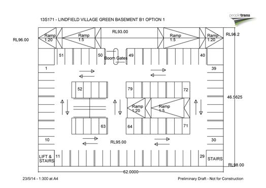
Figure 1 – preliminary sketch basement car park level
B1
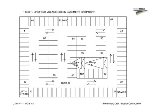
Figure 2 – preliminary sketch basement car park level
B2
Wilde and Woollard P/L. have estimated the total cost of a
single level of basement car parking (with up to 80 spaces) to be in the order
of $8,245,000.00 or $103,000 per space; and for a two level car park (with up
to 180 spaces) the cost estimate is $13,954,000 or $77,000 per space. These
costs exclude contingency allowances; professional fees; fees and charges; and
staff time. The full estimate is in Confidential Attachment A2.
Muller Partnership P/L. have estimated the total cost of a
single level of basement car parking (with up to 80 spaces) to be in the order
of $2,489,000.00 or $31,000 per space; and for a two level car park the cost
estimate is $3,782,000 or $21,000 per space. These costs exclude contingency
allowances; professional fees; fees and charges; and staff time. The
full estimate is in Confidential Attachment A3.
Altus Page Kirkland have estimated the total cost of a
single level of basement car parking (with up to 80 spaces) to be in the order
of 7,110,726.00 or $88,800 per space; and for a two level car park (with up to
180 spaces) the cost estimate is 10,806,772.00 or $60,000 per space. These
costs exclude contingency allowances; professional fees; fees and charges; and
staff time. The full estimate is in Confidential Attachment A4.
There is wide variation in costs at this early stage and
this can be partly attributed to the level of documentation available to the
quantity surveyors to estimate costs. It is considered prudent to adopt the
highest cost estimate for the next stage, as it is broadly within the order of
costs anticipated and is broadly within the available budget. Following
completion of the concept plan the budget can be revised if necessary.
b) Number of car spaces to be provided on
the site by Council
Council’s strategic traffic planner has undertaken an
analysis of the future parking demand for the precinct, based on the Town
Centres Parking Management Plan 2010, and has found that in the future
Council will be required to provide a minimum 100 public short stay spaces;
this represents a reduction of 38 spaces when compared to the current
provision. The basis of this calculation is shown in Figures 3 and 4 below.
It is important to note the results set out below represent
a future scenario when there will be an additional 117 new public car spaces in
the precinct (55 spaces within the proposed development at 23-37 Lindfield
Avenue and 62 new public car spaces within the proposed development at 43-51
Lindfield Avenue). These additional spaces will allow Council to reduce its
current parking provision. The discussion below will consider what a reasonable
reduction could be.
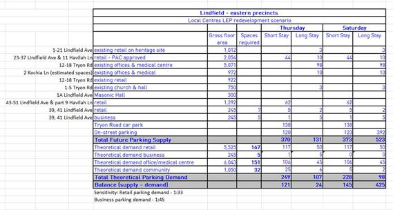
Figure 3 – Lindfield Local
Centre – Eastern Precincts - Parking Management Strategy - parking calculations
Figure 3 shows the total future short stay parking supply
for the precinct will be between 370 & 373 spaces including public parking
on private land, Tryon Road car park and on-street parking on surrounding
streets.
The calculated total future theoretical short stay parking
demand will be between 228 & 249 car spaces on Thursday evening and
Saturday morning – which are the busiest times in the area. This number has
been quantified by calculating existing and future floor space in the precinct
and applying Council’s DCP parking requirements. As a cross-check the Roads and
Maritime Service (RMS) guide suggests that 251 parking spaces would be adequate
for the theoretical parking demand based on the commercial floor space in the
area.
The bottom line of Figure 3 shows that in the future, once
the proposed new developments have occurred on Lindfield Avenue there will be
an over-supply of between 121 & 145 spaces on Thursday evenings and
Saturday mornings. This result suggests that there is potential to reduce the
number of spaces on Council’s land.
Figure 4 shows that if the number of car spaces in the Tryon
Road car park were to be reduced by 38 spaces to a total of 100 spaces (shown
highlighted in yellow) there would be a total of between 332 and 335 short-stay
spaces available on Thursday evenings and Saturday mornings; with a theoretical
demand for short-stay parking of between 228 & 249 the total additional
capacity would be between 83 and 107 spaces when compared to demand.
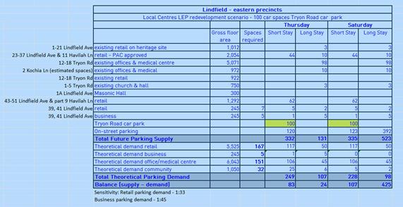
Figure 4 – Lindfield Local
Centre – Eastern Precincts - Parking Management Strategy – revised parking
calculations
Based on the previous discussion this would require Council
to provide up to 80 spaces in a basement car park and an additional 20 spaces
on-grade within the site.
Note: Table 4 does not take account of the additional 100
spaces that might be provided by Transport for NSW as a second basement level
of parking which would be in part available on Thursday evenings and weekends.
c) Potential area
of park land
The area of land that could be made available for a new park
on the subject site is about 2,700 m2 this is shown indicatively on
Figure 5.
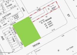
Figure
5: Approximate location and size of proposed park
As discussed above the cost of constructing a basement car
park with an 80 car capacity below the park would be in the order of $8,245,000.00
or $103,000.00 per space as per the estimate prepared by Wilde and Woollard; this
equates to the equivalent of acquiring the subject site as a 2,700m2 park
at a value of $3,053.00 per m2. Taking into account contingencies,
professional fees and other allowances the actual cost of the car park
structure is likely to be about 30% higher than the $8.2 million quoted
suggesting that the actual acquisition/construction cost will be closer to
$4,000 per m2.
d) Estimated cost
of land acquisition versus cost of underground car park construction
The next question to determine is what amount is acceptable
for Council to spend before it becomes cheaper or more cost effective for
Council to acquire land for a park or town square in a nearby location to the
subject site?
The first matter to consider is whether there are in fact
alternative locations on the eastern side of Lindfield. The reality is that
given the amount of apartment building developments in the locality over the
last 10 years there is very limited land available that is located within close
proximity to the rail station and would meet Council’s acquisition criteria (as
per the Open Space Acquisition Strategy, 2006).
Those lands that are available have been assessed and
reported to Council. Council has thoroughly assessed and analysed over twenty
different location options for a new park location on the eastern side of
Lindfield; the most comprehensive of these is a report to the Extraordinary
Meeting of Council on 15 July 2008. Based on these assessments it is considered
that the proposed location of the Village Green is superior to all other
locations in qualitative terms because:
· it meets community expectations;
· it meets the relevant planning
criteria as identified in the OSAS;
· the site is owned by Council and can
be delivered relatively quickly;
· there is no delay to the project
caused by owner-initiated acquisition or possible compulsory acquisition
timeframes; and
· the land is flat and centrally
located - which is a rare commodity in Lindfield;
A detailed analysis has been undertaken of land values in
the Lindfield area in Confidential Attachment A5. Comparing the
cost of providing an underground car park with the data in Confidential Attachment
A5 it can be shown that the use of $9,450,000 (or $3,500 per m2
for a 2,700 m2 park) for construction of the car park can
reasonably be justified before it becomes more cost-effective to consider an
alternative location. This will leave Council with a shortfall in funding for
the car park which will be discussed in the Finance section of this report.
Summary
It is recommended that Council allocate $9,450,000.00 from
S94- Local Parks and Sporting Facilities – South for the construction of a
single level underground car park; the preceding discussion has established
that this funding strategy will meet the requirements of the Contribution Plan
by establishing that the proposal will “…result in a quality park that meets
nexus requirements, being delivered in a more cost-effective way than the
acquisition and embellishment of land…”
Council’s CAPITAL WORKS PROGRAM & OPERATIONAL PROJECTS
2015/2016 identifies a total of $7,542,400.00 for the
acquisition of land in the southern part of the LGA. Funds totalling
$1,907,600.00 will need to be brought forward from S94- Local Parks and
Sporting Facilities – South to meet the budget
requirement; this is discussed further in the financial considerations section
of this report.
PROJECT SCOPE
In previous reports the scope of the project has been
described in some detail; the discussion above has clarified the number of car
parks to be provided on the site. The scope of the project therefore is:
· provision for up to 100 Council
owned car spaces on the site;
· construction of a new single level
basement public car park;
· construction of a new park / civic
space with a minimum size of 2,700sqm;
· streetscape works to adjoining
streets and lanes (extent and detail defined in Contributions Plan - Work
Programs); and
· road and transport works to
adjoining streets and lanes (extent and detail defined by Contributions Plan -
Work Programs).
There are three additional components that need further
discussion:
· commuter parking;
· public amenities building; and
· temporary parking during
construction
Public amenities building
As per Council’s resolution of 12 December 2013 the
Lindfield Branch Library is proposed to be located on the western side of
Lindfield; given the library is no longer proposed for this site it will be
necessary to provide some form of public amenities on the site such as toilets
and change rooms etc. In addition the lift from the basement car park will need
to be housed in a structure. Given these considerations there may be some
benefits to Council, including financial, if the Village Green were to
accommodate a single storey pavilion structure that could integrate public
amenities, the lift from the basement car park as well as an undercover public
seating area. The structure may also provide a small leasable commercial space
for a café.
It is proposed to further develop this idea as part of the
concept design stage of the project.
Commuter parking
Council has resolved to continue to actively investigate the
potential to provide some of the commuter car parking proposed by Transport for
NSW (TfNSW) under the proposed Lindfield Village Green. Recent discussions with
representatives from TfNSW indicate that the State Government is willing to
consider this option only if there is a strong rationale for doing so; a clear
benefit to future users and is cost effective. At the Lindfield Village Green
Project Working Group meeting on 29 April 2014 it was agreed that Council would
engage a quantity surveyor to prepare a cost estimate for the construction of a
two level basement car park including a second level of parking for commuters.
This work has been completed and the results reported above,
the next step will be to issue the completed cost estimate to TfNSW for an
official response from the Minister as to whether TfNSW wish to be a partner in
the project. The intention is to bring another report to Council once an
official response from Minister TfNSW has been received.
It is not anticipated that this additional work will delay
the concept design process.
Temporary parking during construction
A critical consideration for this project is the provision
of public parking during construction of the new car park. The best case
scenario would see one of the adjoining sites on Lindfield Avenue redeveloped
in the period prior to Council commencing construction. The proposed
developments at 23-37 Lindfield Avenue and 62 and 43-51 Lindfield Avenue will
provide up to 117 new public car spaces in the precinct. Unfortunately the
timing of these works is outside Council’s control.
Council’s Town Centres Parking Management Plan provides some
strategies on p-116 proposing 55 new 2 hour spaces during the construction
period on Havilah Road, Milray Street and Tryon Road to replace commuter car
parking.
Other strategies that Council may consider to make up the
shortfall of parking during construction are:
· utilisation of the Council owned
land at 265-271 Pacific Highway (Lindfield library / seniors centre site) for
temporary parking; and/or
· negotiations with the owners of
12-18 Tryon Road (adjoining building) to allow temporary use of the basement
car park area for public parking; and/or
· utilisation of a nearby development
site for temporary parking (if available).
PROJECT PROGRAM
The project will be implemented in three
broad stages:
Stage 1 – Preliminary concept design
· request for Tender (RFT) for design
consultants;
· a short list of up to three (3)
multi-disciplinary teams will be invited to prepare concept plans for public
exhibition;
· each consultant team will be payed a
fixed fee;
· concept plans will be assessed by
Council and Council’s consultants based on set criteria;
· the preferred concept plan will be
reported to a meeting of full Council for approval / adoption; and
· finalisation of the concept plan and
associated documentation to meet Council resolutions as required.
Stage 2 – Architectural commission
· Second RFT for design services
including:
- design development and
development application (DA) documentation; and
- construction
documentation.
Stage 3 – Tender for construction and construction
- construction services;
and
- post-construction
services.
Indicative contract stages, milestones and dates are
outlined below.
|
Key Milestones
|
Dates
|
|
Full council approval of project budget, scope and program
|
OMC 9 Sept 2014
|
|
Stage 1
|
|
|
Advertise Request for Tenders
|
26 Aug 2014
|
|
Evaluation of tenders and short-listing
|
Sept- Oct 2014
|
|
Full council approval of short-listed
consultant teams
|
28 October 2014
|
|
Prepare concept designs
|
Oct 2014 – Jan 2015
|
|
Public exhibition of 3 concept designs
|
Feb 2015
|
|
Full Council approval of preferred concept design
|
April 2015
|
|
Stage 2
|
|
|
Design development, development application (DA)
documentation and
construction documentation
|
May 2015 – Dec 2016
|
|
Stage 3
|
|
|
Commence construction
|
Dec 2016
|
|
Construction complete
|
Dec 2017
|
|
Post-construction (52 weeks)
|
Dec 2018
|
Construction is planned to commence late 2016. At this stage
it is envisaged the car park could be completed and opened by mid-2017
following this, the park is planned to open in late 2017.
It is noted that the timing of the project construction
stage may intersect with construction of the proposed development at 23-37
Lindfield Avenue, Lindfield. The current estimate of this work is a period of
two years from August 2014 to August 2016. Council has written to Anka Property
Group seeking clarification of their construction programme however to date no
response has been received. In the intervening period, it is understood that
Anka have on-sold the site and development consent.
integrated planning and reporting
Places, Spaces and Infrastructure - P4 Revitalisation of our
centres
|
Community Strategic Plan Long Term Objective
|
Delivery Program
Term Achievement
|
Operational Plan
Task
|
|
A range of well planned, clean and safe neighbourhoods and
public spaces designed with a strong sense of identity and place.
|
P4.1.1
Plans to revitalise local centres are being progressively
implemented and achieve quality design outcomes in collaboration with key agencies,
landholders and the community.
|
Implement a place management approach for the local centre
improvements to coordinate works and achieve quality outcomes.
|
|
|
P4.1.4
An
improvement plan for Lindfield centre is being progressively implemented in
collaboration with owners, businesses and state agencies.
|
Engage with relevant
stakeholders to establish timing, extent and partnership opportunities.
Undertake due diligence and
undertake project scope.
Identify and engage with
the key stakeholders.
|
Governance Matters
A probity consultant has recently been engaged to prepare a
Probity Framework for the two projects Council is managing in Lindfield.
A key focus of the provision of probity services is to
assist Council in managing the conduct of the community and stakeholder
engagement, the procurement processes, the Council’s statutory and development
roles to ensure that they are conducted in accordance with legislative and
regulatory requirements and general probity guides. This focus on compliance and
advising on a fair process is required to assist Council to achieve its
objectives without any undue delays due to process breaches.
Risk Management
The key risks for the next stage of the project are that:
· the consultants do not prepare a
concept plan that is supported by the community; and
· the consultants prepare a concept
plan that exceeds the project budget.
The first risk has been mitigated by a creating a process
whereby three consultant teams will be engaged to prepare three different
concepts; consultants will be selected based on a number of factors which will
allow selection based on differing approaches and styles. This will allow an
exhibition where residents will have the opportunity to vote on their preferred
concept. To further support this approach information sessions will be held for
the community, during the exhibition period, to hear presentations from the
design consultants on their concept plans.
The second risk has been mitigated by requiring by two
quantity surveyors: the first engaged by the head consultant; and the second
engaged by Council. The head consultant will engage a quantity surveyor to
provide cost advice during the design and documentation stages (stage 1 and 2).
Council will independently engage a quantity surveyor to audit the work of the
design team’s quantity surveyor and to provide cost planning advice to Council
through all stages of the project (stages 1 and 2).
Financial Considerations
Council’s Revised Delivery Program 2013 – 2017 Draft
Operational Plan 2014 – 2015 (pages 92-100) allocates funds for the project
in the Capital Works Program and Operational Projects 2015-16 spread sheets
under the following headings:
· Open Space Acquisition – LGA south
· Lindfield Village Green
· Town Centre Streetscape
· Roads Program – Lindfield
The total allocation of development contributions is
$16,555,300.00 allocated over the three financial years from 2015-2017. If
Council accepts the recommendation that additional funds be brought forward
from 2010 Plan - Local Parks and Sporting Facilities – South, to top-up the
funds as per previous discussion of $1,907,600.00, then the total funds
available will be $18,462,900.00.
The table below shows the breakdown of funds within the Revised
Delivery Program 2013 – 2017 Draft Operational Plan 2014 – 2015.
 Figure 6 – breakdown of funds within
the Revised Delivery Program 2013 – 2017 Draft Operational Plan 2014 – 2015.
There are two scenarios:
· Scenario 1 – one level car park, Council funds project;
or
· Scenario 2 – two level car park
jointly funded by Council and TfNSW.
Scenario 1, where the total funds available would be
$18,462,900.00, and using the quantity surveyor estimate for a project with a
one level car park which is $19,430,000.00 (Confidential Attachment A2),
the project would have a fund shortfall in the order of $967,100.00. In
addition the quantity surveyor does not include (or excludes) the cost of staff
time in their estimate and it is therefore recommended that an additional
$300,000 be included in the project budget to cover this item.
As noted in the Background to this report Council has
previously resolved to allocate the proceeds from the sale of no.9 Havilah
Lane, being $4,550,000.00, to be directed to the project budget for the
provision of underground car parking and a civic square / village green
precinct. Under this scenario it would be necessary to utilise $967,100.00 of
this budget to make up the shortfall plus $300,000.00 for staff time; a total
of $1,267,100.00.
In terms of the current budgets there are adequate funds
available from Open Space Acquisition – LGA South to fund the car park
construction and construction of the new park with just over $4.3 million
remaining in the account. The proposed road works budget is $1,093,300.00, this
would require further borrowing across the plan as this account currently has a
negative balance. There are adequate funds available to fund streetscape and
transport works with just over $3.8 million remaining in the account.
The break down is shown in the Figure 7 below.

Figure 7 – Comparison of
proposed project budget with current budgets in Restricted Assets Actual June
2014
In terms of Scenario 2, the quantity surveyor cost estimate
for a two level car park is $26,638,000.00 (Confidential Attachment A2),
the funds to be contributed by Council and TfNSW still needs to be determined.
Written advice from TfNSW is also required to determine whether they are
willing to fund a second level of parking as part of the project. One advantage
of this scenario is that a shortfall can be avoided as there are cost savings
(relating to efficiencies of a two level car park) that could be shared between
the two parties.
In summary it is recommended that Council progress with the
project with a total project budget of $19,730,000.00 allocated to the project,
this includes all contingencies, professional fees, staff time and other costs;
and comprises:
· $16,555,300.00 from the Revised
Delivery Program 2013 – 2017 Draft Operational Plan 2014 – 2015;
· $1,267,100.00 from the proceeds from
the sale of no.9 Havilah Lane for the year 2016-2017;
· $1,907,600.00 brought forward and
allocated from the 2010 Plan - Local Parks and Sporting Facilities - South for
the year 2016-2017 for the car park construction; and
· that following further discussions
and advice from TfNSW the project scope and budget is reviewed if TfNSW agree
to be a partner in the project.
Social Considerations
Ku-ring-gai Local Government Area has been going through a
period of change commencing in 2004. This is bringing about population growth
following years of declining and stable population since the 1980s.
Infrastructure is essential to support and encourage the integration of the new
residents of Ku-ring-gai, both among residents of the new dwellings being built
and those moving into larger existing housing vacated by the members of
Ku-ring-gai’s older population who have ‘downsized’ into smaller local
accommodation.
The provision of additional community infrastructure
providing both outdoor and indoor community spaces will continue to support
this process and help Ku-ring-gai continue to be a vibrant and popular place to
live for all ages
Environmental Considerations
Council has engaged a number of consultants to undertake due
diligence on the site of the new park. The full reports can be viewed on
Council’s website at: http://www.kmc.nsw.gov.au/Projects_and_priorities/Development_and_upgrades/Activate_Lindfield/Lindfield_Village_Green
Stage 1 Preliminary Site Investigation
Investigations, assessment and reporting completed by SLR
Consulting Australia Pty Ltd, confirms:
· there is a low to negligible risk
potential for unacceptable concentrations of contamination to be present in
project site soils; and
· the site is considered suitable
(from a contamination perspective) for the proposed redevelopment.
Waste classification & VENM assessment
Fieldwork and reporting completed by SLR Consulting
Australia Pty Ltd, including soil samples taken from five (5) soil bores sites
drilled across the site. Based on the site area and thickness of filled
observed at each of the sampling points, an estimated of 1,250m3 of
fill soil has been identified for offsite disposal during the proposed project
basement excavation. Samples were subject to laboratory analysis with the
outcomes summarised as follows:
· fill soil material would classify as
General Solid Waste (no-putrescible); and
· natural soil material would classify
as virgin excavated natural material (VENM) and also be classified as GSW
(non-putrescible).
The only risk arising for the project from these results is
the additional costs associated with disposal of the fill material.
Geotechnical investigations
Fieldwork, investigations and reporting completed by Asset
Geotechnical Engineering Consultants were based on four (4) non-core boreholes
to depths from 2.4-10.5m and one cored bore hole to rock refusal at 4.45m depth
and continued coring to 7.6m.
Soil analysis results are as follows:
|
Layer
|
Depth Range
|
|
Pavement
|
0.05m
|
|
Fill
|
0.05 - 0.5m
|
|
Residual Clay:
|
0.25 - 3.9m
|
|
Bedrock – Shale (very low to low strength)
|
1.0 - 6.7m
|
|
Bedrock – Shale (low strength)
|
5.5 – 10.5m
|
|
|
|
Groundwater detected at a range of 3.5 to 4.5m depths.
The report outlines comprehensive recommendations in
relation to:
· construction sequence;
· temporary shoring and permanent
retaining walls: outlining advantages and disadvantages for both single and
double level basement structures;
· design approach;
· groundwater control;
· earthworks, including excavation,
subgrade preparation, filling, batter slopes;
· lot classification; and
· footings: strip & pad
foundations vs basement slabs.
The main risk that the site presents is the presence of
groundwater and the method of inflow control on the proposed basement structure
will be a key design factor. The risk can be mitigated by fully waterproofing
the car park structure (impermeable retaining walls & floor structure – or
“tanking”) for both a single and double level basement. Council’s quantity
surveyors have taken this factor into account when preparing the estimates.
Land survey
Digital survey data has been received from surveyors. No
underground services are located on within the Tryon Road car park site.
Community Consultation
Key external stakeholders include:
· local community – residents,
businesses, workers, visitors
· community groups
· authority stakeholders
· Transport for NSW
· Roads and Maritime Service
Council has started the conversation with the local
community on the opportunities and vision for the new Village Green.
In early 2014, we promoted the ‘Activate Lindfield’
initiative to revitalise Lindfield with new community facilities, parking,
parks and village greens. Over 120 residents, business owners and other
interested stakeholders signed up the Activate Lindfield e-newsletter.
Family Fun Day
On Wednesday 26 February, Council hosted a family fun
afternoon on the site of the new village green from 3pm and 6pm. We created a
public area with active and passive activities to encourage locals to begin the
conversation on possible functions and uses for the new village green.
Council staff hosted the event with approximately 600 people
of all ages dropping in to speak to staff, play on the jumping castles, visit
the animal farm or relax on the benches. We spoke to workers, residents,
parents, commuters, shoppers, business owners with over 120 surveys completed.
People told us they wanted a village green with different
nodes of activity in a contained and protected precinct away from traffic.
People drew inspiration and ideas from the Concourse at Chatswood, Lane Cove
village, sites along Sydney Foreshore and Manly.
The primary issues identified by participants included
parking, traffic, new development and project timing. Council has analysed the
survey results and a summary is presented below.
Survey results
The majority of survey respondents were visitors attending
the Family Fun Event with the majority consisting of local residents with their
partners and/or children.
Lindfield local centre “Like”
1. Types
of shops and services, ie. food & café; community services and church
2. Parking
& Lindfield station accessibility
3. Village-community
atmosphere
Special character
1. Lack
of unique character & amenities
2. Village
feel, sense of community and local environment ie. heritage buildings including
surrounding residential architecture & surrounding vegetation
3. Access,
railway, car park
Local centre main attraction:
· 35% do multiple things
· 27% only do one or two things only
· 25% do something else1
· 14% only stay for extended periods
of time
Frequently visited places: Within KMC Regional
Places:
Restaurants 55%
East Lindfield Chatswood/Concourse
Cafes 45%
Roseville Lane Cove
Water, play, pool area 28%
Wahroonga Park Cammeray Square
Bars & Hotels 9% Harris
Farm markets
Requests: Most popular activities for the Village Green
1. Socialising
2. Shopping
3. Eating
4. Kid’s activities/relaxing
5. Sitting
Requests: Most popular features for the Village Green
1. Seating
2. Shade
3. Cafes
4. Easy
access
5. Parking
The survey results confirm that Lindfield local centre is
overwhelmingly underutilised and has extraordinary potential to increase user
visitation. The results of this survey will be used to contribute to the
project brief for the design of Lindfield Village Green
Figure 8 – Lindfield Family
Fun Day, Tryon Road Figure 9 – Lindfield Family Fun
Day, Tryon Road
Figure 10 – Lindfield Family
Fun Day, Tryon Road Figure 11 – Lindfield Family Fun Day,
Tryon Road
Internal Consultation
Key internal stakeholders include:
· Community Department
· Corporate Department
· Development & Regulation
Department
· Operations Department
· Strategy and Environment Department
The urban design team has undertaken a series of briefing
sessions for staff from the above departments to ensure all relevant parties
are aware of the project.
Strategy & Environment department is responsible for the
delivery of the final concept plan for the project. The Team Leader Urban
Design and the Public Domain Projects Officer will be the regular contacts for
the head consultant and will co-ordinate communication between the consultant
team together with Council’s internal and external stakeholders.
A Project Control Group has been established to oversee the
project development; the members are:
· Director Strategy and Environment
· Director Operations
· Director Corporate
· Manager Projects Operations
· Manager Strategic Projects
· Manager Corporate Communications
A working group has been established to develop the project
programme and procurement process, the group comprises:
· Manager Strategic Projects
· Manager Procurement & Contracts
· Manager Projects Operations
· Team Leader Urban Design
· Public Domain Projects Officer
Summary
The purpose of this report is to seek Council’s adoption of
a preliminary project budget, scope of works and programme and for the
Lindfield Village Green project.
A total of six reports have come to Council since December
2011 regarding this project; key resolutions of Council include the following:
· Adoption of an open space
acquisition strategy for Lindfield which includes the Lindfield Village Green;
· In-principle support for the project
to proceed;
· Allocation of seed funding to
commence the project planning stage;
· Allocation of proceeds from the sale
of no.9 Havilah Lane, Lindfield to the project budget;
· Commencement of a concept plan and
community consultation; and
· Approval to commence compulsory
acquisition of the unnamed lane that forms part of the site.
This report defines the scope of the project as follows:
· provision for up to 100 public
(Council owned and managed) car spaces on the site;
· construction of a new single level
basement public car park;
· construction of a new park / civic
space with a minimum size of 2,700m2;
· streetscape works to adjoining
streets and lanes (extent and detail defined in Contributions Plan - Work
Programs)
· road and transport works to
adjoining streets and lanes (extent and detail defined by Contributions Plan -
Work Programs)
The report finds that in the future Council will be required
to provide a minimum 100 public short stay spaces on the site; this represents
a reduction of 38 spaces when compared to the current provision. Based on the
preliminary car park plans prepared this would require Council to provide up to
80 spaces in a basement car park and an additional 20 spaces on-grade within
the site. The report notes that this quantum does not take account of the
potential additional 100 spaces that might be provided by Transport for NSW as
a second basement level of parking which would be in part available on Thursday
evenings and weekends.
A detailed analysis has been undertaken of land values in
the Lindfield area and a comparison with the cost of providing an underground
car park. The report finds that the use of $9,450,000 (or $3,500 per m2
for a 2,700 m2 park) for construction of the car park can be
reasonably justified before it becomes more cost-effective to consider an alternative
location.
The report recommends a preliminary programme for stage 1 –
Concept Design with the following key milestones:
· Advertise Request for Tenders -
August 2014
· Evaluation of tenders and
short-listing- September to October 2014
· Full Council approval of
short-listed consultant teams - October 2014
· Prepare concept designs - October
2014 to January 2015
· Public exhibition of 3 concept
designs - February 2015
· Full Council approval of preferred
concept design - April 2015
In summary the report recommends that Council progress with
the project with a total project budget of $19,730,000.00 allocated to the
project, this includes all contingencies, professional fees, staff time and
other costs, comprising:
· $16,555,300.00 from the Revised
Delivery Program 2013 – 2017 Draft Operational Plan 2014 – 2015
· $1,267,100.00 from the proceeds from
the sale of no.9 Havilah Lane for the year 2016-2017; and
· $1,907,600.00 brought forward and
allocated from the 2010 Plan - Local Parks and Sporting Facilities - South for
the year 2016-2017 for the car park construction
· That following further discussions
and advice from TfNSW the project scope and budget is reviewed if TfNSW agree
to be a partner in the project.
|
Recommendation:
That:
A. Council
adopts the revised project scope which includes:
· Provision of a minimum of 100
public car spaces on the site;
· Construction of a new single level
basement public car park to be owned and operated by Council;
· Construction of a new park / civic
space with a minimum size of 2,700m2;
· Streetscape works to adjoining
streets and lanes (extent and detail defined in Contributions Plan - Work
Programs); and
· Road and transport works to
adjoining streets and lanes (extent and detail defined by Contributions Plan
- Work Programs).
B. Council
progress with the project with a total project budget of $19,730,000.00, this
includes all contingencies, professional fees, staff time and other costs;
the budget comprises:
· $16,555,300.00 from the Revised
Delivery Program 2013 – 2017 Draft Operational Plan 2014 – 2015 from
development contributions 2010 Plan
· $1,267,100.00 from the proceeds
from the sale of no.9 Havilah Lane for the year 2016-2017; and
· $1,907,600.00 brought forward and
allocated from the 2010 Plan - Local Parks and Sporting Facilities - South
for the year 2016-2017 for the car park construction
· That following further discussions
and advice from TfNSW the project scope and budget is reviewed if TfNSW agree
to be a partner in the project.
C. Council
adopts the preliminary project programme for Stage 1 of the project which
plans for construction of the project to commence in late 2016; and that any
revisions to this programme be reported to Council following exhibition of
concept designs:
· Advertise Request for Tenders -
August 2014
· Evaluation of tenders and
short-listing - September to October 2014
· Full Council approval of
short-listed consultant teams - October 2014
· Prepare concept designs - October
2014 to January 2015
· Public exhibition of 3 concept
designs - February 2015
· Full Council approval of preferred
concept design - April 2015
D. Council
write to the Minister for Transport with details of the cost of a second
level of basement parking seeking confirmation that TfNSW wish to participate
in the project, and that a further report is bought to Council advising of
the Minister’s decision once an official response has been received.
|
|
Bill Royal
Team Leader Urban Design
|
Antony Fabbro
Manager Urban & Heritage Planning
|
|
Andrew Watson
Director Strategy & Environment
|
|
|
Attachments:
|
A1
|
Lindfield
Village Green - Legal advice regarding use of development contributions
|
|
Confidential
|
|
|
A2
|
Lindfield
Village Green - Concept Estimate (Final) - Wilde and Woollard - July 2014
|
|
Confidential
|
|
|
A3
|
Lindfield
Village Green - cost estimate - Muller Partnership
|
|
Confidential
|
|
|
A4
|
Lindfield
Village Green - Project Cost Estimate - Option 1 and 2 - Altus Page Kirkland
|
|
Confidential
|
|
|
A5
|
Lindfield
Village Green - cost of land acquisition versus cost of underground car park
construction
|
|
Confidential
|
|
Ordinary
Meeting of Council - 9 September 2014
|
GB.6 / 725
|
|
|
|
|
Item
GB.6
|
S06604/2
|
|
|
29 August 2014
|
Amendments to Sports Facilities Plan of
Management for Public Exhibition
EXECUTIVE
SUMMARY
|
purpose of report:
|
To rectify an anomaly in the Sports Facilities Plan of
Management to bring the permitted hours of clubhouse use in line with the
permitted hours of sportsground use so that licence agreements with sporting
clubs can be negotiated in accordance with the Plan of Management; and to
permit earlier tennis court hire at appropriate locations.
|
|
|
|
|
background:
|
The Sports Facilities Plan of Management (SFPOM) was
adopted by Council on 20 April 2010. It approved the use of sportsgrounds for
organised sports competitions on Saturday evenings until 8.30pm (with lights
permitted until 9pm for pack up of the ground), however the intensity of
clubhouse use on Saturdays was unintentionally left unchanged from the
previous plan of management at 8am-6pm.
|
|
|
|
|
comments:
|
When the SFPOM was prepared and adopted in 2010 it was
intended that the permitted hours of use for clubhouses and amenities at
sportsgrounds would correspond with the permitted hours of use for the ground
itself. Due to an error the permitted hours on Saturdays were left unchanged
at 6pm, and hence do not correspond with permitted use of sportsgrounds or
allow clubs to host occasional functions or events. This situation needs to
be rectified so that licence agreements with sporting clubs can be negotiated
in accordance with the SFPOM and brought to an ordinary meeting of Council
for approval. It is also considered appropriate to permit tennis court
bookings at certain courts that are not close to residents to commence at 7am
instead of 8am.
|
|
|
|
|
recommendation:
|
That Council place on public exhibition an amendment
to the SFPOM to permit the use of clubhouses and amenities until 10pm on
Fridays and Saturdays, and 12am when the club is hosting a club function or
special event and has given surrounding residents at least seven days’ notice
in writing and that Council also place on public exhibition an amendment to
permit tennis court hire from 7am at appropriate locations.
|
Purpose of Report
To rectify an anomaly in the Sports Facilities Plan of
Management to bring the permitted hours of clubhouse use in line with the
permitted hours of sportsground use so that licence agreements with sporting
clubs can be negotiated in accordance with the Plan of Management; and to
permit earlier tennis court hire at appropriate locations.
Background
The Sports Facilities Plan of Management (SFPOM) was adopted
by Council on 20 April 2010. It approved the use of sportsgrounds for organised
sports competitions on Saturday evenings until 8.30pm (with lights permitted
until 9.00pm for pack up of the ground), however the intensity of clubhouse use
on Saturdays was inadvertently left unchanged from the previous plan of
management at 8.00am-6.00pm.
This matter was reported to Council on 14 May 2014 and it
was resolved in Minute No.138 that consideration of the matter be deferred
pending a further report from Council staff.
Comments
Under the current SFPOM, clubhouse and amenities use is
permitted until 10.00pm on weekdays and 6.00pm on weekends.
Unfortunately, due to an error in the current SFPOM, the
permitted hours of use for clubhouses and amenities do not correspond with the
permitted hours of use of sportsgrounds, which is 9.30pm weekdays, 9.00pm Saturdays
and 6.00pm Sundays. It was undoubtedly the intention of the SFPOM when it was
prepared and adopted in 2010 for the hours of use of sportsgrounds to
correspond with the hours of use of clubhouses and amenities, however due to an
editorial oversight the clubhouse permitted hours on Saturdays were
inadvertently left at 8.00am-6.00pm.
This situation needs to be rectified so that licence
agreements with sporting clubs can be negotiated in accordance with the Sports
Facilities Plan of Management and brought to an ordinary meeting of Council for
approval.
It is considered appropriate for clubhouse and amenities use
on Fridays and Saturdays to be permitted until 10.00pm. It is also considered
appropriate to permit clubs to host occasional club functions and events until
12.00am (midnight). In order to keep residents informed of any potential
impacts, the SFPOM and any future renewal of a clubhouse lease and licence will
include a requirement for the club to give at least seven days’ notice in
writing to all residents in adjacent streets on any occasion that a function or
event to be held at the clubhouse is expected to extend past 10.00pm.
Sundays would retain the existing limit of 6.00pm.
Council officers have also used this opportunity to review
the rest of the SFPOM and identified an issue relating to tennis courts that
needs to be addressed. Currently Council’s 71 tennis courts are not permitted
to be hired before 8.00am. At some locations where courts are very close to
residents this is a reasonable time, however at other locations such as
Regimental Park courts, Killara and Tryon Road courts, East Lindfield, there
are no adverse impacts on residents at any time of the day caused by the
playing of tennis and the courts are sitting idle when they could be used.
It is therefore recommended that the SFPOM be amended to
permit tennis courts to be booked from 7.00am seven days per week at certain
locations where it is considered appropriate, subject to Council approval. This
situation would be continually monitored by staff and if any issues arise at
any particular location bookings at that location revert back to 8.00am. This
extension of time for tennis court usage will encourage and facilitate a
healthy recreational activity within the community and may also potentially
increase court hire revenue for Council.
integrated planning and reporting
Community Strategic Plan - Theme P7 Enhancing community
buildings and facilities
|
Community Strategic Plan Long Term Objective
|
Delivery Program
Term Achievement
|
Operational Plan
Task
|
|
P7.1 Multipurpose community
buildings and facilities are available to meet the community’s diverse and
changing needs.
|
P7.1.2 Usage of existing
community buildings and facilities is optimised.
|
Community leases are reviewed and implemented in line with
leasing policy.
|
Governance Matters
Under the Local Government Act 1993, Section 38 Public
Notice of draft Plans of Management:
(1) A council must give public
notice of a draft plan of management.
(2) The period of public
exhibition of the draft plan must be not less than 28 days.
(3) The
public notice must also specify a period of not less than 42 days after the
date on which the draft plan is placed on public exhibition during which
submissions may be made to the council.
(4) The
council must, in accordance with its notice, publicly exhibit the draft plan
together with any other matter which it considers appropriate or necessary to
better enable the draft plan and its implications to be understood.
Under the Local Government Act 1993, Section 40 Adoption of
Plans of Management:
(1) After
considering all submissions received by it concerning the draft plan of
management, the council may decide to amend the draft plan or to adopt it
without amendment as the plan of management for the community land concerned.
(2) If the council decides to
amend the draft plan it must either:
(a) publicly
exhibit the amended draft plan in accordance with the provisions of this
Division relating to the public exhibition of draft plans, or
(b) if it
is of the opinion that the amendments are not substantial, adopt the amended
draft plan without public exhibition as the plan of management for the
community land concerned.
(2A) If a
council adopts an amended plan without public exhibition of the amended draft
plan, it must give public notice of that adoption, and of the terms of the
amended plan of management, as soon as practicable after the adoption.
Following public exhibition and consideration of any submissions
received a report will be brought back to Council to adopt the plan of
management.
Risk Management
Any risk management issues will be identified and addressed
in the lease, licence and hire agreements for each clubhouse.
Financial Considerations
The extension of time for tennis court usage may potentially
increase court hire revenue for Council.
Social Considerations
This amendment will allow community clubs to enter into
licence agreements with Council for the use of clubhouse facilities during
similar hours that sportsgrounds are in use.
The extension of time for tennis court usage will encourage
and facilitate a healthy recreational activity within the community.
Environmental Considerations
It is not considered that bringing clubhouse use into line
with sportsground use will lead to any significant environmental impacts. If
there are any impacts at a particular location these can be dealt with through
clauses in the respective licence agreement and, if necessary, revocation of a
licence.
Community Consultation
Under Section 38 of the Local Government Act 1993 Council is
required to publicly exhibit the draft Plan of Management for a period of 28
days plus a further 14 days to receive submissions. Public exhibition will commence
as soon as practicable following the Council resolution to proceed.
The public exhibition will include public notification of
the exhibition period in the North Shore Times, on Council’s website and at
Council’s Administration Centre and libraries.
Additionally, residents living in streets adjacent to all
sportsground clubhouses who could potentially be impacted by the amended
clubhouse hours will be notified in writing about the public exhibition of the
draft plan of management.
Internal Consultation
Council officers in the Community Department and Strategy
and Environment Departments have been consulted in the preparation of this
report.
Summary
The permitted hours of use for clubhouses and amenities at
sportsgrounds should correspond with the permitted hours of use of the ground
itself. This was undoubtedly the intention of the Sports Facilities Plan of
Management when it was prepared and adopted in 2010, however due to an
editorial oversight clubhouse hours on Saturdays were incorrectly left at
8.00am-6.00pm while the ground can be used until 9.00pm on Saturdays. This
situation needs to be rectified so that licence agreements with sporting clubs
can be negotiated in accordance with the Sports Facilities Plan of Management
and brought to an ordinary meeting of Council for approval.
It is considered appropriate for clubhouse and amenities use
on Fridays and Saturdays to be permitted until 10.00pm. It is also considered
appropriate to permit clubs to host occasional club functions and events until
12.00am (midnight). In order to keep residents informed of any potential
impacts, the SFPOM and any future renewal of a clubhouse lease and licence will
include a requirement for the club to give at least seven days’ notice in
writing to all residents in adjacent streets on any occasion that a function or
event to be held at the clubhouse is expected to extend past 10.00pm.
An issue relating to tennis court hiring times in the SFPOM
has also been identified. Currently Council’s 71 tennis courts are not
permitted to be hired before 8.00am. At some locations where courts are very
close to residents this is a reasonable time, however at other locations there
are no adverse impacts on residents at any time of the day caused by the
playing of tennis and the courts are sitting idle when they could be used by
the community.
It is therefore recommended that the SFPOM be amended to permit
tennis courts to be booked from 7.00am seven days per week at certain locations
where it is considered appropriate, subject to Council staff approval. This
situation would be continually monitored by staff and if any issues arise at
any particular location bookings at that location revert back to 8.00am.
|
Recommendation:
A. That
Council place on public exhibition the recommended amendments to the Sports
Facilities Plan of Management.
B. That
Council amend the Sports Facilities Plan of Management to permit the use of
clubhouses and amenities until 10.00pm on Friday and Saturday evenings and
until 12.00am on Friday and Saturday evenings for occasional club functions
and special events.
C. That
the Sports Facilities Plan of Management and future renewal of club leases
and licences require clubs to give at least seven days’ notice in writing to
all residents in adjacent streets on any occasion that a club function or
event to be held at the clubhouse is expected to extend past 10.00pm.
D. That
the Sports Facilities Plan of Management be amended to permit tennis courts
to be booked from 7.00am seven days per week at certain locations where it is
considered appropriate, subject to Council staff approval.
E. That
Council staff continually monitor tennis court bookings prior to 8.00am and
if any issues arise at any particular location bookings at that location
revert back to 8.00am.
|
|
Roger Faulkner
Team Leader Sport & Recreation Planning
|
Andrew Watson
Director Strategy & Environment
|
|
Ordinary
Meeting of Council - 9 September 2014
|
GB.7 / 730
|
|
|
|
|
Item
GB.7
|
S10030
|
|
|
12 August 2014
|
Draft Policy for Overt Electronic
Surveillance in Public Places
EXECUTIVE
SUMMARY
|
purpose of report:
|
To consider the draft policy for use of overt
electronic surveillance in public places for crime prevention associated with
illegal dumping, littering, vandalism and graffiti.
|
|
|
|
|
background:
|
Incidents of illegal dumping have increased
significantly incurring substantial costs to Council in collection and
disposal costs as well as impacting negatively on the amenity and the
environmental within the community. With assistance of funding from the
Environmental Protection Authority (EPA) and in accordance with the State’s
Waste Strategy, Council can conduct overt electronic surveillance to gather
evidence to assist in the investigation and regulation associated with these
incidents. Council is required to formalise a policy on how and where this
type of surveillance can occur and identify the provisions for the storage
and access of this information.
|
|
|
|
|
comments:
|
Council has obtained legal advice to ensure the policy
complies with the Privacy and Personnel Information Protection Act (PPIP
Act) , the Privacy and Personal Information Protection Amendment
(CCTV) Regulation 2013 and the NSW Government Policy Statement and
Guidelines for the Establishment and Implementation of Closed Circuit
Television (CCTV) in Public Places.
This activity will be part of a range of overt activities
included in preventing illegal dumping, littering, vandalism and graffiti.
|
|
|
|
|
recommendation:
|
That Council place the draft policy for the use of
overt electronic surveillance in public places on public exhibition for 28
days and that a further report be presented to Council on completion of the
exhibition period.
|
Purpose of Report
To consider the draft policy for use of overt electronic
surveillance in public places for crime prevention associated with illegal
dumping, littering, vandalism and graffiti.
Background
Incidents of illegal dumping have been increasing
significantly over the last few years. This is attributed to the escalation in
disposal costs and service providers in the private sector seeking to obtain a
financial gain or competitive advantage by avoiding disposal cost. Incidents
have included truckloads of demolition waste, wood chippings and mixed waste
from residential/commercial premises. These have been dumped in Council’s car
parks, parks, reserves and access ways to fire trials. The removal has resulted
in significant cost to Council. Incidents involving legal dumping have arisen
from 691 incidents in 2011/2012 to 1225 incidents for 2013/2014.
Other incidents involving littering, vandalism and graffiti
can be prevented or minimised by the use of overt electronic surveillance in
public places. Graffiti incidents are currently consuming 330 hours of
operational time at a cost of $215,876 for 2013/2014.
Comments
With assistance of funding from the Environmental Protection
Authority (EPA) and in accordance with the State’s Waste Strategy, Council has
the opportunity to conduct overt electronic surveillance to gather evidence to
assist in the investigation and regulatory action of illegal dumping at
locations where incidents have been regularly occurring.
The range of activities where electronic surveillance will be
employed includes illegal dumping, littering, vandalism and graffiti hot spots.
The draft Overt Electronic Surveillance Policy will require
public exhibition for 28 days to allow community engagement, education and
comment. It will assist with data collection associated with the subject of
anti-social behaviour.
The installation of electronic surveillance is part of a
broad range of measures, including community education, to be employed in
assisting Council for any regulatory action it may elect to take.
Council is required to formalise a policy on how and where
types of overt electronic surveillance can be employed and to identify the
control provisions for storage of relevant information, who will be authorised
to access information and for what purpose the information will be used.
To ensure Council is legally able to conduct this activity,
the attached draft policy has been compiled to reflect directions from
the Privacy and Personnel Information Protection Act (PPIP act) the Privacy
and Personal Information Protection Amendment (CCTV) Regulation 2013 and
the NSW Government Policy Statement and Guidelines for the Establishment and
Implementation of Closed Circuit Television (CCTV) in Public Places.
The following guidelines have
been provided by the NSW Government as steps to follow when considering the
introduction of CCTV surveillance.
1. Identify there is a crime problem which may be addressed by
the introduction of CCTV. Council’s statistics indicated illegal dumping is
increasing significantly with dumping numbers moving from 691 incidents in
2011/2012 to 1225 in 2013/2014. This, together with escalating disposal costs,
is causing impacts on Council’s ability to respond to these incidents in a
timely fashion. Graffiti is on the increase with incidents occurring over
2013/2014 costing $215,876.
2. Establish a Community Safety Committee.
It is proposed
to utilise the existing Ku-ring-gai Local Area Community Safety Precinct
Committee as the forum for information sharing, technical discussion on crime
prevent methods and community feedback to Police and Council.
3. Conduct crime Assessment to identify the crime problems and
when and where they are happening.
Council
data indicates illegal dumping is increasing together with graffiti as
indicated previously in this report.
4. Consult with the Community on the proposed installation of
CCTV.
The
Draft Policy for Overt Camera Surveillance placed on public exhibition for 28
for community comment.
5. Develop a Crime Prevention or Community Safety Plan.
Council
has proposed a Code of Practice and Standard Operating Procedure to assist in
this process. Copies of these documentations are attached to this report.
6. Set Objectives for the CCTV Scheme and develop evaluation
mechanism.
A CCTV
evaluation program is currently being developed including a timetable for
evaluation, feedback from stakeholders and interested parties including the
formation of an Evaluation Committee with a final report on the operation of
the scheme.
7. Determine roles and responsibilities of key players in
managing and operating the program.
The
proposed Code of Practice and Standard Operating Procedure indicates the roles
and responsibilities of officers in operating the program.
8. Development a Code of Practice for operation of the scheme.
Refer
to attached Policy and Operating Procedure.
9. Develop Standard Operating Procedure.
Refer
to attached Operation Procedure.
10. Develop on-going monitoring and auditing mechanisms for the
scheme.
These
will be managed as part of the evaluation report and audit.
11. Determine the technical requirements of the scheme.
Council
has reviewed camera types and modes of operation including discussion with
other organisations that have operated CCTV schemes. Technical details are
indicated in the Code of Practice.
12. Develop and Implement a complaints mechanism.
Council’s
current Complaints Management Policy and Privacy Management Plan will be used
to respond to complaints regarding this scheme.
13. Development information strategies to inform the public about
the scheme.
Council
will use a range of communication methods including appropriate signage, public
exhibition of the Draft Policy concerning this scheme, and the evaluation
assessment conducted each 12 months being posted on Council’s webpage.
14. Install and trail the CCTV scheme.
The
initial CCTV installation will run for 12 months as the trial. Subject to the
12 month review, further consideration will be given to the operation of the
scheme.
15. Conduct an evaluation of the trial and its outcomes and
disseminate the results to the relevant parties.
The
assessment report will communicate the outcomes after the 12 months trial.
16. Review the trial outcomes and determine the need for continued
support for the scheme. The assessment report will consider the matters for
continued operation of the scheme.
The draft policy does not
contemplate or provide for surveillance of Council employees. However, due to
the possibility cameras may unintentionally capture images of staff, it is
appropriate to note the draft policy will operate in conjunction with Council’s
Workplace Surveillance Policy.
The Workplace Surveillance Policy
provides for how Council meets its obligations under the Workplace
Surveillance Act 2005 ,in relation to surveillance of employees,
including through cameras. Under Section 10 of the Workplace Surveillance
Act 2005, Council must give notice of surveillance of an employee to
the employee in writing, in accordance with the information specified in the Act.
The overt surveillance program is not for surveillance of employees but for
investigative purposes in the prevention of illegal dumping and malicious
damage.
All overt investigations will be
in accordance with the Code of Practice for investigations under the direction
of processing of personal information by public sector agencies in
relation to their investigative functions.
integrated planning and reporting
Places, Space and Infrastructure
|
Community Strategic Plan Long Term Objective
|
Delivery Program
Term Achievement
|
Operational Plan
Task
|
|
Preserving the unique character of Ku-ring-gai
|
Ku-ring-gai`s unique visual character and identity is
maintained
|
Strategies, plans and processes are in place to protect
and enhance
Ku-ring-gai`s unique landscape character.
|
Governance Matters
This activity crosses community awareness, amenity and
regulation activities. The purpose of the policy is to help improve the
appearance of the Council’s areas of responsibility.
Risk Management
The purpose of this policy is to provide Council with the
powers to undertake electronic surveillance in accordance with the legislation
governing this type of activity and thereby reducing Council’s risk exposure.
The purpose of the policy, Code of Practice and procedures is intended to
minimise Council’s risk associated with the use of CCTV.
Financial Considerations
Funding for this activity is from the Environmental
Protection Authority (EPA) Grant for reducing illegal dumping and will
assist in reducing Council`s costs of collection and disposal and other
operational costs associated with illegal dumping over the next three (3)
years. As the function of the scheme is to assist in providing a higher level
of evidence in the regulation of illegal dumping and graffiti other on-going
operational costs will be via the current operating resources employed by
Council in both Council’s Operations and Regulatory Services Departments.
Social Considerations
The social benefits include enhancement to the visual
amenity of areas known to be regular dumping locations, improved environmental
outcomes and social benefits of greater awareness to issues concerning illegal
dumping and vandalism.
Environmental Considerations
Environmental benefits will be achieved with reduction in
illegal dumping, littering, vandalism and graffiti and enhancement to visual
amenity.
Community Consultation
The draft policy will be placed on exhibition for 28 days
for public comment wherein a further report will be considered by Council.
Internal Consultation
Staff from Civic, Open Space, Development and Regulatory
Services and Operations were consulted in relation to the implementation of
electronic surveillances.
Summary
Incidents of illegal dumping, littering, vandalism and
graffiti are significant offences which impact on the Ku-ring-gai area’s visual
character associated with public land such as parks, reserves and footpaths.
The removal required from these incidents imposes significant cost to Council
and staff resources.
Grant funding from the Environmental Protection Authority
(EPA) has become available to support a range of measures to educate the
community and to employ tools to assist with deterrent and regulatory actions
in which to prevent illegal dumping, littering, vandalism and graffiti.
To comply with the Privacy and Personal Information
Protection Act (PPIP Act) and the Privacy and Personal Information
Protection Amendment (CCTV) Regulation 2013, Council is required to
formalise a policy detailing the way in which this information is captured and
stored and who will have access to the film footage.
All overt investigations will be in accordance with the Code
of Practice for investigations under the direction on processing of personal
information by public sector agencies in relation to their investigative
functions.
|
Recommendation:
A. That
Council place the draft Policy for Overt Electronic Surveillance in Public
Places on public exhibition for 28 days.
B. That a
report be brought back to Council after the completion of the exhibition
period.
|
|
Colin Wright
Manager Waste
|
Greg Piconi
Director Operations
|
|
Attachments:
|
A1View
|
Draft
Policy - Overt Surveillance in Public Places
|
|
2014/067016
|
|
|
A2View
|
Code
of Practice for Overt Surveillance
|
|
2014/134142
|
|
|
A3View
|
Standard
Operating Procedure for Overt Surveillance
|
|
2014/134147
|
|
APPENDIX
No: 1 - Draft
Policy - Overt Surveillance in Public Places
|
|
Item No: GB.7
|
DRAFT POLICY FOR
OVERT ELECTRONIC
SURVEILLANCE
IN PUBLIC PLACES
1. Purpose
The
purpose of this Policy is to ensure Council can conduct electronic surveillance
operations using remote cameras (CCTV) for covert investigative surveillance to
assist with controlling illegal dumping, littering, vandalism and graffiti.
2. Objectives
The
objectives of this Policy are:
· To
ensure Ku-ring-gai complies with the requirements of the Privacy and
Personal Information Protection Act (PPIP Act) and the Privacy and
Personal Information Protection Amendment (CCTV) Regulation 2013 for crime
prevention via CCTV surveillance.
· To
assist with identifying the persons or company responsible for illegal dumping,
littering, vandalism or graffiti.
· To
provide evidence in any regulatory action Council may pursue against persons or
a company for illegally dumping, littering, vandalism and graffiti.
3. Policy
Council
will provide Closed Circuit Television (CCTV) electronic surveillance to
nominated locations in the Council LGA in accordance with the objectives and
stated principles to assist in preventing or minimising illegal dumping,
littering, vandalism and graffiti as part of a range of measures to manage and
prevent illegal dumping, littering, vandalism, and graffiti.
Overt
cameras will be used for crime prevention adhering to the principles as
outlined in the Code of Practice for Overt Electronic Surveillance in Public
Places.
|
Doc
distribution
|
Internal
|
Doc status
|
Draft
|
Trim No
|
S10030
/ 2014/067016
|
|
Document owner
|
Dir.
Operations
|
Contact
officer/s
|
Colin
Wright/Kathryn Odgers/Andrew Heathcote
|
|
Approval date
|
|
Approved by
|
|
|
Effective date
|
|
Review period
|
3
year
|
Review
date
|
|
|
History of Approved Versions
|
|
Version
|
Effective date
|
Summary of changes
|
|
1.0
|
9/9/2014
|
Draft
policy
|
4. Definitions
Definitions
having specific meaning under this Policy are:
|
Public
Place
|
Defined
from the Local Government Act 1993 and refers to public reserves,
public bathing reserves, public baths or swimming pools, public roads, public
bridges, public wharfs or public road-ferries with the additional of public
transport and car parks.
|
|
Closed
Circuit TV (CCTV)
|
Surveillance
by means of camera monitors, recording visual images of activities, in a
public place.
|
|
Illegal
Dumping
|
Depositing
of any waste other than litter, upon public or private land or waters where
no consent has been obtained from the Council or the granting of an environment
protection licence from the Environment Protection Authority.
|
|
Littering
|
Unlawfully
depositing of waste materials in a public place.
|
|
Vandalism
|
Wilful
destruction of public property including buildings, signage, and street
furniture.
|
|
Graffiti
|
Application
of paint or other material used to create images, writing, or changes to the
colour of building surfaces or other public hard surface areas not authorised
by the Council or any other jurisdiction.
|
|
Lawful
investigation
|
An
investigation carried out by an agency under specific legislative authority
or where the power to conduct the investigation is necessarily implied or
reasonable contemplated under an Act or other law.
|
5. Principles
The following
principles are to be adhered to in the implementation of the overt crime
prevention program.
Overt
Crime Prevention Program
1. The
CCTV Project will be operated fairly, within applicable law, and only for the
purposes for which it is established or which are subsequently agreed in
accordance with the Code of Practice.
2. The
CCTV Program will not limit the privacy and civil liberties of individual
members of the public, including the rights to freedom of religious and
political expression and assembly.
3. Ku-ring-gai
Council has primary responsibility for compliance within the purposes and
objectives of the CCTV Program for the maintenance, management and security of
the Program and the protection of the interests of the public in relation to
the CCTV project.
4. Ku-ring-gai
Council will be accountable to the public for the effective operation and
management of the program. This will be done through regular evaluation and
monitoring of the program.
5. The
public will be provided with clear and easily accessible information in
relation to any operation of the CCTV scheme.
6. Information
recorded will be accurate, relevant and not exceed that necessary to fulfil the
purposes of the CCTV Program.
7. The
retention of, and access to, recorded material will be only for the purposes
provided by this Code of Practice or applicable laws. Recorded materials will
be retained for 28 days unless they are required for law enforcement purposes
or other lawful requirements.
8. All
contact between Ku-ring-gai Council and the NSW Police, in relation to the CCTV
Program, will be conducted strictly in accordance with the Code of Practice.
Everything reasonable within the power of Ku-ring-gai Council will be done to
prevent unauthorised use or discloser of the information.
6. Operations
Monitoring of
cameras will be the responsibility of the Waste Section of Operations and
limited to the nominated responsible officers:
· Manager Waste,
· Waste Contracts and Projects Officer,
and
· Building Assets Coordinator.
When an
incident is identified to which a response or action is required, the
responsible officer will record the incident in the secured record system by:
· Logging
the incident with a detailed description;
· Record
date, time and location of the incident;
· Attaching
any images recorded of the offence;
· Record
outcome of any investigation into the incident; and
· Subject
to the evidence, refer the matter for legal proceedings.
Images will
be retained for a minimum period of seven (7) years or such longer period as
the General Manager may determine as necessary.
7. Accountabilities
General Manager is accountable for:
· ensuring a budget is available to meet policy objectives;
and
· ensuring compliance with policy standards.
Directors are accountable for:
· developing appropriate systems and processes, within
their department, which meets the requirements of the legislation and this
policy; and
· ensuring compliance with this policy and procedures.
Managers and supervisors are accountable for
ensuring:
· Familiarity with the legislation, this policy and
procedures; and
· to inform their employees about the legislation, this
policy and procedures.
All other employees, volunteers and
contractors
are accountable for:
· Familiarising themselves with this policy and procedures
and seeking clarification on any aspect of the policy from their supervisor.
8. Associated
Documents
· Privacy
and Personal Information Protection Amendment (CCTV) Regulation 2013
· Privacy
and Personal Information Protection Act 1998 (PPIP Act)
· Direction
on Processing of Personal Information by Public Sector Agencies in relation to
their Investigative Functions, 23 December 2013
· NSW
Government Policy Statement and Guidelines for the Establishment and
Implementation of Closed Circuit Television (CCTV) in Public Places
· Workplace
Surveillance Act 2005 (NSW)
· Workplace
Surveillance Policy 2007
· Local
Government Act (1993)
· Draft
Graffiti Policy (2014)
· Complaints
Management Policy (2001)
· Privacy
Management Plan (2013)
· Surveillance
Devices Act 2007
|
APPENDIX No: 2 - Code
of Practice for Overt Surveillance
|
|
Item No: GB.7
|

Ku-ring-gai
Council
Covert
Surveillance in Public Places
Code
of Practice
August
2014
Contents
1. OVERVIEW... 3
2. INTRODUCTION.. 3
3. KEY PRINCIPLES.. 3
Principle
1. 3
Principle
2. 4
Principle
3. 4
Principle
4. 4
Principle
5. 4
Principle
6. 4
Principle
7. 4
Principle
8. 4
4. DEFINITIONS.. 5
5. OBJECTIVES.. 5
6. OWNERSHIP OF THE PROGRAM.. 5
7. PUBLIC INFORMATION.. 6
8. CONFIDENTIALITY AND ACCESS.. 6
9. SYSTEM DESCRIPTION AND DESIGN.. 7
10. CAMERA LOCATION.. 7
11. MONITORING.. 7
12. EVALUATION.. 8
13. BREACHES OF THE CODE.. 8
1. OVERVIEW
The
Code of Practice has been complied for Ku-ring-gai Council’s Public Place CCTV
Program.
This
Code of Practice contains the aims, objectives and basic standards under which
the CCTV Project will be operated. The Code of Practice will be accompanied by
a set of Standard Operating Procedures (SOPS) for authorised Ku-ring-gai
Council staff to manage the system. These guidelines and standards are
required to ensure confidentially, correct procedure and privacy of all persons
authorised to manage the program.
Authorised
staff must be fully aware of the contents of this Code of Practice. The
credibility of the program relies on complete understanding and full knowledge
of correct policies and procedures.
These
guidelines have been prepared by Ku-ring-gai Council utilising the NSW
Government Policy Statement and Guidelines for the Establishment and
Implementation of Closed Circuit Television (CCTV) in Public Places. It
has been developed to ensure compliance with all relevant State and Federal
legislation and policy guidelines pertaining to the use of surveillance cameras
in public places. This includes but is not limited to:
· Privacy and Personal Information Protection Act 1998
· Surveillance Devices Act 2007
· Local Government Act 1993
· Australian Standard 4806.1-2006 – Closed Circuit
Television (CCTV) Part 1: Management and Operation.
· Australian Standard 2342-1992 Development, testing and
implementation of information and safety symbols and symbolic signs
· Workplace Surveillance Act 2005
2. INTRODUCTION
In
an effort to identify illegal dumping and littering offences across the
Ku-ring-gai Local Government Area, Council will utilise surveillance cameras as
one of multiple methods to reduce the upward trend in dumping.
In
an effort to reduce graffiti and vandalism on public property, Council will
also utilise surveillance cameras. These are one of several initiatives that
have been developed to reduce the incidences of illegal dumping, littering and
malicious damage on public land and public buildings.
3. KEY
PRINCIPLES
The
code is based on eight (8) key principles
Principle 1
The
CCTV Project will be operated fairly, within applicable law, and only for the
purposes for which it is established or which are subsequently agreed in
accordance with this Code of Practice.
Principle 2
The
CCTV Program will not limit the privacy and civil liberties of individual
members of the public, including the rights to freedom of religious and
political expression and assembly.
Principle 3
Ku-ring-gai
Council has primary responsibility for compliance within the purposes and
objectives of the CCTV Program for the maintenance, management and security of
the Program and the protection of the interests of the public in relation to
the CCTV project.
Principle 4
Ku-ring-gai
Council will be accountable to the public for the effective operation and
management of the program. This will be done through regular evaluation and
monitoring of the program.
Principle 5
The
public will be provided with clear and easily accessible information in
relation to the operation of the CCTV Project for public safety in town
centres.
Principle 6
Information
recorded will be accurate, relevant and not exceed that necessary to fulfil the
purposes of the CCTV Program.
Principle 7
The
retention of, and access to, recorded material will be only for the purposes
provided by this Code of Practice or applicable laws. Recorded materials will
be retained for 28 days unless they are required for law enforcement purposes
or other lawful requirements.
Principle 8
All
contact between Ku-ring-gai Council and the NSW Police in relation to the CCTV
Program will be conducted strictly in accordance with the Code of Practice.
4. DEFINITIONS
|
CCTV
|
Closed
Circuit Television
|
|
Audit
|
A
systematic, independent and documented verification process of objectively
obtaining and evaluating audit evidence to determine if the Code of Practice.
|
|
Public
Place
|
Depositing
of any waste other than litter, upon public or private land or waters where
no consent has been obtained from Council or the granting of an environment
protection licence from the Environment Protection Authority.
|
|
Littering
|
Unlawfully
depositing of waste materials in a public place.
|
|
Vandalism
|
Wilful
destruction of public property including buildings, signage, and street
furniture.
|
|
Graffiti
|
Application
of paint or other material used to create images, writing, or changes to the
colour of building surfaces or other public hard surface areas not authorised
by Council or any other jurisdiction.
|
5. OBJECTIVES
To
inform the community, if and when, camera surveillance is being carried out in
relation to any operation of the CCTV Project for public safety in town centres
to act as a deterrent to individuals or companies from causing the illegal
dumping, littering, vandalism or graffiti offences.
6. OWNERSHIP OF
THE PROGRAM
Ku-ring-gai
Council is the owner of the CCTV Program. Ku-ring-gai Council staff are
authorised for the operation, monitoring and retrieval of recorded footage and
materials of the Surveillance Program.
Procedures
will be put in place to ensure access to the surveillance monitoring equipment
is restricted to authorised officers and equipment is protected from
unauthorised access.
Operators
of camera equipment will act in accordance with the highest level of probity.
The
circumstances in which Police or other authorised persons are able to access
recorded materials and footage will be carefully controlled and outlined in the
Standard Operating Procedures (SOPs).
7. PUBLIC
INFORMATION
Copies
of the Code of Practice will be available for the public. Council will
establish a dedicated CCTV webpage on Council’s website where information about
the CCTV Program will be made available.
Where
cameras are installed in town centres for public safety, clear and visible
signage stating CCTV cameras are operating will be displayed at the perimeter
of the area covered by the system. These signs will:
· Inform the public -cameras are in operation.
· Identify Council as the owner of the system and give a
telephone number if there is a problem, enquiry or complaint.
· Inform the public of the hours of operation.
Enquiries
regarding the CCTV Program and its operation can be made in writing to:
The General Manager
Ku-ring-gai Council
Locked Bag 1056
Pymble NSW 2073
Or
by Telephone on (02) 9424 0000.
8. CONFIDENTIALITY
AND ACCESS
Under
no circumstances is any technical information relating to the Surveillance
Program, including the number of authorised staff, camera capability or police
procedures is to be provided to any unauthorised person.
Access
to and use of recorded material will be facilitated by Council and will only
take place:
· in compliance with the needs of the NSW Police in
connection with their law enforcement functions;
· if necessary for the purposes of legal proceedings; and
· other lawful requirements.
Recorded
material will not be sold or used for commercial purposes.
Images
from recorded material will not, under any circumstances, be used to publicise
the existence of success of the CCTV program.
Appropriate
security measures will be taken against unauthorised access, alteration,
disclosure, accidental loss or destruction of recorded material.
All
requests for surveillance footage are to be made in writing and will remain
confidential. Only requests for footage for a lawful purpose will be
considered.
Information
collected by the CCTV Program is subject to the information protection
principles of The Privacy and Personal Information Protection Act 1998.
9. SYSTEM
DESCRIPTION AND DESIGN
The
program involves two (2) cameras initially, which could be added to in the
future, connected to workstations in the Operations Building by a wireless
network. The system will record all images digitally from the cameras onto
appropriate and secure recording equipment. The level of monitoring is
considered as ‘passive’. Passive monitoring is defined as no deliberate
monitoring by security personnel.
Technical
details:
St
Ives Showground – Static CCTV
See
attached GV-Tower NVR system information.
· 1
x BL3410 Bullet Zoom camera on light pole approx. 40 metres from the Front
gate.
· 1
x VAR-18-2 Infra Red Illuminator adjacent to the camera.
· 1
x Nanobridge WiFi system to operate between the light pole & the building.
· 1
x Pacom 16ch DVR including cabinet in the building.
· 2
x Maxon 3G Modems, one in the building cabinet at the Showground and the other
at the Council’s office at Gordon.
10. CAMERA
LOCATION
Cameras
are installed in areas within the Ku-ring-gai Local Government Area and have
been identified as being subject to a high incidence of illegal dumping,
littering, vandalism or graffiti activity. These locations are determined on
the basis of incidents identified by Council staff. The number and location of
cameras may vary from time to time and will be subject to approval from the
General Manager and Director of Operations.
Cameras
will operate on a 24 hour basis.
11. MONITORING
Monitoring
of cameras will be the responsibility of the Waste Section of the Operations
Department and limited to the nominated responsible officers including:
· Manager Waste,
· Manager, Development & Regulatory Services,
· Waste Contracts and Projects Officer, and
· Building Assets Coordinator.
When
an incident is identified to which a response or action is required, the
responsible officer will record the incident in the secured record system by:
· Logging the incident with a detailed description;
· Record date, time and location of the incident;
· Attaching any images recorded of the offence;
· Record outcome of any investigation into the incident;
and
· Subject to the evidence, refer the matter for enforcement
and/or legal proceedings.
12. EVALUATION
Council
is responsible for ensuring the CCTV Program is subject to a regular evaluation
to identify whether its purposes are relevant and whether objectives are being
achieved.
Council
will produce an evaluation as part of the Quarterly Update every three (3)
months for the first 12 months and then annually. The annual report will be
presented to the Director of Operations and General Manager. A copy of the
report will be circulated to Councillors and made available for public
inspection.
An
annual audit of the Program will be carried out by an independent assessor.
The results of the evaluation will be taken into account in the future
function, management and operation of the CCTV Program.
13. BREACHES OF
THE CODE
Ku-ring-gai
Council will be responsible for ensuring compliance with the Code of Practice.
Council
is required to investigate any alleged breach of the Code. If a breach is
found to have occurred, Council will remedy that breach to the extent possible
under the Code.
Complaints
in relation to any aspect of the management or operation of the CCTV Program
may be made in writing to Council in accordance with Council’s Complaints
Management Policy and Privacy Management Plan addressed to:
The
General Manager
Ku-ring-gai
Council
Locked
Bag 1056
Pymble
NSW 2073
or
by telephone on 02 9424 0000 or email to kmc@kmc.nsw.gov.au.
The
Privacy and Personal Information Act 1998 authorises the Information and Privacy Commission to
receive and investigate complaints about alleged violations of privacy. Any member of the
public is entitled to lodge a complaint with the Information and Privacy
Commission.
Information
and Privacy Commission can be contacted at:
Information
and Privacy Commission
GPO
Box 7011
Sydney
NSW 2001
Telephone:
1800 472 679 Fax: (02) 8114 3756 Email: ipcinfo@ipc.nsw.gov.au
|
APPENDIX No: 3 - Standard
Operating Procedure for Overt Surveillance
|
|
Item No: GB.7
|

Ku-ring-gai
Council
CCTV
Program
Overt
Electronic Surveillance in Public Places
Standard
Operating Procedure
August
2014
Contents
1. Introduction. 3
2. Monitoring Equipment 3
3. Camera Equipment 3
4. Access to recorded images. 3
5. Confidentiality. 4
6. Primary Duties. 4
7. Response to identified incidents. 4
8. Other Authorised Access. 4
Appendix. 5
Standard
Operating Procedures
1. Introduction
The
Standard Operating Procedure has been developed by Ku-ring-gai Council as a
requirement of the Code of Practice and following the NSW Government Policy
Statement and Guidelines for the Establishment of Implementation of Closed
Circuit Television (CCTV) in Public Places.
2. Monitoring
Equipment
The
monitoring equipment used will be desk top computers and smart phones located
with the Waste Contracts and Projects Officer and Building Assets Coordinator.
Ku-ring-gai Council has chosen not to have a control room.
The
monitoring equipment will be positioned so the public are not able to view it.
The
monitoring equipment will only be used for the objectives detailed in Section 5
of the Code of Practice
The
monitoring equipment will only be used by those authorised whose details appear
on the Register of Authorised Persons.
Each
authorised person is to be aware of and agree to abide the Code of Practice and
Standard Operating Procedure.
Each
authorised person will be issued with a username and password that must be used
to log onto the screen.
3. Camera
Equipment
The
camera equipment will be operated by Ku-ring-gai Council. The NSW Police will
not have access to the camera equipment.
The
camera equipment will be located at the selected project area.
Recordings
will be made to a web-based platform and may be transferred to a storage device
when the images are required for further investigation of an incident, for
evidence in court or for other lawful reason.
4. Access to
recorded images
Ku-ring-gai
Council will be solely responsible for allowing access to recorded material in
accordance with the Code of Practice.
When
images are recorded to a storage device then an entry into the Register of
Access is to be made by Council.
5. Confidentiality
Any
Council staff or contractors involved in any of the processes described in
these Standard Operating Procedures will be required to sign a confidentiality
document stating they will not disclose to anybody, or any organisation, unless
otherwise lawfully directed to do so, any information about any image which
they observed generated by the CCTV Cameras. A copy of the confidentiality
agreement is attached.
6. Primary
Duties
The
prime duties and responsibilities of authorised staff are, but not limited to:
· Operation and maintenance of the
surveillance equipment and software;
· Retrieval of footage and other
recorded materials of the surveillance system;
· Respond to requests from Police
relating to incidents and recorded material/footage;
· Adherence to policies, rules of
conduct and procedures;
· Undertaking basic maintenance and
housekeeping;
· Reporting technical problems effecting
the equipment to the Manager, Waste.
7. Response to
identified incidents
Whenever
a response is deemed appropriate to an identified incident, the authorised
Council person must record the following in the Incident Log:
· Type
of incident including description
· Date
and time of incident
· Person/s
making response.
· Notify
the Police as to the circumstances of any criminal event.
· Ensure
footage is secured, saved and marked appropriately in the event that it is
required for legal purposes.
8. Other
Authorised Access
Parties
who should be able to show adequate grounds for disclosure for the purposes of providing
evidence in criminal proceedings, providing evidence in civil proceedings, the
prevention and reduction of crime and disorder, the investigation and detection
of crime and antisocial behaviour are:
· NSW Police;
· Statutory authorities with powers to prosecute;
· Solicitors; and
· Other
agencies, according to purpose and legal status.
Appendix
Confidentiality
Agreement
Operation
of CCTV Cameras
I
_______________________________________ an employee of
(full name printed)
________________________________________________________
(print name of Organisation)
1. Will not
disclose, unless lawfully directed or as a bona fide part of my employment, any
matter or information which comes to my knowledge in relation to or emanating
from the operation of the CCTV cameras owned by Ku-ring-gai Council.
2. Acknowledge
that this agreement is not limited to my current period of employment or to any
time limit period.
3. Understand that
failure to observe this confidentiality may result in legal action being taken
against me and/or employment disciplinary action.
___________________________________ __________________________
(signed) (date)
___________________________________ ___________________________
(witness) (date)
|
APPENDIX
No: 3 - Standard
Operating Procedure for Overt Surveillance
|
|
Item No: GB.7
|
Register of Authorised
Persons
|
Name of Authorised Person
|
Title
|
Date authorised
|
Authorised by
|
Date Authorisation removed
|
Removed by
|
|
|
|
|
|
|
|
|
|
|
|
|
|
|
|
|
|
|
|
|
|
|
|
|
|
|
|
|
|
|
|
|
|
|
|
|
|
|
|
|
|
|
|
|
|
|
|
|
|
|
|
|
|
|
|
|
Register
of Access to CCTV Footage
|
Type of Application
(Police, GIPPA, PIPPA)
|
Date and Scope of Application
|
Details of person/organisation
|
Period, date and time of recorded images
requested
|
Date and Time requested actioned
|
Person who copied images
|
Date images provided to applicant
|
Trim reference
|
|
|
|
|
|
|
|
|
|
|
|
|
|
|
|
|
|
|
|
|
|
|
|
|
|
|
|
|
|
|
|
|
|
|
|
|
|
|
|
|
|
|
|
|
|
|
|
|
|
|
|
|
|
|
|
|
|
|
|
|
|
|
|
Hierarchy
of Management Responsibilities
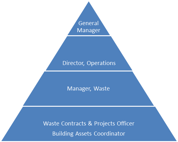
|
APPENDIX
No: 3 - Standard
Operating Procedure for Overt Surveillance
|
|
Item No: GB.7
|
REQUEST
FOR A COPY OF RECORDED MATERIAL FROM KU-RING-GAI COUNCIL SURVEILLANCE CAMERA
PROGRAM
1,
____________________________________ (print name), _______________________
(rank),
_____________________
(Police ID#)
Of
NSW Police, _________________________ (location/unit).
Request
a copy of images recorded by Ku-ring-gai Council’s CCTV cameras.
The
images I request relate to the following:
Time
and Date: ____________________________________
Location:
____________________________________
Incident/COPS
No: ____________________________________
I
require a copy of the images for the purpose of:
_____________________________________________________________________________
______________________________________________________________________________
______________________________________________________________________________
I
acknowledge that I will not make a copy of these images or disclose the images
to any other persons unless lawfully required to do so.
Signed
by recipient: ________________________ Date ______________________________
Witnessed
by Local Area Commander _____________________________________________
(Signature)


