|
|
Item No: GB.1 |
Ordinary Meeting of Council
TO BE HELD ON Tuesday, 28 October 2014 AT 7.00pm
Level 3 Council Chambers
Agenda
** ** ** ** ** **
NOTE: For Full Details, See Council’s Website –
www.kmc.nsw.gov.au under the link to business papers
DECLARATIONS OF INTEREST
Confirmation of Reports to be Considered in Closed Meeting
NOTE:
That in accordance with the provisions of Section 10 of the Local Government Act 1993, all officers’ reports be released to the press and public, with the exception of confidential attachments to the following General Business reports:
C.1 Audit and Risk Committee - Selection of Independent Members
GB.10 Lindfield Village Green - Selection of Preferred Tenderers T17/2014
Attachment A1: T17_2014 - Attachment A1 - Tender Evaluation Report
Attachment A2: KMC Tender Evaluation Plan - Lindfield Village Green Conceptual Design Services
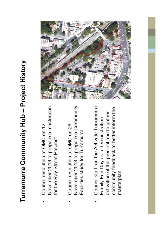
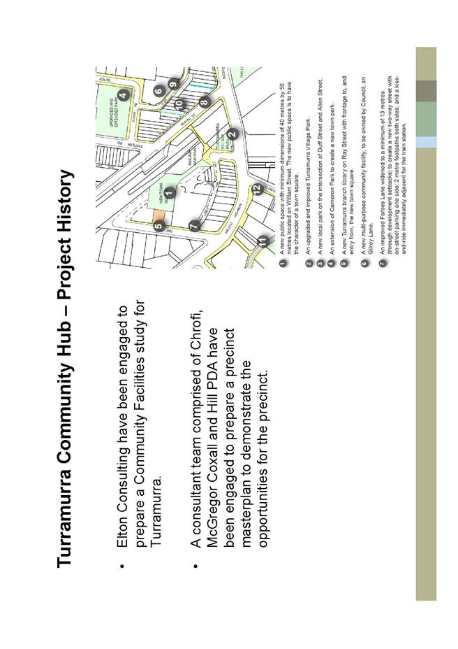
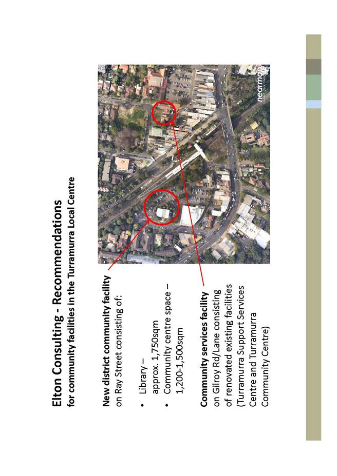
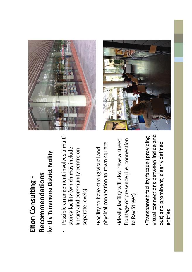
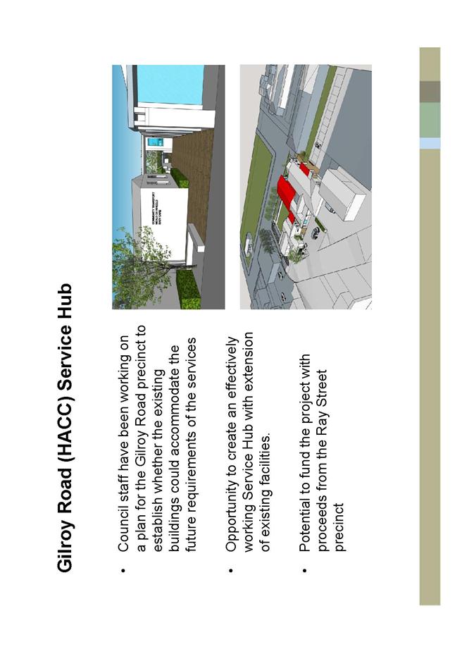
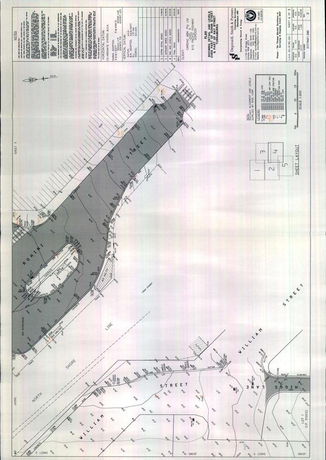
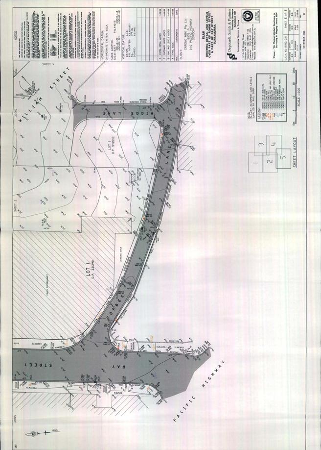
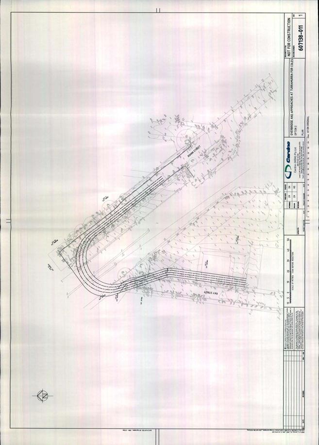
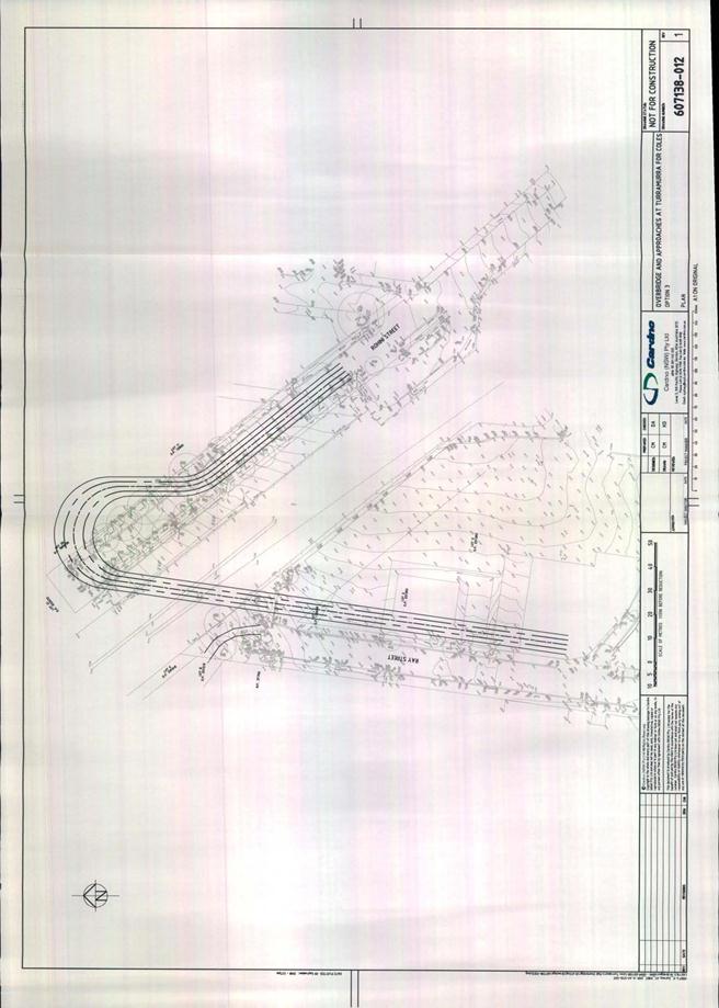
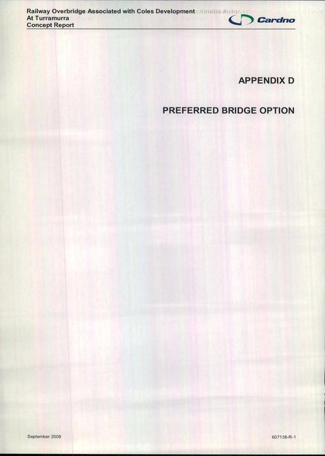
GB.11 Turramurra - Ray Street Precinct - draft master plan for public exhibition
Attachment A5: Councillor briefing - design options and economic feasibility
Attachment A7: Turramurra Community Hub - Preliminary Economic Feasibility - Draft Design Options - surplus funds
Address the Council
NOTE: Persons who address the Council should be aware that their address will be tape recorded.
Documents Circulated to Councillors
CONFIRMATION OF MINUTEs
Minutes of Ordinary Meeting of Council 10
File: S02131
Meeting held 7 October 2014
Minutes numbered 307 to 330
minutes from the Mayor
MM.1 Fresh Tracks Rehabilitation Program - H.A.R.T. Facility 98
File: S02119
In the last few weeks I have visited the H.A.R.T. Driving School at St Ives to review progress of the Fresh Tracks rehabilitation program for young adults with an acquired brain injury. This is a project that I was privileged to launch in April this year and one which the Council has a special interest in, given our relationship with the H.A.R.T. facility that sits on public land just off Mona Vale Road opposite the Showground.
Fresh Tracks is an initiative of the Fresh Tracks Foundation and brings together the medical profession, researchers, the Royal Rehab Hospital at Ryde, Honda Australia, Macquarie University, schools, businesses and the Council in the pursuit of helping young patients improve their physical health and psychological wellbeing.
There are some stark facts about acquired brain injury that you may not be aware of. Overwhelmingly those injured are male and of these, 50% are young people aged between 15 and 34. In other words, they are in the prime of their lives before their accident.
Across Australia there are 80,000 people with a severe brain injury aged between 15-34 years. It is estimated there are 496 people with a profound or severe head injury living in the Ku-ring-gai, Warringah and Pittwater Council areas, so clearly the need for this program extends to northern Sydney and the northern beaches.
When a brain injury occurs most people will not receive an insurance payout. Often the financial burden falls on the family to pay for specialised treatment needed for their rehabilitation. Many families simply don’t have the capacity to provide the number of physiotherapy, occupational therapy and speech therapy sessions needed each week to maximise recovery. This can mean a young person’s opportunity for improvement is limited and in too many cases may even regress.
What is unique about the Fresh Tracks program is that it helps with physical rehabilitation but also improves mood and self-esteem – so important and sometimes overlooked when people are trying to recover. The program revolves around recumbent cycles, where the patients lie prone and use either their hands, feet or a combination of both to steer and move. The program’s location at the H.A.R.T. driving school has been ideal, as it has the space for patients to be able navigate and use the cycles without worrying about traffic or pedestrians.
At the facility patients are first assessed by Royal Rehab as to their capacity to ride the different tracks and if they require a carer to be present. Once assessed they are then free to use the facilities, supervised and assisted by physiotherapy students from Macquarie University.
Two weeks ago I visited Royal Rehab to inspect their new purpose-built facilities and to meet some of the patients there who may eventually benefit from the Fresh Tracks program. I also met the dedicated medical professionals who assist with the lengthy rehabilitation required after significant brain injuries.
I understand from the CEO of the Fresh Tracks Foundation that another charitable organisation – The Primary Club of Australia – has pledged funding for four extra cycles and Community Care Northern Beaches is also providing funds to purchase one more. By offering their support both organisations are underlining the importance of physical activity to aid recovery.
Ultimately the goal of the Fresh Tracks Foundation is to create a ‘community hub’ where patients, their families and friends can come together in a safe, caring and non-judgemental environment. Such a hub could also include other skills development leading to employment for some.
For our part Ku-ring-gai Council will continue to support this very worthwhile program. As an organisation we also need to actively seek ways we can improve access and equity for the disabled – in our buildings, in our shopping centres and in other community events and facilities. I know that our staff are working on policies that will reinforce this aim and I look forward to seeing the outcomes.
Petitions
PT.1 Petition to Oppose the Rezoning and Reclassification from Community Land to Operational (Residential) Land - (Eighty-six [86] Signatures) 100
File: S10300
"We, the undersigned, are concerned citizens who urge our leaders to remove the proposal to re-zone the community land at 136A Junction Lane, Wahroonga (south end of Morris Avenue known as Lot 3 DP 547626 and Lot A 410082). We wish to preserve public access through this site to maintain public amenity and community connectivity.
Community land at 136A Junction Lane (south end of Morris Avenue) Wahroonga has been used as a right-of-way, driveway to adjacent properties on Junction Lane and a pedestrian/cycle access way . Residential re-zoning will restrict pedestrian/cycle access to and from Junction Lane and Morris Avenue to East Wahroonga shops (Hampden Avenue), recreational facilities (Eldinhope Green [Morris Avenue] and Jubilee Oval [Westbrook Avenue]) and transport connections (bus stops on Westbrook Avenue).”
GENERAL BUSINESS
i. The Mayor to invite Councillors to nominate any item(s) on the Agenda that they wish to have a site inspection.
ii. The Mayor to invite Councillors to nominate any item(s) on the Agenda that they wish to adopt in accordance with the officer’s recommendation allowing for minor changes without debate.
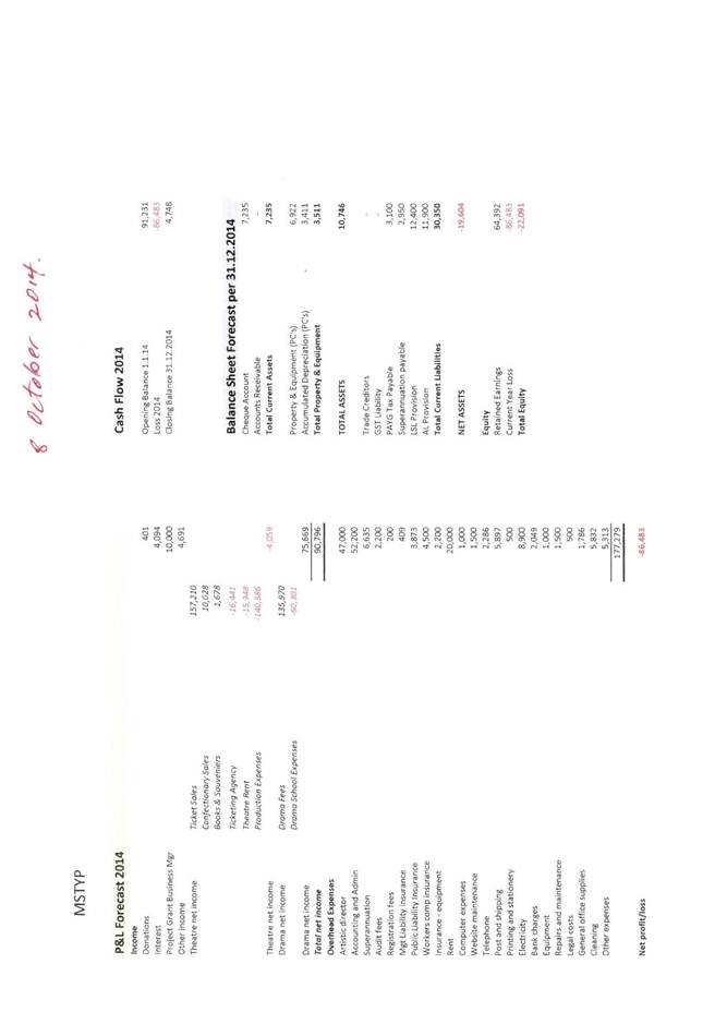
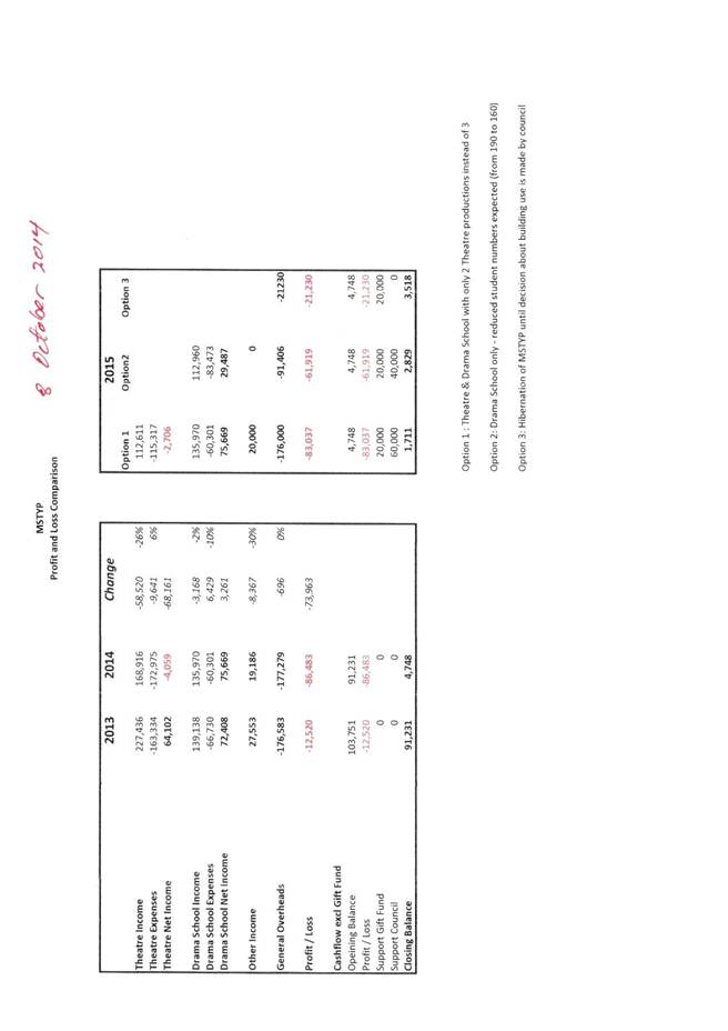
GB.1 Marian Street Theatre for Young People - Request for Financial Assistance 101
File: S10095
To advise Councillors of a request from the Marian Street Theatre for Young People (MSTYP) for financial assistance to support their operations throughout 2015.
Recommendation:
That Council provide $60,000 to the MSTYP to support the continuation of its operations throughout 2015.
GB.2 Marian Street Theatre - Theatre Consultant's Management Report 111
File: S10095
To provide Council with a specialist theatre consultant’s report for the management of the Marian Street Theatre (MST) in Killara.
Recommendation:
That Council receive and note the consultant’s Management Report for the Marian Street Theatre (MST), and that Council engage an independent consultant to determine community priorities for a theatre in Ku-ring-gai.
GB.3 Access and Disability Inclusion Plan 2014 - 2018 121
File: CY00457/2
To present to Council the draft Ku-ring-gai Access and Disability Inclusion Plan 2014 – 2018, for consideration and public exhibition.
Recommendation:
That the Access and Disability Inclusion Plan 2014-2018 be placed on public exhibition for a period of 28 days, then reported back to Council.
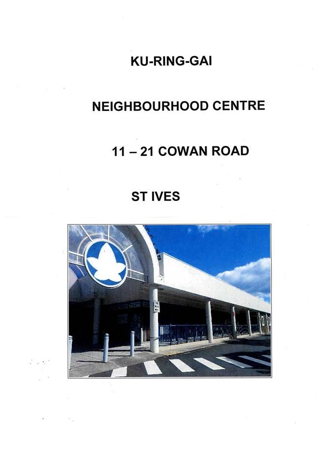
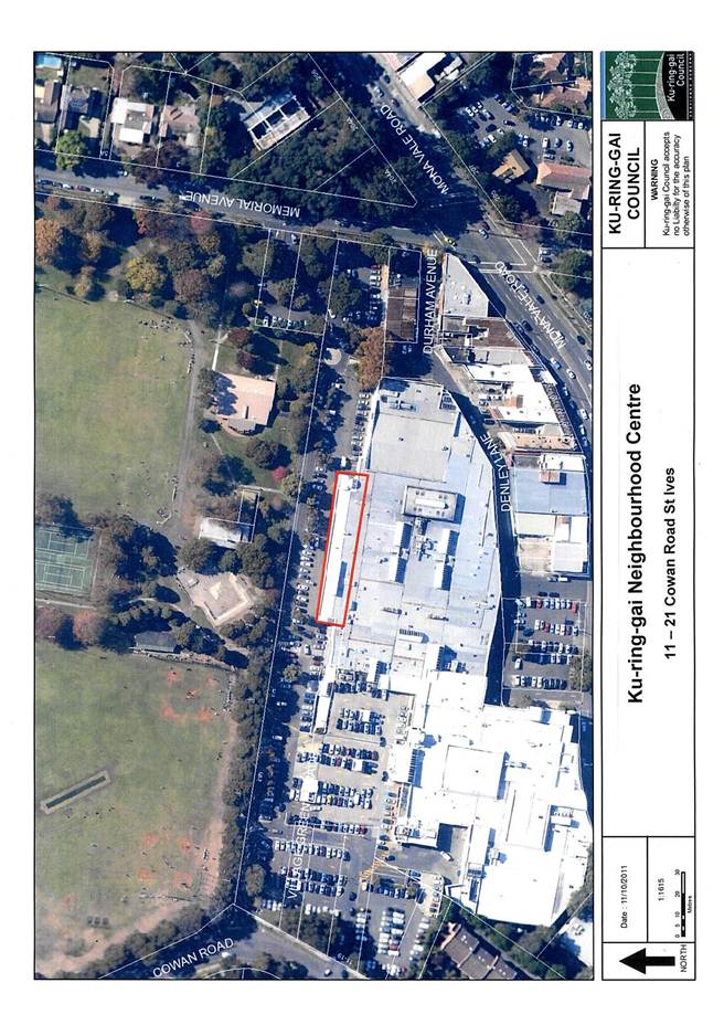
GB.4 Ku-ring-gai Neighbourhood Centre - Lease Renewal of Premises 11-21 Cowan Road St Ives 174
File: S07511
For Council to consider granting a five (5) year lease agreement to Ku-ring-gai Neighbourhood Centre Inc (KNC) for premises located at 11-21 Cowan Road St Ives.
Recommendation:
That Council grant a new lease to Ku-ring-gai Neighbourhood Centre Inc for a period of 5 years.
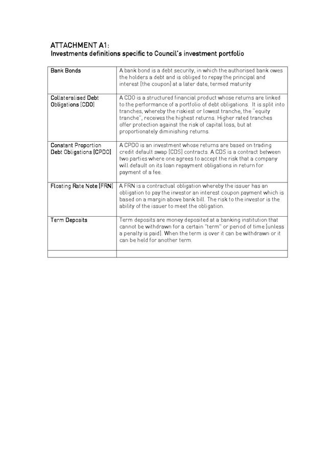
GB.5 Investment Report as at 30 September 2014 181
File: S05273
To present Council’s investment portfolio performance for September 2014.
Recommendation:
That the summary of investments performance for September 2014 be received and noted; and that the Certificate of the Responsible Accounting Officer be noted and report adopted.
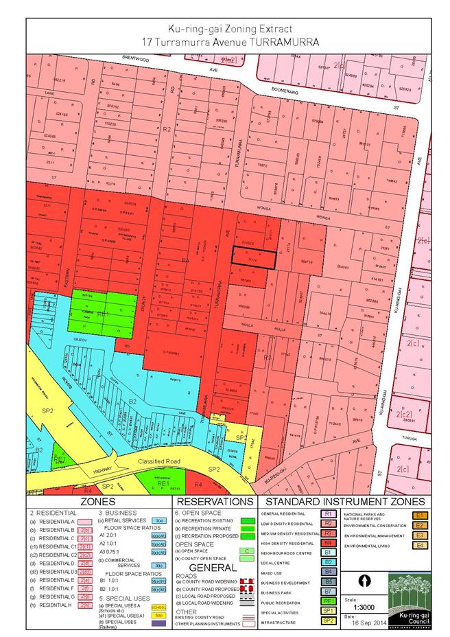
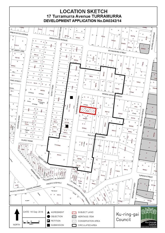
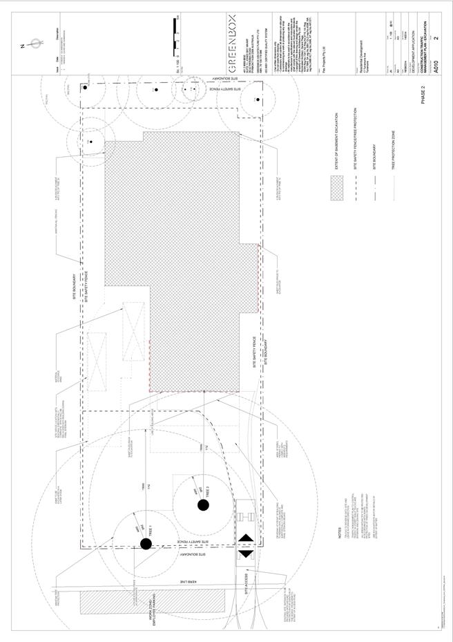
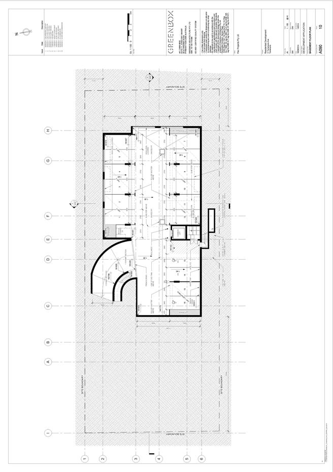
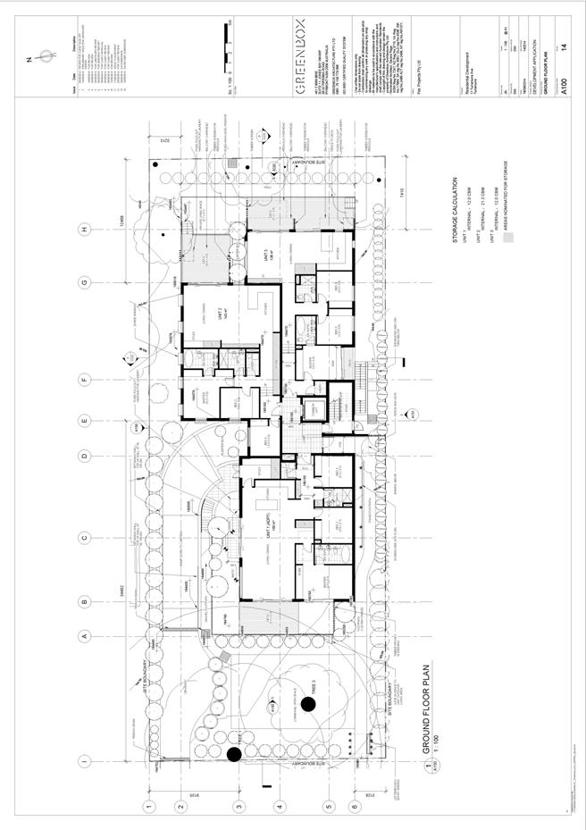
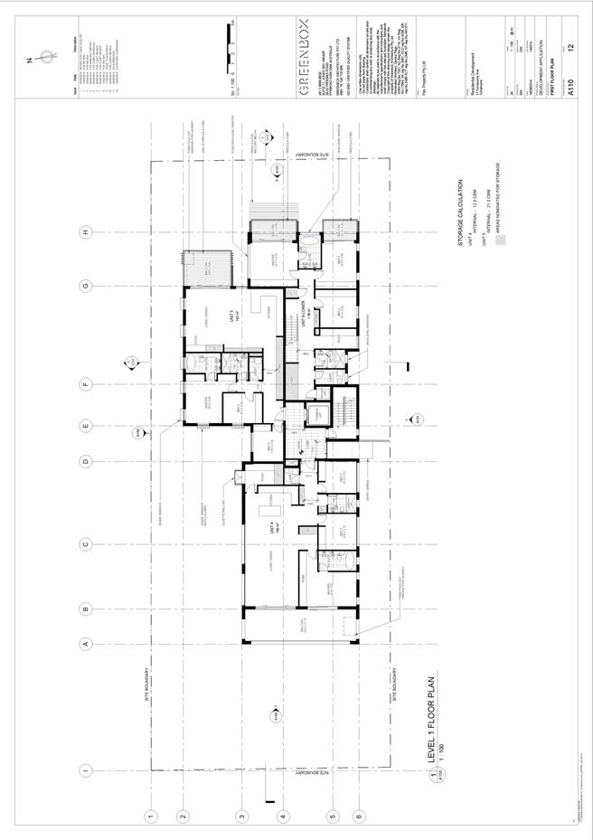
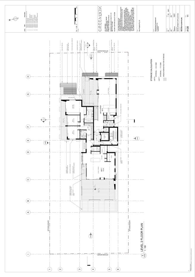
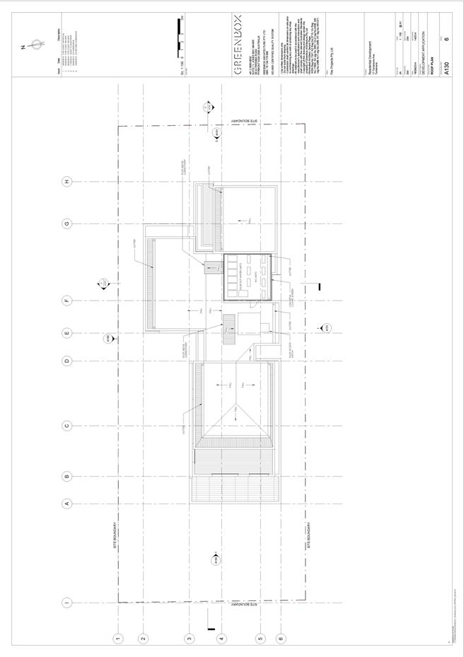
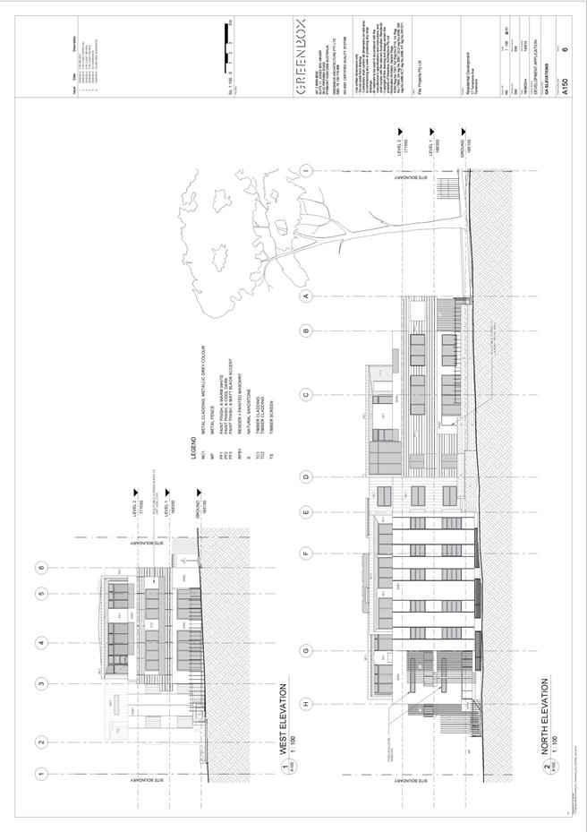
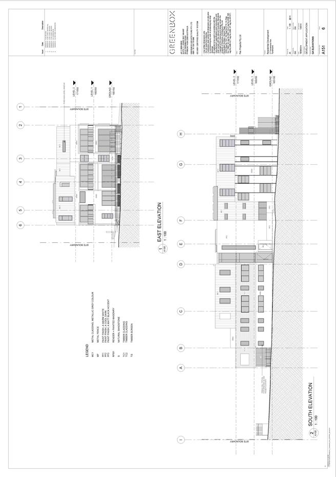
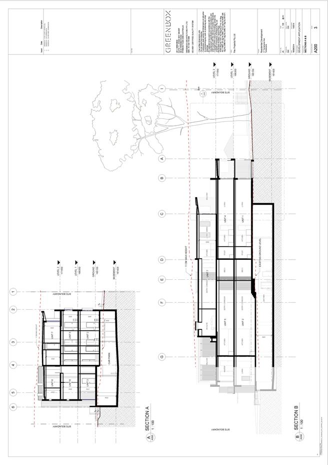
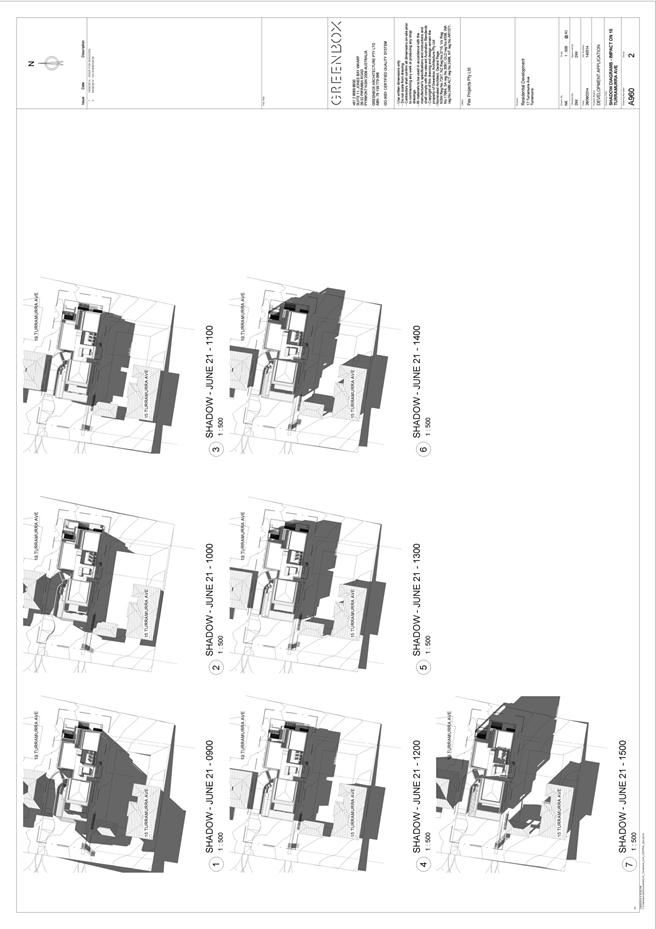
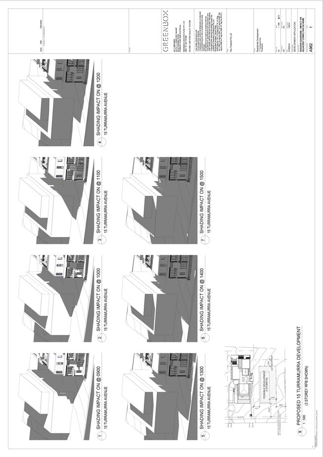
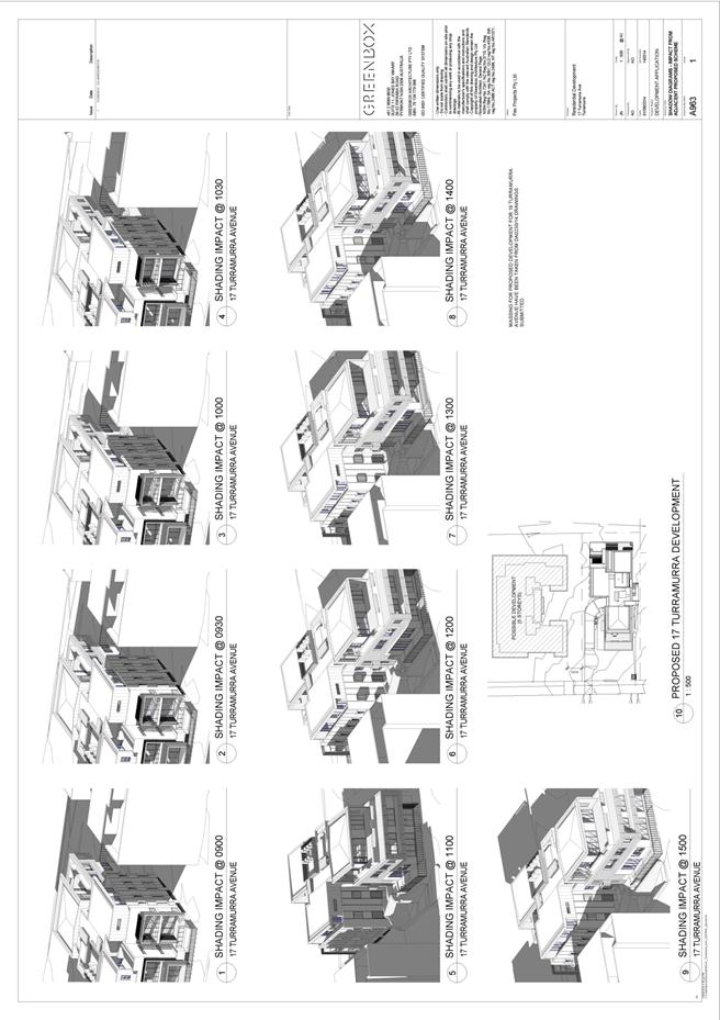
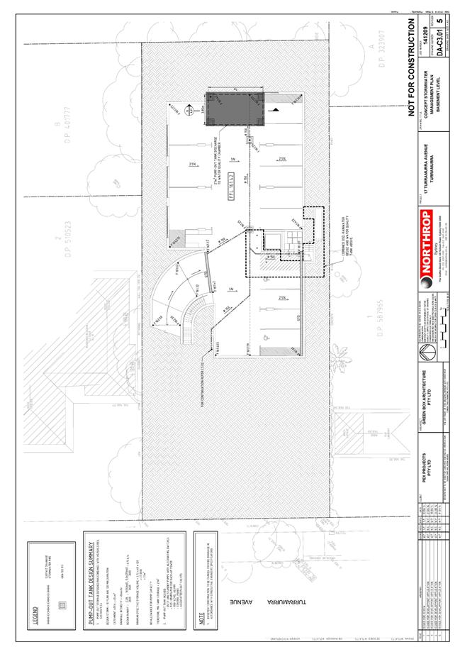
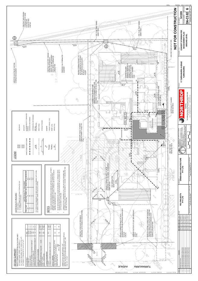
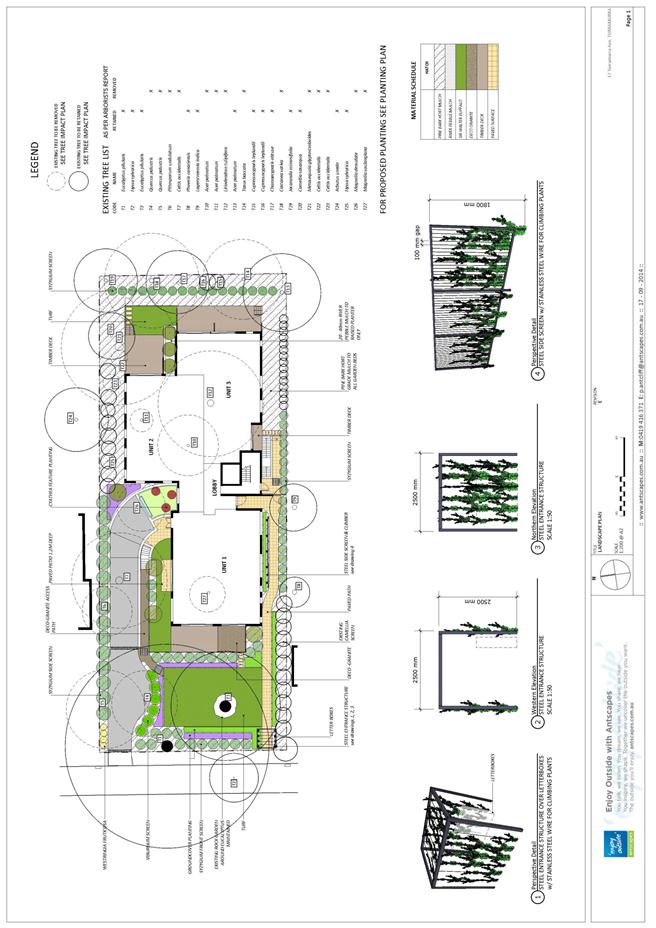
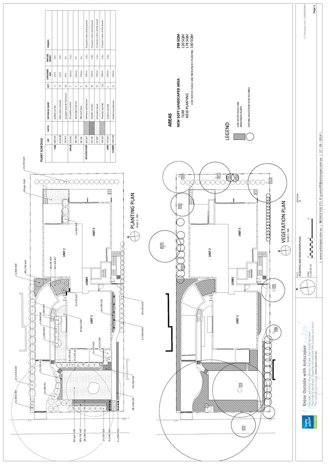
GB.6 17 Turramurra Avenue, Turramurra - demolition of an existing dwelling and construction of a three storey residential flat building containing seven units 190
File: DA0242/14
Ward: Comenara
Applicant: Pex Projects Pty Ltd
Owner: Pex Projects
Demolition of existing an dwelling and construction of a three storey residential flat building containing seven units.
Recommendation:
Deferred commencement consent.
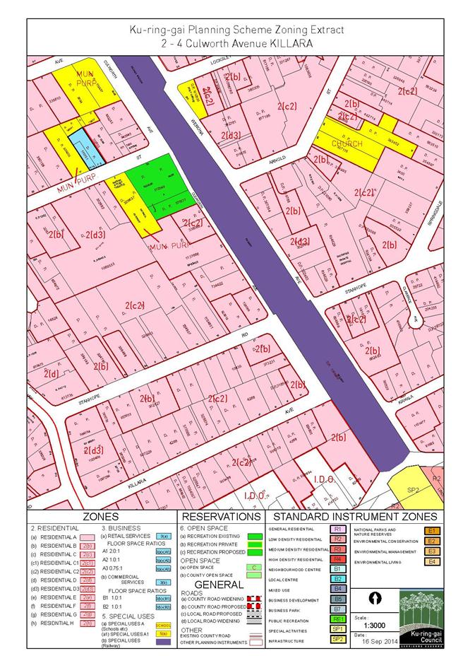
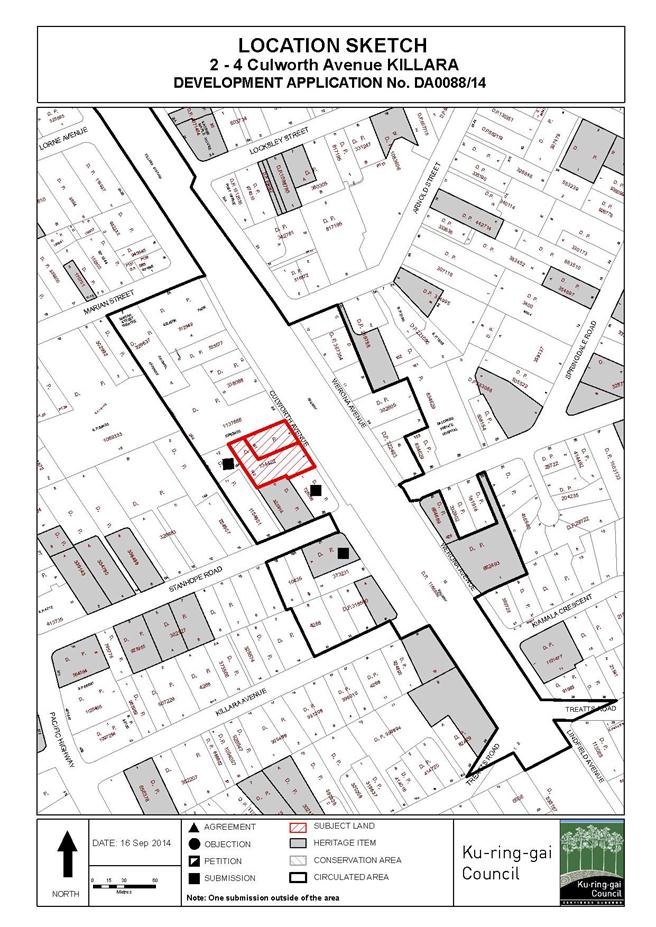
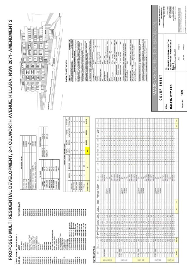
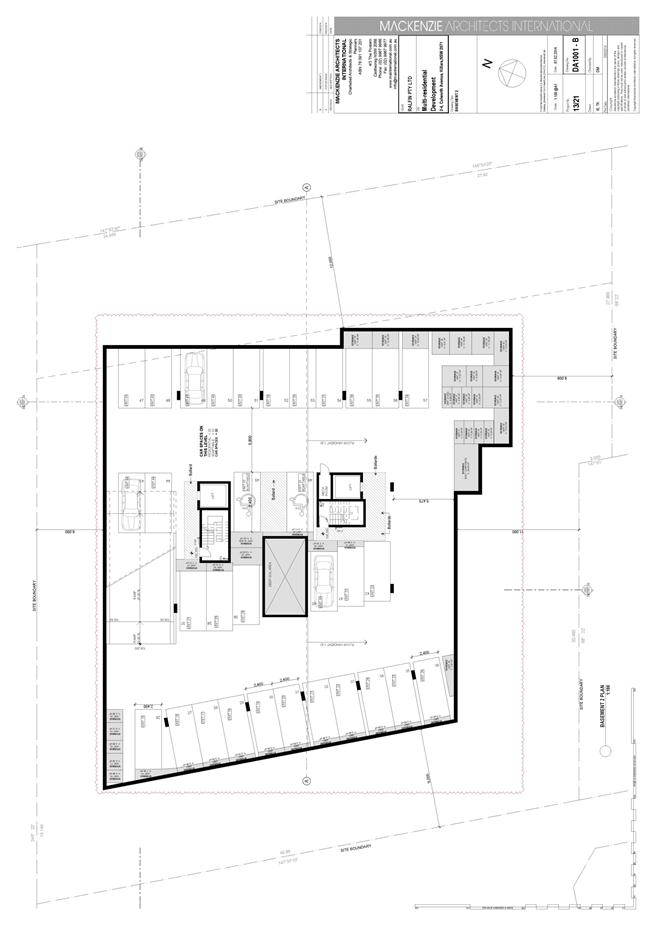
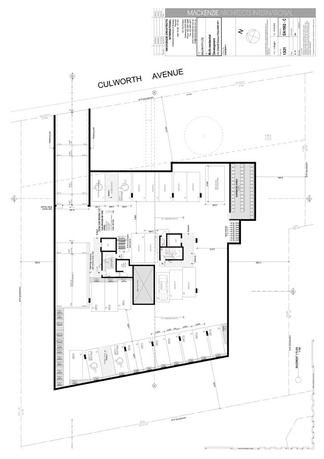
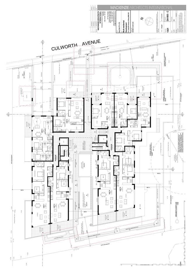
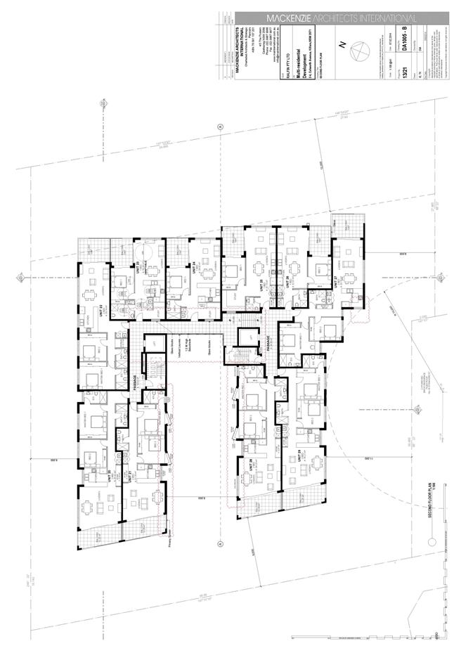
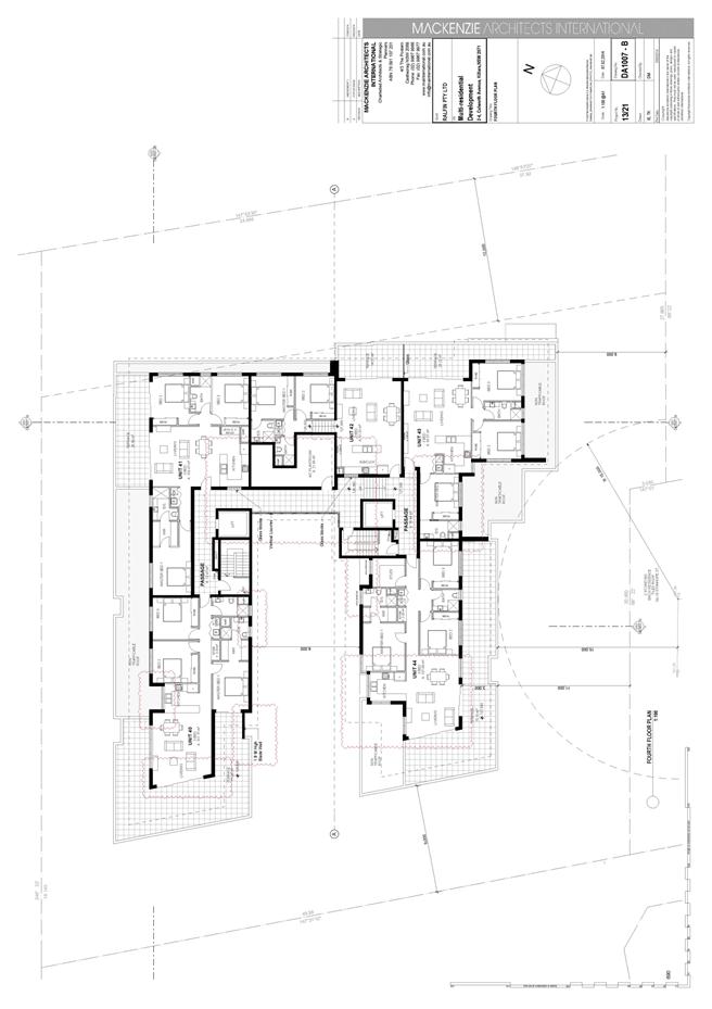
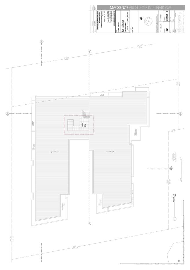
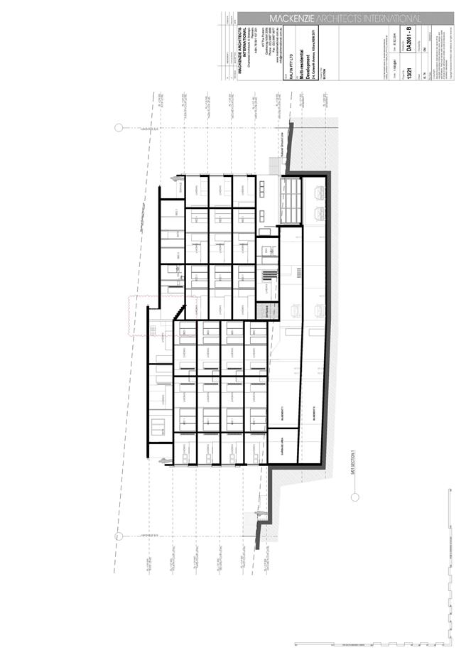
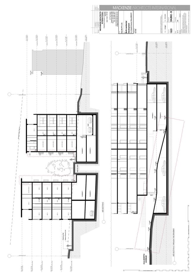
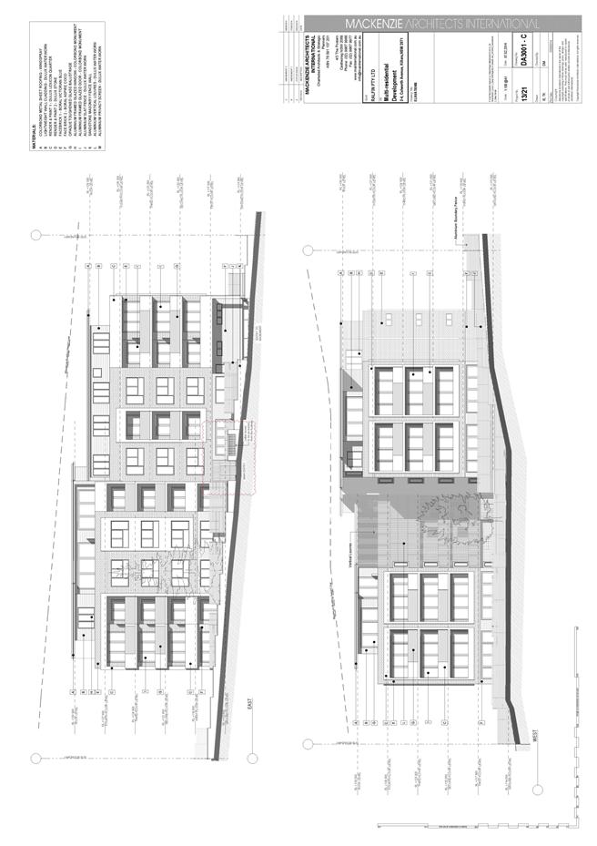
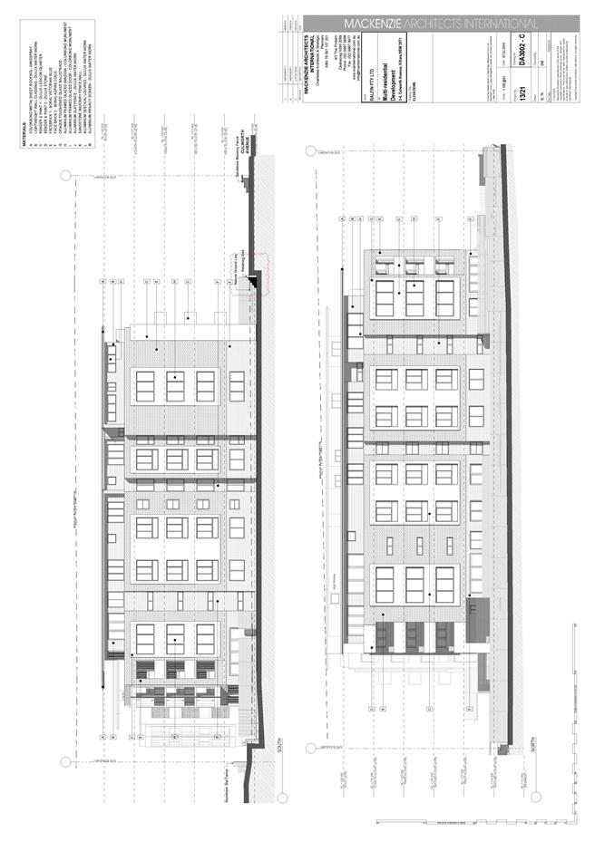
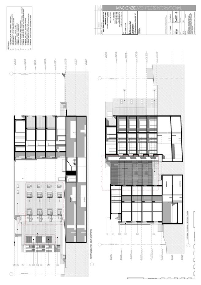
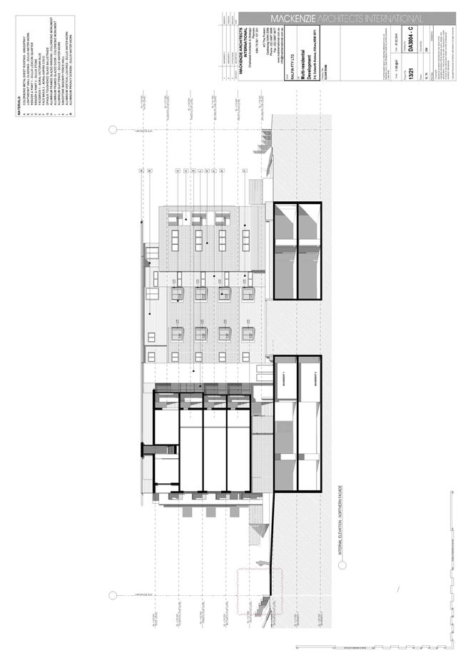
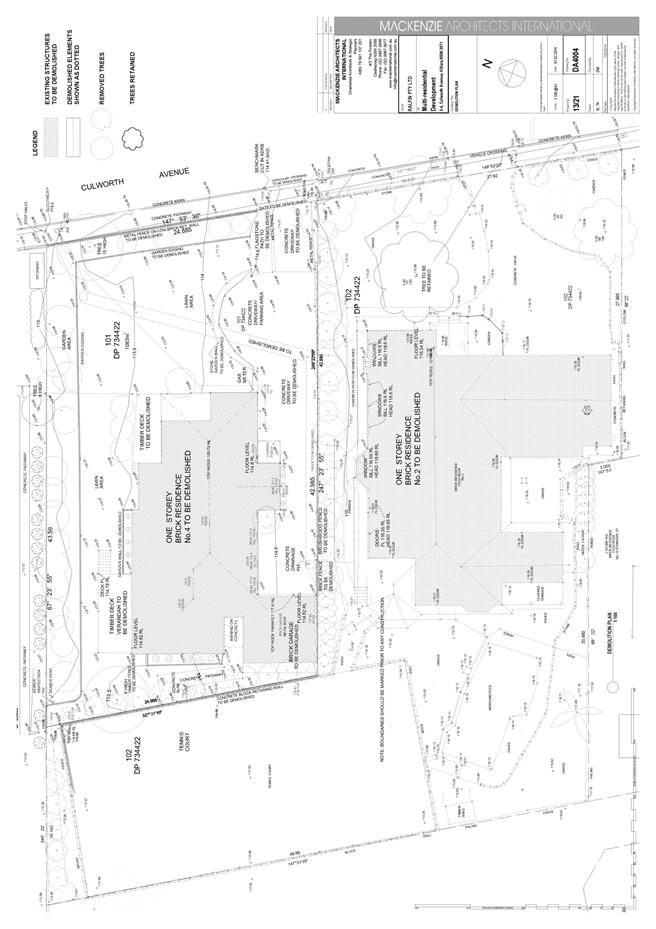
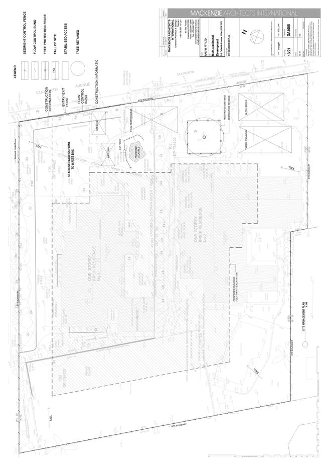
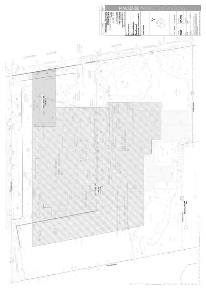
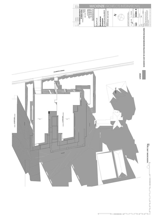
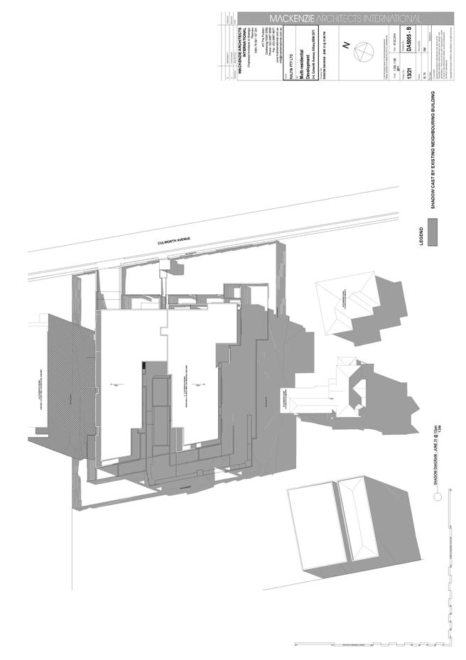
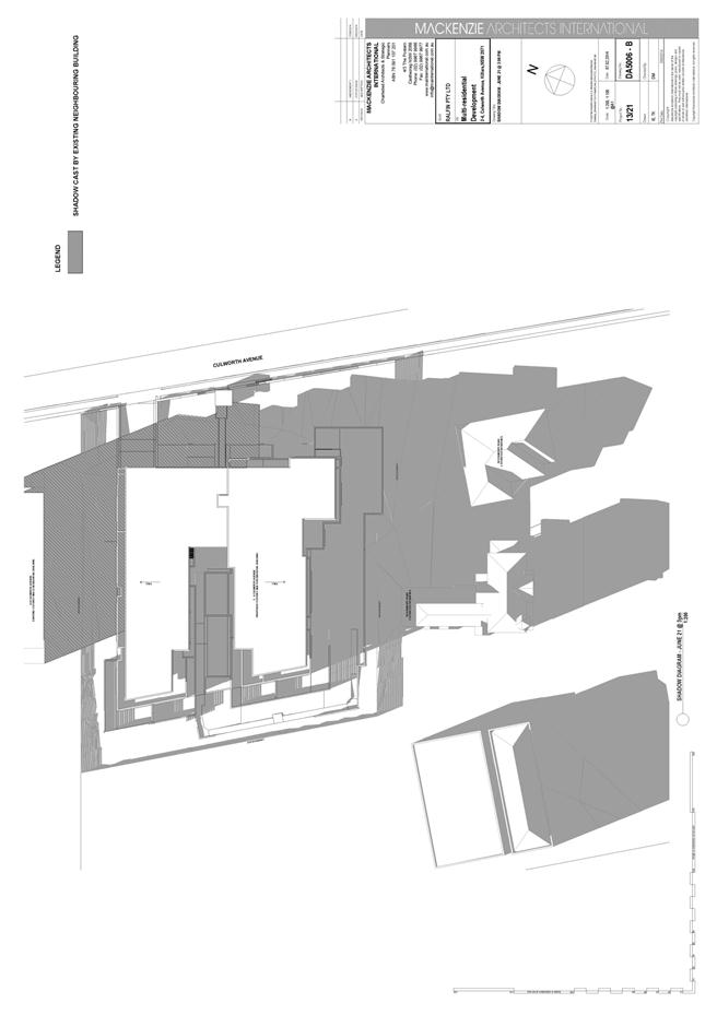
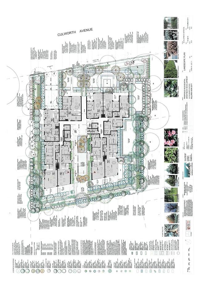
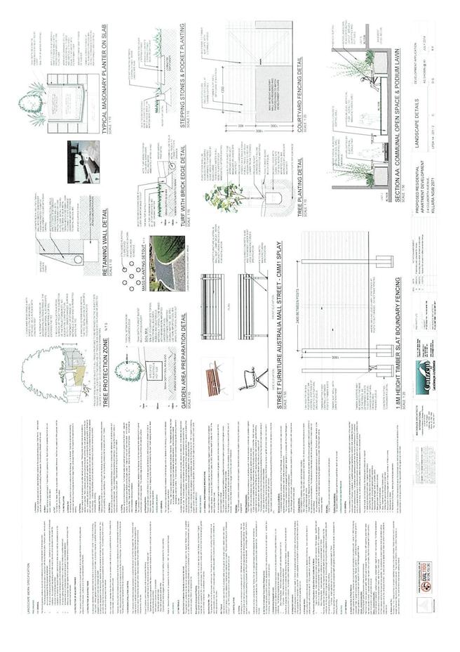
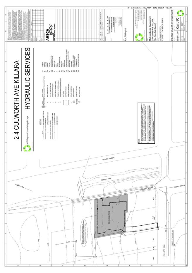
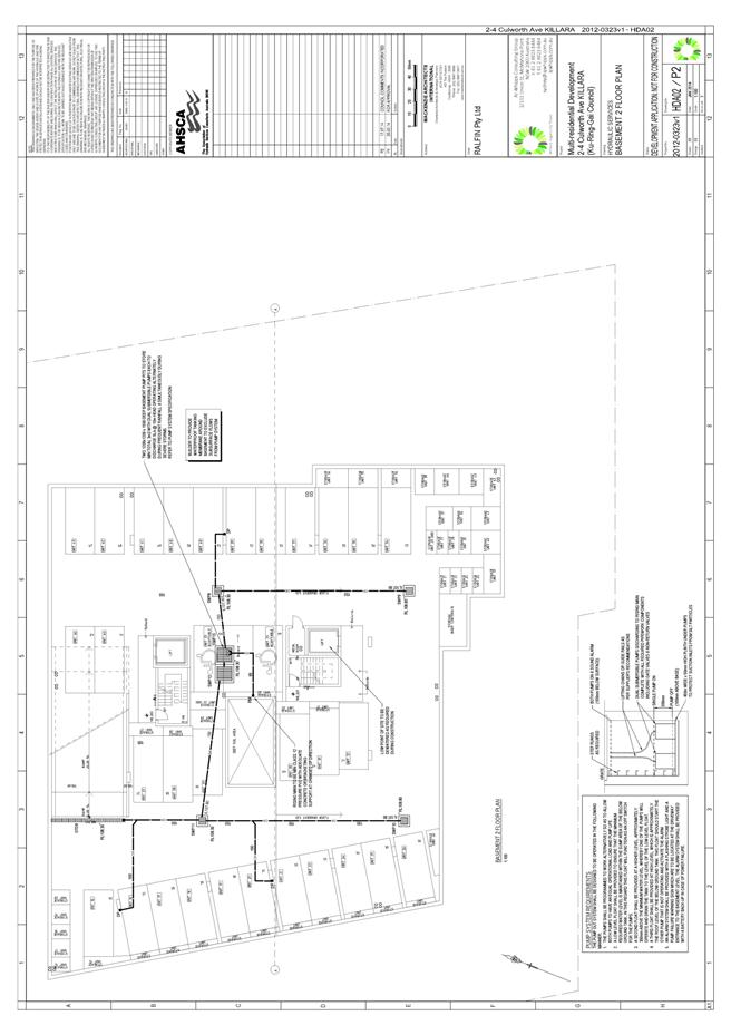
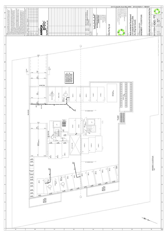
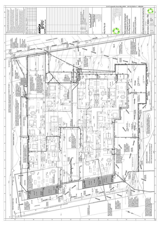
GB.7 2 - 4 Culworth Avenue, Killara - Demolition of existing structures and construction of a five storey residential flat building containing 44 units, basement car parking and associated site works 287
File: DA0088/14
Ward: Gordon
Applicant: Mackenzie Architects International
Owner: MH Bachmayer
Demolition of existing structures and construction of a five storey residential flat building containing 44 units, basement car parking and associated site works.
Recommendation:
Approval.
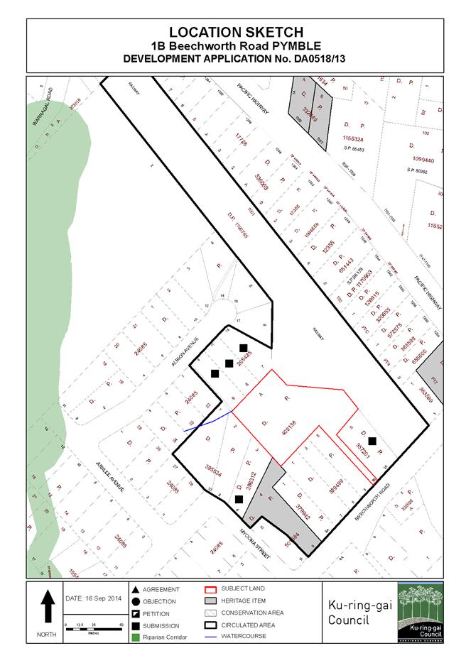
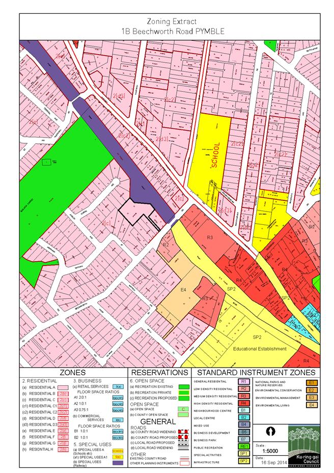
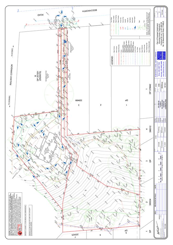
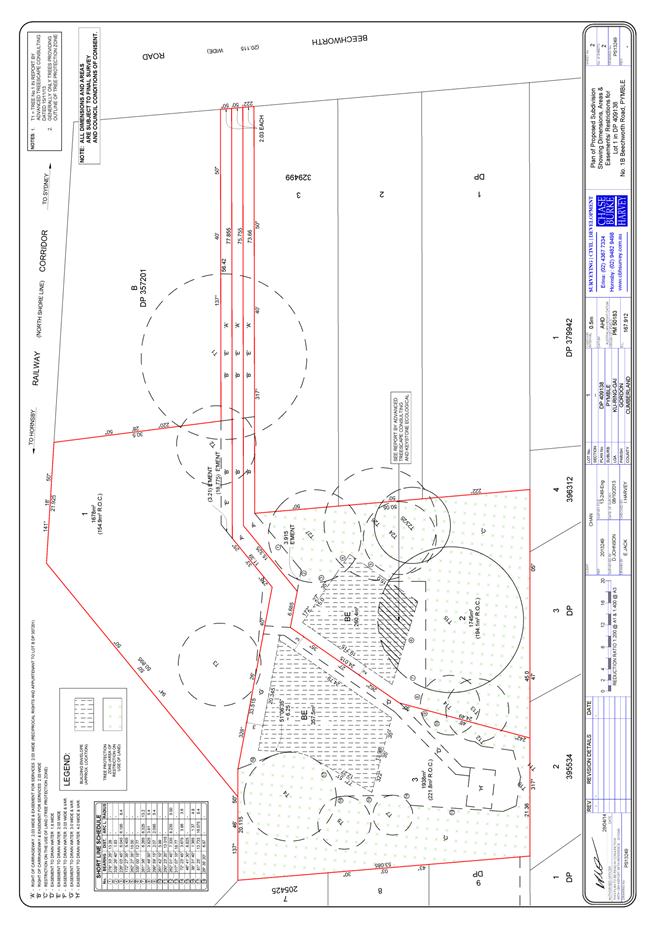
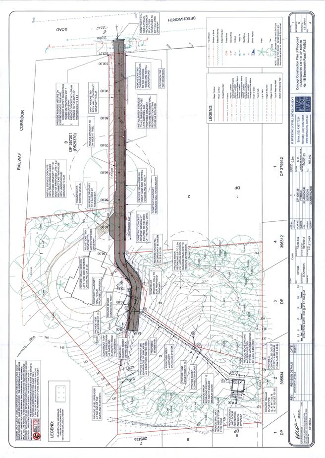
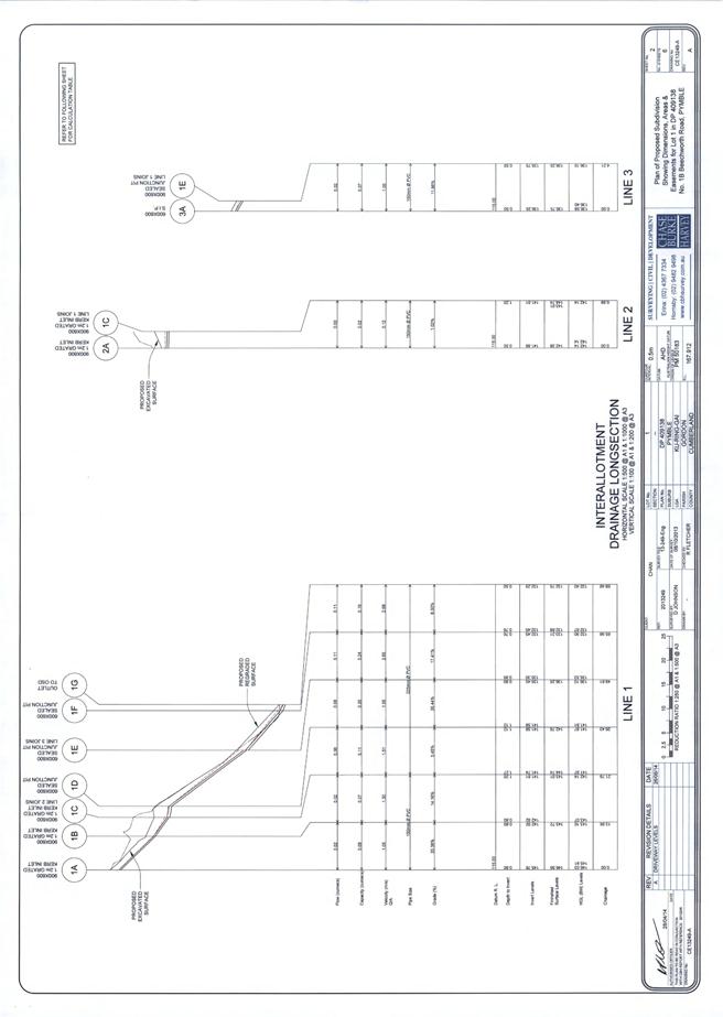
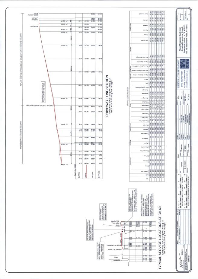
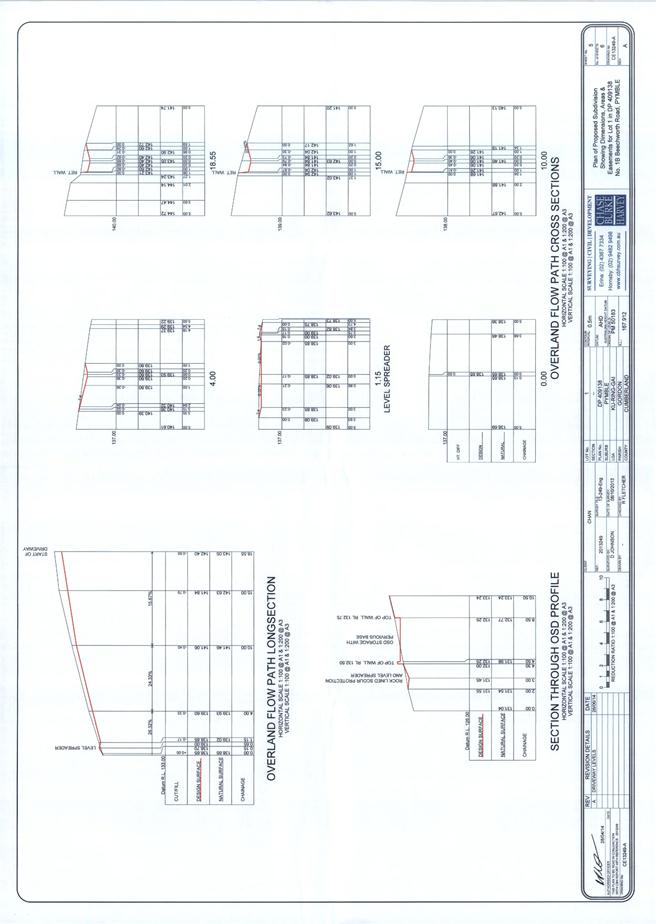
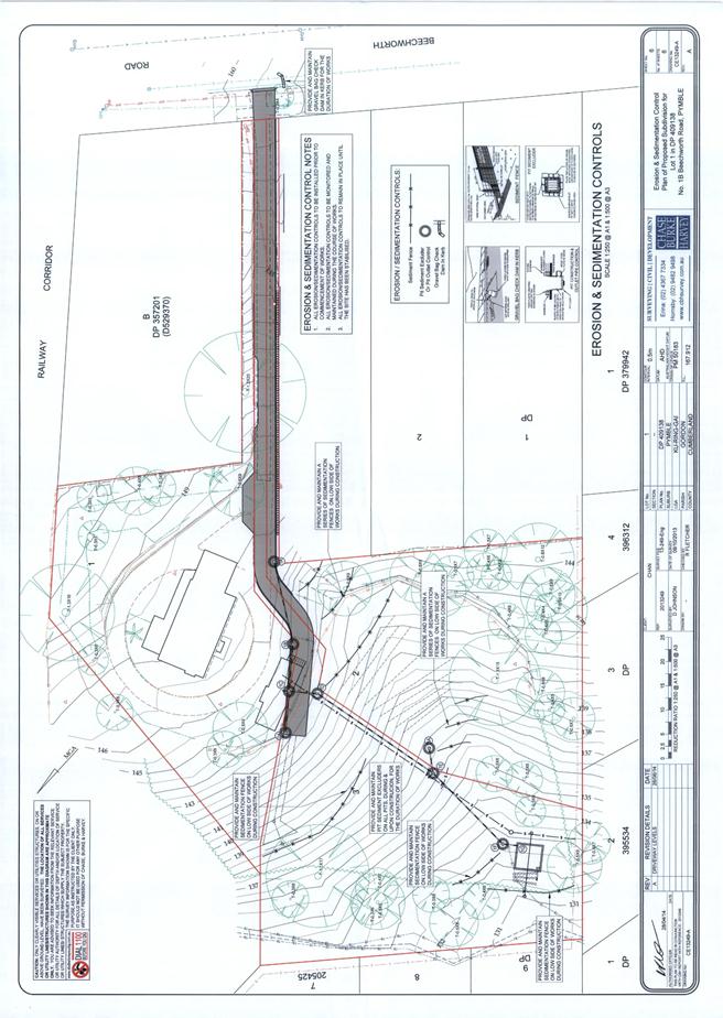
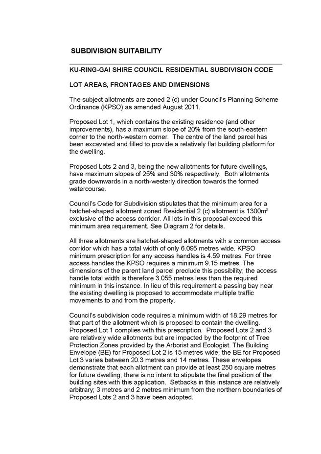
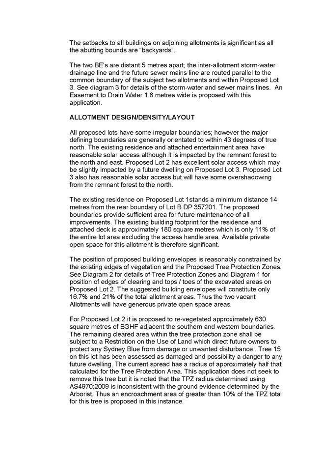
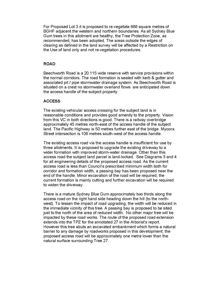
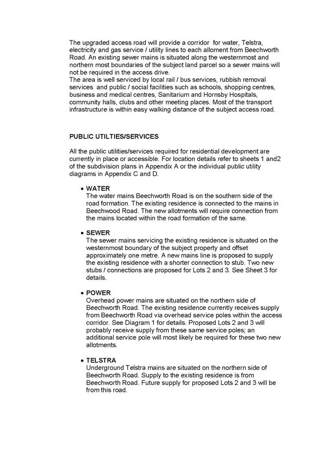
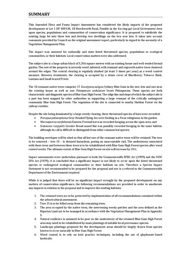
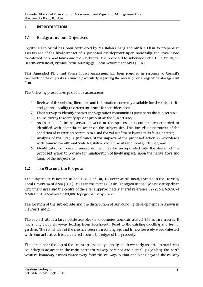
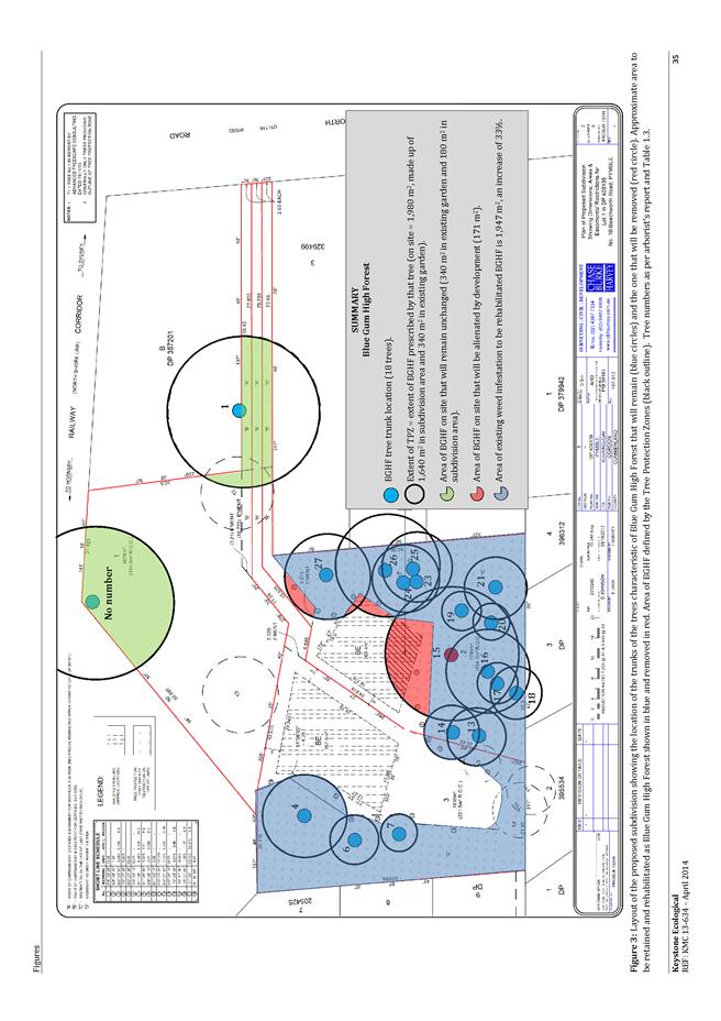
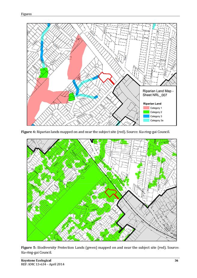
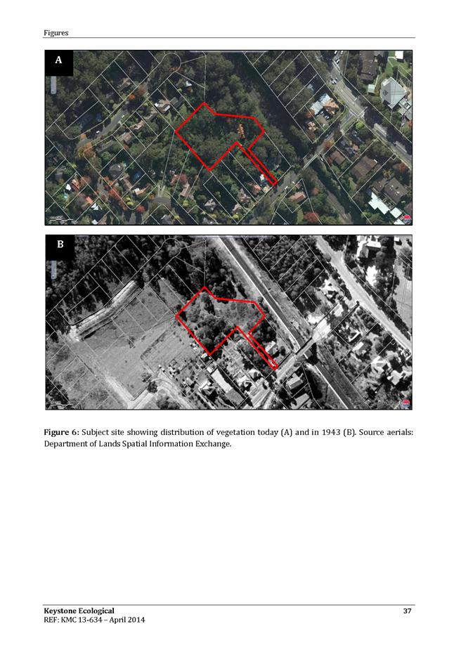
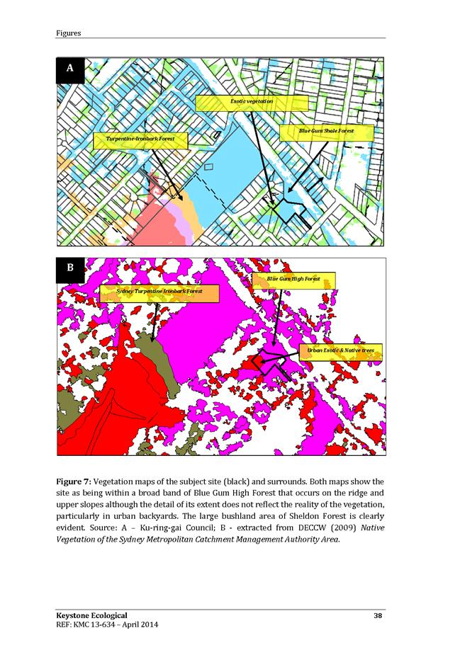
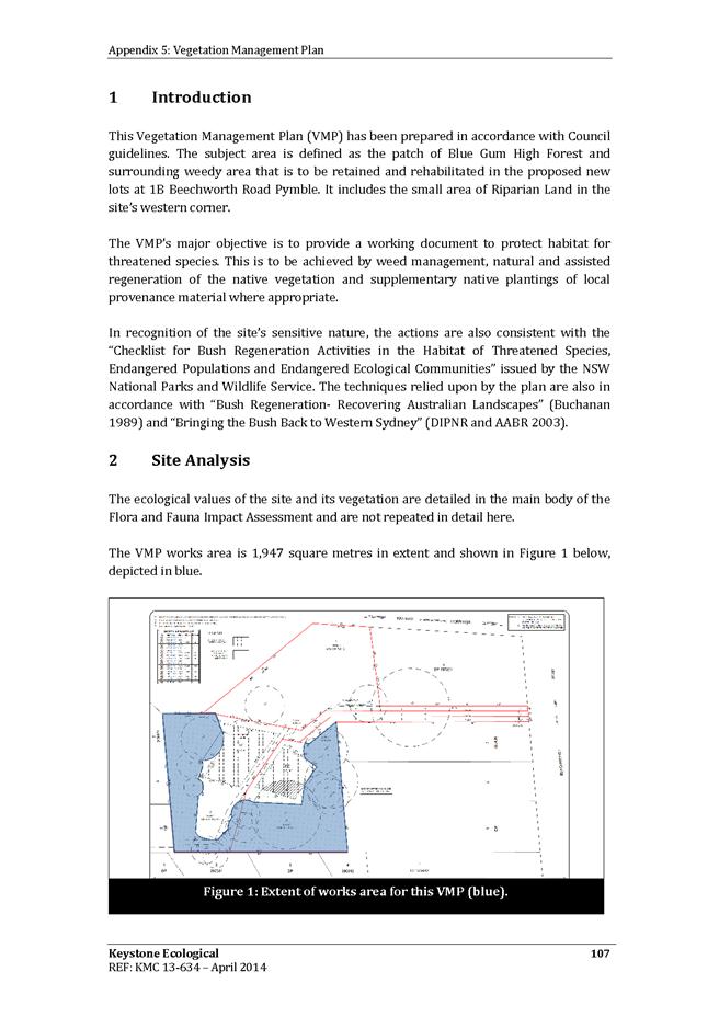
GB.8 1B Beechworth Road, Pymble - Supplementary Report 385
File: DA0518/13
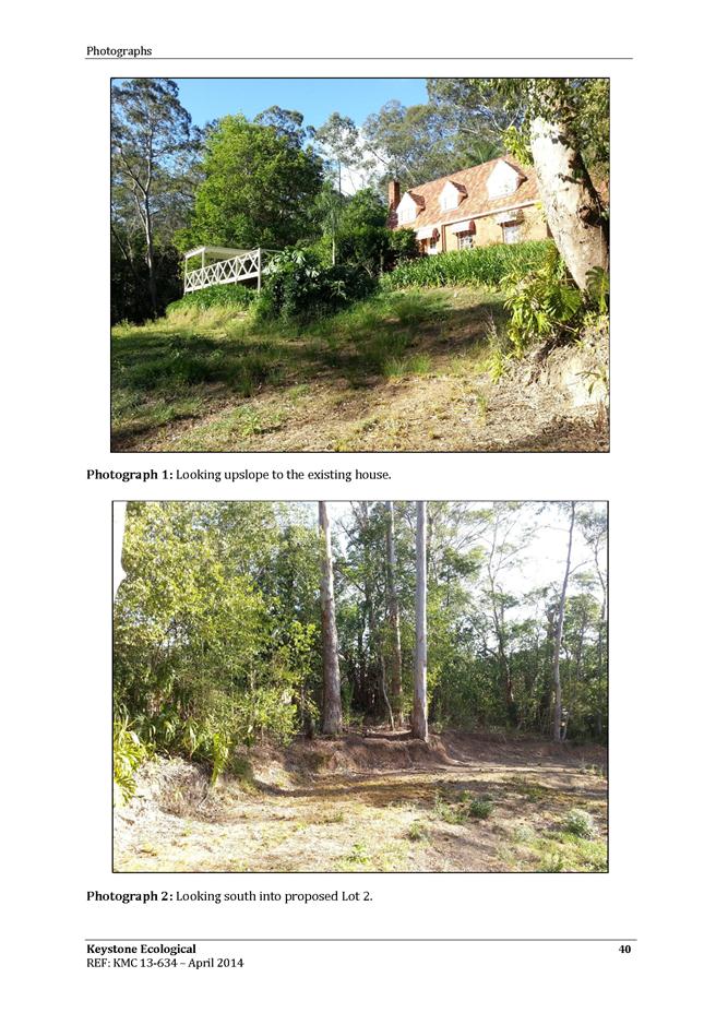
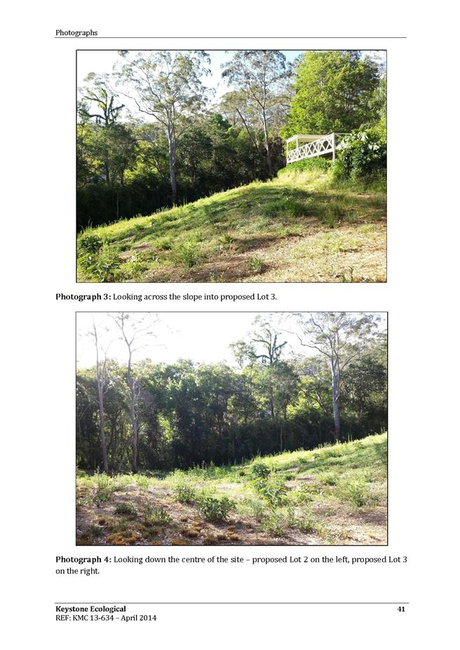
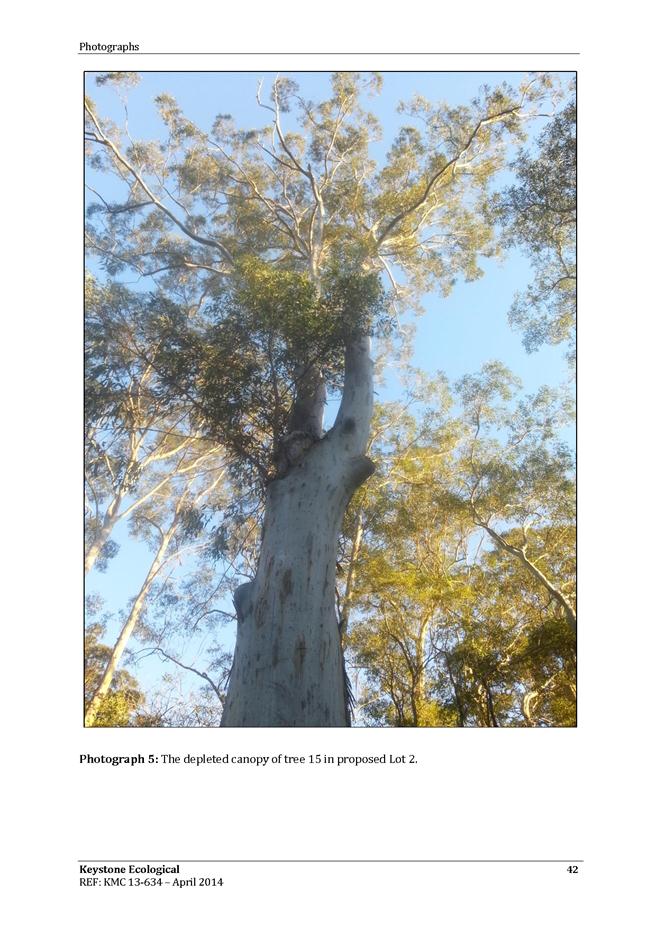
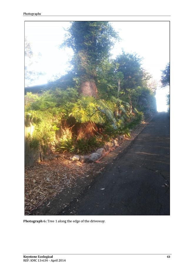
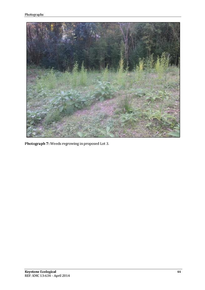
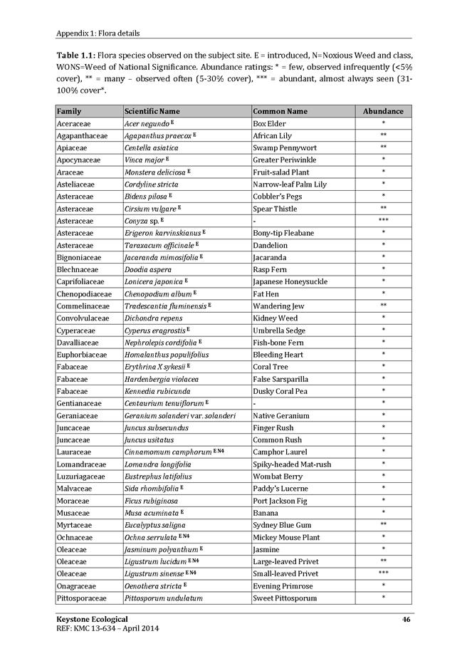
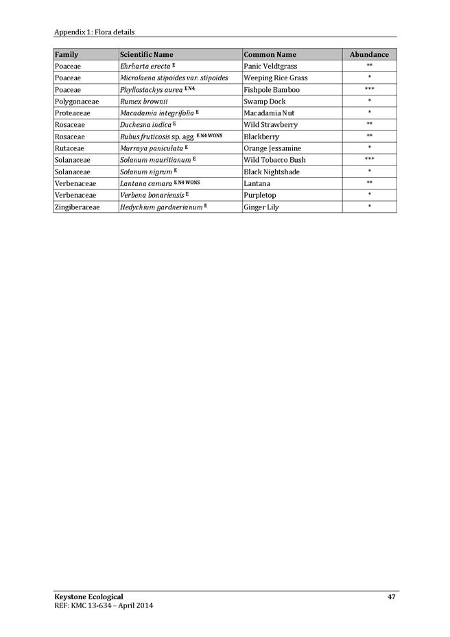
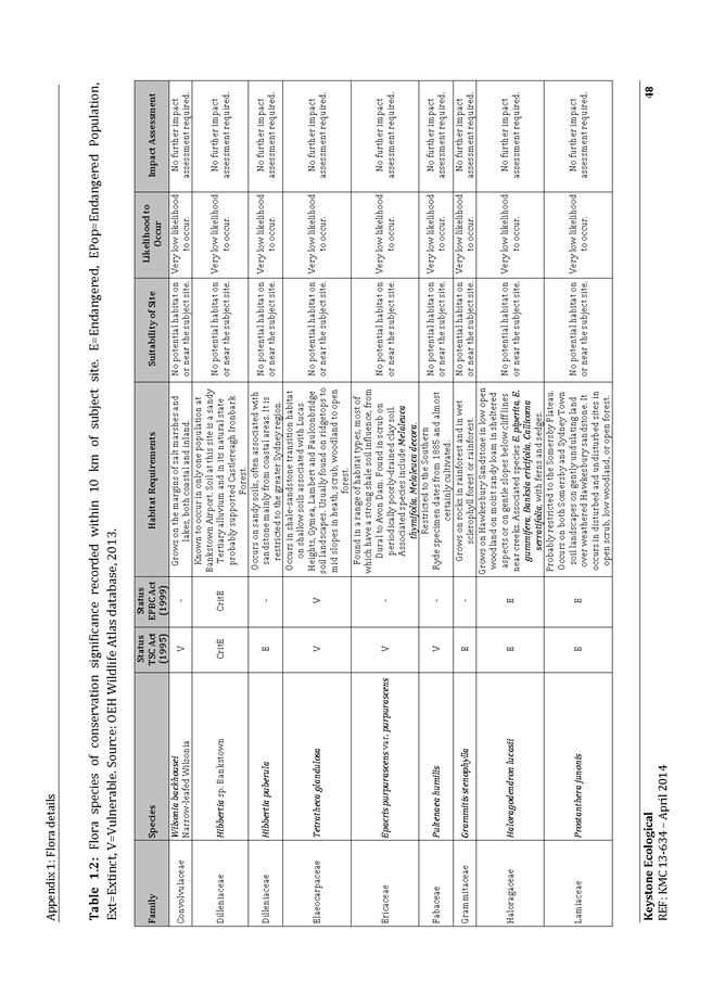
To determine development application DA0518/13 for subdivision of one lot into three lots, upgrade access road, stormwater drainage and ecological regeneration works at 1B Beechworth Road, Pymble.
Recommendation:
That the application be approved.
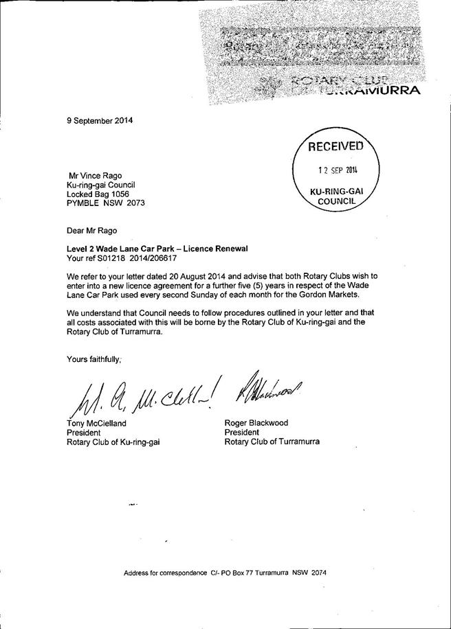
GB.9 Renewal of Licence to Rotary Clubs of Turramurra and Ku-ring-gai to conduct Markets in Wade Lane Car Park Gordon 601
File: S02618
To seek Council approval for the renewal of licence for the continued use of the mid-level of the Wade Lane Car Park to Rotary Club of Turramurra Incorporated and Rotary Club of Ku-ring-gai Incorporated
Recommendation:
That Council grant the renewal of a five (5) year licence to the Turramurra Rotary Club Incorporated and the Ku-ring-gai Rotary Club Incorporated
GB.10 Lindfield Village Green - Selection of Preferred Tenderers T17/2014 607
File: S10291
To consider the tenders received for the Lindfield Village Green Request for Tender (RFT) no.T17/2014 for provision of design consultancy services, and appoint a short-list of three (3) preferred tenderers to develop concept designs for public exhibition.
Recommendation:
In accordance with Section 55 of the Local Government Act and Tender Regulations, it is recommended Council accept the tenders submitted by tenderers ‘A’, ‘E’ and ‘I”, as identified in the Confidential Attachment A1 - Tender Evaluation Report.
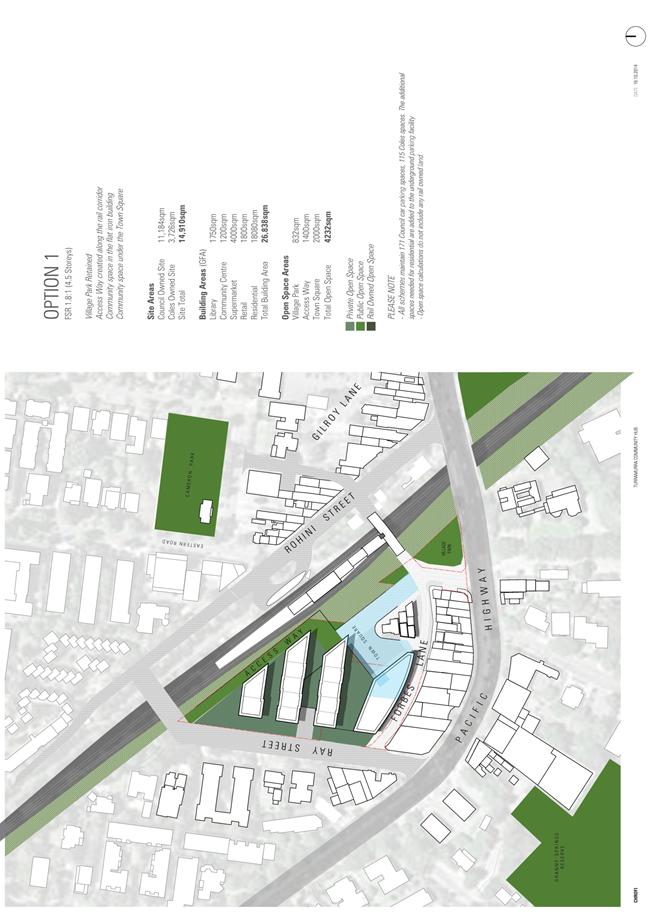
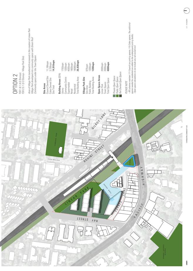
GB.11 Turramurra - Ray Street Precinct - draft master plan for public exhibition 615
File: S09969
To present to Council an assessment of design options and a preferred option for the Turramurra Community Hub for public exhibition.
Recommendation:
That Council proceed to public exhibition with a draft master plan and other material as described in this report.
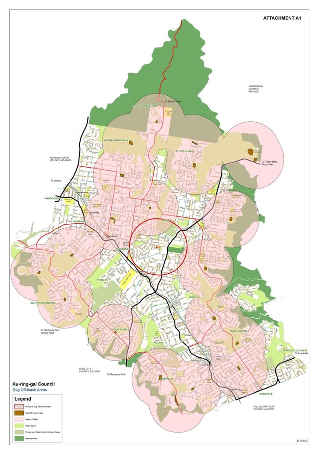
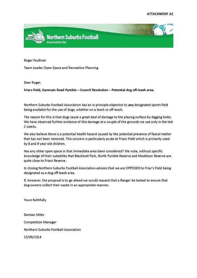
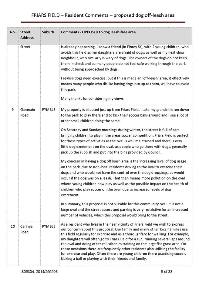
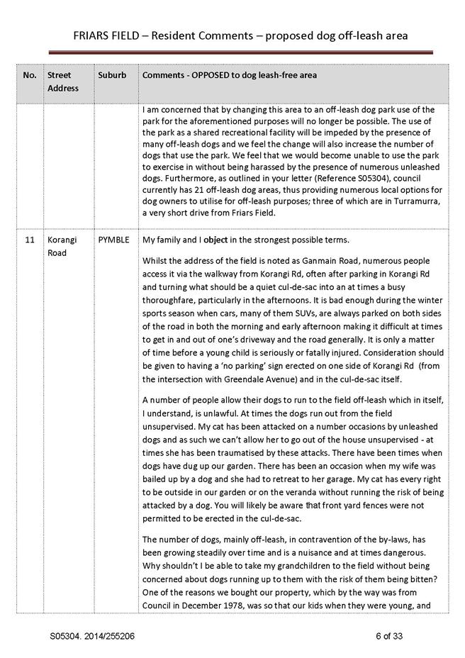
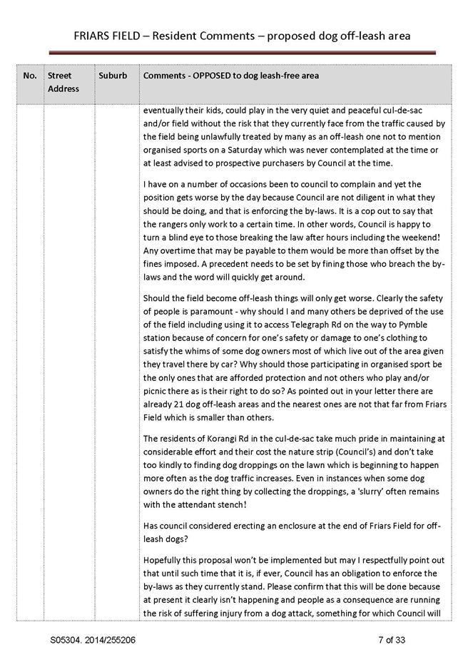
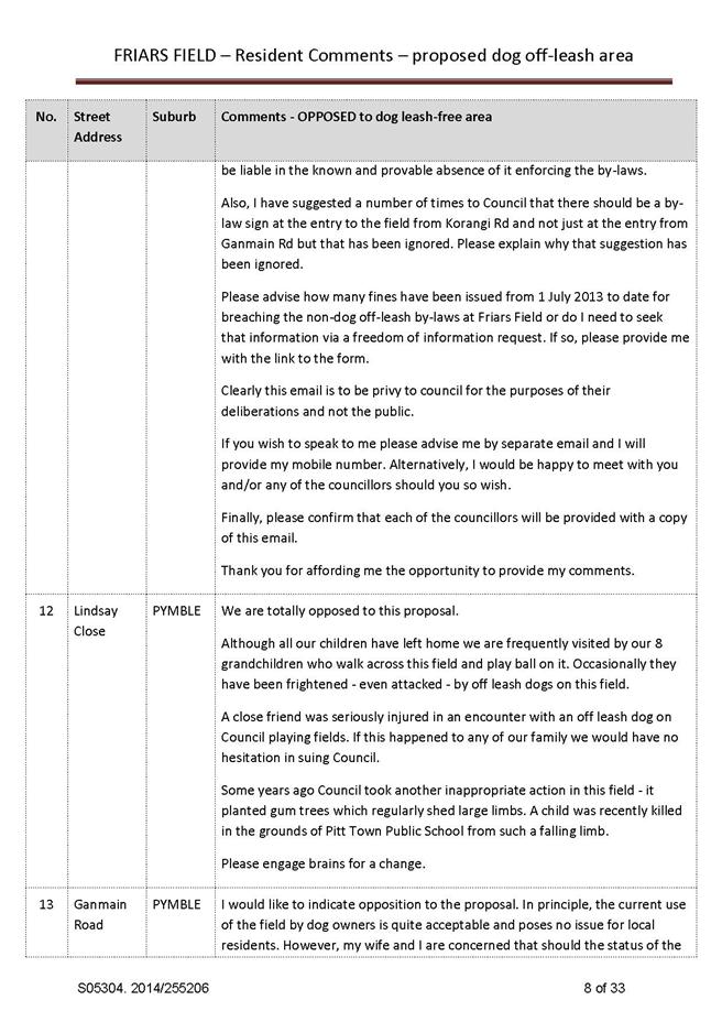
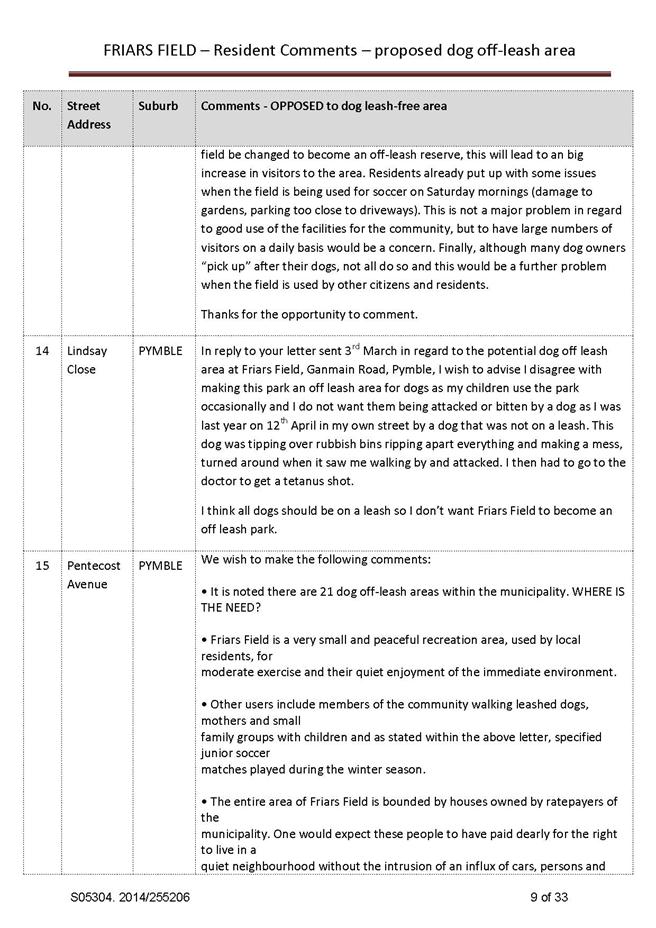
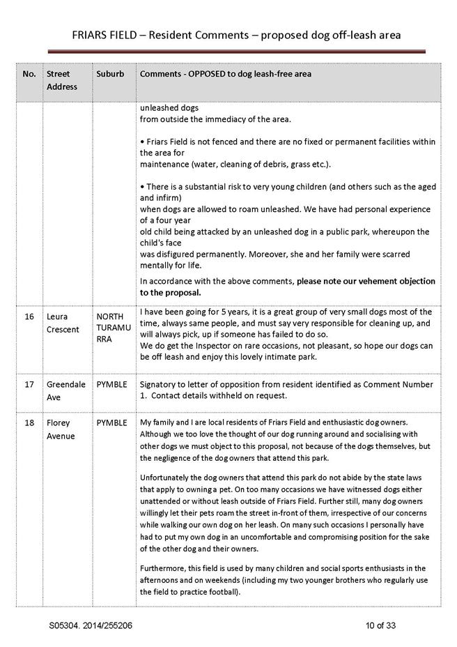
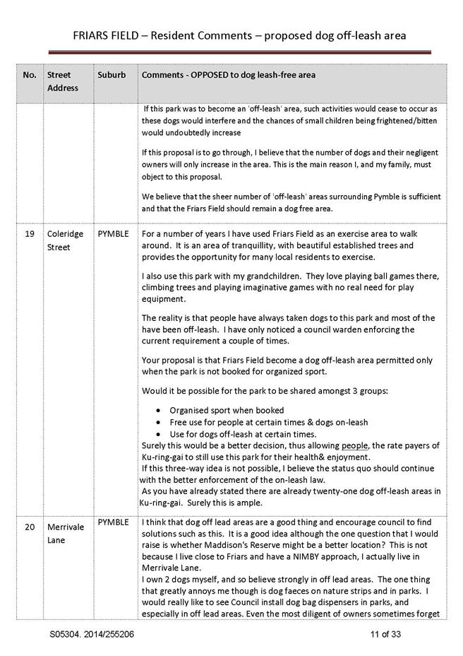
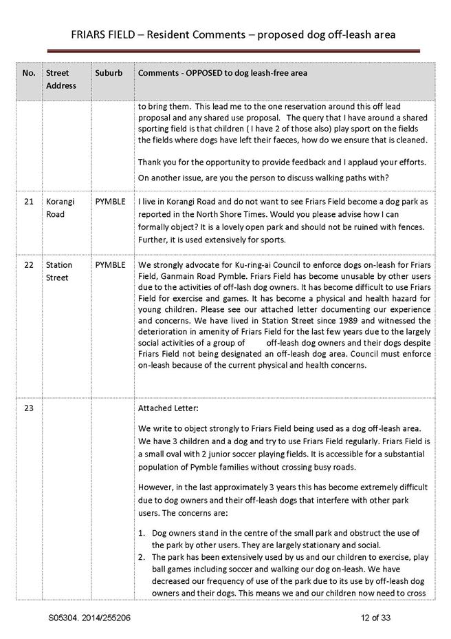
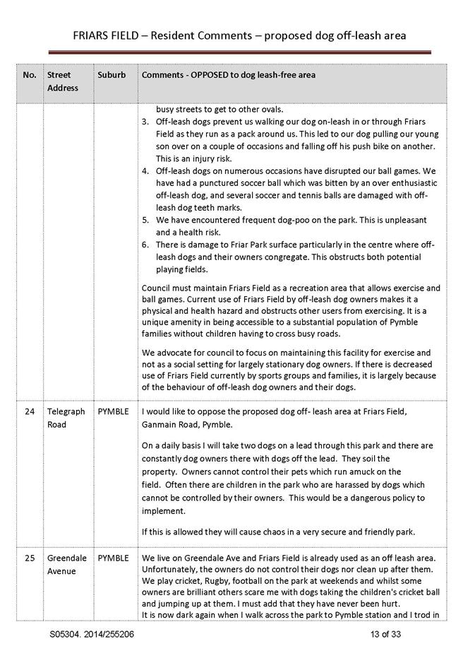
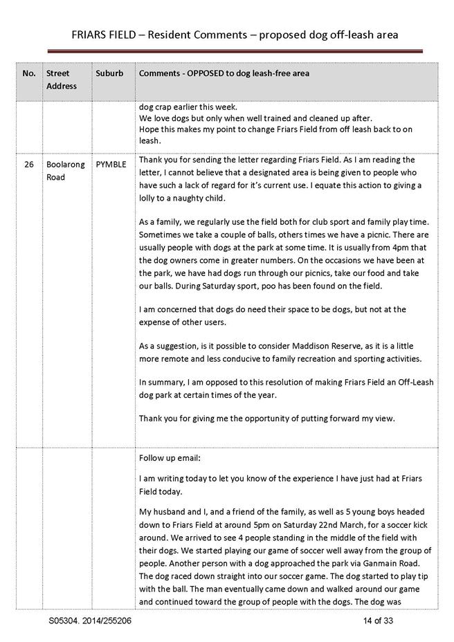
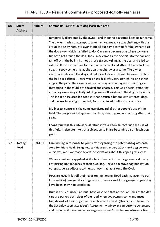
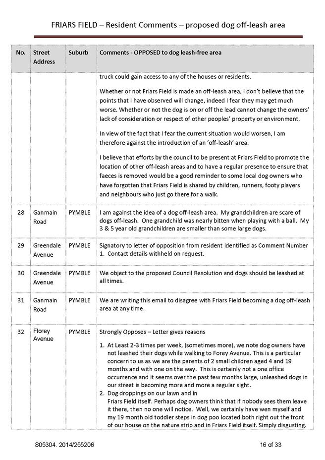
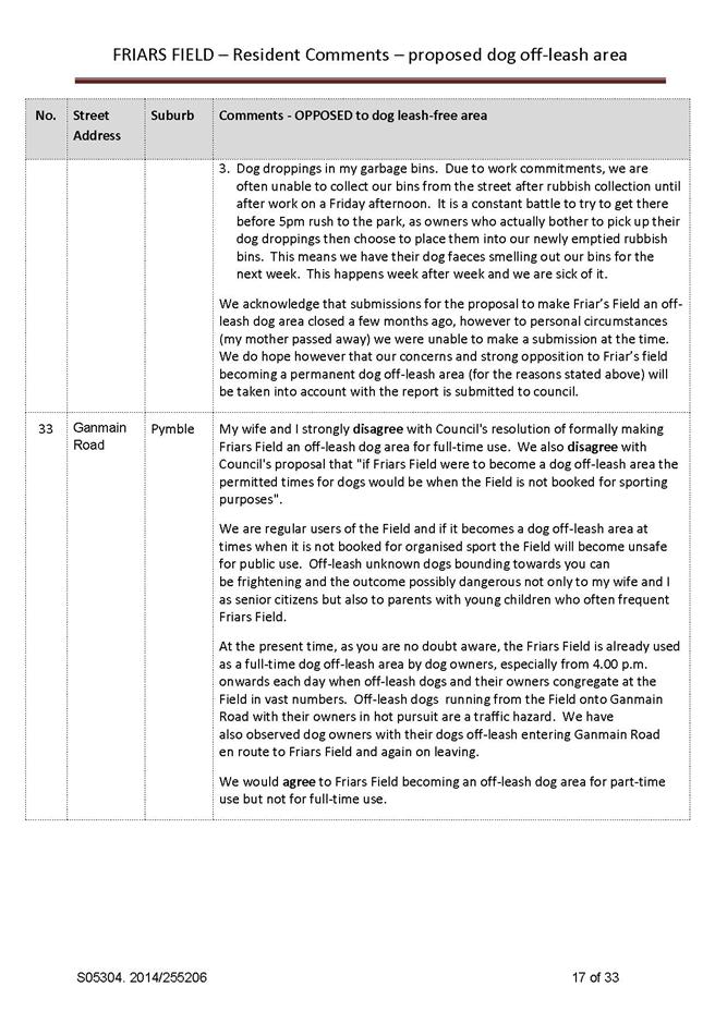
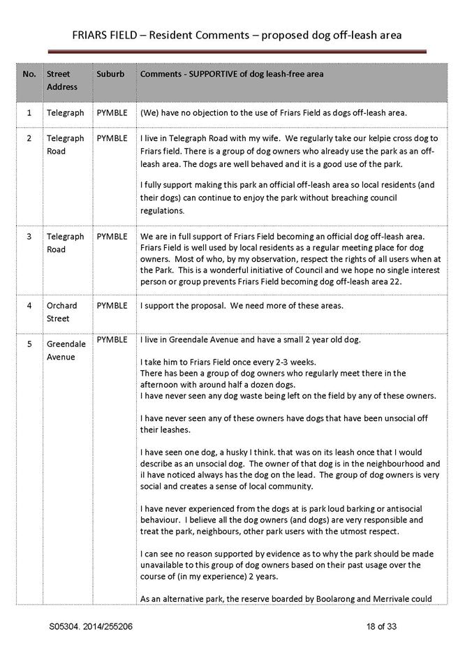
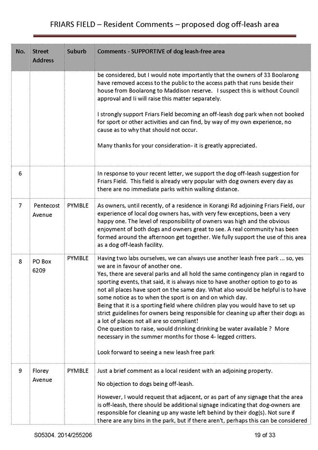
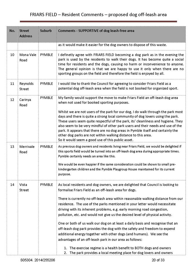
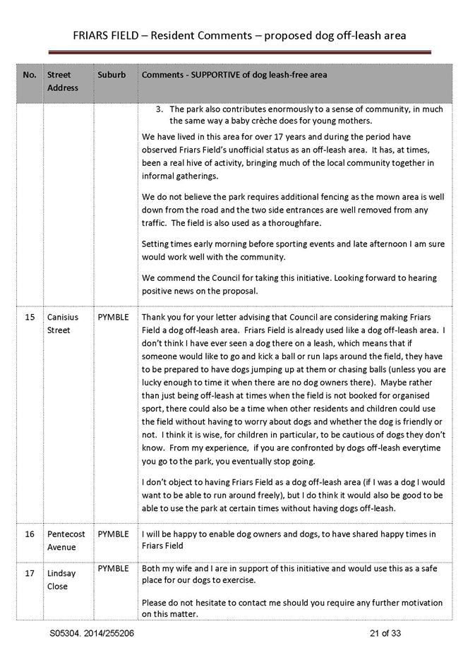
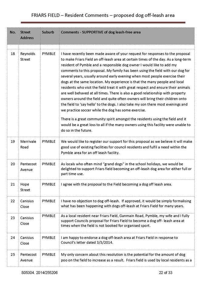
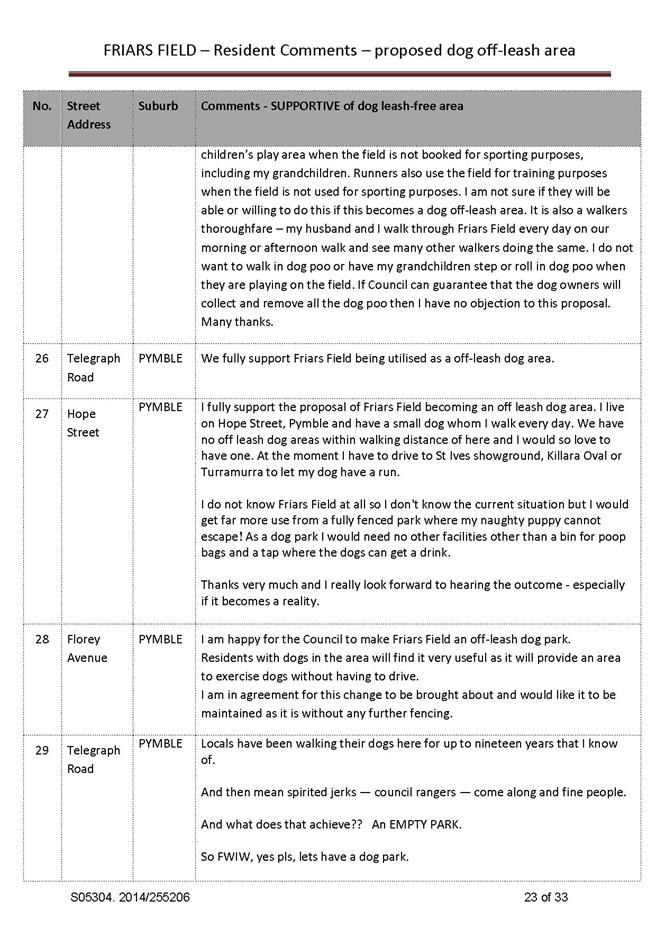
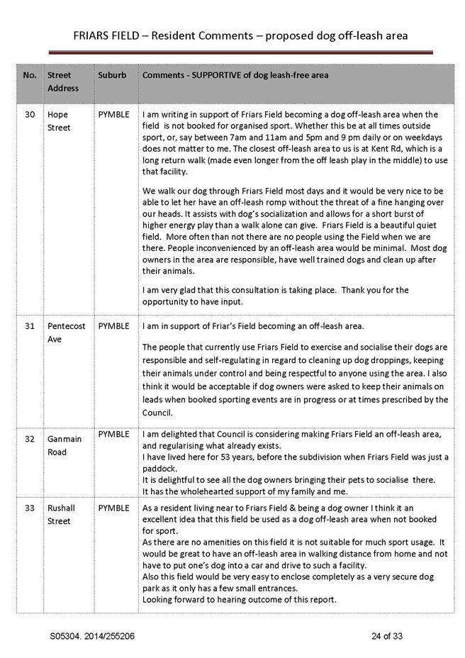
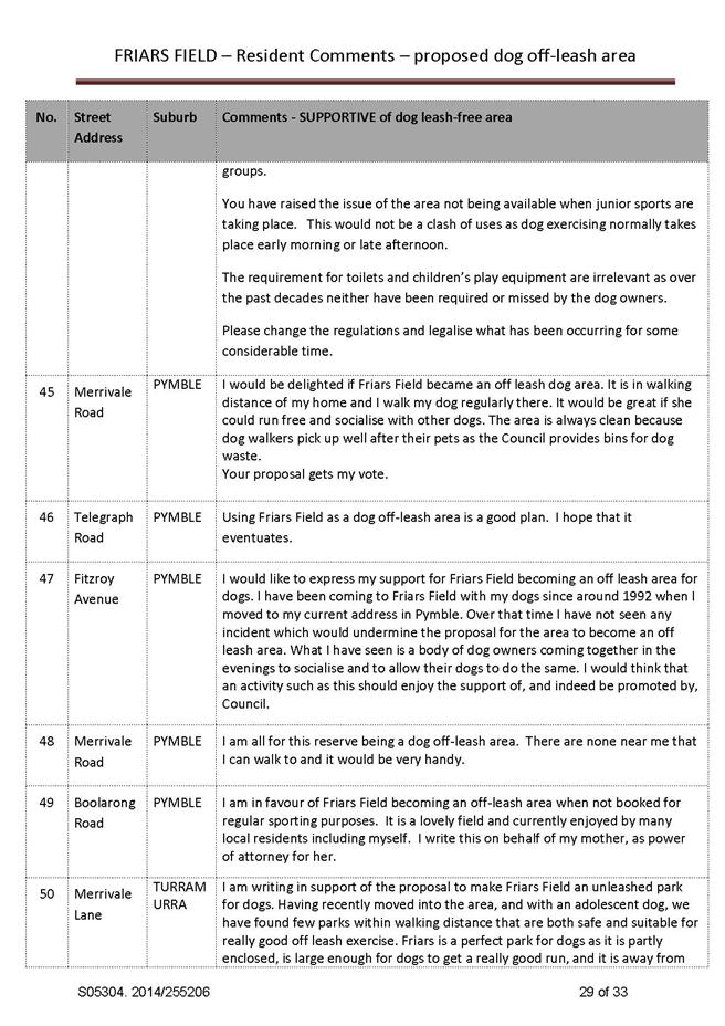
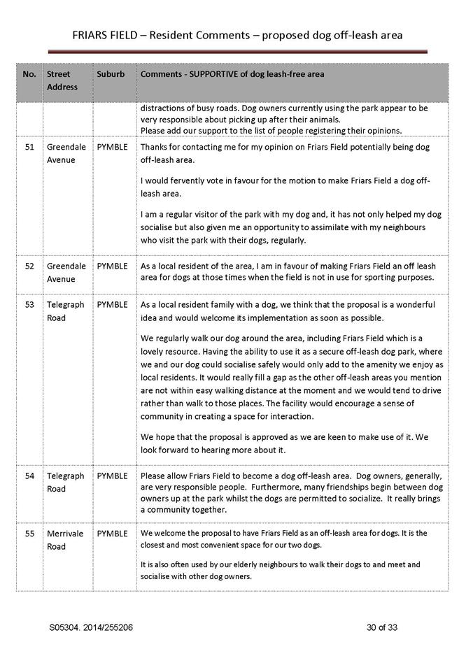
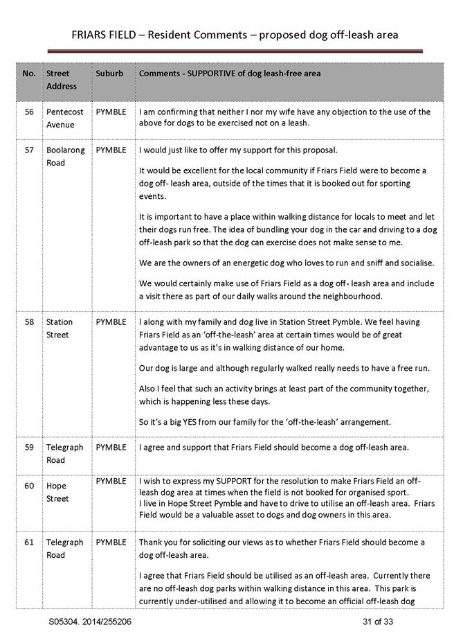
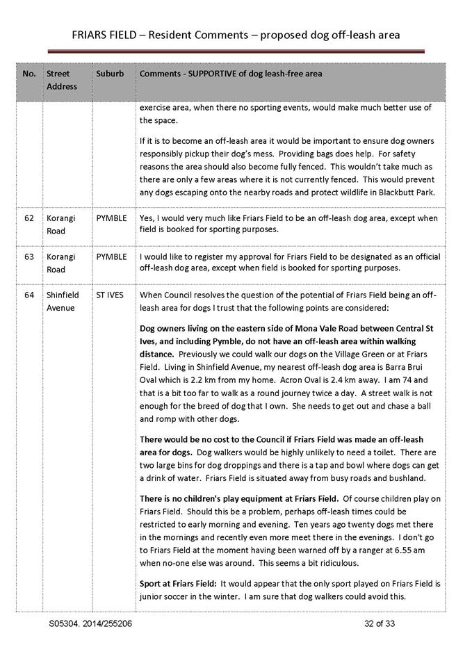
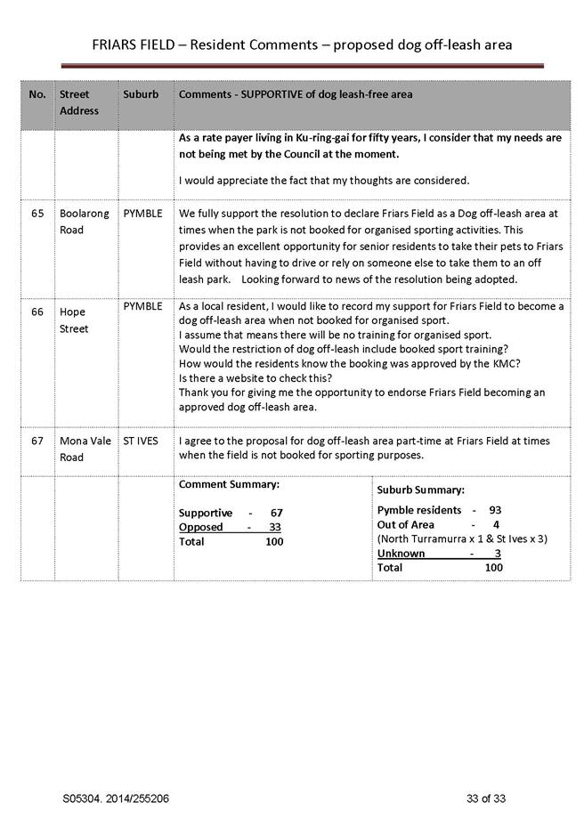
GB.12 Friar's Field, Pymble - Results of Community Consultation into Potential Dog Off-leash Area 788
File: S05304
For Council to consider the results of community consultation into a potential dog off-leash area at Friar’s Field, Pymble.
Recommendation:
That Council does not make Friar’s Field a dog off-leash area and retain its status as an on-leash area at all times.
Extra Reports Circulated to Meeting
Motions of which due Notice has been given
NM.1 NSROC Councils and Fit for the Future 831
File: CY00456/2
Notice of Motion from Councillor Malicki dated 20 October 2014
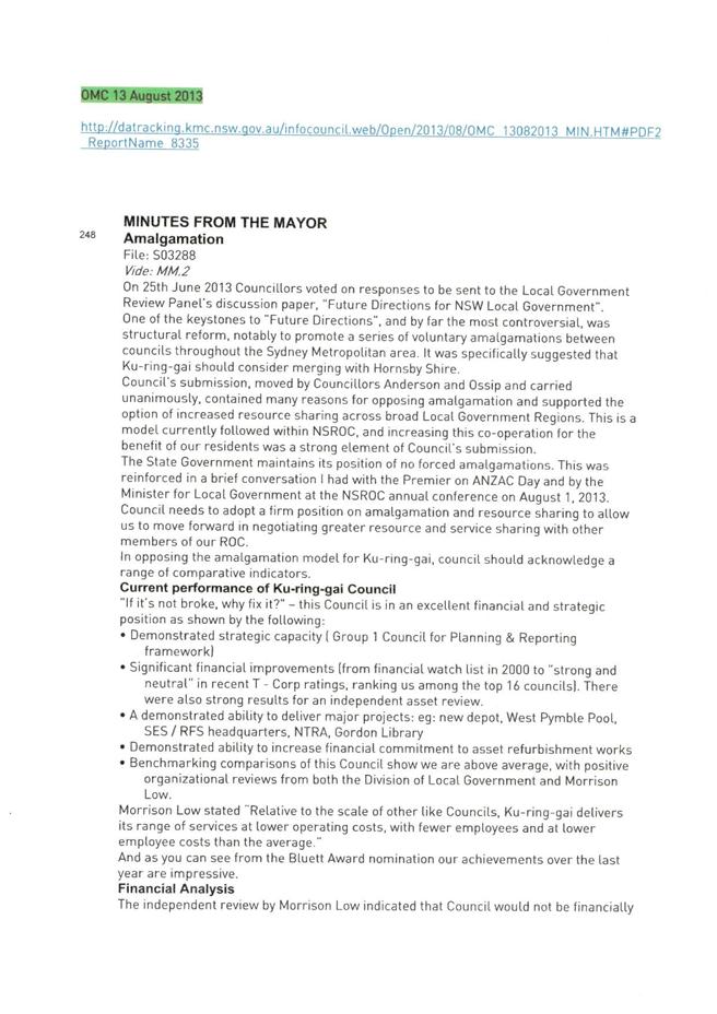
Ku-ring-gai Council has resolved to oppose the concept of amalgamation since this was first proposed by the NSW Government. (Attachment 1) This is a stance shared by six of the seven Councils in the Northern Suburbs Region of Councils, the only exception to this shared stance being Hornsby Council which has been actively researching amalgamation.
Instead of amalgamation, we have resolved to “encourage and participate with NSROC in investigating opportunities to increase the range of resource and services sharing.” Our stance of collaborating with NSROC Councils to strengthen our capacity as an individual council is also the formal stance held by the ROC. (Attachment 2)
Following the release of the document “Fit for the Future”, it has become even more critical to work with the region’s councils in order to formulate a stance for our region that is consistent with the objectives of Fit for the Future but which allows us to retain our individual identities and avoid amalgamation.
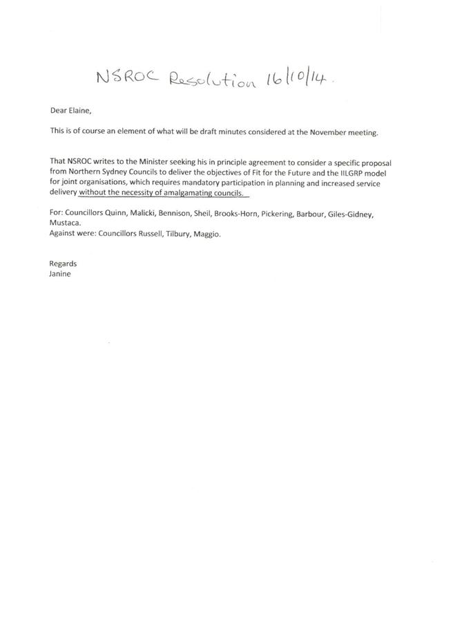
The meeting of the NSROC Board on 16/10/14, which the Mayor did not attend, resolved that “NSROC writes to the Minister seeking his in principle agreement to consider a specific proposal from Northern Sydney Councils to deliver the objectives of Fit for the Future and the IILGRP model for joint organisations, which requires mandatory participation in planning and increased service delivery without the necessity of amalgamating councils.” (Attachment 3.)
It is most desirable for the Mayor to attend all such discussions together with the GM. As the second Councillor representative on NSROC Councillor Malicki has attended all relevant meetings available to her, however the Mayor has not attended several of the most recent NSROC Meetings despite the resolution stating Council should “participate with NSROC in investigating opportunities to increase the range of resource and services sharing.” (Attachments 4,5).
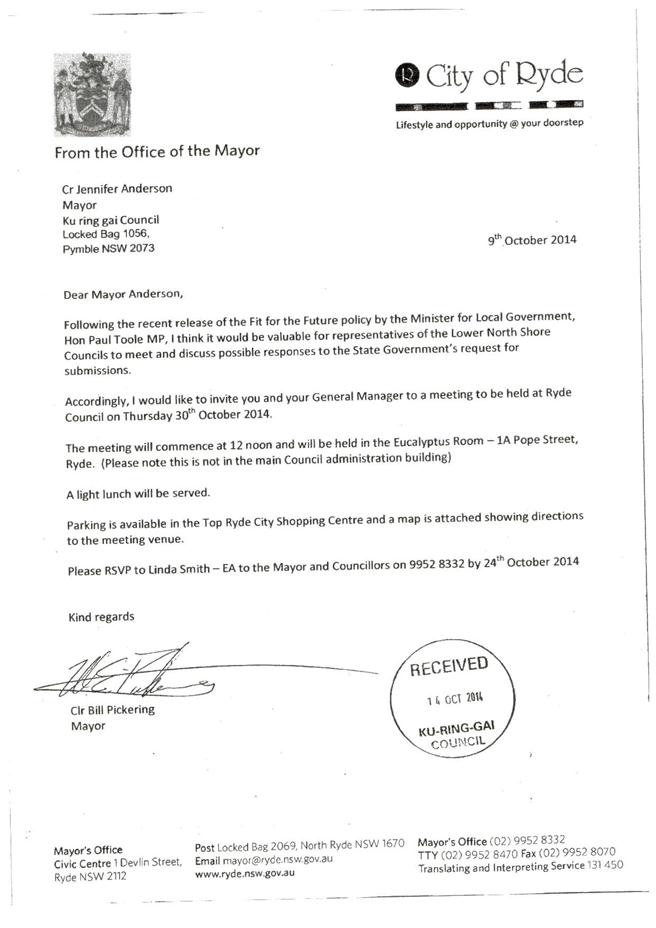
Cr Anderson has also apologised for a meeting called for NSROC members by Mayor Bill Pickering from Ryde Council, set for Thursday 30th October, claiming that to attend would “be inconsistent with Ku-ring-gai Council’s resolved position on amalgamations which precludes any discussions with individual councils about mergers or amalgamations.” (Attachment 6) This meeting is not about “mergers or amalgamations” nor is it with an “individual council”. Mayor Pickering’s letter clearly states “it would be valuable for representatives of the Lower North Shore Councils to meet and discuss possible responses to the State Government’s request for submissions.” (Attachment 7). Mayor Pickering shares Ku-ring-gai’s and NSROC’s opposition to amalgamations and is simply providing an opportunity for his colleagues and GMs to get together on this matter.
Given that Council has already resolved to work with NSROC Councils on this matter, and that now is a critical time for co-operation, I move the following:
“A. That Councillors receive a formal briefing on Fit for the Future as soon as possible.
B. That Council pursues a strategy in preparing a Fit for the Future application based on continuing as an independent, vibrant and viable council.
C. That Council continues to discuss all options for reform with surrounding councils.
D. That the Mayor and / or Council’s second elected NSROC representative Cr Malicki plus the GM attend every meeting called by the NSROC Councils, including those called by individual members, to discuss a response to Fit for the Future or to discuss resource and services sharing. This will include attending the meeting on 30th October called by the Mayor of Ryde Council.
E. That all Mayoral correspondence on Fit for the Future and all correspondence to or from NSROC or its member Councils be distributed to councillors within 24 hours of receipt or reply or as soon as reasonably practicable.”
BUSINESS WITHOUT NOTICE – SUBJECT TO CLAUSE 241 OF GENERAL REGULATIONS
Questions Without Notice
Inspections Committee – SETTING OF TIME, DATE AND RENDEZVOUS
Confidential Business to be dealt with in Closed Meeting
C.1 Audit and Risk Committee - Selection of Independent Members
File: S07428
In accordance with the Local Government Act 1993 and the Local Government (General) Regulation 2005, in the opinion of the General Manager, the following business is of a kind as referred to in section 10A(2)(a), of the Act, and should be dealt with in a part of the meeting closed to the public.
Section 10A(2)(a) of the Act permits the meeting to be closed to the public for business relating to personnel matters concerning particular individuals (other than Councillors).
Report by Director Development & Regulation dated 15 October 2014
Michael Miocic
ACTING General Manager
** ** ** ** ** **
|
Present: |
The Mayor, Councillor J Anderson (Chairperson) (Roseville Ward) Councillors E Malicki & J Pettett (Comenarra Ward) Councillors D Citer & C Szatow (Gordon Ward) Councillors C Berlioz & D Ossip (St Ives Ward) Councillor D Armstrong (Roseville Ward) Councillors C Fornari-Orsmond & D McDonald (Wahroonga Ward) |
|
|
|
|
Staff Present: |
General Manager (John McKee) Director Corporate (David Marshall) Director Development & Regulation (Michael Miocic) Director Operations (Greg Piconi) Director Strategy & Environment (Andrew Watson) Director Community (Janice Bevan) Manager Corporate Communications (Virginia Leafe) Manager Records & Governance (Matt Ryan) Minutes Secretary (Sigrid Banzer) |
The Meeting commenced at 7.00pm
The Mayor offered the Prayer
The Mayor adverted to the necessity for Councillors and staff to declare a Pecuniary Interest/Conflict of Interest in any item on the Business Paper.
No Interest was declared.
Address the Council
The following members of the public addressed Council on items not on the Agenda:
N Copel – Marian Street Theatre
W Blaxland – Marian Street Theatre
V Nicolls – Marian Street Theatre
DOCUMENTS CIRCULATED TO COUNCILLORS
The Mayor adverted to the documents circulated in the Councillors’ papers and advised that the following matters would be dealt with at the appropriate time during the meeting:
|
Late Items: |
Refer MM2 – Fit for the Future – Information Session
Councillors Additional Agenda Information –Refer GB.15 - |
|
Memorandums: |
Refer GB.9 – Amendments to Lindfield Library Site Plan of Management for Public Exhibition – Memorandum from Director Strategy and Environment dated 7 October 2014 advising that the library hours for Lindfield Library were incorrect in the attachment. The hours stated in the Attachment were: Monday, Tuesday, Thursday and Friday – 10.00am to 5.30pm and Saturday – 10.00am to 1.00pm but the hours should read Monday to Friday – 9.30am to 5.00pm, Saturday – 10.00am to 1.00pm and Sunday – Closed. |
|
309 |
File: CY00455/2 Vide: MM.1
|
|
|
I am saddened to advise my Councillor colleagues and our community of the passing of one of our most dedicated environmental volunteers Neroli Lock.
Neroli was an integral part of Ku-ring-gai’s Bushcare volunteer program, joining in 1991. Right up until ill health forced her to step down only weeks ago, Neroli could be found - trowel in hand and always with a smile - working tirelessly to rid Ku-ring-gai of weeds and protect our beautiful environment.
She mentored and encouraged countless other volunteers to share her passion for the local environment. Neroli worked on sites such as William Lewis Park, Ivor Wyatt Reserve and Browns Forest, the latter where she was convenor of the local Bushcare group, as well as further afield when the need arose.
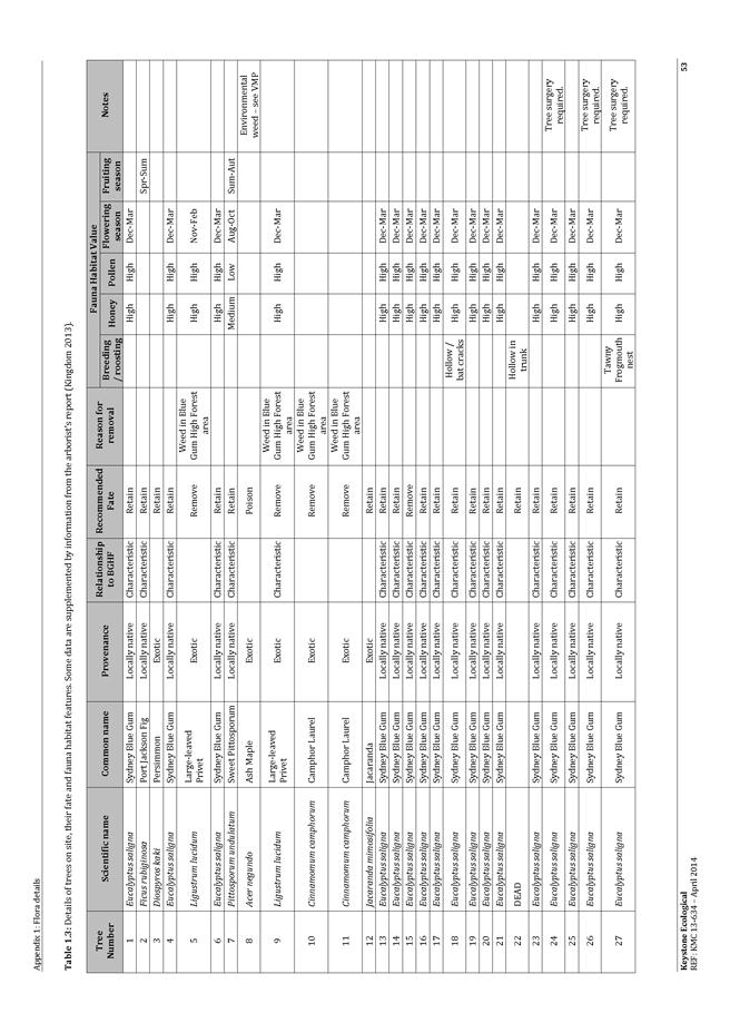
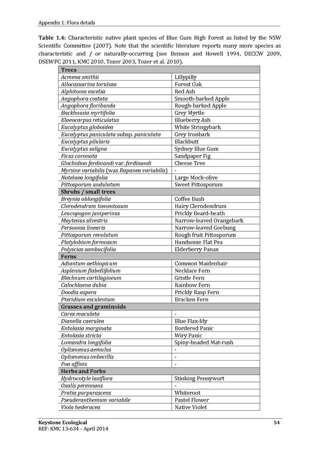
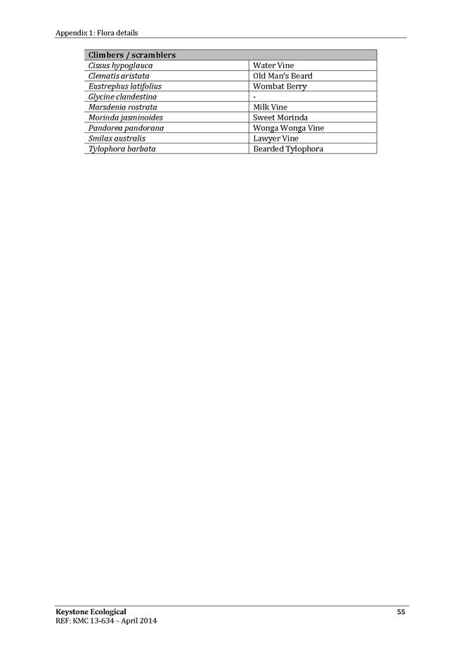
One particular project in which she played a leading part was the saving of an area of Blue Gum High Forest at Rosedale Road in St Ives, by persuading the Council to purchase the site for permanent protection. This site was to form an extension of the Dalrymple Hay Nature Reserve as it is today. To mark this event, Neroli co-authored a book with other volunteers called The Blue Gum Discovery Kit to help others recognise and protect this critically endangered tree.
Neroli was a great networker, who quickly realised the value of having good relationships with people in all three levels of government. Neroli was able to help secure many valuable grants for various Bushcare groups and she also played a central role in on-the-ground work where liaising with officers from government agencies such as National Parks was crucial to a project’s success. I’m pleased to say that the Council recognised Neroli’s commitment and powers of persuasion by making her a member of our Bushcare advisory group and of our advisory panel on the Ku-ring-gai environmental levy.
Neroli’s contribution to Ku-ring-gai’s environment extended beyond Bushcare to other community-based groups such as STEP, which was formed in the early 1970s ‘to preserve all natural bushland within Ku-ring-gai and its environs from alienation and degradation.’ She was also for many years Chair of the local committee of the Keep Australia Beautiful organisation.
Despite a decade of ill health, Neroli’s drive to do good and her enthusiasm for Ku-ring-gai’s environment never wavered. She has left a legacy of selfless dedication which will be hard to replace and for which we are deeply grateful. On behalf of the Council I offer my sincere condolences to her husband Harry, her family and her many friends at this sad time.
|
|
|
A. That the Mayoral Minute be received and noted.
B. That we stand for a minute’s silence to honour Neroli Lock.
C. That the Mayor write to Mrs Lock’s family and encloses a copy of the Mayoral Minute. CARRIED UNANIMOUSLY
|
A minute silence was observed
PETITIONS
|
321 |
28 Karranga Avenue Killara - Alterations and Additions to Dwelling - Heritage Conservation Area
File: DA0263/14 Vide: GB.11
|
|||||||||||||||
|
|
Alterations and additions to dwelling.
|
|||||||||||||||
|
|
(Moved: Councillors Szatow/Citer)
PURSUANT TO SECTION 80(1) OF THE ENVIRONMENTAL PLANNING AND ASSESSMENT ACT, 1979
A. THAT the Council, as the consent authority, is of the opinion that the objection under State Environmental Planning Policy No.1 – Development Standards to clause 60 C of the Ku-ring-gai Planning Scheme Ordinance in respect of the Built Upon Area development standard is well founded. The Council is also of the opinion that strict compliance with the development standard is unreasonable and unnecessary in the circumstances of this case.
AND
B. THAT Council, being satisfied that the objection under SEPP No. 1 is well founded and also being of the opinion that the granting of consent to DA0263/14 is consistent with the aims of the Policy, grants development consent to DA0263/14 for alterations and additions at 28 Karranga Road, Killara, subject to the following conditions:
Conditions that identify approved plans:
1. Approved architectural plans and documentation
The development must be carried out in accordance with work shown in colour on the following plans and documentation listed below and endorsed with Council’s stamp, except where amended by other conditions of this consent.
Reason: To ensure that the development is in accordance with the determination.
2. Inconsistency between documents
In the event of any inconsistency between conditions of this consent and the drawings/documents referred to above, the conditions of this consent prevail.
Reason: To ensure that the development is in accordance with the determination.
3. No demolition of extra fabric
Alterations to, and demolition of the existing building shall be limited to that documented on the approved plans (by way of notation). No approval is given or implied for removal and/or rebuilding of any portion of the existing building which is shown to be retained.
Reason: To ensure compliance with the development consent.
Conditions to be satisfied prior to demolition, excavation or construction:
4. Asbestos works
All work involving asbestos products and materials, including asbestos-cement-sheeting (ie. Fibro), must be carried out in accordance with the guidelines for asbestos work published by WorkCover Authority of NSW.
Reason: To ensure public safety
5. Notice of commencement
At least 48 hours prior to the commencement of any development (including demolition, excavation, shoring or underpinning works), a notice of commencement of building or subdivision work form and appointment of the principal certifying authority form shall be submitted to Council.
Reason: Statutory requirement.
6. Notification of builder’s details
Prior to the commencement of any development or excavation works, the Principal Certifying Authority shall be notified in writing of the name and contractor licence number of the owner/builder intending to carry out the approved works.
Reason: Statutory requirement.
Conditions to be satisfied prior to the issue of the construction certificate:
7. Front terrace balustrade colour
The paint colour of the front terrace balustrade shall be a dark recessive colour, preferably black.
Reason: To protect the Conservation area.
8. Long service levy
In accordance with Section 109F(i) of the Environmental Planning and Assessment Act a Construction Certificate shall not be issued until any long service levy payable under Section 34 of the Building and Construction Industry Long Service Payments Act 1986 (or where such levy is payable by instalments, the first instalment of the levy) has been paid. Council is authorised to accept payment. Where payment has been made elsewhere, proof of payment is to be provided to Council.
Reason: Statutory requirement.
9. Builder’s indemnity insurance
The applicant, builder, developer or person who does the work on this development, must arrange builder’s indemnity insurance and submit the certificate of insurance in accordance with the requirements of Part 6 of the Home Building Act 1989 to the Certifying Authority for endorsement of the plans accompanying the Construction Certificate.
It is the responsibility of the applicant, builder or developer to arrange the builder's indemnity insurance for residential building work over the value of $20,000. The builder's indemnity insurance does not apply to commercial or industrial building work or to residential work valued at less than $20,000, nor to work undertaken by persons holding an owner/builder's permit issued by the Department of Fair Trading (unless the owner/builder's property is sold within 7 years of the commencement of the work).
Reason: Statutory requirement.
Conditions to be satisfied prior to the issue of the construction certificate or prior to demolition, excavation or construction (whichever comes first):
10. Infrastructure restorations fee
To ensure that damage to Council Property as a result of construction activity is rectified in a timely matter:
a) All work or activity taken in furtherance of the development the subject of this approval must be undertaken in a manner to avoid damage to Council Property and must not jeopardise the safety of any person using or occupying the adjacent public areas.
b) The applicant, builder, developer or any person acting in reliance on this approval shall be responsible for making good any damage to Council Property, and for the removal from Council Property of any waste bin, building materials, sediment, silt, or any other material or article.
c) The Infrastructure Restoration Fee must be paid to the Council by the applicant prior to both the issue of the Construction Certificate and the commencement of any earthworks or construction.
d) In consideration of payment of the Infrastructure Restorations Fee, Council will undertake such inspections of Council Property as Council considers necessary and also undertake, on behalf of the applicant, such restoration work to Council Property, if any, that Council considers necessary as a consequence of the development. The provision of such restoration work by the Council does not absolve any person of the responsibilities contained in (a) to (b) above. Restoration work to be undertaken by the Council referred to in this condition is limited to work that can be undertaken by Council at a cost of not more than the Infrastructure Restorations Fee payable pursuant to this condition.
e) In this condition:
“Council Property” includes any road, footway, footpath paving, kerbing, guttering, crossings, street furniture, seats, letter bins, trees, shrubs, lawns, mounds, bushland, and similar structures or features on any road or public road within the meaning of the Local Government Act 1993 (NSW) or any public place; and
“Infrastructure Restoration Fee” means the Infrastructure Restorations Fee calculated in accordance with the Schedule of Fees & Charges adopted by Council as at the date of payment and the cost of any inspections required by the Council of Council Property associated with this condition.
Reason: To maintain public infrastructure.
Conditions to be satisfied during the demolition, excavation and construction phases:
11. Road opening permit
The opening of any footway, roadway, road shoulder or any part of the road reserve shall not be carried out without a road opening permit being obtained from Council (upon payment of the required fee) beforehand.
Reason: Statutory requirement (Roads Act 1993 Section 138) and to maintain the integrity of Council’s infrastructure.
12. Prescribed conditions
The applicant shall comply with any relevant prescribed conditions of development consent under clause 98 of the Environmental Planning and Assessment Regulation. For the purposes of section 80A (11) of the Environmental Planning and Assessment Act, the following conditions are prescribed in relation to a development consent for development that involves any building work:
· The work must be carried out in accordance with the requirements of the Building Code of Australia · In the case of residential building work for which the Home Building Act 1989 requires there to be a contract of insurance in force in accordance with Part 6 of that Act, that such a contract of insurance is in force before any works commence.
Reason: Statutory requirement.
13. Hours of work
Demolition, excavation, construction work and deliveries of building material and equipment must not take place outside the hours of 7.00am to 5.00pm Monday to Friday and 8.00am to 12 noon Saturday. No work and no deliveries are to take place on Sundays and public holidays.
Excavation or removal of any materials using machinery of any kind, including compressors and jack hammers, must be limited to between 7.30am and 5.00pm Monday to Friday, with a respite break of 45 minutes between 12 noon 1.00pm.
Where it is necessary for works to occur outside of these hours (ie) placement of concrete for large floor areas on large residential/commercial developments or where building processes require the use of oversized trucks and/or cranes that are restricted by the RTA from travelling during daylight hours to deliver, erect or remove machinery, tower cranes, pre-cast panels, beams, tanks or service equipment to or from the site, approval for such activities will be subject to the issue of an "outside of hours works permit" from Council as well as notification of the surrounding properties likely to be affected by the proposed works.
Note: Failure to obtain a permit to work outside of the approved hours will result in on the spot fines being issued.
Reason: To ensure reasonable standards of amenity for occupants of neighbouring properties.
14. Approved plans to be on site
A copy of all approved and certified plans, specifications and documents incorporating conditions of consent and certification (including the Construction Certificate if required for the work) shall be kept on site at all times during the demolition, excavation and construction phases and must be readily available to any officer of Council or the Principal Certifying Authority.
Reason: To ensure that the development is in accordance with the determination.
15. Toilet facilities
During excavation, demolition and construction phases, toilet facilities are to be provided, on the work site, at the rate of one toilet for every 20 persons or part of 20 persons employed at the site.
Reason: Statutory requirement.
16. Road reserve safety
All public footways and roadways fronting and adjacent to the site must be maintained in a safe condition at all times during the course of the development works. Construction materials must not be stored in the road reserve. A safe pedestrian circulation route and a pavement/route free of trip hazards must be maintained at all times on or adjacent to any public access ways fronting the construction site. Where public infrastructure is damaged, repair works must be carried out when and as directed by Council officers. Where pedestrian circulation is diverted on to the roadway or verge areas, clear directional signage and protective barricades must be installed in accordance with AS1742-3 (1996) “Traffic Control Devices for Work on Roads”. If pedestrian circulation is not satisfactorily maintained across the site frontage, and action is not taken promptly to rectify the defects, Council may undertake proceedings to stop work.
Reason: To ensure safe public footways and roadways during construction.
17. Services
Where required, the adjustment or inclusion of any new utility service facilities must be carried out by the applicant and in accordance with the requirements of the relevant utility authority. These works shall be at no cost to Council. It is the applicants’ full responsibility to make contact with the relevant utility authorities to ascertain the impacts of the proposal upon utility services (including water, phone, gas and the like). Council accepts no responsibility for any matter arising from its approval to this application involving any influence upon utility services provided by another authority.
Reason: Provision of utility services.
18. Erosion control
Temporary sediment and erosion control and measures are to be installed prior to the commencement of any works on the site. These measures must be maintained in working order during construction works up to completion. All sediment traps must be cleared on a regular basis and after each major storm and/or as directed by the Principal Certifying Authority and Council officers.
Reason: To protect the environment from erosion and sedimentation.
19. Drainage to existing system
Stormwater runoff from all new impervious areas and subsoil drainage systems shall be piped to the existing site drainage system. The installation of new drainage components must be completed by a licensed contractor in accordance with AS3500.3 (Plumbing Code) and the BCA. No stormwater runoff is to be placed into the Sydney Water sewer system. If an illegal sewer connection is found during construction, the drainage system must be rectified to the satisfaction of Council and Sydney Water.
Reason: To protect the environment.
20. No storage of materials beneath trees
No activities, storage or disposal of materials shall take place beneath the canopy of any tree protected under Council's Tree Preservation Order at any time.
Reason: To protect existing trees.
21. Removal of refuse
All builders' refuse, spoil and/or material unsuitable for use in landscape areas shall be removed from the site on completion of the building works.
Reason: To protect the environment.
22. On site retention of waste dockets
All demolition, excavation and construction waste dockets are to be retained on site, or at suitable location, in order to confirm which facility received materials generated from the site for recycling or disposal.
· Each docket is to be an official receipt from a facility authorised to accept the material type, for disposal or processing. · This information is to be made available at the request of an Authorised Officer of Council.
Reason: To protect the environment.
Conditions to be satisfied prior to the issue of an Occupation Certificate:
23. Compliance with BASIX Certificate
Prior to the issue of an Occupation Certificate, the Principal Certifying Authority shall be satisfied that all commitments listed in BASIX Certificate No.A191425_03 have been complied with.
Reason: Statutory requirement.
24. Infrastructure repair
Prior to issue of the Occupation Certificate, the Principal Certifying Authority must be satisfied that any damaged public infrastructure caused as a result of construction works (including damage caused by, but not limited to, delivery vehicles, waste collection, contractors, sub-contractors, concrete vehicles) is fully repaired to the satisfaction of Council Development Engineer and at no cost to Council.
Reason: To protect public infrastructure.
25. Swimming pool (part 1)
Prior to the issue of the Occupation Certificate, the Principal Certifying Authority shall be satisfied that:
C1 1. Access to the pool/spa shall be restricted by a child resistant barrier in accordance with the regulations prescribed in the Swimming Pools Act, 1992:
(a) The pool shall not be filled with water or be allowed to collect stormwater until the child resistant barrier is installed; and (b) The barrier is to conform to the requirements of AS 1926-1 2012 Fences and Gates for Private Swimming Pools.
Reason: To ensure the safety of children.
2. Any mechanical equipment associated with the swimming pool and/or spa pool shall be located in a sound-attenuating enclosure and positioned so that it is setback a minimum of 2m from the boundary of any adjoining premises. The Principal Certifying Authority shall be satisfied that the sound levels associated with the swimming pool/spa filtration system and associated mechanical equipment do not exceed 5dB(A) above the background noise level at the boundaries of the site.
Reason: To protect the amenity of surrounding properties.
Conditions to be satisfied at all times:
26. Swimming pool (part 2)
At all times:
1. Access to the swimming pool must be restricted by fencing or other measures as required by the Swimming Pools Act 1992. 2. Noise levels associated with spa/pool pumping units shall not exceed 5dB(A) above the background noise level at the boundaries of the site. 3. Devices or structures used for heating swimming pool water must not be placed where they are visible from a public place.
Reason: Health and amenity.
CARRIED UNANIMOUSLY |
|
322 |
49A Chilton Parade Warrawee - Alterations and Additions - Heritage Conservation Area
File: DA0259/14 Vide: GB.13
|
||||||||||||
|
|
To determine Development Application DA0259/14 for alterations and additions.
|
||||||||||||
|
|
(Moved: Councillors Szatow/Fornari-Orsmond)
PURSUANT TO SECTION 80(1) OF THE ENVIRONMENTAL PLANNING AND ASSESSMENT ACT, 1979
THAT the Council, as the consent authority, is of the opinion that the objection under State Environmental Planning Policy No. 1 - Development Standards to the Built-upon Area development standard in clause 60C of the Ku-ring-gai Planning Scheme Ordinance is well founded. The Council is also of the opinion that strict compliance with the development standard is unreasonable and unnecessary in the circumstances of this case.
THAT the Council, as the consent authority, being satisfied that the objection under SEPP No. 1 is well founded and also being of the opinion that the granting of consent to DA0259/14 is consistent with the aims of the Policy, grant development consent to DA0259/14 for alterations and additions on land at 49A Chilton Parade Warrawee, for a period of two (2) years from the date of the Notice of Determination, subject to the following conditions:
Conditions that identify approved plans:
1. Approved architectural plans and documentation (new development)
The development must be carried out in accordance with work shown in colour on the following plans and documentation listed below and endorsed with Council’s stamp, except where amended by other conditions of this consent.
Reason: To ensure that the development is in accordance with the determination.
2. No demolition of extra fabric
Alterations to, and demolition of the existing building shall be limited to that documented on the approved plans (by way of notation). No approval is given or implied for removal and/or rebuilding of any portion of the existing building which is shown to be retained.
Reason: To ensure compliance with the development consent.
Conditions to be satisfied prior to demolition, excavation or construction:
3. Asbestos works
All work involving asbestos products and materials, including asbestos-cement-sheeting (ie. Fibro), must be carried out in accordance with the guidelines for asbestos work published by WorkCover Authority of NSW.
Reason: To ensure public safety
4. Notice of commencement
At least 48 hours prior to the commencement of any development (including demolition, excavation, shoring or underpinning works), a notice of commencement of building or subdivision work form and appointment of the principal certifying authority form shall be submitted to Council.
Reason: Statutory requirement.
5. Notification of builder’s details
Prior to the commencement of any development or excavation works, the Principal Certifying Authority shall be notified in writing of the name and contractor licence number of the owner/builder intending to carry out the approved works.
Reason: Statutory requirement.
Conditions to be satisfied prior to the issue of the construction certificate:
6. Long service levy
In accordance with Section 109F(i) of the Environmental Planning and Assessment Act a Construction Certificate shall not be issued until any long service levy payable under Section 34 of the Building and Construction Industry Long Service Payments Act 1986 (or where such levy is payable by instalments, the first instalment of the levy) has been paid. Council is authorised to accept payment. Where payment has been made elsewhere, proof of payment is to be provided to Council.
Reason: Statutory requirement.
7. Builder’s indemnity insurance
The applicant, builder, developer or person who does the work on this development, must arrange builder’s indemnity insurance and submit the certificate of insurance in accordance with the requirements of Part 6 of the Home Building Act 1989 to the Certifying Authority for endorsement of the plans accompanying the Construction Certificate.
It is the responsibility of the applicant, builder or developer to arrange the builder's indemnity insurance for residential building work over the value of $20,000. The builder's indemnity insurance does not apply to commercial or industrial building work or to residential work valued at less than $20,000, nor to work undertaken by persons holding an owner/builder's permit issued by the Department of Fair Trading (unless the owner/builder's property is sold within 7 years of the commencement of the work).
Reason: Statutory requirement.
Conditions to be satisfied prior to the issue of the construction certificate or prior to demolition, excavation or construction (whichever comes first):
8. Infrastructure restorations fee
To ensure that damage to Council Property as a result of construction activity is rectified in a timely matter:
a) All work or activity taken in furtherance of the development the subject of this approval must be undertaken in a manner to avoid damage to Council Property and must not jeopardise the safety of any person using or occupying the adjacent public areas.
b) The applicant, builder, developer or any person acting in reliance on this approval shall be responsible for making good any damage to Council Property, and for the removal from Council Property of any waste bin, building materials, sediment, silt, or any other material or article.
c) The Infrastructure Restoration Fee must be paid to the Council by the applicant prior to both the issue of the Construction Certificate and the commencement of any earthworks or construction.
d) In consideration of payment of the Infrastructure Restorations Fee, Council will undertake such inspections of Council Property as Council considers necessary and also undertake, on behalf of the applicant, such restoration work to Council Property, if any, that Council considers necessary as a consequence of the development. The provision of such restoration work by the Council does not absolve any person of the responsibilities contained in (a) to (b) above. Restoration work to be undertaken by the Council referred to in this condition is limited to work that can be undertaken by Council at a cost of not more than the Infrastructure Restorations Fee payable pursuant to this condition.
e) In this condition:
“Council Property” includes any road, footway, footpath paving, kerbing, guttering, crossings, street furniture, seats, letter bins, trees, shrubs, lawns, mounds, bushland, and similar structures or features on any road or public road within the meaning of the Local Government Act 1993 (NSW) or any public place; and
“Infrastructure Restoration Fee” means the Infrastructure Restorations Fee calculated in accordance with the Schedule of Fees & Charges adopted by Council as at the date of payment and the cost of any inspections required by the Council of Council Property associated with this condition.
Reason: To maintain public infrastructure.
Conditions to be satisfied during the demolition, excavation and construction phases:
9. Road opening permit
The opening of any footway, roadway, road shoulder or any part of the road reserve shall not be carried out without a road opening permit being obtained from Council (upon payment of the required fee) beforehand.
Reason: Statutory requirement (Roads Act 1993 Section 138) and to maintain the integrity of Council’s infrastructure.
10. Prescribed conditions
The applicant shall comply with any relevant prescribed conditions of development consent under clause 98 of the Environmental Planning and Assessment Regulation. For the purposes of section 80A (11) of the Environmental Planning and Assessment Act, the following conditions are prescribed in relation to a development consent for development that involves any building work:
The work must be carried out in accordance with the requirements of the Building Code of Australia In the case of residential building work for which the Home Building Act 1989 requires there to be a contract of insurance in force in accordance with Part 6 of that Act, that such a contract of insurance is in force before any works commence.
Reason: Statutory requirement.
11. Hours of work
Demolition, excavation, construction work and deliveries of building material and equipment must not take place outside the hours of 7.00am to 5.00pm Monday to Friday and 8.00am to 12 noon Saturday. No work and no deliveries are to take place on Sundays and public holidays.
Excavation or removal of any materials using machinery of any kind, including compressors and jack hammers, must be limited to between 7.30am and 5.00pm Monday to Friday, with a respite break of 45 minutes between 12 noon 1.00pm.
Where it is necessary for works to occur outside of these hours (ie) placement of concrete for large floor areas on large residential/commercial developments or where building processes require the use of oversized trucks and/or cranes that are restricted by the RTA from travelling during daylight hours to deliver, erect or remove machinery, tower cranes, pre-cast panels, beams, tanks or service equipment to or from the site, approval for such activities will be subject to the issue of an "outside of hours works permit" from Council as well as notification of the surrounding properties likely to be affected by the proposed works.
Note: Failure to obtain a permit to work outside of the approved hours will result in on the spot fines being issued.
Reason: To ensure reasonable standards of amenity for occupants of neighbouring properties.
12. Approved plans to be on site
A copy of all approved and certified plans, specifications and documents incorporating conditions of consent and certification (including the Construction Certificate if required for the work) shall be kept on site at all times during the demolition, excavation and construction phases and must be readily available to any officer of Council or the Principal Certifying Authority.
Reason: To ensure that the development is in accordance with the determination.
13. Statement of compliance with Australian Standards
The demolition work shall comply with the provisions of Australian Standard AS2601: 2001 The Demolition of Structures. The work plans required by AS2601: 2001 shall be accompanied by a written statement from a suitably qualified person that the proposal contained in the work plan comply with the safety requirements of the Standard. The work plan and the statement of compliance shall be submitted to the satisfaction of the Principal Certifying Authority prior to the commencement of any works.
Reason: To ensure compliance with the Australian Standards.
14. Site notice
A site notice shall be erected on the site prior to any work commencing and shall be displayed throughout the works period.
The site notice must:
be prominently displayed at the boundaries of the site for the purposes of informing the public that unauthorised entry to the site is not permitted display project details including, but not limited to the details of the builder, Principal Certifying Authority and structural engineer be durable and weatherproof display the approved hours of work, the name of the site/project manager, the responsible managing company (if any), its address and 24 hour contact phone number for any inquiries, including construction/noise complaint are to be displayed on the site notice be mounted at eye level on the perimeter hoardings/fencing and is to state that unauthorised entry to the site is not permitted
Reason: To ensure public safety and public information.
15. Dust control
During excavation, demolition and construction, adequate measures shall be taken to prevent dust from affecting the amenity of the neighbourhood. The following measures must be adopted:
physical barriers shall be erected at right angles to the prevailing wind direction or shall be placed around or over dust sources to prevent wind or activity from generating dust earthworks and scheduling activities shall be managed to coincide with the next stage of development to minimise the amount of time the site is left cut or exposed all materials shall be stored or stockpiled at the best locations the ground surface should be dampened slightly to prevent dust from becoming airborne but should not be wet to the extent that run-off occurs all vehicles carrying spoil or rubble to or from the site shall at all times be covered to prevent the escape of dust all equipment wheels shall be washed before exiting the site using manual or automated sprayers and drive-through washing bays gates shall be closed between vehicle movements and shall be fitted with shade cloth cleaning of footpaths and roadways shall be carried out daily
Reason: To protect the environment and amenity of surrounding properties.
16. Use of road or footpath
During excavation, demolition and construction phases, no building materials, plant or the like are to be stored on the road or footpath without written approval being obtained from Council beforehand. The pathway shall be kept in a clean, tidy and safe condition during building operations. Council reserves the right, without notice, to rectify any such breach and to charge the cost against the applicant/owner/builder, as the case may be.
Reason: To ensure safety and amenity of the area.
17. Guarding excavations
All excavation, demolition and construction works shall be properly guarded and protected with hoardings or fencing to prevent them from being dangerous to life and property.
Reason: To ensure public safety.
18. Toilet facilities
During excavation, demolition and construction phases, toilet facilities are to be provided, on the work site, at the rate of one toilet for every 20 persons or part of 20 persons employed at the site.
Reason: Statutory requirement.
19. Protection of public places
If the work involved in the erection, demolition or construction of the development is likely to cause pedestrian or vehicular traffic in a public place to be obstructed or rendered inconvenient, or building involves the enclosure of a public place, a hoarding or fence must be erected between the work site and the public place.
If necessary, a hoarding is to be erected, sufficient to prevent any substance from, or in connection with, the work falling into the public place.
The work site must be kept lit between sunset and sunrise if it is likely to be hazardous to persons in the public place.
Any hoarding, fence or awning is to be removed when the work has been completed.
Reason: To protect public places.
20. Recycling of building material (general)
During demolition and construction, the Principal Certifying Authority shall be satisfied that building materials suitable for recycling have been forwarded to an appropriate registered business dealing in recycling of materials. Materials to be recycled must be kept in good order.
Reason: To facilitate recycling of materials.
21. Construction signage
All construction signs must comply with the following requirements:
are not to cover any mechanical ventilation inlet or outlet vent are not illuminated, self-illuminated or flashing at any time are located wholly within a property where construction is being undertaken refer only to the business(es) undertaking the construction and/or the site at which the construction is being undertaken are restricted to one such sign per property do not exceed 2.5m2 are removed within 14 days of the completion of all construction works
Reason: To ensure compliance with Council's controls regarding signage.
22. Road reserve safety
All public footways and roadways fronting and adjacent to the site must be maintained in a safe condition at all times during the course of the development works. Construction materials must not be stored in the road reserve. A safe pedestrian circulation route and a pavement/route free of trip hazards must be maintained at all times on or adjacent to any public access ways fronting the construction site. Where public infrastructure is damaged, repair works must be carried out when and as directed by Council officers. Where pedestrian circulation is diverted on to the roadway or verge areas, clear directional signage and protective barricades must be installed in accordance with AS1742-3 (1996) “Traffic Control Devices for Work on Roads”. If pedestrian circulation is not satisfactorily maintained across the site frontage, and action is not taken promptly to rectify the defects, Council may undertake proceedings to stop work.
Reason: To ensure safe public footways and roadways during construction.
23. Services
Where required, the adjustment or inclusion of any new utility service facilities must be carried out by the applicant and in accordance with the requirements of the relevant utility authority. These works shall be at no cost to Council. It is the applicants’ full responsibility to make contact with the relevant utility authorities to ascertain the impacts of the proposal upon utility services (including water, phone, gas and the like). Council accepts no responsibility for any matter arising from its approval to this application involving any influence upon utility services provided by another authority.
Reason: Provision of utility services.
24. Erosion control
Temporary sediment and erosion control and measures are to be installed prior to the commencement of any works on the site. These measures must be maintained in working order during construction works up to completion. All sediment traps must be cleared on a regular basis and after each major storm and/or as directed by the Principal Certifying Authority and Council officers.
Reason: To protect the environment from erosion and sedimentation.
25. Drainage to existing system
Stormwater runoff from all new impervious areas and subsoil drainage systems shall be piped to the existing site drainage system. The installation of new drainage components must be completed by a licensed contractor in accordance with AS3500.3 (Plumbing Code) and the BCA. No stormwater runoff is to be placed into the Sydney Water sewer system. If an illegal sewer connection is found during construction, the drainage system must be rectified to the satisfaction of Council and Sydney Water.
Reason: To protect the environment.
26. No storage of materials beneath trees
No activities, storage or disposal of materials shall take place beneath the canopy of any tree protected under Council's Tree Preservation Order at any time.
Reason: To protect existing trees.
27. Removal of refuse
All builders' refuse, spoil and/or material unsuitable for use in landscape areas shall be removed from the site on completion of the building works.
Reason: To protect the environment.
28. On site retention of waste dockets
All demolition, excavation and construction waste dockets are to be retained on site, or at suitable location, in order to confirm which facility received materials generated from the site for recycling or disposal.
Each docket is to be an official receipt from a facility authorised to accept the material type, for disposal or processing. This information is to be made available at the request of an Authorised Officer of Council.
Reason: To protect the environment.
Conditions to be satisfied prior to the issue of an Occupation Certificate:
29. Compliance with BASIX Certificate
Prior to the issue of an Occupation Certificate, the Principal Certifying Authority shall be satisfied that all commitments listed in BASIX Certificate No. A193501 have been complied with.
Reason: Statutory requirement.
30. Infrastructure repair
Prior to issue of the Occupation Certificate, the Principal Certifying Authority must be satisfied that any damaged public infrastructure caused as a result of construction works (including damage caused by, but not limited to, delivery vehicles, waste collection, contractors, sub-contractors, concrete vehicles) is fully repaired to the satisfaction of Council Development Engineer and at no cost to Council.
Reason: To protect public infrastructure.
CARRIED UNANIMOUSLY |
|
323 |
10 The Comenarra Parkway West Pymble - Alterations and Additions to a Dwelling House
File: DA0220/14 Vide: GB.14
|
|||||||||||||||
|
|
Alterations and additions to a dwelling house.
|
|||||||||||||||
|
|
(Moved: Councillors Szatow/Pettett)
PURSUANT TO SECTION 80(1) OF THE ENVIRONMENTAL PLANNING AND ASSESSMENT ACT, 1979
THAT the Council, as the consent authority, is of the opinion that the objection under State Environmental Planning Policy No. 1 – Development Standards to clause 46 of the Ku-ring-gai Planning Scheme Ordinance is well founded. Council is also of the opinion that strict compliance with the development standard is unreasonable and unnecessary in the circumstances of this case.
AND
THAT the Council, as the consent authority, being satisfied that the objection under SEPP No. 1 is well founded and also being of the opinion that the granting of consent to DA0220/14 is consistent with the aims of the Policy, grant development consent to DA0220/14 for alterations and additions to a dwelling house on land at 10 The Comenarra Parkway West Pymble, for a period of two (2) years from the date of the Notice of Determination, subject to the following conditions:
Conditions that identify approved plans:
1. Approved architectural plans and documentation (alterations and additions)
The development must be carried out in accordance with work shown in colour on the following plans and documentation listed below and endorsed with Council’s stamp, except where amended by other conditions of this consent.
Reason: To ensure that the development is in accordance with the determination.
2. Inconsistency between documents
In the event of any inconsistency between conditions of this consent and the drawings/documents referred to above, the conditions of this consent prevail.
Reason: To ensure that the development is in accordance with the determination.
Conditions to be satisfied prior to demolition, excavation or construction:
3. Asbestos works
All work involving asbestos products and materials, including asbestos-cement-sheeting (ie. Fibro), must be carried out in accordance with the guidelines for asbestos work published by WorkCover Authority of NSW.
Reason: To ensure public safety
4. Notice of commencement
At least 48 hours prior to the commencement of any development (including demolition, excavation, shoring or underpinning works), a notice of commencement of building or subdivision work form and appointment of the principal certifying authority form shall be submitted to Council.
Reason: Statutory requirement.
5. Notification of builder’s details
Prior to the commencement of any development or excavation works, the Principal Certifying Authority shall be notified in writing of the name and contractor licence number of the owner/builder intending to carry out the approved works.
Reason: Statutory requirement.
6. Sediment controls
Prior to any work commencing on site, sediment and erosion control measures shall be installed along the contour immediately downslope of any future disturbed areas.
The form of the sediment controls to be installed on the site shall be determined by reference to the ‘NSW Department of Housing manual ‘Managing Urban Stormwater: Soils and Construction’. The erosion controls shall be maintained in an operational condition until the development activities have been completed and the site fully stabilised. Sediment shall be removed from the sediment controls following each heavy or prolonged rainfall period.
Reason: To preserve and enhance the natural environment.
Conditions to be satisfied prior to the issue of the construction certificate:
7. Long service levy
In accordance with Section 109F(i) of the Environmental Planning and Assessment Act a Construction Certificate shall not be issued until any long service levy payable under Section 34 of the Building and Construction Industry Long Service Payments Act 1986 (or where such levy is payable by instalments, the first instalment of the levy) has been paid. Council is authorised to accept payment. Where payment has been made elsewhere, proof of payment is to be provided to Council.
Reason: Statutory requirement.
8. Builder’s indemnity insurance
The applicant, builder, developer or person who does the work on this development, must arrange builder’s indemnity insurance and submit the certificate of insurance in accordance with the requirements of Part 6 of the Home Building Act 1989 to the Certifying Authority for endorsement of the plans accompanying the Construction Certificate.
It is the responsibility of the applicant, builder or developer to arrange the builder's indemnity insurance for residential building work over the value of $20,000. The builder's indemnity insurance does not apply to commercial or industrial building work or to residential work valued at less than $20,000, nor to work undertaken by persons holding an owner/builder's permit issued by the Department of Fair Trading (unless the owner/builder's property is sold within 7 years of the commencement of the work).
Reason: Statutory requirement.
Conditions to be satisfied prior to the issue of the construction certificate or prior to demolition, excavation or construction (whichever comes first):
9. Infrastructure restorations fee
To ensure that damage to Council Property as a result of construction activity is rectified in a timely matter:
a) All work or activity taken in furtherance of the development the subject of this approval must be undertaken in a manner to avoid damage to Council Property and must not jeopardise the safety of any person using or occupying the adjacent public areas.
b) The applicant, builder, developer or any person acting in reliance on this approval shall be responsible for making good any damage to Council Property, and for the removal from Council Property of any waste bin, building materials, sediment, silt, or any other material or article.
c) The Infrastructure Restoration Fee must be paid to the Council by the applicant prior to both the issue of the Construction Certificate and the commencement of any earthworks or construction.
d) In consideration of payment of the Infrastructure Restorations Fee, Council will undertake such inspections of Council Property as Council considers necessary and also undertake, on behalf of the applicant, such restoration work to Council Property, if any, that Council considers necessary as a consequence of the development. The provision of such restoration work by the Council does not absolve any person of the responsibilities contained in (a) to (b) above. Restoration work to be undertaken by the Council referred to in this condition is limited to work that can be undertaken by Council at a cost of not more than the Infrastructure Restorations Fee payable pursuant to this condition.
e) In this condition:
“Council Property” includes any road, footway, footpath paving, kerbing, guttering, crossings, street furniture, seats, letter bins, trees, shrubs, lawns, mounds, bushland, and similar structures or features on any road or public road within the meaning of the Local Government Act 1993 (NSW) or any public place; and
“Infrastructure Restoration Fee” means the Infrastructure Restorations Fee calculated in accordance with the Schedule of Fees & Charges adopted by Council as at the date of payment and the cost of any inspections required by the Council of Council Property associated with this condition.
Reason: To maintain public infrastructure.
Conditions to be satisfied during the demolition, excavation and construction phases:
10. Road opening permit
The opening of any footway, roadway, road shoulder or any part of the road reserve shall not be carried out without a road opening permit being obtained from Council (upon payment of the required fee) beforehand.
Reason: Statutory requirement (Roads Act 1993 Section 138) and to maintain the integrity of Council’s infrastructure.
11. Prescribed conditions
The applicant shall comply with any relevant prescribed conditions of development consent under clause 98 of the Environmental Planning and Assessment Regulation. For the purposes of section 80A (11) of the Environmental Planning and Assessment Act, the following conditions are prescribed in relation to a development consent for development that involves any building work:
· The work must be carried out in accordance with the requirements of the Building Code of Australia · In the case of residential building work for which the Home Building Act 1989 requires there to be a contract of insurance in force in accordance with Part 6 of that Act, that such a contract of insurance is in force before any works commence.
Reason: Statutory requirement.
12. Hours of work
Demolition, excavation, construction work and deliveries of building material and equipment must not take place outside the hours of 7.00am to 5.00pm Monday to Friday and 8.00am to 12 noon Saturday. No work and no deliveries are to take place on Sundays and public holidays.
Excavation or removal of any materials using machinery of any kind, including compressors and jack hammers, must be limited to between 7.30am and 5.00pm Monday to Friday, with a respite break of 45 minutes between 12 noon 1.00pm.
Where it is necessary for works to occur outside of these hours (ie) placement of concrete for large floor areas on large residential/commercial developments or where building processes require the use of oversized trucks and/or cranes that are restricted by the RTA from travelling during daylight hours to deliver, erect or remove machinery, tower cranes, pre-cast panels, beams, tanks or service equipment to or from the site, approval for such activities will be subject to the issue of an "outside of hours works permit" from Council as well as notification of the surrounding properties likely to be affected by the proposed works.
Note: Failure to obtain a permit to work outside of the approved hours will result in on the spot fines being issued.
Reason: To ensure reasonable standards of amenity for occupants of neighbouring properties.
13. Approved plans to be on site
A copy of all approved and certified plans, specifications and documents incorporating conditions of consent and certification (including the Construction Certificate if required for the work) shall be kept on site at all times during the demolition, excavation and construction phases and must be readily available to any officer of Council or the Principal Certifying Authority.
Reason: To ensure that the development is in accordance with the determination.
14. Construction noise
During excavation, demolition and construction phases, noise generated from the site shall be controlled in accordance with the recommendations of the approved noise and vibration management plan.
Reason: To ensure reasonable standards of amenity to neighbouring properties.
15. Site notice
A site notice shall be erected on the site prior to any work commencing and shall be displayed throughout the works period.
The site notice must:
· be prominently displayed at the boundaries of the site for the purposes of informing the public that unauthorised entry to the site is not permitted · display project details including, but not limited to the details of the builder, Principal Certifying Authority and structural engineer · be durable and weatherproof · display the approved hours of work, the name of the site/project manager, the responsible managing company (if any), its address and 24 hour contact phone number for any inquiries, including construction/noise complaint are to be displayed on the site notice · be mounted at eye level on the perimeter hoardings/fencing and is to state that unauthorised entry to the site is not permitted
Reason: To ensure public safety and public information.
16. Dust control
During excavation, demolition and construction, adequate measures shall be taken to prevent dust from affecting the amenity of the neighbourhood. The following measures must be adopted:
· physical barriers shall be erected at right angles to the prevailing wind direction or shall be placed around or over dust sources to prevent wind or activity from generating dust · earthworks and scheduling activities shall be managed to coincide with the next stage of development to minimise the amount of time the site is left cut or exposed · all materials shall be stored or stockpiled at the best locations · the ground surface should be dampened slightly to prevent dust from becoming airborne but should not be wet to the extent that run-off occurs · all vehicles carrying spoil or rubble to or from the site shall at all times be covered to prevent the escape of dust · all equipment wheels shall be washed before exiting the site using manual or automated sprayers and drive-through washing bays · gates shall be closed between vehicle movements and shall be fitted with shade cloth · cleaning of footpaths and roadways shall be carried out daily
Reason: To protect the environment and amenity of surrounding properties.
17. Use of road or footpath
During excavation, demolition and construction phases, no building materials, plant or the like are to be stored on the road or footpath without written approval being obtained from Council beforehand. The pathway shall be kept in a clean, tidy and safe condition during building operations. Council reserves the right, without notice, to rectify any such breach and to charge the cost against the applicant/owner/builder, as the case may be.
Reason: To ensure safety and amenity of the area.
18. Guarding excavations
All excavation, demolition and construction works shall be properly guarded and protected with hoardings or fencing to prevent them from being dangerous to life and property.
Reason: To ensure public safety.
19. Toilet facilities
During excavation, demolition and construction phases, toilet facilities are to be provided, on the work site, at the rate of one toilet for every 20 persons or part of 20 persons employed at the site.
Reason: Statutory requirement.
20. Protection of public places
If the work involved in the erection, demolition or construction of the development is likely to cause pedestrian or vehicular traffic in a public place to be obstructed or rendered inconvenient, or building involves the enclosure of a public place, a hoarding or fence must be erected between the work site and the public place.
If necessary, a hoarding is to be erected, sufficient to prevent any substance from, or in connection with, the work falling into the public place.
The work site must be kept lit between sunset and sunrise if it is likely to be hazardous to persons in the public place.
Any hoarding, fence or awning is to be removed when the work has been completed.
Reason: To protect public places.
21. Recycling of building material (general)
During demolition and construction, the Principal Certifying Authority shall be satisfied that building materials suitable for recycling have been forwarded to an appropriate registered business dealing in recycling of materials. Materials to be recycled must be kept in good order.
Reason: To facilitate recycling of materials.
22. Road reserve safety
All public footways and roadways fronting and adjacent to the site must be maintained in a safe condition at all times during the course of the development works. Construction materials must not be stored in the road reserve. A safe pedestrian circulation route and a pavement/route free of trip hazards must be maintained at all times on or adjacent to any public access ways fronting the construction site. Where public infrastructure is damaged, repair works must be carried out when and as directed by Council officers. Where pedestrian circulation is diverted on to the roadway or verge areas, clear directional signage and protective barricades must be installed in accordance with AS1742-3 (1996) “Traffic Control Devices for Work on Roads”. If pedestrian circulation is not satisfactorily maintained across the site frontage, and action is not taken promptly to rectify the defects, Council may undertake proceedings to stop work.
Reason: To ensure safe public footways and roadways during construction.
23. Services
Where required, the adjustment or inclusion of any new utility service facilities must be carried out by the applicant and in accordance with the requirements of the relevant utility authority. These works shall be at no cost to Council. It is the applicants’ full responsibility to make contact with the relevant utility authorities to ascertain the impacts of the proposal upon utility services (including water, phone, gas and the like). Council accepts no responsibility for any matter arising from its approval to this application involving any influence upon utility services provided by another authority.
Reason: Provision of utility services.
24. Erosion control
Temporary sediment and erosion control and measures are to be installed prior to the commencement of any works on the site. These measures must be maintained in working order during construction works up to completion. All sediment traps must be cleared on a regular basis and after each major storm and/or as directed by the Principal Certifying Authority and Council officers.
Reason: To protect the environment from erosion and sedimentation.
25. Drainage to existing system
Stormwater runoff from all new impervious areas and subsoil drainage systems shall be piped to the existing site drainage system. The installation of new drainage components must be completed by a licensed contractor in accordance with AS3500.3 (Plumbing Code) and the BCA. No stormwater runoff is to be placed into the Sydney Water sewer system. If an illegal sewer connection is found during construction, the drainage system must be rectified to the satisfaction of Council and Sydney Water.
Reason: To protect the environment.
26. No storage of materials beneath trees
No activities, storage or disposal of materials shall take place beneath the canopy of any tree protected under Council's Tree Preservation Order at any time.
Reason: To protect existing trees.
27. Removal of refuse
All builders' refuse, spoil and/or material unsuitable for use in landscape areas shall be removed from the site on completion of the building works.
Reason: To protect the environment.
28. On site retention of waste dockets
All demolition, excavation and construction waste dockets are to be retained on site, or at suitable location, in order to confirm which facility received materials generated from the site for recycling or disposal.
· Each docket is to be an official receipt from a facility authorised to accept the material type, for disposal or processing. · This information is to be made available at the request of an Authorised Officer of Council.
Reason: To protect the environment.
Conditions to be satisfied prior to the issue of an Occupation Certificate:
29. Infrastructure repair
Prior to issue of the Occupation Certificate, the Principal Certifying Authority must be satisfied that any damaged public infrastructure caused as a result of construction works (including damage caused by, but not limited to, delivery vehicles, waste collection, contractors, sub-contractors, concrete vehicles) is fully repaired to the satisfaction of Council Development Engineer and at no cost to Council.
Reason: To protect public infrastructure.
Conditions to be satisfied at all times:
30. Asset Protection Zones
The intent of measures is to provide sufficient space and maintain reduced fuel loads so as to ensure radiant heat levels of buildings are below critical limits and to prevent direct flame contact with a building. To achieve this, the following conditions shall apply:
1. At the commencement of building works, and in perpetuity, the entire property shall be managed as an Inner Protection Area (IPA) as outlined within section 4.1.3 and Appendix 5 of 'Planning for Bush Fire Protection 2006' and the NSW Rural Fire Service's document 'Standards for asset protection zones'.
Design and Construction The intent of measures is that buildings are designed and constructed to withstand the potential impacts of bush fire attack. To achieve this, the following conditions shall apply:
2. New construction on the south-eastern, south-western and north-eastern elevations, and all new roof structures, shall comply with Sections 3 and 9 (BAL FZ) Australian Standard AS3959-2009 'Construction of buildings in bush fire-prone areas'. However, any material, element of construction or system when tested to the method described in Australian Standard AS1530.8.2 Methods for fire tests on building materials, components and structures Part 8.2: Tests on elements of construction for buildings exposed to simulated bushfire attack-Large flaming sources shall comply with Clause 13.8 of that Standard except that flaming of the specimen is not permitted and there shall be no exposed timber.
3. Windows assemblies on the south-eastern, south-western and north-eastern elevations shall comply with modified Sections 3 and 9 of AS3959 (as above) or the following:
i. They shall be completely protected by a non-combustible and non- perforated bushfire shutter that complies with Section 3.7 of AS3959 excluding parts (e) & (f); and
ii. They shall comply with the following:
a) Window frames and hardware shall be metal;
b) Glazing shall be toughened glass, minimum 6mm;
c) Seals to stiles, head and sills or thresholds shall be manufactured from materials having a flammability index no greater than 5;
d) The openable portion of the window shall be screened internally or externally with a mesh with a maximum aperture of 2mm, made from corrosion resistant steel or bronze. The frame supporting the mesh shall be metal.
4. External doors on the south-eastern, South-western and north-eastern elevations (not including garage doors) shall comply with modified Sections 3 and 9 of AS3959 (as above) or the following:
i. They shall be completely protected by a non-combustible and non-perforated bushfire shutter that complies with Section 3.7 of AS3959 excluding parts (e) & (f); and
ii. They shall comply with the following:
a) Doors shall be non-combustible;
b) Externally fitted hardware that supports the panel in its function of opening and closing shall be metal;
c) Where doors incorporate glazing, the glazing shall be toughened glass minimum 6mm;
d) Seals to stiles, head and sills or thresholds shall be manufactured from silicone;
e) Doorframes shall be metal;
f) Doors shall be tight fitting to the doorframe or an abutting door; g) Weather strips, draught excluders or draught seals shall be installed if applicable.
5. New construction on the north-western elevation shall comply with Sections 3 and 8 (BAL 40) Australian Standard AS3959-2009 'Construction of buildings in bush fire-prone areas' and section A3.7 Addendum Appendix 3 of 'Planning for Bush Fire Protection 2006'.
General Advice - consent authority to note
The Service recognises that the site is constrained and that the proposed development falls within the Flame Zone. Flame Zone development is high risk development; consequently, in situations such as this, the Service seeks to improve the overall fire safety of the existing development. This requires greater emphasis on construction standards, landscaping, siting, and vegetation management practices to ensure improved levels of protection are afforded to the development, its occupants and fire fighters. The Service has undertaken a merit based assessment of the proposal and provides the above advice in accordance with 'Planning for Bush Fire Protection 2006'.
Reason: To ensure compliance with Rural Fire Service requirements and to minimise fire hazards.
CARRIED UNANIMOUSLY |
A Motion moved by Councillors McDonald and Fornari-Orsmond
that voting on the following Item
be in seriatum was
CARRIED UNANIMOUSLY
Motions of which due Notice has been given
|
324 |
File: S09469 Vide: NM.1
|
|
|
Notice of Motion from Councillor Malicki dated 25 September 2014
I move that the following procedures operate in Ku-ring-gai Council and that the relevant Codes be altered to reflect the changes. If there is any requirement to exhibit these changes, then these procedures be trialled in the interim:
“A All Council meetings commence with the Mayor seated in the front of the Chamber. At the appointed time, the Mayor will ask all present to rise for the Prayer and Recognition of the Traditional Custodians then continue with the approved Order of Meeting items.
B If any Councillor calls for a Dissent to be recorded, that Councillor’s Dissent will be included in the Minutes as well as the vote for and against any resolution. Minutes will record the names For and Against the motion, then will add “Councillor X Dissenting”.
C All Councillors are to be recognised equally on plaques, at functions, openings and in any media released by Council, bearing in mind that the Mayor and the General Manager are Council's official spokespeople. If necessary, a policy should be prepared to clarify the details of this practice.”
|
|
|
(Moved: Councillors Malicki/Berlioz)
A That all Council meetings commence with the Mayor seated in the front of the Chamber. At the appointed time, the Mayor will ask all present to rise for the Prayer and Recognition of the Traditional Custodians then continue with the approved Order of Meeting items.
For the Motion: Councillors Berlioz, Citer, Ossip, Malicki and Armstrong
Against the Motion: The Mayor, Councillor J Anderson, Councillors McDonald, Pettett, Szatow and Fornari-Orsmond
The voting being EQUAL, the Mayor exercised her Casting Vote AGAINST the Motion
No decision was taken in respect of the above matter as the Motion when put to the vote was LOST
B That, if any Councillor calls for a Dissent to be recorded, that Councillor’s Dissent will be included in the Minutes as well as the vote for and against any resolution. Minutes will record the names For and Against the motion, then will add “Councillor X Dissenting”.
CARRIED UNANIMOUSLY
C That all Councillors are to be recognised equally on plaques, at functions, openings and in any media released by Council, bearing in mind that the Mayor and the General Manager are Council's official spokespeople. If necessary, a policy should be prepared to clarify the details of this practice.”
CARRIED UNANIMOUSLY
|
|
325 |
10/50 Vegetation Clearing Code Meeting with Rural Fire Service (RFS) Commissioner
File: S10321 Vide: NM.3
|
|
|
Notice of Motion from Councillor Berlioz dated 29 September 2014
On 1 August 2014 the NSW Government implemented the 10/50 Vegetation Clearing Code of Practice allowing easy removal of vegetation within areas designated by RFS as Vegetation Clearing Entitlement Areas.
It should be noted that maps of Vegetation Clearing Entitlement Areas were never exhibited for public comment.
While Council fully supports sound bushfire management plans and the need to keep people and properties safe, the Code is flawed and requires amendments to make sure it is used appropriately, is effective and does not cause irrevocable environmental damage. On 9 September 2014 Council unanimously resolved to make representation to the Minister for Police and Emergency Services and the Minister for the Environment and request a suspension of the Code while a full consultative review is undertaken.
Since that time, many residents have expressed their concern, both publicly and directly to council, at the widespread loss of landmark trees, the constant sound of chainsaws and the extensive destruction of vegetation. In the two months since the Code has been effective Ku-ring-gai has recorded the removal of over three hundred trees including significant 30 and 40 metre high trees and threatened species. Reports from property owners and tree loggers indicate that the code is also being used for removal of trees for reasons other than bushfire protection.
On examining the Ku-ring-gai council map of Vegetation Clearing Entitlement Areas, it is evident that if everyone exercised their rights under the new code to clear vegetation without approval within these areas, half the urban area of Ku-ring-gai would lose its canopy trees and understory habitats.
This would not only dramatically change the character of the area but its environmental impact would be severe, with destruction of vegetation that provides essential wildlife habitat and green corridors. As the 10/50 Vegetation Clearing Code overrides the NSW threatened species legislation, the future of threatened species and ecological communities is also at risk.
In a media release from the Premier of NSW on 29 May 2014, Police and Emergency Services Minister Stuart Ayres states the RFS Commissioner is responsible for determining the 10/50 Vegetation Clearing Entitlement Areas.
In a recent press article, a spokesman for the Minister Ayres is quoted as stating that if any council has concerns it should discuss those concerns with the RFS Commissioner. The spokesman also stated the possible RFS review of the code in 12 months.
At the current rate of destruction, any such review of the code and associated Clearing Entitlement Areas will be too late to prevent unnecessary tree removal and irrevocable and widespread environmental destruction. Furthermore, residents may be lulled into a false sense of security relying on the new self-assessable code instead of professionals from RFS to assess bushfire risk.
Section1. Introduction of the 10/50 Vegetation Clearing Code of Practice for NSW, states…“The Commissioner of the NSW Rural Fire Service (NSW RFS) may review this 10/50 Code at any time.“
I therefore move that:
“A. The General Manager, accompanied by appropriate staff, requests an urgent meeting with the RFS Commissioner, Shane Fitzsimmons, in order to discuss council’s concerns with the new 10/50 Vegetation Clearing Code of Practice, the designated Vegetation Clearing Entitlement Areas and its consequences on the Ku-ring-gai area and its residents.
B. The General Manager also requests that the RFS Commissioner immediately review the 10/50 Vegetation Clearing Entitlement Area for Ku-ring-gai.”
|
|
|
(Moved: Councillors Berlioz/McDonald)
That the above Notice of Motion as printed be adopted.
CARRIED UNANIMOUSLY |
|
326 |
Review Panel to carry out the General Manager's Performance Review
File: CY00254/6 Vide: C.1
|
|
|
In accordance with the Local Government Act 1993 and the Local Government (General) Regulation 2005, in the opinion of the General Manager, the following business is of a kind as referred to in section 10A(2)(a), of the Act, and should be dealt with in a part of the meeting closed to the public.
Section 10A(2)(a) of the Act permits the meeting to be closed to the public for business relating to personnel matters concerning particular individuals (other than Councillors).
Confidential Notice of Motion from Councillor Malicki dated 25 September 2014 – circulated to Councillors only
|
|
|
(Moved: Councillors Malicki/Szatow)
That the above Confidential Notice of Motion, as printed, be adopted.
CARRIED UNANIMOUSLY |
GENERAL BUSINESS (cont)
|
327 |
1B Beechworth Road Pymble - Subdivide 1 Lot into 3 Lots, Upgrade Access Road, Stormwater Drainage and Ecological Regeneration Works
File: DA0518/13 Vide: GB.12
|
|
|
Subdivide 1 lot into 3 lots, upgrade access road, stormwater drainage and ecological regeneration works.
|
|
|
(Moved: Councillors Malicki/Fornari-Orsmond)
A. That consideration of subdivision of 1 Lot into 3 Lots, upgrade access road, stormwater drainage and ecological regeneration works at 1B Beechworth Road Pymble be deferred pending a site inspection.
B. That the applicant be requested to have the location of the proposed development pegged out on site for the inspection.
CARRIED UNANIMOUSLY |
Standing Orders were suspended to deal with items
where there are speakers first after a
Motion moved by Councillors Szatow and McDonald
was CARRIED UNANIMOUSLY
|
328 |
47 Highfield Road Lindfield - Two Lot Torrens Title Subdivision of a Heritage Listed Property, Construction of a New Dwelling and Removal of Trees
File: DA0472/13 Vide: GB.15
|
|
|
The following members of the public addressed Council:
J Hill R Nasab
|
|
|
To determine Development Application No.0472/13 for a two lot Torrens Title subdivision of a heritage listed property, construction of a new dwelling and removal of trees.
|
|
|
(Moved: Councillors Berlioz/Malicki)
PURSUANT TO SECTION 80(1) OF THE ENVIRONMENTAL PLANNING AND ASSESSMENT ACT, 1979
THAT Council, as the consent authority, refuse development consent to Development Application No. 0472/13 for a two lot Torrens title sub-division of a heritage listed property and the construction of a new dwelling and removal of trees on land at 47 Highfield Road, Lindfield, for the following reasons:
1. Heritage
The site is listed as a Heritage Item in Schedule 7 of the Ku-ring-gai Planning Scheme Ordinance (KPSO). The objectives Clause 61D of the KPSO seeks to conserve the heritage significance of heritage items, including associated fabric, settings and views. The proposed development will have a detrimental impact upon the heritage character and significance of the subject site.
Particulars
(a) The proposed subdivision is not consistent with the objectives of Clause 61D of the KPSO as:
a. The subdivision will result in the loss of important curtilage to the item and will unduly impact upon the forest grove setting of the item.
b. The proposed dwelling is to be locatedin front of the existing heritage building, reducing its visibility from the public realm, particularly the views from the western end of Highfield Road while travelling east and the views from the adjoining public reserve. Additionally, the new dwelling would dominate the heritage building which is carefully sited back on its large lot in a carefully planned garden reducing its integration into a sophisticated landscape setting.
(b) The proposed development is also inconsistent with the proposed heritage provisions of Draft Ku-ring-gai Local Environmental Plan 2013 that also seek to protect the heritage significance of heritage items.
(c) The proposed development does not comply with the minimum subdivision lot size of Draft Ku-ring-gai Local Environmental Plan 2013 and is not consistent with the objective of this proposed development standard that seeks to protect the heritage features of the site.
2. Insufficient information – no objection lodged pursuant to State Environmental Planning Policy No. 1 - Development Standards
The application does not comply with the maximum 8 metres building height development standard prescribed by Clause 46(2) of the KPSO.
Particulars
(d) The first floor of the new dwelling incorporates a cathedral ceiling with a ceiling height in excess of 8 metres which does not comply with the prescribed development standard.
(e) Council is unable to consider a variation to a development standard without the submission of an objection from the applicant made pursuant to State Environmental Planning Policy No. 1 – Development Standards. No such objection has been received.
3. Street frontage
The application does not comply with the minimum required 18 metres street frontage development standard prescribed by 25H (4) of the KPSO. The proposed 4.6 metres wide frontage does not respect the importance of the heritage item’s natural setting.
Particulars
(f) The applicant has not successfully demonstrated within the lodged pursuant to State Environmental Planning Policy No. 1 – Development Standards that compliance with the development standard in unnecessary or unreasonable in the circumstances of this case. (g) The natural setting of the heritage item will be significantly diminished if the site is sub-divided in the manner proposed (including any reduction in the width of the heritage item’s street frontage). (h) The proposed subdivision essentially seeks to remove the main component of the site’s forested area from the heritage item (being the grove to the south-west of the existing driveway). (i) The street frontage retained to the heritage item will be predominantly characterised by a driveway with little connection to the natural setting of the site that is to be primarily incorporated into the proposed new allotment.
4. Insufficient car parking
The application does not provide sufficient on-site car parking to the new dwelling to be constructed on Proposed Lot 2.
Particulars
(j) Section 4.5.1 of Council’s Development Control Plan No. 38 – The Ku-ring-gai Residential Design Manual (DCP38) and Section 3.1 of DCP43 – Car Parking requires new dwellings to have two on-site parking spaces behind the front building line. (k) The car parking area of the new dwelling to be constructed on Proposed Lot 2 only provides sufficient area for the parking of a single car. (l) The provision of a single car parking space is not considered to be sufficient to cater for the likely demand associated with the future occupation of the dwelling.
5. Inadequate private open space
Section 4.3.8 – Usable Open Space of Council’s Development Control Plan No. 38 – The Ku-ring-gai Residential Design Manual requires at least one usable private open space area with a minimum depth of 5 metres and a minimum area of 50m2 be provided to the new dwelling.
The proposed development does not provide sufficient usable private open space to the new dwelling.
Particulars
(m) The proposed private open space is to be provided by two raised decks with a maximum depth of 3 metres (2 metres less than the required minimum) and a combined total area of 27m2, (23m2 less than the required minimum). No usable private open space is provided at the natural ground level. (n) The absence of any usable private open space at the natural ground level and the notable shortfall of usable private open space at a raised level is demonstrative of the inappropriateness of the proposed subdivision of this site (where the provision of such areas would further remove from the landscaped setting of the heritage item and potentially unduly impact upon the site’s important natural affectations).
6. Insufficient and inaccurate plan information
Insufficient plan information has been submitted to allow Council to undertake a comprehensive assessment of the application.
Particulars
(o) The applicant has not provided amended floor plans reflecting the changes made to the height of the proposed new dwelling or any necessary retaining wall structures needed to provide the for the finished floor level of the building. (p) The applicant has not clearly detailed the extent of cut required for the lower level of the proposed dwelling. (q) An amended landscape plan detailing the landscape works recommended in Section 3 and Schedule 1 of the submitted Vegetation Management Plan has not been provided. (r) The location of Tree 7 – Angophora costata (Sydney Red Gum) has been incorrectly plotted on the submitted plans.
For the Resolution: The Mayor, Councillor J Anderson, Councillors Berlioz, Citer, McDonald, Ossip, Szatow, Malicki and Fornari-Orsmond
Against the Resolution: Councillors Pettett and Armstrong
The above Resolution was CARRIED as an Amendment to the Original Motion. The Original Motion was:
(Moved: Councillors Ossip/Armstrong)
That this matter be deferred for a site inspection.
|
Motions of which due Notice has been given
A Procedural Motion was moved by Councillors Malicki and Pettett
in asking the Mayor to seek a vote on the following matter -
that there be two speakers For and Two Against to address the Council
For the Procedural Motion: Councillors Pettett and Malicki
Against the Procedural Motion: The Mayor, Councillor J Anderson, Councillors Berlioz, Citer, McDonald, Ossip, Szatow, Fornari-Orsmond and Armstrong
No decision was taken in respect of the above matter as
the Motion when put to the vote was LOST
|
329 |
Sale of 828 Pacific Highway Gordon
File: S09582 Vide: NM.2
|
|
|
The following members of the public addressed Council:
P Graham D Scarlett J Watson J Townend T Irving F Barclay A Gates G Simpson E Levin T Wood M Middleton K Cowley G Tabuteau
|
|
|
Notice of Motion from Councillor Ossip dated 29 September 2014
On 20 March 2012, the previous Council made the
significant decision to acquire
This decision was made in a confidential meeting of Council, with no public consultation on either the purchase of the new facility or the potential disposal of such a significant number of community facilities. The Council was evenly divided on the purchase and the Mayor, Councillor Anderson, used her casting vote on such a monumental issue to purchase the new building and plunge the Council into significant debt.
This decision by the previous Council has been greeted with much fury and concern from the community. In my mind, the community’s consternation and dismay at the purchase of what has been termed Council’s ‘Taj Mahal’ is entirely justified. To purchase a facility whose need was never fully justified to the public through incurring substantial debt and then relying upon the sale of treasured community properties to pay back the debt is bewildering and an example of poor public policy. Doing this only a few months before a Council election denied residents the ability to make a fully informed decision at the ballot box.
When I was running for election in 2012, I had no idea that Council had made such a significant investment and I was unaware of the significant costs which would accrue to the community in the process. As a fiscal conservative who believes in government living within its means, it is fair to say that I was shocked and most concerned when I was briefed on the purchase after I was elected.
Thus far, there have been immense difficulties in the reclassification process with tremendous community outrage at the potential sale of valued community assets like Gordon Community Preschool, the Lifeline building and Culworth Avenue car park. It is unacceptable that 7,000 residents can sign a petition protesting against the reclassification of the Culworth Avenue car park and yet, the Council, continues to ignore the clear wishes of residents.
There have also been significant delays in moving into the new facility as well as substantial cost overruns in the fitting out of Council’s new administration headquarters. To date, Council has spent $24.3 million on the new facility – all financed through debt. Despite this, it is still uncertain when the facility will be fit for use.
In recent weeks, the State Government has also released its Fit for the Future Package which is its response to the Independent Local Government Review Panel’s recommendations on the future of local government. As we are all aware, it has been recommended that Ku-ring-gai Council merge with Hornsby Council. If such a merger were to occur, the need for the new administration facility would no longer exist. However, by that stage, a number of valued community assets would have already been disposed of. Therefore, it is of crucial importance that we put an end to the reclassification and potential disposal of community assets before it is too late and they are gone forever.
It is now time for Council to have a debate on the new administration facility in public and with community input – something which should have occurred two years ago. If certain Councillors believe that Council should continue along its current course, then they must stand up and justify their views to the community.
I most certainly do not. In the name of responsibility, the time is now to change the course upon which the previous Council has put us on. We must sell 828 Pacific Highway, pay back the debt and let Council return to what should be its primary concern – the provision of high quality local infrastructure such as roads and footpaths. It is time for Council to listen to its ratepayers and get back to basics.
I therefore move that:
“1. All planning and expenditure related to the fit out of 828 Pacific Highway, Gordon cease immediately.
2. Council begin the process of divesting of 828 Pacific Highway, Gordon with all proceeds from the sale to be used to pay off existing Council debt. As part of this process, Council should attempt to enter into a lease-back arrangement for the space needed for Council to properly execute its functions”
|
|
|
Councillors Malicki and Pettett moved a Procedural Motion asking the Mayor to seek a vote on the matter as there had been 2 speakers For and 2 Against
For the Procedural Motion: The Mayor, Councillor J Anderson, Councillors Berlioz, McDonald, Fornari-Orsmond, Pettett, Szatow and Malicki
Against the Procedural Motion: Councillors Citer, Ossip and Armstrong
|
|
|
(Moved: Councillors Malicki/McDonald)
A. That the General Manager engages independent consultants including an auditor where necessary to:
i. review the process leading up to the acquisition of 828 Pacific Highway, Gordon including the advice on which Council relied on at the time
ii. review the information contained in the capital expenditure review submitted to the Department of local Government;
iii. review the process of design, documentation, and approval of the project since acquisition including any changes of project scope (together with any budget variations) and the reasons for such change;
iv. provide comments on the timeframes associated with the project;
v. provide commentary on claims that the project has not been the subject of public consultation; and
vi. provide commentary on the revitalisation of the Gordon Town Centre in Council’s strategic and integrated planning documents and the relationship with retaining 828 Pacific Highway
B. That independent review be referred to Council for consideration at the earliest possible opportunity.
C. That the services relocation project continue until consideration of the independent review by Council.
D. That the site planning for 818 Pacific Highway Gordon as identified in the Delivery Program and Operational Plan continue until consideration of the independent review by Council
For the Resolution: The Mayor, Councillor J Anderson, Councillors McDonald, Ossip, Szatow, Citer, Pettett, Malicki and Fornari-Orsmond
Against the Resolution: Councillors Berlioz and Armstrong
The above Resolution was CARRIED as an Amendment to the Original Motion. The Original Motion was:
(Moved: Councillors Ossip/Citer)
A. All planning and expenditure related to the fit-out of 828 Pacific Highway Gordon cease immediately.
B. Council begin the process of divesting of 828 Pacific Highway Gordon with all proceeds from the sale to be used to pay off existing Council debt. As part of this process, Council should attempt to enter into a lease-back arrangement for the space needed for Council to properly execute its functions. |
GENERAL BUSINESS (cont)
|
330 |
Delegation of Authority - Mayor and Deputy Mayor - 2014/2015
File: CY00259/6 Vide: GB.4
|
|
|
For Council to give consideration to granting Delegations of Authority to the Mayor and Deputy Mayor.
|
|
|
(Moved: Councillors Malicki/Armstrong)
A. That the Delegations of Authority as outlined in Attachment 1 be granted to the Mayor as amended.
B. That the Delegations of Authority as outlined in Attachment 2 be granted to the Deputy Mayor.
C. That a report (with a copy of Council’s arts register) come to Council on the informal practice of the yearly purchase of an artwork by the Mayor, given that many of these artworks have been stored and are never displayed. In the meantime, no further artwork be purchased.
For the Resolution: The Mayor, Councillor J Anderson, Councillors Berlioz, Citer, McDonald, Ossip, Pettett, Szatow, Malicki and Armstrong
Against the Resolution: Councillor Fornari-Orsmond
|
INSPECTIONS COMMITTEE – SETTING OF TIME, DATE AND RENDEZVOUS
An Inspections Committee will take place to view the following property:
1B Beechworth Road Pymble
Councillors will be advised of the date and time of the Inspections Committee.
The Meeting closed at 10.28 pm
The Minutes of the Ordinary Meeting of Council held on 7 October 2014 (Pages 1 - 87) were confirmed as a full and accurate record of proceedings on 28 October 2014.
__________________________ __________________________
General Manager Mayor / Chairperson
ATTACHMENT 1
Refer Minute No 330
DELEGATION OF AUTHORITY – MAYOR
That, in addition of the role referred to in Section 226 of the Local Government Act 1993 and by authority of Section 377 of the Local Government Act 1993 and subject to compliance with any other requirements of the Local Government Act or Regulations and expressed Policy of the Council or regulations of any public authority concerned other than the Council, the Mayor, Councillor Jennifer Anderson be and is hereby authorised to exercise or perform on behalf of the Council, the following powers, authorities, duties and functions, and that such delegations shall remain in force unless otherwise revoked or amended in whole or in part, as Council may from time to time determine:
1. Donations
To approve donations up to the sum of $250 each, to a total of $1,500 per annum, subject to a yearly report to Council in July each year and provided that funds are available within the sum voted by Council for donations in the adopted Delivery Program and Operational Plan.
2. Mayoral Reception
To authorise expenditure for minor civic receptions for visitors up to a maximum of $500 for any one reception provided that all Councillors are invited to attend and given reasonable notice of the event and provided that funds are available within the sum voted by Council in the adopted Delivery Program and Operational Plan.
3. Temporary General Manager during General Manager’s Leave
In accordance with Section 351(1)(a) of the Local Government Act, the Mayor be given the authority to appoint, after consultation with the General Manager, a temporary General Manager, during the absence of the General Manager on leave.
4. General Manager – Leave
Authority to approve applications for holidays and leave of absence to the General Manager.
ATTACHMENT 2
Refer Minute No 330
DELEGATION OF AUTHORITY – DEPUTY MAYOR
The Deputy Mayor may exercise any function of the Mayor at the request of the Mayor or if the Mayor is prevented by illness, absence or otherwise from exercising the function or if there is a casual vacancy in the office of Mayor.
That the Deputy Mayor shall exercise the Delegation of Authority of the Mayor in those cases where the General Manager certifies that the matter is of such an urgent nature that it will not wait until the return of the Mayor.
|
Ordinary Meeting of Council - 28 October 2014 |
MM.1 / 92 |
|
|
|
|
Item MM.1 |
S02119 |
|
|
17 October 2014 |
Mayoral Minute
Fresh Tracks Rehabilitation Program - H.A.R.T. Facility
In the last few weeks I have visited the H.A.R.T. Driving School at St Ives to review progress of the Fresh Tracks rehabilitation program for young adults with an acquired brain injury. This is a project that I was privileged to launch in April this year and one which the Council has a special interest in, given our relationship with the H.A.R.T. facility that sits on public land just off Mona Vale Road opposite the Showground.
Fresh Tracks is an initiative of the Fresh Tracks Foundation and brings together the medical profession, researchers, the Royal Rehab Hospital at Ryde, Honda Australia, Macquarie University, schools, businesses and the Council in the pursuit of helping young patients improve their physical health and psychological wellbeing.
There are some stark facts about acquired brain injury that you may not be aware of. Overwhelmingly those injured are male and of these, 50% are young people aged between 15 and 34. In other words, they are in the prime of their lives before their accident.
Across Australia there are 80,000 people with a severe brain injury aged between 15-34 years. It is estimated there are 496 people with a profound or severe head injury living in the Ku-ring-gai, Warringah and Pittwater Council areas, so clearly the need for this program extends to northern Sydney and the northern beaches.
When a brain injury occurs most people will not receive an insurance payout. Often the financial burden falls on the family to pay for specialised treatment needed for their rehabilitation. Many families simply don’t have the capacity to provide the number of physiotherapy, occupational therapy and speech therapy sessions needed each week to maximise recovery. This can mean a young person’s opportunity for improvement is limited and in too many cases may even regress.
What is unique about the Fresh Tracks program is that it helps with physical rehabilitation but also improves mood and self-esteem – so important and sometimes overlooked when people are trying to recover. The program revolves around recumbent cycles, where the patients lie prone and use either their hands, feet or a combination of both to steer and move. The program’s location at the H.A.R.T. driving school has been ideal, as it has the space for patients to be able navigate and use the cycles without worrying about traffic or pedestrians.
At the facility patients are first assessed by Royal Rehab as to their capacity to ride the different tracks and if they require a carer to be present. Once assessed they are then free to use the facilities, supervised and assisted by physiotherapy students from Macquarie University.
Two weeks ago I visited Royal Rehab to inspect their new purpose-built facilities and to meet some of the patients there who may eventually benefit from the Fresh Tracks program. I also met the dedicated medical professionals who assist with the lengthy rehabilitation required after significant brain injuries.
I understand from the CEO of the Fresh Tracks Foundation that another charitable organisation – The Primary Club of Australia – has pledged funding for four extra cycles and Community Care Northern Beaches is also providing funds to purchase one more. By offering their support both organisations are underlining the importance of physical activity to aid recovery.
Ultimately the goal of the Fresh Tracks Foundation is to create a ‘community hub’ where patients, their families and friends can come together in a safe, caring and non-judgemental environment. Such a hub could also include other skills development leading to employment for some.
For our part Ku-ring-gai Council will continue to support this very worthwhile program. As an organisation we also need to actively seek ways we can improve access and equity for the disabled – in our buildings, in our shopping centres and in other community events and facilities. I know that our staff are working on policies that will reinforce this aim and I look forward to seeing the outcomes.
|
That this Mayoral Minute be received and noted.
|
|
Jennifer Anderson Mayor |
|
|
Ordinary Meeting of Council - 28 October 2014 |
PT.1 / 94 |
|
|
|
|
Item PT.1 |
S10300 |
|
|
20 October 2014 |
Petition
Petition to Oppose the Rezoning and Reclassification from Community Land to Operational (Residential) Land - (Eighty-six [86] Signatures)
"We, the undersigned, are concerned citizens who urge our leaders to remove the proposal to re-zone the community land at 136A Junction Lane, Wahroonga (south end of Morris Avenue known as Lot 3 DP 547626 and Lot A 410082). We wish to preserve public access through this site to maintain public amenity and community connectivity.
Community land at 136A Junction Lane (south end of Morris Avenue) Wahroonga has been used as a right-of-way, driveway to adjacent properties on Junction Lane and a pedestrian/cycle access way . Residential re-zoning will restrict pedestrian/cycle access to and from Junction Lane and Morris Avenue to East Wahroonga shops (Hampden Ave), recreational facilities (Eldinhope Green [Morris Avenue] and Jubilee Oval [Westbrook Avenue]) and transport connections (bus stops on Westbrook Avenue).”
|
That the petition be received and referred to the appropriate Officer of Council for attention.
|
|
Ordinary Meeting of Council - 28 October 2014 |
GB.1 / 95 |
|
|
|
|
Item GB.1 |
S10095 |
|
|
9 October 2014 |
Marian Street Theatre for Young People - Request for Financial Assistance
EXECUTIVE SUMMARY
|
purpose of report: |
To advise Councillors of a request from the Marian Street Theatre for Young People (MSTYP) for financial assistance to support their operations throughout 2015.
|
|
|
|
|
background: |
MSTYP has been the sole occupier of the Marian Street Theatre (MST) since 2001. In December 2013 Council resolved to give notice to the MSTYP to vacate the MST to enable emergency safety works to be undertaken in the theatre. The MSTYP vacated the MST in January 2014and Council engaged an independent theatre consultant to undertake a detailed review of the theatre and its management. |
|
|
|
|
comments: |
The condition of the MST was far worse than originally anticipated, and the MST remains closed pending a decision from Council about its future. The MSTYP has experienced financial difficulty in 2014. In order to remain financially viable throughout 2015, the MSTYP has requested financial assistance of $60,000 from Council. |
|
|
|
|
recommendation: |
That Council provide $60,000 to the MSTYP to support the continuation of its operations throughout 2015.
|
Purpose of Report
To advise Councillors of a request from the Marian Street Theatre for Young People (MSTYP) for financial assistance to support their operations throughout 2015.
Background
MSTYP has been the sole occupier of the Marian Street Theatre since 2001. In December 2013 Council resolved to give notice to the MSTYP to vacate the MST to enable emergency safety works to be undertaken in the theatre.
The MSTYP vacated the MST in January 2014 and Council engaged an independent theatre consultant, Les Currie from Les Currie Productions, to undertake a detailed review of the theatre and its management.
Comments
The condition of the MST was far worse than originally anticipated, and the MST remains closed pending a decision from Council about its future.
The MSTYP has continued to operate in alternative venues, however it has advised Council that it is experiencing financial difficulty due to additional expenses incurred throughout 2014.
In order to remain financial viable throughout 2015, the MSTYP has requested financial assistance of $60,000 from Council. (Attachment A1)
MSTYP has advised Council that a loss of $80,000 is estimated for January-December 2014, and that without additional funding from Council, they will have no alternative other than to cease all or part of their operations for 2015.
The MSTYP has provided Council with 3 options for consideration:
Option 1 – Council provide financial assistance of $60,000
This option would enable the MSTYP to continue their operations throughout 2015 in an alternative venue conducting the Drama School and 2 seasons of theatre productions. The MSTYP would also contribute $20,000 from their “Gift Fund” to their operational budget for 2015 to further subsidise operations.
Option 2 – Council provide financial assistance of $40,000
This option would enable the Drama School only to continue operating throughout 2015, but would not allow opportunity for any theatre productions. This option would result in reduced student numbers for the drama school, and reduced income for MSTYP. The MSTYP would also contribute $20,000 from their “Gift Fund” to their operational budget for 2015 to further subsidise operations.
.
Option 3 – Council does not provide any financial assistance
The MSTYP would cease all operations and “hibernate” their operations until Council determines the future of the MST.
integrated planning and reporting
Community, People and Culture
|
Community Strategic Plan Long Term Objective |
Delivery Program Term Achievement |
Operational Plan Task |
|
C1 - Community Wellbeing |
C1.1 An equitable and inclusive community that cares and provides for its members. |
Our community facilities are accessible and function as cultural hubs to attract a range of users |
|
C2 - Cultural Diversity and Creativity |
C2.1 A harmonious community that respects, appreciates, celebrates and learns from each other and values our evolving cultural identity.
|
Ku-ring-gai's rich cultural diversity and creativity is celebrated through programs and events. |
|
C4 - Healthy Lifestyles |
C4.1 A community that embraces healthier lifestyle choices and practices. |
A range of cultural, recreational and leisure facilities and activities are available to encourage social interaction and stimulate everyday wellbeing.
|
|
P7 Enhancing community buildings and facilities |
P7.1 Multipurpose community buildings and facilities are available to meet the community’s diverse and changing needs. |
Standards are developed to improve the condition and functionality of existing and new assets.
|
|
|
|
Usage of existing community buildings and facilities is optimised. |
|
P8 Improving the standard of our infrastructure |
P8.1 An improved standard of infrastructure that meets the community’s service level standards and Council’s obligations as the custodian of our community assets. |
Our public infrastructure and assets are planned, managed and funded to meet community expectations, defined levels of service and address inter-generational equity.
|
|
|
|
Programs for infrastructure and asset maintenance management are delivered in accordance with the adopted Asset Management Strategy and Plans.
|
|
E3 Visitation opportunities |
E3.1 Ku-ring-gai has a range of activities and experiences that attract visitors. |
Tourism business has been strengthened and expanded. |
|
|
E3.1 Ku-ring-gai has a range of activities and experiences that attract visitors. |
Ku-ring-gai is marketed as a provider of a range of visitor activities and experiences. |
Governance Matters
Council currently has a Sponsorship Policy and provides financial assistance to community and cultural groups through a Financial Assistance Program each year. Council also has a Sponsorship program that provides funding as sponsorship for both community and commercial activities.
Risk Management
Council, in resolving that the MSTYP vacate the MST in December 2013, did so with the primary concern for the safety of the young people and their audiences. Council avoided significant risk in resolving to close the MST in order to further investigate the physical condition of the building.
The risk to Council’s reputation was also minimised in this regard as the theatre was in a very poor condition physical condition.
Council’s reputation should also be considered in respect to the request from the MSTYP for financial assistance. The MSTYP has encountered financial difficulty throughout 2014, and a factor contributing to this outcome is the fact that the MSTYP no longer operates from the MST.
Financial assistance of $60,000 from Council would ensure the MST remains operational throughout 2015. The funding, if successful, would be for 12 months only, and would be issued with a number of conditions including ones ensuring Council would receive appropriate recognition, and positive media publicity for the funding.
Financial Considerations
MSTYP has requested $60,000 from Council to support their ongoing operations for 2015.
Attachment A2 contains a Profit and Loss comparison for 2013/2014 and projected estimates for 2015, which were supplied to Council by the MSTYP. It is recommended that Council provides $60,000 to the MSTYP as per Option 1 in this attachment.
If the MSTYP is successful in obtaining financial assistance from Council, it is recommended that Council be provided with a detailed Business Model for the operations of MSTYP for 2015, incorporating the Council funding in the projected estimates.
It is also recommended that the funding be provided in 3 lots of $20,000 throughout 2015, and that this be reflected in the MSTYP’s Business Model. An agreement, detailing the timing of the payments and conditions of the funding will be developed between Council and the MSTYP.
There are sufficient funds in the 2014-2015 Community budget to provide the recommended financial assistance to MSTYP.
Social Considerations
MSTYP is a not for profit theatre organisation operating for the benefit of children and young people to explore the creative theatre arts including acting, singing, puppetry and physical theatre, under the direction of professional theatre artists.
The MSTYP creates productions for children and provides drama training and theatre making opportunities for young people from the age of 3 through to young adults. Young people in the community are able to participate in presenting and making theatre as actors, stage managers, directors and technical operators. MSTYP creates a supportive environment where young people work together in developing their talents.
Environmental Considerations
There are no environmental considerations associated with this report.
Community Consultation
There is no community consultation necessary for this report.
Internal Consultation
The Corporate department has been consulted in the writing of this report.
Summary
The MSTYP has been the sole occupier of the MST since 2001. Since vacating the MST in January 2014 the MSTYP has had to hire alternative venues from which to operate their drama classes and stage their theatre productions. This has placed an additional financial burden on the MSTYP which has been estimated at a loss of $80,000 for 2014.
The MSTYP has requested Council provide financial assistance of $60,000 to support the continuation of its operations throughout 2015.
This report recommends funding of $60,000 be provided to MSTYP (in 3 instalments of $20,000 throughout 2015), pending the receipt of a Business Model from MSTYP and the development of a funding agreement between Council and the MSTYP.
|
A. That Council provide the MSTYP financial assistance of $60,000 to support its operations throughout 2015.
B. That, should Council provide financial assistance to the MSTYP, the MSTYP provide Council with a Business Model for 2015 that incorporates Council funding staged throughout 2015.
C. That, should Council provide financial assistance to the MSTYP, Council prepare a funding agreement as described in this report, between Council and the MSTYP, following the receipt of the Business Model from MSTYP, and prior to funding being issued to the MSTYP.
|
|
Janice Bevan Director Community |
|
|
A1View |
Letter MSTYP - Emergency funding request |
|
2014/259346 |
|
|
|
A2View |
MSTYP - Profit and Loss Forecast 2014 |
|
2014/259353 |
|
Ordinary Meeting of Council - 28 October 2014 |
GB.2 / 104 |
|
|
|
|
Item GB.2 |
S10095 |
|
|
6 June 2014 |
Marian Street Theatre - Theatre Consultant's Management Report
EXECUTIVE SUMMARY
|
purpose of report: |
To provide Council with a specialist theatre consultant’s report for the management of the Marian Street Theatre (MST) in Killara. |
|
|
|
|
background: |
In December 2013 Council was advised of significant safety concerns at the Marian Street Theatre (MST). Council resolved that The Marian Street Theatre for Young People (MSTYP) vacate the building to ensure the safety of people using and attending the theatre.
Council also resolved that a Management Report, based on a Direct Management model for Marian Street Theatre (MST), be produced. This report was to also include financial estimates for capital works and ongoing management costs. |
|
|
|
|
comments: |
An independent specialist theatre consultant was engaged to provide Council with a Management Report for the Marian Street Theatre (MST). Included in the report are estimates for capital improvements for Marian Street Theatre (MST) to ensure it complies with safety and access requirements, along with management costs for a Direct Management model for the theatre. |
|
|
|
|
recommendation: |
That Council receive and note the consultant’s Management Report for the Marian Street Theatre (MST), and that Council engage an independent consultant to determine community priorities for a theatre in Ku-ring-gai. |
Purpose of Report
To provide Council with a specialist theatre consultant’s report for the management of the Marian Street Theatre (MST) in Killara.
Background
The MST is located in Marian Street Killara, within walking distance of Killara Railway Station and opposite a small strip of shops.
The original building was constructed in 1906. Council purchased the building in 1931, and it was used as the Killara Soldiers Memorial Hall. The MST was established in 1965, and until 2001, the MST was occupied by Marian Street Theatre Ltd. (Northside Theatre Company). On 24 December 2001 Marian Street Theatre Ltd ceased operations.
The Marian Street Theatre for Young People (MSTYP) formed as a community not-for–profit organisation and was assigned the former lease by Council for the theatre. This was later transferred to a licence in 2011 as Council considered a number of possible management options.
Since 2001 there have been three separate Expressions of Interest (EOI) called for proposals from theatre companies interested in managing the Marian Street Theatre. In 2002 and 2006 Council decided not to proceed with any proposals. The MSTYP continued to remain in occupation as the sole occupier, currently under a licence agreement. A further EOI in 2011 resulted in MSTYP submitting the only interest. Council resolved to grant a short term licence whilst a full review of management options was conducted.
In 2007 Council undertook significant upgrades to the MST, with investment of over $700,000. This upgrade primarily focused on fire safety, disabled access and BCA compliance issues.
In 2013 Council engaged an independent theatre consultant (Soft Tread Enterprises) to develop management options for the future of the theatre. Following the Soft Tread Enterprises report, Council, on 26 June 2012, resolved as follows:
A. That Council conduct a review of alternative management models for the MST, ensuring that the facility is “accessible to the wider community and as financially viable as possible for Council”.
B. That a report be tabled before Council “recommending alternative Management Models”.
C. That the recommended management model and business plan “support MSTYP at the Marian Street Theatre within a financially sustainable model”.
D. That Council enter into a 12 month temporary licence agreement with MSTYP from July 2012 for the hire of the Theatre at $6,000 pa (plus GST).
Council further resolved in December 2013 to work towards a sustainable direct management model. This included developing a more detailed program for the MST that would incorporate professional theatre, the MSTYP, community performing arts groups and commercial users.
Further investigations were undertaken into the physical state of the theatre in November 2013 in preparation for design schemes for electrical and rigging.
At this time Council was advised by structural and electrical consultants, that there were a number of serious safety hazards in the electrical system and faults with the theatre rigging. Council worked with MSTYP to address immediate issues to ensure the safety of staff, young people, and audience in the theatre, and to enable the MSTYP to complete their current season in December 2013.
As the electrical and structural issues required further detailed assessment, and more importantly, due to safety concerns, Council was obliged to close the MST in December 2013. Once the theatre was closed, Council staff and consultants were in a position to fully assess the theatre, and to receive estimated costs for upgrades and capital improvements to ensure a safe venue for all user groups and their audiences.
On 10 December 2013 Council resolved as follows:
A. That Marian Street Theatre for Young People be given notice to vacate the building immediately so that the necessary BCA works can be undertaken to ensure safety of people using and attending the theatre.
B. That Council undertake to fund the essential capital, electrical and safety requirement upgrades to Marian Street Theatre of $222,000 including the $75,000 grant funds, as soon as possible, to ensure the safe operation of the theatre.
C. That Council staff consult with the MSTYP about possible Council venues for hire for the time that the works are being undertaken at the Marian Street Theatre.
D. That Council adopt a Direct Management model as the future operational and management model for the Marian Street Theatre. This model will ensure the continued operation of the MSTYP, access for community and professional performing arts, and other commercial bodies.
E. That staff report to Council in early 2014 with further details for a Direct Management model for the Marian Street Theatre. This report will include recommendations for theatre programming and partnership opportunities, marketing, staffing, technical management and financial considerations.
F. That staff report to Council in early 2014 with further details on a comprehensive funding strategy for the capital works proposed in this report. The report will include construction costs and possible funding sources available, including grant opportunities.
Comments
The resulting Management Report, as per the Council resolution, provides details for a Direct Management model for the theatre. It also contains funding options for additional capital works to ensure safety and access requirements are met, and to ensure the theatre suitable for professional and community use.
The report was conducted by Les Currie from Les Currie Presentations, who, following an EOI process, was engaged to provide Council with an independent specialist theatre Management Report. (See Attachment)
The Les Currie Presentations report explores the Direct Management model option and includes details about the theatre structure, a business plan, marketing strategy, programming, fees, staff work plans, position descriptions and an operational budget. The report includes a 1-3 year venue program outline and budget, and considers the options for the MSTYP to use the theatre for their performances.
Current Condition of the Theatre
The theatre building and condition is important for the quality of productions, and for the safety of performers and audiences.
The Management Report contains detailed information for proposed building works that are required to ensure all areas of the theatre are at a standard to adequately cater for performers and audiences. This includes an assessment of DA issues that would need to be addressed.
Richard Stuart, technical designer and theatre consultant, was engaged to assess the current state of the building, including the theatrical infrastructure. His report showed the building is in far worse shape than originally thought. The stage and surrounding backstage areas of the theatre are in a dilapidated condition with substandard and unsafe rigging over the stage and suspect wiring throughout the stage area - both items being the subject of reports by specialist consultants, recommending significant upgrades.
Essentially, to reopen the theatre to the public as a safe building for theatre companies to set up productions and perform, a major refurbishment program would need to be undertaken. In addition to the unsafe conditions, DDA requirements are such that, to ensure the theatre is at an approved operating standard, significant additional funding is required.
Required Works
The consultant architect Cecilia Kluger, from CK Design, developed conceptual designs for the renovation of the MST that address function, design and access issues.
Access issues present a major challenge as the level of the front entry foyer will need to be lowered to achieve compliant access requirements - this involves major structural works to the front of the theatre. A lift is also necessary to achieve access to all levels within the theatre.
The following 2 options have been developed for Council’s consideration:
Option One- Mid-level renovation - $2.9 million over 4 years
This mid-level renovation would require capital expenditure of $1.9 million upfront, with additional $1 million within 4 years to complete all access works – total $2.9 million over 4 years.
This option addresses the primary renovations in order to ensure the theatre meets safe operating standards with minor cosmetic upgrades.
The works would including relocating the dimmer racks and patch panel to the bio box area; installing a meccano like structure for the lighting rig which will remove any reliance on the roof structure for support; safely securing all lighting bars and having them weight-tested; repairing the ceiling where unsafe holes have been cut; installing hand winches on stage and motorised winches in the auditorium for the raising of lighting bars; installing new curtaining and a fold-up cyclorama; remodelling the backstage spaces; upgrading the safety aspect of the existing goods hoist; adjusting the acoustics inside the auditorium for internal and external bleed including ‘sound locks; ’replacing or upgrading all electrical wiring; upgrading the air-conditioning system; upgrading the house light system and general refurbishment of auditorium including new carpet, painting floors and repainting stage area to black; upgrading foyer area enabling disabled access to the auditorium; reconfiguration of the toilets for disabled use; installing new furniture and carpet and updating the bar; undertaking minor refurbishment to the existing offices, dressing rooms, toilet/shower facilities and staff kitchen facilities. The works would be staged and access issues, including a new lift, would also be addressed with this option.
Option Two -Full renovation - $4.1 million upfront
This option represents a complete renovation of the MST, to include the Option 1 improvements along with remodelling the foyer, and addressing all access issues. It would deliver an attractive, versatile and state-of-the art venue.
The difference between this option and Option 1 is the immediate installation of a lift for disabled access at the rear of the building. This would provide a new entrance to the office and backstage areas and public and disabled access to all levels of the building.
Other improvements would be merging and relocating the bar and box office operations in the main auditorium, designing a new entrance to the foyer and auditorium to comply with DDA standards, extending the footprint of the foyer to include a new balcony, remodelling the roof side walls and old box office area to allow in more natural light, and relocating the toilets.
Marian Street Theatre for Young People
Council’s theatre consultant has considered the position of MSTYP within a direct management model for the MST. The consultant feels the MSTYP could have access to a professionally managed and well maintained venue, and true theatre experience for student performers, within a direct management model.
The MST however, cannot be reopened for any use until it is a safe and compliant building, and this cannot be achieved without significant works and funding as per the above options.
Council is very much aware of the financial difficulties being experienced by the MSTYP and is exploring options to assist them with their ongoing operations throughout 2015.
integrated planning and reporting
Community, People and Culture
|
Community Strategic Plan Long Term Objective |
Delivery Program Term Achievement |
Operational Plan Task |
|
C1 - Community Wellbeing |
C1.1 An equitable and inclusive community that cares and provides for its members. |
Our community facilities are accessible and function as cultural hubs to attract a range of users |
|
C2 - Cultural Diversity and Creativity |
C2.1 A harmonious community that respects, appreciates, celebrates and learns from each other and values our evolving cultural identity. |
Ku-ring-gai's rich cultural diversity and creativity is celebrated through programs and events. |
|
C4 - Healthy Lifestyles |
C4.1 A community that embraces healthier lifestyle choices and practices. |
A range of cultural, recreational and leisure facilities and activities are available to encourage social interaction and stimulate everyday wellbeing.
|
|
P7 Enhancing community buildings and facilities
|
P7.1 Multipurpose community buildings and facilities are available to meet the community’s diverse and changing needs.
|
Standards are developed to improve the condition and functionality of existing and new assets. |
|
|
|
Usage of existing community buildings and facilities is optimised. |
|
P8 Improving the standard of our infrastructure |
P8.1 An improved standard of infrastructure that meets the community’s service level standards and Council’s Obligations as the custodian of our community assets.
|
Our public infrastructure and assets are planned, managed and funded to meet community expectations, defined levels of service and address inter-generational equity. |
|
|
|
Programs for infrastructure and asset maintenance management are delivered in accordance with the adopted Asset Management Strategy and Plans.
|
|
E3 Visitation opportunities
|
E3.1 Ku-ring-gai has a range of activities and experiences that attract visitors. |
Tourism business has been strengthened and expanded.
|
|
|
E3.1 Ku-ring-gai has a range of activities and experiences that attract visitors. |
Ku-ring-gai is marketed as a provider of a range of visitor activities and experiences. |
Governance Matters
The Marian Street Theatre site is currently zoned Special Uses A - Municipal Purposes under the Ku-ring-gai Planning Scheme Ordinance (KPSO). A new comprehensive local environmental plan has been prepared for Ku-ring-gai (draft LEP 2013). It has been submitted to the Minister for Planning. Under draft LEP 2013 the Marian St Theatre site is proposed to be zoned B1 Neighbourhood Centre.
Permissible uses with consent in the B1 zone are as follows:
Bed and breakfast accommodation; Boarding houses; Business premises; Child care centres; Community facilities; Health consulting rooms; Home-based child care; Light industries; Medical centres; Neighbourhood shops; Respite day care centres; Roads; Shop top housing; Water reticulation systems; Any other development not specified in item 2 or 4
An ‘entertainment facility’ which includes a theatre is not specified in either “item 2 or 4” (“permitted without consent” or “prohibited”) and is therefore permitted with consent.
Premises Standards were introduced in 2010. Depending upon the type of work, the requirement for upgrading can arise from clause 94 of the EP&A Act, the BCA/Premises Standard or DDA interpretations. Construction of the steel rigging structure would trigger the Premises Standard.
Risk Management
Council has considerable exposure to risk at the Marian Street Theatre:
· The theatre is not safe for reoccupation in its current state
· Capital works to ensure the theatre is safe and compliant require significant funding that is not included in Council’s Long Term Financial Plan ($2.9m - $4.1m)
· A recurrent budget of approximately $500,000 per annum is required to manage the MST under a Direct Management model
There are also known and manageable risks with Council entering into a long term agreements for a community theatre. For Council, the major risks are:
· Council’s ability to maintain the asset to theatre production standards
· Council’s commitment to a 10 year capital and reactive maintenance program for an ageing asset
· The failure to generate anticipated income from casual and external hirers of the facility
· The theatre may not be of an adequate standard to attract and retain professional productions if option 1 (mid-level improvements) are undertaken
Financial Considerations
The refurbishment costs for Options 1 and 2 provide capital costs to upgrade the theatre that also included contingency costs based on latent conditions of an old structure.
In addition to these capital costs, Council should also consider ongoing management costs and depreciation over a 10 year period. Council’s Corporate department has assessed Options 1 and 2 as follows:
Option One- Mid-level renovation - $2.9 million over 4 years
(The Management Report indicates this option as $1.56m – this does not include the current 2014/15 funding, plus $400k for operational funding of the theatre)
· $1.9m Capital funding upfront with a further $1m within 4 years to allow for completion of staged access items including a lift and ground floor access (required as a development condition)
· A capital contingency of 25% due to age of building, latent conditions and scope creep of $750k.
· An Operating Loss of $5.73m over 10 years ($500k pa indexed and assuming approx. 60,000 tickets sold pa).
· Depreciation is expected to be $1.68m over 10 years
Total estimated cost $11.16 million over 10 years
Option Two -Full renovation - $4.1 million upfront
(The Management Report indicates this option as $3.50m - this does not include the current 2014/15 funding plus $400k for operational funding of the theatre)
· $4.1m Capital funding upfront.
· A capital contingency of 25% due age of building, latent conditions and scope creep of $750k
· Operating Loss $5.73m over 10 years ($500k pa indexed and assuming approx. 60,000 tickets sold pa).
· Depreciation is expected to be $2.08m over 10 years
Total estimated cost is $12.81 million over 10 years.
Social Considerations
The Management Report provides a detailed assessment of
relevant demographics and social trends relating to community theatre and
audience numbers in Ku-ring-gai. It indicates that
Ku-ring-gai has a high percentage of people who support adult theatre. This is
evidenced by the fact that both the Ensemble Theatre in Kirribilli and the
Sydney Theatre Company have strong representation of subscribers from the
Ku-ring-gai LGA.
Environmental Considerations
Environmental considerations in the operation of a theatre include the quality of the air within the building. The poor air conditions within the MST were discovered by air testing and an Environmental Audit undertaken by Viridis as part of the Management Report. The audit indicated that in certain areas of the building pollution levels were above normal and it was not a healthy environment in which to operate.
Two notably unhealthy areas were the disused bar downstairs adjacent to the area where MSTYP students conducted rehearsals, and the Box Office. The worst affected area was the storeroom on Level 2 behind the kitchen where four types of mould were found on a wall due to poor ventilation.
In considering upgrades it is possible to have significant energy savings in installing current Light Emitting Diode (LED technology). The theatre technical consultant has recommended LED lighting in most areas rather than previous.
Community Consultation
The staff and board of the MSTYP were consulted throughout the writing of the Management Report, and a series of meetings were held between Council staff, Council’s consultant and representatives from the MSTYP.
Community cultural groups were also consulted to assess their interest in using the MST as part of the Management Report.
This report recommends that Council undertake independent community consultation before a decision about the future of the MST is made.
It is recommended that Council engage an independent consultant to work with staff in developing a range of conversation areas to explore with community stakeholders. A number of consultation methods, including telephone surveys and deliberative workshops, would be used in this process.
The conversations would include talking to the community about what they value and what they feel is important about theatre and related entertainment. Other conversation areas would explore the location of the theatre, what it would look like, and what type of activities would be associated with the theatre.
It is intended that the consultant also host a workshop with Councillors to discuss their priorities and expectations before the consultation sessions with the community are conducted.
It is now evident that the safety and access matters at the MST cannot be addressed through an upgrade within the current budget. Rather, Council will now need to spend in excess of $2.9m, and up to $4.1m, to ensure all safety and access issues are resolved. Additionally, there are also ongoing management costs for Council to consider.
Community consultation therefore, is necessary prior to Council committing significant funds for refurbishment works and adopting a direct management model for the MST.
Internal Consultation
Staff from Operations, Corporate, and Strategy and Environment departments have been consulted in the writing of this report.
Summary
MST was closed in December 2013 because it was not safe for the MSTYP or its audiences.
MSTYP vacated the Marian Street theatre at the end of January 2014, and Council had all excess materials that had accumulated over many years removed from the theatre.
Council engaged Les Currie Presentations, an independent theatre consultant, to undertake a detailed review of the condition of the MST, and to provide recommendations for a suitable management model for the theatre.
Theatre specialists engaged by the consultant advised that the Marian Street theatre was in far worse condition than the preliminary inspections had revealed.
Councillors were briefed on the updated condition of the theatre, and staff were requested to obtain additional costs for the full refurbishment of the theatre to ensure it would comply with current DDA requirements.
Estimated capital costs to refurbish the Marian Street Theatre are from $2.9m to $4.1 million – this work can be undertaken as one major construction, or in stages.
The consultant also recommended a Direct Management model for the management of the theatre, which would cost approximately $500k per year.
A Direct Management model would ensure the community has access to a wide range of quality adult theatre productions, along with productions by the MSTYP and other community and cultural groups.
This report recommends that Council receive and note the specialists Management Report for the MST, and that Council undertake an independent community consultation program to determine the demand, expectations and possible locations for a theatre in Ku-ring-gai.
|
A. That Council receive and note the specialist Management Report on the Marian Street Theatre undertaken by Les Currie Productions.
B. That Council engage an independent consultant to determine community priorities for a theatre in Ku-ring-gai, and the results of the community consultation reported to Council.
|
|
Mark Taylor Manager Community & Recreation Services |
Janice Bevan Director Community |
|
A1View |
Report by Les Currie Presentations |
Excluded |
|
Ordinary Meeting of Council - 28 October 2014 |
GB.3 / 113 |
|
|
|
|
Item GB.3 |
CY00457/2 |
|
|
10 September 2014 |
Access and Disability
Inclusion Plan 2014 - 2018
EXECUTIVE SUMMARY
|
purpose of report: |
To present to Council the draft Ku-ring-gai Access and Disability Inclusion Plan 2014 – 2018, for consideration and public exhibition.
|
|
|
|
|
background: |
The draft Ku-ring-gai Access and Disability Inclusion Plan (2014–2018) follows the development of the Ku-ring-gai Access Policy in 1997, the Disability Discrimination Act Action Plan in 1998 and the Access Policy and Disability Discrimination Act Action Plan in 2005. |
|
|
|
|
comments: |
The draft Ku-ring-gai Access and Disability Inclusion Plan (2014-2018) provides a framework for Council to address access and disability inclusion across all of Council’s operations and to support it in meeting its statutory obligations. The Plan has been developed taking a whole of organisation approach and is seeking to integrate access into all areas of Council operations. |
|
|
|
|
recommendation: |
That the Access and Disability Inclusion Plan 2014-2018 be placed on public exhibition for a period of 28 days, then reported back to Council.
|
Purpose of Report
To present to Council the draft Ku-ring-gai Access and Disability Inclusion Plan 2014 – 2018, for consideration and public exhibition.
Background
People experience a range of access challenges throughout their lifetime. These challenges can be as a result of life stage, such as pushing young children in a pram, or developed as a result of ageing, such as sensory impairment or loss of mobility. Other access challenges are experienced as a result of a disability, either acquired through injury, ill health or birth. Mental health is also a growing issue across Australia and impacts the person, family and carers alike.
In the latest Australian Bureau of Statistics (ABS) data, the following Ku-ring-gai residents identify as having circumstances that impact on physical access, community inclusion or access to information, services and support:
· An estimated 22,015 residents (18.5%) have a disability that limits, restricts or impairs everyday activities and has lasted, or is likely to last, for at least six months.
· 3,339 residents (3.1%) need help in their day-to-day lives due to severe or profound disability.
· 13,905 (12.7%) are older adults aged 70 plus. 3,470 were over 85 years.
· 10,340 (8.7%) provide unpaid care to a person with a disability, long term illness or person of older age.
· 5,755 (5%) families have young children under the age of five.
· Approximately 23,800 residents experience a mental illness each year.
These numbers are predicted to increase as our population ages. By 2021 the number of older people living in Ku-ring-gai is forecast to increase to 23,725 or 20% of Ku-ring-gai residents. This is significant because age and disability are intrinsically linked, with 41% of people aged 60 years and over requiring assistance because of a disability or old age. The requirement for assistance increases to 84% at 85 year and over.
Future planning and investment is required to ensure that Ku-ring-gai’s public domain, facilities, services and housing are accessible and inclusive to meet this growing demand. Funding is required to support older people and people with disabilities to live healthy, active and engaged lifestyles. Social isolation and being housebound is known to have detrimental impacts on physical and mental health and increase the need for intensive and costly support systems and accommodation.
There has been growing international, national and state recognition of the increasing requirement for more accessible and inclusive communities.
The following Australian legislation and policies have been recently developed and guide local government in addressing access and disability inclusion in their LGA. They have informed the development of the Access and Disability Inclusion Plan (2014–2018):
1. NSW Disability Inclusion Act 2014
2. NDS NSW Implementation Plan 2012 – 2014
3. The Commonwealth National Disability Strategy 2010 – 2020
4. The National Disability Insurance Scheme (NDIS)
5. DDA Disability Access to Premises – Building Standards 2010
6. NSW Social Justice Principles
1. NSW Disability Inclusion Bill 2014
Under this new legislation, passed in August 2014, Local Government will be required to develop Disability Inclusion Plans. Strategies should be developed to address:
· Access to buildings, events and facilities
· Access to information
· Accommodating the specific needs of people with disability
· Supporting employment of people with disability
· Encouraging and creating opportunities for people with disability to access the full range of services and activities available in the community.
2. NDS NSW Implementation Plan 2012 – 2014
Under the NSW Implementation Plan, Local Government is identified as a key partner in many of the policy areas, including:
a) Improving access to buildings and housing in NSW
b) Implementing measures to improve the availability of accessible toilets
c) Increasing participation in mainstream sport and recreation and improving access to sport and recreation facilities
d) Developing partnerships with Local Government so that people with disability are better able to access and participate within the local community
e) Instigating measures that encourage more people with disability to stand for election at the Local Government elections in 2016; and
f) Supporting local councils to develop strategies to increase the diversity of their workforces to include more people with disability.
3. Commonwealth National Disability Strategy (NDS) 2010 – 2020
The NDS is a 10 year plan to improve the lives of
Australians with disability, promote participation and create a more inclusive
society. The strategy focuses on six policy areas that require a
whole-of-government, whole-of-life approach to disability planning and service
delivery. Policy areas include, inclusive and accessible communities; rights
protection, justice and legislation; economic security; personal and community
support; learning and skills; and health and wellbeing.
4. National Disability Insurance Scheme
The National Disability Insurance Scheme (NDIS) is a new way of providing individualised support for people with permanent and significant disability, their families and carers by providing person centred responses to individual need. The launch of the National Disability Insurance Scheme commenced in the Hunter Region 1 July 2013. Full transition across NSW is planned by 2018. As a result of this scheme all levels of government will be required to provide a more individualised approach to supporting people with a disability.
5. DDA Disability Access to Premises – Building Standards 2010
From 1 May 2011, any new building open to the public, or existing buildings undergoing significant renovation, are required to comply with the Disability (Access to Premises) - Buildings Standards 2010. The Standards clarify how to ensure buildings are accessible to people with disability and meet the requirements of discrimination law.
6. NSW Social Justice Principles:
Council’s Integrated Planning and Reporting requirements and the Council Charter for NSW Local Government require that the Community Strategic Plan 2030 is guided by social justice principles. These principles include:
· Equity – there should be fairness in decision making, and prioritising and allocation of resources, particularly for those in need. Everyone should have a fair opportunity to participate in the future of the community. The planning process should take particular care to involve and protect the interests of people in vulnerable circumstances.
· Access - all people should have fair access to services, resources and opportunities to improve their quality of life.
· Participation - everyone should have the maximum opportunity to genuinely participate in decisions which affect their lives.
· Rights - equal rights should be established and promoted, with opportunities provided for people from diverse linguistic, cultural and religious backgrounds to participate in community life.
Comments
The draft Ku-ring-gai Access and Disability Inclusion Plan (2014-2018) (Attachment) provides a framework for Council to meet its obligations under the:
· UN Convention on the Rights of Persons with Disabilities (ratified in 2008)
· Federal Disability Discrimination Act (1992)
· NSW Disability Inclusion Act (2014)
Underlying this legislation is the principle of an equitable and inclusive community where all people are valued and able to enjoy safe, secure, healthy and satisfying lives.
The Access and Disability Inclusion Plan (2014 – 2018) will assist Council in addressing existing or potential access barriers and providing equity of access to premises, services, programs, information, communication, employment and systems. A whole of Council approach has informed the development of this document and cooperation across all Departments is required to successfully implement the Plan.
The draft Ku-ring-gai Council Access and Disability
Inclusion Plan (2014-2018) supersedes the
Ku-ring-gai Access Policy and Disability Discrimination Act Action Plan (2005),
The Ku-ring-gai Disability Discrimination Act Action Plan (1998) and the Access
Policy (1997).
The Access and Disability Inclusion Plan (2014-2018) builds on the framework of previous Council Plans, but also broadens the concept of access by recognising the access needs of the whole community, including seniors, carers, people with disability and parents or guardians with young children. Access is considered in terms of community inclusion, as opposed to disability discrimination.
The Plan also promotes work practices that ‘build-in’ access at the planning and design stages of Council projects, rather than providing access through retrofitting or add-ons. This is in line with Universal Design, Liveable Communities and Liveable Housing principles and delivers significant long-term cost-savings. When access is ‘built-in’ from the outset approximately 2% of additional project costs are required. However, if a retrofit to existing buildings or facilities is necessary, this can cost an additional 25 – 50% of total project costs.
The cost-benefit of providing early consideration of access are also compelling. If access is an afterthought or a project ‘add-on’, it can look clumpy and mechanical (consider a temporary metal ramp). If access is integrated into the design, it can be more aesthetically pleasing and universally utilized (for example, instead of a ramp, a gradual slope made out of the same materials as the surrounds and integrated into the landform could be provided, with built in rest areas where people could gather and sit).
integrated planning and reporting
The Access and Disability Inclusion Plan (2014-2018) seeks to address a broad scope of Long Term Community Objectives that impact across all departments within Council. The table below provides an overview of key community objectives and term achievements that influence the content of the Plan.
|
Community Strategic Plan Long Term Objective |
Delivery Program Term Achievement |
Operational Plan Task |
|
C1.1 - An equitable and inclusive community that cares and provides for its members. |
C1.1.1 - Council’s policies, programs and advocacy address the social and health needs of all age groups, reduce disadvantage and address gaps in service provision. |
Review, update and develop Access Policy and Disability Discrimination Act Action Plan
Review, update and develop Access Policy and Disability Discrimination Act Action Plan
|
|
C1.1.2 - Access has increased for communities that face barriers to using social services and facilities. |
||
|
C1.1.3 - Our community facilities are accessible and function as cultural hubs to attract a range of users. |
||
|
C3.1 - A community where opportunities are provided for all voices to be heard and where community stewardship, participation and engagement is supported and promoted. |
C3.1.1 - Our community is engaged in shaping the identity of their local areas and feel secure and socially connected.
|
|
|
C6.1 - Housing diversity, adaptability and affordability is increased to support the needs of a changing community.
|
C6.1.2 - Diversity and supply of new housing has been investigated to provide safe and responsive housing that addresses the changing population. |
|
|
C6.1.3 - Plans encourage enhanced adaptability to allow for ageing in place, accessibility and sustainable housing. |
||
|
P3.1 – The built environment delivers attractive, interactive and sustainable living and working environments. |
P3.1.1 - A high standard of design quality and building environmental performance is achieved in new development. |
|
|
P4.1 – Our centres offer a broad range of shops and services and contain lively urban village spaces and places where people can live, work, shop, meet and spend leisure time. |
P4.1.1 - Plans to revitalise local centres are being progressively implemented and achieve quality design outcomes in collaboration with key agencies, landholders and the community. |
|
|
P6.1 – Recreation, sporting and leisure facilities are available to meet the community’s diverse and changing needs. |
P6.1.2 - A program is being implemented to improve existing recreation, sporting and leisure facilities and facilitate the establishment of new facilities. |
|
|
P7.1 – Multipurpose community buildings and facilities are available to meet the community’s diverse and changing needs. |
P7.1.2 - Usage of existing community buildings and facilities is optimised.
|
|
|
T1.1 – A range of integrated transport choices are available to enable effective movement to, from and around Ku-ring-gai. |
T1.1.1 - Public transport connections are accessible to all age groups and match the travel needs of the community. |
|
|
T1.1.2 - A network of safe and convenient links to local centres, major land uses and recreation opportunities is in place. |
||
|
T1.1.3 - Advocate to relevant government agencies and private companies for integrated public transport facilities and service improvements that meet community needs. |
||
|
T3.1 – An accessible public transport and regional road network that meets the diverse and changing needs of the community. |
T3.1.1 - A strategic access, traffic and transport plan is being implemented for the Northern Sydney Region. |
Governance Matters
1. The following actions are required by the NSW Disability Inclusion Act (2014):
a. The section of the Council’s Annual Report relating to the implementation of the Access and Disability Inclusion Plan is provided to the Minister for Disability Services
b. A copy of the Plan is sent to the NSW Disability Council
c. A copy of the Plan is registered with the Australian Human Rights Commission.
d. The Plan be reviewed and updated by Council every four years
2. Reporting on the Access and Disability Inclusion Plan will be aligned with Council’s Integrated Planning and Reporting Framework:
a. An internal working group will convene bi-annually to support implementation planning and annual reporting.
b. Progress will be monitored and reported to Council every six months.
c. An Annual Report will be produced in liaison with relevant Departments across Council. The Annual Report will follow Council’s Integrated Planning and Reporting framework and procedures and report on the past 12 months achievements.
Risk Management
The delivery of the Access and Disability Inclusion Plan will help to identify and mitigate risk for Council in a number of areas by proactively incorporating access into Council’s policies, procedures and the development of the built environment and social services. However, it is acknowledged that under the Federal Disability Discrimination Act 1992 there is an ongoing risk that if Council buildings, facilities or services do not provide access, a complaint may be made to the Australian Human Rights Commission.
Financial Considerations
Financial considerations have been identified in the Plan and incorporated into projects where possible. Where costs are unknown or difficult to estimate a separate report will be prepared for Council’s consideration and approval.
Funding for access is generally more cost effective when provided early in a project. When access is ‘built-in’ from the outset, in the planning and design stages, approximately 2% of additional project costs are required. However, if a retrofit to existing buildings or facilities is necessary, this can cost an additional 25 – 50% of total project costs.
Social Considerations
People experience a range of access challenges throughout their lifetime. These challenges can be as a result of life stage, such as pushing young children in a pram, or developed as a result of ageing, such as sensory impairment or loss of mobility. Other access challenges are experienced as a result of a disability, either acquired through injury, ill health or birth. Mental health is also a growing issue across Australia and impacts the person, family and carers alike.
The number of people with a disability is predicted to increase as our population ages. By 2021 the number of older people living in Ku-ring-gai is forecast to increase to 23,725 or 20% of Ku-ring-gai residents. This is significant because age and disability are intrinsically linked, with 41% of people aged 60 years and over requiring assistance because of a disability or old age. The requirement for assistance increases to 84% requiring assistance at 85 year and over.
Future planning and investment is required to ensure that Ku-ring-gai’s public domain, facilities, services and housing are accessible and inclusive to meet this growing demand. Funding is required to support older people and people with disabilities live healthy, active and engaged lifestyles. Social isolation and being housebound is known to have detrimental impacts on physical and mental health and increase the need for intensive and costly support systems and accommodation.
Environmental Considerations
There are a number of environmental challenges in providing full access across the Ku-ring-gai LGA, including the topography of the landform and the Heritage status of buildings. When barriers to providing access are encountered, full consideration of alternatives and workarounds is required.
Community Consultation
In accordance with the NSW Disability Inclusion Act 2014, a public authority must, “consult with people with disability”, when preparing its disability inclusion action plan. It may also “consult with individuals or other entities the authority considers appropriate, including the Disability Council.”
Small group consultations are proposed with specific access groups, including people with disabilities, carers and frail aged older people. Disability service providers should also be engaged to comment on their experience of working with a cross-section of families with differing needs and aspirations, and deliver an overview of the issues and solutions.
In addition to consulting with people with a disability, the community consultation process will be open for the whole community to comment. This is in recognition that most people experience an access issue at some point in their life.
Opportunities for consultation and feedback will be provided through the following channels:
1. Public exhibition for 28 days or longer (both standard and accessible formats will be made available).
2. Stakeholder workshop and discussion forums
3. EngagementHQ ‘Have Your Say’ online forum
4. Written submissions
5. One-to-one meetings will be available if other engagement tools are not appropriate due to an access need.
Information about the consultation process will be communicated through the Council’s website, monthly E-newsletter and Facebook page. Notification of public exhibition will be placed in the North Shore Times.
Internal Consultation
Representatives from all Departments across Council have been provided with an opportunity to engage in the development of the Access and Disability Inclusion Plan. The range of consultation opportunities have included:
· Internal questionnaire to staff
· One-to-one meetings with employees who directly manage or coordinate projects in which access and disability inclusion was a component.
· Briefing to Councillors, General Manager and Directors
· Review of draft document, comments and feedback via email.
· Final draft presented to General Manager and Directors (GMD)
· Workshop with internal manager’s working group - 25 managers attended and participated in workshop activities.
The Plan has been reviewed by an accredited access consultant from the Institute of Access Training Australia. Recommendations received were incorporated into the Plan.
Summary
The draft Ku-ring-gai Access and Disability Inclusion Plan (2014-2018) has been developed as a framework for Council to address access and disability inclusion across all of Council’s operations and to support it in meeting its statutory obligations. The Plan has been developed taking a whole of organisation approach and is seeking to integrate access into all areas of Council operations.
|
A. That the Access and Disability Inclusion Plan 2014-2018 be placed on public exhibition for a period of 28 days then reported back to Council.
B. That a range of consultations be held with identified stakeholders consistent with the NSW Disability Inclusion Act (2014).
|
|
Eve Ismaiel CDO Disability Services |
Danny Houseas Manager Community |
|
Janice Bevan Director Community |
|
|
A1View |
DRAFT- Ku-ring-gai Council Access and Disability Inclusion Plan 2014-2018 - attachment for Council report |
|
2014/255380 |
|
APPENDIX No: 1 - DRAFT- Ku-ring-gai Council Access and Disability Inclusion Plan 2014-2018 - attachment for Council report |
|
Item No: GB.3 |
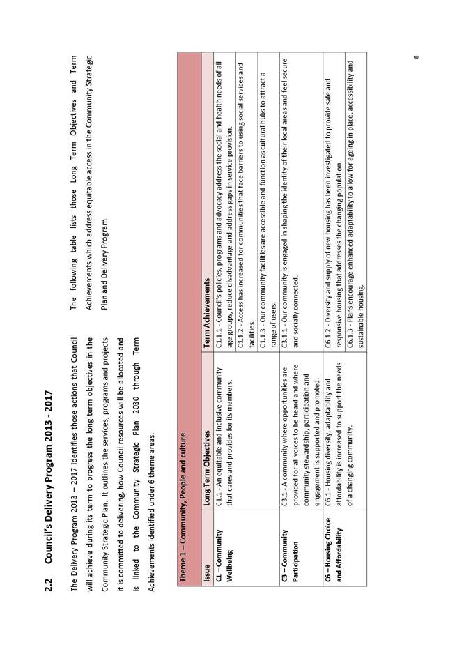
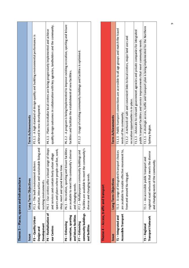
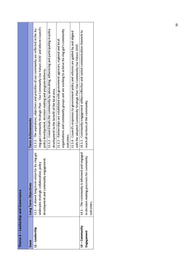
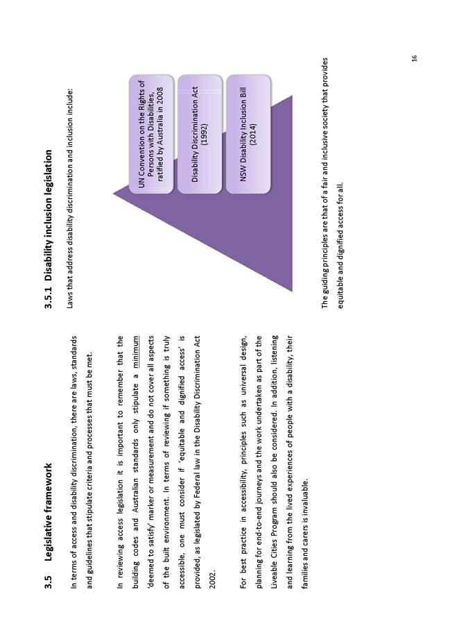
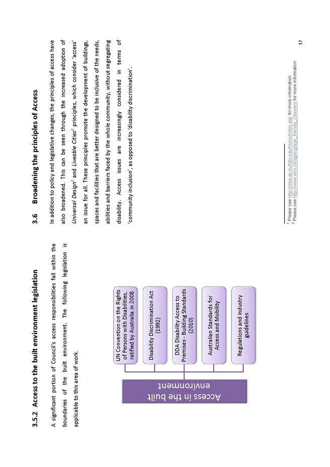
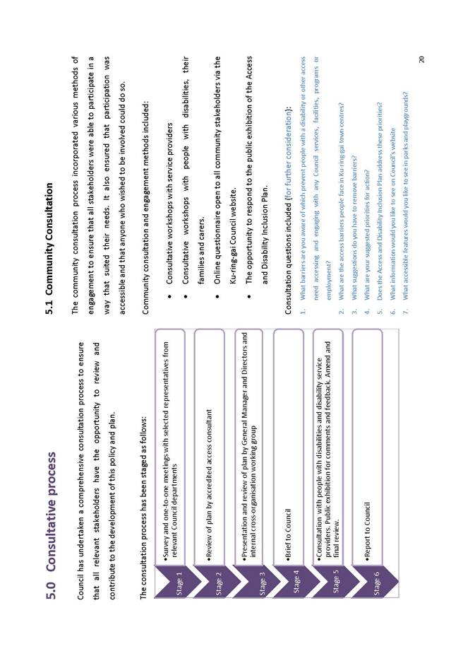


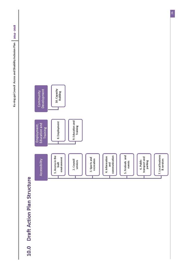
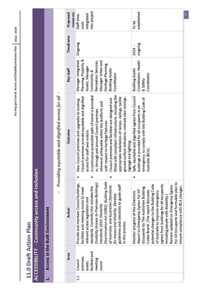
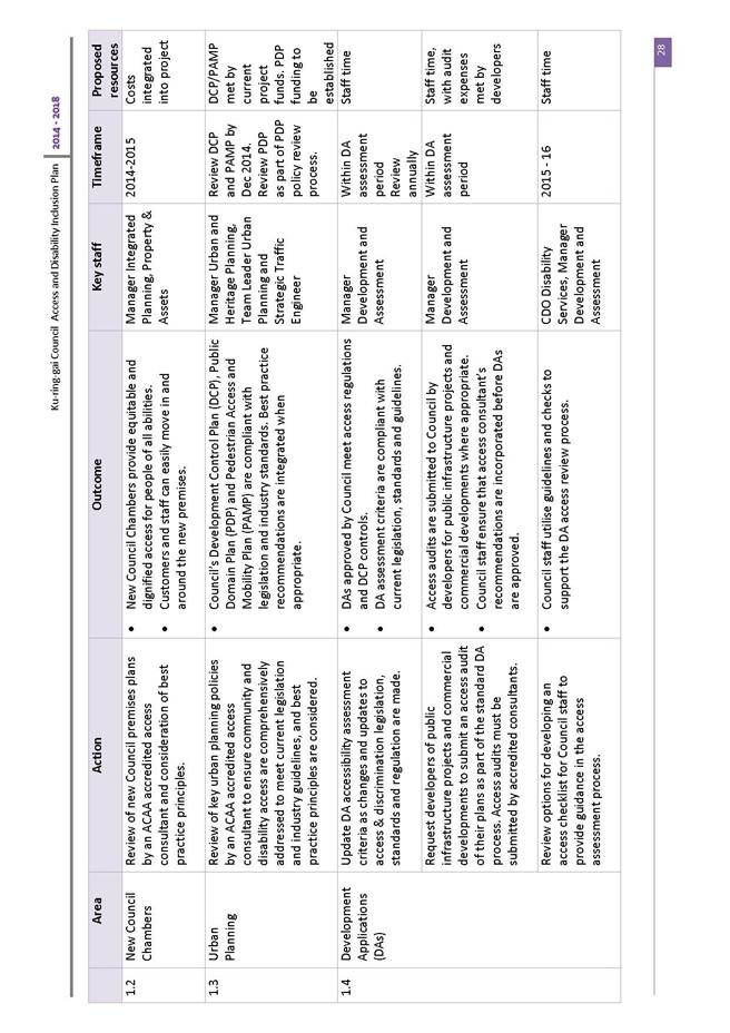
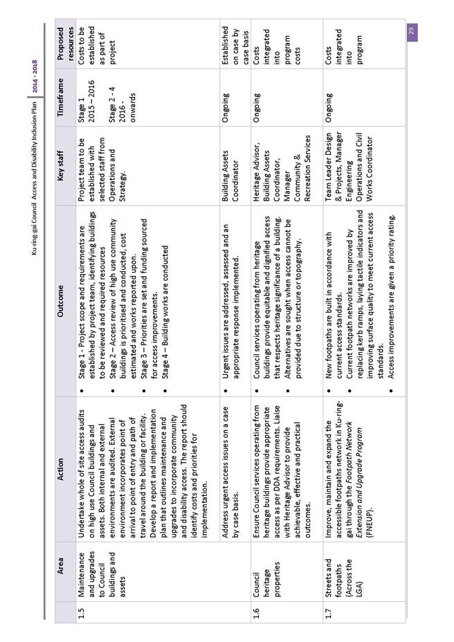
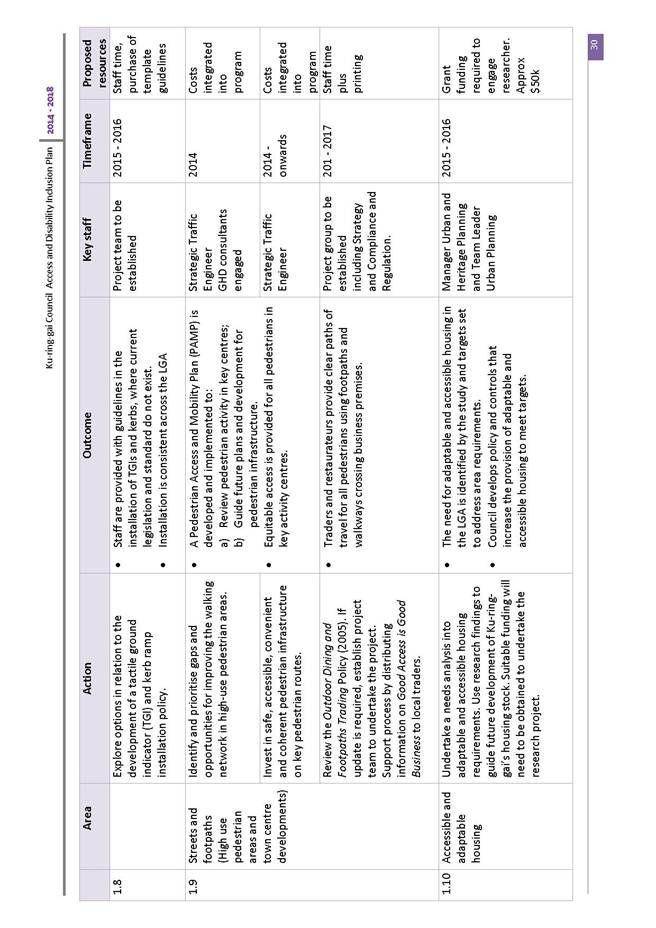
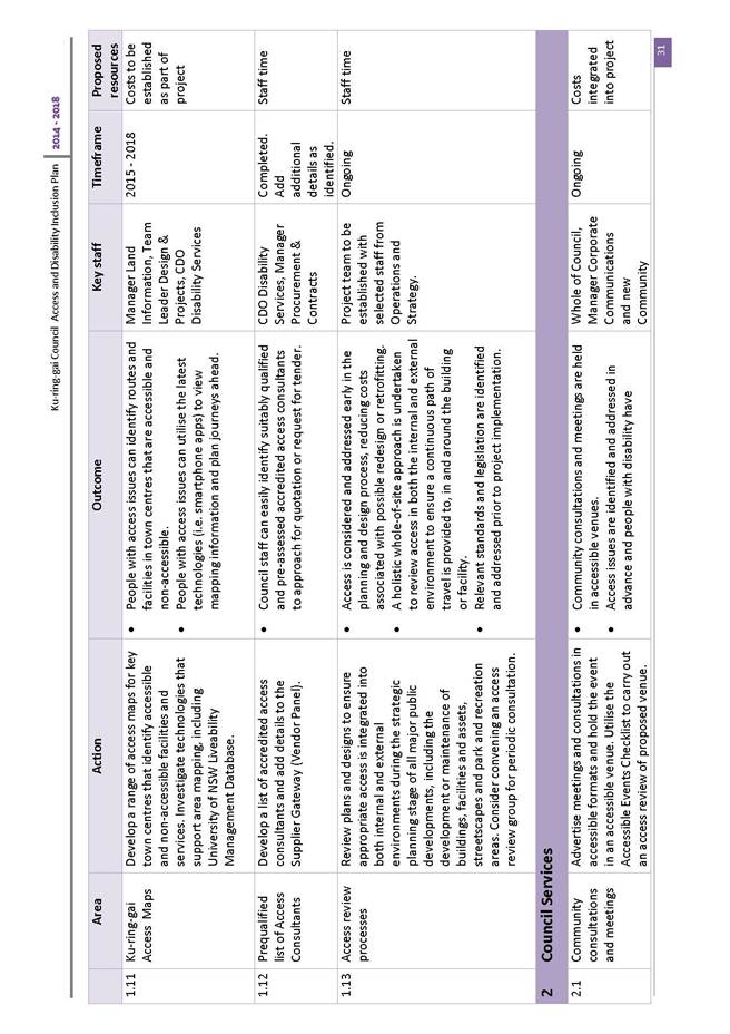
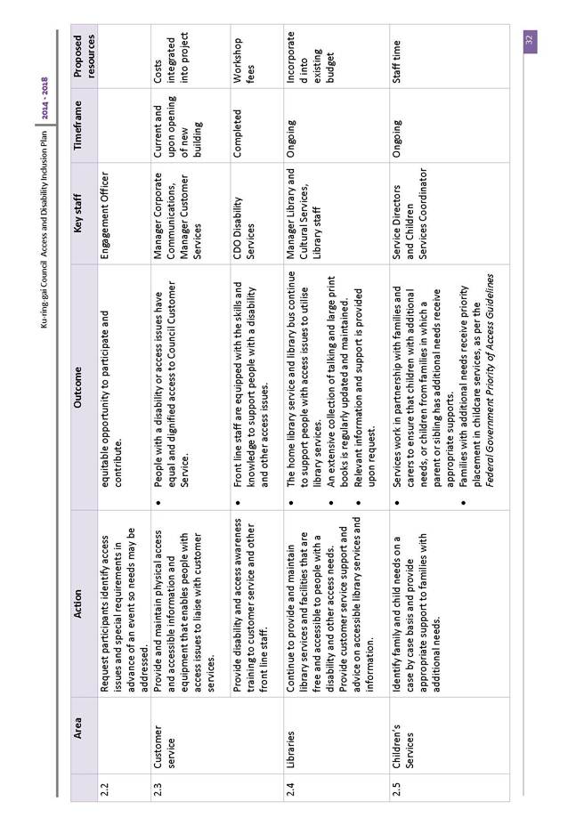
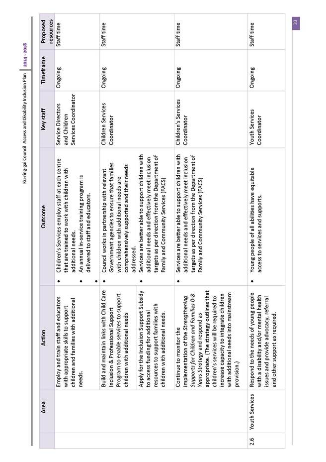
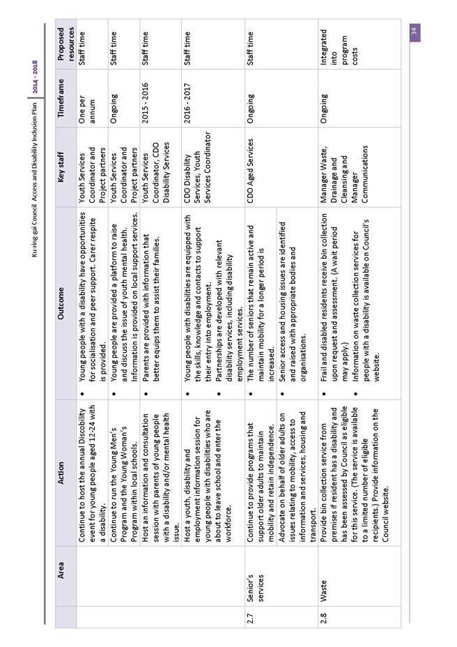
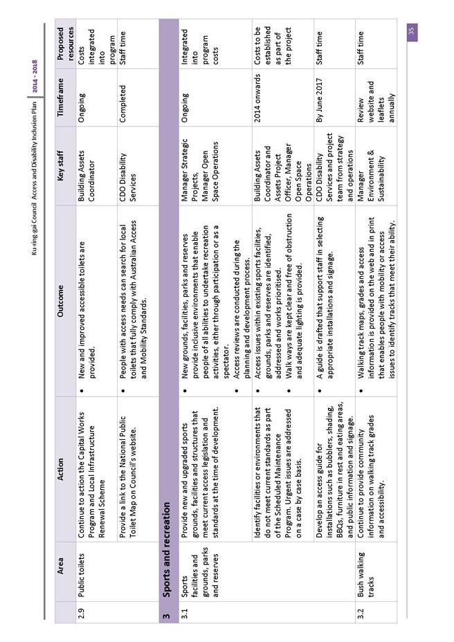
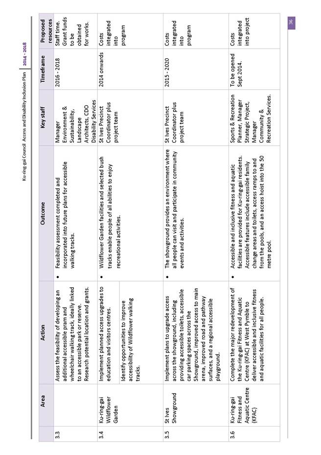
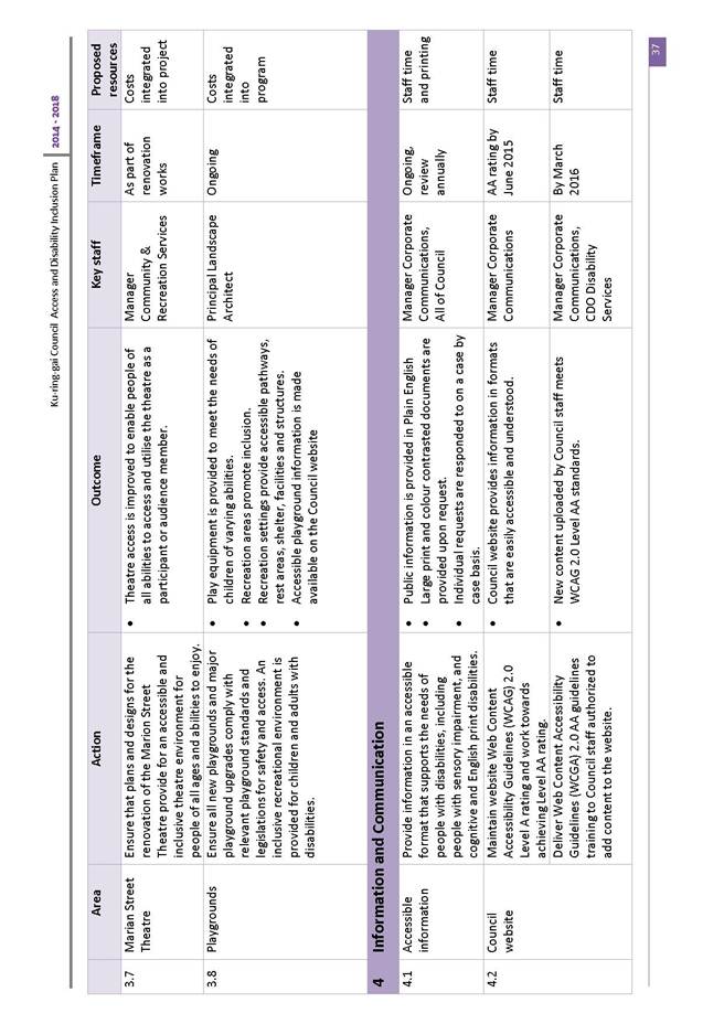
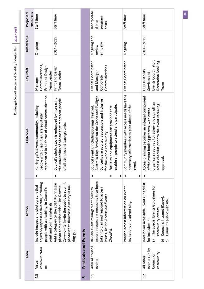
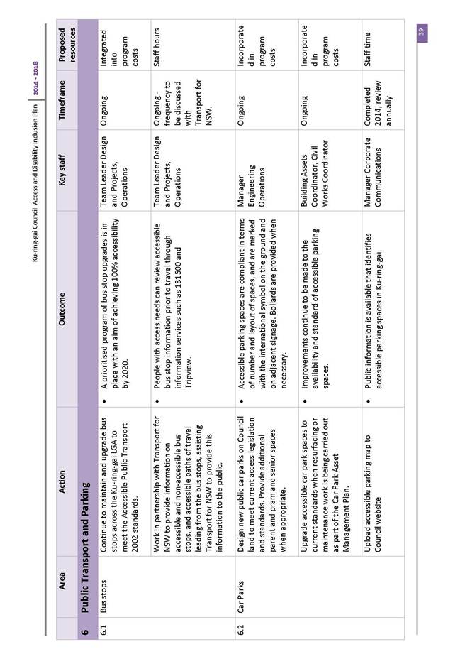
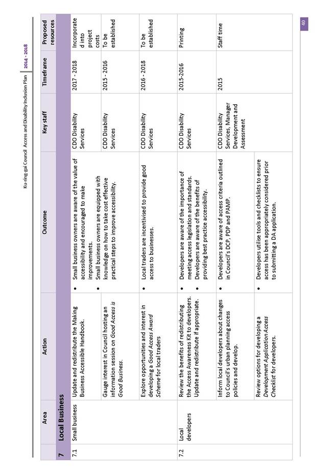
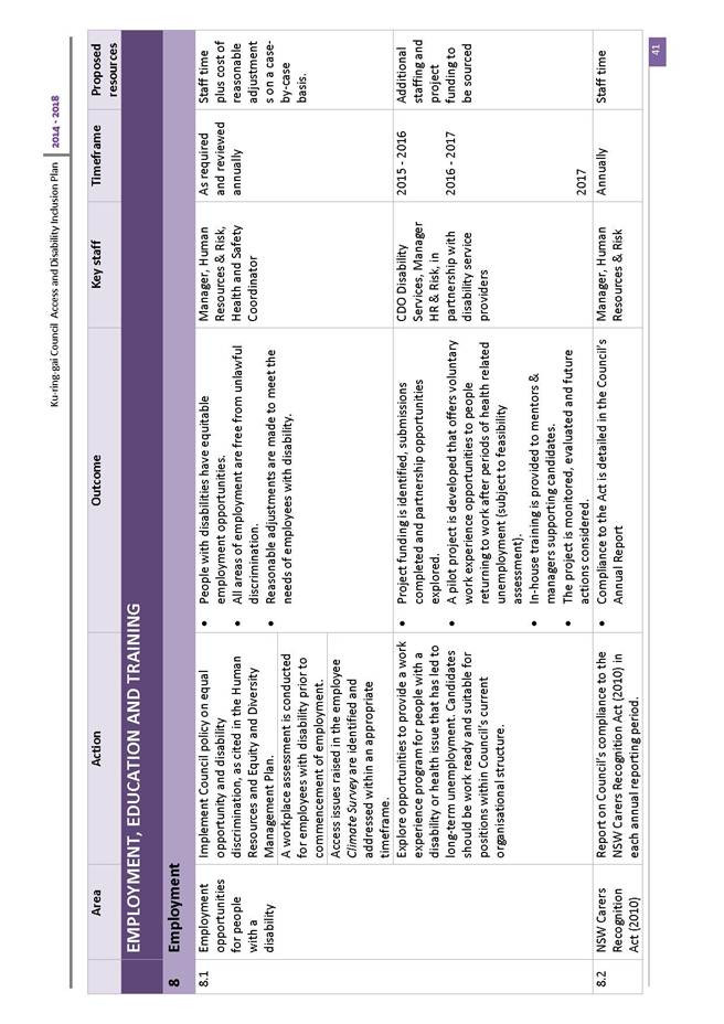
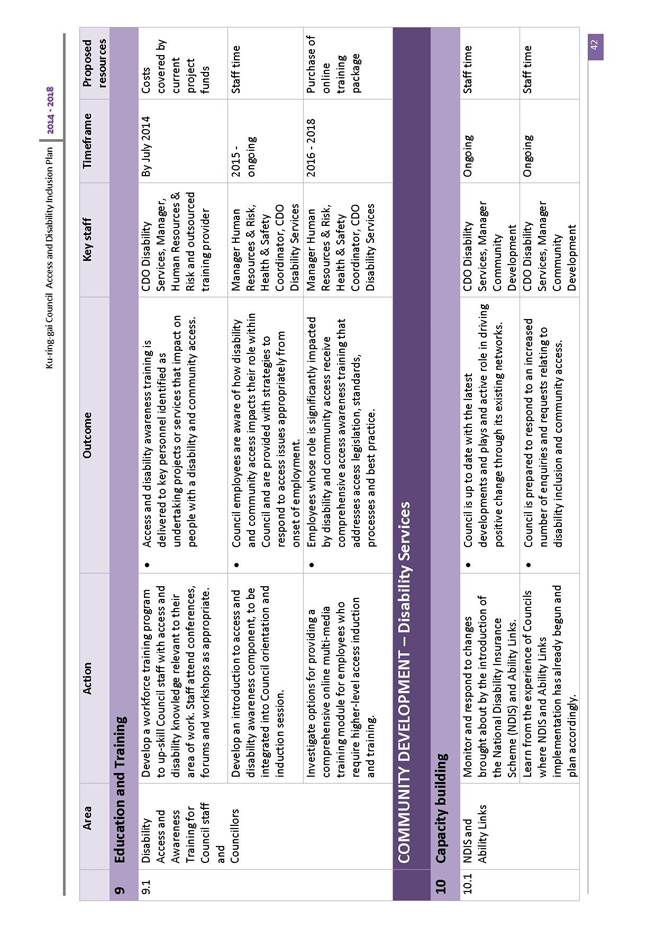
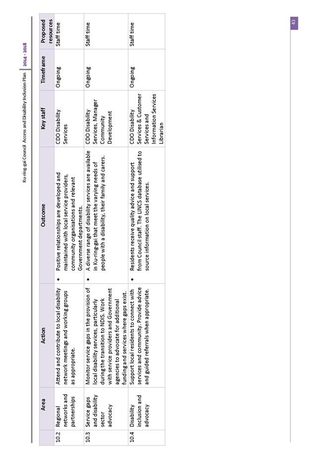
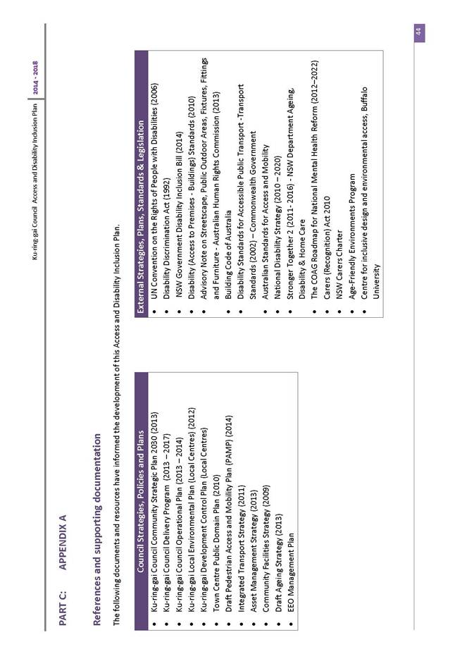
|
Ordinary Meeting of Council - 28 October 2014 |
GB.4 / 166 |
|
|
|
|
Item GB.4 |
S07511 |
|
|
9 October 2014 |
Ku-ring-gai Neighbourhood Centre - Lease Renewal of Premises 11-21 Cowan Road St Ives
EXECUTIVE SUMMARY
|
purpose of report: |
For Council to consider granting a five (5) year lease agreement to Ku-ring-gai Neighbourhood Centre Inc (KNC) for premises located at 11-21 Cowan Road St Ives.
|
|
|
|
|
background: |
Ku-ring-gai Neighbourhood Centre Inc has been operating from their current office since 1996, and has occupied the site continuously since this time under successive term licence agreements. |
|
|
|
|
comments: |
KNC is a non-profit community group offering information and assistance services to the local community. KNC has complied with the terms and conditions of the previous licence and has requested a renewal of their licence with Council for a further term. |
|
|
|
|
recommendation: |
That Council grant a new lease to Ku-ring-gai Neighbourhood Centre Inc for a period of 5 years.
|
Purpose of Report
For Council to consider granting a five (5) year lease agreement to Ku-ring-gai Neighbourhood Centre Inc (KNC) for premises located at 11-21 Cowan Road St Ives.
Background
The KNC is situated within the St Ives Village Shopping Village, 11-21 Cowan Road St Ives. The shopping centre and KNC share a common wall. KNC has been operating from their current premises since 1996. The area solely leased is approx. 100 square metres.
(See Attachments A1 and A2).
Accommodation within KNC comprises of a reception/waiting area and three offices. Bathroom and kitchen are shared. The premises have a separate entry and are carpeted with air conditioning.
KNC is a non-profit community group offering information and assistance services to the local community. The current lease agreement has expired and is currently holding over on a month to month basis.
Comments
Ku-ring-gai Neighbourhood Centre Inc (KNC) is a not for
profit volunteer based community organisation located at St Ives Shopping
Village providing information support and services to
Ku-ring-gai residents. KNC is managed by a voluntary Management Committee that
is elected from members of the organisation.
KNC is managed by volunteers who go through screening and training prior to working with the centre. It is incorporated under the NSW Incorporated Associations Act. It is managed by a volunteer community based management committee that is elected by KNC members each year at the Annual General Meeting. Any interested community member can apply to become a member of KNC.
The Neighbourhood Centre operates a Neighbour Aid program, which is a Home and Community Care Support Program (HACC) for the frail, elderly and people with a disability and their carers. HACC is financed by the NSW State and Federal Governments.
KNC is a member of the following organisations:
- LCSA - Local Community Services Association
- NCOSS - Council of Social Service of New South Wales
- NASSA - Neighbour Aid Social Support Association
- Hornsby Ku-ring-gai Volunteer Coordinators Forum
- Hornsby Ku-ring-gai HACC Community Care Forum
The types of services provided by KNC are as follows:
- HACC Neighbour Aid
- Social support for the frail/elderly, disabled and their carers
- Office support facilities
- Fax, email, photocopy and laminating to A3 size
- Public access computers
- Broadband for Seniors
- Computer, internet and email access - free basic computer lessons
- JP services
- English Conversation Classes
- Pre-loved books for sale
- Community activities & groups
- Tax Help
- Ku-ring-gai Family Support Services
integrated planning and reporting
Community, People and Culture
|
Community Strategic Plan Long Term Objective |
Delivery Program Term Achievement |
Operational Plan Task |
|
C1.1 An equitable and inclusive community that cares and provides for its members. |
C1.1.1 Council’s policies, programs and advocacy address the social and health needs of all age groups, reduce disadvantage and address gaps in service provision.
C1.1.2 Access has increased for communities that face barriers to using social services and facilities |
Develop and implement programs that respond to community needs and address a range of accessibility issues and alleviates social isolation. |
Governance Matters
Described as Lot 100 DP 838008, the premises are located in the St Ives Ward and are zoned Part B2 – RE1. The Planning Instrument is Ku-ring-gai LEP (Local Centres) 2012. It is Community Land.
The proposed lease renewal would also be covered under Council’s Policy for Management of Community and Recreation Land and Facilities (the Policy). As the Centre plays a pivotal community role, the existing rental rebate of 90% would be maintained.
Under Section 47 of the Local government Act, Council is required to publicly notify its intention to enter into any leasing agreement. The notice period is 28 days with consideration given to any submissions received concerning the proposal.
Risk Management
KNC will continue to indemnify Council by undertaking contents insurance as well as $20 million Public Liability Insurance. Evidence of currency is to be supplied annually to Council.
KNC has a record over the last 18 years during its continued occupation of meeting its full responsibilities as a reliable lessee and has consistently complied with the conditions of previous and existing licensing arrangements.
Financial Considerations
Following a market rental review of the premises, the market rental has been assessed at $60,000 pa (+ GST).However, in accordance with Council’s current Policy for Management of Community and Recreation Land and Facilities, a 90% rebate has been applied to the market rental resulting in an annual licence fee of $6,000 pa (+ GST).
KNC has agreed to the annual rental being increased by 5% per annum each calendar year. It is also proposed that the current free use of the St Ives Library Meeting Room by KNC is to cease as of 31 December 2014 and that any future use of this room will require a booking via Council’s booking system, as per Council’s approved fees and charges. The lower community rate will apply to KNC.
Additionally, in accordance with Council’s Policy for Management of Community and Recreation
Land and Facilities, KNC is obliged to pay Council’s legal costs incurred in association with the preparation of the new licence agreement.
Social Considerations
KNC co-ordinates a community information service that is committed to providing a crucial role in the social interaction and development within the general community, offering information and assistance services.
Amongst a wide range of services, the Neighbourhood Centre operates a Neighbour Aid program which is a Home and Community Care Support Program (HACC) for the frail, elderly and people with a disability/their carer’s.
KNC also has a number of volunteers who manage a community based management committee.
The close proximity to the St Ives shopping centre positions it strategically for the community to access this site for services.
Environmental Considerations
There are no environmental considerations associated with the granting of a new licence at this particular location.
Community Consultation
No consultation is required for this process prior to Council resolution. Once Council resolves to grant the proposed lease, 28 days public notification of Council’s intention to grant the lease the premises will occur in accordance with s 47 (1) a of the Local Government Act 1993.
Internal Consultation
Council’s Operations Department has been consulted regarding the maintenance responsibilities for the building under this licence.
Summary
The Ku-ring-gai Neighbourhood Centre Inc (KNC) has been operating as a community based non-profit organisation for 18 years in Cowan Road, St Ives. KNC have a sound track record of front line community involvement servicing the community within Ku-ring-gai LGA. The current lease agreement has expired and is currently holding over on a month to month basis.
KNC co-ordinates a community information service that is committed to providing a crucial role in the social interaction and development within the general community, offering information and assistance services
The renewal of this lease will ensure that the service will continue to maintain its important services at St Ives over the next 5 years.
|
A. That Council approve the granting of a five (5) year lease agreement to Ku-ring-gai Neighbourhood Centre Inc for premises located at 11-21 Cowan Road St Ives.
B. That the lease be treated as commencing from 1 July 2014 and expire on 30 June 2019 in accordance with previous negotiations.
C. That the Mayor and General Manager or their delegate be authorised to execute the necessary documentation.
D. That Council authorise the affixing of the Common Seal of Council to the Lease Agreement.
|
|
Michael New Property Officer Recreational Facilties |
Mark Taylor Manager Community & Recreation Services |
|
Janice Bevan Director Community |
|
|
A1View |
Attachment 1 - Site Photo - Ku-ring-gai Neighbourhood Centre |
|
2014/253365 |
|
|
|
A2View |
Attachment 2 - Site Plan - Ku-ring-gai Neighbourhood Centre |
|
2014/253300 |
|
Ordinary Meeting of Council - 28 October 2014 |
GB.5 / 173 |
|
|
|
|
Item GB.5 |
S05273 |
|
|
2 October 2014 |
Investment Report as at 30 September 2014
EXECUTIVE SUMMARY
|
purpose of report: |
To present Council’s investment portfolio performance for September 2014.
|
|
|
|
|
background: |
Council’s investments are reported monthly to Council in accordance with the Local Government Act 1993, the Local Government (General) Regulation 2005 and Council’s Investment Policy. |
|
|
|
|
comments: |
The net return on investments for the financial year to September 2014 was $1,086,000 against a budget of $842,000, giving a YTD favourable variance of $244,000. |
|
|
|
|
recommendation: |
That the summary of investments performance for September 2014 be received and noted; and that the Certificate of the Responsible Accounting Officer be noted and report adopted.
|
Purpose of Report
To present Council’s investment portfolio performance for September 2014.
Background
Council’s investments are reported monthly to Council in accordance with the Local Government Act 1993, the Local Government (General) Regulation 2005 and Council’s Investment Policy.
Comments
Investment Portfolio Performance Snapshot
The table below provides the investments portfolio performance against targets identified in Council’s Investment Policy as well as other key performance indicators based on industry benchmarks.

Cumulative Investment Returns against Budget
The net return on investments for the financial year to September 2014 was $1,086,000 against a budget of $842,000, giving a YTD favourable variance of $244,000. The total return on investments (interest and net capital gain) for the month of September is provided below.

A comparison of the cumulative investment returns against year to date original budget is shown in the Chart below.
Cash Flow and Investment Movements
Council’s total cash and investment portfolio at the end of September 2014 was $98,837,000.
The net cash outflow for the month was $6,538,000 mainly due to loan repayment.
There were five investments matured in September 2014, and three new investments were made during the month. Table 1 below provides detailed movements of investments by institution name, investment rating and interest rate.
Table 1 – Investment Movements – September 2014

Investment Performance against Industry Benchmarks
Overall during the month of September the investments performance was well above industry benchmark. The benchmark is specific to the type of investment and details are provided below.
Ø UBS Bank Bill Index is used for all Council’s investments
A comparison of the portfolio returns against investment benchmark is provided in Table 2 below.
Table 2 - Investments Performance against Industry Benchmarks

Table 3 below provides a summary of all investments by type and performance during the month.
Attachment A1 provides definitions in relation to different types of investments.
Table 3 - Investments Portfolio Summary during September 2014
Investment by Credit rating and Maturity Profile
The allocation of Council’s investments by credit rating and the maturity profile are shown below:

integrated planning and reporting
Leadership & Governance
|
Community Strategic Plan Long Term Objective |
Delivery Program Term Achievement |
Operational Plan Task |
|
L2.1 Council rigorously manages its financial resources and assets to maximise delivery of services |
Council maintains and improves its long term financial position and performance. |
Continue to analyse opportunities to expand the revenue base of Council |
Governance Matters
Council’s investments are made in accordance with the Local Government Act (1993), the Local Government (General) Regulation 2005 and Council’s Investment Policy.
A revised Investment Policy was adopted by Council on 10 December 2013.
Section 212 of the Local Government (General) Regulation 2005 states:
(1) The responsible accounting officer of a council:
(a) must provide the council with a written report (setting out details of all money that the council has invested under section 625 of the Act) to be presented:
(i) if only one ordinary meeting of the council is held in a month, at that meeting, or
(ii) if more than one such meeting is held in a month, at whichever of those meetings the council by resolution determines, and
(b) must include in the report a certificate as to whether or not the investment has been made in accordance with the Act, the regulations and the council’s investment policies.
(2) The report must be made up to the last day of the month immediately preceding the meeting.
Risk Management
Council manages the risk associated with investments by diversifying the types of investment, credit quality, counterparty exposure and term to maturity profile.
Council invests its funds in accordance with The Ministerial Investment Order.
All investments are made with consideration of advice from Council’s appointed investment advisor, CPG Research & Advisory.
Council has two “Grandfathered” investments in structured products that were previously entered into in accordance with The Ministerial Investment Order at the time. The Ministerial Investment Order no longer allows investment in these products. These investments are:
Maple Hill – HSBC Bank
Maple Hill, with a face value of $3,000,000, is invested by Council on a “held to maturity” basis being December 2014. This CDO has incurred six previous credit events by the underlying securities and can withstand a further five credit events before principal loss is incurred. There are no distressed securities now and independent advice is that the CDO is at low risk of not recovering the full principal. The investment has not operated outside of its terms and conditions, it continues to fully meet interest payments as and when they fall due and there has not been a reduction in the coupon rate. While Council intends to hold this investment to maturity, the market value at 30 September 2014 was quoted by HSBC at $2,934,000.
CPDO PP – Royal Bank of Scotland
This Constant Proportion Debt Obligations Principal Protected (CPDO PP), with a face value of $6,000,000, is invested by Council on a “held to maturity” basis being September 2016. This CPDO is capital protected at maturity date by Royal Bank of Scotland. Since December 2011 it ceased to pay interest, due to a decrease in the credit indices it was linked to, creating an unwind event. The investment now takes the form of a zero coupon senior bank bond with a value of $6M. While Council intends to hold this investment to maturity, the market value at 30 September 2014 was quoted by RBS Morgan at $5,589,000.
Financial Considerations
The budget for interest on investments for the financial year 2014/2015 is $3,338,500. Of this amount approximately $2,293,000 is restricted for the benefit of future expenditure relating to development contributions, $627,200 transferred to the internally restricted Infrastructure & Facility Reserve, and the remainder of $418,300 is available for operations.
Social Considerations
Not applicable.
Environmental Considerations
Not applicable.
Community Consultation
None undertaken or required.
Internal Consultation
None undertaken or required.
Certification - Responsible Accounting Officer
I hereby certify that the investments listed in the attached report have been made in accordance with Section 625 of the Local Government Act 1993, clause 212 of the Local Government General Regulation 2005 and Council’s Investment Policy.
Summary
As at 30 September 2014:
Ø Council’s total cash and investment portfolio is $98,837,000.
Ø Council’s net return on investments for the financial year to September 2014 was $1,086,000 against a budget of $842,000, giving a YTD favourable variance of $244,000.
|
A. That the summary of investments and performance for September 2014 be received and noted.
B. That the Certificate of the Responsible Accounting Officer be noted and the report adopted.
|
|
Tony Ly Financial Accounting Officer |
David Marshall Director Corporate |
|
A1View |
Investments definitions specific to Council’s investment portfolio |
|
2014/037712 |
|
Ordinary Meeting of Council - 28 October 2014 |
GB.6 / 182 |
|
|
|
|
Item GB.6 |
DA0242/14 |
|
|
1 August 2014 |
development application
Summary Sheet
|
Report title: |
17 Turramurra Avenue, Turramurra - demolition of an existing dwelling and construction of a three storey residential flat building containing seven units |
|
ITEM/AGENDA NO: |
GB.6 |
|
Application No: |
DA0242/14 |
|
Property Details: |
17 Turramurra Avenue, Turramurra Lot & DP No: Lot 1 DP 510523 Site area: 1459 m2 Zoning: R4 |
|
Ward: |
|
|
Proposal/Purpose: |
Demolition of existing an dwelling and construction of a three storey residential flat building containing seven units.
|
|
Type of Consent: |
Local |
|
Applicant: |
Pex Projects Pty Ltd |
|
Owner: |
Pex Projects Pty Ltd |
|
Date Lodged: |
30 June 2014 |
|
Recommendation: |
Deferred commencement consent.
|
Purpose of Report
The purpose of this report is to determine DA0242/14 and is reported to Council (and not the JRPP) as the proposed development is a residential flat development with a capital investment value (CIV) of less than $20 million.
integrated planning and reporting
PLACES, SPACES & INFASTRUCTURE
|
Community Strategic Plan Long Term Objective |
Delivery Program Term Achievement |
Operational Plan Task |
|
P2.1 A robust planning framework is in place to deliver quality design outcomes and maintain the identity and character of Ku-ring-gai
|
Applications are assessed in accordance with State and local plans
|
Assessments are of high quality, accurate and consider all relevant legislative requirements
|
Executive Summary
Issues: Tree impacts, minimum frontage requirements
Submissions: 18 objections
Land and Environment Court: N/A
Recommendation: Approval
History
Pre-DA
A Pre-DA consultation was held between Council Officers and the applicant on 13 May 2014. The Pre-DA discussions were generally supportive of the proposed development, noting that conceptual drawings were tabled. However, the following issues were identified:
- the driveway encroachment within the tree protection zone of two Eucalyptus pililaris (Blackbutt) eucalyptus trees
- providing for an adaptable residential unit
- providing for an extra visitor car parking space
- balcony design
- solar access to Unit 3
DA history
3 July 2014 application lodged
18 July 2014 to 18 August 2014 application notified
12 August 2014 preliminary assessment letter issued to applicant
20 August 2014 meeting with applicant to discuss issues
4 September 2014 conceptual amendments submitted to Council
16 September 2014 amended plans formally submitted to Council
The Site
Site description
The site is located on the low, eastern, side of Turrumurra Avenue, to the south of its intersection with Wonga Wonga Street.
The site is a rectangular shaped allotment and has an area of 1459m2 with dimensions of 23.965m x 60.96m. The site contains a detached part single, part two storey dwelling house with rear detached carport and inground pool.
The site is extensively landscaped with cottage style gardens and contains two large remnant Black butts (remnants of the Blue Gum High Forest) within the front setback.
Surrounding development
Surrounding development is of varying scale and density and representative of an area undergoing urban renewal.
To the north and east, are sites containing single dwellings, many of which either have consent for redevelopment or are subject of a current DA. To the south, are single dwellings and one on the corner of Nulla Null Street (2 Nulla Nulla Street) is a heritage item. To the west, at 20 – 28 Turramurra Avenue, a five storey residential flat development exists.
The Proposal
The proposal is to demolish the existing dwelling and rear detached garage and construct a three storey residential flat building comprising:
· basement car parking for 16 vehicles, bicycle parking, waste areas and storage
· three storeys of residential development comprising 7 x 3 bedroom units
· comprehensive landscaping works, including the retention and enhancement of the existing blackbutt’s on site.
Consultation
Community
In accordance with the notification requirements of the Local Centres DCP, owners of surrounding properties were given notice of the application. In response, Council received submissions from the following:
1. SR & GC Morgan – 202/28 Turramurra Avenue, Turramurra
2. CE & JA Lynch – 16 Turramurra Avenue, Turramurra
3. D & S Sandoe OAM - 301/20 Turramurra Avenue, Turramurra
4. P & E Powell – 501/28 Turramurra Avenue, Turramurra
5. W & J Gambell – 101/20 Turramurra Avenue, Turramurra
6. M & J Fiedler – 102/20 Turramurra Avenue, Turramurra
7. NC & MA Mulveney – 201/20 Turramurra Avenue, Turramurra
8. R & M Lough – PO Box 230 Turramurra
9. D & M Nash – 203/20 Turramurra Avenue, Turramurra
10. P & D Howitt – 502/28 Turramurra Avenue, Turramurra
11. I & P Worner – 304/20 Turramurra Avenue, Turramurra
12. S & P Lawrence – 203/28 Turramurra Avenue, Turramurra
13. PG & HM Bailey – 204/28 Turramurra Avenue, Turramurra
14. V & d McGilvray – 501/20 Turramurra Avenue, Turramurra
15. A & L Shaw - 502/20 Turramurra Avenue, Turramurra
16. K Middleton – kgmiddleton@bigpond.com
17. R. Denison – 103/20 Turramurra Avenue, Turramurra
18. Executive committee ‘Lainsborough’ – 302/28 Turramurra Avenue, Turramurra
At Lainsborough (the residential flat buildings on the western side of Turramurra Avenue) an already dangerous situation exists when exiting the property, caused by a lack of visibility of on-coming traffic due to commuter parking on each side of Turramurra Avenue, restricting this view. Concern is raised that the proposed development will exacerbate this issue
The proposed development is located on the opposite side of Turrmurra Avenue from ‘Lainsborough’. The location of the driveway is not in close proximity of Lainsborough and Council’s Development Engineer has raised no objection to its location.
The proposal will result in a significant increase in traffic along Turramurra Avenue
Consistent with the comments of Council’s Development Engineer, the proposed development of 7 units will result in only a minor increase in traffic within the surrounding street network.
The application states that visibility or sight lines for traffic comply with the Australian Standards and Council’s DCP – we strongly disagree
Council’s Development Engineer has assessed this aspect of the proposal and has raised no concerns in this regard.
Trees along the Turramurra Avenue frontage should be kept as they have a typical ‘leafy North Shore’ appeal and will soften the area once fully developed
The site contains two large blackbutts within the front setback, forming an important part of the streetscape. These trees are proposed to be retained.
Council should install ‘No Stopping’ signs on both sides of Turramurra Avenue to ensure adequate sight lines
Council’s Development Engineer considered this matter and does not feel that such measures necessary as the sight lines associated with the existing driveways that have a frontage to Turramurra Avenue are consistent with Australian Standard 2890.1-2009 – off street car parking.
The driveway is not set back the required 6m from the side boundary
The driveway setback to the northern side boundary falls short of the minimum 6m specified in the DCP. This variation is supported in order to retain of the two large eucalypts in the front setback area. A complying driveway setback to the side boundary would necessitate the removal of these trees, which are remnants of the critically endangered Sydney Blue Gum High Forest. The reduced setback will have no adverse impacts.
The elevations comprise an unsightly mixture of materials unsuited to the streetscape
The proposed development includes a strong palate of materials including masonry, timber and cladding. These materials complement and accentuate the architectural design and are considered to be acceptable by Council’s Urban Design Consultant.
Within Council
Landscaping
Council’s Landscape Officer commented on the proposal as follows:
Preservation of trees or vegetation - Clause 5.9, KLEP; Cl 1.3 Volume C Ku-ring-gai Local Centres DCP
An Arboricultural Assessment, prepared by Stuart Pittendrigh, dated June 2014, has been submitted with the application. Tree numbers refer to this report.
Trees to be removed
Tree 4/ Quercus palustris (Pin Oak) The tree is located at the north-western corner of the site. The tree is to be removed for the proposed driveway. There is no objection to the removal of this tree as it is necessary to facilitate the driveway into the basement, the location of which is constrained.
Tree 5/ Quercus palustris (Pin Oak) The tree is located at the north-western corner of the site. The tree is to be removed for the proposed driveway. There is no objection to the removal of this tree, the removal of this tree as it is necessary to facilitate the driveway into the basement, the location of which is constrained.
Tree 6/ Pittosporum undulatum (Sweet Pittosporum) The tree is located on the northern boundary of the site. The tree is to be removed for the proposed driveway. There is no objection to the removal of this tree, the removal of this tree as it is necessary to facilitate the driveway into the basement.
Tree 12/ Liriodendron tulipifera (Tulip Tree) The tree is located in the centre of the rear yard. The tree is to be removed for the proposed building. There is no objection to the removal of this tree as it is within the developable building footprint of the site.
Tree 14/Taxus baccata (Yew) The tree is located in on the eastern boundary. The tree is not numbered on the landscape plan. The tree is assessed as being of average condition and is to be removed. There is no objection to the removal of this tree.
Tree 18/ Castanea sativa (Spanish Chestnut) The tree is located on the rear boundary. The tree is assessed as being of average condition and is to be removed for the proposed stormwater pit. There is no objection to its removal.
Tree 21/ Metasequoia glyptostroboides (Dawn Redwood) The tree is located at the north-eastern corner of the site. The tree is assessed as being of good condition, however the proposed major encroachment for the basement of 18.7% will adversely impact the health and condition of the tree, including an encroachment within the structural root zone. To avoid any impacts on the ecologically significant BGHF trees in the front setback this tree will require removal. There is no objection to the removal of this tree.
There is no objection to the removal of the following trees as they are exempt under Section 13.2 Part 13 Volume A Ku-ring-gai Local Centres DCP - Trees 7, 22, 23 and 27.
Street trees to be removed
There are no street trees located within the Turramurra Avenue nature strip that are proposed to be removed.
Trees to be retained
Alternative driveway location
The advice at the Pre-DA consultation was to investigate locating the proposed driveway within the footprint of the existing driveway to avoid additional compaction and impermeable structures within the tree protection zone of two significant existing trees located in the front setback (Trees 1 and 3). The arborist has considered the driveway location adjacent to the southern boundary and determined that the driveway and passing bay would encroach within the structural root zone of Tree 3. It is agreed that the northern boundary is the preferred driveway location within the subject site
Tree 1/ Eucalyptus pilularis (Blackbutt) The tree is located on the front boundary of the site. The proposed basement and building are located outside of the tree protection zone. The proposed driveway will result in a major encroachment within the tree protection zone. To demonstrate that the tree will remain viable, the arborist has undertaken root investigation along the southern edge of the proposed driveway and prepared a Tree Location/Impact Plan detailing location, size and depth of roots. The size and proximity to the surface of the roots indicate that the driveway is likely to impact numerous large roots. To bridge the roots, a suspended slab on piers is proposed with levels based on the root mapping. A longitudinal section along the southern side of the driveway and vehicle crossover has been provided with detailed sections of the driveway construction to demonstrate the preservation of all major roots.
Tree 3/ Eucalyptus pilularis (Blackbutt) The tree is located within the front setback of the site. The proposed basement excavation is approximately 15 metres from the tree, similar to the existing building. The basement excavation is limit impact on tree roots by the use of sheet piles along the western end. The proposed building setbacks will result in a major encroachment within the tree protection zone. To avoid root severance, the proposed building encroachment within the tree protection zone is to be on pier footings. Sections have been provided to demonstrate sufficient clearance to the underslab. The impact is considered acceptable.
There is evidence of a large structural root running east of the tree towards the proposed building. Root mapping and associated design considerations have reduced the impacts on the root enabling a 13 metres section being protected. Ground protection of this large diameter root during construction has been recommended by the arborist.
The proposed driveway is 9.2m from the tree. The proposed suspended driveway design will preserve any roots of this tree that extend into this area.
Tree 13/Acer palmatum (Japanese Maple) The tree is located at the south-eastern corner of the site. The basement is 4.8m from the tree. An elevated deck and awning is proposed 3 metres from the tree. Excavation for a stormwater pipe is proposed 2 metres from the tree, within the structural root zone. It is conditioned (that the excavation required for the installation of the pipe is to be undertaken by hand and under arborist supervision. (Condition 71)
Tree 17/Chamaecyparis obtusa (Hinoki False Cypress) The tree is located on the eastern boundary. The basement is outside the tree protection zone. An elevated deck and awning is proposed 3 metres from the tree. A stormwater pipe is proposed to be thrust bored 600mm from the tree, within the structural root zone of the tree.
Tree 19/ Jacaranda mimosifolia (Jacaranda)The tree is located at the north-eastern corner of the site. The basement is outside the tree protection zone. A stormwater pipe is proposed to be thrust bored 600mm from the tree, within the structural root zone of the tree.
Communal open space – Cl 7C.1 Volume A Ku-ring-gai Local Centres DCP
The development has a principal area of common open space located within the front setback of the site. To preserve the significant trees within the front setback, the development has an increased front setback of 12.5m instead of the minimum 8m for the ground floor private open space. In consideration of the site constraints and size of development, the location and size of communal open space is considered satisfactory.
Private open space - Cl 7C.2 Volume A Ku-ring-gai Local Centres DCP
The development provides well designed useable private open space.
Deep soil calculation (Part 7A.4 Volume A Ku-ring-gai (Local Centres) DCP)
Where the site area is less than 1800m2, a minimum of 40% of the site is to be deep soil landscape area as per definition in KLEP DCP. The proposed deep soil area is 40.3% of the site area.
The proposal complies with the minimum deep soil requirement.
Screen planting
Northern boundary –Eleaocarpus eumundii (Quandong) in association with retained existing hedging – This tree species has a mature height of 13m and is to be substituted by condition with a smaller species such as Elaeocarpus reticulatus (Blueberry Ash), with smaller species such as Syzigium australe ‘Resiliance’ forward of the building line (Condition 20).
Southern boundary – Syzigium australe ‘Resiliance’ in association with retained existing hedging.
Eastern boundary – Syzigium australe ‘Resiliance’ in association with retained existing trees.
Tree replenishment
A minimum of 10 trees are required for the site. The proposed canopy tree plantings, in addition to existing trees that are being retained, are in excess of this number.
BASIX
Common area landscape
The BASIX certificate reflects the landscape plan for common area landscape and individual units. The proposed plant species and quantities for the planter to Unit 6 are conditioned to be shown on the landscape plan (Condition 8).
Stormwater plan
The stormwater plan is considered satisfactory on landscape grounds.
Environmental site management plan
To ensure preservation of significant trees on the site during construction, plans have been provided for demolition, excavation and construction stages. Tree fencing and site access is to be in accordance with each stage.
Conclusion
The proposal is acceptable on landscape grounds.
Engineering
Council’s Development Engineer commented on the proposal as follows:
Stormwater disposal
The subject site falls away from Turramurra Avenue towards a Category 3a watercourse within 1 and 3 Wonga Wonga Street. The piped system is not contiguous with the subject site boundary and an easement has been sought and agreed to by the downstream owners. The design proposes a new 225mm diameter pipe and associated 1.2m wide drainage easement that commences in the eastern corner of the subject site and runs along the eastern boundary of 1 Wonga Wonga Street where it connects into the existing Council drainage easement.
Deferred commencement consent is recommended for the applicant to submit registered title documents demonstrating that the subject site is benefited by the necessary easement for stormwater drainage as far as the approved point of discharge to the public drainage system. This information is to include, as a minimum, registered title documents demonstrating the benefit and burdens, together with the instruments describing the terms of necessary drainage easement as well as the terms of the easement over the Council pipe to permit the passage of private property runoff.
As part of the deferred commencement, the easement design will need to include survey of the proposed route and arborist’s report (addressing both existing and proposed trees). The documentation is to be submitted to Council and approved prior to the operation of the consent.
An application DA230/14 has also been lodged with Council for the development of 1 Wonga Wonga Street and 2 adjoining lots 19 and 21 Turramurra Avenue over which the proposed easement is to be created.
The stormwater plans shows a combined on-site detention and retention tank comprising 28m3 and 10,000L of storage, respectively ,located within the stairs void area along the southern side of the building that access the basement.
The rainwater retention and re-use have met the BASIX commitments and have satisfied the 50% reduction in runoff days required under Volume C Part 4B.3 of the DCP. The sizing of the on-site detention volume has also satisfied the requirements described in Volume C Part 4B.5 of the DCP with an offset of 10% allowed for rainwater re-use. The design of the OSD system also provides a freeboard of 820mm from the top water level to the habitable finished floor levels of the development which is more than adequate.
A pump-out system with storage capacity of 7m3 has been provided within the basement carpark to drain the basement subsoil drainage. It has been designed to have the rising main discharge to the water quality chamber within the OSD tank.
The BASIX commitments are for re-use of stored rainwater for irrigation of 298sq.m of common landscaped areas and be used for one car wash bay. A central rainwater tank of 10m3 is proposed which satisfies the water commitments.
Water quality measures have been implemented into the design and demonstrate that stormwater can be managed efficiently on-site and the runoff controlled to assist in the maintenance of stream flow and the reduction in gross pollutants.
A water balance model was developed to reflect the water transportation process. The methodology adopted assessed the daily filling of the tank from rainwater sources, overflows during storm which was used to calculate the tank storage and daily drawdown for domestic use. The analysis also included a water quality model (MUSIC Modelling) to investigate stormwater runoff quality from the subject site. The results of the post-development nutrient control measures have been achieved when compared to the stormwater treatment standards / targets outlined in Council’s Local Centres DCP Volume C Clause 4B.6.
The applicant provided a proprietary pollution chamber Stormwater360 ‘StormFilter’ located within the OSD tank prior to connection into Councils public drainage system.
Traffic generation
According to the traffic generation rates nominated by The Roads & Maritime Services (RMS) ‘Guide to Traffic Generating Developments’, the development would generate approximately 3-4 peak hour vehicle trips which would represent one vehicle trip every 15 minutes during the peak hour. According to the above guidelines, the likely traffic generation is expected to be very low. The increase in traffic flows in Wonga Wonga Street is not expected to have a significant effect on traffic flows or on the operation of the intersection with the arterial road network.
Vehicle access and accommodation arrangements
The site is zoned ‘R3’ under the Local Centres LEP. The parking provisions have been determined using Ku-ring-gai Council Local Centres Development Control Plan for multi-dwelling housing. The site is located greater than 400m walking distance from the Turramurra Railway Station. The following parking provisions have been adopted:
Ku-ring-gai Council Local Centres DCP Volume C Clause 2R.2 ‘Car Parking Rates’
|
Multi-Dwelling Housing |
Parking Space Requirement |
|
1 bedroom unit |
1 space per unit |
|
2 bedroom unit |
1.25 space per unit |
|
3 bedroom unit |
1.5 spaces per unit |
|
Visitor car spaces |
1 space per 4 units |
7x 3 bedrooms = 7 x 1.5 spaces/unit = 11 spaces
7 dwellings - visitor space/4 dwellings = 2 visitor spaces
Total parking spaces required = 13 spaces
The development seeks to provide 16 off-street parking spaces, comprising 14 residents’ spaces (includes1 adaptable space) and 2 visitor spaces.
Vehicular access to the car parking facility is to be provided via a new 3.0m wide entry / exit driveway crossing which widens internally from the ramp down from 3.6m to 5.0m at the basement entry level. The driveway clear width satisfied the requirements of Volume C Clause 2.2 of the DCP. The use of the single lane driveway and ramp is also compliant with Clause 3.2.2 of AS2890.1:2004 given that the traffic flows will be in the order of 3-4 peak hour vehicle movements which are significantly low for a two-way access driveway.
A temporary service space has been provided which can also be used as a disabled visitor space. The minimum dimension of 3.5m x 6m can be provided with the space properly signposted.
The driveway gradients comply with Australian Standard 2890.1 (2004) “Off-Street car parking” as do the dimensions of the parking bay, ramp grades and aisle widths. The adaptable parking space width also complies with AS2890.6 (2009).
A driveway longitudinal section has been shown on the engineering plan which has incorporated Council’s Standard High Level vehicular crossing profile. The design is acceptable.
Waste collection
The development allows a garbage truck to enter and depart the garbage/room recycle storage area in a forward direction. The driveway grades and turning manoeuvrability are suitable for the small waste collection vehicle as shown by the swept paths within the Appendix of the Traffic Report. It is intended to use the two visitor spaces for the manoeuvre of Council’s garbage truck. This is acceptable which will be subject to the strata management to manage these spaces such that they are vacant during collection times.
A clear head height of 2.6m has been provided to access the basement area and has also been provided over the travel path of the waste service vehicle.
The proposed 8x240L bins for waste, paper and recycling satisfiy the minimum bin requirements.
The requirements as per Volume C Part 3.4 of the Local Centres DCP have been satisfied.
Construction management
An indicative construction traffic management plan (CTMP) has been submitted which is acceptable for DA purposes. Based on the scale of works and expected construction vehicle movements, a detailed construction traffic management plan (CTMP) must be submitted for review by Council Engineers prior to the commencement of any works on site.
The CTMP would also need to show turning path diagrams demonstrating how construction vehicles for all stages of development will turn into the site without crossing the centreline of Turramurra Avenue. For tree protection purposes, the use of the existing driveway and crossing for construction access is encouraged.
The submitted CTMP shows a Work Zone / Employee Parking along the site frontage. The Work Zones are provided for the set down and pick up of materials and not for the parking of private vehicles associated with the site. A work zone is conditioned for the site frontage Condition 10.
Geotechnical investigation
A desktop study of previous geotechnical investigations carried out in the immediate vicinities has been used. The investigation included the subject site which involved drilling a borehole up to 9m in the south-western portion of the site. The investigation identified subsurface conditions comprising surficial fill over residual silty clays then weathered shale bedrock at moderate depths in the range of 4m and 7m. The report suggests that minor erratic and localised groundwater was encountered at depth of 2.4m with the proposed depths of basement excavation of up to 3m. Given that groundwater has been encountered, it is conditioned that the basement is to be fully tanked to prevent unnecessary subsurface or groundwater extraction as per the requirement of Volume C Part 2.3.4 of the DCP Condition 53.
Standard conditions from the NSW Office of Water relating to a de-watering permit are also recommended. Evidence is also to be provided that Council has approved the proposed de-watering pump-out work. Condition 46.
The report suggests a dilapidation report is to be submitted to include a survey of adjoining dwelling at No. 19 Turramurra Avenue. This may not be necessary given that a DA has been lodged for this site.
All other recommendations during the construction phase shall be carried out as specified within the report. It is also recommended that further geotechnical input be required in particular to groundwater monitoring,
Recommendation
From an engineering perspective there are no objections to approval of this application, subject to the deferred commencement term and recommended Conditions 4, 47, 28, 46 and 66.
Ecology
An ecological review of the study area was based on the results of a desktop review and a site inspection in July 2014.
During the site inspections Blue Gum High Forest (BGHF) a critically endangered ecological community (CEEC) listed under the Threatened Species Conservation Act 1995 was identified within frontage of the site.
The BGHF community on site has been impacted upon from past clearing and the establishment of exotic grasses & herbaceous weeds. The BGHF community is mostly represented by the presence of two remnant canopy trees Eucalyptus pilularis (Blackbutt).
A native shrub layer was absent.
Environmental controls
The native vegetation within the site frontage has been mapped as an area of biodiversity significance under the KLCEP (2013) and also as category 5 canopy remnant under the KLEP DCP (2013).
Impacts of the proposal
The proposal does not propose removal of any trees that comprise part of the onsite Blue Gum High Forest or from the area identified as “biodiversity significance”.
The proposal, however has the potential to impact upon remnant trees which comprises part of the onsite Endangered BGHF community as a direct result of construction of the driveway and basement.
Advice received from Landscape Services confirms that the encroachment of the basement into the Tree Protection Zone (TPZ) will not adversely affect the long-term viability of the remnant Blackbutts (BGHF) within the site frontage.
Flora and fauna assessment
A flora and fauna assessment has been submitted within the development application which assesses the impacts of the proposal upon threatened species, endangered populations and endangered ecological communities listed under the Threatened Species Conservation Act 1995.
The impact assessment is considered satisfactory.
The impact assessment which has been prepared in accordance with Section 5A of the Environmental Planning & Assessment Act 1979 relies upon the abrorist advice with regards to impacts upon the Blackbutt (BGHF) trees. Consistent with comments of Council’s Landscape Assessment Officer this impact is acceptable.
Conclusion: The application is acceptable on ecological grounds for the reasons given above.
Urban design:
Council’s Urban Design Consultant commented on the proposal as follows:
PRINCIPLE 1: CONTEXT
Good design responds and contributes to its context. Context can be defined as the key natural and built features of an area. Responding to context involves identifying the desirable elements of a location’s current character or, in the case of precincts undergoing a transition, the desired future character as stated in planning and design policies. New buildings will thereby contribute to the quality and identity of the area.
The frontage of the site to Turramurra Avenue is 0.035m less than 24m and does not comply, however from an urban design perspective this shortfall in frontage is negligible and is considered to be acceptable in this instance. The site is adjoined to the north by 19-21 Turramurra Avenue and 1 Wonga Wonga Street which is understood to be an amalgamated site and the subject of a current development application DA0230/14. This combined site is zoned identically to the subject site, however, as it has a site area greater than 2,400m2, it is anticipated that this development will likely be the full 17.5m in height and 1.3:1 FSR. The site is adjoined to the south by 15 Turramurra Avenue which is zoned R4 with a maximum building height of 17.5m (Area 1), and a maximum floor space of 0.8:1. This site has a site area less than 1,800m2 and will likely be 11.5m in height. The site is adjoined to the rear by 3 Wonga Wonga Street and 6 Nulla Nulla Street which are both zoned R3 Medium Density Residential with a maximum building height of 11.5m and a maximum floor space ratio of 0.8:1.
PRINCIPLE 2: SCALE
Good design provides an appropriate scale in terms of the bulk and height that suits the scale of the street and the surrounding buildings. Establishing an appropriate scale requires a considered response to the scale of existing development. In precincts undergoing a transition, proposed bulk and height needs to achieve the scale identified for the desired future character of the area.
The proposed southern side elevation scales at 41m in length. KLCDCP2013 7C.10(4) states ‘the continuous length of a single building on any elevation must not exceed 36m.’ This aspect is non-compliant numerically, however otherwise satisfies the dispensations of the DCP in that the elevation is considered to be well articulated using the methods described in KLCDCP2013 7C.10(2), is clearly broken into separate bays by the building entry and is only three storeys in height. In this instance, the length of this elevation is considered to be acceptable from an urban design perspective.
PRINCIPLE 3: BUILT FORM
Good design achieves an appropriate built form for a site and the building’s purpose, in terms of building alignments, proportions, building type and the manipulation of building elements. Appropriate built form defines the public domain, contributes to the character of streetscapes and parks, including views and vistas, and provides internal amenity and outlook.
The proposed side setbacks are 3m in accordance KLCDCP2013 7A.1(6)(iii). It is commendable that only bedroom windows and secondary living space windows face the side setbacks with the outlook of primary living rooms orientated to the street and rear.
The proposed driveway is set back 1.1m from the northern side boundary and runs for approximately 30m at 1.4m from the northern side boundary. This does not comply with KLCDCP2013 7A.1(7) which states ‘side setback areas behind the building line are not to be used for driveways’ or 7A.1(8) which states ‘driveways must be set back a minimum of 6m from the side boundary within the street setback to allow for deep soil planting.’ In this instance however, the location of the driveway crossing at the street frontage has been highly constrained by the presence of significant trees which are intended for retention. Considering this, the driveway location, and its distance from the boundary is considered to be acceptable. The proposed driveway is 3m wide at the front boundary. The length of the driveway above ground is questionable, and it is considered that, in principle, may be better if it were to be subsumed within the building footprint closer to the front boundary. However, balancing this with the optimal location of building footprint in order to gain solar access, and giving consideration to the quality and merits of the design overall, this aspect is nevertheless considered to be acceptable.
The building entry arrangement complies with KLCDCP2013 7C.9(1)(ii) and KLCDCP2013 VolC 2.1(8). The entry sequence appears to be well considered with a letterbox and awning at the front gate. The separate entry to Unit 1 through the study is considered positive.
PRINCIPLE 4: DENSITY
Good design has a density appropriate for a site and its context, in terms of floor space yields (or number of units or residents). Appropriate densities are sustainable and consistent with the existing density in an area or, in precincts undergoing a transition, are consistent with the stated desired future density. Sustainable densities respond to the regional context, availability of infrastructure, public transport, community facilities and environmental quality.
The FSR is stated as being 0.8:1 (A940). This figure is compliant with KLEPLC2012 4.4(2E). This aspect is generally considered to be acceptable.
PRINCIPLE 5: RESOURCE, ENERGY AND WATER EFFICIENCY
Good design makes efficient use of natural resources, energy and water throughout its full life cycle, including construction. Sustainability is integral to the design process. Aspects include demolition of existing structures, recycling of materials, selection of appropriate and sustainable materials, adaptability and reuse of buildings, layouts and built form, passive solar design principles, efficient appliances and mechanical services, soil zones for vegetation and reuse of water.
This aspect is considered to be acceptable.
PRINCIPLE 6: LANDSCAPE
Good design recognises that together landscape and buildings operate as an integrated and sustainable system, resulting in greater aesthetic quality and amenity for both occupants and the adjoining public domain. Landscape design builds on the site’s natural and cultural features in responsible and creative ways. It enhances the development’s natural environmental performance by co-ordinating water and soil management, solar access, micro-climate, tree canopy and habitat values. It contributes to the positive image and contextual fit of development through respect for streetscape and neighbourhood character, or desired future character. Landscape design should optimise usability, privacy and social opportunity, equitable access and respect for neighbour’s amenity, and provide for practical establishment and long term management.
The site coverage is stated as being 34.9% (A940). This figure is compliant with KLCDCP2013 7A.3(1). Similarly, the deep soil is stated as being 40.2%. This figure is compliant with KLCDCP2013 7A.4(1). The primary communal open space has been located within the street setback. KLCDCP2013 7C.1(3) states ‘the communal open space must be located at ground level behind the building line.’ This aspect is non-compliant, however in this instance is considered to be acceptable. The decision to co-locate the communal open space with the significant trees to be retained is in line with KLCDCP2013 7C.1(6) and takes advantage of the amenity the trees provide. The location of the communal open space in the front yard will also ensure solar access in accordance with KLCDCP2013 7C.1(2)(iii).
PRINCIPLE 7: AMENITY
Good design provides amenity through the physical, spatial and environmental quality of a development. Optimising amenity requires appropriate room dimensions and shapes, access to sunlight, natural ventilation, visual and acoustic privacy, storage, indoor and outdoor space, efficient layouts and service areas, outlook and ease of access for all age groups and degrees of mobility.
Solar access is shown as being 7 of 7 (100%) units (A961), however the living room window to Unit 3 appears to be overshadowed by the balcony of Unit 5 reducing the figure to 6 of 7 (86%) units. This still complies with KLCDCP2013 7C. 3(2) and the RFDC Rule of Thumb (p85) and additional modelling provided by the applicant supports this.
A total of 7 of 7 (100%) of the units are naturally cross ventilated in accordance with KLCDCP2013 7C.4(2) and the RFDC Rule of Thumb (p87). 7 of 7 kitchens have access to natural ventilation in accordance with KLCDCP2013 7C.4(3) and the RFDC Rule of Thumb (p87).
All proposed private open spaces are compliant with KLCDCP2013 7C.2(1), 7C.2(2) and 7C.2(4). The private open spaces are of sufficient size such that external air clothes drying facilities can be provided within their area and sufficiently screened in accordance with KLCDCP2013 7C.17(2).
PRINCIPLE 8: SAFETY AND SECURITY
Good design optimises safety and security, both internal to the development and for the public domain. This is achieved by maximising overlooking of public and communal spaces while maintaining internal privacy, avoiding dark and non-visible areas, maximising activity on streets, providing clear, safe access points, providing quality public spaces that cater for desired recreational uses, providing lighting appropriate to the location and desired activities, and clear definition between public and private spaces.
This aspect is considered to be acceptable.
PRINCIPLE 9: SOCIAL DIMENSIONS AND HOUSING AFFORDABILITY
Good designs respond to the social context and needs of the local community in terms of lifestyles, affordability, and access to social facilities. New developments should optimise the provision of housing to suit the social mix and needs in the neighbourhood or, in the case of precincts undergoing transition, provide for the desired future community. New developments should address housing affordability by optimising the provision of economic housing choices and providing a mix of housing types to cater for different budgets and housing needs.
The proposal provides for 7 of 7 (100%) units as 3 bedroom units. KLCDCP2013 7C.6(1) states ‘a range of apartment sizes and types must be included in the development.’ KLCDCP2013 7C.6(3) states ‘a mix of one, two and three-bedroom apartments are to be located on the ground level.’ This aspect in non-compliant, however it is considered that with the mix of recently approved units in Turramurra, or more broadly in Ku-ring-gai LGA, the mix would have an emphasis towards 1 and 2 bedroom units. That being the case, the provision of larger, 3 bedroom, apartments proposed here is considered acceptable. It is also considered that a project of solely 3 bedroom apartments is quite suited to a small boutique development such as this.
The proposal provides for 1 of 7 (14%) units as adaptable in accordance with KLCDCP2013 7C.6(4). It appears that the layout and generous dimensions of Unit 1 allows for the apartment to be successfully adapted. A disabled car space is provided in accordance with KLCDCP2013 7C.6(5) through provision of a double car space allocated to Unit 1. The front path may need to be widened adjacent to the letterboxes as well as at a location along its length to allow passing, however this is a matter that could be resolved at Construction Certificate stage. (Condition 25).
The proposal provides for 5 of 7 (71%) units as visitable in accordance with KLCDCP2013 7C.6(6).
PRINCIPLE 10: AESTHETICS
Quality aesthetics require the appropriate composition of building elements, textures, materials and colours and reflect the use, internal design and structure of the development. Aesthetics should respond to the environment and context, particularly to desirable elements of the existing streetscape or, in precincts undergoing transition, contribute to the desired future character of the area.
The proposed glass balcony to Unit 4 runs the full length of the facade. KLCDCP2013 7C.10(8) states ‘balconies that run the full length of the facade are not permitted.’ This aspect is non-compliant, however the balcony is full length for only the middle storey of a three storey facade and is considered to be an attractive design element within the overall composition. KLCDCP2013 7C.15(3) states ‘continuous transparent balconies are not permitted to balconies or terraces for the lower three storeys.’ In this instance, as the glass is not completely transparent, the balcony treatment is considered to be acceptable from an urban design perspective.
The proposed balconies to Unit 4 and Unit 5 project up to 3.6m from the outermost wall of the building. KLCDCP2013 7C. 10(9) states ‘balconies must not project more than 1.5m from the outermost wall of the building facade.’ This aspect is non-compliant. It is considered that the balcony to Unit 4 is acceptable as it has a ‘heavy’ frame which makes it appear to be an integrated part of the building. The balcony to Unit 5 is also a partially framed element not directly visible from the public domain. With these points in mind, it does not have the ‘stuck on’ appearance that this control seeks to avoid.
Statutory Provisions
The proposal is “Local Development” under Part 4 of the EP&A Act, 1979 and requires development consent.
The provisions of Section 79C(1) of the Environmental Planning and Assessment Act, 1979 (as amended) determine the matters for consideration in assessing a development application as stated below:
(a) The provisions of:
(i) any environmental planning instrument, and
(ii) any proposed instrument that is or has been the subject of public consultation under this Act and that has been notified to the consent authority (unless the Director General has notified the consent authority that the making of the proposed instrument has been deferred indefinitely or has not been approved), and
(iii) any development control plan; and
(iv) any planning agreement that has been entered into under section 93F, or any draft planning agreement that a developer has offered to enter into under section 93F, and
(v) the regulations (to the extent that they prescribe matters for the purposes of this paragraph), and
(vi) any coastal zone management plan (within the meaning of the Coastal Protection Act 1979), that apply to the land to which the development application relates.
(b) the likely impacts of that development, including environmental impacts on both the natural and built environments, and social and economic impacts in the locality,
(c) the suitability of the site for the development,
(d) any submissions made in accordance with this Act or the regulations,
(e) the public interest.
The relevant provisions of environmental planning instruments, proposed instruments, DCPs, the regulations and policies are addressed in the following sections of this report. The likely impacts, suitability of the site and public interest are also addressed below and the submissions received have previously been addressed.
Sydney Regional Environmental Planning Policy (Sydney Harbour Catchment) 2005
SREP 2005 applies to the site as the site is located in the Sydney Harbour Catchment. The Planning Principles in Part 2 of the SREP must be considered in the preparation of environmental planning instruments, development control plans, environmental studies and master plans. The proposal is not affected by the provisions of the SREP which relate to the assessment of development applications as the site is not located in the Foreshores and Waterways Area as defined by the Foreshores and Waterways Area Map.
State Environmental Planning Policy No. 55 - Remediation of Land
The provisions of SEPP 55 require consideration of the potential for a site to be contaminated. The site has a history of residential use and is unlikely to be contaminated. Further investigation is not warranted.
State Environmental Planning Policy (Building Sustainability Index: BASIX) 2004
An amended BASIX certificate was submitted with the amended plans. The application documentation is consistent with the commitments identified in the BASIX certificates.
State Environmental Planning Policy No 65-Design Quality of Residential Flat Development
SEPP 65 aims to improve the design quality of residential flat buildings across New South Wales and to provide an assessment framework and design code for assessing “good design”.
A Design Verification Statement, has been submitted with the application in accordance with clause 50(1A) of the Environmental Planning and Assessment Regulation 2000.
The application has been assessed by Council’s Urban Design Consultant and is considered to be acceptable.
Part 2 of the SEPP sets out design principles against which design review panels and consent authorities may evaluate the merits of a design. The proposal is assessed against the SEPP 65 design principles as follows:
Residential Flat Design Code Compliance Table
Pursuant to Clause 30(2) of SEPP 65, in determining a development application for a residential flat building, the consent authority is to take into consideration the Residential Flat Design Code (RFDC). The following table is an assessment of the proposal against the guidelines provided in the RFDC.
|
|
Guideline |
Consistency with Guideline |
|
PART 02 SITE DESIGN |
||
|
Site Configuration |
|
|
|
Deep Soil Zones |
A minimum of 25 percent of the open space area of a site should be a deep soil zone; more is desirable. Exceptions may be made in urban areas where sites are built out and there is no capacity for water infiltration. In these instances, stormwater treatment measures must be integrated with the design of the residential flat building. |
YES
|
|
Fences + walls |
Define the edges between public and private land to provide privacy and security and contribute positively to the public domain. |
YES
|
|
Open Space |
The area of communal open space required should generally be at least between 25 and 30 percent of the site area. Larger sites and brown field sites may have potential for more than 30 percent. |
YES
|
|
|
The minimum recommended area of private open space for each apartment at ground level or similar space on a structure, such as on a podium or car park, is 25m2 . |
YES
|
|
Orientation |
Optimise solar access, contribute positively to desired streetscape character, support landscape design with consolidated open space areas, protect amenity of existing development and improve thermal efficiency. |
YES
|
|
Planting on Structures |
In terms of soil provision there is no minimum standard that can be applied to all situations as the requirements vary with the size of plants and trees at maturity. The following are recommended as minimum standards for a range of plant sizes:
Medium trees (8 metres canopy diameter at maturity)
- minimum soil volume 35 cubic metres - minimum soil depth 1 metre - approximate soil area 6 metres x 6 metres or equivalent
|
N/A |
|
Stormwater management |
Minimise impact on the health and amenity of natural waterways, preserve existing topographic and natural features and minimise the discharge of sediment and other pollutants to the stormwater drainage system. |
YES
|
|
Safety
|
Carry out a formal crime risk assessment for all residential developments of more than 20 new dwellings. |
N/A
|
|
|
Ensure Residential flat developments are safe and secure for residents and visitors. |
YES
|
|
Visual Privacy |
up to four storeys/12 metres
- 12 metres between habitable rooms/balconies - 9 metres between habitable/balconies and non-habitable rooms - 6 metres between non-habitable rooms
|
YES |
|
Building Entry |
Create entrances which provide a desirable residential identity, provide clear orientation for visitors and contribute positively to the streetscape and building façade design. |
YES
|
|
Parking |
Provide adequate parking for occupants, visitors and disabled. |
YES
|
|
Pedestrian Access
|
Identify the access requirements from the street or car parking area to the apartment entrance.
|
YES
|
|
|
Follow the accessibility standard set out in Australian Standard AS 1428 (parts 1 and 2), as a minimum.
Provide barrier free access to at least 20 percent of dwellings in the development. |
YES
|
|
PART 03 BUILDING DESIGN |
||
|
Building Configuration |
|
|
|
Apartment layout |
Single-aspect apartments should be limited in depth to 8 metres from a window. |
YES
|
|
|
The back of a kitchen should be no more than 8 metres from a window. |
YES
|
|
|
The width of cross-over or cross-through apartments over 15 metres deep should be 4 metres or greater to avoid deep narrow apartment layouts. |
YES
|
|
|
If Council chooses to standardise apartment sizes, a range of sizes that do not exclude affordable housing should be used. As a guide, the Affordable Housing Service suggest the following minimum apartment sizes, which can contribute to housing affordability: (apartment size is only one factor influencing affordability)
- 1 bedroom apartment 50m² - 2 bedroom apartment 70m² - 3 bedroom apartment 95m² |
YES
|
|
Apartment Mix |
Include a mixture of unit types for increased housing choice. |
YES
|
|
Balconies |
Provide primary balconies for all apartments with a minimum depth of 2 metres. Developments which seek to vary from the minimum standards must demonstrate that negative impacts from the context-noise, wind – can be satisfactorily mitigated with design solutions. |
YES
|
|
Ceiling Heights |
The following recommended minimum dimensions are measured from finished floor level (FFL) to finished ceiling level (FCL).
- in residential flat buildings or other residential floors in mixed use buildings: - in general, 2.7 metres minimum for all habitable rooms on all floors, 2.4 metres is the preferred minimum for all non-habitable rooms, however 2.25m is permitted. |
YES
|
|
Ground Floor Apartments |
Optimise the number of ground floor apartments with separate entries and consider requiring an appropriate percentage of accessible units. This relates to the desired streetscape and topography of the site.
|
YES
|
|
|
Provide ground floor apartments with access to private open space, preferably as a terrace or garden.
|
YES
|
|
Internal Circulation |
In general, where units are arranged off a double-loaded corridor, the number of units accessible from a single core/corridor should be limited to eight.
|
YES
|
|
Storage |
In addition to kitchen cupboards and bedroom wardrobes, provide accessible storage facilities at the following rates:
- studio apartments 6m³ - one-bedroom apartments 6m³ - two-bedroom apartments 8m³ - three plus bedroom apartments 10m³
|
YES
|
|
Building Amenity |
|
|
|
Acoustic Privacy |
Ensure a high level of amenity by protecting the privacy of residents within apartments and private open space |
YES
|
|
Daylight Access |
Living rooms and private open spaces for at least 70% of apartments in a development should receive a minimum of three hours direct sunlight between 9am and 3pm in mid winter. |
YES
|
|
|
Limit the number of single-aspect apartments with a southerly aspect (SW-SE) to a maximum of 10% of the total units proposed. |
YES
|
|
Natural Ventilation |
Building depths, which support natural ventilation typically, range from 10 to 18 metres.
|
YES
|
|
|
Sixty percent (60%) of residential units should be naturally cross ventilated. |
YES
|
|
|
Twenty five percent (25%) of kitchens within a development should have access to natural ventilation. |
YES |
|
Building Performance |
|
|
|
Waste Management |
Supply waste management plans as part of the development application submission as per the NSW Waste Board.
|
YES
|
|
Water Conservation |
Rainwater is not to be collected from roofs coated with lead- or bitumen-based paints, or from asbestos- cement roofs. Normal guttering is sufficient for water collections provided that it is kept clear of leaves and debris. |
YES
|
Ku-ring-gai LEP (Local Centres) 2012
Zoning and permissibility:
The site is zoned R4 High Density Residential. The proposed development is defined as a residential flat building and is permissible in the zone.
Residential zone objectives:
The development:
· provides increased housing choice (including adaptable dwellings) in proximity to public transport
· complies with deep soil landscaping requirements and includes a landscape strategy which provides for the protection of existing trees and enhancement of the landscaped character of the area
· achieves a high level of residential amenity through a high standard of building and landscape design
· will be energy and water efficient through compliance with BASIX requirements
· has a rear garden adjacent to a rear garden of another property
· has an on site detention system to minimise impact on downstream waterways
· has a basement car park with dedicated storage areas for waste, household items and bicycles
The development is therefore consistent with the objectives of the R4 High Density Residential zone.
Development standards:
|
Development standard |
Proposed |
Complies |
|
Building height: 11.5m |
<11.5m |
YES |
|
Minimum street frontage: 24m |
23.965m |
NO |
|
Floor space ratio: 0.8:1 |
0.8:1 |
YES |
|
Minimum allotment size: 1200m2 |
1459m2 |
YES |
4.6 Exceptions to development standards:
Clause 4.6 seeks to provide an appropriate degree of flexibility in applying certain development standards to particular development, the premise being to achieve better outcome for and from development by allowing flexibility in particular circumstances.
As shown in the above table, the site falls short of the minimum frontage standard for a residential flat building on allotments less than 1,800m2, which is 24m. Having regard to the object and purpose of Clause 4.6, the applicant has sought to exercise its provisions in order for the proposed development to proceed.
Within Clause 4.6 is a ‘test’ in which any variation sought to a development standard is to be considered and assessed against. The relevant sections of Clause 4.6 are:
…(2) Development consent may, subject to this clause, be granted for development even though the development would contravene a development standard imposed by this or any other environmental planning instrument. However, this clause does not apply to a development standard that is expressly excluded from the operation of the clause.
(3) Development consent must not be granted for development that contravenes a development standard unless the consent authority has considered a written request from the applicant that seeks to justify the contravention of the development standard by demonstrating:
(a) that compliance with the development standard is unreasonable or unnecessary in the circumstance of the case, and
(b) that there are sufficient environmental planning grounds to justify contravening the development standard.
(4) Development consent must not be granted for development that contravenes a development standard unless:
(a) the consent authority is satisfied that:
(i) the applicant’s written request has adequately addressed the matters required to be demonstrated by subclause (3), and
(ii) the proposed development will be in the public interest because it is consistent with the objectives for development within the zone in which the development is proposed to be carried out, and
(b) the concurrence of the Director-General has been obtained.
The frontage of the site fails to satisfy the minimum width required of 24m, with 23.965m, a very minor variation to the development standard of 35mm or 0.14%.
The applicant has demonstrated through a written submission (Attachment 6) that the development, with albeit a marginally decreased frontage can meet all the requirements under the LEP and DCP with regard to FSR, height, landscaping, deep soil and setbacks. The very minor 35mm shortfall does not prevent the site from being developed in an orderly or economic manner as compliance with the frontage would not increase the potential yield or scope of development.
With regard to the applicants’ written request, the following assessment has been carried out:
1. Demonstrate that there are sufficient environmental planning grounds to justify contravening the development standard.
The applicant has provided the following arguments to justify why compliance with the development standard is unreasonable or unnecessary:
The proposal, with a site width of 23.965m, fails to meet the development standard of 24m by 0.0035m.
This breach however, will not result in a completed proposal that will not offend the following objectives (a) and (b) of Clause 6.5(2) of the KLEP 2012.
This is due to the proposal despite having less than the required frontage providing for a residential flat building whilst stall maintaining the local character. Furthermore, the proposal satisfies the fundamental development controls in terms of height, floor space ratio and setbacks whilst ensuring reasonable protection of neighbourhood amenity and consistent with the desired future character.
The applicant has demonstrated that the development, even with the fractionally decreased frontage can easily meet all the requirements of the LEP and DCP with regard to FSR, height, landscaping deep soil and setbacks. The 35mm shortfall does not prevent the site from being developed in an orderly or economic manner as compliance with the frontage would not increase the potential yield.
The proposal will maintain the existing established character of the locality in terms of bulk and scale by providing a single residential flat building that represents an appropriate scale for its site and context.
2. The applicant’s written variation request has adequately addressed the matters required to be demonstrated and the proposed development will be in the public interest because it is consistent with the objectives of the particular standard and the objectives for development within the zone in which the development is proposed to be carried out.
There are sufficient environmental planning grounds to allow the variation to the street frontage particularly when the proposal is assessed against the objectives of Clause 6.5, which are:
(a) to provide site requirements for development for the purposes of multi dwelling housing and residential flat buildings so as to provide for the orderly and economic development of residential land while maintaining the local character, and
(b) to ensure that lot sizes and dimensions of medium and high density residential sites allow for generous landscape areas and setbacks to ensure the amenity to adjoining properties and to support the desired future character of those areas.
The proposal complies with the FSR and height standards and provides adequate landscaping and deep soil planting. The development is in keeping with the localities desired future character.
The applicant has provided an adequate written request with justification to vary the development standard. The applicant in this written request to vary the standard has argued that the development is in the public interest as variation results in no material environmental impact. Further to this is has also been submitted that the development satisfies the fundamental development controls of height, FSR, setback and deep soil.
3. The Applicant’s clause 4.6 variation request has adequately addressed the matters required to be demonstrated and the proposed development will be in the public interest because it is consistent with the objectives of the particular standard and the objectives for development within the zone in which the development is proposed to be carried out
The applicant has provided an adequate written request with justification to vary the development standard. The applicant has demonstrated that the development is in the public interest in that it maintains the objectives of the clause, as discussed above.
4. Assessment against R4 zone objectives
The objectives of the R4 zoning are as follows:
· To provide for the housing needs of the community within a high density residential environment.
· To provide a variety of housing types within a high density residential environment.
· To enable other land uses that provide facilities or services to meet the day to day needs of residents.
· To provide a transition between low density residential housing and higher density forms of development.
The subject proposal has a built form which is compatible with the high density residential environment of the area and the land to be developed. The proposal provides for the housing needs of the community through a high density residential flat development and represents an appropriate scale of building with the adjoining R3 land to the east.
5. The concurrence of the Director-General has been obtained
Under Planning Circular PS08-003 issued 9 May 2008:
Notification of assumed concurrence of the Director-General under clause 4.6(4) (and the former clause 24(4)) of the Standard Instrument
(1) Under clause 64 of the Environmental Planning and Assessment Regulation 2000, council is notified that it may assume the Director-General’s concurrence for exceptions to development standards, subject to paragraphs (2) and (3), in respect of all applications made under:
(a) clause 4.6 (or the former clause 24, or any future amended version of this clause) of the Standard Instrument (Local Environmental Plans) Order 2006, or
(b) any other clause that is based on a substantially similar format and has a substantially similar effect to the clause described in (1)(a),
where such a clause is adopted in an environmental planning instrument to provide for exceptions to development standards.
Accordingly, concurrence is assumed as the Local Centres LEP 2012 has adopted Clause 4.6 of the Standard Instrument.
For the reasons discussed and in satisfying the ‘test’ of Cl. 4.6 of the LEP, the frontage variation to the minimum site frontage development standard is supported.
5.9 Preservation of trees or vegetation:
Clause 5.9 requires that a person must not ringbark, cut down, top, lop, remove, injure or wilfully destroy any tree without the authority conferred by a development consent or permit. Council’s Landscape and Tree Assessment Officer has advised that the proposed tree removal is acceptable.
5.10 Heritage conservation:
The provisions of clause 5.10 apply to development that relates to a heritage item or is located in the vicinity of a heritage item or within a heritage conservation area. Council’s Heritage Advisor has considered the objectives of clause 5.10 and advised that the proposal will have an acceptable impact on the heritage significance of the heritage item within the vicinity of the proposed development.
Policy Provisions (DCPs, Council policies, strategies and management plans)
Ku-ring-gai Local Centres Development Control Plan
|
COMPLIANCE TABLE |
||
|
Development control |
Proposed |
Complies |
|
Volume A |
||
|
Part 3 Land amalgamation and subdivision |
||
|
Lot amalgamation is to avoid creating: |
|
|
|
A primary street frontage less than that required by KLEP (Local Centres) 2012 |
|
YES |
|
A lot size less than that required by KLEP (Local Centres) 2012 |
|
YES |
|
A highly constrained site |
No isolated and highly constrained sites will be created by the development |
YES |
|
Part 7 Residential flat development controls |
||
|
7A – Site design |
||
|
7A.1 Building Setbacks |
||
|
A minimum street setback of 10m is required. |
>10m |
YES |
|
A 2m articulation zone must be provided behind the street setback with no more than 40% of the zone occupied by the building. |
<40% |
YES |
|
The building line is to be parallel to the prevailing building line in the street. |
Building line is parallel to prevailing building line |
YES |
|
A minimum side setback of 6m is required up to the fourth storey. |
6m |
YES |
|
For building of 3 storeys or less on sites less than 1800m2 a minimum side setback of 3m is required. |
>3m |
YES |
|
Side setback areas behind the building line are not to be used for driveways or vehicular access into the building. |
Side setback adjacent to residential flat building does not contain a driveway |
YES |
|
Driveways must be set back a minimum of 6m from the side boundary within the street setback to allow for deep soil planting. |
The driveway has a 1.1m setback from the side boundary |
NO |
|
Side and rear setbacks at the zone interface must be a minimum of 9m to the fourth storey and above |
Proposal < four stories |
YES
|
|
Basements must not encroach into the street, side and rear setbacks. |
No encroachments |
YES |
|
Ground floor terraces and courtyards must have a minimum setback of 8m from the street boundary |
>8m |
YES |
|
Ground floor terraces and courtyards must have a minimum setback of 4m from the side and rear boundaries |
Min. 4m |
YES |
|
A maximum of 15% of the total area of the street setback is to be occupied by private terraces and courtyards |
<15% |
YES |
|
7A.2 Building separation |
||
|
The minimum separation between residential buildings on the development sites and the adjoining sites must be:
Up to 4th storey 12m between habitable rooms/balconies 9m between habitable rooms/balconies and non-habitable rooms 6m between non-habitable rooms |
6m 9m 6m
|
YES YES YES
|
|
7A.3 Site coverage |
|
|
|
The site coverage may be up to a maximum of 40% of the site area providing that the deep soil landscaping requirements in Part 7A.4 can be met. |
40% |
YES |
|
Where a site incorporates an access handle the site coverage must not exceed 35% of the total site area less 35% of the access handle. |
No access handle |
N/A |
|
7A.4 Deep soil landscaping |
||
|
Residential flat development must have a minimum deep soil landscaping area of 40% for a site area less than 1800m2 and 50% for a site area of 1800m2 or more |
40% |
YES |
|
Lots with the following sizes are to support a minimum number of tall trees capable or attaining a mature height of 13m on shale transitional soil and 10m on sandstone derived soils
1200m2 of less / 1 per 400m2 of site area 1201-1800m2 / 1 per 350m2 of site area 1801m2 or more / 1 per 300m2 of site area |
The site area is 1459 m2 and the soil type is shale transitional. A minimum of 4 trees capable with a mature height of at least 13m are required. More than 4 trees are proposed. |
YES |
|
At least 50% of all tree plantings are to be locally occurring trees and spread around the site. |
At least 50% of the proposed tree plantings are locally occurring trees |
YES |
|
7B – Access and parking |
||
|
7B.1 – Car Parking Provision |
||
|
Residential flat developments must provide on-site car parking within basements |
A basement car park is proposed |
YES |
|
Basement car park areas must be consolidated under building footprints. |
The basement car park is located under the building footprint |
YES |
|
The basement car park must not project more than 1m above existing ground level to the floor level of the storey immediately above. |
<1m |
YES |
|
Direct internal access mist be provided from the basement car park to each level of the building |
Lift access from the basement to all floors of the residential flat building has been provided |
YES |
|
For residential flat developments not within 400m of a railway station the car parking rates for the following apartment types apply:
One bedroom: 1 spaces Two bedroom:1 spaces Three bedroom:1.5 spaces |
A minimum of 16 spaces are required. 16 spaces for the residents of the residential flat building have been provided. |
YES |
|
Two car spaces are required for a single occupancy dwelling |
Two car spaces are provided for each of the heritage listed dwellings |
YES |
|
For every 4 apartments one visitor car space is required. At least one visitor car space is to comply with the dimensional and location requirements of AS2890.6 |
2 visitor spaces provided |
YES |
|
One visitor car space is to be provided with a tap to make provision for on-site car washing |
One car washing bay provided |
YES |
|
Each adaptable housing dwelling is to be provided with at least one car space which complies with the dimensional and locational requirements of AS2890.6 |
Each adaptable dwelling has a car space which complies with the dimensional and locational requirements of AS2890.6 |
YES |
|
A space to the temporary parking of service and removalist vehicles is to be provided. The space is to have a minimum dimension of 3.5m x 6m and minimum manoeuvring area 7m wide. |
The required space is provided on basement level 1 |
YES |
|
7B.2 Bicycle Parking Provision |
||
|
A minimum of 1 bicycle space per 5 units shall be provided within the residential car park area |
2 resident bicycle spaces provided |
YES |
|
A minimum of 1 bicycle space per 10 units shall be provided for visitors in the visitor car park area |
1 visitor bicycle spaces provided |
YES |
|
7C - Building design and sustainability |
||
|
|
||
|
7C.1 - Communal Open Space |
||
|
At least 10% of the site area must be provided as communal open space with a minimum dimension of 5m |
>10% |
YES |
|
A single parcel of communal open space with a minimum area of 80m2, minimum dimensions of 8m and 3 hours solar access to 50% of the space on 21 June must be provided |
More than 40m2 of the communal open space area will achieve 3 hours solar access |
YES |
|
The communal open space must be provided at ground level behind the building line |
Communal open space is forward of the front building line |
NO |
|
Shared facilities such as BBQs, shade structures, play equipment and seating are to be provided in the communal open space |
Seating areas provided |
YES |
|
7C.2 – Private open space |
||
|
Ground floor and podium apartments are to have a terrace or private courtyard with a minimum area of 25m2 |
>25m2 |
YES |
|
All apartments not at the ground floor or podium level are to include private open space with a minimum area (internal dimension) of:: - 10m2 – 1 bedroom apartment - 12m2 – 2 bedroom apartment - 15m2 – 3 bedroom or larger apartment
|
3 bedroom min. 15m2 |
YES
|
|
The primary outdoor open space must have a minimum dimension of 2.4m |
2.4m |
YES |
|
The primary private open space is to have direct access from the main living areas |
All outdoor spaces are accessed from the main living area |
YES |
|
Private open space for ground and podium level apartments is to be differentiated from common areas by: A change in level Screen planting, such as hedges and low shrubs A fence wall to a maximum height of 1.8m, any solid wall component is to be a maximum height of 1.2m with 30% transparent component above plus gate to the common area. |
Changes in level, planting and fencing is used to differentiate ground level private open space from common areas. |
YES |
|
7C.3 – Solar access |
||
|
A minimum of 70% of apartments in each building must receive at least 3 hours direct sunlight to living rooms and adjacent private open space between 9am and 3pm on 21 June |
>70% |
YES |
|
A minimum of 50% of the common open space for residents use must receive direct sunlight for 3 hours between 9m and 3pm on 21 June |
>50% of the common open space will receive 3 hours solar access |
YES |
|
The number of single aspect apartments with a southerly aspect (SW to SE) is limited to 10% of the total number of apartments proposed in each building. |
None proposed |
YES |
|
All developments must allow the retention of 3 hours sunlight between 9am and 3pm on 21 June to living areas and the principal portion of the private and communal open space of existing residential flat buildings and multi-dwelling housing on adjoining lots and any residential development in adjoining lower density zones |
No adjoining flat development, massing diagrams provided demonstrating that 15 Turramurra Avenue to the south can be successfully developed |
YES |
|
Developments must allow the retention of a minimum 4 hours direct sunlight to all existing neighbouring solar collectors and solar hot water services |
No impact on neighbouring solar collectors and solar hot water services |
YES |
|
All developments must utilise shading and glare control |
Shading devices are proposed |
YES |
|
7C.4 – Natural Ventilation |
||
|
All habitable rooms are to have operable windows or doors |
operable windows and doors provided |
YES |
|
At least 60% of apartments must have natural cross ventilation |
100% |
YES |
|
At least 25% of kitchens are to be immediately adjacent to an operable window |
4/ 7 = 57% |
YES |
|
Cross ventilation is not to be dependant on skylights or open corridors where it would impact on privacy |
No reliance on windows to open corridors or skylights |
YES |
|
7C.5 – Apartment depth and width |
||
|
Dual aspect apartments are to have a maximum internal plan depth of 18m from glass line to glass line |
<18m |
YES |
|
Single aspect apartments are to have a maximum internal plan depth of 8m from glass line to internal face of wall of habitable area |
No single aspect apartment proposed |
YES |
|
The width of dual aspect apartments over 15m deep must be 4m or greater to avoid deep narrow apartment layouts |
<15m |
YES |
|
All kitchens must not be located more than 8m to the back wall of the kitchen from an external opening |
All kitchen are within 8m on an external opening |
YES |
|
7C.6 – Apartment mix and sizes |
||
|
A range of apartment sizes and types must be included in the development |
3 bedroom apartments only proposed |
NO |
|
One bedroom and studio apartments are to have a minimum floor area of 38.5m2 |
N/A |
N/A |
|
Two bedroom apartments are to have a minimum floor area of 70m2 |
N/A |
N/A |
|
Three bedroom apartments are to have a minimum floor area of 95m2 |
All units >95m2. |
YES |
|
A mix of 1, 2 and 3 bedroom apartments are to be provided on the ground level |
3 bedroom apartments only provided at the ground level |
YES |
|
At least one apartments for each 10 apartments is to be designed as adaptable housing Class C |
1 adaptable apartment has been provided |
YES |
|
At least 70% of apartments in the development are to be visitable |
71% |
YES |
|
7C.7 – Room sizes |
||
|
Living areas in apartments with two or more bedrooms are to have living areas with a minimum internal plan dimension of 4m |
>4m |
YES |
|
Living areas in one bedroom apartments are to have a minimum internal plan dimension of 3.5m |
3.5m min. |
YES |
|
Bedrooms in one and two bedroom apartments must have minimum internal plan dimension of 3m (excluding wardrobes) |
3m min. |
YES |
|
In apartments with 3 or more bedrooms at least two bedrooms are to have minimum internal plan dimension of 3m (excluding wardrobes) |
3m min. |
YES |
|
Built in wardrobes are to be provided to all studio apartments, to all bedrooms in one and two bedroom apartments and to at least two bedrooms in apartments of three or more bedrooms |
Built in wardrobes have been provided. |
YES |
|
7C.8 – Building entries |
||
|
Buildings must address the street either: with main entrances to lift lobbies directly accessible and visible from the street; or with the path to the building entry readily visible from the street where site configuration is conducive to having a side entry. |
The entry to the building is set back from the street as the building is located behind the existing dwellings. The pedestrian entry to the site is identified by a freestanding structure located at the front boundary. |
YES |
|
Buildings with facades over 18m long must have multiple entries.
|
The façade of the building is less than 18m long. One has been provided. |
YES |
|
Building entry must be integrated with building facade design. At street level, the entry is to be articulated with awnings, porticos, recesses or projecting bays for clear identification.
|
The entries to the building are identified through awnings. |
YES |
|
All entry areas must be well lit and designed to avoid any concealment or entrapment areas. All light spill is prohibited.
|
The entry area does not contain concealment or entrapment areas. Light spill will be minimised by the proposed awnings. |
YES |
|
Lockable mail boxes must be provided close to the street. They must be at 90 degrees to the street and to Australia Post standards and integrated with front fences or building entries.
|
Mailboxes are located at the front boundary of the site and are orientated 90 degrees to the street alignment. |
YES |
|
On large development sites comprising multiple building blocks, clear entries, sightlines and way-finding signs are to be provided. |
The layout of the development is relatively simple and way finding signage is unlikely to be necessary.
|
YES |
|
7C.9 Internal Common Circulation |
||
|
The design of internal common circulation space must comply with the provisions in AS1428.1 and AS1428.2 to provide adequate pedestrian mobility and access.
|
An access report which demonstrates compliance with the standards has been provided. |
YES |
|
All common circulation areas including foyers, lift lobbies and stairways must have: i) appropriate levels of lighting with a preference for natural light where possible; ii) short corridor lengths that give clear sight lines; iii) clear signage noting apartment numbers, common areas and general direction finding; iv) natural ventilation; v) low maintenance and robust materials.
|
All common circulations areas have natural lighting and ventilation. All corridors are short in length and provide clear sight lines. |
YES
|
|
Where artificial lighting is required energy efficient lights are to be used in conjunction with timers or daylight controls.
|
This issue is addressed by the BASIX certificate |
YES |
|
All single common corridors must: - serve a maximum of 8 units - >1.5m wide - >1.8m wide at lift lobbies |
No corridor serves more than 3 units. All corridors are 1.8m wide at lift lobbies and 1.5m wide elsewhere. |
YES
|
|
7C.10 Building facades |
||
|
Street, side and rear building facades must be modulated and articulation with wall planes varying in depth by not less than 0.6m. No single wall plane is to exceed 81m2 in area. |
Parts of the south, west and north elevations have wall planes greater than 81m2. |
NO |
|
The continuous length of a single building on any elevation must not exceed 36m. The length of a single building elevation facing the side or rear may exceed 36m providing that:
The façade is recessed to an adequate depth and width to appear as distinctive bays or wings The recess is common area with landscaping which includes at least one medium tree with an 8m canopy diameter at maturity |
The side elevations exceed more than 36m. Design criteria of DCP complied with. |
YES |
|
Air conditioning units must not be located on the building façade or with the private open space |
Air conditioning units are located in the basement plant rooms |
YES |
|
Balconies that run the full length of the building façade are not permitted |
No balconies that run the full length of the building façade are proposed |
YES |
|
Balconies must not project more than 1.5m from the outermost wall of the building facade |
No balconies project more than 1.5. |
YES |
|
Windows to a habitable room are to be situated to encourage opportunities for passive surveillance to the site and on site areas surrounding the building |
Windows to a habitable room are located to provide for passive surveillance to the site and on site areas surrounding the building |
YES |
|
7C.11 – Building storeys |
||
|
Sites with the following maximum building heights under the Ku-ring-gai LEP (Local Centres) are to have a maximum number of storeys above the basement as follows: 11.5m = 3 storeys 14.5m = 4 storeys 17.5m = 5 storeys 23.5m = 7 storeys |
The site is subject to a height limit of 11.5m and the building has a height of 3 storeys |
YES |
|
7C.12 – Ground floor apartments |
||
|
The finished ground level outside the living area at the building line of a ground level apartment must not be more than 0.9m below existing ground level. |
All private open space areas are above NGL. |
YES |
|
Where the finished ground level outside the living area at the building line is more than 0.5m, the private open space must be level for a minimum of 2.4m from the living area.
|
Levels consistent with DCP control |
YES |
|
No obstructions, such as retaining walls or fences, are permitted to project beyond a 45˚ control plane, (10am sun angle at 23 March) drawn from the finished ground level outside the living area at the building line to the end of the private open space. Plants may project beyond the 45˚ control plane.
|
No obstructions |
YES |
|
7C.13 – Top storey design and roof forms |
||
|
The gross floor area of the top storey is not to exceed 60% of the gross floor area of the storey immediately below. |
60% |
YES |
|
The top storey of a building is to be set back from the outer face of the floors below on all sides (roof projection is allowed beyond the outer face of the top storey).
|
The lift, corridor and fire stairs of the top storey are setback from the floors below. |
YES |
|
The upper storeys of residential buildings are to be articulated with differentiated roof forms, maisonettes or mezzanine penthouses and the like.
|
A skillion roof is proposed |
YES |
|
Service elements are to be integrated into the overall design of the roof so as not to be visible from the public domain or any surrounding development. These elements include lift overruns, plant equipment, chimneys, vent stacks, water storage, communication devices and signage.
|
The lift overruns have been integrated into the design of the building. No plant equipment, chimneys, vent stacks, water storage, communication devices and signage is located on the roof. |
YES |
|
Roof design must respond to solar access, for example, by using eaves and skillion roofs.
|
The eaves of the skillion roofs will provide sun protection to the windows on the top floor level. |
YES |
|
Where solar panels are provided they must be integrated into the roof line.
|
Solar panels are proposed and successfully integrated. |
YES |
|
Lightweight pergolas, privacy screens and planters are permitted on the roof, provided they do not increase the bulk of the building, create visual clutter or impact on significant views from adjoining properties.
|
No lightweight pergolas, privacy screens or planters are located on the roof. |
YES |
|
7C.14 – Internal ceiling heights |
||
|
The minimum ceiling height for a habitable room shall be 2.4m |
2.7m min. |
YES |
|
The minimum ceiling height for a non-habitable room shall be 2.25m |
2.7m min. |
YES |
|
7C.15 – Visual privacy |
||
|
Buildings must be designed to ensure privacy for residents of the development and of the neighbouring site. The use of offset balconies, recessed balconies, vertical fins, solid and semi-transparent balustrades, louvres/screen panels and planter boxes is encouraged. |
Privacy for residents of the development and neighbouring sites has been considered. Recessed balconies and vertical fins have been utilised. |
YES |
|
Privacy for ground floor apartments should be achieved by the use of a change in level and/or screen planting. |
Changes in level, fencing and landscaping used to achieve privacy |
YES |
|
Continuous transparent balustrades are not permitted to balconies or terraces for the lower 3 storeys.
|
No continuous balconies across the facades |
YES |
|
Screening between apartments must be integrated with the overall building design.
|
Screening devices are integrated into the design of the building |
YES |
|
Landscaped screening must be provided to adjoining sites.
|
Landscape planting has been provided adjacent to the site boundaries |
YES |
|
7C.16 - Storage |
||
|
Storage space shall be provided at the following minimum volumes: - 6m3 for studio and one bedroom apartments - 8m3 for two bedroom units - 10m3 for two bedroom units - 12m3 for units with three or more bedrooms At least 50% of the required storage space must be provided inside the apartment. |
Storage provision complies with these requirements. |
YES |
|
7C.17 – External air clothes drying facilities |
||
|
Each apartment is required to have access to an external air clothes drying area, e.g. a screened balcony, a terrace or common area. |
All apartments have access to a screened clothes drying area |
YES |
|
External air clothes drying areas must be screened from public and common open space areas. |
All external clothes drying area are screened from public and common open space areas |
YES |
|
Where space is provided in common areas clothes lines are to be provided.
|
Provisions integrated |
|
|
7C.18 - Fencing |
||
|
Front fences and walls (to a public street) and side fences in the street setback must not be higher than: i) 0.9m if of closed construction (such as masonry, lapped and capped timber or brushwood fences); or ii) 1.2m if of open construction (such as open paling and picket fences).
Note: Open fencing includes: panels set into a timber frame or between brick piers, where any solid base is not taller than 0.9m, and panels are spaced pickets, palings, or lattice. |
A lightweight 1.2m fence is proposed on the front boundary. |
YES |
|
Closed front fences with a maximum height of 1.8m may be considered where the site fronts a busy road or other sources of undesirable noise. These fences are to be set back at least 2m from the front boundary and screened by landscaping. Note: Rendered masonry boundary walls are generally inappropriate to the landscape character of Ku-ring-gai. |
An open front fence is proposed. |
N/A |
|
Fences and walls must step down and follow the natural contours of the site.
|
The new front fence has been stepped to follow the natural slope of the site |
YES |
|
Hedges and shrub planting on the front boundary are to have a maximum height of 1.2m.
|
No hedge planting is proposed, the existing landscaping at the front boundary is to be retained and protected |
YES |
|
All fencing must be designed to highlight entrances, and be compatible with buildings, letterboxes and garbage storage areas.
|
An opening in the front fence identifies the location of the pedestrian entry to the site |
YES |
|
External finishes for fencing must be robust and graffiti resistant.
|
The external finishes are robust & graffiti resistant |
YES |
An assessment of the variations to the design controls identified in the compliance table is provided below.
Driveway setback
The driveway is set back 1.1 metres from the side boundary and does not meet the 6 metres requirement. This variation is however acceptable as the driveway location is dictated by the significant blackbutt trees in the front setback. A complying driveway would necessitate the removal of these significant trees.
Façade area
Design Control No. 3 in Part 7C.10 ‘Building facades’ of the Local Centres DCP limits the area of a single wall plane to a maximum of 81m2. Parts of the southern, western and northern elevations have wall planes somewhat greater than 81m2 in area. The objectives of the maximum wall plane area control include promoting buildings of high architectural quality and creating building façades that reduce the bulk and scale of the building. The eastern side of the northern elevation has a wall plane with an area of 84m2, the western side of the southern elevation has a wall plane with an area of 98m2 and the northern side of the western elevation has an area of 132m2.
The development has been designed to provide an uncluttered backdrop to the heritage dwellings at the front of the site. To achieve this outcome, the facades of the development have a simple expression which does not compete with the more intricate architecture of the heritage listed dwellings. This design approach has been carried over to the southern and western elevations. These elevations have been articulated through the use of fenestration, materials and variations in wall alignment. With respect to the western elevation, it is also noted that part of the wall plane which exceeds 81m2 is located below the existing ground level and would not be visible from the adjacent site. With respect to the southern elevation, the maximum wall plane area of 98m2 relates to an elevation where the next largest wall plane is 71m2 and the smallest wall plane is 18m2. The design of the southern elevation successfully reduces the bulk and scale of the building.
Façade length
Design Control No. 4 in Part 7C.10 ‘Building facades’ of the Local Centres DCP limits the continuous length of a single building on any elevation to 36 metres. The objective of this control is to promote view corridors between buildings and provide a leafy outlook from all apartments. Variations to the design control may be considered if the façade is recessed to an adequate depth and width to appear as distinctive bays or wings and the recess is common area with landscaping which includes at least one medium tree with an 8m canopy diameter at maturity.
The northern and southern facades of the building are 42 metres in length. The walls of the northern elevation are staggered in plan whilst the southern elevation is articulated and landscaping is provided. While a recess capable of supporting a tree with an 8m canopy spread is not provided on the southern elevation, significant plantings as part of the landscaping scheme are proposed and break the mass of the façade, along with varying finishes and colours.
Despite the variation to the continuous building length control, the development achieves the objective of providing a leafy outlook to all apartments and providing view corridors between buildings.
Communal open space
The development positions its required area of communal open space within the front setback area, contrary to the controls of the DCP which requires this area to be located at the rear of the site.
However, the location of the communal open space within the front setback is acceptable in this instance as this location is favourable for solar access and benefits from a high level of amenity provided by the retained large canopy trees that are set within the area.
A complying design where the communal open space is located at the rear would necessitate the removal of these trees, as the building would have to be pushed forward, in order to provide the required quantum of open space.
Apartment mix and sizes
The DCP requires a range of apartment sizes and mixes. The development provides for seven generously sized 3 bedroom units.
As the development is relatively small, it is considered acceptable that it consist solely of 3 bedrooms units, as these units will supplement that range of supply within the Turramurra area as surrounding high density developments provide for a high proportion of 1 and 2 bedroom units.
Volume B – Part 2 site design for water management
The configuration and composition of the development is considered to be consistent with the controls of Part 2 – site design for water management.
Volume B – Clause 5.4 category 3A water course
The site’s eastern (rear) boundary adjoins a piped trunk drainage system which is identified under the DCP as being a category 3A riparian corridor. The system is located on 3 Wonga Wonga Avenue.
Clause 5.4 of the DCP seeks through development to rehabilitate and reinstate the watercourses where feasible. The piped system is not located on this site and does not form part of this application. It is not feasible to reinstate or rehabilitate the corridor.
The landscape plan associated with the application acknowledges the presence of the riparian corridor and should development on the adjoining sites (containing the trunk drainage system) occur, then the proposed landscaping of this site would support and enhance any rehabilitation works.
The development is assessed as being satisfactory in this regard.
Volume B – Part 6 biodiversity controls
The subject site is mapped within the DCP as containing vegetation representative of Category 2, 4 and 5 vegetation.
The design of the scheme acknowledges this vegetation which is successfully integrated into the design to retain and enhance this vegetation.
Consistent with the comments of Council’s Landscape Assessment Officer and Ecological Assessment Officer, the proposed development is consistent with the controls of the DCP and achieves the objectives for biodiversity retention and enhancement within the LCLEP 2012.
Volume C- Part 1 site design
The configuration and composition of the development is considered to be consistent with the controls of Part 1 – site design contained within the DCP.
Volume C – Part 2 access and parking
The development’s basement has been designed to satisfy the design criteria and controls as required by Part 2 of the DCP.
In addition to this, the application is supported by a detailed traffic report and analysis that demonstrates that the development will have an acceptable impact upon traffic flows and movements within the local area, but that the basement supports the necessary movements for vehicles that need to access it.
The basement is also supported with the required ancillary facilities required by the DCP including bicycle parking, adaptable car parking and a car wash bay.
Volume C – Part 4 water management
A detailed stormwater plan has been submitted which demonstrates how stormwater generated by the development will be captured and conveyed to Council’s trunk drainage system.
Consistent with the comments of Council’s Development Engineer, the stormwater system’s design is consistent with the controls of the DCP, subject to it being a deferred commencement consent, requiring the easement that the development will rely upon being registered. This requirement has been included within the recommendation section of this report.
Volume C – Part 5 notification controls
The proposed development has been notified in accordance with the requirements of Volume C – Part 5 of the notification controls.
Section 94 Development Contributions Plan 2010
The development attracts a section 94 contribution of $204,350.49 which is required to be paid prior to the issue of the Construction Certificate. (Condition 42)
Likely Impacts
The likely impacts of the development have been considered within this report and are deemed to be acceptable, subject to conditions.
Suitability of the Site
The site is suitable for the proposed development.
Public Interest
Approval of the application is considered to be in the public interest.
Conclusion
Having regard to the provisions of section 79C of the Environmental Planning and Assessment Act 1979, the proposed development is considered to be satisfactory.
|
A. THAT Council, as the consent authority, is satisfied that the request under Clause 4.6 of Ku-ring-gai Local Centres LEP 2012 to vary the minimum street frontage development standard is well founded. Council is also satisfied that the proposed development will be in the public interest and is consistent with the objectives of the minimum site frontage development standard and the R4 High Density Residential zone.
AND
B. THAT Council, as the consent authority, grant deferred commencement consent to DA0242/14 for the demolition of the existing dwelling and construction of a residential flat building containing seven units and basement carparking on land at 17 Turramurra Avenue, Turramurra, subject to the following terms:
Schedule (A) - deferred commencement condition:
Evidence required to satisfy the following condition must be submitted to Council within twelve (12) months of the date of this consent.
The consent does not operate until the following deferred commencement condition has been satisfied.
1. Drainage easement
The applicant shall submit documentary evidence that the property benefits from a drainage easement over the downstream properties as far as the public drainage system. This consent will not operate until the documentary evidence has been submitted to and approved by Council’s Development Engineer.
Reason: To ensure that provision is made for stormwater drainage from the site in a proper manner that protects adjoining properties.
Upon receipt of written notification from Council that the abovementioned condition has been satisfied, the following conditions will apply:
Schedule (B) - the standard conditions of consent are set out as follows:
1. Approved architectural plans and documentation (new development)
The development must be carried out in accordance with the following plans and documentation listed below and endorsed with Council’s stamp, except where amended by other conditions of this consent:
Reason: To ensure that the development is in accordance with the determination.
2. Inconsistency between documents
In the event of any inconsistency between conditions of this consent and the drawings/documents referred to above, the conditions of this consent prevail.
Reason: To ensure that the development is in accordance with the determination.
Conditions to be satisfied prior to demolition, excavation or construction:
3. Asbestos works
All work involving asbestos products and materials, including asbestos-cement-\ sheeting (ie. Fibro), must be carried out in accordance with the guidelines for asbestos work published by WorkCover Authority of NSW.
Reason: To ensure public safety
4. Groundwater inflow predictions
Prior to the commencement of works on site, but after the geotechnical investigation comprising cored boreholes and groundwater monitoring:
1. The predicted instantaneous inflow rate (expressed in litres per second) and the predicted total groundwater extraction volume (expressed in megalitres) for the defined period of construction (expressed in months) of the development shall be determined and advised to the NSW Office of Water. The treatment, management and disposal of the pumped groundwater will be subject to the approval of the appropriate regulatory authority.
2. The predicted instantaneous inflow rate (expressed in litres per second) and the predicted total groundwater extraction volume (expressed in megalitres per year) for the long-term operation of the development shall be determined and advised to the NSW Office of Water. The treatment, management and disposal of the pumped groundwater will be subject to the approval of the appropriate regulatory authority.
Note: The appropriate regulatory authority may be either council, Sydney Water, the NSW Environmental Protection Authority or the NSW Office of Water, depending on the quality or contamination status of the groundwater and the proposed method of disposal.
Reason: To protect the environment.
5. Notice of commencement
At least 48 hours prior to the commencement of any development (including demolition, excavation, shoring or underpinning works), a notice of commencement of building or subdivision work form and appointment of the principal certifying authority form shall be submitted to Council.
Reason: Statutory requirement.
6. Notification of builder’s details
Prior to the commencement of any development or excavation works, the Principal Certifying Authority shall be notified in writing of the name and contractor licence number of the owner/builder intending to carry out the approved works.
Reason: Statutory requirement.
7. Dilapidation survey and report (public infrastructure)
Prior to the commencement of any development or excavation works on site, the Principal Certifying Authority shall be satisfied that a dilapidation report on the visible and structural condition of all structures of the following public infrastructure, has been completed and submitted to Council:
Public infrastructure
· Full road pavement width, including kerb and gutter, of Turramurra Avenue over the site frontage · All driveway crossings and laybacks opposite the subject site.
The report must be completed by a consulting structural/civil engineer. Particular attention must be paid to accurately recording (both written and photographic) existing damaged areas on the aforementioned infrastructure so that Council is fully informed when assessing any damage to public infrastructure caused as a result of the development.
The developer may be held liable to any recent damage to public infrastructure in the vicinity of the site, where such damage is not accurately recorded by the requirements of this condition prior to the commencement of works.
Note: A written acknowledgment from Council must be obtained (attesting to this condition being appropriately satisfied) and submitted to the Principal Certifying Authority prior to the commencement of any excavation works.
Reason: To record the structural condition of public infrastructure before works commence.
8. Dilapidation survey and report (private property)
Prior to the commencement of any demolition or excavation works on site, the Principal Certifying Authority shall be satisfied that a dilapidation report on the visible and structural condition of all structures upon the following lands, has been completed and submitted to Council:
The dilapidation report must include a photographic survey of adjoining properties detailing their physical condition, both internally and externally, including such items as walls ceilings, roof and structural members. The report must be completed by a consulting structural/geotechnical engineer as determined necessary by that professional based on the excavations for the proposal and the recommendations of the submitted geotechnical report.
In the event that access for undertaking the dilapidation survey is denied by a property owner, the applicant must demonstrate in writing to the satisfaction of the Principal Certifying Authority that all reasonable steps have been taken to obtain access and advise the affected property owner of the reason for the survey and that these steps have failed.
Note: A copy of the dilapidation report is to be provided to Council prior to any excavation works been undertaken. The dilapidation report is for record keeping purposes only and may be used by an applicant or affected property owner to assist in any civil action required to resolve any dispute over damage to adjoining properties arising from works.
Reason: To record the structural condition of likely affected properties before works commence.
9. Construction and traffic management plan
The applicant must submit to Council a Construction Traffic Management Plan (TMP), which is to be approved prior to the commencement of any works on site.
The plan is to consist of a report with Traffic Control Plans attached.
The report is to contain commitments which must be followed by the demolition and excavation contractor, builder, owner and subcontractors. The TMP applies to all persons associated with demolition, excavation and construction of the development.
The report is to contain construction vehicle routes for approach and departure to and from all directions.
The report is to contain a site plan showing entry and exit points. Swept paths are to be shown on the site plan showing access and egress for a 12.5 metre long heavy rigid vehicle and if required for demolition and excavation stages a 19.0 metre long articulated vehicle are to be shown.
The Traffic Control Plans are to be prepared by a qualified person (red card holder). One must be provided for each of the following stages of the works:
· Demolition · Excavation · Concrete pour · Construction of vehicular crossing and reinstatement of footpath · Traffic control for vehicles reversing into or out of the site.
Traffic controllers must be in place at the site entry and exit points to control heavy vehicle movements in order to maintain the safety of pedestrians and other road users.
When a satisfactory TMP is received, a letter of approval will be issued with conditions attached. Traffic management at the site must comply with the approved TMP as well as any conditions in the letter issued by Council. Council’s Rangers will be patrolling the site regularly and fines will be issued for any non-compliance with this condition.
Reason: To ensure that appropriate measures have been considered during all phases of the construction process in a manner that maintains the environmental amenity and ensures the ongoing safety and protection of people.
10. Work zone
If a works zone is proposed, the applicant must make a written application to the Ku-ring-gai Local Traffic Committee to install the work zone. Work zones are provided specifically for the set down and pick up of materials and not for the parking of private vehicles associated with the site. Work zones will generally not be approved where there is sufficient space on-site for the setting down and picking up of goods being taken to or from a construction site.
If the work zone is approved by the Local Traffic Committee, the applicant must obtain a written copy of the related resolution from the Ku-ring-gai Local Traffic Committee and submit this to the Principal Certifying Authority prior to commencement of any works on site.
Where approval of the work zone is resolved by the Committee, the necessary work zone signage shall be installed (at the cost of the applicant) and the adopted fee paid prior to commencement of any works on site. At the expiration of the work zone approval, the applicant is required to remove the work zone signs and reinstate any previous signs at their expense.
In the event the work zone is required for a period beyond that initially approved by the Traffic Committee, the applicant shall make a payment to Council for the extended period in accordance with Council’s schedule of fees and charges for work zones prior to the extended period commencing.
Reason: To ensure that appropriate measures have been made for the operation of the site during the construction phase.
11. Sediment controls
Prior to any work commencing on site, sediment and erosion control measures shall be installed along the contour immediately downslope of any future disturbed areas.
The form of the sediment controls to be installed on the site shall be determined by reference to the ‘NSW Department of Housing manual ‘Managing Urban Stormwater: Soils and Construction’. The erosion controls shall be maintained in an operational condition until the development activities have been completed and the site fully stabilised. Sediment shall be removed from the sediment controls following each heavy or prolonged rainfall period.
Reason: To preserve and enhance the natural environment.
12. Erosion and drainage management
Earthworks and/or demolition of any existing buildings shall not commence until an erosion and sediment control plan is submitted to and approved by the Principal Certifying Authority. The plan shall comply with the guidelines set out in the NSW Department of Housing manual "Managing Urban Stormwater: Soils and Construction" certificate. Erosion and sediment control works shall be implemented in accordance with the erosion and sediment control plan.
Reason: To preserve and enhance the natural environment.
13. Marking of trees to be removed
All trees that are to be removed within the Blue Gum High Forest conservation area and the development area, are to be clearly marked on site by the Project Arborist in accordance with the approved plans. All other trees are to be retained.
Reason: To protect existing trees during the construction phase.
14. Tree protection measures
To preserve the following tree/s, no work shall commence until the area beneath their canopy is fenced off or protected as shown on the following plan/s pertaining to the completion of each stage, to prevent any activities, storage or the disposal of materials within the fenced area. The ground protection and tree protection fence/s shall be maintained intact until the completion of all demolition/building work on site.
The tree protection fencing shall be constructed of galvanised pipe at 2.4 metre spacings and connected by securely attached chain mesh fencing to a minimum height of 1.8 metres in height prior to work commencing. Ground protection should be in accordance with Section 4.5 of AS4970-2009 Protection of trees on development sites.
Reason : To protect existing trees during construction phase
15. Tree protective fencing type galvanised mesh
The tree protection fencing shall be constructed of galvanised pipe at 2.4 metre spacing and connected by securely attached chain mesh fencing to a minimum height of 1.8 metres in height prior to work commencing.
Reason: To protect existing trees during construction phase.
16. Tree protection signage
Prior to works commencing, tree protection signage is to be attached to each tree protection zone, displayed in a prominent position and the sign repeated at 10 metres intervals or closer where the fence changes direction. Each sign shall contain in a clearly legible form, the following information:
Tree protection zone.
· This fence has been installed to prevent damage to the trees and their growing environment both above and below ground and access is restricted. · Any encroachment not previously approved within the tree protection zone shall be the subject of an arborist's report. · The arborist's report shall provide proof that no other alternative is available. · The Arborist's report shall be submitted to the Principal Certifying Authority for further consultation with Council. · The name, address, and telephone number of the developer.
Reason: To protect existing trees during the construction phase.
17. Tree fencing inspection
Upon installation of the required tree protection measures, an inspection of the site by the Principal Certifying Authority is required to verify that tree protection measures comply with all relevant conditions.
Reason: To protect existing trees during the construction phase.
18. Construction waste management plan
Prior to the commencement of any works, the Principal Certifying Authority shall be satisfied that a waste management plan, prepared by a suitably qualified person, has been prepared in accordance with Council’s Local Centres DCP 2012.
The plan shall address all issues identified in DCP 40, including but not limited to: the estimated volume of waste and method for disposal for the construction and operation phases of the development.
Note: The plan shall be provided to the Certifying Authority.
Reason: To ensure appropriate management of construction waste.
19. Noise and vibration management plan
Prior to the commencement of any works, a noise and vibration management plan is to be prepared by a suitably qualified expert addressing the likely noise and vibration from demolition, excavation and construction of the proposed development and provided to the Principal Certifying Authority. The management plan is to identify amelioration measures to achieve the best practice objectives of AS 2436-2010 and NSW Department of Environment and Climate Change Interim Construction Noise Guidelines. The report shall be prepared in consultation with any geotechnical report that itemises equipment to be used for excavation works.
The management plan shall address, but not be limited to, the following matters:
• identification of the specific activities that will be carried out and associated noise sources identification of all potentially affected sensitive receivers, including residences, churches, commercial premises, schools and properties containing noise sensitive equipment; • the construction noise objective specified in the conditions of this consent; • the construction vibration criteria specified in the conditions of this consent determination of appropriate noise and vibration objectives for each identified sensitive receiver; • noise and vibration monitoring, reporting and response procedures assessment of potential noise and vibration from the proposed demolition, excavation and construction activities, including noise from construction vehicles and any traffic diversions; • description of specific mitigation treatments, management methods and procedures that will be implemented to control noise and vibration during construction; • construction timetabling to minimise noise impacts including time and duration restrictions, respite periods and frequency; • procedures for notifying residents of construction activities that are likely to affect their amenity through noise and vibration contingency plans to be implemented in the event of non-compliances and/or noise complaints.
Reason: To protect the amenity afforded to surrounding residents during the construction process.
Conditions to be satisfied prior to the issue of the construction certificate:
20. Amendments to approved landscape plan
Prior to the issue of a Construction Certificate, the Principal Certifying Authority shall be satisfied that the approved landscape plans, listed below and endorsed with Council’s stamp, have been amended in accordance with the requirements of this condition as well as other conditions of this consent:
The above landscape plan(s) shall be amended in the following ways:
1. The proposed planting of Eleaocarpus eumundii (Quandong) is to be substituted with a smaller species such as Elaeocarpus reticulatus (Blueberry Ash), with smaller species such as Syzigium australe ‘Resiliance’ forward of the building line.
2. The Unit 6 planter is to be shown planted with 20 Rhaphis excelsa (Lady Palm) or similar, minimum 20cm pot size.
Prior to the issue of the Construction Certificate, the Principal Certifying Authority shall be satisfied that the landscape plan has been amended are required by this condition.
Note: An amended plan, prepared by a landscape architect or qualified landscape designer shall be submitted to the Certifying Authority.
Reason: To ensure adequate landscaping of the site
21. Long service levy
In accordance with Section 109F(i) of the Environmental Planning and Assessment Act a Construction Certificate shall not be issued until any long service levy payable under Section 34 of the Building and Construction Industry Long Service Payments Act 1986 (or where such levy is payable by instalments, the first instalment of the levy) has been paid. Council is authorised to accept payment. Where payment has been made elsewhere, proof of payment is to be provided to Council.
Reason: Statutory requirement.
22. Builder’s indemnity insurance
The applicant, builder, developer or person who does the work on this development, must arrange builder’s indemnity insurance and submit the certificate of insurance in accordance with the requirements of Part 6 of the Home Building Act 1989 to the Certifying Authority for endorsement of the plans accompanying the Construction Certificate.
It is the responsibility of the applicant, builder or developer to arrange the builder's indemnity insurance for residential building work over the value of $20,000. The builder's indemnity insurance does not apply to commercial or industrial building work or to residential work valued at less than $20,000, nor to work undertaken by persons holding an owner/builder's permit issued by the Department of Fair Trading (unless the owner/builder's property is sold within 7 years of the commencement of the work).
Reason: Statutory requirement.
23. Outdoor lighting
Prior to the issue of a Construction Certificate, the Certifying Authority shall be satisfied that all outdoor lighting will comply with AS/NZ1158.3: 1999 Pedestrian Area (Category P) Lighting and AS4282: 1997 Control of the Obtrusive Effects of Outdoor Lighting.
Note: Details demonstrating compliance with these requirements are to be submitted prior to the issue of a Construction Certificate.
Reason: To provide high quality external lighting for security without adverse affects on public amenity from excessive illumination levels.
24. External service pipes and the like prohibited
Proposed water pipes, waste pipes, stack work, duct work, mechanical ventilation plant and the like must be located within the building. Details confirming compliance with this condition must be shown on construction certificate plans and detailed with construction certificate specifications. Required external vents or vent pipes on the roof or above the eaves must be shown on construction certificate plans and detailed with construction certificate specifications. External vents or roof vent pipes must not be visible from any place unless detailed upon development consent plans. Where there is any proposal to fit external service pipes or the like this must be detailed in an amended development (S96) application and submitted to Council for determination.
Vent pipes required by Sydney Water must not be placed on the front elevation of the building or front roof elevation. The applicant, owner and builder must protect the appearance of the building from the public place and the appearance of the streetscape by elimination of all external services excluding vent pipes required by Sydney Water and those detailed upon development consent plans.
Reason: To protect the streetscape and the integrity of the approved development.
25. Access for people with disabilities (residential)
Prior to the issue of the Construction Certificate, the Certifying Authority shall be satisfied that access for people with disabilities to and from and between the public domain, residential units and all common open space areas is provided. Consideration must be given to the means of dignified and equitable access.
Compliant access provisions for people with disabilities shall be clearly shown on the plans submitted with the Construction Certificate. All details shall be provided to the Principal Certifying Authority prior to the issue of the Construction Certificate. All details shall be prepared in consideration of the Disability Discrimination Act, and the relevant provisions of AS1428.1, AS1428.2, AS1428.4 and AS 1735.12.
Reason: To ensure the provision of equitable and dignified access for all people in accordance with disability discrimination legislation and relevant Australian Standards.
26. Adaptable units
Prior to the issue of the Construction Certificate, the Certifying Authority shall be satisfied that the nominated adaptable units within the development application, Unit 1, are designed as adaptable housing in accordance with the provisions of Australian Standard AS4299-1995: Adaptable Housing.
Note: Evidence from an appropriately qualified professional demonstrating compliance with this control is to be submitted to and approved by the Certifying Authority prior to the issue of the Construction Certificate.
Reason: Disabled access & amenity.
27. Stormwater management plan
Prior to issue of the Construction Certificate, the applicant must submit, for approval by the Principal Certifying Authority, scale construction plans and specifications in relation to the stormwater management and disposal system for the development. The plan(s) must be based on Stormwater Management & Civil Engineering Plans prepared by Northrop dated 1 September 2014 and accompanying Report - Job No. 141209 dated 1 September 2014 and must include the following detail:
· exact location and reduced level of discharge point to the public drainage system · Layout of the property drainage system components, including but not limited to (as required) gutters, downpipes, spreaders, pits, swales, kerbs, cut-off and intercepting drainage structures, subsoil drainage, flushing facilities and all ancillary stormwater plumbing - all designed for a 235mm/hour rainfall intensity for a duration of five (5) minutes (1:50 year storm recurrence) · location(s), dimensions and specifications for the required rainwater storage and reuse tanks and systems and where proprietary products are to be used, manufacturer specifications or equivalent shall be provided · specifications for reticulated pumping facilities (including pump type and manufacturer specifications) and ancillary plumbing to fully utilise rainwater in accordance with Council’s Local Centres DCP Volume C Part 4 and/or BASIX commitments · details of the required on-site detention tanks required by Council’s Local Centres DCP Volume C Part 4, including dimensions, materials, locations, orifice and discharge control pit details as required · the required basement stormwater pump-out system is to cater for driveway runoff and subsoil drainage
The above construction drawings and specifications are to be prepared by a qualified and experienced civil/hydraulic engineer in accordance with Council’s Local Centres DCP Volume C Part 4, Australian Standards 3500.2 and 3500.3 - Plumbing and Drainage Code and the Building Code of Australia.
Reason: To protect the environment.
28. Stormwater retention / detention
Prior to the issue of a Construction Certificate, the Principal Certifying Authority is to be satisfied that:
1. A mandatory rainwater retention and re-use system, comprising storage tanks and ancillary plumbing is provided. The minimum total storage volume of the rainwater tank system, and the prescribed re-use of the water on site must satisfy all relevant BASIX commitments and the requirements specified in Council’s Local Centres DCP Volume C Part 4; and
2. An on-site stormwater detention system must be provided to control the rate of runoff leaving the site. The minimum volume of the required on-site detention system must be determined in accordance with Council’s Local Centres DCP Volume C Part 4B.5 having regard to the specified volume concession offered in lieu of installing rainwater retention tanks. The on-site detention system must be designed by a qualified civil/hydraulic engineer and must satisfy the design controls set out in Council’s Local Centres DCP Volume C Part 4.
Reason: To protect the environment.
29. Excavation for services
Prior to the issue of the Construction Certificate, the Principal Certifying Authority shall be satisfied that no proposed underground services (ie: water, sewerage, drainage, gas or other service) unless previously approved by conditions of consent, are located beneath the canopy of any tree protected under Council’s Tree Preservation Order, located on the subject allotment and adjoining allotments.
Note: A plan detailing the routes of these services and trees protected under the Tree Preservation Order shall be submitted to the Principal Certifying Authority.
Reason: To ensure the protection of trees.
30. Pier and beam footings near trees
Prior to the issue of the Construction Certificate, the Principal Certifying Authority shall be satisfied that the footings of the approved driveway will be isolated pier construction within the specified radius of the trunk/s of the following tree:
The piers shall be located such that no roots of a diameter greater than 30mm will be severed or injured during the construction period. The suspended section of the driveway shall be laid in accordance with the Detailed Driveway Section (Driveway Root Mapping, dwg A968 Issue 2, prepared by Greenbox Architecture, dated 18/09/14).
Note: Structural details of the pier or pier and beam construction shall be submitted to the Principal Certifying Authority.
Reason: To protect existing trees.
31. Noise from plant in residential zone
Where any form of mechanical ventilation equipment or other noise generating plant is proposed as part of the development, prior to the issue of the Construction Certificate the Certifying Authority, shall be satisfied that the operation of an individual piece of equipment or operation of equipment in combination will not exceed more than 5dB(A) above the background level during the day when measured at the site’s boundaries and shall not exceed the background level at night (10.00pm -6.00 am) when measured at the boundary of the site.
C1. Note: A certificate from an appropriately qualified acoustic engineer is to be submitted with the Construction Certificate, certifying that all mechanical ventilation equipment or other noise generating plant in isolation or in combination with other plant will comply with the above requirements.
Reason: To comply with best practice standards for residential acoustic amenity.
32. Driveway grades - basement car parks
Prior to the issue of the Construction Certificate, longitudinal driveway sections are to be prepared by a qualified civil/traffic engineer and be submitted for to and approved by the Certifying Authority. These profiles are to be at 1:100 scale along both edges of the proposed driveway, starting from the centreline of the frontage street carriageway to the proposed basement floor level. The traffic engineer shall provide specific written certification on the plans that:
· vehicular access can be obtained using grades of 20% (1 in 5) maximum and · all changes in grade (transitions) comply with Australian Standard 2890.1 -“Off-street car parking” (refer clause 2.5.3) to prevent the scraping of the underside of vehicles.
If a new driveway crossing is proposed, the longitudinal sections must incorporate the driveway crossing levels as issued by Council upon prior application.
Reason: To provide suitable vehicular access without disruption to pedestrian and vehicular traffic.
33. Basement car parking details
Prior to issue of the Construction Certificate, certified parking layout plan(s) to scale showing all aspects of the vehicle access and accommodation arrangements must be submitted to and approved by the Certifying Authority. A qualified civil/traffic engineer must review the proposed vehicle access and accommodation layout and provide written certification on the plans that:
· all parking space dimensions, driveway and aisle widths, driveway grades, transitions, circulation ramps, blind aisle situations and other trafficked areas comply with Australian Standard 2890.1 - 2004 “Off-street car parking” · a clear height clearance of 2.6 metres (Volume C Part 3.4 of the Local Centres DCP for waste collection trucks) is provided over the designated garbage collection truck manoeuvring areas within the basement · no doors or gates are provided in the access driveways to the basement car park which would prevent unrestricted access for internal garbage collection at any time from the basement garbage storage and collection area · the vehicle access and accommodation arrangements are to be constructed and marked in accordance with the certified plans
Reason: To ensure that parking spaces are in accordance with the approved development.
34. Drainage of paved areas
All new exposed impervious areas graded towards adjacent property and/or habitable areas are to be drained via the main drainage system. This may require the installation of suitable inlets pits, cut-off structures (e.g. kerb), and/or barriers that direct such runoff to the formal drainage system. Details of such measures shall be shown on the Construction Certificate drawings, to the satisfaction of the Certifying Authority.
Reason: To control surface run off and protect the environment.
35. Vehicular access and garaging
Driveways and vehicular access ramps must be designed not to scrape the underside of cars. In all respects, the proposed vehicle access and accommodation arrangements must be designed and constructed to comply with Australian Standard 2890.1 - 2004 “Off-Street car parking”. Details are to be provided to and approved by the Certifying Authority prior to the issue of the Construction Certificate.
Reason: To ensure that parking spaces are in accordance with the approved development.
36. Car parking allocation
Car parking within the development shall be allocated in the following way:
Each adaptable dwelling must be provided with car parking complying with the dimensional and location requirements of AS2890.1 - parking spaces for people with disabilities.
At least one visitor space shall also comply with the dimensional and location requirements of AS2890.1 - parking spaces for people with disabilities.
Consideration must be given to the means of access from disabled car parking spaces to other areas within the building and to footpath and roads and shall be clearly shown on the plans submitted with the Construction Certificate.
Reason: To ensure equity of access and appropriate facilities are available for people with disabilities in accordance with federal legislation.
37. Number of bicycle spaces
The basement car park shall be adapted to provide 3 bicycle spaces in accordance with the Local Centres DCP 2013. The bicycle parking spaces shall be designed in accordance with AS2890.3. Details shall be submitted to the satisfaction of the Certifying Authority prior to the issue of a Construction Certificate.
Reason: To provide alternative modes of transport to and from the site.
38. Energy Australia requirements
Prior to issue of the Construction Certificate, the applicant must contact Energy Australia regarding power supply for the subject development. A written response detailing the full requirements of Energy Australia (including any need for underground cabling, substations or similar within or in the vicinity the development) shall be submitted to the Principal Certifying Authority for approval prior to issue of the Construction Certificate.
Any structures or other requirements of Energy Australia shall be indicated on the plans issued with the Construction Certificate, to the satisfaction of the Principal Certifying Authority and Energy Australia. The requirements of Energy Australia must be met in full prior to issue of the Occupation Certificate.
Reason: To ensure compliance with the requirements of Energy Australia.
39. Utility provider requirements
Prior to issue of the Construction Certificate, the applicant must make contact with all relevant utility providers whose services will be impacted upon by the development. A written copy of the requirements of each provider, as determined necessary by the Certifying Authority, must be obtained. All utility services or appropriate conduits for the same must be provided by the developer in accordance with the specifications of the utility providers.
Reason: To ensure compliance with the requirements of relevant utility providers.
40. Underground services
All electrical services (existing and proposed) shall be undergrounded from the proposed building on the site to the appropriate power pole(s) or other connection point. Undergrounding of services must not disturb the root system of existing trees and shall be undertaken in accordance with the requirements of the relevant service provided. Documentary evidence that the relevant service provider has been consulted and that their requirements have been met are to be provided to the Certifying Authority prior to the issue of the Construction Certificate. All electrical and telephone services to the subject property must be placed underground and any redundant poles are to be removed at the expense of the applicant.
Reason: To provide infrastructure that facilitates the future improvement of the streetscape by relocation of overhead lines below ground.
Conditions to be satisfied prior to the issue of the construction certificate or prior to demolition, excavation or construction (whichever comes first):
41. Infrastructure restorations fee
To ensure that damage to Council Property as a result of construction activity is rectified in a timely matter:
a) All work or activity taken in furtherance of the development the subject of this approval must be undertaken in a manner to avoid damage to Council Property and must not jeopardise the safety of any person using or occupying the adjacent public areas.
b) The applicant, builder, developer or any person acting in reliance on this approval shall be responsible for making good any damage to Council Property and for the removal from Council Property of any waste bin, building materials, sediment, silt, or any other material or article.
c) The Infrastructure Restoration Fee must be paid to the Council by the applicant prior to both the issue of the Construction Certificate and the commencement of any earthworks or construction.
d) In consideration of payment of the Infrastructure Restorations Fee, Council will undertake such inspections of Council Property as Council considers necessary and also undertake, on behalf of the applicant, such restoration work to Council Property, if any, that Council considers necessary as a consequence of the development. The provision of such restoration work by the Council does not absolve any person of the responsibilities contained in (a) to (b) above. Restoration work to be undertaken by the Council referred to in this condition is limited to work that can be undertaken by Council at a cost of not more than the Infrastructure Restorations Fee payable pursuant to this condition.
e) In this condition:
“Council Property” includes any road, footway, footpath paving, kerbing, guttering, crossings, street furniture, seats, letter bins, trees, shrubs, lawns, mounds, bushland, and similar structures or features on any road or public road within the meaning of the Local Government Act 1993 (NSW) or any public place; and
“Infrastructure Restoration Fee” means the Infrastructure Restorations Fee calculated in accordance with the Schedule of Fees & Charges adopted by Council as at the date of payment and the cost of any inspections required by the Council of Council Property associated with this condition.
Reason: To maintain public infrastructure.
42. Section 94 Contributions - Centres.
This development is subject to a development contribution calculated in accordance with Ku-ring-gai Contributions Plan 2010, being a s94 Contributions Plan in effect under the Environmental Planning and Assessment Act, as follows:
The contribution shall be paid to Council prior to the issue of any Construction Certificate, Linen Plan, Certificate of Subdivision or Occupation Certificate whichever comes first in accordance with Ku-ring-gai Contributions Plan 2010.
The contributions specified above are subject to indexation and will continue to be indexed to reflect changes in the consumer price index and housing price index until they are paid in accordance with Ku-ring-gai Contributions Plan 2010 to reflect changes in the consumer price index and housing price index. Prior to payment, please contact Council directly to verify the current payable contributions.
Copies of Council’s Contribution Plans can be viewed at Council Chambers, 818 Pacific Hwy Gordon or on Council’s website at www.kmc.nsw.gov.au.
Reason: To ensure the provision, extension or augmentation of the Key Community Infrastructure identified in Ku-ring-gai Contributions Plan 2010 that will, or is likely to be, required as a consequence of the development.
Conditions to be satisfied during the demolition, excavation and construction phases:
43. Road opening permit
The opening of any footway, roadway, road shoulder or any part of the road reserve shall not be carried out without a road opening permit being obtained from Council (upon payment of the required fee) beforehand.
Reason: Statutory requirement (Roads Act 1993 Section 138) and to maintain the integrity of Council’s infrastructure.
44. Prescribed conditions
The applicant shall comply with any relevant prescribed conditions of development consent under clause 98 of the Environmental Planning and Assessment Regulation. For the purposes of section 80A (11) of the Environmental Planning and Assessment Act, the following conditions are prescribed in relation to a development consent for development that involves any building work:
· The work must be carried out in accordance with the requirements of the Building Code of Australia · In the case of residential building work for which the Home Building Act 1989 requires there to be a contract of insurance in force in accordance with Part 6 of that Act, that such a contract of insurance is in force before any works commence.
Reason: Statutory requirement.
45. Hours of work
Demolition, excavation, construction work and deliveries of building material and equipment must not take place outside the hours of 7.00am to 5.00pm Monday to Friday and 8.00am to 12 noon Saturday. No work and no deliveries are to take place on Sundays and public holidays.
Excavation or removal of any materials using machinery of any kind, including compressors and jack hammers, must be limited to between 7.30am and 5.00pm Monday to Friday, with a respite break of 45 minutes between 12 noon 1.00pm.
Where it is necessary for works to occur outside of these hours (ie) placement of concrete for large floor areas on large residential/commercial developments or where building processes require the use of oversized trucks and/or cranes that are restricted by the RTA from travelling during daylight hours to deliver, erect or remove machinery, tower cranes, pre-cast panels, beams, tanks or service equipment to or from the site, approval for such activities will be subject to the issue of an "outside of hours works permit" from Council as well as notification of the surrounding properties likely to be affected by the proposed works.
Note: Failure to obtain a permit to work outside of the approved hours will result in on the spot fines being issued.
Reason: To ensure reasonable standards of amenity for occupants of neighbouring properties.
46. Reduction or elimination of groundwater impact
If, during the detailed design of the development or during construction significant quantities of groundwater are identified or encountered, the NSW Office of Water shall be consulted. Any measures as directed or agreed to by the NSW Office of Water to reduce or eliminate the inflow of groundwater to the construction site shall be incorporated into the detailed design and/or construction of the development.
Note: The NSW Office of Water shall determine the significance of any extraction volume and the need for an authorisation to account for the take of water so identified. Where an authorisation is deemed to be required, the applicant shall procure an entitlement from the relevant water source(s) appropriate to account for the extraction of groundwater. The authorisation shall be subject to prescribed assessment fees and administrative charges as determined from time-to-time by the Independent Pricing and Regulatory Tribunal (IPART).
Reason: To protect the environment.
47. Approved plans to be on site
A copy of all approved and certified plans, specifications and documents incorporating conditions of consent and certification (including the Construction Certificate if required for the work) shall be kept on site at all times during the demolition, excavation and construction phases and must be readily available to any officer of Council or the Principal Certifying Authority.
Reason: To ensure that the development is in accordance with the determination.
48. Statement of compliance with Australian Standards
The demolition work shall comply with the provisions of Australian Standard AS2601: 2001 The Demolition of Structures. The work plans required by AS2601: 2001 shall be accompanied by a written statement from a suitably qualified person that the proposal contained in the work plan comply with the safety requirements of the Standard. The work plan and the statement of compliance shall be submitted to the satisfaction of the Principal Certifying Authority prior to the commencement of any works.
Reason: To ensure compliance with the Australian Standards.
49. Construction noise
During excavation, demolition and construction phases, noise generated from the site shall be controlled in accordance with the recommendations of the approved noise and vibration management plan.
Reason: To ensure reasonable standards of amenity to neighbouring properties.
50. Site notice
A site notice shall be erected on the site prior to any work commencing and shall be displayed throughout the works period.
The site notice must:
· be prominently displayed at the boundaries of the site for the purposes of informing the public that unauthorised entry to the site is not permitted · display project details including, but not limited to the details of the builder, Principal Certifying Authority and structural engineer · be durable and weatherproof · display the approved hours of work, the name of the site/project manager, the responsible managing company (if any), its address and 24 hour contact phone number for any inquiries, including construction/noise complaint are to be displayed on the site notice · be mounted at eye level on the perimeter hoardings/fencing and is to state that unauthorised entry to the site is not permitted
Reason: To ensure public safety and public information.
51. Dust control
During excavation, demolition and construction, adequate measures shall be taken to prevent dust from affecting the amenity of the neighbourhood. The following measures must be adopted:
· physical barriers shall be erected at right angles to the prevailing wind direction or shall be placed around or over dust sources to prevent wind or activity from generating dust · earthworks and scheduling activities shall be managed to coincide with the next stage of development to minimise the amount of time the site is left cut or exposed · all materials shall be stored or stockpiled at the best locations · the ground surface should be dampened slightly to prevent dust from becoming airborne but should not be wet to the extent that run-off occurs · all vehicles carrying spoil or rubble to or from the site shall at all times be covered to prevent the escape of dust · all equipment wheels shall be washed before exiting the site using manual or automated sprayers and drive-through washing bays · gates shall be closed between vehicle movements and shall be fitted with shade cloth · cleaning of footpaths and roadways shall be carried out daily
Reason: To protect the environment and amenity of surrounding properties.
52. Post-construction dilapidation report
The applicant shall engage a suitably qualified person to prepare a post construction dilapidation report at the completion of the construction works. This report is to ascertain whether the construction works created any structural damage to adjoining buildings, infrastructure and roads. The report is to be submitted to the Principal Certifying Authority. In ascertaining whether adverse structural damage has occurred to adjoining buildings, infrastructure and roads, the Principal Certifying Authority must:
· compare the post-construction dilapidation report with the pre-construction dilapidation report · have written confirmation from the relevant authority that there is no adverse structural damage to their infrastructure and roads.
A copy of this report is to be forwarded to Council at the completion of the construction works.
Reason: Management of records.
53. Compliance with submitted geotechnical report
A contractor with specialist excavation experience must undertake the excavations for the development and a suitably qualified and consulting geotechnical engineer must oversee excavation.
Geotechnical aspects of the development work, namely:
· appropriate excavation method and vibration control · support and retention of excavated faces · hydro-geological considerations
must be undertaken in accordance with the recommendations of the Geotechnical Assessment prepared by JK Geotechnics Ref: 27416Zrpt Rev1 dated 19 May 2014. Approval must be obtained from all affected property owners, including Ku-ring-gai Council, where rock anchors (both temporary and permanent) are proposed below adjoining property(ies).
Reason: To ensure the safety and protection of property.
54. Use of road or footpath
During excavation, demolition and construction phases, no building materials, plant or the like are to be stored on the road or footpath without written approval being obtained from Council beforehand. The pathway shall be kept in a clean, tidy and safe condition during building operations. Council reserves the right, without notice, to rectify any such breach and to charge the cost against the applicant/owner/builder, as the case may be.
Reason: To ensure safety and amenity of the area.
55. Guarding excavations
All excavation, demolition and construction works shall be properly guarded and protected with hoardings or fencing to prevent them from being dangerous to life and property.
Reason: To ensure public safety.
56. Toilet facilities
During excavation, demolition and construction phases, toilet facilities are to be provided, on the work site, at the rate of one toilet for every 20 persons or part of 20 persons employed at the site.
Reason: Statutory requirement.
57. Protection of public places
If the work involved in the erection, demolition or construction of the development is likely to cause pedestrian or vehicular traffic in a public place to be obstructed or rendered inconvenient, or building involves the enclosure of a public place, a hoarding or fence must be erected between the work site and the public place.
If necessary, a hoarding is to be erected, sufficient to prevent any substance from, or in connection with, the work falling into the public place.
The work site must be kept lit between sunset and sunrise if it is likely to be hazardous to persons in the public place.
Any hoarding, fence or awning is to be removed when the work has been completed.
Reason: To protect public places.
58. Recycling of building material (general)
During demolition and construction, the Principal Certifying Authority shall be satisfied that building materials suitable for recycling have been forwarded to an appropriate registered business dealing in recycling of materials. Materials to be recycled must be kept in good order.
Reason: To facilitate recycling of materials.
59. Construction signage
All construction signs must comply with the following requirements:
· are not to cover any mechanical ventilation inlet or outlet vent · are not illuminated, self-illuminated or flashing at any time · are located wholly within a property where construction is being undertaken · refer only to the business(es) undertaking the construction and/or the site at which the construction is being undertaken · are restricted to one such sign per property · do not exceed 2.5m2 · are removed within 14 days of the completion of all construction works
Reason: To ensure compliance with Council's controls regarding signage.
60. Maintenance period for works in public road
A maintenance period of six (6) months applies to all work in the public road reserve carried out by the applicant - after the works have been completed to the satisfaction of Ku-ring-gai Council. In that maintenance period, the applicant shall be liable for any section of the public infrastructure work which fails to perform in the designed manner, or as would reasonably be expected under the operating conditions. The maintenance period shall commence once the applicant receives a formal letter from Council stating that the works involving public infrastructure have been completed satisfactorily.
Reason: To protect public infrastructure.
61. Road reserve safety
All public footways and roadways fronting and adjacent to the site must be maintained in a safe condition at all times during the course of the development works. Construction materials must not be stored in the road reserve. A safe pedestrian circulation route and a pavement/route free of trip hazards must be maintained at all times on or adjacent to any public access ways fronting the construction site. Where public infrastructure is damaged, repair works must be carried out when and as directed by Council officers. Where pedestrian circulation is diverted on to the roadway or verge areas, clear directional signage and protective barricades must be installed in accordance with AS1742-3 (1996) “Traffic Control Devices for Work on Roads”. If pedestrian circulation is not satisfactorily maintained across the site frontage, and action is not taken promptly to rectify the defects, Council may undertake proceedings to stop work.
Reason: To ensure safe public footways and roadways during construction.
62. Road repairs necessitated by excavation and construction works
It is highly likely that damage will be caused to the roadway at or near the subject site as a result of the construction (or demolition or excavation) works. The applicant, owner and builder (and demolition or excavation contractor as appropriate) will be held responsible for repair of such damage, regardless of the Infrastructure Restorations Fee paid (this fee is to cover wear and tear on Council's wider road network due to heavy vehicle traffic, not actual major damage).
Section 102(1) of the Roads Act states “A person who causes damage to a public road is liable to pay to the appropriate roads authority the cost incurred by that authority in making good the damage.”
Council will notify when road repairs are needed, and if they are not carried out within 48 hours, then Council will proceed with the repairs, and will invoice the applicant, owner and relevant contractor for the balance.
Reason: To protect public infrastructure.
63. Services
Where required, the adjustment or inclusion of any new utility service facilities must be carried out by the applicant and in accordance with the requirements of the relevant utility authority. These works shall be at no cost to Council. It is the applicants’ full responsibility to make contact with the relevant utility authorities to ascertain the impacts of the proposal upon utility services (including water, phone, gas and the like). Council accepts no responsibility for any matter arising from its approval to this application involving any influence upon utility services provided by another authority.
Reason: Provision of utility services.
64. Temporary disposal of stormwater runoff
During construction, stormwater runoff must be disposed of in a controlled manner that is compatible with the erosion and sediment controls on the site. Immediately upon completion of any impervious areas on the site (including roofs, driveways, paving) and where the final drainage system is incomplete, the necessary temporary drainage systems must be installed to manage and control runoff as far as the approved point of stormwater discharge. Such measures shall be to the satisfaction of the Principal Certifying Authority.
Reason: To preserve and enhance the natural environment.
65. Erosion control
Temporary sediment and erosion control and measures are to be installed prior to the commencement of any works on the site. These measures must be maintained in working order during construction works up to completion. All sediment traps must be cleared on a regular basis and after each major storm and/or as directed by the Principal Certifying Authority and Council officers.
Reason: To protect the environment from erosion and sedimentation.
66. Drainage to interallotment easement
Stormwater runoff from all new impervious areas and subsoil drainage systems shall be piped and connected to the interallotment stormwater drainage line benefiting the site. The interallotment line must be covered by the necessary easement for drainage which may exist or need to be created under this consent.
Reason: To protect the environment.
67. Grated drain at garage
A 200mm wide grated channel/trench drain, with a heavy-duty removable galvanised grate is to be provided in front of the garage door/basement parking slab to collect driveway runoff. The channel drain shall be connected to the main drainage system and must have an outlet of minimum diameter 150mm to prevent blockage by silt and debris.
Reason: Stormwater control.
68. Sydney Water Section 73 Compliance Certificate
The applicant must obtain a Section 73 Compliance Certificate under the Sydney Water Act 1994. An application must be made through an authorised Water Servicing Co-ordinator. The applicant is to refer to “Your Business” section of Sydney Water’s web site at www.sydneywater.com.au <http://www.sydneywater.com.au> then the “e-develop” icon or telephone 13 20 92. Following application a “Notice of Requirements” will detail water and sewer extensions to be built and charges to be paid. Please make early contact with the Co-ordinator, since building of water/sewer extensions can be time consuming and may impact on other services and building, driveway or landscape design.
Reason: Statutory requirement.
69. Arborist’s report
The trees to be retained shall be inspected and monitored by an AQF Level 5 Arborist in accordance with AS4970-2009 during and after completion of development works to ensure their long term survival. Regular inspections and documentation from the project arborist to the Principal Certifying Authority are required at the following times or phases of work. All reports should include dated, a brief description of the trees inspected, and any mitigation works prescribed. An arborist report prepared by About Trees, dated 27/11/13, has been submitted as part of the application. Tree numbers refer to this report.
All works as recommended by the project arborist are to be undertaken by an experienced arborist with a minimum AQF Level 3 qualification.
Reason: To ensure protection of existing trees.
70. Treatment of tree roots
If tree roots are required to be severed for the purposes of constructing the approved works, they shall be cut cleanly by hand, by an experienced Arborist/Horticulturist with a minimum qualification of Horticulture Certificate or Tree Surgery Certificate. All pruning works shall be undertaken as specified in Australian Standard 4373-2007 - Pruning of Amenity Trees.
Reason: To protect existing trees.
71. Hand excavation
All excavation, excluding for basement, within the specified radius of the trunk(s) of the following tree(s) shall be hand dug. No tree roots of 50mm or greater in diameter located within the specified radius of the trunk(s) of the following, tree(s) shall be severed or injured in the process of any hand excavation.
Reason: To protect existing trees.
72. Thrust boring
Excavation for the installation of any services within the specified radius of the trunk/s of the following tree/s shall utilise the thrust boring method. Thrust boring shall be carried out at least 600mm beneath natural ground level to minimise damage to tree/s root system:
Reason: To protect existing trees.
73. No storage of materials beneath trees
No activities, storage or disposal of materials shall take place beneath the canopy of any tree protected under Council's Tree Preservation Order at any time.
Reason: To protect existing trees.
74. Removal of refuse
All builders' refuse, spoil and/or material unsuitable for use in landscape areas shall be removed from the site on completion of the building works.
Reason: To protect the environment.
75. Removal of noxious plants & weeds
All noxious and/or environmental weed species shall be removed from the property prior to completion of building works:
Reason: To protect the environment.
76. On site retention of waste dockets
All demolition, excavation and construction waste dockets are to be retained on site, or at suitable location, in order to confirm which facility received materials generated from the site for recycling or disposal.
· Each docket is to be an official receipt from a facility authorised to accept the material type, for disposal or processing. · This information is to be made available at the request of an Authorised Officer of Council.
Reason: To protect the environment.
Conditions to be satisfied prior to the issue of an Occupation Certificate:
77. Easement for waste collection
Prior to issue of the Occupation Certificate, an easement for waste collection is to be created under Section 88B of the Conveyancing Act 1919. This is to permit legal access for Council, Council’s contractors and their vehicles over the subject property for the purpose of collecting waste from the property. The terms of the easement are to be generally in accordance with Council’s draft terms for an easement for waste collection and shall be to the satisfaction of Council’s Development Engineer.
Reason: To permit legal access for Council, Council’s contractors and their vehicles over the subject site for waste collection.
78. Compliance with BASIX Certificate
Prior to the issue of an Occupation Certificate, the Principal Certifying Authority shall be satisfied that all commitments listed in BASIX Certificate No. 548926M_02 have been complied with.
Reason: Statutory requirement.
79. Mechanical ventilation
Following completion, installation and testing of all the mechanical ventilation systems, the Principal Certifying Authority shall be satisfied of the following prior to the issue of any Occupation Certificate:
1. The installation and performance of the mechanical systems complies with:
· The Building Code of Australia · Australian Standard AS1668 · Australian Standard AS3666 where applicable
2. The mechanical ventilation system in isolation and in association with other mechanical ventilation equipment, when in operation will not be audible within a habitable room in any other residential premises before 7am and after 10pm Monday to Friday and before 8am and after 10pm Saturday, Sunday and public holidays. The operation of the unit outside these restricted hours shall emit a noise level of not greater than 5dbA above the background when measured at the nearest adjoining boundary.
Note: Written confirmation from an acoustic engineer that the development achieves the above requirements is to be submitted to the Principal Certifying Authority prior to the issue of the Occupation Certificate.
Reason: To protect the amenity of surrounding properties.
80. Completion of landscape works
Prior to the release of the Occupation Certificate, the Principal Certifying Authority is to be satisfied that all landscape works, including the removal of all noxious and/or environmental weed species, have been undertaken in accordance with the approved plan(s) and conditions of consent.
Reason: To ensure that the landscape works are consistent with the development consent.
81. Retention and re-use positive covenant
Prior to issue of the Occupation Certificate, the applicant must create a positive covenant and restriction on the use of land under Section 88E of the Conveyancing Act 1919, burdening the property with the requirement to maintain the site stormwater retention and re-use facilities on the property.
The terms of the instruments are to be generally in accordance with the Council's "draft terms of Section 88B instruments for protection of retention and re-use facilities" and to the satisfaction of Council (refer to Council’s Local Centres DCP Volume C Part4R.9). For existing titles, the positive covenant and the restriction on the use of land is to be created through an application to the Land Titles Office in the form of a request using forms 13PC and 13RPA. The relative location of the reuse and retention facility, in relation to the building footprint, must be shown on a scale sketch, attached as an annexure to the request forms.
Registered title documents showing the covenants and restrictions must be submitted to and approved by the Principal Certifying Authority prior to issue of an Occupation Certificate.
Reason: To protect the environment.
82. Provision of copy of OSD designs if Council is not the PCA
Prior to issue of the Occupation Certificate, the following must be provided to Council’s Development Engineer:
· a copy of the approved Construction Certificate stormwater detention/retention design for the site · A copy of any works-as-executed drawings required by this consent · The Engineer’s certification of the as-built system.
Reason: For Council to maintain its database of as-constructed on-site stormwater detention systems.
83. Certification of drainage works
Prior to issue of the Occupation Certificate, the Principal Certifying Authority is to be satisfied that:
· the stormwater drainage works have been satisfactorily completed in accordance with the approved Construction Certificate drainage plans · the minimum retention and on-site detention storage volume requirements of BASIX and Council’s Local Centres DCP Volume C Part 4B.5 respectively, have been achieved · retained water is connected and available for use · basement and subsoil areas are able to drain via a pump/sump system installed in accordance with AS3500.3 and Council’s Local Centres DCP Volume C Part 4R.6 · all grates potentially accessible by children are secured · components of the new drainage system have been installed by a licensed plumbing contractor in accordance with the Plumbing and Drainage Code AS3500.3 2003 and the Building Code of Australia · all enclosed floor areas, including habitable and garage floor levels, are safeguarded from outside stormwater runoff ingress by suitable differences in finished levels, gradings and provision of stormwater collection devices
Note: Evidence from a qualified and experienced consulting civil/hydraulic engineer documenting compliance with the above is to be provided to Council prior to the issue of an Occupation Certificate.
Reason: To protect the environment.
84. WAE plans for stormwater management and disposal
Prior to issue of the Occupation Certificate, a registered surveyor must provide a works as executed survey of the completed stormwater drainage and management systems. The survey must be submitted to and approved by the Principal Certifying Authority prior to issue of the Occupation Certificate. The survey must indicate:
· as built (reduced) surface and invert levels for all drainage pits · gradients of drainage lines, materials and dimensions · as built (reduced) level(s) at the approved point of discharge to the public drainage system · as built location and internal dimensions of all detention and retention structures on the property (in plan view) and horizontal distances to nearest adjacent boundaries and structures on site · the achieved storage volumes of the installed retention and detention storages and derivative calculations · as built locations of all access pits and grates in the detention and retention system(s), including dimensions · the size of the orifice or control fitted to any on-site detention system · dimensions of the discharge control pit and access grates · the maximum depth of storage possible over the outlet control · top water levels of storage areas and indicative RL’s through the overland flow path in the event of blockage of the on-site detention system
The works as executed plan(s) must show the as built details above in comparison to those shown on the drainage plans approved with the Construction Certificate prior to commencement of works. All relevant levels and details indicated must be marked in red on a copy of the Principal Certifying Authority stamped construction certificate stormwater plans.
Reason: To protect the environment.
85. Basement pump-out maintenance
Prior to issue of the Occupation Certificate, the Principal Certifying Authority shall be satisfied that a maintenance regime has been prepared for the basement stormwater pump-out system.
Note: A maintenance regime specifying that the system is to be regularly inspected and checked by qualified practitioners is to be prepared by a suitable qualified professional and provided to the Principal Certifying Authority.
Reason: To protect the environment.
86. OSD positive covenant/restriction
Prior to issue of the Occupation Certificate, the applicant must create a positive covenant and restriction on the use of land under Section 88E of the Conveyancing Act 1919, burdening the owner with the requirement to maintain the on-site stormwater detention facilities on the lot.
The terms of the instruments are to be generally in accordance with the Council's "draft terms of Section 88B instrument for protection of on-site detention facilities" and to the satisfaction of Council (refer to Council’s Local Centres DCP Volume C Part 4R.9. For existing titles, the positive covenant and the restriction on the use of land is to be created through an application to the Land Titles Office in the form of a request using forms 13PC and 13RPA. The relative location of the on-site detention facility, in relation to the building footprint, must be shown on a scale sketch, attached as an annexure to the request forms.
Registered title documents, showing the covenants and restrictions, must be submitted and approved by the Principal Certifying Authority prior to issue of an Occupation Certificate.
Reason: To protect the environment.
87. Easement drainage line construction
Prior to issue of the Occupation Certificate, the Principal Certifying Authority shall be satisfied that the required interallotment drainage system has been installed and surveyed under the supervision of a designing engineer or equivalent professional.
Note: At the completion of the interallotment works, the following must be submitted to the Principal Certifying Authority for approval:
· details from the supervising engineer that that the as-constructed works comply with the approved interallotment design documentation · a full works as executed drawing of the as built interallotment drainage line (dimensions, grades, materials, invert levels) prepared by a registered surveyor, and details from the surveyor that all drainage structures are wholly contained within existing drainage easement(s)
Reason: To protect the environment.
88. Sydney Water Section 73 Compliance Certificate
Prior to issue of an Occupation Certificate the Section 73 Sydney water Compliance Certificate must be obtained and submitted to the Principal Certifying Authority
Reason: Statutory requirement.
89. Certification of as-constructed driveway/car park - RFB
Prior to issue of an Occupation Certificate, the Principal Certifying Authority is to be satisfied that:
§ the as-constructed car park complies with the approved Construction Certificate plans
§ finished driveway gradients and transitions will not result in the scraping of the underside of cars
§ no doors, gates, grilles or other structures have been provided in the access driveways to the basement carpark, which would prevent unrestricted access for internal garbage collection from the basement garbage storage and collection area
§ the vehicular headroom requirements of: - Australian Standard 2890.1 - “Off-street car parking”, - 2.6 metres height clearance for waste collection trucks (refer Local Centres DCP) are met from the public street into and within the applicable areas of the basement car park.
Note: Evidence from a suitably qualified and experienced traffic/civil engineer indicating compliance with the above is to be provided to and approved by the Principal Certifying Authority prior to the issue of an Occupation Certificate.
Reason: To ensure that vehicular access and accommodation areas are compliant with the consent.
90. Reinstatement of redundant crossings and completion of infrastructure works
Prior to issue of the Occupation Certificate, the Principal Certifying Authority must be satisfied that he or she has received a signed inspection form from Council which states that the following works in the road reserve have been completed:
· new concrete driveway crossing in accordance with levels and specifications issued by Council · removal of all redundant driveway crossings and kerb laybacks (or sections thereof) and reinstatement of these areas to footpath, turfed verge and upright kerb and gutter (reinstatement works to match surrounding adjacent infrastructure with respect to integration of levels and materials) · full repair and resealing of any road surface damaged during construction · full replacement of damaged sections of grass verge to match existing
This inspection may not be carried out by the Private Certifier because restoration of Council property outside the boundary of the site is not a matter listed in Clause 161 of the Environmental Planning and Assessment Regulation 2000.
All works must be completed in accordance with the General Specification for the Construction of Road and Drainage Works in Ku-ring-gai Council, dated November 2004. The Occupation Certificate must not be issued until all damaged public infrastructure caused as a result of construction works on the subject site (including damage caused by, but not limited to, delivery vehicles, waste collection, contractors, sub-contractors, concrete vehicles) is fully repaired to the satisfaction of Council. Repair works shall be at no cost to Council.
Reason: To protect the streetscape.
91. Infrastructure repair
Prior to issue of the Occupation Certificate, the Principal Certifying Authority must be satisfied that any damaged public infrastructure caused as a result of construction works (including damage caused by, but not limited to, delivery vehicles, waste collection, contractors, sub contractors, concrete vehicles) is fully repaired to the satisfaction of Council Development Engineer and at no cost to Council.
Reason: To protect public infrastructure.
Conditions to be satisfied at all times:
92. Outdoor lighting
At all times for the life of the approved development, all outdoor lighting shall not detrimentally impact upon the amenity of other premises and adjacent dwellings and shall comply with, where relevant, AS/NZ1158.3: 2005 Pedestrian Area (Category P) Lighting and AS4282: 1997 Control of the Obtrusive Effects of Outdoor Lighting.
Reason: To protect the amenity of surrounding properties.
93. No door restricting internal waste collection in basement
At all times, the basement garbage storage and collection area is to be accessible by Council’s Waste Collection Services. No doors, grilles, gates or other devices shall be provided in any location which would prevent this service. Where a gate, door or the like is to be erected, unimpeded access to the garbage collection point is to be provided by other means through written agreement with Council’s Waste Collection Services.
Reason: To facilitate access to the garbage collection point.
94. Noise control - plant and machinery
All noise generating equipment associated with any proposed mechanical ventilation system/s shall be located and/or soundproofed so the equipment is not audible within a habitable room in any other residential premises before 7am and after 10pm Monday to Friday and before 8am and after 10pm Saturday, Sunday and public holidays. The operation of the unit outside these restricted hours shall emit a noise level of not greater than 5dbA above the background when measured at the nearest boundary.
Reason: To protect the amenity of surrounding residents.
|
|||||||||||||||||||||||||||||||||||||||||||||||||||||||||||||||||||||||||||||||||||||||||||||||||||||||||||||||||||||||||||||||||||||||||||||||||||||||||||||||||||||||||||||||
|
Adam Richardson Executive Assessment Officer |
Selwyn Segall Team Leader - Development Assessment North |
|
Corrie Swanepoel Manager Development Assessment Services |
Michael Miocic Director Development & Regulation |
|
A1View |
Zoning extract |
|
2014/232894 |
|
|
|
A2View |
Objectors map |
|
2014/232898 |
|
|
A3View |
Architectural plans |
|
2014/237912 |
|
|
A4View |
Stormwater plans |
|
2014/237916 |
|
|
A5View |
Landscape plans |
|
2014/237884 |
|
|
A6View |
Cl. 4.6 Variation Request |
|
2014/164795 |
|
Ordinary Meeting of Council - 28 October 2014 |
GB.7 / 273 |
|
|
|
|
Item GB.7 |
DA0088/14 |
|
|
11 September 2014 |
development application
Summary Sheet
|
Report title: |
2 - 4 Culworth Avenue, Killara - Demolition of existing structures and construction of a five storey residential flat building containing 44 units, basement car parking and associated site works |
|
ITEM/AGENDA NO: |
GB.7 |
|
Application No: |
DA0088/14 |
|
Property Details: |
2 – 4 Culworth Avenue, Killara Lot & DP No: Lot 101 and Lot 102 DP 34422 Site area (m2): 2986m2 Zoning: 2d(3) |
|
Ward: |
Gordon
|
|
Proposal/Purpose: |
Demolition of existing structures and construction of a five storey residential flat building containing 44 units, basement car parking and associated site works.
|
|
Type of Consent: |
Local |
|
Applicant: |
Mackenzie Architects International |
|
Owner: |
MH Bachmayer |
|
Date Lodged: |
18 March 2014 |
|
Recommendation: |
Approval.
|
Purpose of Report
To determine Development Application No. 0088/14, which proposes demolition of existing dwellings and associated structures and construction of a five storey residential flat building containing 44 dwellings, basement car parking and associated landscape works.
integrated planning and reporting
Places, Spaces & Infrastructure
|
Community Strategic Plan Long Term Objective |
Delivery Program Term Achievement |
Operational Plan Task |
|
P2.1 A robust planning framework is in place to deliver quality design outcomes and maintain the identity and character of Ku-ring-gai
|
Applications are assessed in accordance with State and local plans
|
Assessment are of high quality, accurate and consider all relevant legislative requirements
|
Executive Summary
Issues: Urban design, solar access to adjoining properties
Submissions: Four (4) submissions received
Land and Environment Court N/A
Recommendation: Approval
History
Site
The site has no history relevant to this application.
Pre-DA
No Pre-DA consultation was undertaken with Council prior to the lodgement of this Development Application
DA History
18 March 2014 application lodged
24 March to 28 April 2014 application notified
26 May 2014 preliminary planning assessment letter issued
2 July 2014 conceptual amendments provided to Council
8 August 2014 amended plans submitted to Council
15 September 2014 further amended plans submitted to Council
The Site
Site description
|
Easements/rights of way: |
Yes – Drainage burdening 4 Culworth Avenue and benefiting 2 Culworth Avenue. |
|
Heritage Item: |
No |
|
Heritage conservation area: |
No |
|
In vicinity of heritage item: |
Yes (18 Stanhope Road) |
|
Bush fire prone land: |
No |
|
Endangered species: |
No |
|
Urban bushland: |
No |
|
Contaminated land: |
No |
The site is located on the western side of Culworth Avenue, north of its intersection with Stanhope Road.
The site is of a rectangular configuration having an area of 2,986.5m2, a 52.57m frontage to Culworth Avenue,a depth of 58.13m and comprising two allotments. The site contains two dwelling’s, 2 and 4 Culworth Avenue while, 4 Culworth Avenue also has a tennis court and rear in ground swimming pool. The site is extensively landscaped, but contains few substantial trees.
The site has a steep cross fall from the south-western to the north-eastern corners of the site, with a change in levels of approximately 4m.
Surrounding development
Surrounding development is a mix of densities, scales and built forms. To the north five storey residential flat development exists, to the east is the Northern Rail Line, whilst to the south is low density residential development comprising a mix of heritage listed buildings, period cottages and contemporary dwellings.
Figure 1 below illustrates the development site and the varying built forms which surround it.

Figure 1
The Proposal
The application proposes the demolition of existing structures and construction of a five storey residential flat building containing:
· 2 basement levels providing car parking for 57 vehicles, plant rooms and storage
· 5 storey’s of residential development containing 44 units (14 x 1 bedroom, 26 x 2 bedrooms and 4 x 3 bedrooms)
· associated site and landscaping works, including tree removal and bulk earthworks
Amended plans dated 8 August and 15 September 2014
The amended plans proposed the following changes to the application:
· altered landscaping and deep soil arrangements
· reduction to the upper most storey floor area so that it does not exceed the maximum ratio of 60% of the floor directly below
· additional solar access information to demonstrate compliance with Council’s controls
· resolution of design issues with setbacks, building separation, balcony area, privacy, solar access and cross ventilation
· updated stormwater plans
Consultation
Community
In accordance with Development Control Plan No. 56, owners of surrounding properties were given notice of the application. In response, submissions from the following were received:
1. Mr and Mrs P Seeto – 20 Stanhope Road, Killara
2. RS & KL Spira – 21 Stanhope Road, Killara
3. Edwin & Rina Mok – 16A Stanhope Road, Killara
4. Urbanesque Planning – Suite 9, 1-15 Tramore Place, Killarney Heights
Privacy impact on 18A Stanhope Road
The proposed development, whist providing for generous side and rear setbacks, is also supplemented with screen plantings that will provide a sufficient visual buffer to adjoining residential properties.
The proposed development will overshadow 16, 18 ,18A and 20 Stanhope Road and result in a loss of afternoon light
Detailed shadow and solar access diagrams accompanied the application which demonstrate that solar access to adjoining properties exceeds the minimum requirements of DCP 55.
The increase in density will exacerbate local traffic and parking congestion
Council’s Development Engineer reviewed the traffic report that accompanies the application and concluded that the proposal will not have an adverse impact on surrounding traffic flows.
There is considerable damage on Killara Avenue from the trucks that frequently drive up and down this street and there has not been any suggestion of repair taking place
Condition 42 requires that an infrastructure restoration fee be paid prior to construction and that any damage caused during construction be repaired by the developer at the developer’s cost, failing which Council will undertake the work and recover the cost from the fees paid.
The “U “shape design and orientation of the development towards the rear creates significant bulk issues that creates privacy issues
The ‘U’ shaped building rather that create bulk and privacy issues will in fact have a lesser impact than a traditional rectangular shaped building. This is achieved through greater articulation and a greater setback to the central section of the building.
Questions over the necessity of the number of balconies on the rear of the building facing the lower density properties
The number of west facing balconies associated with the building is acceptable for the density and orientation of the development, noting an underlying requirement to ensure the private open space of units within the development receive the required amount of solar access. The privacy impacts of these balconies is mitigated through extensive screen planting between the rear of the building and the boundary as well as the 9m setback.
The loss of vegetation along the western boundary will exacerbate privacy and bulk issues
Substantial screen planting in the form of lilly pilli hedging forms part of the comprehensive landscape scheme for this application and will provide an effective vegetated screen to adjoining properties.
Amended plans dated 8 August and 14 September 2014
The amended plans were not notified to surrounding residents as they did not result in a greater environmental impact than the original proposal.
Within Council
Heritage
Council's Heritage Advisor commented on the proposal as follows:
Heritage status
The site is not identified as having any significant buildings but directly adjoins a heritage item at No 18 Stanhope Road and is within the vicinity of several items. The site adjoins a HCA – Area C 25A – Stanhope Road, which was gazetted in LEP 218 in July 2013.
Nearby Items
· Nos 12, 18 & 21 (draft) Stanhope Road; and
· Nos 10 & 12 (draft) Culworth Avenue.
HCA
The HCA is a relatively small precinct (area C 25), formerly part of a National Trust UCA. It includes part of Stanhope Road, a small part of Killara Avenue and Treatts Road and the southern part of Culworth Avenue. It is separated from several broad HCAs that extend east of the Northern Railway Line.
Clause 61D (4) of the KPSO requires that before granting consent to the proposed works Council must consider the effect of the works on the item, nearby items or conservation area concerned. Clause 61D (5) allows Council to require a HIS before granting consent.
Demolition of existing houses
The existing houses on the site are not considered to have significant heritage values and given rezoning of the site, demolition is acceptable. Photographic archival recording is required before any works on site commence. Materials salvaged from the site particularly stone, should be retained on the site and reused in future landscaping works.
Heritage Impact Statement (HIS)
The applicant submitted a Heritage Impact Statement (HIS) prepared by an experienced consultant. The HIS makes the following assessment of impacts on the adjoining item and HCA:
Impact on item at No 18 Stanhope Road, Killara:
The proposed works will have no impact on the ability to understand the historic significance of No 18 Stanhope as a substantial two-storey Federation Queen Anne style dwelling.
Where a building of substantially greater massing and scale is permitted by planning controls to be erected adjoining a heritage item there is an inherent impact upon the setting of that item. The impact is mitigated by the proposal in the following ways:
· The proposed new building lies to the rear of the heritage item.
· The proposed building and landscaping will not block the principal view corridors towards this item, which are obtained from Stanhope Road.
· The proposed building and landscaping will not block the principal view corridors out of this item, which are to the south and east.
· The proposed building lies under the maximum height limit permitted for this site.
· The proposed building is generally set back 15m (with the exception of two point encroachments) from ground to third floor level and 18m at fourth level (including a terrace) from the heritage listed building.
· The southern elevation of the proposed building, addressing the heritage item, is simple but well-articulated with both horizontal and vertical elements.
· The use of face brick complements the heritage item. The use of rendered panels alleviates the face brickwork, preventing it from becoming visually overwhelming.
· Landscaping is provided for the southern boundary that will, over time, help to integrate the new building into the setting of the heritage item.
Impact on the HCA:
The proposed new building fulfils the desired future character of this part of Killara as expressed by Council’s current and draft planning controls. A building of a substantially greater massing and scale than surrounding heritage items and conservation areas will have an inherent impact on these items. The proposed building has been carefully designed to comply with height, setback and FSR controls to minimise these impact. Elevations are well articulated, detailed and finished in a manner that complements the items and conservation areas without mimicking or overwhelming the item. The principal view corridors towards or out of heritage items and conservation areas are respected and retained.
DCP 55 – Chapter 3.4 - Development within a UCA
This site is not within a HCA, but the southern boundary adjoins a HCA. DCP 55 currently applies to the site. In this situation as a mitigating measure, it is encouraged to maintain existing and establish additional landscape screening along the boundaries of the site that adjoin the UCA.
Design Controls - Chapter 3.5 - Development within the vicinity of a heritage item
C – 1 – Setbacks.
a) Minimum setback distance from closest point of heritage item is 10m for first and second levels and 15m for third and fourth level. Top level should be setback further and be 60% of floor area of lower floor.
b) The development should not be sited closer to the street boundary that the adjacent heritage item. Note: a heritage item means any building on the site of a heritage item, including secondary structures such as garages or sheds.
Comment – The site is located to the rear (north) of the heritage item. The southern facades of the proposed development are set back 9-11m from the north boundary of the item. The top floor is setback a further 3m from the southern facade (including the terrace) and achieves the minimum required building separation of 15m.
The site is located to the rear of the heritage item and thus does not affect the street setback or built pattern in Stanhope Street.
Other heritage items are sufficiently separated from this site and should not be affected.
C- 2 – Screen plantings should achieve screening between sites.
Comment – The proposal provides for screen planting along all boundaries and is satisfactory.
C – 3 – Respect aesthetic character of heritage items.
Comment - The development is located to the rear of the heritage item. The new building is of a substantially greater scale and bulk than the heritage item and would have a visual impact on it. The proposal adopts a contemporary design approach, responds to the setbacks in the DCP as described above and uses landscape screening to mitigate this impact.
The site is sufficiently separated from other nearby heritage items and their heritage significance should not be adversely affected.
C – 4 – Colours should be complimentary to heritage items.
Comment – The Federation period heritage items predominately have mid to dark face brickwork red tile or slate roofs and lighter painted timber work or smaller area of roughcast. The proposal provides for a simple mix of materials and textures that reference and complement the facades of the heritage item.
C – 5 – Fences should be no higher than the fence of the item.
Comment – The site is located at the rear of the item and the fence is a simple boundary fence located to the rear of the heritage item and satisfactory.
C – 6 – Heritage impact statement to discuss impacts on the item including its garden and setting.
Comment – A HIS was provided with the application prepared by an experienced heritage consultant.
Comments
It is acknowledged that there is an inherent impact when a development of a larger height and scale is sited adjoining a heritage item and that there will be a level of visual impact from the proposed development. The understanding of the item from the public realm of Stanhope Road will largely be retained with the proposed development in the background. The mitigating measures provided in the design of the application are considered acceptable. The application complies with the objectives and controls in DCP 55 for development adjoining a heritage item and HCA and is considered satisfactory.
With regard to the HCA, the objective in this situation is to ensure adequate tree screening along the boundaries of the site and to maintain the existing landscaped quality. This has been satisfactorily achieved.
Conclusions and recommendations
Demolition of the existing buildings is acceptable, provided photographic archival recording is undertaken. It is recommended that stone salvaged from the demolition works be retained and re-used in the landscape works. Conditions 10 & 57 are recommended to this end.
The application is considered satisfactory from a heritage perspective. The proposed development has acceptable impacts on the adjoining heritage item, nearby heritage items and the HCA and largely complies with the objectives and controls in DCP 55.
Landscaping
Council's Landscape and Tree Assessment Officer has commented on the proposal as follows:
Tree impacts
T9 Cedrus deodar (Himalayan Cedar) located centrally within the site frontage. The tree is outwardly in good health and condition and prominent within the streetscape as a cultural planting. The tree is proposed to be retained. The arborist has stated that the tree protection zone (TPZ) identified as 4.2m is not being encroached by development works. This statement is incorrect as drainage work is proposed. To minimise potential tree impacts it is conditioned for ALL excavation work to be undertaken by hand, with the retention of tree roots.
T20 Phoenix canariensis (Canary Island Date Palm) located within the rear setback. The palm is a mature specimen in good health and condition. The project arborist states that the palm is to be retained with an acceptable level of impact. This statement is incorrect as the palm spatially conflicts with the development footprint. The species can be readily transplanted. Amended plans show T20 to be transplanted to the site frontage. However, the proposed location conflicts with proposed drainage infrastructure. It is therefore conditioned for T20 to be located within the proposed lawn area forward of Unit 4 in the COS.
The retention of existing screen planting adjacent to the northern side boundary is supported.
Other trees nominated for removal can are Trees 4a, 4b, 5, 6, 7, 8, 10, 11, 12, 13, 14, 15, 17, 18, 19, 27, 31, 32, 33, 34, 38 and 41. As these trees have little landscape significance, there is no objection to their removal.
Landscape plan/tree replenishment
The following comments are made:
· Landscape plan is acceptable
· Tree replenishment requirements for the site are satisfied
Stormwater plan
Overall, the proposed drainage works for the site are acceptable on landscape grounds.
BASIX
BASIX certificate #525173M_02 dated 14/08/2014 has been submitted with the application. The assessing l officer is in agreement that the development proposal is consistent with landscape areas.
Deep soil
LEP194 requires a site greater than 1800sqm to have a minimum 50% deep soil landscape area. The site, with an area of 2986sqm, requires a minimum deep soil landscape area of 1493sqm. By the applicant’s calculations, the proposed development will result in a deep soil landscape area of 1500sqm or 50.25%. This calculation is correct.
Other issues and comments
Communal open space
Access and facilities – no facilities are proposed within the communal open space for residents and their visitors to utilise. It is therefore conditioned for occasional seating to be provided throughout the COS area, particularly where the area gains solar amenity within the site frontage Condition 23.
In order to provide direct access to the sunnier parts of the communal open space, Condition 23 requires an additional path to be constructed through the COS area to ensure equitable access. If the path is kept to a maximum width of 1.0m, the area can be included within the deep soil landscape area calculations.
Conclusion
The application is acceptable on landscape grounds, subject to conditions.
Engineering
Council's Development Engineer commented on the proposal as follows:
Water management
The amended water management plans address previous concerns.
· the full site storage requirement has been provided in the detention tanks
· water quality treatment measures have been shown on the drawings
· the top water level of the southern detention tank has been revised
· the plans contain a note about not pumping seepage into the street gutter
Parking
The number of parking spaces provided is 46 resident (including 5 accessible) and 11 visitor. This exceeds the minimum required by 2 spaces. This is satisfactory from an engineering point of view.
Waste management
The architectural drawing DA2002-B demonstrates that adequate headroom will be available for the small waste collection vehicle provided that no overhead services are installed between the entry and the service bay.
There are no engineering objections to the proposed development.
Urban design
Council's Urban Design Consultant has assessed the development against the provisions of SEPP 65 as follows:
PRINCIPLE 1: CONTEXT
Good design responds and contributes to its context. Context can be defined as the key natural and built features of an area. Responding to context involves identifying the desirable elements of a location’s current character or, in the case of precincts undergoing a transition, the desired future character as stated in planning and design policies. New buildings will thereby contribute to the quality and identity of the area.
i. The context is comprised of a mix of existing one and two storey dwellings with more recent residential flat buildings, one immediate north of the site. Under the draft LEP the site is zoned R4 high density, however to the immediate south-west and west of the site is the low density residential zoned land.
ii. The Heritage Impact Statement on page 6 states that the site is part of the Culworth Avenue Urban Conservation Zone. This area is characterised by one and two storey federation period dwellings and 1920’s bungalows, two and three storey flats, and large inter-war period residences in Marion Street.
iii. The streetscape is characterised by buildings with variable front setbacks ranging from 9-14m with the occasional larger 20 metres setback. Street trees and mature vegetation in the front setbacks dominate the streetscape. The front boundary line is defined by fences and hedges.
iv. The proposed development is in close proximity to Killara Station and development of this type is appropriate for the area.
v. Fencing proposed along the perimeter boundary is consistent with the existing streetscape character.
vi. No. 18 Stanhope Road is listed as a heritage item in the KPSO. As stated in the HIS, it is a substantial, free standing, two storey federation style dwelling. 21 Stanhope Road is also a heritage item and is somewhat detached from the proposal. Two additional heritage items at 2 Hill Street and 16 Victoria Street are also in proximity of the development site.
PRINCIPLE 2: SCALE
Good design provides an appropriate scale in terms of the bulk and height that suits the scale of the street and the surrounding buildings. Establishing an appropriate scale requires a considered response to the scale of existing development. In precincts undergoing a transition, proposed bulk and height needs to achieve the scale identified for the desired future character of the area.
The current proposal will have overshadowing of its own proposed communal open spaces and apartments on the lower levels of the southern wing, the heritage item at 18 Stanhope Road and the dwelling at 20 Stanhope Road.
Although the ‘U’ shape is a commendable approach to achieve better amenity through thinner floor plates, the orientation of this footprint may have benefited through an ‘L’ shaped building orientated towards the north. This however presents its own issues, such as overshadowing from the existing residential flat building to the north.
All issues must be addressed appropriately, all matters are considered in light of the site and the objectives for the controls. There are always trade offs to reach an optimal outcome considering the specific attributes of a site. The proposal generally satisfies the building separation requirements for all floors from the heritage item at 18 Stanhope.
It has been discussed in the amended Solar Access and Ventilation Report that the heritage item at 18 Stanhope largely overshadows itself at the ground level due to the wrap-around veranda. Any residential flat building will result in overshadowing to the existing item.
As the land slopes up to 18 Stanhope, this provides additional height to the item to assist in the proposal not being overwhelmed, however as the building type is significantly different to the two-storey dwelling, this improvement is marginal.
The proposal meets the objectives listed in DCP 55 in regard to the desired future character and in respecting the heritage significance of the item, not visually dominating the item, (as far as is plausible between the building types) and not reducing the views to and from the item, the main view being to and from Stanhope Road.
PRINCIPLE 3: BUILT FORM
Good design achieves an appropriate built form for a site and the building’s purpose, in terms of building alignments, proportions, building type and the manipulation of building elements. Appropriate built form defines the public domain, contributes to the character of streetscapes and parks, including views and vistas, and provides internal amenity and outlook.
i. The development provides positive space between the two wings of the buildings due to the footprint of the proposal. However, this space will be significantly overshadowed.
ii. The building / unit depth is generally compliant and therefore good air circulation is provided.
iii. The proportion of the proposal is appropriate for the scale of the street, topography and height. The scale is assisted by the additional ‘spatial width’ provided by the rail corridor.
iv. The proposal when viewed from the street is seen as two buildings that step with the topography of the land.
v. The proportion of the proposal is appropriate for the scale of the street, topography and height. This scale is assisted by the additional ‘spatial width’ provided by rail corridor. The scale between the heritage item at 18 Stanhope will be assisted by the up slope from the subject site and by the applicant providing the full 15 metre setback to all levels when this is only required at the 3rd and 4th levels.
vi. the proposal is appropriately articulated from the street as two buildings that step with the topography.
vii. the proposal is generally well articulated. The proposed internal walls of the internal space, (as seen in the Western elevation) have been provided with louvres. The material for these needs to be advised (Condition 2). Also, Units 4, 5, 13, 14, 15, 23, 24, 25, 33, 34, 35, 41 & 42 are recommended to have highlight windows that are openable to the proposed studies and kitchens where appropriate (Condition 2).
PRINCIPLE 4: DENSITY
Good design has a density appropriate for a site and its context, in terms of floor space yields (or number of units or residents). Appropriate densities are sustainable and consistent with the existing density in an area or, in precincts undergoing a transition, are consistent with the stated desired future density. Sustainable densities respond to the regional context, availability of infrastructure, public transport, community facilities and environmental quality.
i. The proposed density is compliant and consistent with that of adjoining, recently completed, residential flat buildings.
PRINCIPLE 5: RESOURCE, ENERGY AND WATER EFFICIENCY
Good design makes efficient use of natural resources, energy and water throughout its full life cycle, including construction. Sustainability is integral to the design process. Aspects include demolition of existing structures, recycling of materials, selection of appropriate and sustainable materials, adaptability and reuse of buildings, layouts and built form, passive solar design principles, efficient appliances and mechanical services, soil zones for vegetation and reuse of water.
i. Solar access: 70.5% of units (31) as stated are compliant. The DA has a supporting report in regard to solar access which demonstrates how compliance is achieved.
ii. Natural ventilation: 66% and exceeds the required 60%.
PRINCIPLE 6: LANDSCAPE
Good design recognises that together landscape and buildings operate as an integrated and sustainable system, resulting in greater aesthetic quality and amenity for both occupants and the adjoining public domain. Landscape design builds on the site’s natural and cultural features in responsible and creative ways. It enhances the development’s natural environmental performance by co-ordinating water and soil management, solar access, micro-climate, tree canopy and habitat values. It contributes to the positive image and contextual fit of development through respect for streetscape and neighbourhood character, or desired future character. Landscape design should optimise usability, privacy and social opportunity, equitable access and respect for neighbour’s amenity, and provide for practical establishment and long term management.
i. Overall, the landscape is well considered. It is positive to see landscaping that is not just on the periphery of the site but introduced into a courtyard and semi-private space between the proposed wings of the building.
ii. The site is terraced to suit the building footprint.
iii. The relocation of the communal open space is positive and will receive sun.
iv. The courtyard space between the proposal’s north and south ‘wings’ have been improved with the introduction of the hooded windows that direct outlook. However, as discussed in this report, further separation is desirable to satisfy RFDC controls.
v. An entry reinforced by landscape has been provided from the street and this is a positive outcome.
PRINCIPLE 7: AMENITY
Good design provides amenity through the physical, spatial and environmental quality of a development. Optimising amenity requires appropriate room dimensions and shapes, access to sunlight, natural ventilation, visual and acoustic privacy, storage, indoor and outdoor space, efficient layouts and service areas, outlook and ease of access for all age groups and degrees of mobility.
i. Locating balconies to the street and rear only assists in minimising overlooking and privacy issues. The hooded amendment to the proposed windows between the wings is an improvement.
ii. Units 7, 17, 27 and 37 have been provided another openable window to achieve better air flow within the apartments.
iii. The insertion of glass bricks to units 4, 5, 13, 14, 15, 23, 24, 25, 33, 34, 35 & 41 will not permit cross ventilation. It is recommended that these be replaced with openable highlight windows (Condition 2).
PRINCIPLE 8: SAFETY AND SECURITY
Good design optimises safety and security, both internal to the development and for the public domain. This is achieved by maximising overlooking of public and communal spaces while maintaining internal privacy, avoiding dark and non-visible areas, maximising activity on streets, providing clear, safe access points, providing quality public spaces that cater for desired recreational uses, providing lighting appropriate to the location and desired activities, and clear definition between public and private spaces.
i. The proposal provides good surveillance to the street and of the proposed courtyards between the north and south wings.
ii. Entry paths to the ground floor units have been provided and this activates the street.
PRINCIPLE 9: SOCIAL DIMENSIONS AND HOUSING AFFORDABILITY
Good designs respond to the social context and needs of the local community in terms of lifestyles, affordability, and access to social facilities. New developments should optimise the provision of housing to suit the social mix and needs in the neighbourhood or, in the case of precincts undergoing transition, provide for the desired future community. New developments should address housing affordability by optimising the provision of economic housing choices and providing a mix of housing types to cater for different budgets and housing needs.
i. The required number of adaptable apartments has been provided
ii. The mix of apartment sizes and types is appropriate for the area
PRINCIPLE 10: AESTHETICS
Quality aesthetics require the appropriate composition of building elements, textures, materials and colours and reflect the use, internal design and structure of the development. Aesthetics should respond to the environment and context, particularly to desirable elements of the existing streetscape or, in precincts undergoing transition, contribute to the desired future character of the area.
i. The proposed aesthetic resolution is commendable. The top floor appearing recessed using a darker material is appropriate.
ii. The variation in the brick colour provides interest and contrasts with the rendered and painted window surrounds. The use of less render and paint finishes and mostly face brick is appropriate to the area. Face brick is a robust material.
iii. The articulation and form is reasonably handled. The building appropriately steps down the site, recesses the top level and articulates the openings and balconies.
Statutory Provisions
Environmental Planning and Assessment Act, 1979
The proposal is “Local Development” under Part 4 of the EP&A Act, 1979 and requires development consent.
The provisions of Section 79C(1) of the Environmental Planning and Assessment Act, 1979 (as amended) determine the matters for consideration in assessing a development application as stated below:
(a) The provisions of:
(i) any environmental planning instrument, and
(ii) any proposed instrument that is or has been the subject of public consultation under this Act and that has been notified to the consent authority (unless the Director General has notified the consent authority that the making of the proposed instrument has been deferred indefinitely or has not been approved), and
(iii) any development control plan; and
(iv) any planning agreement that has been entered into under section 93F, or any draft planning agreement that a developer has offered to enter into under section 93F, and
(v) the regulations (to the extent that they prescribe matters for the purposes of this paragraph), and
(vi) any coastal zone management plan (within the meaning of the Coastal Protection Act 1979), that apply to the land to which the development application relates.
(b) the likely impacts of that development, including environmental impacts on both the natural and built environments, and social and economic impacts in the locality,
(c) the suitability of the site for the development,
(d) any submissions made in accordance with this Act or the regulations,
(e) the public interest.
The relevant provisions of environmental planning instruments, draft instruments, DCPs, regulations and policies are addressed in the following sections of this report. The likely impacts, suitability of the site and public interest are also addressed below and the submissions received have previously been addressed.
State Environmental Planning Policies
State Environmental Planning Policy No. 55 - Remediation of Land
The provisions of SEPP 55 require Council to consider the potential for a site to be contaminated. The subject site has a history of residential use and as such, it is unlikely to contain any contamination and further investigation is not warranted in this case.
Sydney Regional Environmental Planning Policy (Sydney Harbour Catchment) 2005
Matters for consideration under SREP 2005 include biodiversity, ecology and environmental protection, public access to and scenic qualities of foreshores and waterways, maintenance of views, control of boat facilities and maintenance of a working harbour. The proposal is not in close proximity to, or within view, of a waterway or wetland and is considered satisfactory. Water re-use measures will minimise the impact on downstream waterways.
State Environmental Planning Policy (Building Sustainability Index: BASIX) 2004
A valid BASIX certificate has been submitted. The certificate demonstrates compliance with the provisions of the SEPP and adequately reflects all amendments to the application.
State Environmental Planning Policy (Infrastructure) 2007
The proposed development is subject to the provisions of State Environmental Planning Policy (Infrastructure) 2007, as the development is on land which adjoins the Northern Rail Corridor.
The proposal was referred to RailCorp on 24 March and 11 August 2014, however, no response has been provided in respect of those referrals.
As no comment or response from RailCorp has been received, concurrence to the development has been assumed pursuant of Clause 86(5), which allows the consent authority to do so when no response has been provided within 21 days of the date the request was made.
The proposal is nevertheless considered to be satisfactory with regard to noise from the rail corridor, subject to compliance with the recommendations of the submitted acoustic report, which is listed as an approved documented in Condition 1.
State Environmental Planning Policy No. 65 - Design quality of residential flat development
Council's Urban Design Consultant has reviewed the application against the 10 design quality principles of SEPP 65 (refer Internal referrals). In summary, the development satisfies SEPP 65 in the following ways:
§ the development responds to the future character of the area as defined by LEP 194 and DCP 55
§ the bulk and height of the development is appropriate in the context of the future character of the area as defined by LEP 194 and DCP 55
§ the built form of the development contributes to the streetscape
§ the density of the development is consistent with the future densities of the area as defined by DCP 55
§ the design of the development is such that it makes efficient use of natural resources, energy and water
§ landscaping within the development responds to the future character of the area as well as resulting in aesthetic quality and amenity for occupants, adjoining properties and the public domain
§ the development provides amenity for its occupants and for those of adjoining properties
§ the development optimises safety and security, both internal to the development and for the public domain
§ the development responds to the social context and needs of the local community in terms of lifestyles, affordability and access to social facilities
§ the aesthetic quality of the development contributes to the desired future character of the area
Residential Flat Design Code:
The Residential Flat Design Code supports the ten design quality principles identified in SEPPP 65. The considerations contained in the Design Code are as follows:
|
|
Guideline |
Consistency with Guideline |
|
PART 02 SITE DESIGN |
||
|
Site Configuration |
|
|
|
Deep Soil Zones |
A minimum of 25 percent of the open space area of a site should be a deep soil zone; more is desirable. Exceptions may be made in urban areas where sites are built out and there is no capacity for water infiltration. In these instances, stormwater treatment measures must be integrated with the design of the residential flat building. |
YES
|
|
Fences + walls |
Define the edges between public and private land to provide privacy and security and contribute positively to the public domain. |
YES
|
|
Open Space |
The area of communal open space required should generally be at least between 25 and 30 percent of the site area. Larger sites and brown field sites may have potential for more than 30 percent. |
YES
|
|
|
The minimum recommended area of private open space for each apartment at ground level or similar space on a structure, such as on a podium or car park, is 25m2 .
|
YES
|
|
Optimise solar access, contribute positively to desired streetscape character, support landscape design with consolidated open space areas, protect amenity of existing development and improve thermal efficiency. |
YES
|
|
|
Planting on Structures |
In terms of soil provision there is no minimum standard that can be applied to all situations as the requirements vary with the size of plants and trees at maturity. The following are recommended as minimum standards for a range of plant sizes:
Medium trees (8 metres canopy diameter at maturity) - minimum soil volume 35 cubic metres - minimum soil depth 1 metre - approximate soil area 6 metres x 6 metres or equivalent
|
YES
|
|
Stormwater management |
Minimise impact on the health and amenity of natural waterways, preserve existing topographic and natural features and minimise the discharge of sediment and other pollutants to the stormwater drainage system. |
YES
|
|
Safety
|
Carry out a formal crime risk assessment for all residential developments of more than 20 new dwellings. |
YES
|
|
Visual Privacy |
Refer to Building Separation minimum standards
- up to four storeys/12 metres - 12 metres between habitable rooms/balconies - 9 metres between habitable/balconies and non-habitable rooms - 6 metres between non-habitable rooms - five to eight storeys/up to 25 metres - 18 metres between habitable rooms/balconies - 13 metres between habitable rooms/balconies and non-habitable rooms - 9 metres between non-habitable rooms |
NO
|
|
Building Entry |
Create entrances which provide a desirable residential identity, provide clear orientation for visitors and contribute positively to the streetscape and building façade design. |
YES
|
|
Parking |
Provide adequate parking for occupants, visitors and disabled. |
YES
|
|
Pedestrian Access
|
Identify the access requirements from the street or car parking area to the apartment entrance.
|
YES
|
|
|
Follow the accessibility standard set out in Australian Standard AS 1428 (parts 1 and 2), as a minimum.
Provide barrier free access to at least 20 percent of dwellings in the development. |
YES
|
|
Vehicle Access
|
Generally limit the width of driveways to a maximum of six metres.
|
YES
|
|
|
Locate vehicle entries away from main pedestrian entries and on secondary frontages.
|
YES
|
|
PART 03 BUILDING DESIGN |
||
|
Building Configuration |
|
|
|
Apartment layout |
Single-aspect apartments should be limited in depth to 8 metres from a window. |
YES
|
|
|
The back of a kitchen should be no more than 8 metres from a window. |
YES
|
|
|
The width of cross-over or cross-through apartments over 15 metres deep should be 4 metres or greater to avoid deep narrow apartment layouts. |
YES
|
|
|
If Council chooses to standardise apartment sizes, a range of sizes that do not exclude affordable housing should be used. As a guide, the Affordable Housing Service suggest the following minimum apartment sizes, which can contribute to housing affordability: (apartment size is only one factor influencing affordability)
- 1 bedroom apartment 50m² - 2 bedroom apartment 70m² - 3 bedroom apartment 95m² |
YES
|
|
Apartment Mix |
Include a mixture of unit types for increased housing choice. |
YES
|
|
Balconies |
Provide primary balconies for all apartments with a minimum depth of 2 metres. Developments which seek to vary from the minimum standards must demonstrate that negative impacts from the context-noise, wind – can be satisfactorily mitigated with design solutions. |
YES
|
|
Ceiling Heights |
The following recommended minimum dimensions are measured from finished floor level (FFL) to finished ceiling level (FCL). - in residential flat buildings or other residential floors in mixed use buildings: - in general, 2.7 metres minimum for all habitable rooms on all floors, 2.4 metres is the preferred minimum for all non-habitable rooms, however 2.25m is permitted. |
YES
|
|
Ground Floor Apartments |
Optimise the number of ground floor apartments with separate entries and consider requiring an appropriate percentage of accessible units. This relates to the desired streetscape and topography of the site.
|
YES
|
|
|
Provide ground floor apartments with access to private open space, preferably as a terrace or garden.
|
YES
|
|
Internal Circulation |
In general, where units are arranged off a double-loaded corridor, the number of units accessible from a single core/corridor should be limited to eight.
|
YES
|
|
Storage |
In addition to kitchen cupboards and bedroom wardrobes, provide accessible storage facilities at the following rates:
- studio apartments 6m³ - one-bedroom apartments 6m³ - two-bedroom apartments 8m³ - three plus bedroom apartments 10m³
|
YES
|
|
Building Amenity |
|
|
|
Acoustic Privacy |
Ensure a high level of amenity by protecting the privacy of residents within apartments and private open space |
YES
|
|
Daylight Access |
Living rooms and private open spaces for at least 70 percent of apartments in a development should receive a minimum of three hours direct sunlight between 9 am and 3 pm in mid winter. |
YES
|
|
|
Limit the number of single-aspect apartments with a southerly aspect (SW-SE) to a maximum of 10% of the total units proposed. |
YES
|
|
Building depths, which support natural ventilation typically, range from 10 to 18 metres.
|
YES
|
|
|
|
Sixty percent (60%) of residential units should be naturally cross ventilated. |
YES
|
|
Building Performance |
|
|
|
Waste Management |
Supply waste management plans as part of the development application submission as per the NSW Waste Board.
|
YES
|
|
Water Conservation |
Rainwater is not to be collected from roofs coated with lead- or bitumen-based paints, or from asbestos- cement roofs. Normal guttering is sufficient for water collections provided that it is kept clear of leaves and debris. |
YES
|
Building separation:
As noted in the above table and as discussed by Council’s urban design consultant, the design of the building at the rear varies the building separation controls of the RFDC.
The development has been design as a ‘U’ shaped building, presenting as a single building to the street and as two building to the rear flanking an internal courtyard.
This has the effect of significantly breaking the building mass when viewed from adjoining properties and allows a greater number of units to be cross ventilated.
The height and configuration of the building requires a 12m separation. At the rear of the building between its two’ wings’, a 9m building separation is proposed.
The reduced building separation of 9m is considered to be acceptable for the following reasons:
i. The site suffers from a reduced building envelope, with zone interface to the rear (requiring a 9m setback to that boundary) and adjoins a heritage item to the southern side boundary (requiring a 15m building separation). The result of this limits the building footprint to the centre of the site. Further to this, the constrained building envelope inhibits other building footprints or alternate designs.
ii. The separation of the building at the rear, whilst non-compliant is highly desirable as it breaks the building when viewed from the rear. The adjoining property is zoned low density and minimising the building mass from the property is contextually desirable.
iii. Any proposal to widen the building to achieve a compliant building separation would bring the building closer the heritage item, compromising its curtilage and would impact upon the available solar access to that dwelling.
In addition to this and in recognition of the objective of the building separation control, the design of the development in this location has been configured to ensure that no windows directly overlook each other through the use of hooded windows that orientate a view towards the rear which are also assisted through the a split in floor levels between the two wings, horizontally offsetting the windows.
Local content
Ku-ring-gai Planning Scheme Ordinance
Part A: Development
|
Development standard |
Proposed |
Complies |
|
Site area (min): 2400m2 |
2986m2 |
YES |
|
Deep landscaping (min): 50% |
50% |
YES |
|
Street frontage (min): 30m |
55m |
YES |
|
Number of storeys (max): 5 |
5 |
YES |
|
Site coverage (max): 35% |
33% |
YES |
|
Top floor area (max): 60% of level below |
60% |
YES |
|
Storeys and ceiling height (max): 4 and 13.4m |
4 & <13.4m |
YES |
|
Car parking spaces (min): 44 resident and 11 visitor |
46 resident and 11 visitor |
YES |
|
Zone interface setback (min): 9m |
≥9m |
YES |
|
Manegeable housing (min): 10% |
11.3% |
YES |
|
Lift access: required if greater than three storeys |
Lift access proposed |
YES |
Part B: Residential zone objectives:
The development satisfies the objectives for residential zones as prescribed in clause 25D.
Part C: Heritage /conservation areas:
The proposed development adjoins a local listed heritage item at its south-eastern boundary, known as 18 Stanhope Road.
As concluded by Council’s Heritage Advisor, the proposed development has an acceptable degree of impact, particularly when considering its context and setting. The development is therefore assessed as being satisfactory and consistent with the applicable heritage controls and considerations prescribed by Clause 25C and D of the KPSO.
Draft Ku-ring-gai Local Environmental Plan 2013
The draft LEP and supporting material was exhibited from 25 March 2013 to 6 May 2013. The particular aims of the draft LEP are to guide the future development of land and the management of environmental, social, economic, heritage and cultural resources within Ku-ring-gai. The subject site is located within an area identified on the statutory maps and as such the draft LEP forms a consideration for the assessment of this application.
The subject site is proposed to be zoned ‘R4 HighDensity Residential’ and the development is permissible within this zoning. The objectives of the zone are as follows:
(i) To provide for the housing needs of the community within a high density residential environment
(ii) To provide a variety of housing types within a high density residential environment
(iii) To enable other land uses that provide facilities or services to meet the day to day needs of residents
(iv) To provide for high density residential housing close to public transport, services and employment opportunities.
The proposal has a built form which is compatible with the existing high density character of the area and the land to be developed. Therefore, the proposal meets the objectives of the draft zone. The proposal is compliant with the FSR of 1.29:1. The proposal is compliant with the maximum height limit of 17.5m. The development is otherwise assessed as being satisfactory with the draft instrument and its approval would not inhibit or frustrate its future implementation.
Policy Provisions (DCPs, Council policies, strategies and management plans)
Development Control Plan No. 55 - Railway/Pacific Highway Corridor & St Ives Centre
|
Development control |
Proposed |
Complies |
|
|
Part 3 Local context: |
|||
|
Development adjacent to a heritage item: |
|
|
|
|
§ 10m setback § (1st & 2nd storeys) |
>10m |
YES |
|
§ 15m setback § (3rd & 4th storeys) |
Main building 15m, minor point encroachments of 14.5m and 14.7m |
NO |
|
|
|
|
|
|
|
Part 4.1 Landscape design: |
|||
|
Deep soil landscaping (min) |
|
|
|
|
150m2 per 1000m2 of site area = 450m2 |
>450m2 provided |
YES |
|
No. of tall trees required (min): 10 trees |
Adequate trees and landscape plantings provided |
YES |
|
|
Part 4.2 Density: |
|||
|
Building footprint (max): |
|
|
|
|
35% of total site area |
33% |
YES |
|
Floor space ratio (max): |
|
|
|
|
1.3:1 |
1.27:1 |
YES |
|
Part 4.3 Setbacks: |
|||
|
Street boundary setback (min): |
|
|
|
|
10-12 metres (<40% of the zone occupied by building footprint) |
10m – 12m <40% of zone occupied by building footprint |
YES |
|
Rear boundary setback (min): |
|
|
|
|
6m |
9m |
YES |
|
Side boundary setback (min): |
|
|
|
|
6m |
6m – 9m |
YES |
|
Setback of ground floor courtyards to street boundary (min): |
|
|
|
|
8m/11m |
Min. 7.4m |
NO |
|
% of total area of front setback occupied by private courtyards (max): |
|
|
|
|
15% |
<15% |
YES |
|
Part 4.4 Built form and articulation: |
|||
|
Façade articulation: |
|
|
|
|
§ Wall plane depth >600mm |
>600mm |
YES |
|
§ Wall plane area <81m2 |
Southern elevation provides for wall plans in excess of 81m2 (max. 128sqm) |
NO |
|
Built form: |
|
|
|
|
§ Building width < 36m |
37m |
NO |
|
§ Balcony projection < 1.2m |
Max. 1.5m |
NO |
|
Part 4.5 Residential amenity |
|||
|
Solar access: |
|
|
|
|
§ >70% of units receive 3+ hours direct sunlight in winter solstice |
70.45% |
YES |
|
§ >50% of the principle common open space of the development receives 3+ hours direct sunlight in the winter solstice |
>50% |
YES |
|
§ <15% of the total units are single aspect with a western orientation |
0% (single aspect units face east) |
YES |
|
development shall allow the retention of at least 3 hours of sunlight between 9.00am and 3.00pm on 21 June to the habitable rooms and the outdoor principal living area of adjoining low density zoned dwelling |
>3 hours |
YES |
|
Visual privacy: |
|
|
|
|
Separation b/w windows and balconies of a building and any neighbouring building on site or adjoining site: |
|
|
|
Storeys 1 to 4 § 12m b/w habitable rooms § 9m b/w habitable and non-habitable rooms § 6m b/w non-habitable rooms |
9m |
NO |
|
5th Storey § 18m b/w habitable rooms § 13m b/w habitable and non-habitable rooms § 9m b/w non-habitable rooms |
9m |
NO |
|
Internal amenity: |
|
|
|
|
§ Habitable rooms have a minimum floor to ceiling height of 2.7m |
2.7m |
YES |
|
§ Non-habitable rooms have a minimum floor to ceiling height of 2.4m |
>2.4m |
YES |
|
§ 1-2 bedroom units have a minimum plan dimension of 3m in all bedroom |
>3m |
YES |
|
§ 3+ bedroom units have a minimum plan dimension of 3m in at least two bedrooms |
>3m |
YES |
|
§ Single corridors: - serve a maximum of 8 units - >1.5m wide - >1.8m wide at lift lobbies |
Max 5 units >1.5m >1.8m |
YES |
|
Outdoor living: |
|
|
|
|
§ ground floor apartments have a terrace or private courtyard greater than 25m2 in area |
>25m2 |
YES |
|
§ Balcony sizes: - 10m2 - 1 bedroom unit - 12m2 - 2 bedroom unit - 15m2 - 3 bedroom unit NB. At least one space >10m2 |
≥10m2 ≥12m2 ≥15m2 |
YES |
|
§ primary outdoor space has a minimum dimension of 2.4m |
>2.4m |
YES |
|
Part 4.7 Social dimensions: |
|||
|
Visitable units (min): |
|
|
|
|
70% |
100%* |
YES |
|
Housing mix: |
|
|
|
|
Mix of sizes and types |
Mix of 1,2 and 3 bedroom units |
YES |
|
Part 5 Parking and vehicular access: |
|||
|
Car parking (min): |
|
|
|
|
44 resident spaces, 11 visitor spaces, 56 total spaces |
46 spaces residential, 11 spaces visitor, total 57 spaces |
YES |
Part 3 Local context:
Setback to a heritage item:
The proposed development at the 3rd and 4th storeys is generally complaint with the required 15m set back to the adjoining heritage item, 18 Stanhope Road.
Given the irregular shape of the common boundary and regular built form of the heritage item, the proposed building at two points encroaches into this setback area with encroachments of 0.5m and 0.3m where the building returns to suit the form of the boundary rather than the heritage item. These encroachments are acceptable as they are minor and inconsequential and are also supported by Council’s Heritage Advisor, who argues that the resultant impact on the significance of the item is negligible.
Part 4.3 Setbacks:
Courtyard setbacks:
The north-eastern Courtyard 4 encroaches into the street setback zone by 600mm more than is permitted by the DCP.
The departure is acceptable in this instance as it is on the same alignment as the two other courtyards at the ground floor and occurs due to the angled street boundary.
Further, it is recognised that the site is constrained due to larger setback requirements to the south and west as a result of the zone interface and heritage affectations. As it is impracticable to set the building any further towards the rear and as the building itself satisfies the setback requirement, the departure is reasonable. Furthermore, the development otherwise complies with deep soil and site coverage controls and provides for a comprehensive landscaping scheme within the front setback.
Part 4.4 Built form and articulation:
Wall plane area:
The design and configuration of the development is such that the northern and southern elevations (or the sides of the building) have areas of wall plane which exceed 81m2, contrary to the limit of control 4.4(C-2) of DCP 55.
Despite the variation, the elevations are well articulated and configured and are considered to represent a high degree of architectural quality and form. The non-conforming wall areas are assessed as being acceptable to the design in which they relate.
Built form:
Building width: The proposed building has a maximum width of 37m which viewed from the street, which is a minor departure from the maximum control of 36m.
This variation is minor and the impact of the departure nominal as the building is articulated into two distinct sections when viewed from the street. This provides for visual relief and limits the impact of the bulk of the building which diminishes its massing. Considering the positive urban design comments, in this respect the departure is acceptable.
Balcony projection: The development’s front façade has balconies which project more than 1.5m beyond the front façade. The subject balconies are isolated to the south-eastern corner of the building. Given this and that the balconies are otherwise successfully integrated into the design of the building, they are considered to be satisfactory.
Visual privacy:
The visual privacy controls within the DCP reflect the building separation controls within the RFDC. As discussed earlier in the report, despite the variation to the numerical standards the development has been designed to satisfy the visual privacy objectives of the DCP and achieves the same degree of privacy as strict compliance.
To assist with daylight access, where two balconies adjoin without a common wall it is proposed that they be separated by framed opaque glass. This solution is acceptable, provided that the glazing is taken to the underside of the balcony above or in the case of the top most floor to the ceiling level of the unit to which the treatment relates. This amendment is required by Condition 2.
Part 4.5 Residential amenity:
Solar access:
Control 4.5.1(C-6) requires that development retains at least 3 hours of sunlight between 9.00am and 3.00pm on 21 June to habitable rooms and the principal portion of the outdoor living area of adjoining houses in single house zones.
The development’s southern boundary adjoins two dwellings on land zoned for low density residential purposes, being 16 and 18 Stanhope Road. The orientation and height of the proposed development casts a shadow over these properties, particularly 18 Stanhope Road.
Having regard to the controls and considerations of the DCP as well as the potential for impact generated by the development, the applicant has submitted a detailed solar access study.
The report is supported by digitally rendered views from the sun which accurately depicts the amount of sunlight that will be received by the dwelling throughout the solar trajectory during the winter solstice.
The digitally rendered views from sun demonstrates that the north facing glazing of 18 Stanhope Road is heavily self-shaded from its deep wrap around verandas at the ground floor and that the upper floor windows of that dwelling are not affected by the building.
The views from the sun demonstrate that 3 hours of solar access would available to the dwelling as required, notwithstanding that the solar access to the ground floor windows that would be available to receive the sunlight are shaded by the dwelling’s verandah. The four figures below demonstrate this:
Figure 2
Figure 3
Figure 4
Figure 5
It has been demonstrated that the proposed development ensures the required level of solar access is provided.
Part 4.7 – Social dimensions
Visitability:
The DCP requires that 70% of units within the development are to be ‘visitable’ meaning that those persons either disabled or have difficulty walking can access units within the development.
The table above indicates that as designed, 100% of the units are accessible, through a pedestrian path from the street to lifts in the development. This target is dependant on the southern lift being provided with two ground floor doors that allow the lift to be accessed from both sections of the ground floor (accounting for the spilt in the floor levels at that point). This requirement is to be addressed through a condition of consent requiring amendment to the architectural plans, ensuring that the southern lift is provided with a north and south - facing door (Condition 2).
Development Control Plan 31 - Access
The proposed development has been supported by a detailed access report, prepared by an accredited access consultant.
This report demonstrates that the proposed development has been designed to satisfy the access requirements of the DCP. The access report has been included in the documents and plans listed in Condition 1.
Development Control Plan 40 - Construction and Demolition Waste Management
A construction and demolition waste management plan has been submitted with the application. Compliance with the requirements of the DCP is required by Condition 21.
Development Control Plan 47 - Water Management
The proposed development has been supported by a comprehensive stormwater management plan, prepared in accordance with the requirements of DCP 47. As discussed earlier in this report, the plan has been assessed by Council’s Engineer and is satisfactory, subject to Conditions 1, 80, 81 and 82.
Section 94 Plan
The development attracts a section 94 contribution of $907,355.02 (Condition 43).
Likely Impacts
As demonstrated by this assessment, the proposed development will have an acceptable impact upon the surrounding natural, social, economic and built environments.
Suitability of the Site
The site is considered to be suitable for the proposed development.
Public Interest
Approval of the application is considered to be in the public interest.
Conclusion
Having regard to the provisions of section 79C of the Environmental Planning and Assessment Act 1979, the proposed development is considered to be satisfactory. Therefore, it is recommended that the application be approved.
|
A. THAT the Council, as the consent authority, grant development consent to DA0088/14 for demolition of existing structures and construction of a five storey residential flat building containing 44 residential units, basement and associated landscaping works on land at 2–4 Culworth Avenue, Killara, for a period of two (2) years from the date of the Notice of Determination, subject to the following conditions:
1. Approved architectural plans and documentation (new development)
The development must be carried out in accordance with the following plans and documentation listed below and endorsed with Council’s stamp, except where amended by other conditions of this consent:
Reason: To ensure that the development is in accordance with the determination.
2. Amendments to approved plans
The plans subject of this development consent shall be amended in the following ways:
• to ensure the visitability of all units within the development the southern lift core at the ground floor shall be provided with a north and south facing door so that units 5 to 9 can be accessed from the main entry • the access pathway to the communal open space shall be continued through and joined through the main communal open space area linking the front and rear of the building. This path shall be 1.0m in width • occasional seating shall be placed throughout the communal open space areas • the vertical louvers to the rear passageways are to be fixed and of aluminium material finished to be recessive and complement the other materials in the building. The finish shall not be reflective • highlight openable windows in lieu of the glass blocks to the studies or kitchens of units 4, 5, 13, 14, 15, 23, 24, 25, 33, 34, 35 and 41 shall be provided. These widows shall be provided with a sill height of 1.6m to maintain privacy • where two balconies conjoin and the plans nominates a ‘glass separation’ they are to be separated by fixed, framed opaque toughened glazing that extends to the underside of the balcony above it or in the case of the top most floor to the roof of that storey.
Reason: To ensure a high level of architectural design is achieved.
3. Inconsistency between documents
In the event of any inconsistency between conditions of this consent and the drawings/documents referred to above, the conditions of this consent prevail.
Reason: To ensure that the development is in accordance with the determination.
4. Approved landscape plans
Landscape works shall be carried out in accordance with the following landscape plan(s), listed below and endorsed with Council’s stamp, except where amended by other conditions of this consent:
Reason: To ensure that the development is in accordance with the determination.
Conditions to be satisfied prior to demolition, excavation or construction:
5. Asbestos works
All work involving asbestos products and materials, including asbestos-cement-sheeting (ie. Fibro), must be carried out in accordance with the guidelines for asbestos work published by WorkCover Authority of NSW.
Reason: To ensure public safety
6. Lot consolidation
Prior to issue of the Construction Certificate, the dwellings and associated improvements at 2 - 4 Culworth Avenue must be demolished and the lots consolidated. Evidence of lot consolidation, in the form of a plan registered with Land and Property Information, must be submitted for approval of the Principal Certifying Authority prior to issue of the Construction Certificate.
Reason: To ensure continuous structures will not be placed across separate titles.
7. Notice of commencement
At least 48 hours prior to the commencement of any development (including demolition, excavation, shoring or underpinning works), a notice of commencement of building or subdivision work form and appointment of the principal certifying authority form shall be submitted to Council.
Reason: Statutory requirement.
8. Notification of builder’s details
Prior to the commencement of any development or excavation works, the Principal Certifying Authority shall be notified in writing of the name and contractor licence number of the owner/builder intending to carry out the approved works.
Reason: Statutory requirement.
9. Dilapidation survey and report (public infrastructure)
Prior to the commencement of any development or excavation works on site, the Principal Certifying Authority shall be satisfied that a dilapidation report on the visible and structural condition of all structures of the following public infrastructure, has been completed and submitted to Council:
Public infrastructure
• Full road pavement width, including kerb and gutter, of Culworth Avenue over the site frontage, including the full intersection. • All driveway crossings and laybacks opposite the subject site.
The report must be completed by a consulting structural/civil engineer. Particular attention must be paid to accurately recording (both written and photographic) existing damaged areas on the aforementioned infrastructure so that Council is fully informed when assessing any damage to public infrastructure caused as a result of the development.
The developer may be held liable to any recent damage to public infrastructure in the vicinity of the site, where such damage is not accurately recorded by the requirements of this condition prior to the commencement of works.
Note: A written acknowledgment from Council must be obtained (attesting to this condition being appropriately satisfied) and submitted to the Principal Certifying Authority prior to the commencement of any excavation works.
Reason: To record the structural condition of public infrastructure before works commence.
10. Archival recording of buildings
Prior to the commencement of any development or excavation works on site, the Principal Certifying Authority shall be satisfied that an archival report has been submitted to Council’s Heritage Advisor.
The report must consist of an archival standard photographic record of the building (internally and externally), its garden and views of it from the street illustrating its relationship to neighbouring properties and the streetscape. Recording shall be undertaken in accordance with the guidelines for “Photographic Recording of Heritage Items Using Film or Digital Capture (2006)” prepared by the New South Wales Heritage Office.
Information shall be bound in an A4 report format. It shall include copies of photographs, referenced to plans of the site. Two (2) copies (one (1) copy to include negatives or CD of images shall be submitted to Council's Heritage Advisor. The recording document will be held in the local studies collection of Ku-ring-gai Library, the local historical society and Council’s files.
Note: A written acknowledgment from Council must be obtained (attesting to this condition being appropriately satisfied) and submitted to the Principal Certifying Authority prior to the commencement of any works.
Reason: To ensure the proper management of historical artefacts and to ensure their preservation.
11. Dilapidation survey and report (private property)
Prior to the commencement of any demolition or excavation works on site, the Principal Certifying Authority shall be satisfied that a dilapidation report on the visible and structural condition of all structures upon the following lands, has been completed and submitted to Council:
The dilapidation report must include a photographic survey of adjoining properties detailing their physical condition, both internally and externally, including such items as walls ceilings, roof and structural members. The report must be completed by a consulting structural/geotechnical engineer as determined necessary by that professional based on the excavations for the proposal and the recommendations of the submitted geotechnical report.
In the event that access for undertaking the dilapidation survey is denied by a property owner, the applicant must demonstrate in writing to the satisfaction of the Principal Certifying Authority that all reasonable steps have been taken to obtain access and advise the affected property owner of the reason for the survey and that these steps have failed.
Note: A copy of the dilapidation report is to be provided to Council prior to any excavation works been undertaken. The dilapidation report is for record keeping purposes only and may be used by an applicant or affected property owner to assist in any civil action required to resolve any dispute over damage to adjoining properties arising from works.
Reason: To record the structural condition of likely affected properties before works commence.
12. Geotechnical report
Prior to the commencement of any bulk excavation works on site, the applicant shall submit to the Principal Certifying Authority, the results of the detailed geotechnical investigation comprising a minimum of six boreholes to at least 3 metres below the proposed basement level, with at least three groundwater monitoring bores, as recommended in the report by Jeffery and Katauskas dated 22 January 2014. The report is to address such matters as:
• appropriate excavation methods and techniques • vibration management and monitoring • dilapidation survey • support and retention of excavates faces • hydrogeological considerations
The recommendations of the report are to be implemented during the course of the works.
Reason: To ensure the safety and protection of property.
13. Construction and traffic management plan
The applicant must submit to Council a Construction Traffic Management Plan (CTMP), which is to be approved prior to the commencement of any works on site.
The plan is to consist of a report with Traffic Control Plans attached.
The report is to contain commitments which must be followed by the demolition and excavation contractor, builder, owner and subcontractors. The CTMP applies to all persons associated with demolition, excavation and construction of the development.
The report is to contain construction vehicle routes for approach and departure to and from all directions.
The report is to contain a site plan showing entry and exit points. Swept paths are to be shown on the site plan showing access and egress for an 11 metre long heavy rigid vehicle.
The Traffic Control Plans are to be prepared by a qualified person (red card holder). One must be provided for each of the following stages of the works:
o Demolition o Excavation o Concrete pour o Construction of vehicular crossing and reinstatement of footpath o Traffic control for vehicles reversing into or out of the site.
Traffic controllers must be in place at the site entry and exit points to control heavy vehicle movements in order to maintain the safety of pedestrians and other road users.
When a satisfactory CTMP is received, a letter of approval will be issued with conditions attached. Traffic management at the site must comply with the approved CTMP as well as any conditions in the letter issued by Council. Council’s Rangers will be patrolling the site regularly and fines may be issued for any non-compliance with this condition.
Reason: To ensure that appropriate measures have been considered during all phases of the construction process in a manner that maintains the environmental amenity and ensures the ongoing safety and protection of people.
14. Work zone
A Works Zone is to be provided in Culworth Avenue subject to the approval of the Ku-ring-gai Local Traffic Committee.
No loading or unloading must be undertaken from the public road or nature strip unless within a Works Zone which has been approved and paid for.
In the event the work zone is required for a period beyond that initially approved by the Traffic Committee, the applicant shall make a payment to Council for the extended period in accordance with Council’s schedule of fees and charges for work zones prior to the extended period commencing.
Reason: To ensure that appropriate measures have been made for the operation of the site during the construction phase.
15. Erosion and drainage management
Earthworks and/or demolition of any existing buildings shall not commence until an erosion and sediment control plan is submitted to and approved by the Principal Certifying Authority. The plan shall comply with the guidelines set out in the NSW Department of Housing manual "Managing Urban Stormwater: Soils and Construction" certificate. Erosion and sediment control works shall be implemented in accordance with the erosion and sediment control plan.
Reason: To preserve and enhance the natural environment.
16. Tree protection fencing
To preserve the following tree/s, no work shall commence until the area beneath their canopy is fenced off at the specified radius from the trunk/s to prevent any activities, storage or the disposal of materials within the fenced area. The fence/s shall be maintained intact until the completion of all demolition/building work on site.
Reason: To protect existing trees during the construction phase.
17. Tree protective fencing type galvanised mesh
The tree protection fencing shall be constructed of galvanised pipe at 2.4 metre spacing and connected by securely attached chain mesh fencing to a minimum height of 1.8 metres in height prior to work commencing.
Reason: To protect existing trees during construction phase.
18. Tree protection signage
Prior to works commencing, tree protection signage is to be attached to each tree protection zone, displayed in a prominent position and the sign repeated at 10 metres intervals or closer where the fence changes direction. Each sign shall contain in a clearly legible form, the following information:
Tree protection zone.
this fence has been installed to prevent damage to the trees and their growing environment both above and below ground and access is restricted any encroachment not previously approved within the tree protection zone shall be the subject of an arborist's report the arborist's report shall provide proof that no other alternative is available the Arborist's report shall be submitted to the Principal Certifying Authority for further consultation with Council the name, address, and telephone number of the developer
Reason: To protect existing trees during the construction phase.
19. Tree protection mulching
Prior to works commencing and throughout construction, the area of the tree protection zone is to be mulched to a depth of 100mm with composted organic material being 75% Eucalyptus leaf litter and 25% wood.
Reason: To protect existing trees during the construction phase.
20. Tree fencing inspection
Upon installation of the required tree protection measures, an inspection of the site by the Principal Certifying Authority is required to verify that tree protection measures comply with all relevant conditions.
Reason: To protect existing trees during the construction phase.
21. Construction waste management plan
Prior to the commencement of any works, the Principal Certifying Authority shall be satisfied that a waste management plan, prepared by a suitably qualified person, has been prepared in accordance with Council’s DCP 40 - Construction and Demolition Waste Management.
The plan shall address all issues identified in DCP 40, including but not limited to: the estimated volume of waste and method for disposal for the construction and operation phases of the development.
Note: The plan shall be provided to the Certifying Authority.
Reason: To ensure appropriate management of construction waste.
22. Noise and vibration management plan
Prior to the commencement of any works, a noise and vibration management plan is to be prepared by a suitably qualified expert addressing the likely noise and vibration from demolition, excavation and construction of the proposed development and provided to the Principal Certifying Authority. The management plan is to identify amelioration measures to achieve the best practice objectives of AS 2436-2010 and NSW Department of Environment and Climate Change Interim Construction Noise Guidelines. The report shall be prepared in consultation with any geotechnical report that itemises equipment to be used for excavation works.
The management plan shall address, but not be limited to, the following matters:
• identification of the specific activities that will be carried out and associated noise sources • identification of all potentially affected sensitive receivers, including residences, churches, commercial premises, schools and properties containing noise sensitive equipment • the construction noise objective specified in the conditions of this consent • the construction vibration criteria specified in the conditions of this consent • determination of appropriate noise and vibration objectives for each identified sensitive receiver • noise and vibration monitoring, reporting and response procedures • assessment of potential noise and vibration from the proposed demolition, excavation and construction activities, including noise from construction vehicles and any traffic diversions • description of specific mitigation treatments, management methods and procedures that will be implemented to control noise and vibration during construction • construction timetabling to minimise noise impacts including time and duration restrictions, respite periods and frequency • procedures for notifying residents of construction activities that are likely to affect their amenity through noise and vibration • contingency plans to be implemented in the event of non-compliances and/or noise complaints
Reason: To protect the amenity afforded to surrounding residents during the construction process.
Conditions to be satisfied prior to the issue of the construction certificate:
23. Amendments to approved landscape plan
Prior to the issue of a Construction Certificate, the Principal Certifying Authority shall be satisfied that the approved landscape plans, listed below and endorsed with Council’s stamp, have been amended in accordance with the requirements of this condition as well as other conditions of this consent:
The above landscape plan(s) shall be amended in the following ways:
the proposed location of T20 is to be amended (to minimise spatial conflicts with proposed drainage infrastructure) to be relocated centrally within the communal setback in front of Unit 4 to ensure equitable access through the communal open space the proposed pedestrian path is to be connected from the western to eastern end. The path is to be maintained at 1.0m wide to promote usage of the southern communal open space, occasional seating is to be proposed within the area, particularly towards the southeast corner where there is solar amenity
Prior to the issue of the Construction Certificate, the Principal Certifying Authority shall be satisfied that the landscape plan has been amended as required by this condition.
Note: An amended plan, prepared by a landscape architect or qualified landscape designer shall be submitted to the Certifying Authority.
Reason: To ensure adequate landscaping of the site
24. Long service levy
In accordance with Section 109F(i) of the Environmental Planning and Assessment Act a Construction Certificate shall not be issued until any long service levy payable under Section 34 of the Building and Construction Industry Long Service Payments Act 1986 (or where such levy is payable by instalments, the first instalment of the levy) has been paid. Council is authorised to accept payment. Where payment has been made elsewhere, proof of payment is to be provided to Council.
Reason: Statutory requirement.
25. Builder’s indemnity insurance
The applicant, builder, developer or person who does the work on this development, must arrange builder’s indemnity insurance and submit the certificate of insurance in accordance with the requirements of Part 6 of the Home Building Act 1989 to the Certifying Authority for endorsement of the plans accompanying the Construction Certificate.
It is the responsibility of the applicant, builder or developer to arrange the builder's indemnity insurance for residential building work over the value of $20,000. The builder's indemnity insurance does not apply to commercial or industrial building work or to residential work valued at less than $20,000, nor to work undertaken by persons holding an owner/builder's permit issued by the Department of Fair Trading (unless the owner/builder's property is sold within 7 years of the commencement of the work).
Reason: Statutory requirement.
26. Outdoor lighting
Prior to the issue of a Construction Certificate, the Certifying Authority shall be satisfied that all outdoor lighting will comply with AS/NZ1158.3: 1999 Pedestrian Area (Category P) Lighting and AS4282: 1997 Control of the Obtrusive Effects of Outdoor Lighting.
Note: Details demonstrating compliance with these requirements are to be submitted prior to the issue of a Construction Certificate.
Reason: To provide high quality external lighting for security without adverse affects on public amenity from excessive illumination levels.
27. Air drying facilities
Prior to the issue of the Construction Certificate, the Certifying Authority shall be satisfied that a common open space area dedicated for open air drying of clothes is provided. This area is to be located at ground level behind the building line and in a position not visible from the public domain.
In lieu of the above, written confirmation that all units will be provided with internal clothes drying facilities prior to the Occupation Certificate is to be submitted to the Certifying Authority prior to the issue of the Construction Certificate.
Reason: Amenity & energy efficiency.
28. External service pipes and the like prohibited
Proposed water pipes, waste pipes, stack work, duct work, mechanical ventilation plant and the like must be located within the building. Details confirming compliance with this condition must be shown on construction certificate plans and detailed with construction certificate specifications. Required external vents or vent pipes on the roof or above the eaves must be shown on construction certificate plans and detailed with construction certificate specifications. External vents or roof vent pipes must not be visible from any place unless detailed upon development consent plans. Where there is any proposal to fit external service pipes or the like this must be detailed in an amended development (S96) application and submitted to Council for determination.
Vent pipes required by Sydney Water must not be placed on the front elevation of the building or front roof elevation. The applicant, owner and builder must protect the appearance of the building from the public place and the appearance of the streetscape by elimination of all external services excluding vent pipes required by Sydney Water and those detailed upon development consent plans.
Reason: To protect the streetscape and the integrity of the approved development.
29. Access for people with disabilities (residential)
Prior to the issue of the Construction Certificate, the Certifying Authority shall be satisfied that access for people with disabilities to and from and between the public domain, residential units and all common open space areas is provided. Consideration must be given to the means of dignified and equitable access.
Compliant access provisions for people with disabilities shall be clearly shown on the plans submitted with the Construction Certificate. All details shall be provided to the Principal Certifying Authority prior to the issue of the Construction Certificate. All details shall be prepared in consideration of the Disability Discrimination Act, and the relevant provisions of AS1428.1, AS1428.2, AS1428.4 and AS 1735.12.
Reason: To ensure the provision of equitable and dignified access for all people in accordance with disability discrimination legislation and relevant Australian Standards.
30. Adaptable units
Prior to the issue of the Construction Certificate, the Certifying Authority shall be satisfied that the nominated adaptable units within the development application, [3, 12, 13, 23 and 33], are designed as adaptable housing in accordance with the provisions of Australian Standard AS4299-1995: Adaptable Housing.
Note: Evidence from an appropriately qualified professional demonstrating compliance with this control is to be submitted to and approved by the Certifying Authority prior to the issue of the Construction Certificate.
Reason: Disabled access & amenity.
31. Paving near trees
Prior to the issue of the Construction Certificate, the Principal Certifying Authority shall be satisfied that paving works within the specified radius of the trunk/s of the following tree/s will be of a type and construction to ensure that existing water infiltration and gaseous exchange to the tree/s root system is maintained:
Note: Details of the paving prepared by a suitably qualified professional shall be submitted to the Principal Certifying Authority.
Reason: To protect existing trees.
32. Pier and beam footings near trees
Prior to the issue of the Construction Certificate, the Principal Certifying Authority shall be satisfied that the footings of the approved Unit 6 courtyard wall/fence will be isolated pier or pier and beam construction within the specified radius of the trunk/s of the following tree/s:
The piers shall be located such that no roots of a diameter greater than 30mm will be severed or injured during the construction period. The beam/s shall be of reinforced concrete or galvanised steel sections and placed in positions with the base of the beam being a minimum of 50mm above existing soil levels.
Note: Structural details of the pier or pier and beam construction shall be submitted to the Principal Certifying Authority.
Reason: To protect existing trees.
33. Noise from road and rail (residential only)
Prior to the issue of the Construction Certificate, the Certifying Authority shall submit evidence to Council demonstrating that the development will be acoustically designed and constructed to ensure that the following LAeq levels are not exceeded:
(a) in any bedroom in the building-35 dB(A) at any time between 10 pm and 7 am, (b) anywhere else in the building (other than a garage, kitchen, bathroom or hallway)-40dB(A) at any time.
Plans and specifications of the required acoustic design shall be prepared by a practicing acoustic engineer and shall be submitted to the Principal Certifying Authority.
Reason: To minimise the impact of noise from the adjoining road or rail corridor on the occupants of the development.
34. Noise from plant in residential zone
Where any form of mechanical ventilation equipment or other noise generating plant is proposed as part of the development, prior to the issue of the Construction Certificate the Certifying Authority, shall be satisfied that the operation of an individual piece of equipment or operation of equipment in combination will not exceed more than 5dB(A) above the background level during the day when measured at the site’s boundaries and shall not exceed the background level at night (10.00pm -6.00 am) when measured at the boundary of the site.
C1. Note: A certificate from an appropriately qualified acoustic engineer is to be submitted with the Construction Certificate, certifying that all mechanical ventilation equipment or other noise generating plant in isolation or in combination with other plant will comply with the above requirements.
Reason: To comply with best practice standards for residential acoustic amenity.
35. Location of plant (residential flat buildings)
Prior to the issue of the Construction Certificate, the Certifying Authority shall be satisfied that all plant and equipment (including but not limited to air conditioning equipment) is located within the basement.
C1. Note: Architectural plans identifying the location of all plant and equipment shall be provided to the Certifying Authority.
Reason: To minimise impact on surrounding properties, improved visual appearance and amenity for locality.
36. Driveway crossing levels
Prior to issue of the Construction Certificate, driveway and associated footpath levels for any new, reconstructed or extended sections of driveway crossings between the property boundary and road alignment must be obtained from Ku-ring-gai Council. Such levels are only able to be issued by Council under the Roads Act 1993. All footpath crossings, laybacks and driveways are to be constructed according to Council's specifications "Construction of Gutter Crossings and Footpath Crossings".
Specifications are issued with alignment levels after completing the necessary application form at Customer Services and payment of the assessment fee. When completing the request for driveway levels application from Council, the applicant must attach a copy of the relevant development application drawing which indicates the position and proposed level of the proposed driveway at the boundary alignment.
This development consent is for works wholly within the property. Development consent does not imply approval of footpath or driveway levels, materials or location within the road reserve, regardless of whether this information is shown on the development application plans. The grading of such footpaths or driveways outside the property shall comply with Council's standard requirements. The suitability of the grade of such paths or driveways inside the property is the sole responsibility of the applicant and the required alignment levels fixed by Council may impact upon these levels.
The construction of footpaths and driveways outside the property in materials other than those approved by Council is not permitted.
Reason: To provide suitable vehicular access without disruption to pedestrian and vehicular traffic.
37. Basement car parking details
Prior to issue of the Construction Certificate, certified parking layout plan(s) to scale showing all aspects of the vehicle access and accommodation arrangements must be submitted to and approved by the Certifying Authority. A qualified civil/traffic engineer must review the proposed vehicle access and accommodation layout and provide written certification on the plans that:
all parking space dimensions, driveway and aisle widths, driveway grades, transitions, circulation ramps, blind aisle situations and other trafficked areas comply with Australian Standard 2890.1 - 2004 “Off-street car parking” a clear height clearance of 2.6 metres (required under DCP40 for waste collection trucks) is provided over the designated garbage collection truck manoeuvring areas within the basement no doors or gates are provided in the access driveways to the basement car park which would prevent unrestricted access for internal garbage collection at any time from the basement garbage storage and collection area the vehicle access and accommodation arrangements are to be constructed and marked in accordance with the certified plans
Reason: To ensure that parking spaces are in accordance with the approved development.
38. Car parking allocation
Car parking within the development shall be allocated in the following way:
Each adaptable dwelling must be provided with car parking complying with the dimensional and location requirements of AS2890.1 - parking spaces for people with disabilities.
At least one visitor space shall also comply with the dimensional and location requirements of AS2890.1 - parking spaces for people with disabilities.
Consideration must be given to the means of access from disabled car parking spaces to other areas within the building and to footpath and roads and shall be clearly shown on the plans submitted with the Construction Certificate.
Reason: To ensure equity of access and appropriate facilities are available for people with disabilities in accordance with federal legislation.
39. Number of bicycle spaces
The basement car park shall be adapted to provide 14 bicycle spaces in accordance with DCP 55. The bicycle parking spaces shall be designed in accordance with AS2890.3. Details shall be submitted to the satisfaction of the Certifying Authority prior to the issue of a Construction Certificate.
Reason: To provide alternative modes of transport to and from the site.
40. Energy Australia requirements
Prior to issue of the Construction Certificate, the applicant must contact Energy Australia regarding power supply for the subject development. A written response detailing the full requirements of Energy Australia (including any need for underground cabling, substations or similar within or in the vicinity the development) shall be submitted to the Principal Certifying Authority for approval prior to issue of the Construction Certificate.
Any structures or other requirements of Energy Australia shall be indicated on the plans issued with the Construction Certificate, to the satisfaction of the Principal Certifying Authority and Energy Australia. The requirements of Energy Australia must be met in full prior to issue of the Occupation Certificate.
Reason: To ensure compliance with the requirements of Energy Australia.
41. Utility provider requirements
Prior to issue of the Construction Certificate, the applicant must make contact with all relevant utility providers whose services will be impacted upon by the development. A written copy of the requirements of each provider, as determined necessary by the Certifying Authority, must be obtained. All utility services or appropriate conduits for the same must be provided by the developer in accordance with the specifications of the utility providers.
Reason: To ensure compliance with the requirements of relevant utility providers.
Conditions to be satisfied prior to the issue of the construction certificate or prior to demolition, excavation or construction (whichever comes first):
42. Infrastructure restorations fee
To ensure that damage to Council Property as a result of construction activity is rectified in a timely matter:
a) All work or activity taken in furtherance of the development the subject of this approval must be undertaken in a manner to avoid damage to Council Property and must not jeopardise the safety of any person using or occupying the adjacent public areas.
b) The applicant, builder, developer or any person acting in reliance on this approval shall be responsible for making good any damage to Council Property, and for the removal from Council Property of any waste bin, building materials, sediment, silt, or any other material or article.
c) The Infrastructure Restoration Fee must be paid to the Council by the applicant prior to both the issue of the Construction Certificate and the commencement of any earthworks or construction.
d) In consideration of payment of the Infrastructure Restorations Fee, Council will undertake such inspections of Council Property as Council considers necessary and also undertake, on behalf of the applicant, such restoration work to Council Property, if any, that Council considers necessary as a consequence of the development. The provision of such restoration work by the Council does not absolve any person of the responsibilities contained in (a) to (b) above. Restoration work to be undertaken by the Council referred to in this condition is limited to work that can be undertaken by Council at a cost of not more than the Infrastructure Restorations Fee payable pursuant to this condition.
e) In this condition:
“Council Property” includes any road, footway, footpath paving, kerbing, guttering, crossings, street furniture, seats, letter bins, trees, shrubs, lawns, mounds, bushland, and similar structures or features on any road or public road within the meaning of the Local Government Act 1993 (NSW) or any public place; and
“Infrastructure Restoration Fee” means the Infrastructure Restorations Fee calculated in accordance with the Schedule of Fees & Charges adopted by Council as at the date of payment and the cost of any inspections required by the Council of Council Property associated with this condition.
Reason: To maintain public infrastructure.
43. Section 94 Contributions - Centres
This development is subject to a development contribution calculated in accordance with Ku-ring-gai Contributions Plan 2010, being a s94 Contributions Plan in effect under the Environmental Planning and Assessment Act, as follows:
The contribution shall be paid to Council prior to the issue of any Construction Certificate, Linen Plan, Certificate of Subdivision or Occupation Certificate whichever comes first in accordance with Ku-ring-gai Contributions Plan 2010.
The contributions specified above are subject to indexation and will continue to be indexed to reflect changes in the consumer price index and housing price index until they are paid in accordance with Ku-ring-gai Contributions Plan 2010 to reflect changes in the consumer price index and housing price index. Prior to payment, please contact Council directly to verify the current payable contributions.
Copies of Council’s Contribution Plans can be viewed at Council Chambers, 818 Pacific Hwy Gordon or on Council’s website at www.kmc.nsw.gov.au.
Reason: To ensure the provision, extension or augmentation of the Key Community Infrastructure identified in Ku-ring-gai Contributions Plan 2010 that will, or is likely to be, required as a consequence of the development.
Conditions to be satisfied during the demolition, excavation and construction phases:
44. Road opening permit
The opening of any footway, roadway, road shoulder or any part of the road reserve shall not be carried out without a road opening permit being obtained from Council (upon payment of the required fee) beforehand.
Reason: Statutory requirement (Roads Act 1993 Section 138) and to maintain the integrity of Council’s infrastructure.
45. Prescribed conditions
The applicant shall comply with any relevant prescribed conditions of development consent under clause 98 of the Environmental Planning and Assessment Regulation. For the purposes of section 80A (11) of the Environmental Planning and Assessment Act, the following conditions are prescribed in relation to a development consent for development that involves any building work:
the work must be carried out in accordance with the requirements of the Building Code of Australia in the case of residential building work for which the Home Building Act 1989 requires there to be a contract of insurance in force in accordance with Part 6 of that Act, that such a contract of insurance is in force before any works commence.
Reason: Statutory requirement.
46. Hours of work
Demolition, excavation, construction work and deliveries of building material and equipment must not take place outside the hours of 7.00am to 5.00pm Monday to Friday and 8.00am to 12 noon Saturday. No work and no deliveries are to take place on Sundays and public holidays.
Excavation or removal of any materials using machinery of any kind, including compressors and jack hammers, must be limited to between 7.30am and 5.00pm Monday to Friday, with a respite break of 45 minutes between 12 noon 1.00pm.
Where it is necessary for works to occur outside of these hours (ie) placement of concrete for large floor areas on large residential/commercial developments or where building processes require the use of oversized trucks and/or cranes that are restricted by the RTA from travelling during daylight hours to deliver, erect or remove machinery, tower cranes, pre-cast panels, beams, tanks or service equipment to or from the site, approval for such activities will be subject to the issue of an "outside of hours works permit" from Council as well as notification of the surrounding properties likely to be affected by the proposed works.
Note: Failure to obtain a permit to work outside of the approved hours will result in on the spot fines being issued.
Reason: To ensure reasonable standards of amenity for occupants of neighbouring properties.
47. Approved plans to be on site
A copy of all approved and certified plans, specifications and documents incorporating conditions of consent and certification (including the Construction Certificate if required for the work) shall be kept on site at all times during the demolition, excavation and construction phases and must be readily available to any officer of Council or the Principal Certifying Authority.
Reason: To ensure that the development is in accordance with the determination.
48. Statement of compliance with Australian Standards
The demolition work shall comply with the provisions of Australian Standard AS2601: 2001 The Demolition of Structures. The work plans required by AS2601: 2001 shall be accompanied by a written statement from a suitably qualified person that the proposal contained in the work plan comply with the safety requirements of the Standard. The work plan and the statement of compliance shall be submitted to the satisfaction of the Principal Certifying Authority prior to the commencement of any works.
Reason: To ensure compliance with the Australian Standards.
49. Construction noise
During excavation, demolition and construction phases, noise generated from the site shall be controlled in accordance with the recommendations of the approved noise and vibration management plan.
Reason: To ensure reasonable standards of amenity to neighbouring properties.
50. Site notice
A site notice shall be erected on the site prior to any work commencing and shall be displayed throughout the works period.
The site notice must:
be prominently displayed at the boundaries of the site for the purposes of informing the public that unauthorised entry to the site is not permitted display project details including, but not limited to the details of the builder, Principal Certifying Authority and structural engineer be durable and weatherproof display the approved hours of work, the name of the site/project manager, the responsible managing company (if any), its address and 24 hour contact phone number for any inquiries, including construction/noise complaint are to be displayed on the site notice be mounted at eye level on the perimeter hoardings/fencing and is to state that unauthorised entry to the site is not permitted
Reason: To ensure public safety and public information.
51. Dust control
During excavation, demolition and construction, adequate measures shall be taken to prevent dust from affecting the amenity of the neighbourhood. The following measures must be adopted:
physical barriers shall be erected at right angles to the prevailing wind direction or shall be placed around or over dust sources to prevent wind or activity from generating dust earthworks and scheduling activities shall be managed to coincide with the next stage of development to minimise the amount of time the site is left cut or exposed all materials shall be stored or stockpiled at the best locations the ground surface should be dampened slightly to prevent dust from becoming airborne but should not be wet to the extent that run-off occurs all vehicles carrying spoil or rubble to or from the site shall at all times be covered to prevent the escape of dust all equipment wheels shall be washed before exiting the site using manual or automated sprayers and drive-through washing bays gates shall be closed between vehicle movements and shall be fitted with shade cloth cleaning of footpaths and roadways shall be carried out daily
Reason: To protect the environment and amenity of surrounding properties.
52. Further geotechnical input
The geotechnical and hydro-geological works implementation, inspection, testing and monitoring program for the excavation and construction works must be in accordance with the report by Jeffery and Katauskas dated 22 January 2014 and the report submitted prior to commencement of bulk excavation. Over the course of the works, a qualified geotechnical/hydro-geological engineer must complete the following:
further geotechnical investigations and testing recommended in the above report(s) and as determined necessary further monitoring and inspection at the hold points recommended in the above report(s) and as determined necessary written report(s) including certification(s) of the geotechnical inspection, testing and monitoring programs
Reason: To ensure the safety and protection of property.
53. Compliance with submitted geotechnical report
A contractor with specialist excavation experience must undertake the excavations for the development and a suitably qualified and consulting geotechnical engineer must oversee excavation.
Geotechnical aspects of the development work, namely:
appropriate excavation method and vibration control support and retention of excavated faces hydro-geological considerations
must be undertaken in accordance with the recommendations of the geotechnical report prepared by Jeffery and Katauskas dated 22 January 2014 and the report submitted before commencement of bulk excavation. Approval must be obtained from all affected property owners, including Ku-ring-gai Council, where rock anchors (both temporary and permanent) are proposed below adjoining property(ies).
If the groundwater monitoring indicates that constant pumping would be required for long-term basement drainage, then a tanked basement design is to be adopted. The NSW Office of Water will also require a licence to be obtained for temporary dewatering in excess of 3 megalitres. All requirements of NSW Office of Water are to be met during design, excavation and construction.
Reason: To ensure the safety and protection of property.
54. Use of road or footpath
During excavation, demolition and construction phases, no building materials, plant or the like are to be stored on the road or footpath without written approval being obtained from Council beforehand. The pathway shall be kept in a clean, tidy and safe condition during building operations. Council reserves the right, without notice, to rectify any such breach and to charge the cost against the applicant/owner/builder, as the case may be.
Reason: To ensure safety and amenity of the area.
55. Guarding excavations
All excavation, demolition and construction works shall be properly guarded and protected with hoardings or fencing to prevent them from being dangerous to life and property.
Reason: To ensure public safety.
56. Toilet facilities
During excavation, demolition and construction phases, toilet facilities are to be provided, on the work site, at the rate of one toilet for every 20 persons or part of 20 persons employed at the site.
Reason: Statutory requirement.
57. Recycling of building material (specific)
During demolition and construction, the Principal Certifying Authority shall be satisfied that, in addition to building materials generally suitable for recycling, the following materials have been forwarded to an appropriate registered business dealing in recycling of materials. All materials to be recycled must be kept in good order:
Stone salvaged from existing buildings retained on site and reused in landscaping works.
Reason: To facilitate recycling of materials.
58. Construction signage
All construction signs must comply with the following requirements:
are not to cover any mechanical ventilation inlet or outlet vent are not illuminated, self-illuminated or flashing at any time are located wholly within a property where construction is being undertaken refer only to the business(es) undertaking the construction and/or the site at which the construction is being undertaken are restricted to one such sign per property do not exceed 2.5m2 are removed within 14 days of the completion of all construction works
Reason: To ensure compliance with Council's controls regarding signage.
59. Approval for rock anchors
Approval is to be obtained from the property owner for any anchors proposed beneath adjoining private property. If such approval cannot be obtained, then the excavated faces are to be shored or propped in accordance with the recommendations of the geotechnical and structural engineers.
Reason: To ensure the ongoing safety and protection of property.
60. Road reserve safety
All public footways and roadways fronting and adjacent to the site must be maintained in a safe condition at all times during the course of the development works. Construction materials must not be stored in the road reserve. A safe pedestrian circulation route and a pavement/route free of trip hazards must be maintained at all times on or adjacent to any public access ways fronting the construction site. Where public infrastructure is damaged, repair works must be carried out when and as directed by Council officers. Where pedestrian circulation is diverted on to the roadway or verge areas, clear directional signage and protective barricades must be installed in accordance with AS1742-3 (1996) “Traffic Control Devices for Work on Roads”. If pedestrian circulation is not satisfactorily maintained across the site frontage, and action is not taken promptly to rectify the defects, Council may undertake proceedings to stop work.
Reason: To ensure safe public footways and roadways during construction.
61. Services
Where required, the adjustment or inclusion of any new utility service facilities must be carried out by the applicant and in accordance with the requirements of the relevant utility authority. These works shall be at no cost to Council. It is the applicants’ full responsibility to make contact with the relevant utility authorities to ascertain the impacts of the proposal upon utility services (including water, phone, gas and the like). Council accepts no responsibility for any matter arising from its approval to this application involving any influence upon utility services provided by another authority.
Reason: Provision of utility services.
62. Temporary rock anchors
If the use of temporary rock anchors extending into the road reserve is proposed, then approval must be obtained from Council and/or the Roads and Traffic Authority in accordance with Section 138 of the Roads Act 1993. The Applicant is to submit details of all the work that is to be considered, and the works are not to commence until approval has been granted. The designs are to include details of the following:
how the temporary rock anchors will be left in a way that they will not harm or interfere with any future excavation in the public road that the locations of the rock anchors are registered with Dial Before You Dig that approval of all utility authorities likely to use the public road has been obtained. All temporary rock anchors are located outside the allocations for the various utilities as adopted by the Streets Opening Conference that any remaining de-stressed rock anchors are sufficiently isolated from the structure that they cannot damage the structure if pulled during future excavations or work in the public road that signs will be placed and maintained on the building stating that de-stressed rock anchors remain in the public road and include a contact number for the building manager. The signs are to be at least 600mm x 450mm with lettering on the signs is to be no less than 75mm high. The signs are to be at not more than 60m spacing. At least one sign must be visible from all locations on the footpath outside the property. The wording on the signs is to be submitted to Council’s Director Technical Services for approval before any signs are installed
Permanent rock anchors are not to be used where any part of the anchor extends outside the development site into public areas or road reserves.
All works in the public road are to be carried out in accordance with the Conditions of Construction issued with any approval of works granted under Section 138 of the Roads Act 1993.
Reason: To ensure the ongoing safety and protection of property.
63. Sydney Water Section 73 Compliance Certificate
The applicant must obtain a Section 73 Compliance Certificate under the Sydney Water Act 1994. An application must be made through an authorised Water Servicing Co-ordinator. The applicant is to refer to “Your Business” section of Sydney Water’s web site at www.sydneywater.com.au <http://www.sydneywater.com.au> then the “e-develop” icon or telephone 13 20 92. Following application a “Notice of Requirements” will detail water and sewer extensions to be built and charges to be paid. Please make early contact with the Co-ordinator, since building of water/sewer extensions can be time consuming and may impact on other services and building, driveway or landscape design.
Reason: Statutory requirement.
64. Arborist’s report
The tree/s to be retained shall be inspected, monitored and treated by a qualified Arborist during and after completion of development works to ensure their long term survival. Regular inspections and documentation from the Arborist to the Principal Certifying Authority are required at the following times or phases of work:
Reason: To ensure protection of existing trees.
65. Cutting of tree roots
No tree roots of 30mm or greater in diameter located within the specified radius of the trunk/s of the following tree/s shall be severed or injured in the process of any works during the construction period. All pruning works shall be undertaken as specified in Australian Standard 4373-2007 - Pruning of Amenity Trees:
Reason: To protect existing trees.
66. Approved tree works
Approval is given for the following works to be undertaken to trees on the site:
Removal or pruning of any other tree on the site is not approved, excluding species exempt under Council’s Tree Preservation Order. All trees to be clearly tagged consistent with the arboricultural impact assessment report.
Reason: To ensure that the development is in accordance with the determination.
67. Hand excavation
All excavation within the specified radius of the trunk/s of the following tree/s shall be hand dug:
Reason: To protect existing trees.
68. No storage of materials beneath trees
No activities, storage or disposal of materials shall take place beneath the canopy of any tree protected under Council's Tree Preservation Order at any time.
Reason: To protect existing trees.
69. Supervision of transplanting
Transplanting of the following trees/shrubs shall be directly supervised by an experienced AQF3 arborist/horticulturist.
Reason: To protect the trees during transplanting.
70. Removal of refuse
All builders' refuse, spoil and/or material unsuitable for use in landscape areas shall be removed from the site on completion of the building works.
Reason: To protect the environment.
71. Canopy replenishment trees to be planted
The canopy replenishment trees to be planted shall be maintained in a healthy and vigorous condition until they attain a height of 5.0 metres whereby they will be protected by Council’s Tree Preservation Order. Any of the trees found faulty, damaged, dying or dead shall be replaced with the same species.
Reason: To maintain the treed character of the area.
72. Survey and inspection of waste collection clearance and path of travel
At the stage when formwork for the ground floor slab is in place and prior to concrete being poured, a registered surveyor is to:
ascertain the reduced level of the underside of the slab at the driveway entry, certify that the level is not lower than the level shown on the approved DA plans; and certify that the minimum headroom of 2.6 metres will be available for the full path of travel of the small waste collection vehicle from the street to the collection area. This certification is to be provided to Council’s Development Engineer prior to any concrete being poured for the ground floor slab. No work is to proceed until Council has undertaken an inspection to determine clearance and path of travel.
At the stage when formwork for the ground floor slab is in place and prior to concrete being poured, Council’s Development Engineer and Manager Waste Services are to carry out an inspection of the site to confirm the clearance available for the full path of travel of the small waste collection vehicle from the street to the collection area. This inspection may not be carried out by a private certifier because waste management is not a matter listed in Clause 161 of the Environmental Planning and Assessment Regulation 2000.
Reason: To ensure access will be available for Council’s contractors to collect waste from the collection point.
73. On site retention of waste dockets
All demolition, excavation and construction waste dockets are to be retained on site, or at suitable location, in order to confirm which facility received materials generated from the site for recycling or disposal.
Each docket is to be an official receipt from a facility authorised to accept the material type, for disposal or processing. This information is to be made available at the request of an Authorised Officer of Council.
Reason: To protect the environment.
Conditions to be satisfied prior to the issue of an Occupation Certificate:
74. Easement for waste collection
Prior to the issue of the Occupation Certificate, an easement for waste collection is to be created under Section 88B of the Conveyancing Act 1919. The terms of the easement are to be generally in accordance with Council's draft terms for an easement for waste collection and shall be to the satisfaction of Council's Development Engineer.
Reason: To permit legal access for Council, Council's contractors and their vehicles over the subject site for waste collection.
75. Compliance with BASIX Certificate
Prior to the issue of an Occupation Certificate, the Principal Certifying Authority shall be satisfied that all commitments listed in BASIX Certificate No. 525173M_02 have been complied with.
Reason: Statutory requirement.
76. Clotheslines and clothes dryers
Prior to the issue of the Occupation Certificate, the Principal Certifying Authority shall be satisfied that the units either have access to an external clothes line located in common open space or have a mechanical clothes dryer installed.
Reason: To provide access to clothes drying facilities.
77. Mechanical ventilation
Following completion, installation and testing of all the mechanical ventilation systems, the Principal Certifying Authority shall be satisfied of the following prior to the issue of any Occupation Certificate:
1. the installation and performance of the mechanical systems complies with:
The Building Code of Australia Australian Standard AS1668 Australian Standard AS3666 where applicable
2. the mechanical ventilation system in isolation and in association with other mechanical ventilation equipment, when in operation will not be audible within a habitable room in any other residential premises before 7am and after 10pm Monday to Friday and before 8am and after 10pm Saturday, Sunday and public holidays. The operation of the unit outside these restricted hours shall emit a noise level of not greater than 5dbA above the background when measured at the nearest adjoining boundary.
Note: Written confirmation from an acoustic engineer that the development achieves the above requirements is to be submitted to the Principal Certifying Authority prior to the issue of the Occupation Certificate.
Reason: To protect the amenity of surrounding properties.
78. Completion of landscape works
Prior to the release of the Occupation Certificate, the Principal Certifying Authority is to be satisfied that all landscape works, including the removal of all noxious and/or environmental weed species, have been undertaken in accordance with the approved plan(s) and conditions of consent.
Reason: To ensure that the landscape works are consistent with the development consent.
79. Accessibility
Prior to the issue of an Occupation Certificate, the Principal Certifying Authority shall be satisfied that:
the lift design and associated functions are compliant with AS 1735.12 & AS 1428.2 the level and direction of travel, both in lifts and lift lobbies, is audible and visible the controls for lifts are accessible to all persons and control buttons and lettering are raised international symbols have been used with specifications relating to signs, symbols and size of lettering complying with AS 1428.2 the height of lettering on signage is in accordance with AS 1428.1 - 1993 the signs and other information indicating access and services incorporate tactile communication methods in addition to the visual methods
Reason: Disabled access & services.
80. Certification of drainage works (dual occupancies and above)
Prior to issue of the Occupation Certificate, the Principal Certifying Authority is to be satisfied that:
the stormwater drainage works have been satisfactorily completed in accordance with the approved Construction Certificate drainage plans the minimum retention and on-site detention storage volume requirements of BASIX and Ku-ring-gai Water Management Development Control Plan No. 47 respectively, have been achieved retained water is connected and available for use all grates potentially accessible by children are secured components of the new drainage system have been installed by a licensed plumbing contractor in accordance with the Plumbing and Drainage Code AS3500.3 2003 and the Building Code of Australia all enclosed floor areas, including habitable and garage floor levels, are safeguarded from outside stormwater runoff ingress by suitable differences in finished levels, gradings and provision of stormwater collection devices
The rainwater certification sheet contained in Appendix 13 of the Ku-ring-gai Water Management Development Control Plan No. 47, must be completed and attached to the certification. Where an on-site detention system has been constructed, the on-site detention certification sheet contained in Appendix 4 of DCP 47 must also be completed and attached to the certification.
Note: Evidence from a qualified and experienced consulting civil/hydraulic engineer documenting compliance with the above is to be provided to Council prior to the issue of an Occupation Certificate.
Reason: To protect the environment.
81. WAE plans for stormwater management and disposal (dual occupancy and above)
Prior to issue of the Occupation Certificate, a registered surveyor must provide a works as executed survey of the completed stormwater drainage and management systems. The survey must be submitted to and approved by the Principal Certifying Authority prior to issue of the Occupation Certificate. The survey must indicate:
as built (reduced) surface and invert levels for all drainage pits gradients of drainage lines, materials and dimensions as built (reduced) level(s) at the approved point of discharge to the public drainage system as built location and internal dimensions of all detention and retention structures on the property (in plan view) and horizontal distances to nearest adjacent boundaries and structures on site the achieved storage volumes of the installed retention and detention storages and derivative calculations as built locations of all access pits and grates in the detention and retention system(s), including dimensions the size of the orifice or control fitted to any on-site detention system dimensions of the discharge control pit and access grates the maximum depth of storage possible over the outlet control top water levels of storage areas and indicative RL’s through the overland flow path in the event of blockage of the on-site detention system
The works as executed plan(s) must show the as built details above in comparison to those shown on the drainage plans approved with the Construction Certificate prior to commencement of works. All relevant levels and details indicated must be marked in red on a copy of the Principal Certifying Authority stamped construction certificate stormwater plans.
Reason: To protect the environment.
82. OSD positive covenant/restriction
Prior to issue of the Occupation Certificate, the applicant must create a positive covenant and restriction on the use of land under Section 88B or 88E of the Conveyancing Act 1919, burdening the owner with the requirement to maintain the on-site stormwater detention facilities on the lot.
The terms of the instruments are to be generally in accordance with the Council's "draft terms of Section 88B instrument for protection of on-site detention facilities" and to the satisfaction of Council (refer to appendices of Ku-ring-gai Council Water Management DCP 47). For existing titles, the positive covenant and the restriction on the use of land is to be created through an application to the Land Titles Office in the form of a request using forms 13PC and 13RPA. The relative location of the on-site detention facility, in relation to the building footprint, must be shown on a scale sketch, attached as an annexure to the request forms.
Registered title documents, showing the covenants and restrictions, must be submitted and approved by the Principal Certifying Authority prior to issue of an Occupation Certificate.
Reason: To protect the environment.
83. Sydney Water Section 73 Compliance Certificate
Prior to issue of an Occupation Certificate the Section 73 Sydney water Compliance Certificate must be obtained and submitted to the Principal Certifying Authority
Reason: Statutory requirement.
84. Certification of as-constructed driveway/carpark - RFB
Prior to issue of an Occupation Certificate, the Principal Certifying Authority is to be satisfied that:
the as-constructed car park complies with the approved Construction Certificate plans
the completed vehicle access and accommodation arrangements comply with Australian Standard 2890.1 - 2004 “Off-Street car parking" in terms of minimum parking space dimensions
finished driveway gradients and transitions will not result in the scraping of the underside of cars
no doors, gates, grilles or other structures have been provided in the access driveways to the basement car park, which would prevent unrestricted access for internal garbage collection from the basement garbage storage and collection area
the vehicular headroom requirements of:
- Australian Standard 2890.1 - “Off-street car parking”, - 2.6 metres height clearance for waste collection trucks (refer DCP 40) are met from the public street into and within the applicable areas of the basement car park
Note: Evidence from a suitably qualified and experienced traffic/civil engineer indicating compliance with the above is to be provided to and approved by the Principal Certifying Authority prior to the issue of an Occupation Certificate.
Reason: To ensure that vehicular access and accommodation areas are compliant with the consent.
85. Reinstatement of redundant crossings and completion of infrastructure works
Prior to issue of the Occupation Certificate, and upon the completion of any works which may cause damage to Council property, the Principal Certifying Authority must be satisfied that he or she has received a signed inspection form from Council which states that the following works in the road reserve have been completed:
new concrete driveway crossing in accordance with levels and specifications issued by Council removal of all redundant driveway crossings and kerb laybacks (or sections thereof) and reinstatement of these areas to footpath, turfed verge and upright kerb and gutter (reinstatement works to match surrounding adjacent infrastructure with respect to integration of levels and materials) full repair and resealing of any road surface damaged during construction full replacement of damaged sections of grass verge to match existing
This inspection may not be carried out by the Private Certifier because restoration of Council property outside the boundary of the site is not a matter listed in Clause 161 of the Environmental Planning and Assessment Regulation 2000.
All works must be completed in accordance with the General Specification for the Construction of Road and Drainage Works in Ku-ring-gai Council, dated November 2004. The Occupation Certificate must not be issued until all damaged public infrastructure caused as a result of construction works on the subject site (including damage caused by, but not limited to, delivery vehicles, waste collection, contractors, sub-contractors, concrete vehicles) is fully repaired to the satisfaction of Council. Repair works shall be at no cost to Council.
Reason: To protect the streetscape.
86. Mechanical ventilation
Prior to the issue of the Occupation Certificate, the Principal Certifying Authority shall be satisfied that all mechanical ventilation systems are installed in accordance with Part F4.5 of the Building Code of Australia and comply with Australian Standards AS1668.2 and AS3666 Microbial Control of Air Handling and Water Systems of Building.
Reason: To ensure adequate levels of health and amenity to the occupants of the building.
87. Fire safety certificate
Prior to the issue of the Occupation Certificate, the Principal Certifying Authority shall be satisfied that a Fire Safety Certificate for all the essential fire or other safety measures forming part of this consent has been completed and provided to Council.
Note: A copy of the Fire Safety Certificate must be submitted to Council.
Reason: To ensure suitable fire safety measures are in place.
Conditions to be satisfied at all times:
88. Outdoor lighting
At all times for the life of the approved development, all outdoor lighting shall not detrimentally impact upon the amenity of other premises and adjacent dwellings and shall comply with, where relevant, AS/NZ1158.3: 2005 Pedestrian Area (Category P) Lighting and AS4282: 1997 Control of the Obtrusive Effects of Outdoor Lighting.
Reason: To protect the amenity of surrounding properties.
89. Encroachment over burdens
At all times for the life of the approved development, no part of any structure shall encroach over any easement and no loadings shall be imposed to utilities within any easement unless approved by the owner(s) appurtenant to the burden.
This development consent does not set aside or affect in any way the exercise of any rights-at-law which may be conferred upon any parties by the existence and/or terms of the grant of any easements or rights-of-carriageway on or over the subject lot(s). It is the applicant’s full responsibility to ensure that any rights-at-law are investigated and upheld. Council accepts no responsibility whatsoever, at any time, for any claim for any matter or thing arising from its approval to this application involving any encroachment or other influence upon any easement or right-of-carriageway.
The applicant’s attention is directed to the rights of persons benefited by any easement or right-of-carriageway concerning the entry and breaking up of a structure approved by this consent. In the event that such a structure causes damage, blockage or other thing requiring maintenance to infrastructure within the easement or right-of-carriageway, or access is required to carry out maintenance, Council accepts no responsibility in this regard.
Reason: To ensure compliance with the development consent.
90. Noise control - plant and machinery
All noise generating equipment associated with any proposed mechanical ventilation system/s shall be located and/or soundproofed so the equipment is not audible within a habitable room in any other residential premises before 7am and after 10pm Monday to Friday and before 8am and after 10pm Saturday, Sunday and public holidays. The operation of the unit outside these restricted hours shall emit a noise level of not greater than 5dbA above the background when measured at the nearest boundary.
Reason: To protect the amenity of surrounding residents.
|
|
Adam Richardson Executive Assessment Officer |
Selwyn Segall Team Leader - Development Assessment North |
|
Corrie Swanepoel Manager Development Assessment Services |
Michael Miocic Director Development & Regulation |
|
A1View |
Zoning extract |
|
2014/232215 |
|
|
|
A2View |
Objectors map |
|
2014/232218 |
|
|
A3View |
Architectural plans |
|
2014/236766 |
|
|
A4View |
Landscape plan |
|
2014/262689 |
|
|
A5View |
Stormwater plans |
|
2014/235743 |
|
Ordinary Meeting of Council - 28 October 2014 |
GB.8 / 366 |
|
|
|
|
Item GB.8 |
DA0518/13 |
|
|
15 October 2014 |
1B Beechworth Road, Pymble - Supplementary Report
EXECUTIVE SUMMARY
|
purpose of report: |
To determine development application DA0518/13 for subdivision of one lot into three lots, upgrade access road, stormwater drainage and ecological regeneration works at 1B Beechworth Road, Pymble.
|
|
|
|
|
background: |
An assessment report which recommended approval of the application was considered by Council on 7 October 2014 where Council resolved to defer determination pending a site inspection. |
|
|
|
|
comments: |
The site inspection was held on 14 October 2014. |
|
|
|
|
recommendation: |
That the application be approved.
|
Purpose of Report
To determine development application DA0518/13 for subdivision of one lot into three lots, upgrade access road, stormwater drainage and ecological regeneration works at 1B Beechworth Road, Pymble.
Background
An assessment report and recommendation was considered by Council at its meeting on 7 October 2014. Council resolved to defer determination of the application pending a site inspection. The site inspection took place on 14 October 2014. During the site inspection a number of questions were answered by staff. No further issues or questions were taken on notice.
Comments
The site inspection took place on 14 October 2014 and commenced at approximately 3.30pm. During the site inspection a number of questions were answered by staff. No further issues or questions were taken on notice. The site inspection concluded at approximately 4.00pm.
integrated planning and reporting
Places, Spaces & Infrastructure
|
Community Strategic Plan Long Term Objective |
Delivery Program Term Achievement |
Operational Plan Task |
|
P3.1 The built environment delivers attractive, interactive and sustainable living and working environments.
|
A high standard of design quality and building environmental performance is achieved in new development.
|
Assessment of applications is consistent with Council’s adopted LEPs and DCPs.
|
|
THAT the Council, as the consent authority, grant development consent to DA0518/13 for subdivision of one lot into three lots, upgrade access road, stormwater drainage and ecological regeneration works at 1B Beechworth Road, Pymble, for a period of two years from the date of the Notice of Determination, subject to the following conditions:
Conditions that identify approved plans:
1. Approved architectural plans and documentation (new development)
The development must be carried out in accordance with the following plans and documentation listed below and endorsed with Council’s stamp, except where amended by other conditions of this consent:
Reason: To ensure that the development is in accordance with the determination.
2. Inconsistency between documents
In the event of any inconsistency between conditions of this consent and the drawings/documents referred to above, the conditions of this consent prevail.
Reason: To ensure that the development is in accordance with the determination.
Conditions to be satisfied prior to demolition, excavation or construction:
3. Asbestos works
All work involving asbestos products and materials, including asbestos-cement-sheeting (ie. Fibro), must be carried out in accordance with the guidelines for asbestos work published by WorkCover Authority of NSW.
Reason: To ensure public safety
4. Notice of commencement
At least 48 hours prior to the commencement of any development (including demolition, excavation, shoring or underpinning works), a notice of commencement of building or subdivision work form and appointment of the principal certifying authority form shall be submitted to Council.
Reason: Statutory requirement.
5. Notification of builder’s details
Prior to the commencement of any development or excavation works, the Principal Certifying Authority shall be notified in writing of the name and contractor licence number of the owner/builder intending to carry out the approved works.
Reason: Statutory requirement.
6. Dilapidation photos (public infrastructure)
Prior to the commencement of any works on site the applicant must submit to Ku-ring-gai Council and the Principal Certifying Authority a photographic record on the visible condition of Beechworth Road between the site entry and Pacific Highway (in colour - preferably saved to cd-rom in ‘jpg’ format). The photos must include detail of: · The existing footpath · The existing kerb and gutter · The existing full road surface between kerbs · The existing verge area · The existing driveway and layback where to be retained · Any existing drainage infrastructure including pits, lintels, grates. Particular attention must be paid to accurately recording any pre-developed damaged areas on the aforementioned infrastructure so that Council is fully informed when assessing damage to public infrastructure caused as a result of the development (which is not to be repaired by the Applicant as part of the development). The developer may be held liable to all damage to public infrastructure in the vicinity of the site, where such damage is not accurately recorded and demonstrated under the requirements of this condition prior to the commencement of any works.
Reason: To protect public infrastructure.
7. Construction and traffic management plan
The applicant must submit to Council a Traffic Control Plan for vehicles reversing into the site (eg for concrete pours for the new driveway).
Construction vehicles are only to use Beechworth Road north of the site entry for approach and departure to and from all directions.
When a satisfactory TCP is received, a letter of approval will be issued . Council’s Rangers will be patrolling the site regularly and fines may be issued for any non-compliance with this condition.
Separate approvals must be obtained from Council if it is proposed to stand plant or hoist materials across Council's land http://www.kmc.nsw.gov.au/I_want_to/Pay_register_request_or_reply/Find_a_form
Reason: To ensure that appropriate measures have been considered during all phases of the construction process in a manner that maintains the environmental amenity and ensures the ongoing safety and protection of people.
8. Erosion and drainage management
Earthworks and/or demolition of any existing buildings shall not commence until an erosion and sediment control plan is submitted to and approved by the Principal Certifying Authority. The plan shall comply with the guidelines set out in the NSW Department of Housing manual "Managing Urban Stormwater: Soils and Construction" certificate. Erosion and sediment control works shall be implemented in accordance with the erosion and sediment control plan.
Reason: To preserve and enhance the natural environment.
9. Trunk protection
To preserve the following tree/s, no work shall commence until the trunk/s are protected by the placement of 50 x 100mm hardwood timbers spaced at 150mm centres and secured by 2mm wire at 300mm wide spacing over suitable protective padding material as per AS4970-2009. The trunk protection shall be maintained intact until the completion of all work on site.
Any damage to the tree/s shall be treated immediately by an experienced AQF3 Horticulturist/Arborist and a report detailing the works carried out shall be submitted to the Principal Certifying Authority:
Reason: To protect existing trees during the construction phase.
10. Tree fencing inspection
Upon installation of the required tree protection measures, an inspection of the site by the Principal Certifying Authority is required to verify that tree protection measures comply with all relevant conditions.
Reason: To protect existing trees during the construction phase
11. Construction waste management plan
Prior to the commencement of any works, the Principal Certifying Authority shall be satisfied that a waste management plan, prepared by a suitably qualified person, has been prepared in accordance with Council’s DCP 40 - Construction and Demolition Waste Management.
The plan shall address all issues identified in DCP 40, including but not limited to: the estimated volume of waste and method for disposal for the construction and operation phases of the development.
Note: The plan shall be provided to the Certifying Authority.
Reason: To ensure appropriate management of construction waste.
Conditions to be satisfied prior to the issue of the construction certificate:
12. Construction details for stormwater management and driveway works
Prior to the issue of a Construction Certificate, the applicant must submit construction details for the approved stormwater management and driveway works for approval by the Principal Certifying Authority.
Reason: To protect the environment and provide suitable vehicular access.
13. Long service levy
In accordance with Section 109F(i) of the Environmental Planning and Assessment Act a Construction Certificate shall not be issued until any long service levy payable under Section 34 of the Building and Construction Industry Long Service Payments Act 1986 (or where such levy is payable by instalments, the first instalment of the levy) has been paid. Council is authorised to accept payment. Where payment has been made elsewhere, proof of payment is to be provided to Council.
Reason: Statutory requirement.
14. Builder’s indemnity insurance
The applicant, builder, developer or person who does the work on this development, must arrange builder’s indemnity insurance and submit the certificate of insurance in accordance with the requirements of Part 6 of the Home Building Act 1989 to the Certifying Authority for endorsement of the plans accompanying the Construction Certificate.
It is the responsibility of the applicant, builder or developer to arrange the builder's indemnity insurance for residential building work over the value of $20,000. The builder's indemnity insurance does not apply to commercial or industrial building work or to residential work valued at less than $20,000, nor to work undertaken by persons holding an owner/builder's permit issued by the Department of Fair Trading (unless the owner/builder's property is sold within 7 years of the commencement of the work).
Reason: Statutory requirement.
15. Driveway crossing levels
Prior to issue of the Construction Certificate, driveway and associated footpath levels for any new, reconstructed or extended sections of driveway crossings between the property boundary and road alignment must be obtained from Ku-ring-gai Council. Such levels are only able to be issued by Council under the Roads Act 1993. All footpath crossings, laybacks and driveways are to be constructed according to Council's specifications "Construction of Gutter Crossings and Footpath Crossings".
Specifications are issued with alignment levels after completing the necessary application form at Customer Services and payment of the assessment fee. When completing the request for driveway levels application from Council, the applicant must attach a copy of the relevant development application drawing which indicates the position and proposed level of the proposed driveway at the boundary alignment.
This development consent is for works wholly within the property. Development consent does not imply approval of footpath or driveway levels, materials or location within the road reserve, regardless of whether this information is shown on the development application plans. The grading of such footpaths or driveways outside the property shall comply with Council's standard requirements. The suitability of the grade of such paths or driveways inside the property is the sole responsibility of the applicant and the required alignment levels fixed by Council may impact upon these levels.
The construction of footpaths and driveways outside the property in materials other than those approved by Council is not permitted.
Reason: To provide suitable vehicular access without disruption to pedestrian and vehicular traffic.
Conditions to be satisfied prior to the issue of the construction certificate or prior to demolition, excavation or construction (whichever comes first):
16. Infrastructure restorations fee
To ensure that damage to Council Property as a result of construction activity is rectified in a timely matter:
a) All work or activity taken in furtherance of the development the subject of this approval must be undertaken in a manner to avoid damage to Council Property and must not jeopardise the safety of any person using or occupying the adjacent public areas.
b) The applicant, builder, developer or any person acting in reliance on this approval shall be responsible for making good any damage to Council Property, and for the removal from Council Property of any waste bin, building materials, sediment, silt, or any other material or article.
c) The Infrastructure Restoration Fee must be paid to the Council by the applicant prior to both the issue of the Construction Certificate and the commencement of any earthworks or construction.
d) In consideration of payment of the Infrastructure Restorations Fee, Council will undertake such inspections of Council Property as Council considers necessary and also undertake, on behalf of the applicant, such restoration work to Council Property, if any, that Council considers necessary as a consequence of the development. The provision of such restoration work by the Council does not absolve any person of the responsibilities contained in (a) to (b) above. Restoration work to be undertaken by the Council referred to in this condition is limited to work that can be undertaken by Council at a cost of not more than the Infrastructure Restorations Fee payable pursuant to this condition.
e) In this condition:
“Council Property” includes any road, footway, footpath paving, kerbing, guttering, crossings, street furniture, seats, letter bins, trees, shrubs, lawns, mounds, bushland, and similar structures or features on any road or public road within the meaning of the Local Government Act 1993 (NSW) or any public place; and
“Infrastructure Restoration Fee” means the Infrastructure Restorations Fee calculated in accordance with the Schedule of Fees & Charges adopted by Council as at the date of payment and the cost of any inspections required by the Council of Council Property associated with this condition.
Reason: To maintain public infrastructure.
17. Section 94 development contributions - other than identified centres (For DAs determined on or after 19 December 2010).
This development is subject to a development contribution calculated in accordance with Ku-ring-gai Contributions Plan 2010, being a s94 Contributions Plan in effect under the Environmental Planning and Assessment Act, as follows:
The contribution shall be paid to Council prior to the issue of any Construction Certificate, Linen Plan, Certificate of Subdivision or Occupation Certificate whichever comes first in accordance with Ku-ring-gai Contributions Plan 2010.
The contributions specified above are subject to indexation and may vary at the time of payment in accordance with Ku-ring-gai Contributions Plan 2010 to reflect changes in the consumer price index and housing price index. Prior to payment, please contact Council directly to verify the current payable contributions.
Copies of Council’s Contribution Plans can be viewed at Council Chambers, 818 Pacific Hwy Gordon or on Council’s website at www.kmc.nsw.gov.au.
Reason: To ensure the provision, extension or augmentation of the Key Community Infrastructure identified in Ku-ring-gai Contributions Plan 2010 that will, or is likely to be, required as a consequence of the development.
Notwithstanding the total above, in accordance with the s94E Direction issued by the Minister for Planning dated 3 March 2011, for so long as it remains legally in force, the maximum amount payable for the subject development application shall be $20,000 for each residential lot authorised by the consent (3 lots authorised - 1 existing lot = 2 new lots authorised): 2 x $20,000 = $40,000.
Reason: To ensure the provision, extension or augmentation of the Key Community Infrastructure identified in Ku-ring-gai Contributions Plan 2010 that will, or is likely to be, required as a consequence of the development.
Conditions to be satisfied during the demolition, excavation and construction phases:
18. Road opening permit
The opening of any footway, roadway, road shoulder or any part of the road reserve shall not be carried out without a road opening permit being obtained from Council (upon payment of the required fee) beforehand.
Reason: Statutory requirement (Roads Act 1993 Section 138) and to maintain the integrity of Council’s infrastructure.
19. Prescribed conditions
The applicant shall comply with any relevant prescribed conditions of development consent under clause 98 of the Environmental Planning and Assessment Regulation. For the purposes of section 80A (11) of the Environmental Planning and Assessment Act, the following conditions are prescribed in relation to a development consent for development that involves any building work:
· The work must be carried out in accordance with the requirements of the Building Code of Australia · In the case of residential building work for which the Home Building Act 1989 requires there to be a contract of insurance in force in accordance with Part 6 of that Act, that such a contract of insurance is in force before any works commence.
Reason: Statutory requirement.
20. Hours of work
Demolition, excavation, construction work and deliveries of building material and equipment must not take place outside the hours of 7.00am to 5.00pm Monday to Friday and 8.00am to 12 noon Saturday. No work and no deliveries are to take place on Sundays and public holidays.
Excavation or removal of any materials using machinery of any kind, including compressors and jack hammers, must be limited to between 7.30am and 5.00pm Monday to Friday, with a respite break of 45 minutes between 12 noon 1.00pm.
Where it is necessary for works to occur outside of these hours (ie) placement of concrete for large floor areas on large residential/commercial developments or where building processes require the use of oversized trucks and/or cranes that are restricted by the RTA from travelling during daylight hours to deliver, erect or remove machinery, tower cranes, pre-cast panels, beams, tanks or service equipment to or from the site, approval for such activities will be subject to the issue of an "outside of hours works permit" from Council as well as notification of the surrounding properties likely to be affected by the proposed works.
Note: Failure to obtain a permit to work outside of the approved hours will result in on the spot fines being issued.
Reason: To ensure reasonable standards of amenity for occupants of neighbouring properties.
21. Approved plans to be on site
A copy of all approved and certified plans, specifications and documents incorporating conditions of consent and certification (including the Construction Certificate if required for the work) shall be kept on site at all times during the demolition, excavation and construction phases and must be readily available to any officer of Council or the Principal Certifying Authority.
Reason: To ensure that the development is in accordance with the determination.
22. Statement of compliance with Australian Standards
The demolition work shall comply with the provisions of Australian Standard AS2601: 2001 The Demolition of Structures. The work plans required by AS2601: 2001 shall be accompanied by a written statement from a suitably qualified person that the proposal contained in the work plan comply with the safety requirements of the Standard. The work plan and the statement of compliance shall be submitted to the satisfaction of the Principal Certifying Authority prior to the commencement of any works.
Reason: To ensure compliance with the Australian Standards.
23. Construction noise
During excavation, demolition and construction phases, noise generated from the site shall be controlled in accordance with the recommendations of the approved noise and vibration management plan.
Reason: To ensure reasonable standards of amenity to neighbouring properties.
24. Site notice
A site notice shall be erected on the site prior to any work commencing and shall be displayed throughout the works period.
The site notice must:
· be prominently displayed at the boundaries of the site for the purposes of informing the public that unauthorised entry to the site is not permitted · display project details including, but not limited to the details of the builder, Principal Certifying Authority and structural engineer · be durable and weatherproof · display the approved hours of work, the name of the site/project manager, the responsible managing company (if any), its address and 24 hour contact phone number for any inquiries, including construction/noise complaint are to be displayed on the site notice · be mounted at eye level on the perimeter hoardings/fencing and is to state that unauthorised entry to the site is not permitted
Reason: To ensure public safety and public information.
25. Dust control
During excavation, demolition and construction, adequate measures shall be taken to prevent dust from affecting the amenity of the neighbourhood. The following measures must be adopted:
· physical barriers shall be erected at right angles to the prevailing wind direction or shall be placed around or over dust sources to prevent wind or activity from generating dust · earthworks and scheduling activities shall be managed to coincide with the next stage of development to minimise the amount of time the site is left cut or exposed · all materials shall be stored or stockpiled at the best locations · the ground surface should be dampened slightly to prevent dust from becoming airborne but should not be wet to the extent that run-off occurs · all vehicles carrying spoil or rubble to or from the site shall at all times be covered to prevent the escape of dust · all equipment wheels shall be washed before exiting the site using manual or automated sprayers and drive-through washing bays · gates shall be closed between vehicle movements and shall be fitted with shade cloth · cleaning of footpaths and roadways shall be carried out daily
Reason: To protect the environment and amenity of surrounding properties.
26. Use of road or footpath
During excavation, demolition and construction phases, no building materials, plant or the like are to be stored on the road or footpath without written approval being obtained from Council beforehand. The pathway shall be kept in a clean, tidy and safe condition during building operations. Council reserves the right, without notice, to rectify any such breach and to charge the cost against the applicant/owner/builder, as the case may be.
Reason: To ensure safety and amenity of the area.
27. Toilet facilities
During excavation, demolition and construction phases, toilet facilities are to be provided, on the work site, at the rate of one toilet for every 20 persons or part of 20 persons employed at the site.
Reason: Statutory requirement.
28. Protection of public places
If the work involved in the erection, demolition or construction of the development is likely to cause pedestrian or vehicular traffic in a public place to be obstructed or rendered inconvenient, or building involves the enclosure of a public place, a hoarding or fence must be erected between the work site and the public place.
If necessary, a hoarding is to be erected, sufficient to prevent any substance from, or in connection with, the work falling into the public place.
The work site must be kept lit between sunset and sunrise if it is likely to be hazardous to persons in the public place.
Any hoarding, fence or awning is to be removed when the work has been completed.
Reason: To protect public places.
29. Recycling of building material (general)
During demolition and construction, the Principal Certifying Authority shall be satisfied that building materials suitable for recycling have been forwarded to an appropriate registered business dealing in recycling of materials. Materials to be recycled must be kept in good order.
Reason: To facilitate recycling of materials.
30. Road reserve safety
All public footways and roadways fronting and adjacent to the site must be maintained in a safe condition at all times during the course of the development works. Construction materials must not be stored in the road reserve. A safe pedestrian circulation route and a pavement/route free of trip hazards must be maintained at all times on or adjacent to any public access ways fronting the construction site. Where public infrastructure is damaged, repair works must be carried out when and as directed by Council officers. Where pedestrian circulation is diverted on to the roadway or verge areas, clear directional signage and protective barricades must be installed in accordance with AS1742-3 (1996) “Traffic Control Devices for Work on Roads”. If pedestrian circulation is not satisfactorily maintained across the site frontage, and action is not taken promptly to rectify the defects, Council may undertake proceedings to stop work.
Reason: To ensure safe public footways and roadways during construction.
31. Services
Where required, the adjustment or inclusion of any new utility service facilities must be carried out by the applicant and in accordance with the requirements of the relevant utility authority. These works shall be at no cost to Council. It is the applicants’ full responsibility to make contact with the relevant utility authorities to ascertain the impacts of the proposal upon utility services (including water, phone, gas and the like). Council accepts no responsibility for any matter arising from its approval to this application involving any influence upon utility services provided by another authority.
Reason: Provision of utility services.
32. Sydney Water Section 73 Compliance Certificate
The applicant must obtain a Section 73 Compliance Certificate under the Sydney Water Act 1994. An application must be made through an authorised Water Servicing Co-ordinator. The applicant is to refer to “Your Business” section of Sydney Water’s web site at www.sydneywater.com.au <http://www.sydneywater.com.au> then the “e-develop” icon or telephone 13 20 92. Following application a “Notice of Requirements” will detail water and sewer extensions to be built and charges to be paid. Please make early contact with the Co-ordinator, since building of water/sewer extensions can be time consuming and may impact on other services and building, driveway or landscape design.
Reason: Statutory requirement.
33. Cutting of tree roots
No tree roots of 30mm or greater in diameter located within the specified radius of the trunk/s of the following tree/s shall be severed or injured in the process of any works during the construction period. All pruning works shall be undertaken as specified in Australian Standard 4373-2007 - Pruning of Amenity Trees:
Reason: To protect existing trees.
34. Approved tree works
Approval is given for the following works to be undertaken to trees on the site:
Removal or pruning of any other tree on the site is not approved, excluding species exempt under Council’s Tree Preservation Order.
Reason: To ensure that the development is in accordance with the determination.
35. Hand excavation
All excavation within the specified radius of the trunk/s of the following tree/s shall be hand dug:
Reason: To protect existing trees.
36. No storage of materials beneath trees
No activities, storage or disposal of materials shall take place beneath the canopy of any tree protected under Council's Tree Preservation Order at any time.
Reason: To protect existing trees.
37. Vegetation management plan
The Vegetation Management Plan, prepared by Keystone Ecological, dated Revised 30th of April 2014, is endorsed in its entirety.
· All weeding removal (Table 1) weed techniques (Appendix 5), environmental protection measures and ongoing maintenance works are to be carried out in accordance with the VMP.
· All noxious and environmental weeds (Table 1) are to be removed from the Blue Gum High Forest community within the site.
· All works at all times within the Blue Gum High Forest community are to be conducted by a suitably qualified bush regenerator. The minimum qualifications minimum qualifications and experience (for bush regenerator) are a TAFE Certificate 2 in Bushland Regeneration and one year demonstrated experience (for other personnel). In addition the site supervisor is to be eligible for full professional membership of the Australian Association of Bush Regenerators (AABR).
Reason: To ensure the protection and enhancement of Blue Gum High Forest within the site.
38. Removal of refuse
All builders' refuse, spoil and/or material unsuitable for use in landscape areas shall be removed from the site on completion of the building works.
Reason: To protect the environment.
39. On site retention of waste dockets
All demolition, excavation and construction waste dockets are to be retained on site, or at suitable location, in order to confirm which facility received materials generated from the site for recycling or disposal.
· Each docket is to be an official receipt from a facility authorised to accept the material type, for disposal or processing. · This information is to be made available at the request of an Authorised Officer of Council.
Reason: To protect the environment.
Conditions to be satisfied prior to the issue of an Occupation Certificate:
40. Completion of landscape works
Prior to the release of the Occupation Certificate, the Principal Certifying Authority is to be satisfied that all landscape works, including the removal of all noxious and/or environmental weed species, have been undertaken in accordance with the approved plan(s) and conditions of consent.
Reason: To ensure that the landscape works are consistent with the development consent.
Conditions to be satisfied prior to the issue of a Subdivision certificate:
41. Certification of subdivision works
Prior to the issue of the Subdivision Certificate or a Final Certificate of Compliance, the applicant shall submit certification from a suitably qualified and experienced engineer that the stormwater management and driveway works have been carried out in accordance with the approved Construction Certificate plans.
Works-as-executed plans prepared by a registered surveyor are also to be submitted to and approved by Council prior to the issue of the Subdivision Certificate.
Reason: To ensure that works have been carried out in accordance with the development consent.
42. Sydney Water Section 73 Compliance Certificate
Prior to release of the linen plan/issue of the subdivision certificate, the Section 73 Sydney Water compliance certificate which refers to the subdivision application must be obtained and submitted to the Council.
Reason: Statutory requirement.
43. Requirements of public authorities for connection to services
Prior to the issue of the Subdivision Certificate, the Principal Certifying Authority shall be satisfied that the applicant has complied with the requirements of any public authorities (e.g. Energy Australia, Sydney Water, Telstra Australia, AGL, etc) in regard to the connection, relocation and/or adjustment of the services affected by the proposed subdivision. All costs related to the relocation, adjustment or support of services are the responsibility of the applicant.
Note: Details of compliance with the requirements of any relevant public authorities are to be submitted to the Principal Certifying Authority.
Reason: To ensure that services are available to the allotments of land.
44. Infrastructure repair - subdivision works
Prior to issue of the Subdivision Certificate, any infrastructure within the road reserve along the frontage of the subject site or within close proximity, which has been damaged as a result of subdivision works, must be fully repaired to the satisfaction of Council’s Development Engineer and at no cost to Council.
Reason: To protect public infrastructure.
45. Provision of services
Prior to issue of the Subdivision Certificate, separate underground electricity, gas and phone or appropriate conduits for the same, must be provided to each allotment to the satisfaction of the utility provider. A suitably qualified and experienced engineer or surveyor is to provide certification that all new lots have ready underground access to the services of electricity, gas and phone. Alternatively, a letter from the relevant supply authorities stating the same may be submitted to satisfy this condition.
Reason: Access to public utilities.
46. Issue of subdivision certificate
The subdivision certificate must not be issued until all conditions of development consent have been satisfied.
Reason: To ensure that the development is completed prior to transfer of responsibility for the site and development to another person.
47. Submission of 88b instrument
Prior to the issue of the Subdivision Certificate, the applicant must submit an original instrument under Section 88B of the Conveyancing Act with the plan of subdivision, plus six (6) copies to Council. Ku-ring-gai Council must be named as the authority whose consent is required to release, vary or modify the burdens.
Reason: To create all required easements, rights-of-carriageway, positive covenants, restrictions-on-use or other burdens/benefits as may be required.
48. Submission of plans of subdivision (Torrens title)
For endorsement of the subdivision certificate, the applicant shall submit an original plan of subdivision plus 6 copies, suitable for endorsement by Council. The following details must be submitted with the plan of subdivision and its copies:
a) the endorsement fee current at the time of lodgement b) the 88B instrument(s) plus 6 copies c) a copy of the Final Certificate of Compliance for the driveway and drainage works d) all surveyor’s and/or consulting engineers’ certification(s) required under this subdivision consent e) The Section 73 (Sydney Water) Compliance Certificate for the subdivision. f) Proof of payment of S94 contribution
Council will check the consent conditions on the subdivision. Failure to submit the required information will delay endorsement of the linen plan and may require payment of rechecking fees. Plans and copies of subdivision must not be folded. Council will not accept bonds in lieu of completing subdivision works.
Reason: Statutory requirement.
49. General easement/R.O.W. provision and certification
Prior to issue of the Subdivision Certificate, a registered surveyor is to provide details to Council that all physical structures are fully contained within the proposed allotments or will be fully covered by the proposed burdens upon registration of the final plan of subdivision. Alternatively, where the surveyor is of the opinion that creation of burdens and benefits is not required, then proof to this effect must be submitted to the Principal Certifying Authority.
Reason: To ensure that all physical structures are fully contained within the proposed allotments or will be fully covered by the proposed burdens upon registration of the final plan of subdivision.
INTEGRATED REFERRAL CONDITIONS:
50. Office of Water
a) The Construction Certificate will not be issued over any part of the site requiring a controlled activity approval until a copy of the approval has been provided to Council.
b) These General Terms of Approval (GTA) only apply to the controlled activities described in the plans and associated documentation relating to DA0518/13 and provided by Council:
(i) Site plan, map and/or surveys
Any amendments or modifications to the proposed controlled activities may render these GTA invalid. If the proposed controlled activities are amended or modified the NSW Office of Water must be notified to determine if any variations to these GTA will be required.
c) Prior to the commencement of any controlled activity (works) on waterfront land, the consent holder must obtain a Controlled Activity Approval (CAA) under the Water Management Act from the NSW Office of Water. Waterfront land for the purposes of this DA is land and material in or within 40 metres of the top of the bank or shore of the river identified.
d) The consent holder must prepare or commission the preparation of:
(i) Vegetation Management Plan
(ii) Erosion and Sediment Control Plan
(iii) Soil and Water Management Plan
e) All plans must be prepared by a suitably qualified person and submitted to the NSW Office of Water for approval prior to any controlled activity commencing. The following plans must be prepared in accordance with the NSW Office of Water’s guidelines located at www.water.nsw.gov.au/Water- Licensing/Approvals/default.aspx
(i) Vegetation management plans
(ii) Outlet structures
f) The consent holder must (i) carry out any controlled activity in accordance with approved plans and (ii) construct and/or implement any controlled activity by or under the direct supervision of a suitably qualified professional and (iii) when required, provide a certificate of completion to the NSW Office of Water.
Rehabilitation and maintenance
g) The consent holder must reinstate waterfront land affected by the carrying out of any controlled activity in accordance with a plan or design approved by the NSW Office of Water.
Reporting requirements
h) The consent holder must use a suitably qualified person to monitor the progress, completion, performance of works, rehabilitation and maintenance and report to the NSW Office of Water as required.
i) The consent holder must not locate ramps, stairs, access ways, cycle paths, pedestrian paths or any other non-vehicular form of access way in a riparian corridor other than in accordance with a plan approved by the NSW Office of Water.
Disposal
j) The consent holder must ensure that no materials or cleared vegetation that may (i) obstruct flow, (ii) wash into the water body, or (iii) cause damage to river banks; are left on waterfront land other than in accordance with a plan approved by the NSW Office of Water.
Drainage and Stormwater
k) The consent holder is to ensure that all drainage works (i) capture and convey runoffs, discharges and flood flows to low flow water level in accordance with a plan approved by the NSW Office of Water; and (ii) do not obstruct the flow of water other than in accordance with a plan approved by the NSW Office of Water.
l) The consent holder must stabilise drain discharge points to prevent erosion in accordance with a plan approved by the NSW Office of Water.
Erosion control
m) The consent holder must establish all erosion and sediment control works and water diversion structures in accordance with a plan approved by the NSW Office of Water. These works and structures must be inspected and maintained throughout the working period and must not be removed until the site has been fully stabilised.
Excavation
n) The consent holder must ensure that no excavation is undertaken on waterfront land other than in accordance with a plan approved by the NSW Office of Water.
Reason: Requirement pursuant to Water Management Act 2000.
|
|
Joshua Daniel Executive Assessment Officer |
Richard Kinninmont Team Leader- Development Assessment - Central |
|
Corrie Swanepoel Manager Development Assessment Services |
Michael Miocic Director Development & Regulation |
|
A1View |
Council Resolution 7 October 2014 - Action Memo |
|
2014/253277 |
|
|
|
A2View |
Assessment Report |
|
2014/224922 |
|
|
A3View |
Site Location Sketch |
|
2014/233362 |
|
|
A4View |
Zoning Extract |
|
2014/233374 |
|
|
A5View |
Subdivision Plan |
|
2014/234333 |
|
|
A6View |
Engineering Plan |
|
2014/159646 |
|
|
A7View |
Statement of Environmental Effects |
|
2013/318402 |
|
|
A8View |
Flora & Fauna Assessment and Vegetation Management Plan |
|
2014/110064 |
|
APPENDIX No: 1 - Council Resolution 7 October 2014 - Action Memo |
|
Item No: GB.8 |
|
For Action |
|
Ordinary Council – 7/10/2014 |
|
TO: Executive Assessment Officer (Joshua Daniel) |
|
Subject: |
OMC327 - 1B Beechworth Road Pymble - Subdivide 1 Lot into 3 Lots, Upgrade Access Road, Stormwater Drainage and Ecological Regeneration Works |
|
Minute Number: |
327 |
|
Notes: |
|
|
File Reference: |
DA0518/13 2014/224922 |
Resolved:
(Moved: Councillors Malicki/Fornari-Orsmond)
A. That consideration of subdivision of 1 Lot into 3 Lots, upgrade access road, stormwater drainage and ecological regeneration works at 1B Beechworth Road Pymble be deferred pending a site inspection.
B. That the applicant be requested to have the location of the proposed development pegged out on site for the inspection.
CARRIED UNANIMOUSLY
|
|
Item No: GB.8 |
development application
Summary Sheet
|
Report title: |
1B Beechworth Road Pymble - Subdivide 1 Lot into 3 Lots, Upgrade Access Road, Stormwater Drainage and Ecological Regeneration Works |
|
ITEM/AGENDA NO: |
GB.12 |
|
Application No: |
DA0518/13 |
|
Property Details: |
Address: 1B Beechworth Road, Pymble Lot & DP No: Lot 1, DP 409138 Site area (m2): 5,356m2 Zoning: Residential 2(c) |
|
Ward: |
Comenarra |
|
Proposal/Purpose: |
Subdivide 1 lot into 3 lots, upgrade access road, stormwater drainage and ecological regeneration works |
|
Type of Consent: |
Integrated (Water Management Act 2000) |
|
Applicant: |
Chase Burke and Harvey |
|
Owner: |
Mr KS Chan |
|
Date Lodged: |
11 December 2013 |
|
Recommendation: |
Approval |
Purpose of Report
To determine Development Application No. 0518/13 for subdivision of 1 lot into 3 lots, upgrade access road, stormwater drainage and ecological regeneration works.
This application is reported to full Council given that Torrens title subdivision is proposed on land that contains endangered ecological species and, as such, delegation is not granted.
integrated planning and reporting
Places, Spaces & Infrastructure
|
Community Strategic Plan Long Term Objective |
Delivery Program Term Achievement |
Operational Plan Task |
|
P2.1 A robust planning framework is in place to deliver quality design outcomes and maintain the identity and character of Ku-ring-gai
|
Applications are assessed in accordance with State and local plans
|
Assessments are of a high quality, accurate and consider all relevant legislative requirements
|
Executive Summary
|
Issues: |
Blue Gum High Forest, Landscaping |
|
Submissions: |
Five submissions received |
|
|
|
|
Zoning: |
Residential 2(c) |
|
Land and Environment Court: |
N/A |
|
Recommendation: |
Approval |
History
Site
The site has a history of residential use.
A search of Council records indicated no history of previous Development Applications or pre-DA meetings held in relation to the site.
Pre-DA
N/A
DA history
11 December 2013 The development application was lodged.
23 December 2013 The application was notified to neighbouring property owners for the extended Christmas/New Year period until 14 February 2014.
23 December 2013 Council sent a letter to the applicant requesting the following:
· heritage assessment in relation to the adjoining heritage listed property (No. 9 Beechworth Road)
· cheque for Integrated Development referral payable to NSW Office of Water
15 January 2014 The applicant lodged a cheque for an Integrated Development referral to NSW Office of Water.
17 January 2014 A Heritage Impact Statement was lodged.
25 February 2014 Integrated Development General Terms of Approval received from NSW Office of Water.
28 March 2014 Council sent a further letter to the applicant requesting the following:
· SEPP No. 1 Objection to address non-compliant access corridor width
· water management documentation
· vegetation management plan (VMP) comprising Blue Gum High Forest (BGHF) vegetation
· landscaping information including details of retaining walls
5 May 2014 Additional plans and information was lodged in response to Council’s letter.
3 June 2014 Landscaping comments were provided to the applicant that requested an amended driveway profile and services location plan for tree protection.
30 June 2014 Amended plans were lodged to address the landscaping comments.
The Site
Site description
The site is an irregular, battleaxe-shaped, allotment with an area of 5,356m2, comprising a 6.095 metres wide frontage to the north-western side of Beechworth Road. The access corridor has a length of approximately 74 metres. The alignment of the north-eastern side boundary is skewed as a result of the alignment of an adjoining railway corridor boundary. The site’s maximum width is approximately 87 metres and maximum length (excluding the access corridor) is approximately 66 metres.
The site has a significant westerly cross fall of approximately 21 metres and average grade of approximately 18% across the widest dimension of the site from the eastern corner to the western corner.
The site contains an existing, two storey, dwelling house with attached garage, detached timber deck/viewing platform and garden shed. The dwelling is surrounded by a landscaped garden and the remainder of the site supports native vegetation including remnant Blue Gum High Forest. Drainage is to a natural watercourse situated within the western corner of the site.
The site does not contain a heritage item and is not located within a heritage conservation area. The site is within the vicinity of a heritage item at 9 Beechworth Road.
Surrounding development
Surrounding residential allotments are of varied shapes and areas, particularly those to the north (fronting Albion Avenue) with common boundaries to the railway corridor. Surrounding development is characterised by residential dwelling houses of a mixture of styles.
The site is located within a 1945-1968 visual character study area on the south-eastern interface with a 1920-1945 visual character study area (properties on the opposite side of Beechworth Road and to the east). A heritage listed property with a T-shaped allotment at No. 9 Beechworth Road adjoins the site for a length of approximately 11m along the south-western side boundary.
The North Shore railway corridor immediately adjoins the site’s north-eastern side boundary, to the rear of the access corridor, which contains a substantial vegetation buffer between the boundary and the railway line.
The western area of the site and adjoining sites is characterised by natural features associated with the watercourse and riparian vegetation.
The Proposal
The proposal is for Torrens title subdivision of one existing lot into three new lots, as follows:
Existing Lot 1, DP 409138:
Site area (exclusive of access corridor): 5010.1m2
Street frontage (Beechworth Road): 6.095m
Vehicular access: Access corridor to Beechworth Road
|
Proposed |
Lot 1: |
Lot 2: |
Lot 3: |
|
Site area: |
1523.1m2 |
1550.9m2 |
1716.2m2 |
|
Street frontage (Beechworth Road): |
2.03m |
2.03m |
2.03m |
|
Vehicular access: |
Access corridor ROC |
Access corridor ROC |
Access corridor ROC |
Proposed Lot 1 will retain the existing dwelling house and shed. The existing detached timber deck/viewing platform will be demolished.
Proposed Lot’s 2 and 3 will be two new vacant allotments. Indicative building envelopes have been provided on plans for Lot’s 2 and 3 to illustrate likely future building footprints (subject to future development applications).
Vehicular access to each proposed new lot will be via a new 3.5 metres wide driveway (upgrade of the existing driveway) along the access corridor with rights of carriageway to Beechworth Road.
An inter-allotment stormwater drainage line is proposed for the new allotments and will service stormwater discharges from the existing dwelling and paved areas.
The proposal also involves revegetation of areas of remnant Blue Gum High Forest (BGHF) and a Restriction on the Use of Land to protect areas of BGHF on site.
Amended engineering plans, dated 26 June 2014
The amended plans proposed the following changes to the application:
· Increased driveway levels in the vicinity of the significant Sydney Blue Gum tree within the access corridor to avoid excavation for service conduits and to protect the tree.
· Increased driveway passing bay width to 5.5 metres.
Consultation
Community
In accordance with Development Control Plan No. 56, owners of surrounding properties were given notice of the application. In response, submissions from the following were received:
1. CS Chee, 1A Beechworth Road, Pymble
2. D Pendergast, J Urquhart and R Urquhart, 9 Albion Avenue, Pymble
3 A & S Seymour, 11 Albion Avenue, Pymble
4. J & R Sindel, 15 Albion Avenue, Pymble
5. B & B Shepherd, 6 Myoora Street, Pymble
The submissions raised the following issues:
The land if approved for building will be prone to water damage and unstable due to erosion.
Council’s Development Engineer made the following comments in relation to the above concerns:
“The land slopes from east to west and does have a relatively steep gradient of over 20% in places. The existing residence is to remain on Lot 1, and all lots will be provided with an interallotment drainage system to convey runoff to the natural watercourse in the western corner of the site. New dwellings on Lot’s 2 and 3 will be subject to separate applications, and water management systems for those lots, designed in accordance with Council’s controls, will protect them from adverse impacts due to surface runoff.
Large areas of Lot’s 2 and 3 are designated as tree protection zones, which will not be subject to increased erosion”.
Any future building works will be required to comply with the Building Code of Australia.
The existing driveway results in vehicular noise to residents at No. 1A Beechworth Road due to gradient and would be exacerbated by increased vehicular access.
Council’s Development Engineer has made the following comments in relation to the driveway:
The driveway gradient is existing, and is not steeper than many driveways in Ku-ring-gai. The traffic volume due to two additional dwellings is likely to be extremely low (less than 2 vehicles in peak hours).
Accordingly, no significant impacts are envisaged having regard to neighbouring amenity.
Privacy compromised from balcony area at No. 1A Beechworth Road which faces driveway.
The proposed driveway will replace an existing driveway within the access corridor and is required for access to each allotment. It will not present any unreasonable privacy impacts to adjoining neighbours given the low traffic volumes as discussed above.
No space provided for rubbish bin collection due to small road frontage.
Council’s Development Engineer made the following comments in response to this concern:
“With regard to garbage bin placement given the site’s small frontage to Beechworth Road, it is likely that bins would be placed in front of neighbouring properties, however, there is sufficient frontage available and on-street parking at this location is sufficiently rare, that blocking of neighbours’ driveways would be unnecessary. There is no alternative, and this issue is not considered to be fatal to the subdivision”.
Impacts to the adjoining properties to the north-west (Nos. 9, 11 and 15 Albion Avenue), including:
· Privacy
· Security
· Property value
· Visual impacts
· Amenity loss/standard of living
· Vehicle movement, lighting (including car headlights) and noise
· Loss of visually significant trees and natural outlook
The proposal involves a Restriction on the Use of Land in the Tree Protection Zone and no trees are proposed to be removed as part of the subdivision works. Moreover, weed management works and revegetation using plantings characteristic of BGHF understorey will assist this endangered ecological community and provide vegetative screening to ensure the suitable retention of neighbouring privacy and visual amenity/natural outlook. Council’s Landscape Assessment Officer and Ecological Assessment Officer have supported the proposal in this regard.
The locations of the indicative future dwellings are not expected to result in any significant impacts to the above (or other) neighbouring properties given the substantial setbacks provided from the building footprints, being a minimum of approximately 16.5 metres and 14 metres to the rear boundaries of Nos. 9 and 11 Albion Avenue, respectively.
Any impacts associated with the driveway and vehicle movement, including lighting and noise are expected to be negligible given the proximity of the driveway from these adjoining properties and substantial vegetative screening provided therein. The likely location of future dwellings on each lot will further mitigate such impacts.
The subdivision and creation of two additional residential allotments would not create any undue security impacts and no new fencing is considered necessary to this end. Such considerations would be subject to future development of each allotment.
Impact on property values is not a relevant planning consideration.
Accordingly, no significant impacts are envisaged having regard to the above matters.
The access corridor width is less than minimum width specified by Council.
Initial assessment applied the minimum corridor width requirement of the Ku-ring-gai Planning Scheme Ordinance (KPSO) assuming the narrow access handle to an individual lot, however this matter has since been resolved as the access corridor represents the combined 6.095 metres wide corridor. Accordingly, the proposal is compliant with the minimum access corridor width standard of 4.6 metres.
Removal of existing riparian buffer zone and tree corridor and associated wildlife/habitat impacts
The proposal does not involve the removal of the riparian buffer zone and tree corridor. The proposal is however expected to enhance ecological aspects of the site (BGHF community) and is supported by Council’s Ecological Assessment Officer with due regard to flora and fauna and habitat. A Flora and Fauna Impact Assessment was submitted with the application to this end and was considered acceptable.
Amended plans
The amended plans were not notified to surrounding residents as the proposed amendments do not result in a greater environmental impact than the original proposal.
Within Council
Heritage
Council’s Heritage Advisor commented on the proposal as follows:
“Heritage status
The existing site at 1B Beechworth Road, Pymble is not a heritage item. The site is in the vicinity of No. 9 Beechworth Road, Pymble which is a Heritage Item.
Clause 61E of the KPSO requires Council to assess and consider impacts of development on the heritage significance of nearby items.
Comments
The nearby heritage item is a one and two storey brick and slate tile Federation style house with a separate brick garage and tile roof. The property abuts the subject (development) land for a distance of approximately 11 metres and has two road frontages; namely, Beechworth Road and Myoora Street.
Conclusions and recommendations
The heritage listed property at No. 9 Beechworth Road cannot be seen from the proposed future dwelling sites on the development land at No. 1B Beechworth Road and is approximately 45 metres away from the nearest corner of the building envelope of the proposed Lot 2. There is a significant stand of Blue Gum Forest trees at various stages of growth which prevent a clear view of the heritage item.
Therefore, the proposed development would have little impact on the heritage item and is considered acceptable.”
Landscaping
Council's Landscape Assessment Officer commented on the proposal as follows:
“Tree impacts
No trees are proposed to be removed as part of the subdivision works. The arborist states that T15 Eucalyptus saligna (Sydney Blue Gum) while having structural issues, poses an acceptable level of risk and is therefore being retained as part of this application.
Tree 1 Eucalyptus saligna (Sydney Blue Gum) is located within the access handle. The tree is outwardly in good health and condition and is a dominant specimen. The tree due to its age and size is considered to be a remnant specimen of the critically endangered BGHF plant community. The existing bitumen driveway is located within the tree’s structural root zone (SRZ) and tree protection zone (TPZ) and there is some evidence of surface cracking and minor upheaval due to tree roots. The new concrete driveway is proposed above existing grade. Services shall be laid on top of existing grades without excavation, thereby minimising tree impact.
Amended plans satisfactorily address previous concerns.
NOTE: Clarification has been provided that the existing retaining wall is to be retained.
Tree 2 Ficus rubignosa (Port Jackson Fig) located adjacent to the driveway within proposed Lot 1. The tree is outwardly in good health and condition. The proposed driveway is located within the trees identified TPZ and SRZ. It is conditioned for the existing driveway location to be maintained and the new driveway to be located on top of existing grade. Standard tree protection measures and supervision of works by an AQF5 Arborist when undertaken within the TPZ can be conditioned (Condition 32).
Tree 10 Cinnamomum camphora (Camphor laurel) located adjacent to the south-western site corner at the bottom of the site. The tree is a weed species and will be required to be removed as per council’s Weed Policy. Drainage works are proposed within the tree’s TPZ. The trees removal can be conditioned (Condition 33).
Tree 12 Jacaranda mimosifolia (Jacaranda) located within the lower portion of the site. Drainage work is proposed within the trees TPZ, however, it is assessed as being less than 10% which is a minor impact and should not adversely impact the trees ongoing health and viability.
Other retained trees are located at appropriate setbacks so as not to be impacted by development works.
Landscape plan/tree replenishment
No landscape plan has been submitted with the application. It is noted that the submitted plans include nominated areas to be revegetation zones and areas that have a restricted area on title, in addition to rights of carriageway and drainage easements.
A VMP (vegetation management plan) has been submitted as requested. Refer to Ecology comments below.
Stormwater plan
Supported on landscape grounds
Riparian
A Category 3 watercourse traverses the site adjacent to the northwest site boundary. The riparian corridor is weed infested although there are mature endemic trees as well. From a landscape viewpoint it is advantageous that restorative riparian planting be undertaken as part of the subdivision works. Refer to Ecology comments below.
The application is acceptable on landscape grounds.
Ecology
Council's Ecological Assessment Officer commented on the proposal as follows:
“The remnant vegetation within the subject property comprises of Blue Gum High Forest (BGHF) a critically endangered vegetation type listed under the Threatened Species Conservation Act 1995. The BGHF community was primarily identified within the lower steeper rear yard of the site and straddles along the Category 3 watercourses that flows adjacent to the north western boundary.
Biodiversity and riparian land controls
The entire site is mapped as an area of “biodiversity significance” under KLEP 218 (2013) section 6.6.
6.6 Biodiversity Protection [local]
(1) The objective of this clause is to protect, maintain and improve the diversity and condition of native vegetation and habitat, including:
(a) protecting biological diversity of native flora and fauna, and
(b) protecting the ecological processes necessary for their continued existence, and
(c) encouraging the recovery of threatened species, communities, populations and their habitats, and
(d) protecting, restoring and enhancing biodiversity corridors.
(2) This clause applies to development on land that is identified as “Areas of Biodiversity Significance” on the Biodiversity Map.
(3) Before granting development consent for development on land to which this clause applies, the consent authority must consider:
(a) the impact of the proposed development on the following:
(i) any native vegetation community,
(ii) the habitat of any threatened species, population or ecological community,
(iii) any regionally significant species of plant, animal or habitat,
(iv) any biodiversity corridor,
(v) any wetland,
(vi) the biodiversity values within any reserve,
(vii) the stability of the land, and
(b) any proposed measure to be undertaken to ameliorate any potential adverse environmental impact, and
(c) any opportunity to restore or enhance remnant vegetation, habitat and
biodiversity corridors.
(4) Development consent must not be granted for development on land to which this
clause applies unless the consent authority is satisfied that the development:
(a) is consistent with the objectives of this clause, and
(b) is designed, and will be sited and managed, to avoid any potential adverse environmental impact or, if a potential adverse environmental impact cannot be avoided:
(i) the development minimises disturbance and adverse impacts on remnant vegetation communities, habitat and threatened species and populations, and
(ii) measures have been considered to maintain native vegetation and habitat in parcels of a size, condition and configuration that will facilitate biodiversity protection and native flora and fauna movement through biodiversity corridors, and
(iii) the development avoids clearing steep slopes and facilitates the stability of
the land, and
(iv) measures have been considered to achieve no net loss of significant vegetation or habitat.
(5) In this clause: biodiversity corridor means an area to facilitate the connection and maintenance of native flora and fauna habitats. Within the urban landscape, biodiversity corridors may be broken by roads and other urban elements and may include remnant trees and associated native and exotic vegetation.
Having consideration to the relevant clauses, it is concluded that the development is consistent with clause 4 (a-b) sections i-iv & clause 5.
Riparian controls
A small area within the north-western portion of the subject property has been mapped as containing a Category 3 riparian corridor under the KLEP 218 (2013). The Category 3 riparian corridor is also mapped under Council’s Riparian Policy which requires a 10m core riparian zone (CRZ).
The proposal complies with the setback both under the KLEP and Council’s Riparian Policy.
The following KLEP 218 (2013) clauses below have been considered. The proposed is consistent with clause 6.7 Riparian land and waterways [local] (1) parts (a)- i-iv & Part 6 (4) –C of the KLEP 218 (2013).
6.7 Riparian land and waterways [local]
(1) The objectives of this clause are:
(a) to protect or improve:
(i) water quality within waterways,
(ii) stability of the bed and banks of waterways,
(iii) aquatic and riparian species, communities, populations and habitats,
(iv) ecological processes within waterways and riparian lands,
(v) scenic and cultural heritage values of waterways and riparian lands, and
(b) where practicable, to provide for the rehabilitation of existing piped or channelised waterways to a near natural state.
(2) This clause applies to development on land that is identified as “Riparian land” on the Riparian Lands Map. Note: Some development types within 40m of these waterways will still require referral to the Office of Water as ‘integrated development’.
(3) Before determining a development application for development on land to which this clause applies, the consent authority must consider:
(a) whether the development is likely to have any adverse impact on the following:
(i) water quality in the waterway,
(ii) the natural flow regime, including groundwater flows to a waterway,
(iii) aquatic and riparian species, populations, communities, habitats and ecosystems,
(iv) stability of the bed, shore and banks of the waterway,
(v) the free passage of native aquatic and terrestrial organisms within or along
the waterway and riparian land,
(vi) public access to, and use of, any public waterway and its foreshores,
(b) any opportunities for rehabilitation or re-creation of the watercourse and its
riparian areas,
(c) any appropriate measures proposed to avoid, minimise or mitigate the impacts
of the development.
(4) Development consent must not be granted for development on land to which this clause applies unless the consent authority is satisfied that the development:
(a) integrates riparian, stormwater and flooding measures,
(b) is sited, designed and managed to avoid potential adverse environmental impacts, and
(c) if a potential adverse environmental impact cannot be avoided by adopting feasible alternatives, the development minimises or mitigates any adverse environmental impact, to a satisfactory extent.
Flora and fauna assessment
A flora and fauna assessment has been prepared by Keystone to assess the impacts of the proposal upon threatened species, endangered populations and endangered ecological communities listed under the Threatened Species Conservation Act 1995.
The impact assessment (7-part test) prepared for threatened species, endangered populations and endangered ecological communities in accordance with section 5a of the Environmental Planning & Assessment Act 1979 is acceptable, the proposed development is unlikely to significantly affect threatened species, endangered populations or endangered ecological communities.
The proposal will not result in the removal of trees or vegetation which comprises part of the onsite BGHF community.
Conclusion
The application is supported on ecological grounds with a condition” (Condition 36).
Engineering
Council's Development Engineer commented on the proposal as follows:
“Amended plans have been received, Chase Burke & Harvey Sheets 1 to 6 Revision A. The initial concerns raised have been addressed as follows, and the application is now acceptable, subject to conditions:
· Calculations for the design of the interallotment drainage system have been provided.
· Detention of driveway runoff has been provided in an above ground basin at the low point of Lot 3.
· Water quality measures are provided.
· The plans show a swale drain and level spreader at the end of the driveway to collect and dispose of surface runoff.
· The plans now show the depression in Lot 2 to be filled.
The proposal is technically acceptable, and, importantly, has also been supported by Council’s Landscape Assessment Officer and Council’s Ecological Assessment Officer.
A submission has been received in regard to water management, driveway gradient and waste management.
The land slopes from east to west and does have a relatively steep gradient of over 20% in places. The existing residence is to remain on Lot 1, and all lots will be provided with an interallotment drainage system to convey runoff to the natural watercourse in the western corner of the site. New dwellings on Lots 2 and 3 will be subject to separate applications, and water management systems for those lots, designed in accordance with Council’s controls, will protect them from adverse impacts due to surface runoff.
Large areas of Lots 2 and 3 are designated as tree protection zones, which will not be subject to increased erosion.
The driveway gradient is existing and is not steeper than many driveways in Ku-ring-gai. The traffic volume due to two additional dwellings is likely to be extremely low (less than 2 vehicles in peak hours).
With regard to garbage bin placement, given the site’s small frontage to Beechworth Road, it is likely that bins would be placed in front of neighbouring properties, however, there is sufficient frontage available and on-street parking at this location is sufficiently rare, that blocking of neighbours’ driveways would be unnecessary. There is no alternative and this issue is not considered to be fatal to the approval of the subdivision.
Outside Council
NSW Office of Water
Under the provisions of section 91 of the Environmental Planning and Assessment Act 1979, the application constitutes Integrated Development on the basis that proposed works require a controlled activity approval under the Water Management Act 2000, due to the proposal involving subdivision of land within 40 metres of a watercourse.
Accordingly, the development was referred to the NSW Office of Water and General Terms of Approval were provided in response (Condition 48).
Statutory Provisions
Acts
Environmental Planning and Assessment Act 1979 and Water Management Act 2000
Under the provisions of section 91 of the Environmental Planning and Assessment Act 1979, the application constitutes Integrated Development on the basis that proposed works require a controlled activity approval under the Water Management Act 2000, due to the proposal involving subdivision of land within 40 metres of a watercourse.
Accordingly, the development was referred to the NSW Office of Water and General Terms of Approval were provided in response (Condition 48).
State Environmental Planning Policies
Sydney Regional Environmental Planning Policy (Sydney Harbour Catchment) 2005
Matters for consideration under SREP (Sydney Harbour Catchment) 2005 include biodiversity, ecology and environmental protection, public access to and scenic qualities of foreshores and waterways, maintenance of views, control of boat facilities and maintenance of a working harbour.
A natural watercourse traverses the north-western boundary of the site, and this part of the site is characterised by a riparian corridor, which is mapped as an area of Natural Resources Riparian Land. As such, the riparian land and waterways provisions of the Ku-ring-gai Local Environmental Plan 218 (2013) apply. The category 3 riparian corridor is also mapped under Council’s Riparian Policy which requires a 10m core riparian zone (CRZ).
The proposal complies with the setback both under the KLEP 218 and Councils Riparian Policy and is supported by Council’s Ecology Officer (including the Vegetation Management Plan) as discussed above.
Accordingly, the proposal is considered satisfactory having regard to the matters for consideration under SREP (Sydney Harbour Catchment) 2005.
State Environmental Planning Policy No. 55 - Remediation of Land
The provisions of SEPP 55 require Council to consider the potential for a site to be contaminated. The subject site has a history of residential use and as such, it is unlikely to contain any contamination and further investigation is not warranted in this case
State Environmental Planning Policy (Infrastructure) 2007
The provisions of SEPP (Infrastructure) 2007 apply to development on land that is in or immediately adjacent to a rail corridor. In particular, Clause 86 specifies that the consent authority must not grant consent to the following development without the concurrence of the chief executive of the rail authority (Sydney Trains):
(1) This clause applies to development (other than development to which clause 88 applies) that involves the penetration of ground to a depth of at least 2m below ground level (existing) on land:
(a) within or above a rail corridor, or
(b) within 25m (measured horizontally) of a rail corridor, or
(c) within 25m (measured horizontally) of the ground directly above an underground rail corridor.
The development site adjoins the North Shore rail corridor, however concurrence from Sydney Trains is not required given the proposed subdivision and associated works do not involve excavation of 2 metres below ground level (existing) on land within 25 metres of the rail corridor.
Ku-ring-gai Planning Scheme Ordinance (KPSO)
Permissibility
Subdivision within the Residential 2(c) zone is permissible under Clause 23 of the KPSO. Clause 58A of the KPSO provides that a person shall not subdivide land to which the Ordinance applies except with development consent.
Clause 58B sets out the subdivision requirements for dwelling house lots and provides the following minimum requirements for Residential 2(c) subdivisions:
Part A: Development standards
|
Development standard |
Proposed |
Complies |
|
Subdivision for dwelling houses – hatchet-shaped (battleaxe) lot
|
|
|
|
Site area (exclusive of access corridor): 1300m2 (min)
|
Lot 1: 1523.1m2 Lot 2: 1550.9m2 Lot 3: 1716.2m2
|
YES YES YES |
|
Access corridor width: 4.6m (min) |
6.095m |
YES
|
|
Boundary to a public road for each separate lot created
|
Boundary to Beechworth Road for each allotment |
YES |
|
Built upon areas 60% max Lot 1 - (1006.8m2)(max) |
Existing built-upon area: 340m2 (33.8%) |
YES
|
Part B: Aims and objectives for residential zones
The development is satisfactory having regard to the following aims of the KPSO:
(i) The application has demonstrated that the development will maintain the amenity and environmental character of the residential zone.
(ii) The development adequately responds to the unique features and constraints of the site and the associated issues that stem from those constraints. As such, the application demonstrates that the development is compatible with the character of the area, is sympathetic and harmonious in its relationship with adjoining development.
The existing site area is 5010.1m2 (exclusive of the access corridor) which is significantly greater than the prevailing allotment sizes in the surrounding area. It is noted that the subject site is considerably constrained by slope and dense vegetation, particularly adjacent to the western corner which also contains a natural watercourse. The adjoining lots range in size from 1031m2 to 1543m2, with an average lot size of 1355m2. The surrounding allotments present a mix of configurations with frontages to Beechworth Road, Albion Avenue or Myoora Street. The proposed lots comply with the Ku-ring-gai Planning Scheme Ordinance minimum allotment size (area) provisions for battleaxe lots and will retain the following areas, greater than the average surrounding allotment area:
· Lot 1: 1523.1m2
· Lot 2: 1550.9m2
· Lot 3: 1716.2m2
Ku-ring-gai Planning Scheme Ordinance – LEP 218 Biodiversity and Heritage
Cl.61L Biodiversity protection
The subject site is mapped as an area of Biodiversity Significance and, as such, the biodiversity protection provisions of the LEP apply.
Council’s Ecological Assessment Officer has provided an assessment of the proposed development against the biodiversity lands controls in accordance with the KLEP 218 2013. The proposal is acceptable in this regard. Refer to comments above.
Cl.61M Riparian land and waterways
The subject site is mapped as an area of Natural Resources Riparian Land and, as such, the riparian land and waterways provisions of the LEP apply.
Council’s Ecological Assessment Officer has provided an assessment of the proposed development against the riparian lands controls in accordance with the KLEP 218 2013. The proposal is acceptable in this regard. Refer to comments above.
Cl.61E Development in the vicinity of heritage items
The existing site at 1B Beechworth Road, Pymble is not a heritage item. The site is in the vicinity of No. 9 Beechworth Road, Pymble which is a Heritage Item.
Clause 61E of the KPSO requires Council to assess and consider impacts of development on the heritage significance of nearby items.
Council’s Heritage Advisor has stated the proposal would have negligible impact on the heritage item and is considered acceptable having regard to Clause 61E. Refer to comments above.
Draft Ku-ring-gai Local Environmental Plan 2013
The draft comprehensive Ku-ring-gai Local Environmental Plan 2013 (DLEP) seeks to replace the Ku-ring-gai Planning Scheme Ordinance by bringing the principal planning instrument of the LGA in line with the standard instrument. The draft LEP was exhibited from 25 March 2013 to 6 May 2013. The particular aims of the draft LEP are to guide the future development of land and the management of environmental, social, economic, heritage and cultural resources within Ku-ring-gai. The subject site is located within an area identified on the statutory maps and as such the draft LEP forms a consideration for the assessment of this application under the provisions of Section 79C of the Act.
As a result of the plan, the subject site is proposed to be zoned E4 Environmental Living and the development is permissible within this zoning. The objectives of the zone are as follows:
· to provide for low-impact residential development in areas with special ecological, scientific or aesthetic values
· to ensure that residential development does not have an adverse effect on those values
· to ensure development does not result in further fragmentation of ecological communities, biodiversity corridors or other significant vegetation or habitat
The subject proposal is compatible with the existing low density character of the area. A small portion of the site is mapped ‘riparian vegetation’. Council’s Ecological Assessment Officer has assessed the development proposal (including the Vegetation Management Plan) in relation to impacts of the development on ecology of the site and nearby reserves and impacts to the vegetation corridor and found it acceptable. The proposal meets the objectives of the draft zone and will maintain the existing prevailing low density subdivision character of the area.
4.1 Minimum subdivision lot size
The proposal meets the objectives of the clause, being;
“(a) to ensure that lot sizes and dimensions are able to accommodate development consistent with relevant development controls
(b) to ensure that lot sizes and dimensions allow development to be sited to protect natural or cultural features including heritage items, remnant vegetation, habitat and waterways, and provide for generous landscaping to support the amenity of adjoining properties and the desired character of the area
(c) to ensure that subdivision of low density residential sites reflects and reinforces the predominant subdivision pattern of the area”
Clause 4.1(3) specifies a minimum lot size of 1500m2 (exclusive of access handle).
The proposed lot sizes comply with the minimum lot size provision of the draft LEP as follows:
· Lot 1: 1523.1m2
· Lot 2: 1550.9m2
· Lot 3: 1716.2m2
The proposal is consistent with the provisions of the draft instrument, including matters of heritage significance, biodiversity protection, riparian land and waterways.
POLICY PROVISIONS
Development Control Plan No. 38 - Ku-ring-gai Residential Design Manual (DCP 38)
The existing dwelling on Lot 1 is compliant with regard to floor space ratio, built upon area and building height provisions of DCP 38. The only structure proposed to be demolished is the stand-alone timber deck/viewing platform to the west of the existing dwelling. The proposal does not involve construction of any new dwellings on proposed Lot’s 2 and 3.
The below table provides a DCP 38 compliance assessment of the existing dwelling on its new, reduced (Lot 1).
|
COMPLIANCE TABLE |
||||
|
Development Control |
Compliance |
Comment |
||
|
Streetscape: |
||||
|
Building setbacks |
YES |
The proposed subdivision would not adversely impact the streetscape. As a consequence of the irregular battle-axe shape and skewed boundaries of Lot 1 in relation to layout of the existing dwelling, the new side setback to the western boundary varies from approximately 3 metres at the southern end of the dwelling (attached garage) to 15 metres at the northern end. The siting of the existing dwelling in relation to the new western boundary would not detract from the amenity of private open spaces and living areas on neighbouring properties and the prevailing setback satisfies the assessment criteria.
|
||
|
Building form |
||||
|
FSR |
YES |
The FSR of the existing dwelling on the smaller Lot 1 will be 0.13:1, which complies with the maximum permissible ratio of 0.31:1.
|
||
|
Built-upon area
|
YES |
The BUA of the new Lot 1 will be 340m2 (33.8%), which complies with the required maximum of 503.4m2 (50%). |
||
|
Open space & landscaping: |
||||
|
Soft landscaping area |
YES |
The soft landscaping area of the new Lot 1 will be 666.8m2 (66.2%), which complies with the required minimum of 503.4m2 (50%).
|
||
|
Tree replenishment |
YES |
No tree replenishment is required.
|
||
|
Useable open space
|
YES |
Suitable open space area is provided well in excess of the required minimum depth of 5m and minimum area of 50m2 |
||
|
Privacy & security: |
||||
|
Privacy |
YES |
The proposed subdivision does not alter the existing privacy and security for the existing dwelling located on Lot 1. It is envisaged that suitable privacy would be retained having consideration to the indicative future dwelling footprints on Lot’s 2 and 3 given the setbacks provided.
|
||
|
Access & parking: |
||||
|
|
YES |
The proposed development will maintain the existing 2 car parking spaces on Lot 1 in compliance with the DCP requirements. Access will be improved by the proposed new concrete formation driveway. Council’s Development Engineer has supported the proposal having regard to vehicular access and parking.
|
||
|
Water management: |
||||
|
|
YES |
As discussed by Council’s Development Engineer, the existing residence is to remain on Lot 1. All lots will be provided with an interallotment drainage system to convey runoff to the natural watercourse in the western corner of the site in compliance with the DCP requirements.
|
||
Development Control Plan No. 40 - Construction and Demolition Waste Management
Waste management aspects of the proposed development are acceptable. A waste management plan in accordance with DCP 40 is required by condition prior to commencement of works (Condition 11).
Development Control Plan No. 43 – Car Parking
The proposal is consistent with the objectives and guidelines for the design of parking and service areas and demonstrates safe and efficient vehicular access, consistent with the desirable characteristics and environmental standards expected in the Ku-ring-gai area.
Council’s Development Engineer has supported the application having regard to the provisions of DCP 43.
Development Control Plan No. 47 – Water Management (DCP 47)
Council’s Development Engineer has assessed the development against the provisions of DCP 47 and has indicated the proposal is acceptable in this regard. Refer to comments above.
Development Control Plan No. 56 – Notification
The development application was notified to neighbouring properties in accordance with the provisions of DCP 56. The issues raised in the submissions received are adressed above (refer to Consultation).
Ku-ring-gai Contributions Plan 2010
The proposal is subject to Council’s Ku-ring-gai Contributions Plan 2010. Pursuant to the plan, the subdivision of one existing lot into three lots would attract a contribution for the creation of two additional lots being $45,831 which is required to be paid by Condition 16.
Likely Impacts
All likely impacts have been considered in the assessment of the application.
Suitability of the Site
The site is considered suitable for the proposed development.
Public Interest
The approval of the application is considered to be in the public interest.
Conclusion
Having regard to the provisions of section 79C of the Environmental Planning and Assessment Act
1979, the proposed development is considered to be satisfactory. Therefore, it is recommended that the application be approved.
|
Recommendation:
THAT the Council, as the consent authority, grant development consent to DA0518/13 for subdivision of one lot into three lots, upgrade of access road, stormwater drainage and ecological regeneration works at 1B Beechworth Road, Pymble, for a period of two years from the date of the Notice of Determination, subject to the following conditions:
Conditions that identify approved plans:
1. Approved architectural plans and documentation (new development)
The development must be carried out in accordance with the following plans and documentation listed below and endorsed with Council’s stamp, except where amended by other conditions of this consent:
Reason: To ensure that the development is in accordance with the determination.
2. Inconsistency between documents
In the event of any inconsistency between conditions of this consent and the drawings/documents referred to above, the conditions of this consent prevail.
Reason: To ensure that the development is in accordance with the determination.
Conditions to be satisfied prior to demolition, excavation or construction:
3. Asbestos works
All work involving asbestos products and materials, including asbestos-cement-sheeting (ie. Fibro), must be carried out in accordance with the guidelines for asbestos work published by WorkCover Authority of NSW.
Reason: To ensure public safety
4. Notice of commencement
At least 48 hours prior to the commencement of any development (including demolition, excavation, shoring or underpinning works), a notice of commencement of building or subdivision work form and appointment of the principal certifying authority form shall be submitted to Council.
Reason: Statutory requirement.
5. Notification of builder’s details
Prior to the commencement of any development or excavation works, the Principal Certifying Authority shall be notified in writing of the name and contractor licence number of the owner/builder intending to carry out the approved works.
Reason: Statutory requirement.
6. Dilapidation photos (public infrastructure)
Prior to the commencement of any works on site the applicant must submit to Ku-ring-gai Council and the Principal Certifying Authority a photographic record on the visible condition of Beechworth Road between the site entry and Pacific Highway (in colour - preferably saved to cd-rom in ‘jpg’ format). The photos must include detail of: · The existing footpath · The existing kerb and gutter · The existing full road surface between kerbs · The existing verge area · The existing driveway and layback where to be retained · Any existing drainage infrastructure including pits, lintels, grates. Particular attention must be paid to accurately recording any pre-developed damaged areas on the aforementioned infrastructure so that Council is fully informed when assessing damage to public infrastructure caused as a result of the development (which is not to be repaired by the Applicant as part of the development). The developer may be held liable to all damage to public infrastructure in the vicinity of the site, where such damage is not accurately recorded and demonstrated under the requirements of this condition prior to the commencement of any works.
Reason: To protect public infrastructure.
7. Construction and traffic management plan
The applicant must submit to Council a Traffic Control Plan for vehicles reversing into the site (eg for concrete pours for the new driveway).
Construction vehicles are only to use Beechworth Road north of the site entry for approach and departure to and from all directions.
When a satisfactory TCP is received, a letter of approval will be issued . Council’s Rangers will be patrolling the site regularly and fines may be issued for any non-compliance with this condition.
Separate approvals must be obtained from Council if it is proposed to stand plant or hoist materials across Council's land http://www.kmc.nsw.gov.au/I_want_to/Pay_register_request_or_reply/Find_a_form
Reason: To ensure that appropriate measures have been considered during all phases of the construction process in a manner that maintains the environmental amenity and ensures the ongoing safety and protection of people.
8. Erosion and drainage management
Earthworks and/or demolition of any existing buildings shall not commence until an erosion and sediment control plan is submitted to and approved by the Principal Certifying Authority. The plan shall comply with the guidelines set out in the NSW Department of Housing manual "Managing Urban Stormwater: Soils and Construction" certificate. Erosion and sediment control works shall be implemented in accordance with the erosion and sediment control plan.
Reason: To preserve and enhance the natural environment.
9. Trunk protection
To preserve the following tree/s, no work shall commence until the trunk/s are protected by the placement of 50 x 100mm hardwood timbers spaced at 150mm centres and secured by 2mm wire at 300mm wide spacing over suitable protective padding material as per AS4970-2009. The trunk protection shall be maintained intact until the completion of all work on site.
Any damage to the tree/s shall be treated immediately by an experienced AQF3 Horticulturist/Arborist and a report detailing the works carried out shall be submitted to the Principal Certifying Authority:
Reason: To protect existing trees during the construction phase.
10. Tree fencing inspection
Upon installation of the required tree protection measures, an inspection of the site by the Principal Certifying Authority is required to verify that tree protection measures comply with all relevant conditions.
Reason: To protect existing trees during the construction phase
11. Construction waste management plan
Prior to the commencement of any works, the Principal Certifying Authority shall be satisfied that a waste management plan, prepared by a suitably qualified person, has been prepared in accordance with Council’s DCP 40 - Construction and Demolition Waste Management.
The plan shall address all issues identified in DCP 40, including but not limited to: the estimated volume of waste and method for disposal for the construction and operation phases of the development.
Note: The plan shall be provided to the Certifying Authority.
Reason: To ensure appropriate management of construction waste.
Conditions to be satisfied prior to the issue of the construction certificate:
12. Long service levy
In accordance with Section 109F(i) of the Environmental Planning and Assessment Act a Construction Certificate shall not be issued until any long service levy payable under Section 34 of the Building and Construction Industry Long Service Payments Act 1986 (or where such levy is payable by instalments, the first instalment of the levy) has been paid. Council is authorised to accept payment. Where payment has been made elsewhere, proof of payment is to be provided to Council.
Reason: Statutory requirement.
13. Builder’s indemnity insurance
The applicant, builder, developer or person who does the work on this development, must arrange builder’s indemnity insurance and submit the certificate of insurance in accordance with the requirements of Part 6 of the Home Building Act 1989 to the Certifying Authority for endorsement of the plans accompanying the Construction Certificate.
It is the responsibility of the applicant, builder or developer to arrange the builder's indemnity insurance for residential building work over the value of $20,000. The builder's indemnity insurance does not apply to commercial or industrial building work or to residential work valued at less than $20,000, nor to work undertaken by persons holding an owner/builder's permit issued by the Department of Fair Trading (unless the owner/builder's property is sold within 7 years of the commencement of the work).
Reason: Statutory requirement.
14. Driveway crossing levels
Prior to issue of the Construction Certificate, driveway and associated footpath levels for any new, reconstructed or extended sections of driveway crossings between the property boundary and road alignment must be obtained from Ku-ring-gai Council. Such levels are only able to be issued by Council under the Roads Act 1993. All footpath crossings, laybacks and driveways are to be constructed according to Council's specifications "Construction of Gutter Crossings and Footpath Crossings".
Specifications are issued with alignment levels after completing the necessary application form at Customer Services and payment of the assessment fee. When completing the request for driveway levels application from Council, the applicant must attach a copy of the relevant development application drawing which indicates the position and proposed level of the proposed driveway at the boundary alignment.
This development consent is for works wholly within the property. Development consent does not imply approval of footpath or driveway levels, materials or location within the road reserve, regardless of whether this information is shown on the development application plans. The grading of such footpaths or driveways outside the property shall comply with Council's standard requirements. The suitability of the grade of such paths or driveways inside the property is the sole responsibility of the applicant and the required alignment levels fixed by Council may impact upon these levels.
The construction of footpaths and driveways outside the property in materials other than those approved by Council is not permitted.
Reason: To provide suitable vehicular access without disruption to pedestrian and vehicular traffic.
Conditions to be satisfied prior to the issue of the construction certificate or prior to demolition, excavation or construction (whichever comes first):
15. Infrastructure restorations fee
To ensure that damage to Council Property as a result of construction activity is rectified in a timely matter:
a) All work or activity taken in furtherance of the development the subject of this approval must be undertaken in a manner to avoid damage to Council Property and must not jeopardise the safety of any person using or occupying the adjacent public areas.
b) The applicant, builder, developer or any person acting in reliance on this approval shall be responsible for making good any damage to Council Property, and for the removal from Council Property of any waste bin, building materials, sediment, silt, or any other material or article.
c) The Infrastructure Restoration Fee must be paid to the Council by the applicant prior to both the issue of the Construction Certificate and the commencement of any earthworks or construction.
d) In consideration of payment of the Infrastructure Restorations Fee, Council will undertake such inspections of Council Property as Council considers necessary and also undertake, on behalf of the applicant, such restoration work to Council Property, if any, that Council considers necessary as a consequence of the development. The provision of such restoration work by the Council does not absolve any person of the responsibilities contained in (a) to (b) above. Restoration work to be undertaken by the Council referred to in this condition is limited to work that can be undertaken by Council at a cost of not more than the Infrastructure Restorations Fee payable pursuant to this condition.
e) In this condition:
“Council Property” includes any road, footway, footpath paving, kerbing, guttering, crossings, street furniture, seats, letter bins, trees, shrubs, lawns, mounds, bushland, and similar structures or features on any road or public road within the meaning of the Local Government Act 1993 (NSW) or any public place; and
“Infrastructure Restoration Fee” means the Infrastructure Restorations Fee calculated in accordance with the Schedule of Fees & Charges adopted by Council as at the date of payment and the cost of any inspections required by the Council of Council Property associated with this condition.
Reason: To maintain public infrastructure.
16. Section 94 development contributions - other than identified centres (For DAs determined on or after 19 December 2010).
This development is subject to a development contribution calculated in accordance with Ku-ring-gai Contributions Plan 2010, being a s94 Contributions Plan in effect under the Environmental Planning and Assessment Act, as follows:
The contribution shall be paid to Council prior to the issue of any Construction Certificate, Linen Plan, Certificate of Subdivision or Occupation Certificate whichever comes first in accordance with Ku-ring-gai Contributions Plan 2010.
The contributions specified above are subject to indexation and may vary at the time of payment in accordance with Ku-ring-gai Contributions Plan 2010 to reflect changes in the consumer price index and housing price index. Prior to payment, please contact Council directly to verify the current payable contributions.
Copies of Council’s Contribution Plans can be viewed at Council Chambers, 818 Pacific Hwy Gordon or on Council’s website at www.kmc.nsw.gov.au.
Reason: To ensure the provision, extension or augmentation of the Key Community Infrastructure identified in Ku-ring-gai Contributions Plan 2010 that will, or is likely to be, required as a consequence of the development.
Notwithstanding the total above, in accordance with the s94E Direction issued by the Minister for Planning dated 3 March 2011, for so long as it remains legally in force, the maximum amount payable for the subject development application shall be $20,000 for each residential lot authorised by the consent (3 lots authorised - 1 existing lot = 2 new lots authorised): 2 x $20,000 = $40,000.
Reason: To ensure the provision, extension or augmentation of the Key Community Infrastructure identified in Ku-ring-gai Contributions Plan 2010 that will, or is likely to be, required as a consequence of the development.
Conditions to be satisfied during the demolition, excavation and construction phases:
17. Road opening permit
The opening of any footway, roadway, road shoulder or any part of the road reserve shall not be carried out without a road opening permit being obtained from Council (upon payment of the required fee) beforehand.
Reason: Statutory requirement (Roads Act 1993 Section 138) and to maintain the integrity of Council’s infrastructure.
18. Prescribed conditions
The applicant shall comply with any relevant prescribed conditions of development consent under clause 98 of the Environmental Planning and Assessment Regulation. For the purposes of section 80A (11) of the Environmental Planning and Assessment Act, the following conditions are prescribed in relation to a development consent for development that involves any building work:
· The work must be carried out in accordance with the requirements of the Building Code of Australia · In the case of residential building work for which the Home Building Act 1989 requires there to be a contract of insurance in force in accordance with Part 6 of that Act, that such a contract of insurance is in force before any works commence.
Reason: Statutory requirement.
19. Hours of work
Demolition, excavation, construction work and deliveries of building material and equipment must not take place outside the hours of 7.00am to 5.00pm Monday to Friday and 8.00am to 12 noon Saturday. No work and no deliveries are to take place on Sundays and public holidays.
Excavation or removal of any materials using machinery of any kind, including compressors and jack hammers, must be limited to between 7.30am and 5.00pm Monday to Friday, with a respite break of 45 minutes between 12 noon 1.00pm.
Where it is necessary for works to occur outside of these hours (ie) placement of concrete for large floor areas on large residential/commercial developments or where building processes require the use of oversized trucks and/or cranes that are restricted by the RTA from travelling during daylight hours to deliver, erect or remove machinery, tower cranes, pre-cast panels, beams, tanks or service equipment to or from the site, approval for such activities will be subject to the issue of an "outside of hours works permit" from Council as well as notification of the surrounding properties likely to be affected by the proposed works.
Note: Failure to obtain a permit to work outside of the approved hours will result in on the spot fines being issued.
Reason: To ensure reasonable standards of amenity for occupants of neighbouring properties.
20. Approved plans to be on site
A copy of all approved and certified plans, specifications and documents incorporating conditions of consent and certification (including the Construction Certificate if required for the work) shall be kept on site at all times during the demolition, excavation and construction phases and must be readily available to any officer of Council or the Principal Certifying Authority.
Reason: To ensure that the development is in accordance with the determination.
21. Statement of compliance with Australian Standards
The demolition work shall comply with the provisions of Australian Standard AS2601: 2001 The Demolition of Structures. The work plans required by AS2601: 2001 shall be accompanied by a written statement from a suitably qualified person that the proposal contained in the work plan comply with the safety requirements of the Standard. The work plan and the statement of compliance shall be submitted to the satisfaction of the Principal Certifying Authority prior to the commencement of any works.
Reason: To ensure compliance with the Australian Standards.
22. Construction noise
During excavation, demolition and construction phases, noise generated from the site shall be controlled in accordance with the recommendations of the approved noise and vibration management plan.
Reason: To ensure reasonable standards of amenity to neighbouring properties.
23. Site notice
A site notice shall be erected on the site prior to any work commencing and shall be displayed throughout the works period.
The site notice must:
· be prominently displayed at the boundaries of the site for the purposes of informing the public that unauthorised entry to the site is not permitted · display project details including, but not limited to the details of the builder, Principal Certifying Authority and structural engineer · be durable and weatherproof · display the approved hours of work, the name of the site/project manager, the responsible managing company (if any), its address and 24 hour contact phone number for any inquiries, including construction/noise complaint are to be displayed on the site notice · be mounted at eye level on the perimeter hoardings/fencing and is to state that unauthorised entry to the site is not permitted
Reason: To ensure public safety and public information.
24. Dust control
During excavation, demolition and construction, adequate measures shall be taken to prevent dust from affecting the amenity of the neighbourhood. The following measures must be adopted:
· physical barriers shall be erected at right angles to the prevailing wind direction or shall be placed around or over dust sources to prevent wind or activity from generating dust · earthworks and scheduling activities shall be managed to coincide with the next stage of development to minimise the amount of time the site is left cut or exposed · all materials shall be stored or stockpiled at the best locations · the ground surface should be dampened slightly to prevent dust from becoming airborne but should not be wet to the extent that run-off occurs · all vehicles carrying spoil or rubble to or from the site shall at all times be covered to prevent the escape of dust · all equipment wheels shall be washed before exiting the site using manual or automated sprayers and drive-through washing bays · gates shall be closed between vehicle movements and shall be fitted with shade cloth · cleaning of footpaths and roadways shall be carried out daily
Reason: To protect the environment and amenity of surrounding properties.
25. Use of road or footpath
During excavation, demolition and construction phases, no building materials, plant or the like are to be stored on the road or footpath without written approval being obtained from Council beforehand. The pathway shall be kept in a clean, tidy and safe condition during building operations. Council reserves the right, without notice, to rectify any such breach and to charge the cost against the applicant/owner/builder, as the case may be.
Reason: To ensure safety and amenity of the area.
26. Toilet facilities
During excavation, demolition and construction phases, toilet facilities are to be provided, on the work site, at the rate of one toilet for every 20 persons or part of 20 persons employed at the site.
Reason: Statutory requirement.
27. Protection of public places
If the work involved in the erection, demolition or construction of the development is likely to cause pedestrian or vehicular traffic in a public place to be obstructed or rendered inconvenient, or building involves the enclosure of a public place, a hoarding or fence must be erected between the work site and the public place.
If necessary, a hoarding is to be erected, sufficient to prevent any substance from, or in connection with, the work falling into the public place.
The work site must be kept lit between sunset and sunrise if it is likely to be hazardous to persons in the public place.
Any hoarding, fence or awning is to be removed when the work has been completed.
Reason: To protect public places.
28. Recycling of building material (general)
During demolition and construction, the Principal Certifying Authority shall be satisfied that building materials suitable for recycling have been forwarded to an appropriate registered business dealing in recycling of materials. Materials to be recycled must be kept in good order.
Reason: To facilitate recycling of materials.
29. Road reserve safety
All public footways and roadways fronting and adjacent to the site must be maintained in a safe condition at all times during the course of the development works. Construction materials must not be stored in the road reserve. A safe pedestrian circulation route and a pavement/route free of trip hazards must be maintained at all times on or adjacent to any public access ways fronting the construction site. Where public infrastructure is damaged, repair works must be carried out when and as directed by Council officers. Where pedestrian circulation is diverted on to the roadway or verge areas, clear directional signage and protective barricades must be installed in accordance with AS1742-3 (1996) “Traffic Control Devices for Work on Roads”. If pedestrian circulation is not satisfactorily maintained across the site frontage, and action is not taken promptly to rectify the defects, Council may undertake proceedings to stop work.
Reason: To ensure safe public footways and roadways during construction.
30. Services
Where required, the adjustment or inclusion of any new utility service facilities must be carried out by the applicant and in accordance with the requirements of the relevant utility authority. These works shall be at no cost to Council. It is the applicants’ full responsibility to make contact with the relevant utility authorities to ascertain the impacts of the proposal upon utility services (including water, phone, gas and the like). Council accepts no responsibility for any matter arising from its approval to this application involving any influence upon utility services provided by another authority.
Reason: Provision of utility services.
31. Sydney Water Section 73 Compliance Certificate
The applicant must obtain a Section 73 Compliance Certificate under the Sydney Water Act 1994. An application must be made through an authorised Water Servicing Co-ordinator. The applicant is to refer to “Your Business” section of Sydney Water’s web site at www.sydneywater.com.au <http://www.sydneywater.com.au> then the “e-develop” icon or telephone 13 20 92. Following application a “Notice of Requirements” will detail water and sewer extensions to be built and charges to be paid. Please make early contact with the Co-ordinator, since building of water/sewer extensions can be time consuming and may impact on other services and building, driveway or landscape design.
Reason: Statutory requirement.
32. Cutting of tree roots
No tree roots of 30mm or greater in diameter located within the specified radius of the trunk/s of the following tree/s shall be severed or injured in the process of any works during the construction period. All pruning works shall be undertaken as specified in Australian Standard 4373-2007 - Pruning of Amenity Trees:
Reason: To protect existing trees.
33. Approved tree works
Approval is given for the following works to be undertaken to trees on the site:
Removal or pruning of any other tree on the site is not approved, excluding species exempt under Council’s Tree Preservation Order.
Reason: To ensure that the development is in accordance with the determination.
34. Hand excavation
All excavation within the specified radius of the trunk/s of the following tree/s shall be hand dug:
Reason: To protect existing trees.
35. No storage of materials beneath trees
No activities, storage or disposal of materials shall take place beneath the canopy of any tree protected under Council's Tree Preservation Order at any time.
Reason: To protect existing trees.
36. Vegetation management plan
The Vegetation Management Plan, prepared by Keystone Ecological, dated Revised 30th of April 2014, is endorsed in its entirety.
· All weeding removal (Table 1) weed techniques (Appendix 5), environmental protection measures and ongoing maintenance works are to be carried out in accordance with the VMP.
· All noxious and environmental weeds (Table 1) are to be removed from the Blue Gum High Forest community within the site.
· All works at all times within the Blue Gum High Forest community are to be conducted by a suitably qualified bush regenerator. The minimum qualifications minimum qualifications and experience (for bush regenerator) are a TAFE Certificate 2 in Bushland Regeneration and one year demonstrated experience (for other personnel). In addition the site supervisor is to be eligible for full professional membership of the Australian Association of Bush Regenerators (AABR).
Reason: To ensure the protection and enhancement of Blue Gum High Forest within the site.
37. Removal of refuse
All builders' refuse, spoil and/or material unsuitable for use in landscape areas shall be removed from the site on completion of the building works.
Reason: To protect the environment.
38. On site retention of waste dockets
All demolition, excavation and construction waste dockets are to be retained on site, or at suitable location, in order to confirm which facility received materials generated from the site for recycling or disposal.
· Each docket is to be an official receipt from a facility authorised to accept the material type, for disposal or processing. · This information is to be made available at the request of an Authorised Officer of Council.
Reason: To protect the environment.
Conditions to be satisfied prior to the issue of an Occupation Certificate:
39. Completion of landscape works
Prior to the release of the Occupation Certificate, the Principal Certifying Authority is to be satisfied that all landscape works, including the removal of all noxious and/or environmental weed species, have been undertaken in accordance with the approved plan(s) and conditions of consent.
Reason: To ensure that the landscape works are consistent with the development consent.
Conditions to be satisfied prior to the issue of a Subdivision certificate:
40. Sydney Water Section 73 Compliance Certificate
Prior to release of the linen plan/issue of the subdivision certificate, the Section 73 Sydney Water compliance certificate which refers to the subdivision application must be obtained and submitted to the Council.
Reason: Statutory requirement.
41. Requirements of public authorities for connection to services
Prior to the issue of the Subdivision Certificate, the Principal Certifying Authority shall be satisfied that the applicant has complied with the requirements of any public authorities (e.g. Energy Australia, Sydney Water, Telstra Australia, AGL, etc) in regard to the connection, relocation and/or adjustment of the services affected by the proposed subdivision. All costs related to the relocation, adjustment or support of services are the responsibility of the applicant.
Note: Details of compliance with the requirements of any relevant public authorities are to be submitted to the Principal Certifying Authority.
Reason: To ensure that services are available to the allotments of land.
42. Infrastructure repair - subdivision works
Prior to issue of the Subdivision Certificate, any infrastructure within the road reserve along the frontage of the subject site or within close proximity, which has been damaged as a result of subdivision works, must be fully repaired to the satisfaction of Council’s Development Engineer and at no cost to Council.
Reason: To protect public infrastructure.
43. Provision of services
Prior to issue of the Subdivision Certificate, separate underground electricity, gas and phone or appropriate conduits for the same, must be provided to each allotment to the satisfaction of the utility provider. A suitably qualified and experienced engineer or surveyor is to provide certification that all new lots have ready underground access to the services of electricity, gas and phone. Alternatively, a letter from the relevant supply authorities stating the same may be submitted to satisfy this condition.
Reason: Access to public utilities.
44. Issue of subdivision certificate
The subdivision certificate must not be issued until all conditions of development consent have been satisfied.
Reason: To ensure that the development is completed prior to transfer of responsibility for the site and development to another person.
45. Submission of 88b instrument
Prior to the issue of the Subdivision Certificate, the applicant must submit an original instrument under Section 88B of the Conveyancing Act with the plan of subdivision, plus six (6) copies to Council. Ku-ring-gai Council must be named as the authority whose consent is required to release, vary or modify the burdens.
Reason: To create all required easements, rights-of-carriageway, positive covenants, restrictions-on-use or other burdens/benefits as may be required.
46. Submission of plans of subdivision (Torrens title)
For endorsement of the subdivision certificate, the applicant shall submit an original plan of subdivision plus 6 copies, suitable for endorsement by Council. The following details must be submitted with the plan of subdivision and its copies:
a) the endorsement fee current at the time of lodgement b) the 88B instrument plus 6 copies c) a copy of the Final Certificate of Compliance for the driveway and drainage works d) all surveyor’s and/or consulting engineers’ certification(s) required under this subdivision consent e) The Section 73 (Sydney Water) Compliance Certificate for the subdivision. f) Proof of payment of S94 contribution
Council will check the consent conditions on the subdivision. Failure to submit the required information will delay endorsement of the linen plan and may require payment of rechecking fees. Plans and copies of subdivision must not be folded. Council will not accept bonds in lieu of completing subdivision works.
Reason: Statutory requirement.
47. General easement/R.O.W. provision and certification
Prior to issue of the Subdivision Certificate, a registered surveyor is to provide details to Council that all physical structures are fully contained within the proposed allotments or will be fully covered by the proposed burdens upon registration of the final plan of subdivision. Alternatively, where the surveyor is of the opinion that creation of burdens and benefits is not required, then proof to this effect must be submitted to the Principal Certifying Authority.
Reason: To ensure that all physical structures are fully contained within the proposed allotments or will be fully covered by the proposed burdens upon registration of the final plan of subdivision.
INTEGRATED REFERRAL CONDITIONS:
48. Office of Water
a) The Construction Certificate will not be issued over any part of the site requiring a controlled activity approval until a copy of the approval has been provided to Council.
b) These General Terms of Approval (GTA) only apply to the controlled activities described in the plans and associated documentation relating to DA0518/13 and provided by Council:
(i) Site plan, map and/or surveys
Any amendments or modifications to the proposed controlled activities may render these GTA invalid. If the proposed controlled activities are amended or modified the NSW Office of Water must be notified to determine if any variations to these GTA will be required.
c) Prior to the commencement of any controlled activity (works) on waterfront land, the consent holder must obtain a Controlled Activity Approval (CAA) under the Water Management Act from the NSW Office of Water. Waterfront land for the purposes of this DA is land and material in or within 40 metres of the top of the bank or shore of the river identified.
d) The consent holder must prepare or commission the preparation of:
(i) Vegetation Management Plan
(ii) Erosion and Sediment Control Plan
(iii) Soil and Water Management Plan
e) All plans must be prepared by a suitably qualified person and submitted to the NSW Office of Water for approval prior to any controlled activity commencing. The following plans must be prepared in accordance with the NSW Office of Water’s guidelines located at www.water.nsw.gov.au/Water- Licensing/Approvals/default.aspx
(i) Vegetation management plans
(ii) Outlet structures
f) The consent holder must (i) carry out any controlled activity in accordance with approved plans and (ii) construct and/or implement any controlled activity by or under the direct supervision of a suitably qualified professional and (iii) when required, provide a certificate of completion to the NSW Office of Water.
Rehabilitation and maintenance
g) The consent holder must reinstate waterfront land affected by the carrying out of any controlled activity in accordance with a plan or design approved by the NSW Office of Water.
Reporting requirements
h) The consent holder must use a suitably qualified person to monitor the progress, completion, performance of works, rehabilitation and maintenance and report to the NSW Office of Water as required.
i) The consent holder must not locate ramps, stairs, access ways, cycle paths, pedestrian paths or any other non-vehicular form of access way in a riparian corridor other than in accordance with a plan approved by the NSW Office of Water.
Disposal
j) The consent holder must ensure that no materials or cleared vegetation that may (i) obstruct flow, (ii) wash into the water body, or (iii) cause damage to river banks; are left on waterfront land other than in accordance with a plan approved by the NSW Office of Water.
Drainage and Stormwater
k) The consent holder is to ensure that all drainage works (i) capture and convey runoffs, discharges and flood flows to low flow water level in accordance with a plan approved by the NSW Office of Water; and (ii) do not obstruct the flow of water other than in accordance with a plan approved by the NSW Office of Water.
l) The consent holder must stabilise drain discharge points to prevent erosion in accordance with a plan approved by the NSW Office of Water.
Erosion control
m) The consent holder must establish all erosion and sediment control works and water diversion structures in accordance with a plan approved by the NSW Office of Water. These works and structures must be inspected and maintained throughout the working period and must not be removed until the site has been fully stabilised.
Excavation
n) The consent holder must ensure that no excavation is undertaken on waterfront land other than in accordance with a plan approved by the NSW Office of Water.
Reason: Requirement pursuant to Water Management Act 2000.
|
|
Joshua Daniel Executive Assessment Officer |
Richard Kinninmont Team Leader- Development Assessment - Central |
|
Corrie Swanepoel Manager Development Assessment Services |
Michael Miocic Director Development & Regulation |
|
Attachments: |
A1 |
Site Location Sketch |
|
2014/233362 |
|
|
A2 |
Zoning Extract |
|
2014/233374 |
|
|
A3 |
Subdivision Plan |
|
2014/234333 |
|
|
A4 |
Engineering Plan |
|
2014/159646 |
|
|
A5 |
Statement of Environmental Effects |
|
2013/318402 |
|
|
A6 |
Flora & Fauna Assessment and Vegetation Management Plan |
|
2014/110064 |
|
Ordinary Meeting of Council - 28 October 2014 |
GB.9 / 581 |
|
|
|
|
Item GB.9 |
S02618 |
|
|
26 September 2014 |
Renewal of Licence to Rotary Clubs of Turramurra and Ku-ring-gai to conduct Markets in Wade Lane Car Park Gordon
EXECUTIVE SUMMARY
|
purpose of report: |
To seek Council approval for the renewal of licence for the continued use of the mid-level of the Wade Lane Car Park to Rotary Club of Turramurra Incorporated and Rotary Club of Ku-ring-gai Incorporated
|
|
|
|
|
background: |
The Rotary Clubs of Turramurra and Ku-ring-gai have been conducting community markets in the mid-level of the Wade Lane Car Park on the second Sunday of the month since December 1994. |
|
|
|
|
comments: |
The markets provide a useful community function and the proceeds from the operation of the markets are exclusively used for charitable activities, predominantly in the Ku-ring-gai area. |
|
|
|
|
recommendation: |
That Council grant the renewal of a five (5) year licence to the Turramurra Rotary Club Incorporated and the Ku-ring-gai Rotary Club Incorporated
|
Purpose of Report
To seek Council approval for the renewal of licence for the continued use of the mid-level of the Wade Lane Car Park to Rotary Club of Turramurra Incorporated and Rotary Club of Ku-ring-gai Incorporated
Background
The Rotary Clubs of Turramurra and Ku-ring-gai have been conducting community markets in the mid-level of the Wade Lane Car Park on the second Sunday of the month since December 1994, pursuant to Development Application 4348/94.
The Clubs have utilised the Wade Lane Car Park by way of a licence agreement which has been renewed every five (5) years, with the existing agreement expiring on 25 August 2014.
A request has been received from Rotary Club of Turramurra Incorporated and Rotary Club of Ku-ring-gai Incorporated for the renewal of licence for the continued occupancy of the mid-level of the Wade Lane Car Park.
Comments
The development consent required Rotary to enter into a licence agreement to use the middle level of Wade Lane Car Park and incorporated a fee structure.
Since the expiry of the licence agreement the Clubs have remained in occupancy on a holding over provision.
The Clubs now have confirmed their wish to renew the licence for a further five (5) year term (Attachment A).
It is understood that the markets provide a useful community function and have proved to be popular with the residents.
The Rotary Clubs have previously advised that proceeds from the operation of the markets are exclusively used for charitable activities, predominantly in the Ku-ring-gai area.
The car park is on Community classified land and is covered under the Car Parks Generic Plan of Management (PoM) which was adopted on 24 February 2009.
integrated planning and reporting
Theme: Places, Spaces and Infrastructure
|
Community Strategic Plan Long Term Objective |
Delivery Program Term Achievement |
Operational Plan Task |
|
P7.1 Multipurpose community buildings and facilities are available to meet the community’s diverse and changing needs. |
Usage of existing community buildings and facilities is optimised. |
P7.1.1.1.3 Develop service levels for Council’s buildings in line with community requirements and available resources. |
Governance Matters
The car park is on Community classified land and is subject to the Car Parks Generic Plan of Management (PoM) which was adopted on 24 February 2009. The proposed licence is a permissible use under the PoM.
In accordance with sections 47 and 47A of the Local Government Act 1993, Council is required to publicly notify its intention to enter into a new five year licence with the Clubs for a period of 28 days and consider any submissions received in regard to the proposal.
Council’s solicitors will prepare the Licence Agreement. The licence agreement will be generally on the same terms and conditions as previous agreements including the payment of a licence fee which reflects the community nature of its activities. Council’s Policy for the Management of Community and Recreational Land and Facilities Policy will apply to the fee structure.
Risk Management
Pursuant to the proposed licence the Clubs will be required to indemnify Council as a result of their activities and hold public risk insurance cover for a minimum amount of $20m. Conditions of occupation and use of the licence area are also governed by a legally enforceable licence which serves to protect Council’s interest.
The Clubs have a history of complying with the terms of previous licences dating back to 1994 and development consent conditions.
Financial Considerations
DA 4348/94 also established the licence fee for the use of the car park. To date, the application of the licence fee has been based on the requirements of DA being the fee equivalent to the use of Small Halls for sales, exhibitions, conferences by community groups and adjusted annually in accordance with adopted Council’s Fees and Charges.
However, this is no longer relevant as the structure of Council’s Fees & Charges have changed over the years and since 2009 Council’s contemporary practice for the use of facilities by community groups is to assess fees and rentals on a market rental and then apply a level of rebate which reflects the nature of the community group, and the activity carried out on Council land in accordance with Council’s adopted Policy for the Management of Community and Recreational Land and Facilities.
Consistent with Council’s Policy for the Management of Community and Recreational Land and Facilities it is proposed to obtain an independent valuation and then apply a rebate which reflects the criteria set out in the Rebate Assessment Schedule within the Policy. This takes into account the community nature of the Clubs and the work they perform.
It is considered the Clubs are within the Category Three community service groups and would be eligible to a discount in the range of 50% to 80% of the market rate. Staff from Council’s Community & Recreation Service section have advised that a 70% discount should apply in this instance.
Council’s legal and associated costs with the preparation and granting of the licence are to be borne by the Clubs.
Social Considerations
The community markets conducted by the Rotary Clubs have been well received by residents and visitors. They also provide a useful community function in that proceeds from the sale of items are exclusively used for charitable activities predominately in the Ku-ring-gai area.
Environmental Considerations
The community markets are conducted on the mid-level of the Wade Lane Car Park by the Clubs 12 times per annum and have minimal environment impact. A condition of the licence as well as the development approval is that they vacate and clean the site by 4.00pm on each day.
The Clubs are also required to comply with other conditions of the licence and development consent which are aimed at limiting impact.
Community Consultation
In the event Council endorses a further licence term then public notification of the proposed licence agreement will be required in accordance with s.47 and s.47A Local Government Act 1993.
Internal Consultation
Advice has been sought from staff of Council’s Community & Recreational Property section regarding the level of rental rebate appropriate, having regard for the Policy for the Management of Community and Recreational Land and Facilities, the nature of the Clubs and the service they provide to the community.
Summary
The Rotary Clubs of Turramurra and Ku-ring-gai have requested renewal of the licence for the use of the mid-level of the Wade Lane Car Park. The licensees have complied with the conditions of the licence agreement and are considered to be suitable tenants for the continued occupancy of the mid-level of the Wade Lane Car Park under the conditions specified in Development Application 4348/94.
The car park is on Community classified land and is covered under the Generic Plan of Management (PoM) adopted the 24 February 2009, and the proposed licence is permissible under the PoM.
Given that the land on which the markets are held is classified Community Land public notification of Council’s intent to renew the agreement will be undertaken in accordance with sections 47 and 47A of the Local Government Act 1993.
The licence agreement will be generally on the same terms and conditions as previous agreements including the payment of a licence fee and an appropriate rebate which reflects the community nature of the Clubs activities in accordance with Council’s Policy for the Management of Community and Recreational Land and Facilities.
|
A. That Council grant the renewal of a 5 year licence to the Turramurra Rotary Club Incorporated and the Ku-ring-gai Rotary Club Incorporated.
B. That Council authorise the issue of a Public Notice as prescribed by Sections 47 and 47A of the Local Government Act 1993.
C. That Council endorse the licence fee being established in accordance with Council’s Policy for the Management of Community and Recreational Land and Facilities and that a 70% rebate apply to the market rate assessed by independent valuation.
D. That Council authorise the Mayor and General Manager to sign licence documentation.
E. That Council authorise the Common Seal of Council to be affixed to licence documentation.
|
|
Vince Rago Property Program Co-ordinator |
Deborah Silva Acting Director Strategy and Environment |
|
A1View |
Clubs Licence renewal request |
|
2014/229386 |
|
Ordinary Meeting of Council - 28 October 2014 |
GB.10 / 587 |
|
|
|
|
Item GB.10 |
S10291 |
|
|
8 October 2014 |
Lindfield Village Green - Selection of Preferred Tenderers T17/2014
EXECUTIVE SUMMARY
|
purpose of report: |
To consider the tenders received for the Lindfield Village Green Request for Tender (RFT) no.T17/2014 for provision of design consultancy services, and appoint a short-list of three (3) preferred tenderers to develop concept designs for public exhibition.
|
|
|
|
|
background: |
In August 2014, an open tender was undertaken to seek suitably qualified and experienced architects and landscape architects to assist with the Lindfield Village Green concept design. Tender documents were released through Tenderlink on 26 August 2014 with a closing date of 23 September 2014. |
|
|
|
|
comments: |
The process of short-listing three (3) tenderers to engage for design consultancy services to develop concept designs for public exhibition was achieved through an open tender process. Fifteen (15) submissions were received. The submissions were assessed against criteria established in accordance with the Tender Evaluation Plan. A full evaluation of the tender submissions has been undertaken by a Tender Evaluation Committee (TEC). |
|
|
|
|
recommendation: |
In accordance with Section 55 of the Local Government Act and Tender Regulations, it is recommended Council accept the tenders submitted by tenderers ‘A’, ‘E’ and ‘I”, as identified in the Confidential Attachment A1 - Tender Evaluation Report.
|
Purpose of Report
To consider the tenders received for the Lindfield Village Green Request for Tender (RFT) no.T17/2014 for provision of design consultancy services, and appoint a short-list of three (3) preferred tenderers to develop concept designs for public exhibition.
Background
Council, as part of the Delivery Program 2013-2017 and Operational Plan 2013-2014, seeks to revitalise Lindfield local centre to improve the vitality and liveability. The key objective of the project is to create an open space with multiple urban uses, including a pedestrian plaza, new cafe pavilion, water features, lighting, landscaping and basement car park. Council intends the Lindfield Village Green to be a place for the wider community, residents and users to meet, play and connect.
Council adopted the preliminary project budget, program and scope of works as described in OMC 9 September 2014 Lindfield Village Green – Confirmation of Preliminary Scope of Works, Project Budget and Program as the basis for moving forward with the project.
An open tender process invited tenders from Registered Landscape Architects and Architects to provide design consultancy services for the Lindfield Village Green.
Assessment of the submissions in response to the open tender has provided a short-list of three (3) multi-disciplinary consultant teams. If Council is of a mind to adopt the preferred short-listed tenderers each team would then be invited to prepare a preliminary concept for a fixed fee of $65,000.00 including GST. The three (3) preliminary concept plans would be publicly exhibited and assessed by Council against the project objectives and community input; one (1) of the three (3) designs would then be selected and reported to Council as the preferred Preliminary Concept.
If adopted by elected Councillors, the preferred Preliminary Concept will form the basis of the second stage tender process seeking consultants to undertake a full architectural commission including concept design refinement, design development, development application, construction certificate, construction services and post-construction services.
Comments
Fifteen (15) tenders were received and recorded in accordance with Council’s tendering policy. Tenders were received from the following companies:
· Collins and Turner Pty Ltd;
· Complete Urban Pty Ltd;
· Conrad Gargett Riddel, Ancher, Mortlock & Woolley;
· Corkery Consulting;
· DWP Suters;
· Group GSA Pty Ltd;
· JMD Design;
· KI Studio;
· Olsson & Associates Architects Pty Ltd;
· PLACE Design Group;
· RPS Asia Pacific;
· Taylor Brammer Landscape Architects Pty Ltd;
· The Trustee for LFA Pacific Unit Trust T/as LFA (Pacific) Pty Ltd;
· Turf Design Studio Pty Ltd; and
· Via 28 Pty Ltd t/a Amber Road.
It should be noted the order above does not correspond to the order of the list of tenderers named from ‘A’ to ‘O’ in the confidential attachments.
The fifteen (15) submissions received were assessed against the evaluation criteria set out in the Evaluation Plan (Confidential Attachment A2); the short-listed tenderers identified as providing the best value to Council are as follows:
· Tenderer ‘A’;
· Tenderer ‘E’; and
· Tenderer ‘I’.
integrated planning and reporting
Places, Spaces and Infrastructure - P4 Revitalisation of our centres
Community, People and Culture - C4 Healthy lifestyles
|
Community Strategic Plan Long Term Objective |
Delivery Program Term Achievement |
Operational Plan Task |
|
A range of well planned, clean and safe neighbourhoods and public spaces designed with a strong sense of identity and place. |
P4.1.1 Plans to revitalise local centres are being progressively implemented and achieve quality design outcomes in collaboration with key agencies, landholders and the community.
P4.1.4 An improvement plan for Lindfield centre is being progressively implemented in collaboration with owners, businesses and state agencies. |
Implement a place management approach for the local centre improvements to coordinate works and achieve quality outcomes.
Engage with relevant stakeholders to establish timing, extent and partnership opportunities.
Undertake due diligence and undertake project scope.
Identify and engage with the key stakeholders. |
|
A healthy, safe, and diverse community that respects our history, and celebrates our differences in a vibrant culture of learning. |
C4.1.2 New and enhanced open space and recreational facilities have been delivered to increase community use and enjoyment.
|
Undertake acquisitions for new parks.
Undertake assessment and identify locations for new parks
Complete the design for identified parks and include design principles which facilitate passive recreation activities.
Construct parks at identified locations and include design principles which facilitate passive recreation activities |
Governance Matters
Tender documents were prepared and released through Tenderlink on 26 August 2014, closing on 23 September 2014. At close of tender, fifteen (15) tenders were received. All submissions were recorded in accordance with Council’s tendering policy.
The Tender Evaluation Committee (TEC), including Probity Adviser, comprising of staff from Operations, Strategy & Environment and Corporate Departments assessed all the tenders received in accordance with the assessment criteria and for conformity with Schedules and the requirements of the RFT, as defined by the Tender Evaluation Plan (TEP) – Confidential Attachment A2.
In accordance with the TEP, the evaluation took into account:
· Appreciation of the Task;
· Methodology& Program;
· Project Team Capacity & Resources; and
· Past Performance & Relevant Experience.
Confidential Attachments A1& A2 respectively, to this report include:
· Tender Evaluation Report; and
· Tender Evaluation Plan.
The attachments are considered to be confidential in accordance with Section 10A (2)(d)(iii) of The
Local Government Act 1993 as they are considered to contain Commercial-in-Confidence information.
Risk Management
As defined in OMC – 9 September 2014 Lindfield Village Green – Confirmation of Preliminary Scope of Works, Project Budget and Program the key risks for Preliminary Concept stage of the project are that:
· the consultants do not prepare a concept plan that is supported by the community; and
· the consultants prepare a concept plan that exceeds the project budget.
The first risk has been mitigated by a creating a process whereby three consultant teams will be engaged to prepare three different concepts; consultants will be selected based on a number of factors which will allow selection based on differing approaches and styles. This will allow an exhibition where residents will have the opportunity to vote on their preferred concept. To further support this approach information sessions will be held for the community, during the exhibition period, to hear presentations from the design consultants on their concept plans.
The second risk will be mitigated by Council independently engaging a quantity surveyor to audit each of the three (3) tenderers Preliminary Concepts, and to provide cost planning advice to Council throughout all of the project stages. The procurement for the Council’s independent quantity surveyor is currently underway.
Financial Considerations
This project is currently listed in Council’s Revised Delivery Program 2013 – 2017 Draft Operational Plan 2014 – 2015 as PJ104328 Tryon Road (Lindfield) Village Green. The current funding allocation for the project is $536,100.00 of which $44,696.00 has been spent on project design costs to date.
It is anticipated that a total of $210,000.00 (GST incl) will be spent on this stage of the project. Each of the appointed three (3) tenderers will be paid a fixed fee of $65,000.00 including GST for the provision of design consultancy services to prepare Preliminary Concepts for public exhibition. An additional sum up to $15,000 (GST incl) will be required to undertake final amendments to the preferred Preliminary Concept Plan. This will be negotiated with the Consultant team on the basis of the hourly rates provided by the Consultant Team tender schedules.
The total project budget was defined in OMC – 9 September 2014 Lindfield Village Green – Confirmation of Preliminary Scope of Works, Project Budget and Program, when Council resolved that:
“….Council progress with the project with a total project budget of $19,730,000.00, this includes all contingencies, professional fees, staff time and other costs; the budget comprises:
· $16,555,300.00 from the Revised Delivery Program 2013 – 2017 Draft Operational Plan 2014 – 2015 from development contributions 2010 Plan
· $1,267,100.00 from the proceeds from the sale of no.9 Havilah Lane for the year 2016-2017; and
· $1,907,600.00 brought forward and allocated from the 2010 Plan - Local Parks and Sporting Facilities - South for the year 2016-2017 for the car park construction
· That following further discussions and advice from TfNSW the project scope and budget is reviewed if TfNSW agree to be a partner in the project…..”
Social Considerations
Ku-ring-gai Local Government Area has been going through a period of change commencing in 2004. This is bringing about population growth following years of declining and stable population since the 1980s. Infrastructure is essential to support and encourage the integration of the new residents of Ku-ring-gai, both among residents of the new dwellings being built and those moving into larger existing housing vacated by the members of Ku-ring-gai’s older population who have ‘downsized’ into smaller local accommodation.
The provision of additional community infrastructure providing both outdoor and indoor community spaces will continue to support this process and help Ku-ring-gai continue to be a vibrant and popular place to live for all ages.
Environmental Considerations
As described in the previous paper OMC – 9 September 2014 Lindfield Village Green – Confirmation of Preliminary Scope of Works, Project Budget and Program, Council has completed due diligence activities on the site of the new park, including:
· Stage 1 Preliminary Site Investigation;
· Waste classification & VENM assessment;
· Geotechnical investigations;
· Land survey.
The full reports can be viewed on Council’s website at:
Community Consultation
Key external stakeholders include:
· local community – residents, businesses, workers, visitors;
· community groups;
· authority stakeholders;
· Transport for NSW; and
· Roads and Maritime Service.
Council has started the conversation with the local community on the opportunities and vision for the new Village Green. A website has been established at:
This is continually updated as new information comes to hand.
In early 2014, Council promoted the ‘Activate Lindfield’ initiative to revitalise Lindfield with new community facilities, parking, parks and village greens. Over 120 residents, business owners and other interested stakeholders signed up the Activate Lindfield e-newsletter.
The completed concept plans will be put on public exhibition in early 2015, at the same time workshops will be run to provide the community with an opportunity to provide their input. In parallel to this a survey will be run seeking people’s opinions on the options.
Internal Consultation
A Project Control Group (PCG) for the project has been established comprising senior staff, managers and directors from all departments within Council. The PCG meets regularly to review the progress, budget and scope.
Summary
Tender documents were prepared and released through Tenderlink on 26 August 2014, closing on 23 September 2014.
The TEC, including Probity Adviser, was formed consisting of representatives from Operations, Strategy & Environment Department and Corporate Department.
At close of tender, fifteen (15) tenders were received. All submissions were recorded in accordance with Council’s tendering policy and assessed against an agreed Tender Evaluation Plan.
Following evaluation in accordance with the TEP, it is recommended that the following tenderers be appointed on the basis that they provide the best value for Council:
· Tenderer ‘A’;
· Tenderer ‘E’; and
· Tenderer ‘I’.
|
A. That Council accept the submissions from Tenderer ‘A’, ‘E’ and ‘I’ to develop concept designs for the Lindfield Village Green for public exhibition.
B. That the Mayor and General Manager be delegated authority to execute all tender documents on Council’s behalf in relation to the contract.
C. That the Seal of Council be affixed to all necessary documents.
D. That all tenderers be advised of Council’s decision in accordance with Clause 178 of the Local Government Tendering Regulations. |
|
Sue-Anne Fulton Public Domain Projects Officer |
Bill Royal Team Leader Urban Design |
|
Andrew Watson Director Strategy & Environment |
|
|
T17_2014 - Attachment A1 - Tender Evaluation Report |
|
Confidential |
||
|
|
KMC Tender Evaluation Plan - Lindfield Village Green Conceptual Design Services |
|
Confidential |
|
Ordinary Meeting of Council - 28 October 2014 |
GB.11 / 594 |
|
|
|
|
Item GB.11 |
S09969 |
|
|
18 September 2014 |
Turramurra - Ray Street Precinct - draft master plan for public exhibition
EXECUTIVE SUMMARY
|
purpose of report: |
To present to Council an assessment of design options and a preferred option for the Turramurra Community Hub for public exhibition.
|
|
|
|
|
background: |
At the Ordinary Meeting of Council on 12 November 2013 Council resolved to commence the preparation of a master plan for the site, known as the Ray Street precinct, located on the western side of the Turramurra rail station in an area bounded by Ray Street, William Street and Forbes Lane. This report addresses resolution J which requires that “A report is brought back to Council reporting on the results of the background studies and options assessment and recommending a preferred master plan option, timing and next steps”.
At the Ordinary Meeting of Council on 26 November 2013 Council considered a report advising Council on a way forward with regard planning for community facilities in Turramurra. On the matter Council resolved in part that“…Council prepare a community facilities strategy for Turramurra…” |
|
|
|
|
comments: |
Council has commenced two studies in light of the Council resolutions from November 2013:
- Turramurra Community Facilities Study; and - Turramurra Community Hub Master Plan and Economic Feasibility Assessment
This report outlines the findings of these studies and makes recommendations based on the study findings for Council to consider. |
|
|
|
|
recommendation: |
That Council proceed to public exhibition with a draft master plan and other material as described in this report.
|
Purpose of Report
To present to Council an assessment of design options and a preferred option for the Turramurra Community Hub for public exhibition.
Background
The preparation of a master plan started in July 2013 when Council considered a report on the future of its landholdings within the Ray Street Precinct, Turramurra in light of a supermarket redevelopment proposed by Coles Group Property Developments Ltd. At the time the matter was deferred for a Councillor briefing and a meeting with representatives from Coles.
At the Ordinary Meeting of Council on 12 November 2013 Council was asked to consider an updated report on the future of its landholdings within the Ray Street Precinct, Turramurra.
At that meeting Council resolved unanimously the following:
A. That a Planning Proposal be prepared, in accordance with section 55 of the Environmental Planning and Assessment Act, 1979, to reclassify No.5 Ray Street (lot 2 DP 221290) and no.12 William Street (Lot 1 DP 519532) from Community land to Operational land via an amendment to Ku-ring-gai Local Centres LEP (2012). In addition the planning proposal remove RE1 zone from the precinct and replace it with a B2 Local centre zone.
B. That Council undertake a public hearing under the provisions of the Local Government Act, 1993 for the proposed reclassification to reclassify No.5 Ray Street (Lot 2 DP 221290) and no.12 William Street (Lot 1 DP 519532) Community land to Operational land.
C. That Council formally seek to discharge all interests for to reclassify No.5 Ray Street (Lot 2 DP 221290) and no.12 William Street (Lot 1 DP 519532)
D. That the Planning Proposal be submitted to the Department of Planning and Infrastructure for a Gateway Determination in accordance with Section 56 of the Environmental Planning and Assessment Act, 1979.
E. That upon receipt of a Gateway Determination, the exhibition and consultation process is carried out in accordance with the requirements of the Environmental Planning and Assessment Act, 1979 and with the Gateway Determination requirements.
F. That a report be brought back to Council at the end of the exhibition and public hearing processes.
G. That Council prepares a master plan for a potential Turramurra Community Hub based on the current controls in the Local Centres LEP 2012 (and taking into account Council’s resolution with regard recommendation B above) which are a B2 – Local Centres zone, maximum building height of 5 storeys (17.5 metres) and floor space ratio of 1.8:1.
H. Council allocate funds of $150,000 to the project for the year 2013-2014 from the section 94 reserve.
I. That Council maintains an equivalent area in its master planning for a civic square/urban park within the Ray Street/William Street precinct. The new space is to have minimum dimensions of 40 x 50 metres; an open north aspect and not to be overshadowed by new buildings; active frontages to at least two sides; and a location that is visible and easily accessible from the rail station.
J. A report is brought back to Council reporting on the results of the background studies and options assessment and recommending a preferred master plan option, timing and next steps.
K. That a meeting be held between all Councillors and representatives of Coles at the earliest opportunity.
At the Ordinary Meeting of Council on 26 November 2013 Council considered a report advising Council on a way forward with regard planning for community facilities in Turramurra. On this matter Council resolved in part:
B. That Council prepares a community facilities strategy for Turramurra to determine the following:
- What community facilities does Council need to provide?
- How much space does Council need to provide?
- Where are these facilities best located?
- What is the likely cost of the new facilities?
This report addresses and completes resolution J from Ordinary Meeting of Council on 12 November 2013 and addresses resolution B from Ordinary Meeting of Council on 26 November 2013.
Council’s resolutions with regard preparation of a Planning Proposal to reclassify 5 Ray Street and 12 William Street from Community land to Operational land have not been acted on to date. This process will be commenced once Council has adopted a preferred master plan and following this proceeding to a public hearing with the master plan. This will ensure the community are fully aware of Council’s intentions when considering whether they support, or do not support, reclassification of the subject properties.
Comments
This report will discuss what actions Council could take to pro-actively facilitate a high quality development within the ‘Ray Street Precinct’ of Turramurra which would incorporate community facilities, retail shops and residential apartments to provide a community hub for the residents of Turramurra.
Council has commenced two studies in light of the Council resolutions of November 2013:
· Turramurra Community Facilities Study; and
· Turramurra Community Hub Master Plan and Economic Feasibility Assessment
This report outlines the findings of these studies for Council to consider.
Site Description
The site is bounded by Ray Street, the north shore rail corridor, Forbes Lane and the Pacific Highway; the area is a triangular parcel of land comprising a small freestanding supermarket, a Council library and a strip of shops fronting the Pacific Highway. The remainder of the area is occupied by public car parking and traversed by Forbes Lane (one way), Higgs Lanes and William Street road reserves (currently used for car parking). For the purposes of this report the site will be termed the ‘Ray Street Precinct’ (Figure 01).
The master plan includes both Council and privately owned land to ensure a precinct wide approach to deliver the best outcome to the community; the plan assumes that all land owners within the site become participants in the greater site redevelopment
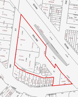
Figure 01– Site Boundary – Ray Street Precinct
Site Planning Objectives
Objectives and planned future character statements for the Ray Street Precinct as set out in the Ku-ring-gai Local Centres DCP, 2013 are listed out below:
Objectives:
· To create distinct retail precincts that provides a range of services, facilities and experiences.
· To create a ‘civic heart’ for Turramurra.
· To provide enhanced shopping precincts anchored by modern supermarkets.
· To encourage residential apartments in mixed use buildings to support viability of the retail uses.
· To provide opportunities for new speciality retail, cafes and restaurants to be located away from the highway.
Planned Future Character
Precinct T1 – Pacific Highway and Ray Street Retail Area:
i. In the future this precinct will become a community focal point, centred on a large new town square. A new Turramurra branch library will also be provided fronting the proposed public space.
ii. This area will also become a major shopping destination with a new larger supermarket and associated specialty shops.
iii. Forbes Lane will be widened (through development setbacks) to create a new two-way street with on-street parking and “kiss-and-ride” area for the train station.
iv. Shop-top housing will be provided on the retail podium providing further support for the retail and community uses. Council’s parking will be relocated to new basement parking upon redevelopment.
v. Shops along the Pacific Highway will be encouraged to have an active street frontage to Forbes Lane to create a quieter shopping precinct away from the Pacific Highway which will also activate the laneway.
Turramurra Community Facilities Study
A project brief was prepared which covers the requirements of resolution B from the Ordinary Meeting of Council on 26 November 2013; the brief is attached to this report for Councillors information in Attachment A1. Based on the project brief Elton Consulting P/L. was engaged in May 2014 to undertake the study.
The study is currently being finalised and will be reported to Council upon its completion. Preliminary findings were presented to Councillors at a briefing on the evening of 8 October 2014; this information is available in Attachment A2.
The scope of the study includes examination of the broader Turramurra catchment which contains a number of Council owned community facilities providing community centre space. A review of existing facilities was undertaken to understand existing provision and gaps. The catchment contains ten community facilities including:
- Five facilities that offer space for general community use - Turramurra Community Centre (former Seniors’ Centre), West Pymble Community Centre, Ku-ring-gai Town Hall, Pymble Playgroup House and Hamilton Park Hall;
- Three facilities that primarily operate as community service centres - Turramurra Support Services Centre (which includes Easy Care Gardening, Community Transport and Meals on wheels), Life Start Co-operative facility and Wahroonga Rehabilitation Centre; and
- Two facilities that have a cultural/arts focus - Pymble Presbytery and Boonah Creative Arts Centre.
The key recommendations of the study are that:
- The new library and community centre are to be co-located as a community hub with a floor area of approximately 3,000sqm, the building may be up to 3 levels;
- The preferred location for a new community hub is within the Ray Street precinct adjoining the proposed town square;
- The existing community services centre on Gilroy Road is well located however it requires significant expansion and upgrading to meet current and future demands;
- The library is to have a floor space of approximately 1,750sqm;
- The Community Centre is to have a floor space of 1,200sqm -1,500sqm (the study notes however that there is potential to reduce the required floor area given co-location would allow sharing of spaces and there are a number of privately owned facilities in Turramurra. the study concludes the lower figure is therefore more applicable).
Other important recommendations are (see Figure 02):
- Strong visual connection between community hub and shops, railway station – clear line of sight, signage, lighting
- Strong physical connection to town/civic square
- Building seen as part of a ‘village’ and as a space that promotes that ‘village’ feeling and ‘village’ activities.


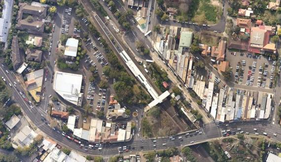
Figure 01 – Recommended location of community facilities in Turramurra

Figure 02 – Character statement on the Community Facilities and Library
Turramurra Community Services Centre Study
Council officers have undertaken an in-house study of the Turramurra Community Services Centre located on the corner of Gilroy Road and Gilroy Lane. Information was gained through measurements of the building and interviews with management staff from each of the groups using the facility. The purpose of the study was to:
- determine the size of the existing facility;
- understand the current and future demands on the services
- determine the future floor space requirements;
- develop a concept plan for the centre by adapting and extending the existing buildings; and
- estimate the cost of the works and include the funding as part of the Ray Street precinct master plan
An important assumption is that the Turramurra Community Centre (former Seniors’ Centre), which currently offers space for general community uses, will be vacated in the future (at the time that a new community hub is built within the Ray Street precinct) as this use will be transferred to the new hub.
This study is currently in progress and will be reported to Council when complete. Preliminary findings were presented to Councillors at a briefing on the evening of 8 October 2014; this information is available in Attachment A2.
 |
||
 |
||
Figure 03 – Preliminary perspective renders of possible modifications to create a Turramurra Community Services Centre
Turramurra Community Hub Master Plan and Economic Feasibility Assessment
A project brief has been prepared which covers the resolutions G, H and I from the Ordinary Meeting of Council on 12 November 2013; the brief is attached to this report for Councillors information in Attachment A3. Based on the project brief a consultant team was engaged in August 2014 to undertake the master plan; the team consists of Choi Rophia Fighera (CHROFI Architects), McGregor Coxall (Landscape Architects) and Hill PDA (land economists).
Preliminary findings of the draft Turramurra Community Facilities Study were made available to the master planning team; the advice is attached to this report for Councillors information in Attachment A4.
Since being engaged the master planning team have undertaken the following tasks:
- Review of background information and council policies;
- Site analysis and assessment;
- Development of design principles;
- Preparation of design options; and
- Preliminary financial analysis.
Design Principles
The consultant team has established strong master planning principles utilising an approach that was established through careful analysis of the site; the principles are:
1. Create a pedestrian spine along Forbes Lane through to Rohini Street and connecting to the Turramurra Community Service Centre on Gilroy Lane;
2. Incentivise the activation of the rear of the shops along the Pacific Highway building on what is already working in Turramurra;
3. Create a green corridor adjoining the railway corridor (with potential to utilise rail land at a later stage should Transport for NSW (TFNSW) approve);
4. Provide a pedestrian and cycle access way from the Pacific Highway north along the edge of the rail corridor linking to the cycle way on the east of the rail line;
5. Create a large, level and accessible town square that is centrally located;
6. Minimise the overshadowing of the proposed town square;
7. Maximise the amount of retail and commercial floor space that is located below the level of the town square by utilising the natural topography of the site;
8. Maintain and enhance the residential character and rhythm of Ray Street; and
9. Co-locate the proposed library and community centre in a location adjoining the proposed town square.
Figure 04 – Principle diagrams prepared by the consultant team
Preparation of design options and preliminary financial analysis
Building on the design principles listed above the master planning team have prepared a number of options for Council’s consideration. The consultant team provided Councillors with a briefing on the evening of 8 October 2014; the information presented is available in Confidential Attachment A5. Following the briefing four options have been developed that take into account Councillor’s comments and ideas. The options are outlined below and presented in full in Attachment A6.
Design Option 1
Figure 05 - Design Option 1
Key features of Design Option 1 are:
- B2 – Local Centres zone
- Maximum building height of 5 storeys (17.5 metres)
- Floor space ratio (FSR)of 1.8:1
- New town square located centrally
- Turramurra Village Park retained in current location
- Linear park alongside the rail corridor
- New library and community centre
A summary of the proposal is as follows:
|
Element |
Area / number |
Location |
Notes |
|
Town Square |
Minimum of 2,000 sqm |
Centred around 4-8 William Street |
Broad, level area created by building podium which would be at same level as Forbes Lane and Ray Street |
|
Linear Park* |
1,400 sqm |
Along the eastern edge of the rail corridor |
6m wide landscaped access way. This option reduces the linear park to a minimum width for access and landscaping
Provide an access way from the Pacific Highway to the town square through to the northern edge of Ray Street. |
|
Village Park |
832 sqm |
Retained in current location |
|
|
Community Space 1 - Library |
1,750sqm |
Located below town square in semi-basement |
Windows along the eastern edge below podium for light and outlook
Main entrance from the town square |
|
Community Space 2 – community centre |
1,200sqm |
Fronting Forbes Lane and town square |
Single level Council owned strata within mixed building
Entrance from town square.
Connected to library using a double height void which would also provide natural light. |
|
Residential |
No. of units – approx. 180 |
Fronting Ray Street |
This option maximises the number of residential units compared to other options.
Buildings oriented east –west to optimise solar access and minimise overshadowing of open space and town square |
|
Retail |
1,800 sqm specialty retail and 4,000 sqm supermarket |
Located below ground level in semi-basement and fronting town square |
Includes full-line supermarket plus specialty retail |
|
Car parking public |
No. spaces - 286 |
Located in basement below retail |
Including replacement of 171 existing Council owned spaces. |
|
Car parking - private residential |
No. spaces - As required by Council’s DCP |
Located in basement below public parking |
|
*This does not include the land of known as ‘the railway gardens’ however they could be incorporated into the linear park should TFNSW give approval to relocate the boundary fence. Council is currently in discussion with TFNSW regarding this matter (refer discussion below under the heading ‘railway gardens’)
Design Option 2
Figure 06 - Design Option 2
Key features of Design Option 2 are:
- B2 – Local Centres zone
- Maximum building height of 5 storeys (17.5 metres)
- FSR of 1.8:1 on most of the site with the exception of the Turramurra Village Park site which has a proposed FSR of 2.5:1
- New town square located centrally
- New two – three storey community building on Pacific Highway (Turramurra Village Park)
- New public roof garden / lookout on top of community building on Pacific Highway (Turramurra Village Park)
- Expanded linear park alongside the rail corridor including replacement area of Turramurra Village Park
- New library and community centre
- The potential for additional space available for other community facilities such as youth centre / indoor sports (note: the financial report figure is based off two facilities and the space in the Forbes Lane building utilised as additional retail)
A summary of the proposal is as follows:
|
Element |
Total Area |
Location |
Notes |
|
Town Square |
Minimum of 2,000 sqm |
Centred around 4-8 William Street |
Broad, level area created by building podium which would be at same level as Forbes Lane and Ray Street |
|
Linear Park* incorporating new Turramurra Village Park |
2,000 sqm |
Along the eastern edge of the rail corridor |
20m wide linear multi-function parkland
Incorporates area of parkland the same as Turramurra Village Park
Provides an access way from the town square through to the northern edge of Ray Street. |
|
Rooftop Garden |
450 sqm |
on top of proposed community building |
Publicly accessible green roof/garden lookout with views to the surrounds. |
|
Community Space 1 - library |
1,750sqm |
Located below town square in semi-basement |
Two – three levels, Council owned strata within mixed building |
|
Community Space 2 – community centre |
1,200sqm |
Fronting Forbes Lane and town square |
Council owned strata within mixed building
|
|
Community Space 3 / additional retail area – |
1,200 sqm |
Turramurra Village Park |
Within new Council owned two – three storey community building |
|
Residential |
No. of units – approx. 180 |
Fronting Ray Street |
Buildings fronting Ray Street oriented east –west to optimise solar access and minimise overshadowing of open space and town square |
|
Retail |
1,800 sqm specialty retail and 4,000 sqm supermarket |
Located below ground level in semi-basement and fronting town square |
Includes full-line supermarket plus specialty retail |
|
Car parking public |
No. spaces - 286 |
Located in basement below retail & part community component on Turramurra Village Park in basement |
Including replacement of 171 existing Council owned spaces. |
|
Car parking - private residential |
No. spaces - As required by Council’s DCP |
Located in basement below public parking |
|
*This does not include the land of known as ‘the railway gardens’ however they could be incorporated into the linear park should TFNSW give approval to relocate the boundary fence. Council is currently in discussion with TFNSW regarding this matter (refer discussion below under the heading ‘railway gardens’)
Design Option 3
Figure 07 - Design Option 3
Key features of Design Option 3 are:
- B2 – Local Centres zone
- Maximum building height of 5 storeys (17.5 metres) on Ray Street area
- Maximum building height of 5-6 storeys (20.5 metres) on Turramurra Village Park site
- FSR of 1.8:1 on Ray Street area
- FSR of 4:1 on Turramurra Village Park site
- New town square located centrally
- Linear park alongside the rail corridor
- New Turramurra Village Park
- New library and community centre
- Additional community space available for other facilities such as youth centre / indoor sports on Turramurra Village Park site (note: the financial report figure is based off two facilities and the space in the Forbes Lane building utilised as additional retail)
A summary table is as follows:
|
Element |
Total Area |
Location |
Notes |
|
Town Square |
Minimum of 2,000 sqm |
Centred around 4-8 William Street |
Broad, level area created by building podium which would be at same level as Forbes Lane and Ray Street |
|
Linear Park* |
2,000 sqm |
Along the eastern edge of the rail corridor |
20m wide linear multi-function parkland
Provides an access way from the Pacific Highway, through the town square to the northern edge of Ray Street. |
|
New Village Park |
1,300 sqm |
Relocated to northern side of town square |
New location away from Pacific Highway
In addition to new linear parkland
Large parkland connected to the Town Square within the heart of the site |
|
Community Space 1 - library |
1,750sqm |
Located below town square in semi-basement
|
Council owned strata within mixed building
Entrance from town square.
Connected to library using a double height void which would also provide natural light. |
|
Community Space 2 – community centre |
1,200sqm |
Fronting Ray Street & in mixed use building |
Council owned strata within mixed building
|
|
Community Space 3 |
1,200 sqm |
Located on Turramurra Village Park |
Two level Council owned strata within mixed building |
|
Residential |
No. of units – approx. 207 |
Fronting Ray Street & in mixed use building on Turramurra Village Park site |
Additional residential units on Pacific Highway over community uses.
Buildings fronting Ray Street oriented east –west to optimise solar access and minimise overshadowing of open space and town square |
|
Retail |
1,800 sqm specialty retail and 4,000 sqm supermarket |
Located below ground level in semi-basement and fronting town square |
Includes full-line supermarket plus specialty retail |
|
Car parking public |
No. spaces - 286 |
Located in basement below retail
Part community component on Turramurra Village Park in basement |
Including replacement of 171 existing Council owned spaces. |
|
Car parking - private residential |
No. spaces - As required by Council’s DCP |
Located in basement below public parking |
|
*This does not include the land of known as ‘the railway gardens’ however they could be incorporated into the linear park should TFNSW give approval to relocate the boundary fence. Council is currently in discussion with TFNSW regarding this matter (refer discussion below under the heading ‘railway gardens’)
Design Option 4

Figure 08 - Design Option 4
Key features of Design Option 4 are:
- B2 – Local Centres zone
- Maximum building height of 5 storeys (17.5 metres) on Ray Street area
- Maximum building height of 9-10 storeys (up to 32.5 metres) on Turramurra Village Park site
- FSR of 1.8:1 on Ray Street area
- FSR of 6:1 on Turramurra Village Park site
- New town square located centrally
- Linear park alongside the rail corridor
- New Turramurra Village Park
- New library and community centre
- Additional space available for other community facilities such as youth centre / indoor sports (note: the financial report figure is based off two facilities and the space in the Forbes Lane building utilised as additional retail)
A summary table is as follows:
|
Element |
Total Area |
Location |
Notes |
|
Town Square |
Minimum of 2,000 sqm |
Centred around 4-8 William Street |
Broad, level area created by building podium which would be at same level as Forbes Lane and Ray Street |
|
Linear Park* |
2,000 sqm |
Along the eastern edge of the rail corridor |
20m wide linear multi-function parkland
Provides an access way from the town square through to the northern edge of Ray Street. |
|
New Village Park |
1,300 sqm |
Relocated to location on northern side of town square |
New location away from Pacific Highway
In addition to new linear parkland
Large parkland connected to the Town Square within the heart of the site |
|
Community Space 1 - library |
1,750sqm |
Located below town square in semi-basement |
Council owned strata within mixed building Entrance from town square.
Connected to library using a double height void which would also provide natural light. |
|
Community Space 2 – community centre |
1,200sqm |
Fronting Forbes Lane and town square |
Council owned strata within mixed building |
|
Community Space 3 |
1,200 sqm |
Located on Turramurra Village Park |
Within new Council owned two – three storey community building |
|
Residential |
No. of units – approx. 226 |
Fronting Ray Street & in mixed use building on Turramurra Village Park site |
Additional residential units on Pacific Highway over community uses.
Buildings fronting Ray Street oriented east –west to optimise solar access and minimise overshadowing of open space and town square |
|
Retail |
1,800 sqm specialty retail and 4,000 sqm supermarket |
Located below ground level in semi-basement and fronting town square |
Includes full-line supermarket plus specialty retail |
|
Car parking public |
No. spaces - 286 |
Located in basement below retail
Community component on Turramurra Village Park in basement |
Including replacement of 171 existing Council owned spaces. |
|
Car parking - private residential |
No. spaces - As required by Council’s DCP |
Located in basement below public parking |
|
*This does not include the land of known as ‘the railway gardens’ however they could be incorporated into the linear park should TFNSW give approval to relocate the boundary fence. Council is currently in discussion with TFNSW regarding this matter (refer discussion below under the heading ‘railway gardens’)
Assessment and Preferred option/s
A summary table of the allocated areas and financials is as follows:
|
|
Do nothing |
Option 1 |
Option 2 |
Option 3 |
Option 4 |
|
Town Square |
0 |
Minimum of 2,000 sqm |
Minimum of 2,000 sqm |
Minimum of 2,000 sqm |
Minimum of 2,000 sqm |
|
Parkland area |
832sqm |
2,232 sqm |
2,000 sqm + 450 sqm roof top garden |
3,300 sqm |
3,300 sqm |
|
Community Space |
700 sqm (existing library) |
2,750 sqm |
3,950 sqm * |
3,950 sqm * |
3,950 sqm * |
|
Residential units |
0 |
180 |
180 |
207 |
226 |
|
Retail area |
2,485 sqm including existing Coles supermarket |
5,800 sqm |
5,800sqm* |
5,800sqm * |
5,800sqm* |
|
Public and retail car parking |
224 |
286 |
286 |
286 |
286 |
|
Financial return to Council (when compared to a commercial rate of return) |
nil |
Acceptable |
Acceptable/ moderate |
Moderate |
Commercial rate of return |
*Council can choose whether to fund additional community space or include additional retail space in options 2-4. This will result in variations to parking numbers and the financial return shown; these have not been quantified at this stage
A summary of the relative benefits / detriments of each option is as follows:
Do nothing
· No change to current situation
· A discussion of the disadvantages of this option is provided in the Risk Management section of this report.
· This option is not recommended and is put forward for comparative reasons only
Design Option 1
· Consistent with LEP and DCP controls
· Consistent with Council resolutions
· Additional 3,400sqm of public space when compared to do-nothing
· Additional 2,000sqm of community space when compared to do-nothing
· Maintains Turramurra Village Park in current location
· Turramurra Village Park remains largely unusable due to hostile environment
· The lowest financial rate of return to council (refer confidential Attachment A7 for details)
Design Option 2
· Largely consistent with LEP and DCP controls – requires rezoning and reclassification in relation to Village Park
· Largely consistent with Council resolutions – Village Park relocation not foreshadowed
· Additional 3,650sqm (including 450 sqm green roof) of public space when compared to do-nothing
· Additional 2,000sqm of community space when compared to do-nothing
· New linear park land
· Replaces Village Park on the highway with a low-scale public building
· New building on Village Park would provide noise attenuation to new town square
· Public building provides modest gateway for Turramurra
· Acceptable financial rate of return to council (refer confidential Attachment A7 for details)
Design Option 3
· Largely consistent with LEP and DCP controls – requires rezoning and reclassification in relation to Village Park
· Largely consistent with Council resolutions – Village Park relocation not foreshadowed
· Additional 4,500sqm of public space when compared to do-nothing
· Additional 3,250sqm of community space when compared to do-nothing
· New linear park land
· Replaces Village Park on the highway with a moderate scale mixed use building incorporating public uses
· New building on Village Park would provide noise attenuation to new town square
· Relocates and enlarges Turramurra Village Park to a new location away from the noise of the Pacific Highway
· Provides gateway building to Turramurra
· Moderate financial return potential for council (refer confidential Attachment A7 for details)
Design Option 4
· Largely consistent with LEP and DCP controls – requires rezoning and reclassification in relation to Village Park
· Largely consistent with Council resolutions – Village Park relocation not foreshadowed
· Additional 4,500sqm of public space when compared to do-nothing
· Additional 3,250sqm of community space when compared to do-nothing
· New linear park land
· Replaces Village Park on the highway with a large scale mixed use building incorporating public uses
· New building on village Park would provide noise attenuation to new town square
· Mix of uses including residential and retail
· Relocates and enlarges Turramurra Village Park to a new location away from the noise of the Pacific Highway
· Provides significant gateway building to Turramurra
· Highest financial rate of return potential for council (refer confidential Attachment A7 for details)
Preferred option
Based on the above information it is Option 2 which achieves a strong balance between positive planning and environmental outcomes, delivers quality community infrastructure and acceptable financial return to Council. However, it is acknowledged that each of the schemes offer a range of ideas and alternatives and it would be of value to Council to test these alternatives with the community during the exhibition process. Therefore it is recommended that Council:
· Adopt Design Option 2 as the preferred option for the purposes of public exhibition and that the consultants are instructed to prepare a draft master plan and exhibition material on that basis (including detailed plans, sections and perspective views); and
· In conjunction with the exhibition of Design Option 2, Council exhibits Design Options 1,3 & 4 as illustrated and attached to this report in Attachment A6 for the purposes of seeking public comment on the range of ideas presented.
Options for a road bridge and/or rail underpass
All the options presented include proposed options for a road bridge and/or rail underpass. At this stage these are proposals are indicative and no detail proposals have been prepared.
Council staff have commenced discussions with representatives from Transport for NSW (TFNSW) to seek feedback on aspects of the design options that adjoin and potentially impact on the station and rail corridor. The two key considerations are the proposed options for a road bridge connecting Ray Street and William Street and possible road tunnel from Rohini Street connecting to the proposed basement car park of the Turramurra community hub.
The idea of a road bridge in this location is not a new one and was examined at length during the early stages of the town centre planning process. The preferred traffic management option, prepared by GTA consultants in 2006, included the bridge as a desirable and necessary component for future traffic management in Turramurra. A detailed study was undertaken later in September 2008 by Cardno and funded by Coles Development Group; a copy of this study is included in Attachment A8. To date there has been no cost estimate produced for the bridge however investigations suggest a cost of $6-$7 million dollars is likely. The structure itself could not be funded by S94 funds and therefore would have to be funded by the development.
‘Railway gardens’
The potential to utilise the land known as the ‘railway gardens’ on the western side of the station has also been raised with representatives of Sydney Trains (ST). In initial correspondence, ST representatives have indicated that Council has an existing licence for the maintenance and beautification of the green space next to the station and that ST have no issue with relocating the existing fence line closer to the track to allow Council access to the licensed area for maintenance. A site visit with representatives from TFNSW and ST has been arranged for the 27 October 2015 to discuss the issue further. It is anticipated that this matter will be resolved by the time the project is on public exhibition.
integrated planning and reporting
Themes
· Places, Spaces and Infrastructure
· Community, People and Culture
|
Community Strategic Plan Long Term Objective |
Delivery Program Term Achievement |
Operational Plan Task |
|
A range of well planned, clean and safe neighbourhoods and public spaces designed with a strong sense of identity and place. |
P1.1.1 Opportunities are provided to our community to contribute to plans for enhancing the local area and visual amenity of our centres.
|
Develop concept plans informed by community engagement.
Engage with key stakeholders and the community in the revitalisation of our neighbourhood centres and local areas. |
|
|
P4.1.1 Plans to revitalise local centres are being progressively implemented and achieve quality design outcomes in collaboration with key agencies, landholders and the community. |
Implement a place management approach for the local centre improvements to coordinate works and achieve quality outcomes. |
|
A healthy, safe, and diverse community that respects our history, and celebrates our differences in a vibrant culture of learning. |
C4.1.2 New and enhanced open space and recreational facilities have been delivered to increase community use and enjoyment.
|
Undertake acquisitions for new parks.
Undertake assessment and identify locations for new parks
Complete the design for identified parks and include design principles which facilitate passive recreation activities.
Construct parks at identified locations and include design principles which facilitate passive recreation activities |
Governance Matters
Council’s charter under the Local Government Act 1993 is clear. A number of elements of the charter which could be taken as applying to the management of the subject land are highlighted below:
· to provide directly or on behalf of other levels of government, after due consultation, adequate, equitable and appropriate services and facilities for the community and to ensure that those services and facilities are managed efficiently and effectively
· to exercise community leadership
· to promote and to provide and plan for the needs of children
· to have regard to the long term and cumulative effects of its decisions
· to bear in mind that it is the custodian and trustee of public assets and to effectively plan for, account for and manage the assets for which it is responsible
· to engage in long-term strategic planning on behalf of the local community
Council has the opportunity to pro-actively work with the development sector to create a unique precinct for Turramurra local centre. To do this Council needs to review how it can best utilise its assets within this precinct, and potentially consider the divestment of some assets to fund the acquisition of other assets which are more relevant to the changing requirements of the community. In the case of the subject precinct, this may involve selling land currently utilised as car parking to gain new facilities such as a new library and town square.
A review of Council assets, reclassification and the sale of some assets to fund the acquisition of other assets which are more relevant to the changing requirements of the community, is entirely consistent with Council’s charter.
Risk Management
Coles Group Property Developments Ltd. submitted a Development Application in April 2013 for a new supermarket at 1 Ray Street, Turramurra. The proposed development (whilst permissible) is not consistent with the strategic objectives and planned future character of this precinct, as set out in the Ku-ring-gai Local Centres DCP 2013. If the Coles DA is approved and developed it could effectively sterilise development of adjoining sites and prevent Council’s vision from being realised for at least the life of the supermarket, which could be in the order of 20-30 years.
The first risk is the integrity and due protection of the value of the public assets held and administered by the Council, or the public interest generally. Such a risk may be reputational as well as financial.
The second risk would be the possible inability of the Council to discharge its Charter obligations to provide adequate, equitable and appropriate services and facilities for the community. Such a risk may be reputational as well as financial.
The third risk for this project is in relation to Council’s reputation. The project has become reasonably well known within the local community as a result of Council’s ‘Activate Turramurra’ events and activities. Community consultation to date has been generally positive and supportive of the process and there is now an expectation that Council will continue to the next stage of the project which will involve exhibition of a draft master plan. If Council is seen not to be progressing revitalisation of the local centre in line with the Community Strategic Plan, then there would be a risk of loss of reputation as a result.
The fourth risk is the opportunity costs to Council, of not making a decision. No action by Council would indicate an acceptance that if the Coles DA is approved and built that this will represent an appropriate outcome for the precinct for 20 plus years. The potential financial risks of this approach are:
· loss of potential development contribution funds;
· potential loss in value of the Council’s assets;
· a potential loss in actual or prospective revenue (through future sale or leasing of land);
· ongoing maintenance of ageing assets including library repairs and refurbishments; and
· Unresolved funding shortfall to deliver Turramurra community facilities in Council’s Long Term Financial Plan.
Council has been pro-active in its decision to commence reclassification and master planning; this approach can effectively mitigate the risks noted above.
Financial Considerations
There are adequate funds available to complete the master plan stage of the project.
The Design Options 1-4 considered in this report all result in a positive financial outcome for Council. To achieve this Council needs to be pro-active and engage with the development sector to deliver a community hub for Turramurra. The first step is to prepare a master plan that clearly shows the outcomes Council seeks from the potential development of the land.
The second step is reclassification; Council has resolved to reclassify the site from Community Land to Operational Land which will facilitate potential future redevelopment of the site and sale or leasing of Council land. The proceeds from land sales could be used in number of ways, but not limited to:
Turramurra specific:
- To provide additional community facilities on the site in the form of a youth centre / indoor sports facility or other as identified by Council;
- To renovate and extend the Turramurra Community Service Centre on Gilroy Road;
LGA wide:
- To fund Council’s co-contribution for projects identified in the Development Contributions Plan 2010.
Other potential financial benefits could include:
· Activation and reinvigoration of a declining commercial centre;
· Increased value of Council’s assets;
· Development contribution funds from site redevelopment;
· Increased value of council’s assets;
· Gain in actual or prospective revenue (through future sale or leasing of land);
· Generation of local employment and investment.
Social Considerations
Council’s Community Strategic Plan 2030, recognises the community’s vision for Ku-ring-gai as a place with infrastructure and facilities that accommodate the needs of the community. The plan further emphasises the desire for an adopted program for the implementation of new facilities, identified funding sources and a program to maintain Council’s assets at a sustainable standard.
Currently the precinct is utilised for car parking by shoppers, commuters and local business owners, beyond this function the site provides very little social benefit to the community and is very much an under-utilised asset for Council. The site has the potential to provide new community buildings and open space that will provide a high level of social benefit to the community. If Council were to actively participate in redevelopment within this precinct it would present new opportunities to bring forward the delivery of public infrastructure or facilities by many years.
A survey was conducted at the Turramurra Family Fun day to collect people’s opinions, these are early results but they appear to demonstrate a desire to see more use of the area particularly around the ideas of open space, better shops, socialising and dining. Brief summaries of responses to key questions are as follows:
What people like about the area:
· Library and access to train stations rated highest
· Coles, parking, cafes were popular choices
· Accessibility around the precinct received the lowest score
What people don’t like:
· Supermarket – it is in need of upgrade and expansion
· There are not enough cafes and restaurants for socialising
· Lack of all-day (commuter) parking
· Little for families to do in the area, especially kids
· The precinct feels rundown and tired
Does this area have special character?
· Mixed response with just under half claiming it doesn’t have a special character
· Many respondents commented on greenery and open spaces as well as historical value.
Most common use of the area:
· 48% visit to go to Coles
· 18% visit to go to the library
· 10% visit for parking
· 10% visit for cafes and restaurants
· Most respondents claim to use both sides of the Turramurra Local Centre
Other comments:
· 87% claimed it is important for open space to be provided on the site as a part of any site master plan
What would you like to see on the site?
· Exercising space
· Space for working and reading
· Space for picnics
· Night-time dining
· Events space
· Kids activities
· Cafes and restaurants
· Space for socialising
Environmental Considerations
The Ray Street precinct is a predominantly hard paved car park with some significant trees located on the edges of the site. There are no heritage items or areas of biodiversity significance. Redevelopment will not have any significant adverse environmental impacts.
Overall, if the development were to be undertaken in a co-ordinated manner with site amalgamation as discussed there is potential for a range of environmental improvements on the site:
· the provision of a new town square and streetscape improvements would allow more tree planting;
· Council’s stormwater management requirements would ensure significant improvements to stormwater management in the precinct; and
· new shops, cafes and restaurants will make the area safer at night.
In terms of traffic impacts the overall floor space (GFA) proposed in options 1-4 is well below that tested as part of the Turramurra Town Centre Traffic and Car Parking Study undertaken in 2006. While some further modelling will be required at a later stage of the project at this stage the traffic impacts are anticipated to be manageable within the recommendations of that study. This matter was discussed in some detail in a report to the Ordinary Meeting of Council - 12 November 2013, GB.6
Community Consultation
Council staff from the Community and Strategy and Environment departments conducted a Family Fun Day consultation event in the Ray Street car park. This involved cordoning off a space within the car park and laying artificial turf and creating a “pop up” Village Park. The day was a success with large numbers of the community visiting the event. At the event staff collected over 180 surveys from members of the community to get their input into the precinct. Feedback from community event has been collated and provided to the consultant team (Attachment A9)
An open conversation page has been created on Council’s website allowing further conversation around the feedback from the survey. This page will be used to gain feedback and facilitate discussion throughout the master plan process.
The master plan once adopted by Council will be placed on formal exhibition with workshop presentations to enable to community to respond to the plan for the precinct. This feedback will be summarised and responses provided and will be reported back to Council in early 2015.
Internal Consultation
Consultation has occurred internally within the Strategy and Environment Department as required, including with the Manager Environment & Sustainability.
The Manager Library and Cultural Services, Manager Community Development and staff from Community & Recreation Services have been consulted during the preparation of the draft Turramurra Community Facilities Study.
A meeting was held between all Councillors, senior staff and representatives of Coles Group Property Developments Ltd on 28 January 2014; the consultant team and senior staff presented preliminary draft material to the General Manager and Directors (GMD) on 19 September 2014; preliminary findings were presented to Councillors at a briefing on the evening of 8 October 2014; and finally a site visit with Councillors, staff and consultants was undertaken on 22 October 2014.
Summary
In response to the resolution of Council at the Ordinary Meeting of Council on 12 November 2013 to prepare a master plan for the Ray Street precinct in Turramurra, Council staff have engaged a consultant team comprising of Architects, Landscape Architects and Land Economists.
The consultant team has prepared four design options for the site after careful site analysis, examining the background information including Council’s community consultation and preliminary findings from Elton Consulting’s Turramurra Community Facilities Study and presentations to GMD and a Councillor briefing.
The options adopt a common approach with the provision of 3,000sqm of community facility floor space; 2,000sqm town square (minimum) and new linear parkland. Variations arise through the options of relocating Turramurra Village Park; providing extra parkland in an alternative location; and utilising the Turramurra Village Park as a site for a 2-3 levels of community facility floor space and/or additional levels of residential floor space. The options also vary the heights and volumes of residential development focussed around the current LEP and DCP controls.
The report recommends Design Option 2 as the preferred option as it achieves a strong balance between positive planning and environmental outcomes, delivers quality community infrastructure and acceptable financial return to Council.
The report also notes that the Design Options 1, 2, 3 & 4 (presented in Attachment A6) offer a range of ideas and alternatives that should be tested with the community during the exhibition process; the options also provide background to Council’s decision. Therefore it is recommended that Council:
· Adopt Design Option 2 as the preferred option for the purposes of public exhibition and that the consultants are instructed to prepare a draft master plan on that basis including exhibition material (detailed plans, sections and perspective views); and
· In conjunction with the exhibition of the draft master plan, Council exhibits Design Options 1, 2, 3 & 4 as illustrated and attached to this report in Attachment A6 for the purposes of seeking public comment on the range of ideas presented.
|
That:
A. Council adopt Design Option 2 as the preferred option for the purposes of public exhibition and that the consultants are instructed to prepare a draft master plan on that basis including exhibition material (detailed plans, sections and perspective views).
B. In conjunction with the exhibition of the draft master plan, Council exhibits Design Options 1, 2, 3 & 4 as illustrated and attached to this report in Attachment A6 for the purposes of seeking public comment.
C. That the draft master plan be placed on exhibition from mid-November 2014 to the end of January 2015 including two public information sessions in November 2014.
D. That a report be brought back to Council with:
i. A summary of submissions and community feedback from the exhibition; and ii. Recommendation for a final master plan and the next steps.
E. That staff and consultants meet with private property owners within the master plan site boundary to present the draft master plan as resolved by Council.
F. That Council staff continue discussions with Transport for NSW and Sydney Trains in relation to gaining public access to the ‘railway gardens’ including relocation of the boundary fence line and demolition of the disused toilet block.
|
|
Bill Royal Team Leader Urban Design |
Noa Tranter Property Projects Officer |
|
Antony Fabbro Manager Urban & Heritage Planning |
Deborah Silva Acting Director Strategy and Environment |
|
A1View |
Turramurra Local Centre Community Facilities Strategy Brief |
|
2014/082694 |
|
|
|
A2View |
Project Update - Turramurra Community Hub - Briefing to Councillors |
|
2014/261395 |
|
|
A3View |
Turramurra Community Hub Masterplan and Economic Feasibility Assessment Brief |
|
2014/149375 |
|
|
A4View |
Turramurra Community Facilities Study Update - Preliminary Findings Report |
|
2014/261410 |
|
|
Councillor briefing - design options and economic feasibility |
|
Confidential |
|
|
|
A6View |
Turramurra Community Hub - Masterplan Options |
|
2014/263073 |
|
|
Turramurra Community Hub - Preliminary Economic Feasibility - Draft Design Options - surplus funds |
|
Confidential |
|
|
|
A8View |
Cardno Study - Ray Street Railway Overbridge |
|
2014/221365 |
|
|
A9View |
Turramurra Family Fun Day - Survey Results |
|
2014/215439 |
|
APPENDIX No: 3 - Turramurra Community Hub Masterplan and Economic Feasibility Assessment Brief |
|
Item No: GB.11 |
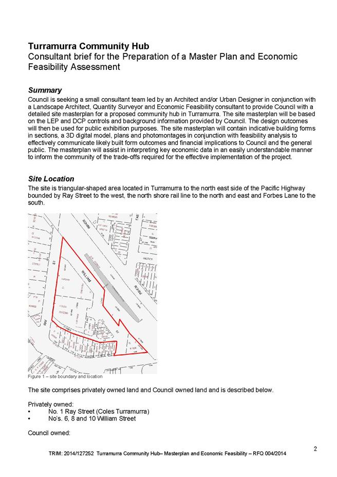
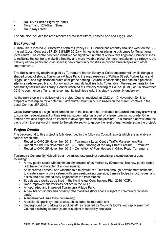
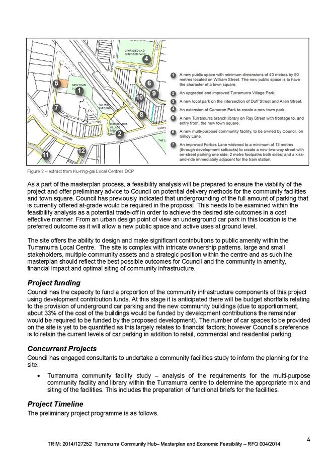
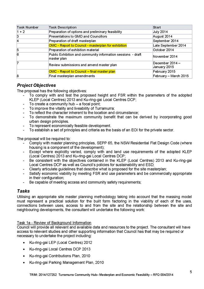
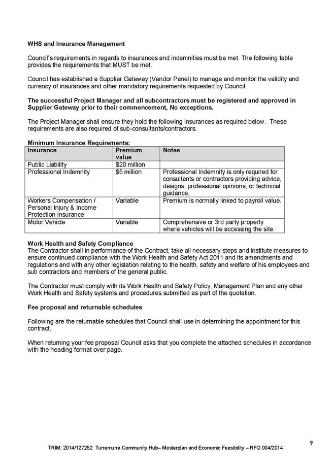
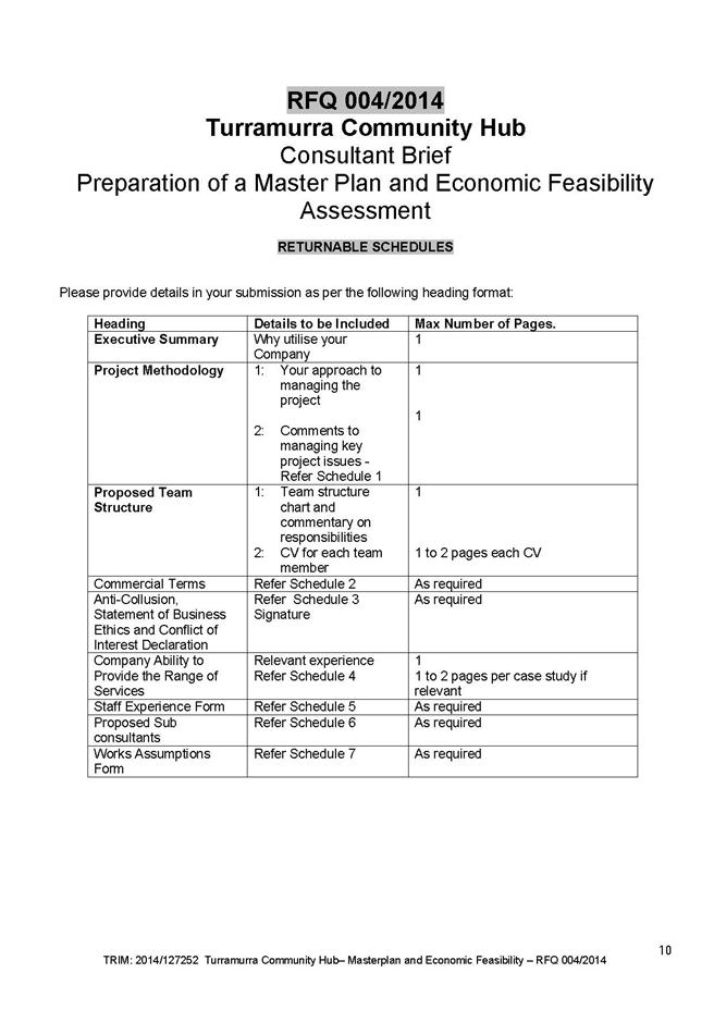
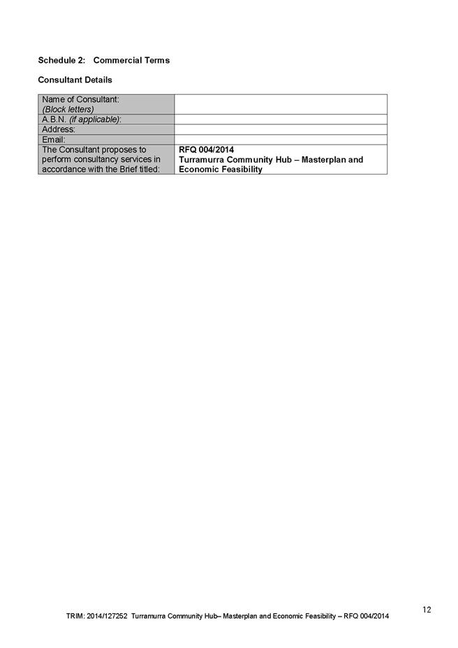
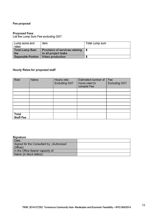


|
APPENDIX No: 4 - Turramurra Community Facilities Study Update - Preliminary Findings Report |
|
Item No: GB.11 |
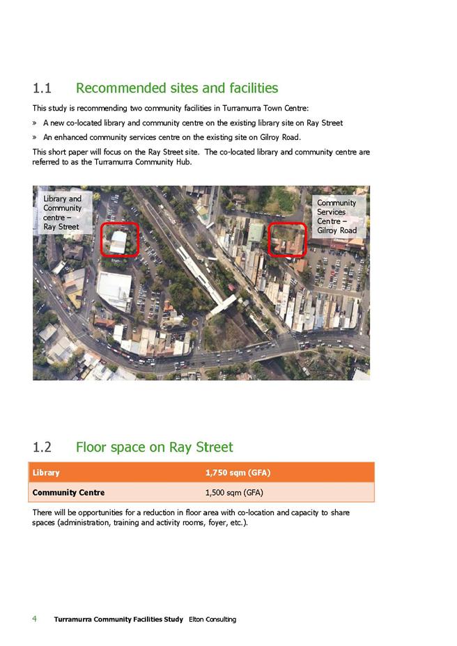
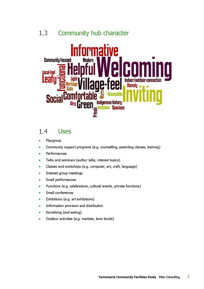
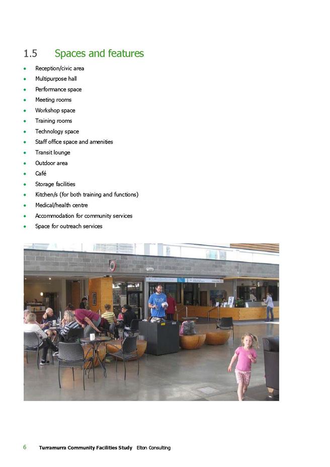
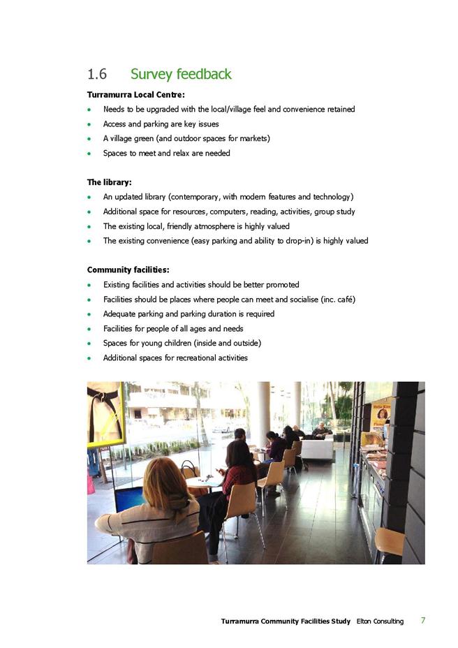
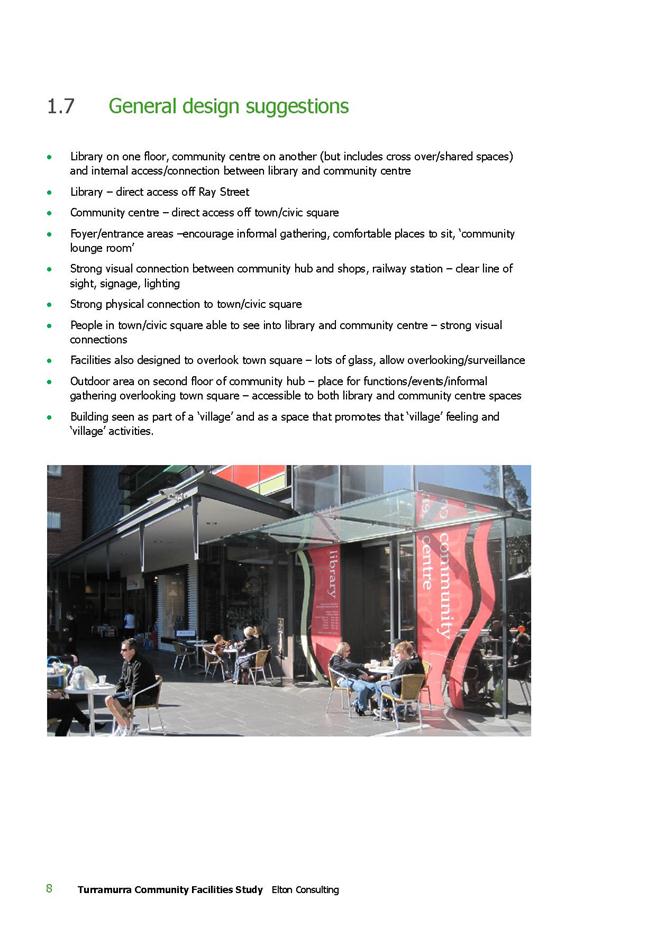

|
Ordinary Meeting of Council - 28 October 2014 |
GB.12 / 765 |
|
|
|
|
Item GB.12 |
S05304 |
|
|
9 October 2014 |
Friar's Field, Pymble -
Results of Community Consultation into Potential Dog Off-leash Area
EXECUTIVE SUMMARY
|
purpose of report: |
For Council to consider the results of community consultation into a potential dog off-leash area at Friar’s Field, Pymble.
|
|
|
|
|
background: |
On 23 August 2013 Council resolved that a report be submitted to Council outlining the costs and implications of formally making Friars Field an off-leash dog area for either full-time or part-time use, and that the report include the results of consultation with stakeholder groups, individual users of the facility and surrounding residents. |
|
|
|
|
comments: |
In March 2014 Council wrote to Northern Suburbs Football Association (NSFA) and 815 residents in streets surrounding Friar’s Field. Of the 815 letters sent to local residents near Friar’s Field, 100 residents responded. |
|
|
|
|
recommendation: |
That Council does not make Friar’s Field a dog off-leash area and retain its status as an on-leash area at all times.
|
Purpose of Report
For Council to consider the results of community consultation into a potential dog off-leash area at Friar’s Field, Pymble.
Background
At the Ordinary Meeting of Council on 23 August 2013 Council considered the following Notice of Motion from Councillor Ossip:
Off-leash dog areas provide great amenity to residents, in providing a space for both dogs and their owners to exercise and socialise. These areas are recognised as helping to reduce behavioural problems amongst dogs and cultivating a sense of community amongst residents.
Whilst Ku-ring-gai Council currently has 20 off-leash areas, none of these are located in Pymble. Friars Field, over the past 20 years, has gained a reputation amongst residents as being the ‘unofficial’ dog park of the area. Yet, at present, dog-owners are unable to truly make use of the park without the threat of being fined.
I move that:
“A report be submitted to Council outlining the costs and implications of formally making Friars Field an off-leash dog area for either full-time or part-time use.”
At this meeting Council resolved (Minute No.273):
A. That the above Notice of Motion as printed be adopted.
B. That the report include the results of consultation with stakeholder groups, individual users of the facility and surrounding residents.
Ku-ring-gai Council currently has 21 dog off-leash areas, as shown on the map in Attachment A1. The proposed dog off-leash area at Friar’s Field, Pymble is indicated on the map in Attachment A1 inside the red circle close to the centre of the map.
The closest dog off-leash areas to Friar’s Field are Kent Road Park at Turramurra, Karuah Park at Turramurra and Turramurra Memorial Park, which are all approximately 1.5km from Friar’s Field. Slightly further afield, dog off-leash areas within 3.5km of Friar’s Field include Westbrook Oval (Claude Cameron Grove) at Wahroonga, Warrimoo Oval at St Ives Chase, Acron Oval at St Ives, Barra Brui Oval at St Ives, Bert Oldfield Oval at Killara, Bicentennial Park at West Pymble, and Mitchel Crescent Reserve at Warrawee.
Comments
The first part of the Council resolution asks for an outline of the costs associated with formally making Friar’s Field an off-leash dog area for either full-time or part-time use. These costs are covered in the Financial Considerations section of this report.
The second part of the resolution asks for the results of consultation with stakeholders and residents. In March 2014, Council officers wrote to Northern Suburbs Football Association, the major stakeholder group which hires Friar’s Field, Pymble, and 815 residents living near the field, inviting comments as to whether they agree or disagree with the field becoming a dog off-leash area at times when it is not booked for organised sport.
Northern Suburbs Football Association’s submission can be read in Attachment A2.
Of the 815 letters sent to local residents near Friar’s Field, 99 residents responded. The responses are summarised in the chart below. 67 people or 8.2% supported the proposal, 33 people or 4.0% opposed the proposal, and 716 or 87.8% did not respond.
The responses from residents can be read in Attachment A3.
The first submission in Attachment A3 presents a comparison of the number of parks and dog off-leash areas in the four councils surrounding Ku-ring-gai. Council officers have checked the figures with each Council and found them to be slightly different, as discussed below.
N.B. The number of sportsfields indicates the number of locations. Some locations have multiple sportsfields at the site.
Ku-ring-gai Council - 21 dog off-leash areas within 193 parks and 47 sportsfield areas.
- 10 of the dog off-leash areas are on sportsfields.
Willoughby Council - 10 dog off-leash areas within 50 parks and 34 sportsfield areas.
- 8 of the dog off-leash areas are on sportsfields.
Ryde Council - 12 dog off-leash areas within 37 parks and 20 sportsfield areas.
- 7 of the dog off-leash areas are on sportsfields.
Hornsby Council - 9 dog off-leash areas within 137 parks and 42 sportsfield areas.
- 2 of the dog off-leash areas are on sportsfields.
Warringah Council - 13 dog off-leash areas within 150 parks and 43 sportsfield areas.
- 8 of the dog off-leash areas are on sportsfields.
Of interest is the fact that Ku-ring-gai Council has a larger supply of dog off-leash areas than our four neighbouring councils, both in real terms and when compared to the number of parks and sports fields in each LGA.
Some residents’ submissions suggested allowing limited dog off-leash times, such as one resident who said “Maybe it would be a good idea to have limited hours for this purpose, say 7am-9.30am and 5pm-7.30pm in the afternoon.”
This suggestion for limited dog off-leash times, along with the other submissions received, were considered by Council officers from Strategy & Environment, Operations and Development & Regulation. It was determined that limited dog off-leash times are inappropriate for Friar’s Field, primarily because the area is categorised and used as a sportsfield.
Organised sport bookings for the last three years at Friar’s Field have been as follows:
2014 winter sports season
· Tuesdays (pre-season) 6.15pm – 7.45pm
· Sundays (pre-season) 9.00am – 6.00pm
· Saturdays 8.00am – 1.00pm
· Sundays 9.00am – 1.00pm and 3.00 – 5.00pm
2013 winter sports season
· Tuesdays (pre-season) 6.00pm – 8.00pm
· Thursdays (pre-season) 6.00 – 7.00pm
· Saturdays 8.00am – 1.00pm
· Sundays 9.00am – 1.00pm
· Mondays 3.30pm – 5.00pm
2012 winter sports season
· Saturdays 8.00am – 1.00pm
· Sundays 9.00am – 1.00pm
· Tuesdays 3.30pm – 5.00pm
· Wednesdays 3.30pm – 5.00pm
It is felt that the impacts on the field which will result from dogs off-leash, as at other sportsfields that are shared dog off-leash areas, are too significant for its off-leash status to change. Experience gained since 2004 – when Council last undertook a review of all off-leash areas and resolved to turn 10 sportsfields into shared off-leash areas – has led Council officers to strongly recommend against adding any more sportsfields to the list of dog off-leash areas. These concerns and experiences are outlined in more detail in the submissions below from Council’s Regulatory Services Department and Operations Department.
Submission from Ku-ring-gai Council Regulatory Services Department
Overview
Friar’s Field is a small park in Pymble which is regularly used for children’s sport, family recreational activities, personal exercise regimes such as jogging or walking, and exercising dogs on leash. A significant number of people using the field come by car; not all walk to the facility. Some dog owners disregard the law and exercise dogs off-leash, however they are appropriately warned and cautioned if found.
Section 13 of the Companion Animal Act states that within each Council there must be at least one off-leash area that is available to the public at all times. Ku-ring-gai far exceeds this requirement and has one of the largest numbers of off-leash areas within the Sydney Metropolitan region, providing 21 dedicated off-leash parks.
Exercise and socialisation for dogs is critical in reducing nuisance dog behaviour. Allowing dogs to run freely in a public area with numerous other dogs is not the answer for all. It is important to have facilities available for residents to walk or train their dog on a leash without fear of being rushed by off-leash dogs.
Customer Request History
Friar’s Field receives the largest number of complaints and requests to patrol for off-leash dogs of other parks within Ku-ring-gai. Concerned members of the public contact Council on a regular basis alerting the Regulatory Services team to off-leash dogs.
The field has been patrolled on a multi-weekly basis over the past 12 months due to the high number of complaints and it has been found that off-leash dogs are present every morning and evening.
The field is extremely difficult to patrol and enforce as there are three exits, which owners with off-leash dogs use to avoid the regulatory officers. In order to stop the dog owners from fleeing the field and educate about the appropriate use of the park a warning is often issued. There have been approximately 50 warnings issued to owners with dogs off-leash at the field.
Dog Attack History
There have been four reported dog attacks at Friar’s Field, all involving off-leash dogs. Two of the attacks involved young children who were playing sport on the field. These incidents demonstrate the potential danger when combining sporting grounds and off-leash dogs.
Conclusion
Currently there is a complete disregard from a significant number of dog owners for the regulations and in their submissions to Council, some people state, ‘it is already used as “off –leash” despite the potential consequences’. Therefore, the Regulatory Services Team does not support the field being declared as an off-leash area or a shared usage facility.
Acron Oval is an example of the difficulty in creating a shared sportsground with off-leash dogs. It receives a high volume of complaints, particularly in regards to dog attack incidents, dog owners ignoring signage and requests from officials to leash their dogs during organised sporting activities and designated training times.
Submission from Ku-ring-gai Council Open Space Operations Department
Council’s Open Space Operations department would not support the proposed off-leash area at Friar’s Field. The reasons for our opposition are as follows:
· Historically the areas that are shared as sportsfields and off-leash areas require the highest amount of maintenance when compared to sportsfields with no off-leash area. The dogs dig up any fresh soil that has been put down to cover holes caused by dogs. The maintenance teams currently have to maintain these areas on a weekly basis to fill in holes caused by dogs to minimise the risk of injury to users of the fields.
· The dog owners do not always pick up after their dog. It tends to be the case of the dog being left alone whilst the owners continue to walk around the field. This is a potential health hazard to grounds staff who have to maintain the field. Faecal matter also sticks to the machinery. Dog faeces is always a bigger problem at off-leash areas simply due to the increased numbers of dogs.
· On occasions there has been friction between dog walkers and grounds staff, such as at Bert Oldfield Oval, due to the fact that the dogs are not always under effective control. The dog walkers also don’t like to be told to control their animal by a member of the grounds team.
· The dog walkers do not obey the signage on the sports fields stating that dogs need to be on-leash after a certain time. This makes maintenance extremely difficult.
· Out of our 21 dog off-leash areas, 10 are at sports fields and are therefore shared dog off-leash areas, meaning dogs are not allowed off-leash if the field is booked for sporting purposes or special events.
Alternatives to Friar’s Field
Some submissions suggested that Council consider the nearby Maddison Reserve, Pymble as an alternative dog off-leash area instead of Friar’s Field. Maddison Reserve is larger in area than Friar’s Field but does not have a street frontage, being surrounded by houses on three sides and bushland and a creek on the other. It sits internally on a block and is accessed by a bush track from Merrivale Road and Korangi Road, and by a pathway from Boolarong Road.
Maddison Reserve is not considered appropriate for a dog off-leash area. It is not visible from the street, hence accidents such as dog attacks or dog fights can’t be seen. It is also completely inaccessible for anyone with mobility issues.
There are no other alternatives in close proximity to Friar’s Field.
integrated planning and reporting
C5 – Community Health and Safety
|
Community Strategic Plan Long Term Objective |
Delivery Program Term Achievement |
Operational Plan Task |
|
C5.1 A community where residents feel safe and enjoy good health. |
Our residents and visitors enjoy clean, safe, friendly and vibrant neighbourhoods. |
Implement Council’s adopted Companion Animals Management Plan 2011-2016. |
Governance Matters
Under Section 13 of the Companion Animals Act Council must provide one dog off-leash area in the LGA. Ku-ring-gai Council has 21 such areas. It is a matter for Council to decide if it wishes to add to this.
Risk Management
As discussed in the comments section of this report, the main risk for Council is the possibility of someone sustaining an injury as a result of a hole in the ground at a sportsfield. Such holes are far more prevalent and larger at sportsfields that are also dog off-leash areas, as a result of dogs digging in the ground. The risk of injury increases under formal training and match conditions at sportsfields, therefore Council staff are required to carry out double the number of inspections and surface maintenance at sportsfields that are dog off-leash areas when compared to other sportsfields.
Financial Considerations
If Council was the make Friar’s Field a dog off-leash area, indicative costs would include the installation of a bin attached to a post on a concrete slab at a cost of approximately $700 each. There are 3 entrances to the field, each one requiring a bin. Therefore the total cost of bins would be approximately $2100.
In addition, Council staff would be required to undertake weekly inspections and surface maintenance at the field instead of fortnightly due to the risk management issues discussed in the Risk Management section of this report. At $100 per visit this would cost an additional $2600 per year.
Social Considerations
The health benefits for dogs and their owners of regular exercise and socialisation opportunities are well documented. If Friar’s Field does not become a dog off-leash area, opportunities to exercise and socialise one’s dog still exists in Ku-ring-gai at 21 other dog off-leash areas, albeit not within easy walking distance for dog owners living near Friar’s Field.
Environmental Considerations
If Friar’s Field was to become a dog off-leash area the main environmental considerations would be noise from barking dogs and uncollected dog faeces, which from Council officers’ experience is an issue at all off-leash areas.
Community Consultation
Council wrote to Northern Suburbs Football Association and 815 Pymble residents who live near the park inviting submissions in response to the proposed dog off-leash area.
Internal Consultation
Staff from Development and Regulation, Operations, Community and Strategy & Environment have been consulted in the preparation of this report.
Summary
As required by a Council resolution, Council wrote to Northern Suburbs Football Association and 815 Pymble residents who live near Friar’s Field inviting submissions in response to the proposal to make the field a dog off-leash. The submissions received are included in Attachments A1 and A2.
Given that Friar’s Field is regularly booked for organised sports training and games, and given the experience and issues with other sportsfields in the LGA that are shared dog off-leash areas, Council officers recommend against making Friar’s Field a dog off-leash area.
|
That Council does not make Friar’s Field a dog off-leash area and retain its status as an on-leash area at all times. |
|
Roger Faulkner Team Leader Sport & Recreation Planning |
Ian Dreghorn Manager Strategic Projects |
|
Andrew Watson Director Strategy & Environment |
|
|
A1View |
Ku-ring-gai Council Dog Off-leash Areas |
|
2014/254249 |
|
|
|
A2View |
Northern Suburbs Football Association Submission |
|
2014/254292 |
|
|
A3View |
Friar's Field resident submissions |
|
2014/254474 |
|
Ordinary Meeting of Council - 28 October 2014 |
NM.1 / 808 |
|
|
|
|
Item NM.1 |
CY00456/2 |
|
|
20 October 2014 |
Notice of Motion
NSROC Councils and Fit for the Future
Notice of Motion from Councillor Malicki dated 20 October 2014
Ku-ring-gai Council has resolved to oppose the concept of amalgamation since this was first proposed by the NSW Government. (Attachment 1) This is a stance shared by six of the seven Councils in the Northern Suburbs Region of Councils, the only exception to this shared stance being Hornsby Council which has been actively researching amalgamation.
Instead of amalgamation, we have resolved to “encourage and participate with NSROC in investigating opportunities to increase the range of resource and services sharing.” Our stance of collaborating with NSROC Councils to strengthen our capacity as an individual council is also the formal stance held by the ROC. (Attachment 2)
Following the release of the document “Fit for the Future”, it has become even more critical to work with the region’s councils in order to formulate a stance for our region that is consistent with the objectives of Fit for the Future but which allows us to retain our individual identities and avoid amalgamation.
The meeting of the NSROC Board on 16/10/14, which the Mayor did not attend, resolved that “NSROC writes to the Minister seeking his in principle agreement to consider a specific proposal from Northern Sydney Councils to deliver the objectives of Fit for the Future and the IILGRP model for joint organisations, which requires mandatory participation in planning and increased service delivery without the necessity of amalgamating councils.” (Attachment 3.)
It is most desirable for the Mayor to attend all such discussions together with the GM. As the second Councillor representative on NSROC Councillor Malicki has attended all relevant meetings available to her, however the Mayor has not attended several of the most recent NSROC Meetings despite the resolution stating Council should “participate with NSROC in investigating opportunities to increase the range of resource and services sharing.” (Attachments 4,5).
Cr Anderson has also apologised for a meeting called for NSROC members by Mayor Bill Pickering from Ryde Council, set for Thursday 30th October, claiming that to attend would “be inconsistent with Ku-ring-gai Council’s resolved position on amalgamations which precludes any discussions with individual councils about mergers or amalgamations.” (Attachment 6) This meeting is not about “mergers or amalgamations” nor is it with an “individual council”. Mayor Pickering’s letter clearly states “it would be valuable for representatives of the Lower North Shore Councils to meet and discuss possible responses to the State Government’s request for submissions.” (Attachment 7). Mayor Pickering shares Ku-ring-gai’s and NSROC’s opposition to amalgamations and is simply providing an opportunity for his colleagues and GMs to get together on this matter.
Given that Council has already resolved to work with NSROC Councils on this matter, and that now is a critical time for co-operation, I move the following:
“A. That Councillors receive a formal briefing on Fit for the Future as soon as possible.
B. That Council pursues a strategy in preparing a Fit for the Future application based on continuing as an independent, vibrant and viable council.
C. That Council continues to discuss all options for reform with surrounding councils.
D. That the Mayor and / or Council’s second elected NSROC representative Cr Malicki plus the GM attend every meeting called by the NSROC Councils, including those called by individual members, to discuss a response to Fit for the Future or to discuss resource and services sharing. This will include attending the meeting on 30th October called by the Mayor of Ryde Council.
E. That all Mayoral correspondence on Fit for the Future and all correspondence to or from NSROC or its member Councils be distributed to councillors within 24 hours of receipt or reply or as soon as reasonably practicable.”
|
That the above Notice of Motion as printed be adopted.
|
|
Councillor Elaine Malicki Councillor for Comenarra Ward |
|
|
A1View |
Mayoral Minute on Amalgamation of 13 August 2013 - Attachment 1 |
|
2014/262364 |
|
|
|
A2View |
NSROC press release of 15 February 2013 - Attachment 2 |
|
2014/262376 |
|
|
A3View |
NSROC Resolution 16 October 2014 - Attachment 3 |
|
2014/262382 |
|
|
A4View |
Email from J Ricketts NSROC to Cr Malicki dated 17 October 2014 - Attachment 4 |
|
2014/262421 |
|
|
A5View |
NSROC agenda meeting 16 October 2014 and minutes meeting 11 September 2014 - Attachment 5 |
|
2014/262439 |
|
|
A6View |
Email dated 11 October from Mayor Anderson to Ryde Council - Attachment 6 |
|
2014/262449 |
|
|
A7View |
Letter dated 9 October 2014 from Mayor Pickering to Mayor Anderson - Attachment 7 |
|
2014/262450 |
|
|
A8View |
The Future of Local Government - Part of Submission - Attachment 8 |
|
2014/262891 |
|
APPENDIX No: 4 - Email from J Ricketts NSROC to Cr Malicki dated 17 October 2014 - Attachment 4 |
|
Item No: NM.1 |

|
APPENDIX No: 5 - NSROC agenda meeting 16 October 2014 and minutes meeting 11 September 2014 - Attachment 5 |
|
Item No: NM.1 |

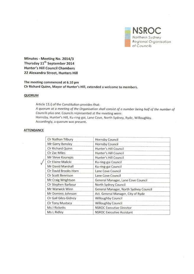
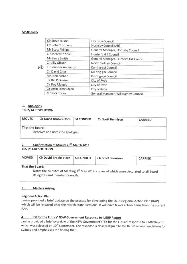
|
APPENDIX No: 6 - Email dated 11 October from Mayor Anderson to Ryde Council - Attachment 6 |
|
Item No: NM.1 |
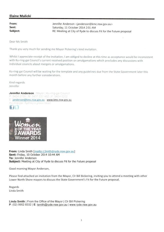
|
APPENDIX No: 7 - Letter dated 9 October 2014 from Mayor Pickering to Mayor Anderson - Attachment 7 |
|
Item No: NM.1 |