Ordinary
Meeting of Council
TO
BE HELD ON Tuesday, 8 September 2015 AT 7.00pm
Level
3 Council Chamber
Agenda
** ** ** ** ** **
NOTE:
For Full Details, See Council’s Website –
www.kmc.nsw.gov.au
under the link to business papers
APOLOGIEs
DECLARATIONS OF INTEREST
Confirmation of Reports to be
Considered in Closed Meeting
NOTE:
A. That
in accordance with the provisions of Section 10 of the Local Government Act
1993, all officers’ reports be released to the press and public, with the
exception of the following Confidential Reports and their respective
attachments:
C.1 Gordon
Golf Club Limited - Contract Fee Review
C.2 Teetop Pty
Ltd - Contract Fee Review - Gordon Golf Course
C.3 General
Manager’s Performance Assessment - for councillors only
B. That
in accordance with the provisions of Section 10 of the Local Government Act
1993, all officers’ reports be released to the press and public, with the
exception of confidential attachments to the following General Business
reports:
GB.3 Gordon Golf Course Masterplan
Communications and Consultation Outcomes
Attachment A3: ................................... Gordon
Golf Course - Masterplan options
GB.9 Lindfield Community Hub
Preferred Option
Attachment A7: . Addendum No. 2
Feasibility Analysis of Exhibited Options 1-4 Prepared by SJB Urban, by JLL,
dated 21 July 2015
GB.12 Adshel Infrastructure
Technology Upgrade proposal
Attachment A2: . Adshel
Infrastructure Development Proposal
GB.13 Tender NSROC - Road
Surfacing, Patching, and associated Works - 2015 to 2017
Attachment A1: . Report evaluation
comments and recommendations
Attachment A2: . Tender Evaluation
Committee – Minutes
Attachment A3: . Comparison of
Supply and Delivery
Address the Council
NOTE: Persons
who address the Council should be aware that their address will be tape recorded.
Documents Circulated to Councillors
CONFIRMATION OF MINUTEs
Minutes of Ordinary Meeting of Council 10
File: S02131
Meeting held 25 August 2015
Minutes numbered 232 to 252
minutes from the Mayor
Petitions
Recommendations from Committee
RC.1 Minutes
from Ku-ring-gai Traffic Committee 53
File: CY00022/7
Meeting held 20
August 2015
Minutes
numbered KTC11 to KTC17.
GENERAL BUSINESS
i.
The Mayor to invite Councillors to
nominate any item(s) on the Agenda that they wish to have a site inspection.
ii.
The Mayor to invite Councillors to
nominate any item(s) on the Agenda that they wish to adopt in accordance with
the officer’s recommendation allowing for minor changes without debate.
GB.1 Draft
General and Special Purpose Financial Statements for the year ended 30 June
2015 60
File: S08023/7
To present to Council the draft
Financial Statements for the year ended 30 June 2015 for certification and
referral to Council’s external auditor, UHY Haines Norton Chartered Accountants
and seek approval to carry over budgets to fund incomplete works at 30 June
2015.
Recommendation:
That Council receive, certify and
refer the draft Financial Statements for the year ended 30 June 2015 to
Council’s external auditor UHY Haines Norton Chartered Accountants, and that
carry forward expenditure for the amount of $10.602m and associated loan
funding of $1.465m be approved.
GB.2 Climate
Change Policy for Public Exhibition 207
File: S09069/5
To seek Council’s endorsement of
the Draft Climate Change Policy 2015 and Draft Greenhouse Gas Reduction Action
Plan 2015 for public exhibition.
Recommendation:
That Council endorses the public
exhibition of the Draft Climate Change Policy 2015 and Draft Greenhouse Gas
Reduction Action Plan 2015.
GB.3 Gordon
Golf Course Masterplan Communications and Consultation Outcomes 303
File: S09625
To report the outcomes of the
Communications and Consultation Program undertaken in relation to the Regional
Park Masterplan for Gordon Golf Course and provide a preferred concept for the
Gordon Golf Course Masterplan.
Recommendation:
That Council receive and note the
consultation report for the Gordon Golf Course Masterplan and that Council
adopt the preferred concept for the Masterplan consisting of part golf course,
recreational area, facilities and small scale residential.
GB.4 Gordon
Community Preschool - 2A Park Avenue Gordon - Renewal of Lease 358
File: S07458
For Council to consider the
granting of a 5 year lease to Gordon Community Preschool (GCP) for continued
occupation at 2A Park Avenue, Gordon.
Recommendation:
That Council grant a new 5 year
lease to Gordon Community Preschool from1 February 2016 to 31 January 2021.
GB.5 Lifeline
Harbour to Hawkesbury Inc - 4 Park Avenue Gordon - Renewal of Licence 365
File: S07471
For Council to consider the
granting of a 5 year licence to Lifeline Harbour to Hawkesbury Inc (Lifeline)
for continued occupation at 4 Park Avenue, Gordon.
Recommendation:
That Council grants a new 5 year
licence to Lifeline Harbour to Hawkesbury Inc from1 February 2016 to 31 January
2021.
GB.6 Northern
Sydney Aboriginal Heritage Office - proposal for relocation to the Ku-ring-gai
Wildflower Garden 374
File: S02414
To advise Councillors of a
proposal for the Northern Sydney Aboriginal Heritage Office (AHO) to relocate
to the Ku-ring-gai Wildflower Garden.
Recommendation:
That Council support the
relocation of Northern Sydney Aboriginal Heritage Office to the Ku-ring-gai
Wildflower Garden, and that a Business Model along with an agreement,
determining terms and conditions for the AHO to be accommodated at the
Wildflower Garden, is developed between the AHO and Ku-ring-gai Council.
GB.7 31 Tryon
Road, Lindfield - Demolition of existing structures and construction of a
residential flat building comprising 11 units, basement parking and landscaping
works 389
File: DA0508/14
Ward: Roseville
Applicant:
Playoust Churcher Architects
Owner: Allan Roy
Tattersall and Cheryl Ann Tattersall
To determine Development
Application DA0508/14 which proposes demolition of existing structures and
construction of a residential flat building comprising 11 units, basement
parking and landscaping works
Recommendation:
Approval
GB.8 49-51
Boomerang Street, Turramurra - Torrens Title subdivision of one lot into two
lots. 486
File: DA0078/15
Ward: Wahroonga
Applicant: DL
Long and JC Long
C/-Vaughan Milligan Development Consultants P/L
Owner: DL Long
and JC Long
Torrens title subdivision of one
lot into two lots
Recommendation:
Approval
GB.9 Lindfield
Community Hub Preferred Option 512
File: S10749
Present a comprehensive
assessment of the 4 (four) exhibited illustrative development options for the
Lindfield Community Hub site, and recommend a preferred option for Council
adoption.
Recommendation:
It is recommended that Council
adopt Option 2 (as exhibited) as the preferred option for the Lindfield
Community Hub subject to further refinements or adjustments that may necessary to address any concerns or issues raised by the private sector
prior during market sounding.
GB.10 Heritage
Listing - 28 Cook Road Killara 744
File: S10066
To have Council consider 28 Cook
Road, Killara as a potential heritage item under the Ku-ring-gai Local
Environmental Plan 2015.
Recommendation:
That a planning proposal be
prepared to list 28 Cook Road, Killara as an item of local heritage
significance under KLEP 2015.
GB.11 Consideration
of Submissions on the Planning Proposal to heritage list 6 Caithness Street,
Killara and 51 Warrangi Street, Turramurra 902
File: S10453
For Council to consider the submissions
received during the public exhibition of the planning proposal to heritage list
6 Caithness Street, Killara and 5 Warrangi Street, Turramurra.
Recommendation:
That Council take no further
action on the heritage listing for 6 Caithness Street, Killara and 51 Warrangi
Street, Turramurra.
GB.12 Adshel
Infrastructure Technology Upgrade proposal 1179
File: S03552/14
To consider and endorse support
for the Adshel Technology upgrade proposal.
Recommendation:
That Council support the proposal
to upgrade advertising at various locations on bus shelter light boxes with
digital and scrolling format and provide owner’s consent to the submission of a
Development Application on the terms set out in this report.
GB.13 Tender
NSROC - Road Surfacing, Patching, and associated Works - 2015 to 2017 1186
File: S10628
To seek Council's approval to
accept the Northern Sydney Regional Organisation of Councils (NSROC) tender for
the schedule of rates for supply; supply and delivery; and supply, delivery and
laying of asphaltic concrete, including associated road profiling and heavy
patching and other work items for the period 2015/2016 and 2016/2017.
Recommendation:
That Council accepts the
tenderers identified in Confidential Attachment A1 to supply; supply and
delivery; and supply, delivery and laying of asphaltic concrete, including
associated road profiling and heavy patching and other work items for the
period 2015/2016 and 2016/2017.
Extra Reports Circulated to Meeting
Motions of which due Notice has
been given
NM.1 Clearway
St Ives 1191
File: TM1/07
Notice of Motion from Councillor
Berlioz dated 31 August 2015
RMS
is proposing a clearway through St Ives 7 days a week. A net 52 public car
spaces will be lost. The clearway hours proposed will severely impact on the
survival of the retail strip shops located between Stanley Street and Rosedale
Road.
The
St Ives small businesses on the southern side of Mona Vale Road provide the
only retail and commercial businesses choice to the St Ives community, services
to the local and wider community and they rely heavily on passing trade. A
vital part of their business depends on weekend trade.
In
the last 12 months three of these retailers have invested heavily in opening
new businesses or expanding. Other long-standing businesses of 40 years prove
their valued contribution to the community.
The
RMS proposal for St Ives is for clearways to operate Monday to Friday 6am to
10am and 3pm to 7pm in both directions.
Saturday
and Sunday 9am to 6pm both directions with the exception of Stanley
Street to Porter’s Lane which will operate from 2pm to 6pm.
In
contrast, clearways on roads with similar or heavier traffic volumes (RMS 2012)
Pacific Highway through Ku-ring-gai, Boundary Road through French’s Forest and
Roseville Chase, Warringah Road through Beacon Hill, Penshurst Street through
Chatswood only apply on one side either morning or evening and they do not
apply on weekends.
A
weekend clearway has recently been put in place for Victoria Road Rozelle.
However, Victoria Road carries 30% more vehicles than Mona Vale Road. Further,
in the case of Victoria Road Rozelle which loses 44 cars due to the clearway,
RMS is spending $1.267M for to make up for the loss of car parking.
The
traffic volumes and speeds on Mona Vale Road St Ives do not warrant a weekend
clearway through the shopping strip between Stanley Street and Porter’s Lane.
I
move that council write urgently to RMS including a copy of this Notice of
Motion and that council:
· Request withdrawal of any weekend clearway on Mona
Vale Road from Stanley Street to Porter’s Lane.
· Send copy of the letter to MP for Davidson Jonathan
O’Dea and the Minister for Roads, Maritime and
Freight, Duncan Gay
BUSINESS WITHOUT NOTICE – SUBJECT TO CLAUSE 241 OF
GENERAL REGULATIONS
Questions Without Notice
Inspections Committee – SETTING OF TIME, DATE AND
RENDEZVOUS
Confidential Business to be
dealt with in Closed Meeting
C.1 Gordon
Golf Club Limited - Contract Fee Review
File: S07448
In accordance
with the Local Government Act 1993 and the Local Government (General)
Regulation 2005, in the opinion of the General Manager, the following
business is of a kind as referred to in section 10A(2)(d)(ii), of the Act, and
should be dealt with in a part of the meeting closed to the public.
Section 10A(2)(d) of the Act
permits the meeting to be closed to the public for business relating to
commercial information of a confidential nature that would, if disclosed:
(i)
prejudice the commercial position of the person who supplied it, or
(ii)
confer a commercial advantage on a competitor of Council, or
(iii)
reveal a trade secret.
This matter is classified
confidential under section 10A(2)(d)(ii) because it would confer a commercial
advantage on a competitor of the Council.
Report by
Director Community dated 13 July 2015
C.2 Teetop Pty
Ltd - Contract Fee Review - Gordon Golf Course
File: S07447
In accordance
with the Local Government Act 1993 and the Local Government (General)
Regulation 2005, in the opinion of the General Manager, the following
business is of a kind as referred to in section 10A(2)(d)(ii), of the Act, and
should be dealt with in a part of the meeting closed to the public.
Section 10A(2)(d) of the Act
permits the meeting to be closed to the public for business relating to
commercial information of a confidential nature that would, if disclosed:
(iv)
prejudice the commercial position of the person who supplied it, or
(v)
confer a commercial advantage on a competitor of Council, or
(vi)
reveal a trade secret.
This matter is classified
confidential under section 10A(2)(d)(ii) because it would confer a commercial
advantage on a competitor of the Council.
Report by
Director Community dated 13 July 2015
C.3 2016
General Manager’s Performance Assessment
Confidential
Mayoral Minute by the Mayor, Councillor Jennifer Anderson dated 21 August 2015
– circulated to Councillors only.
John McKee
General
Manager
** ** ** ** ** **
Minute Ku-ring-gai
Council Page
MINUTES OF Ordinary Meeting of Council
HELD ON Tuesday, 25 August 2015
|
Present:
|
The Mayor, Councillor J Anderson (Chairperson) (Roseville
Ward)
Councillors E Malicki & J Pettett (Comenarra Ward)
Councillors D Citer & C Szatow (Gordon Ward)
Councillors C Berlioz & D Ossip (St Ives Ward)
Councillor D Armstrong (Roseville Ward)
Councillor C Fornari-Orsmond (Wahroonga Ward)
|
|
|
|
|
Staff Present:
|
General Manager (John McKee)
Director Corporate (David Marshall)
Director Operations (Greg Piconi)
Director Community (Janice Bevan)
Corporate Lawyer (Jamie Taylor)
Acting Director Development & Regulation (Corrie
Swanepoel)
Acting Director Strategy & Environment (Antony Fabbro)
Manager Corporate Communications
(Virginia Leafe)
Governance Officer (Christine Dunand)
Minutes Secretary (Judy Murphy)
|
The Meeting
commenced at 7.00pm
The Mayor offered
the Prayer
|
232
|
Apologies
File: S02194
Councillor Duncan McDonald tendered an apology for
non-attendance [business reasons ] and requested leave of absence.
|
|
|
Resolved:
(Moved: Councillors Fornari-Orsmond/Pettett)
That the
apologies be accepted and leave of absence granted
.
CARRIED UNANIMOUSLY
|
Address the Council
The following member of the
public addressed Council on items not on the Agenda:
P Wass - Marian
Street Theatre
DOCUMENTS CIRCULATED
TO COUNCILLORS
The Mayor adverted to the
documents circulated in the Councillors’ papers and advised that the following
matters would be dealt with at the appropriate time during the meeting:
|
Late Items:
|
MM.2 - VALE Barrett 'Barry' Leslie Lewis AO - Former
Ku-ring-gai Councillor
MM.3 - VALE Andrea Coleman 1959 – 2015 Volunteer Member
of Ku-ring-gai Rural Fire Service Brigade
MM.4 - Councillor Elaine Malicki – Ku-ring-gai
Council’s Longest Serving Elected Representative
PT.1 - Proposed Child Care Centre 18-20 Lady Game Drive
Killara DA0588/14 - (One hundred and sixty seven [167] Signatures)
PT.2 - Proposed Clearway at Mona Vale Road St Ives
(Six Hundred and Two [602] Signatures)
|
|
Councillors Information:
|
Attachment 1 to GB.1 - Delivery Program 2013 – 2017
& Operational Plan 2014 – 2015 – Bi-annual Report
Traffic
Management in St Ives - Memorandum from Director Operations dated 18
August 2015 in relation to QWN from Councillor Ossip regarding a report on
Traffic Management in St Ives.
Stolen Sundial at Lookout Park Turramurra –
Memorandum from Director Operations dated 20 August 2015 in relation to QWN
from Councillor Malicki regarding the stole sundial at Lookout Park
Turramurra.
|
|
Late Confidential Items:
|
C.1 - 2016 General Manager’s Performance Agreement
|
CONFIRMATION OF MINUTEs
|
233
|
Minutes of Ordinary
Meeting of Council
File: S02131
|
|
|
Meeting held 11 August 2015
Minutes numbered 220 to 231
|
|
|
Resolved:
(Moved: Councillors Citer/Malicki)
That Minutes numbered 220 to 231 circulated to Councillors
were taken as read and confirmed as an accurate record of the proceedings of
the Meeting, with a change to Minute No 228 Proposed Interim Heritage Order -
Berrilee 25 Bushlands Avenue Gordon the reference to Sir Robert Christian
Simpson be changed to Sir Robert Christian Wilson.
That the Apologies to include ‘Cr Cheryl Szatow was also
absent under a previous apology tendered to Council.’
CARRIED
UNANIMOUSLY
|
minutes from the Mayor
|
234
|
VALE Jean Rixon
File: CY00455/3
Vide: MM.1
|
|
|
It is my sad duty to inform my Councillor colleagues and
the Ku-ring-gai community of the passing of a much loved resident, Jean Rixon
from Roseville.
Until her death last month, Jean was an energetic
volunteer who since her retirement as an esteemed local pharmacist, had made
it her life’s mission to serve Ku-ring-gai residents.
Despite being in her mid-eighties, Jean gave her time
tirelessly as a volunteer pastoral worker for St Andrews Anglican Church at
Roseville. She visited the sick in hospitals, the elderly in their homes and
nursing homes and provided meals for anyone who needed them.
Such was her cheerfulness, energy and dedication that she
inspired others to become pastoral care volunteers at the church.
Jean was also a keen tennis player, playing every week at
Roseville until shortly before her death.
Despite being an only child and never marrying, Jean
touched lives and brought comfort to many. She was admired for her compassion
and empathy for others. Members of St Andrews Church nominated her for a
Mayoral Seniors Award this year, which I was pleased to present to her in
March.
The Ku-ring-gai community and her many friends have lost a
great person who will be remembered long after her passing. May Jean rest in
peace knowing the appreciation of the community she served well.
|
|
|
Resolved:
A. That
the Mayoral Minute be received and noted.
B. That
we stand for a minute’s silence to honour Jean Rixon.
C. That
the Mayor writes to Jean’s family and encloses a copy of this Mayoral Minute
CARRIED
UNANIMOUSLY
|
One minutes silence was observed
|
235
|
VALE Barrett
'Barry' Leslie Lewis AO - Former Ku-ring-gai Councillor
File: CY00455/3
Vide: MM.2
|
|
|
I have received the sad news that former Ku-ring-gai Council
alderman Barry Lewis passed away at his home in Port Macquarie on 7th July
2015 aged 87 years.
Mr Lewis was an alderman for more than 30 years at the
Sutherland, Sydney City and Ku-ring-gai councils respectively. His
distinguished career in local government began in 1956 when he was elected to
Sutherland Council. In 1969 he was elected to Sydney City Council, serving as
Deputy Lord Mayor 1973-74 and 1976-77, and where he was to meet his wife of
almost 40 years, Nanette Rudge. Nanette was also a Sydney City alderman and
together they continued to serve the Sydney community throughout the 1970s
and early 1980s.
Mr Lewis became an experienced and knowledgeable committee
member on topics ranging from parking to health services. It was this breadth
of experience that Ku-ring-gai Council was to benefit from when he and his
wife Nanette were elected in 1987. Both of them served the Ku-ring-gai
community between 1987 and 1991, representing Roseville Ward.
When they retired to Port Macquarie 15 years ago, they
found a new community to serve. Their shared love of heritage meant they
became involved in the restoration of the historic Wesleyan chapel in Horton
Street. In 1998 Barry became project director of the St Thomas's Anglican
Church Restoration project - a position he held until 2004.
Both Barry and Nanette were recognised for their services
to the community in 2007 with the Medal of the Order of Australia. Arguably
they were one of the few husband and wife duos to be awarded double honours.
Their selfless record of service to every community they
have lived in deserves special mention and recognition. We acknowledge and
thank Barry Lewis for his contribution to the Ku-ring-gai community and offer
our condolences to his family and friends.
|
|
|
Resolved:
A. That
the Mayoral Minute be received and noted.
B. That
we stand for a minute’s silence to honour Barry Lewis
C. That
the Mayor writes to Barry’s family and encloses a copy of this Mayoral
Minute.
CARRIED
UNANIMOUSLY
|
One minutes silence was observed
|
236
|
VALE Andrea Coleman
1959 – 2015 Volunteer Member of Ku-ring-gai Rural Fire Service Brigade
File: CY00455/3
Vide: MM.3
|
|
|
It is my sad duty to advise my Councillor colleagues and
Ku-ring-gai residents of the untimely death of a much loved member of our
community, Ms Andrea Coleman.
Andrea became a volunteer with the Ku-ring-gai RFS Brigade
in 2010. With her children growing older she felt she wanted to give back
something to the community she lived in.
Initially she was made assistant training officer, but her
organisational skills and warm engaging personality soon saw her become the
brigade’s community engagement officer.
In this role, Andrea had the responsibility of putting on
education displays at locations such as
St Ives Shopping Village and open days at the brigade headquarters. She also
hosted community engagement activities such as street meetings and school
visits to discuss bushfire prevention with the public.
Last week Ku-ring-gai RFS Brigade captain Mark Unsworth
paid tribute to the positive impact Andrea had on educating residents on the
dangers of bushfire. “She was a brilliant organiser, full of energy. I knew
that I could give her any task and she would not only make sure it was done,
but that it was a great success.”
Her passing has special poignancy for Council staff.
Andrea worked closely with members of our environment and bush management
team in organising educational events. Her happy nature and ability to
connect with everyone she met will be sorely missed by them.
We are deeply sorry to hear of Andrea’s sudden and
unexpected passing. On behalf of the Council and the Ku-ring-gai community, I
extend my sincere condolences to her family – especially her children Max and
Philippa – and to the members of the Ku-ring-gai RFS Brigade who knew and
loved her.
|
|
|
Resolved:
A. That
the Mayoral Minute be received and noted.
B. That
we stand for a minute’s silence to honour Andrea Coleman
C. That
the Mayor writes to Andrea’s family and encloses a copy of this Mayoral
Minute.
CARRIED
UNANIMOUSLY
|
One minutes silence was observed
|
237
|
Councillor Elaine Malicki -
Ku-ring-gai Council's Longest Serving Elected Representative
File: CY004553
Vide: MM.4
|
|
|
Tonight I would like to especially acknowledge Cr Elaine
Malicki, who has achieved the distinction of becoming Ku-ring-gai Council’s
longest serving elected representative.
Since her election in September 1991, Cr Malicki has
impressively notched up close to 24 years of service, now surpassing the
previous record of just over 23 years and eight months held by the late Tony
Hall.
For the benefit of residents and those present at
tonight’s meeting, here is an outline of Cr Malicki’s achievements during her
long career in local government.
Cr Malicki has served three terms as Mayor, notably during
centenary celebrations for the Council in 2006 and two terms as Deputy Mayor.
She has served on a range of Council committees, including planning and
bushfire management.
Cr Malicki has been a key driver and advocate in many
large projects including the Ku-ring-gai Fitness and Aquatic Centre, North
Turramurra Recreation Area, several new parks and upgrades to neighbourhood
centres. She is a passionate supporter of sport in Ku-ring-gai and a
committed proponent of creating a regional park on the site of Gordon Golf
Course.
Cr Malicki received a Long Service Award from the Minister
for Local Government in 2012 and a high commendation in the 2013 Women in
Local Government Awards.
Cr Malicki’s experience on Council is reflected in her
interest in local community affairs, particularly those affecting
Ku-ring-gai’s beautiful natural environment. Prior to her election on
Council, Elaine was president of a coalition of community groups which successfully
opposed the building of a freeway through the Lane Cove Valley bushland. She
was also secretary of the Ku-ring-gai Ratepayers Association and instigator
of the Urban Runoff Committee. She also instigated the Ku-ring-gai Residents'
Coalition, which allowed local action groups to join together for mutual
support.
The Rural Fire Service honoured Cr Malicki with an award
for her work in educating the community on bushfire prevention. Cr Malicki
also had the pleasure of officially opening the new RFS headquarters at
Wahroonga in 2013, a project in which she played a leading role.
In conclusion, on behalf of the Council and our community,
I thank Cr. Malicki for her long commitment to preserving Ku-ring-gai’s
unique qualities and her dedication to local government. We extend our
congratulations on her record breaking service to Ku-ring-gai Council and its
community.
|
|
|
Resolved:
(Moved: Mayor, Councillor Anderson)
That
this Mayoral Minute be received and noted.
CARRIED
UNANIMOUSLY
|
PETITIONS
|
238
|
Proposed Child Care
Centre 18-20 Lady Game Drive Killara DA0588/14 - (One hundred and sixty seven
[167] Signatures)
File: DA0588/14
Vide: PT.1
|
|
|
“We, the undersigned, petition the Mayor and Councillors
of Ku-ring-gai to stop the proposed change of use of the residential
property located at 18-20 Lady Game Drive Killara to a Child Care Centre.”
|
|
|
Resolved:
(Moved: Councillors Citer/Armstrong)
That the petition be received and referred to the
appropriate Officer of Council for attention.
CARRIED
UNANIMOUSLY
|
|
239
|
Proposed Clearway at Mona Vale Road
St Ives (Six Hundred and Two [602] Signatures)
File: TM1/07
Vide: PT.2
|
|
|
“We, the undersigned, request the Mayor and Councillors of
Ku-ring-gai to petition the State Government of NSW to stop the proposed
clearway for Mona Vale Road St Ives. (Six Hundred and Two [602] Signatures).”
|
|
|
Resolved:
(Moved: Councillors Berlioz/Ossip)
That the petition be received and referred to the
appropriate Officer of Council for attention.
CARRIED
UNANIMOUSLY
|
GENERAL BUSINESS
|
240
|
Extinguishment and
Relocation of Council Easement - 6A-8 Buckingham Road Killara
File: CY00066/7
Vide: GB.2
|
|
|
To seek Council approval to the extinguishment and
relocation of an easement in favour of Council at 6A‑8 Buckingham
Road, Killara
|
|
|
Resolved:
(Moved: Councillors Malicki/Szatow)
A. That
the General Manager or his delegate be authorised to negotiate Council’s
requirements including compensation for the extinguishment of the existing
easement (J344860) and the modification/creation of a new easement in favour
of Council at 6A‑8 Buckingham Road, Killara.
B. Subject
to the General Manager or his delegate completing negotiations as set out in
the report that Council grant approval for the extinguishment of the existing
easement and the creation of a new easement in favour of Council at 6A-8
Buckingham Road, Killara.
C. That
Council authorises the Mayor and General Manager to affix the Common Seal of
the Council to the instrument for the release of the easement and the
creation of the new easement and to execute all associated documentation.
CARRIED
UNANIMOUSLY
|
|
241
|
Investment Report
as at 31 July 2015
File: S05273
Vide: GB.3
|
|
|
To present Council’s investment portfolio performance
for July 2015.
|
|
|
Resolved:
(Moved: Councillors Malicki/Pettett)
A. That
the summary of investments and performance for July 2015 be received and
noted.
B. That
the Certificate of the Responsible Accounting Officer be noted and the report
adopted.
CARRIED
UNANIMOUSLY
|
|
242
|
Analysis of Land
and Environment Court Costs - 4th Quarter 2014 to 2015
File: S05273
Vide: GB.4
|
|
|
To report legal costs in relation to development
control matters in the Land and Environment Court for the year ended 30 June
2015.
|
|
|
Resolved:
(Moved: Councillors Malicki/Pettett)
That the
analysis of Land and Environment Court costs for the year ended 30 June 2015
be received and noted.
CARRIED
UNANIMOUSLY
|
|
243
|
90–92 Eton Road
Lindfield - DA0552/14 - Construction of 13 Small Lot Dwellings, New Road,
Stormwater System and Community Title Subdivision into 14 Lots
File: DA0552/14
Vide: GB.5
|
|
|
Construction of 13 small lot houses, new private
roadway, stormwater works and Community title subdivision into 14 lots.
|
|
|
Resolved:
(Moved: Councillors Malicki/Pettett)
THAT the Council, as the consent authority, grant deferred
development consent to DA0552/14 for the construction of 13 small lot houses
and Community Title subdivision into 14 lots, being 13 residential Torrens
title lots and 1 community Lot for the private road, at 90-92 Eton Road,
Lindfield (formerly 100 Eton Road), for a period of two (2) years from the
date on which the consent becomes operable.
SCHEDULE A: Deferred Commencement - Terms to be satisfied prior to the
consent becoming operable
The
following deferred commencement terms must be complied with to the
satisfaction of Council within 24 months of the date of issue of this
deferred commencement consent:
Approval for relocation of Council pipe and easement
In order for the consent to become operable;
(i) The applicant must
obtain a resolution from Ku-ring-gai Council, as the asset owner, that it
will consent to the relocation of the existing Council easement for drainage
and underground pipe.
(ii) A full hydraulic
design for the relocation of the pipe is to be prepared in accordance with
the requirements of Chapter 9 of Council’s DCP 47 Water Management and
submitted to Council with the relevant application and fees. The design must
be suitable for construction.
(iii) Council’s
resolution is required for the relocation of the pipe, extinguishment of the
existing easement and where required, the creation of a new easement.
Reason: To protect the environment and Council's assets.
Once the
consent becomes operable, the following conditions apply:
SCHEDULE B –
Conditions of Development Consent
Conditions that identify approved plans:
1. Approved architectural plans and
documentation (new development)
The development must be carried out in accordance with the
following plans and documentation listed below and endorsed with Council’s
stamp, except where amended by other conditions of this consent:
|
Plan no.
|
Drawn by
|
Dated
|
|
P5-DA01-100[2]
|
Batessmart
|
04.06.15
|
|
P5-DA02-101[2]
|
Batessmart
|
04.06.15
|
|
P5-DA05-001[1]
|
Batessmart
|
10.04.15
|
|
P5-DA05-002[1]
|
Batessmart
|
10.04.15
|
|
P5-DA05-003[1]
|
Batessmart
|
10.04.15
|
|
P5-DA05-004[1]
|
Batessmart
|
10.04.15
|
|
P5-DA05-005[1]
|
Batessmart
|
10.04.15
|
|
P5-DA05-006[1]
|
Batessmart
|
10.04.15
|
|
P5-DA05-007[1]
|
Batessmart
|
10.04.15
|
|
P5-DA05-008[1]
|
Batessmart
|
10.04.15
|
|
P5-DA05-009[1]
|
Batessmart
|
10.04.15
|
|
P5-DA05-010[1]
|
Batessmart
|
10.04.15
|
|
P5-DA05-011[1]
|
Batessmart
|
10.04.15
|
|
P5-DA05-012[1]
|
Batessmart
|
10.04.15
|
|
P5-DA05-013[1]
|
Batessmart
|
10.04.15
|
|
P5-DA07-001[2]
|
Batessmart
|
10.04.15
|
|
P5-DA07-002[2]
|
Batessmart
|
10.04.15
|
|
P5-DA07-100[1]
|
Batessmart
|
04.12.14
|
|
P5-DA07-101[1]
|
Batessmart
|
04.12.14
|
|
P5-DA07-102[1]
|
Batessmart
|
04.12.14
|
|
P5-DA07-103[1]
|
Batessmart
|
04.12.14
|
|
P5-DA07-104[1]
|
Batessmart
|
04.12.14
|
|
P5-DA07-105[1]
|
Batessmart
|
04.12.14
|
|
P5-DA07-106[1]
|
Batessmart
|
14.09.26
|
|
P5-DA07-107[1]
|
Batessmart
|
04.12.14
|
|
P5-DA07-108[1]
|
Batessmart
|
04.12.14
|
|
P5-DA07-109[1]
|
Batessmart
|
04.12.14
|
|
P5-DA08-002[1]
|
Batessmart
|
04.12.14
|
|
P5-DA08-003[1]
|
Batessmart
|
04.12.14
|
|
Materality Sheets 1
and 2
|
Batessmart
|
Undated
|
|
C101 Rev C
|
James Taylor and
Associates
|
07.04.15
|
|
C102 Rev B
|
James Taylor and
Associates
|
07.04.15
|
|
C104 Rev B
|
James Taylor and
Associates
|
07.04.15
|
|
C105 Rev C
|
James Taylor and
Associates
|
07.04.15
|
|
C106 Rev B
|
James Taylor and
Associates
|
07.04.15
|
|
C107 Rev A
|
James Taylor and
Associates
|
07.04.15
|
|
C201 Rev B
|
James Taylor and
Associates
|
07.04.15
|
|
DA-L-100 Rev 3
|
Turf
|
11/06/15
|
|
DA-L-300 Rev 3
|
Turf
|
11/06/15
|
|
DA-L-400 Rev 3
|
Turf
|
11/06/15
|
|
L-P5-DA-10
|
Turf
|
09/04/15
|
|
L-P5-DA-11
|
Turf
|
09/04/15
|
|
TDS-SK-001 Rev 1
|
Turf
|
02/04/15
|
|
Draft Precinct 5
subdivision plan
|
Peter William
Vandergraaf
|
03.06.2015
|
|
TMP01 Issue B Sheet 1
of 2
|
Naturally Trees
|
08/04/15
|
|
TMP01 Issue B Sheet 2
of 2
|
Naturally Trees
|
08/04/15
|
Reason: To ensure that the development is in accordance with the
determination.
2. Inconsistency between documents
In the event of any inconsistency between conditions of this
consent and the drawings/documents referred to above, the conditions of this
consent prevail.
Reason: To ensure that the development is in accordance with the
determination.
3. Approved landscape plans
Landscape works shall be carried out in accordance with the
following landscape plan(s), listed below and endorsed with Council’s stamp, except
where amended by other conditions of this consent:
|
Plan no.
|
Drawn by
|
Dated
|
|
DA-L-100 Rev B, DA-L-300 Rev B, A-L-400 Rev B, DA-L-500 Rev
B, L-P5-DA-10 Issue 2, L-P5-DA-11 Issue 2 TDS-SK-001 Rev 1
|
Turf
|
11/06/15 9/04/15 2/04/15
|
Reason: To ensure that the development is in
accordance with the determination.
4. Amendments to
approved plans
The approved plans
including architectural, landscaping and engineering shall be amended as
follows:
- The proposed sandstone retaining wall to the landscape
easement between the private open space of Precinct 5 and the
adjoining Asset Protection Zone is to follow the existing
contours to ensure compliance with maximum 1 metre height and avoid conflicts
with rock outcropping (5.7.5 Edgelea Urban
Design Guidelines February 2012).
Prior to the issue of the
Construction Certificate, the Principal Certifying Authority shall be
satisfied that the landscape plan has been amended are required by this
condition.
Note: An amended plan, prepared by a
landscape architect or qualified landscape designer shall be submitted to the
Certifying Authority.
Reason: To ensure the development is in accordance with the
determination
Conditions to be satisfied prior to demolition, excavation or
construction:
5. Asbestos works
All work involving asbestos products and materials, including
asbestos-cement- sheeting (ie. Fibro), must be carried out in accordance with
the guidelines for asbestos work published by WorkCover Authority of NSW.
Reason: To ensure public safety
6. Notice of commencement
At
least 48 hours prior to the commencement of any development (including
demolition, excavation, shoring or underpinning works), a notice of
commencement of building or subdivision work form and appointment of the
principal certifying authority form shall be submitted to Council.
Reason: Statutory
requirement.
7. Notification of builder’s details
Prior to the commencement of any
development or excavation works, the Principal Certifying Authority shall be
notified in writing of the name and contractor licence number of the
owner/builder intending to carry out the approved works.
Reason: Statutory requirement.
8. Dilapidation survey and report (public infrastructure)
Prior to the commencement of any development or
excavation works on site, the Principal Certifying Authority shall be
satisfied that a dilapidation report on the visible and structural condition
of all structures of the following public infrastructure, has been completed
and submitted to Council:
Public
infrastructure
· Full road pavement, including kerb and gutter, of
Eton Road from Abingdon Road to the southern extremity of the subject site,
including the bus bay.
Tubbs
View, full road pavement.
The
report must be completed by a consulting structural/civil engineer.
Particular attention must be paid to accurately recording (both written and
photographic) existing damaged areas on the aforementioned infrastructure so
that Council is fully informed when assessing any damage to public
infrastructure caused as a result of the development.
The
developer may be held liable to any recent damage to public infrastructure in
the vicinity of the site, where such damage is not accurately recorded by the
requirements of this condition prior to the commencement of works.
Note: A written
acknowledgment from Council must be obtained (attesting to this condition
being appropriately satisfied) and submitted to the Principal Certifying
Authority prior to the commencement of any excavation works.
Reason: To record the
structural condition of public infrastructure before works commence.
9. Dilapidation survey and report (private
property)
Prior to the commencement of any demolition or
excavation works on site, the Principal Certifying Authority shall be
satisfied that a dilapidation report on the visible and structural condition
of all structures upon the following lands, has been completed and submitted
to Council:
|
Address
|
|
· 64 Abingdon Road.
|
|
· 10 Kimo Street
(if construction of dwelling has commenced).
|
|
|
The dilapidation report must include a photographic
survey of adjoining properties detailing their physical condition, both
internally and externally, including such items as walls ceilings, roof and
structural members. The report must be completed by a consulting
structural/geotechnical engineer as determined necessary by that professional
based on the excavations for the proposal and the recommendations of the
submitted geotechnical report.
In
the event that access for undertaking the dilapidation survey is denied by a
property owner, the applicant must demonstrate in writing to the satisfaction
of the Principal Certifying Authority that all reasonable steps have been
taken to obtain access and advise the affected property owner of the reason
for the survey and that these steps have failed.
Note: A copy of the dilapidation report is to be provided to Council
prior to any excavation works been undertaken. The dilapidation report is for
record keeping purposes only and may be used by an applicant or affected
property owner to assist in any civil action required to resolve any dispute
over damage to adjoining properties arising from works.
Reason: To record the structural condition of likely affected properties
before works commence.
10. Access through public reserve not permitted
Access for construction purposes shall not be gained
through the adjoining public reserve. Should no alternative access exist, an
application for access to the construction site via the public reserve shall
be submitted to Council for consideration and approval prior to the
commencement of works.
Reason: To protect
public reserves.
11. Construction and traffic management plan
The
applicant must submit to Council a Construction Traffic Management Plan
(CTMP), which is to be approved prior to the commencement of any works on
site.
The
plan is to consist of a report with Traffic Control Plans attached.
The
report is to contain commitments which must be followed by the excavation
contractor, builder, owner and subcontractors. The CTMP applies to all persons
associated with demolition, excavation and construction of the development.
The
report is to contain construction vehicle routes for approach and departure
to and from all directions.
The
report is to contain a site plan showing entry and exit points. Swept paths
are to be shown on the site plan showing access and egress for an 11 metre
long heavy rigid vehicle.
The
Traffic Control Plans are to be prepared by a qualified person (red card
holder). One must be provided for each of the following stages of the works:
o Excavation
o Concrete
pour
o Traffic
control for vehicles reversing into or out of the site.
Traffic
controllers must be in place at the site entry and exit points to control
heavy vehicle movements in order to maintain the safety of pedestrians and
other road users.
When
a satisfactory CTMP is received, a letter of approval will be issued with
conditions attached. Traffic management at the site must comply with the
approved CTMP as well as any conditions in the letter issued by Council.
Council’s Rangers will be patrolling the site regularly and fines may be
issued for any non-compliance with this condition.
Reason: To ensure that
appropriate measures have been considered during all phases of the
construction process in a manner that maintains the environmental amenity and
ensures the ongoing safety and protection of people.
12. Erosion and drainage management
Earthworks and/or demolition of any existing
buildings shall not commence until an erosion and sediment control plan is
submitted to and approved by the Principal Certifying Authority. The plan
shall comply with the guidelines set out in the NSW Department of Housing
manual "Managing Urban Stormwater: Soils and Construction"
certificate. Erosion and sediment control works shall be implemented in
accordance with the erosion and sediment control plan.
Reason: To preserve and
enhance the natural environment.
13. Tree fencing inspection
Upon installation of the required tree protection measures, an
inspection of the site by the Principal Certifying Authority is required to
verify that tree protection measures comply with all relevant conditions.
Reason: To protect existing trees during the construction phase.
14. Construction waste management plan
Prior to the commencement of any works, the
Principal Certifying Authority shall be satisfied that a waste management
plan, prepared by a suitably qualified person, has been prepared in
accordance with Council’s DCP 40 - Construction and Demolition Waste
Management.
The plan shall address all issues identified in DCP
40, including but not limited to: the estimated volume of waste and method
for disposal for the construction and operation phases of the development.
Note: The plan shall be provided to the Certifying Authority.
Reason: To
ensure appropriate management of construction waste.
15. Noise and vibration management plan
Prior
to the commencement of any works, a noise and vibration management plan is to
be prepared by a suitably qualified expert addressing the likely noise and
vibration from demolition, excavation and construction of the proposed
development and provided to the Principal Certifying Authority. The management plan is to identify amelioration
measures to achieve the best practice objectives of AS 2436-2010 and NSW
Department of Environment and Climate Change Interim Construction Noise
Guidelines. The report shall be prepared in consultation with any
geotechnical report that itemises equipment to be used for excavation works.
The
management plan shall address, but not be limited to, the following matters:
· identification of the specific activities that will
be carried out and associated noise sources
· identification of all potentially affected sensitive
receivers, including residences, churches, commercial premises, schools and
properties containing noise sensitive equipment
· the construction noise objective specified in the
conditions of this consent
· the construction vibration criteria specified in the
conditions of this consent
· determination of appropriate noise and vibration
objectives for each identified sensitive receiver
· noise and vibration monitoring, reporting and
response procedures
· assessment of potential noise and vibration from the
proposed demolition, excavation and construction activities, including noise
from construction vehicles and any traffic diversions
· description of specific mitigation treatments,
management methods and procedures that will be implemented to control noise
and vibration during construction
· construction timetabling to minimise noise impacts
including time and duration restrictions, respite periods and frequency
· procedures for notifying residents of construction
activities that are likely to affect their amenity through noise and
vibration
· contingency plans to be implemented in the event of
non-compliances and/or noise complaints
Reason: To protect the
amenity afforded to surrounding residents during the construction process.
16. CCTV report of existing Council pipe system near works
Prior
to the commencement of any works on site, qualified practitioners must
undertake a closed circuit television inspection and then report on the
existing condition of the Council drainage pipeline through Lots 8 to 14. The
report must be provided to Council’s, Development Engineer and is to include
a copy of the video footage of the pipeline. A written acknowledgment from
Council’s Development Engineer (attesting to this condition being
appropriately satisfied) shall be obtained and submitted to the Principal
Certifying Authority prior to the commencement of any works on site.
Reason: To protect
Council’s infrastructure.
Conditions to be satisfied prior to the issue of the construction
certificate:
17. Project ecologist
A Project Ecologist shall be commissioned prior to the release
of the Construction Certificate to ensure all bushland/environmental
protection measures are carried out in accordance with the conditions of
consent.
The Project Ecologist shall have a minimum qualification of TAFE
Certificate III in Bush Regeneration or Conservation and Land Management -
Natural Area Restoration. He/she shall have at least 4 years experience in
the management of native bushland in the Sydney region. Details of the
arborist including name, business name and contact details shall be provided
to the Principal Certifying Authority with a copy to Council.
Reason: To ensure the protection of existing biodiversity values of
the site
18. Fauna protection
Prior to works commencing and/or tree removal works a qualified
ecologist shall investigate all trees within the development for fauna
occupation. In accordance with appropriate licensing requirements the
ecologist shall supervise the relocation of any fauna found within the trees
approved for removal.
The qualified ecologist must hold an Animal Ethics Permit from
the Office of Environment & Heritage and a wildlife licence under section
132C of the National Parks and Wildlife Act 1974 issued by the Office of
Environment and Heritage.
Evidence of engagement of the qualified ecologist and the
required licensing must be provided to the Private Certifying Authority with
a copy to Council prior to the trees being removed.
Reason: To ensure protection of fauna
species.
19. Nest boxes
Prior to works commencing and/or tree
removal works being undertaken eighteen nest boxes comprising of 6 small
mammal & 6 medium mammal, 6 microbat boxes shall be installed within the
retained (bushland) area to the south of the proposed development. The nest
boxes shall be constructed of durable wood material (marine ply) and
installed at a minimum height of 6 metres from the ground and positioned under
the direction of a qualified ecologist.
The qualified ecologist must hold an Animal Ethics
Permit from the Office of Environment & Heritage and a wildlife licence
under section 132C of the National Parks and Wildlife Act 1974 issued
by the Office of Environment and Heritage.
Reason: To ensure protection of fauna species.
20. Amendments to approved tree protection plan
Prior to the issue of a Construction Certificate, the Principal
Certifying Authority shall be satisfied that the approved tree protection
plans, listed below and endorsed with Council’s stamp, have been amended in
accordance with the requirements of this condition as well as other
conditions of this consent:
|
Plan no.
|
Drawn by
|
Date
|
|
TMP01
Sheets 1- 2 Rev B
|
Naturally
Trees
|
8/04/15
|
The above tree protection plan(s) shall be amended in the
following ways:
1. Tree protection and ground protection is to be provided to
the bushland edge directly southeast of the proposed access road, retaining
wall to Lot 14 and stormwater works. The fencing is to connect to that shown
in association with Trees 830 and 831. Sediment fencing is to be relocated
along the line of the tree protection fencing.
Note: An
amended plan, prepared by a qualified arborist and verified by the Project
Arborist and Project Ecologist shall be submitted to the Certifying
Authority.
Reason : To protect existing trees during construction phase
21. Long service levy
In
accordance with Section 109F(i) of the Environmental Planning and Assessment
Act a Construction Certificate shall not be issued until any long service
levy payable under Section 34 of the Building and Construction Industry Long
Service Payments Act 1986 (or where such levy is payable by instalments, the
first instalment of the levy) has been paid. Council is authorised to accept
payment. Where payment has been made elsewhere, proof of payment is to be
provided to Council.
Reason: Statutory requirement.
22. Builder’s indemnity insurance
The applicant, builder, developer or person who does
the work on this development, must arrange builder’s indemnity insurance and
submit the certificate of insurance in accordance with the requirements of
Part 6 of the Home Building Act 1989 to the Certifying Authority for
endorsement of the plans accompanying the Construction Certificate.
It is the responsibility of the applicant, builder
or developer to arrange the builder's indemnity insurance for residential
building work over the value of $20,000. The builder's indemnity insurance
does not apply to commercial or industrial building work or to residential
work valued at less than $20,000, nor to work undertaken by persons holding
an owner/builder's permit issued by the Department of Fair Trading (unless
the owner/builder's property is sold within 7 years of the commencement of
the work).
Reason: Statutory requirement.
23. Outdoor lighting
Prior
to the issue of a Construction Certificate, the Certifying Authority shall be
satisfied that all outdoor lighting will comply with AS/NZ1158.3: 1999
Pedestrian Area (Category P) Lighting and AS4282: 1997 Control of the
Obtrusive Effects of Outdoor Lighting.
Note: Details
demonstrating compliance with these requirements are to be submitted prior to
the issue of a Construction Certificate.
Reason: To provide high
quality external lighting for security without adverse affects on public
amenity from excessive illumination levels.
24. Tree protection fencing/ground protection
To preserve the following tree/s, no work shall commence until
the area beneath their canopy is fenced off or ground protection installed as
per following Tree Management Plans to prevent any activities, storage or the
disposal of materials within the fenced area. The fencing/ground protection
shall be maintained intact until the completion of all demolition/building
work on site.
|
Plan no.
|
Drawn by
|
Date
|
|
TMP01
Sheets 1- 2 Rev B
|
Naturally
Trees
|
8/04/15
|
The tree protection fencing shall be constructed of galvanised
pipe at 2.4 metre spacings and connected by securely attached chain mesh
fencing to a minimum height of 1.8 metres in height prior to work commencing.
Ground protection shall be in accordance with AS4970-2009 Protection of trees
on development sites.
Reason : To protect existing trees during construction phase
25. Design of works in public road (Roads Act approval)
If
the design for the new Council pipe from Eton Road to the bioretention basin
has not been approved with the Council report, then prior to issue of the
Construction Certificate, the Certifying Authority shall be satisfied that
engineering plans and specifications prepared by a qualified consulting
engineer have been approved by Council’s Development Engineer. The plans to
be assessed must be to a detail suitable for construction issue purposes
Development
consent does not give approval to these works on Council's asset. The
applicant must obtain a separate approval under sections 138 and 139 of The
Roads Act 1993 for the works required as part of the development. The
Construction Certificate must not be issued, and these works must not proceed
until Council has issued a formal written approval under the Roads Act 1993.
The
required plans and specifications are to be designed in accordance with the
General Specification for the Construction of Road and Drainage Works in
Ku-ring-gai Council, dated November 2004. The drawings must detail existing
utility services and trees affected by the works, erosion control
requirements and traffic management requirements during the course of works.
Survey must be undertaken as required. Traffic management is to be certified
on the drawings as being in accordance with the documents SAA HB81.1 - 1996 -
Field Guide for Traffic Control at Works on Roads - Part 1 and RTA Traffic
Control at Work Sites (1998). Construction of the works must proceed only in
accordance with any conditions attached to the Roads Act approval issued by
Council.
A
minimum of three (3) weeks will be required for Council to assess the Roads
Act application. Early submission of the Roads Act application is recommended
to avoid delays in obtaining a Construction Certificate. An engineering
assessment and inspection fee (set out in Council’s adopted fees and charges)
is payable and Council will withhold any consent and approved plans until
full payment of the correct fees. Plans and specifications must be marked to
the attention of Council’s Development Engineers. In addition, a copy of this
condition must be provided, together with a covering letter stating the full
address of the property and the accompanying DA number.
Reason: To ensure that the plans are suitable for construction purposes.
26. Utility provider requirements
Prior
to issue of the Construction Certificate, the applicant must make contact
with all relevant utility providers whose services will be impacted upon by
the development. A written copy of the requirements of each provider, as
determined necessary by the Certifying Authority, must be obtained. All
utility services or appropriate conduits for the same must be provided by the
developer in accordance with the specifications of the utility providers.
Reason: To ensure compliance with the requirements of relevant utility
providers.
27. Underground services
All
electrical services (existing and proposed) shall be undergrounded from the
proposed building on the site to the appropriate power pole(s) or other
connection point. Undergrounding of services must not disturb the root system
of existing trees and shall be undertaken in accordance with the requirements
of the relevant service provided. Documentary evidence that the relevant
service provider has been consulted and that their requirements have been met
are to be provided to the Certifying Authority prior to the issue of the
Construction Certificate. All electrical and telephone services to the
subject property must be placed underground and any redundant poles are to be
removed at the expense of the applicant.
Reason: To provide
infrastructure that facilitates the future improvement of the streetscape by
relocation of overhead lines below ground.
Conditions to be satisfied prior to the issue of the construction
certificate or prior to demolition, excavation or construction
(whichever comes first):
28. Infrastructure restorations fee
To
ensure that damage to Council Property as a result of construction activity
is rectified in a timely matter:
a) All work or activity taken in
furtherance of the development the subject of this approval must be
undertaken in a manner to avoid damage to Council Property and must
not jeopardise the safety of any person using or occupying the adjacent
public areas.
b) The applicant, builder,
developer or any person acting in reliance on this approval shall be
responsible for making good any damage to Council Property, and for the
removal from Council Property of any waste bin, building materials, sediment,
silt, or any other material or article.
c) The Infrastructure Restoration
Fee must be paid to the Council by the applicant prior to both the issue of
the Construction Certificate and the commencement of any earthworks or
construction.
d) In consideration of payment of
the Infrastructure Restorations Fee, Council will undertake such inspections
of Council Property as Council considers necessary and also undertake, on
behalf of the applicant, such restoration work to Council Property, if any,
that Council considers necessary as a consequence of the development. The provision
of such restoration work by the Council does not absolve any person of the
responsibilities contained in (a) to (b) above. Restoration work to be
undertaken by the Council referred to in this condition is limited to work hat
can be undertaken by Council at a cost of not more than the Infrastructure
Restorations Fee payable pursuant to this condition.
e) In
this condition:
“Council Property” includes any
road, footway, footpath paving, kerbing, guttering, crossings, street
furniture, seats, letter bins, trees, shrubs, lawns, mounds, bushland,
and similar structures or features on any road or public road within the
meaning of the Local Government Act 1993 (NSW) or any public place; and
“Infrastructure Restoration
Fee” means the Infrastructure Restorations Fee calculated in accordance with
the Schedule of Fees & Charges adopted by Council as at the date of
payment and the cost of any inspections required by the Council of Council
Property associated with this condition.
Reason: To maintain
public infrastructure.
29. Bush fire risk certification
Bush fire protection measures shall be carried out in accordance
with the following bush fire risk assessment, report and certificate, listed
below and endorsed with Council’s stamp, except where amended by other
conditions of this consent:
|
Document title
|
Prepared by
|
Dated
|
|
Bushfire Protection
Assessment
|
Ecological Australia
|
October 2014
|
Prior to the issue of the construction certificate, the
principal certifying authority must be satisfied that the construction
certificate is in accordance with the recommendations of the report and
certificate as listed above.
Reason: To ensure that the development is in accordance with the
determination.
Conditions to be satisfied during the demolition, excavation and
construction phases:
30. Road
opening permit
The opening of
any footway, roadway, road shoulder or any part of the road reserve shall not
be carried out without a road opening permit being obtained from Council
(upon payment of the required fee) beforehand.
Reason: Statutory requirement (Roads Act 1993
Section 138) and to maintain the integrity of Council’s infrastructure.
31. Prescribed conditions
The
applicant shall comply with any relevant prescribed conditions of development
consent under clause 98 of the Environmental Planning and Assessment
Regulation. For the purposes of section 80A (11) of the Environmental Planning
and Assessment Act, the following conditions are prescribed in relation to a
development consent for development that involves any building work:
· The work must be carried out in accordance with the
requirements of the Building Code of Australia
· In the case of residential building work for which
the Home Building Act 1989 requires there to be a contract of
insurance in force in accordance with Part 6 of that Act, that such a
contract of insurance is in force before any works commence.
Reason: Statutory
requirement.
32. Hours of work
Demolition,
excavation, construction work and deliveries of building material and
equipment must not take place outside the hours of 7.00am to 5.00pm Monday to
Friday and 8.00am to 12 noon Saturday. No work and no deliveries are to take
place on Sundays and public holidays.
Excavation
or removal of any materials using machinery of any kind, including
compressors and jack hammers, must be limited to between 7.30am and 5.00pm
Monday to Friday, with a respite break of 45 minutes between 12 noon 1.00pm.
Where
it is necessary for works to occur outside of these hours (ie) placement of
concrete for large floor areas on large residential/commercial developments
or where building processes require the use of oversized trucks and/or cranes
that are restricted by the RTA from travelling during daylight hours to
deliver, erect or remove machinery, tower cranes, pre-cast panels, beams,
tanks or service equipment to or from the site, approval for such activities
will be subject to the issue of an "outside of hours works permit"
from Council as well as notification of the surrounding properties likely to
be affected by the proposed works.
Note: Failure to obtain a permit to work outside
of the approved hours will result in on the spot fines being issued.
Reason: To ensure reasonable standards of amenity for
occupants of neighbouring properties.
33. Rural Fire Service conditions
Asset Protection Zones
The intent of measures is to provide sufficient
space and maintain reduced fuel loads so as to ensure radiant heat levels of
buildings are below critical limits and to prevent direct flame contact with
a building. To achieve this, the following conditions shall apply:
1. At the commencement of building works, and in
perpetuity, the site shall be managed as an Inner Protection Area (IPA) as
outlined within section 4.1.3 and Appendix 5 of 'Planning for Bush Fire
Protection 2006' and the NSW Rural Fire Service's document 'Standards for
asset protection zones'.
Water and utilities
The intent of measures is to provide adequate
services of water for the protection of buildings during and after the
passage of a bush fire, and to locate gas and electricity so as not to
contribute to the risk of fire to a building. To achieve this, the following
conditions shall apply:
2. The provision of water, electricity and gas shall
comply with section 4.1.3 of 'Planning for Bush Fire Protection 2006'.
Access
The intent of measures for property access is to
provide safe access to/from the public road system for fire fighters
providing property protection during a bush fire and for occupants faced with
evacuation. To achieve this, the following conditions shall apply:
3. The proposed shared property access road shall
comply with section 4.1.3 (2) of ‘Planning for Bush Fire Protection 2006’.
Design and construction
The intent of measures is that buildings are
designed and constructed to withstand the potential impacts of bush fire
attack. To achieve this, the following conditions shall apply:
4. The north-east, south-east and south-west
elevations of dwellings proposed on lots 11-14 (as shown on drawing no.
P5_DA02.001[1], prepared by BatesSmart, revision 1, dated 26/9/2014) shall
comply with section 3 and section 7 (BAL 29) Australian Standard AS3959-2009
‘Construction of buildings in bush fire-prone areas’ and section A3.7
Addendum Appendix 3 of 'Planning for Bush Fire Protection' 2006’.
5. The north-west elevations of dwellings proposed
on lots 11-14 and north-east and south-east elevations of dwellings proposed
on lots 8-10 (as shown on drawing no. P5_DA02.001[1], prepared by BatesSmart,
revision 1, dated 26/9/2014) shall comply with section 3 and section 6 (BAL
19) Australian Standard AS3959-2009 ‘Construction of buildings in bush
fire-prone area’ and section A3.7 Addendum Appendix 3 of 'Planning for Bush
Fire Protection' 2006’.
6. The south-west and north-west elevations of
dwellings proposed on lots 8-10 and all elevations of dwellings proposed on
lots 2 to 7 (as shown on drawing no. P5_DA02.001[1], prepared by BatesSmart,
revision 1, dated 26/9/2014) shall comply with Sections 3 and 5 (BAL 12.5)
Australian Standard AS3959-2009 'Construction of buildings in bush fire-prone
areas' and section A3.7 Addendum Appendix 3 of 'Planning for Bush Fire
Protection 2006'.
Reason: statutory requirement
34. Temporary
irrigation
Temporary irrigation within
the Tree protection fencing is to be provided where necessary during all
stages of works. Irrigation volumes are to be determined by the Project
Arborist.
Reason: To protect
trees to be retained on site.
35. Demolition
of existing site structures
To preserve the health and
condition of existing trees to be retained, all demolition of existing
structures including tree removal, are to be undertaken within the access
restricted to the existing roads and in accordance with Section 2, Appendix 6
and Appendix 7, Arboricultural Impact Appraisal and Method Statement, Naturally Trees, 8/04/15(Rev
B). Where vehicular access is required across existing soft landscape
area, temporary ground protection capable of supporting the vehicles is to be
constructed in accordance with
Section 4.5.3, AS4970-2009 Protection of trees on development sites.
Reason: To protect
trees to be retained on site.
36. Approved plans to be on site
A copy of all approved and certified plans, specifications and
documents incorporating conditions of consent and certification (including
the Construction Certificate if required for the work) shall be kept on site
at all times during the demolition, excavation and construction phases and
must be readily available to any officer of Council or the Principal
Certifying Authority.
Reason: To ensure that the development is in accordance with the
determination.
37. Engineering fees
For
the purpose of any development related inspections by Ku-ring-gai Council
engineers, the corresponding fees set out in Councils adopted Schedule of
Fees and Charges are payable to Council. A re-inspection fee per visit may be
charged where work is unprepared at the requested time of inspection, or
where remedial work is unsatisfactory and a further inspection is required.
Engineering fees must be paid in full prior to any final consent from
Council.
Reason: To protect
public infrastructure.
38. Construction noise
During
excavation, demolition and construction phases, noise generated from the site
shall be controlled in accordance with the recommendations of the approved
noise and vibration management plan.
Reason: To ensure
reasonable standards of amenity to neighbouring properties.
39. Site notice
A
site notice shall be erected on the site prior to any work commencing and
shall be displayed throughout the works period.
The
site notice must:
·
be prominently displayed at the
boundaries of the site for the purposes of informing the public that
unauthorised entry to the site is not permitted
·
display project details
including, but not limited to the details of the builder, Principal
Certifying Authority and structural engineer be durable and weatherproof
·
display the approved hours of
work, the name of the site/project manager, the responsible managing company
(if any), its address and 24 hour contact phone number for any inquiries,
including construction/noise complaint are to be displayed on the site notice
·
be mounted at eye level on the
perimeter hoardings/fencing and is to state that unauthorised entry to the
site is not permitted
Reason: To ensure public
safety and public information.
40. Dust control
During
excavation, demolition and construction, adequate measures shall be taken to
prevent dust from affecting the amenity of the neighbourhood. The following
measures must be adopted:
·
physical barriers shall be
erected at right angles to the prevailing wind direction or shall be placed
around or over dust sources to prevent wind or activity from generating dust
·
earthworks and scheduling
activities shall be managed to coincide with the next stage of development to
minimise the amount of time the site is left cut or exposed
·
all materials shall be stored or
stockpiled at the best locations
·
the ground surface should be
dampened slightly to prevent dust from becoming airborne but should not be
wet to the extent that run-off occurs
·
all vehicles carrying spoil or
rubble to or from the site shall at all times be covered to prevent the
escape of dust
·
all equipment wheels shall be
washed before exiting the site using manual or automated sprayers and
drive-through washing bays
·
gates shall be closed between
vehicle movements and shall be fitted with shade cloth
·
cleaning of footpaths and
roadways shall be carried out daily
Reason: To protect the
environment and amenity of surrounding properties.
41. Post-construction dilapidation report
The
applicant shall engage a suitably qualified person to prepare a post
construction dilapidation report at the completion of the construction works.
This report is to ascertain whether the construction works created any
structural damage to adjoining buildings, infrastructure and roads. The
report is to be submitted to the Principal Certifying Authority. In
ascertaining whether adverse structural damage has occurred to adjoining
buildings, infrastructure and roads, the Principal Certifying Authority must:
·
compare the post-construction
dilapidation report with the pre-construction dilapidation report
·
have written confirmation from
the relevant authority that there is no adverse structural damage to their
infrastructure and roads.
A
copy of this report is to be forwarded to Council at the completion of the
construction works.
Reason: Management of
records.
42. Use of road or footpath
During excavation, demolition and construction
phases, no building materials, plant or the like are to be stored on the road
or footpath without written approval being obtained from Council beforehand.
The pathway shall be kept in a clean, tidy and safe condition during building
operations. Council reserves the right, without notice, to rectify any such
breach and to charge the cost against the applicant/owner/builder, as the
case may be.
Reason: To ensure safety
and amenity of the area.
43. Guarding excavations
All excavation, demolition and construction works
shall be properly guarded and protected with hoardings or fencing to prevent
them from being dangerous to life and property.
Reason: To ensure public
safety.
44. Toilet facilities
During excavation, demolition and construction
phases, toilet facilities are to be provided, on the work site, at the rate
of one toilet for every 20 persons or part of 20 persons employed at the
site.
Reason: Statutory
requirement.
45. Certification of footings & excavation adjacent to
easements
During
demolition and construction, the Principal Certifying Authority shall be
satisfied that:
·
footings, and any required
permanent excavation or drainage easement support, are constructed in
accordance with the conditions of this consent relating to footings and
excavation adjacent to drainage easements and/or drainage pipes
·
footings allow for complete
future excavation over the full width of the easement to a depth of the
invert of the pipe, without the need to support or underpin the subject
structure
Reason: Safety.
46. Recycling of building material (general)
During
demolition and construction, the Principal Certifying Authority shall be
satisfied that building materials suitable for recycling have been forwarded
to an appropriate registered business dealing in recycling of materials.
Materials to be recycled must be kept in good order.
Reason: To facilitate
recycling of materials.
47. Maintenance period for works on Council asset
A
maintenance period of six (6) months applies to all work on Council's assets
carried out by the applicant - after the works have been completed to the
satisfaction of Ku-ring-gai Council. In that maintenance period, the
applicant shall be liable for any section of the public infrastructure work
which fails to perform in the designed manner, or as would reasonably be
expected under the operating conditions. The maintenance period shall
commence once the applicant receives a formal letter from Council stating
that the works involving public infrastructure have been completed
satisfactorily.
Reason: To protect
public infrastructure.
48. Road reserve safety
All
public footways and roadways fronting and adjacent to the site must be
maintained in a safe condition at all times during the course of the
development works. Construction materials must not be stored in the road
reserve. A safe pedestrian circulation route and a pavement/route free of
trip hazards must be maintained at all times on or adjacent to any public
access ways fronting the construction site. Where public infrastructure is
damaged, repair works must be carried out when and as directed by Council
officers. Where pedestrian circulation is diverted on to the roadway or verge
areas, clear directional signage and protective barricades must be installed
in accordance with AS1742-3 (1996) “Traffic Control Devices for Work on
Roads”. If pedestrian circulation is not satisfactorily maintained across the
site frontage, and action is not taken promptly to rectify the defects,
Council may undertake proceedings to stop work.
Reason: To ensure safe
public footways and roadways during construction.
49. Services
Where
required, the adjustment or inclusion of any new utility service facilities
must be carried out by the applicant and in accordance with the requirements
of the relevant utility authority. These works shall be at no cost to
Council. It is the applicants’ full responsibility to make contact with the
relevant utility authorities to ascertain the impacts of the proposal upon
utility services (including water, phone, gas and the like). Council accepts
no responsibility for any matter arising from its approval to this
application involving any influence upon utility services provided by another
authority.
Reason: Provision of
utility services.
50. Footings and excavation near easements
Footings
to be located adjacent to easements and/or Council drainage pipes shall be
sited and constructed so that all footings are located outside of easement
boundaries.
The
applicant shall refer to Council Plan 80-011 concerning such works. Footings
must extend to at least the depth of the invert of the adjacent pipe within
the easement unless the footings are to be placed on competent bedrock. If
there is no pipe within the easement, a future depth of pipe of 1.6 metres is
to be assumed for future pipe placement. If there is a Council pipe without
an easement a future easement width of 1.8 metres centred on the pipeline is
to be adopted.
If
permanent excavation is proposed beneath the obvert of the pipe within the
easement, suitable means to protect the excavation from seepage or other
water flow from the pipe and trench and means to retain the easement and
associated pipe cover are to be provided at no cost to Council. Council
accepts no liability for such seepage or water flows now or at any time in
the future resulting from such excavation.
Reason: To ensure
structural stability.
51. Structures to be clear of drainage easements
During
all phases of demolition, excavation and construction, it is the full
responsibility of the applicant and their contractors to:
·
ascertain the exact location of
the Council drainage pipe traversing the site in the vicinity of the
works
·
take full measures to protect
the in-ground Council drainage system
·
ensure dedicated overland flow
paths are satisfactorily maintained through the site
Drainage
pipes can be damaged through applying excessive loading (such as construction
machinery, material storage and the like). All proposed structures and
construction activities are to be sited fully clear of Council drainage
pipes, drainage easements, watercourses and trunk overland flow paths on the
site. Trunk or dedicated overland flow paths must not be impeded or diverted
by fill or structures unless otherwise approved.
If
a Council drainage pipeline is uncovered during construction, all work is to
cease and the Principal Certifying Authority and Council must be contacted
immediately for advice. Any damage caused to a Council drainage system must
be immediately repaired in full as directed and at no cost to Council.
Reason: To protect existing Council infrastructure and
maintain over land flow paths.
52. Sydney Water Section 73 Compliance Certificate
The
applicant must obtain a Section 73 Compliance Certificate under the Sydney
Water Act 1994. An application must be made through an authorised Water
Servicing CoOrdinator. The applicant is to refer to “Your Business” section
of Sydney Water’s web site at www.sydneywater.com.au
<http://www.sydneywater.com.au> then the “e-develop” icon or
telephone 13 20 92. Following application a “Notice of Requirements” will
detail water and sewer extensions to be built and charges to be paid. Please
make early contact with the CoOrdinator, since building of water/sewer
extensions can be time consuming and may impact on other services and
building, driveway or landscape design.
Reason: Statutory
requirement.
53. Arborist’s
report
The
trees to be retained shall be inspected, monitored and treated by a Project
Arborist who must be a qualified (AQF) Level 5 arborist in accordance with
AS4970-2009 Protection of trees on development sites. Regular inspections
and documentation from the Project Arborist to the Principal Certifying
Authority are required including at the following times or phases of work.
All monitoring shall be recorded and provided to the Principal Certifying
Authority prior to completion of the works.
|
Schedule
|
|
Tree/location
|
Time
of inspection
|
|
As shown on Tree Management Plan, Naturally Trees, 15/04/14
|
As
per Programme of arboricultural input, Appendix 7, Arboricultural
Impact Appraisal and Method Statement, Naturally Trees, 15/04/14.
|
Reason: To ensure protection of existing trees.
54. Treatment of tree roots
If tree roots are required to be severed for the purposes of
constructing the approved works, they shall be cut cleanly by hand, by an
experienced Arborist/Horticulturist with a minimum qualification of
Horticulture Certificate or Tree Surgery Certificate. All pruning works
shall be undertaken as specified in Australian Standard 4373-2007 - Pruning
of Amenity Trees.
Reason: To protect existing trees.
55. No storage of materials beneath trees
No activities, storage or disposal of materials shall take place
beneath the canopy of any tree protected under Council's Tree Preservation
Order at any time.
Reason: To protect existing trees.
56. Removal of refuse
All builders' refuse, spoil and/or material unsuitable for use
in landscape areas shall be removed from the site on completion of the
building works.
Reason: To protect the environment.
57. On site retention of waste dockets
All demolition, excavation and construction waste
dockets are to be retained on site, or at suitable location, in order to
confirm which facility received materials generated from the site for
recycling or disposal.
· Each
docket is to be an official receipt from a facility authorised to accept the material
type, for disposal or processing.
· This
information is to be made available at the request of an Authorised Officer
of Council.
Reason: To protect the environment.
Conditions to be satisfied prior to the issue of an Occupation
Certificate:
58. Concept approval
All
works associated with the development and its ongoing use shall have regard
to, and be undertaken in accordance with the Conditions and supporting
documentation of Concept Approval MP06_0130.
Reason: To ensure
compliance with the Concept Approval.
59. Positive covenant and easement over bioretention basin
Prior
to the issue of an Occupation Certificate, the Principal Certifying Authority
is to be satisfied that an easement or equivalent has been created over the
bioretention basin in terms which allow its maintenance by the community
association together with a positive covenant and restriction on use
describing how it is to be maintained. The terms of the positive covenant
and restriction on use can be generally in accordance with Council's
"draft terms of Section 88B Instrument for the protection of on site
detention facilities".
Reason: To protect the
environment.
60. Compliance with BASIX Certificate
Prior
to the issue of an Occupation Certificate, the Principal Certifying Authority
shall be satisfied that all commitments listed in BASIX Certificate No.
577084M have been complied with.
Reason: Statutory
requirement.
61. Completion of landscape works
Prior to the release of the Occupation Certificate, the
Principal Certifying Authority is to be satisfied that all landscape works,
including the removal of all noxious and/or environmental weed species, have
been undertaken in accordance with the approved plan(s) and conditions of
consent.
Reason: To ensure that the landscape works are consistent
with the development consent.
62. Completion of tree works
Prior to the release of the Occupation Certificate, the
Principal Certifying Authority is to be satisfied that all tree works,
including pruning in accordance with AS4373-2007 or remediation works in
accordance with AS4370-2009, have been undertaken in accordance with the
approved plan(s) and conditions of consent.
Reason: To ensure that the tree works are
consistent with the development consent.
63. Retention and re-use positive covenant
Prior
to issue of the Final Occupation Certificate, the applicant must create a
positive covenant and restriction on the use of land under Section 88B or 88E
of the Conveyancing Act 1919, burdening the property with the requirement to
maintain the site stormwater retention and re-use facilities and water
quality measures (such as rain-gardens) on the property.
The
terms of the instruments are to be generally in accordance with the Council's
"draft terms of Section 88B instruments for protection of retention and
re-use facilities" and to the satisfaction of Council (refer to
appendices of Ku-ring-gai Water Management Development Control Plan No. 47).
For existing titles, the positive covenant and the restriction on the use of
land is to be created through an application to the Land Titles Office in the
form of a request using forms 13PC and 13RPA. The relative location of the
reuse and retention facility, in relation to the building footprint, must be
shown on a scale sketch, attached as an annexure to the request forms.
Registered
title documents showing the covenants and restrictions must be submitted to
and approved by the Principal Certifying Authority prior to issue of the
Final Occupation Certificate.
Reason: To protect the environment.
64. Certification of drainage and roadworks
Prior
to issue of the Occupation Certificate, the Principal Certifying Authority is
to be satisfied that the stormwater drainage and roadworks have been
satisfactorily completed in accordance with the approved Construction
Certificate drainage plans.
Note:
A suitably qualified engineer is to provide evidence documenting the above.
Reason: To protect the
environment.
65. WAE plans
Prior
to issue of the Occupation Certificate, a registered surveyor must provide a
works as executed survey of the completed stormwater drainage and management
systems and the new road and retaining structures. The survey must be
submitted to and approved by the Principal Certifying Authority prior to
issue of the Occupation Certificate. The survey must indicate:
·
as built (reduced) surface and
invert levels for all drainage pits
·
gradients of drainage lines,
materials and dimensions
·
as built (reduced) level(s) at
the approved point of discharge to the public drainage system
·
as built location and internal
dimensions of all detention and retention structures on the property (in plan
view) and horizontal distances to nearest adjacent boundaries and structures on
site
·
the achieved storage volumes of
the installed retention and detention storages and derivative calculations
·
as built locations of all access
pits and grates in the detention and retention system(s), including
dimensions
·
the size of the orifice or control
fitted to any on-site detention system
·
dimensions of the discharge
control pit and access grates
·
the maximum depth of storage
possible over the outlet control
·
top water levels of storage
areas and indicative RL’s through the overland flow path in the event of
blockage of the on-site detention system
The
works as executed plan(s) must show the as built details above in comparison
to those shown on the drainage plans approved with the Construction
Certificate prior to commencement of works. All relevant levels and details
indicated must be marked in red on a copy of the Principal Certifying
Authority stamped construction certificate stormwater plans.
Reason: To protect the
environment.
66. CCTV report of pipe after work
Prior
to issue of the Occupation Certificate, a closed circuit television
inspection and report on the Council drainage pipeline traversing the site is
to be undertaken by appropriate contractors and provided to Council’s
Development Engineer. The report is to include a copy of the footage of the
inside of the pipeline. Any damage that has occurred to the section of the
pipeline since the commencement of construction on the site must be repaired
in full to the satisfaction of Council’s Development Engineer at no cost to
Council.
Reason: To protect the
environment.
67. Sydney Water Section 73 Compliance Certificate
Prior
to issue of an Occupation Certificate the Section 73 Sydney water Compliance
Certificate must be obtained and submitted to the Principal Certifying
Authority
Reason: Statutory
requirement.
68. Construction of infrastructure works - approved plans
Prior
to issue of the Occupation Certificate, the Principal Certifying Authority
must be satisfied that all approved drainage works have been completed in
accordance with the Council Roads Act approval and accompanying drawings,
conditions and specifications.
The
works must be supervised by the applicant’s designing engineer and completed
and approved to the satisfaction of Ku-ring-gai Council.
The
supervising consulting engineer is to provide certification upon completion
that the works were constructed in accordance with the Council approved
stamped drawings. The works must be subject to inspections by Council at the
hold points noted on the Roads Act approval. All conditions attached to the
approved drawings for these works must be met prior to the Occupation
Certificate being issued.
Reason: To ensure that
works undertaken on Council's assets are to the satisfaction of Council.
69. Infrastructure repair
Prior
to issue of the Occupation Certificate, the Principal Certifying Authority
must be satisfied that any damaged public infrastructure caused as a result
of construction works (including damage caused by, but not limited to,
delivery vehicles, waste collection, contractors, sub-contractors, concrete
vehicles) is fully repaired to the satisfaction of Council Development
Engineer and at no cost to Council.
Reason: To protect
public infrastructure.
Conditions to be satisfied prior to the issue of a Subdivision
certificate:
70. Easement for waste collection
An
easement for waste collection is to be created under Section 88B of the
Conveyancing Act 1919. This is to permit legal access for Council, Council’s
contractors and their vehicles over the subject property for the purpose of
collecting waste from the property. The terms of the easement are to be
generally in accordance with Council’s draft terms for an easement for waste
collection and shall be to the satisfaction of Council’s Development Engineer.
Reason: To permit legal access for Council, Council’s
contractors and their vehicles over the subject site for waste collection.
71. Sydney Water Section 73 Compliance Certificate
Prior
to release of the linen plan/issue of the subdivision certificate, the
Section 73 Sydney Water compliance certificate which refers to the
subdivision application must be obtained and submitted to the Council.
Reason: Statutory
requirement.
72. Requirements of public authorities for connection to services
Prior
to the issue of the Subdivision Certificate, the Principal Certifying
Authority shall be satisfied that the applicant has complied with the
requirements of any public authorities (e.g. Energy Australia, Sydney Water,
Telstra Australia, AGL, etc) in regard to the connection, relocation and/or
adjustment of the services affected by the proposed subdivision. All costs
related to the relocation, adjustment or support of services are the responsibility
of the applicant.
Note: Details of compliance with the requirements
of any relevant public authorities are to be submitted to the Principal
Certifying Authority.
Reason: To ensure that
services are available to the allotments of land.
73. Provision of services
Prior
to issue of the Subdivision Certificate, separate underground electricity,
gas and phone or appropriate conduits for the same, must be provided to each
allotment to the satisfaction of the utility provider. A suitably qualified
and experienced engineer or surveyor is to provide certification that all new
lots have ready underground access to the services of electricity, gas and
phone. Alternatively, a letter from the relevant supply authorities stating
the same may be submitted to satisfy this condition.
Reason: Access to public
utilities.
74. Submission of 88b instrument
Prior
to the issue of the Subdivision Certificate, the applicant must submit an
original instrument under Section 88B of the Conveyancing Act with the plan of
subdivision, plus six (6) copies to Council. Ku-ring-gai Council must be
named as the authority whose consent is required to release, vary or modify
the burdens.
Reason: To create all required easements,
rights-of-carriageway, positive covenants, restrictions-on-use or other
burdens/benefits as may be required.
75. Submission of plans of subdivision
For
endorsement of the subdivision certificate, the applicant shall submit an
original plan of subdivision plus 6 copies, suitable for endorsement by
Council. The following details must be submitted with the plan of subdivision
and its copies:
a) the
endorsement fee current at the time of lodgement
b) the
88B instrument plus 6 copies
c) all
surveyor’s and/or consulting engineers’ certification(s) required under this subdivision
consent
d) The
Section 73 (Sydney Water) Compliance Certificate for the subdivision.
e) The
Precinct Plan
Council
will check the consent conditions on the subdivision. Failure to submit the
required information will delay endorsement of the linen plan and may require
payment of rechecking fees. Plans and copies of subdivision must not be
folded. Council will not accept bonds in lieu of completing subdivision
works.
Reason: Statutory
requirement.
76. General easement/R.O.W. provision and certification
Prior
to issue of the Subdivision Certificate, a registered surveyor is to provide
details to Council that all physical structures are fully contained within
the proposed allotments or will be fully covered by the proposed burdens upon
registration of the final plan of subdivision. Alternatively, where the
surveyor is of the opinion that creation of burdens and benefits is not
required, then proof to this effect must be submitted to the Principal
Certifying Authority.
Reason: To ensure that all physical structures are fully
contained within the proposed allotments or will be fully covered by the
proposed burdens upon registration of the final plan of subdivision.
CARRIED
UNANIMOUSLY
|
|
244
|
Proposed Exhibition
of Draft Percentage Levy Contributions Plan
File: S10604
Vide: GB.6
|
|
|
The purpose of this report is to present a draft
percentage levy (indirect) contributions plan to Council and to seek a
recommendation that the draft document be exhibited.
|
|
|
Resolved:
(Moved: Councillors Malicki/Pettett)
A. That
the draft indirect s94A Contributions Plan be placed on statutory exhibition
for a minimum of 28 days and that a report be prepared back to Council
following the completion of the exhibition period.
B. That
delegation be granted to the General Manager to make any typographical
changes of an explanatory or clarifying nature to the draft Contributions
Plan that do not alter the intent of the s94A Contributions Plan as reported
to Council.
CARRIED
UNANIMOUSLY
|
|
245
|
Destruction of
Council records
File: S04882
Vide: NM.1
|
|
|
Notice
of Motion from Councillor Malicki dated 17 August 2015
I have been informed by staff that all records connected
with Ku-ring-gai's recreation areas prior to 1997 no longer exist. This
includes Development and Building Applications which as we know contain
conditions of consent and other important and relevant information.
I move that council receive a report on this matter
including where the documents went, the extent of the cull which occurred,
whether other areas of council records have likewise been removed, who
authorised the removal or destruction of these records and when, and any
other relevant matter.
|
|
|
Resolved:
(Moved: Councillors Malicki/Szatow)
That the above Notice of Motion as printed be adopted.
CARRIED
UNANIMOUSLY
|
|
246
|
Angle parking St
Ives Village Green
File: S07533
Vide: NM.2
|
|
|
Notice
of Motion from Councillor Berlioz dated 17 August 2015
The Masterplan for St Ives
Village Green adopted 11/05/2010 includes the provision of right angle
(perpendicular) parking spaces on Memorial Avenue and Cowan Road. This method
of parking provides more parking spaces than the tradition parallel parking.
One major drawback of
perpendicular parking however is that it is a lot more hazardous to get out
of a perpendicular spot compared to a parallel spot. Traffic vision is
generally much more constrained (by adjacent vehicles, mostly) and you tend
to have to stick yourself right into the flow.
Angle parking is a compromise
solution with a better view of the roadway for leaving, and better angle for
faster switching from parked mode to traffic mode.
Since the adoption of the St
Ives Village Masterplan four years ago, development of multi unit dwellings
in both Memorial Avenue and Cowan Road roads and in surrounding areas means
Cowan and Memorial roads have become more heavily used and vehicle volumes
have increased and are likely to continue to do so.
Both streets are undergoing
multi-unit development and both streets carry increased traffic resulting
from local development as well as development outside our local area
Competing needs of parking
versus efficient vehicle movement can impede mobility and compromise safety.
Given the increased traffic volumes in Memorial Avenue and Cowan Road, I move
that:
A. A comparative study be undertaken of three
parking scenarios on Memorial Avenue and Cowan Road (perpendicular parking,
60degree angle parking and indented Parallel parking) using updated traffic
data to assess the safety factors and the potential impacts on traffic flow.
B For
each of the three scenarios, the study should include:
·
Concept drawings of required
dimensions of car spaces and width of maneuverability.
·
An overlay demonstrating the square
metreage of St Ives Village Green and trees which will be lost.
·
The yield or loss of car spaces
compared with the existing number available.
·
For each option an estimate of
cost.
C. A
report comes back to council within the first quarter of 2016.
|
|
|
Resolved:
(Moved: Councillors Berlioz/Ossip)
That the above Notice of Motion as printed be adopted.
CARRIED
UNANIMOUSLY
|
|
247
|
2016 General
Manager Performance Agreement
File: CY00254/7
Vide: C.1
|
|
|
Confidential Mayoral Minute by the Mayor, Councillor
Jennifer Anderson dated 21 August 2015
|
|
|
Resolved:
(Moved: Councillor Malicki/Pettett)
That the 2016 General Manager Performance Agreement be
deferred for until the next Ordinary Meeting of Council to be held on Tuesday
8 September 2015.
CARRIED
UNANIMOUSLY
|
|
248
|
Delivery Program
2013-2017 and Operational Plan 2014-2015 - Bi-annual Report
File: FY00382/7
Vide: GB.1
|
|
|
To report to Council on the progress of the Revised
Delivery Program 2013-2017 and Operational Plan 2014-2015, for the period
January to June 2015.
|
|
|
Resolved:
(Moved: Councillors Malicki/Pettett)
A. That
the report on the six (6) monthly progress review of the Revised Delivery
Program, 2013-2017 and Operational Plan 2014/2015 for the period of January
2015 to June 2015 be received and noted.
B. That
2014-2015 Tasks as listed in the report be carried over or included for
completion in Council’s 2015-2016 Operational Plan.
C. That
Council receive and note the report having regard that comments contained
therein reflect achievements across Council for the last twelve months.
D. That
the final paragraph in the Key Achievements section of P1.1.1.1 page 67 Book
1 relating to the Canoon Road Recreation Area Master Plan being:
‘Following
facilitated meetings between user groups and residents the Canoon Road
Recreation Area Master Plan (as part of the Plan of Management) has become
more than a statutory document. It has established some common ground between
the local residents and users, and will establish a framework that involves
all parties in the management of the land into the future.’
be
removed from the Revised Delivery Program 2013-2014 & and Operational
Plan 2014/2015 attachment.
CARRIED
UNANIMOUSLY
|
BUSINESS WITHOUT
NOTICE - SUBJECT TO CLAUSE 241 OF GENERAL REGULATIONS
The following item
after a
Motion moved by Councillors
Ossip and Berlioz
to have the matter
dealt with at the meeting was
CARRIED
UNANIMOUSLY
and the
Chairperson ruled urgency
|
249
|
Proposed Imminent Clearway for Mona
Vale Road St Ives
File: TM1/07
Vide: BN.1
|
|
|
Councillor David Ossip drew Council’s attention to the RMS
plans to implement a seven (7) days a week clearway on Mona Vale Road between
the Pacific Highway, Pymble and Kitchener Street, St Ives. This clearway will
include the segment of Mona Vale Road between Stanley Street and Rosedale
Road in St Ives, with consequential impacts upon the strip of shops adjacent
to Mona Vale Road which currently benefit from street parking opportunities
available outside their stores.
The strip of shops on Mona Vale Rd between Stanley Street
and Rosedale Road is a focal point for the St Ives community. For decades,
residents of St Ives and Ku-ring-gai have been well served by this collection
of small businesses. I am personally aware of the substantial risks many of
these business owners have taken to set up their businesses and refit their
stores. Some owners have mortgaged their own family home or made other
sacrifices in order to establish businesses which enliven our community and
invigorate our local economy. We must never forget this sacrifice and must
always remember that these small businesses add to the amenity of living in
Ku-ring-gai by providing the goods and services we all desire and by
providing a source of local employment.
With this mind, I would like to formally note my concern
about the impact the proposed clearway will have on the strip of shops which
occupy this part of Mona Vale Road. The owners of the various stores estimate
that they will lose significant revenue as a result of this clearway, putting
their future at risk. This is because of their reliance on passing trade,
which they believe will be lost should the clearway proceed. This is
particularly distressing to a few business owners who have either recently
entered into new leases for their premises or spent hundreds of thousands of
dollars on new fit-outs for their respective stores.
Given the risks that are taken to establish such
businesses and the substantial benefits that the community as a whole derive
from such risk, government has a role in creating an environment in which
small business can succeed. Certainly, it is not government’s role to ensure
the success of every small business – the fact that some businesses succeed
and some fail is a natural feature of the capitalist system. But equally,
it’s not government’s job to make life more difficult for small business.
This is certainly the view of Jonathan O’Dea MP who has
been a very strong advocate for these businesses and who has done everything
within his power thus far to ensure that all viewpoints have been taken into
consideration and appropriate process has been followed.
|
|
|
Resolved:
(Moved: Councillors Ossip/Berlioz)
A. That
Council formally notes its concern about the potential adverse impact of the
proposed clearway on the strip of shops on Mona Vale Road, between Stanley
Street and Rosedale Road in St Ives, and formally asks if further
consideration can be given to reducing the impact of the proposed clearway on
these businesses.
B. That a
copy of this motion be sent as a matter of urgency to the local State member
of parliament, Jonathan O’Dea MP and to the appropriate RMS representative.
CARRIED
UNANIMOUSLY
|
QUESTIONS WITHOUT
NOTICE
|
250
|
Educating Residents to the Recent
Changes to 10/50
File: S10321
Vide: QN.1
|
|
|
Question Without Notice from Councillor
Elaine Malicki
What are we going to do to educating residents to the
recent changes to 10/50?
Answer by Acting Director Strategy and Environment
The Acting Director Strategy and Environment advised he
will take the question on notice.
|
|
251
|
Notification of Changes to 10/20
File: S10321
Vide: QN.2
|
|
|
Question Without Notice from Councillor
Elaine Malicki
Can we put out a Press Release or in other ways use the
website or use any other method to make this clear (relating to changes to
10/50)?
Answer by Acting Director Strategy and Environment
The Acting Director Strategy and Environment will take the
question on notice.
|
|
252
|
Update on the Net Additional
Dwellings Constructed in Ku-ring-gai since April 2004
File: S07685/2
Vide: QN.3
|
|
|
Question Without Notice from Councillor
Christiane Berlioz
Could we be provided with an update on the net additional
dwellings constructed in Ku-ring-gai since April 2004, specifying additional
dwellings for each suburb and specifying dwellings inside and outside the
town centres as we used to get, making sure it is delivered the way I’d like
it delivered.
Answer by Acting Director Strategy and Environment
The Acting Director Strategy and Environment advised he
will take that on notice. Noting that the Metropolitan Urban Development
Program is now the formal and official calculator for development yields in
Ku-ring-gai, but we can look at what data we have to furnish the question.
|
The Meeting closed
at 8.24pm
The Minutes of the
Ordinary Meeting of Council held on 25 August 2015 (Pages 1 - 52) were
confirmed as a full and accurate record of proceedings on 8 September 2015.
__________________________ __________________________
General Manager Mayor
/ Chairperson
Minute Ku-ring-gai
Council Page
MINUTES OF Ku-ring-gai Traffic Committee
HELD ON Thursday, 20 August 2015
|
Present:
|
Ku-ring-gai Council (Councillor Christiane Berlioz,
Chairperson)
Director Operations (Mr Greg Piconi)
Roads & Maritime Services (Ms Kathryn Hawkins)
Roads & Maritime Serivces (Ms Amy Burrows)
Representing Police Local Area Command North Shore
(Snr Const Samantha Sholkie)
Representing Member for Davidson (Mr Michael Lane)
|
|
|
|
|
Staff Present:
|
Traffic Team Leader (Mr Deva Thevaraja)
Senior Traffic Engineer (Mr John Gill)
|
|
|
|
|
Others Present:
|
Representing Bike North (Ms Lyness Beavis)
|
|
|
|
|
Apologies:
|
Representing Police Local Area Command Kuring-gai
(Snr Const Narelle Tomich)
Representing Member for Ku-ring-gai (Mr David Ross)
Manager Traffic and Transport (Mr George Koolik)
Strategic Transport Engineer (Mr Joseph Piccoli)
|
The Meeting
commenced at 9.00am
DECLARATIONS
OF INTEREST
No interest was declared.
CONFIRMATION
OF MINUTEs
|
|
Minutes
of Ku-ring-gai Traffic Committee
File: CY00022/7
|
|
|
Meeting held 18 June 2015
Minutes numbered KTC06 to KTC10
|
|
|
The
Committee Recommends:
That Minutes numbered KTC06 to KTC10 were received and
confirmed as an accurate record of the proceedings of the meeting.
|
GENERAL
BUSINESS
|
KTC11
|
General Matter
Items Under Delegated Authority
File: S02738
Vide: GB.1
|
|
|
Advice on matters considered under Delegated
Authority.
|
|
|
The Committee
Recommends:
That the information regarding traffic facilities approved
during June to August 2015 be noted.
|
|
KTC12
|
Greengate Road,
Killara
File: TM2/07
Vide: GB.2
|
|
|
To consider a request from AAA Traffic Control to
partially close a section of Greengate Road at Pacific Highway and to
implement traffic control measures on Pacific Highway on Christmas Eve 2015
at Greengate Hotel.
|
|
|
The
Committee’s Comments:
Council’s Team Leader Traffic advised that the TMP has yet
to be approved by RMS.
|
|
|
The Committee
Recommends:
That Council approve the
temporary partial closure of Greengate Road between Pacific Highway and the
eastern end of Greengate Hotel on Thursday, 24 December 2015, subject to:
A. Transport
for NSW TMC granting approval for the closure of travel lanes and reduction
of speed limit on Pacific Highway in the vicinity of Greengate Hotel for
Christmas Eve 2015.
B. The
Roads and Maritime Services approving the Traffic Management Plan submitted
by AAA Traffic Control for Christmas Eve 2015.
C. The
event organiser fully implementing the Roads and Maritime Services-approved
Traffic Management Plan to ensure safety of the patrons and to address the
traffic impacts that may result from the proposed road closure.
D. The
eastbound section of Greengate Road between Pacific Highway and the eastern
end of Greengate Hotel be closed from 3.00pm on 24 December to 1.00am on 25
December 2015, while the westbound traffic on Greengate Road will be
controlled by traffic controllers from 9.00pm on 24 December and 1.00am 25
December 2015.
E. The
closure being advertised by Council as required by Section 116 of the Roads
Act 1993 and no substantial objection to the proposal which cannot be
addressed, being received by the closing date of the advertising.
F. The
event organiser to inform the affected residents of the proposed road closure
of Greengate Road and other detour arrangements in the area on Christmas Eve
2015.
G. The
event organiser providing and maintaining all necessary signs, barricades and
all other safety equipment at its expense to properly effect the changed
traffic conditions.
H. The
event organiser placing appropriate advance warning signs on Pacific Highway
to warn motorists about the closure of travel lanes on Pacific Highway.
I. AAA
Traffic Control responds in writing to Council by Friday, 11 December 2015,
regarding the acceptance of Council’s conditions for the temporary partial
closure of a section of Greengate Road and traffic alterations on Pacific
Highway on Christmas Eve 2015.
|
|
KTC13
|
Wahroonga Village
Shops - Parking Changes
File: S02281
Vide: GB.3
|
|
|
To report findings and recommendation from a review of the
current parking restrictions at the Wahroonga Village shopping precinct.
|
|
|
The
Committee’s Comments:
The Representative for RMS advised that the signage on the
Plan attached to the report was not correct near the traffic signals at
Coonanbarra Road/Pacific Highway, as the statutory signage is ‘No Stopping’
on either side of Coonanbarra Road within 30m of the traffic signals.
Director Operations advised that no changes are made to the existing
statutory restrictions associated with traffic signals.
The Representative for Bicycle NSW questioned what the
Block Grant covers and what facilities. The Director Operations advised that
it covers lines and signs only.
|
|
|
The Committee
Recommends:
A. That
the existing timed parking restriction on both sides of Railway Avenue,
between Redleaf Lane and Coonanbarra Road be replaced with ‘1/2P 8.30am-6pm
Mon-Sun’, as shown in Plan No: Wahroonga Village On-Street Parking
Arrangements.
B. That
existing timed parking restriction on the eastern side of Coonanbarra Road
between Railway Avenue and the entrance to the Coonanbarra Car Park be
replaced with ‘1/2P 8.30am-6pm Mon-Sun’, as shown in Plan No: Wahroonga
Village, On-Street Parking Arrangements.
C. That
existing timed parking restriction on the western side of Redleaf Avenue,
between Railway Avenue and the Pacific Highway be replaced with ‘1/2P
8.30am-6pm Mon-Sun’, as shown in Plan No: Wahroonga Village, On-Street
Parking Arrangements.
D. That
existing timed parking restriction on the western side of Coonanbarra Road
and on the east side of Redleaf Avenue, be replaced with ‘1P 8.30am-6pm
Mon-Sun’ ‘, as shown in Plan No: Wahroonga Village, On-Street Parking
Arrangements.
E. That
the Coonanbarra Car Park be divided into two areas for two (2) hour (137
spaces) and three (3) hour (36 spaces) parking time limits ‘8.30am–6pm
Mon-Sun’, as shown on Plan No: Wahroonga Village Coonanbarra Car Park Parking
Arrangements.
F. That improved
and clearer signage be displayed at the entrances to the Coonanbarra Road Car
Park and within the car park.
G. That
there are no limits on the number of entries to the Coonanbarra Car Park. The
one/two entries per day limit be abolished.
H. That
Wahroonga Chamber of Commerce and Council’s Regulation & Compliance be
informed of Council’s decision.
|
|
KTC14
|
Road Safety Audit -
Secondary Road 2043
File: S02904
Vide: GB.4
|
|
|
To consider recommended treatments along Secondary
Road 2043 (SR2043) identified with a safety risk in the Road Safety Audit
Report (7 July 2015).
|
|
|
The
Committee’s Comments:
The Representative of the Member for Davidson expressed
concern that the recent restoration works carried out by Ausgrid in Archbold
Road was not of an acceptable standard. Both the Director Operations and
Chairperson advised that they found the restoration work to be satisfactory.
The Rep for Bicycle NSW questioned if the safety of
cyclists was taken into consideration in this study. Director Operations
advised that the study was on existing conditions and any future design to
improve traffic facilities will consider accommodating cyclists.
The Representative of Member for Davidson raised the issue
of sunken manhole covers at Horace Street and Eastern Arterial and
generally. Director Operations advised that these matters will be
investigated.
|
|
|
The Committee
Recommends:
A. That
Council approve in principle the recommended treatments in Secondary Road
2043 as identified in the Road Safety Audit Report prepared by Bitzios
Consulting.
B. That
an investigation be undertaken to find treatments to reduce the risk of cars
going off Burns Road between Hampden Road and Clissold Road, Wahroonga.
C. That
Council apply for funding under the NSW Safer Roads Programme and the
Australian Government Black Spot Programme.
|
|
KTC15
|
Road Safety Audit -
Yanko Road / The Comenarra Parkway
File: S02904
Vide: GB.5
|
|
|
To consider recommended treatments along Yanko Road,
Doncaster Avenue and The Comenarra Parkway identified with a safety risk in
the Road Safety Audit Report (July 2015) and the Skid Resistance Test Results
(September 2014).
|
|
|
The
Committee’s Comments:
The Representative for RMS raised that the recommendation
to introduce 50km speed limit on Yanko Road/The Comenarra Parkway, between
Browns Road and Jordan Road, should be referred to RMS’ Speed Management
Centre for investigation..
|
|
|
The Committee
Recommends:
A. That
Council approve in principle the recommended treatments for Yanko Road to The
Comenarra Parkway as identified in the Road Safety Audit Report prepared by
Cardno Consulting.
B. That
an investigation be undertaken to find treatments to reduce the risk of cars
going off The Comenarra Parkway between Hicks Avenue and Stainsby Close.
C. That
Council apply for funding under the NSW Safer Roads Programme and the
Australian Government Black Spot Programme, for eligible treatments/projects.
|
|
KTC16
|
Road Safety Audit -
Kissing Point Road, Turramurra
File: S02904
Vide: GB.6
|
|
|
To consider recommended treatments along Kissing Point
Road identified with a safety risk in the Road Safety Audit Report (July
2015).
|
|
|
The
Committee’s Comments:
The Representative for Bicycle NSW pointed out that
Kissing Point Road is a very popular bicycle route but very dangerous and
therefore would like to provide input to any proposed traffic facilities for
Kissing Point Road, and would like to see more funding going towards cyclists
facilities.
|
|
|
The Committee
Recommends:
A. That
Council approve in principle the recommended treatments for Kissing Point
Road, Turramurra, as identified in the Road Safety Audit Report prepared by
Cardno Consulting.
B. That
Council apply for funding under the NSW Safer Road Programme and the Australian
Government Black Spot Programme, for eligible treatments/projects.
|
|
KTC17
|
Road Safety Audit -
Lady Game Drive
File: S02904
Vide: GB.7
|
|
|
To consider recommended treatments along Lady Game
Drive identified with a safety risk in the Road Safety Audit Report (July
2015) and the Skid Resistance Test results (September 2014).
|
|
|
The
Committee’s Comments:
The Representative for Bicycle NSW advised that cyclist
safety should be considered in the design process of any traffic facilities
along Lady Game Drive.
|
|
|
The Committee
Recommends:
A. That
Council approve in principle the recommended treatments in Lady Game Drive as
identified in the Road Safety Report prepared by Cardno.
B. That
an investigation be undertaken to find treatments to reduce the risk of cars
going off Lady Game Drive roadway between the ‘Wild Life’ sign and De Burgh
Road.
C. That
Council apply for funding under the NSW Safer Roads Programme and the
Australian Government Black Spot Programme, for eligible treatments/
projects.
|
general discussion
- Mona Vale Road, St Ives
The Chairperson
requested an update on the proposed clearway restrictions in Mona Vale Road, St
Ives. Director Operations advised that RMS have put this matter on hold until
a meeting with the Minister and shopowners is held by end of August.
- Parking across driveways
The Chairperson discussed the recently adopted Council’s Policy on
parking across driveways and suggested a review. She believes that the
Policy should consider safety of all residents exiting their driveways
rather than giving priority to those from multi-residential developments.
Director Operations responded that it is the Policy approved by Council
and can be reviewed at any time. However, he indicated that the Policy
has recently been changed to introduce parking restrictions on either side
of multi-residential developments as the number of vehicles exiting these
developments are considerably higher than those from individual
residences.
The Meeting closed
at 9.40am
|
Ordinary
Meeting of Council - 8 September 2015
|
GB.1 / 57
|
|
|
|
|
Item
GB.1
|
S08023/7
|
|
|
10 August 2015
|
Draft General and Special Purpose
Financial Statements for the year ended 30 June 2015
EXECUTIVE
SUMMARY
|
purpose of report:
|
To present to Council the draft Financial Statements
for the year ended 30 June 2015 for certification and referral to Council’s
external auditor, UHY Haines Norton Chartered Accountants and seek approval
to carry over budgets to fund incomplete works at 30 June 2015.
|
|
|
|
|
background:
|
In accordance with Section 413(2)(C) of the Local
Government Act 1993, Council must prepare a statement on the General &
Special Purpose Financial Reports as to its opinion on the reports prior to
formally referring them to the auditor.
Analyses of the financial performance of the Council
for the year ended 30 June 2015 are also provided in this report.
|
|
|
|
|
comments:
|
The Draft Financial Statements show an operating
surplus of $22.58m including capital grants and contributions. If capital
grants and contributions are excluded, the operating surplus is $13.46m and when
considered with other financial indicators it demonstrates that Council is in
a sound financial position.
|
|
|
|
|
recommendation:
|
That Council
receive, certify and refer the draft Financial Statements for the year ended
30 June 2015 to Council’s external auditor UHY Haines Norton Chartered
Accountants, and that carry forward expenditure for the amount of $10.602m
and associated loan funding of $1.465m be approved.
|
Purpose of Report
To present to Council the draft Financial Statements for the
year ended 30 June 2015 for certification and referral to Council’s external
auditor, UHY Haines Norton Chartered Accountants and seek approval to carry
over budgets to fund incomplete works at 30 June 2015.
Background
The Draft General and Special Purpose Financial Statements
for the year ended 30 June 2015 have been completed and audited by Council’s
external auditor UHY Haines Norton Chartered Accountants. These financial
reports have also been endorsed by Council’s Audit and Risk Committee on 20
August 2015.
Comments
The endorsement of these statements is required before
referral to Council to formalise the external audit of the Financial
Statements. The Draft Financial Statements 2014/2015 are attached to this
report (Attachment A1).
Annual
Financial Statements Process
The process that Council must follow in the production,
audit, adoption and the advertising of the Financial Statements is prescribed
in detail by the Local Government Act 1993. The following timetable will allow
these processes to be satisfied and for the Financial Statements to be adopted
by Council.
|
Timeframe
|
Deliverable
|
|
8 September 2015
|
Ordinary Meeting of
Council – 2014/15 Draft Financial Statements presented to Council seeking
Council to resolve to certify the draft statements and formally refer them to
the auditor (Section 413 - LG Act 1993).
|
|
9 September 2015
|
External Auditor’s
Report – External Auditor’s report anticipated to be received by Council.
|
|
11 - 18 September 2015
|
Draft Financial
Statements placed on public exhibition. Public advertising notifies that the
Financial Statements are available for inspection at the Council Chambers,
libraries and Council’s website. The advertisement also advises that the
Financial Statements will be formally presented to Council on 6 October 2015
and submissions will be received until 13 October 2015. (Section 418, 420 –
LG Act 1993)
|
|
6 October 2015
|
Ordinary Meeting of
Council – Final adoption. Council’s auditor’s report on the Financial
Statements formally presented to Council. Council considers a response to any
public submissions received to date on the Financial Statements.
|
|
13 October 2015
|
Closing date for public
submissions on the Financial Statements. All submissions received must be
referred to Council’s auditor for consideration (Section 420 – LG Act 1993).
|
The draft Financial Statements for the year ended 30 June
2015 have been prepared in accordance with the Local Government Act 1993 (as
amended) and Regulations made thereunder, the Australian Accounting Standards
and professional pronouncements and the Local Government Code of Accounting
Practice and Financial Reporting (Update No 23). The Draft Financial Statements
comprise the following reports:
· General Purpose Financial Statements
(independently audited)
· Special Purpose Financial Statements
(independently audited)
· Special Schedules
Financial
Performance and Position of Council as at 30 June 2015
The comments below provide highlights of Council’s financial
performance during 2014/15 and financial position at 30 June 2015.
A summary of the financial results from the Draft Financial
Statements 2014/15 is presented below:
|
Income Statement
‘000
|
Actual
2015
|
Actual
2014
|
|
Income from Continuing
Operations
|
133,320
|
116,869
|
|
Expenses from Continuing
Operations
|
110,734
|
100,828
|
|
Net Operating Result for
the Year
|
22,586
|
16,041
|
|
Net Operating Result for
the year before Grants and Contributions for Capital purposes
|
13,460
|
3,117
|
|
Statement of Financial Position
‘000
|
Actual
2015
|
Actual
2014
|
|
Current Assets
|
45,686
|
57,969
|
|
Non-Current Assets
|
1,139,045
|
1,084,550
|
|
Total Assets
|
1,184,731
|
1,142,519
|
|
Current Liabilities
|
23,445
|
25,759
|
|
Non-Current Liabilities
|
24,280
|
39,630
|
|
Total Liabilities
|
47,725
|
65,389
|
|
Net Assets
|
1,137,006
|
1,077,130
|
|
Total Equity
|
1,137,006
|
1,077,130
|
|
Statement of Cash Flows
‘000
|
Actual
2015
|
Actual
2014
|
|
Net Cash Flow from
Operating Activities
|
29,265
|
34,768
|
|
Net Cash Flow from
Investing Activities
|
(11,122)
|
(55,922)
|
|
Net Cash Flow from
Financing Activities
|
(17,909)
|
8,076
|
|
Net Decrease in Cash
|
234
|
(13,078)
|
|
Plus: Cash at beginning
of year
|
(50)
|
13,028
|
|
Cash at end of Year
|
184
|
(50)
|
|
Plus: Investments on
hand at end of year
|
97,100
|
92,462
|
|
Total Cash &
Investments
|
97,284
|
92,412
|
Income
from Continuing Operations
During the financial year 2014/15 Council received $133.32m
in income from Continuing Operations from the following sources:
Rates & Annual Charges
Rates and Annual Charges contributed $76.3m or 57%
($72.9m in 2013/14). Rates income increased by a total of 3% from the last
financial year taking into consideration the approved rate peg increase of
2.3%, as well as supplementary rates during the year. Annual Charges which are predominantly
represented by domestic waste charges increased by 11%. This reflects the
provision of funds towards the cost of remediating the former tip site at the
North Turramurra Recreation Area. Whilst a major component of these costs was
chargeable to the Domestic Waste Management reserve, it was necessary in the
short term to fund part of this project from the Infrastructure and Facilities
reserve and recover costs in future from increased Domestic Waste charges.
User Charges & Fees
User Charges and Fees totalled $13.68m (10%) compared to
$11.48m in 2013/14, an increase of 19%. This category of income mainly includes
regulatory/statutory fees and community facilities hire. The principal increase
from 2013/14 financial year was due to income received from Council’s Fitness
& Aquatic Centre (KFAC) which officially opened in October 2014. Additional
expenditure for KFAC to offset income has also been incurred and is reflected
in Materials and Contracts expenditure. No other major variations were observed.
Interest and Investment Revenue
A total of $4m (3%) compared to $3.96m in 2013/14 was
received from Interest and Investment revenue. While there is no major
variance in interest earned from previous year, interest income was still lower
in 2014/15 when compared to the total average portfolio invested during the
year. This is mainly due to lower average interest rates (3.87%) in 2014/15
compared to the previous year (4.27% in 2013/14).
Council’s Cash and Investments at the end of the financial
year totalled $97.28m. Notwithstanding the decrease in income compared to
investments portfolio, Council ended the year with a strong investment
performance which exceeded the bank bill benchmark by 1.27% (the weighted
average return for the total portfolio as at end of year was 3.87% compared to
the benchmark of the UBS Bank Bill Index of 2.60%). Compared to revised budget,
the net return on investments at the end of June 2015 recorded a favourable
variance of $199k.
Other Revenue
Income from “Other Revenue “totalled $9.53m (7%) compared to
$9.30m in 2013/14.
Other Revenues have increased by 2.4% compared to 2013/14
which is principally due to higher income from program fees (from Community
events held during the year) and an increase in recycling income achieved by
changing the recycling contractor.
Operating Grants and Contributions
During 2014/15 a total of $7.7m
(6%) compared to $4.7m in previous year was received by Council. Grants &
Contributions provided for Operating Purposes increased by 64% on the previous
financial year. This was largely due to the full payment of the Financial
Assistance Grant (FAG) as opposed to only 50% received in 2013/14. The
Financial Assistance Grant for 2013/14 reflected a one off reduction due to the
fact that this grant was no longer being paid in advance. Other variations in
operational grants income were due to additional grants received in the
Recreation & Culture category (eg.St Ives Showground Regional playground)
and the reclassification of Roads to Recovery (RtoR) grant from capital to
operational. This reclassification is due to the fact the RtoR grants are not
specifically given to Council for capital purposes, therefore, should be
treated and disclosed as operational grants.
Capital Grants and Contributions
Grants and Contributions
provided for Capital Purposes decreased by 29% on the previous financial year
with $9.12m received in 2014/15 compared to $12.92m in 2013/14. This was
largely due to decreased Section 94 contributions from developers and
reclassification of the Roads to Recovery grant from capital to operational.
Net Gains from Disposal of Assets
One of the largest variations in the current draft financial
statements is identified in the Net Gains from Disposal of Assets. Net gains
from asset sales were $12.85m ($1.51m in 2013/14) largely due to the sale of
Council’s car park at Culworth Avenue, Killara and 24 lots from B2 Land
subdivision (the settlement of 2 lots is due to be finalised by December 2015).
The net gain represents the gross sale price less the written down value of
assets. A summary of major variations in Net Gain on Asset Sales follows:
· B2 land subdivision
Council owned assets that were part of the development of 26
lot residential land subdivision at South Turramurra with the NSW Department of
Planning. Council’s owned assets were disclosed in Note 22 “Assets Held for
Sale” in previous years. Construction and development of the site was completed
during 2014/15 and 24 lots were offered for sale. Council received gross
proceeds of $13.97m from the sale during 2014/15. After accounting for the book
value of assets held for sale, the net gain on asset sales was recorded at
$7.5m.
Further disclosure relating to this project is available in
Note 19 – Interests in other entities.
· Culworth Avenue Car Park - 20-28
Culworth Ave, Killara NSW 2071
During 2014/15 Council divested a portion of the Culworth
Avenue Car Park to Rail Corporation NSW. Total proceeds from the sale were $7m.
After accounting for the book value of assets held in Council’s financial
register, the net gain on asset sales was recorded at $6.2m
Expenses
from Continuing Operations
Total Operating Expenses for the financial year ended 30
June 2015 were $110.73m, compared to $100.82m in 2013/14, this is an increase
of 9.8% on the previous financial year.
Employee Benefits and
On-costs
Employee Costs were $36.1m
compared to $35m in 2013/14, which is an increase of 3.2% on the previous
financial year. The major variation was due to the award increase. It must be
noted that notwithstanding the increase, a significant saving was achieved in
Workers compensation insurance with a decrease of 62% from the previous year
($296k in 2014/15, $778k in 2013/14). This reflects the continuation of
Safestart and other safety training programs for staff. The decrease includes a
favourable adjustment of $212k to Council’s premium relating to 2013/14
received in 2014/15.
Borrowing Costs
Borrowing Costs totalled $1.56m compared to $1.46m in
2013/14. There was no significant variation during the year. A total of $750k
(relating to 828 Pacific Highway loan), in addition to existing loans, has been
accrued /recognised in the accounts during the financial year which was not a
cash outflow, but rather an increase in the outstanding balance of the loan. As
per the loan agreement Council is required to start interest and principal
repayments on this loan by 2016/17.
Materials & Contracts
Materials & Contracts is the largest category of
expenditure representing 35% of the total Council expenditure. A total of
$38.4m compared to $31.1m in 2013/14 was spent on Materials and Contracts
during 2014/15. This is an increase of 23.5% on the previous financial year.
The principal components of this increase are within Contractor &
Consultancy costs, in particular, costs associated with KFAC, increased costs
resulting from remediation of Council’s old depot at Carlotta Avenue, Gordon,
tree maintenance costs from storm damages, legal expenses and others.
Depreciation and Amortisation
Depreciation and Amortisation
has risen by $892k or 4.8% on previous year from $18.45m in 2013/14 to $19.34
in 2014/15, primarily due to additional assets recognised in the Recreational
Facilities ( February 2014) asset class and depreciated over a full financial
year. Council revalued infrastructure assets in 2014/15 and also performed an
independent review on Council’s asset data. As part of this review depreciation
rates and assets useful lives were revised for each class of infrastructure
assets. The revised useful lives are disclosed in Note 1 to the Financial
Statements.
Other Expenses
Material expenditure items in
this category include electricity costs, insurance, street lighting, rental
rebates and other expenses. Other Expenses have increased by $511k or 3.5%
compared to previous financial year, mainly due to increased costs for advertising
(community events), insurance and utility expenses.
Operating
result
The operating result is a measure of the increase in the
value of Council’s net assets. It takes into account the income received by
Council less the expenses from operations including depreciation of assets. The
operating result excludes capital expenditure (expenditure on assets).
Council’s net operating result for the 2014/15 financial
year is disclosed in the Income Statement. For the financial year ended 30 June
2015 Council had an operating surplus excluding revenue from capital grants and
contributions of $13.46m compared to $3.11m in 2013/14. The operating result
after capital grants and contributions was $22.58m, a variance of $6.54m in
comparison to previous financial year ($16m in 2013/14). This variance is
mainly due to net gains from asset sales and additional operational grants
offset by higher expenditure in Materials & Contracts.
A comparison of Operating Result for 2014/15 to original
budget and 2013/14 financial year is provided in the table below. It must be
noted that major variations in expenditure and income compared to original
budget are disclosed in Note 16 of the Draft Financial Statements.
|
$’000
|
2014/15
Actual
|
2014/15
Original Budget
|
2013/14
Actual
|
|
Net Operating
Result
(Surplus)
|
22,586
|
20,480
|
16,041
|
|
Net Operating
Result
(before Capital grants & contributions)
|
13,460
|
3,370
|
3,117
|
Council’s operating result is strong. The operating surplus
means that Council’s revenue exceeds both the cost of running its day to day
operations and the depreciation of its assets. This surplus is available for
capital works.
The operating result (shown separately as including and
excluding capital grants and contributions) for the last three financial years
is provided in the chart below.
Working
capital
Working capital is a measure of
Council’s liquidity and ability to meet its obligations as they fall due. It is
one of the primary measures of the overall financial position of Council, which
allows for unforeseen expenditure or reductions in revenue.
Working capital represents Council’s net current assets,
after deducting internal and external restrictions.
The available working capital at the end of 2014/15
financial year is $4.67m, in line with the target identified in Council’s
Annual Budget. This level of working capital highlights an adequate liquidity
position with Council being able to meet its short term liabilities when they
fall due.
Chart below provides a comparison of Council’s working
capital for the last 3 financial years.
Performance
Measurement Indicators
The Statement
of Performance Measurement (Note 13 of the Draft Financial Statements and
Special Schedule 7) provide ratios used to assess various aspects of Council’s
financial performance. These ratios have been prescribed by the Code of
Accounting Practice for 2014/15, which are mainly the financial ratios
identified in T-Corp’s Financial Assessment and Benchmarking Report. The
Infrastructure assets ratios listed in “Special Schedule 7 - Report on
Infrastructure Assets” are Building & Infrastructure Renewal Ratio,
Infrastructure Backlog Ratio, Asset Maintenance Ratio and Capital Expenditure
Ratio.
The results
of all financial indicators, including asset ratios, providing previous three
year comparisons and commentary are detailed in the table and charts below.
|
Financial
Indicator
|
|
2014/15
|
2013/14
|
2012/13
|
|
Operating Performance
Ratio
Total Operating Revenue
(excl Capital grants & Contrib.) – Operating Expense
Total Operating Revenue
|
0.51%
|
1.56%
|
5.84%
|
|
Own Source Operating
Revenue
Total Operating Revenue (
less all grants & Contributions)
Total Operating Revenue
|
86.00%
|
84.72%
|
84.22%
|
|
Unrestricted Current
Ratio
Current Assets( less all
External Restrictions)
Current Liabilities (less
Specific Purpose Liabilities)
|
2.50x
|
2.78x*
|
2.04x
|
|
Debt Service Cover Ratio
Operating Result before
capital excl.interest & depreciation
Principal repayments plus
borrowing costs
|
1.09x
|
4.82x
|
10.88x
|
|
Rates, Annual charges,
Interest outstanding Percentage
Rates, Annual Charges
Outstanding
Rates, Annual Charges
Collectible
|
3.18%
|
3.25%
|
3.47%
|
|
Cash Expense Cover Ratio
( expressed in months)
(Current Years cash &
Cash Equivalents ( incl. Term Deposits)
Payments from cash flow of
operating and financing activities) X 12
|
6.08
|
8.01
|
7.68
|
|
Asset Ratios
|
|
|
|
|
Building &
Infrastructure Renewal Ratio
Asset Renewals( Building
& Infrastructure)
Depreciation, Amortisation
& Impairment
|
100.01%
|
104.46%
|
94.06%
|
|
Infrastructure Backlog
Ratio
Estimated cost to bring
Assets to a satisfactory condition
Total value of Infrastructure,
Building, other structure and Land Imp Assets
|
4.36%
|
28.78%
|
29.79%
|
|
Asset Maintenance Ratio
Actual Asset Maintenance
Required Asset Maintenance
|
1.01x
|
0.95x
|
0.81x
|
|
Capital Expenditure Ratio
Annual Capital
Expenditure
Annual Depreciation
|
1.28x
|
2.29x
|
4.05x
|
*The
ratio includes $8.7m of Assets held for sale
Operating
Performance Ratio
|
|
This ratio
measures Council’s achievement of containing operating expenditure within
operating revenue. It is important to distinguish that this ratio is
focussing on operating performance and hence capital grants and
contributions, fair value adjustments and reversal of revaluation decrements
are excluded. The benchmark is greater than (-4%).
Council
performance ratio is above the benchmark which means that Council can easily
contain operating expenditure (excluding capital grants and contributions)
within its operating revenue. The ratio has been above benchmark for the last
three years. The main decrease from last year is mainly due to higher
expenditure in Materials & Contracts from old depot remediation costs,
KFAC contractors, tree maintenance costs and others.
|
Own Source Operating Revenue
|
|
This ratio
measures fiscal flexibility. It is the degree of reliance on external funding
sources such as operating grants and contributions. Council’s financial
flexibility improves the higher the level of its own source revenue. The
benchmark is greater than 60%.
Council’s
Own Source Operating Revenue Ratio (86%) has remained above the benchmark of
(>60%) in the last three years. Council has sufficient level of fiscal
flexibility, in the event of being faced with unforseen events.
|
Unrestricted
Current Ratio
|
|
The
Unrestricted Current Ratio is designed to represent Council’s ability to meet
short term obligations as they fall due. The benchmark is greater than 1.5x.
Council’s
Unrestricted Current Ratio at 2.5x is above benchmark of >1.5x and has
been outperforming benchmark for the last three years. Council’s liquidity is
good and it can readily pay its debts as they fall due.
|
Debt Service Cover Ratio
|
|
This ratio
measures the availability of operating cash to service debt including
interest, principal and lease payments. The benchmark is greater than 2x.
The Debt
Service Cover Ratio has been below benchmark (unfavourable) in 2014/15 and it
has decreased compared to previous years due to increased one off principal
and interest repayments during the financial year.
|
Rates,
Annual Charges, Interest & Extra Outstanding Percentage
|
|
The purpose
of this ratio is to assess the impact of uncollected rates and annual charges
on liquidity and the adequacy of recovery efforts.
The
percentage of rates and annual charges that are unpaid at the end of the
financial year is a measure of how well Council is managing debt recovery.
Council’s ratio of 3.18% is satisfactory and is better than benchmark of
“less than 5%”.
|
Cash Expense Cover Ratio
|
|
This
liquidity ratio indicates the number of months a Council can continue paying
for its immediate expenses without additional cash inflow.
Council’s
Cash Expense Cover Ratio is satisfactory and above benchmark of “greater than
3 months”.
|
Building
and Infrastructure Renewal Expenditure
|
|
This indicator assesses Council’s rate at which buildings
and infrastructure assets are being renewed against the rate at which they
are depreciating. An indicator of 100% indicates that the amount spent on
asset renewals equals the amount of depreciation. Council’s ratio was in
line with the benchmark in 2014/15.
Council is continuing to focus on
appropriate asset standards for renewal and maintenance as identified in
Council’s Asset Management Strategy. Future financial and asset management
plans have consciously prioritised renewal capital works programs over new
programs.
|
Infrastructure Backlog Ratio
|
|
This ratio
shows what proportion of the backlog is against the total value of Council’s
infrastructure. Council achieved a backlog ratio of 4.4% at the end of
2014/15, which is a major decrease from the previous year. This was mainly
due to an independent review on infrastructure assets that was undertaken
during the year. This review was focused on assessing condition of Council’s assets
by asset class and reviewing Council’s methodology to determine cost to bring
assets to a satisfactory condition. The ratio of 4.4% is an improvement from
previous years; however, it indicates that Council still has an
infrastructure backlog. Council is continuing to focus on appropriate asset
standards for renewal and maintenance of its assets.
|
Asset Maintenance Ratio
|
|
This ratio
compares actual versus required annual asset maintenance. A ratio of above
1.0
indicates
that Council is investing enough funds within the year to ensure assets reach
their useful lives. The benchmark is greater than1.0.
Council is
committed to increase expenditure on asset maintenance in future to maintain
its infrastructure assets in satisfactory condition in the long term.
|
Capital Expenditure Ratio
|
|
This
indicates the extent to which Council is forecasting to expand its asset base
with capital expenditure spent on both new assets, and renewal of existing
assets. The benchmark is greater than 1.1x. Council’s Capital Expenditure
Ratio of 1.28x continues to be above the benchmark reflecting its significant
capital expenditure program on new assets and the renewal of existing assets
compared to their depreciation. The decrease from previous year is largely
due to less capital works undertaken compared to previous year.
|
Budgetary
Position as at 30 June 2015
The section below analyses Council’s overall financial
performance against revised budget for the year ended 30 June 2015.
The operating result including capital items for the 2014/15
financial year was a surplus of $22.59m compared to a budgeted surplus of
$20.47m resulting in a positive variance of $2.12m. After adjusting for
operational projects proposed to be carried forward ($1.411m), the true
budgetary variance is $706k favourable.
The main variations to the operating result were savings in
Domestic Waste Management costs (restricted) and Employee costs, higher
Interest income and other corporate accounts items. This is partly offset by
lower Section 94 income (restricted), lower parking fines income and additional
costs required for tree maintenance resulting from storm damages. More details
are listed in the tables provided below.
Capital & Operational
Projects
Actual expenditure for
capital and operational projects for the period ending 30 June 2015 is $35.2m
against the annual revised budget of $44.16m, resulting in a variance of $8.9m.
There are incomplete projects of $10.6m which are proposed to be carried forward.
Budgets voted for some works had not been fully spent as at 30 June 2015 and
accordingly are requested to be carried forward into the current financial
year.
Details of Operational
& Capital projects and projects proposed to be carried forward to 2015/16
are provided further in this report.
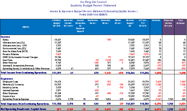
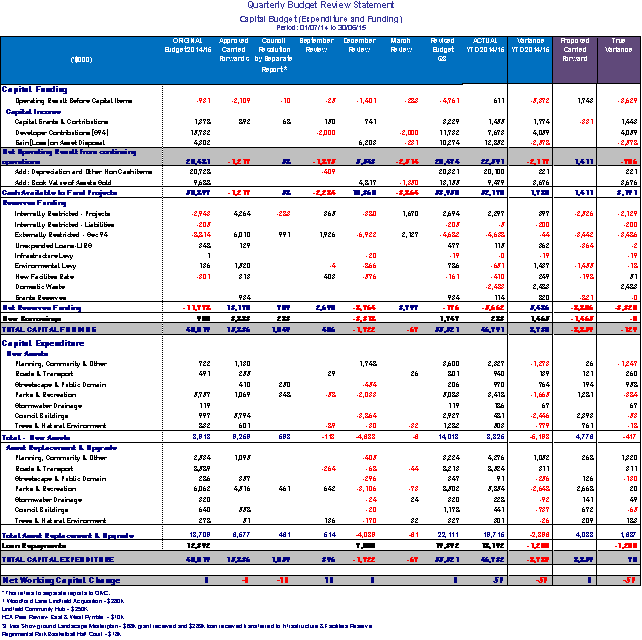
Major
Budget Variations
The table below provides comments for major budget
variations in Operational budget and reserve movements after allowing for
proposed carried forward expenditure.

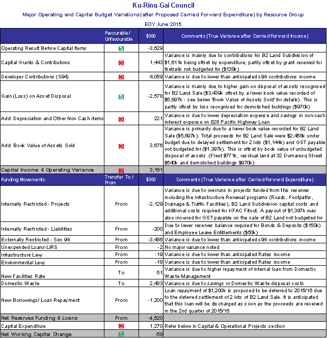
The actual working capital balance as at 30 June 2015 is
still to be determined as end of financial year processes are not yet
finalised. It is anticipated that the long term financial plan target of
$4.644m will be achieved.
Cash and
Investments position
Restricted funds are invested in
accordance with Council’s Investment Policy. Total investments portfolio as at
end of June 2015 was $97.28m. Closing balances of Council’s reserves as at end
of June are provided below.
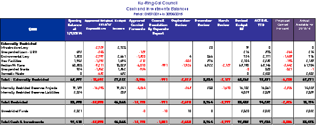
A detailed Restricted Assets Report as at 30 June
2015 (Actual) is shown in Attachment A2
Capital
& Operational Projects Summary
Actual expenditure for
capital and operational projects for the period ending 30 June 2015 is $35.2m
against the annual revised budget of $44.16m, resulting in a variance of $8.9m.
This variance is mainly due to incomplete projects of $10.6m which are proposed
to be carried forward, partly offset by overruns in some projects. The total
overrun on operational and capital projects is $1.6m.
The Proposed Carried Forward Expenditure from
2014/2015 is detailed in Attachment A3
Major Project Budget
Variations from Revised Budget 2014/15
û Ku-ring-gai Fitness & Aquatic Centre Fit-out
$233k - due to additional establishment costs for YMCA from delay of opening
and additional items required, such as data connection points and fencing.
û Old Depot Remediation at Carlotta Avenue, Gordon
$138k - due to more testing required to meet Auditor's requirements for Site
Validations.
û B2 Land Subdivision $258k - to provide for
additional parking and repairs to the site and infrastructure following storm
damage.
û Roads Renewal Programs $120k - Roads Renewal
program was overspent partly due to early commencement of 2015/16 works.
û New Street between Dumaresq St & McIntyre St
$169k – additional budget allowed for in the 2010 Contributions Plan not
reflected in the budget.
û Drainage Renewal Program $144k - primarily due to
Pipe installation at Karanga Avenue requiring special pipes and more complex
works.
û Footpaths Renewal Programs $136k – over
expenditure mainly in bank stabilisations with 5 landslips to address due to
storm damages.
û Community Major Events including St Ives Medieval
Fair and the Big Swing - $172k
The table and chart
below show the annual actual projects expenditure against annual revised budget
for the year ended 30 June 2015.

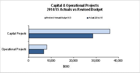
Proposed carried
forward to 2015/16
Attachment A3 lists projects
which were included in the 2014/2015 budget. Budgets voted for some works had
not been fully spent as at 30 June 2015 and accordingly are requested to be
carried forward into the current financial period. The total requested carried
forward works is $10.602m.
The carry over budgets are
funded from the following sources:
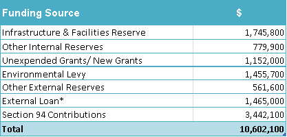
*The External loan funding
relates to 828 Pacific Highway upgrade project. The project formed part of the
original budget 2014/15. Upgrade works were not completed at the end of the
financial year, therefore, the loan funding was not drawn. It is recommended
to carry this project forward, requiring loan borrowing of $1.465m in the
2015/16 financial year.
It is now proposed to seek
approval to carry over budgets to fund the incomplete works at 30 June
2015. A detailed summary of all carried forward projects can
be found in Attachment A3.
The chart below provides historical carried forward
expenditure from 2009/10 to the proposed 2014/15.
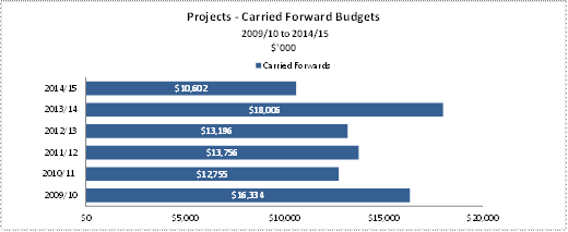
integrated planning and reporting
Leadership & Governance
|
Community Strategic Plan Long Term Objective
|
Delivery Program
Term Achievement
|
Operational Plan
Task
|
|
L2.1 Council rigorously manages its financial resources
and assets to maximise delivery of services.
|
L2.1.2 Council’s financial services provide accurate,
timely, open and honest advice to the community.
|
Manages financial performance to achieve targets as
defined in the Long Term Financial Plan.
|
Governance Matters
In accordance with Section 413(2)(C) of the Local Government
Act 1993, Council must prepare a statement on the General & Special Purpose
Financial Reports as to its opinion on the reports prior to referring them to
audit.
The draft Financial Statements for the year ended 30 June
2015 have been prepared in accordance with the Local Government Act 1993 (as
amended) and Regulations made thereunder, the Australian Accounting Standards
and professional pronouncements and the Local Government Code of Accounting
Practice and Financial Reporting.
It should be noted that the Financial Statements are
presented to Council in draft form at this stage. These draft Financial
Statements are required to be audited in accordance with Sections 415, 416 and
417 of the Local Government Act 1993. Upon finalisation of the audit, the
Financial Statements and the audit report will be presented to Council in
accordance with Sections 418 and 419 of the Local Government Act 1993. It is
intended that the public meeting will be conducted at the Ordinary Meeting of
Council on 6 October 2015. A representative from Council’s external auditor,
UHY Haines Norton Chartered Accountants will be present at the public meeting.
Risk Management
Council is financially sound which
positions it well to deal with unforseen events as they arise.
The Financial Statements are
audited by the external auditors who, amongst other things, form an opinion on
the Financial Statements whether:
· the
Council’s accounting records have been kept in accordance with the requirements
of the Local Government Act 1993, Chapter 13 part 3 Division 2; and
· the
Financial Statements:
o have been presented in accordance with the requirements of
this Division;
o are consistent with the Council’s accounting records;
o present fairly the Council’s financial position, the
results of its operations and its cash flows; and
o are in accordance with applicable Accounting Standards and
other mandatory professional reporting requirements in Australia.
· all
information relevant to the conduct of the audit has been obtained; and
· there
are no material deficiencies in the accounting records or financial statements
that the auditors have become aware of during the course of the audit.
Financial Considerations
Council has achieved a sound financial result for 2014/15.
Council’s net operating result for the financial year ended 30 June 2015 is a
surplus of $22.58m including Grants and Contributions for capital purposes.
After adjusting for Capital Grants and Contributions, the net operating result
was $13.46m.
The actual working capital for 2014/15 is $4.67m in line
with the target identified in Council’s Annual Budget.
Social Considerations
Not applicable.
Environmental Considerations
Not applicable.
Community Consultation
The draft Financial Statements for the year ended 30 June
2015 were referred to the Audit Committee on 20 August 2015 for review and were
endorsed.
The draft Financial Statements will be on public exhibition
from 11 September 2015. The Financial Statements will be formally presented to
Council on 6 October 2015. Submissions from the public will be received until
13 October 2015 and any comments received will be referred to the external
auditor.
Internal Consultation
All departments have been consulted on the end of year
financial results for 2014/15.
Summary
The purpose of this report is to present to Council the
draft Financial Statements for the year ended 30 June 2015 for certification
and referral to Council’s external auditor, UHY Haines Norton Chartered
Accountants.
The draft Financial Statements have been prepared in
accordance with:
* Local Government Act 1993
(as amended) and Regulations made thereunder
* The Australian Accounting
Standards and professional pronouncements
* Local Government Code of
Accounting Practice and Financial Reporting
In accordance with Section 413(2)(C) of the Local Government
Act 1993, Council must prepare a statement on the General & Special Purpose
Financial Reports as to its opinion on the reports prior to referring them to
audit.
On 6 October 2015 the audited financial reports, together
with the auditor’s reports, will be formally presented to Council at which time
Council’s auditor will be present to answer questions in relation to their
Audit report.
|
Recommendation:
A. That
Council receive and certify the Draft Financial Statements for the year ended
30 June 2015.
B. That
the Draft Financial Statements be referred to Council’s external auditor, UHY
Haines Norton Chartered Accountants to provide an opinion on the draft
Financial Statements ended 30 June 2015 and to report to Council.
C. That
the Draft Financial Statements ended 30 June 2015 be certified by the Mayor,
Deputy Mayor or one other Councillor, the General Manager and the Responsible
Accounting Officer in accordance with Section 413(2)(C) of the Local
Government Act 1993 and the Local Government Code of Accounting Practice and
Financial Reporting.
D. That
6 October 2015 be fixed as the date for the public meeting to present the
audited Financial Statements and the audit reports for the year ended 30 June
2015 as required by Section 419 of the Local Government Act 1993, and that
Council’s external auditor be present to answer questions.
E. That
Council adopt carry over expenditure of $10.602m to carry forward to the
2015/16 financial year, as listed in Attachment A3, and borrow $1.465m for
the external loan funded portion of these works.
|
|
Angela Apostol
Manager Finance
|
David Marshall
Director Corporate
|
|
Attachments:
|
A1View
|
Draft
General Purpose and Special Purpose Financial Statements for the year ended
30 June 2015
|
|
2015/231025
|
|
|
A2View
|
Restricted
Assets Report as at 30 June 2015
|
|
2015/221108
|
|
|
A3View
|
Proposed
Carried Forward Expenditure from 2014/15
|
|
2015/221079
|
|
APPENDIX
No: 1 - Draft
General Purpose and Special Purpose Financial Statements for the year ended
30 June 2015
|
|
Item No: GB.1
|

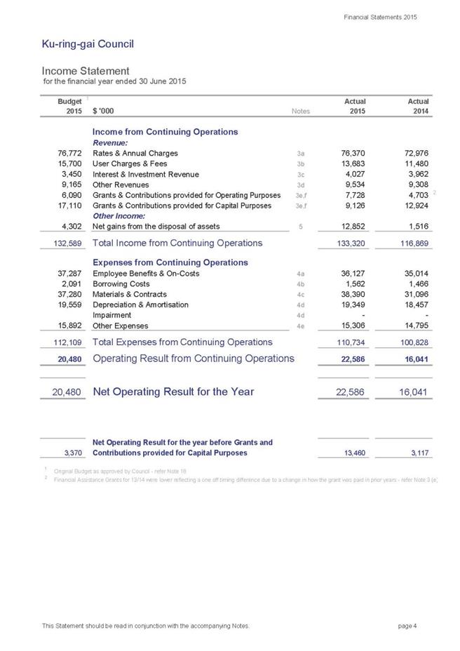
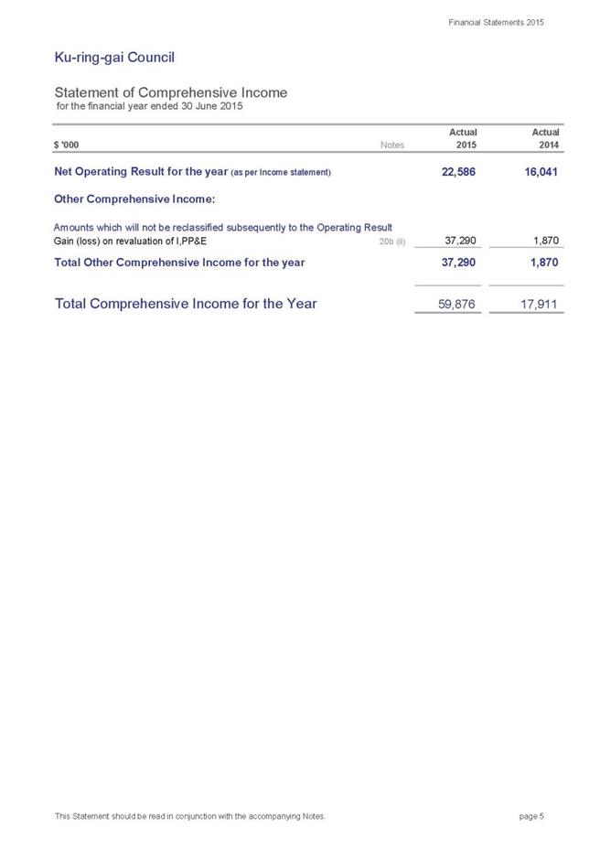
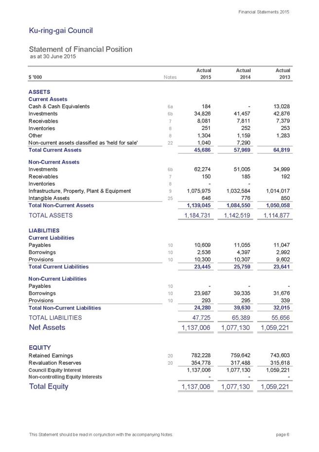
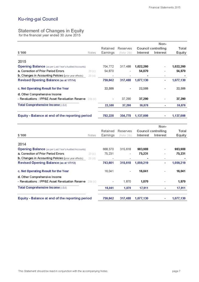
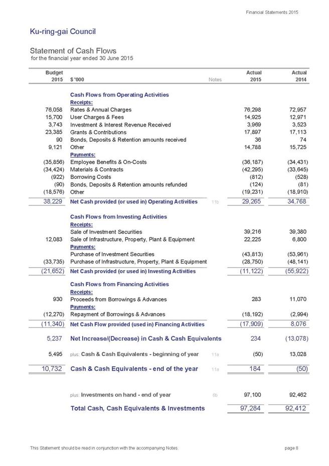
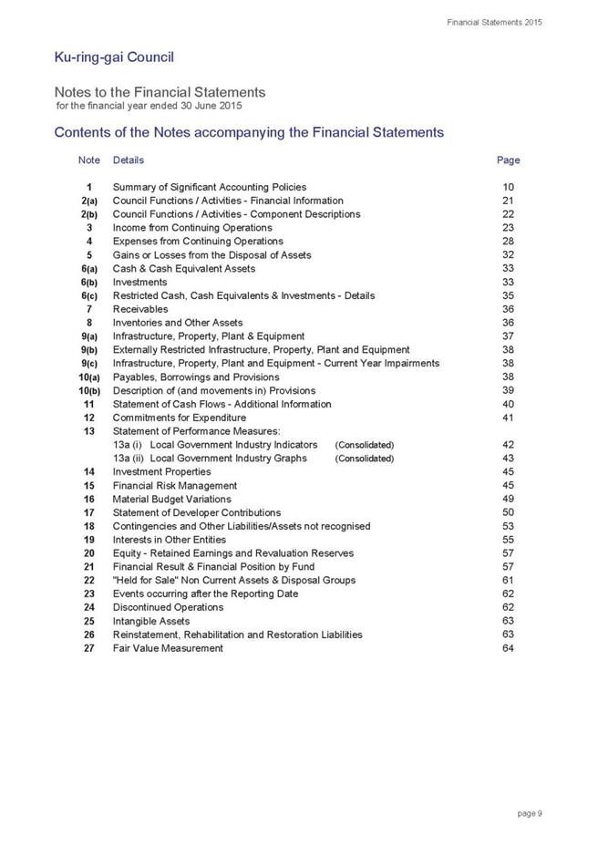
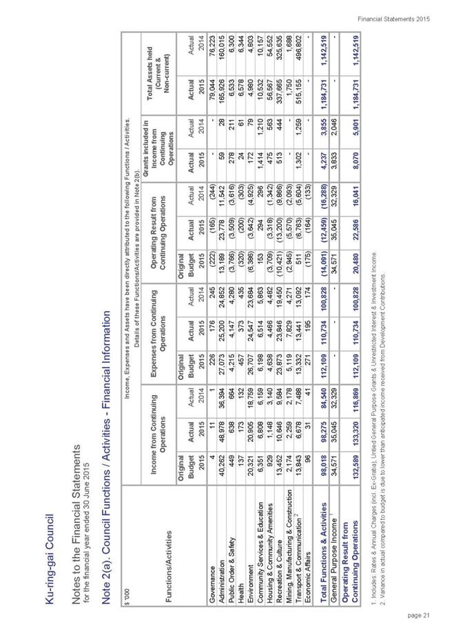
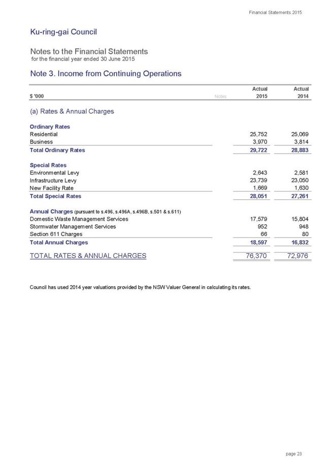
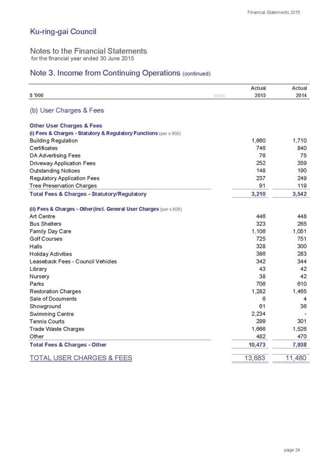
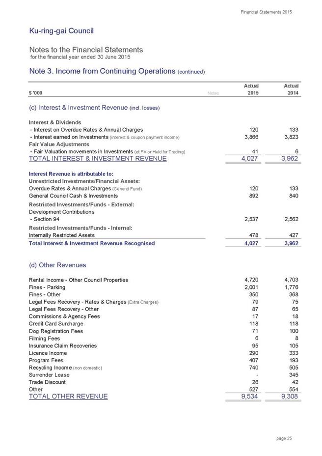
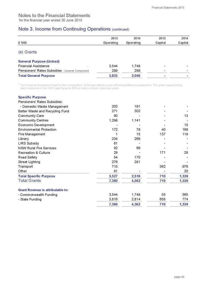
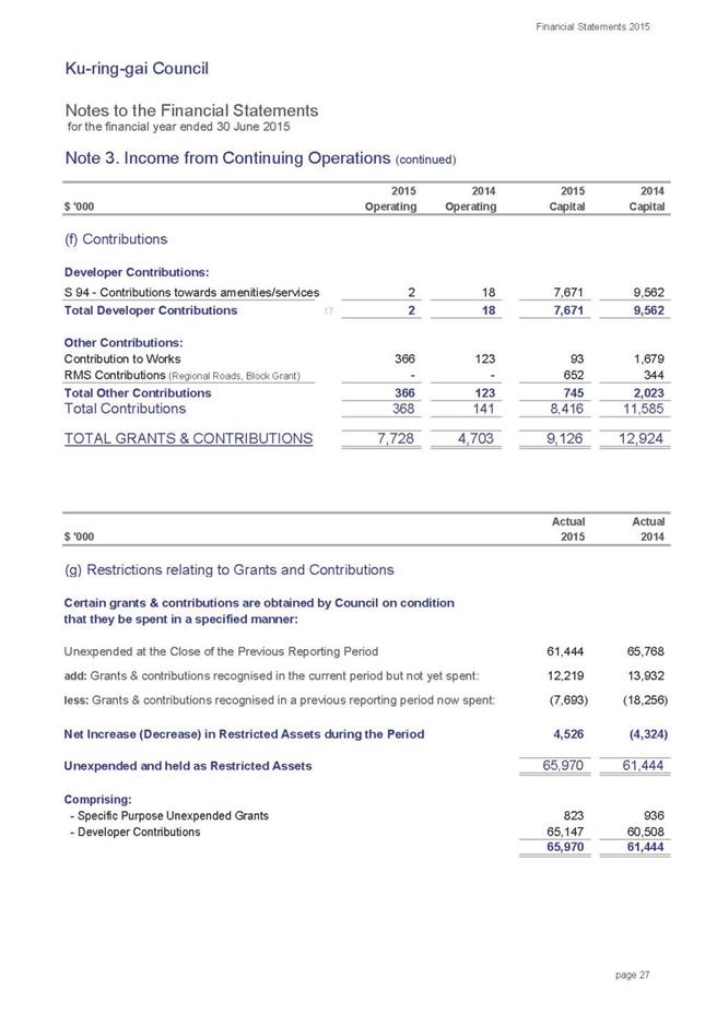
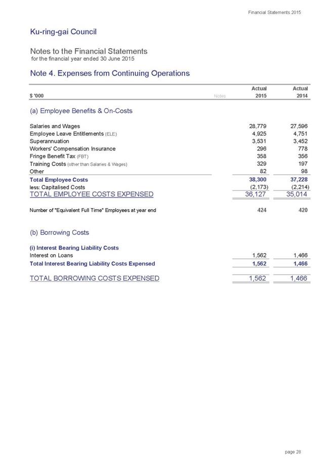
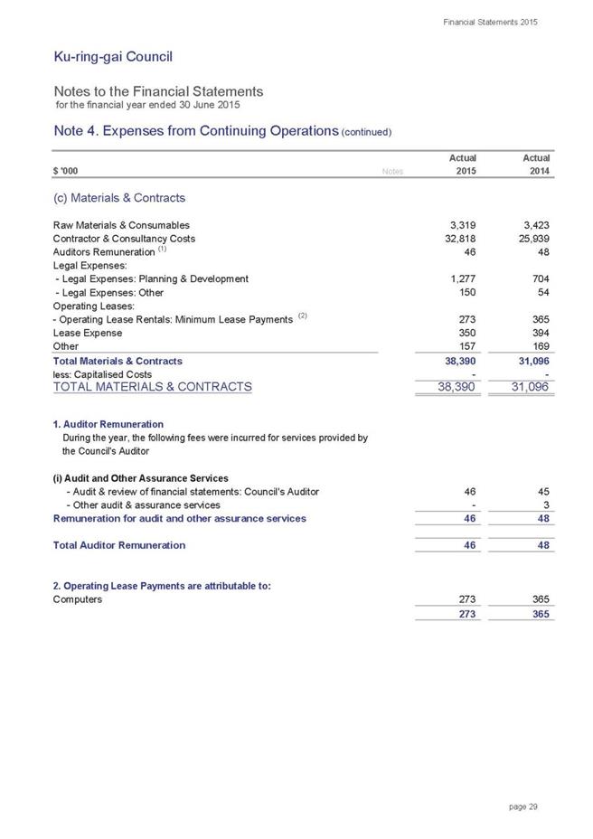
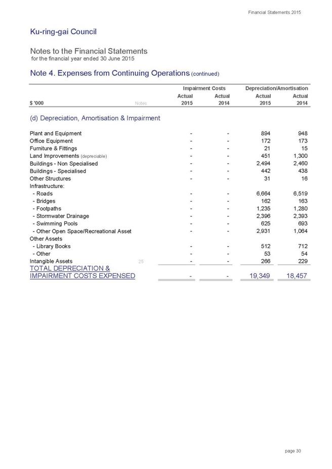
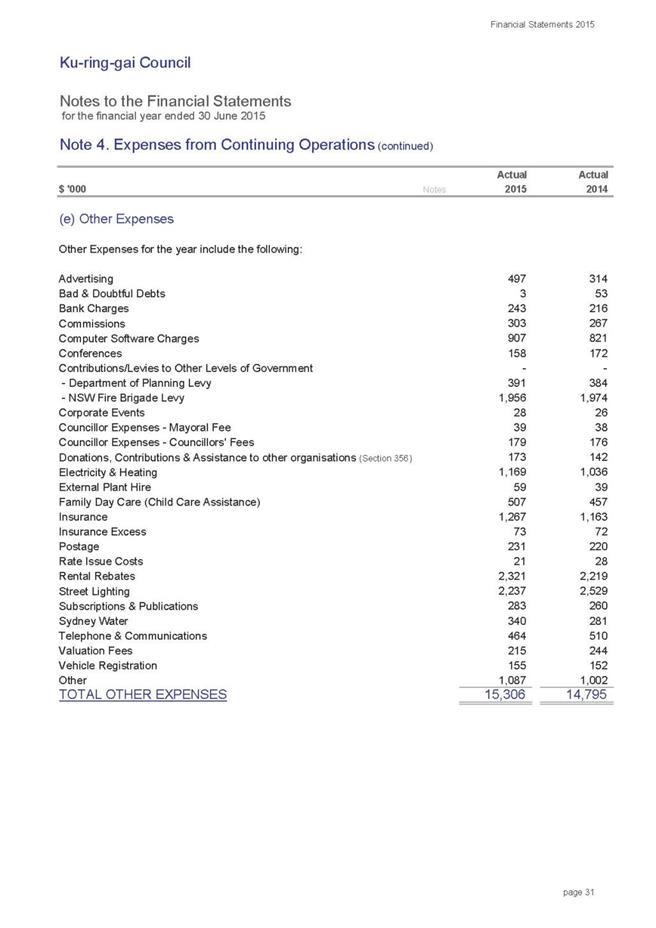
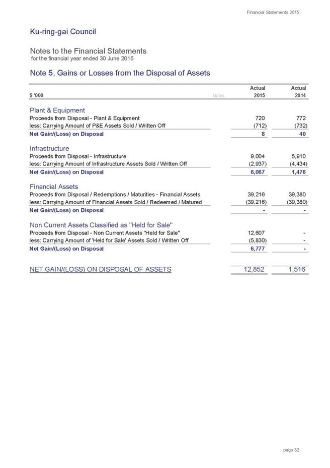
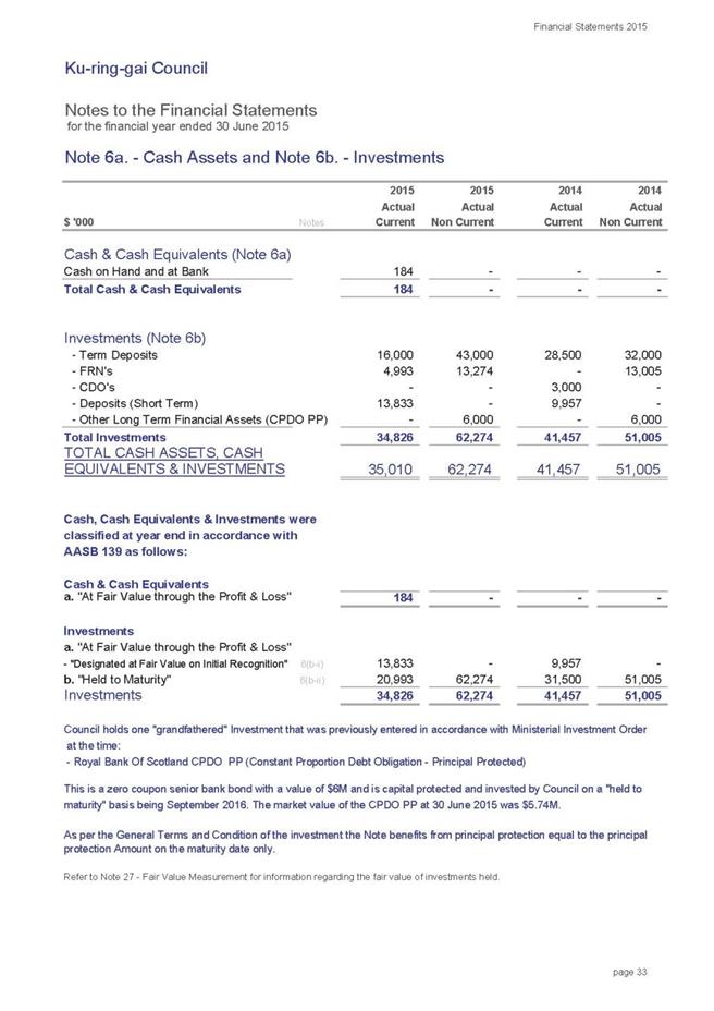
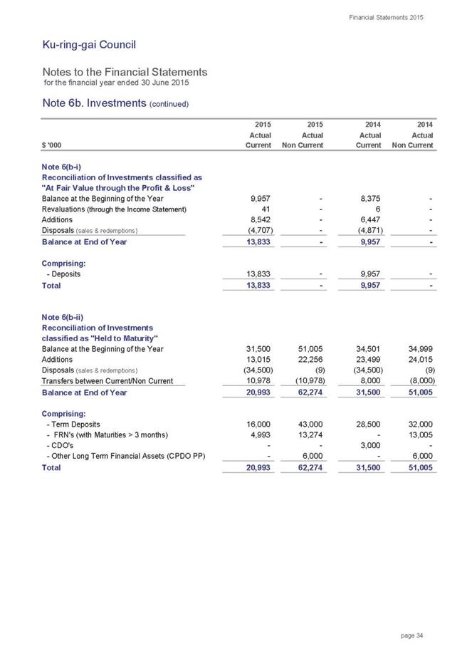
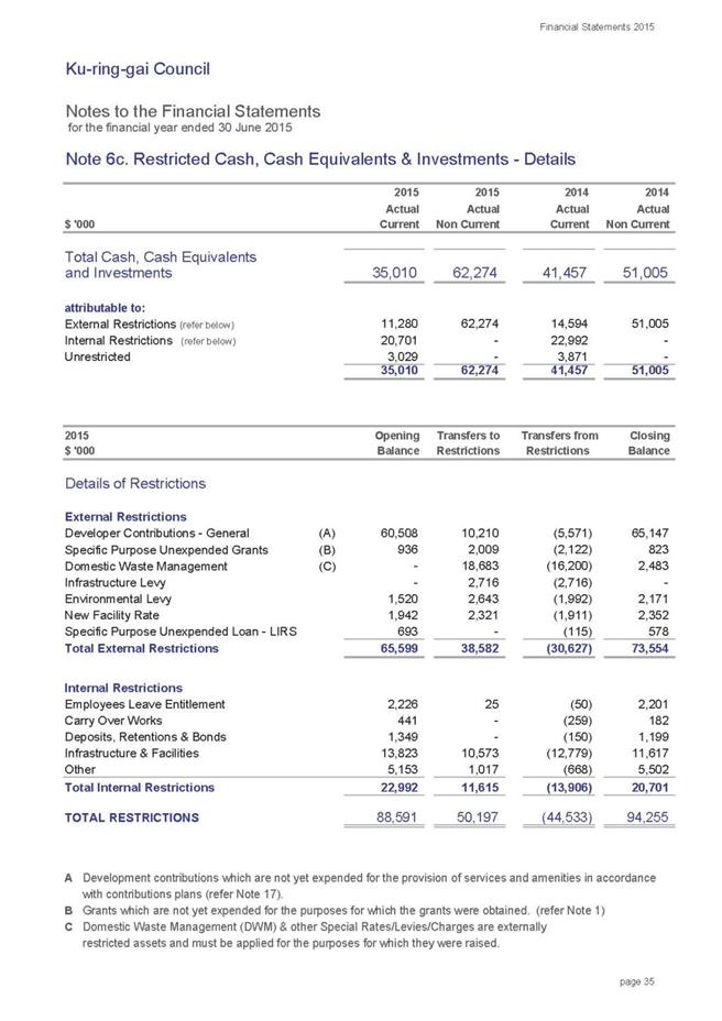
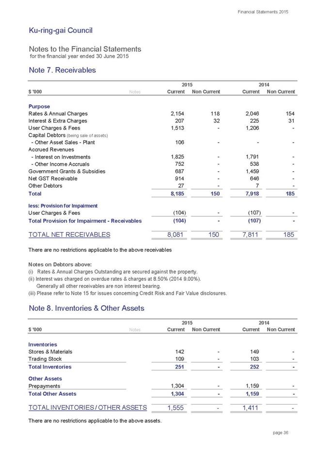
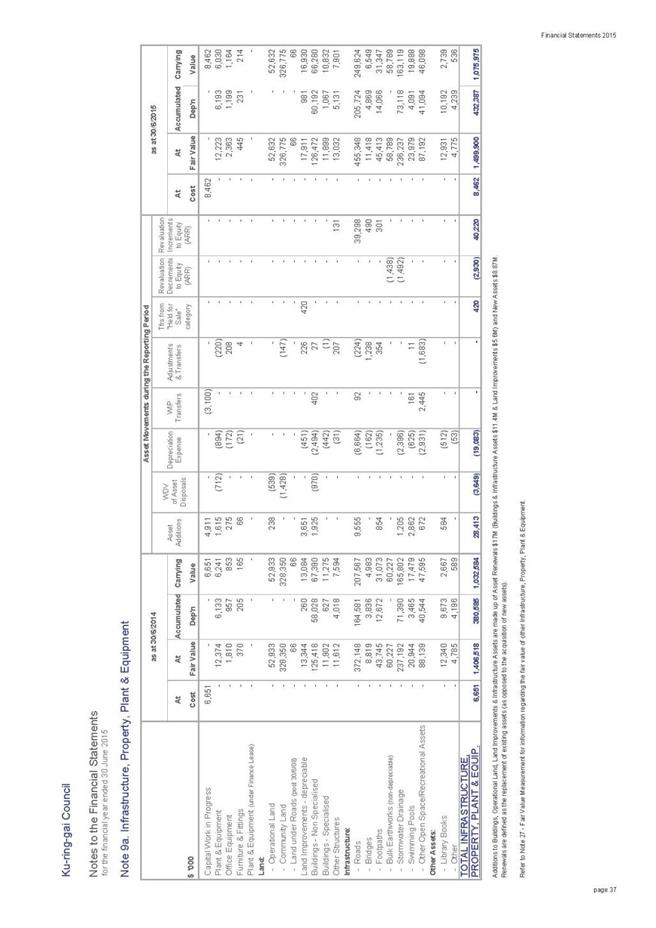
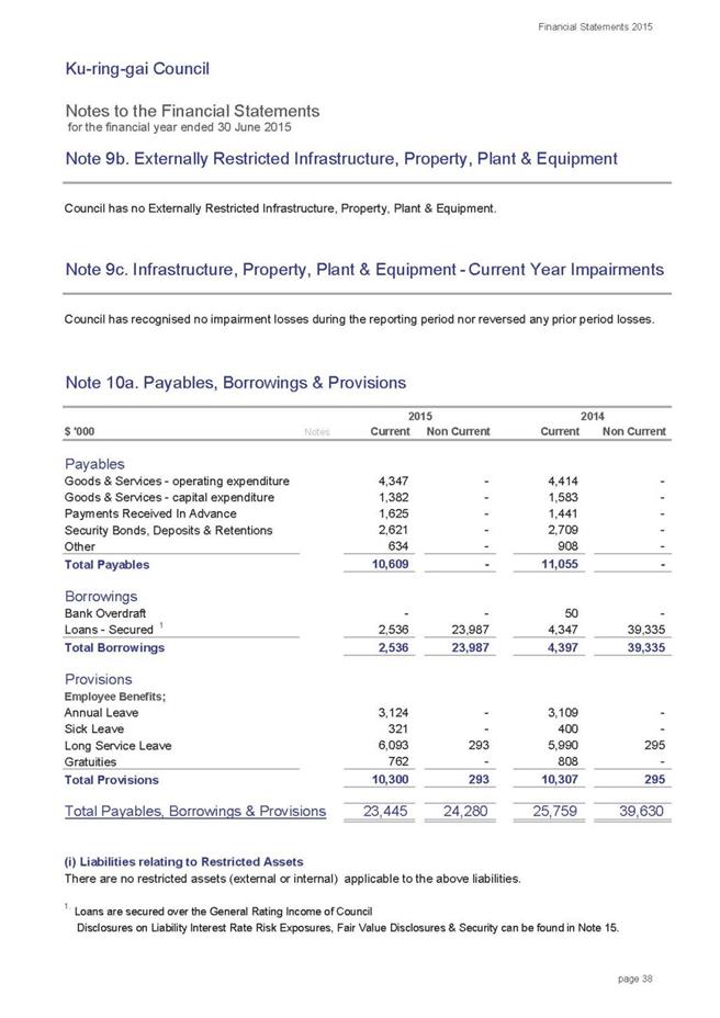
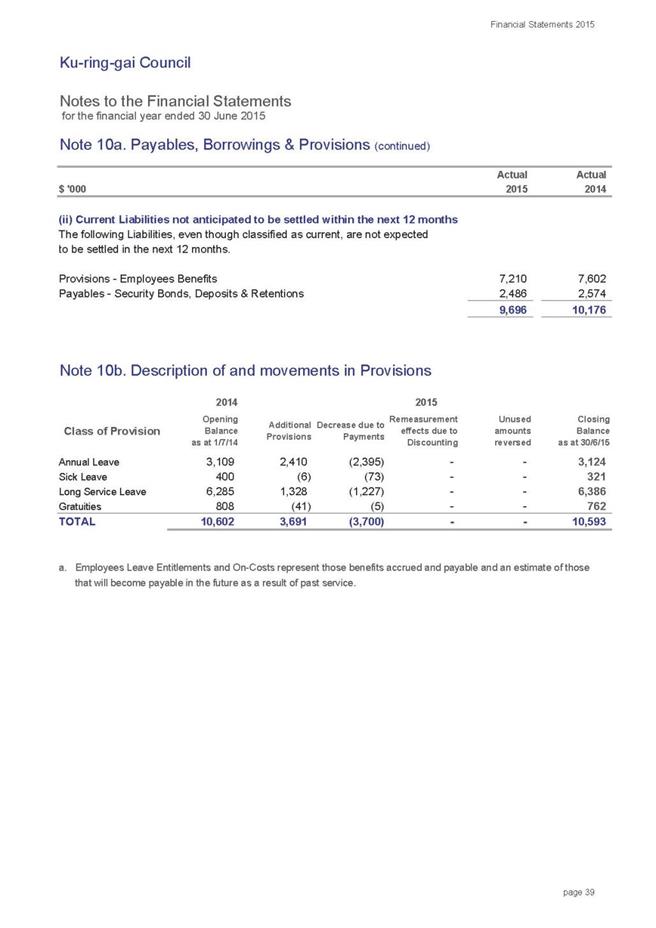
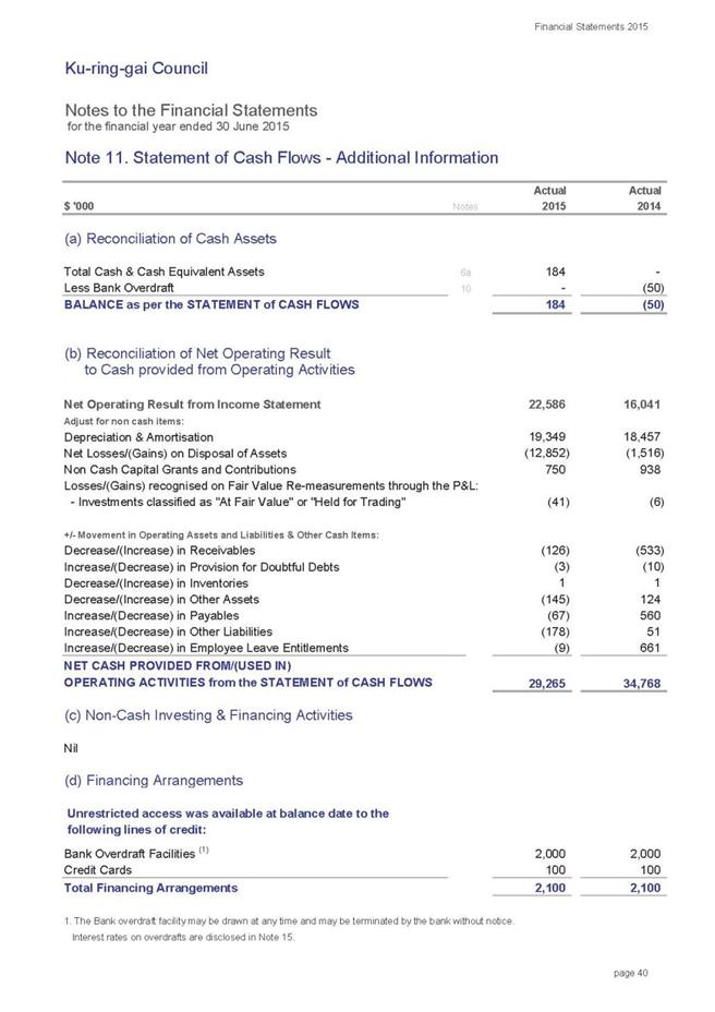
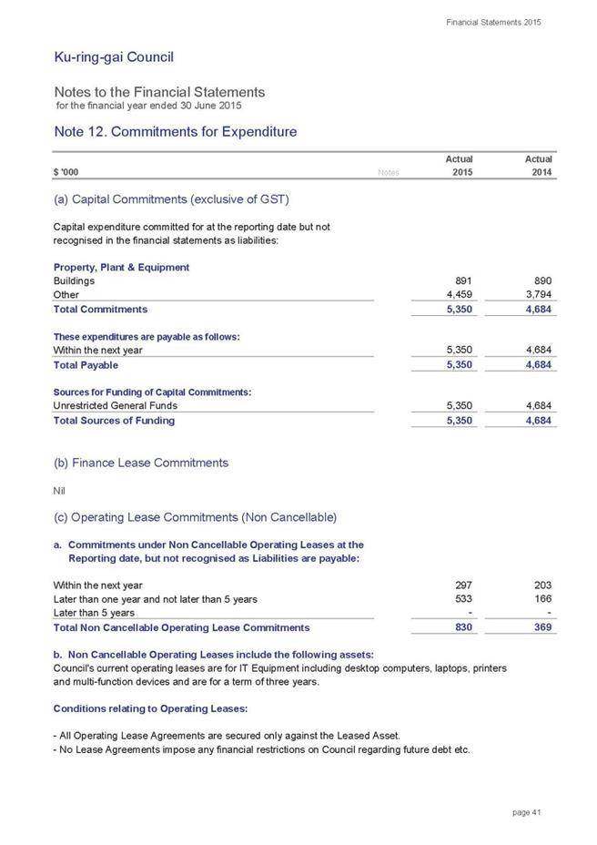
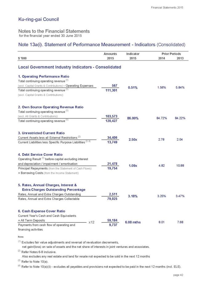
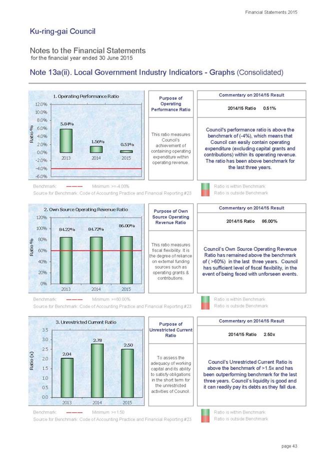
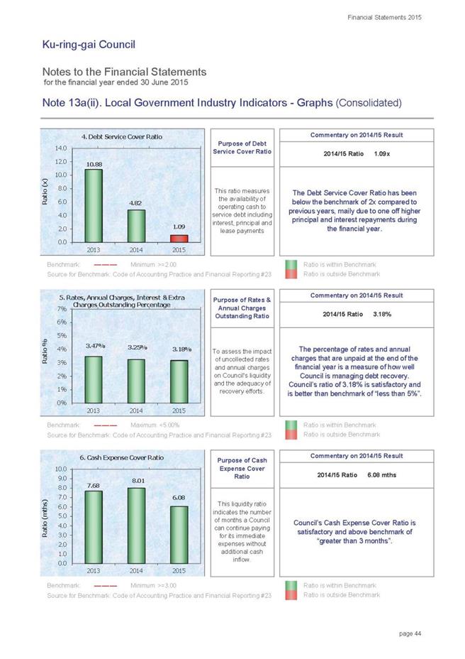
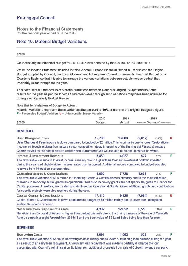
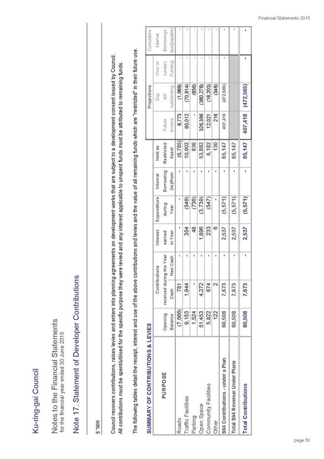
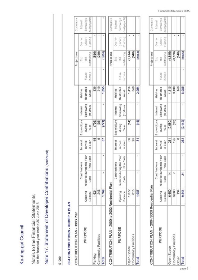
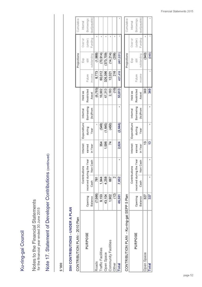
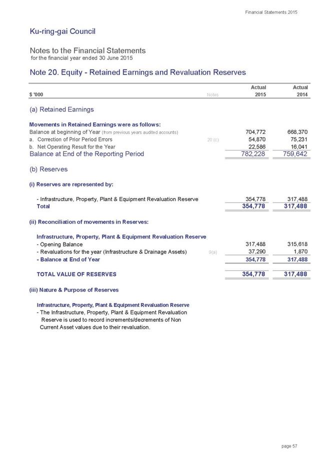
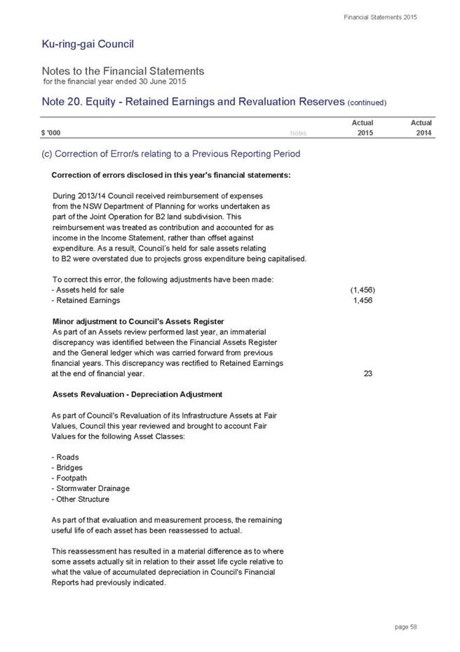
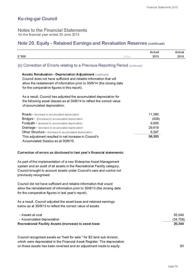
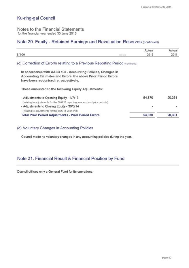
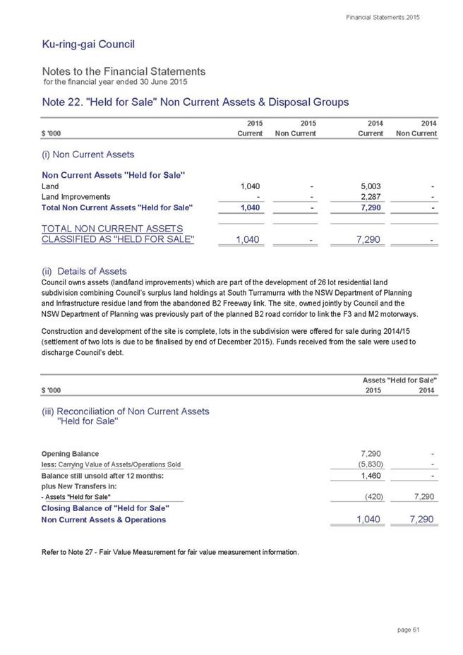
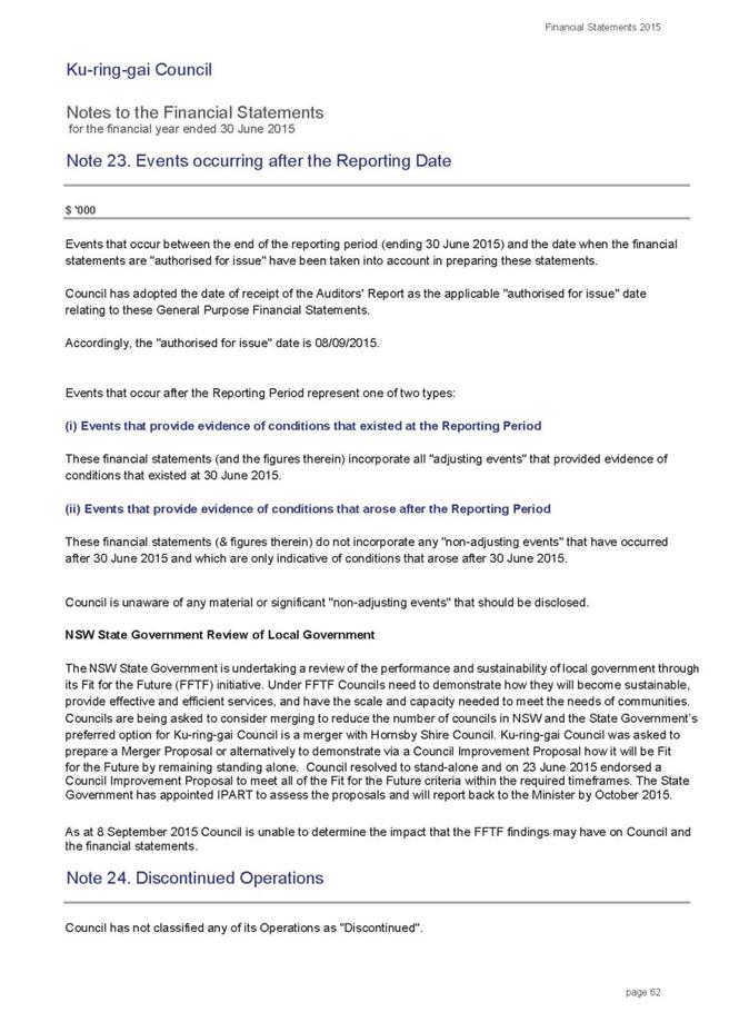
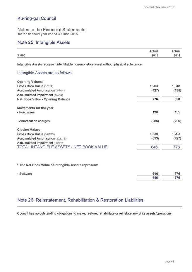
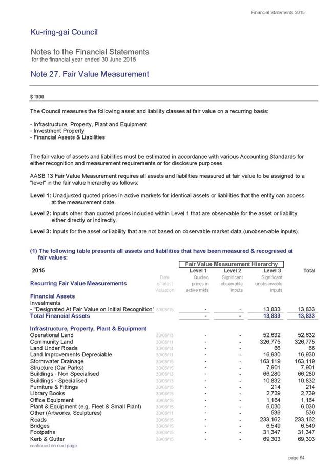
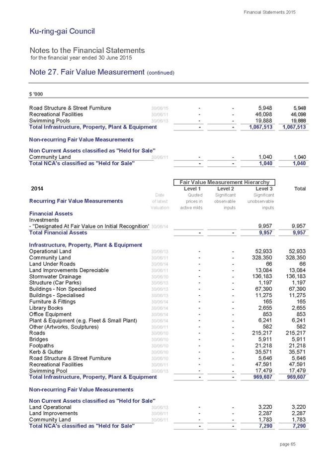
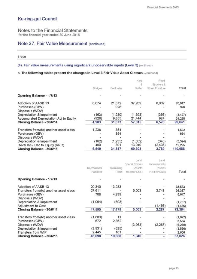
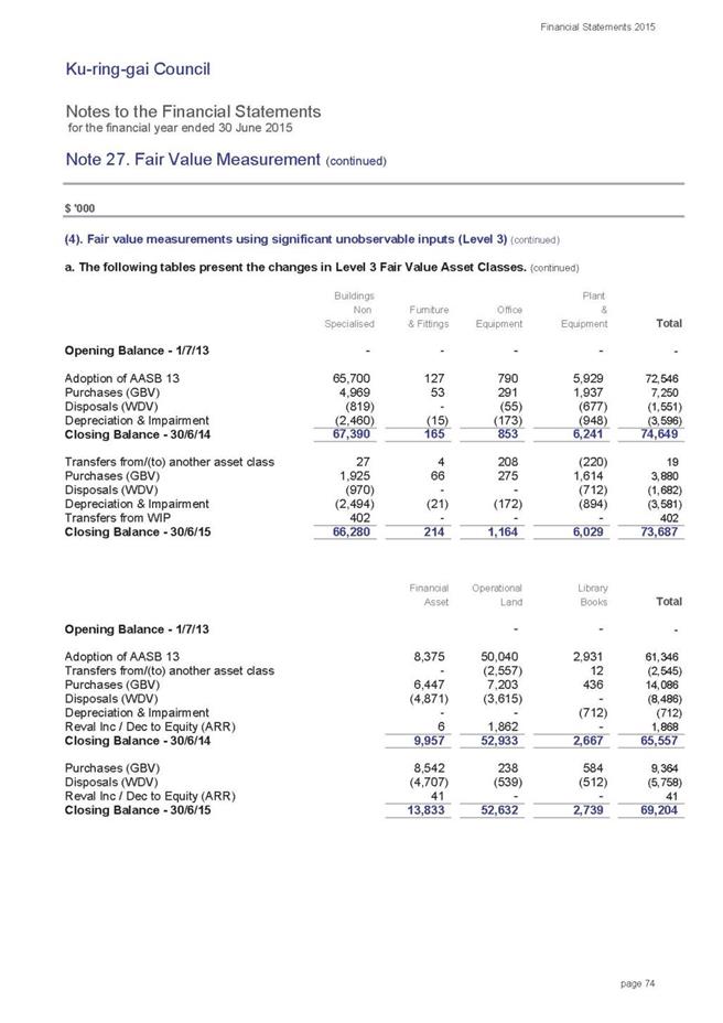
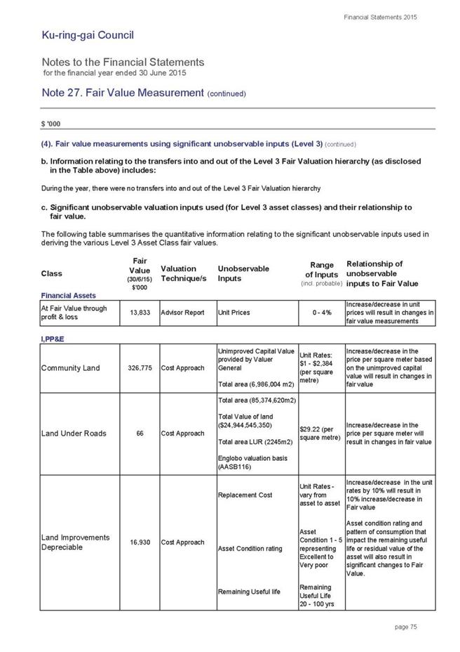
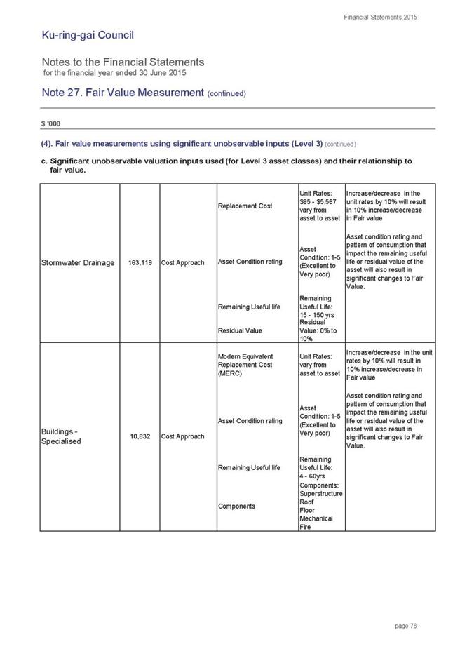
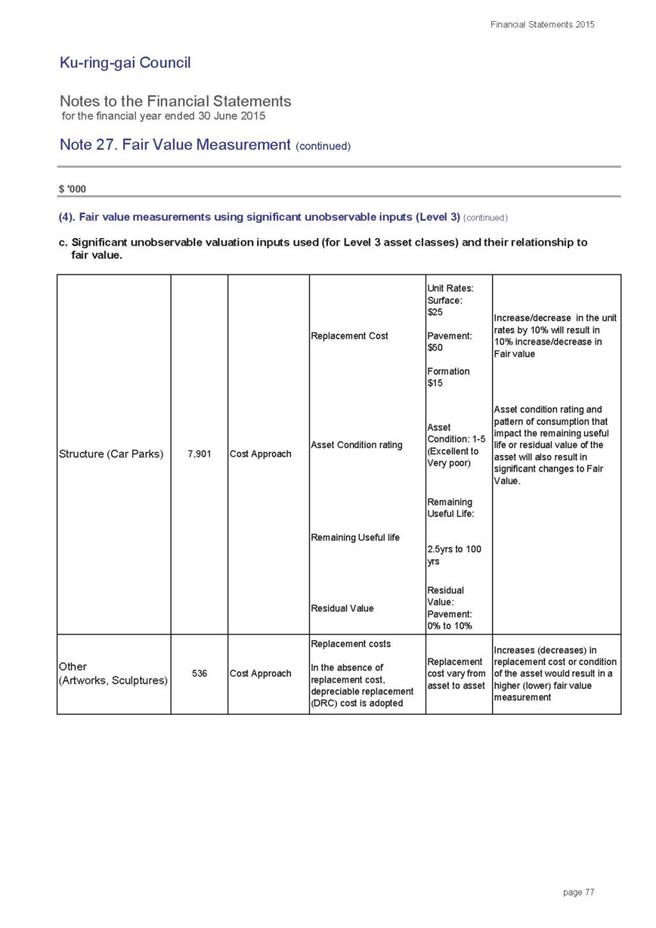
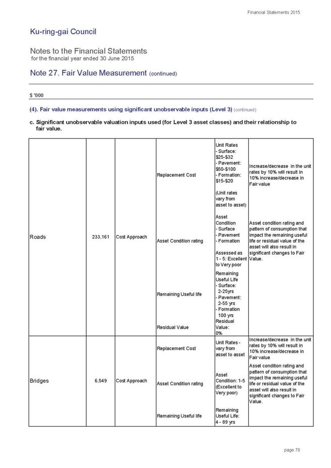
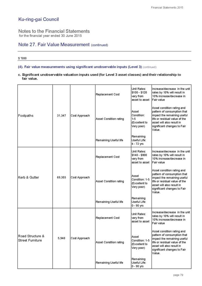
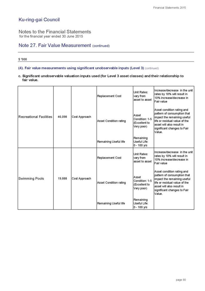
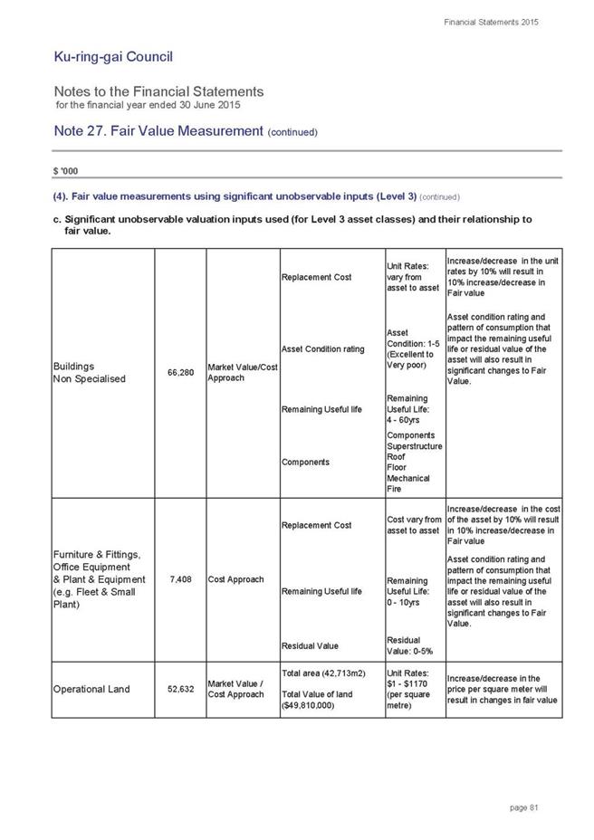
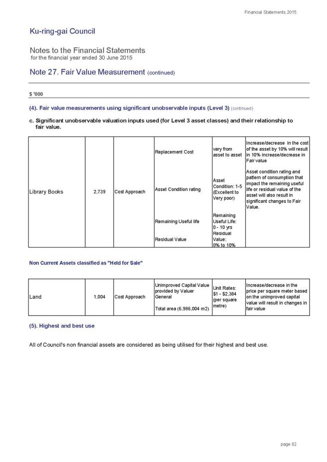

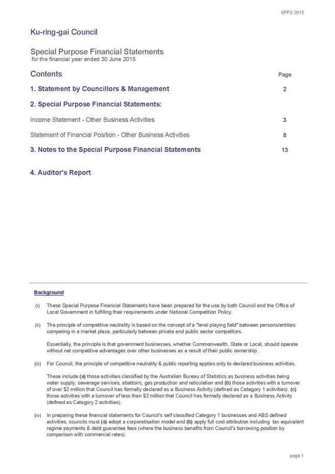
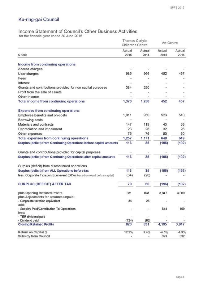
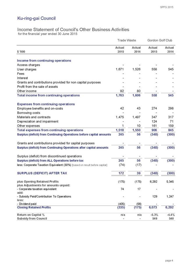
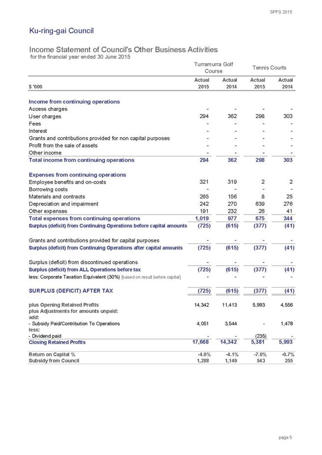
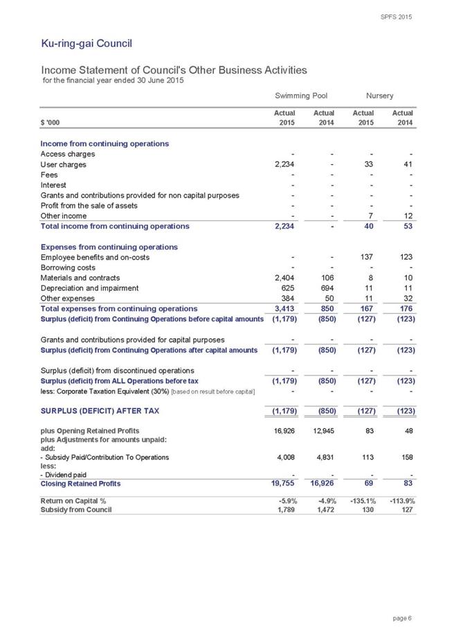
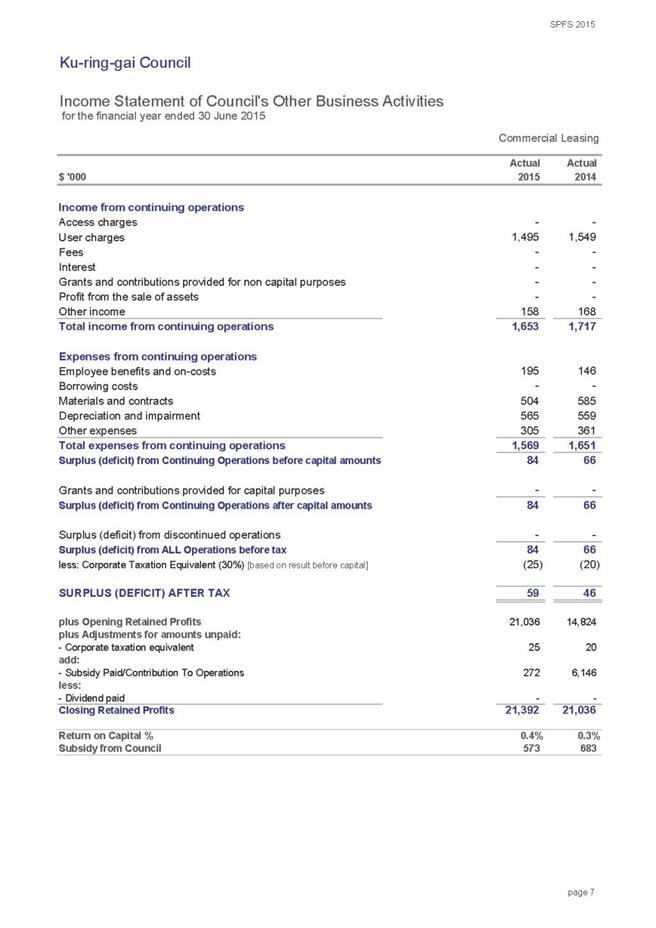
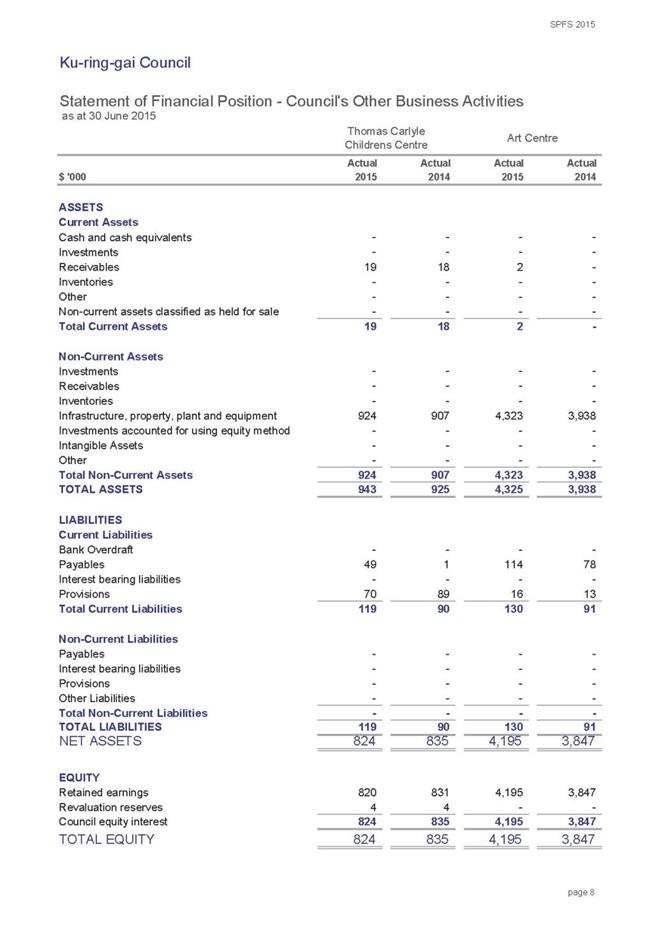
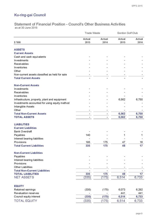
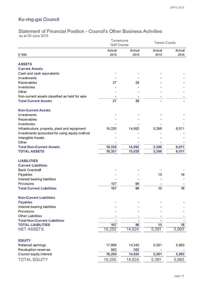
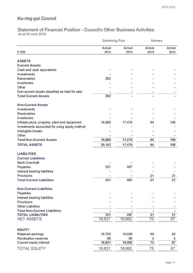
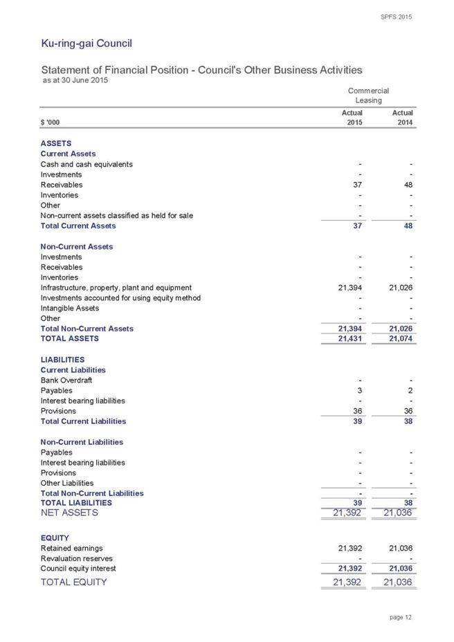
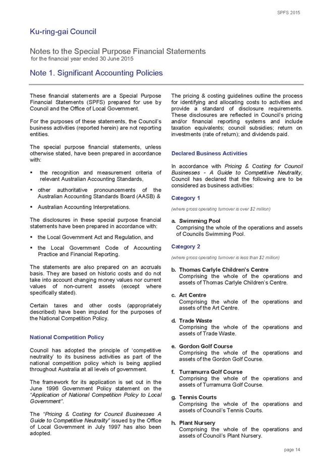

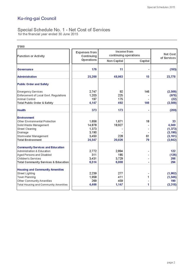
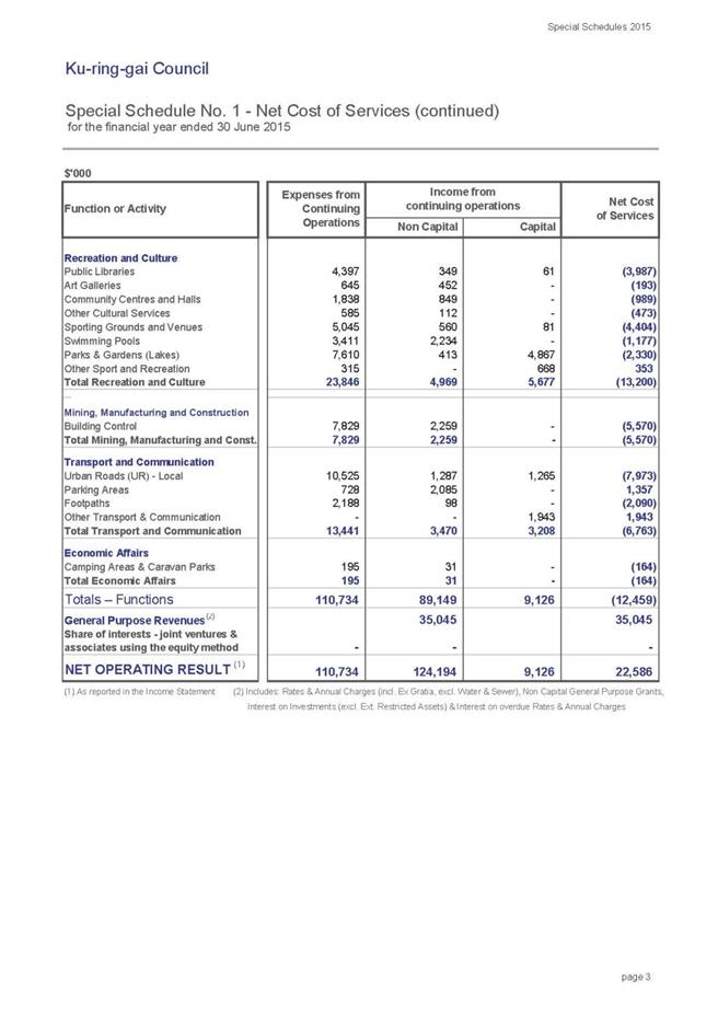
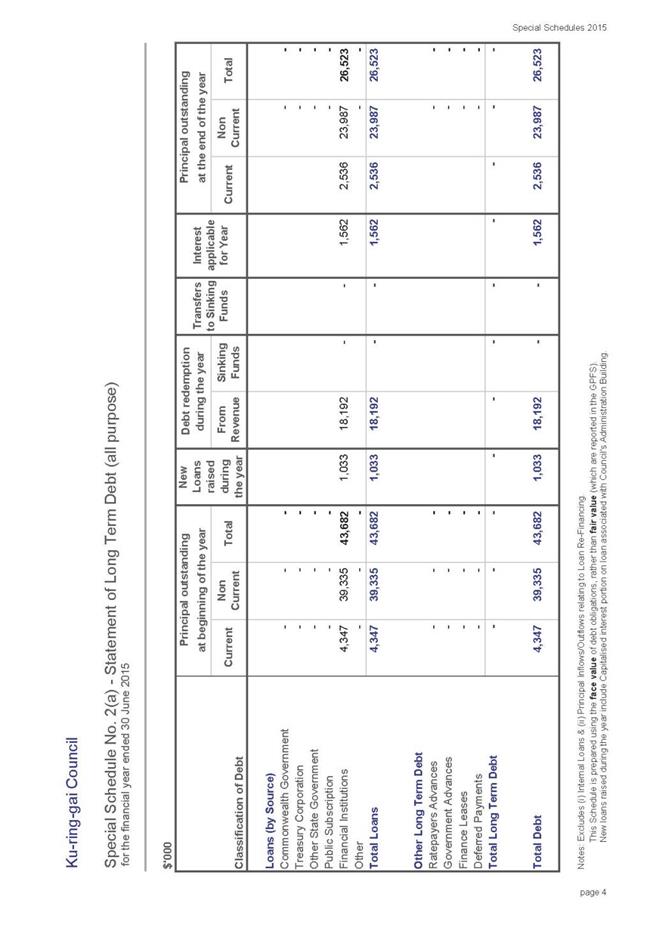
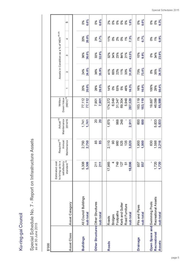
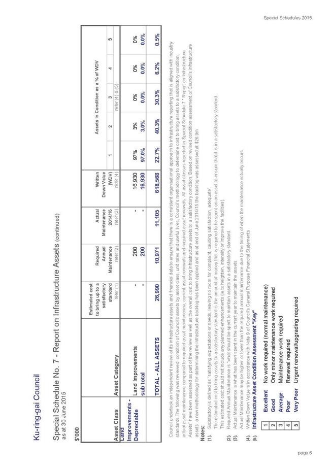
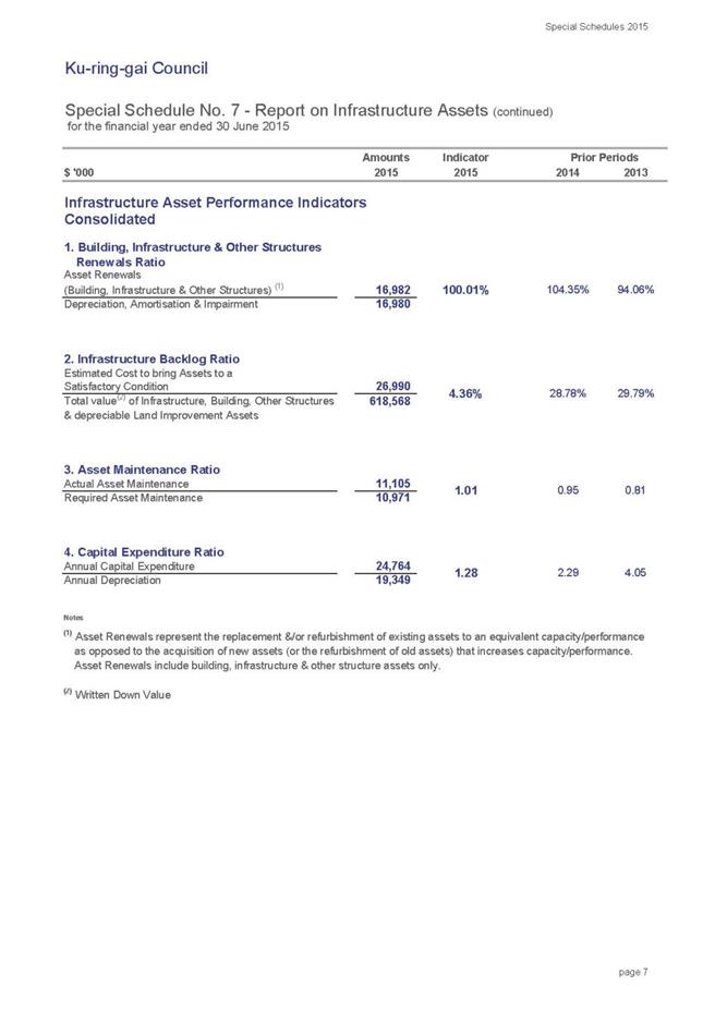
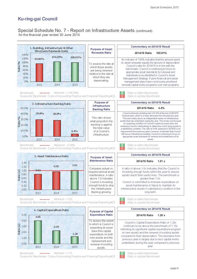
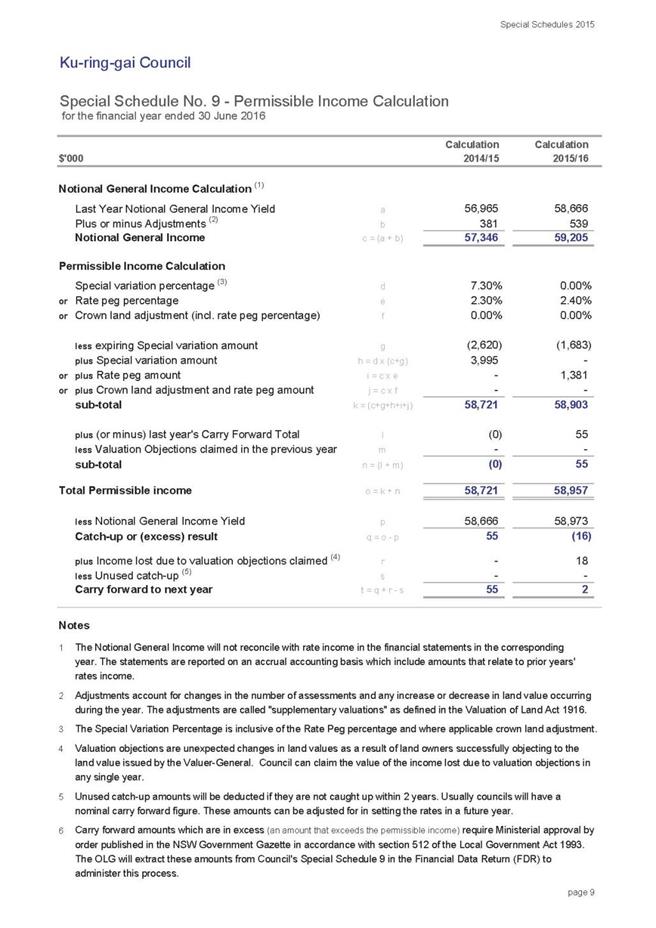
|
APPENDIX No: 2 - Restricted
Assets Report as at 30 June 2015
|
|
Item No: GB.1
|

|
APPENDIX No: 3 - Proposed
Carried Forward Expenditure from 2014/15
|
|
Item No: GB.1
|
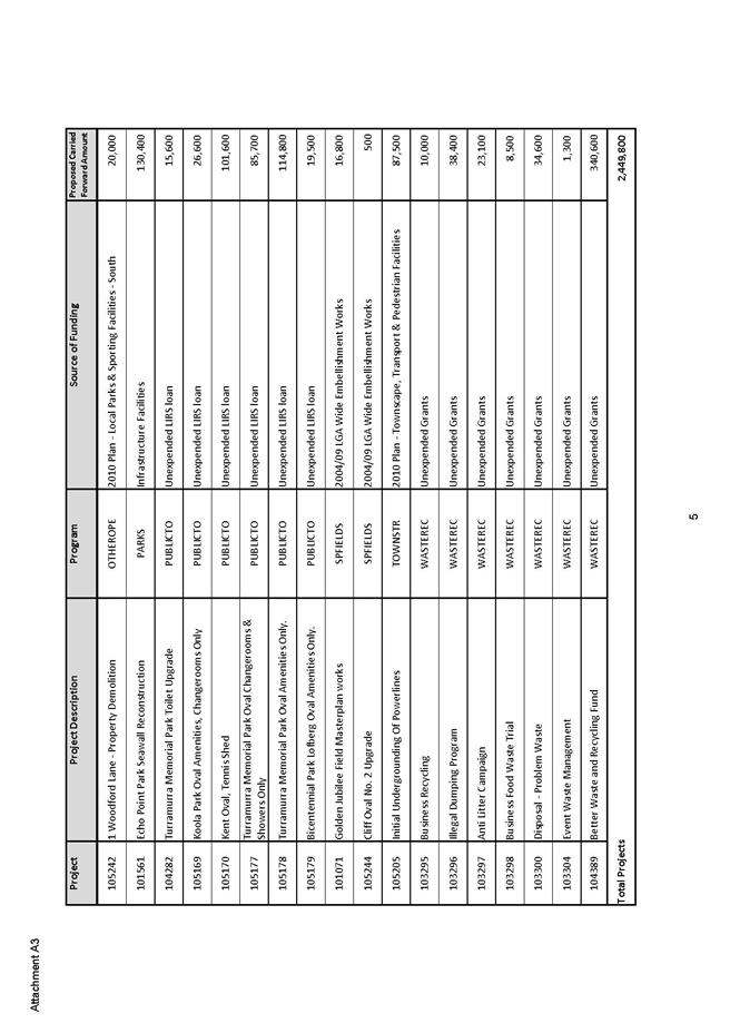
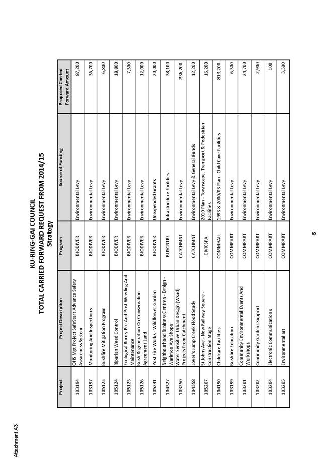
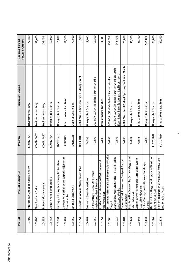
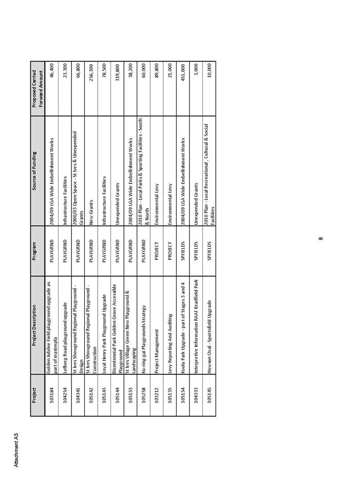
|
Ordinary
Meeting of Council - 8 September 2015
|
GB.2 / 204
|
|
|
|
|
Item
GB.2
|
S09069/5
|
|
|
16 July 2015
|
Climate Change Policy for Public
Exhibition
EXECUTIVE
SUMMARY
|
purpose of report:
|
To seek Council’s endorsement of the Draft Climate
Change Policy 2015 and Draft Greenhouse Gas Reduction Action Plan 2015 for
public exhibition.
|
|
|
|
|
background:
|
The warming of the climate system is unequivocal, and
since the 1950s, many of the observed changes are unprecedented over decades
to millennia. The atmosphere and ocean have warmed, the oceans have
acidified, the amounts of snow and ice have diminished, and sea level has
risen. Human influence on the climate system is clear and in recent decades
changes in climate have caused detrimental impacts on natural and human
systems on all continents and across the oceans. Limiting future climate
change impacts and risks will require substantial and sustained reductions in
greenhouse gas emissions together with adaptation. Ku-ring-gai Council, as a
key asset owner, service provider and decision-maker, has a responsibility to
its community to effectively mitigate against and adapt to the impacts of
climate change.
|
|
|
|
|
comments:
|
The Draft Climate Change Policy
2015 provides a revised management framework for Council to respond to the
observed and projected implications of climate change on Ku-ring-gai’s
natural and built environment, community and economy. The Draft Greenhouse
Gas Reduction Action Plan 2015 supports the Draft Climate Change Policy 2015
by providing a mitigation response to climate change and describing how
Council intends to meet its 2020 greenhouse gas (GHG) emission reduction
target.
|
|
|
|
|
recommendation:
|
That Council endorses the public exhibition of the
Draft Climate Change Policy 2015 and Draft Greenhouse Gas Reduction Action
Plan 2015.
|
Purpose of Report
To seek Council’s endorsement of the Draft Climate Change
Policy 2015 and Draft Greenhouse Gas Reduction Action Plan 2015 for public
exhibition.
Background
Why should Council address climate change?
“The warming of the climate system is unequivocal, and since
the 1950s, many of the observed changes are unprecedented over decades to
millennia. The atmosphere and ocean have warmed, the oceans have acidified, the
amounts of snow and ice have diminished, and sea level has risen.” (IPCC 2014b,
p2)
Globally, averaged combined land and ocean surface
temperature show a warming of 0.85°C between 1880 and 2012 (IPCC 2014b).
Australia’s air and ocean temperatures are now, on average, 0.9°C warmer than
they were in 1910, with most of the warming occurring since 1950. The frequency
of very warm months in Australia has increased five-fold over the past 15
years, while the frequency of very cool months has declined by around a third,
compared to 1951–1980. (BoM and CSIRO 2014)
Since 1970, there have been large increases in annual
rainfall in Australia’s north-west and decreases in the south-west. South-east
Australia has experienced below average autumn and early winter rainfall since
1990. Natural variability continues to play the dominant role in extreme
rainfall. (BoM and CSIRO 2014)
In Australia, mean sea level was 0.225m higher in 2012 than
in 1880, the earliest year for which robust estimates are available. Rates of
sea level rise in Australia are similar to global averages. Ocean acidity
levels have increased since the 1800s due to increased CO2 absorption
from the atmosphere. (BoM and CSIRO 2014)
Human influence on the climate system is clear.
“Anthropogenic greenhouse gas (GHG) emissions have increased since the
pre-industrial era, driven largely by economic and population growth, and are
now higher than ever. Their effects, together with those of other anthropogenic
drivers, have been detected throughout the climate system and are extremely
likely to have been the dominant cause of the observed warming since the
mid-20th century.“ (IPCC 2014b, p4)
Australian temperatures are projected to continue to warm,
with more hot days and warm nights and fewer cool days and cold nights. As with
global projections, the degree of change will depend on future emission scenarios.
Up to 2.5°C of warming this century is anticipated if we curb greenhouse
emissions, but under high emission scenarios temperatures could increase from
2.2°C to 5.0°C by 2070 (BoM and CSIRO 2014).
Average rainfall in southern Australia is projected to
decrease, with a likely increase in drought frequency and severity. An increase
in the number and intensity of extreme rainfall events is projected for most
regions. Hotter, drier weather conditions will increase the number of extreme
fire-weather days as well as fire severity and intensity in southern and
eastern Australia (BoM and CSIRO 2014).
Regional data, incorporating the Ku-ring-gai Local
Government Area, echoes Australian climate projections over the course of the
century. These projections include: future increases in the intensity of
extreme rainfall events and the time spent in drought; continued substantial
increases in projected mean, maximum and minimum temperatures; increases in
extreme temperatures, with a substantial increase in the temperature reached on
hot days, the frequency of hot days, and the duration of warm spells; and
harsher fire-weather. (CSIRO 2015a, CSIRO 2015b)
A summary of climate projections for the Sydney Metropolitan
region are provide below:
Figure
1: Climate projections for the Sydney Metropolitan region (Source: OEH 2014, p3)
“In recent decades, changes in climate have caused impacts
on natural and human systems on all continents and across the oceans. In many
regions, changing precipitation or melting snow and ice are altering
hydrological systems, affecting water resources in terms of quantity and
quality (medium confidence). Many terrestrial, freshwater, and marine species
have shifted their geographic ranges, seasonal activities, migration patterns,
abundances, and species interactions in response to ongoing climate change
(high confidence).The negative impacts of climate change on crop yields have
been more common than positive impacts (high confidence). Some impacts of ocean
acidification on marine organisms have been attributed to human influence
(medium confidence). Impacts from recent climate-related extremes, such as heat
waves, droughts, floods, cyclones and wildfires, reveal significant
vulnerability and exposure of some ecosystems and many human systems to current
climate variability (very high confidence).” (IPCC 2014b, p7-8)
Climate change is projected to undermine food security, and
to reduce renewable surface water and groundwater resources in most dry
subtropical regions, intensifying competition for water among sectors. In urban
areas, climate change is projected to increase risks for people, assets,
economies and ecosystems, including risks from heat stress, storms and extreme
precipitation, inland and coastal flooding, landslides, air pollution, drought,
water scarcity, sea-level rise, and storm surges. (IPCC 2014b)
“Our future climate will depend on committed warming caused
by past anthropogenic emissions, as well as future anthropogenic emissions and
natural climate variability”. (IPCC 2014b, p10)
“Continued emissions of greenhouse gases and rising rates
and magnitudes of warming and other changes in the climate system, accompanied
by ocean acidification, increase the risk of severe, pervasive, and in some
cases irreversible detrimental impacts.” (IPCC 2014b, p13)
“Limiting climate change will require substantial and
sustained reductions in greenhouse gas emissions which, together with
adaptation, can limit climate change risks.” (IPCC 2014b, p8)
“Mitigation involves some level of co-benefits and of risks
due to adverse side-effects, but these risks do not involve the same
possibility of severe, widespread, and irreversible impacts as risks from
climate change, increasing the benefits from near-term mitigation efforts.”
(IPCC 2014b, p17)
A full summary of climate change observations, projections,
impacts and risks at a global, national, state and regional level is attached
to this report as Attachment A1.
In light of the above, Ku-ring-gai Council, as a key asset
owner, service provider and decision-maker, has a responsibility to its
community to effectively mitigate against and adapt to the impacts of climate
change.
Council’s response
At the OMC of 13 October 2009 Council adopted its first Climate
Change Policy. At the OMC of 8 June 2010 Council adopted an Energy
Reduction Strategy, which included a program of works for Council’s buildings
and facilities, to reduce corporate energy consumption in line with the adopted
Climate Change Policy and GHG emission reduction targets, and to reduce
Council’s financial vulnerability to increasing operational costs.
At the OMC of 9 November 2010 Council adopted its first
Climate Change Adaptation Strategy. This Strategy investigated the
vulnerability and resilience of Council and the local community to changing
weather patterns by developing a method to identify and evaluate the specific
risks expected across the Ku-ring-gai Local Government Area (LGA) and to
prioritise adaptation actions based on their ability to reduce risk (benefit)
and minimise financial, social and environmental impact (cost).
The Draft Climate Change Policy 2015 (Attachment A2)
provides a revised management framework for Council to respond to the observed
and projected implications of climate change on Ku-ring-gai’s natural and built
environment, community and economy.
The Draft Greenhouse Gas Reduction Action Plan 2015 (Attachment
A3) supports the Draft Climate Change Policy 2015 by providing a mitigation
response to climate change and describing how Council intends to meet its 2020
GHG emission reduction target. It outlines findings from a review of Council’s
reduction targets to date; Council’s current performance against its 2020 GHG
emission reduction target; Council’s future predicted GHG emissions based on
current levels of activity and investment; future GHG emission scenarios
(including resourcing implications); and recommended abatement activities to
enable Council to achieve its 2020 GHG reduction target.
A review of Council’s 2010 Climate Change Adaptation
Strategy is currently being reviewed. The revised Strategy will also be
presented to Council later in this financial year.
Comments
How was the review of these documents conducted?
The Draft Climate Change Policy 2015 and Draft Greenhouse
Gas Reduction Action Plan 2015 were informed by:
A review of the latest climate science and climate
modelling (global, Australian and regional)
This involved a review of:
· The Intergovernmental Panel on Climate
Change (IPCC) Fifth Assessment Report (AR5), released in November 2014,
which provides the latest state of knowledge on climate change. The IPCC is the
leading international scientific body for the assessment of climate change.
· The Bureau of Meteorology (BoM) and
CSIRO’s State of the Climate 2014 report. This report provides a summary
of climate observations and monitoring carried out by BoM and CSIRO in the
Australian region and future climate scenarios.
· The CSIRO’s Climate Change in
Australia – Projections for Australia’s NRM regions -Technical Report. This
Report provides an assessment of observed climate change in Australia and its
causes, and details projected future changes over the 21st century. This report
is presented using a unique Australian regionalisation scheme, which defines
eight natural resource management (NRM) clusters, informed by logical groupings
of recent past climatic conditions, biophysical factors and expected broad
patterns of climate change. Further sub-division of these clusters was needed
in some cases to better capture the important patterns of projected change. In
light of this, five of the eight clusters were further sub-divided, creating 15
sub-clusters. The Ku-ring-gai Local Government Area (LGA) forms part of the
sub-cluster East Coast (South), under the East Coast cluster.
· The NSW and ACT Regional Climate
Modelling (NARCliM) project, a multi-agency research partnership between the
NSW and ACT governments and the Climate Change Research Centre at the
University of NSW. This project has produced a suite of twelve regional climate
projections for south-east Australia spanning the range of likely future
changes in climate. Climate change projections are presented for the near
future (2030) and far future (2070), compared to the baseline climate
(1990–2009). The Ku-ring-gai Local Government Area falls under the
‘Metropolitan Sydney’ region.
· The Department of Environment and
Climate Change (DECCW)’s 2010 report NSW Climate Impact Profile: The impacts
of climate change on the biophysical environment of New South Wales. This
report describes some of the likely changes to the NSW climate and the
implications of these changes for our natural ecosystems, the lands we manage,
and our towns and cities. Taking into account regional differences, information
is presented on the likely impacts of climate change in each of the State Plan
regions of NSW. The Ku-ring-gai Local Government Area falls under the Sydney /
Central Coast region.
Energy and water audit
of our key facilities
In March 2013, Ironbark Sustainability conducted Level 1 and
2 (AS 3598) audits and Engeneous 5 star sustainability ratings at 15 of
Council’s key facilities, to identify current ESD performance and opportunities
for reducing energy and water consumption. A series of efficiency measures,
totalling $992,120 were identified through these audits, which has the
potential to deliver up to a 51.2% reduction in greenhouse gas emissions at
these facilities (see Appendix of Attachment A2).
Consultant’s report
Council’s performance against its current GHG emission
reduction target (20% by 2020 based on 2000 levels) was subject to a recent
analysis by Ironbark Sustainability, in consultation with Council staff. This
analysis also investigated Council’s predicted GHG emissions to 2020 under a
number of different scenarios (including a business as usual scenario) to
determine the most appropriate levels of abatement activity and investment
required in order for Council to meet its current 2020 greenhouse gas emission
reduction target.
Climate Change Authority Report
In February 2014 the Climate Change Authority (CCA) released
a set of recommendations on future emission targets and trajectories for
Australia in its report Reducing Australia’s Greenhouse Gas Emissions –
Targets and Progress Review. Based on the target and trajectory
recommendations for Australia, a set of Council targets and trajectories have
been developed.
Staff and Councillor briefing / consultation
Details of the briefing / consultation process are included
in the Internal Consultation section below.
What is an appropriate response?
The continuing appropriateness of Council’s current
greenhouse gas emission reduction targets was considered in light of
recommended international and Australian targets and the CCA’s (2014) set of
recommendations in its report Reducing Australia’s Greenhouse Gas Emissions
– Targets and Progress Review.
At the 2009 United Nations Climate Change Conference in
Copenhagen it was agreed that holding any temperature increase to below
2˚C above pre-industrial levels was needed to prevent ‘dangerous’ climate
change. Warming above 2˚C increases the likelihood that the world will
cross irreversible ‘tipping points’ in the climate system that results in
abrupt, highly disruptive and permanent changes.
As the magnitude of global temperature increases is not
determined by emissions in one year but by the cumulative concentration of
emissions in the atmosphere limiting climate risks implies a limit to
cumulative greenhouse gas emissions.
Consistent with the objective of limiting cumulative
emissions, the IPCC in its AR5 quantified a global emissions budget as
the key to avoiding global warming beyond 2˚C. The CCA uses the global
emissions budget as a reference point for setting a national budget for
Australia. A global emissions budget sets out the total amount of global
emissions consistent with the aim of limiting warming to a specific temperature
target, within a probability range.
The CCA used a global emissions budget of 1,700 Gt CO2-e
(Kyoto multi-gases) for the period 2000–2050 as a reference point to set a
national recommended emissions budget for Australia for 2013-2050 of 10,100 Mt
CO2‑e,
to provide a likely chance of limiting global warming to less than 2˚C.
This emissions budget is described by a trajectory and a set of targets,
equating to a 19% reduction in GHG emissions by 2020; a 40-60% reduction by
2030; and a 100% reduction by 2045, relative to 2000 levels.
Figure
2: Australian emissions budget and set of targets and trajectories (Source:
CCA 2014, p9)
In its report, the CCA (2014) lists the following
considerations as being the key factors used when formulating its target and
trajectory recommendations:
• What the science tells us
• International action to reduce emissions
• Australia's progress to date in reducing emissions
• Australia's equitable share of emissions
• Economic implications for Australia
• Domestic and international opportunities for
emissions reduction
Based on the CCA target and trajectory recommendations
above, a Council emission budget for 2013-2050 has been developed (158,827 t CO2e)
and a corresponding set of GHG emission reduction targets, which form the
objectives of the Draft Climate Change Policy 2015.
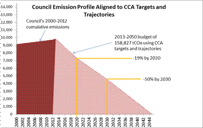
Figure
3: Council emissions budget and set of targets and trajectories
Council’s current GHG emission reduction
target of 20% by 2020 based on 2000 levels remains appropriate. Council’s
current 2050 emissions reduction target of 90% should be revised to be 100% by
2045. An interim reduction target of 50% by 2030 should also be introduced.
How we are tracking against our 2020 GHG emission
reduction target?
Council’s 2000 baseline emissions (electricity from fixed
assets, electricity from street lighting and vehicles) were determined through
the Greenhouse Gas Abatement Tool, developed through the ICLEI Oceania Cities
of Climate Protection program. As this tool is no longer available, the
National Greenhouse and Energy Reporting (NGER) framework was utilised,
operating under the National Greenhouse and Energy Reporting Act 2007 to
develop a whole-of-Council greenhouse gas emissions profile for 2011-2012.
Using this profile, Council extracted the data that aligned with the 2000
baseline data (electricity from fixed assets, electricity from street lighting
and vehicles) to measure progress against its 2020 reduction target. This data
represents 97% of the emissions that Council can currently measure.
Ironbark Sustainability’s report revealed that with current
levels of activity and investment, Council’s GHG emissions (from electricity
from fixed assets, electricity from street lighting and vehicles) has increased
by 6% in 2012, compared to 2000 levels, as shown in the table below.
|
1999/2000
|
2011/12
|
% change 2012
|
|
Tonnes CO2-e
|
|
Fixed assets
|
2926
|
3367
|
15%
|
|
Fixed assets target
|
2340
|
2340
|
|
|
Street lighting
|
4664
|
5082
|
9%
|
|
Street lighting target
|
3732
|
3732
|
|
|
Vehicles
|
1,559
|
1290
|
-17%
|
|
Vehicles target
|
1,247
|
1,247
|
|
|
Total
|
9,149
|
9,739
|
6%
|
|
Total Target
|
7,319
|
7,319
|
|
Table 1: Comparison of
Council’s emissions in 2011-2012 against its 2020 target
Following Ironbark
Sustainability’s report, Council’s emissions between 2000 and 2014 were also
calculated and are presented in the figures below.
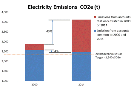
Figure
4: Council's electricity emissions from fixed assets 2000-2014
GHG emissions from fixed assets decreased by 4% between
1999/2000 and 2013/2014 for common accounts, due to energy efficiency measures
and alternative energy projects implemented across Council. However, when
incorporating the emissions from new electricity accounts added between 2000
and 2014 (most notably the Ku-ring-gai Fitness and Aquatic Centre, 828 Pacific
Highway and the North Turramurra and Gordon Golf Course sewer treatment plants)
Council’s emissions from fixed assets were 43% higher in 2014 than they were in
2000.
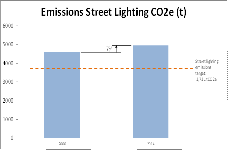
Figure
5: Council’s electricity emissions from street lighting 2010-2014
Council emissions for street lighting have
increased by 7% between 2000 and 2014. Emissions include Scope 2 and Scope 3
emissions.
Figure
6: Council's fleet emissions 2000-2014
Council has reduced GHG emissions
from our fleet by 29% between 2000 and 2014.
*
Emissions include electricity for Council assets, electricity for street
lighting, and fleet fuel. Reporting period is for the 12 months April to March.
Figure
7: Council's total emissions 2000-2014
Council’s overall GHG emissions have increased by 10%
between 2000 and 2014.
A significant challenge exists for Council in meeting its
2020 GHG emission reduction target in light of predicted population growth in
the Local Government Area and Council’s predicted new and replacement assets.
Future emission scenarios
Council’s predicted GHG emissions in 2020 under a number of
different scenarios were examined (see Attachment A3 p17-20) to
determine the most appropriate and cost effective level of abatement activity
and investment required in order for Council to meet its 2020 GHG emission
reduction target. A comparison of the business as usual (baseline) emissions
scenario with the most desirable emission scenarios are presented below:
|
Scenario
|
Emissions
1999/2000
(tonnes CO2-e)
|
Emissions
2011/12
(tonnes CO2-e)
|
Emissions
2019/20
(tonnes CO2-e)
|
% change 2020
|
Cumulative Electricity cost
(2013-2027)*
* Does not account for new or disposed assets past
2020
|
Scenario conditions
|
Extra investment required to meet 2020 emission
reduction target
|
NPV1 of total costs (capital +
electricity)
(2013-2027)*
* Does not account for new or disposed
assets past 2020
|
|
Baseline Scenario
|
9,149
|
9,739
|
10,330
|
13%
|
$66,053,239
|
This takes into account:
- Population increase
- New and replacement
assets
- Environmental Levy
and grant funding
- Average vehicle
efficiency improvements of 1% per year
- Efficiency
improvements for street lighting of 2% per year
NO
FURTHER INVESTMENT REQUIRED BY COUNCIL
|
$4,989,000
|
$47,602,322
|
|
Scenario 3
|
9149
|
9739
|
8010
|
-12%
|
$53,548,743
|
This takes into account:
- Population increase
- New and replacement
assets
- Environmental Levy
and grant funding
- Average vehicle
efficiency improvements of 1% per year
- Re-investment of
savings from actions undertaken through Environmental Levy and grant funding
($660,269)
- Bulk street light
changeover
|
$1,786,000
|
$41,041,186
|
|
Scenario 3A
|
9149
|
9739
|
7417
|
-19%
|
$53,548,743
|
This takes into account:
- Population increase
- New and replacement
assets
- Environmental Levy
and grant funding
- Average vehicle
efficiency improvements of 1% per year
- Re-investment of
savings from actions undertaken through Environmental Levy and grant funding
($660,269)
- Bulk street light
changeover
- Impacts of current
Renewable Energy Target (RET) - 20% by 2020
|
$162,000
|
$41,041,186
|
|
2020 Target
|
7,319
|
7,319
|
7,319
|
|
|
|
|
|
1 2013-2027(15
years) and 4.6% discount rate
Table 2: Future GHG emission scenarios
Ironbark Sustainability’s analysis revealed that with
current levels of activity and investment, (Baseline Scenario) Council’s GHG
emissions (from electricity from fixed assets, street lighting and vehicles)
are predicted to be 13% higher in 2020 based on 2000 levels. Under this
scenario cumulative electricity costs are $66,053,239 for the period 2013-2027,
the NPV of total costs for the period 2013-2027 is $47,602,322 and an
additional $4,989,000 of investment in mitigation activities would be required
for Council to meet its 2020 GHG emission reduction target.
Adopting Scenario 3 /3A will require the additional
abatement activities of:
· Re-investment of savings from actions
undertaken through Environmental Levy and grant funding ($660,269 )
· Bulk street light changeover to more
energy efficient street lighting.
· $1,786,000 of additional investment
(with no Renewable Energy Target) to meet 2020 GHG emission reduction target
· $162,000 of additional investment (if
there is no substantial reduction in the Large Scale Renewable Energy Target)
to meet 2020 GHG emission reduction target
Under Scenario 3 Council’s GHG emissions (from electricity
from fixed assets, street lighting and vehicles) are predicted to be 12% lower
in 2020 based on 2000 levels. Under this scenario cumulative electricity costs
are $53,548,743 for the period 2013-2027 and the NPV of total costs for the
period 2013-2027 is $41,041,186.
Under Scenario 3A Council’s GHG emissions (from electricity
from fixed assets, street lighting and vehicles) are predicted to be 19% lower
in 2020 based on 2000 levels. Under this scenario cumulative electricity costs
are $53,548,743 for the period 2013-2027 and the NPV of total costs for the
period 2013-2027 is $41,041,186.
It is recommended that Council
adopts Scenario 3 / 3A as its GHG emission reduction pathway. The ongoing fate
of the RET is crucial in determining whether Council will be required to
proceed over future years with the 3 or 3A Scenario. With the current status of
the RET it is recommended that Council proceeds with Scenario 3A.
The underlying assumptions behind
the calculation of Council’s emission scenarios are provided below:
· Population increase – Council
provided estimates for population growth based on the Resource for Aging
Population Planning 2.0 tool developed by LGNSW
(seehttp://www.lgnsw.org.au/policy/ageing). Ironbark Sustainability estimated
the impact of population increases for different asset types and the overall
contribution given the percentage of total emissions each asset type is
responsible and applied this across Council’s portfolio of assets.
· Environmental Levy and grant funding
– the impact of energy saving measures implemented through Environmental Levy
and grant funding were estimated using typical cost-benefit figures for
existing technologies and the expected cost-benefit figures for emerging
technologies such as open-space LED lighting.
· New and replaced assets – new
assets were identified using the long term financial plan (LTFP). Energy
consumption for these assets was provided by the Council officers responsible
for the new assets and was based on the typical energy consumption and
emissions of similar existing assets.
· Average vehicle efficiency per year
– a 1% improvement per year in vehicle energy efficiency was presumed based on
guidance from Ironbark Sustainability. It is based on an average 10%
improvement in vehicle emissions intensity from 2002 to 2012 reported by The
Australian Government and the Federal Chamber of Automotive.
· Street lighting efficiency
improvements - the Street Lighting Improvement program (SLI program)
coordinator advised that in the absence of any bulk street lighting upgrades,
the expected annual improvement in energy efficiency of Ausgrid street lights
is 1% to 2% per annum. These are energy efficiency improvements expected as the
Ausgrid maintenance program replaces existing luminaires with more energy
efficient LED lighting. An estimate on the energy savings expected from bulk
street lighting upgrades was provided by Ironbark Sustainability based on their
experience of energy savings achieved in numerous bulk street lighting upgrades
in Victoria.
The more we do now the less we have to do later
The figure below demonstrates the required emissions
profiles (targets and trajectories) under the business as usual (baseline)
emissions scenario (Scenario A) and the recommended emissions scenario
(Scenario C).
Figure
7: Two scenarios with a Council emissions budget of 158,827 t CO2-e
A 13% increase in GHG emissions by 2020 equates to the need
for a reduction of 78% by 2030 to meet Council’s emissions budget to 2050. A
20% decrease in GHG emissions by 2020 equates to the need for a reduction of
56% by 2030 to meet Council’s emissions budget to 2050.
Draft Climate Change Policy (2015) implementation
activities
To meet the objectives of the Draft Climate Change Policy
2015, the following climate change mitigation and adaptation activities will be
implemented across a number of sections of Council:
|
|
RESPONSIBILITY AREA
|
|
ACTIVITY AREA
|
Environment & Sustainability
|
Development & Assessment
|
Integrated Planning, Property & Assets
|
Projects Operations
|
Strategic Projects
|
Engineering Services
|
Information Technology
|
Community & Recreation Services
|
Library and Cultural Services
|
Procurement and contracts
|
Finance
|
Open Space Operations
|
Waste Operations
|
People & Culture
|
Urban Planning & Heritage
|
Corporate Communications
|
|
Staff behavioural change
programs
|
√
|
√
|
√
|
√
|
√
|
√
|
√
|
√
|
√
|
√
|
√
|
√
|
√
|
√
|
√
|
√
|
|
Energy efficiency and
renewable energy works program for Council buildings and facilities
|
√
|
|
|
|
|
√
|
|
|
|
|
|
|
|
|
|
|
|
Monitoring and maintenance
of Council’s water reuse systems
|
√
|
|
|
|
|
√
|
|
|
|
|
|
√
|
|
|
|
|
|
Community / business climate
change mitigation programs
|
√
|
|
|
|
|
|
|
|
|
|
|
|
|
|
|
√
|
|
Community / business climate
change adaptation programs
|
√
|
|
|
|
|
|
|
|
|
|
|
√
|
|
|
|
√
|
|
Sustainability data
management and reporting system
|
√
|
|
|
|
|
√
|
|
√
|
|
|
|
|
|
|
|
|
|
Sustainability and climate
resilience provisions in planning controls
|
√
|
√
|
|
|
|
|
|
|
|
|
|
|
|
|
√
|
|
|
Sustainability and climate
resilience building performance standards for new and refurbished assets
|
√
|
|
√
|
|
|
√
|
|
√
|
|
|
|
|
|
|
|
|
|
Sustainable design and
resource efficiency integrated into capital works program
|
√
|
|
|
√
|
√
|
|
|
|
|
|
|
|
|
|
√
|
|
|
Sustainable design of parks,
playgrounds and ovals
|
√
|
|
|
√
|
√
|
|
|
|
|
|
|
√
|
|
|
|
|
|
Green infrastructure
|
√
|
|
|
√
|
√
|
|
|
|
|
|
|
|
|
|
|
|
|
Flood risk management
|
√
|
|
|
|
|
√
|
|
|
|
|
|
√
|
|
|
|
|
|
Energy efficient street
lighting upgrades
|
√
|
|
|
|
|
√
|
|
|
|
|
|
|
|
|
|
|
|
Energy efficient equipment /
appliances / devices
|
|
|
|
|
|
√
|
√
|
|
|
|
|
|
|
|
|
|
|
Software to enhance resource
efficiency
|
|
|
|
|
|
|
√
|
|
|
|
|
|
|
|
|
|
|
Sustainable event management
|
√
|
|
|
|
|
|
|
√
|
√
|
√
|
|
|
|
|
|
√
|
|
Sustainable design of town
and neighbourhood centres
|
√
|
|
|
|
|
|
|
|
|
|
|
|
|
|
√
|
|
|
Sustainable transport
|
√
|
|
|
|
|
√
|
|
|
|
|
|
|
|
|
√
|
|
|
Sustainable procurement
|
√
|
|
|
|
|
|
|
|
|
√
|
|
|
|
|
|
|
|
Financing for energy
reduction / efficiency projects
|
|
|
|
|
|
|
|
|
|
|
√
|
|
|
|
|
|
|
Emergency and disaster
resilience management
|
√
|
|
|
|
|
|
|
|
|
|
|
√
|
|
|
|
|
|
Fleet management
|
|
|
|
|
|
|
|
|
|
|
|
√
|
|
|
|
|
|
Minimum performance
standards for new or replacement outdoor lighting installations
|
√
|
|
|
√
|
√
|
|
|
|
|
|
|
√
|
|
|
|
|
|
Community waste reduction
and efficiency programs
|
√
|
|
|
|
|
|
|
|
|
|
|
|
√
|
|
|
|
|
Council waste management
programs
|
|
|
|
|
|
|
|
|
|
|
|
|
√
|
|
|
|
|
Proactive engagement with State
and Federal Government and other relevant agencies to influence policies and
reforms that affect Council’s climate change mitigation and adaptation
program
|
√
|
|
|
|
|
√
|
|
|
|
|
|
√
|
|
|
|
|
Table
3: Climate change mitigation and adaptation activities
The Draft Greenhouse Gas Reduction Action Plan 2015 provides
further details of the recommended abatement activities across the areas of
buildings and facilities, open space, street lighting, fleet and staff
engagement and education, to meet the conditions of Scenario 3 / 3A and for
Council to achieve its 2020 GHG emission reduction target.
The revised Climate Change Adaptation Strategy 2015 will
provide further details on recommended adaptation activities in order for
Council to meet the Draft Climate Change Policy 2015 objective: ‘To reduce
Council and the community’s vulnerability and increase its resilience to the
impacts of climate change’.
integrated planning and reporting
Natural Environment
|
Community Strategic Plan Long Term Objective
|
Delivery Program
Term Achievement
|
Operational Plan
Task
|
|
A community addressing and
responding to the impacts of climate change and extreme weather events.
|
The community is
effectively informed and engaged on climate change issues.
Council’s vulnerability to
climate change is reduced
|
Deliver the Climate Wise
Communities program
Pursue viable opportunities
for a community volunteer network to respond to extreme weather events
|
Governance Matters
Under the NSW Local Government Act 1993, councils are
required to manage the local environment with consideration to the principles
of Ecologically Sustainable Development (ESD), which incorporates the
Precautionary Principle. Section 7e of the Act requires ‘councils, Councillors
and council employees to have regard to ESD principles in carrying out all of
their responsibilities’. Due to the levels of variability associated with the
rate and magnitude of changes to the climatic system and its associated impacts
under different modelling scenarios, Council will adopt the Precautionary
Principle in responding to climate change.
Risk Management
“Climate change will amplify existing risks and create new
risks for natural and human systems. Risks are unevenly distributed and are
generally greater for disadvantaged people and communities in countries at all
levels of development.” (IPCC 2014b, p13)
“The precise levels of climate change sufficient to trigger
abrupt and irreversible change remain uncertain, but the risk associated with
crossing such thresholds increases with rising temperature. (IPCC 2014b, p13)
Warming above 2˚C increases the likelihood that the world will cross these
irreversible ‘tipping points’. “Two of the most fragile tipping points are
believed to be the permanent melting of Arctic summer sea-ice and the Greenland
Ice Sheet, which may occur between 1 and 2.5 ˚C of global warming
(compared with pre-industrial levels). Crossing any of these tipping points
would cause substantial regional and global consequences.” (Climate Change
Authority 2014, p36)
The IPCC defines key risks as potentially severe impacts
relevant to Article 2 of the United Nations Framework Convention on Climate
Change, which refers to “dangerous anthropogenic interference with the climate
system” and are identified based on expert judgement using the criteria: large
magnitude; high probability, or irreversibility of impacts; timing of impacts;
persistent vulnerability or exposure contributing to risks; or limited
potential to reduce risks through adaptation or mitigation (IPCC 2014a, p12).
Human risks identified by the IPCC (IPCC 2014a) with high
probability, severe consequences and with sufficient data to validate a high
degree of confidence, and that have relevance to Ku-ring-gai, include:
· Systematic risks from extreme weather
events leading to a breakdown in infrastructure networks, critical services
including power, water and health support;
· Risk of mortality and morbidity during
periods of extreme heat, particularly for vulnerable populations and those
working outdoors;
· Risk to food security and breakdown of
food systems due to drought, fluctuations and changes in magnitude of climate
and precipitation variability;
· Risk of loss of terrestrial
biodiversity, ecosystem goods and service functions
· Risk of infrastructure overload arising
from energy demand for heating and cooling;
· Challenges to the insurance system;
· Risks from reduced labour productivity;
· Risk of increase in food and water
borne disease.
“The overall risks of climate change impacts can be reduced
by limiting the rate and magnitude of climate change. This will require
substantial and sustained reductions in greenhouse gas emissions together with
adaptation. Reducing climate change can also reduce the scale of adaptation
that might be required” (IPCC 2014a).
The IPCC (2014a) refers to climate resilient pathways, that
is, sustainable development trajectories that combine adaptation and mitigation
to reduce climate change and its impacts, as a means of ensuring that effective
risk management can be implemented and sustained, as depicted in the figure
below:
Figure
8: Climate resilient pathways (Source: IPCC 2014a, p29)
Climate resilient pathways (in green) lead to a more
resilient world through adaptive learning, increasing scientific knowledge,
effective adaptation and mitigation measures, and other choices to reduce risk.
Pathways that lower resilience (in red) can involve insufficient mitigation,
maladaptation, failure to learn and use knowledge, and other actions that lower
resilience, and they can be irreversible in terms of possible futures (IPCC
2014a, p29).
The inadequate resilience of communities has been witnessed
across Australia with recent extreme weather events. (Climate Commission 2013)
This clearly demonstrates the need for councils to provide leadership in
climate change adaptation by building climate resilience into its operations
and service delivery and that of their constituent communities.
The Attorney-General in Carroll and O’dea (2011) discussed
the legal risks associated with climate change as involving responsibility to
mitigate impacts, the need to take climate change into account when making
decisions and the impact of climate change on national security.
Financial Considerations
Below is a figure which summarises the financial implications
of adopting the emission reduction scenarios 3 and 3A, compared to the business
as usual, or baseline scenario.
Figure
9: Financial implications of different emission reduction scenarios
Based on the NPV of total costs for both Scenario 3 and
Scenario 3A, Council will spend $6,561,136 less in the period 2013-2027
compared to the Baseline Scenario. Cumulative electricity costs for the period
2013-2027 will also be $12,504,496 less under the Scenario 3 and Scenario 3A
conditions compared to the Baseline Scenario.
To meet Council’s 2020 emissions reduction target, an extra
investment of $162,000 is required for Scenario 3A and $1,786,000 for Scenario
3, compared to $4,989,000 for the Baseline Scenario. Hence, it is financially
advantageous for Council to adopt Scenario 3 / Scenario 3A.
Through the recent budget process, $162,000 of general
revenue was allocated to Council’s 2015-16 energy management program,
representing the additional investment required for Council to achieve its 2020
GHG emissions reduction target under Scenario 3A. An additional $40,000, which
represents the estimated cost savings from Environmental Levy projects
implemented in 2014-2015, has also been allocated to Council’s 2015-16 energy
management program, again consistent with Scenario 3A.
The cost savings from Environmental Levy projects will be
verified on an annual basis and will represent a budget expenditure item in
Council’s long term financial plan and asset management plan.
Setting a budget for emissions through to 2050 highlights
the trade-offs involved between actions taken now and those made necessary
later. In short, weaker action now imposes a greater emissions reduction task
for future generations, at a greater cost. (Climate Change Authority 2014)
Social Considerations
Impacts from recent climate-related extremes, such as heat
waves, droughts, floods, cyclones, and wildfires, reveal significant
vulnerability and exposure of human systems to current climate variability
(very high confidence). Impacts of such climate-related extremes on human
systems include disruption of food production and water supply, damage to
infrastructure and settlements, morbidity and mortality, and consequences for
mental health and human well-being. (IPCC 2014a)
Environmental Considerations
Evidence of observed climate-change impacts is strongest and
most comprehensive for natural systems. In many regions, changing precipitation
or melting snow and ice are altering hydrological systems, affecting water
resources in terms of quantity and quality (medium confidence). Many
terrestrial, freshwater, and marine species have shifted their geographic
ranges, seasonal activities, migration patterns, abundances, and species
interactions in response to ongoing climate change (high confidence). Some
impacts of ocean acidification on marine organisms have been attributed to
human influence (medium confidence).” (IPCC 2014b, p6)
Community Consultation
The importance of addressing climate change is demonstrated
in the long term objectives of Council’s Community Strategic Plan 2030, namely:
an aware community able to prepare and respond to the risk to life and property
from emergency events; a community empowered with knowledge, learning and
information that benefits the environment; a community addressing and
responding to the impacts of climate change and extreme weather events; and a
community progressively reducing its consumption of resources and leading in
recycling and reuse.
The Draft Climate Change Policy 2015 also contains community
objectives, namely:
· To deliver programs that enables a
continued reduction in community energy use and greenhouse gas emissions.
· To reduce Council and the community’s
vulnerability and increase its resilience to the impacts of climate change.
It is proposed that the Draft Climate Change Policy 2015 and
Draft Greenhouse Gas Reduction Action Plan 2015 be placed on public exhibition
for 28 days with a further 14 days for public comment. Copies of the documents
will be made available on Council’s website, at Council Chambers and at
Council’s four (4) libraries. The public exhibition period will be promoted
through Council’s social media platforms, including Facebook and Twitter;
online e-news communications; and local news media.
Following the public exhibition period, a report will be
brought back to Council outlining any changes and recommended amendments to the
Draft Climate Change Policy 2015 and Draft Greenhouse Gas Reduction Action Plan
2015 for final endorsement.
Internal Consultation
Staff from all directorates of Council were consulted on the
Draft Climate Change Policy 2015 and Draft Greenhouse Gas Reduction Action Plan
2015. Internal consultation involved:
· Direct staff consultations on key
activity areas, for example street lighting and building works
· A GMD briefing / consultation on the
Draft GHG Reduction Action Plan (2015) and GHG reduction targets and the
proposed allocation of budget for Council’s 2015-16 energy management program
· A staff briefing / consultation,
involving managers and staff from all directorates.
In addition, a Councillor briefing on the Draft Climate
Change Policy 2015 and Draft Greenhouse Gas Reduction Action Plan 2015 was
conducted on 17 August 2015.
Summary
“The warming of the climate system is unequivocal,
and since the 1950s, many of the observed changes are unprecedented over
decades to millennia. The atmosphere and ocean have warmed, the oceans have
acidified, the amounts of snow and ice have diminished, and sea level has
risen.” (IPCC 2014b, p2)
In Australia air and ocean temperatures have warmed, the
frequency of very warm months has increased and the frequency of very cool
months has declined. South-east Australia has experienced below average autumn
and early winter rainfall since 1990. Mean sea level was 0.225m higher in 2012
than in 1880, the earliest year for which robust estimates are available. Ocean
acidity levels have increased since the 1800s due to increased CO2
absorption from the atmosphere. (BoM and CSIRO 2014)
Human influence on the climate system is clear. “Anthropogenic
greenhouse gas (GHG) emissions have increased since the pre-industrial era,
driven largely by economic and population growth, and are now higher than ever.
Their effects, together with those of other anthropogenic drivers, have been
detected throughout the climate system and are extremely likely to have been
the dominant cause of the observed warming since the mid-20th century.“ (IPCC
2014b, p4)
Australian temperatures are projected to continue to warm,
with more hot days and warm nights and fewer cool days and cold nights. Average
rainfall in southern Australia is projected to decrease, with a likely increase
in drought frequency and severity. An increase in the number and intensity of
extreme rainfall events is projected for most regions. Hotter, drier weather
conditions will increase the number of extreme fire-weather days as well as
fire severity and intensity in southern and eastern Australia (BoM and CSIRO
2014).
“In recent decades, changes in climate have caused impacts
on natural and human systems on all continents and across the oceans. (IPCC
2014b) “Continued emissions of greenhouse gases and rising rates and magnitudes
of warming and other changes in the climate system, accompanied by ocean
acidification, increase the risk of severe, pervasive, and in some cases
irreversible detrimental impacts.” (IPCC 2014b, p13)
“Our future climate will depend on committed warming caused
by past anthropogenic emissions, as well as future anthropogenic emissions and
natural climate variability. (IPCC 2014b, p10) “Limiting climate change will
require substantial and sustained reductions in greenhouse gas emissions which,
together with adaptation, can limit climate change risks.” (IPCC 2014b, p8)
The Draft Climate Change Policy 2015 (Attachment A2)
provides a revised management framework for Council to respond to the observed
and projected implications of climate change on Ku-ring-gai’s natural and built
environment, community and economy. The Draft Greenhouse Gas Reduction Action
Plan 2015 (Attachment A3) supports the Draft Climate Change Policy
(2015) by providing a mitigation response to climate change and describing how
Council intends to meet its 2020 GHG emission reduction target.
The continuing appropriateness of Council’s current
greenhouse gas emission reduction targets was considered in light of
recommended international and Australian targets and the CCA’s (2014) set of
recommendations in its report Reducing Australia’s Greenhouse Gas Emissions
– Targets and Progress Review. Council’s current GHG
emission reduction target of 20% by 2020 based on 2000 levels remains appropriate.
Council’s current 2050 emissions reduction target of 90% should be revised to
be 100% by 2045. An interim reduction target of 50% by 2030 should also be
introduced.
With current levels of activity and investment, Council’s
GHG emissions (from electricity from fixed assets, electricity from street
lighting and vehicles) has increased by 6% in 2012, compared to 2000 levels.
Council’s overall GHG emissions have increased by 10% between 2000 and 2014. A
significant challenge therefore exists for Council in meeting its 2020 GHG
emission reduction target in light of predicted population growth in the Local
Government Area and Council’s predicted new and replacement assets.
Council’s predicted GHG emissions in 2020 under a number of
different scenarios were examined (see Attachment A3 p17-20) to
determine the most appropriate and cost effective level of abatement activity
and investment required in order for Council to meet its 2020 GHG emission
reduction target.
With current levels of activity and investment (the Baseline
Scenario), Council’s GHG emissions (from electricity from fixed assets, street
lighting and vehicles) are predicted to be 13% higher in 2020 based on 2000
levels. Under this scenario cumulative electricity costs are $66,053,239 for
the period 2013-2027, the NPV of total costs for the period 2013-2027 is
$47,602,322 and an additional $4,989,000 of investment in mitigation activities
would be required for Council to meet its 2020 GHG emission reduction target.
The desired scenarios are Scenarios 3 /3A.
Under Scenario 3 Council’s GHG emissions (from electricity
from fixed assets, street lighting and vehicles) are predicted to be 12% lower
in 2020 based on 2000 levels. Under this scenario cumulative electricity costs
are $53,548,743 for the period 2013-2027 and the NPV of total costs for the
period 2013-2027 is $41,041,186.
Under Scenario 3A Council’s GHG emissions (from electricity
from fixed assets, street lighting and vehicles) are predicted to be 19% lower
in 2020 based on 2000 levels. Under this scenario cumulative electricity costs
are $53,548,743 for the period 2013-2027 and the NPV of total costs for the
period 2013-2027 is $41,041,186.
The desired scenario (Scenarios 3 /3A) will require the
additional abatement activities of: re-investment of savings from actions
undertaken through Environmental Levy and grant funding ($660,269); bulk street
light changeover to more energy efficient street lighting; and $1,786,000 of
additional investment (with no Renewable Energy Target) to meet Council’s 2020
GHG emission reduction target (Scenario 3) or $162,000 of additional investment
(if there is no substantial reduction in the Large Scale Renewable Energy
Target) to meet Council’s 2020 GHG emission reduction target (Scenario 3A).
With the current status of the RET it is recommended that Council proceeds with
Scenario 3A. It is financially advantageous for Council to adopt Scenario 3 /
Scenario 3A.
The IPCC (2014a) refers to
climate resilient pathways, that is, sustainable development trajectories that
combine adaptation and mitigation to reduce climate change and its impacts, as
a means of ensuring that effective risk management can be implemented and
sustained.
To meet the objectives of the Draft Climate Change Policy
2015, a number of climate change mitigation and adaptation activities will be
implemented across a number of sections of Council.
Staff from all directorates of Council were consulted on the
Draft Climate Change Policy 2015 and Draft Greenhouse Gas Reduction Action Plan
2015. It is proposed that the Draft Climate Change Policy 2015 and Draft
Greenhouse Gas Reduction Action Plan 2015 be placed on public exhibition for 28
days with a further 14 days for public comment.
REFERENCES
Bureau of Meteorology and CSIRO (2014) State of the Climate
2014.
Carroll and O’dea Lawyers (2011)The Attorney General
Speaks Out About Natural Disasters and Climate Change, School of Law, James
Cook University, Thursday, 6 October 2011
Climate Change Authority (2014) Reducing Australia’s
greenhouse gas emissions – Targets and Progress Review: Final Report.
Climate Commission (2013) The Angry Summer, Cool
Australia.
CSIRO (2015a) Climate Change in Australia: East Coast
South Projection Summaries
CSIRO (2015b) Climate Change in Australia – Projections for
Australia’s NRM regions -Technical Report.
Intergovernmental Panel on Climate Change (2014a) Climate
Change 2014 Impacts, Adaptation and Vulnerability: Summary for Policy Makers,
Working Group II contribution to the Fifth Assessment Report of the Intergovernmental
Panel on Climate Change.
Intergovernmental Panel on Climate Change (2014b) Climate
Change 2014: Synthesis Report: Summary for Policy Makers, Fifth
Assessment Report of the Intergovernmental Panel on Climate Change.
Office of Environment and Heritage (2014) Metropolitan
Sydney climate change snapshot.
|
Recommendation:
A. That
the Draft Climate Change Policy 2015 and Draft Greenhouse Gas Reduction
Action Plan 2015 be endorsed for public exhibition.
B. That
the Draft Climate Change Policy 2015 and Draft Greenhouse Gas Reduction
Action Plan 2015 be exhibited for a period of 28 days with a further 14 days
for public comment.
C. That
a further report be presented to Council following the public exhibition
period outlining any changes and recommended amendments to the Draft Climate
Change Policy 2015 and Draft Greenhouse Gas Reduction Action Plan 2015 for
final endorsement.
|
|
Marnie Kikken
Manager Environment & Sustainability
|
Antony Fabbro
Acting Director Strategy and Environment
|
|
Attachments:
|
A1View
|
Final
draft - Climate Change Background Paper 2015
|
|
2015/226019
|
|
|
A2View
|
Climate
Change Policy - Version 2 - Draft
|
|
2015/226991
|
|
|
A3View
|
Final
draft - Greenhouse Gas Reduction Action Plan 2015
|
|
2015/226020
|
|
APPENDIX
No: 1 - Final
draft - Climate Change Background Paper 2015
|
|
Item No: GB.2
|

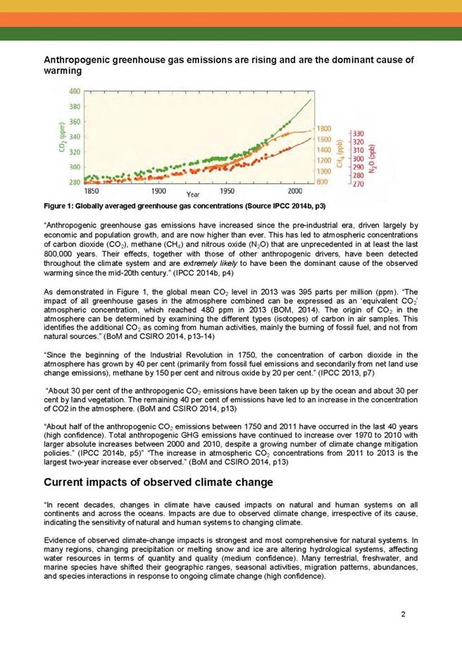
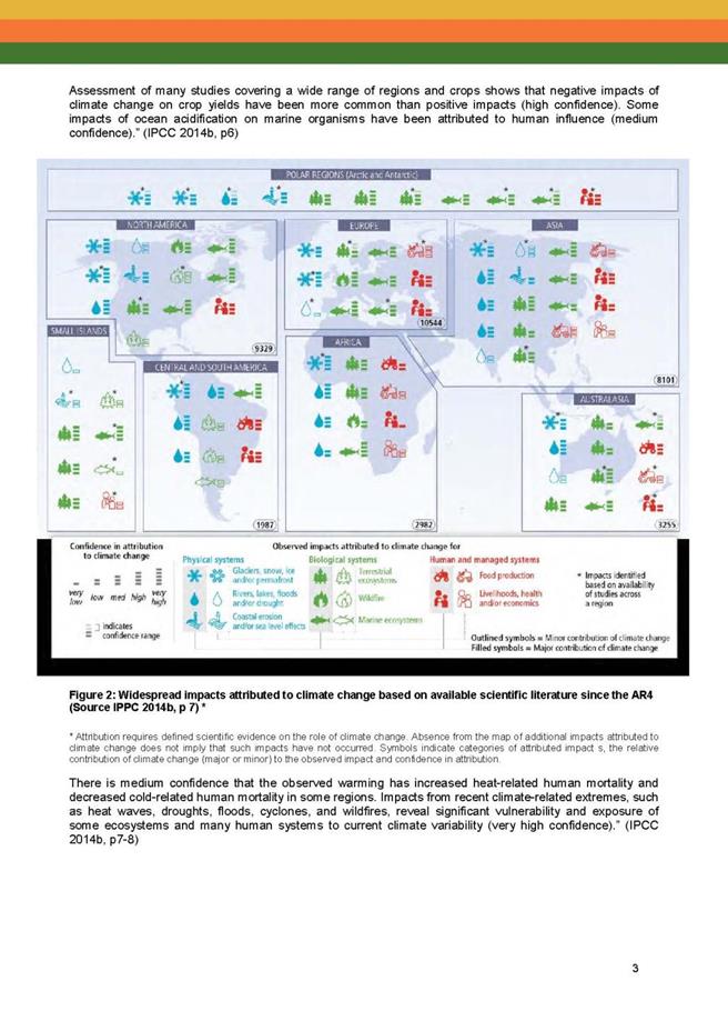

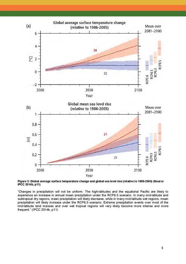


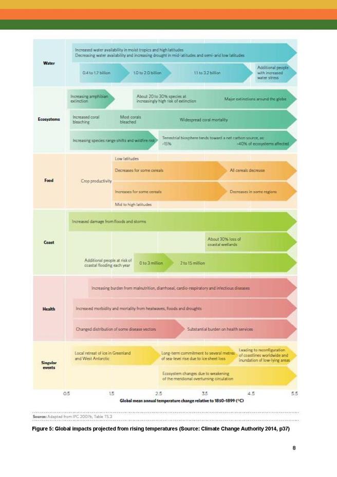

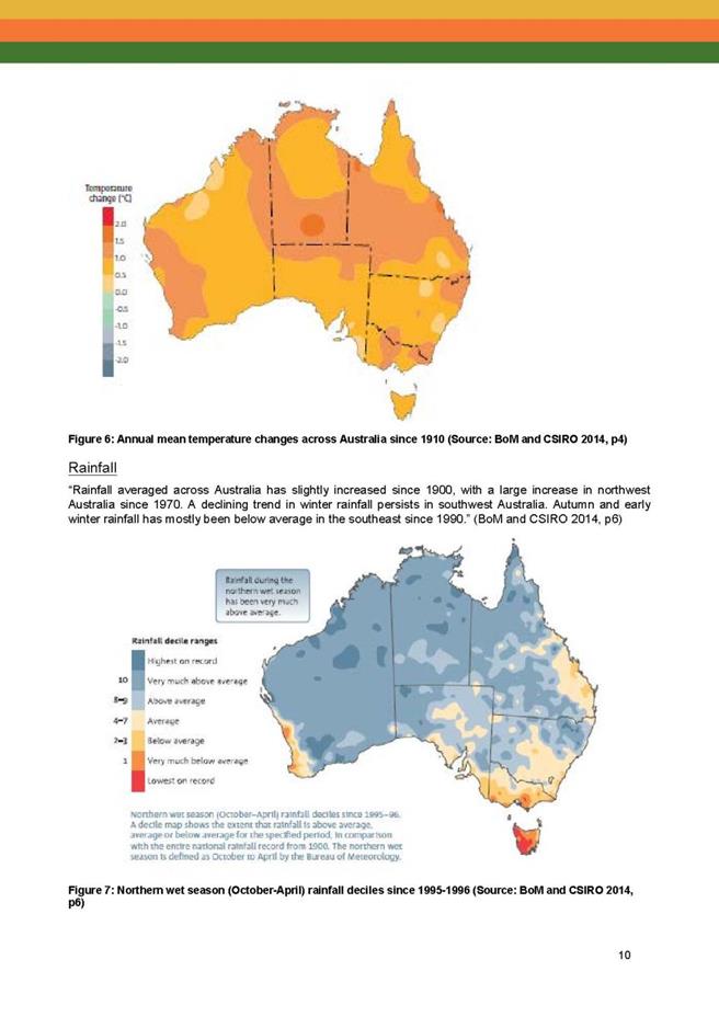
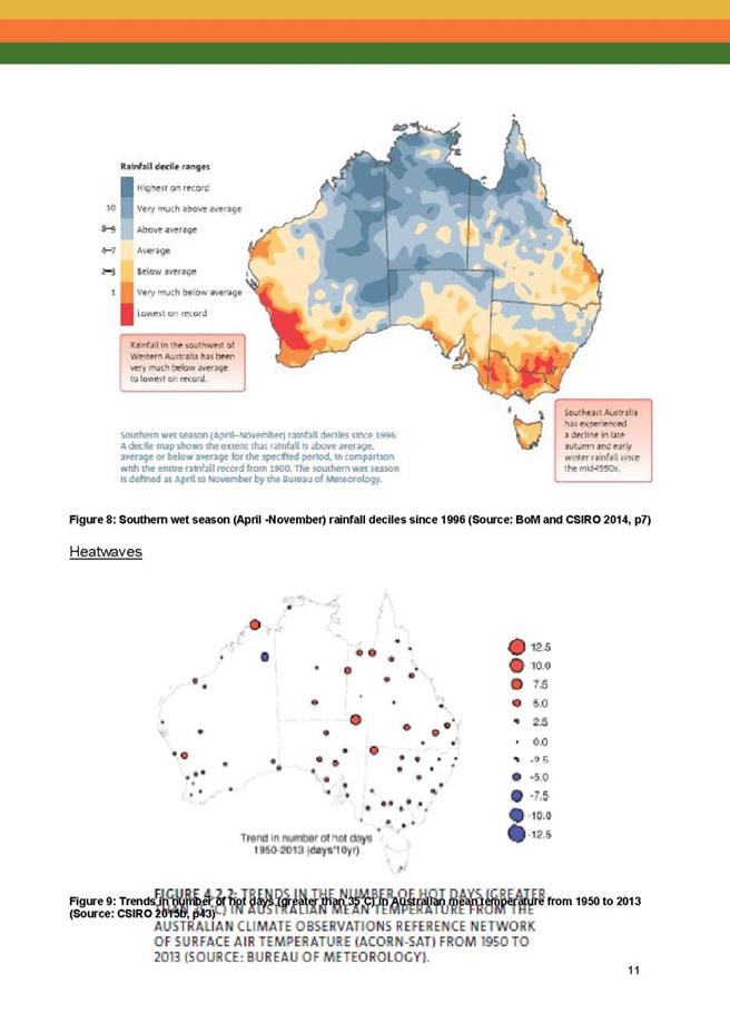
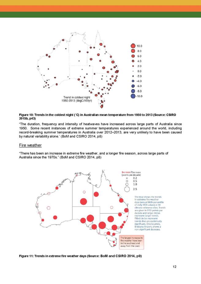

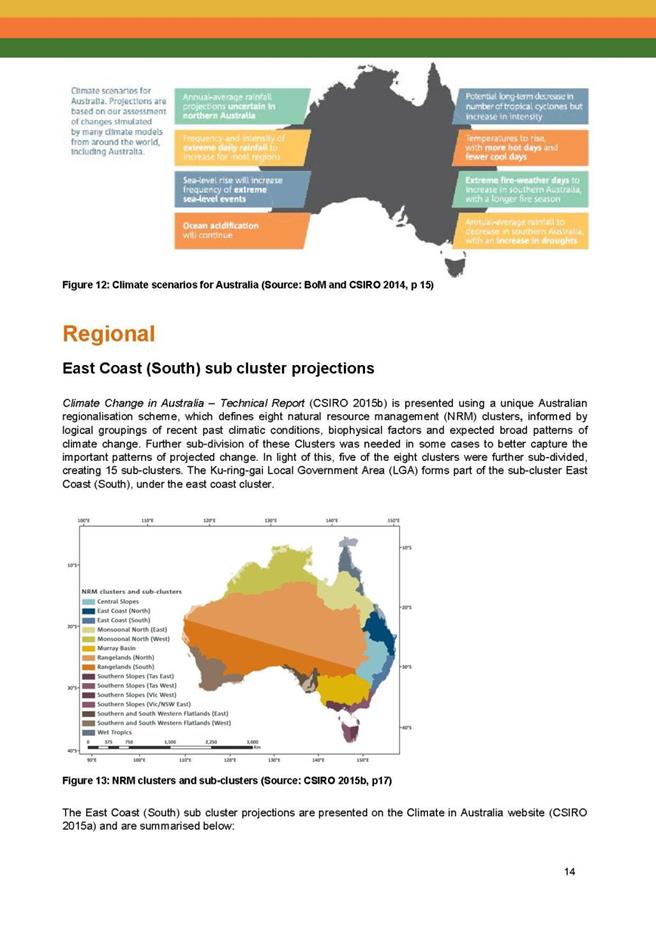
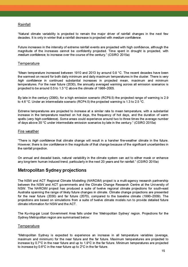

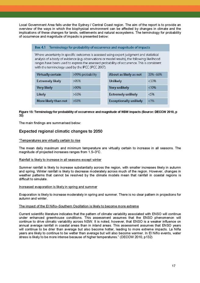

|
APPENDIX No: 2 - Climate
Change Policy - Version 2 - Draft
|
|
Item No: GB.2
|


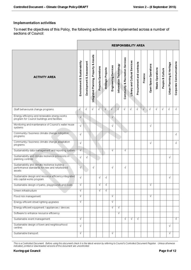

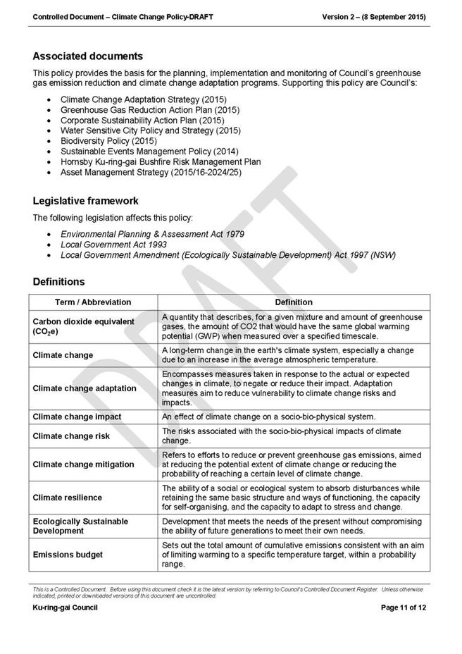

|
APPENDIX No: 3 - Final
draft - Greenhouse Gas Reduction Action Plan 2015
|
|
Item No: GB.2
|

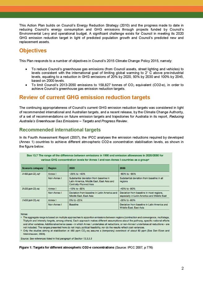

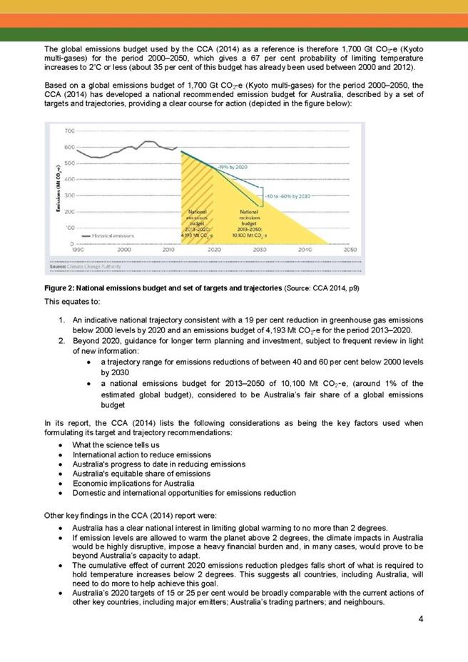
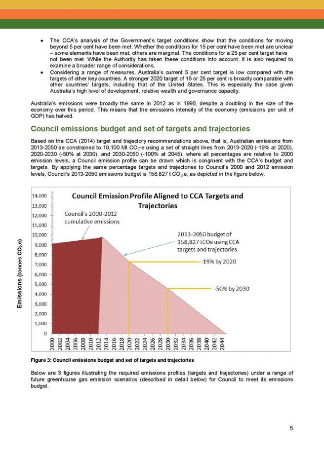
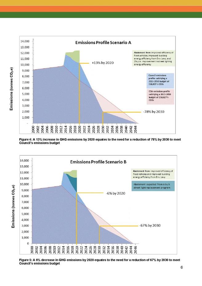
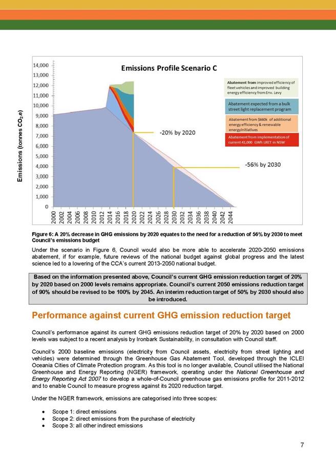
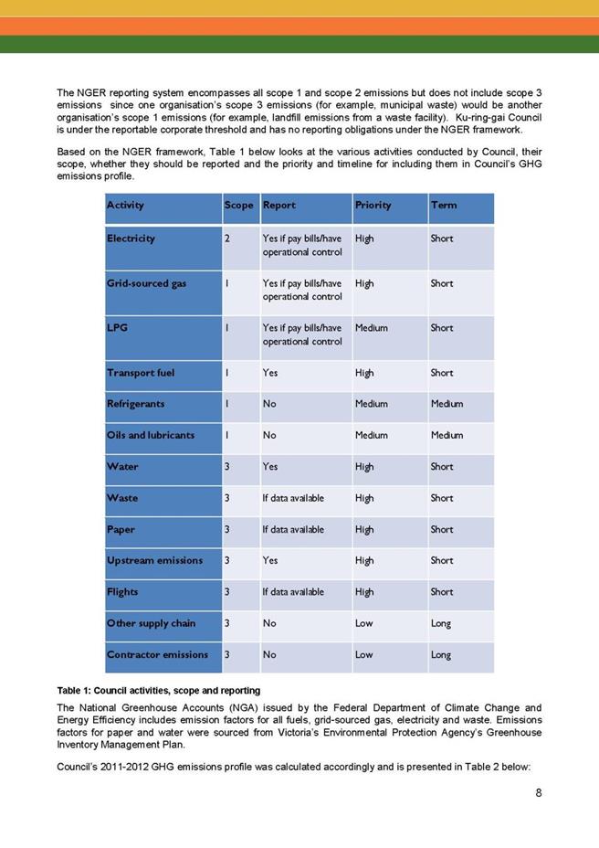
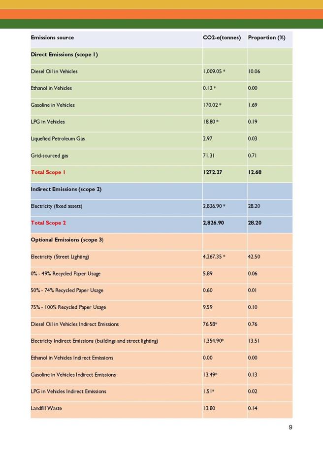
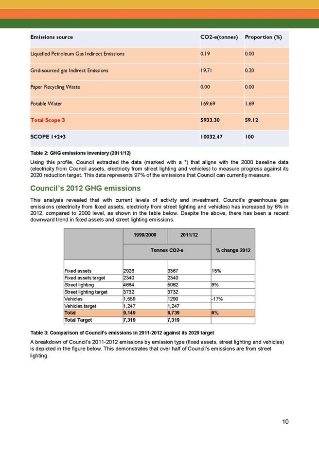
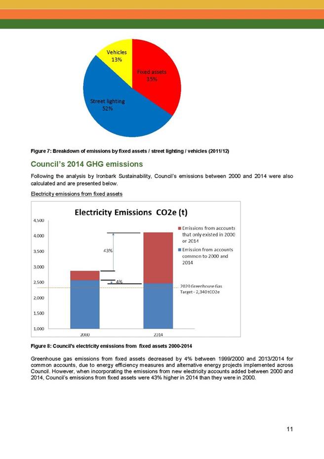
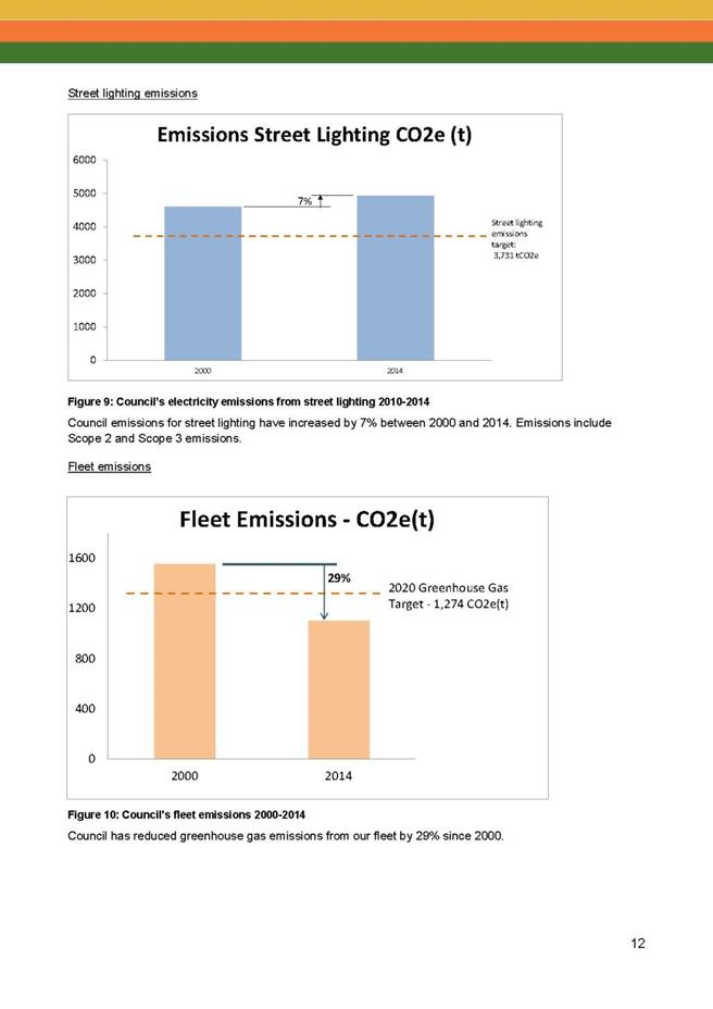
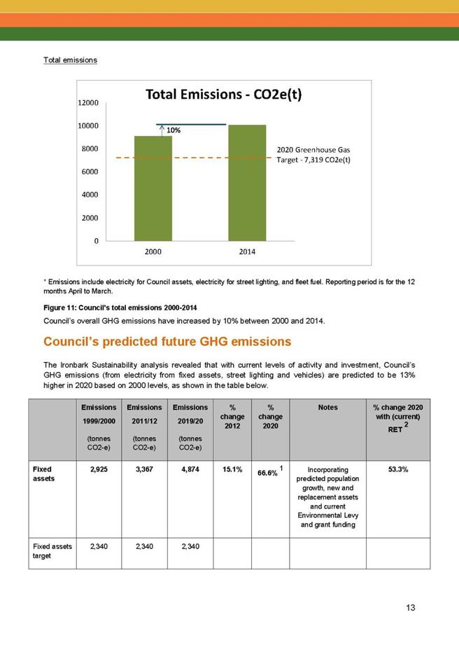
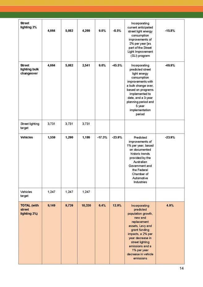
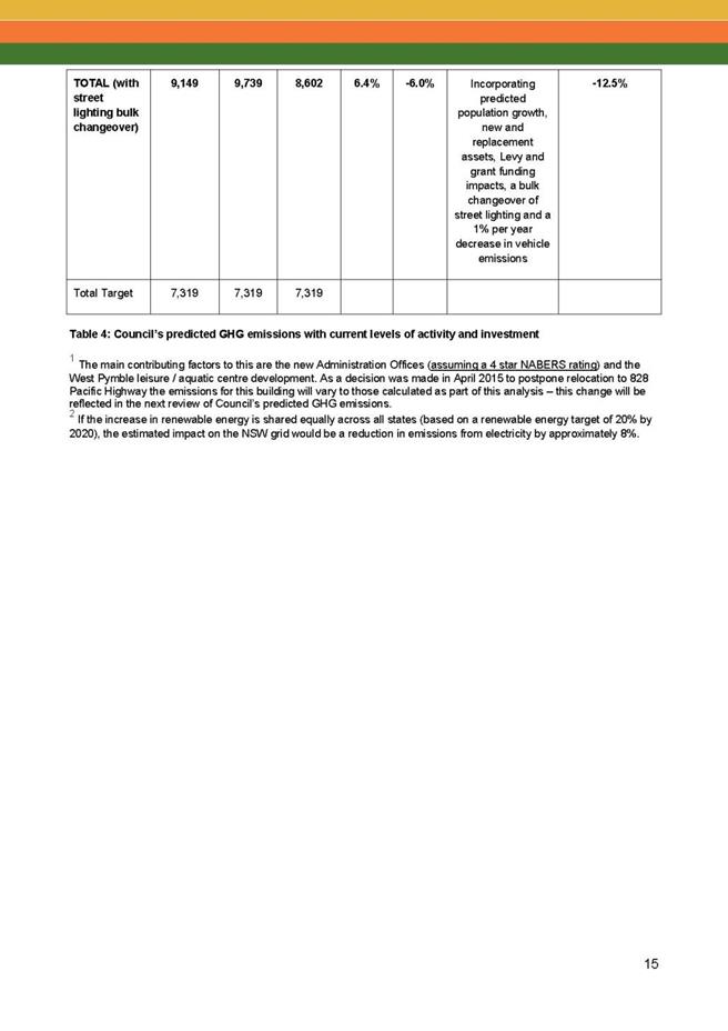
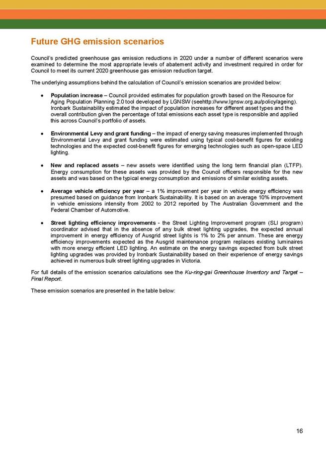
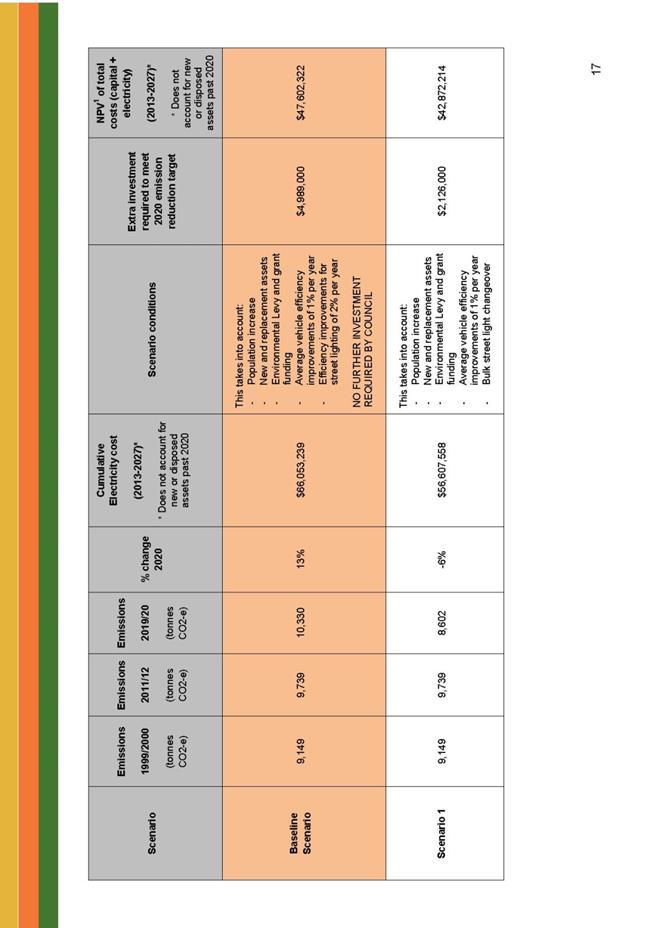

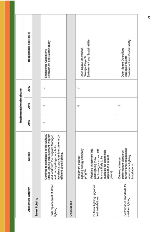
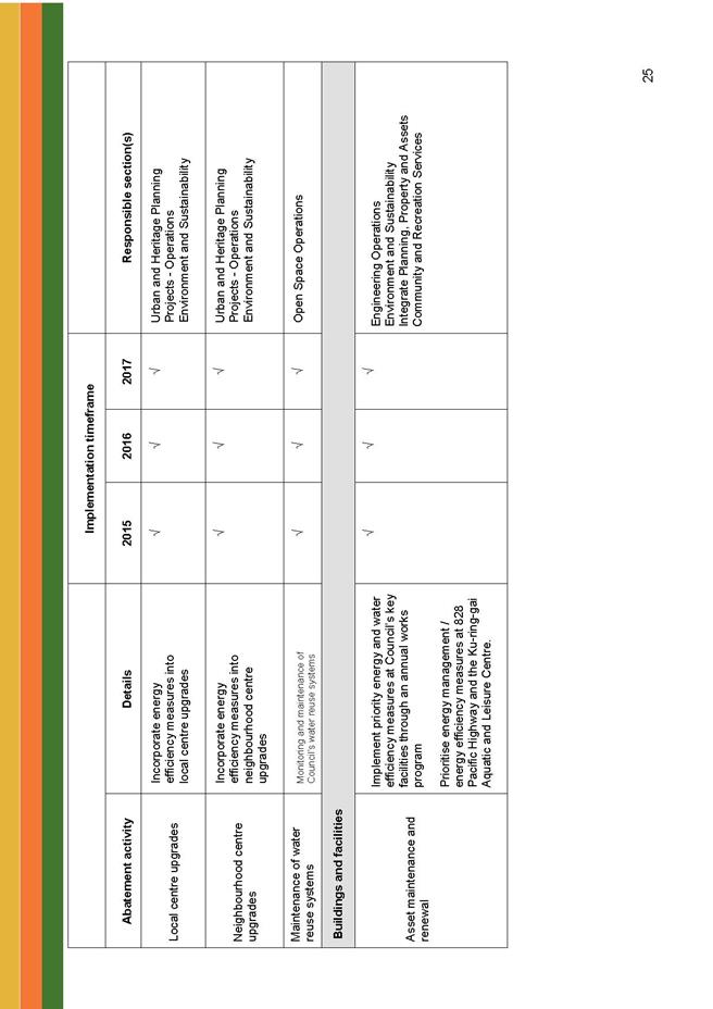
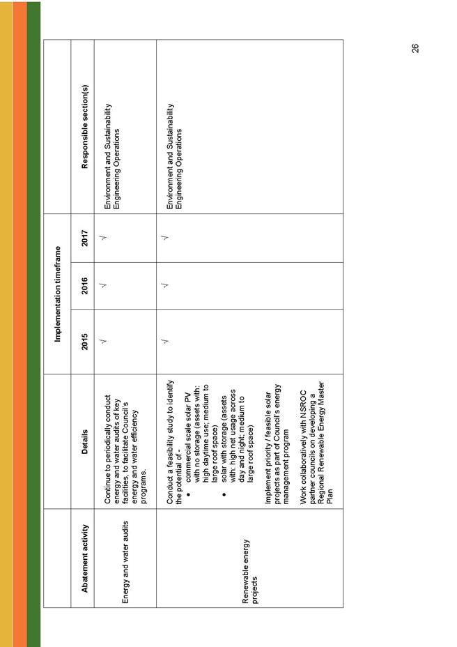
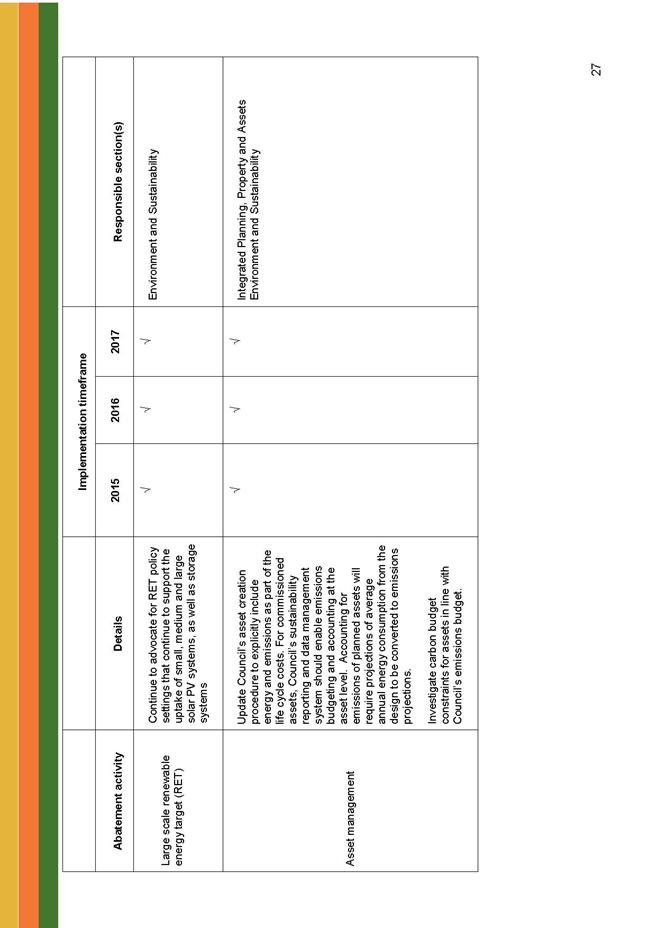
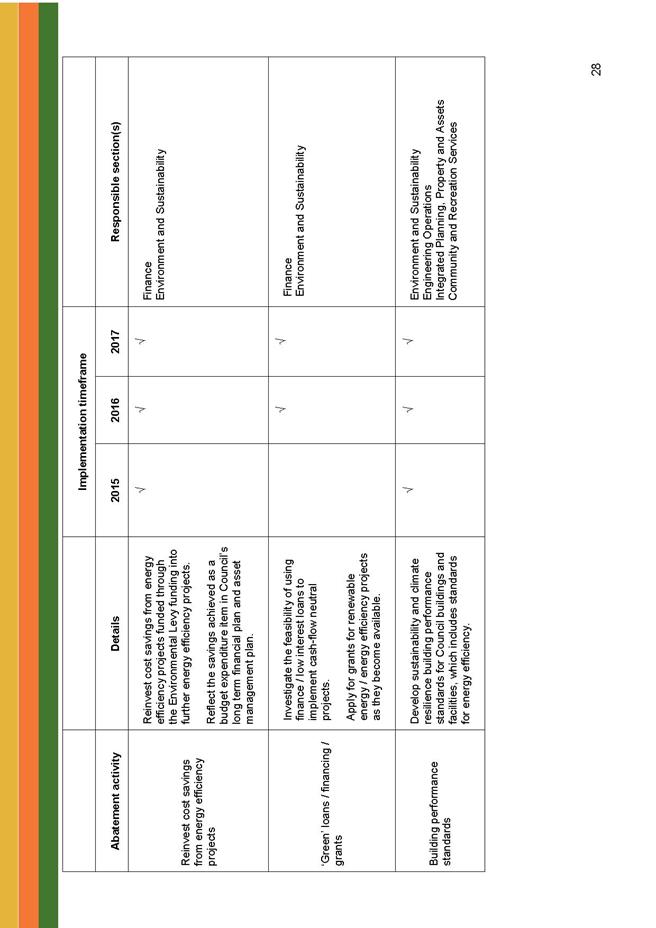
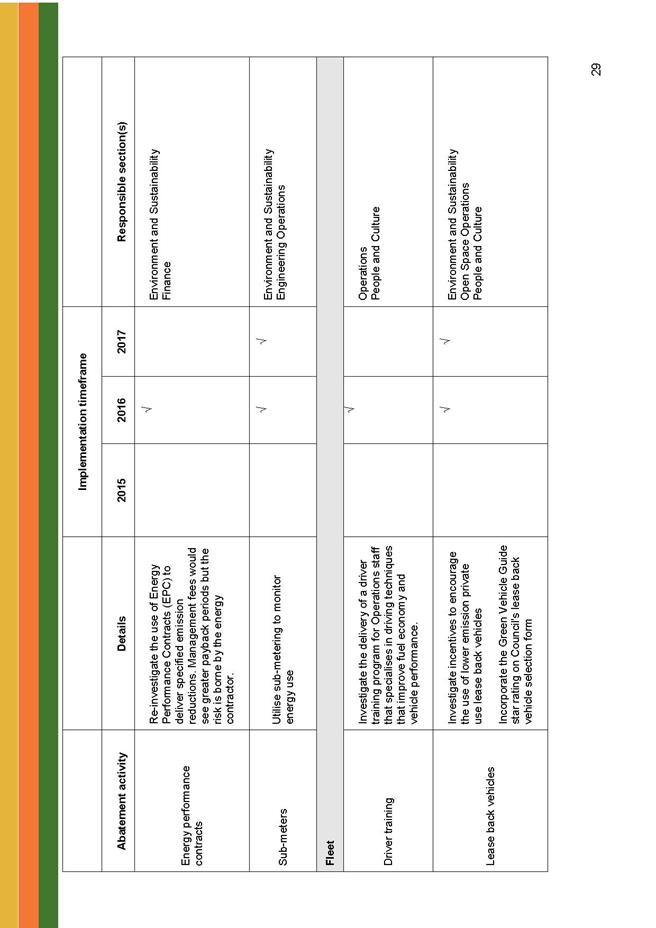
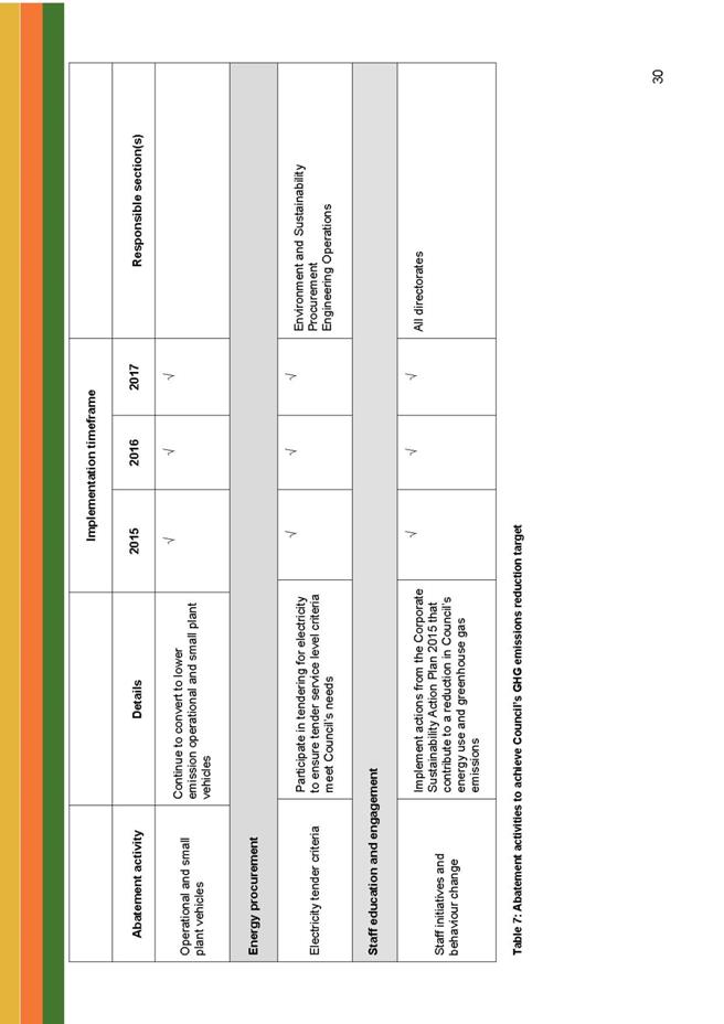
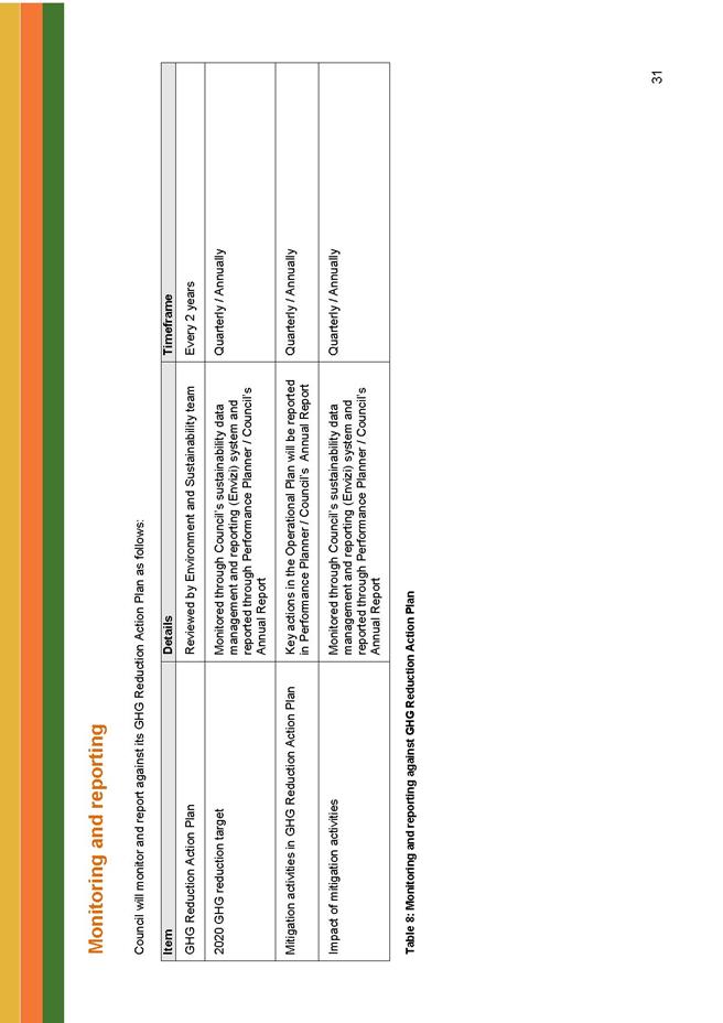
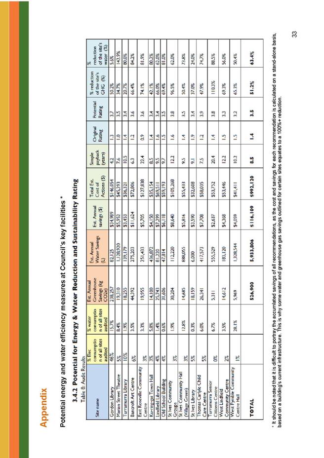
|
Ordinary
Meeting of Council - 8 September 2015
|
GB.3 / 298
|
|
|
|
|
Item
GB.3
|
S09625
|
|
|
30 July 2015
|
Gordon Golf Course Masterplan
Communications and Consultation Outcomes
EXECUTIVE
SUMMARY
|
purpose of report:
|
To report the outcomes of the Communications and
Consultation Program undertaken in relation to the Regional Park Masterplan
for Gordon Golf Course and provide a preferred concept for the Gordon Golf
Course Masterplan.
|
|
|
|
|
background:
|
Council adopted a Communications and Consultation
Program on 29 July 2014. The program was implemented from August 2014 and
concluded in June 2015.
|
|
|
|
|
comments:
|
Council undertook a detailed consultation program with
the local and broader community. A draft concept for the Masterplan for the
Gordon Golf Course has been developed based on the outcomes of the
consultation with the community.
|
|
|
|
|
recommendation:
|
That Council receive and note the consultation report
for the Gordon Golf Course Masterplan and that Council adopt the preferred
concept for the Masterplan consisting of part golf course, recreational area,
facilities and small scale residential.
|
Purpose of Report
To report the outcomes of the Communications and
Consultation Program undertaken in relation to the Regional Park Masterplan for
Gordon Golf Course and provide a preferred concept for the Gordon Golf Course
Masterplan.
Background
Council moved a Notice of Motion at the OMC of 30 May 2014
to prepare a Communications and Consultation Strategy to set out how all
stakeholders will be engaged and contribute to the Master Planning for a
Regional Park and Recreation Space at the Gordon Golf Course.
Council adopted the Communications and Consultation Strategy
for Gordon Golf Course Master Planning Project on 29 July 2014. The program was
implemented from August 2014 and concluded in June 2015.
Objectives of the Communications and Consultation
Strategy
The following objectives for the communications and
engagement of residents and stakeholders were met:
· Engage residents and stakeholders
upfront and at an early stage to identify and articulate a vision and set of
values for a Regional Park
· Establish a high degree of
understanding and awareness of the master planning process across all
stakeholder groups
· Tap into local knowledge and expertise
on Gordon Golf Course
· Build upon existing community needs and
aspirations from recent consultation
· Define community priorities for open
space and sporting facilities
· Comprehensively involve our residents
and other stakeholders in the decision making process for the Masterplan
· Meet the requirements under the
Community Strategic Plan for engaging and involving the community
Underpinning our engagement strategy with best practice
principles
The engagement approach was robust and transparent. It
ensured all community stakeholders had an opportunity for comment and input.
Our approach was underpinned by two key principles:
1. NSW Social Justice Principles
2. International Association of Public Participation
(IAP2) spectrum
The NSW Social Justice Principles of inclusion and
democratic representation are:
· Equity – There is fairness in
decision making and prioritising and allocation of resources.
· Access – All people have fair
access to services, resources and opportunities to meet their basic needs and
improve their quality of life.
· Participation – Everyone has the
maximum opportunity to genuinely participate in decisions which affect their
lives.
· Rights – Everyone’s rights are
recognised and promoted.
The International Association of Public Participation (IAP2)
spectrum illustrates:
· Inform- We will keep you
informed.
· Consult- We will keep you
informed, listen to and acknowledge concerns and provide feedback on how public
input influenced the decision.
· Involve - We will work with you
to ensure that your concerns and aspirations are directly reflected in the
alternatives developed and provide feedback on how public input influenced the
decision.
· Collaborate - We will look to
you for direct advice and innovation in formulating solutions and incorporate
your advice and recommendations into the decisions to the maximum extent
possible.
Comments
Gordon Golf Communication and Engagement Strategy
Overview
Council resolved to engage and inform the community
regarding the decision to transform Gordon Golf Course into a regional park.
The first part of the communications and engagement strategy
was undertaken between August and mid November 2014.
Communications methods included:
· letters to 2655
residents/property owners in the vicinity of the golf course
· Five articles in the Ku-ring-gai
Council e-news (with approx. 7,000 subscribers)
· Two Gordon Golf Course Masterplan
e-newsletters (with 472 subscribers)
· Use of social media (Facebook and
Twitter)
· Advertisements in Council’s corporate
advertisement in the North Shore and mentions in the Mayoral Minute
· Media releases
· Dedicated project page on Council’s
website
· Online video about the project
including information about the Masterplan project and ‘vox pops’ capturing
community aspirations for a new park – the video has been viewed 585
times
Consultation methods included:
· New regional park and recreation space
on the Gordon Golf Course page on Council’s EngagmentHQ site
(‘Haveyoursaykuringai page’)
Over the entire length of the project the page received 4050
visits with peak daily traffic of 322 visits. In 2014, October was the
busiest month with 1986 page views and 698 visitors.
Two online discussion forums were set up and included:
a. What
are uses and activities that would make a great regional park and recreation
space?
121 people
visited the forum and 12 people contributed
b. What
are the issues, challenges and constraints that might impact a regional park
and recreation space on Gordon Golf Course?
114 people
visited the forum and 13 people contributed
• Community visioning workshops
Two community visioning workshops (held on 27 October and 3
November 2014) were designed to start a conversation about the new regional
park, identify issues and challenges, and explore future opportunities. The
workshops were facilitated by Council staff.
The workshops ran for 90 minutes and were attended by 108
community members including residents, golfers, community leaders, and
sporting representatives. Workshop participants were asked to discuss the
factors that needed to be considered as part of the master plan, and ideas and
visions for the new regional park and recreation space.
Key outputs of the engagement 2014
This engagement consisted of feedback from
predominantly motivated communities (opt in, self-selected) - participants
consisted of affected stakeholders and interested community members e.g.
neighbours, golfers, club members etc. This feedback indicated a strong desire
to keep the golf course as is.
The online forum and community visioning workshops
identified a number of issues and concerns:
· scepticism about the economic benefits
or need for a new regional park
· concerns about the impact of traffic
congestion, parking and access for local residents
· commercialisation of the space – ‘no
cafes, no shops, no markets’
· impact on the environment
· people from outside the area using the
park and potential anti-social behaviour.
The aspirations of those workshop participants who chose to
give their suggestions for a new park were as follows:
· a range of sporting fields including
soccer, football, athletics
· a driving range and 12 hole golf course
· picnic, barbecue and families amenities
· outdoor fitness equipment
· green space with multiple walking and
bike tracks
· performance space for drama and
open-air cinema.
It should be noted that those opposed to the regional park
chose not to be part of this part of this exercise in the workshop or made a
point of saying that the golf course was all that they wanted.
The Communications and Engagement Strategy was extended into
2015 and a specialist consultant, StraightTalk, was engaged to provide
independent facilitation and analysis. StraightTalk’s report is provided as (Attachment
A1)
As with the previous communication and engagement, the focus
was to provide multiple avenues for comment and input from the whole community.
Communications methods included:
· Article in the Ku-ring-gai Council
e-news (with approx. 7,000 subscribers)
· Five Gordon Golf Course Masterplan
E-newsletter (with 472 subscibers)
· Use of social Media (Facebook and
Twitter)
· Ongoing use of dedicated project page
on Council’s website and online video
· Advertisements in Council’s Corporate
advertisement in the North Shore Times (4 in total over the entire consultation
program)
· Media Releases (4) over the entire
consultation program
Consultation methods included:
· ‘Haveyoursaykuringai page’ - over the
two phase the project page received 4050 visits with peak daily traffic of 322
visits. In 2015 April was the busiest month with 3036 page views and 1088
visitors.
· Online survey (hosted on the
‘Haveyoursaykuringai’ page) - 11 March to 25 April 2015 - 102 participants
· Random telephone survey (undertaken by
independent market research consultancy) March 2015 - 403 participants
· Face to face meeting with Gordon Golf
Club - 7 April 2015
· Opt in stakeholder workshop - Took
place on 14 May. 48 people attended – attendees were generally in line with
those who attended visioning workshops in late 2014 (i.e. residents, golfers,
community leaders and sporting representatives)
· Randomly recruited community workshop
-27 attendees selected during the random telephone survey by market research
consultancy
Online discussion forums - via the ‘haveyoursaykuringgai’
site were held focussing on the following themes:
· Recreational facilities in Ku-ring-gai
· Benefits of a Regional Park
· Issues and constraints in developing
regional park
· Funding the regional park
Key outputs of 2015 engagement
The engagement can be broadly split into two groups
1) Feedback
received from motivated communities (opt in, self-selected). Participants
consisted of affected stakeholders and interested community members e.g.
neighbours, golfers, club members etc.
Engagement methods employed
included:
• Online survey (hosted on
the ‘Haveyoursaykuringai’ page)
• Face to face meeting with
Gordon Golf Club
• Opt in stakeholder
workshop
• Online discussion forums
2) Feedback
received from the broader community (randomly recruited). Those who may not
be directly affected or have a direct interest.
Engagement methods employed
included:
• Random telephone survey
undertaken by market research consultancy
• Randomly
recruited community workshop (broadly reflecting demographic makeup of
Ku-ring-gai)
• Attendees
selected during the random telephone survey by market research consultancy.
Engagement outputs
1.Motivated communities
Feedback received from the motivated communities (opt in,
self-selected) - golf course users, club members and residents living,
adjoining, or near the golf course etc., - indicated concern about the proposed
changes to the Golf Course and a level of cynicism about the process and
motivations behind it.
Overall, the motivated communities were strongly in favour
of retaining the golf course as is and suggested that rather than selling the
golf course, Council should look at how it could be managed to be more
profitable. There was little support for a regional park. When discussing a
regional park or any redevelopment of the site, concerns mirrored those in
previous consultation.
Participants indicated:
· opposition to increased activation of
the area and associated traffic, noise etc
· concern regarding loss of access to
passive green space
· opposition to the sale of public land
and concern that developing the site will be needed to fund any new facilities
and this in turn will lead to more traffic and people
Where the motivated communities did engage with the concept
of a regional park they thought a park should contain:
· open space and walking facilities
· cycling tracks
· areas for barbecues and picnics
· children's playgrounds
· sports facilities
· other highlighted issues were a lack of
both indoor sporting facilities and sports grounds in the area.
2. Broader community
In order to understand the thoughts and motivations of the
wider community, a telephone survey was commissioned and 403 residents were
contacted by an independent market research company Jetty Research.
The representative survey covered a number of topics as it
sought to understand community opinion on leisure activities in Ku-ring-gai
including Marian St Theatre and Gordon Golf Course. The following graph
indicates the type of leisure activity undertaken in the last 6 months.
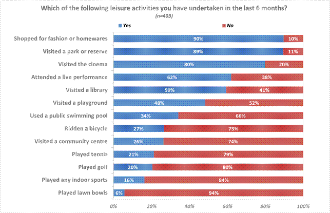
Over 60% of the community indicated satisfaction with the
leisure activities currently available within the LGA.
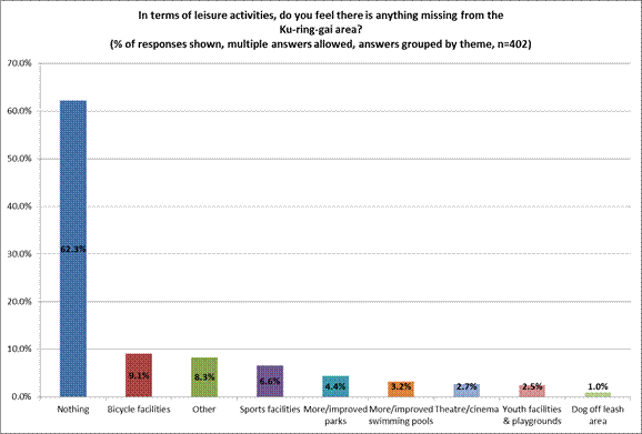
When asked about playing golf and Gordon Golf Course, the
following statistics are relevant.
The majority of respondents had not played golf in the last
3 or so years (70%). Some had played golf in the last 6 months (20%) whilst a
smaller number played less recently, within only the last 3 years (10%).
· A large majority of respondents (91%)
had heard of Gordon Golf Course.
· Only 2% of respondents were members of
the Gordon Golf Course.
· 10% of respondents had played golf at
the Gordon Golf Course in the previous 12 months.
The randomly recruited workshop was more attuned to the
diversity of the community and the needs of people with disabilities, children
and young people, older people and young adults. When identifying
opportunities for leisure/recreational facilities they indicated:
· a preference for more active recreation
facilities in the area including:
· quality bike tracks (for range of ages
and activities)
· accessible walking tracks (for a range
of abilities including people with disabilities and elderly)
· new multipurpose indoor sports
facilities (which are currently lacking in Ku-ring-gai)
· additional skate park facilities
· additional dog off-leash areas
· new and upgraded playground for all
abilities (including those with disabilities.
· a need for additional cultural
recreational space including facilities for live entertainment (outdoor and
indoor) and leasable indoor community facilities for art and cultural
activities.
· concern about funding options in terms
of equity (a rate rise would be funded by everyone, even those who don't use
the park); special levy (will it be used for what it is intended for; will it
be well used) and user pays (restricts who could access and use facilities).
As a consequence of the Master Planning consultation, there
were a number of issues raised by the community and the golf club.
The Gordon Golf Club has expressed concern about the
establishment of the whole area as a regional park and with the current lease
to 2018 with an option to extend to 2023, Council would need to negotiate a
change in the lease or wait until 2023 for the course to be turned into a
regional park.
The community also expressed concern about the loss of the
golf course and funding for any new facilities proposed for the site.
Further email submissions were received following a call out
by Basketball NSW that advocated for an indoor sports centre at the Gordon Golf
Club site -16 in total.
Proposed Masterplan Concept
In order to accommodate the concerns of the Golf Club and
the community, it is considered that a suitable option for the Masterplan for
the Gordon Golf course would be to provide a reduced playing area for golf and
establish part of the area as a park. To help fund these facilities, it is
proposed to have part of the land set aside for 30 lot small scale residential
development similar to that shown on the attached draft concept
Masterplan. (Attachment A2).
Funding from the residential development could also be
utilised for the construction of a new club house at North Turramurra. This
would allow for the Gordon Golf Club members to use both facilities and play at
both courses under their membership entitlements.
A confidential attachment (Attachment 3) proposes
options for the Masterplan that take into account the future expenditure and
revenue for the various options. The information is considered to be
confidential as it contains commercial in confidence information relating to
leases and licences and also possible revenue from property sales.
Council currently has a budget deficit of approximately
$700,000 per annum for both Gordon and North Turramurra golf courses and with
the continued trend of golf declining and loss of revenue, this is likely to
increase in the future. Also, with the increased residential development around
the Gordon town centre, there is a need for additional open space.
In the Ku-ring-gai Council area there are currently six (6)
golf courses, and with the decline in golf, the private clubs are lowering
their fees and to attract new members. This places additional competition on
Council owned courses.
integrated planning and reporting
Leadership
|
Community Strategic Plan Long Term Objective
|
Delivery Program
Term Achievement
|
Operational Plan
Task
|
|
L4.1 The community is informed and engaged in
decision-making processes for community outcomes
|
Community engagement utilises effective and varied
communication channels to reach all sections of the community.
|
Revise Engagement Policy and ensure promotion and
education throughout the organisation.
|
|
|
Contribute to enhancing and protecting Council’s
reputation and public image
|
|
Governance Matters
The development and subsequent delivery of the
Communications and Engagement Strategy adheres to the guidelines and principles
of Ku-ring-gai Council’s Consultation Policy, the International Association of
Public Participation (IAP2) and NSW Social Justice Principles.
Risk Management
The outcomes of the Communications and Consultation Strategy
will ensure a Masterplan for Gordon Golf Course is guided by the vision and
values of the community. The failure to deliver on this strategy may have
negative reputational risk for Council and deliver Masterplan outcomes not
endorsed by stakeholders.
Financial Considerations
Council is currently subsidising golf at approximately
$700,000 per annum and this is likely to increase in the future as the trend in
golf continues to decline. The current contractors are experiencing
difficulties with lease fee payments to Council and seeking financial relief.
Council has had to reduce green fees in order to attract
more players. The competition from other nearby courses places additional
pressure on Council’s finances.
The cost of maintaining a park and facilities would be less
than a golf course, and would enable a greater number of people in the
community to benefit from the proposed facilities.
Social Considerations
The Communications and Engagement Strategy reached a broad
section of the Ku-ring-gai community. Council ensured the engagement program
was inclusive, transparent and equitable to all in the community. These
considerations have been factored into the outcomes.
Environmental Considerations
There are no environmental considerations to be addressed in
the outcomes of the Communications and Engagement Strategy. However, a number
of environmental issues were highlighted throughout the engagement with
community, regarding any change to the use of Gordon Golf Course.
Community Consultation
The Communications and Engagement Strategy undertook an
extensive program of informing and engaging residents and stakeholders in the
planning and design of the master plan for Gordon Golf Course.
The strategy :
· engaged residents and stakeholders
upfront and at an early stage to identify and articulate a vision and set of
values for a Regional Park
· establish a high degree of
understanding and awareness of the master planning process across all
stakeholder groups
· comprehensively involved our residents
and other stakeholders in the decision making process for the Masterplan
What was undertaken:
Extensive, multi-channel communications program was
implemented to inform residents and stakeholders on the master planning
process.
A multi-model engagement process consulting with all
stakeholders incorporating the following engagement activities:
· 4 workshops -3 opt in and 1 randomly
recruited
· 400 randomly selected telephone survey
of Ku-ring-gai residents
· Have your say survey on Council’s
website
· Meetings with Gordon Golf course
management and Board
Internal Consultation
Consultation was undertaken with the staff from Operations,
Strategy & Environment, and Corporate departments in the writing of this
report.
Summary
In May 2014 Council resolved to prepare a Communications and
Consultation Strategy to engage the community in the master planning for a
regional park and recreation space at the Gordon Golf Course, and in July 2014
Council adopted the Communications and Consultation Strategy for Gordon Golf
Course Master Planning Project.
The program was implemented from August 2014 and concluded
in June 2015. During this time Council undertook a detailed consultation
program with the local and broader community.
A draft concept for the Masterplan for the Gordon Golf
Course has been developed based on the outcomes of the consultation with the
community.
The Gordon Golf Club has expressed concern about the
establishment of the entire area as a regional park, and with the current lease
to 2018 with an option to extend to 2023, Council would need to negotiate a
change in the lease or wait until 2023 for the course to be turned into a
regional park. Some members of the community also expressed concern about the
loss of the golf course and funding for any new facilities proposed for the
site.
In order to accommodate the concerns of the Golf Club and
address community concerns, it is considered that a suitable option for the
Masterplan for the Gordon Golf course would be to provide a reduced playing
area for golf and establish part of the area as a park. To help fund these
facilities, it is proposed to have part of the land set aside for small scale
residential development similar to that shown on the attached draft
concept Masterplan.
Funding from the residential development could also be
utilised for the construction of a new club house at North Turramurra. This
would allow for the Gordon Golf Club members to use both facilities under their
membership entitlements.
This report is recommending that Council receive and note
the results of the communications and engagement strategy and that the outcomes
from the strategy be incorporated into the master planning process for the
Gordon Golf Course.
|
Recommendation:
A. That
Council receive and note the outcomes of the communications and engagement
strategy.
B. That
the draft Masterplan concept for the Gordon Golf Course provide for the
following items:
1. Retention
of a minimum of 9 holes on the existing golf course.
2. That an
area of approximately 9 hectares be provided for recreational facilities as
shown on the attached concept plan
3. That the
proposed recreational facilities include: an indoor sports centre; a sports
field incorporating athletics track and field facilities; a bike path; a dog
off-leash area; a children’s play area; an outdoor exercise area and general
parkland.
4. That funding for the above facilities be
provided by the provision of approximately 30 single residential lots of
approximately 650 square metres per lot or town houses on an area similar to
that shown on the attached concept plan.
|
|
Virginia Leafe
Manager Corporate Communications
|
Janice Bevan
Director Community
|
|
Greg Piconi
Director Operations
|
|
|
Attachments:
|
A1View
|
Gordon
Golf Course consultation report August 2015
|
|
2015/230711
|
|
|
A2View
|
Gordon
Golf Course - Preferred masterplan option
|
|
2015/217631
|
|
|
A3
|
Gordon
Golf Course - Masterplan options
|
|
Confidential
|
|
APPENDIX
No: 1 - Gordon
Golf Course consultation report August 2015
|
|
Item No: GB.3
|
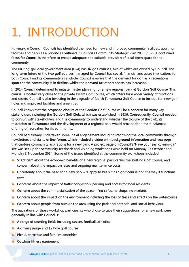

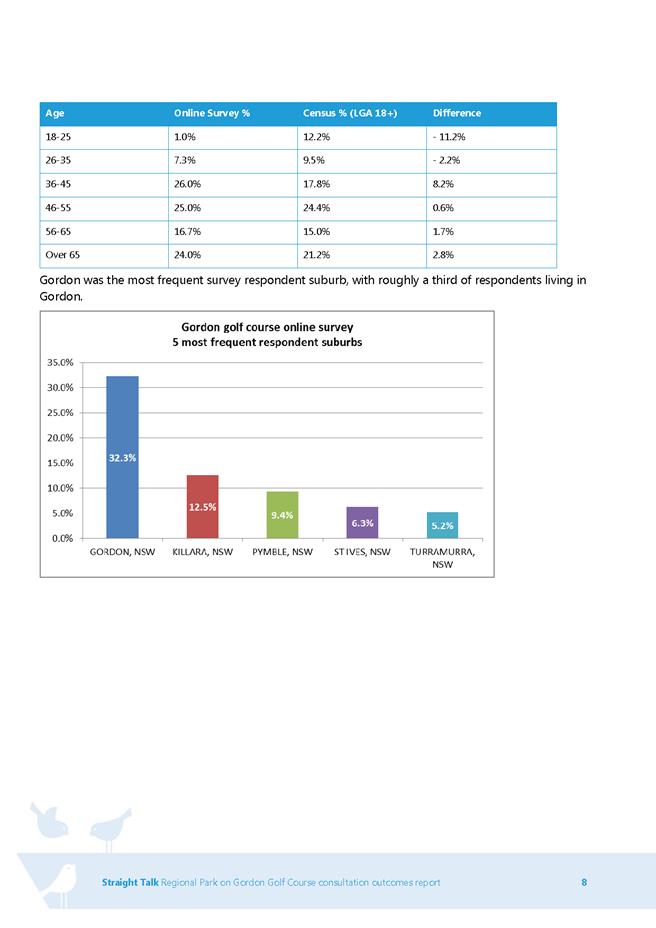
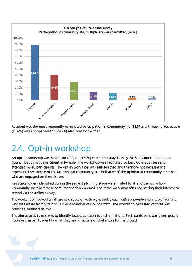
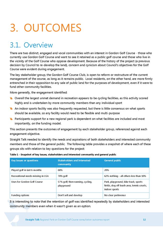
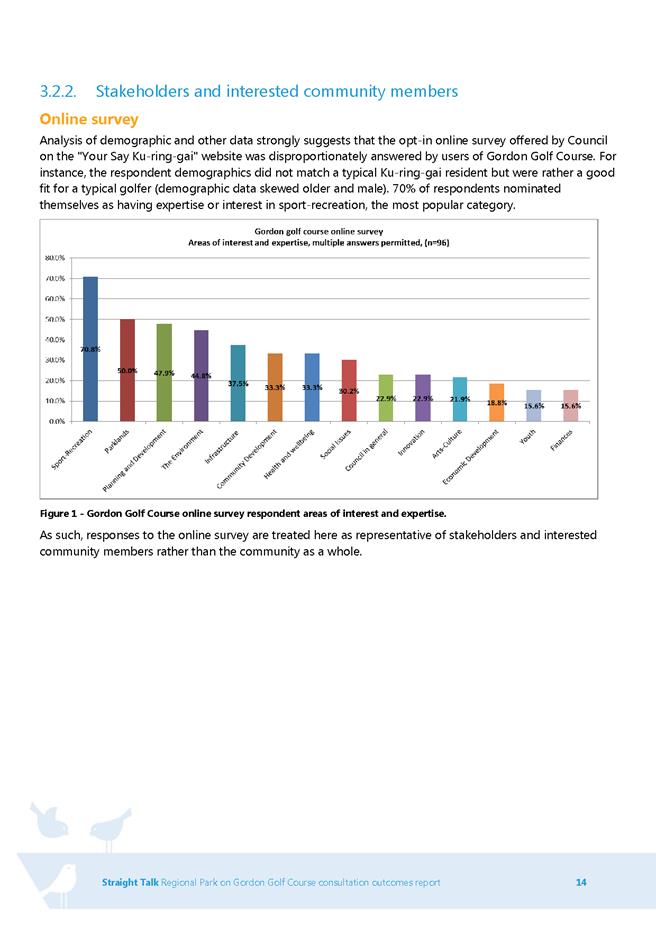
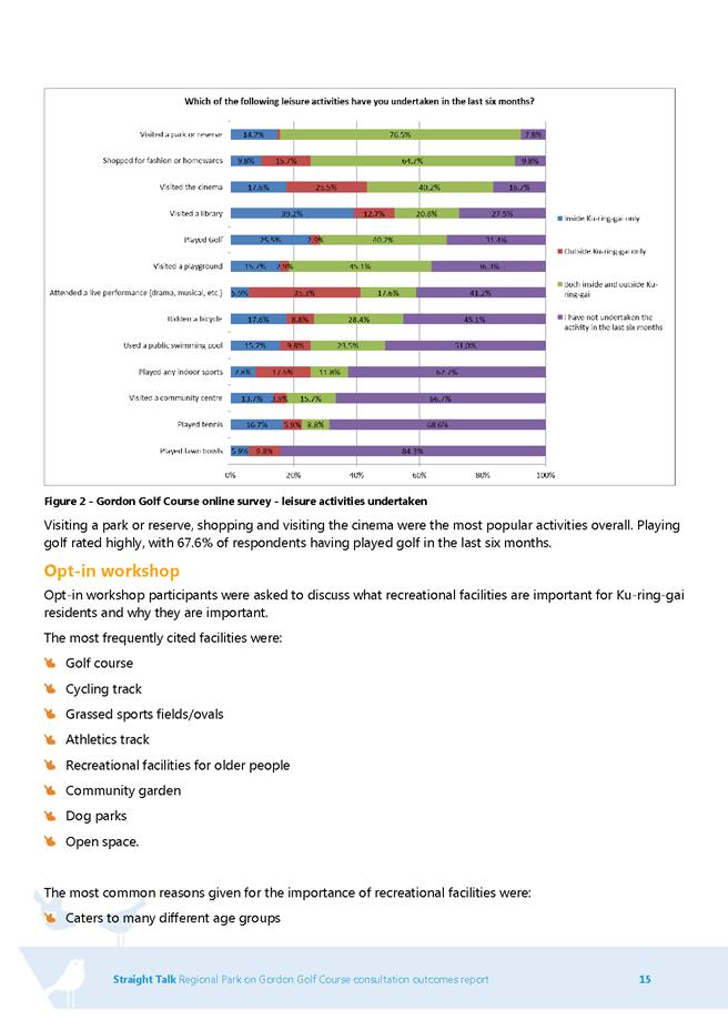
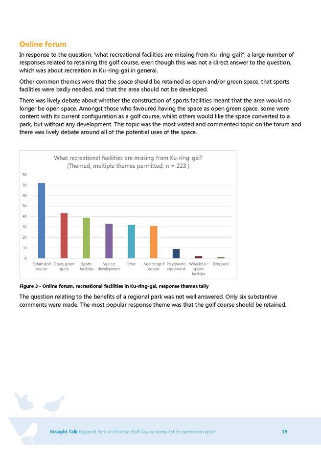
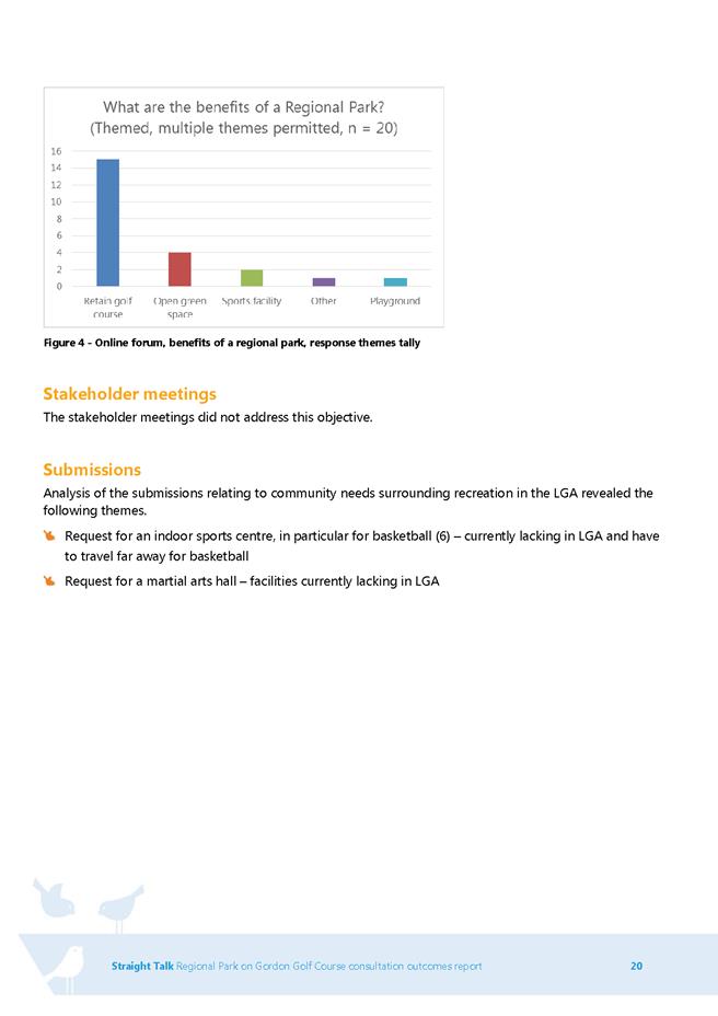
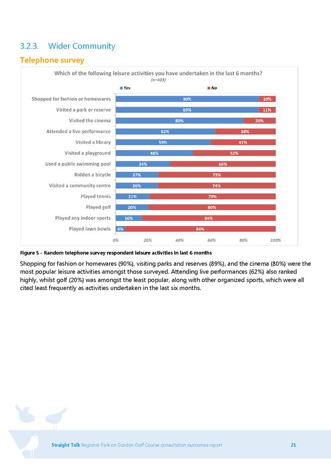
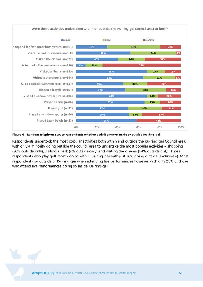
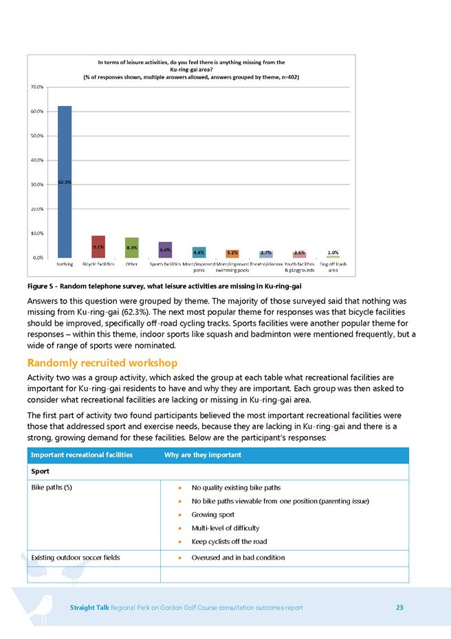
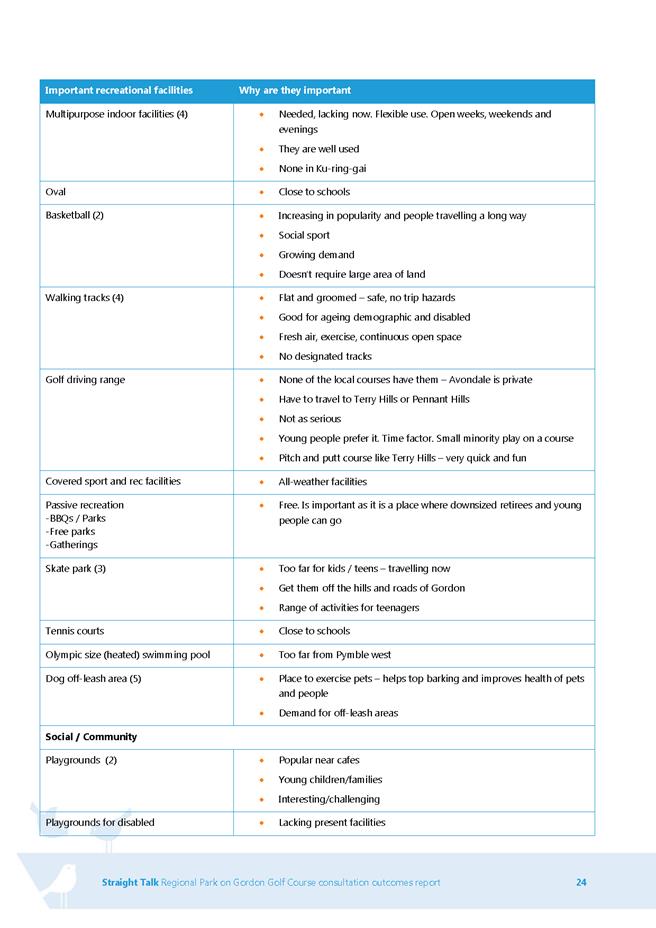
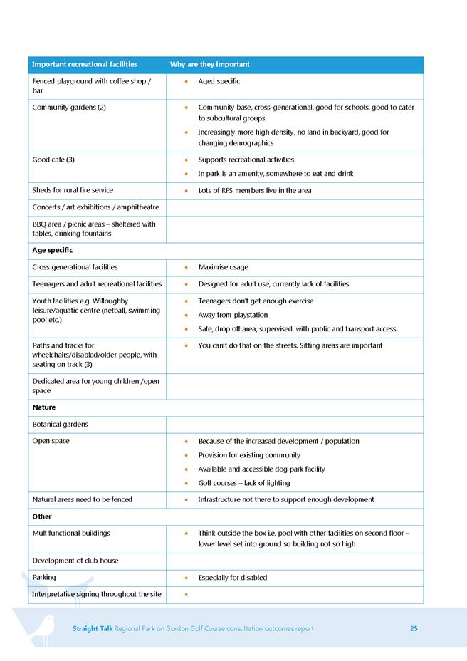
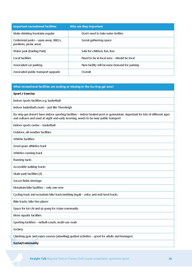
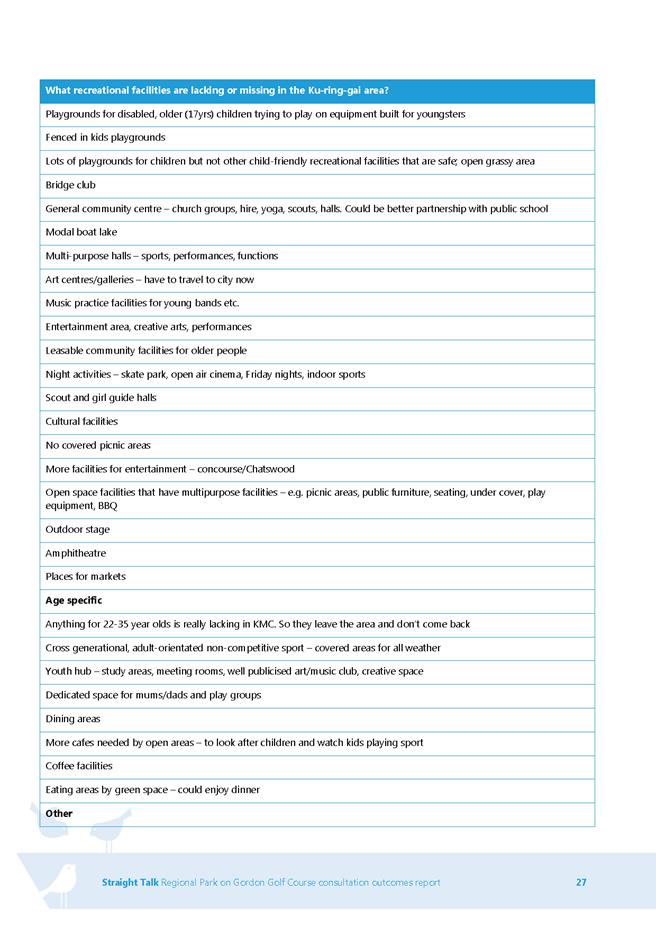
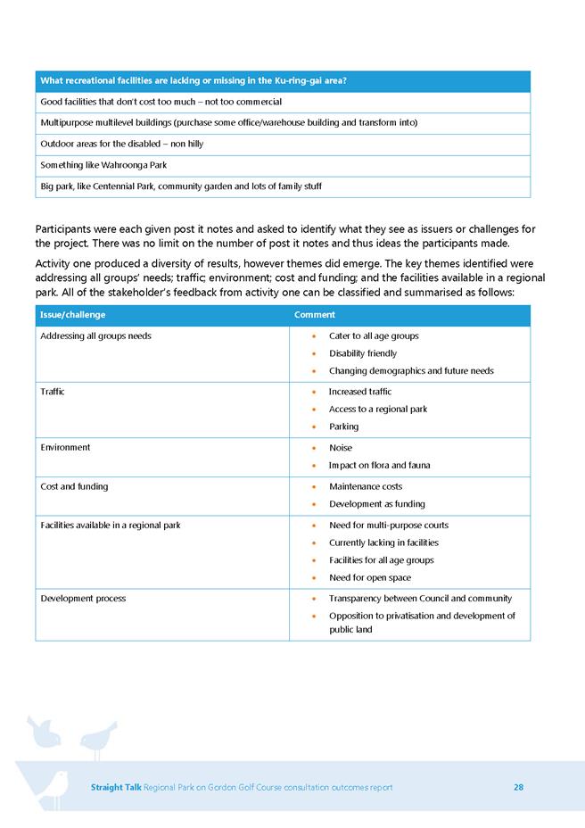
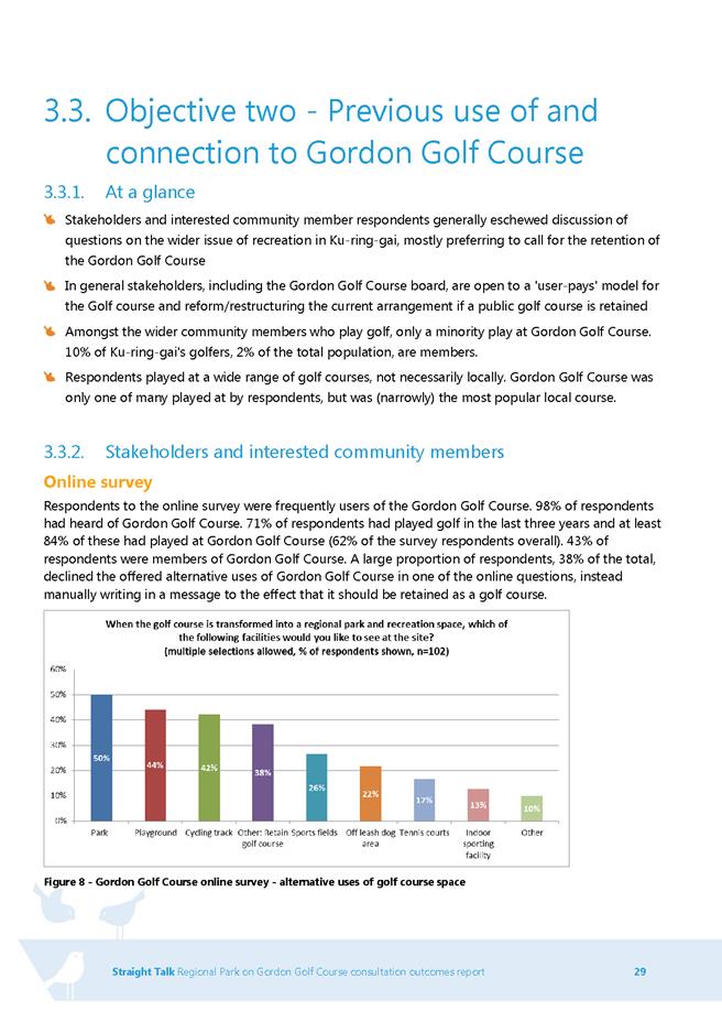
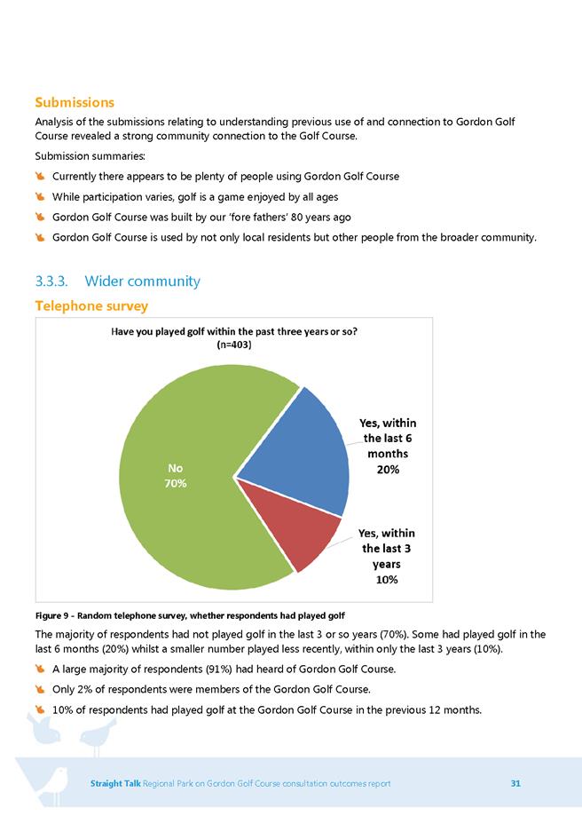
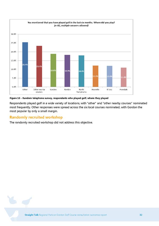
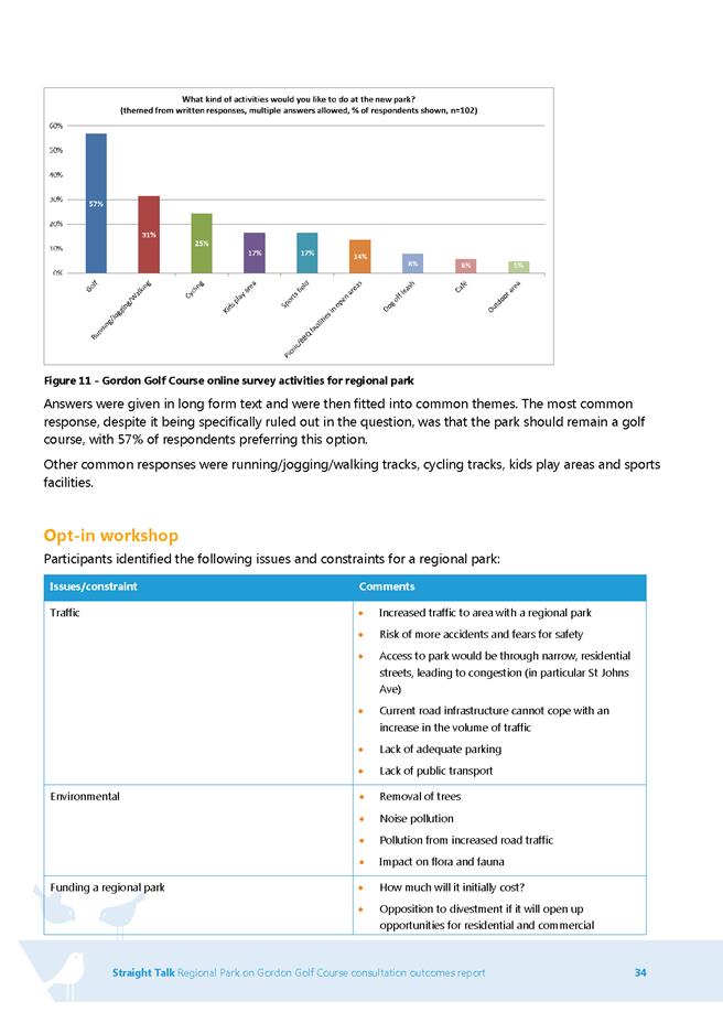
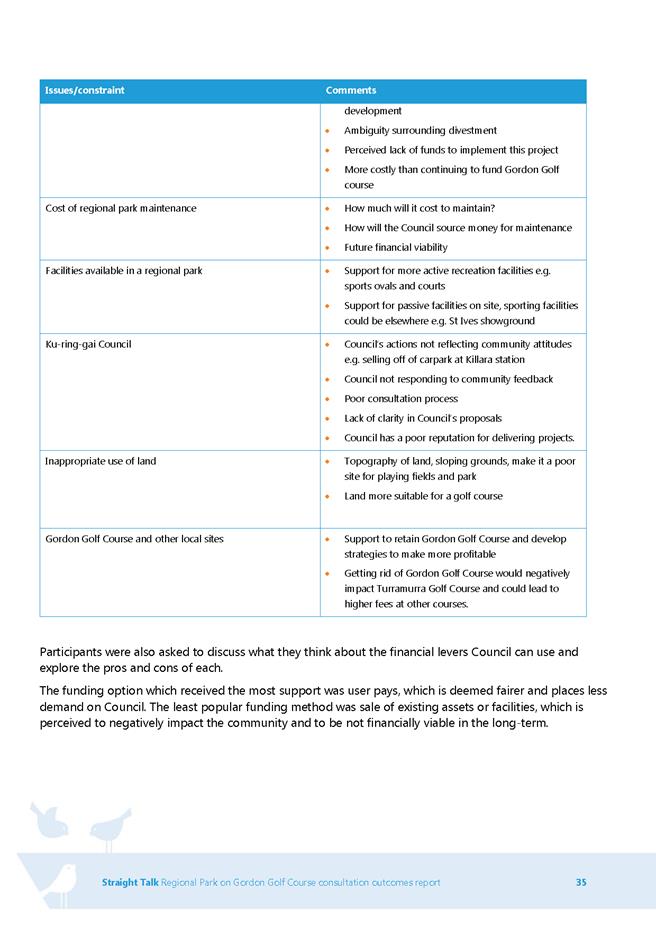
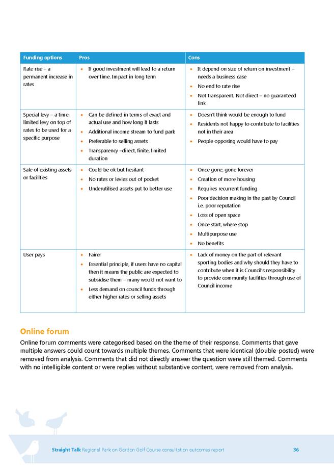
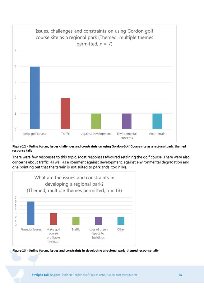
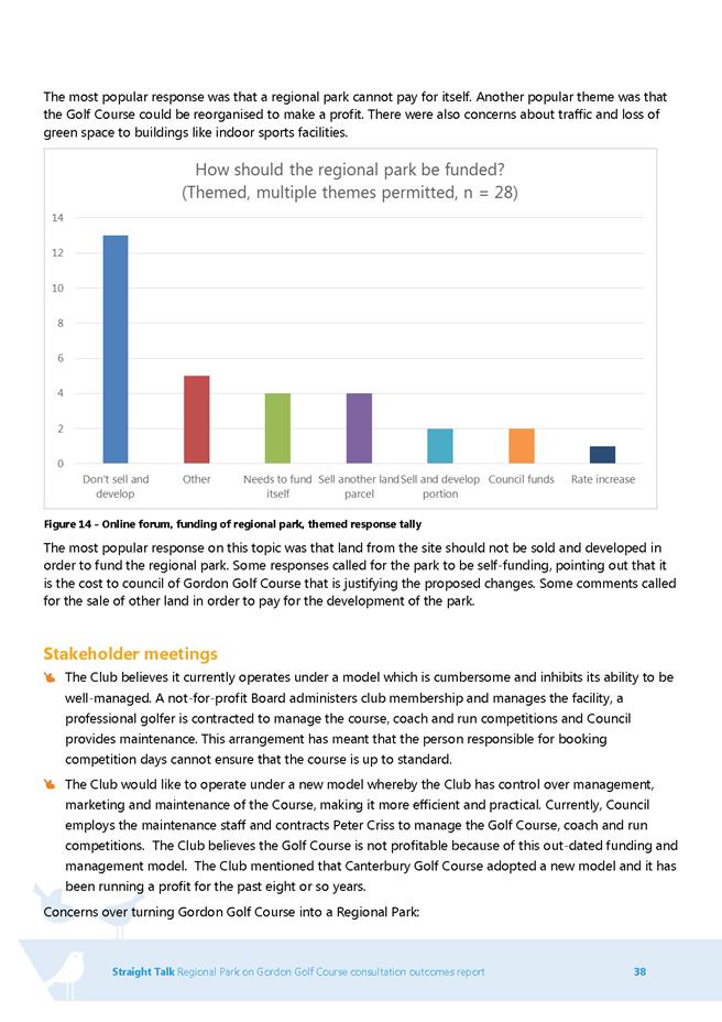
|
APPENDIX No: 2 - Gordon
Golf Course - Preferred masterplan option
|
|
Item No: GB.3
|
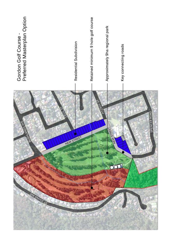
|
Ordinary
Meeting of Council - 8 September 2015
|
GB.4 / 351
|
|
|
|
|
Item
GB.4
|
S07458
|
|
|
2 August 2015
|
Gordon Community Preschool - 2A Park
Avenue Gordon - Renewal of Lease
EXECUTIVE
SUMMARY
|
purpose of report:
|
For Council to consider the granting of a 5 year lease
to Gordon Community Preschool (GCP) for continued occupation at 2A Park
Avenue, Gordon.
|
|
|
|
|
background:
|
Gordon Community Preschool is a non-profit community based
preschool operated by a parent Board of Management. The current lease expires
on 31 January 2016.
|
|
|
|
|
comments:
|
GCP has complied with the terms and conditions of the
current lease and has requested a renewal of their lease with Council for a
further term.
|
|
|
|
|
recommendation:
|
That Council grant a new 5 year lease to Gordon
Community Preschool from1 February 2016 to 31 January 2021.
|
Purpose of Report
For Council to consider the granting of a 5 year lease to
Gordon Community Preschool (GCP) for continued occupation at 2A Park Avenue,
Gordon.
Background
Gordon Community Preschool is a non-profit community based
preschool operated by a parent Board of Management. The term of the current
lease expires on 31 January 2016.
Comments
Council staff have been in communication with GCP during
2015 and the preschool is keen to have certainty to enable it to offer ongoing
children’s services for the next 5 years. The granting of the 5 year lease will
allow the preschool certainty to continue operations and take enrolments from
2016 to 2020.
GCP has complied with the terms and conditions of the
previous lease and has requested a renewal of their lease with Council for a
further term.
integrated planning and reporting
|
Community Strategic Plan Long Term Objective
|
Delivery Program
Term Achievement
|
Operational Plan
Task
|
|
C1.1 An equitable and inclusive community that cares and
provides for its members.
|
C1.1.1
Council’s policies, programs and advocacy address the
social and health needs of all age groups, reduce disadvantage and address
gaps in service provision.
C1.1.2
Access has increased for
communities that face barriers to using social services
and facilities
|
Deliver quality children services to meet the needs of
local families, including immunisation, vacation care, long day care and
family day care.
Develop and implement programs that respond to community
needs and
address a range of accessibility issues and alleviates
social isolation.
|
Governance Matters
The property located at 2A Park Avenue Gordon is described
as Lot 12 DP852087 (Attachment A1). It is zoned R4 High Density
Residential and is covered by Ku-ring-gai Local Environment Plan (Local
Centres) 2012.
A public notification period of 28 days of the proposed
lease is required under section 47 of the NSW Local Government Act.
The proposed lease complies with Council’s Policy for
Management of Community and Recreation Land and Facilities.
Risk Management
GCP is to procure $20 million Public Liability insurance.
The preschool is to fully indemnify Council against personal and property
damage on the premises. Evidence of currency is to be supplied annually to
Council.
GCP has during the period of its occupation, met its
responsibilities as a lessee and has complied with the conditions of the
current lease.
Financial Considerations
The current rent payable by GCP is $16,534pa (incl. GST).
This includes a 90% rental rebate.
GCP has agreed to pay increased rental for the first year of
the term of $17,360pa, after rebate, with successive 5% yearly increase.
GCP has also agreed to the new rentals and term under a
Heads of Agreement. (Attachment A2).
The projected rentals over the 5 year period are:
$17,360 – Year 1
$18,228 – Year 2
$19,140 – Year 3
$20,097 – Year 4
$21,102 – Year 5
In accordance with Council’s Policy for Management of
Community and Recreation Land and Facilities, GCP is obliged to pay Council’s
legal costs, estimated at $1,500 plus GST and the one off $575 administration
fee to Council, for administrative costs incurred associated with the
preparation of the lease.
Social Considerations
GCP is a community based preschool providing care and
education for children aged 3-5 years. Children attend the preschool for either
2 or 3 three days per week between the hours of 9.00am - 3.00pm.
With security of tenure for another 5 years, the preschool
will be able to continue its occupation of this current site on Council’s land
with no disruption to the current service.
Environmental Considerations
There are no environmental considerations associated with
the granting of a new lease at this location.
Community Consultation
No consultation is required for the process prior to this
Council report. Once Council resolves to grant the proposed lease, 28 days
public notification of Council’s intention to grant the lease of the premises
will occur in accordance with s 47 (1) a of the Local Government Act 1993.
Internal Consultation
Consultation has taken place between Council’s Community,
Operations, and Strategy and Environment departments in the writing of this
report.
Summary
Gordon Community Preschool has requested a new 5 year lease
for the premises at 2A Park Avenue Gordon, until January 2021.
GPS provides care and education for children aged 3-5 years.
Children attend the preschool for either 2 or 3 three days per week between the
hours of 9.00am - 3.00pm.
The renewal of this lease will ensure that the preschool
services will continue at the GCP for the next 5 years.
|
Recommendation:
A. That
Council grant a new lease to Gordon Community Preschool for a period of 5
years.
B. That
the lease commence from 1 February 2016 and expire on 31 January 2021.
C. That the Mayor and General
Manager or their delegate be authorised to execute the necessary
documentation.
D. That Council authorise the
affixing of the Common Seal of Council to the Lease Agreement.
|
|
|
|
Michael New
Property Officer Recreational Facilties
|
Mark Taylor
Manager Community & Recreation Services
|
|
Janice Bevan
Director Community
|
|
|
Attachments:
|
A1View
|
Gordon
Preschool - Aerial Map 2015
|
|
2015/199947
|
|
|
A2View
|
Signed
Returned Heads of Agreement - Gordon Preschool
|
|
2015/194150
|
|
APPENDIX
No: 1 - Gordon
Preschool - Aerial Map 2015
|
|
Item No: GB.4
|
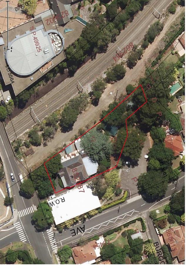
|
APPENDIX No: 2 - Signed
Returned Heads of Agreement - Gordon Preschool
|
|
Item No: GB.4
|
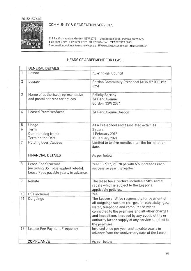
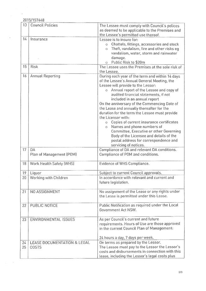
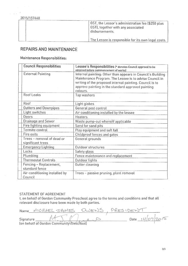
|
Ordinary
Meeting of Council - 8 September 2015
|
GB.5 / 359
|
|
|
|
|
Item
GB.5
|
S07471
|
|
|
2 August 2015
|
Lifeline Harbour to Hawkesbury Inc - 4
Park Avenue Gordon - Renewal of Licence
EXECUTIVE
SUMMARY
|
purpose of report:
|
For Council to consider the granting of a 5 year
licence to Lifeline Harbour to Hawkesbury Inc (Lifeline) for continued
occupation at 4 Park Avenue, Gordon.
|
|
|
|
|
background:
|
Lifeline has been operating at the Gordon location
since 1991. It is a not-for-profit organisation and operates a 24-hour
telephone counselling service and face to face counselling.
|
|
|
|
|
comments:
|
Lifeline has complied with the terms and conditions of
the previous licence and has requested a renewal of their licence with
Council for a further term.
|
|
|
|
|
recommendation:
|
That Council grants a new 5 year licence to Lifeline
Harbour to Hawkesbury Inc from1 February 2016 to 31 January 2021.
|
Purpose of Report
For Council to consider the granting of a 5 year licence to
Lifeline Harbour to Hawkesbury Inc (Lifeline) for continued occupation at 4
Park Avenue, Gordon.
Background
Lifeline Harbour to Hawkesbury Inc (Lifeline) has been
operating for over 24 years at the current location in Gordon. It is a
not-for-profit community based organisation operating a 24-hour telephone
counselling service and face to face counselling.
The term of the current licence expires on 31 January 2016.
Comments
Lifeline has complied with the terms and conditions of the
previous licence and has requested a renewal of the licence with Council for a
further term.
Lifeline is keen to have certainty to enable it to offer
counselling services for the next 5 years. The granting of a 5 year licence
will allow Lifeline certainty to continue its operations from 2016 through to
2020.
integrated planning and reporting
Community People and Culture.
|
Community Strategic Plan Long Term Objective
|
Delivery Program
Term Achievement
|
Operational Plan
Task
|
|
C1.1 An equitable and inclusive community that cares and
provides for its members.
|
C1.1.1
Council’s policies, programs and advocacy address the
social and health needs of all age groups, reduce disadvantage and address
gaps in service provision.
C1.1.2
Access has increased for
communities that face barriers to using social services
and facilities
C3.1.2
Volunteers are valued,
recognised and supported in providing services to the
community.
|
Deliver quality children services to meet the needs of
local families, including immunisation, vacation care, long day care and
family day care.
Develop and implement programs that respond to community
needs and
address a range of accessibility issues and alleviates
social isolation.
Facilitate new opportunities for volunteering by the
community to achieve community goals.
Provide up to date demographic profile of the community.
|
Governance Matters
The property located at 4 Park Avenue, Gordon is described
as Lot 11 DP852087 (Attachment A1).
A public notification period of 28 days of the proposed
lease is required under section 47 of the NSW Local Government Act. It is zoned
R4 High Density Residential and is covered by Ku-ring-gai Local Environment
Plan Local Centres) 2012.
The proposed lease complies with Council’s Policy for
Management of Community and Recreation Land and Facilities.
Risk Management
Lifeline is to procure $20 million Public Liability
insurance and is to fully indemnify Council against personal and property
damage on the premises. Evidence of currency is to be supplied annually to
Council.
Lifeline has, during the period of its occupation, fulfilled
their responsibilities as a licensee and has complied with the conditions of
the licence.
Financial Considerations
The current licence fees payable by Lifeline is $6,286pa
(incl GST). This includes a 90% rental rebate.
Lifeline has agreed to pay increased fees for the first year
of the term of $6,600pa, (after rebate), with successive 5% yearly increase.
Lifeline has agreed to the new licence fees and term under a Heads of
Agreement. (Attachment A2).
The projected licence fees over the 5 year period are:
$ 6,600 – Year 1
$ 6,930 – Year 2
$ 7,276 – Year 3
$ 7,640 – Year 4
$ 8,022 – Year 5
In accordance with Council’s Policy for Management of
Community and Recreation Land and Facilities, Lifeline is obliged to pay Council’s
legal costs, estimated at $1,500 plus GST and the one off $575 administration
fee to Council, for administrative costs incurred associated with the
preparation of the licence.
Social Considerations
Lifeline has over 350 staff and volunteers who provide
24-hour telephone counselling and a range of services including:
• Face-to-face counselling
• Gambling counselling
• Suicide prevention programs
• Suicide bereavement support
• Men's anger management
• Partners in depression group
• Emergency relief
• Support line
• Community aid
Lifeline also operates telephone counsellor training courses
covering a variety of communication and counselling skills, with both
theoretical and experiential components.
Lifeline offers counselling for people coping with a range
of problems including suicide, grief and loss, relationship or family
breakdown, depression, financial struggles, anger or violence, problem
gambling, and loneliness.
Environmental Considerations
There are no environmental considerations associated with
the granting of a new licence at this location.
Community Consultation
No consultation is required for this process prior to
Council resolution. Once Council resolves to grant the proposed licence, 28
days public notification of Council’s intention to grant the licence of the
premises will occur, in accordance with s 47 (1) a of the Local Government Act
1993.
Internal Consultation
Consultation has taken place between Council’s Community,
Operations and Strategy and Environment departments over the past several
months.
Summary
Lifeline Harbour to Hawkesbury Inc has been operating for
over 24 years and is a not-for-profit community based organisation carrying out
essential counselling services for the Ku-ring-gai community. Lifeline has
requested a new 5 year licence until January 2021.
Lifeline’s presence at Gordon offers counselling for people
coping with a range of problems including, suicide, grief and loss,
relationship or family breakdown, depression, financial struggles, anger or
violence, problem gambling, and loneliness.
The renewal of this licence will ensure that Lifeline will
continue to maintain its important services at Gordon over the next 5 years.
|
Recommendation:
A. That
Council grant a licence to Lifeline Harbour to Hawkesbury Inc. for a period
of 5 years.
B. That
the licence commence from 1 February 2016 and expire on 31 January 2021.
C. That
the Mayor and General Manager or their delegate be authorised to execute the
necessary documentation.
D. That
Council authorise the affixing of the Common Seal of Council to the Licence
Agreement.
|
|
Michael New
Property Officer Recreational Facilties
|
Mark Taylor
Manager Community & Recreation Services
|
|
Janice Bevan
Director Community
|
|
|
Attachments:
|
A1View
|
Lifeline
Gordon - Aerial Map
|
|
2015/199952
|
|
|
A2View
|
Signed
Returned Heads of Agreement - Lifeline
|
|
2015/220599
|
|
APPENDIX
No: 1 - Lifeline
Gordon - Aerial Map
|
|
Item No: GB.5
|
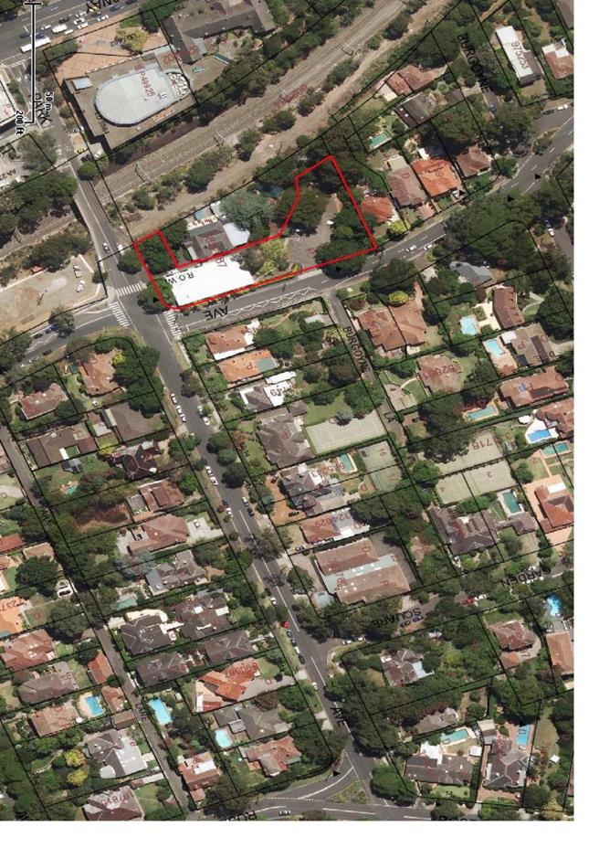
|
APPENDIX No: 2 - Signed
Returned Heads of Agreement - Lifeline
|
|
Item No: GB.5
|
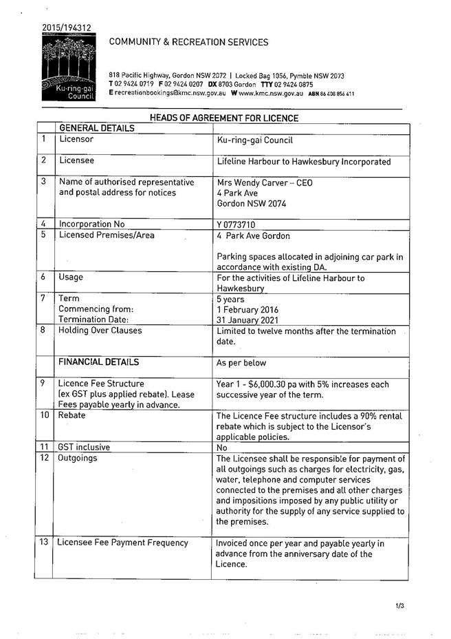
|
Ordinary
Meeting of Council - 8 September 2015
|
GB.6 / 368
|
|
|
|
|
Item
GB.6
|
S02414
|
|
|
26 August 2015
|
Northern Sydney Aboriginal Heritage
Office - proposal for relocation to the Ku-ring-gai Wildflower Garden
EXECUTIVE
SUMMARY
|
purpose of report:
|
To advise Councillors of a proposal for the Northern
Sydney Aboriginal Heritage Office (AHO) to relocate to the Ku-ring-gai
Wildflower Garden.
|
|
|
|
|
background:
|
The AHO is a regional organisation, established in
2000, consisting of 7 member Councils. North Sydney Council is the auspice
for the AHO on behalf of member councils. The primary roles of the AHO
include Aboriginal sites identification and documentation, heritage site
management, Aboriginal cultural education and dialogue between Indigenous and
non-Indigenous communities.
|
|
|
|
|
comments:
|
Historically the AHO has been accommodated in member
Council premises for approximately 3-8 year periods. The AHO has previously
been housed at Warringah, Lane Cove, Willoughby and Manly Councils since its
inception - an opportunity has now arisen for the AHO to be relocated to the
Wildflower Garden at St Ives.
|
|
|
|
|
recommendation:
|
That Council support the relocation of Northern Sydney
Aboriginal Heritage Office to the Ku-ring-gai Wildflower Garden, and that a
Business Model along with an agreement, determining terms and conditions for
the AHO to be accommodated at the Wildflower Garden, is developed between the
AHO and Ku-ring-gai Council.
|
Purpose of Report
To advise Councillors of a proposal for the Northern Sydney
Aboriginal Heritage Office (AHO) to relocate to the Ku-ring-gai Wildflower
Garden.
Background
The AHO was established in 2000
with 4 partner Councils - Lane Cove, North Sydney, Warringah and Willoughby
Councils. Initially these Councils employed an Aboriginal Heritage Manager who
carried out a range of tasks for the Councils, for an initial period of 5
years.
The establishment of AHO was
significant as, at that time, there was no one employed at a local government
level in Australia dealing specifically with Aboriginal heritage issues.
In 2005 Manly joined the
partnership and was followed by Ku-ring-gai Council in 2006, then Pittwater
Council in 2OO7 and Armidale Dumaresq Council in 2008. City of Ryde Council was
a partner from 2010 to 2015.
Each of the 7 current
participating councils provide an annual payment of approximately $37,000 to
the AHO for the provision of services and programs through the three themes of
site management, education and council support.
Comments
Aboriginal Heritage Office
The Aboriginal Heritage Office is an award-winning
initiative and a best practice example of how local government can work towards
improved management and protection of Aboriginal heritage and provide cultural
and environmental education to the community.
The main objectives of the AHO
are to:
· Protect Aboriginal sites
and heritage in the participating council areas through the
development and implementation of site management plans, policy
development and
regular monitoring of site conditions
· Ensure that consultation
and communication between all stakeholders is maintained
· Ensure heritage site
management efforts are both coordinated and effective
· Develop and implement
community education programs and events aimed at increasing
the collective knowledge of Aboriginal cultural heritage
The AHO also has a significant
museum collection that would be a major attraction for educational and tourism
purposes. The AHO museum is currently closed due to lack of exhibition space in
its present location at Manly.
Management and Reporting
Structure of the AHO
The AHO is supported by a
Steering Committee comprising representatives from each of the 7 partner
councils.
The AHO staff are employed by
North Sydney Council and all human resources services, information technology
requirements and day to day supervision for the AHO are also provided by North
Sydney Council.
The Aboriginal Heritage Office
employs of a number of permanent staff including the Aboriginal Heritage Office
manager, an archaeologist and an education officer, a part-time volunteer
co-ordinator and casual staff contracted for specific projects. There are up to
8 staff members at a time, depending on funding and grant allocations.
A Memorandum of Understanding,
outlining the responsibilities of the member Councils has been developed. (Attachment
A1)
Accommodation
It is intended that the AHO occupy office accommodation
(previous caretaker’s house) at the Wildflower Garden that will be vacant
following a staff move from the Wildflower Garden to the St Ives Showground.
The St Ives Precinct Plan of Management allows for office
space for the Precinct Co-ordinator and staff to occupy within a prominent
position at the Showground, as a first point of call for visitors and community
groups arriving on-site, rather than the position they currently occupy at the
Wildflower Garden.
The staff moved to the Showground will provide a much needed
presence for visitor liaison and extra security. Additionally, with the
increase in major events at the Showground, and the soon to be established
regional playground, it will be more efficient to have specialist staff located
at the Showground rather than at the Wildflower Garden.
The Visitor’s Centre and school and community environmental
programs will continue to operate from the Wildflower Garden.
Next Stages
This report is seeking Council support for the relocation of
the AHO to the Ku-ring-gai Wildflower Garden.
Once there is support from Council, further discussion can
continue with the project auspice North Sydney Council, and the Steering
Committee of the AHO about the proposal and firm terms and conditions for the
relocation can be developed.
Council will also engage a consultant to develop a business
model for the proposal. The business model will include operating terms and
conditions for the AHO, integration of cultural and environmental education
programs with Council’s Strategy and Environment department and the AHO, the
Australian Plant Society and other relevant community groups.
The next stages include:
· Meeting with representatives of North
Sydney Council and the AHO Steering Committee
· Engaging a consultant to develop a
business model and plan for the Ku-ring-gai Wildflower Garden
· Finalise an agreement between Council
and the AHO
The AHO essentially provides shared consultancy services to
all member councils, and because each council contributes to the AHO, host
councils provide the AHO with free accommodation, including on-costs associated
with the running of the facility e.g. power, rates, waste services, building
maintenance etc. This arrangement has resulted in reducing the annual
contributions for each council and has made it easier to attract new members.
The Aboriginal Heritage Office has been hosted by the
following councils:
Warringah Council 2000 - 2003
Lane Cove Council 2003 - 2006
Willoughby Council 2006 – 2014 (2 separate locations)
Many Council 2014 - until present
It should also be noted that North Sydney Council does not
charge any project management or supervision fees and any support provided is
considered as an in-kind contribution.
While there has not been a formal agreement amongst the
participating councils to rotate the provision of accommodation for the AHO, it
has been the practice since its inception. The Ku-ring-gai Wildflower Garden
would provide an ideal location for the Aboriginal Heritage Office based on the
following considerations:
· central proximity to the northern
Sydney region and easy access for all member councils
· office accommodation to conduct the key
administrative functions of the AHO
· the bush setting would allow for a
number of outdoor activities to be undertaken e.g. archaeological digs, bush
walks, bush tucker activities,
· access to a teaching space (Caley’s
Pavilion) for education talks, presentations, performances and training,
· exhibition space to house the AHO
museum and possible space to expand the collection
· potential to provide an independent
income stream to expand the services of the AHO through fee for service
programs and tourism related activities.
All previous facilities housing the Aboriginal Heritage
Office provided limited opportunities to expand its capacity to deliver
services beyond current levels.
The AHO, in partnership with Council, has run a number of
programs at the Ku-ring-gai Wildflower Garden and considers this site as an
ideal location. Many of the programs currently operated from the Ku-ring-gai
Wildflower Garden are compatible with the activities of the AHO and there are
significant opportunities to increase the range of activities currently offered
on site.
Tourism and Business Potential
A Visitor’s Centre was established at the Wildflower Garden
last year and the number of visitors to the site has almost doubled since its
opening in October 2014. The tourism potential associated with the AHO and the
introduction of Aboriginal programs and activities would contribute to this
increase in visitation to the Wildflower Garden. The proposed business model
will explore these options before an agreement is reached with the AHO.
Role of Local Government
Local government has a key role
to play in safeguarding Aboriginal sites and heritage. As the people who make
decisions about land and how it will be used, councils hold the future of many
Aboriginal sites in their hands.
In valuing Aboriginal heritage,
local government not only commits to preserving the past, it commits to the
future by fostering communication, understanding and respect between Indigenous
and non-Indigenous Australians.
integrated planning and reporting
|
Community Strategic Plan Long Term Objective
|
Delivery Program
Term Achievement
|
Operational Plan
Task
|
|
C1.1 An equitable and
inclusive community that cares and provides for its members.
C2.1 A harmonious community
that respects, appreciates, celebrates and learns from each other and values
our evolving cultural identity.
N1.1 A community empowered
with knowledge, learning and information that benefits the environment
P5.1 Ku-ring-gai’s heritage is protected, promoted and
responsibly managed.
E3.1 Ku-ring-gai has a range
of activities and experiences that attract visitors.
L1.1 A shared long term vision
for Ku-ring-gai underpins strategic collaboration, policy development and
community engagement.
|
C1.1.3 Our community
facilities are accessible and function as cultural hubs to attract a range of
users
C2.1.1 Ku-ring-gai’s
rich cultural diversity and creativity is celebrated through programs and
events.
N1.1.2 Increased
community action that benefits the environment.
P5.1.1 Strategies,
plans and processes
are in place to effectively
protect
and preserve Ku-ring-gai’s
heritage assets
P5.1.3 Local,
aboriginal and cultural
history is recognised and
promoted
E3.1.2 Ku-ring-gai is
marketed as a provider of a range of visitor activities and experiences.
L1.1.3 Partnerships are
established with government agencies, regional and local organisations and
community groups and are working to achieve Ku-ring-gai’s community outcomes.
|
Design and obtain the
necessary approvals for a multipurpose cultural and educational centre at the
Wildflower Garden.
Promote and support a range of
cultural and nationally significant events through Council.
Continue to develop and
deliver a series of signature events at the St Ives Showground and Wildflower
Garden.
Promote cultural events to the
whole community via Council's communication methods e.g. social media and
website.
Develop and deliver programs,
resources and education demonstration sites at the Wildflower Garden.
Deliver environmental
resources and programs for residents.
Deliver environmental
resources and programs for businesses.
Deliver environmental
resources and programs for schools.
Deliver management actions and
training to protect and manage Aboriginal heritage including actions.
Support Aboriginal cultural
activities at the St Ives Precinct.
Facilitate opportunities for
organisations to stage events
Pursue priority areas where
partnership arrangements will provide tangible benefits to the local area.
|
Governance Matters
The Land is Crown Land managed by Council under the recently
adopted St Ives Showground and Precinct Land Plan of Management (POM). Council
retains the authority and option to approve the activities that are permitted
and recommended in the POM as well as any activities that are permitted within
the zoning of the land.
Under Council’s Principal Local Environment
Plan the following outlines land use zones and related controls apply to the St
Ives Showground & Precinct Lands:
· Zone RE1
Public Recreation
· Zone E2
Environmental Conservation
The proposed relocation of the
AHO to the Wildflower Garden is consistent with the adopted POM which, under
Environmental Sensitivity and Community Awareness, cites potential to integrate
sustainability focus and educational facilities along with Aboriginal heritage
and bush foods at the Wildflower Garden.
The POM also promotes potential
for the existing house (offices) to be utilised for environmental education and
Aboriginal cultural and heritage displays.
Risk Management
The Aboriginal Heritage Office
is a joint project involving 7 northern Sydney councils - any risks associated
with its operation are shared by all partner organisations.
North Sydney Council, as the
auspice organisation, is required to coordinate and consult with member
councils regarding any risk management issues.
Risk assessments have been
completed for key areas of work undertaken by the Aboriginal Heritage Office on
behalf of all councils. Any work undertaken by the Aboriginal Heritage Office
representing Ku-ring-gai Council must adhere to all relevant policies.
Financial Considerations
To date each host council has provided the Aboriginal
Heritage Office with free accommodation including costs associated with the
management of the facility e.g. power, rates, waste services, building
maintenance etc. This arrangement has resulted in reducing the annual
contributions for each council and has made it easier to attract new members.
The current Aboriginal Heritage Office budget does not allow
for any payment of rental or outgoings and any additional charges would require
a renegotiation of the Memorandum of Understanding between councils and an
increase in member annual fees. Other member councils are also unlikely to
consider such a request favourably, based on their contribution of providing
free accommodation over many years and other in-kind supports.
It has been acknowledged in discussions with the AHO and North
Sydney Council that a business model and plan must be developed to ensure the
long term financial sustainability and growth of the office.
The business model will explore and may include fee for
service programs and training, visitation fees, sale of Aboriginal crafts and
artwork, guided tours, performances and special functions. Additional grants
for both capital and specialist programs can be sought once a more permanent
home is found for the Aboriginal Heritage Office.
If Council supports the relocation of the Aboriginal
Heritage Office to the Wildflower Garden any costs associated with such a move
would need to be negotiated with member councils. Costs associated with
accommodating the AHO at the Wildflower Garden are considered to be minimal as this
is a fully functioning administration office with the required infrastructure
already provided.
Social Considerations
The Aboriginal Heritage Office
is an award-winning initiative and a best practice example of how local
government can work towards improved management and protection of Aboriginal
heritage. The success of the partnership is reflected in the awards that have
been received, including the 2001 Energy Australia Heritage Award, the 2OO8
Pride of Workmanship Rotary Award, the 2012 NSW Heritage Council's 'Heritage
Heroes' Award, the 2012 North Sydney Community Award, the 2012 Building
Inclusive Communities Award 2013 and 2014 Cultural Heritage Award, Clean
Beaches (Keeping Australia Beautiful and the 2014 Cultural Heritage Award,
Caring for Country (Keeping Australia Beautiful).
The AHO liaises and works
closely with the Aboriginal custodians of the land, the Metropolitan Local
Aboriginal Land Council (MLALC), and the Aboriginal community on Aboriginal
heritage issues.
The development of a business
model with the AHO will enable Council to partner with an organisation that
already has a strong standing and high respect within the community.
It is anticipated that there
will be significant community benefits associated with the AHO operating from
the Ku-ring-gai Wildflower Garden.
Environmental Considerations
The activities of the Aboriginal
Heritage Office are consistent with the St Ives Showground and Precinct Lands
Plan of Management 2015.
The proposed relocation of the
Aboriginal Heritage Office to the Ku-ring-gai Wildflower Garden will assist in
managing the land in an environmentally sensitive and responsible manner and at
the same time addressing the social and cultural needs of the community. One of
the objectives of the AHO is to preserve natural and culturally significant
areas and to raise public awareness through environmental education. The
proposed uses are directed towards protecting and enhancing the natural
environment and restoring areas of high ecological, cultural and aesthetic
values.
Community Consultation
The accommodation requirements of the AHO have been
discussed for a period time at the AHO Steering Committee meetings. It has been
widely acknowledged by Council representatives attending meetings that the
current site at Manly is unsuitable and a more permanent solution needs to be
found. All member councils have been asked to consider possible sites for the
relocation of the AHO, with a view to a more appropriate accommodation.
The current site at Manly only supports the administration
functions of the AHO and provides minimal opportunities for visitation by
outside groups, training, exhibitions, meetings and educational programs, and
unfortunately the AHO museum has been closed due to the inadequacy of the space
and all the exhibits have been placed in storage.
Meetings have been held with the manager of the Aboriginal
Heritage Office and an initial meeting has also been held with North Sydney
Council to discuss the possible relocation of the AHO.
As part of the development of a business model for the
Wildflower Garden, it is anticipated that community groups, for example, the
Australian Native Plants Society, that currently use the site will be
consulted.
Internal Consultation
Council’s Operations and Strategy and Environment
departments have been consulted in the writing of this report.
Summary
This report is seeking Council
support to relocate the Northern Sydney Aboriginal Heritage Office to the
Ku-ring-gai Wildflower Garden.
The Northern Sydney Aboriginal
Heritage Office is a regional organisation consisting of 7 northern Sydney
councils. It was established in 2000 to:
· Protect Aboriginal sites
and heritage in the participating council areas through the
development and implementation of site management plans, policy
development and
regular monitoring of site conditions
· Ensure that consultation
and communication between all stakeholders is maintained
· Ensure heritage site
management efforts are both coordinated and effective
· Develop and implement
community education programs and events aimed at increasing
the collective knowledge of Aboriginal cultural heritage
The AHO has been housed by a number of member councils since
its inception, however none of the council’s has had a bushland setting
available to enable the AHO to reach its full potential.
There are many benefits for the Ku-ring-gai community, plus
increased tourism potential should the AHO be located at the Wildflower Garden.
Following support from Council a detailed Business Plan and
agreement will be developed for the AHO at the Wildflower Garden.
|
Recommendation:
1. That
Council support the relocation of the Northern Sydney Aboriginal Heritage
Office to the Ku-ring-gai Wildflower Garden.
2. That a
Business Model, along with an agreement determining terms and conditions for
the AHO to be accommodated at the Wildflower Garden, is developed between the
AHO and Ku-ring-gai Council, and that the General Manager be a signatory to
this agreement.
|
|
Danny Houseas
Manager Community
|
Mark Taylor
Manager Community & Recreation Services
|
|
Janice Bevan
Director Community
|
|
|
Attachments:
|
A1View
|
Aboriginal
Heritage Office - signed MOU - North Sydney Council - Report Attachment
|
|
2015/230530
|
|
APPENDIX
No: 1 - Aboriginal
Heritage Office - signed MOU - North Sydney Council - Report Attachment
|
|
Item No: GB.6
|
|
Ordinary
Meeting of Council - 8 September 2015
|
GB.7 / 383
|
|
|
|
|
Item
GB.7
|
DA0508/14
|
|
|
29 June 2015
|
Summary
Sheet
|
Report title:
|
31 Tryon Road,
Lindfield - Demolition of existing structures and construction of a
residential flat building comprising 11 units, basement parking and
landscaping works
|
|
ITEM/AGENDA
NO:
|
GB.7
|
|
Application No:
|
DA0508/14
|
|
Property Details:
|
31 Tryon Road, Lindfield
Lot & DP No: Lot 20
DP 3055, Lot 21 DP 1005041 and Lot 1 DP 944071
Site area (m2): 1339m²
Zoning: R4 High Density Residential
|
|
Ward:
|
Roseville
|
|
Proposal/Purpose:
|
To determine Development Application DA0508/14 which
proposes demolition of existing structures and construction of a residential
flat building comprising 11 units, basement parking and landscaping works
|
|
Type of Consent:
|
Local
|
|
Applicant:
|
Playoust Churcher Architects
|
|
Owner:
|
Allan Roy Tattersall and Cheryl Ann Tattersall
|
|
Date Lodged:
|
28 November 2014
|
|
Recommendation:
|
Approval
|
Purpose of Report
To determine Development Application No. 508/14 for the
demolition of existing structures and construction of a residential flat
building comprising 11 units, basement parking and landscaping works.
integrated planning and reporting
PLACES, SPACES 7 INFRASTRUCTURE
|
Community Strategic Plan Long Term Objective
|
Delivery Program
Term Achievement
|
Operational Plan
Task
|
|
P2.1 A robust planning framework is in place to deliver
quality design outcomes and maintain the identity and character of
Ku-ring-gai
|
Applications are assessed in accordance with State and
local plans
|
Assessments are of high quality, accurate and consider all
relevant legislative requirements
|
Executive Summary
|
Issues:
|
- Site
isolation
- Setbacks
- Spatial
separation
- Submissions
regarding traffic impacts
|
|
|
|
Submissions:
|
23
|
|
|
|
Land and Environment Court:
|
No
|
|
|
|
Recommendation:
|
Approval
|
History
Site
There is no
relevant development application history.
Pre-DA
Pre0133/13 Pre DA
meeting for demolition of the existing dwelling and construction of a 4 storey
residential flat building was held on 23 November 2013. Key issues raised:
· allotment size
· heritage
· floor space ratio
· building height
· site isolation
· setbacks
Pre0066/14 Pre DA
meeting for demolition of existing dwelling and construction of a 3 storey
residential flat building was held on 2 July 2014. Key issues raised:
· site isolation
· privacy
· heritage
DA History
28 November 2014 The application
was lodged.
12 December – 11 January 2015 The application was
advertised.
13 January 2015 The
applicant was advised of heritage issues and urban design issues which will be
raised in formal correspondence.
21 January 2015 The
landscape referral received raising concerns with the BASIX certificate.
27 February
2015 The assessment officer emailed
applicant regarding design changes to balconies.
4 March 2015 The
applicant submits amended plans and elevations relating to the balcony.
5 March 2015 The
assessment officer emailed the applicant with concerns regarding the proposed
floor space ratio.
9 March 2015 The
applicant submits amended plans, elevations and sections and floor space ratio
calculation plan.
27 March 2015 The
development application was reallocated to new assessment officer named in this
report.
22 April 2015 Council
wrote to the applicant and requested the following information:
- updated stormwater management plans
- longitudinal driveway section
- environmental site management plan
- geotechnical assessment
- an amended landscape plan
- an amended BASIX certificate
- an amended deep soil landscape plan due to non compliance
- to address design issues relating to the roof pitch, the front
façade, reduction in height, smaller opening to Tryon Road and change to
balustrades to opaque glass.
- amendments to the balcony on the east side along the Tryon Road
frontage were resolved in the plans submitted in March it is requested this
design change be included in the formally submitted amended plans
- deletion of the entry structure
- finish and colour details on the central bay to be amended to a
recessive colour
23 April 2015 The applicant requests
an extension of time to submit the requested information.
10 June 2015 Council requested an
update from the applicant regarding the time frame for submitting information.
Council advises that information should be submitted by 1 July 2015.
10 June 2015 The applicant advises of
meeting with engineers the following day regarding and information would be
submitted within 2 – 3 weeks.
6 July 2015 Council
wrote to the applicant and requested additional information must be submitted
by 27 July 2015 otherwise the application would be determined.
27 July 2015 Applicant
submits amended plans and information.
7 August 2015 Applicant
submits geotechnical report.
25 August 2015 Applicant
submits amended driveway section.
26 August 2015 Applicant
submits amended stormwater plans.
The Site
Site description
The site comprises three lots known as Lot 20 DP 3055, Lot
21 DP 1005041 and Lot 1 DP 944071. The site has a frontage of 24.285m to Tryon
Road and a depth of 54.88m. The site is rectangular shaped, with an area of
1338m² and is located on the high side of the street.
The site contains a three storey dwelling, with vehicular
access from Tryon Lane located to the rear. Other existing improvements include
an in ground swimming pool, concrete tennis court and a brick garage.
The site is relatively flat and ground levels at the rear
boundary are approximately 200mm lower than the front boundary.
Surrounding development
The adjoining site to the west,
known as 27-29 Tryon Road, contains a single storey dwelling and a two storey
aged care facility. The adjoining site to the east, known as 33 Tryon Road,
contains a heritage listed Lindfield Uniting Church. The site on the opposite
side of Tryon Road contains a two storey school. Development to the rear of the
site includes single and two storey dwelling houses.
The Proposal
The applicant seeks consent to
demolish the existing dwelling and construct a residential flat building
comprising 11 units, basement parking and landscaping. The proposed works
include:
· demolition of existing structures
including dwelling, swimming pool and tennis court
· vehicular access from Tryon Lane,
centrally located within the site providing access to the basement level
· landscaping works including pathways,
communal open space and bbq area fronting Tryon Lane
· pedestrian access from Tryon Road.
· a 3 storey residential flat building
comprising the following:
Basement
RL90.990 16 residential car spaces, 2
accessible spaces, 3 visitor spaces, 6 bicycle spaces, storage, garbage room,
lift and stairs.
Ground Floor
RL93.915 4 units (2 x 2 bedroom and 2 x 3 bedroom),
lift and stairs.
First Floor
RL97.015 4 units (3 x 3 bedroom and 1 x 2
bedroom), lift and stairs.
Second Floor
RL100.115 3 units (3 x 2 bedroom) lift and
stairs.
Consultation
Community
In accordance with Volume C Part
5 of the Ku-ring-gai Local Centres Development Control Plan, owners of
surrounding properties were given notice of the application between 12 December
2014 to 11 January 2015. Twenty-six (26) submissions were received from the
following:
1. Robert
Boyd-Boland 12/15 Tryon Road, Lindfield
2. David
Hellstrom (3 submissions) 21/25 Tryon Road, Lindfield
3. HL
& WR Cooper (2) 17/15 Tryon Road,
Lindfield
4. Robert
Oliver 26 Russell Avenue,
Lindfield
5. Roy E.
Cook 2/25 Tryon Road, Lindfield
6. Mrs C
Power 16/15 Tryon Road, Lindfield
7. Emeritus
Professor David Barker AM 25/9 Tryon Road, Lindfield
8. Ian
and Irma Stewart 14/9 Tryon Road, Lindfield
9. So
Jean Han Lee 23/25 Tryon Road,
Lindfield
10. W &
J Macdonald 21/15 Tryon Road, Lindfield
11. Celia
Palmer 19/15 Tryon Road,
Lindfield
12. David
Patten 14/12-18 Russell Avenue,
Linfield
13. CJ
O’Brien and RJ O’Brien 13/25 Tryon Road, Lindfield
14. Errol
Brown 9/9 Tryon Road, Lindfield
15. Evelyn
Chan 8/25 Tryon Road, Lindfield
16. Dianne
Letham 18/15 Tryon Road, Lindfield
17. Paul
and Esther Chan 4/25 Tryon Road, Lindfield
18. Darin
Tyson-Chan 21/9 Tryon Road, Lindfield
19. Rudolph
Lee and Crystal Yee Wan Wong 19/25 Tryon Road, Lindfield
20. A R Arnott 4/2-6
Russell Avenue, Lindfield
21. Frank
Huh 9/25 Tryon Road,
Lindfield
22. Adrian
Riley 5/25 Tryon Road,
Lindfield
The
submissions raised the following issues:
Concern over all building
and other materials access being through the rear of site Tryon Lane
This is the only means of
vehicle access for residents of 5-25 Tryon Road and properties on Russell
Avenue
Tryon Lane is one way and
the works will block the lane and prevent users to exit
The reliance upon Tryon Lane for construction vehicles is
not supported. Condition 11 and 12 require a work zone within Tryon Road
and an amended construction management plan to be submitted to Council.
The route for construction vehicles requires approach
to the site via Russell Lane and egress via Tryon Lane
The construction management plan lodged with this
Development Application is not supported. An amended construction management
plan is required by Condition 11. All construction vehicles
involved in the demolition, excavation and construction of the proposed
development shall approach the site travelling along Pacific Highway, turning
into Havilah Road, right into Lindfield Avenue, left into Tryon Road and
right into the site (except the actual kerb and
gutter construction in Tryon Lane which will require some restriction to
traffic in the lane, residents would be notified of this at the time).
Construction vehicles departing the site will travel along the same route until
they reach Pacific Highway where vehicles can turn north or south at the signalised
intersection.
The construction management report underestimates the
truck movements required for demolition
The manoeuvring path for vehicles on site is
unreasonable
Trucks will not be able to enter and exit the site in
a forward direction
Condition
11 requires that a revised and detailed
construction traffic management plan (CTMP) must be submitted for review by
Council Engineers prior to the commencement of any works on site. The CTMP
would also confirm the approach and departure routes, expected construction
vehicle movements and ensure that vehicles can access the site in a safe
manner.
All major building works should occur from Tryon Road
and not Tryon Lane
Condition 12 requires the work zone to be provided
with Tryon Road. All construction vehicles involved in the demolition,
excavation and construction of the proposed development shall approach the site
travelling along Pacific Highway, turning into Havilah Road, right into
Lindfield Avenue, left into Tryon Road and right into the site (except of the actual kerb and gutter construction in Tryon
Lane which will require some restriction to traffic in the lane, residents
would be notified of this at the time). Construction vehicles departing the
site will travel along the same route until they reach Pacific Hwy where
vehicles can turn north or south at the signalised intersection.
Noise impacts from large scale machinery
Conditions 44 and 49 seek to minimise noise impacts
upon surrounding properties. The conditions provide hours of work and noise
requirements to ensure no unreasonable impacts upon the acoustic amenity of
surrounding residents.
Safety and danger concerns for children using the
ballet school at the corner of Lindfield Avenue and Tryon Lane from the truck
movements
The proposed truck movements in the construction traffic
management plan, with reliance upon Tryon Lane and Russell Avenue, is not
supported. A revised construction management traffic plan is required by Condition
11.
Traffic impacts on the Seldon complex at 9 - 15 Tryon
Road
The Seldon complex has vehicular access from Tryon Lane. As
part of the recommendations of this report, construction vehicles are not
permitted to use Tryon Lane. There is concern regarding the impacts upon
surrounding development, Condition 12 requires a work zone to be
established in Tryon Road.
The deep soil excavation plan indicates prevention of
trucks entering the site to load soil and will therefore occur on Tryon Lane
and block access for residents
The use of Tryon Lane by construction vehicles is not
supported.
There is no provision for a loading bay within the
development for future occupants
There is a loading bay provided within the basement to
facilitate residents moving and would prevent the reliance upon moving trucks
being parked within Tryon Lane.
The cycle way along Tryon Lane and Russell Lane will
be largely impacted by the development and this raises safety concerns
The reliance upon Tryon Lane and Russell Lane for truck
movements is not supported.
The three and two bedroom
configurations are borderline in terms of size
The proposed size of the two and
three bedrooms is compliant with the Residential Design Flat Code and
Development Control Plan (Local Centres) 2013.
This development will result in the loss of the old
building which is in excellent condition is a tragic loss to the Ku-ring-gai
community
The property was occupied by a person of prominence
and importance the Molesworth family owned the property and Maud Margaret Molesworth
was an Australian Champion Women’s tennis player
The site is not identified as a heritage item and is not
proposed to be heritage listed.
Objection to the building being described as two
storeys when it is quite clearly a three storey building
The proposal is for a three storey development which
replaces an existing two storey house.
Amended plans lodged 27 July 2015
The plans of the amended proposal were not notified as it
would not result in any greater amenity impacts than the original proposal.
Within Council
Heritage
Council’s Heritage Adviser has
commented on the original proposal as follows:
“Heritage Status
The site is not a heritage
item and in not included in a Heritage Conservation Area. The site is within
the Local Centres LEP and adopted DCP. The zoning on the site allows
residential flat buildings and the height is limited to 11.5 metres.
The site adjoins a State and
local heritage item at 33 Tryon Road – The Lindfield Uniting Church. There are
other items within the general vicinity but none directly within the immediate
vicinity. The site is within the vicinity of HCA Area C -22. The HCA area is
a broad area including most of the land east of Nelson Road.
The church was identified as
a potential heritage item in the 1986/87 heritage study but not listed. It was
identified as a State item in a review of Uniting Church properties in 2003 and
listed on the State Heritage Register in 2008. It was subsequently listed as a
local item in the Local Centres LEP.
In relation to heritage the
objectives in the Local Centres LEP are:
(a) to conserve the
environmental heritage of Ku-ring-gai;
(b) to
conserve the heritage significance of heritage items and heritage conservation
areas, including associated fabric, settings and views;
(c) to conserve
archaeological sites; and
(d) to
conserve Aboriginal objects and Aboriginal places of heritage significance.
Clause 61D (4) of the LEP
requires that before granting consent to the proposed works Council must
consider the effect of the works on the item, nearby items or conservation area
concerned. Clause 61D (5) allows Council to require a HIS before granting
consent.
Heritage Impact Statement
(HIS)
The applicant has included a
well-considered HIS prepared by an experienced heritage consultant. The report
follows the Heritage Council guidelines for such a report. It concludes:
“In our view the revised
proposal, while allowing for viable development, provides a careful and
sympathetic design response that addresses the specific nature of the heritage
listed church, respects its intrinsic cultural values and preserves its
heritage significance and its legibility. Indeed, the proposal would present a
contradistinctive relationship between the heritage listed church and the
proposed development in which each maintains its integrity.
On the strength of the
foregoing, we are satisfied that the pertinent consent authority, having
jurisdiction over the works as proposed, would be in a position to approve such
works without concern for the loss of heritage values on the property within
the visual catchment area of the proposed site. We support this contention on
the strength of the observations made in this report.
Recommendations
To ensure maximum conservation
of significance Rappoport also recommends the following:
Salvage of components,
particularly interior components of the subject building which would be of
potential value for use in maintaining and restoring similar period houses in
the area i.e. slate tiles, Federation windows.”
Local Centres DCP
The site is subject to the
heritage provision in the above DCP. Chapter 7.3 (Part B) provides specific
objectives and controls for new development in the vicinity of a heritage
item. The objectives and controls for a residential context are discussed
further in the report.
Demolition
The existing dwelling on the
site is a good representative example of a Federation period dwelling set on a
relatively large site, with established landscaping and a tennis court.
Although not inspected as part of this assessment, the HIS states that the interiors
are generally intact and in good condition.
Demolition of the building is
necessary to allow development of the site to the scale envisaged in the
zoning. Several other similar houses in Tryon Road were demolished for
residential flat development within the last 10 years. The evidence of the
area’s built fabric and history is being lost.
Given the rezoning,
demolition of the existing building and site elements is acceptable, provided
an archival standard photographic recording of the building and site is
undertaken (Condition 9). As recommended in the HIS,
salvaged components from the building and specifically the interior of the
building should be recycled. A condition to
this effect is included. Condition 58
Comment
The bell tower and entry in
Tryon Road is the main front to the adjoining item and forms an architectural
focus to the Church. A new accessible entry and path has been constructed
which links the church to the hall (at the southern end of the church building)
placing more visual and functional focus on the Nelson Road frontage. The
recent extension to the kitchen area of the hall (adjoining the site) has
resulted in a minimal side setback adjoining the subject site however this area
is not considered to be significant and is not considered a heritage setback
issue. The functional and practical entry is now from the Nelson Road which
has a much wider presentation to the streetscape.
Consideration
against Objectives and Controls in LEP and DCP:
Objectives
1. To
conserve the heritage significance of heritage items and heritage conservation
areas, including associated fabric, settings and views;
2. To
ensure that new development respects the heritage significance of the adjoining
or nearby heritage items.
3. To
ensure that new development does not visually dominate a heritage items
4. To
ensure that new development does not reduce views from or to the heritage item
from the public realm;
5. To
ensure that the development does not impact on the garden setting of the
heritage item, particularly in terms of overshadowing the garden or causing
physical impacts on important trees.
Comment
The proposed development
would have minimal impact on the existing setting and views of the church from
Tryon Road and minor impacts on the setting and views from Tryon Lane. It
would not impact on the Nelson Road setting.
The building is of a larger
scale, height and footprint than the existing dwelling on the site. The eaves
line of the proposed building lines up with the gutter to the spire but it is
above the roof of the nave and will dominate it to some extent. This is
largely a product of the zoning.
The views of the church will
remain essentially the same but the view corridor from Tryon Road (west) is
slightly reduced. The western elevation is not significant. The garden of the
church is not affected by the development.
Controls
Development in the vicinity
of a heritage item is to be sympathetic to the heritage item having regard to:
1, Form
of building including height, roofline, setbacks and building alignment;
i) Proportions
including door and window openings, bays, floor-to –floor ceiling heights and
coursing levels;
ii) Materials
and colours;
iii) Siting
and orientation;
iv) Setting
and context; and
v) Streetscape
pattern.
Comment
The proposed development is
residential and different to the community/institutional use of the church but
consistent with the existing character of the site. The predominant side
setback is over 12 metres but reduces at the Tryon Road frontage as the entry
and spire is close to the side boundary.
The height is similar to the
eaves of the spire, the use of materials is more contemporary and colours are
generally recessive. However, the Tryon Road elevation proposes a light
painted central bay which is considered inappropriate. A more recessive colour
is recommended or the use of face brickwork. The proposed building is
generally consistent with existing siting, orientation and streetscape pattern.
2. The
applicant’s HIS discussing the effect the development would have on the item,
including its garden and setting, has been considered
Comment
A well- considered HIS has
been submitted with the application.
3. Significant views to and
from heritage items are to be protected
Comment
This has been achieved.
4. Development
in the vicinity of a heritage item must respect the curtilage and setting of
the item
Comment
This has been achieved.
5. An
application for development in the vicinity of a heritage item must demonstrate
that the construction process will not result in damage to the heritage item or
its setting.
Comment
The proposed development is
on an adjoining site and generally set back around 12 metres. Any damage to
the item would be managed during the construction process and standard
engineering conditions will apply.
Residential
Context
In addition
to the planning setbacks the following setbacks apply:
i) Must
have a minimum 12 metres building separation to the heritage item;
ii) Must
not exceed a façade height of 8 metres from existing ground level
iii) Any
building mass above 8 metres height must be stepped back an additional 6m from
the heritage item;
iv) Front
setbacks must be more than the front setback of the adjoining item; and
v) Any
new development must have a maximum wall length of 36 metres.
Comment
The above setback controls
are generally achieved apart from the verandah and balconies on the eastern
side which extend beyond the building line. It is recommended that the
balconies be amended and set back in line with the façade and eastern wall of
the building. This may involve replanning of the two apartments.
The second floor, above the 8
metres wall height is not set back an additional 6metres as required. The
applicant considers that the non-compliance would not negatively impact on the
adjoining item and is “within the spirit” of the controls. The spirit of the
control is to provide maximum physical separation where higher scale
development adjoins a heritage item. In this case the item is a church and the
overall scale is larger than a residential building due to the wall and roof
height. The west elevation of the church is a minor elevation as the primary
elevations are the east and north. The departure from the control is considered
acceptable if all the numeric planning controls are achieved.
6. Screen
planting on side and rear boundaries adjoining a heritage item site is to
achieve a minimum mature height of 4 metres
Comment
This is achieved.
7. Front
and side fences are to be no higher than the fence of the adjoining heritage
item. Front fences must be open and transparent such as timber picket of metal
palisade. Side fences are to be timber. No metal panel fencing is to be
constructed on any heritage item boundary.
Comment
The proposal retains the
exiting front fence with minor modifications. This is satisfactory.
The proposed new entry
structure is not acceptable on heritage grounds as it visually conflicts with
the lynch gate, entry and spire of the church. It is recommended to provide a
simple letter box on the front boundary. Alternatively it could be relocated
to the western side and connected via a path to the entry.
Preliminary conclusions
and recommendations
Demolition of the existing
house is acceptable given to the rezoning, provided archival recording is
undertaken. In addition to the standard recycling condition, interior fittings
and building fabric should also recycled.
The proposed development is
largely consistent with the rezoning and would have acceptable impacts on the
adjoining heritage item. However, a number of amendments need to be undertaken
to minimise impact on the adjoining church including the following:
i) Deletion
of the entry structure near the Tryon Road entrance as it will visually
conflict with the entry, lych gate and the spire to the church. A simple
letter box on the street frontage next to the path should be provided instead.
Alternatively, the entry could be relocated to the western side of the building
and a path provided.
ii) The
finish and colour of the central bay on Tryon Road should be more recessive to
reduce visual impacts on the church. It is recommended it be face brick to
match other elevations.
iii) The
balcony on the eastern side, along the Tryon Road frontage, needs to be
amended. It should not project beyond the wall line of the building. Its
location conflicts with the entry and spire of the church, which provides a
strong architectural focus and the proposed balcony is only 6 metres from it.
It is likely amended plans
will need to be provided as it is unlikely these changes could be conditioned.
Council’s Heritage Adviser
commented on the amended proposal as follows:
Heritage comments on amended
plans
The amendments made are:
i) The
entry structure at the Tryon Road frontage has been deleted and replaced with a
low masonry letter box structure set back 1 metres from the fence.
ii) The
finish of the central bay of the Tryon Road elevation has been amended to face
brick – Austral “Boral Blue”. This is a recessive colour and consistent with
the face brickwork of the side and rear elevations.
iii) The
design on the north (Tryon Road) and east side of the building has been amended
by pulling back the balcony on the north and east side by 1 metres and removing
the columns as shown on the original drawings. The walls to the dining/living
room at G-01, 1-01 and 2-01 have been amended as shown on the drawings in red.
These amendments result in a more balanced front elevation and remove the
initial concern that this part of the building conflicts with the bell tower of
the church.
Conclusions and
recommendations
Given that rezoning of the site
has occurred, demolition of the existing building is considered acceptable,
provided standard archival recording is undertaken. In addition to standard
recycling conditions and as discussed in the applicant’s heritage report,
original and significant interior fittings and building fabric should also be
recycled. Condition 58.
The amendments shown on the
drawings, dated 27 July 2015, are satisfactory. The proposed development is
consistent with the rezoning of the site and is considered to have acceptable
impacts on the adjoining heritage item.”
Landscaping
Council’s Landscape and Tree Assessment Officer commented on
the revised proposal as follows:
“Tree impacts
i) T1 Cedrus atlantica (Atlantic Cedar)
located within the site frontage is proposed to be removed. The tree is in fair
condition, with a sparse canopy and signs of decline. The removal of T1 is
acceptable.
ii) T5 – T7 Jacaranda mimosifolia
(Jacaranda) are located within the road reserve in front of the site. The trees
are proposed to be retained. The trees are in poor condition, with stem and
branch defects. It is recommended they be removed. The removal of T5 – T7 is
supported, subject to replacement with Lophostemon confertus (Brushbox) to
continue the avenue planting within the road reserve.
iii) Subject to standard tree protection
requirements during construction, there should be no other tree impacts.
Landscape plan/tree replenishment
The submitted landscape plan is acceptable.
Stormwater plan
The proposed stormwater drainage works are
acceptable.
BASIX
The
development is consistent with the BASIX certificate for landscape areas.
Deep soil
The proposed development will have a deep soil landscape
area of 579.2m² or 43.2%. The KLCDCP requires a minimum 40% of site area as
deep soil landscape area, resulting in an excess of 43.6m².
Council’s
calculations differ from the applicant’s. Some areas <2.0 metres wide have
been included, which is inconsistent with the DCP definition. The areas
included are minor and does not result in a non-compliance with the deep soil
landscape area DCP control.
Construction traffic management plan
The CTMP is not supported on landscape grounds. While it is
acknowledged the plan is conceptual, the proposed construction access,
entry/exit points and materials store conflict with retained trees and tree
protection requirements. This will prevent vehicular construction access from
Tryon Road and therefore either access will be required from the rear laneway
or a construction zone approval along Tryon Road is needed.
It is requested the submitted CTMP not be
stamped or approved.
It is required that a detailed CTMP and on site CMP be
submitted.
Conclusion
The application is acceptable on landscape grounds subject
to conditions.” Conditions 3, 11, 12,
13-17, 66 – 80 and 82.
Planner’s comment: The submitted construction
management plan is not referenced for approval. Condition 11 requires
the submission of a revised construction traffic management plan prior to the
issue of a Construction Certificate. The plan is required to be provided to Council
for review.
Engineering
Council’s Development Engineer commented on the revised
proposal as follows:
“Stormwater disposal
The
subject site is relatively flat, with a moderate fall towards the eastern
corner towards Tryon Lane and having site discharge directed to a new kerb and
gutter.
The stormwater plans show
the collection of all roof areas to be directed to a 20,000 Litres rainwater
reuse tank located under the driveway area. The stored rainwater would be used
for garden irrigation, laundry and toilet flushing. The overflows from the
rainwater tank would be directed to the bioretention system which would
surcharge into the landscaped detention basin. The detention basin has been
calculated to be approximately 29.3m3 of storage within a central
bioretention lawn area. The OSD requirements described in Volume
C Part 4B.5 of the DCP have been satisfied.
A revised
BASIX Certificate has been submitted, with the water commitments requiring a
central water tank (rainwater or stormwater) of 20,000 litres to collect runoff
from at least 330m² of roof area and irrigation of 542m² of common landscaped
area on the site. The rainwater
retention and re-use has met the BASIX commitments, and satisfied the 50%
reduction in runoff days required under Volume C Part 4B.3 of the DCP.
A pump-out system, with storage capacity of 7m3,
has been provided within the basement carpark to drain the driveway area of 55m2.
The pump-out tank has been sized in accordance with the Local Centres DCP
requirements.
The design
has provided a proprietary gross pollutant trap (GPT) ‘Graf
Platin’ 5,000 Litres rainwater tanks with inlet filters located upstream
of the detention system to capture litter, debris and other pollutants prior to
connection into Council’s public drainage system. The stormwater treatment
standards / targets outlined in Council’s Local Centres DCP Volume C Clause
4B.6 would be achieved by the proposed treatment train.
Runoff
from the paved areas would be diverted to a bioretention swale prior to
discharge into the OSD basin. The detention discharge control pit has also
provided for a filter basket as a secondary treatment system, which is
acceptable.
The
Stormwater Management Plan & Details 10955 – C1.00/D and C1.01/D, dated 26
August 2015 and accompanying report prepared by Waddington Consulting Pty Ltd,
dated 6 July 2015 are acceptable.
Traffic generation
According to the traffic generation rates nominated by The
Roads & Maritime Services (RMS) ‘Guide to Traffic Generating Developments’,
the development would generate approximately 6 peak hour vehicle trips for the
AM and PM peak periods.
If discounted given the
existing use for single dwelling on the site, the traffic generated would only
be 5 additional vehicle trips during the peak periods. This would represent one vehicle trip every 12 minutes
during the peak hours. According to the above guidelines, this is
very low traffic generation and is not expected to have a significant effect on
the existing road network.
Vehicular access and accommodation arrangements
The
site is zoned ‘R4’ under the Local Centres LEP. The parking provisions have
been determined using Ku-ring-gai Council Local Centres
Development Control Plan for residential flat building. The site is located
within 400m walking distance from Lindfield Railway Station. The following
parking provisions have been adopted:
Ku-ring-gai
Council Local Centres DCP Volume A Part 7B.1-6
‘Car Parking Rates’
|
Residential Flat Building
|
Parking Space Requirement
|
|
1
bedroom unit
|
0.7 – 1
space
|
|
2
bedroom unit
|
1 -
1.25 spaces
|
|
3
bedroom unit or more
|
1 – 2
spaces
|
|
Visitor
car spaces
|
1 space
per 4 units
|
6 x 2 bedrooms = 6 x 1 space/unit = 6 spaces
5 x 3 bedrooms = 5 x 1 space/unit = 5 spaces
11 units - visitor space/4 dwellings = 3 visitor spaces
Total parking spaces required = minimum14 spaces and
maximum 21 spaces.
The
development seeks to provide 20 off-street parking spaces, comprising 17
residents’ spaces (including 2 adaptable spaces) and 3 visitor spaces. The
parking requirements have been met.
The adaptable parking space is to comply with AS2890.6:2009
with regard to having a minimum width of 2.4 metres plus 2.4 metres shared
area. This is also referred to within the access consultant’s report.
The basement plan shows the visitor space doubling as a
temporary services and removalist space which satisfies the
minimum dimension of 3.5 metres x 6 metres.
Vehicular access to the car parking facility is to be
provided via a new combined 6.1m wide entry / exit driveway which narrows to
3.6 metres at the entry to the basement level. The driveway clear width
satisfies the requirements of Volume C Clause 2.2 of the DCP. The use of the
single lane driveway and ramp is also compliant with Clause 3.2.2 of
AS2890.1:2004 given that the traffic flows will be in the order of 5 peak hour
vehicle movements which are significantly low for a two-way access driveway.
Traffic flow is also restricted to eastbound only in Tryon
Lane. All traffic accessing the site will be restricted to left in/left out
only.
The dimensions of the parking bay, ramp grades, aisle
widths and driveway gradients comply with Australian Standard 2890.1 (2004)
“Off-Street car parking”
Waste collection
The development allows a garbage truck to enter and depart
the garbage/room recycle storage area in a forward direction. The turning
manoeuvrability is suitable for the small waste collection vehicle as shown by
the swept paths within the Appendix of the Traffic Report.
A driveway longitudinal section has been submitted which
satisfies the minimum head height of 2.6m to access the basement area. The
driveway grade of 20% shown for the small waste collection vehicle also
complies with requirements of Volume C Part 3.4 of the Local
Centres DCP.
The proposed 15x240L bins for waste, paper and recycling
satisfies the minimum bin requirements.
Construction management
An indicative Construction Traffic Management Plan has been
submitted by the traffic engineer together with a Construction Management
Report, prepared by CAM Consulting. The report states that construction
vehicles up to the 12.5m heavy rigid vehicles (HRV) can access the site. The
swept paths have been depicted within the appendix of the traffic report. Refer
to response to submission below for comment on construction vehicle routes.
A work zone will be created
fronting the work site in Tryon Road for loading/unloading materials during the
period of peak demand.
Submissions have been received
which raised construction traffic related issues.
Construction vehicle routes
– The specified traffic routes noted in the traffic report are not supported.
The use of Middle Harbour Road, Trafalgar Ave, Russell Lane and Tryon Lane is
not permitted due to the narrow lanes which would restrict heavy construction
vehicle movements, heavy traffic envisaged and would also restrict entry and
exit access for the nearby development.
As part of the CTMP approval,
it will be conditioned that all construction vehicles involved in the
demolition, excavation and construction of the proposed development shall
approach the site travelling along Pacific Highway, turning into Havilah Road,
right into Lindfield Avenue, left into Tryon Road and right into the site (except of the actual kerb and gutter construction in Tryon
Lane which will require some restriction to traffic in the lane, residents
would be notified of this at the time). Construction vehicles departing the
site will travel along the same route until they reach Pacific Hwy where
vehicles can turn north or south at the signalised intersection.
Based on the scale of works and expected construction vehicle
movements, a detailed construction traffic management plan (CTMP) must be
submitted for review by Council Engineers prior to the commencement of any
works on site. The CTMP would also confirm the approach and departure routes.
Impacts on Council infrastructure
The applicant will be required to construct road shoulder
and kerb and gutter in Tryon Lane. Plans can be submitted and approved prior to
issue of a Construction Certificate.
Geotechnical investigation
A geotechnical site assessment has been carried out which
comprised of drilling of two boreholes to depths between 5.1metres and 5.7
metres.
Subsurface conditions comprised fill up to a depth of 0.7
metres. Residual clay to depths of 1.5 metres and 1.3 metres to extremely
weathered shale extending to depths of 2.1 metres and 2.0 metres, respectively
in the boreholes was encountered. Weathered shale bedrock was encountered
beneath the shaly clay from about 4.7 metres to 4.8 metres. Groundwater was
measured in the boreholes at depths of 4.1 metres (1.3 hours after auger
drilling) and 5.1 metres (after short period). It should be noted that bulk
excavation for the basement depth will be in the order of 3.0 metres from
existing surface levels proposed and therefore groundwater seepage does not appear
to be an issue.
The
geotechnical recommendations regarding excavation support, vibration
monitoring, dilapidation reporting of adjoining buildings and foundation design
shall be carried out during construction as specified
within the report.
The report recommends a dilapidation report is to be
submitted to include a survey of adjoining dwelling and including the church
and the garage at the rear north-western boundary.
All other recommendations during the construction phase
shall be carried out as specified within the report. It is also recommended
that further geotechnical input be required in particular groundwater
monitoring, prior to commencement of bulk excavation.
Recommendations
The proposal is acceptable subject to conditions.” Conditions
8,10 -12, 31 – 40, 42, 47, 52 – 57, 60 – 64, 77 - 79, 85 – 93.
Building
Council’s Building Surveyor commented on the proposal as
follows:
“Class 2 & 7a building
Exit travel distances from 5
units (3 on 1st floor and 2 on second) appear to exceed the deemed
to satisfy provisions of BCA D1.4 and therefore will require re-configuration
or an alternate solution.
Subject to the exit travel
distance issue being satisfactorily addressed, there is no objection to the
proposal subject to conditions.” Conditions 43, 48, 95, 100.
Planner’s comment: This issue was raised with the
applicant. The applicant submitted further information from BCA vision stating
the proposal was consistent with the deemed to satisfy requirements of Clause
D1.4(a). Conditions 43 and 48 require compliance with relevant
Australian Standards and the Building Code of Australia. The proposal is
satisfactory in this regard.
Urban Design
Council’s Urban Design Consultant commented on the revised
proposal as follows:
“1 Context
The context is comprised of a mix of community and
residential uses. These include a heritage listed church, a nursing home, a
child care centre and a primary school. Residential flat buildings run the
length of Tryon Road up until Lindfield Avenue where another church forms the
termination of the street.
The streetscape is characterised by newer apartment
buildings set back approximately 7-8m from the boundary. Street trees dominate
the streetscape. The front boundary line is defined by fences and hedges.
The site has two street frontages, one to Tryon Lane. The
laneway is generally framed by the rear elevation of residential flats that
address Tryon Road and by detached single storey dwellings.
The proposed development is in close proximity to Lindfield
Station and development of the proposals type is appropriate for the area.
The Uniting Church to the immediate east is a local and
state listed heritage item. The adjoining site to the immediate west is owned
by the Whitehall Nursing Home.
This is an isolated site, hemmed in between the church and
the land owned by the nursing home. This should be considered in the assessment
of the proposal.
2 Scale
Improvements have been made with respect to
the scale of the building and the response to the context since the Pre-DA
consultation. The proposal provides a built form that is compatible with other
development within the immediate vicinity.
The top floor is sufficiently recessive to enable the form
to be considered compatible with the surrounding context. A slightly deeper
eave would provide a more elegant proportion to the building.
3 Built form
The proposal represents a marked improvement from the
Pre-DA proposal. The bulk and scale of the proposal at the interface with the
church has been reduced and the form and layout of building elements improved.
An apartment has been removed per floor allowing for better
apartment layouts with better amenity and reduced entry corridor lengths.
Building depth is greater than 18 metres however each apartment
has two external walls resulting in higher amenity.
Building length is appropriate, given the shape of the
block
The proportions of the building are appropriate for the
scale of the street.
The site has two street frontages and therefore the proposal
should address both appropriately. Improvements have been made that ensure the
laneway frontage is addressed appropriately with larger windows than the
original submission.
4 Density
The density is appropriate for the site and
context.
5 Resource, energy and water
efficiency
Solar access: 60% of units (9 out of the 15) All apartments
are corner apartments and have good access to daylight. Given the narrow site
frontage facing north and the orientation this solar access is acceptable.
Natural ventilation: 100% claimed. They are all corner
apartments and have two frontages
It is noted that the BASIX Certificate indicates a
performance for energy that is slightly better than what is required.
6 Landscape
Overall the
landscape is well considered and appropriate to the context Greenery once
mature will soften the fence edges to the streets.
7 Amenity
The reduction of a unit per floor provides
higher amenity layouts and less space wasted on access to apartments in
compliance with BCA distances from a lift. The proposed units have two external
walls and therefore higher amenity due to good penetration of daylight and
cross ventilation.
The layouts of the apartments are simple and
functional.
The proposed units generally receive
sunlight or daylight and are ventilated.
The units are private and provide good
surveillance of the street and rear lane.
Storage is shown as provided within the
basement and the units.
The number of south orientated apartments
exceeds 10%; however, it is difficult to achieve a lower percentage with a
small apartment floor plate and with the orientation of the site.
8 Safety and security
The proposed units provide good surveillance
of the street and the site itself. This can be improved through private entries
from the street.
Adequate lighting should be provided to the
basement car park and to the site itself – this could be conditioned as it is
not appropriate to indicate this on DA plans
Definition between the laneway and the site
has been provided to clearly demarcate public and private space.
9 Social dimensions and housing
affordability
Adaptable apartments provided. The mix of
apartment sizes and types is appropriate for the area.
10
Aesthetics
The proposed development provides a simple
and well balanced composition of elements appropriate to the location and the
adjacent heritage item.
There is sufficient balance between the open balustrades
and solid masonry elements to break the building into smaller domestic
components that also relate the scale of the adjoining church.
Since the proposal was originally presented at the pre-DA,
significant refinement has occurred that provides for a more effective built
form that appears less bulky and sits more comfortably next to the church.
The top floor is set back and recessive in nature. A simple
suggestion for improvement would be to widen the eave overhang of the top floor
to at least 1m. This would provide additional protection of the terrace, make
the top floor more recessive due to the shadow cast, and provide an improved
proportion given the scale of the building. An eave of this depth was indicated
on the Pre-DA sketches and comment was made at that time of the desirable
proportion – in recent amendments this appears to have been lost.
Planner’s comments – The issue of site isolation is
discussed below. A lighting plan is required to be submitted (Condition 19)
prior to the issue of a Construction Certificate. Condition 20 requires
the eaves to be a minimum 1.0 metres in width at the top storey. Subject to
these conditions, the proposal is satisfactory with respect to SEPP 65.
Statutory Provisions
Environmental
Planning and Assessment Act 1979
This proposal is ‘Local
Development’ under Part 4 of the Environmental Planning and Assessment Act 1979
and requires development consent pursuant to the Ku-ring-gai Local
Environmental Plan (Local Centres) 2012.
The Objects of the Act are:
(a) to encourage:
(i) the proper management, development and conservation of
natural and artificial resources, including agricultural land, natural areas,
forests, minerals, water, cities, towns and villages for the purpose of
promoting the social and economic welfare of the community and a better
environment,
(ii) the promotion and co-ordination of the orderly and
economic use and development of land,
(iii) the protection, provision and co-ordination of
communication and utility services,
(iv) the provision of land for public purposes,
(v) the provision and co-ordination of community services
and facilities, and
(vi) the protection of the environment, including the
protection and conservation of native animals and plants, including threatened
species, populations and ecological communities, and their habitats, and
(vii) ecologically sustainable development, and
(viii) the provision and maintenance of affordable housing,
and
(b) to promote the sharing of the responsibility for
environmental planning between the different levels of government in the State,
and
(c) to provide increased opportunity for public involvement
and participation in environmental planning and assessment.
The proposal is consistent with
the Objects of the Act in that it promotes and coordinates an orderly and
economic use and development of the land which is consistent with the
objectives of the zone.
State Environmental Planning Policies
State Environmental Planning Policy
No.65 - Design Quality of Residential Flat Development (RFDC)
SEPP65 aims to improve the design quality of residential
flat buildings across NSW and provides an assessment framework, the Residential
Flat Design Code (RFDC), for assessing ‘good design’.
Clause 50(1A) of the EPA Regulation 2000 requires the
submission of a design verification statement from the building designer at
lodgement of the development application. A design verification statement has
been submitted by Playoust Churcher which submits the application has been
designed in accordance with the design quality principles under Part 2 of SEPP
65.
The SEPP requires the assessment of any development
application for residential flat development against 10 principles contained in
Clauses 9-18 and Council is required to consider the matters contained in the
publication “Residential Flat Design Code”.
As such, the following consideration has been given to the
requirements of the SEPP and Design Code.
Residential Flat Design Code Compliance
Table
Pursuant to Clause 30(2) of SEPP 65 in determining a
development application for a residential flat building the consent authority
is to take into consideration the Residential Flat Design Code (RFDC). The
following table is an assessment of the proposal against the guidelines
provided in the RFDC.
|
|
Guideline
|
Consistency with
Guideline
|
|
PART 02
SITE DESIGN
|
|
Site Configuration
|
|
|
|
Deep Soil Zones
|
A minimum of 25 percent of the
open space area of a site should be a deep soil zone.
|
YES
|
|
Open Space
|
The area of communal open space
required should generally be at least between 25% and 30%.
|
YES
|
|
|
The minimum private open space
for each apartment at ground level is 25m2.
|
YES
Ground floor apartments
provided with terraces in addition to landscaping.
|
|
Planting on Structures
|
Medium trees (8 metres canopy diameter at maturity)
- minimum soil volume 35m³
- minimum soil depth 1 metre
- approximate soil area 6m x 6 m or equivalent
|
YES
The landscape plan shows a
mixture of small and medium trees set amongst shrubs and ground cover. Trees
are located along the boundaries and shrubs and turf confined to the areas
above the basement with planting on slabs having soil depths of 600mm.
|
|
Visual Privacy
|
The minimum separation between
residential buildings on the development sites and the adjoining sites must
be:
Up to 4th storey
12m between habitable
rooms/balconies
9m between habitable
rooms/balconies and non-habitable rooms
6m between non-habitable rooms
|
NO
The proposal is set back 3
metres from the western side boundary.
|
|
Pedestrian Access
|
Identify the access
requirements from the street or car parking area to the apartment entrance.
|
YES
|
|
|
Follow the accessibility
standard set out in Australian Standard AS 1428 (parts 1 and 2), as a
minimum.
Provide barrier free access to
at least 20 percent of dwellings in the development.
|
YES
A lift has been provided from
the basement to each level of the development.
|
|
Vehicle Access
|
Generally limit the width of
driveways to a maximum of six metres.
|
YES
No concerns are raised
regarding the driveway width by Council’s engineers.
|
|
|
Locate vehicle entries away
from main pedestrian entries and on secondary frontages.
|
YES
The driveway entrance is
located to the rear of the site from Tryon Lane with the main pedestrian
entrance from Tryon Road.
|
|
PART 03
BUILDING DESIGN
|
|
Building Configuration
|
|
|
|
Apartment layout
|
The back of a kitchen should be
no more than 8 metres from a window
|
YES
|
|
|
- 2 bedroom corner apartment
80m² + 11m² external area
- 3 bedroom apartment 124m² +
24m² external area
|
YES
|
|
Apartment Mix
|
Include a mixture of unit types
for increased housing choice.
|
NO
The proposal includes: 6 x 2
bedroom and 5 x 3 bedroom units. All corner apartments.
|
|
Balconies
|
Provide primary balconies for
all apartments with a minimum depth of 2 metres. Developments which seek to
vary from the minimum standards must demonstrate that negative impacts from
the context-noise, wind – can be satisfactorily mitigated with design
solutions.
|
YES
|
|
Ceiling Heights
|
2.7 metres minimum for all
habitable rooms on all floors,
2.4 metres is the preferred
minimum for all non-habitable rooms, however 2.25m is permitted.
|
YES
|
|
Ground Floor Apartments
|
Optimise the number of ground
floor apartments with separate entries and consider requiring an appropriate
percentage of accessible units. This relates to the desired streetscape and
topography of the site.
|
YES
|
|
|
Provide ground floor apartments
with access to private open space, preferably as a terrace or garden.
|
YES
All ground floor apartments
have direct access to private open space areas which include balconies and
courtyards.
|
|
Internal Circulation
|
In general, where units are
arranged off a double-loaded corridor, the number of units accessible from a
single core/corridor should be limited to eight.
|
YES
Lift provides access to a
maximum of 4 units.
|
|
Storage
|
In addition to kitchen cupboards
and bedroom wardrobes, provide accessible storage facilities at the following
rates:
- two-bedroom apartments 8m³
- three plus bedroom apartments
10m³
|
YES
|
|
Building Amenity
|
|
|
|
Daylight Access
|
Living rooms and private open
spaces for at least 70 percent of apartments in a development should receive
a minimum of three hours direct sunlight between 9 am and 3 pm in mid winter.
|
YES
73%
|
|
SW-SE orientation maximum 10%
of units proposed.
|
NO
27%
|
|
Natural
Ventilation
|
Building depths, which support
natural ventilation typically range from 10 to 18 metres.
|
NO
|
|
Sixty percent (60%) of
residential units should be naturally cross ventilated.
|
YES
100%
|
|
Building Performance
|
|
|
|
Waste Management
|
Supply waste management plans
as part of the development application submission as per the NSW Waste Board.
|
YES
|
|
Water Conservation
|
Rainwater is not to be
collected from roofs coated with lead- or bitumen-based paints, or from
asbestos- cement roofs. Normal guttering is sufficient for water collections
provided that it is kept clear of leaves and debris.
|
YES
|
Site configuration
Visual privacy
The minimum separation distances
between residential buildings required by the RFDC are as follows:
|
· 12m between habitable
rooms/balconies
· 9m between habitable
rooms/balconies and non-habitable rooms
|
· 6m between non-habitable
rooms
The proposal is set back 6.4
metres from the adjoining dwelling to the west and does not satisfy the
required separation distance. The proposal is set back 3.0 metres from the
western boundary. The purpose of the control is to provide spatial separation
between built form which is consistent with the scale of development. The site
has a maximum height of 11.5 metres as does the adjoining site at 29 Tryon
Road, being only three storeys in height.
The proposal contains bedrooms and
kitchens with openings in the western elevation. The kitchens are located on
the corner of the building and orientated so that the sinks do not face the
side boundaries. Given the use of the rooms and the proposed landscape
screening along the side boundaries, the reduced spatial separation does not
result in any significant loss of visual privacy to the adjoining property and
does not unreasonable burden the future development of the adjoining site.
Building configuration
Apartment mix
The control requires a range of
apartment sizes and types to be provided within the development. The proposal
includes 6 x 2 bedroom units and 5 x 3 bedroom units. All apartments are corner
apartments and have a range of sizes.
The proposal does not include
provision of any 1 bedroom units. It is considered what is proposed is in
response to market demands, particularly in Lindfield which has experienced a
lot of multi unit developments over recent years. In recent approvals, the
mixed use development at 43 Lindfield Avenue comprised 33 units consisting of
15 x 1 bedroom, 3 x 2 bedroom and 15 x 3 bedroom and the residential flat
building at 15 – 17 Havilah Road comprised 40 units consisting of 10 x 1
bedroom, 24 x 2 bedroom and 6 x 3 bedroom units. Given the size of the proposed
development, the absence of 1 bedroom units is not considered detrimental.
Council’s Urban Design Consultant considers the proposed mix of apartment sizes
and types appropriate for the area.
Building amenity
Daylight access
The control seeks to limit
single aspect apartments with a southerly aspect (SW-SE) to a maximum of 10% of
the total units proposed. The proposal results in three apartments having a
southerly aspect which equates to 27% of apartments proposed. The purpose of
this control is to ensure adequate daylight amenity to apartments. The proposal
has been considered acceptable by Council’s Urban Design Consultant who
indicates it is difficult to achieve a lower percentage with a small apartment
floor plate and with the orientation of the site.
Natural ventilation
The control indicates building
depths which support natural ventilation range between 10 to 18 metres. The
proposed building depth is greater than 18 metres. However, the proposal has
been designed so that each apartment benefits from two external walls and
therefore 100% natural ventilation is provided to the entire development. The
purpose for limiting building depth is to support natural ventilation, given
the proposal achieves 100% natural ventilation the building length is
acceptable.
Draft State
Environmental Planning Policy No. 65 - Design Quality of Residential Flat
Development
The draft SEPP was on exhibition
from 23 September 2014 to 31 October 2014. The SEPP 2015 was gazetted on 19
June 2015 and takes effect on 17 July 2015. The development application was
lodged on 28 November 2015 and the transitional arrangements of the SEPP
specify that development applications lodged before 19 June 2015 are subject to
the version of the SEPP in force prior to 19 June 2015. The development has
been considered under SEPP 65 above.
State
Environmental Planning Policy No. 55 – Remediation of Land
The
provisions of SEPP 55 require Council to consider the potential for a site to
be contaminated. The subject site has a history of residential use and, as
such, it is unlikely to contain any contamination and further investigation is
not warranted in this case.
State
Environmental Planning Policy (Building Sustainability Index: BASIX) 2004
A BASIX certificate has been
submitted with the application (Certificate No. 584774M_02 dated 23 July 2015).
The proposal satisfies the SEPP requirements. (Condition 80)
Sydney Regional Environmental Planning Policy (Sydney Harbour
Catchment) 2005
SREP 2005 applies to the site as
the site is located in the Sydney Harbour Catchment. The Planning Principles in
Part 2 of the SREP must be considered in the preparation of environmental
planning instruments, development control plans, environmental studies and
master plans. The proposal is not affected by the provisions of the SREP which
relate to the assessment of development applications as the site is not located
in the Foreshores and Waterways Area as defined by the Foreshores and Waterways
Area Map.
Local Content
Ku-ring-gai Local Environmental Plan (Local Centres) 2012
Zoning and permissibility:
The
site is zoned R4 High Density Residential. The proposed development is defined
as a residential flat building and is permissible in the zone.
Residential zone objectives:
The objectives for the R4 High Density
Residential Zone are:
· To provide for the housing needs of the community within a
high density residential environment.
· To provide a variety of housing types within a high density
residential environment.
· To enable other land uses that provides facilities or
services to meet the day to day needs of residents.
· To provide for high density residential housing close to
public transport, services and employment opportunities.
The zone objectives for the zones in the standard instrument
are generic and do not attempt to influence planning outcomes, they simply
reflect the types of development that are permissible in the zone. The
development is consistent with the objectives of the R4 High Density
Residential Zone.
Development standards:
|
Development standard
|
Proposed
|
Complies
|
|
Building height: 11.5m
|
11.1m
|
YES
|
|
Minimum street frontage: 24m
|
24.285m
|
YES
|
|
Floor space ratio:
0.8:1
|
0.79:1
|
YES
|
|
Minimum allotment size:
1200m2
|
1338m²
|
YES
|
5.9 Preservation of
trees or vegetation:
Clause 5.9 requires that a person must not ringbark, cut
down, top, lop, remove, injure or wilfully destroy any tree without the
authority conferred by a development consent or permit. Council’s Landscape
Officer has advised that the proposed tree removal is acceptable.
5.10 Heritage conservation
The objectives of the clause are as follows:
(a)
to conserve the environmental heritage of Ku-ring-gai,
(b) to conserve the heritage significance
of heritage items and heritage conservation areas, including associated fabric,
settings and views,
(c) to conserve archaeological sites,
(d) to conserve Aboriginal objects and Aboriginal places of
heritage significance.
The application has been considered by Council’s Heritage
Advisor who considers the proposal acceptable. The proposal achieves an
appropriate relationship with the adjoining heritage item and the development
is considered to be a sympathetic to the character of the item. The development
maintains the views and setting of the heritage item and is consistent with the
provisions of Clause 5.10.
6.1 Earthworks
The objectives of the clause are as follows:
(a) to ensure that earthworks for which development consent is
required will not have a detrimental impact on environmental functions and
processes, neighbouring uses, cultural or heritage items or features of the
surrounding land,
(b) to allow earthworks of a minor nature without requiring
separate development consent.
The application proposes excavation for the purposes of the
basement car parking. The proposed excavation is unlikely to disrupt or have
any detrimental effect on the drainage patterns and soil stability in the
locality. The proposal has been submitted by a geotechnical report. The
excavation is to facilitate the redevelopment of the land. The proposed
excavation does not result in any adverse impacts upon the amenity of adjoining
properties. The proposal is considered satisfactory with respect of Clause 6.1
Earthworks.
6.5 Site requirements for
multi dwelling housing and residential flat buildings
The objectives of the Clause are
as follows:
(a) to provide site requirements for development for the purposes
of multi dwelling housing and residential flat buildings so as to provide for
the orderly and economic development of residential land while maintaining the
local character, and
(b) to ensure that lot sizes and dimensions of medium and high
density residential sites allow for generous landscaped areas and setbacks to
ensure the amenity of adjoining properties and to support the desired future
character of those areas.
Subclause (2) requires sites to
be at least 1200m² and where the site has an area less than 1800m², a 24 metres
street frontage for the erection of a residential flat building. The site has
an area of 1338m² and a width of 24.285 metres. The site dimensions in meeting
the minimum requirements achieves compliance with the required landscape area
and setbacks to ensure the amenity of adjoining properties is not adversely
affected and the proposal is consistent with the desired future character of
Lindfield Town Centre.
Policy Provisions
Ku-ring-gai Development Control Plan (Local Centres) 2012
|
COMPLIANCE TABLE
|
|
Development control
|
Proposed
|
Complies
|
|
Volume A
|
|
Part 3 Land amalgamation
and subdivision
|
|
Lot amalgamation is to
avoid creating:
|
|
|
|
A primary street frontage less
than that required by KLEP (Local Centres) 2012
|
Lot
12 DP 1188210 has a frontage of 22.86 metres and does not meet the 24 metre
standard
|
NO
|
|
A lot size less than that
required by KLEP (Local Centres) 2012
|
Lot
12 DP 1188210 has a site area of 763.8m² and does
not meet the 1200m² standard
|
NO
|
|
A highly constrained site
|
No
isolated and highly constrained sites will be created by the development
|
YES
|
|
Part 7 Residential flat
development controls
|
|
7A – Site design
|
|
7A.1 Building Setbacks
|
|
A minimum street setback of
10m is required.
|
9.5m
basement
11.9m
building
|
NO
YES
|
|
A 2m articulation zone must be
provided behind the street setback with no more than 40% of the zone occupied
by the building.
|
<40%
|
YES
|
|
The building line is to be
parallel to the prevailing building line in the street.
|
Building
line is parallel to prevailing building line
|
YES
|
|
Side setback areas behind the
building line are not to be used for driveways or vehicular access into the
building.
|
Driveway
centrally located and does not encroach within side setbacks
|
YES
|
|
Driveways must be set back a
minimum of 6m from the side boundary within the street setback to allow for
deep soil planting.
|
Proposed
driveway is not located in the street setback.
|
YES
|
|
Rear setback 6 metres
|
8.1m
to terrace 11.3m to building
|
YES
|
|
Basements must not encroach
into the street, side and rear setbacks.
|
9.5m
basement setback from front setback
|
NO
|
|
Ground floor terraces and
courtyards must have a minimum setback of 8m from the street boundary
|
8m
|
YES
|
|
Ground floor terraces and
courtyards must have a minimum setback of 4m from the side and rear
boundaries
|
3.0m
(units G02 & G03)
|
NO
|
|
A maximum of 15% of the total
area of the street setback is to be occupied by private terraces and
courtyards
|
<15%
|
YES
|
|
7A.2 Building separation
|
|
The minimum separation between
residential buildings on the development sites and the adjoining sites must
be:
Up to 4th storey
12m between habitable
rooms/balconies
9m between habitable
rooms/balconies and non-habitable rooms
6m between non-habitable rooms
|
6.4m
from west
6.4m
from west
6m
|
NO
NO
YES
|
|
7A.3 Site coverage
|
|
|
|
The site coverage may be up to
a maximum of 35% of the site area providing that the deep soil landscaping
requirements in Part 7A.4 can be met.
|
35%
|
YES
|
|
7A.4 Deep soil landscaping
|
|
Residential flat development
must have a minimum deep soil landscaping area of 40% for a site area less
than 1800m2
|
41.5%
|
YES
|
|
Lots with the following sizes
are to support a minimum number of tall trees capable or attaining a mature
height of 13m on shale transitional soil and 10m on sandstone derived soils
1201-1800m2 / 1 per
350m2 of site area
|
The
site area is 1339m2. A minimum of 4 trees capable with a mature
height of at least 13m are required. 4 trees are proposed.
|
YES
|
|
At least 50% of all tree
plantings are to be locally occurring trees and spread around the site.
|
At
least 50% of the proposed tree plantings are locally occurring trees
|
YES
|
|
7B – Access and parking
|
|
7B.1 – Car Parking Provision
|
|
Residential flat developments
must provide on-site car parking within basements
|
A
basement car park is proposed
|
YES
|
|
Basement car park areas must
be consolidated under building footprints.
|
The
basement car park is not entirely located under the building footprint
|
NO
|
|
The basement car park must not
project more than 1m above existing ground level to the floor level of the
storey immediately above.
|
846mm
|
YES
|
|
Direct internal access must be
provided from the basement car park to each level of the building
|
Lift
access from the basement to all floors of the residential flat building has
been provided
|
YES
|
|
For residential flat
developments not within 400m of a railway station the car parking rates for
the following apartment types apply:
One bedroom: 0.7-1 spaces
Two bedroom:1-1.25 spaces
Three bedroom:1-2 spaces
|
The
development is required to provide minimum 16 spaces. In the basement of the
development 17 resident parking spaces have been provided.
|
YES
Condition 34
|
|
For every 4 apartments one visitor
car space is required. At least one visitor car space is to comply with the
dimensional and location requirements of AS2890.6
|
3
visitor parking spaces have been provided.
|
YES
|
|
One visitor car space is to be
provided with a tap to make provision for on-site car washing
|
A
car washing bay has not been nominated on the plans but is required by
condition.
|
YES
Condition 21
|
|
Each adaptable housing
dwelling is to be provided with at least one car space which complies with
the dimensional and locational requirements of AS2890.6
|
Each
adaptable dwelling has a car space which complies with the dimensional and
locational requirements of AS2890.6
|
YES
|
|
A space to the temporary
parking of service and removalist vehicles is to be provided. The space is to
have a minimum dimension of 3.5m x 6m and minimum manoeuvring area 7m wide.
|
Compliant
space within basement that does not interfere with vehicles entering or
existing
|
YES
|
|
7B.2 Bicycle Parking Provision
|
|
A minimum of 1 bicycle space
per 5 units shall be provided within the residential car park area
|
6
bicycle parking area provided
|
YES
Condition 35
|
|
A minimum of 1 bicycle space
per 10 units shall be provided for visitors in the visitor car park area
|
6
bicycle parking area provided
|
YES
Condition 35
|
|
7C - Building design and sustainability
|
|
7C.1 - Communal Open Space
|
|
At least 10% of the site area
must be provided as communal open space with a minimum dimension of 5m
|
>10%
|
YES
|
|
A single parcel of communal
open space with a minimum area of 80m2, minimum dimensions of 8m
and 3 hours solar access to 50% of the space on 21 June must be provided
|
More
than 40m2 of the communal open space area will achieve 3 hours
solar access
|
YES
|
|
The communal open space must
be provided at ground level behind the building line
|
Behind
building line
|
YES
|
|
Shared facilities such as
BBQs, shade structures, play equipment and seating are to be provided in the
communal open space
|
Rear
north-eastern corner communal open space contains bbq area
|
YES
|
|
7C.2 – Private open space
|
|
Ground floor and podium
apartments are to have a terrace or private courtyard with a minimum area of
25m2
|
>25m2
|
YES
|
|
All apartments not at the
ground floor or podium level are to include private open space with a minimum
area (internal dimension) of::
- 12m2
– 2 bedroom apartment
- 15m2
– 3 bedroom or larger apartment
|
2
bedroom min. 15.9m2
3
bedroom min. 21.8m2
|
YES
YES
|
|
The primary outdoor open space
must have a minimum dimension of 2.4m
|
2.4m
|
YES
|
|
The primary private open space is to have direct access
from the main living areas
|
All outdoor spaces are accessed from the main living area
|
YES
|
|
Private open space for ground and podium level apartments
is to be differentiated from common areas by:
A change in level
Screen planting, such as hedges and low shrubs
A fence wall to a maximum height of 1.8m, any solid wall
component is to be a maximum height of 1.2m with 30% transparent component
above plus gate to the common area.
|
Planter boxes used at ground floor. Fencing 1.5m height
with 500mm masonry planter.
|
YES
|
|
7C.3 –
Solar access
|
|
A minimum of 70% of apartments
in each building must receive at least 3 hours direct sunlight to living
rooms and adjacent private open space between 9am and 3pm on 21 June
|
73%
|
YES
|
|
A minimum of 50% of the common
open space for residents use must receive direct sunlight for 3 hours between
9m and 3pm on 21 June
|
>50%
of the common open space will receive 3 hours solar access
|
YES
|
|
The number of single aspect
apartments with a southerly aspect (SW to SE) is limited to 10% of the total
number of apartments proposed in each building.
|
None
proposed
|
YES
|
|
All developments must allow
the retention of 3 hours sunlight between 9am and 3pm on 21 June to living
areas and the principal portion of the private and communal open space of
existing residential flat buildings and multi-dwelling housing on adjoining
lots and any residential development in adjoining lower density zones
|
Given the orientation, the
northern elevation of the existing dwelling at 29 Tryon Road will maintain
compliant solar access.
|
YES
|
|
Developments must allow the
retention of a minimum 4 hours direct sunlight to all existing neighbouring
solar collectors and solar hot water services
|
No impact on neighbouring solar collectors and solar hot
water services
|
YES
|
|
All developments must utilise
shading and glare control
|
Roof
overhang and awnings proposed
|
YES
|
|
7C.4 – Natural Ventilation
|
|
All habitable rooms are to have
operable windows or doors
|
Operable
windows and doors provided
|
YES
|
|
At least 60% of apartments
must have natural cross ventilation
|
100%
|
YES
|
|
At least 25% of kitchens are
to be immediately adjacent to an operable window
|
8
/ 11 = 72%
(G01,
101 and 201)
|
YES
|
|
Cross ventilation is not to be
dependant on skylights or open corridors where it would impact on privacy
|
No
reliance on windows to open corridors or skylights
|
YES
|
|
7C.5 – Apartment depth and width
|
|
Dual aspect apartments are to
have a maximum internal plan depth of 18m from glass line to glass line
|
>18m
|
NO
|
|
The width of dual aspect
apartments over 15m deep must be 4m or greater to avoid deep narrow apartment
layouts
|
All
corner apartments
|
YES
|
|
All kitchens must not be
located more than 8m to the back wall of the kitchen from an external opening
|
All
kitchen are within 8m on an external opening
|
YES
|
|
7C.6 – Apartment mix and sizes
|
|
A range of apartment sizes and
types must be included in the development
|
A
mix of 2 and 3 bedroom apartments is proposed
|
NO
|
|
Two bedroom apartments are to
have a minimum floor area of 70m2
|
90.6m2
min.
|
YES
|
|
Three bedroom apartments are
to have a minimum floor area of 95m2
|
98.5m2
min.
|
YES
|
|
A mix of 1, 2 and 3 bedroom
apartments are to be provided on the ground level
|
A
mix of 2 and 3 bedroom apartments are provided at the ground level
|
NO
|
|
At least one apartments for
each 10 apartments is to be designed as adaptable housing Class C
|
2 adaptable
apartments have been provided
|
YES
Condition 28
|
|
At least 70% of apartments in
the development are to be visitable
|
All apartments
capable of being visitable.
|
YES
|
|
7C.7 –
Room sizes
|
|
Living areas in apartments
with two or more bedrooms are to have living areas with a minimum internal
plan dimension of 4m
|
>4m
|
YES
|
|
Bedrooms in one and two
bedroom apartments must have minimum internal plan dimension of 3m (excluding
wardrobes)
|
3m min.
|
YES
|
|
In apartments with 3 or more
bedrooms at least two bedrooms are to have minimum internal plan dimension of
3m (excluding wardrobes)
|
3m min.
|
YES
|
|
Built in wardrobes are to be
provided to all studio apartments, to all bedrooms in one and two bedroom
apartments and to at least two bedrooms in apartments of three or more
bedrooms
|
Built in wardrobes have been provided.
|
YES
|
|
7C.8 –
Building entries
|
|
Buildings
must address the street either:
with main
entrances to lift lobbies directly accessible and visible from the street; or
with the path to the building
entry readily visible from the street where site configuration is conducive to
having a side entry.
|
The entry path is readily visible from the street
|
YES
|
|
Buildings with facades over
18m long must have multiple entries.
|
16m
|
YES
|
|
Building entry must be
integrated with building facade design. At street level, the entry is to be
articulated with awnings, porticos, recesses or projecting bays for clear
identification.
|
The entry to the building is identified by pathway and
recess at the ground floor level.
|
YES
|
|
All entry areas must be well
lit and designed to avoid any concealment or entrapment areas. All light
spill is prohibited.
|
The entry area does not contain concealment or entrapment
areas. Light spill will be minimised by the proposed awning.
|
YES
|
|
Lockable mail boxes must be
provided close to the street. They must be at 90 degrees to the street and to
Australia Post standards and integrated with front fences or building
entries.
|
Mailboxes are located at the front boundary of the site
and are orientated 90 degrees to the street alignment.
|
YES
|
|
7C.9 Internal Common
Circulation
|
|
The design of internal common
circulation space must comply with the provisions in AS1428.1 and AS1428.2
to provide adequate pedestrian mobility and access.
|
The
access report states pedestrian access to the development is by means of a
continuous path of travel from Tryon Road
|
YES
Conditions 27 and 83
|
|
All
common circulation areas including foyers, lift lobbies and stairways must
have:
i) appropriate levels of lighting with a preference for
natural light where possible;
ii) short corridor lengths that give clear sight lines;
iii) clear signage noting apartment numbers, common areas and
general direction finding;
iv) natural ventilation;
v) low maintenance and robust materials.
|
All
common circulation areas have natural lighting and ventilation. All corridors
are short in length and provide clear sight lines.
|
YES
|
|
Where artificial lighting is
required energy efficient lights are to be used in conjunction with timers or
daylight controls.
|
This
issue is addressed by the BASIX certificate
|
YES
|
|
All single common corridors
must:
- serve a
maximum of 8 units
- >1.5m wide
- >1.8m
wide at lift lobbies
|
No
corridor serves more than 4 units. All corridors are 1.8m wide at lift
lobbies and 1.5m wide elsewhere.
|
YES
|
|
7C.10 Building facades
|
|
Street, side and rear building facades must be modulated
and articulation with wall planes varying in depth by not less than 0.6m. No
single wall plane is to exceed 81m2 in area.
|
The
facades have areas of less than 81m2.
|
YES
|
|
The continuous length of a single building on any
elevation must not exceed 36m. The length of a single building elevation
facing the side or rear may exceed 36m providing that:
1. The
façade is recessed to an adequate depth and width to appear as distinctive
bays or wings
2. The
recess is common area with landscaping which includes at least one medium
tree with an 8m canopy diameter at maturity
|
<36m
|
YES
|
|
Air conditioning units must not be located on the building
façade or with the private open space
|
Air
conditioning units are located in the basement
|
YES
|
|
Balconies that run the full length of the building façade
are not permitted
|
No
balconies that run the full length of the building façade are proposed
|
YES
|
|
Balconies must not project more than 1.5m from the
outermost wall of the building facade
|
The
balconies do not project more than 1.5m from the outermost wall of the
building façade.
|
YES
|
|
Windows to a habitable room are to be situated to
encourage opportunities for passive surveillance to the site and on site
areas surrounding the building
|
Windows
to a habitable room are located to provide for passive surveillance to the
site and on site areas surrounding the building
|
YES
|
|
7C.11 – Building storeys
|
|
Sites with the following maximum building heights under
the Ku-ring-gai LEP (Local Centres) are to have a maximum number of storeys
above the basement as follows:
11.5m = 3 storeys
|
The
site is subject to a height limit of 11.1m and the building has a height of 3
storeys
|
YES
|
|
7C.12 – Ground floor apartments
|
|
The finished ground level
outside the living area at the building line of a ground level apartment must
not be more than 0.9m below existing ground level.
|
<0.9m
|
YES
|
|
Where the finished ground
level outside the living area at the building line is more than 0.5m, the
private open space must be level for a minimum of 2.4m from the living area.
|
Level
for 2.4m
|
YES
|
|
No obstructions, such as
retaining walls or fences, are permitted to project beyond a 45˚ control
plane, (10am sun angle at 23 March) drawn from the finished ground level
outside the living area at the building line to the end of the private open
space. Plants may project beyond the 45˚ control plane.
|
Retaining
walls adequate setbacks
|
YES
|
|
7C.13 – Top storey design and roof forms
|
|
The gross floor area of the
top storey is not to exceed 60% of the gross floor area of the storey
immediately below.
|
60%
|
YES
|
|
The top storey of a building
is to be set back from the outer face of the floors below on all sides (roof
projection is allowed beyond the outer face of the top storey).
|
The
top storey is set back on all sides
|
YES
|
|
The upper storeys of
residential buildings are to be articulated with differentiated roof forms,
maisonettes or mezzanine penthouses and the like.
|
The
roof eaves should be increased. This is required by condition.
|
YES
Condition 20
|
|
Service elements are to be
integrated into the overall design of the roof so as not to be visible from
the public domain or any surrounding development. These elements include lift
overruns, plant equipment, chimneys, vent stacks, water storage, communication
devices and signage.
|
The
lift overruns have been integrated into the design of the building. No plant
equipment, chimneys, vent stacks, water storage, communication devices and
signage is located on the roof.
|
YES
|
|
Roof design must respond to
solar access, for example, by using eaves and skillion roofs.
|
The
eaves of the roofs will provide sun protection to the windows on the top
floor level.
|
YES
|
|
Where solar panels are
provided they must be integrated into the roof line.
|
Solar
panels are not proposed.
|
YES
|
|
Lightweight pergolas, privacy
screens and planters are permitted on the roof, provided they do not increase
the bulk of the building, create visual clutter or impact on significant
views from adjoining properties.
|
No
lightweight pergolas, privacy screens or planters are located on the roof.
|
YES
|
|
7C.14 – Internal ceiling heights
|
|
The minimum ceiling height for a habitable room shall be
2.4m
|
2.7m
min.
|
YES
|
|
The minimum ceiling height for a non-habitable room shall
be 2.25m
|
2.7m
min.
|
YES
|
|
7C.15 – Visual privacy
|
|
Buildings must be designed to
ensure privacy for residents of the development and of the neighbouring site.
The use of offset balconies, recessed balconies, vertical fins, solid and
semi-transparent balustrades, louvres/screen panels and planter boxes is encouraged.
|
Privacy
for residents of the development and neighbouring sites has been considered.
Recessed balconies and frosted glass balustrades.
|
YES
|
|
Privacy for ground floor apartments should be achieved by
the use of a change in level and/or screen planting.
|
Changes
in level, fencing and landscaping used to achieve privacy
|
YES
|
|
Continuous transparent
balustrades are not permitted to balconies or terraces for the lower 3
storeys.
|
No
continuous balconies across the facades
|
YES
|
|
Screening between apartments
must be integrated with the overall building design.
|
Screening
devices are integrated into the design of the building
|
YES
|
|
Landscaped screening must be
provided to adjoining sites.
|
Landscape
planting has been provided adjacent to the site boundaries
|
YES
|
|
7C.16 - Storage
|
|
Storage space shall be provided at the following minimum
volumes:
- 8m3 for two bedroom units
- 10m3 for two bedroom units
- 12m3 for units with three or more bedrooms
At least 50% of the required storage
space must be provided inside the apartment.
|
Storage
provision complies with these requirements.
|
YES
|
|
7C.17 – External air
clothes drying facilities
|
|
Each apartment is required to
have access to an external air clothes drying area, e.g. a screened balcony,
a terrace or common area.
|
Drying yard proposed adjacent
to eastern side boundary
|
YES
|
|
External air clothes drying
areas must be screened from public and common open space areas.
|
External drying area proposed
|
YES
|
|
Where space is provided in
common areas clothes lines are to be provided.
|
Clothes lines are not provided
|
YES
|
|
7C.18
- Fencing
|
|
Front
fences and walls (to a public street) and side fences in the street setback
must not be higher than:
i) 0.9m
if of closed construction (such as masonry, lapped and capped timber or
brushwood fences); or
ii) 1.2m if of open
construction (such as open paling and picket fences).
Note: Open fencing includes: panels set into a
timber frame or between brick piers, where any solid base is not taller than
0.9m, and panels are spaced pickets, palings, or lattice.
|
The proposal retains the existing front fence which has a
masonry plinth and timber palisades. The proposal introduces a new gate and
fills in the existing centrally pedestrian gate to match the existing fence.
|
YES
|
|
Fences and walls must step
down and follow the natural contours of the site.
|
Fences reflect the topography of the site.
|
YES
|
|
Hedges and shrub planting on
the front boundary are to have a maximum height of 1.2m.
|
No hedge planting on front boundary.
|
YES
|
|
All fencing must be designed
to highlight entrances, and be compatible with buildings, letterboxes and
garbage storage areas.
|
Proposal includes front pedestrian gate
|
YES
|
|
External finishes for fencing
must be robust and graffiti resistant.
|
Proposal retains existing front fence.
|
N/A
|
Part 3A.1 Land Amalgamation
The controls require sites to be
amalgamated to avoid isolating an adjoining site. Particularly, the potential
redevelopment of the adjoining site in accordance with its zoning must not be
compromised. Lot amalgamation is to avoid creating allotments which have a
frontage less than those required by the KLEP, a site area less than those
required by the KLEP and is not to result in a highly constrained site. A
highly constrained site is determined to be a lot where heritage, Riparian or
biodiversity values significantly reduce the development potential of the lot.
The adjoining site 29 Tryon Road
(Lot 12 DP 1188210) is zoned R4 High Density Residential and has a frontage of
22.86 metres and a site area of 763.8m². The site presently contains a single
storey dwelling house. The site does not meet the minimum allotment size of
1200m² or the minimum frontage of 24 metres to
permit multi dwelling development.
Council’s records indicate that
the lot to the north of 29 Tryon Road (Lot 11 DP 1188210) contains an aged care
facility that recently underwent a $4.1 million refurbishment. It is considered
unlikely, that this facility would be demolished in order to facilitate a
residential flat building development and it is considered the proposal results
in the site isolation of Lot 12 DP 1188210.
The site is not considered to be highly constrained as per the definition
above.
Control 6 indicates where a
development proposal results in an isolated site, the applicant must
demonstrate the following:
i) Negotiations between the owners of the lots have
commenced prior to the lodgement of the development proposal. Where a
satisfactory result cannot be achieved the development proposal should include
details of the negotiations, demonstrating that a reasonable offer has been
made to the owner of the isolated site; and
ii) Both the isolated site and the development site can
be orderly and economically developed in accordance with the provisions of KLEP
(Local Centres) 2012 and DCP, including:
- achieving an
appropriate urban form for the location, and
- having
an acceptable level of amenity.
The applicant has submitted a
written offer to the owner of 29 Tryon Road, dated 25 October 2014. This was
subsequent to a discussion undertaken on 7 October 2014. The offer was based
upon an independent valuation report prepared by Blue Quadrant Pty Ltd.
Under Development Application
DA0491/11 alterations and additions, landscaping and boundary adjustment to the
existing aged care facility were approved 13 November 2011. Lot 11 and Lot 12
within DP118821 were created on 12 November 2013. Previously, the properties
were two (2) allotments being Lots 1 and 2 in
DP548814 and are known as 27-29 Tryon Road, Lindfield. The use of the land for
an aged care facility known as “Whitehall Nursing Home” (with this use
commencing in 1969) and a single detached residential dwelling (believed to be
constructed prior to 1945).
The development consent created a
boundary adjustment which re-aligned the rear boundary of Lot 2 (29
Tryon Road). The boundary was moved approximately 3 metres in a northerly
direction so as to regularise the legal title with the location of the existing
boundary fencing. As an outcome, Lot 1 (27 Tryon Road) increased in size from
2,173.83m² to 2,247.2m² and Lot 2 (29 Tryon Road) decreased in size from
836.1m² to 763.88m².
The applicant has submitted a sketch proposal regarding the
development of Lot 12 for the purposes of multi dwelling development. The
concept design (Attachment 8) provides for three multi-dwellings, one
storey in scale with driveway access from Tryon Road, consisting of 1 x 1
bedroom, 1 x 2 bedroom and 1 x 3 bedroom dwellings.
In accordance with Control 6, it is necessary for the
applicant to demonstrate that the isolated site can be developed in an orderly
and economic manner in accordance with the provisions of KLEP (Local Centres)
2012 and the DCP, including achieving an appropriate urban form for the
location and having an acceptable level of amenity.
The site is zoned R4 High Density Residential under the
KLEP. The minimum allotment size is 1200m² and 24 metres frontage. The future
development of this site for the purposes of multi dwelling housing would be
non-compliant with the development standard of Clause 6.5 (2)(a) requirements
for multi dwelling housing and residential flat buildings as the site has a frontage of 22.86 metres and a site area of 763.8m².
The application would need to be supported by a Clause 4.6 Exceptions to
development standards variation request. The merits of the variation would be
considered at the time an application is lodged.
The site is subject to a maximum height of 11.5 metres and a
maximum FSR of 0.8:1 (GFA). The concept design provided proposes a FSR of
0.29:1, is single storey in scale, which is less than the permitted 11.5
metres. The site is capable of accommodating an addition two storeys which
would increase the floor space ratio. Consideration of the concept design has
been made against the provisions of Part 6 multi dwelling housing of KDCP
(Local Centres).
Part 6 Multi Dwelling Housing
This Part of the DCP is divided into sections which relate
to site design, access and parking and building sustainability. The table below
outlines the key controls relevant for consideration of the concept design:
|
CONTROL
|
PROPOSED
|
COMPIANCE
|
|
PART 6A SITE DESIGN
|
|
6A.2 Building Setbacks
|
|
Front – 10m
|
10.3m
|
YES
|
|
Side – min. 3m
|
3.0m
|
YES
|
|
Rear - 6m
|
4.0m
|
YES
Control 9 allows
encroachment of ground floor courtyard walls to secondary frontages
|
|
6A.3 Building Separation
|
|
3m between non habitable
6m between habitable and non habitable
|
3m side setback to building and 4.0m to private open
space.
|
YES
|
|
6A.4 Site coverage
|
|
35%
|
35%
|
YES
|
|
6A.5 Deep Soil Landscaping
|
|
40%
|
47.5%
|
YES
|
|
Part 6B Parking and Access
|
|
Driveways setback 3m from side boundary
|
Min 6m from western boundary
|
YES
|
|
Car parking 4.5 spaces
|
7 spaces provided.
|
YES
|
|
Part 6C Building Design and Sustainability
|
|
Part 6C.2 Private Open Space
|
|
|
|
Private Open space 25m², 4m width and directly accessible
from living area
|
25m²
|
YES
|
|
Part 6 C.3 Solar Access
|
|
|
|
Each dwelling solar access for 3 hours to living area
between 9 – 3pm
|
The orientation of 29 Tryon
Road is such that the front of the property faces north. With appropriate
design the site would be capable of meeting the solar access requirement.
|
YES
|
|
Part C6.11 Visual Privacy
|
|
|
|
Designed to ensure privacy
|
Given the provided setbacks,
existing and proposed buildings adjoining the site, a floor layout is capable
of being achieved which has an acceptable privacy outcome.
|
YES
|
Consideration of site isolation extends beyond the concept
diagrams that detail how an isolated allotment maybe developed. The
circumstance in which the potentially isolated allotment has come about also
requires consideration.
The Land & Environment Court has dealt with numerous
developments involving a potentially isolated allotment being created and, as a
consequence, developed three planning principles that can be used to help
determine the acceptability or otherwise of a potentially isolated allotment.
The first and most relevant of the planning principles of
the Land & Environment Court was established in Melissa Grech V Auburn
Council [2004] NSWLEC 40.
In that matter, the Court established three principles that
should apply to any assessment involving a potentially isolated allotment as
follows:
….Firstly, where a property will be isolated by a
proposed development and that property cannot satisfy the minimum lot
requirements then negotiations between the owners of the properties should
commence at an early stage and prior to the lodgement of the development application.
Secondly, and where no satisfactory result is achieved
from the negotiations, the development application should include details of
the negotiations between the owners of the properties. These details should
include offers to the owner of the isolated property. A reasonable offer, for
the purposes of determining the development application and addressing the
planning implications of an isolated lot, is to be based on at least one recent
independent valuation and may include other reasonable expenses likely to be
incurred by the owner of the isolated property in the sale of the property.
Thirdly, the level of negotiation and any offers made for
the isolated site are matters that can be given weight in the consideration of
the development application. The amount of weight will depend on the level of
negotiation and whether offers are deemed reasonable or unreasonable, and
relevant planning requirements and the provisions of S79C of the Environmental
Planning and Assessment Act 1979……
In the case of the subject application:
(i) The
applicant has provided evidence that negotiations with the owner of 29 Tryon
Road to acquire that property commenced in October 2014. The development
application was lodged on 28 November 2014. Whilst this was not well in advance
of the lodgement date of the DA, the response from the adjoining owner
indicated that the property would be used in conjunction with the aged care
facility.
It is considered that
with regard to the first planning principle mentioned above that negotiation to
acquire 29 Tryon Road did not technically occur early on and well before the
lodgement of the subject Development Application. However, it is evident that
the owner of 29 Tryon Road has considered the future development of this site,
independent of 31 Tryon Road.
(ii) The applicant has submitted a valuation report by Blue
Quadrant Pty Ltd. The offers made are consistent with the valuation provided in
the valuation report. Accordingly, it is considered, with regard to the second
of the planning principles, that a reasonable and acceptable offer has been
made to acquire 29 Tryon Road.
(iii) The
documentation provided by the applicant demonstrates that negotiations for the
purchase of 29 Tryon Road took place and that a reasonable and acceptable offer
had been made. The purchase prices offered were consistent with the
valuation.
Nothing within the planning
principle or Council’s planning controls demands that an agreement to acquire a
potentially isolated allotment be reached. Importantly, such a position would
confer a distinct commercial advantage to the owners of 29 Tryon Road or any
other land owner that has land which allows for a higher density of
development, subject to amalgamation. It would also prevent the owners of 31
Tryon Road undertaking development which is permitted within the zone at a
higher density use.
The second of the Land & Environment Court cases that
established a planning principle concerning isolated allotments was Cornerstone
Property Group V Warringah Council 2004 NSWLEC 189. That case considered
the instance of a potentially isolated allotment and expanded on the principle
established in the Grech case. Importantly, that principle established
considerations where site isolation would result as a consequence of
development and that no planning controls or mechanisms for dealing with
potentially isolated sites existed within the relevant consent authority’s
planning controls. Both the KLEP (Local Centres) and KDCP (Local Centres)
include controls for dealing with potentially isolated allotments as well as
undersized allotments for multi-unit housing. The applicant has demonstrated
with concept designs that an appropriate form of development could be carried
out upon 29 Tryon Road.
The third Land & Environment Court case which dealt with
the issue of an isolated allotment was Karavellas V Sutherland Shire
Council 2004 NSWLEC 251. As is the case with the second planning
principle, the circumstances of that case were different to that proposed in
this instance, as the subject Council’s applicable planning controls compelled
amalgamation, through an amalgamation strategy / plan. Such a strategy does not
exist in this instance, other than minimum lot and frontage size for medium
density development.
It is acknowledged that in that case the Court considered
the matter as to what extent of any the carrying of the development on the
development site would compromise the ability of the potentially isolated
allotment to be developed in a manner consistent with the otherwise prevailing
development controls and standards. This has been considered and demonstrated
within the submitted concept for 29 Tryon Road. However, importantly this site
has a distinct relationship with the adjoining aged care development and
alternative development options exist in so far as this site being consolidated
and becoming part of the aged care facility. It is noted that 27 and 29 Tryon
Road are identified as being owned by the same company.
If this development application were to be approved by
Council, it will result in the isolation of the adjoining property at 29 Tryon
Road, Lindfield. The applicant has made a reasonable offer to acquire
this site which has been rejected. The site is zoned for the purpose of
multi-unit residential development. The applicant has demonstrated, through a
concept design for the adjoining property, that development can still occur,
despite the site isolation.
Part 7A.1 Building setbacks
The control requires a minimum
street setback of 10 metres. The proposed basement encroaches with a 9.5 metres
setback. At and above ground the building is compliant with a 11.9 metres
setback. The basement encroachment is confined to a 5.8m² component of the
basement, with the remainder of the basement set back a compliant 10.2 metres.
Control 12 permits encroachments
within the required setbacks and allows for ground floor terraces and
courtyards to have a minimum setback of 4 metres from the side and rear
boundaries. The courtyards of apartments G02 and G03 are set back 3.0 metres
from the western side boundary and do not comply with the permitted
encroachment. The two terraces of G04 are set back 3.4 metres from the eastern
side boundary and do not comply.
The objectives of the control is
to ensure the built form is softened by landscaping, ensuring adequate space
between sites to enable effecting landscaping and tree planting and adequate
separation between buildings to alleviate amenity impacts. The proposal is
acceptable for the following reasons:
- the proposal
achieves a compliant deep soil landscape area
- the proposal
achieves an acceptable landscape outcome for the site which includes effective
landscaping and tree planting
- the proposal does
not result in any significant adverse impacts upon the amenity of adjoining
properties
- the terrace
associated with G02 contains a planter box along the western elevation to
provide additional landscape screening and maintain visual privacy to 29 Tryon Road
- the rear terrace
associated with G03 does not align with any habitable rooms
- the terraces
associated with G04 do not align with any openings in the adjoining properties.
The windows within the western elevation of the church are frosted thereby further
alleviating any privacy impacts.
Part 7A.2 Building separation
The minimum separation distances
between residential buildings required by the control are as follows:
|
· 12m between habitable
rooms/balconies
· 9m between habitable
rooms/balconies and non-habitable rooms
|
· 6m between non-habitable
rooms
The proposal is set back 6.4
metres from the adjoining dwelling to the west and does not satisfy the
required the separation distance. The proposal is setback 3.0 metres from the
western boundary. The purpose of the control is to provide spatial separation
between built form which is consistent with the scale of development. The site
has a maximum height of 11.5 metres as does the adjoining site at 29 Tryon
Road, being only three storeys.
The proposal contains bedrooms and
kitchens, with openings in the western elevation. The kitchens are located on
the corner of the building and orientated so that the sinks do not face the
side boundaries. It is considered, given the use of the rooms and the proposed
landscape screening along the side boundaries the reduced spatial separation is
acceptable.
Part 7B.1 Car parking provision
The control C-2 requires basement
car parking to be consolidated under building footprints. The proposed basement
is predominantly located beneath the building footprint however, the proposed
basement does encroach within the required setbacks. The basement non
compliance is acceptable on merit for the reasons discussed above under
building setbacks.
The proposal is required to
provide a car washing bay within the basement. The proposal does not show a tap
but scope exists for a visitor space to be utilised as a car washing bay. Condition
21 requires a car washing bay to be provided.
Subject to this, the proposal is compliant and acceptable.
Part C.5 Apartment depth and
width
The purpose of this control is to
facilitate natural ventilation to developments. The proposal achieves 100%
natural ventilation and for the reasons discussed above, the proposal is
acceptable.
Part C.6 Apartment mix and
sizes
The control requires a range of
apartment sizes and types to be provided within the development. Control C3
requires a mix of 1, 2 and 3 bedroom apartments. The proposal includes 6 x 2
bedroom units and 5 x 3 bedroom units. All apartments are corner apartments and
have a range of size.
The proposal does not include
provision of any 1 bedroom units. It is considered what is proposed is in
response to market demands, particularly in Lindfield which has experienced a
lot of multi unit developments over recent years. In recent approvals, the
mixed use development at 43 Lindfield Avenue comprised 33 units consisting of
15 x 1 bedroom, 3 x 2 bedroom and 15 x 3 bedroom and the residential flat
building at 15 – 17 Havilah Road comprised 40 units consisting of 10 x 1
bedroom, 24 x 2 bedroom and 6 x 3 bedroom units. Given the size of the proposed
development, the absence of 1 bedroom units is not considered detrimental. The
proposal is consistent with the control objectives in providing for housing
choice, providing both 2 and 3 bedroom units on the ground floor, provides for
increase housing choice for seniors or people with disabilities and providing
for housing that caters for different household requirements now and in future.
The provision of 3 bedroom units is more suited to families and those down
sizing.
7C.13 Top storey design and
roof forms
Council’s Urban Design Consultant
has recommended the eave overhang to the top floor be widened to at least 1
metres. This would provide for additional protection of the terraces, make the
top floor more recessive due to the shadow cast and provide an improved
proportion given the scale of the building. Condition 20 is recommended requiring the widening of the eave.
Section 94 Plan
The development attracts a section
94 contribution of $263,629.21 which is required to be paid prior to the issue
of the Construction Certificate (Condition 41).
Australian
Standard for Demolition - Clause 92(1)(b)
Clause
92(1)(b) of the Environmental Planning & Assessment Regulations 2000
requires the consent authority to consider the provisions of Australian
Standard AS 2601-1991: The demolition of structures. The demolition of the
existing structures will be carried out in accordance with a
construction/demolition management plan, and this will be required to be
submitted prior to the issue of a Construction Certificate. Conditions to this
effect are included in the recommendation section of this report. Conditions
11 and 48.
Likely Impacts
The likely impacts of the
development have been considered within this report and are deemed to be
acceptable, subject to conditions.
Suitability of the Site
The proposal is considered to be
an acceptable development which does not result in any unreasonable impacts
upon adjoining properties or the streetscape. The site is suitable for the
proposed development and this has been demonstrated in the above assessment.
Public Interest
The public interest is best served
by the consistent application of the requirements of the relevant Environmental
Planning Instruments and by Council ensuring that any adverse effects on the
surrounding area and the environment are minimised. The proposal has been
assessed against the relevant environmental planning instruments and is deemed
to be acceptable. Accordingly, the proposal is recommended for approval.
Conclusion
This application has been assessed
under the heads of consideration of Section 79C of the Environmental Planning
and Assessment Act 1979 and all relevant instruments and policies. The proposal
is considered to be generally consistent with the relevant Council statutory
and policy controls. Where strict compliance has not been achieved, the
proposal has been considered with respect of the control outcomes and supported
on merit.
The proposal is considered to be generally
consistent with the relevant Council statutory and policy controls. Where
strict compliance has not been achieved, the proposal has been considered with
respect of the control outcomes and supported on merit. Accordingly, the
application is recommended for approval.
|
Recommendation:
THAT
Council as the consent authority, grant consent to Development Application
No. 0506/14 for demolition of existing structures and construction of a
residential flat building comprising 11 units, basement parking and
landscaping works on land at 31 Tryon Road, Lindfield, for a period of two (2) years from the date of the
Notice of Determination, subject to the following conditions:
CONDITIONS THAT IDENTIFY APPROVED PLANS:
1. Approved architectural plans and documentation
(new development)
The
development must be carried out in accordance with the following plans and
documentation listed below and endorsed with Council’s stamp, except where
amended by other conditions of this consent:
|
Plan no.
|
Drawn by
|
Dated
|
|
DA100-A Site Analysis Plan, Site Context and Street
Elevation
|
Playoust Churcher Architects
|
24/11/14
|
|
DA101-A Site-Roof Plan
|
Playoust Churcher Architects
|
24/11/14
|
|
DA102-A Basement Plan
|
Playoust Churcher Architects
|
24/11/14
|
|
DA103-C Ground Floor Plan
|
Playoust Churcher Architects
|
15/7/15
|
|
DA104-C First Floor Plan
|
Playoust Churcher Architects
|
15/7/15
|
|
DA105-C Second Floor Plan
|
Playoust Churcher Architects
|
15/7/15
|
|
DA106-A Demolition and Excavation Plan
|
Playoust Churcher Architects
|
24/11/14
|
|
DA107-C Floor Space Plans, Deep Soil and Site Coverage
Plans
|
Playoust Churcher Architects
|
15/7/15
|
|
DA108-A Communal, Private and Opens pace plan
|
Playoust Churcher Architects
|
24/11/14
|
|
DA109-A Adaptable, Visitable Plan and Pre & Post
Adaptable Plan
|
Playoust Churcher Architects
|
24/11/14
|
|
DA200-D Elevations
|
Playoust Churcher Architects
|
15/7/15
|
|
DA201-C West Elevation and Section1
|
Playoust Churcher Architects
|
15/7/15
|
|
DA202-A Sections
|
Playoust Churcher Architects
|
24/11/14
|
|
LPDA 15-170/1-E Landscape Plan
|
Conzept Landscape Architects
|
20/07/15
|
|
LPDA 15-170/2-B Landscape Details
|
Conzept Landscape Architects
|
(04/11/14) July 2015
|
|
10955-C1.00-D Stormwater Management Plan
|
Waddington Consulting Pty Ltd
|
26.08.15
|
|
10955-C1.01-D Stormwater Details
|
Waddington Consulting Pty Ltd
|
26.08.15
|
|
C15079-C01 Revision B Driveway Layout
|
CAM Consulting
|
20/08/15
|
|
C15079-C02 Revision B Driveway Long Section
|
CAM Consulting
|
20/08/15
|
|
Document(s)
|
Dated
|
|
Colours and finishes schedule FB01 Revision A prepared
by Playoust Churcher Architects
|
November 2014
|
|
Basix certificate No. (584774M_02)
|
23 July 2015
|
|
Arboricultural Impact Assessment prepared by Urban
Forestry Australia
|
November 2014
|
|
Statement of Heritage Impact (Job No.2206) prepared by
Rapport Pty Ltd
|
November 2014
|
|
Access Report (AN14-203550 20141127DAR_LP) prepared by
Philip Chun Access Pty Ltd
|
27 November 2014
|
|
Waste Management Plan prepared by B. Churcher of
Playoust Churcher Architects
|
20 November 2014
|
|
Traffic and Parking Report (ref 14065) prepared by
Terraffic Pty Ltd
|
27 November 2014
|
|
Geotechnical Report (Ref:27642Srpt2Rev1) prepared by JK
Geotechnics
|
7 August 2015
|
|
Stormwater Management Plan - Revision C prepared by
Waddington Consulting Pty Ltd
|
2 July 2015
|
|
Design Compliance Assessment (ref P14136(4)) prepared
by BCA Vision
|
26 November 2014
|
|
Design Compliance Assessment (ref P14136(4)) prepared
by BCA Vision
|
17 August 2015
|
Reason: To ensure that the development is in accordance
with the determination.
2. Inconsistency between documents
In
the event of any inconsistency between conditions of this consent and the
drawings/documents referred to above, the conditions of this consent prevail.
Reason: To ensure that the development is in accordance
with the determination.
3. Approved landscape
plans
Landscape works shall be
carried out in accordance with the following landscape plan(s), listed below
and endorsed with Council’s stamp, except where amended by other conditions
of this consent:
|
Plan
no.
|
Drawn
by
|
Dated
|
|
LPDA
15-170/1 Issue E LPDA 15-170/2 Issue B
|
Conzept
|
20/07/2015
04/11/2014
|
Reason: To
ensure that the development is in accordance with the determination.
4. No
demolition of extra fabric
Alterations to, and demolition
of the existing building shall be limited to that documented on the approved
plans (by way of notation). No approval is given or implied for removal
and/or rebuilding of any portion of the existing building which is shown to
be retained.
Reason: To
ensure compliance with the development consent.
Conditions to be satisfied prior to
demolition, excavation or construction:
5. Asbestos
works
All
work involving asbestos products and materials, including
asbestos-cement-sheeting (ie. Fibro), must be carried out in accordance with
the guidelines for asbestos work published by WorkCover Authority of NSW.
Reason: To
ensure public safety.
6. Notice of
commencement
At least 48 hours prior to the
commencement of any development (including demolition, excavation, shoring or
underpinning works), a notice of commencement of building or subdivision work
form and appointment of the principal certifying authority form shall be
submitted to Council.
Reason: Statutory
requirement.
7. Notification
of builder’s details
Prior to the commencement of any development or
excavation works, the Principal Certifying Authority shall be notified in
writing of the name and contractor licence number of the owner/builder
intending to carry out the approved works.
Reason: Statutory
requirement.
8. Dilapidation survey
and report (public infrastructure)
Prior to the
commencement of any development or excavation works on site, the Principal Certifying
Authority shall be satisfied that a dilapidation report on the visible and
structural condition of all structures of the following public
infrastructure, has been completed and submitted to Council:
Public infrastructure
- Full road pavement width, including kerb and gutter, of Tryon
Road and Tryon Lane over the site frontage.
- All driveway crossings and laybacks opposite the subject site.
The report must be completed
by a consulting structural/civil engineer. Particular attention must be paid
to accurately recording (both written and photographic) existing damaged
areas on the aforementioned infrastructure so that Council is fully informed
when assessing any damage to public infrastructure caused as a result of the
development.
The developer may be held
liable to any recent damage to public infrastructure in the vicinity of the
site, where such damage is not accurately recorded by the requirements of
this condition prior to the commencement of works.
Note: A written acknowledgment from Council must be
obtained (attesting to this condition being appropriately satisfied) and
submitted to the Principal Certifying Authority prior to the commencement of
any excavation works.
Reason: To record the structural condition of public
infrastructure before works commence.
9. Archival recording
of buildings
Prior to the
commencement of any development or excavation works on site, the Principal
Certifying Authority shall be satisfied that an archival report has been
submitted to Council’s Heritage Advisor.
The report must consist of an
archival standard photographic record of the building (internally and
externally), its garden and views of it from the street illustrating its
relationship to neighbouring properties and the streetscape. Recording shall
be undertaken in accordance with the guidelines for “Photographic Recording
of Heritage Items Using Film or Digital Capture (2006)” prepared by the New
South Wales Heritage Office.
Information
shall be bound in an A4 report format. It shall include copies of
photographs, referenced to plans of the site. Two (2) copies (one (1) copy
to include negatives or CD of images shall be submitted to Council's Heritage
Advisor. The recording document will be held in the local studies collection
of Ku-ring-gai Library, the local historical society and Council’s files.
Note: A written acknowledgment from Council must be
obtained (attesting to this condition being appropriately satisfied) and
submitted to the Principal Certifying Authority prior to the commencement of
any works.
Reason: To
ensure the proper management of historical artefacts and to ensure their preservation.
10. Dilapidation
survey and report (private property)
Prior to the
commencement of any demolition or excavation works on site, the Principal
Certifying Authority shall be satisfied that a dilapidation report on the
visible and structural condition of all structures upon the following lands,
has been completed and submitted to Council:
|
- No.33 Tryon Road
|
|
- No 22-29 Tryon Road, including the
garage at the north-western boundary
|
The
dilapidation report must include a photographic survey of adjoining
properties detailing their physical condition, both internally and
externally, including such items as walls ceilings, roof and structural
members. The report must be completed by a consulting structural/geotechnical
engineer as determined necessary by that professional based on the
excavations for the proposal and the recommendations of the submitted
geotechnical report.
In the event that access for
undertaking the dilapidation survey is denied by a property owner, the
applicant must demonstrate in writing to the satisfaction of the Principal
Certifying Authority that all reasonable steps have been taken to obtain
access and advise the affected property owner of the reason for the survey
and that these steps have failed.
Note: A
copy of the dilapidation report is to be provided to Council prior to any
excavation works been undertaken. The dilapidation report is for record
keeping purposes only and may be used by an applicant or affected property
owner to assist in any civil action required to resolve any dispute over
damage to adjoining properties arising from works.
Reason: To record the structural condition of likely affected
properties before works commence.
11. Construction and
traffic management plan
The applicant must submit to
Council a Construction Traffic Management Plan (TMP), which is to be approved
prior to the commencement of any works on site.
The plan is to consist of a
report with Traffic Control Plans attached.
The report is to contain
commitments which must be followed by the demolition and excavation
contractor, builder, owner and subcontractors. The TMP applies to all
persons associated with demolition, excavation and construction of the
development.
The report is to contain
construction vehicle routes for approach and departure to and from all
directions. All construction vehicles involved in the demolition,
excavation and construction of the proposed development shall approach the
site travelling along Pacific Highway, turning into Havilah Road, right into
Lindfield Avenue, left into Tryon Road and right into the site (except the actual kerb and gutter construction in Tryon
Lane which will require some restriction to traffic in the lane, residents
would be notified of this at the time). Construction vehicles departing the
site will travel along the same route until they reach Pacific Highway where
vehicles can turn north or south at the signalised intersection.
The report is to contain a
site plan showing entry and exit points. Swept paths are to be shown on the
site plan showing access and egress for a 12.5 metres long heavy rigid
vehicle and if required for demolition and excavation stages a 19.0 metres
long articulated vehicle are to be shown.
The Traffic Control Plans are
to be prepared by a qualified person (red card holder). One must be provided
for each of the following stages of the works:
· demolition
· excavation
· concrete pour
· construction of
vehicular crossing and reinstatement of footpath
· traffic control for
vehicles reversing into or out of the site.
Traffic controllers must be in
place at the site entry and exit points to control heavy vehicle movements in
order to maintain the safety of pedestrians and other road users.
When a satisfactory TMP is
received, a letter of approval will be issued with conditions attached.
Traffic management at the site must comply with the approved TMP as well as
any conditions in the letter issued by Council. Council’s Rangers will be
patrolling the site regularly and fines will be issued for any non-compliance
with this condition.
Reason: To ensure that appropriate
measures have been considered during all phases of the construction process
in a manner that maintains the environmental amenity and ensures the ongoing
safety and protection of people.
12. Work zone
A works zone shall be provided
along the site frontage in Tryon Road. The applicant must make a written
application to the Ku-ring-gai Local Traffic Committee to install the work
zone. Work zones are provided specifically for the set down and pick up of materials
and not for the parking of private vehicles associated with the site. Work
zones will generally not be approved where there is sufficient space on-site
for the setting down and picking up of goods being taken to or from a
construction site.
If the work zone is approved
by the Local Traffic Committee, the applicant must obtain a written copy of
the related resolution from the Ku-ring-gai Local Traffic Committee and
submit this to the Principal Certifying Authority prior to commencement of
any works on site.
Where approval of the work
zone is resolved by the Committee, the necessary work zone signage shall be
installed (at the cost of the applicant) and the adopted fee paid prior to
commencement of any works on site. At the expiration of the work zone
approval, the applicant is required to remove the work zone signs and
reinstate any previous signs at their expense.
In the event the work zone is
required for a period beyond that initially approved by the Traffic
Committee, the applicant shall make a payment to Council for the extended
period in accordance with Council’s schedule of fees and charges for work
zones prior to the extended period commencing.
Reason: To ensure that
appropriate measures have been made for the operation of the site during the
construction phase.
13. Tree protection
fencing
To preserve the following
tree/s, no work shall commence until the area beneath their canopy is fenced
off at the specified radius from the trunk/s to prevent any activities,
storage or the disposal of materials within the fenced area. The fence/s
shall be maintained intact until the completion of all demolition/building
work on site.
|
Tree/Location
|
Radius from trunk
|
|
T2 Fagus sylvatica
‘purpureum’ (Purple Copper Beech) Adjacent to Tryon Rd site frontage
|
Front boundary, 5.0m
elsewhere
|
|
T3 Parrotia persica
(Persian Ironwood) Adjacent to western site corner
|
Front boundary, 5.0m
elsewhere
|
|
T8 Lophostemon confertus
(Brush Box) Tryon Rd nature strip
|
Top of kerb, edge of path,
8.0m elsewhere
|
Reason: To
protect existing trees during the construction phase.
14. Tree
protective fencing type galvanised mesh
The
tree protection fencing shall be constructed of galvanised pipe at 2.4 metre
spacing and connected by securely attached chain mesh fencing to a minimum
height of 1.8 metres in height prior to work commencing.
Reason:
To protect existing trees during
construction phase.
15. Tree
protection signage
Prior to works commencing, tree protection signage is to
be attached to each tree protection zone, displayed in a prominent position
and the sign repeated at 10 metres intervals or closer where the fence
changes direction. Each sign shall contain in a clearly legible form, the
following information:
Tree protection zone.
- this fence has been installed to prevent damage to the
trees and their growing environment both above and below ground and access is
restricted
- any encroachment not previously approved within the tree
protection zone shall be the subject of an arborist's report
- the arborist's report shall provide proof that
no other alternative is available
- the Arborist's report shall be submitted to the Principal
Certifying Authority for further consultation with Council
- the name, address, and telephone number of the
developer
Reason: To protect existing trees during the
construction phase.
16. Tree protection mulching
Prior to works commencing and throughout construction,
the area of the tree protection zone is to be mulched to a depth of 100mm
with composted organic material being 75% Eucalyptus leaf litter and 25%
wood.
Reason: To protect existing trees during the
construction phase.
17. Tree
fencing inspection
Upon
installation of the required tree protection measures, an inspection of the
site by the Principal Certifying Authority is required to verify that tree
protection measures comply with all relevant conditions.
Reason: To protect existing trees during the
construction phase.
18. Noise and vibration
management plan
Prior to the commencement of
any works, a noise and vibration management plan is to be prepared by a
suitably qualified expert addressing the likely noise and vibration from
demolition, excavation and construction of the proposed development and
provided to the Principal Certifying Authority.
The management plan is to identify amelioration measures to achieve the best
practice objectives of AS 2436-2010 and NSW Environment Protection Authority
Interim Construction Noise Guidelines. The report shall be prepared in
consultation with any geotechnical report that itemises equipment to be used
for excavation works.
The
management plan shall address, but not be limited to, the following matters:
· identification
of the specific activities that will be carried out and associated noise
sources;
· identification
of all potentially affected sensitive receivers, including residences,
commercial premises and properties containing noise sensitive equipment;
· the
construction noise objective specified in the conditions of this consent;
· the
construction vibration criteria specified in the conditions of this consent;
· determination
of appropriate noise and vibration objectives for each identified sensitive
receiver;
· noise
and vibration monitoring, reporting and response procedures;
· assessment
of potential noise and vibration from the proposed demolition, excavation and
construction activities, including noise from construction vehicles and any
traffic diversions;
· description
of specific mitigation treatments, management methods and procedures that
will be implemented to control noise and vibration during construction;
· construction
timetabling to minimise noise impacts including time and duration
restrictions, respite periods and frequency;
· procedures
for notifying surrounding occupants of construction activities that are
likely to affect their amenity through noise and vibration;
· contingency
plans to be implemented in the event of non-compliances and/or noise
complaints.
Reason: To protect the amenity afforded to surrounding
residents and commercial occupants during the construction process.
Conditions
to be satisfied prior to the issue of the construction certificate:
19. Lighting plan
A lighting plan demonstrating
clear pedestrian access for the basement and ground floor shall be provided
to the Principal Certifying Authority prior to the issue of a Construction
Certificate.
Reason:
To ensure safe access throughout the site.
20. Eave overhang
The eave overhang of the top
storey roof is to be widen to have a minimum of 1.0 metres depth and maximum
depth of 1.5 metres from the external wall of the top storey. Amended plans
and specifications are to be submitted to the Principal Certifying Authority
prior to the issue of a Construction Certificate.
Reason:
To improve the proportion and scale of the building.
21. Car washing bay
A car wash bay is required to
be provided within the basement. The visitor/temporary service parking space
shown on drawing DA102-A prepared by Playoust Churcher and dated 24/11/14
shall be provided with a tap and associated drainage and identified as the
car wash bay within the development. Amended plans and specifications are to
be submitted to the Principal Certifying Authority prior to the issue of a
Construction Certificate.
Reason: To
provide a car wash bay for occupants.
22. Long service levy
In accordance with Section
109F(i) of the Environmental Planning and Assessment Act a Construction Certificate
shall not be issued until any long service levy payable under Section 34 of
the Building and Construction Industry Long Service Payments Act 1986 (or
where such levy is payable by instalments, the first instalment of the levy)
has been paid. Council is authorised to accept payment. Where payment has
been made elsewhere, proof of payment is to be provided to Council.
Reason: Statutory requirement.
23. Builder’s
indemnity insurance
The
applicant, builder, developer or person who does the work on this
development, must arrange builder’s indemnity insurance and submit the
certificate of insurance in accordance with the requirements of Part 6 of the
Home Building Act 1989 to the Certifying Authority for endorsement of the
plans accompanying the Construction Certificate.
It is the
responsibility of the applicant, builder or developer to arrange the
builder's indemnity insurance for residential building work over the value of
$20,000. The builder's indemnity insurance does not apply to commercial or
industrial building work or to residential work valued at less than $20,000,
nor to work undertaken by persons holding an owner/builder's permit issued by
the Department of Fair Trading (unless the owner/builder's property is sold
within 7 years of the commencement of the work).
Reason: Statutory requirement.
24. Outdoor lighting
Prior to the issue of a
Construction Certificate, the Certifying Authority shall be satisfied that
all outdoor lighting will comply with AS/NZ1158.3: 1999 Pedestrian Area (Category
P) Lighting and AS4282: 1997 Control of the Obtrusive Effects of Outdoor
Lighting.
Note: Details demonstrating compliance with these
requirements are to be submitted prior to the issue of a Construction
Certificate.
Reason: To provide high quality external
lighting for security without adverse affects on public amenity from
excessive illumination levels.
25. Air
drying facilities
Prior to the issue of the
Construction Certificate, the Certifying Authority shall be satisfied that a
common open space area dedicated for open air drying of clothes is provided.
This area is to be located at ground level behind the building line and in a
position not visible from the public domain.
In
lieu of the above, written confirmation that all units will be provided with
internal clothes drying facilities prior to the Occupation Certificate is to
be submitted to the Certifying Authority prior to the issue of the
Construction Certificate.
Reason: Amenity & energy efficiency.
26. External service
pipes and the like prohibited
Proposed water pipes, waste
pipes, stack work, duct work, mechanical ventilation plant and the like must
be located within the building. Details confirming compliance with this
condition must be shown on construction certificate plans and detailed with
construction certificate specifications. Required external vents or vent
pipes on the roof or above the eaves must be shown on construction
certificate plans and detailed with construction certificate specifications.
External vents or roof vent pipes must not be visible from any place unless
detailed upon development consent plans. Where there is any proposal to fit
external service pipes or the like this must be detailed in an amended
development (S96) application and submitted to Council for determination.
Vent pipes required by Sydney
Water must not be placed on the front elevation of the building or front roof
elevation. The applicant, owner and builder must protect the appearance of
the building from the public place and the appearance of the streetscape by
elimination of all external services excluding vent pipes required by Sydney
Water and those detailed upon development consent plans.
Reason: To protect the streetscape and the integrity
of the approved development.
27. Access for people
with disabilities (residential)
Prior to the issue of the
Construction Certificate, the Certifying Authority shall be satisfied that
access for people with disabilities to and from and between the public
domain, residential units and all common open space areas is provided.
Consideration must be given to the means of dignified and equitable access.
Compliant access provisions
for people with disabilities shall be clearly shown on the plans submitted
with the Construction Certificate. All details shall be provided to the
Principal Certifying Authority prior to the issue of the Construction
Certificate. All details shall be prepared in consideration of the Disability
Discrimination Act, and the relevant provisions of AS1428.1, AS1428.2, AS1428.4
and AS 1735.12.
Reason: To ensure the provision of equitable and
dignified access for all people in accordance with disability discrimination
legislation and relevant Australian Standards.
28. Adaptable
units
Prior to the
issue of the Construction Certificate, the Certifying Authority shall be
satisfied that the nominated adaptable units within the development
application, [G03 and 103], are designed as adaptable housing in accordance
with the provisions of Australian Standard AS4299-1995: Adaptable Housing.
Note: Evidence from an appropriately qualified
professional demonstrating compliance with this control is to be submitted to
and approved by the Certifying Authority prior to the issue of the
Construction Certificate.
Reason: Disabled access &
amenity.
29. Noise
from plant in residential zone
Prior to the issue of the
Construction Certificate an acoustic design report shall be prepared by an
appropriately qualified acoustic consultant identifying all mechanical
ventilation equipment and other noise generating plant including, but not
limited to car park and garbage room exhaust, roller shutter doors, air
conditioners and lifts proposed as part of the development. The report shall
provide acoustic design detailing and recommendations to address any
potential noise impacts to ensure that the operation of an individual piece
of equipment or operation of equipment in combination will not exceed more
than 5dB(A) above the background (LA90, 15 min) level during the day when
measured at the nearest adjoining property boundary and shall not be audible within
a habitable room in any residential premises between the hours of 10.00pm and
7.00am.
Reason: To
comply with best practice standards for residential acoustic amenity.
30. Location
of plant (residential flat buildings)
Prior to the issue of the
Construction Certificate, the Certifying Authority shall be satisfied that
all plant and equipment (including but not limited to air conditioning
equipment) is located within the basement.
Note: Architectural plans identifying the location
of all plant and equipment shall be provided to the Certifying Authority.
Reason: To minimise impact on surrounding properties,
improved visual appearance and amenity for locality.
31. Driveway crossing
levels
Prior to issue of the Construction
Certificate, driveway and associated footpath levels for any new,
reconstructed or extended sections of driveway crossings between the property
boundary and road alignment must be obtained from Ku-ring-gai Council. Such
levels are only able to be issued by Council under the Roads Act 1993. All
footpath crossings, laybacks and driveways are to be constructed according to
Council's specifications "Construction of Gutter Crossings and Footpath
Crossings".
Specifications are issued with
alignment levels after completing the necessary application form at Customer
Services and payment of the assessment fee. When completing the request for
driveway levels application from Council, the applicant must attach a copy of
the relevant development application drawing which indicates the position and
proposed level of the proposed driveway at the boundary alignment.
This development consent is
for works wholly within the property. Development consent does not imply approval
of footpath or driveway levels, materials or location within the road
reserve, regardless of whether this information is shown on the development
application plans. The grading of such footpaths or driveways outside the
property shall comply with Council's standard requirements. The suitability
of the grade of such paths or driveways inside the property is the sole
responsibility of the applicant and the required alignment levels fixed by
Council may impact upon these levels.
The construction of footpaths
and driveways outside the property in materials other than those approved by
Council is not permitted.
Reason: To
provide suitable vehicular access without disruption to pedestrian and
vehicular traffic.
32. Basement car parking
details
Prior to issue of the
Construction Certificate, certified parking layout plan(s) to scale showing
all aspects of the vehicle access and accommodation arrangements must be
submitted to and approved by the Certifying Authority. A qualified
civil/traffic engineer must review the proposed vehicle access and
accommodation layout and provide written certification on the plans that:
- all parking space dimensions, driveway and aisle widths, driveway
grades, transitions, circulation ramps, blind aisle situations and other
trafficked areas comply with Australian Standard 2890.1 - 2004 “Off-street
car parking”
- a clear height clearance of 2.6 metres (Volume C Part 3.4
of the Local Centres DCP for waste collection trucks) is provided over the
designated garbage collection truck manoeuvring areas within the basement
- no doors or gates are provided in the access driveways to the
basement carpark which would prevent unrestricted access for internal garbage
collection at any time from the basement garbage storage and collection area
- the vehicle access and accommodation arrangements are to be
constructed and marked in accordance with the certified plans
Reason: To
ensure that parking spaces are in accordance with the approved development.
33. Vehicular access and garaging
Driveways and vehicular access
ramps must be designed not to scrape the underside of cars. In all respects,
the proposed vehicle access and accommodation arrangements must be designed
and constructed to comply with Australian Standard 2890.1 - 2004 “Off-Street
car parking”. Details are to be provided to and approved by the Certifying
Authority prior to the issue of the Construction Certificate.
Reason: To
ensure that parking spaces are in accordance with the approved development.
34. Car
parking allocation
Car parking within the
development shall be allocated in the following way:
|
Resident car spaces
|
16
|
|
Visitor spaces
|
3
|
|
Total spaces
|
19
|
Each adaptable dwelling must
be provided with car parking complying with the dimensional and location requirements
of AS2890.1 - parking spaces for people with disabilities.
At least one visitor space
shall also comply with the dimensional and location requirements of AS2890.1
- parking spaces for people with disabilities.
Consideration must be given to
the means of access from disabled car parking spaces to other areas within
the building and to footpath and roads and shall be clearly shown on the
plans submitted with the Construction Certificate.
Reason: To ensure equity of access and appropriate facilities
are available for people with disabilities in accordance with federal
legislation.
35. Number of bicycle
spaces
The basement car park shall be
adapted to provide five (5) bicycle spaces in accordance with 7B.2 Bicycle
Parking Provision of Development Control Plan (Local Centres) 2013. The
bicycle parking spaces shall be designed in accordance with AS2890.3. Details
shall be submitted to the satisfaction of the Certifying Authority prior to
the issue of a Construction Certificate.
Reason: To
provide alternative modes of transport to and from the site.
36. Design of works in
public road (Roads Act approval)
Prior to issue of the
Construction Certificate, the Certifying Authority shall be satisfied that
engineering plans and specifications prepared by a qualified consulting
engineer have been approved by Council’s Development Engineer. The plans to
be assessed must be to a detail suitable for construction issue purposes and
must detail the following infrastructure works required in Tryon Lane:
- Detailed design of the road shoulder and kerb and gutter
Development consent does not
give approval to these works in the road reserve. The applicant must obtain
a separate approval under sections 138 and 139 of The Roads Act 1993 for the
works in the road reserve required as part of the development. The
Construction Certificate must not be issued, and these works must not proceed
until Council has issued a formal written approval under the Roads Act 1993.
The required plans and
specifications are to be designed in accordance with the General
Specification for the Construction of Road and Drainage Works in Ku-ring-gai
Council, dated November 2004. The drawings must detail existing utility
services and trees affected by the works, erosion control requirements and
traffic management requirements during the course of works. Survey must be
undertaken as required. Traffic management is to be certified on the drawings
as being in accordance with the documents SAA HB81.1 - 1996 - Field Guide for
Traffic Control at Works on Roads - Part 1 and RTA Traffic Control at Work
Sites (1998). Construction of the works must proceed only in accordance with
any conditions attached to the Roads Act approval issued by Council.
A minimum of three (3) weeks
will be required for Council to assess the Roads Act application. Early
submission of the Roads Act application is recommended to avoid delays in
obtaining a Construction Certificate. An engineering assessment and
inspection fee (set out in Council’s adopted fees and charges) is payable and
Council will withhold any consent and approved plans until full payment of
the correct fees. Plans and specifications must be marked to the attention of
Council’s Development Engineers. In addition, a copy of this condition must
be provided, together with a covering letter stating the full address of the
property and the accompanying DA number.
Reason: To ensure that the
plans are suitable for construction purposes.
37. Energy Australia
requirements
Prior to issue of the
Construction Certificate, the applicant must contact Energy Australia
regarding power supply for the subject development. A written response
detailing the full requirements of Energy Australia (including any need for
underground cabling, substations or similar within or in the vicinity the
development) shall be submitted to the Principal Certifying Authority for
approval prior to issue of the Construction Certificate.
Any structures or other
requirements of Energy Australia shall be indicated on the plans issued with
the Construction Certificate, to the satisfaction of the Principal Certifying
Authority and Energy Australia. The requirements of Energy Australia must be
met in full prior to issue of the Occupation Certificate.
Reason: To ensure compliance with the requirements of Energy
Australia.
38. Utility provider
requirements
Prior to issue of the
Construction Certificate, the applicant must make contact with all relevant
utility providers whose services will be impacted upon by the development. A
written copy of the requirements of each provider, as determined necessary by
the Certifying Authority, must be obtained. All utility services or
appropriate conduits for the same must be provided by the developer in
accordance with the specifications of the utility providers.
Reason: To ensure compliance with the requirements of relevant
utility providers.
39. Underground
services
All electrical services
(existing and proposed) shall be undergrounded from the proposed building on
the site to the appropriate power pole(s) or other connection point.
Undergrounding of services must not disturb the root system of existing trees
and shall be undertaken in accordance with the requirements of the relevant
service provided. Documentary evidence that the relevant service provider has
been consulted and that their requirements have been met are to be provided
to the Certifying Authority prior to the issue of the Construction
Certificate. All electrical and telephone services to the subject property
must be placed underground and any redundant poles are to be removed at the
expense of the applicant.
Reason: To provide infrastructure that facilitates the
future improvement of the streetscape by relocation of overhead lines below
ground.
Conditions
to be satisfied prior to the issue of the construction certificate or prior to demolition, excavation
or construction (whichever comes first):
40. Infrastructure
restorations fee
To ensure that damage to
Council Property as a result of construction activity is rectified in a
timely matter:
a) All work or activity taken in furtherance of
the development the subject of this approval must be undertaken in a manner
to avoid damage to Council Property and must not jeopardise the safety of any
person using or occupying the adjacent public areas.
b) The applicant, builder, developer or any person
acting in reliance on this approval shall be responsible for making good any
damage to Council Property, and for the removal from Council Property of any
waste bin, building materials, sediment, silt, or any other material or
article.
c) The Infrastructure Restoration Fee must be paid
to the Council by the applicant prior to both the issue of the Construction
Certificate and the commencement of any earthworks or construction.
d) In consideration of payment of the
Infrastructure Restorations Fee, Council will undertake such inspections of
Council Property as Council considers necessary and also undertake, on behalf
of the applicant, such restoration work to Council Property, if any, that
Council considers necessary as a consequence of the development. The
provision of such restoration work by the Council does not absolve any person
of the responsibilities contained in (a) to (b) above. Restoration work to be
undertaken by the Council referred to in this condition is limited to work
that can be undertaken by Council at a cost of not more than the
Infrastructure Restorations Fee payable pursuant to this condition.
e) In this condition:
“Council
Property” includes any road, footway, footpath paving, kerbing, guttering,
crossings, street furniture, seats, letter bins, trees, shrubs, lawns,
mounds, bushland, and similar structures or features on any road or public
road within the meaning of the Local Government Act 1993 (NSW) or any public
place; and
“Infrastructure
Restoration Fee” means the Infrastructure Restorations Fee calculated in
accordance with the Schedule of Fees & Charges adopted by Council as at
the date of payment and the cost of any inspections required by the Council
of Council Property associated with this condition.
Reason: To
maintain public infrastructure.
41. Section
94 Contributions - Centres.
(For
DAs determined on or after 19 December 2010)
This
development is subject to a development contribution calculated in accordance
with Ku-ring-gai Contributions Plan 2010, being a s94 Contributions Plan in
effect under the Environmental Planning and Assessment Act, as follows:
|
Key Community Infrastructure
|
Amount
|
|
Local parks and local sporting facilities
|
$137,527.59
|
|
Local recreation and cultural facilities; Local social
facilities
|
$20,695.50
|
|
Local roads, local bus facilities & local drainage
facilities (new roads and road modifications)
|
$24,151.69
|
|
Local roads, local bus facilities & local drainage
facilities (townscape, transport & pedestrian facilities)
|
$81,254.43
|
|
Total:
|
$263,629.21
|
The
contribution shall be paid to Council prior to the issue of any Construction
Certificate, Linen Plan, Certificate of Subdivision or Occupation Certificate
whichever comes first in accordance with Ku-ring-gai Contributions
Plan 2010.
The
contributions specified above are subject to indexation and will continue to
be indexed to reflect changes in the consumer price index and housing price
index until they are paid in accordance with Ku-ring-gai Contributions Plan
2010 to reflect changes in the consumer price index and housing price index.
Prior to payment, please contact Council directly to verify the current
payable contributions.
Copies
of Council’s Contribution Plans can be viewed at Council Chambers, 818
Pacific Hwy Gordon or on Council’s website at www.kmc.nsw.gov.au.
Reason: To ensure the provision, extension or augmentation of the
Key Community Infrastructure identified in Ku-ring-gai Contributions Plan
2010 that will, or is likely to be, required as a consequence of the
development.
Conditions
to be satisfied during the demolition, excavation and construction phases:
42. Road opening permit
The opening of any footway, roadway, road
shoulder or any part of the road reserve shall not be carried out without a
road opening permit being obtained from Council (upon payment of the required
fee) beforehand.
Reason: Statutory requirement
(Roads Act 1993 Section 138) and to maintain the integrity of Council’s
infrastructure.
43. Prescribed conditions
The applicant shall comply
with any relevant prescribed conditions of development consent under clause
98 of the Environmental Planning and Assessment Regulation. For the purposes
of section 80A (11) of the Environmental Planning and Assessment Act, the
following conditions are prescribed in relation to a development consent for
development that involves any building work:
- The work must be carried out in accordance with the requirements
of the Building Code of Australia
- In the case of residential building work for which the Home
Building Act 1989 requires there to be a contract of insurance in force in
accordance with Part 6 of that Act, that such a contract of insurance is in
force before any works commence.
Reason: Statutory
requirement.
44. Hours
of work
Demolition, excavation,
construction work and deliveries of building material and equipment must not
take place outside the hours of 7.00am to 5.00pm Monday to Friday and 8.00am
to 12 noon Saturday. No work and no deliveries are to take place on Sundays
and public holidays.
Excavation or removal of any
materials using machinery of any kind, including compressors and jack
hammers, must be limited to between 7.30am and 5.00pm Monday to Friday, with
a respite break of 45 minutes between 12 noon 1.00pm.
Where it is necessary for
works to occur outside of these hours (ie) placement of concrete for large
floor areas on large residential/commercial developments or where building
processes require the use of oversized trucks and/or cranes that are
restricted by the RTA from travelling during daylight hours to deliver, erect
or remove machinery, tower cranes, pre-cast panels, beams, tanks or service
equipment to or from the site, approval for such activities will be subject
to the issue of an "outside of hours works permit" from Council as
well as notification of the surrounding properties likely to be affected by
the proposed works.
Note: Failure to obtain a permit to work
outside of the approved hours will result in onthe spot fines being issued.
Reason: To ensure reasonable standards of amenity for
occupants of neighbouring properties.
45. Vibration
Vibration emitted from
activities associated with the demolition, excavation, construction and
fit-out of buildings and associated infrastructure shall satisfy the values
referenced in Table 2.2 of the Environment Protection Authority Assessing
Vibration - a Technical Guideline.
Reason: To protect the amenity of surrounding residents
during the construction process.
46. Approved plans to be on site
A
copy of all approved and certified plans, specifications and documents
incorporating conditions of consent and certification (including the
Construction Certificate if required for the work) shall be kept on site at
all times during the demolition, excavation and construction phases and must
be readily available to any officer of Council or the Principal Certifying
Authority.
Reason: To ensure that the development is in accordance
with the determination.
47. Engineering fees
For the purpose of any
development related inspections by Ku-ring-gai Council engineers, the
corresponding fees set out in Councils adopted Schedule of Fees and Charges
are payable to Council. A re-inspection fee per visit may be charged where
work is unprepared at the requested time of inspection, or where remedial
work is unsatisfactory and a further inspection is required. Engineering fees
must be paid in full prior to any final consent from Council.
Reason: To protect public infrastructure.
48. Statement of
compliance with Australian Standards
The demolition work shall
comply with the provisions of Australian Standard AS2601: 2001 The Demolition
of Structures. The work plans required by AS2601: 2001 shall be accompanied
by a written statement from a suitably qualified person that the proposal
contained in the work plan comply with the safety requirements of the
Standard. The work plan and the statement of compliance shall be submitted to
the satisfaction of the Principal Certifying Authority prior to the commencement
of any works.
Reason: To ensure compliance with the Australian
Standards.
49. Construction noise
During excavation, demolition
and construction phases, noise generated from the site shall be controlled in
accordance with best practice objectives of AS
2436-2010 and NSW Environment Protection Authority Interim Construction Noise
Guidelines and the recommendations of the approved noise and vibration
management plan.
Reason: To protect the amenity of surrounding residents
during the construction process.
50. Site notice
A site notice shall be erected
on the site prior to any work commencing and shall be displayed throughout
the works period.
The site notice must:
- be prominently displayed at the boundaries of the site for the
purposes of informing the public that unauthorised entry to the site is not
permitted
- display project details including, but not limited to the details
of the builder, Principal Certifying Authority and structural engineer
- be durable and weatherproof
- display the approved hours of work, the name of the site/project
manager, the responsible managing company (if any), its address and 24 hour
contact phone number for any inquiries, including construction/noise
complaint are to be displayed on the site notice
- be mounted at eye level on the perimeter hoardings/fencing and is
to state that unauthorised entry to the site is not permitted
Reason: To ensure public safety and public information.
51. Dust control
During excavation, demolition
and construction, adequate measures shall be taken to prevent dust from
affecting the amenity of the neighbourhood. The following measures must be
adopted:
- physical barriers shall be erected at right angles to the
prevailing wind direction or shall be placed around or over dust sources to
prevent wind or activity from generating dust
- earthworks and scheduling activities shall be managed to coincide
with the next stage of development to minimise the amount of time the site is
left cut or exposed
- all materials shall be stored or stockpiled at the best locations
- the ground surface should be dampened slightly to prevent dust
from becoming airborne but should not be wet to the extent that run-off
occurs
- all vehicles carrying spoil or rubble to or from the site shall
at all times be covered to prevent the escape of dust
- all equipment wheels shall be washed before exiting the site
using manual or automated sprayers and drive-through washing bays
- gates shall be closed between vehicle movements and shall be
fitted with shade cloth
- cleaning of footpaths and roadways shall be carried out daily
Reason: To protect the environment and amenity of
surrounding properties.
52. Post-construction
dilapidation report
The applicant shall engage a
suitably qualified person to prepare a post construction dilapidation report
at the completion of the construction works. This report is to ascertain
whether the construction works created any structural damage to adjoining
buildings, infrastructure and roads. The report is to be submitted to the
Principal Certifying Authority. In ascertaining whether adverse structural
damage has occurred to adjoining buildings, infrastructure and roads, the
Principal Certifying Authority must:
- compare the post-construction dilapidation report with the pre-construction
dilapidation report
- have written confirmation from the relevant authority that there
is no adverse structural damage to their infrastructure and roads.
A copy of this report is to be
forwarded to Council at the completion of the construction works.
Reason: Management of records.
53. Compliance with
submitted geotechnical report
A contractor with specialist
excavation experience must undertake the excavations for the development and
a suitably qualified and consulting geotechnical engineer must oversee
excavation.
Geotechnical aspects of the
development work, namely:
- appropriate excavation method and vibration control
- support and retention of excavated faces
- hydro-geological considerations
Must be undertaken in
accordance with the recommendations of the Geotechnical Assessment prepared
by JK Geotechnics Ref. 27642Srpt2 Rev 1
dated 7 August 2015. Approval must be obtained from all affected property
owners, including Ku-ring-gai Council, where rock anchors (both temporary and
permanent) are proposed below adjoining property(ies).
Reason: To ensure the safety and protection of property.
54. Use
of road or footpath
During
excavation, demolition and construction phases, no building materials, plant
or the like are to be stored on the road or footpath without written approval
being obtained from Council beforehand. The pathway shall be kept in a
clean, tidy and safe condition during building operations. Council reserves
the right, without notice, to rectify any such breach and to charge the cost
against the applicant/owner/builder, as the case may be.
Reason: To ensure safety and amenity of the area.
55. Guarding
excavations
All
excavation, demolition and construction works shall be properly guarded and
protected with hoardings or fencing to prevent them from being dangerous to
life and property.
Reason: To ensure public safety.
56. Toilet
facilities
During
excavation, demolition and construction phases, toilet facilities are to be provided,
on the work site, at the rate of one toilet for every 20 persons or part of
20 persons employed at the site.
Reason: Statutory requirement.
57. Protection
of public places
If the work
involved in the erection, demolition or construction of the development is
likely to cause pedestrian or vehicular traffic in a public place to be
obstructed or rendered inconvenient, or building involves the enclosure of a
public place, a hoarding or fence must be erected between the work site and
the public place.
If necessary,
a hoarding is to be erected, sufficient to prevent any substance from, or in
connection with, the work falling into the public place.
The work site
must be kept lit between sunset and sunrise if it is likely to be hazardous
to persons in the public place.
Any hoarding, fence or awning is to be removed when the work has
been completed.
Reason: To protect public places.
58. Recycling of building material (specific)
During demolition and
construction, the Principal Certifying Authority shall be satisfied that, in
addition to building materials generally suitable for recycling, the
following materials have been forwarded to an appropriate registered business
dealing in recycling of building materials. All material to be recycled must
be kept in good order:
Interior components of the
building such as doors, windows, fireplace surrounds timber mouldings and
decorative elements that can be reasonably salvaged such as skirtings,
architraves, balustrades, stairs and fittings.
Reason: To facilitate recycling of materials.
59. Construction
signage
All
construction signs must comply with the following requirements:
- are not to cover any mechanical
ventilation inlet or outlet vent
- are not illuminated, self-illuminated or
flashing at any time
- are located wholly within a property where
construction is being undertaken
- refer only to the business(es) undertaking
the construction and/or the site at which the construction is being
undertaken
- are restricted to one such sign per
property
- do not exceed 2.5m2
- are removed within 14 days of the
completion of all construction works
Reason: To
ensure compliance with Council's controls regarding signage.
60. Maintenance period
for works in public road
A maintenance period of six
(6) months applies to all work in the public road reserve carried out by the
applicant - after the works have been completed to the satisfaction of
Ku-ring-gai Council. In that maintenance period, the applicant shall be
liable for any section of the public infrastructure work which fails to
perform in the designed manner, or as would reasonably be expected under the
operating conditions. The maintenance period shall commence once the
applicant receives a formal letter from Council stating that the works
involving public infrastructure have been completed satisfactorily.
Reason: To protect public
infrastructure.
61. Road reserve safety
All public footways and
roadways fronting and adjacent to the site must be maintained in a safe
condition at all times during the course of the development works.
Construction materials must not be stored in the road reserve. A safe
pedestrian circulation route and a pavement/route free of trip hazards must
be maintained at all times on or adjacent to any public access ways fronting the
construction site. Where public infrastructure is damaged, repair works must
be carried out when and as directed by Council officers. Where pedestrian
circulation is diverted on to the roadway or verge areas, clear directional
signage and protective barricades must be installed in accordance with
AS1742-3 (1996) “Traffic Control Devices for Work on Roads”. If pedestrian
circulation is not satisfactorily maintained across the site frontage, and
action is not taken promptly to rectify the defects, Council may undertake
proceedings to stop work.
Reason: To ensure safe public
footways and roadways during construction.
62. Road repairs
necessitated by excavation and construction works
It is highly
likely that damage will be caused to the roadway at or near the subject site
as a result of the construction (or demolition or excavation) works. The
applicant, owner and builder (and demolition or excavation contractor as
appropriate) will be held responsible for repair of such damage, regardless
of the Infrastructure Restorations Fee paid (this fee is to cover wear and
tear on Council's wider road network due to heavy vehicle traffic, not actual
major damage).
Section
102(1) of the Roads Act states “A person who causes damage to a public road
is liable to pay to the appropriate roads authority the cost incurred by that
authority in making good the damage.”
Council will
notify when road repairs are needed, and if they are not carried out within
48 hours, then Council will proceed with the repairs, and will invoice the
applicant, owner and relevant contractor for the balance.
Reason: To protect public infrastructure.
63. Services
Where required, the adjustment
or inclusion of any new utility service facilities must be carried out by the
applicant and in accordance with the requirements of the relevant utility
authority. These works shall be at no cost to Council. It is the applicants’
full responsibility to make contact with the relevant utility authorities to
ascertain the impacts of the proposal upon utility services (including water,
phone, gas and the like). Council accepts no responsibility for any matter
arising from its approval to this application involving any influence upon
utility services provided by another authority.
Reason: Provision of utility services.
64. Erosion control
Temporary sediment and erosion
control and measures are to be installed prior to the commencement of any
works on the site. These measures must be maintained in working order during
construction works up to completion. All sediment traps must be cleared on a
regular basis and after each major storm and/or as directed by the Principal
Certifying Authority and Council officers.
Reason: To protect the
environment from erosion and sedimentation.
65. Sydney Water Section
73 Compliance Certificate
The applicant must obtain a Section
73 Compliance Certificate under the Sydney Water Act 1994. An
application must be made through an authorised Water Servicing CoOrdinator.
The applicant is to refer to “Your Business” section of Sydney Water’s web
site at www.sydneywater.com.au
<http://www.sydneywater.com.au> then the “e-develop” icon or
telephone 13 20 92. Following application a “Notice of Requirements” will
detail water and sewer extensions to be built and charges to be paid. Please
make early contact with the CoOrdinator, since building of water/sewer extensions
can be time consuming and may impact on other services and building, driveway
or landscape design.
Reason: Statutory requirement.
66. Arborist’s
report
The tree/s to be retained
shall be inspected, monitored and treated by a qualified Arborist during and
after completion of development works to ensure their long term survival.
Regular inspections and documentation from the Arborist to the Principal
Certifying Authority are required at the following times or phases of work:
|
Tree/Location
|
Time of inspection
|
|
T2 Fagus sylvatica
‘purpureum’ (Purple Copper Beech) Adjacent to Tryon Rd site frontage
|
* Immediately prior to the
commencement of ANY works on site. * Certification of correct installation
of tree protection measures as per the consent conditions. * At four
monthly intervals during construction * At the completion of all works on
site.
|
|
T3 Parrotia persica
(Persian Ironwood) Adjacent to western site corner
|
|
|
T8 Lophostemon confertus
(Brush Box) Tryon Rd nature strip
|
|
Reason: To ensure protection of
existing trees.
67. Treatment
of tree roots
If
tree roots are severed for the purposes of constructing the approved works,
they shall be cut cleanly by hand, by an experienced AQF3
Arborist/Horticulturist. All pruning works shall be undertaken as specified
in Australian Standard 4373-2007 - Pruning of Amenity Trees.
Reason: To protect existing trees.
68. Cutting of tree roots
No tree roots of 30mm or
greater in diameter located within the specified radius of the trunk/s of the
following tree/s shall be severed or injured in the process of any works
during the construction period. All pruning works shall be undertaken as
specified in Australian Standard 4373-2007 - Pruning of Amenity Trees:
|
Tree/Location
|
Radius from trunk
|
|
T2 Fagus sylvatica
‘purpureum’ (Purple Copper Beech) Adjacent to Tryon Rd site frontage
|
5.0m
|
|
T3 Parrotia persica
(Persian Ironwood) Adjacent to western site corner
|
5.0m
|
|
T8 Lophostemon confertus
(Brush Box) Tryon Rd nature strip
|
10.0m
|
Reason: To protect existing
trees.
69. Approved tree works
Approval is given for the
following works to be undertaken to trees on the site:
|
Tree/Location
|
Approved tree works
|
|
Cedrus atlantica
(Atlantic Cedar) Front garden
|
Removal
|
|
T5 - T7 Jacaranda
mimosifolia (Jacaranda) Tryon Rd nature strip
|
Removal
|
Removal or pruning of any
other tree on the site is not approved, excluding species exempt under
Council’s Tree Preservation policies.
Reason: To ensure that the development is in accordance
with the determination.
70. Hand excavation
All excavation within the
specified radius of the trunk/s of the following tree/s shall be hand dug:
|
Tree/Location
|
Radius from trunk
|
|
T2 Fagus sylvatica
‘purpureum’ (Purple Copper Beech) Adjacent to Tryon Rd site frontage
|
5.0m
|
|
T3 Parrotia persica
(Persian Ironwood) Adjacent to western site corner
|
5.0m
|
|
T8 Lophostemon confertus
(Brush Box) Tryon Rd nature strip
|
10.0m
|
Reason: To protect existing trees.
71. Thrust boring
Excavation for the
installation of any services within the specified radius of the trunk/s of
the following tree/s shall utilise the thrust boring method. Thrust boring
shall be carried out at least 600mm beneath natural ground level to minimise damage
to tree/s root system:
|
Tree/Location
|
Radius from trunk
|
|
T2 Fagus sylvatica
‘purpureum’ (Purple Copper Beech) Adjacent to Tryon Rd site frontage
|
5.0m
|
|
T3 Parrotia persica
(Persian Ironwood) Adjacent to western site corner
|
5.0m
|
|
T8 Lophostemon confertus
(Brush Box) Tryon Rd nature strip
|
8.0m
|
Reason: To
protect existing trees.
72. No
storage of materials beneath trees
No
activities, storage or disposal of materials shall take place beneath the
canopy of any tree protected under Council's Tree Preservation Order at any
time.
Reason: To
protect existing trees.
73. Tree planting on
nature strip
The following tree species
shall be planted, at no cost to Council, in the nature strip fronting the
property along (enter street). The tree/s used shall be a minimum 25 litres
container size specimen/s:
|
Tree/Species
|
Quantity
|
Location
|
|
Lophostemon confertus
(Brush Box)
|
1
|
Tryon Rd nature strip to
continue avenue planting
|
Reason: To
provide appropriate landscaping within the streetscape.
74. Tree removal on
nature strip
Following
removal of T5-T7 Jacaranda mimosifolia (Jacaranda) from Council's
nature strip, the nature strip shall be rehabilitated to the satisfaction of
Council’s Landscape Assessment Officer at no cost to Council.
Reason: To
protect the streetscape.
75. Removal of refuse
All
builders' refuse, spoil and/or material unsuitable for use in landscape areas
shall be removed from the site on completion of the building works.
Reason: To protect the environment.
76. Canopy
replenishment trees to be planted
The
canopy replenishment trees to be planted shall be maintained in a healthy and
vigorous condition until they attain a height of 5.0 metres whereby they will
be protected by Council’s Tree Preservation Order. Any of the trees found
faulty, damaged, dying or dead shall be replaced with the same species.
Reason: To
maintain the treed character of the area.
77. On site retention of waste dockets
All
demolition, excavation and construction waste dockets are to be retained on
site, or at suitable location, in order to confirm which facility received
materials generated from the site for recycling or disposal.
- Each docket is to be an official receipt from a facility
authorised to accept the material type, for disposal or processing.
- This information is to be made available at the request of an
Authorised Officer of Council.
Reason: To protect the
environment.
78. Survey and inspection of waste collection clearance and path of
travel
At
the stage when formwork for the ground floor slab is in place and prior to
concrete being poured, a registered surveyor is to:
· ascertain the reduced level of the underside of the
slab at the driveway entry,
· certify that the level is not lower than the level
shown on the approved DA plans; and
· certify that the minimum headroom of 2.6 metres will
be available for the full path of travel of the small waste collection
vehicle from the street to the collection area.
· This certification is to be provided to Council’s
Development Engineer prior to any concrete being poured for the ground floor
slab.
· No work is to proceed until Council has undertaken
an inspection to determine clearance and path of travel.
At
the stage when formwork for the ground floor slab is in place and prior to
concrete being poured, Council’s Development Engineer and Manager Waste
Services are to carry out an inspection of the site to confirm the clearance
available for the full path of travel of the small waste collection vehicle
from the street to the collection area. This inspection may not be
carried out by a private certifier because waste management is not a matter
listed in Clause 161 of the Environmental Planning and Assessment Regulation
2000.
Reason: To ensure access will be available for Council’s
contractors to collect waste from the collection point.
Conditions
to be satisfied prior to the issue of an Occupation Certificate:
79. Easement for waste
collection
Prior to issue of the
Occupation Certificate, an easement for waste collection is to be created
under Section 88B of the Conveyancing Act 1919. This is to permit legal
access for Council, Council’s contractors and their vehicles over the subject
property for the purpose of collecting waste from the property. The terms of
the easement are to be generally in accordance with Council’s draft terms for
an easement for waste collection and shall be to the satisfaction of
Council’s Development Engineer.
Reason: To permit legal access for Council, Council’s
contractors and their vehicles over the subject site for waste collection.
80. Compliance with BASIX
Certificate
Prior to the issue of an
Occupation Certificate, the Principal Certifying Authority shall be satisfied
that all commitments listed in BASIX Certificate No. 584774M_02 and dated 23
July 2015 have been complied with.
Reason: Statutory
requirement.
81. Mechanical
ventilation
Following
completion, installation and testing of all the mechanical ventilation systems
and other noise generating plant, the
Principal Certifying Authority shall be satisfied of the following prior to
the issue of any Occupation Certificate:
1. The
installation and performance of the mechanical ventilation systems complies
with:
- The
Building Code of Australia
- Australian
Standard AS1668
- Australian
Standard AS3666 where applicable
2. The
operation of the mechanical ventilation systems and other
noise generating plant in isolation or in
association with other equipment will not be audible within a
habitable room in any residential premises between the hours of 10.00pm and
7.00am. The operation of the equipment outside these restricted hours shall
emit a noise level of not greater than 5dB(A) above background when measured
at the nearest adjoining residential boundary. The background (LA90, 15 min)
level is to be determined without the source noise present.
Note: Written
confirmation from an acoustic engineer that the development achieves the
above requirements is to be submitted to the Principal Certifying Authority
prior to the issue of the Occupation Certificate.
Reason: To protect the amenity
of surrounding properties.
82. Completion
of landscape works
Prior to the
release of the Occupation Certificate, the Principal Certifying Authority is
to be satisfied that all landscape works, including the removal of all
noxious and/or environmental weed species, have been undertaken in accordance
with the approved plan(s) and conditions of consent.
Reason: To ensure that the landscape works are
consistent with the development consent.
83. Accessibility
Prior to the
issue of an Occupation Certificate, the Principal Certifying Authority shall
be satisfied that:
- the lift design and associated functions are compliant with AS 1735.12
& AS 1428.2
- the level and direction of travel, both in lifts and lift
lobbies, is audible and visible
- the controls for lifts are accessible to all persons and control
buttons and lettering are raised
- international symbols have been used with specifications relating
to signs, symbols and size of lettering complying with AS 1428.2
- the height of lettering on signage is in accordance with AS
1428.1 – 1993
- the signs and other information indicating access and services
incorporate tactile communication methods in addition to the visual methods
Reason: Disabled access & services.
84. Retention
and re-use positive covenant
Prior to issue of the
Occupation Certificate, the applicant must create a positive covenant and
restriction on the use of land under Section 88E of the Conveyancing Act
1919, burdening the property with the requirement to maintain the site
stormwater retention and re-use facilities on the property.
The terms of the instruments
are to be generally in accordance with the Council's "draft terms of
Section 88B instruments for protection of retention and re-use
facilities" and to the satisfaction of Council (refer to Council’s Local
Centres DCP Volume C Part4R.9). For existing titles, the positive covenant
and the restriction on the use of land is to be created through an
application to the Land Titles Office in the form of a request using forms
13PC and 13RPA. The relative location of the reuse and retention facility, in
relation to the building footprint, must be shown on a scale sketch, attached
as an annexure to the request forms.
Registered title documents
showing the covenants and restrictions must be submitted to and approved by
the Principal Certifying Authority prior to issue of an Occupation
Certificate.
Reason: To
protect the environment.
85. Provision of copy of
OSD designs if Council is not the PCA
Prior to issue of the
Occupation Certificate, the following must be provided to Council’s
Development Engineer:
- A copy of the approved Construction Certificate stormwater
detention/retention design for the site
- A copy of any works-as-executed drawings required by this consent
- The Engineer’s certification of the as-built system.
Reason: For Council to maintain its database of
as-constructed on-site stormwater detention systems.
86. Certification of
drainage works
Prior to issue of the
Occupation Certificate, the Principal Certifying Authority is to be satisfied
that:
- the stormwater drainage works have been satisfactorily completed
in accordance with the approved Construction Certificate drainage plans
- the minimum retention and on-site detention storage volume
requirements of BASIX and Council’s Local Centres DCP Volume C Part 4B.5
respectively, have been achieved
- retained water is connected and available for use
- basement and subsoil areas are able to drain via a pump/sump
system installed in accordance with AS3500.3 and Council’s Local Centres DCP
Volume C Part 4R.6
- all grates potentially accessible by children are secured
- components of the new drainage system have been installed by a
licensed plumbing contractor in accordance with the Plumbing and Drainage
Code AS3500.3 2003 and the Building Code of Australia
- all enclosed floor areas, including habitable and garage floor
levels, are safeguarded from outside stormwater runoff ingress by suitable
differences in finished levels, gradings and provision of stormwater
collection devices
Note: Evidence from a qualified and experienced
consulting civil/hydraulic engineer documenting compliance with the above is
to be provided to Council prior to the issue of an Occupation Certificate.
Reason: To
protect the environment.
87. WAE plans for
stormwater management and disposal
Prior to issue of the
Occupation Certificate, a registered surveyor must provide a works as
executed survey of the completed stormwater drainage and management systems.
The survey must be submitted to and approved by the Principal Certifying
Authority prior to issue of the Occupation Certificate. The survey must
indicate:
- as built (reduced) surface and invert levels for all drainage
pits
- gradients of drainage lines, materials and dimensions
- as built (reduced) level(s) at the approved point of discharge to
the public drainage system
- as built location and internal dimensions of all detention and
retention structures on the property (in plan view) and horizontal
distances to nearest adjacent boundaries and structures on site
- the achieved storage volumes of the installed retention and
detention storages and derivative calculations
- as built locations of all access pits and grates in the detention
and retention system(s), including dimensions:
· the size of the orifice
or control fitted to any on-site detention system
· dimensions of the
discharge control pit and access grates
· the maximum depth of
storage possible over the outlet control
· top water levels of
storage areas and indicative RL’s through the overland flow path in the event
of blockage of the on-site detention system
The works as executed plan(s)
must show the as built details above in comparison to those shown on the
drainage plans approved with the Construction Certificate prior to
commencement of works. All relevant levels and details indicated must be
marked in red on a copy of the Principal Certifying Authority stamped
construction certificate stormwater plans.
Reason: To
protect the environment.
88. Basement pump-out
maintenance
Prior to issue of the
Occupation Certificate, the Principal Certifying Authority shall be satisfied
that a maintenance regime has been prepared for the basement stormwater
pump-out system.
Note: A maintenance regime specifying that the
system is to be regularly inspected and checked by qualified
practitioners is to be prepared by a suitable qualified professional and
provided to the Principal Certifying Authority.
Reason: To
protect the environment.
89. OSD positive
covenant/restriction
Prior to issue of the
Occupation Certificate, the applicant must create a positive covenant and
restriction on the use of land under Section 88E of the Conveyancing Act
1919, burdening the owner with the requirement to maintain the on-site
stormwater detention facilities on the lot.
The terms of the instruments
are to be generally in accordance with the Council's "draft terms of
Section 88B instrument for protection of on-site detention facilities"
and to the satisfaction of Council (refer to Council’s Local Centres DCP Volume
C Part 4R.9). For existing titles, the positive covenant and the restriction
on the use of land is to be created through an application to the Land Titles
Office in the form of a request using forms 13PC and 13RPA. The relative
location of the on-site detention facility, in relation to the building
footprint, must be shown on a scale sketch, attached as an annexure to the
request forms.
Registered title documents,
showing the covenants and restrictions, must be submitted and approved by the
Principal Certifying Authority prior to issue of an Occupation Certificate.
Reason: To
protect the environment.
90. Sydney Water Section
73 Compliance Certificate
Prior to issue of an
Occupation Certificate the Section 73 Sydney water Compliance Certificate
must be obtained and submitted to the Principal Certifying Authority
Reason: Statutory
requirement.
91. Certification of
as-constructed driveway/carpark - RFB
Prior to issue of an
Occupation Certificate, the Principal Certifying Authority is to be satisfied
that:
· the as-constructed car
park complies with the approved Construction Certificate plans
· the completed vehicle
access and accommodation arrangements comply with Australian Standard 2890.1
- 2004 “Off-Street car parking" and the Seniors Living State Environment
Planning Policy in terms of minimum parking space dimensions
· finished driveway
gradients and transitions will not result in the scraping of the underside of
cars
· no doors, gates, grilles
or other structures have been provided in the access driveways to the
basement carpark, which would prevent unrestricted access for internal
garbage collection from the basement garbage storage and collection area
· the vehicular headroom
requirements of:
- Australian
Standard 2890.1 - “Off-street car parking”,
- The Seniors Living SEPP (as last amended) for accessible parking
spaces,
- 2.6 metres height clearance for waste collection trucks
(refer DCP 40) are met from the public street into and within the applicable
areas of the basement carpark.
Note: Evidence from a suitably qualified and
experienced traffic/civil engineer indicating compliance with the above is to
be provided to and approved by the Principal Certifying Authority prior to
the issue of an Occupation Certificate.
Reason: To
ensure that vehicular access and accommodation areas are compliant with the
consent.
92. Reinstatement of
redundant crossings and completion of infrastructure works
Prior to issue of the
Occupation Certificate, the Principal Certifying Authority must be satisfied
that he or she has received a signed inspection form from Council which
states that the following works in the road reserve have been completed:
- new concrete driveway crossing in
accordance with levels and specifications issued by Council
- removal of all redundant driveway crossings and kerb laybacks (or
sections thereof) and reinstatement of these areas to footpath, turfed verge
and upright kerb and gutter (reinstatement works to match surrounding adjacent
infrastructure with respect to integration of levels and materials)
- full repair and resealing of any road
surface damaged during construction
- full replacement of damaged sections of
grass verge to match existing
This inspection may not be
carried out by the Private Certifier because restoration of Council property
outside the boundary of the site is not a matter listed in Clause 161 of the
Environmental Planning and Assessment Regulation 2000.
All works must be completed in
accordance with the General Specification for the Construction of Road and
Drainage Works in Ku-ring-gai Council, dated November 2004. The Occupation
Certificate must not be issued until all damaged public infrastructure caused
as a result of construction works on the subject site (including damage
caused by, but not limited to, delivery vehicles, waste collection,
contractors, sub-contractors, concrete vehicles) is fully repaired to the
satisfaction of Council. Repair works shall be at no cost to Council.
Reason: To
protect the streetscape.
93. Infrastructure repair
Prior to issue of the
Occupation Certificate, the Principal Certifying Authority must be satisfied
that any damaged public infrastructure caused as a result of construction
works (including damage caused by, but not limited to, delivery vehicles,
waste collection, contractors, sub-contractors, concrete vehicles) is fully
repaired to the satisfaction of Council Development Engineer and at no cost
to Council.
Reason: To
protect public infrastructure.
94. Mechanical ventilation
Prior to the issue of the
Occupation Certificate, the Principal Certifying Authority shall be satisfied
that all mechanical ventilation systems are installed in accordance with Part
F4.5 of the Building Code of Australia and comply with Australian Standards
AS1668.2 and AS3666 Microbial Control of Air Handling and Water Systems of
Building.
Reason: To ensure adequate levels of health and amenity
to the occupants of the building.
95. Fire safety
certificate
Prior to the issue of the
Occupation Certificate, the Principal Certifying Authority shall be satisfied
that a Fire Safety Certificate for all the essential fire or other safety
measures forming part of this consent has been completed and provided to Council.
Note: A copy of the Fire Safety Certificate must be
submitted to Council.
Reason: To
ensure suitable fire safety measures are in place.
Conditions
to be satisfied at all times:
96. Outdoor lighting
At all times for the life of
the approved development, all outdoor lighting shall not detrimentally impact
upon the amenity of other premises and adjacent dwellings and shall comply
with, where relevant, AS/NZ1158.3: 2005 Pedestrian Area (Category P) Lighting
and AS4282: 1997 Control of the Obtrusive Effects of Outdoor Lighting.
Reason: To
protect the amenity of surrounding properties.
97. No door restricting
internal waste collection in basement
At all times, the basement
garbage storage and collection area is to be accessible by Council’s Waste
Collection Services. No doors, grilles, gates or other devices shall be
provided in any location which would prevent this service. Where a gate, door
or the like is to be erected, unimpeded access to the garbage collection
point is to be provided by other means through written agreement with
Council’s Waste Collection Services.
Reason: To
facilitate access to the garbage collection point.
98. Noise control - plant
and machinery
All
noise generating equipment associated with mechanical ventilation systems,
plant and machinery shall be located and/or soundproofed so the equipment is
not audible within a habitable room in any residential premises between the
hours of 10.00pm and 7am. The operation of the equipment outside these
restricted hours shall emit a noise level of not greater than 5dB(A) above
the background when measured at the nearest adjoining boundary. The
background (LA90, 15 min) level is to be determined without the source noise
present.
Reason: To
protect the amenity of surrounding residents.
99. Car parking
At all times, the visitor car
parking spaces are to be clearly identified and are to be for the exclusive
use of visitors to the site. On site permanent car parking spaces are not to
be used by those other than an occupant or tenant of the subject building.
Any occupant, tenant, lessee or registered proprietor of the development site
or part thereof shall not enter into an agreement to lease, license or transfer
ownership of any car parking spaces to those other than an occupant, tenant
or lessee of the building. These requirements are to be enforced through the
following:
- restrictive covenant placed on title pursuant to Section 88B
of the Conveyancing Act, 1919
- restriction on use under Section 68 of the Strata Schemes
(Leasehold Development) Act, 1986 to all lots comprising in part or whole car
parking spaces
Reason: To
ensure adequate provision of visitor parking spaces.
100. Annual
Fire Safety Statement
Each
12 months after the installation of essential fire or other safety measures,
the owner of a building must cause the Council to be given an Annual Fire
Safety Statement for the building. In addition a copy of the statement must
be given to the NSW Fire Commissioner and a copy displayed prominently in the
building.
Reason: To
ensure statutory maintenance of essential fire safety measures.
|
|
Kimberley Kavwenje
Executive Assessment Officer
|
Shaun Garland
Team Leader Development Assessment South
|
|
Corrie Swanepoel
Manager Development Assessment Services
|
Michael Miocic
Director Development & Regulation
|
|
Attachments:
|
A1View
|
Location
Sketch
|
|
2015/225870
|
|
|
A2View
|
Zoning
Extract
|
|
2015/225867
|
|
|
A3View
|
Survey
|
|
2014/301836
|
|
|
A4View
|
Amended
Architectural Plans
|
|
2015/197991
|
|
|
A5View
|
Basement
plan
|
|
2014/302061
|
|
|
A6View
|
Site
and roof plan
|
|
2014/302060
|
|
|
A7View
|
Landscape
plans
|
|
2015/197948
|
|
|
A8View
|
Concept
plans for 29 Tryon Road, Lindfield
|
|
2014/301774
|
|
APPENDIX No: 1 - Location
Sketch
|
|
Item No: GB.7
|
|
APPENDIX No: 2 - Zoning
Extract
|
|
Item No: GB.7
|
|
APPENDIX No: 3 - Survey
|
|
Item No: GB.7
|
|
APPENDIX No: 4 - Amended
Architectural Plans
|
|
Item No: GB.7
|
|
APPENDIX No: 5 - Basement
plan
|
|
Item No: GB.7
|
|
APPENDIX No: 6 - Site
and roof plan
|
|
Item No: GB.7
|
|
APPENDIX No: 7 - Landscape
plans
|
|
Item No: GB.7
|
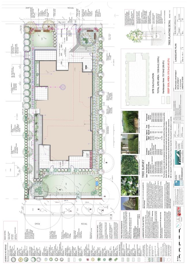
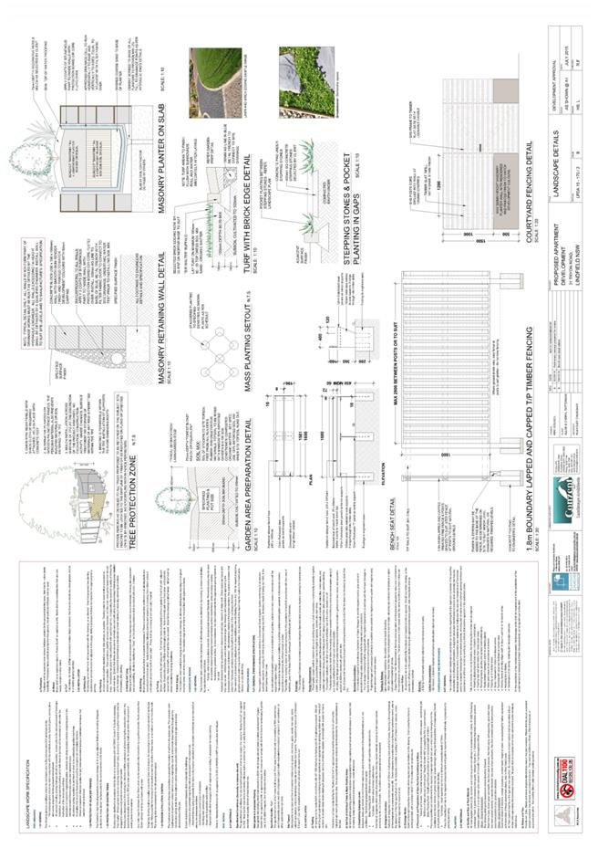
|
APPENDIX No: 8 - Concept
plans for 29 Tryon Road, Lindfield
|
|
Item No: GB.7
|
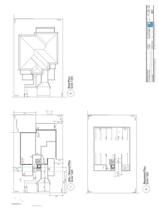
|
Ordinary
Meeting of Council - 8 September 2015
|
GB.8 / 473
|
|
|
|
|
Item
GB.8
|
DA0078/15
|
|
|
17 August 2015
|
Summary
Sheet
|
Report title:
|
49-51 Boomerang
Street, Turramurra - Torrens Title subdivision of one lot into two lots.
|
|
ITEM/AGENDA
NO:
|
GB.8
|
|
Application No:
|
DA0078/15
|
|
Property Details:
|
49-51 Boomerang Street, Turramurra
Lot & DP No: Lot 1 DP 20144
Site area (m2): 2,288m2
Zoning: Residential 2(c)
|
|
Ward:
|
Wahroonga
|
|
Proposal/Purpose:
|
Torrens title subdivision of one lot into two lots
|
|
Type of Consent:
|
Local
|
|
Applicant:
|
DL Long and JC Long
C/-Vaughan Milligan Development Consultants P/L
|
|
Owner:
|
DL Long and JC Long
|
|
Date Lodged:
|
17 March 2015
|
|
Recommendation:
|
Approval
|
Purpose of Report
The purpose of this report is for full Council to determine
DA0078/15 as the proposed development is a two lot Torrens title subdivision
where the land contains endangered ecological species (Blue Gum High Forest).
integrated planning and reporting
PLACES, SPACES & INFRASTRUCTURE
|
Community Strategic Plan Long Term Objective
|
Delivery Program
Term Achievement
|
Operational Plan
Task
|
|
P2.1 A robust planning framework is in place to deliver
quality design outcomes and maintain the identity and character of
Ku-ring-gai
|
Applications are assessed in accordance with State and
local plans
|
Assessments are of a high quality, accurate and consider
all relevant legislative requirements
|
Executive Summary
|
Issues
|
N/A
|
|
Submissions
|
None
|
|
Land & Environment Court
|
N/A
|
|
Recommendation
|
Approval
|
|
|
|
LEGISLATIVE REQUIREMENTS:
|
|
|
|
|
Zoning at lodgement
|
Residential 2(c) (current zoning: R2)
|
|
Permissible under
|
KPSO
|
|
Relevant legislation
|
SEPP 55
SREP 20 – Hawkesbury Nepean River
KPSO
Draft KLEP 2013
Section 94 – Development Contribution
Plan
DCP 55 Notification
|
|
Integrated Development
|
No
|
History
Site
The site has been historically used for residential
purposes. The site was previously zoned “Residential 2(c)” under the provisions
of the Ku-ring-gai Planning Scheme Ordinance (KPSO). On 2 April 2015,
Ku-ring-gai Local Environmental Plan 2015 was gazetted, rezoning the site to
“R2 – Low Density Residential”.
Pre-DA
There was no Pre DA for this application.
DA History
|
17 March 2015
|
The Development Application was lodged.
|
|
|
|
|
25 March 2015
|
The Development Application was notified to owners of
surrounding properties for 14 days.
|
|
|
|
|
13 May 2015
|
A letter was sent to the applicant requesting additional
information regarding:
-driveway crossover
-tree impacts
|
|
|
|
|
3 June
2015
|
A further assessment letter was issued to the applicant
relating to:
-biodiversity significance
|
|
|
|
|
5 June 2015
|
Amended plans and additional information was received from
the applicant.
|
|
|
|
|
9 July 2015
|
Council requested additional information regarding:
-Sewer plan
|
|
|
|
|
4 August 2015
|
The applicant submitted the requested sewer plan.
|
|
|
|
The Site
Site description
|
Visual character study category:
|
1920-1945
|
|
Easements/rights of way:
|
Yes – drainage (along rear boundary)
|
|
Heritage item:
|
No
|
|
Heritage conservation area:
|
No
|
|
In the vicinity of a heritage item:
|
No
|
|
Bush fire prone land:
|
No
|
|
Endangered species:
|
Yes – Blue Gum High Forest (BGHF)
|
|
Urban bushland:
|
No
|
|
Contaminated land:
|
No
|
The site is identified as Lot 1 within Deposited Plan 20144
and is referred to as No. 49-51 Boomerang Street, Turramurra. The site is
located on the north-eastern corner of Boomerang Street and Turramurra Avenue.
It is regular in shape and has a total area of 2288m2, with a
frontage of approximately 26m to Boomerang Street and a depth of 84 to 90.5m.
The site falls gradually to the north-west corner of the site, with a total
cross fall of approximately 3.5m.
The site currently contains a brick dwelling house and
attached garage. The site contains a number of trees, including species
composition characteristic of the Blue Gum High Forest (BGHF) plant community.
Surrounding development
The predominant character of the surrounding development is
of one and two storey dwellings on large landscaped allotments. Adjoining the
site to the north and east are two separate allotments containing single
residential dwellings and landscaping.
The Proposal
The applicant seeks development consent to:
· Subdivide the site into two Torrens
title lots, being:
o Lot 1 – 1077m2
o Lot 2 – 1211m2
· Subdivision work including new driveway
crossing and sewer main extension
· Remove 2 trees from within the site
· The existing dwelling on the proposed
Lot 1 will remain
Consultation
Community
In accordance with the notification requirements of
Ku-ring-gai Council’s Notification Development Control Plan 55, owners of surrounding
properties were given notice of the application. No submissions were received.
Within Council
Landscaping
Council’s Landscape and Tree Assessment Officer commented on
the proposal as follows:
“Tree
impacts
Two trees
are proposed to be removed to accommodate the proposed vehicular crossover from
Turramurra Ave, being T3 Pittosporum undulatum (Native Daphne) and T38
Callistemon salignus (Willow Bottlebrush). The removal of the two trees is
accepted.
The proposed
dwelling footprint encroaches within the TPZ of T29 Eucalyptus saligna (Sydney
Blue Gum) which is identified as being of biodiversity significance within
KLEP2015 mapping. An amended arboricultural assessment has identified the
potential building encroachment based from the indicative building footprint as
being less than 10% and therefore considered minor when assessed agfainst
AS4970-2009. T29 has been identified by the arborist as having low to moderate
significance, however the species is consistent with the critically endangered
Blue Gum High Forest plant community and T29 has been mapped and identified as
being part of the BGHF plant community. Its significance therefore is
considered to be higher than that assessed by the arborist. The defects identified
by the arborist as a result of previous storm damage are noted. Further
structural testing will be necessary (as per the arborist’s recommendations).
Landscape
plan/tree replenishment
Not
required for subdivision.
Stormwater
plan
The site drains
to Turramurra Ave adjacent to the building footprint.
BASIX
Not
required.
Driveway
crossover location
The
location of the driveway crossover is acceptable on landscape grounds.
Proposed
dwelling footprint (Lot 2)
There is a
high number of BGHF trees located on and adjacent to the site, that influence
the development envelope on site, however, the applicant has demonstrated
(Drawing 12710 subdivision detail 11/12/14) that a viable building footprint
could be accommodated without adversely affecting the BGHF trees.
Conclusion
The
application is acceptable on landscape grounds subject to conditions”.
Engineering
Council’s Development Engineer commented on the proposal as
follows:
“The applicant has submitted
amended plans showing works required to provide vehicular access to the new
lot. The plans are satisfactory and may be stamped and listed in Condition 1.
Approval under the Roads Act is required for the driveway crossing and lowering
of the footpath.
There does not seem to be a
need for a Construction Certificate, since the only works required for the
issue of the Subdivision Certificate are the construction of the driveway
crossing and a sewer main extension.
The recommended conditions
allow for the driveway plans to be approved by Council’s Director Operations
prior to the commencement of the works and for the works to be completed prior
to issue of the Subdivision Certificate.
There are no engineering
objections to the proposed subdivision”.
Ecology
Council’s Ecological Assessment Officer commented on the
proposal as follows:
During the site inspection the
vegetation was inspected to determine the presence/ absence of native plant
communities. The vegetation onsite was determined to be representative of Blue
Gum High Forest (BGHF) listed as a Critically Endangered Ecological Community
(CEEC) under the Threatened Species Conservation Act 1995. Native ground
covers were sparse to absent due to past clearing and the establishment of
exotic lawn
Environmental controls
The native vegetation within
the rear of the site has been mapped as “biodiversity significance” under the
KLEP 2014.
Impacts
of the proposal
The proposal does not propose
the removal of any trees that comprise part of the onsite Blue Gum High Forest
or from the area of land mapped as “biodiversity significance”.
Conclusion
The application is acceptable
on ecological grounds, no ecological conditions are warranted.
Outside Council
The application did not require any external referrals.
Statutory Provisions
Environmental Planning and
Assessment Act 1979 (EP&A Act)
The proposal is “Local Development” under Part 4 of the
Environmental Planning and Assessment Act, 1979 (EP&A Act) and requires
development consent.
The provisions of Section 79C(1) of the EP&A Act
determine the matters for consideration in assessing a development application
as stated below:
(a) The
provisions of:
(i) any
environmental planning instrument, and
(ii) any
proposed instrument that is our has been the subject of public consultation
under this Act and that has been notified to the consent authority (unless the
Director General has notified the consent authority that the making of the
proposed instrument has been deferred indefinitely or has not been approved),
and
(iii) any
development control plan; and
(iv) any
planning agreement that has been entered into under section 93F, or any drat
planning agreement that a developer has offered to enter into under section
93F, and
(v) the
regulation s(to the extent that they prescribe matters for the purposes of this
paragraph), and
(vi) any
coastal zone management plan (within the meaning of the Coastal Protection Act
1979), that apply to the land to which the development application relates.
(b) the
likely impacts of that development, including environmental impacts on both the
natural and built environments, and social and economic impact in the locality,
(c) the
suitability of the site for the development,
(d) any submissions
made in accordance with this Act or the regulations,
(e) the
public interest.
The relevant provisions of environmental planning
instruments, proposed instruments and DCPs are addressed in the following
sections of this report. The likely impacts, suitability of the site and public
interest are also addressed below and the submissions received have previously
been addressed.
State Environmental Planning Policies
State Environmental Planning
Policy No. 55 – Remediation of Land (SEPP 55)
The provisions of SEPP 55
require Council to consider the potential for a site to be contaminated. The
subject site has a history of residential use and, as such, it is unlikely to
contain any contamination and further investigation is not warranted in this case.
Sydney Regional Environmental
Plan No. 20 – Hawkesbury-Nepean River (SREP 20)
SREP 20 applies to land within
the catchment of the Hawkesbury Nepean River. The general aim of the plan is
to ensure that development and future land uses within the catchment are
considered in a regional context. The plan includes strategies for the
assessment of development in relation to water quality and quantity, scenic
quality, aquaculture, recreation and tourism. The proposed development is
considered to achieve the relevant aims under this Policy.
Local Content (LEP, KPSO, etc)
Ku-ring-gai Planning Scheme
Ordinance (KPSO)
The KPSO is a planning scheme
ordinance originally made under the Local Government 1919 (LG Act) and
transferred from the LG Act under Schedule 6 of the EP&A Act as
transitional arrangements that continue to be in force.
Like an Environmental Planning
Instrument (EPI) made under Part 3 of the EP&A Act, the KPSO also performs
the purpose of environmental planning within each LGA. This report has
considered the following provisions of the KPSO:
Zoning and permissibility:
The site is zoned Residential
2(c) in the KPSO. The proposed land subdivision is permissible with consent
under Clause 23 of the KPSO. Clause 25H of the KPSO specifically applies to
subdivision in the residential zones and states that land may be subdivided,
but only with development consent.
The following clauses are deemed relevant to the proposal:
Schedule 9 aims and
objectives for residential zones:
The development: (i) provides
satisfactory levels of solar access & privacy to surrounding properties;
(ii) is of a bulk, scale and design, characteristic of the area; (iii)
maintains adequate levels of soft landscaping; (iv) provides suitable
egress/ingress for vehicles; and (v) maintains the landscape quality of the
municipality. Consequently, the aims and objectives for residential development
as outlined by Schedule 9 have been satisfied.
The proposed development meets the zone objectives as it
facilitates additional housing in the locality and the housing is capable of
being compatible with the built character of the low density residential
environment.
The
numerical requirement of subdivision, when compared with the proposal, is
summarised in the table below:
Development standards
Minimum Allotment Size Clause 25H
|
Development standard
|
Proposed
|
Complies
|
|
Site area: 2288m2
|
|
Subdivision for dwelling
houses
|
|
|
|
Site area: 930m²
|
Lot
1: 1077m²
Lot
2: 1211m2
|
YES
YES
|
|
Frontage: 18m
|
Lot
1: 26m (to Boomerang St)
Lot
2: 47.11m (to Turramurra Ave)
|
YES
YES
|
The proposed
subdivision/boundary adjustment complies with the minimum allotment size
development standard set out in the KPSO.
Heritage /conservation areas:
The subject
site is not heritage listed nor does it fall within an existing or draft
heritage conservation area.
Part D: Areas of Biodiversity Significance
Clause
61L of the KPSO requires Council to consider:
(a) the
impact of the proposed development on the following:
(i) any native vegetation community,
(ii) the habitat of any threatened species, population or ecological
community,
(iii) any regionally significant species of fauna, flora or habitat,
(iv) any biodiversity corridor,
(v) any wetland,
(vi) the biodiversity values within any reserve,
(vii) the stability of the land, and
(b) any appropriate measures proposed to avoid, minimise or
mitigate the impacts of the development, and
(c) any opportunity to
restore or enhance remnant vegetation, habitat and
biodiversity
corridors.
Council’s
Ecological Assessment Officer and Landscape and Tree Assessment Officer have assessed the proposal’s impact on the biodiversity
significance of the site and found it to be satisfactory.
Clause
38B – Services
Clause 38B states that consent must not be issued to the
carrying out of development on land unless access to a water supply, drainage
and a sewerage system will be available. The site is connected to the sewer
system and reticulated water is provided.
Draft Ku-ring-gai Local Environmental Plan 2013
The Ku-ring-gai Local Environmental Plan 2015 was gazetted
by the Minister for Planning on 5 March 2015, coming into operation on 2 April
2015. The purpose of the LEP is to replace the KPSO with in LEP version
consistent with the Department of Planning’s standard template.
The effect of the LEP on this application is somewhat
limited as a consequence of Clause 1.8 which states:
1.8A Savings provision relating to development
applications
If a development application has been made before the
commencement of this Plan in relation to land which this Plan applies and the
application has not been finally determined before that commencement, the
application must be determined as if this Plan has not commenced.
Note: However, under Division 4B of Part 2
of the Act, a development application may be made for consent to carry out
development that may only be carried out if the environmental planning
instrument applying to the relevant development is appropriately amended or if
a new instrument, including an appropriate principal environmental planning
instrument, is made, and the consent authority may consider the application.
The Division requires public notice of the development application and the
draft environmental planning instrument allowing the development at the same
time, or as closely together as is practicable.
The effect of this is that, as the application was made
prior to the gazettal of the LEP, it is to be determined as if the LEP had not
commenced, thus deferring assessment of the application to the KPSO.
However, the Court of Appeal has ruled that despite Clause
1.8A, it is necessary to consider the development against draft instruments as
at the time the application was lodged, it was a prescribed matter for
consideration.
When exhibited, the draft Ku-ring-gai Local Environmental
Plan 2013 essentially sought to convert the controls of the KPSO into a format
and structure consistent with the Department of Planning and Infrastructure’s
Standard Instrument template.
Zoning and permissibility:
The site is proposed to be zoned R2 – Low Density
Residential in the draft LEP. The proposed land subdivision is permissible with
consent under clause 2.6 of the Draft KLEP 2013.
Residential zone objectives:
· to provide for the housing needs of
the community within a low density residential environment
· to enable other land uses that
provide facilities or services to meet the day to day needs of residents
· to provide housing that is
compatible with the existing environmental and built character of Ku-ring-gai
The development is consistent with the objectives of the
zone in that it facilitates additional housing in the locality and the housing
is capable of being compatible with the built character of the low density
residential environment.
Draft Ku-ring-gai Local Environmental Plan 2013 (Draft KLEP)
The
Draft KLEP seeks to replace the KPSO by bringing the principal planning
instrument of the Local Government Area (LGA) in line with the standard
instrument. The DKLEP was exhibited from 25 March 2013 to 6 May 2013 and
Gazetted on 2 April 2015. The particular aims of the draft LEP are to guide the
future development of land and the management of environmental, social,
economic, heritage and cultural resources within Ku-ring-gai.
The
subject site is located within an area identified on the statutory maps and as
such the Draft KLEP forms an area of consideration for the assessment of this
application. This assessment report has considered the following provisions of
the Draft KLEP:
Land use table
Under
the Draft KLEP the site would be zoned R2 Low Density Residential. It is
considered that the proposal would not contradict the following draft
objectives and development standards:
4.1
Minimum subdivision lot size
(1) The objectives of this clause are as follows:
(a) to ensure that lot sizes and dimensions are able to
accommodate
development consistent with relevant development controls,
(b) to ensure that lot sizes and dimensions allow development to
be sited to protect natural or cultural features including heritage items,
remnant vegetation, habitat and waterways, and provide for generous landscaping
to support the amenity of adjoining properties and the desired character of the
area.
(c) to ensure that subdivision of low density residential sites
reflects and
reinforces the predominant subdivision pattern of the area,
(2) This clause applies to a subdivision of any land shown on the
Lot Size Map that requires development consent and that is carried out after
the commencement of this Plan.
(3) The size of any lot resulting from a subdivision of land to
which this clause applies is not to be less than the minimum size shown on the
Lot Size Map in relation to that land.
(3A) In addition to subclause (3), development consent must not be
granted for the subdivision of land to create a lot on which the erection of a
dwelling house is permissible if the subdivision would result in a lot that is
less than 18 metres wide at 12 metres from the street frontage of the lot.
(3B) If under Schedule 1 the erection of a dual occupancy (detached)
is permissible on a lot, development consent may, despite subclauses (3) and
(3A), be granted for the subdivision of that lot if a dual occupancy (detached)
has been erected on that lot and the lot has an area of not less than 550m2.
(3C) Despite subclauses (3) and (3A), development consent must not
be granted for the subdivision of land to create a lot on which the erection of
multi dwelling housing or a residential flat building is permissible unless the
subdivision would result in the creation of a lot with any dimension not less
than 23 metres.
(4) This clause does not apply in relation to the subdivision of
individual lots in a strata plan or community title scheme.
(4A) Despite subclause (3), if a lot is a battleaxe lot, or other
lot with an access handle, the area of the access handle is not to be included
when calculating the size of the lot for the purpose of this clause.
Clause 4.1
Minimum subdivision lot size
The
proposal meets the objectives of the clause. The proposed allotment sizes
exceed the specified minimum lot size of 930m² as per Clause 4.1(3) and the
frontage of both allotments meets the minimum dimension of 18 metres in width
at 12 metres from the street frontage of the lot as required under Clause 4.1(3A).
Clauses 4.1(3B), 4.1(3C), (4) and 4(A) do not apply.
It is
noted that the applicant has submitted an indicative dwelling outline of 332m2
for proposed Lot 2 to demonstrate that that the allotment can be developed in
accordance with the development standards. The proposal therefore meets the
requirements of the Draft LEP.
Clause 5.9 Preservation of trees or vegetation
The proposal involves the removal of two trees. Council’s
Landscape and Tree Assessment Officer has no objection to this.
Clause 5.10 Heritage conservation
The site is not a heritage item nor is it located within a
heritage conservation area.
Clause 6.1 Acid sulphate soils
The works are unlikely to lower the water table. As such, no
further investigation is considered necessary.
Clause 6.3 Biodiversity protection
The ‘Natural Resources – Biodiversity Map’ prepared under
the KPSO (LEP No. 218) identifies the site as containing an area of
biodiversity significance. This area contains Blue Gum High Forest. Council’s
Tree and Landscape Assessment Officer and Ecological Assessment Officer are
satisfied the proposed development will have no adverse impact on this
biodiversity significant vegetation.
Clause 6.5 Stormwater and water sensitive urban design
The objective of this clause
is to avoid or minimise the adverse impact of urban stormwater on the land on
which development is to be carried out, adjoining properties, native bushland,
waterways and groundwater systems. The consent authority must be satisfied
that:
(a) water
sensitive urban design principles are incorporated into the design of the
development, and
(b) riparian,
stormwater and flooding measures are integrated, and
(c) the
stormwater management system includes all reasonable management actions to
avoid any adverse impacts on the land to which the development is to be carried
out, adjoining properties, native bushland, waterways and groundwater systems,
and
(d) if
a potential adverse environmental impact cannot be feasibly avoided, the
development minimises and mitigates the adverse impacts of stormwater runoff on
adjoining properties, native bushland, waterways and groundwater systems.
Council’s Development
Engineer has no objection to the proposal, based on the above considerations.
Policy Provisions
Development
Control Plan No. 40 - Construction and Demolition Waste Management
The key objectives of this DCP
are to encourage building design and construction techniques which will
minimise waste generation, implement the principles of the waste hierarchy of
avoiding, reusing and recycling building and construction materials, and
commercial waste, minimise the environmental impacts of waste, promote the
principles of ecologically sustainable development, meet Council's
responsibilities in relation to the Northern Sydney Regional Waste Plan and
assist in achieving the Federal and State Government's waste minimisation
targets.
A waste management plan, demonstrating compliance with the
requirements of the DCP, has been submitted and is acceptable.
Development
Control Plan 47 - Water Management
Council’s Development Engineer
has assessed the proposal against DCP 47 and is satisfied that it meets the
objectives and is acceptable, subject to conditions.
Section 94 Development Contributions Plan 2010
The development attracts a section 94 contribution of $28,681.23
which is required to be paid prior to the issue of the Construction Certificate
(Condition 6).
Likely Impacts
The likely impacts of the development have been considered
within this report and are deemed to be acceptable, subject to conditions.
Suitability of the Site
The site is suitable for the proposed development.
Public Interest
The proposal is considered to be in the public interest.
Conclusion
Having regard to the provisions of section 79C of the
Environmental Planning and Assessment Act 1979, the proposed development is
satisfactory.
|
Recommendation:
A. That
Council, as the consent authority, grant development consent to DA0078/15 for
Torrens title subdivision of one lot to create two lots on land at 49-51
Boomerang Street, Turramurra for a period of two (2) years from the date of
the Notice of Determination, subject to the following conditions:
CONDITIONS THAT IDENTIFY APPROVED PLANS:
1. Approved
architectural plans and documentation (new development)
The
development must be carried out in accordance with the following plans and
documentation listed below and endorsed with Council’s stamp, except where
amended by other conditions of this consent:
|
Plan no.
|
Drawn by
|
Dated
|
|
Subdivision detail
12710 sheet 1 issues 1 and 2
|
C.M.S. Surveyors P/L
|
11/12/14
|
|
Driveway crossing works plan
110336 DW1 issue A
|
Stormcivil
|
29.05.2015
|
Reason: To
ensure that the development is in accordance with the determination.
2. Inconsistency
between documents
In
the event of any inconsistency between conditions of this consent and the
drawings/documents referred to above, the conditions of this consent prevail.
Reason: To
ensure that the development is in accordance with the determination.
CONDITIONS
TO BE SATISFIED PRIOR TO DEMOLITION, EXCAVATION OR CONSTRUCTION:
3. Asbestos works
All
work involving asbestos products and materials, including
asbestos-cement-sheeting (ie. Fibro), must be carried out in accordance with
the guidelines for asbestos work published by WorkCover Authority of NSW.
Reason: To
ensure public safety.
4. Design of works in public road
Prior to the commencement of
works, engineering plans for the new driveway crossing and associated
lowering of the footpath shall be approved by Council's Director Operations
under the Roads Act 1993.
An engineering assessment and
inspection fee is payable. Plans must be submitted to Council, marked to the
attention of Council's Development Engineers, and a copy of this condition
provided, together with a covering letter stating the address of the property
and the DA number.
Reason: To ensure
that plans are suitable for construction purposes.
CONDITIONS TO BE SATISFIED PRIOR TO THE ISSUE OF THE
CONSTRUCTION CERTIFICATE OR PRIOR TO DEMOLITION, EXCAVATION OR CONSTRUCTION
(WHICHEVER COMES FIRST):
5. Infrastructure restorations fee
To ensure that damage to
Council Property as a result of construction activity is rectified in a
timely matter:
a) All work or activity taken in furtherance of the development
the subject of this approval must be undertaken in a manner to avoid damage
to Council Property and must not jeopardise the safety of any person using or
occupying the adjacent public areas.
b) The applicant, builder, developer or any person acting in
reliance on this approval shall be responsible for making good any damage to
Council Property, and for the removal from Council Property of any waste bin,
building materials, sediment, silt, or any other material or article.
c) The Infrastructure Restoration Fee must be paid to the Council
by the applicant prior to both the issue of the Construction Certificate and
the commencement of any earthworks or construction.
d) In consideration of payment of the Infrastructure Restorations
Fee, Council will undertake such inspections of Council Property as Council
considers necessary and also undertake, on behalf of the applicant, such
restoration work to Council Property, if any, that Council considers
necessary as a consequence of the development. The provision of such
restoration work by the Council does not absolve any person of the
responsibilities contained in (a) to (b) above. Restoration work to be
undertaken by the Council referred to in this condition is limited to work
that can be undertaken by Council at a cost of not more than the
Infrastructure Restorations Fee payable pursuant to this condition.
e) In this condition:
“Council
Property” includes any road, footway, footpath paving, kerbing, guttering,
crossings, street furniture, seats, letter bins, trees, shrubs, lawns,
mounds, bushland, and similar structures or features on any road or public
road within the meaning of the Local Government Act 1993 (NSW) or any public
place; and
“Infrastructure
Restoration Fee” means the Infrastructure Restorations Fee calculated in
accordance with the Schedule of Fees & Charges adopted by Council as at
the date of payment and the cost of any inspections required by the Council
of Council Property associated with this condition.
Reason: To
maintain public infrastructure.
6. Section 94 development contributions - other than identified
centres (For DAs determined on or after 19 December 2010).
This
development is subject to a development contribution calculated in accordance
with Ku-ring-gai Contributions Plan 2010, being a s94 Contributions Plan in
effect under the Environmental Planning and Assessment Act, as follows:
Section
94 Development Contributions - Non-Centres
This
development is subject to a development contribution calculated in accordance
with Ku-ring-gai Contributions Plan 2010, being a s94 Contributions Plan in
effect under the Environmental Planning and Assessment Act, as follows:
|
|
|
|
|
|
|
Key
Community Infrastructure
|
|
|
Amount
|
|
|
Local
parks and Local sporting facilities
|
|
|
$24,490.20
|
|
|
Local
recreational and cultural, Local social facilities
|
|
|
$4,191.03
|
|
|
|
|
|
|
|
|
|
|
|
|
|
|
TOTAL
CONTRIBUTIONS
|
|
|
$28,681.23
|
|
|
|
|
|
|
|
The
contribution shall be paid to Council prior to the issue of any Construction
Certificate, Linen Plan, Certificate of Subdivision or Occupation Certificate
whichever comes first in accordance with Ku-ring-gai Contributions
Plan 2010.
The
contributions specified above are subject to indexation and may vary at the
time of payment in accordance with Ku-ring-gai Contributions Plan 2010 to
reflect changes in the consumer price index and housing price index. Prior
to payment, please contact Council directly to verify the current payable
contributions.
Copies
of Council’s Contribution Plans can be viewed at Council Chambers, 818
Pacific Hwy Gordon or on Council’s website at www.kmc.nsw.gov.au.
Notwithstanding the total
above, in accordance with the s94E Direction issued by the Minister for
Planning dated 3 March 2011, for so long as it remains legally in force, the
maximum amount payable for the subject development application shall be
$20,000 x 2= $40,000.
Reason: To ensure the provision, extension or augmentation of the
Key Community Infrastructure identified in Ku-ring-gai Contributions Plan
2010 that will, or is likely to be, required as a consequence of the
development.
CONDITIONS
TO BE SATISFIED DURING THE DEMOLITION, EXCAVATION AND CONSTRUCTION PHASES:
7. Road opening permit
The opening of any footway, roadway, road
shoulder or any part of the road reserve shall not be carried out without a
road opening permit being obtained from Council (upon payment of the required
fee) beforehand.
Reason: Statutory requirement
(Roads Act 1993 Section 138) and to maintain the integrity of Council’s
infrastructure.
8. Prescribed
conditions
The applicant shall comply
with any relevant prescribed conditions of development consent under clause
98 of the Environmental Planning and Assessment Regulation. For the purposes
of section 80A (11) of the Environmental Planning and Assessment Act, the following
conditions are prescribed in relation to a development consent for
development that involves any building work:
· The
work must be carried out in accordance with the requirements of the Building
Code of Australia
· In the
case of residential building work for which the Home Building Act 1989
requires there to be a contract of insurance in force in accordance with Part
6 of that Act, that such a contract of insurance is in force before any works
commence.
Reason: Statutory requirement.
9. Hours of work
Demolition, excavation,
construction work and deliveries of building material and equipment must not
take place outside the hours of 7.00am to 5.00pm Monday to Friday and 8.00am
to 12 noon Saturday. No work and no deliveries are to take place on Sundays
and public holidays.
Excavation or removal of any
materials using machinery of any kind, including compressors and jack
hammers, must be limited to between 7.30am and 5.00pm Monday to Friday, with
a respite break of 45 minutes between 12 noon 1.00pm.
Where it is necessary for
works to occur outside of these hours (ie) placement of concrete for large
floor areas on large residential/commercial developments or where building
processes require the use of oversized trucks and/or cranes that are restricted
by the RTA from travelling during daylight hours to deliver, erect or remove
machinery, tower cranes, pre-cast panels, beams, tanks or service equipment
to or from the site, approval for such activities will be subject to the
issue of an "outside of hours works permit" from Council as well as
notification of the surrounding properties likely to be affected by the
proposed works.
Note: Failure to obtain a permit to work outside of
the approved hours will result in on the spot fines being issued.
Reason: To ensure reasonable standards of amenity
for occupants of neighbouring properties.
10. Approved plans to be on site
A
copy of all approved and certified plans, specifications and documents
incorporating conditions of consent and certification (including the
Construction Certificate if required for the work) shall be kept on site at
all times during the demolition, excavation and construction phases and must
be readily available to any officer of Council or the Principal Certifying
Authority.
Reason: To
ensure that the development is in accordance with the determination.
11. Maintenance period
for works in public road
A maintenance period of six
(6) months applies to all work in the public road reserve carried out by the
applicant - after the works have been completed to the satisfaction of
Ku-ring-gai Council. In that maintenance period, the applicant shall be
liable for any section of the public infrastructure work which fails to
perform in the designed manner, or as would reasonably be expected under the
operating conditions. The maintenance period shall commence once the
applicant receives a formal letter from Council stating that the works
involving public infrastructure have been completed satisfactorily.
Reason: To protect public infrastructure.
12. Road reserve safety
All public footways and
roadways fronting and adjacent to the site must be maintained in a safe
condition at all times during the course of the development works.
Construction materials must not be stored in the road reserve. A safe
pedestrian circulation route and a pavement/route free of trip hazards must
be maintained at all times on or adjacent to any public access ways fronting
the construction site. Where public infrastructure is damaged, repair works
must be carried out when and as directed by Council officers. Where
pedestrian circulation is diverted on to the roadway or verge areas, clear
directional signage and protective barricades must be installed in accordance
with AS1742-3 (1996) “Traffic Control Devices for Work on Roads”. If
pedestrian circulation is not satisfactorily maintained across the site
frontage, and action is not taken promptly to rectify the defects, Council
may undertake proceedings to stop work.
Reason: To ensure safe public footways and roadways
during construction.
13. Services
Where required, the adjustment
or inclusion of any new utility service facilities must be carried out by the
applicant and in accordance with the requirements of the relevant utility
authority. These works shall be at no cost to Council. It is the applicants’
full responsibility to make contact with the relevant utility authorities to
ascertain the impacts of the proposal upon utility services (including water,
phone, gas and the like). Council accepts no responsibility for any matter
arising from its approval to this application involving any influence upon
utility services provided by another authority.
Reason: Provision of utility services.
14. Erosion control
Temporary sediment and erosion
control and measures are to be installed prior to the commencement of any
works on the site. These measures must be maintained in working order during
construction works up to completion. All sediment traps must be cleared on a
regular basis and after each major storm and/or as directed by the Principal
Certifying Authority and Council officers.
Reason: To protect the environment from erosion and
sedimentation.
15. Sydney Water Section
73 Compliance Certificate
The applicant must obtain a Section
73 Compliance Certificate under the Sydney Water Act 1994. An
application must be made through an authorised Water Servicing CoOrdinator.
The applicant is to refer to “Your Business” section of Sydney Water’s web
site at www.sydneywater.com.au
<http://www.sydneywater.com.au> then the “e-develop” icon or
telephone 13 20 92. Following application a “Notice of Requirements” will
detail water and sewer extensions to be built and charges to be paid. Please
make early contact with the CoOrdinator, since building of water/sewer
extensions can be time consuming and may impact on other services and
building, driveway or landscape design.
Reason: Statutory requirement.
16. Trees
on nature strip
Removal/pruning
of the following tree/s from Council's nature strip to permit vehicular
access shall be undertaken at no cost to Council by an experienced tree
removal contractor/arborist holding public liability insurance amounting to a
minimum cover of $20,000,000:
|
Tree/Location
|
Approved tree works
|
|
T3 Pittosporum undulatum
(Native Daphne) Turramurra Ave nature strip
|
Removal
|
|
T38 Callistemon salignus
(Willow Bottlebrush) Turramurra Ave nature strip
|
Removal
|
Reason: To
ensure protection of existing trees.
17. Canopy/root
pruning
Canopy
and/or root pruning of the following tree/s which is necessary to accommodate
the approved building works shall be undertaken by an experienced AQF3
Arborist/Horticulturist. All pruning works shall be undertaken as specified
in Australian Standard 4373-2007 - Pruning of Amenity Trees.
|
Tree/Location
|
Tree
works
|
|
T1
Melia azedarach (White Cedar) Adjacent to western site boundary
|
Root
pruning
|
|
T4
Macadamia tetraphylla (Macadamia) Adjacent to western site boundary
|
Root
pruning
|
Reason: To
protect the environment.
18. Approved tree works
Approval is given for the
following works to be undertaken to the following trees:
|
Tree/Location
|
Approved tree works
|
|
T3 Pittosporum undulatum
(Native Daphne) Turramurra Ave nature strip
|
Removal
|
|
T38 Callistemon salignus
(Willow Bottlebrush) Turramurra Ave nature strip
|
Removal
|
Removal or pruning of any
other tree on the site is not approved, excluding species exempt under
Council’s Tree Preservation Order.
Reason: To ensure that the development is in accordance
with the determination.
19. Hand
excavation
All
excavation within the specified radius of the trunk/s of the following tree/s
shall be hand dug:
|
Tree/Location
|
Radius
from Trunk
|
|
T1
Melia azedarach (White Cedar) Adjacent to western site boundary
|
4.0m
|
|
T4
Macadamia tetraphylla (Macadamia) Adjacent to western site boundary
|
4.0m
|
Reason: To
protect existing trees.
20. No
storage of materials beneath trees
No
activities, storage or disposal of materials shall take place beneath the
canopy of any tree protected under Council's Tree Preservation Order at any
time.
Reason: To
protect existing trees.
21. Removal
of refuse
All
builders' refuse, spoil and/or material unsuitable for use in landscape areas
shall be removed from the site on completion of the building works.
Reason: To
protect the environment.
22. On site retention of waste dockets
All
demolition, excavation and construction waste dockets are to be retained on
site, or at suitable location, in order to confirm which facility received materials
generated from the site for recycling or disposal.
· Each
docket is to be an official receipt from a facility authorised to accept the
material type, for disposal or processing.
· This
information is to be made available at the request of an Authorised Officer
of Council.
Reason: To
protect the environment.
CONDITIONS
TO BE SATISFIED PRIOR TO THE ISSUE OF A SUBDIVISION CERTIFICATE:
23. Sydney
Water Section 73 Compliance Certificate
Prior to release of the linen
plan/issue of the subdivision certificate, the Section 73 Sydney Water
compliance certificate which refers to the subdivision application
must be obtained and submitted to the Council.
Reason: Statutory
requirement.
24. Requirements of
public authorities for connection to services
Prior to the issue of the
Subdivision Certificate, the Principal Certifying Authority shall be
satisfied that the applicant has complied with the requirements of any public
authorities (e.g. Energy Australia, Sydney Water, Telstra Australia, AGL,
etc) in regard to the connection, relocation and/or adjustment of the
services affected by the proposed subdivision. All costs related to the
relocation, adjustment or support of services are the responsibility of the
applicant.
Note: Details of compliance with the requirements
of any relevant public authorities are to be submitted to the Principal
Certifying Authority.
Reason: To ensure that services are available to the
allotments of land.
25. Construction of works
in public road
Prior issue of the Subdivision
Certificate all road, footpath and/or drainage works in the public road must
be completed in full, inspected and approved by Council. The applicant’s
designing engineer is to provide certification upon completion that the works
were constructed in accordance with the Council approved drawings. This
certification shall be provided prior to release of the linen plan/issue of
the Subdivision Certificate. The completed works are to be approved by
Council’s Development Engineer prior to release of the linen plan/issue of
the Subdivision Certificate.
Reason: To ensure completion of all road, footpath
and/or drainage works in the public road.
26. Provision of services
Prior
to issue of the Subdivision Certificate, separate underground electricity,
gas and phone or appropriate conduits for the same, must be provided to each
allotment to the satisfaction of the utility provider. A suitably qualified
and experienced engineer or surveyor is to provide certification that all new
lots have ready underground access to the services of electricity, gas and
phone. Alternatively, a letter from the relevant supply authorities stating
the same may be submitted to satisfy this condition.
Reason: Access to public utilities.
27. Submission of 88b
instrument
If required, prior to the
issue of the Subdivision Certificate, the applicant must submit an original
instrument under Section 88B of the Conveyancing Act with the plan of
subdivision, plus six (6) copies to Council. Ku-ring-gai Council must be
named as the authority whose consent is required to release, vary or modify
the burdens.
Reason: To create all required easements,
rights-of-carriageway, positive covenants, restrictions-on-use or other
burdens/benefits as may be required.
28. Submission of plans
of subdivision (Torrens Title)
For endorsement of the
subdivision certificate, the applicant shall submit an original plan of
subdivision plus 6 copies, suitable for endorsement by Council. The following
details must be submitted with the plan of subdivision and its copies:
a) the endorsement fee current at the time of lodgement
b) the 88B instrument (if required) plus 6 copies
c) all surveyor’s and/or consulting engineers’ certification(s)
required under this subdivision consent
d) The Section 73 (Sydney Water) Compliance Certificate for the
subdivision.
e) Proof of payment of S94 contribution
Council will check the consent
conditions on the subdivision. Failure to submit the required information
will delay endorsement of the linen plan and may require payment of
rechecking fees. Plans and copies of subdivision must not be folded.
Council will not accept bonds in lieu of completing subdivision works.
Reason: Statutory requirement.
29. General
easement/R.O.W. provision and certification
Prior to issue of the
Subdivision Certificate, a registered surveyor is to provide details to
Council that all physical structures are fully contained within the proposed
allotments or will be fully covered by the proposed burdens upon registration
of the final plan of subdivision. Alternatively, where the surveyor is of
the opinion that creation of burdens and benefits is not required, then proof
to this effect must be submitted to the Principal Certifying Authority.
Reason: To ensure that all physical structures are fully
contained within the proposed allotments or will be fully covered by the
proposed burdens upon registration of the final plan of subdivision.
|
|
Amy Bentley
Senior Assessment Officer
|
Selwyn Segall
Team Leader - Development Assessment North
|
|
Corrie Swanepoel
Manager Development Assessment Services
|
Michael Miocic
Director Development & Regulation
|
|
Attachments:
|
A1View
|
Location
Map
|
|
2015/230206
|
|
|
A2View
|
Zoning
Map
|
|
2015/230190
|
|
|
A3View
|
Subdivision
Plan
|
|
2015/177429
|
|
APPENDIX
No: 1 - Location
Map
|
|
Item No: GB.8
|
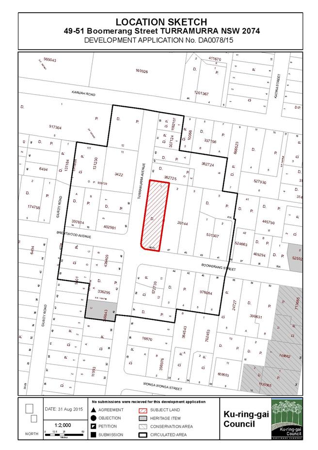
|
APPENDIX No: 2 - Zoning
Map
|
|
Item No: GB.8
|
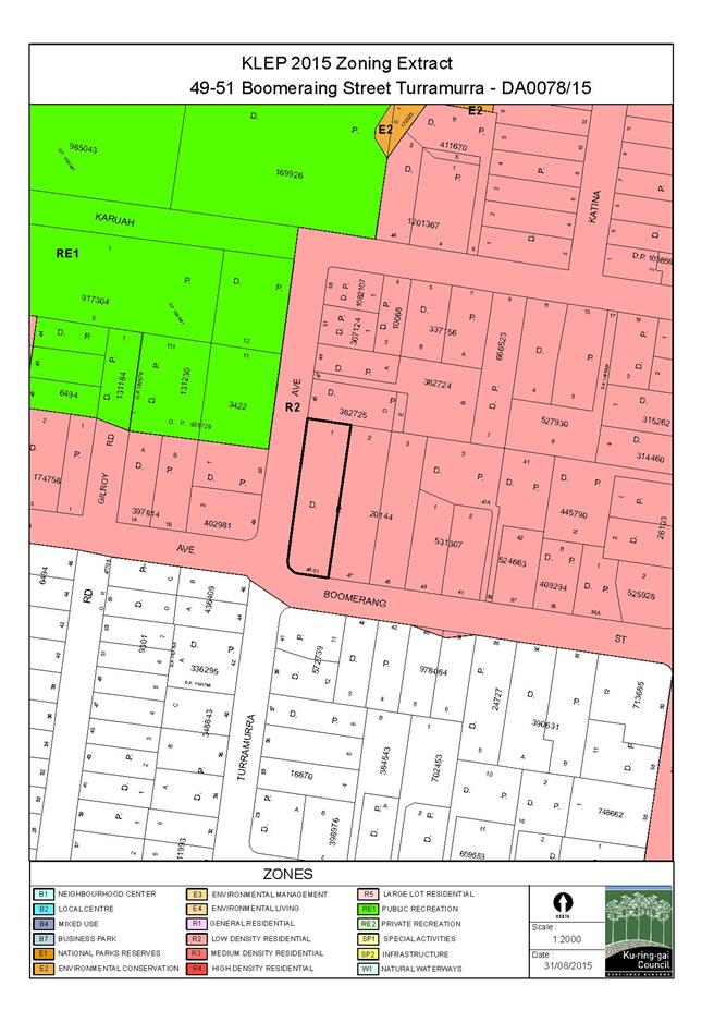
|
APPENDIX No: 3 - Subdivision
Plan
|
|
Item No: GB.8
|
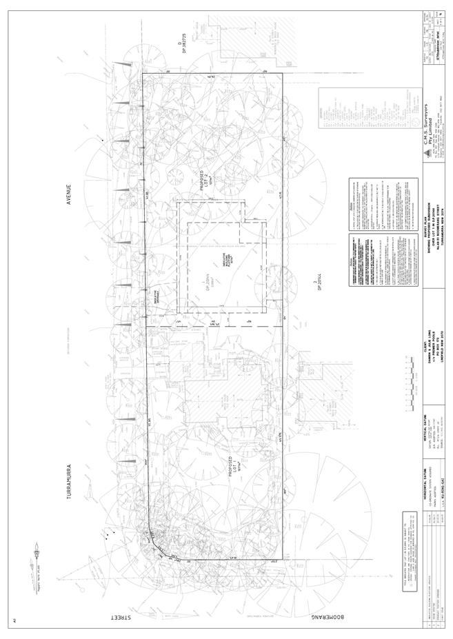
|
Ordinary
Meeting of Council - 8 September 2015
|
GB.9 / 497
|
|
|
|
|
Item
GB.9
|
S10749
|
|
|
30 July 2015
|
Lindfield Community Hub Preferred Option
EXECUTIVE
SUMMARY
|
purpose of report:
|
Present a comprehensive assessment of the 4 (four)
exhibited illustrative development options for the Lindfield Community Hub
site, and recommend a preferred option for Council adoption.
|
|
|
|
|
background:
|
At the Ordinary Meeting of
Council 11 November 2014 Council adopted the following
criteria to be used for the assessment of the adopted development Options 1,
2, 3, and 4:
· Public & Stakeholder responses;
· Project Costs;
· Financial Feasibility;
· Project Objectives;
· Traffic & Transport;
· Community Facilities Review;
· Specialist Council Staff Review;
· Project Working Group (PWG) approval;
and
· Full Council Approval.
|
|
|
|
|
comments:
|
Four illustrative master plan options were prepared
and exhibited during the period 21 March 2015 and 14 May 2015; the community
and all key stakeholders were extensively consulted during this period. At
the same time Council has procured a number of independent consultants to
assess the options against the adopted criteria.
This report presents a
comprehensive assessment of the four options with the view to recommending a
preferred option.
|
|
|
|
|
recommendation:
|
It is recommended that Council
adopt Option 2 (as exhibited) as the preferred option for the Lindfield
Community Hub subject to further refinements or adjustments that may
necessary to address any concerns or issues raised by the
private sector prior during market sounding.
|
Purpose of Report
Present a comprehensive assessment of the 4 (four) exhibited
illustrative development options for the Lindfield Community Hub site, and
recommend a preferred option for Council adoption.
Background
Planning for this site commenced in 2012 following an announcement
by the NSW Government that it intended to build a multi-storey commuter car
park on Council’s land at Woodford Lane, Lindfield. Since that time there has
been extensive reporting to Council with respect to negotiations with Transport
for NSW, land reclassification, community facilities, land acquisition, master
planning, probity matters and road closures.
The full list of council reports which pertain to the
Lindfield Hub project have been set out below for reference:
1. OMC – 26
June 2012 – GB.9 - Council Car Park – Woodford Lane, Lindfield –
Reclassification
2. OMC – 26
February 2013 – GB.16 - Woodford Lane, Lindfield Commuter Car Park
3. Missing
final report for reclassification
4. OMC – 28
May 2013 – GB.10 - Lindfield Community Hub and commuter Car Park – Next Steps
5. OMC – 30
July 2013 – GB.5 – Proposed Reclassification of 1B Beaconsfield Parade and
19 Drovers Way, Lindfield (Woodford Lane Car Park) to Operational Land
Following the Exhibition and Public Hearing Process
6. OMC – 12
November 2013 – C.1 - Potential Property Acquisition – Lindfield
7. OMC - 10
December 2013 - GB.19 - Lindfield Village Green - Tryon Road - Project Update
8. OMC – 24
June 2014 – C.1 - Property Acquisition - Lindfield
9. OMC – 9
September 2014 – GB.4 – Lindfield Community Hub – Woodford Lane – Report on
Progress
10. OMC - 11
November 2014 – GB.7 – Lindfield Community Hub – Probity Matters
11. OMC – 25
November 2014 – GB.8 – Lindfield Community Hub – Probity Management Plan
12. OMC – 9
December 2014 – Tender No. RFT22/2014 – Lindfield Community Hub – Tender For
Consultants to Prepare Illustrative Development Options and Master Plan
13. OMC – 21
April 2015 – GB.5 – Compulsory Acquisition of Roads - Lindfield
At the Ordinary Meeting of Council 9 September 2014 a report
was put to Council seeking approval of three preferred land use scenarios for
the Lindfield Community Hub as the basis for engaging architectural consultants
to prepare illustrative concept designs for public engagement and exhibition.
At that meeting it was resolved (in part) that Council:
A. Adopts
the following land use scenarios as the basis for preparing illustrative
concept plans for community consultation and further technical assessment:
· Option A (the same as Option 1
version 3) - Community facilities with secondary/specialty retail and
residential; a new park; and three storey height limit.
· Option B (the same as option 3b
version 3 and 5% contingency) - Community facilities with major
retail/secondary/specialty retail as well as residential; a new park; and seven
storey height limit.
· Option C (the same as option 4
version 3) - Community facilities with residential only; a new park; and five
storey height limit.
· Option D (the same as option 5 p536)
– full line supermarket (4,200sqm) with community facility,
secondary/speciality retail, additional car spaces and no residential
accommodation, new park on retail podium; and three storey height limit.
B. Adopts the preliminary
project programme as follows:
· Advertise tender for design services
and assess tender, Sept-Nov 2014
· Report to Council preferred tender,
Dec 2014
· Preparation of 3 concept options,
Jan-Feb 2015
· Exhibition and community workshops,
February 2015
· Assessment of options, March 2015
· Report to Council - preferred
concept plan for exhibition, April 2015
· Consultant – preparation of draft
illustrative master plan, Apr-May 2015
· Public Exhibition and information
sessions, June 2015
· Assessment of public submissions,
July 2015
· Report to Council – final master plan
and planning proposal, August 2015
This report completes resolutions A and B as above.
At the Ordinary Meeting of Council 11 November 2014 a report
was put to Council addressing a number of issues raised by Council’s probity
consultant in relation to the Lindfield Community Hub master plan. At that
meeting it was resolved (in part) as follows:
C. That Council utilises the following criteria for the assessment
of the adopted development options A, B, C and D:
· public response to options as
determined by on-line and face-to-face survey responses, public comments during
workshops and information sessions; and public submissions during exhibition;
· a cost review of each option by
Council’s quantity surveyor consultant;
· a financial feasibility analysis of
the options by Council’s land economist consultant;
· a review by Council’s traffic
consultant;
· a review by Council’s community
facilities consultant;
· an officer review of each option
against the objectives of the project as set out in the project brief;
· a review by specialist Council
staff including engineers, traffic, landscape, urban design among others;
· project Working Group (PWG)
approval of preferred preliminary option; and
· full Council approval of preferred
illustrative master plan
This report completes resolution C as above.
Comments
Four illustrative master plan
options were prepared and exhibited during the period 21 March 2015 and 14 May
2015; the community and all key stakeholders were extensively consulted during
this period (refer details under Community Consultation in this report). A
summary of the exhibited options has been provided below and full details of
the four options can be viewed at Attachment A1-Exhibited
Development Options
Option 1 - Key Components
Figure 1: Option 1 - Plan
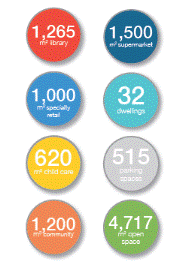
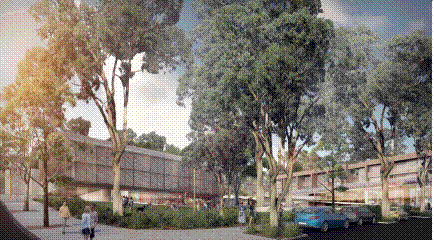
Figure 2: Option 1 – Figure 3: Option 1 – 3-D
View
Development Statistics
Option 2 - Key Components
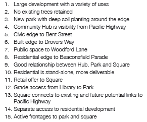
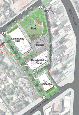
Figure 4: Option 2 - Plan
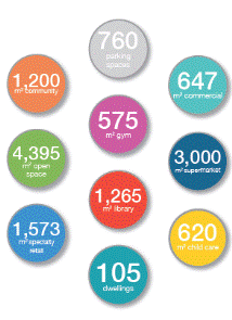
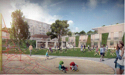
Figure 5: Option 2 – Figure 6: Option 2 –
3-D View
Development Statistics
Option 3
- Key Components`
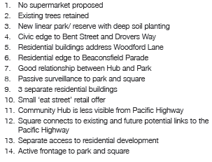
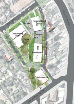
Figure 7: Option 3 - Plan
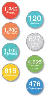
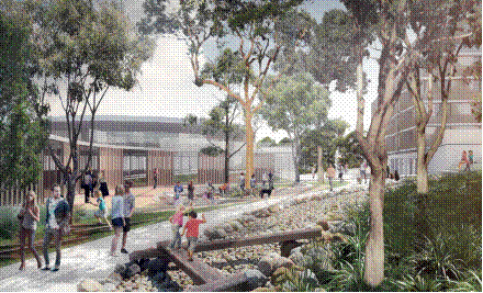
Figure 8: Option 3 – Figure 9: Option 3 – 3-D View
Development Statistics
Option 4 - Key Components
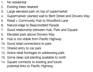
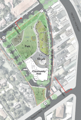
Figure 10: Option 4 - Plan
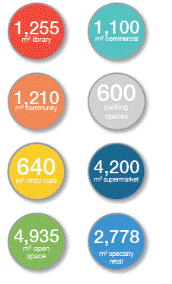
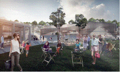
Figure 11: Option 4 – Figure 12: Option 4 –
3-D View
Development Statistics
1. Assessment of Exhibited Master Plan Options
This report seeks to provide a comprehensive assessment of
the site against the criteria adopted by Council in November 2014, with the
view to recommending a preferred option to Council, the criteria are:
· Public & Stakeholder responses;
· Project Costs;
· Financial Feasibility;
· Project Objectives;
· Traffic & Transport;
· Community Facilities Review;
· Specialist Council Staff Review;
· Project Working Group (PWG) approval;
and
· Full Council Approval.
Each option is ranked 1 through to 4 with 4 being the
highest score and 1 being the lowest score. The scores are colour coded for
legibility; green (score of 4); brown (score of 3); orange (score of 2); and
red (score of 1).
1.1 Public
and Stakeholder Responses
Responses to the
exhibited options are addressed under three components:
- On-line
survey results;
- Community
workshop results; and
- Public
Submissions.
CRED community planning was
engaged to manage the community engagement programme for the Lindfield Hub
project and to report on the results. The full engagement outcomes report by
CRED can be viewed at Attachment A2: Lindfield Community Hub,
Community Engagement Outcomes Report by Cred consultants.
1.1.1 On-line
survey results
An online survey was conducted
between 21 March 2015 and 14 May 2015, in which 63% of respondents showed a
preference for Option 4, and the rest for Option 2. Option 4 precludes
residential uses and has a maximum building height of 3 storeys. Results
indicate residents want a new and larger supermarket with a range of high
quality shops.
The main reasons
respondents said they would visit the Lindfield Community Hub were as follows:
- Community
facilities and classes;
- Relaxing
and meeting up with people;
- Convenient
parking and supermarket;
- Library;
- Restaurants
and cafes;
- Retail
and shops;
- Bringing
children to the park/play centre;
- Walking
home from work and the station, through the Hub.
1.1.2 Community
workshop results
An opt-in community workshop was
planned but subsequently cancelled due to lack of interest. A recruited
workshop was held on 9 May 2015, where 78% of people showed a clear preference
for Option 2, and 18% preferred Option 4, the remaining 4% preferred options 1
and 2.
1.1.3 Public
Submissions
There were two written
submissions to Council one from Support Lindfield, a local community group, and
the second from the 2nd and 3rd Lindfield Scouts Group
1.1.3.1 Scouts
Australia: 2nd and 3rd Lindfield Scouts Group Submission
The submission from Scouts
indicated support for the Lindfield Hub redevelopment project and expressed a
preference of options 2 and 4 over the other options. The group also expressed
an interest in relocating to the new community hub building; this matter is
discussed further later in this report. The full Scouts submission is provided
in Attachment A3: Scouts Submission, 2nd and 3rd
Lindfield Scouts Group, 08 May 2015.
1.1.3.2 Support
Lindfield Submission
Support Lindfield made a detailed
submission which claims to be on behalf of 600 members who have contributed
over the last two and a half years. Support Lindfield also state they have over
20,000 flyers distributed and 750 people attending community forums.
A summary of the conclusions of
the Support Lindfield submission are as follows:
- The
community are supportive of a community hub;
- Options
2 and 4 most closely align with the community’s preferences;
- Option
2 is the preferred option with some modifications (increase the supermarket
size to 3,600sqm and amount of specialty retail to 2,100sqm);
- In
relation to options 1 and 3 the community did not prefer these as there was too
little retail; and
- The
community did not identify retention of existing trees as a high priority
particularly where they would restrict the creation of high quality public
spaces and retail floor space.
The Support Lindfield submission
notes that the community is willing to compromise on a number of matters:
- Height
of buildings;
- Inclusions
of apartments in the development for commercial viability;
- Some
increases in local traffic;
- pedestrian
link over the highway;
- environmental
(existing trees).
The Support Lindfield submission
notes that the community is not willing to compromise on:
- Public
spaces and places must be included;
- A
supermarket with a mix of speciality shops;
- Community
focused – enhances sense of community;
- Car
parking – must cater for all uses including commuters;
- Inspiring
design that the community can be proud of.
The full Support Lindfield
submission can be viewed under Attachment A4: Support Lindfield, Submission
to Ku-ring-gal Council on Lindfield Community Hub, 08 May 2015.
In summary, the submissions from
Scouts NSW and Support Lindfield showed a clear preference for options 2 and 4
due to their outstanding public benefits, clear distinction of public and
private domain, and their ability to activate the local area.
|
Criteria
|
Option 1
|
Option 2
|
Option 3
|
Option 4
|
|
Public Submissions
|
1
|
4
|
1
|
4
|
1.1.3.3 Summary
Public Engagement Results
The overall public engagement
results show that Options 2 and 4 are equally favoured by the public. Option 2 provides
for a good mix of uses including community hub building, park, mid-range
supermarket, boutique retail and residential components, providing a
much-needed boost to the local community and the local economy. Option 4
provides for a large-scale supermarket, which was highly desired by the
community. Option 1 proposes a small-scale supermarket which is not in line
with community aspirations. Option 3 has no supermarket and no central focus,
neither of which are in line with community aspirations.
The results of the assessment has
been summarised in the table below.
|
Criteria
|
Option 1
|
Option 2
|
Option 3
|
Option 4
|
|
Online Survey
|
1
|
3
|
1
|
4
|
|
Community Workshop
|
1
|
4
|
1
|
3
|
|
Public Submissions
|
1
|
4
|
1
|
4
|
|
Total
|
3
|
11
|
3
|
11
|
1.2 Project
Cost
MBM Quantity Surveyors were
engaged to prepare a preliminary budget estimate for the project. This report
entitled Lindfield Community Hub Budget Estimate - Preliminary Estimate
Report dated 15 April 2015, is provided in full under Attachment A5:
Lindfield Community Hub, Budget Estimate, Preliminary Estimate Report, 15
April 2015.
MBM have prepared indicative
budget estimate for each of the proposed development options (1, 2, 3 & 4)
for Lindfield Community Hub to be used for preliminary feasibility purposes.
The total estimated cost of each option is set out in the Table below.
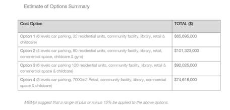
Table
1: Cost Estimate of Options Summary, by MBM
Option 2 is the most expensive
option, at a preliminary estimate of $101.3 million dollars as it is the most
complex in terms of construction and proposes the greatest range of uses;
Option 3 is the second most expensive, at $92 million, because it has a large
number of residential apartments which have higher construction and fit-out
costs when compared to other uses. Options 4 and 1 are the lowest cost options
at $74.6 million and $65.7 Million respectively.
RLB Quantity Surveyors were
subsequently engaged to undertake a peer review of the MBM report; the peer
review paper considers the following issues:
- Strategic
advice;
- Review
of items/rates;
- Library
and Community facilities allowances; and
- Park
and Town Centre allowances.
The full report by RLB is
available in Attachment A6: Peer Review of MBM Cost Estimate by RLB,
25 May, 2015.
RLB’s peer review identified the
following issues:
- The
rates provided by MBM for the construction and fit-out costs of the new
community buildings are significantly below similar bench marks for a high
quality facility.
- The
rates provided by MBM for the new parkland and public domain areas are
considerably lower than similar bench marks for a high quality parks and public
domain areas.
As a result of the peer review RLB
recommend an overall increase in the construction costs of the options of
between $11-12 million.
In summary, a review of the
projects costs shows us that Option 1 incurs the lowest cost and therefore the
lowest cash risk whilst Option 2 incurs the highest cost, and is also the most
complex in terms of the proposed mix of uses, therefore representing the higher
levels of development risk.
|
Criteria
|
Option 1
|
Option 2
|
Option 3
|
Option 4
|
|
Project Cost
|
4
|
1
|
2
|
3
|
1.3 Economic
Feasibility
Based on the MBM and RLB findings,
Jones Lang LaSalle (JLL) were engaged to further refine the economic
feasibility analysis of the options: The full report can be viewed at Confidential
Attachment A7: Addendum No. 2 Feasibility Analysis of Exhibited Options
1-4 Prepared by SJB Urban, by JLL, dated 21 July 2015.
Provided below is a summary of the
scenarios JLL have undertaken analysis on:
- Option
1 - 3 Storey, Community facilities + library, speciality retail, mini-major
retail, residential (32 units), car parking including 240 commuter spaces
- Option
2 - 7 Storey, Community facilities + library, speciality retail, major
retail, commercial, residential (105 units) car parking including 240 commuter
spaces
- Option
3 - 5 Storey, Community facilities + library, speciality retail,
commercial, residential (120 dwellings), car parking including 240 commuter
spaces
- Option
4 - 3 Storey, Community facilities + library, speciality retail, major
retail, car parking including 240 commuter spaces
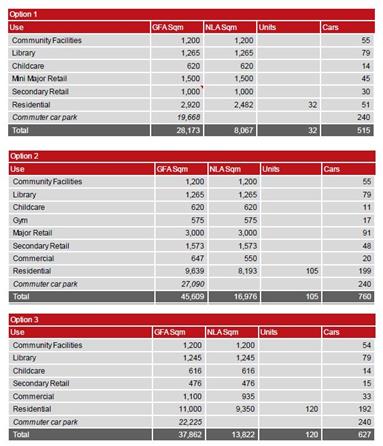
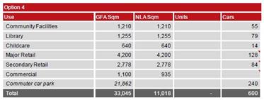
Table
2: Breakdown of floor space and car parking, exhibited options 1-4, by JLL
JLL has various key assumptions
and limitations including but not limited to:
- Equity
injection to the project $13.19million from collected s.94 contributions as at
April 2015.
- Equity
injection to the project $16.8million from the State Government of NSW for the
construction of the commuter car park (subject to agreement from TFNSW).
- No
income is derived from the community uses or car parking.
JLL’s
observations from the above financial analysis are summarised below.
- Option
1 - Provides a poor financial outcome
of based on significant ‘community costs’ (including associated car parking)
with smaller income producing uses.
- Option
2 - Provides an indicative
‘break-even option’ given the provision of residential and major retail uses.
- Option
3 - Presents the most viable option
given the quantum of residential.
- Option
4 - Provides a poor financial outcome
based on the lack of residential which support the options viability. The major
retail also assumes constrained trade based on the assumption that there will
be no right turn lane from Pacific Highway to Beaconsfield Parade.
In
summary, Option 3 presents the most financially rewarding proposition for
Council with option 2 also ’break-even’ proposition (including a small margin
for error, delay or change of project scope).
|
Criteria
|
Option 1
|
Option 2
|
Option 3
|
Option 4
|
|
Economic Feasibility
|
1
|
3
|
4
|
2
|
1.4 Project
Objectives
A comprehensive
assessment of the options was carried out by council staff, against the project
objectives. The full assessment table can be viewed at Attachment A8: Lindfield
Community Hub, Assessment of Options Against Objectives, April 2015.
A summary of the
assessment under the broad project objective headings is given below:
1.4.1 The
Village
A modern urban village,
like a traditional village, provides a range of opportunities for people to
live, work, shop and pursue leisure and cultural interests in the one location.
Social interaction is also a key component of a village:
- Option
3 comprises 70% of its floor space as residential apartments and lacks the
critical retail mass to create a place where residents could complete most of
their shopping in one location
- Option
4 lacks residential apartments which are a critical part of a village as they
provide multiple benefits in terms of people living in an area, caring for an
area, ‘eyes on the street’ for safety and people movements. The total amount of
retail (7,000sqm) in option 4 is also of concern particularly in terms of
impacts on existing traders nearby on the Pacific Highway and impact on road network.
- Options
1 and 2 both provide a balanced range of uses that would have the potential to
create a vibrant local hub.
- The key
differences between option 1 & 2 is the proposed building scale and the
amount of retail floor space, the communities preference in this regard will be
determined through the survey results.
- As
discussed above, 7 storey buildings are compatible with the idea of an urban
village, particularly given the planning context in which properties to the
west/south-west of the site are zoned for 5 storey apartment buildings.
- The
proposed building scale and the amount of retail floor space are considered
further in relation to financial feasibility and market demand.
Options 1 and 2 are considered to
have the best potential to meet the objective of creating a village; option 3
is considered to have the least potential.
|
Criteria
|
Option 1
|
Option 2
|
Option 3
|
Option 4
|
|
The Village
|
4
|
4
|
1
|
2
|
1.4.2 The
Attraction
The development options
explore a range of opportunities to create a place which will attract people to
the area as well as make it easy for people to visit when arriving by car, on
foot or by bicycle. It is important to note that the facilities are planned to
cater for local residents living in the southern part of Ku-ring-gai LGA; it is
not intended to create a place that will necessarily attract people from the
broader region.
- All
options offer local attractions and facilities in the form of a new park, town
square, branch library and community centre;
- Option
1 provides a limited retail offer and as a result the attraction is likely to
be limited. The benefit of this is that it may offer a supportive role to
existing traders on the Pacific Highway;
- Option
2 provides a strong retail offer that is likely to draw people from the local
catchment (southern part of LGA);
- Option
3 offers limited facilities to attract people above and beyond the proposed
community infrastructure;
- Option
4 provides a very large retail offer which has the potential to attract too
many people – traffic modelling suggests the number of visitors by car is
likely to exceed the capacity of the local road network.
Options 1 and 2 are considered to
have the best potential to meet the objective of creating an attraction, while
option 4 may be too large for the context.
|
Criteria
|
Option 1
|
Option 2
|
Option 3
|
Option 4
|
|
The Attraction
|
3
|
4
|
1
|
2
|
1.4.3 The
Canopy
All options to a
greater or lesser extent have responded to this objective. Option 1 and 3
clearly provide the best outcome in terms of deep soil and tree protection.
All options propose
significant new tree planting within the new streets and parks that would, over
the medium, term result in a canopy cover greater than the existing situation
|
Criteria
|
Option 1
|
Option 2
|
Option 3
|
Option 4
|
|
The Canopy
|
3
|
1
|
4
|
2
|
1.4.4 The
Environment
Overall sustainability
is achieved through eliminating the need for multiple trips as the hub becomes
a ‘one stop’ destination.
All options have
proposed green technologies explored to achieve Council’s energy targets:
- Green
technology in buildings;
- Orientation
of residential to maximise solar and cross ventilation;
- Stormwater
storage and re-use.
The heat island effect
of the site would be reduced due to the proposed parkland and tree canopy.
|
Criteria
|
Option 1
|
Option 2
|
Option 3
|
Option 4
|
|
The Environment
|
4
|
4
|
4
|
4
|
1.4.5 Connectivity
Generally, all options
are designed to be well-connected with respect to pedestrians, cyclists and
vehicles, with good access to public transport and cycle routes. The sloping
site poses connectivity challenges however these challenges have been dealt
with in a similar manner in all options. All options improve significantly on
the existing conditions.
|
Criteria
|
Option 1
|
Option 2
|
Option 3
|
Option 4
|
|
Connectivity
|
4
|
4
|
4
|
4
|
1.4.6 Accessibility
The site has accessibility
issues due to the steep fall of the site (approximately 9m from the eastern end
to the western end of the site). All options have been designed with universal
access principles in mind and are therefore more or less equal in this regard.
All options improve significantly on existing conditions.
|
Criteria
|
Option 1
|
Option 2
|
Option 3
|
Option 4
|
|
Accessibility
|
4
|
4
|
4
|
4
|
1.4.7 Safety/Crime
Prevention Through Environmental Design (CPTED)
All options propose to
comply with CPTED principles and will have good lighting to all of the public
spaces. Options 1, 2 and 3 have a mix of residential and retail uses that
allows for passive surveillance of the site during all times of the day and night.
However, Option 4 does not have residential uses which mean that the site has
little or no surveillance during night time.
|
Criteria
|
Option 1
|
Option 2
|
Option 3
|
Option 4
|
|
Safety/CPTED
|
4
|
4
|
4
|
1
|
1.5 Traffic
and Transport Review
A traffic and transport review of
the 4 options was conducted by Transport consultants engaged by Council
(Peopletrans). The full report can be viewed at Attachment A9: Lindfield
Community Hub, Concept Design Options, Transport Review, by Peopletrans, August
2015.
The assessment criteria used by
the consultants are as follows:
· Pedestrians;
- Pedestrian
accessibility to, from and through the site
- Pedestrian
accessibility within the site
· Cyclists;
- Cyclist
accessibility to, from and through the site
- End
of Trip Facilities
· Public Transport Integration (Trains
& Buses);
· General Traffic Accessibility;
- Intersection
Operation
- Car
Parking
- Loading
· Safety.
In summary,
the report made the following conclusions and recommendations:
· The assessment found it was
challenging to choose an outright preferred option as there were positive and
negative elements of each.
· The scale and type of
development of SJB Option 4 would have an unacceptable traffic impact on the
surrounding road network and would have to be scaled back significantly if it
were to be given any further consideration in the context of the other 3
options.
· The elements that could be
compared equitably related primarily to the road network configuration, number
of car parking stations and the location of the car park accesses.
· There were elements that
were identified as part of the Lindfield Transport Model Network Study 2013/14
which was not identified on any of the SJB option layouts including the
following:
- The need to maintain kiss & ride parking on Woodford Lane
(accessed to and from the south);
- The need for a community bus stop located near the community
facilities;
- The importance of Woodford Lane as a public domain/shared zone
street including a contra-flow cycle lane providing a safer link across the
Pacific Highway from the proposed future traffic signals at Strickland Avenue.
In summary,
options 1, 2 and 3 were deemed acceptable from a traffic and transport point of
view. Option 4, however, due to its large supermarket component, would have an
unacceptable traffic impact on the surrounding road network.
|
Criteria
|
Option 1
|
Option 2
|
Option 3
|
Option 4
|
|
Traffic & Transport
|
4
|
4
|
4
|
2
|
1.6 Community
Facilities Review
Elton Consulting were first
commissioned by Ku-ring-gai Council in 2013 to undertake a study of community
facilities in Lindfield and the southern parts of the LGA; the completed study,
entitled Lindfield Community Facilities Study, 2014, provides objectives
and guidelines to guide Council in the planning, design and delivery of new
community facilities in the Lindfield Local Centre.
Elton Consulting were recently
re-engaged to undertake an assessment of the four exhibited options to
determine how each of the options rate against the original objectives and
guidelines; the report can be viewed at Attachment A10: Lindfield
Community Hub Review of Concept Design Options (Community Facilities), 06 May
2015; by Elton Consulting. A summary of the findings is set out
below.
Two options received
significantly higher scores in the assessment – Option 2 and Option 3, with
Option 2 being the highest scoring option. Option 4 was the lowest scoring
option. The assessment findings are summarised below.
Option 2 scored a total of 47/50
and rated well against all criteria. The proposed facility would have a strong
public presence (with both the community centre and library achieving ground
floor access), prominent entries and strong physical and visual open space
connections. The option also includes a reasonable quantity of residential and
retail uses which would assist to activate the site; revitalise the Lindfield
Local Centre and contribute to public safety through passive surveillance.
Option 3 scored a total of 43/50
and rated well against most criteria. The facility design would also result a
prominent facility with at grade entries for both the library and community
centre. With the majority of the library below ground level, the positioning of
the facility foyer (a critical connection between the library and community
centre) may be somewhat restricted and may compromise connections between the
facility components. This option proposes the highest number of residential
dwellings as well as commercial space, which would assist to activate the site
and improve public safety through passive surveillance.
Option 1 received a score of
31/50. The facility is located on a prominent corner of the site however it
would have a lower profile or public presence with the main entry located to
the south and only small entry to the main, Bent street frontage. The option
proposes only a small number of dwellings and small retail component, limiting
the option’s potential to achieve an activated site and contribute to the
revitalisation of the Local Centre. Opportunities for the provision of
contained open space for the community facility are limited. In addition, this
option also represents a missed opportunity to incorporate the adjacent scout
hall into the new community hub (though this cannot be guaranteed in any
option, as it is subject to the outcome of negotiations with Lindfield Scouts).
Option 4 was the lowest scoring
option with a total score of 22/50. The proposed level change between Bent
Street and the site would result in a facility with little public presence and
a lack of connection to the local centre, compromising its potential to be a
key community focal point and gathering space. The lack of other land-uses
limits the potential to achieve a highly utilised, activated site. The park and
facility would also lack public surveillance. This option does not realise the
potential of the site. This option also represents a missed opportunity to
incorporate the adjacent scout hall into the new community hub.
A summary of the assessment is
contained in the table below:
|
Criteria
|
Option 1
|
Option 2
|
Option 3
|
Option 4
|
|
Community Facilities Review
|
2
|
4
|
3
|
1
|
1.7 Council
Staff Workshop
A workshop involving 18
specialist Council staff was held on 22 June 2015 to seek input and feedback on
each development option and to assess each option individually in order to
determine a preferred option. The full staff workshop notes are included in Attachment
A11: Lindfield Community Hub, Staff Assessment Workshop Summary June,
2015.
In summary, the staff
unanimously agreed that option 2 was the preferred option for the site, owing
to its variety in land uses, presence of a mid-range supermarket and clear
distinction of public and private spaces. Option 4 was gauged as second-best,
as it provided a large-scale supermarket, in line with community aspiration.
Option 1 was ruled out because it had a low development potential, proposed a
small-scale supermarket (which went against community aspiration) and was
financially unviable. Option 3 had no clarity between public and private spaces
and was excessive in its residential component.
A numeric summary of
the assessment is provided in the table below.
|
Criteria
|
Option 1
|
Option 2
|
Option 3
|
Option 4
|
|
Staff Workshop
|
1
|
4
|
1
|
3
|
1.8 Project
Control Group (PCG) Approval of Preferred Option
A PCG meeting was held
on 5 August 2015 where an update of the Lindfield Hub project was provided by
council staff and PBS consultants. It was generally agreed that Option 2 would
be the preferred option for the site. To view the full minutes of this PCG meeting,
please refer to Attachment A12: Local Centres – Major Projects, PCG
Meeting Minutes, 5 August 2015.
2. Summary of Assessment
The assessment of the
master plan options has been summarised in the table below.
|
Criteria
|
Option 1
|
Option 2
|
Option 3
|
Option 4
|
|
Public Engagement (online survey, community workshop and public
submissions)
|
3
|
11
|
3
|
11
|
|
Estimated project
Cost
|
4
|
1
|
2
|
3
|
|
Economic Feasibility
|
1
|
3
|
4
|
2
|
|
Traffic & Transport
|
4
|
4
|
4
|
2
|
|
Community Facilities Review
|
2
|
4
|
3
|
1
|
|
Project Objective - Village
|
4
|
4
|
1
|
2
|
|
Project Objective - Attraction
|
3
|
4
|
1
|
2
|
|
Project Objective - Canopy
|
3
|
1
|
4
|
2
|
|
Project Objective - Environment
|
4
|
4
|
4
|
4
|
|
Project Objective - Connectivity
|
4
|
4
|
4
|
4
|
|
Project Objective - Accessibility
|
4
|
4
|
4
|
4
|
|
Project Objective - Safety/CPTED
|
4
|
4
|
4
|
1
|
|
Council Staff Workshop
|
1
|
4
|
1
|
3
|
|
TOTAL SCORE
|
42
|
52
|
39
|
41
|
The assessment deems Option 2
as a clear preference with a score of 52/60 or 87%. Option 1, 3 and 4 are
ranked as less preferred with scores of between 39/60 and 42/60 or 65% to 70%.
3. Next Steps – Market Sounding
Councillors were briefed on 4
August 2015 by staff and consultants advising that a market sounding process
was about to commence. As per an email sent to councillors on the dated
27 August 2015, the process commenced on 31 August 2015 and is expected
to run for 3 weeks.
The market sounding phase involves informal
discussions conducted with selected private sector participants to determine
the private sector’s reaction to Council’s preferred option. This is referred
to as a ‘market sounding’ and the feedback from this process will inform the
preferred option which may then need to be refined or adjusted to address any
concerns or issues raised by the private sector. In addition, it will provide
Council with market based feedback on the Council’s preferred Option 2. This
feedback will then enable Councillors to make an informed decision having
regard to both the community consultation and consultation (albeit limited)
with the private sector. No part consulted in this process has any rights or
advantage over any other parties if and when Council seeks formal market
interest in the project.
As Councillors were advised, two options
are being used in the market sounding process:
· Option 2
because it has been assessed as the preferred option based on Council’s
criteria; and
· Option 4
because the community’s preferences were equally weighted between Options 2 and
4.
It is proposed to report the results of the
market sounding process to full Council at OMC 6 October 2015.
4. Recommendation - Preferred Option
Based on the comprehensive assessment presented in this
report, it is recommended that Council adopt Option 2 as the preferred option.
However, Council is to be mindful that modifications to this option may be
required prior to the EOI process, based on feedback and interest received from
the private sector during the market sounding meetings.
As Councillors were advised at the briefing
on 4 August 2015 consultants have identified that:
· the private
sector is unlikely to be attracted to Option 4 as it lacks residential uses to
make the project profitable; and
· the private
sector is likely to be attracted to Option 2 although it is likely there will
be a desire to increase the residential component of the project through
increased height.
integrated planning and reporting
Places, Spaces and Infrastructure
- P4 Revitalisation of our centres
Community, People and Culture - C4
Healthy lifestyles
|
Community Strategic Plan Long Term Objective
|
Delivery Program
Term Achievement
|
Operational Plan
Task
|
|
A range of well planned, clean and safe neighbourhoods and
public spaces designed with a strong sense of identity and place.
|
P4.1.1
Plans to revitalise local centres are being progressively
implemented and achieve quality design outcomes in collaboration with key
agencies, landholders and the community.
P4.1.4
An improvement plan for Lindfield centre is being
progressively implemented in collaboration with owners, businesses and state
agencies.
|
Implement a place management approach for the local centre
improvements to coordinate works and achieve quality outcomes.
Engage with relevant
stakeholders to establish timing, extent and partnership opportunities.
Undertake due diligence and
undertake project scope.
Identify and engage with the key stakeholders.
|
|
A healthy, safe, and diverse community that respects our
history, and celebrates our differences in a vibrant culture of learning.
|
C4.1.2
New and enhanced open space and recreational facilities
have been delivered to increase community use and enjoyment.
|
Undertake acquisitions for new parks.
Undertake assessment and identify locations for new parks
Complete the design for identified parks and include
design principles which facilitate passive recreation activities.
Construct parks at identified locations and include design
principles which facilitate passive recreation activities
|
Governance Matters
The following set of governance documents are currently
being prepared, or are completed, for the Lindfield Community Hub Project.
These documents are intended to guide the day-to-day management of the project,
including the market sounding phase and the EOI phase. They are:
· Governance Structure;
· Probity Management Framework;
· Probity Plan & Market Sounding
Probity Protocol;
· Scope Management Plan;
· Communications Strategy;
· Project Decision Making Framework; and
· Probity Protocol - Separation of
Planning Powers.
Probity Management Framework
The Probity Framework is required to ensure that each aspect
of the process is, and is seen to be, open and transparent, that any conflict
of interest is avoided, pecuniary interests declared and that all aspects of
the project process complies with relevant legislation.
The Probity Framework includes documentation of the
relationship between parties involved in the project, including the
independence of any parties engaged by Council to undertake any relevant
consulting, be it financial, market and economic analysis, or any other
relevant assignment for the project.
The Probity Framework includes details on the probity
fundamentals in accordance with the Independent Commission Against Corruption’s
probity advising guidance material as well as key areas and controls to be
implemented during the project to ensure that these principles are met. This
document was reported to Council on 25 November 2015.
Governance
Structure
The governance structure for the Lindfield Community Hub
sets out the hierarchy of decision making bodies and their roles and
responsibilities.
This document is complete and attached to this report in Attachment
A13: Governance Structure, Lindfield Community Hub, GMD Approved and
it is recommended that Council adopt this plan.
Probity Plan & Market Sounding Probity Protocol
This document supports the Probity Management Framework and
provides more specific on roles and responsibilities as well as identifying key
probity risks. The plan also includes a probity protocol for the market
sounding phase of the Lindfield Community Hub project.
Council has engaged consultants to undertake market sounding
with selected developers on its behalf for the Project. This will involve face
to face meetings with developers to determine the level of interest in the
Project. The Market Sounding Probity Protocol is for use by Council and
its consultants and sets out the probity requirements for the market sounding
process to ensure that probity is maintained, that industry members are
confident that they can participate fully in the knowledge that proprietary
information will be protected and that commercially valuable information is kept
confidential.
This document is complete and attached to this report at Attachment
A14: Lindfield Community Hub Probity Plan & Protocol (Market
Sounding) by PBS, August 2015 and it is recommended that Council adopt the
Plan and Protocol as attached.
Probity Protocol - Separation of Planning Powers
The purpose of this Protocol is to formalise a framework for
the assessment of the rezoning and development applications, and other related
applications, where Council has a land use regulator role and the value of the
development warrants consideration by the JRPP ($5 million).
The Protocol is intended to address probity issues arising
from Council’s roles as an assessment authority (subject to the role of the
JRPP), as a current land owner but also taking into consideration circumstances
whereby Council has previously resolved its preferred outcome for the site
(such as through master planning initiatives).
This document is currently under preparation and may be
reported to Council in the near future.
Project Decision Making Framework
This document provides a framework to facilitate the
effective management all levels of decisions associated with the Lindfield
Community Hub Project. The application of this framework will provide an
effective and transparent basis for prudent decision making in all aspects of
the project. The process is iterative in nature, requiring decision based on
quantifiable data resulting in a transparent and auditable process.
This document is complete and attached to this report in Attachment
A15: Lindfield Community Hub, Decision Making Framework, by PBS, 25
August 2015 and it is recommended that Council adopt the Framework as
attached to this report.
Scope Management Plan
This document is currently under preparation and will be
reported to Council in the near future.
Communications Strategy
This document is currently under preparation and will be
reported to Council in the near future.
RISK MANAGEMENT
The following set of risk related documents are currently
being prepared, or are completed, for the Lindfield Community Hub Project:
· Risk Management Plan;
· Risk Management Matrix;
· Due diligence report.
Risk
Management Plan
This document provides a framework for the effective
management of all levels of risk associated with the Lindfield Community Hub
Project Centre project; application of the plan will provide an effective basis
for prudent decision making in all aspects of the project.
This
document will achieve this by defining the following:
· Defining the project objectives and
scope of risk management activities;
· Definitions of major risk sources and
the criteria used to rate them;
· The process that will be/has been
adopted by the Project Control Group (PCG) to identify, analyse, evaluate, and
treat risks (risk assessment) during the project;
· How reporting on risk status, and
changes to risk status, will be undertaken within the project;
· Establish a sound framework for
communicating risk management activities with all project stakeholders; and
· Define the roles and responsibilities
for the management of risk;
Risk
within this project will be managed using the standards and procedures set out
in AS/NZ ISO 31000:2009 – Risk Management – Principals and Guidelines.
This document is complete and attached to this report in Attachment
A16: Lindfield Community Hub, Risk Management Plan, by PBS, July 2015 and
it is recommended that Council adopt this Plan.
Risk
Management Matrix
A project-specific Risk Management Matrix is currently being
prepared in conjunction with Council’s risk officer. The details of this Plan
will be reported to Council once finalised.
Due Diligence Report
A comprehensive due diligence checklist has been prepared
and staff are currently seeking all information for Council owned land within
the site area of the Lindfield Community Hub. Once compiled the completed
report will be reported to Council. The list of items includes the following
items:
· a section 149 certificate for the land;
· a diagram for the land from a
recognised sewerage authority that purports to show the location of the
authority’s sewer in relation to the land;
· a copy of the title search for the lot;
· a copy of a plan for the land issued by
the LPI;
· a copy of all deeds, dealings and other
instruments lodged or registered as shown on the title search for the land that
creates an easement, profit à prendre, restriction on the use of land or
positive covenant that burdens or benefits the land;
· a survey report that discloses: any
encroachment onto any adjoining land by any building or structure other than a
dividing fence, and any encroachment onto the Transfer Land by any building or
structure on any adjoining land other than a dividing fence;
· if the land is subject to any adverse
affectations, information on those affectations;
· if there is any matter in relation to
any building or structure on the land that is included in the sale of the land
that would justify the making of any upgrading or demolition order, information
on that matter;
· any building certificates that have
been issued in relation to a building or structure on the land;
· if the land is burdened by a positive
covenant imposed under Division 4 of Part 6 to the Conveyancing Act 1919,
information on whether any amount is payable under section 88F of that Act in
respect of the land, and
· if the land is subject to an annual
charge for the provision of coastal protection services under the Local
Government Act 1993, a section 603 certificate in respect of that land;
· Geotechnical Survey and bore holes;
· Topographic and boundary survey
(including encroachments as above);
· Environmental Assessment
(contamination): Phase 1 and 2;
· Arboriculture Study;
· Flora and fauna study.
Financial Considerations
As reported earlier in this report the preferred option
(Option 2) has been assessed by Council’s
consultants Jones Lang LaSalle as providing for a ‘breakeven’ financial outcome
for Council given the level of provision of residential and major retail uses.
Their advice is that this as an acceptable basis on which to move forward with
the project at this stage.
The financial model for this
project includes a contingency sum available to fund some additional community
works which might include, and subject to Council resolution:
· A pedestrian bridge over the Pacific
Highway and associated land acquisition;
· Land purchases by negotiation for road
widening identified in the Lindfield Traffic Study, 2014;
· Land purchases by negotiation for a new
pedestrian access way connecting Woodford Lane and the Pacific Highway;
· Land purchases by negotiation and/or
works costs associated with incorporating AUSGRID and/or Lindfield Scouts
within the development site.
The costs of these items are as yet unquantified (except for
the bridge which was reported to Council at OMC 9 September 2014 with an
estimated cost of $2.7-4.6 million in 2014 dollars) however it is considered
highly unlikely that all these elements will be funded within the contingency
allocated.
Council may need to seek additional development yield from
the project for what it might see as important additional works. Alternatively
Council may need to find other funding sources however it is noted that the
latter course of action is not consistent with Council’s adopted Resourcing
Strategy.
Updates on these matters will be reported to Council as
costs are quantified and priorities identified.
Social Considerations
Council, as part of the Delivery
Program 2013-2017 and Operational Plan 2013-2014, seeks to revitalise the
Lindfield local centre to improve the vitality and liveability. The key
objective of the project is to create a vibrant community hub for Lindfield
incorporating a new branch library and community centre, town centre park,
commuter and community parking with other uses such as retail and residential
spaces. Council envisages this to be a rare opportunity to create a precinct
which will be a valuable asset to the residents of Lindfield and the wider
community to gather in a quality urban environment.
The provision of additional
community infrastructure providing both outdoor and indoor community spaces
will continue to support this process and help Ku-ring-gai continue to be a
vibrant and popular place to live for all ages.
Environmental Considerations
As noted above a comprehensive due diligence checklist has
been prepared and staff are currently seeking all information for Council owned
land within the site area of the Lindfield Community Hub. The list of items
includes the environmental considerations such as a geotechnical survey,
environmental assessments (contamination), an arboriculture study and a flora
and fauna study.
Community Consultation
1. Stakeholder
Consultation
There are a number of key stakeholders for this project
including: Lindfield 2nd 3rd Scouts Group; Transport for
NSW (TFNSW); AUSGRID; and the Ku-ring-gai Youth Development Services (KYDS).
Below is an update on discussions with these groups; these
matters brought to Councillor’s attention at briefing 4 August 2014.
1.1 Lindfield
2nd 3rd Scouts Group
Lindfield 2nd 3rd Scouts occupy a hall located at 1A
Beaconsfield Parade, Lindfield (Lot 2 of DP184154; Lot c of DP 399995; and Lot
A of 327729). The property is owned by the Boy Scouts Association.
In May 2015 Lindfield 2nd 3rd Scouts made a submission to
Council following the exhibition of the Lindfield Community Hub options; in
their submission the Group expressed interest in relocating from their current
building into the proposed community hub building. The Group see a strong
synergy between their activities and the proposed activities within the hub.
The preferred option (Option 2) envisaged the potential of
utilising the Scouts’ land as part of the community hub project as shown in
Figure 13 below. It can be seen that the Scouts’ land is proposed to
accommodate residential uses.
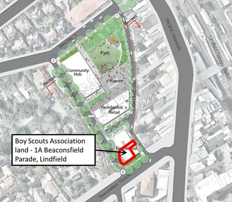
Figure 13: Option 2 showing location of Scouts land
Since receiving the submission, Council officers and
consultants have met with representative of Lindfield Scouts to gain further
insight into their requirements. The meetings have been positive, and
discussions have indicated that Scouts position is as follows:
· Scouts are supportive of the community
hub project;
· Scouts have not yet made a decision to
relocate and this would be dependent on ongoing talks with Council;
· There are three levels of Scouts
management (National, branch and local) that must approve the possible
relocation, any of which can refuse the offer to relocate;
· Scouts will not consider a relocation
offer that provides any lesser accommodation than they currently enjoy.
· Scouts may wish to allow for expansion
room to allow for the possible relocation of Scouts regional office into a new
facility with them;
· They have considered alternate
locations nominated by Council off the site however they find the locations are
not acceptable due to space constraints and/or distance from the rail station;
· Scouts have prepared a sketch that
outlines their current and future spatial needs;
· Scouts Lindfield wish to enter into a
Memorandum of Understanding with Council. This would allow them to seek
approval from the various levels of the organisation prior to commencing
detailed negotiations with Council;
· The Group has constituted a sub-committee
to advance discussions with Council to relocate into the community hub; and
· If for whatever reason Scouts are to
stay in their current hall, their main interest is in ensuring that community
hub project does not adversely impact their operation.
Given the time frame for an agreement between Council and
Scouts is likely to take between 6-12 months, the inclusion of the Scouts’ land
within the preferred option at this stage of the project has been identified as
a significant project risk. The multiple levels of approval across the Scouts
organisation also add considerable uncertainty. If Council is of a mind to
adopt preferred Option 2 for this project as a result of this report the next
step will be to advertise an Expression of Interest (EOI) to the private sector
seeking financial offers. Consultants engaged by Council to assist with the EOI
have advised not to include the Scouts’ land as part of this process so that
tenderers have high levels of certainty. However, the consultants have advised
that the potential for the Scouts land to be included and the status of
engagement with Scouts (e.g. Memorandum of Understanding between Scouts and
Council) be fully described in the EOI so that tenderers responses can
accommodate this potentiality via alternate proposals.
It is important to be clear that this does not mean
Lindfield Scouts will not be included in the project in the future. Option 2
(if adopted) will be the preferred master plan option and Council staff and
consultants will continue to work with representatives of Lindfield Scouts to
facilitate this outcome.
In terms of the proposed compulsory acquisition of Drovers
Way; Scouts have expressed concern that their trailer access to the rear of the
Scouts Hall will be impeded by the closure. Scouts have therefore requested
that the road be only partly closed in order that their trailer access may be
left unimpeded. The merits or purported rights of Scouts on this issue are not
discussed or conceded here.
1.2 Transport
for NSW (TfNSW)
In May 2012 the NSW
Government announced by media release it will build a new commuter car park
comprising 240 new spaces in Lindfield. Since that time, and in accordance with
Council resolutions, staff have worked in close liaison with
representatives from TFNSW to resolve the location and number of commuter car
parking in Lindfield through the two Lindfield projects – the Village Green and
the Community Hub.
Given the stage of planning for the two projects TFNSW has
suggested that Council submit a formal proposal to the Assistant Deputy
Secretary - Planning Division of Transport for NSW for the Minister’s approval
as the basis for commencing negotiations and completing an agreement between
the parties for the delivery of 240 commuter car spaces in Lindfield local
centre. The proposal will cover two key aspects:
· The proposed location or spatial
arrangement of the commuter car parking
· The estimated cost of the car parking
A proposal is currently under preparation and will be
reported to Council in the near future.
1.3 AUSGRID
An AUSGRID substation is located at 1 Beaconsfield Parade,
Lindfield (Lot 1 of DP184042), adjoining the Scouts land. The property is owned
by the AUSGRID.
The preferred option (Option 2) envisaged the potential of
utilising the AUSGRID land as part of the community hub project as shown in
Figure 14. It can be seen that the AUSGRID land is proposed to accommodate
residential uses.
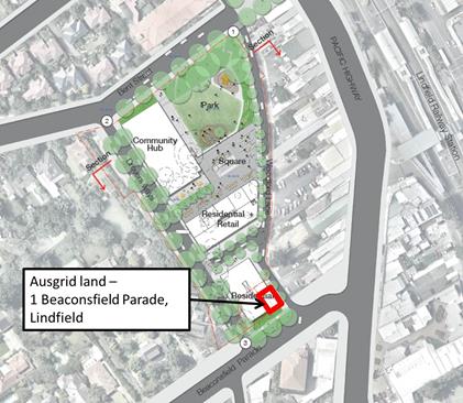
Figure 14: Option 2 showing location of Scouts land
Several meetings have been held to date between
representatives of AUSGRID, Council staff and Council-appointed consultants.
AUSGRID have verbally indicated that they may be willing to move from their
current location and into one of the basement levels of the community hub
building, provided they are remunerated at market rate for their land and a new
substation is built within the development. AUSGRID have a standard procedure
with respect to sale of their land and change of premises; the final agreement
will be determined by AUSGRID’s property section in discussions with Council
staff. This approach is not unusual for a development of this scale, though it
is as yet unquantified, and may be a project risk.
Staff and consultants will continue to meet with
representatives of AUSGRID and as discussions progress the outcomes will be
reported to Council. Further work will also be undertaken to determine the
financial implications and risk profile for the project.
1.4 Ku-ring-gai
Youth Development Services (KYDS)
At OMC 11 November 2014 Council resolved to “relocate the Ku-ring-gai Youth Development Service (KYDS)
service within the proposed Lindfield community hub (upon completion of the
facility) and that the new facility provide purpose-built rooms to be designed
in consultation with representatives of KYDS to meet their specific
requirements”.
Since that time two meetings have been held with
representatives of KYDS to discuss the proposed relocation of the service to
the new community hub building once constructed. Council’s architect (SJB)
attended the second meeting to understand the spatial needs.
KYDS have since written to Council (Refer Attachment A17: Letter
from KYDS to Council dated 26 June, 2015) setting out their preferred
location – which is within the hub building – and their likely space and
functional requirements post-2017. Current planning assumes replacement of
similar space to what KYDS currently occupy, albeit, of course, new and
purpose-built. Any additional space requirements or an alternate location are a
matter for Council at a future point in time.
2. Community
Consultation
Council started the conversation with the local community on
the opportunities and vision for the Lindfield Community Hub in early 2014 by
creating the ‘Activate Lindfield’ initiative. Since that time 692 residents,
business owners and other interested stakeholders have signed-up to the
Activate Lindfield e-newsletter.
In late 2014 Council established a web page for the project;
this is continually updated as new information comes to hand such as Council
reports and consultant reports.
In April 2015 flyers were sent by post to 8,032 residents in
Lindfield, Roseville and Killara to announce the upcoming exhibition commencing
in April 2015. Council also produced a brochure for residents to take home from
the exhibition to assist with completing the on-line survey.
The public exhibition went for eight weeks from Saturday 21
March to Friday 8 May 2015 with a further extension to Thursday 14 May 2014.
During this time the community, invited to provide feedback on the four
options; there were numerous ways residents could ask questions and provide
feedback on the designs:
· Attend the exhibition launch event
which was held on Saturday 21 March;
· Complete a Lindfield Community Hub
survey on-line;
· Visit the mobile exhibition space at
Council’s Woodford Lane car park where Council staff were available to talk
about the designs at the following times:
- 8am -
11am on Tuesdays
- 11am –
2pm on Wednesdays
- 3pm –
6pm on Thursdays
- An
option was also provided for groups of six or more, to make an appointment for
another time
· Register to attend a workshop;
· Complete a printed survey which was
available at Council’s Customer Service Centre at 818 Pacific Highway
Gordon during business hours;
· Mail a submission to Ku-ring-gai
Council Locked Bag 1056 Pymble NSW 2073; or
· Join a discussion using one of the
online “Have Your Say” tools which include 'Q&A', 'online forum' and
'Submit comment direct to Council'.
The following table summarises the engagement method and
number of people involved.
|
Consultation
method
|
Respondent
group
|
Number
|
|
Exhibition launch
|
General community
|
200
|
|
Mobile exhibition space
|
General Community
|
36 attended to discuss project
with staff over 8 weeks
|
|
Lindfield Community Hub
Survey
|
General community
|
206 responses
|
|
1 x Lindfield Community
Hub opt-in workshop
|
Local residents and
businesses
|
Cancelled
due to
low registration
|
|
1 x Lindfield Community
Hub recruited workshop
|
Recruited (via
telephone) local residents randomly selected and representative of a broad
range of age groups, genders, and cultural backgrounds
|
28 participants
|
|
On-line questions via
“Have Your Say”
|
General Community
|
9 questions via the
website. Responses were provided by Council staff
|
|
Submissions to Council
|
General Community
|
2 submissions
|
|
Web site traffic
|
General Community
|
1035 unique visits &
794 active visitors
|
Internal Consultation
Internal consultation for this project is prescribed by the Governance
structure for this project as follows:
· Ku-ring-gai Council / Elected Officials;
· Executive Steering Committee (GMD);
· Project Sponsor - Director Strategy and Environment;
· Project Manager - Team Leader Urban Design;
· Project Control Group (PCG) (meetings are currently held
bi-monthly);
· Project Working Group (PWG);
· Tender Review Committee.
Summary
Four illustrative master plan options for the Lindfield
Community Hub were exhibited by Council during the period 21 March 2015 and 14
May 2015.
A thorough assessment of the exhibited options is now
complete. The assessment process has deemed Option 2 as the preferred option
for a wide variety of reasons, financial and traffic considerations being of
primary significance.
Council’s consultants have commenced a market sounding
process based on options 2 and 4, these being the most favoured by the
community. A clear idea as to the private sector’s view on the options will
emerge from this process; the feedback and recommendations from the market
sounding process will be reported to Council at OMC 6th October
2015. Further refinements to Option 2 may be required prior to Council
advertising an Expression of Interest.
|
Recommendation:
That Council:
A. Adopt
Option 2 (as exhibited) as the preferred option for the Lindfield Community
Hub subject to further refinements or adjustments that may necessary to address any concerns or issues raised by the private sector
prior during market sounding;
B. Adopt
the Governance Structure for the Lindfield Community Hub as attached to this
report;
C. Adopt
the Probity Plan & Market Sounding Probity Protocol for the Lindfield
Community Hub as attached to this report;
D. Adopt
the Project Decision Making Framework for the Lindfield Community Hub as
attached to this report; and
E. Adopt
the Risk Management Plan for the Lindfield Community Hub as attached to this
report.
F. That
staff report back to council advising on the results of the market sounding
and on any recommended refinements to the preferred option prior to
advertising an Expression of Interest.
|
|
Bill Royal
Team Leader Urban Design
|
Sarah Koshy
Senior Urban Designer
|
|
Antony Fabbro
Manager Urban & Heritage Planning - Strategy and
Environment
|
|
|
Attachments:
|
A1View
|
Exhibited
Development Options
|
|
2015/068839
|
|
|
A2View
|
Activate
Lindfield, Lindfield Hub, Community Engagement Outcomes Report by Cred
Consultants
|
|
2015/150732
|
|
|
A3View
|
Scouts
Submission, 2nd and 3rd Lindfield Scouts Group, 08 May 2015
|
|
2015/116977
|
|
|
A4View
|
Activate
Lindfield, Submission to Ku-ring-gal Council on Lindfield Community Hub, 08
May 2015.
|
|
Click here
to open
|
|
|
A5View
|
Lindfield
Community Hub, Budget Estimate, Preliminary Estimate Report, 15 April 2015
|
|
2015/091591
|
|
|
A6View
|
Peer
Review of MBM Cost Estimate, 25 May 2015
|
|
2015/128532
|
|
|
A7View
|
Addendum
No. 2 Feasibility Analysis of Exhibited Options 1-4 Prepared by SJB Urban, by
JLL, dated 21 July 2015
|
|
Confidential
|
|
|
A8View
|
Lindfield
Community Hub, Assessment of Options Against Objectives, April 2015.
|
|
2015/226972
|
|
|
A9View
|
Lindfield
Community Hub, Concept Design Options, Transport Review, by Peopletrans,
August 2015
|
|
2015/200303
|
|
|
A10View
|
Lindfield
Community Hub Review of Concept Design Options (Community Facilities), 06 May
2015; by Elton Consulting
|
|
2015/111423
|
|
|
A11View
|
Lindfield
Community Hub, Staff Assessment Workshop Summary, June 2015
|
|
2015/226999
|
|
|
A12View
|
Local
Centres – Major Projects, PCG Meeting Minutes, 05 Aug 2015
|
|
2015/227007
|
|
|
A13View
|
Governance
Structure, Lindfield Community Hub, GMD Approved
|
|
2015/225042
|
|
|
A14View
|
Lindfield
Community Hub Probity Plan & Protocol (Market Sounding) by PBS, August
2015
|
|
2015/224857
|
|
|
A15View
|
Lindfield
Community Hub, Decision Making Framework, by PBS, 25 August 2015
|
|
2015/225012
|
|
|
A16View
|
Lindfield
Community Hub, Risk Management Plan, by PBS, July 2015
|
|
2015/224958
|
|
|
A17View
|
Letter
from KYDS to Council dated 26 June 2015
|
|
2015/226144
|
|
APPENDIX
No: 1 - Exhibited
Development Options
|
|
Item No: GB.9
|
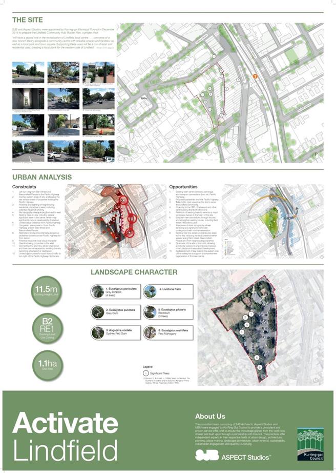


|
APPENDIX No: 2 - Activate
Lindfield, Lindfield Hub, Community Engagement Outcomes Report by Cred
Consultants
|
|
Item No: GB.9
|
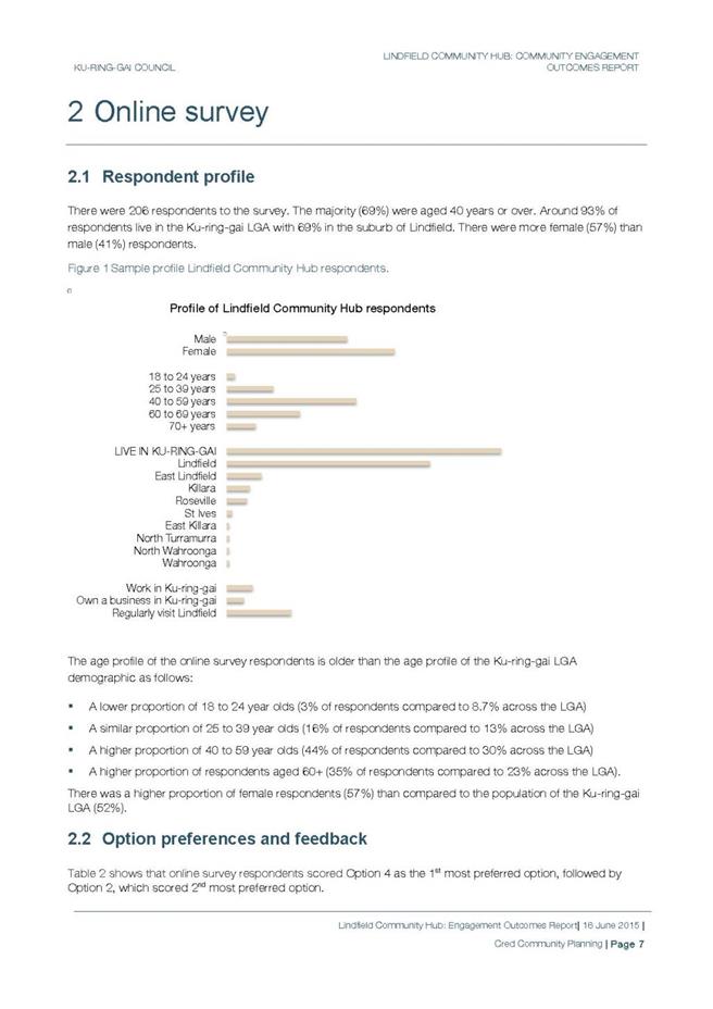
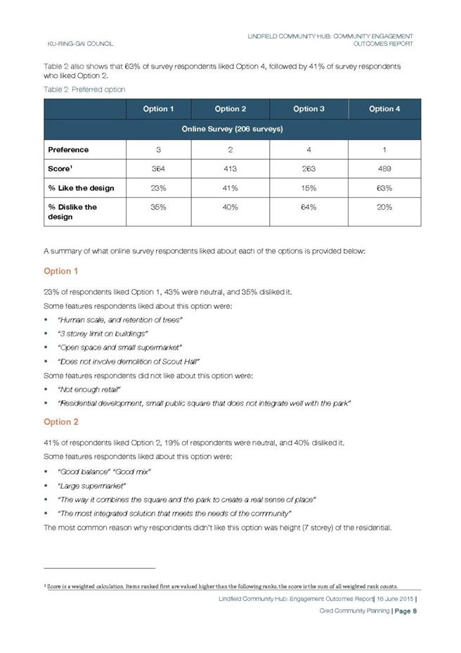
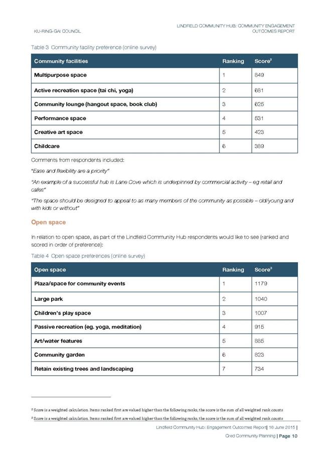
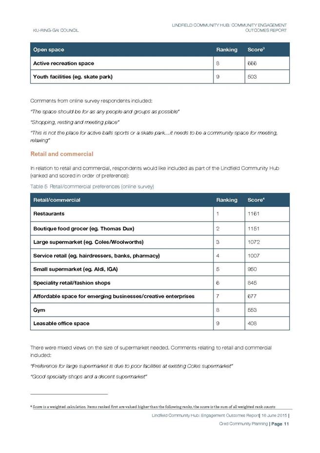
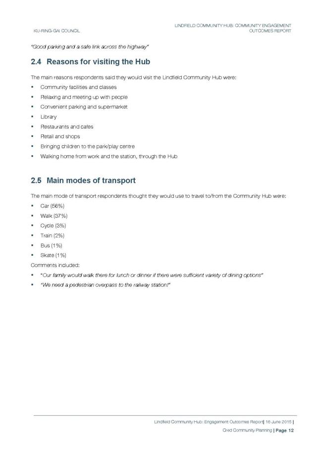
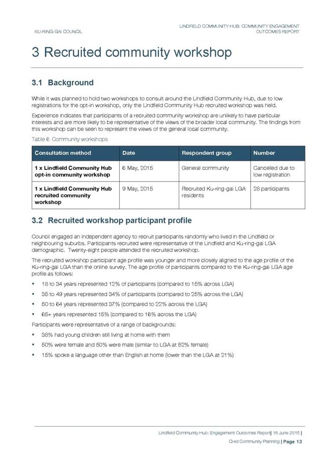
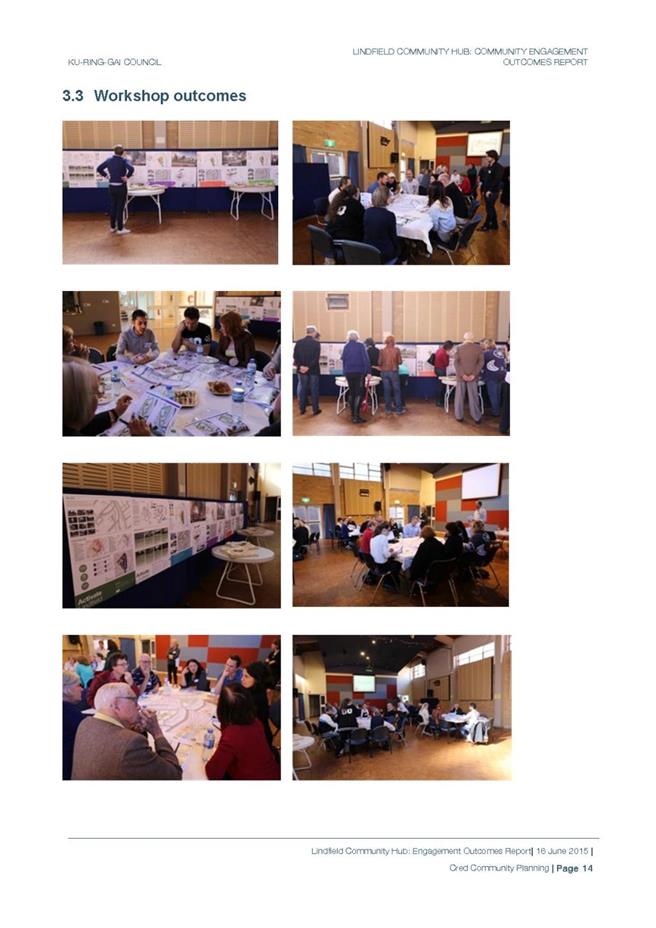
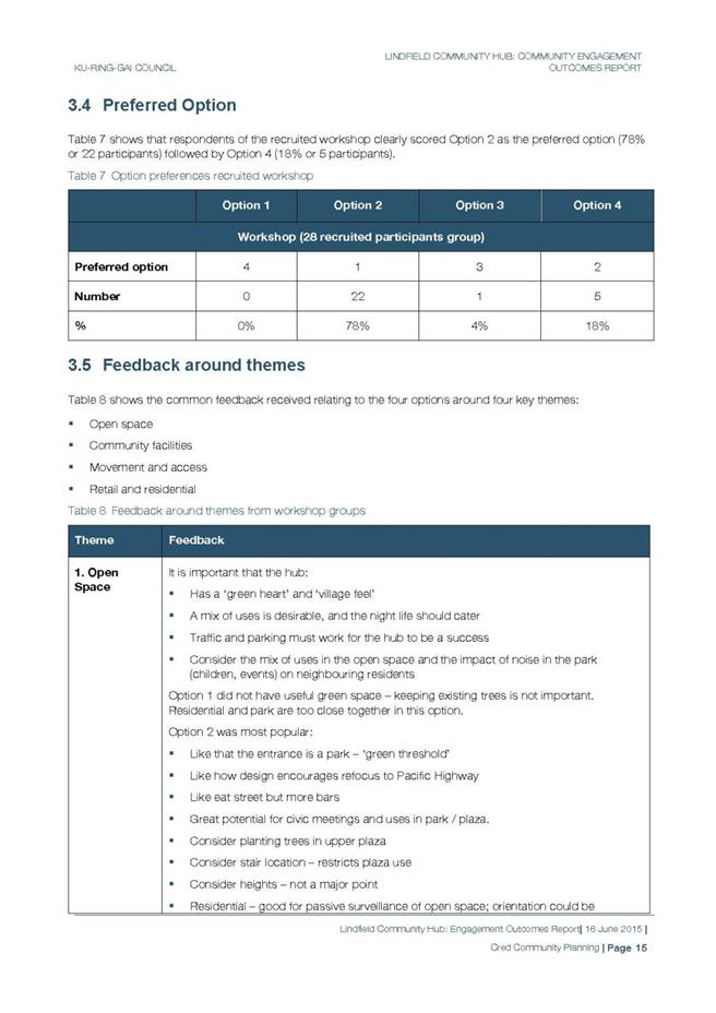
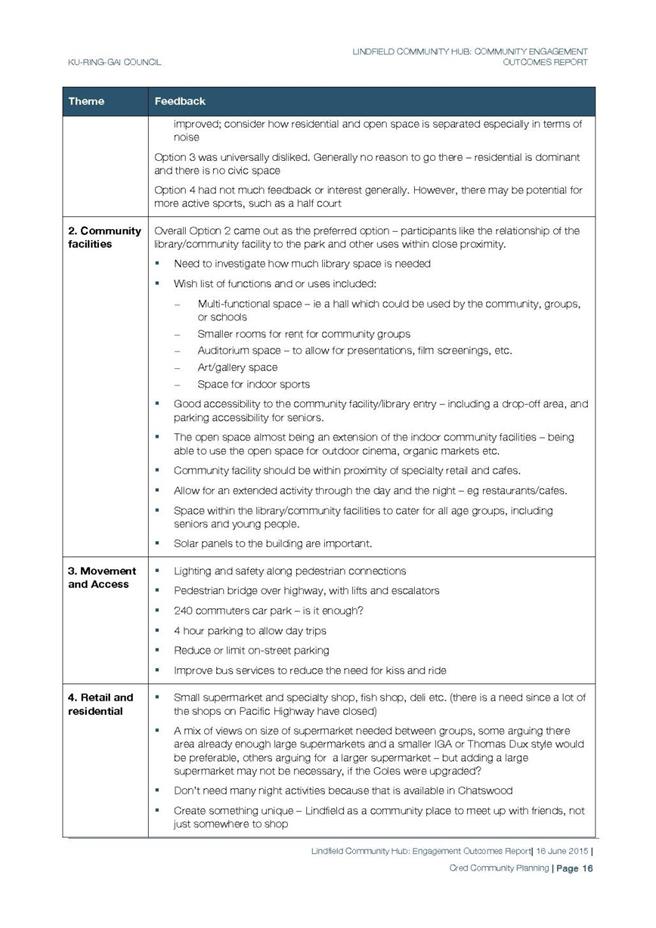
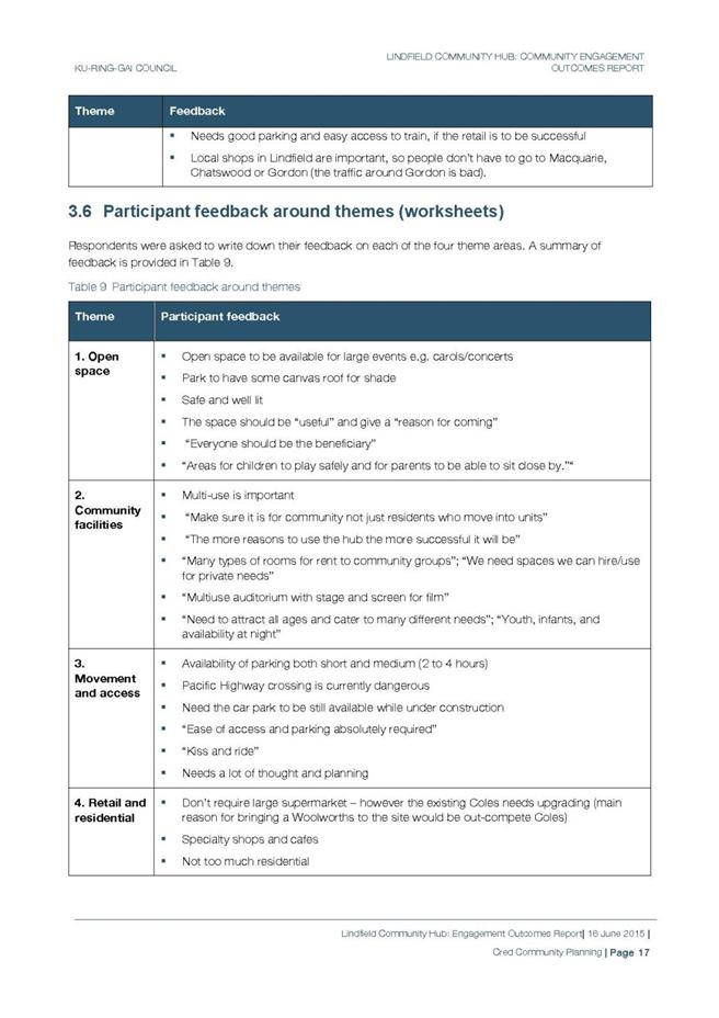
|
APPENDIX No: 3 - Scouts
Submission, 2nd and 3rd Lindfield Scouts Group, 08 May 2015
|
|
Item No: GB.9
|
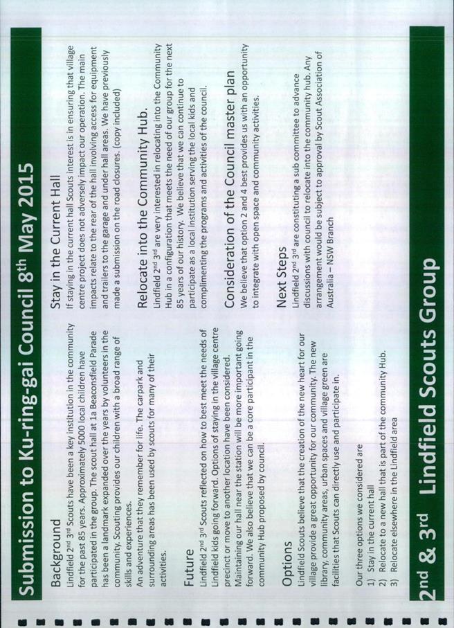
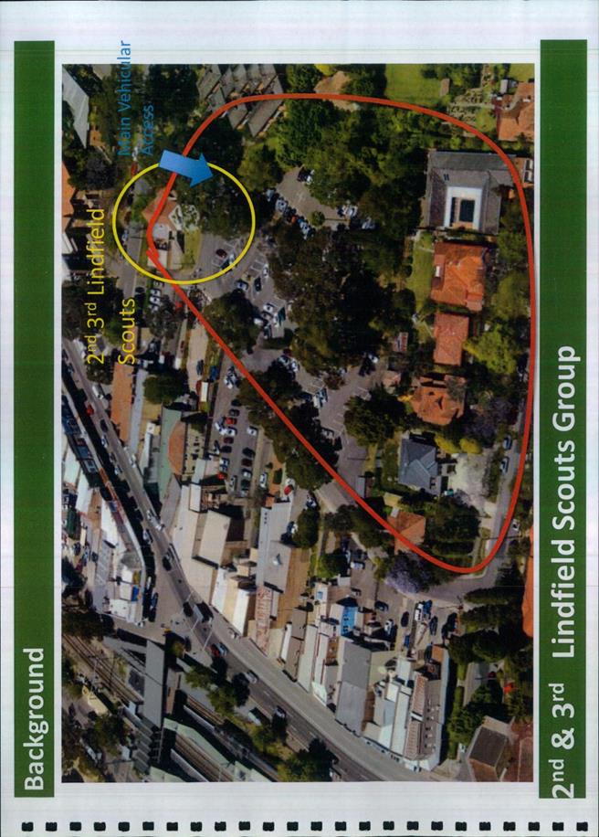
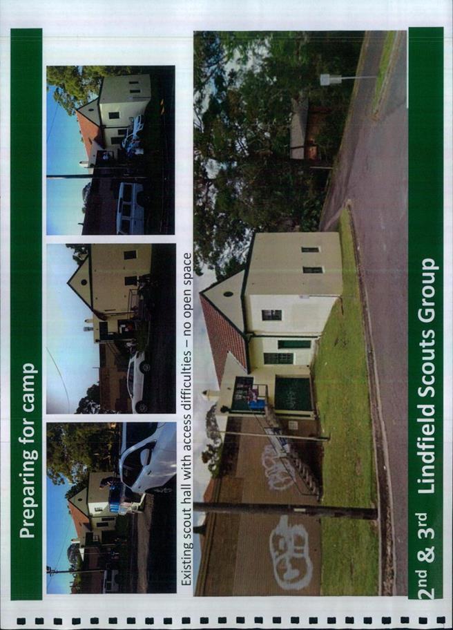
|
APPENDIX No: 5 - Lindfield
Community Hub, Budget Estimate, Preliminary Estimate Report, 15 April 2015
|
|
Item No: GB.9
|
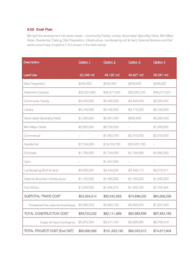


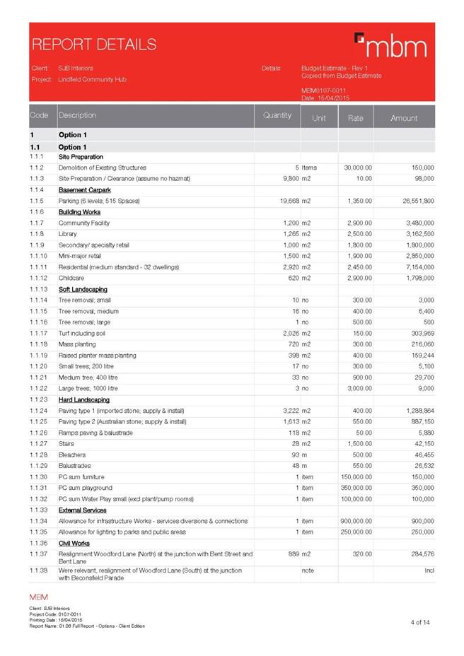
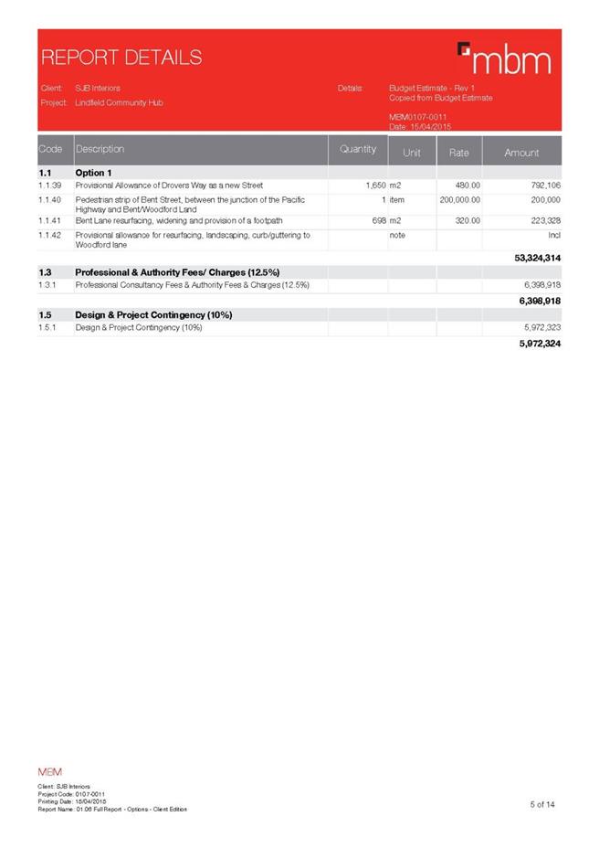


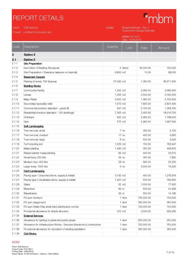
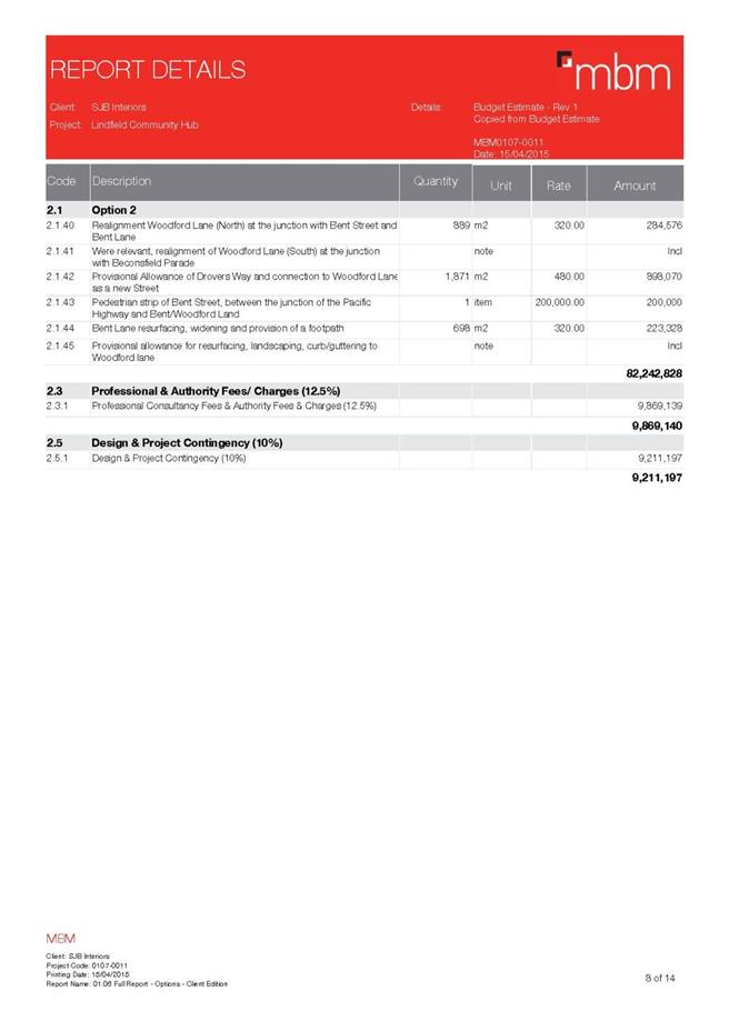

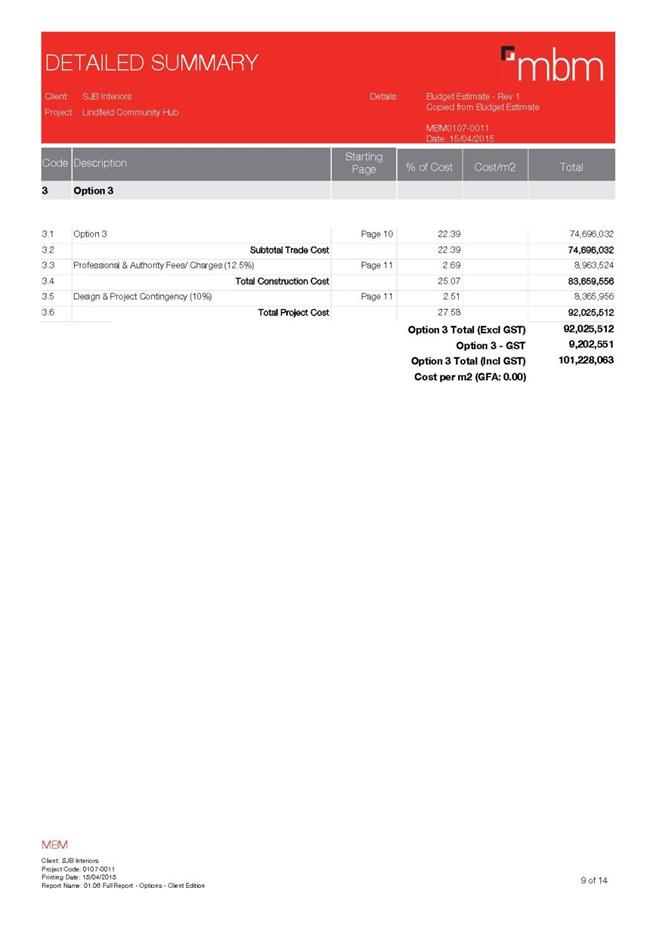
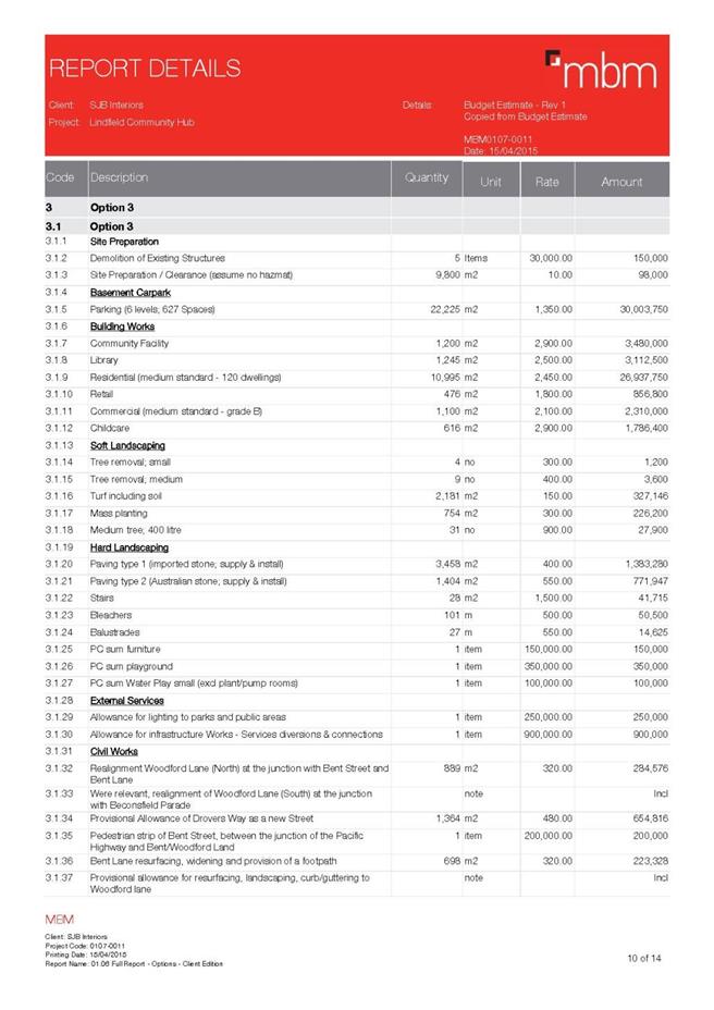


|
APPENDIX No: 6 - Peer
Review of MBM Cost Estimate, 25 May 2015
|
|
Item No: GB.9
|

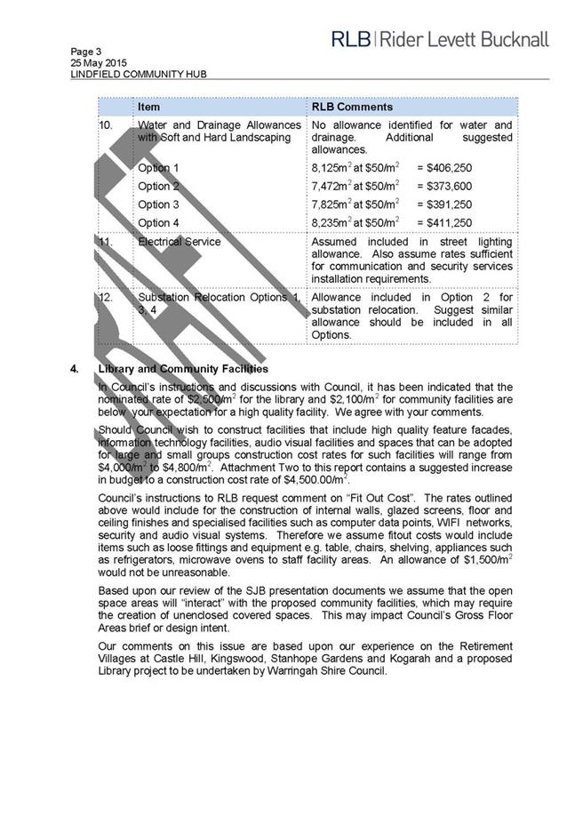
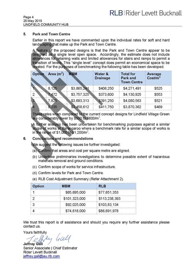
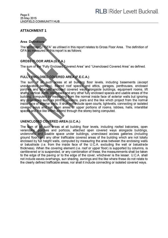
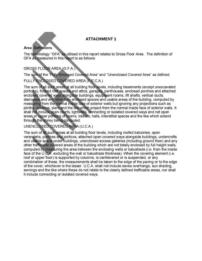
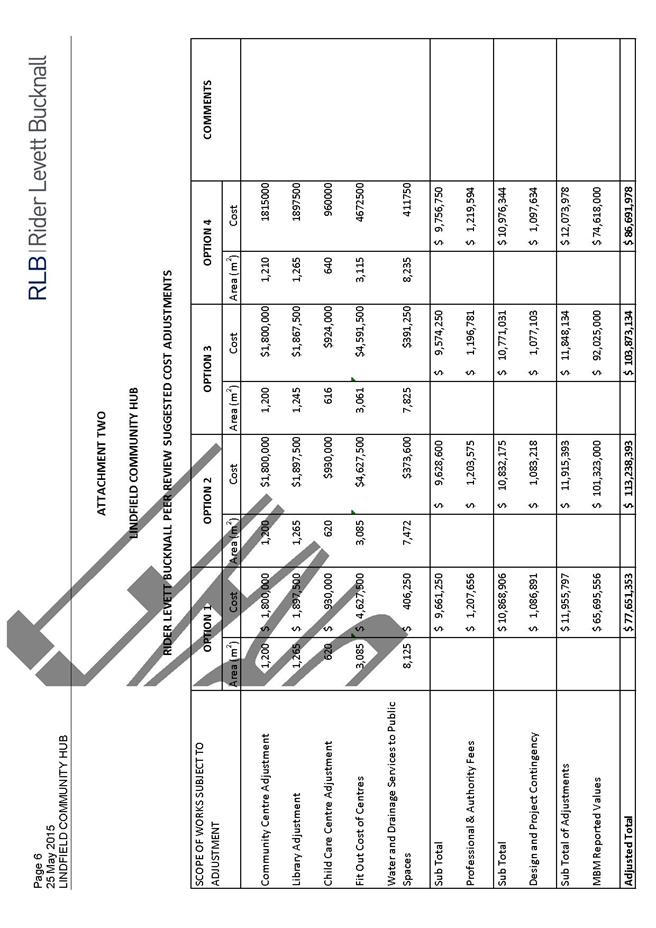
|
APPENDIX No: 8 - Lindfield
Community Hub, Assessment of Options Against Objectives, April 2015.
|
|
Item No: GB.9
|
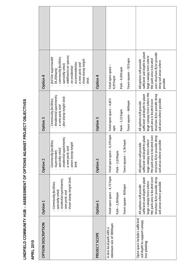
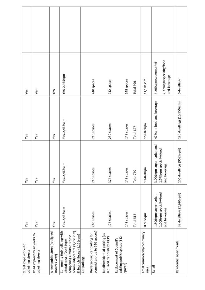
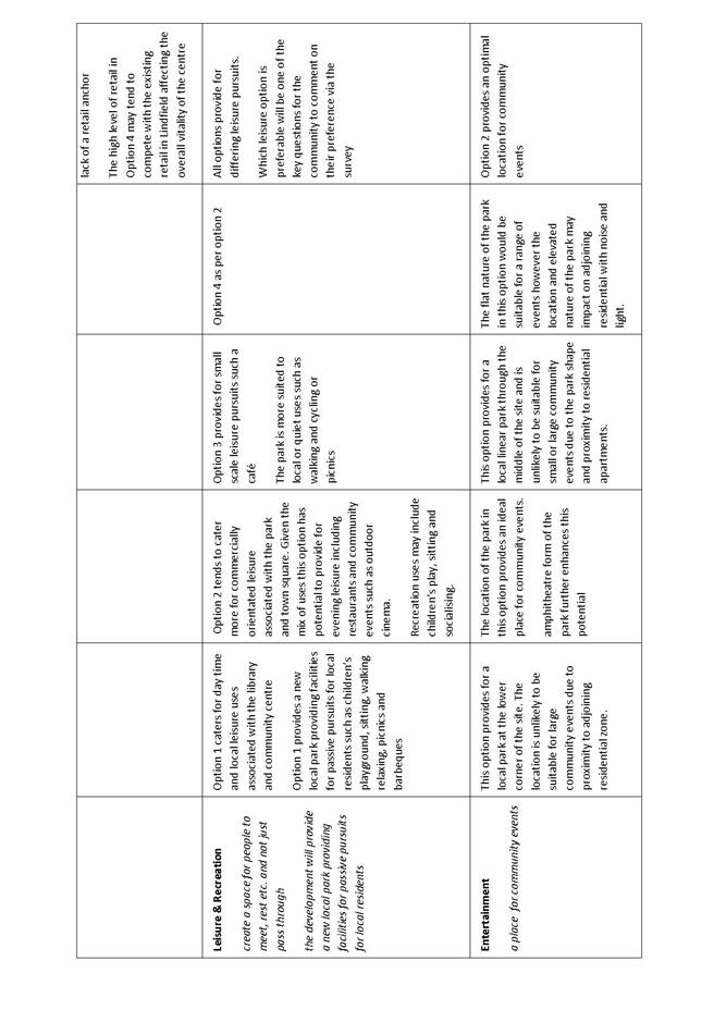
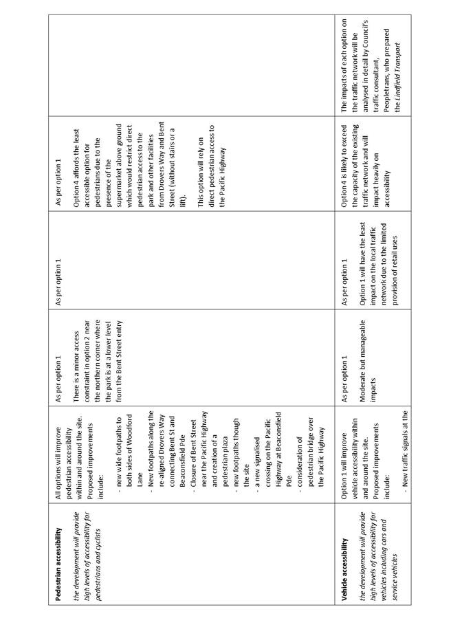
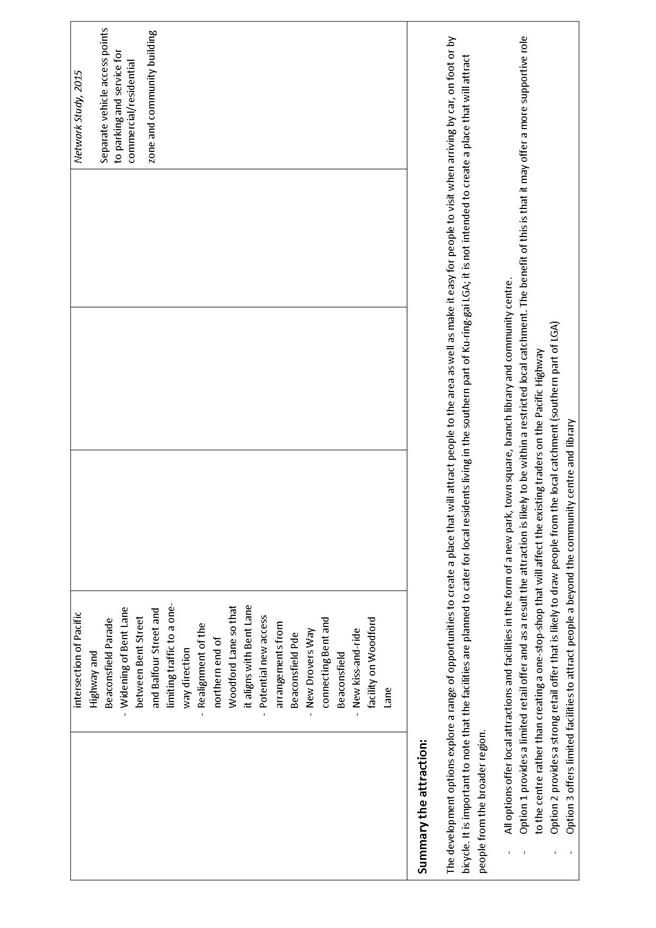
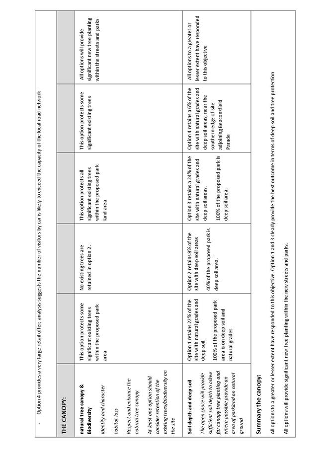
|
APPENDIX No: 9 - Lindfield
Community Hub, Concept Design Options, Transport Review, by Peopletrans,
August 2015
|
|
Item No: GB.9
|

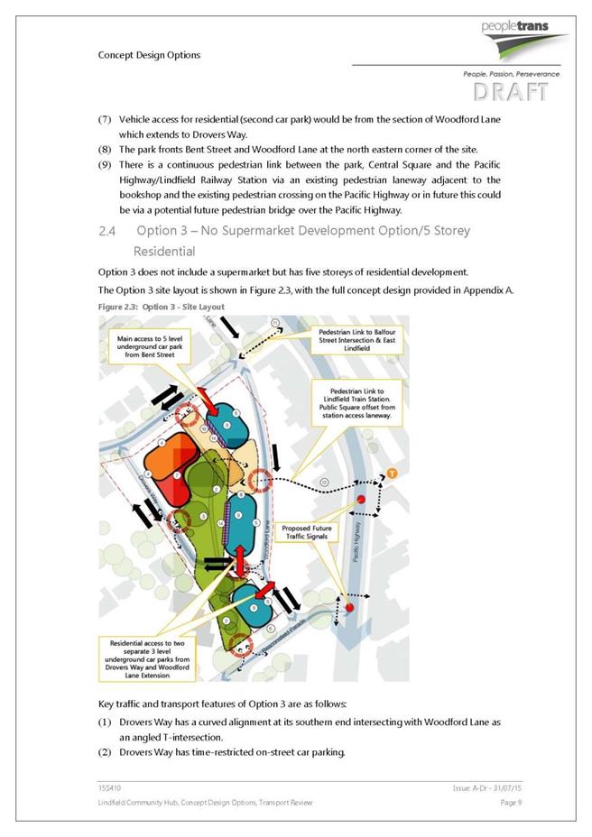
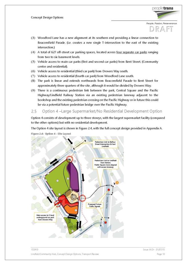


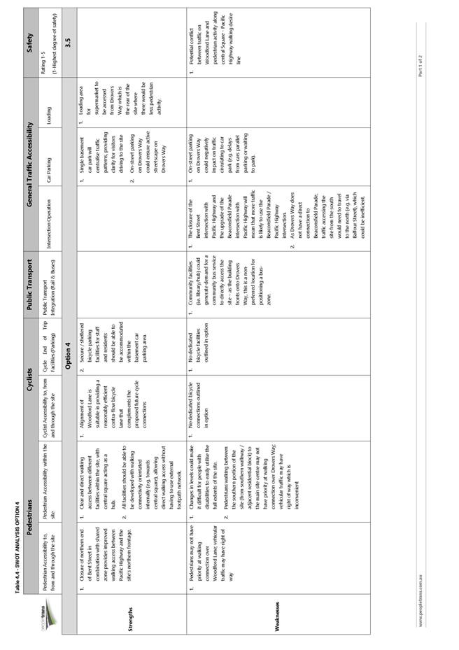
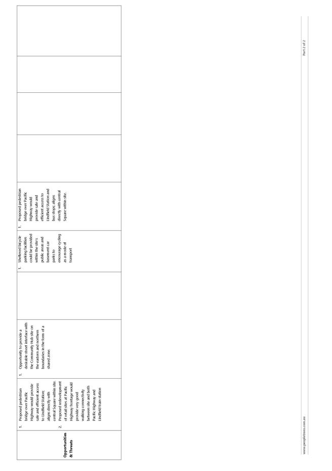
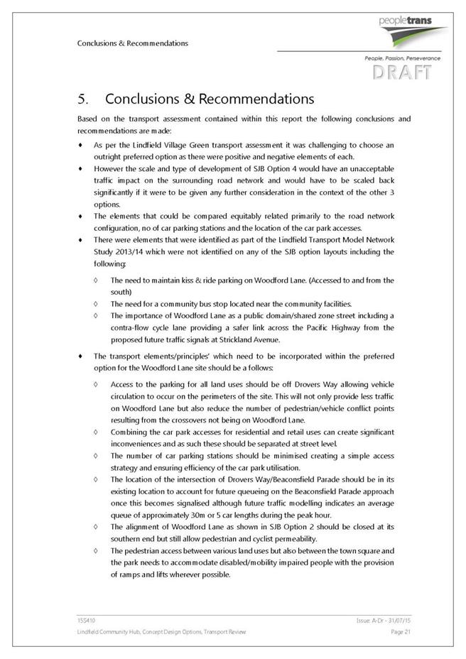
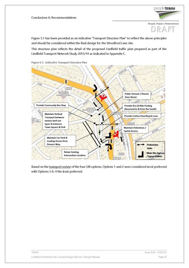

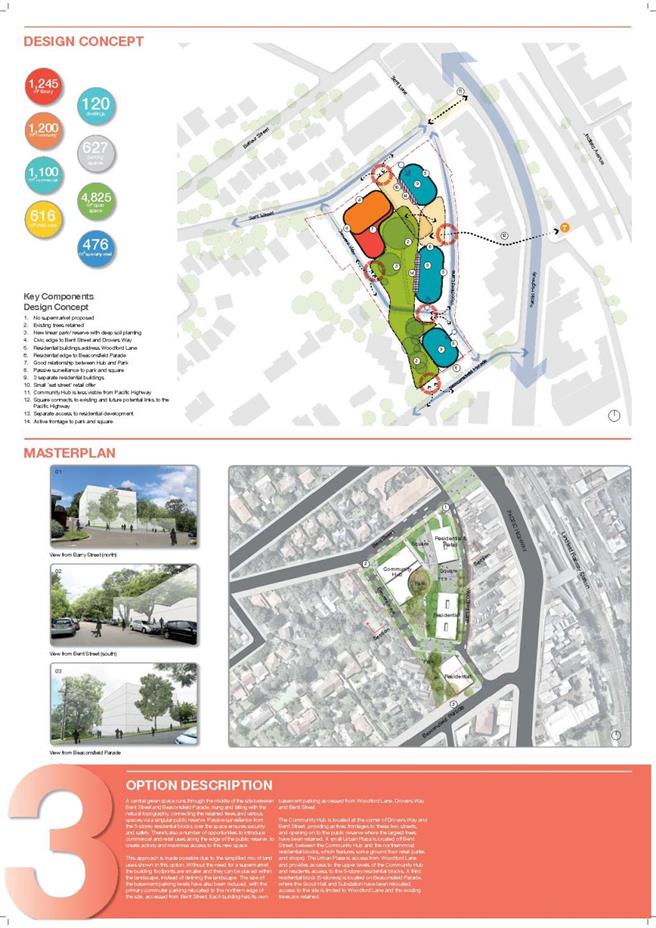
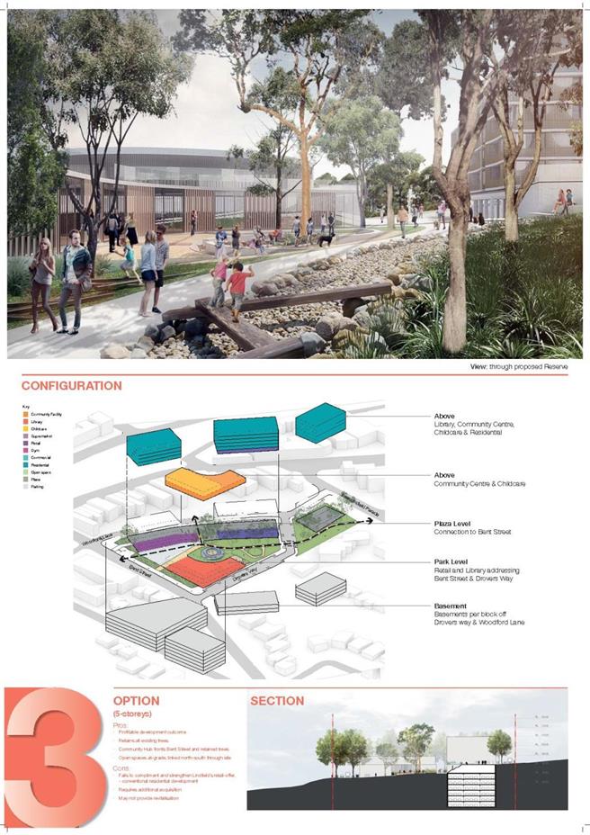
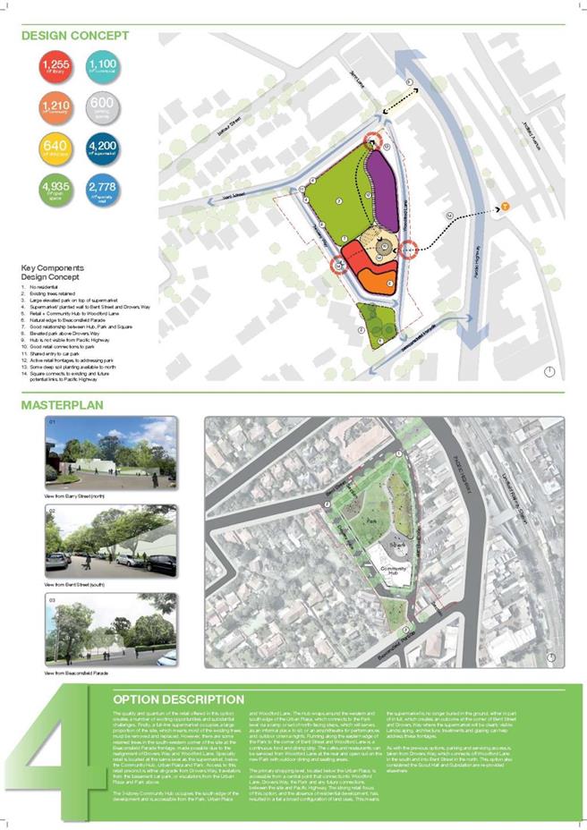
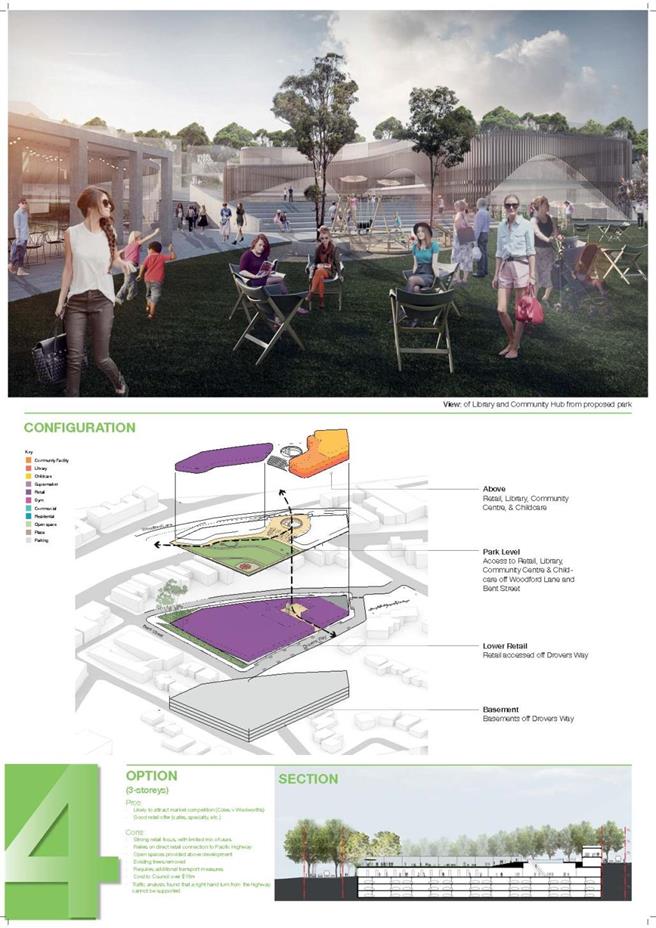


|
APPENDIX No: 10 - Lindfield
Community Hub Review of Concept Design Options (Community Facilities), 06 May
2015; by Elton Consulting
|
|
Item No: GB.9
|

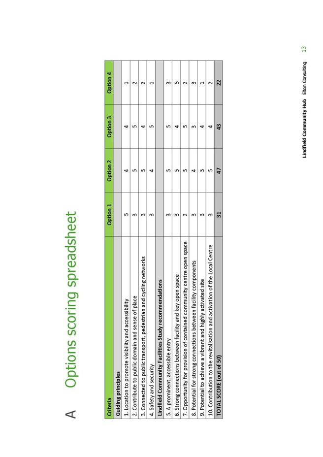

|
APPENDIX No: 11 - Lindfield
Community Hub, Staff Assessment Workshop Summary, June 2015
|
|
Item No: GB.9
|
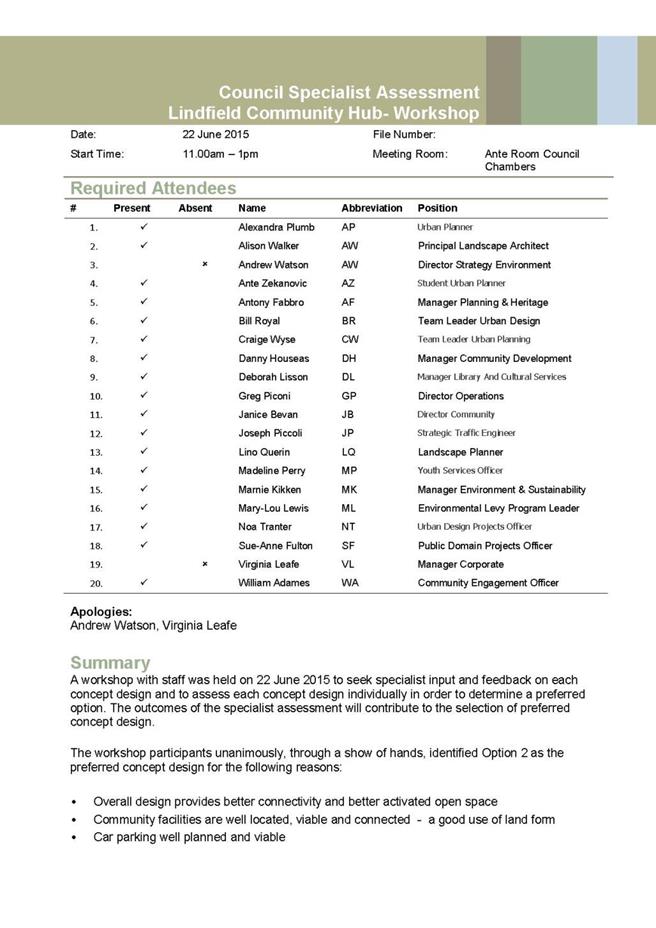

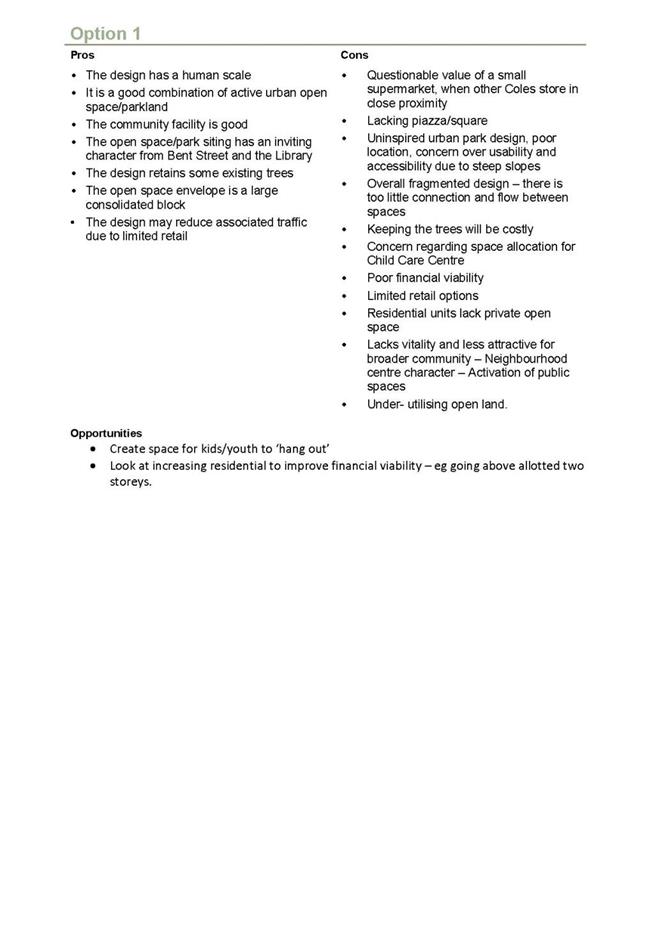
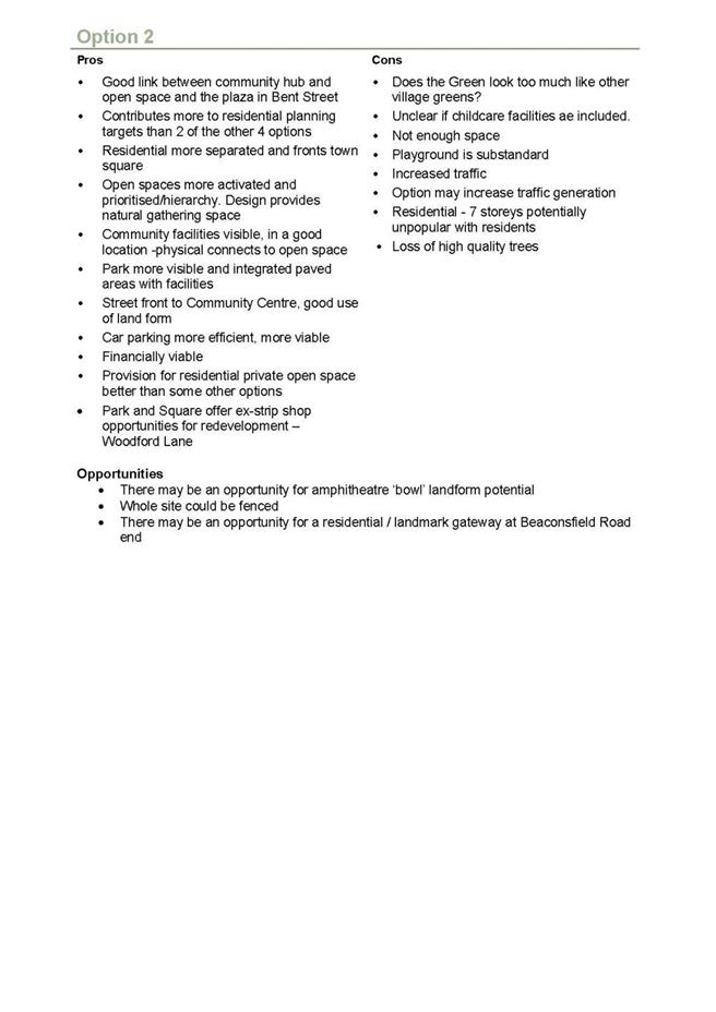
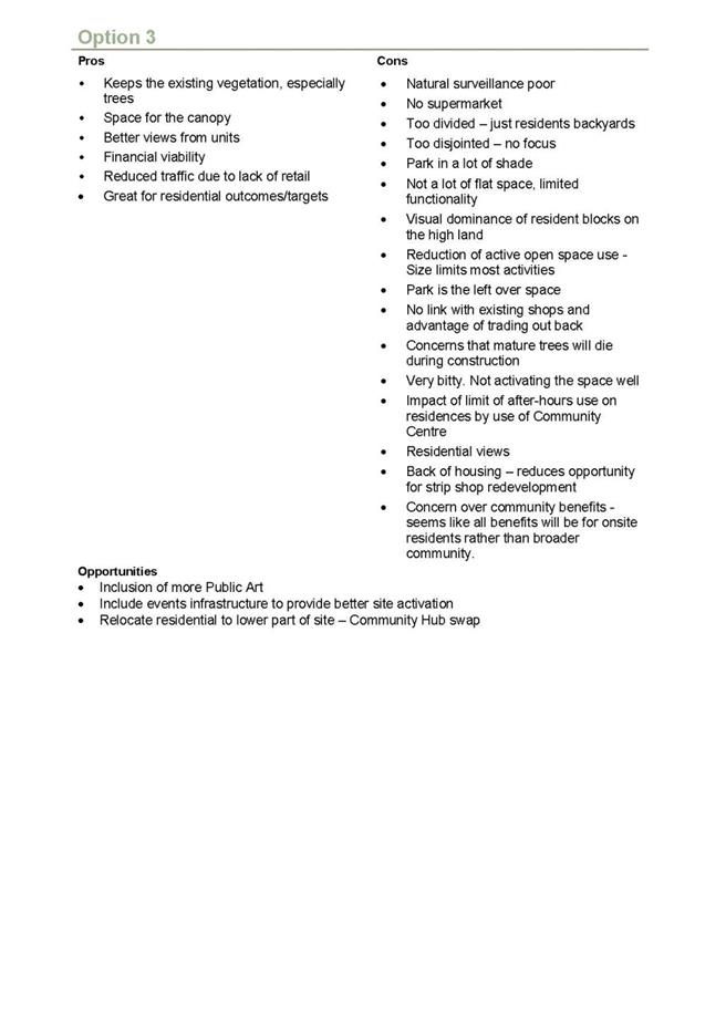

|
APPENDIX No: 12 - Local
Centres – Major Projects, PCG Meeting Minutes, 05 Aug 2015
|
|
Item No: GB.9
|
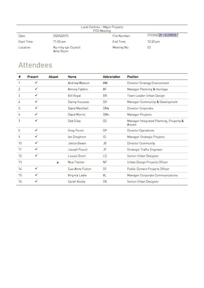
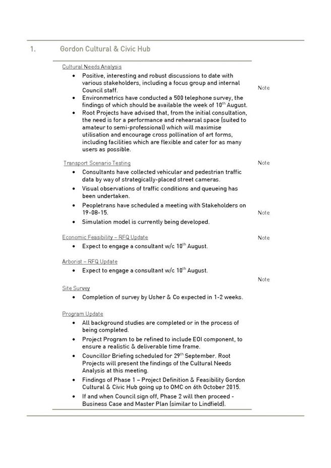

|
APPENDIX No: 13 - Governance
Structure, Lindfield Community Hub, GMD Approved
|
|
Item No: GB.9
|
|
APPENDIX No: 14 - Lindfield
Community Hub, Plan & Protocol (Market sounding) by PBS, August 2015
|
|
Item No: GB.9
|
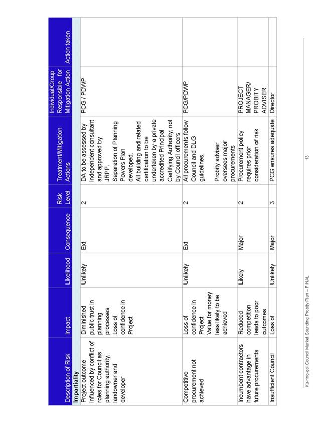
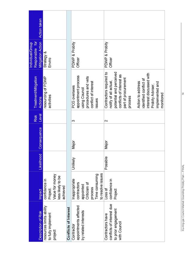
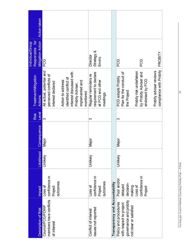
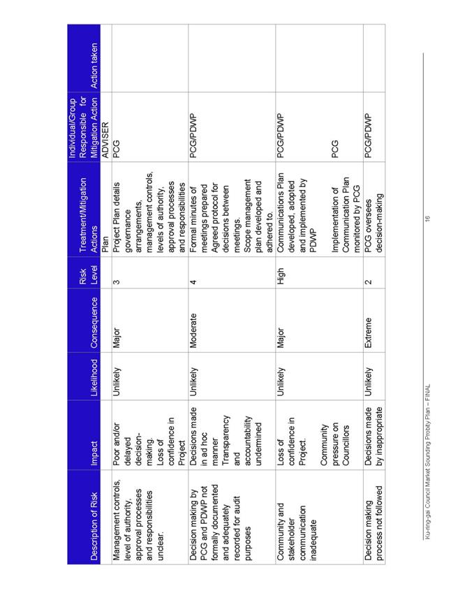
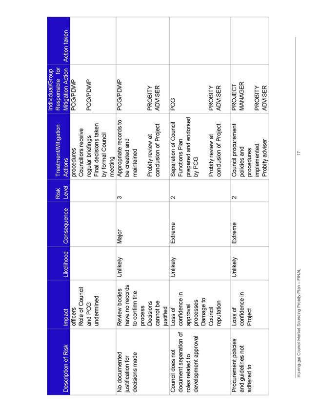
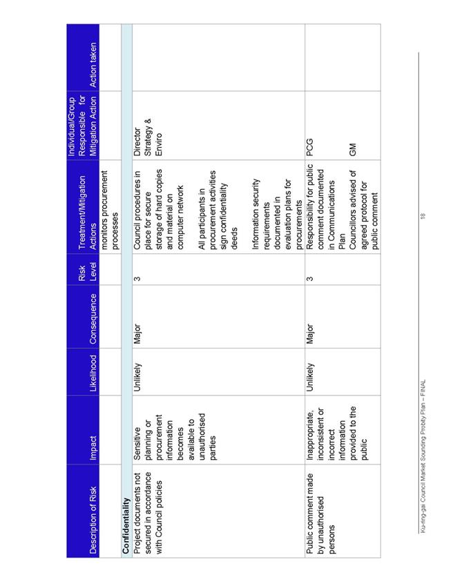
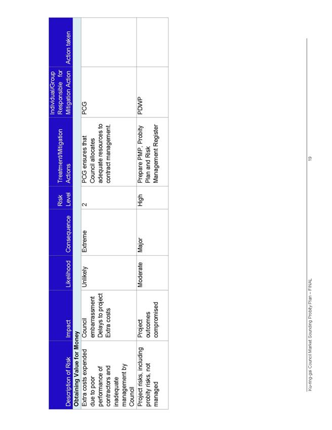
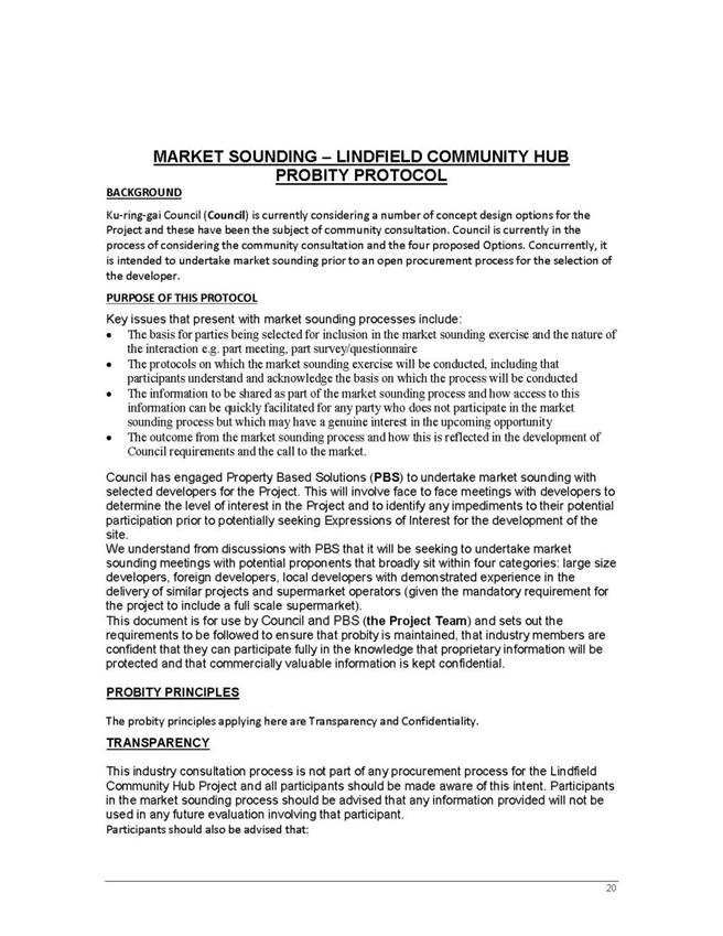
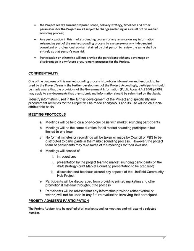
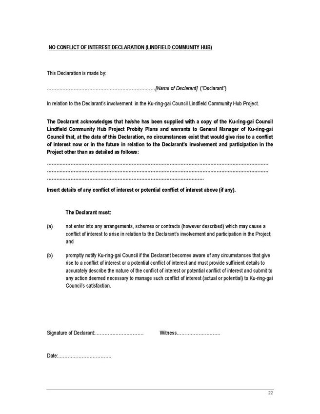
|
APPENDIX No: 15 - Lindfield
Community Hub, Decision Making Framework, by PBS, 25 August 2015
|
|
Item No: GB.9
|
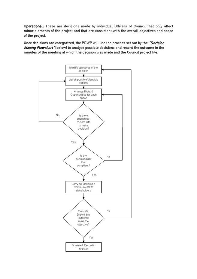
|
APPENDIX No: 16 - Lindfield
Community Hub, Risk Management Plan, by PBS, July 2015
|
|
Item No: GB.9
|
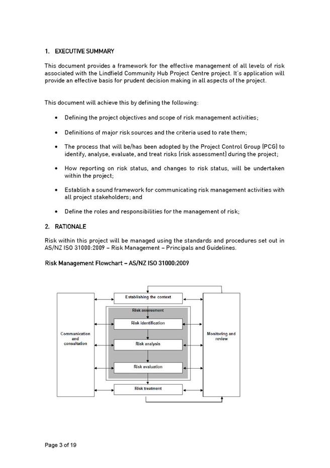
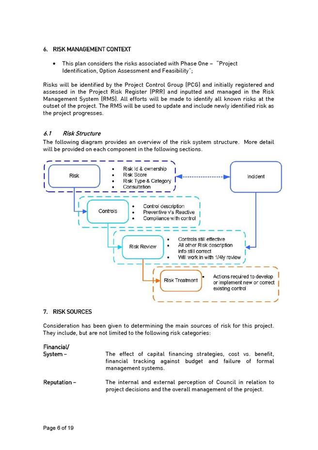
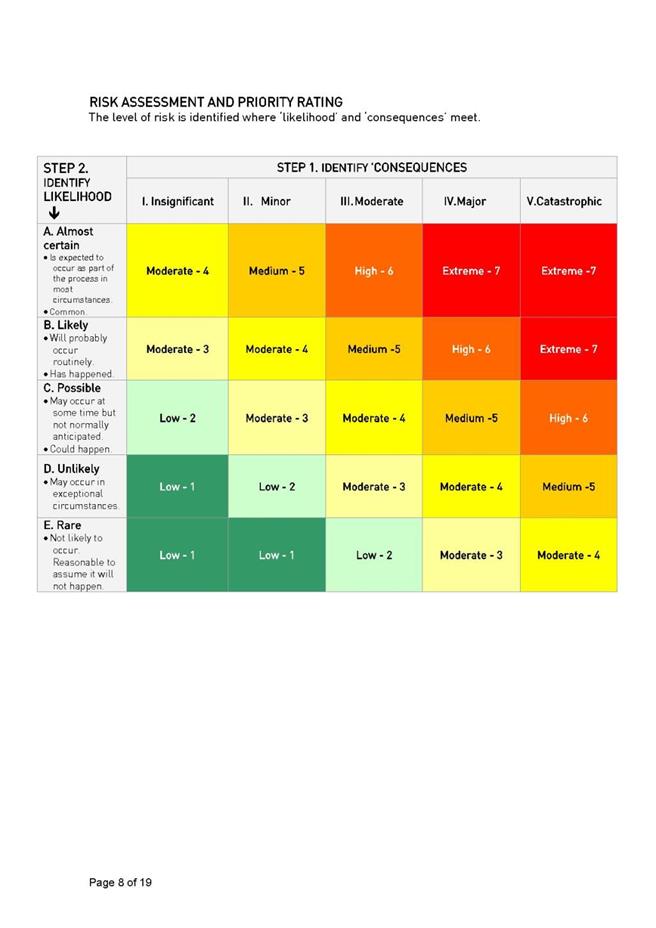
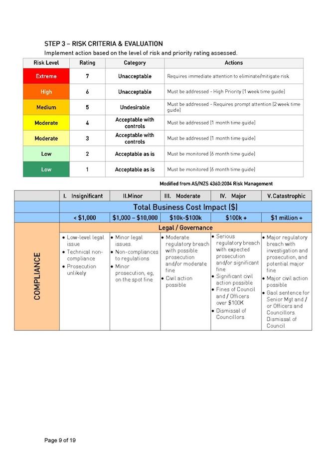
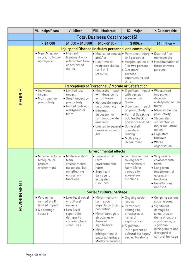
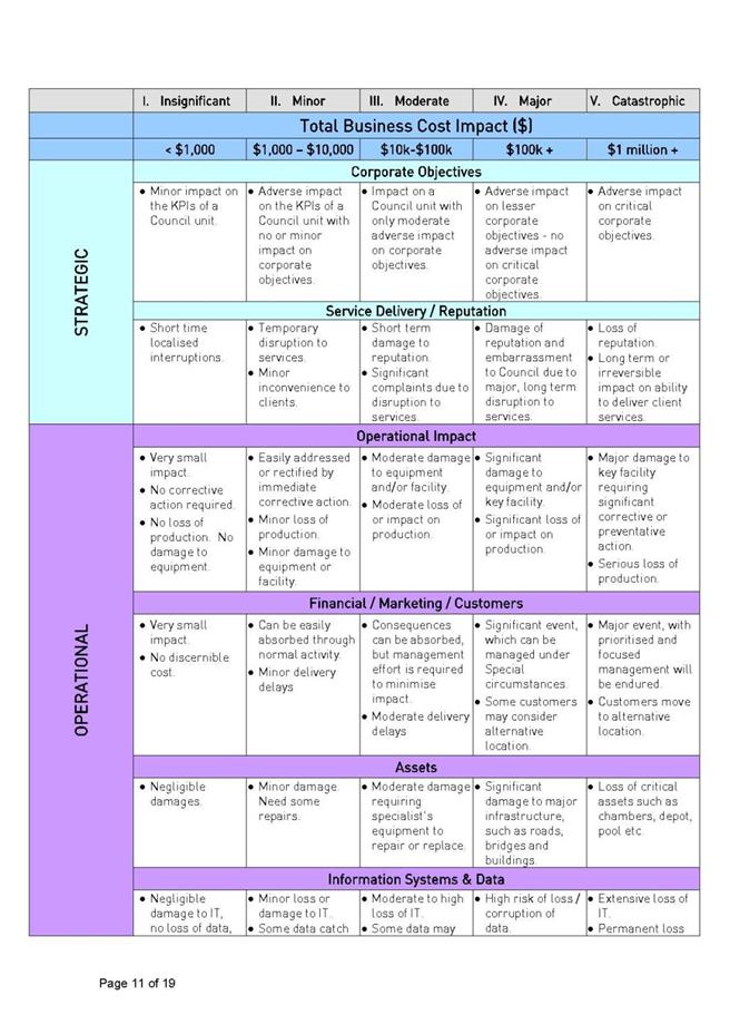
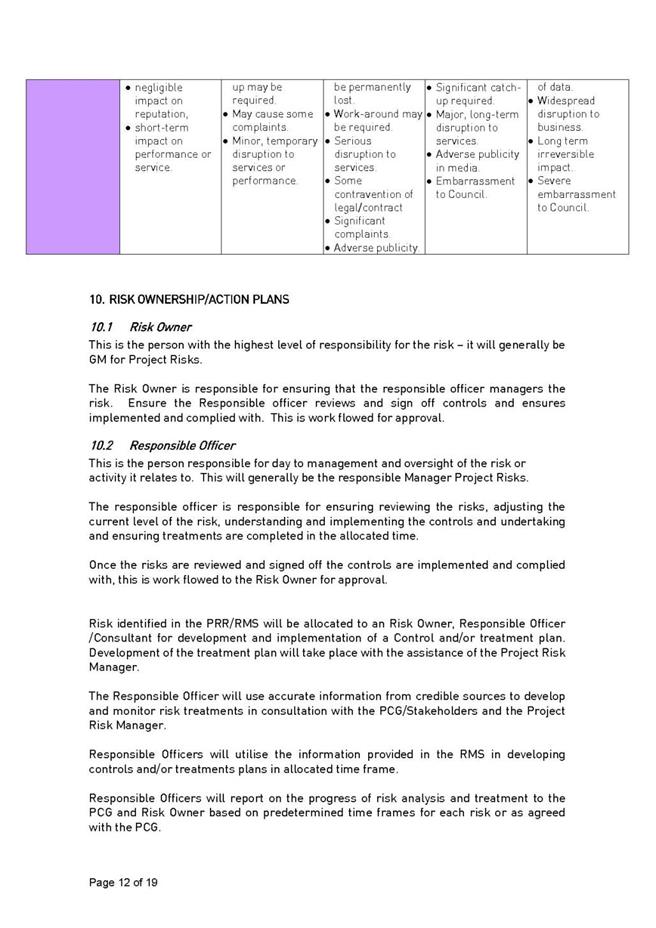
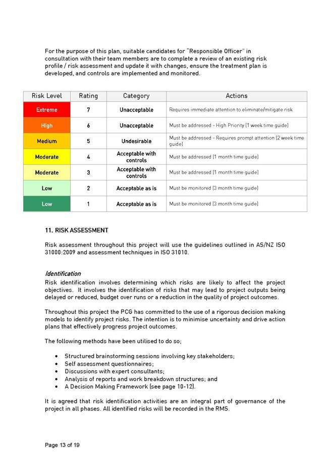
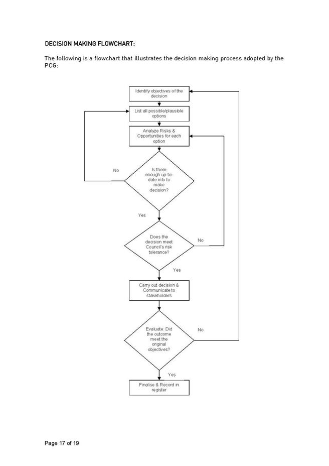

|
APPENDIX No: 17 - Letter
from KYDS to Council dated 26 June 2015
|
|
Item No: GB.9
|
|
Ordinary
Meeting of Council - 8 September 2015
|
GB.10 / 727
|
|
|
|
|
Item
GB.10
|
S10066
|
|
|
31 July 2015
|
Heritage Listing - 28 Cook Road Killara
EXECUTIVE
SUMMARY
|
purpose of report:
|
To have Council consider 28 Cook Road, Killara as a
potential heritage item under the Ku-ring-gai Local Environmental Plan 2015.
|
|
|
|
|
background:
|
On 21 April 2015 Council resolved to make an interim
heritage order over 28 Cook Road, Killara. On 24 April 2015 the interim
heritage order came into effect.
|
|
|
|
|
comments:
|
A heritage assessment has been prepared for the local
heritage listing of 28 Cook Road, Killara.
|
|
|
|
|
recommendation:
|
That a planning proposal be prepared to list 28 Cook
Road, Killara as an item of local heritage significance under KLEP 2015.
|
Purpose of Report
To have Council consider 28 Cook Road, Killara as a
potential heritage item under the Ku-ring-gai Local Environmental Plan 2015.
Background
On 21 April 2015 Council resolved to make an interim
heritage order over 28 Cook Road, Killara. On 24 April 2015 the interim
heritage order came into effect. The IHO provided Council with time to
undertake further historical research of the property to establish if it
warrants a formal heritage listing.
Under the conditions of the Interim Heritage Order, which
will lapse on 24 October 2015 (and the property will no longer be protected as
a heritage item), unless Council passes a resolution that places the item on
the heritage schedule of the KLEP 2015 to protect and manage the item or it
nominates the item for inclusion on the State Heritage Register.
Comments
An independent heritage assessment of 28 Cook Road Killara
(Lot 3, DP 516966) has been undertaken by the heritage consultants Conroy
Heritage Planning and found it is of local heritage significance and should be
included as a heritage item under Schedule 5 and on the heritage map of the
Ku-ring-gai Local Environmental Plan 2015 (KLEP 2015).
A heritage item is a place, which may include built
structures, landscapes, moveable objects and relics, that have recognised
cultural significance. In NSW, heritage items of local significance are
assessed against 7 criteria:
a) Historical
significance – an item is important in the course, or pattern, of the
cultural or natural history of the local area;
b) Historical
association significance – an item has strong or special association with
the life or works of a person, or group of persons, of importance to the local
area’s cultural or natural history;
c) Aesthetic
significance – an item is important in demonstrating aesthetic
characteristics and/or a high degree of creative or technical achievement in
the local area;
d) Social
significance – an item has a strong or special association with a
particular community or cultural group in the local area, for social, cultural
or spiritual reasons;
e) Technical/research
significance – an item has potential to yield information that will
contribute to an understanding of the local area scientific, cultural or
natural history;
f) Rarity
– an item possesses uncommon, rare or endangered aspects of the local area’s
cultural or natural history; and
g) Representativeness
- an item is important in demonstrating the principal characteristics of a
class of the local area’s cultural or natural places; or cultural or natural
environments.
28 Cook Road, Killara fulfils all seven criteria for
heritage significance. In particular, it has historical and architectural
significance to Ku-ring-gai. A heritage assessment for 28 Cook Road, Killara
can be found at Attachment 1 and the completed State Heritage Inventory
form at Attachment 2.
History and significance of 28
Cook Road, Killara
The property at 28 Cook Road
Killara, known as Glen Brae, was constructed in 1904 by Robert Baker, a retired
orchardist. Robert Baker’s parents, William and Jane Baker were among the
earliest European settlers in the district. Robert Baker spent his adult life
working the land in Killara. He erected Glen Brae as a place to live out his
years of retirement from farming life. The building is a very rare and
surviving example of a dwelling in the Ku-ring-gai LGA that provides evidence
of the historically significant transition of the area from the semi-rural cultural
landscape of the nineteenth century, to the emergent pattern of suburban
development that came to dominate the twentieth century.
Its built form is consistent with the traditional Australian
‘farmhouse’, in particular it has simple floor plan and wide verandahs, beneath
a simple and prominent roof form. It is also significant because it is a late
example of the farmhouse style, while also exhibiting the principal
characteristics of the Federation bungalow style.
The property exterior and
interior are substantially intact with alterations to the main building being
minor and not impacting on the overall significance of Glen Brae. The attention
to detail of the interior and external finishes of this property are high.
Examples include the original fireplaces with intact tiling and marble mantles
(unique to each room), the joinery throughout and the range of pressed metal
ceilings that have retained original details such as leaf-patterned covers over
the joins in the cornice-sheets in the corners of each room.
The property setting to Cook Road, while altered, retains
the open character and is evocative of the rural garden, allowing the original
setting of the house to continue to be interpreted from the public domain.
Condition of 28 Cook Road, Killara
The property at 28 Cook Road,
Killara appears to be in very good condition throughout with only minor
settlement cracking. The property had been occupied as a family home prior to
the sale in March 2014. The sale photos show a well maintained house and
garden. When the property was inspected at the end of May 2015 the house was
still in good condition, however, the pool and garden showed some signs of
neglect. Some damage had occurred to the north-east corner gutter but this was
repairable.
Given the cultural significance of 28 Cook Road, Killara as
a heritage place to Ku-ring-gai it is recommended a planning proposal be
prepared to include it in the KLEP 2015 as a heritage item under Schedule 5 and
on the heritage map.
integrated planning and reporting
Theme 3: Places, Spaces and Infrastructure
|
Community Strategic Plan Long Term Objective
|
Delivery Program
Term Achievement
|
Operational Plan
Task
|
|
Ku-ring-gai’s heritage is protected, promoted and
responsibly managed.
|
Strategies, plans and
processes are in place to effectively protect and preserve Ku-ring-gai’s
heritage assets.
|
Identify gaps in existing strategies and plans.
|
Governance Matters
This report addresses the first stage in obtaining a gateway
for a Planning Proposal which seeks to list an item of local heritage
significance under an amendment to the KLEP 2015.
If the planning proposal is supported by the Department, the
draft plan will be placed on exhibition seeking further State agency and
stakeholder feedback prior to being reported back to Council.
The process for the preparation and implementation of
planning proposals is governed by the provisions of the Environmental
Planning and Assessment Act, 1979.
Council will seek the plan-making delegation under Section
23 of the EP&A Act to finalise the Planning Proposal. This involves Council
taking on the Director General’s function under s59(1) of the Act in liaising
with the Parliamentary Counsel’s Office (PCO) to draft the required local
environmental plan to give effect to the Planning Proposal as well the
Minister’s function under s59(2) of the Act in making the Plan.
Risk Management
There is a community expectation that places of heritage
significance within the Ku-ring-gai Council LGA will be identified and
protected. There is a strategic risk of damaging the reputation of Council if
these culturally significant places are not identified and considered for
protection.
Financial Considerations
The cost of preparing this report is covered by the
Ku-ring-gai draft Principal Local Environmental Plan - Urban Planning &
Heritage Budget – Strategy and Environment Department.
Social Considerations
The identification and protection of Ku-ring-gai’s heritage
places contributes to the ongoing conservation of Ku-ring-gai’s community
valued historic landscape and garden suburbs
Environmental Considerations
The retention and conservation of heritage places has an
important role in protecting the environment. The environmental sustainability
benefits afforded by the retention of heritage places includes the substantial
reduction in building demolition and new construction waste, and the
conservation of embodied energy in the existing buildings.
Community
Consultation
As part of making the Interim Heritage Order for the site,
the IHO was published in the NSW Government Gazette. The property owners and
the NSW Heritage Council were notified, along with a public notice placed in
the North Shore Times on 1 May 2015.
The affected property owners will be notified of this report
going to council and will be further notified and have the opportunity to
provide feedback during the formal exhibition period.
Should the Planning Proposal receive a favourable Gateway
Determination, it will be exhibited in accordance with the Department’s Gateway
Determination requirements and with explanatory heritage information. This will
involve appropriate notification and receipt of submissions on the draft plan
from the relevant State agencies and the general community and a further report
back to Council.
Internal Consultation
Consultation with relevant Departments of Council has taken
place in preparing this report, in particular, Development and Regulation. In
addition, Council’s Heritage Reference Committee has reviewed the proposed
heritage item.
Summary
An independent heritage study to assess the heritage
significance of 28 Cook Road Killara has found that the property is of local
heritage significance. The purpose of this report is to have Council consider
the inclusion of 28 Cook Road ,Killara as a potential heritage item under the
Ku-ring-gai Local Environmental Plan 2015.
|
Recommendation:
A. That
Council proceed to prepare a planning proposal to amend KLEP 2015 to include:
· 28 Cook Road Killara (Lot 3, DP
516966) as a potential heritage item in Schedule 5 and on the Heritage Map.
B. That
the Planning Proposal be forwarded to the Department of Planning and
Environment for a Gateway Determination in accordance with the provisions of
the EP&A Act and Regulations.
C. That
in order to facilitate an expedient gateway determination, the NSW Heritage
Office be consulted prior to submitting the Planning Proposal to the
Department of Planning and Environment. Should comments not be received
within 21 days, the planning proposal is to be submitted regardless.
D. That
Council request the plan making delegation under Section 23 of the EP&A
Act for this planning proposal.
E. That
upon receipt of a Gateway Determination, the exhibition and consultation
process is carried out in accordance with the requirements of the
Environmental Planning and Assessment Act, 1979 and with the Gateway
Determination requirements.
F. That
a report be brought back to Council at the conclusion of the exhibition
period.
|
|
Andreana Kennedy
Heritage Specialist Planner
|
Antony Fabbro
Acting Director Strategy and Environment
|
|
Attachments:
|
A1View
|
Heritage
assessment of 28 Cook Road Killara
|
|
2015/226165
|
|
|
A2View
|
State
Heritage Inventory form - 28 Cook Road Killara
|
|
2015/226169
|
|
APPENDIX
No: 1 - Heritage
assessment of 28 Cook Road Killara
|
|
Item No: GB.10
|
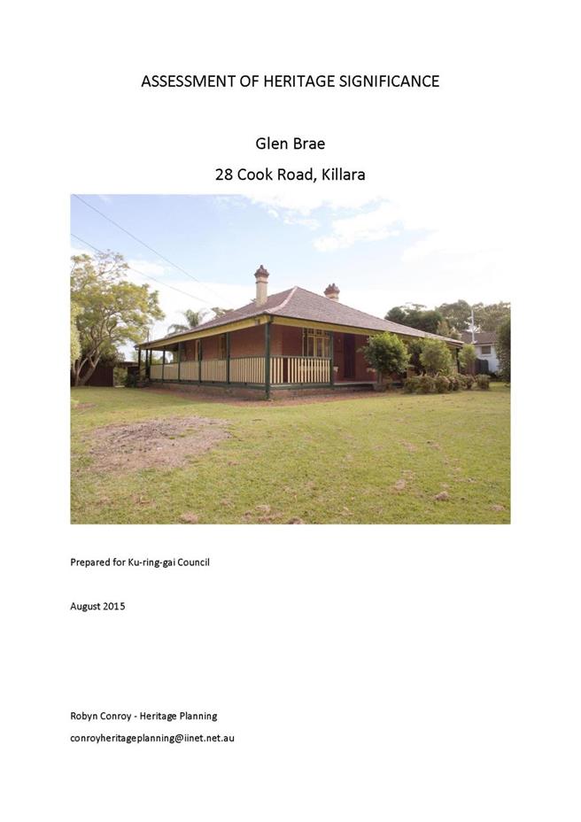
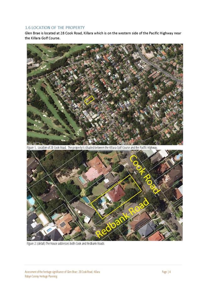
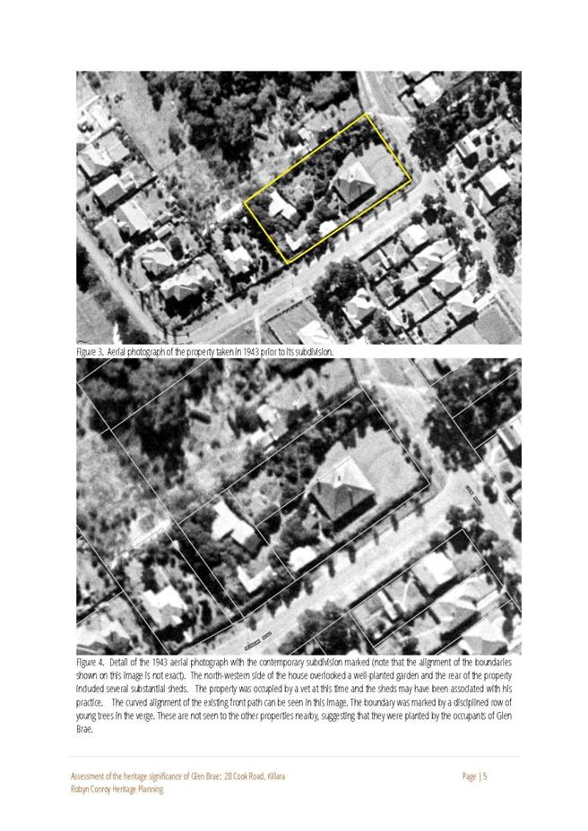
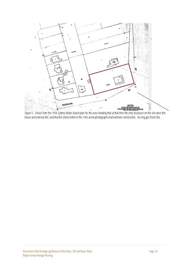
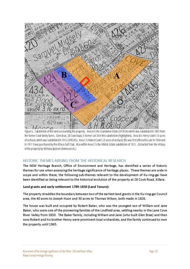
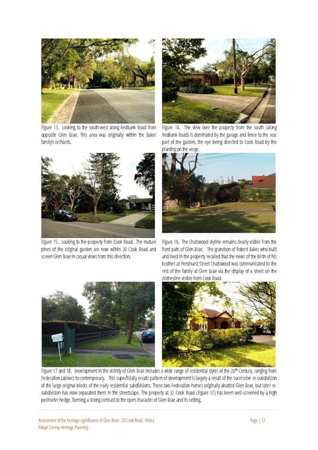
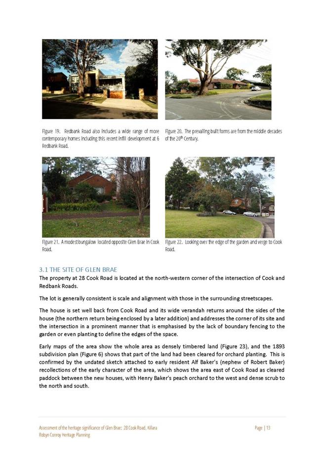
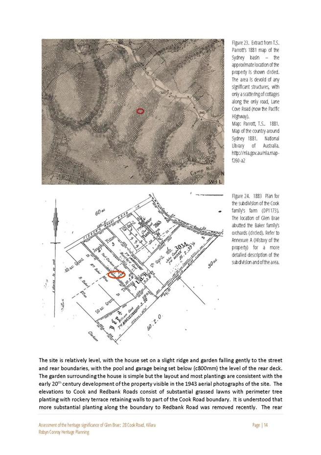
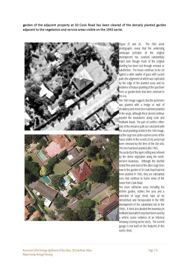
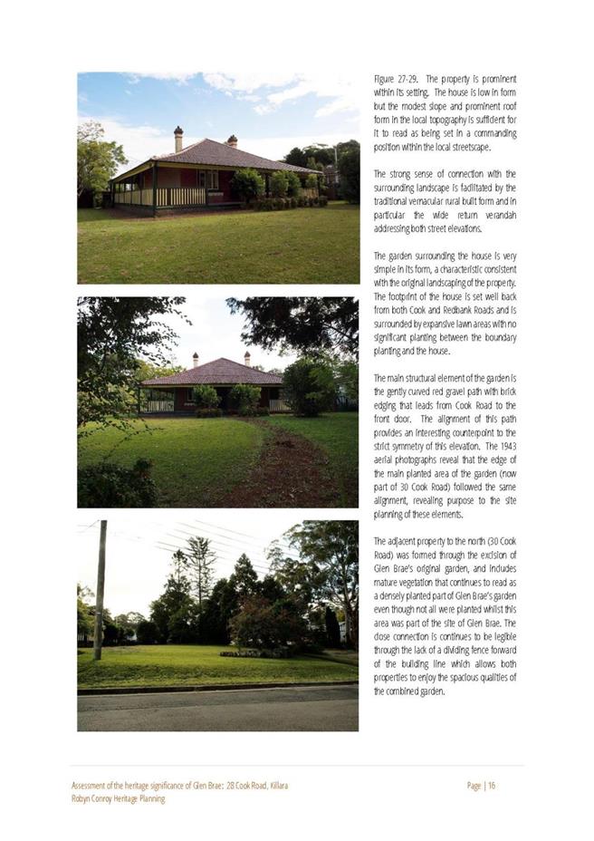
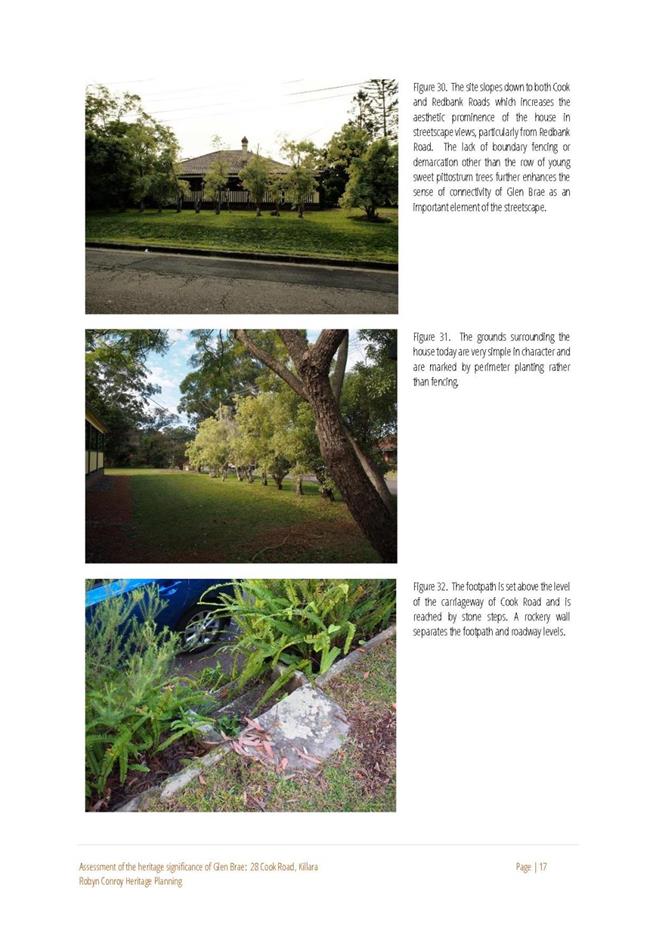
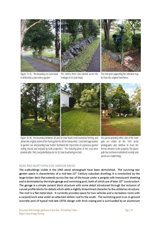
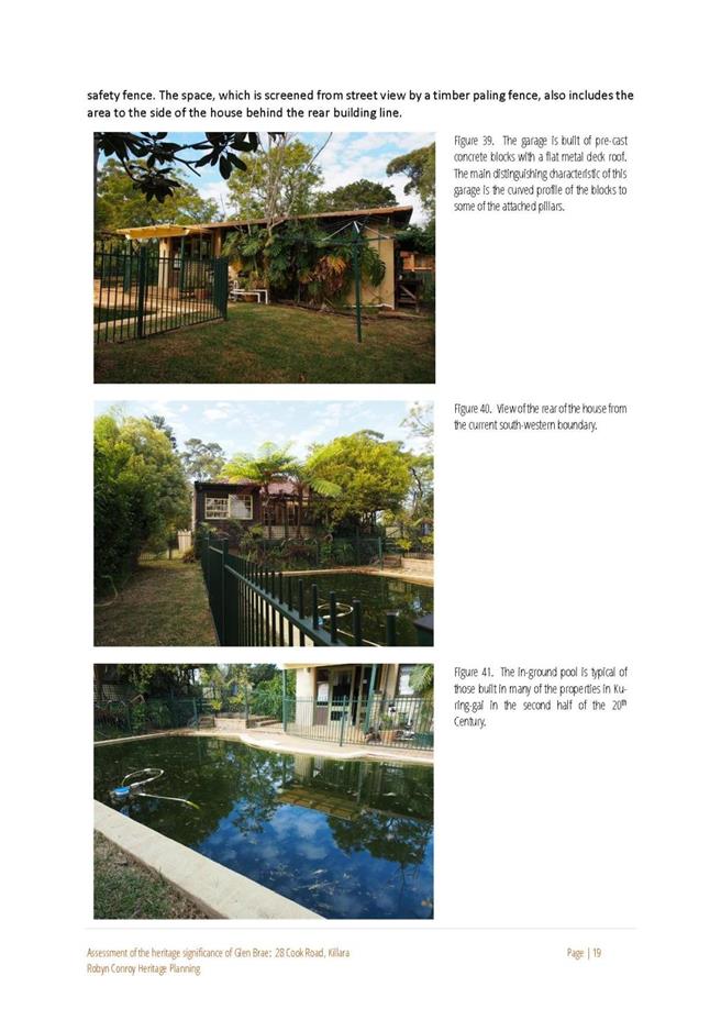
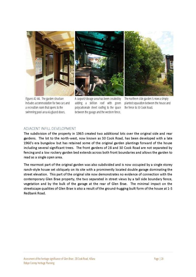
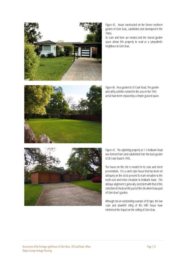
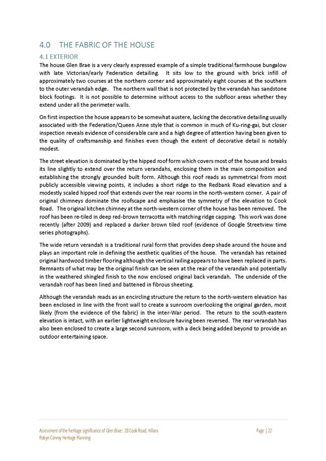
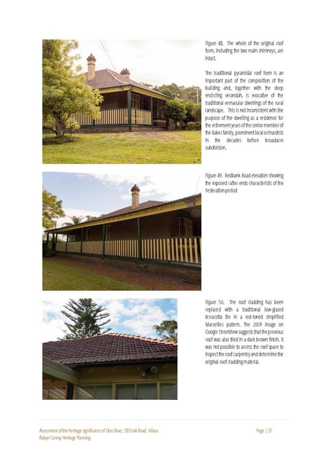
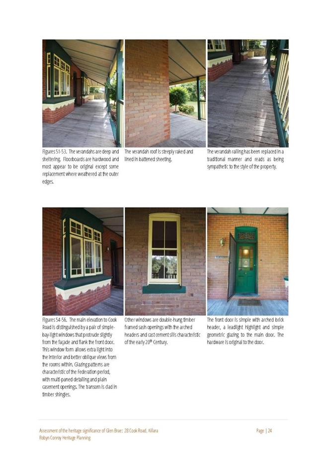
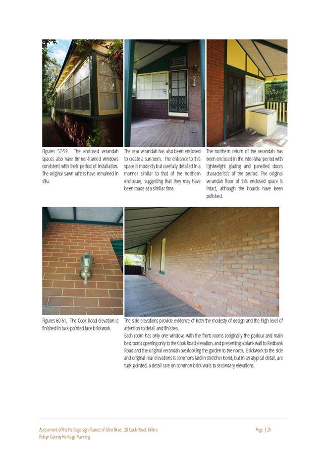
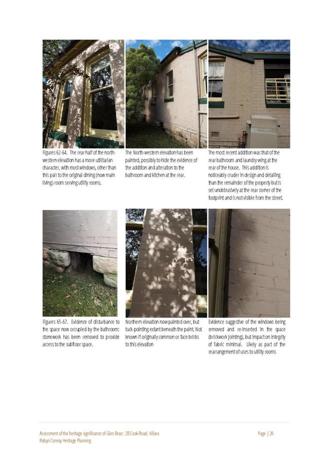
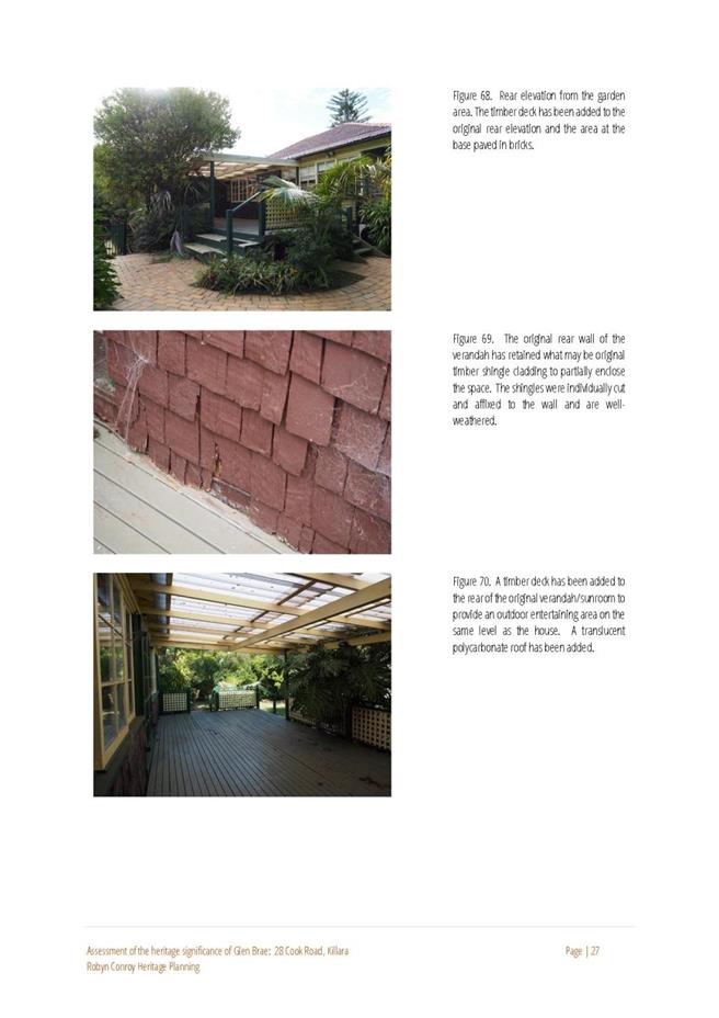
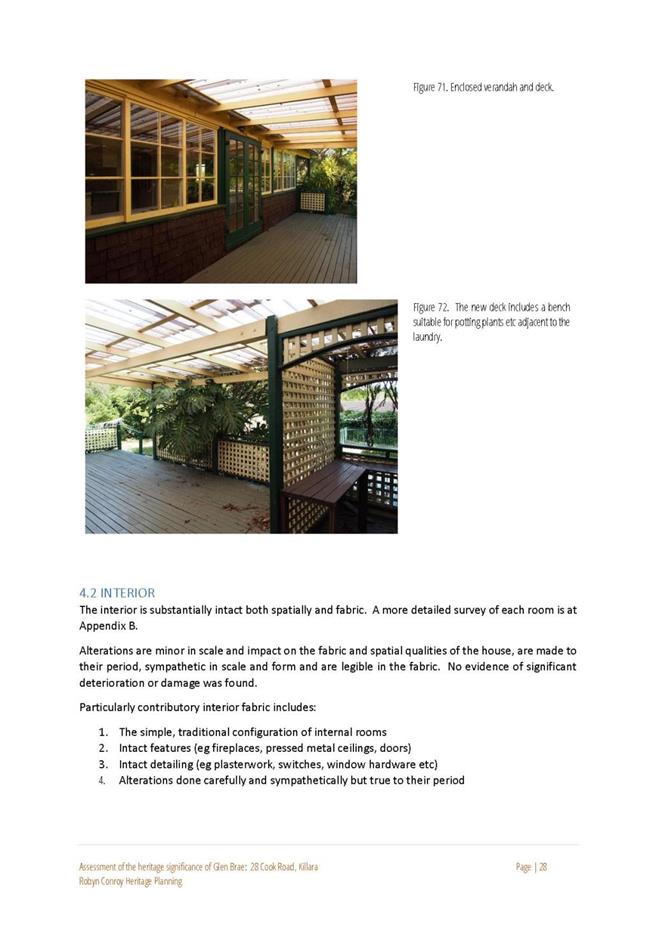
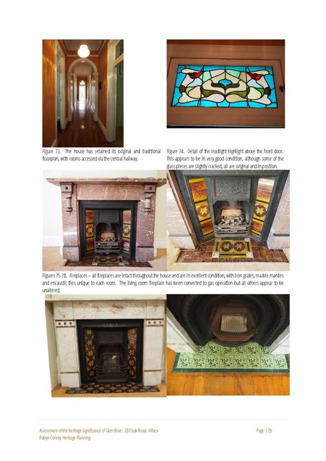
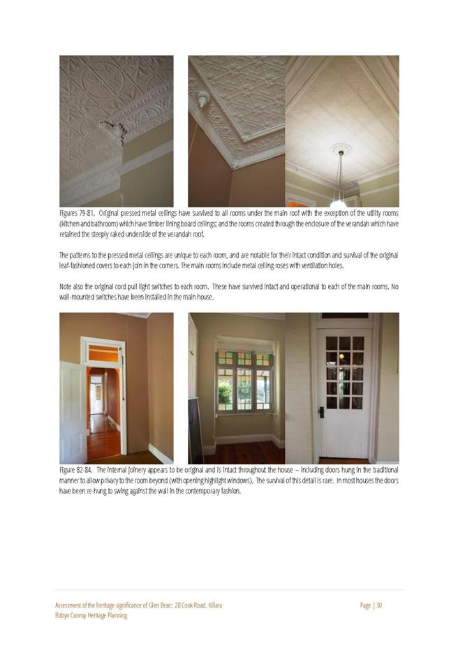
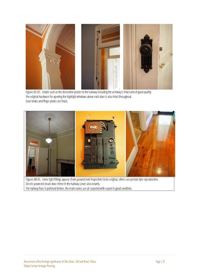

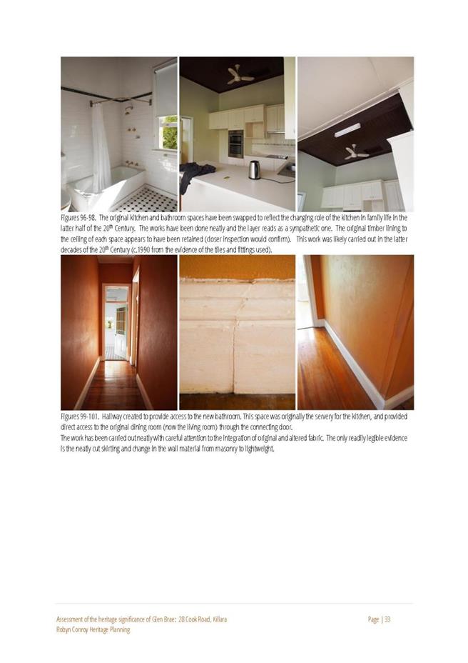
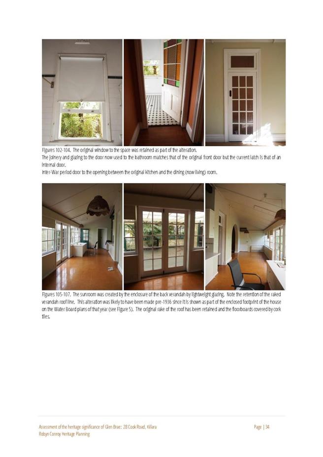
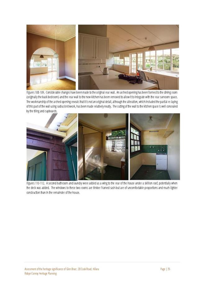
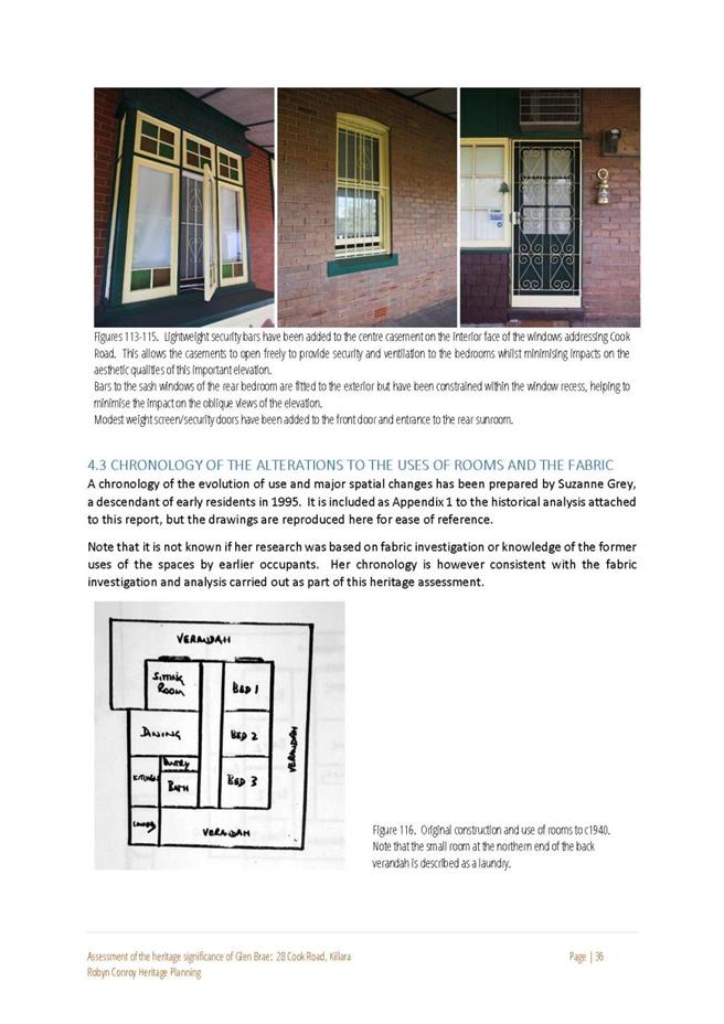
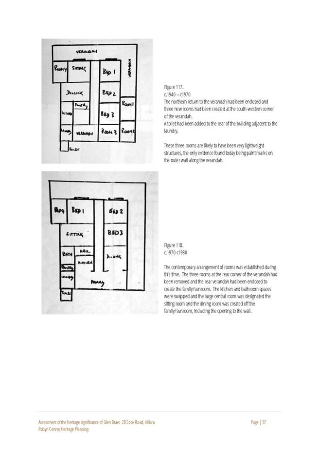
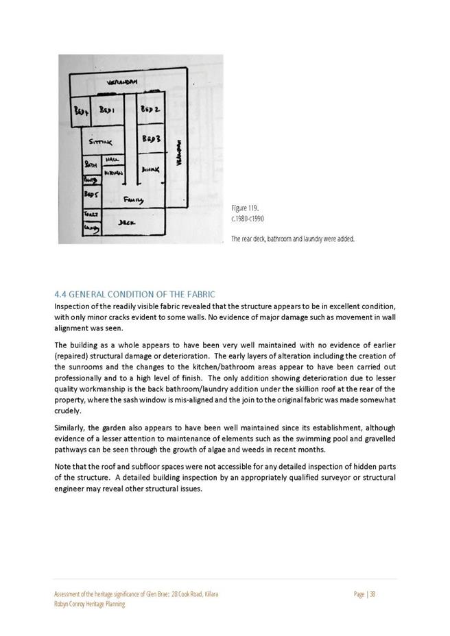
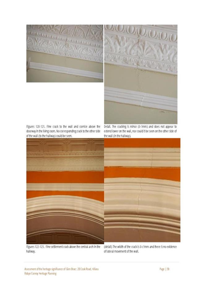
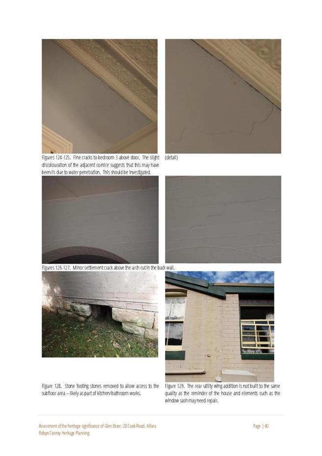
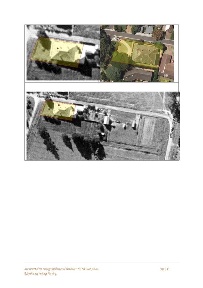
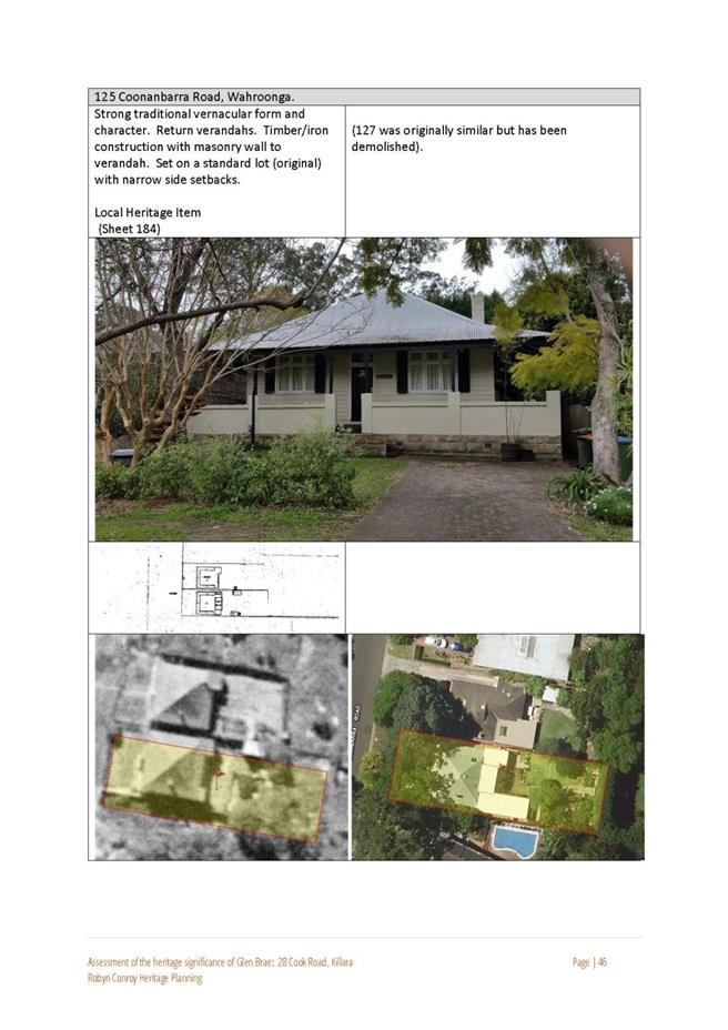
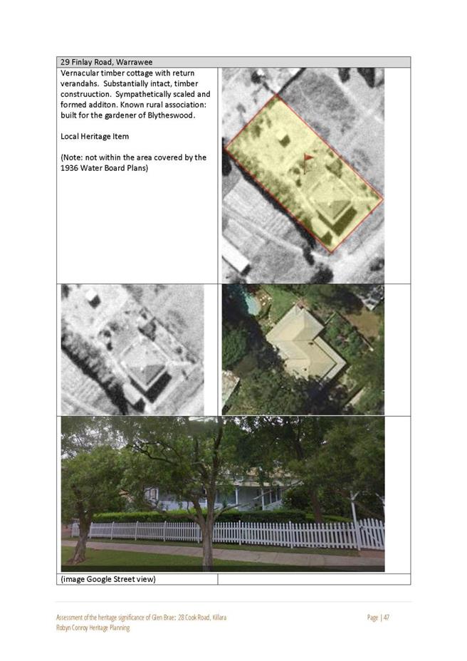
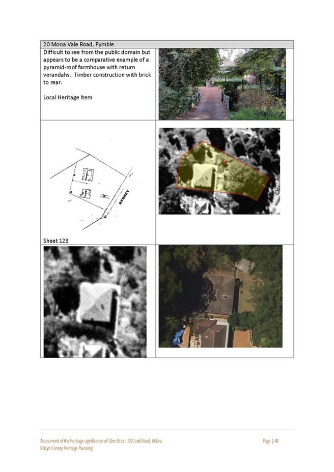
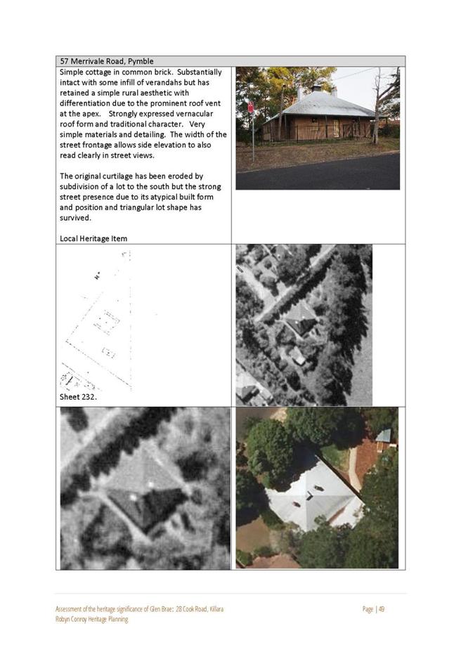

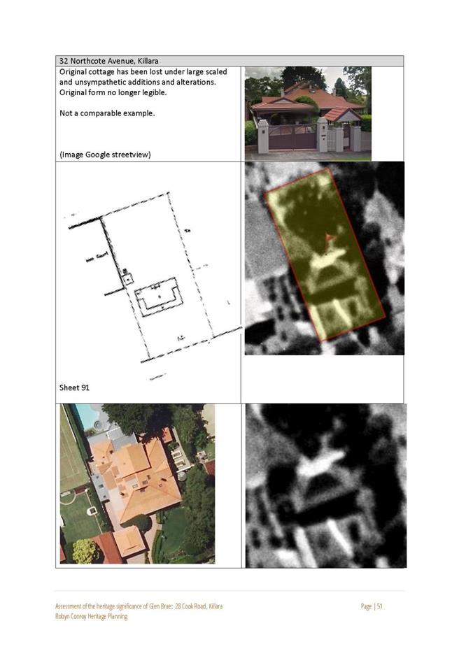
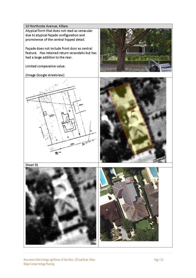
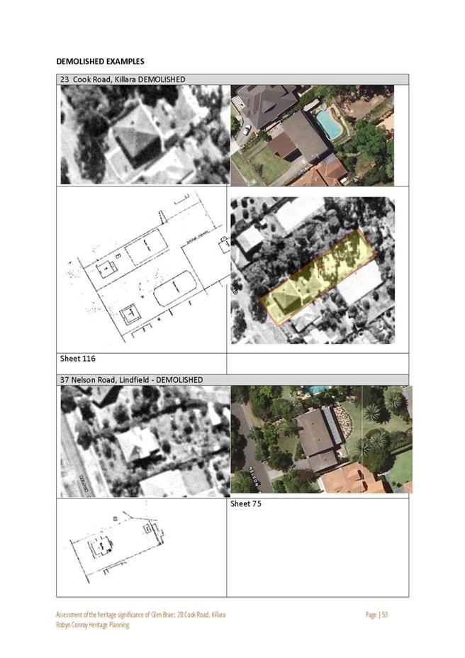
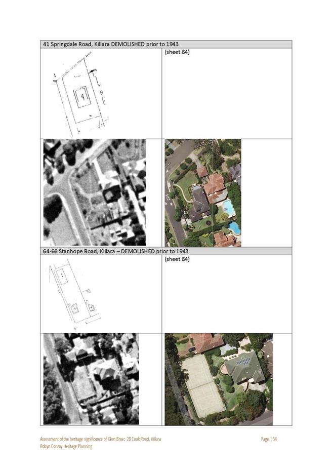
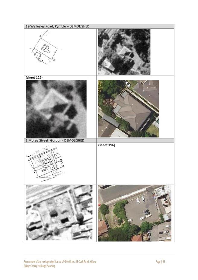
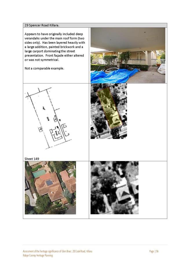
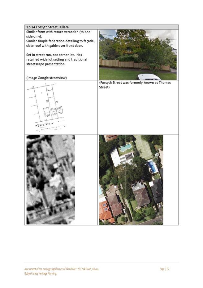
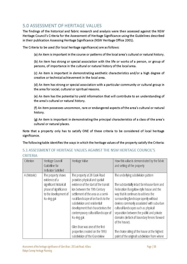
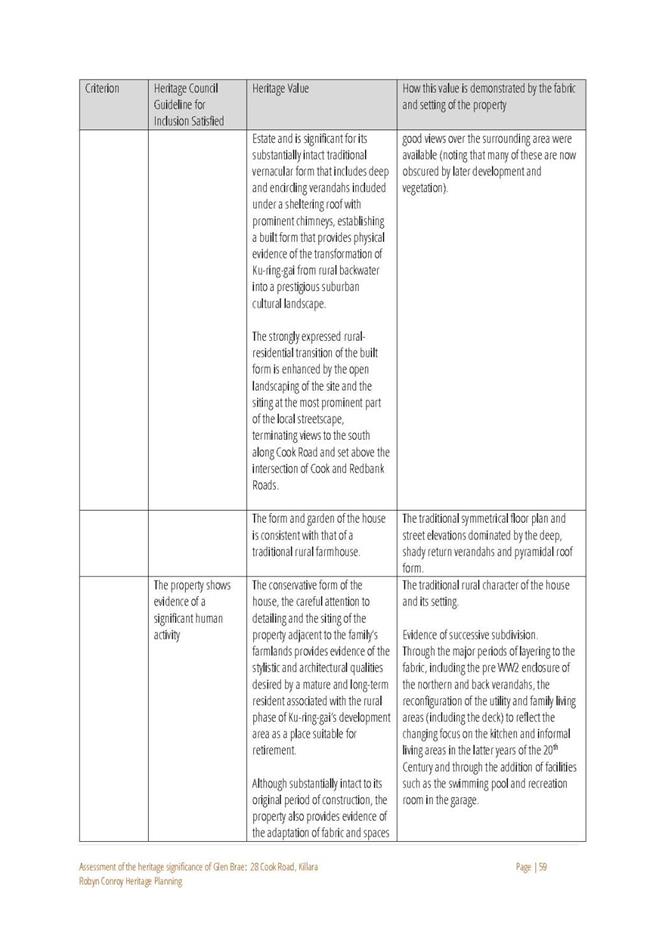
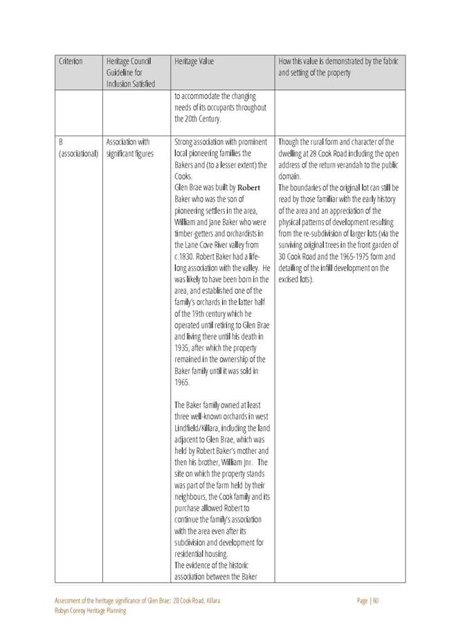
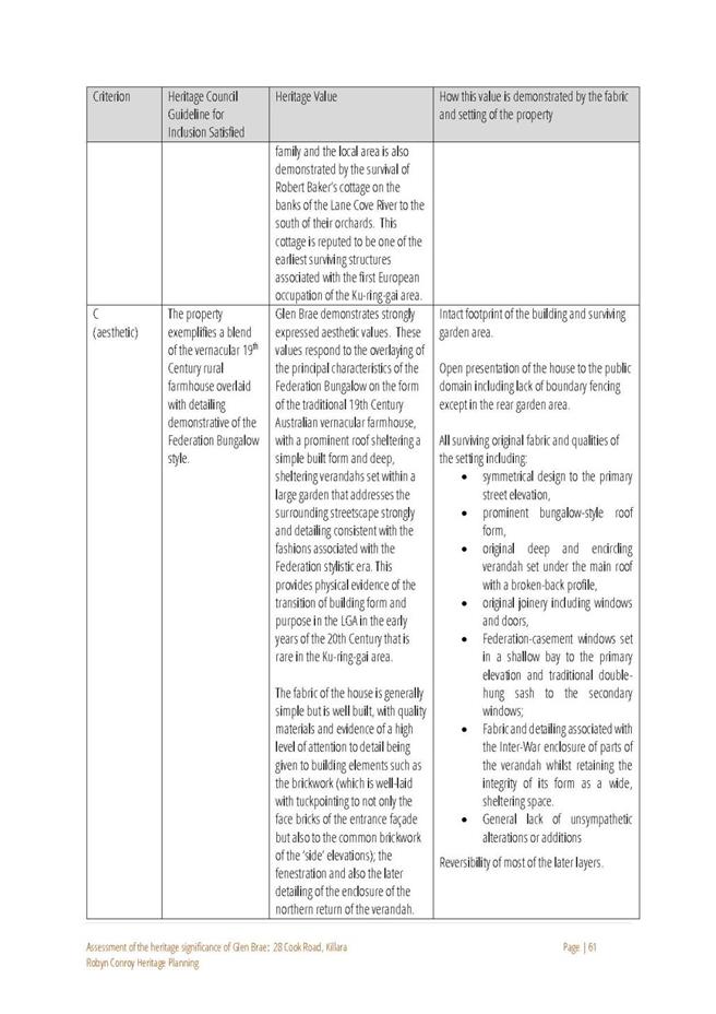
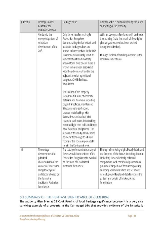
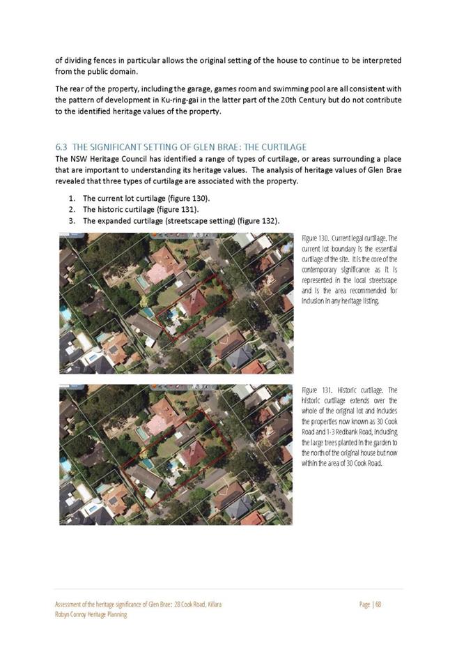
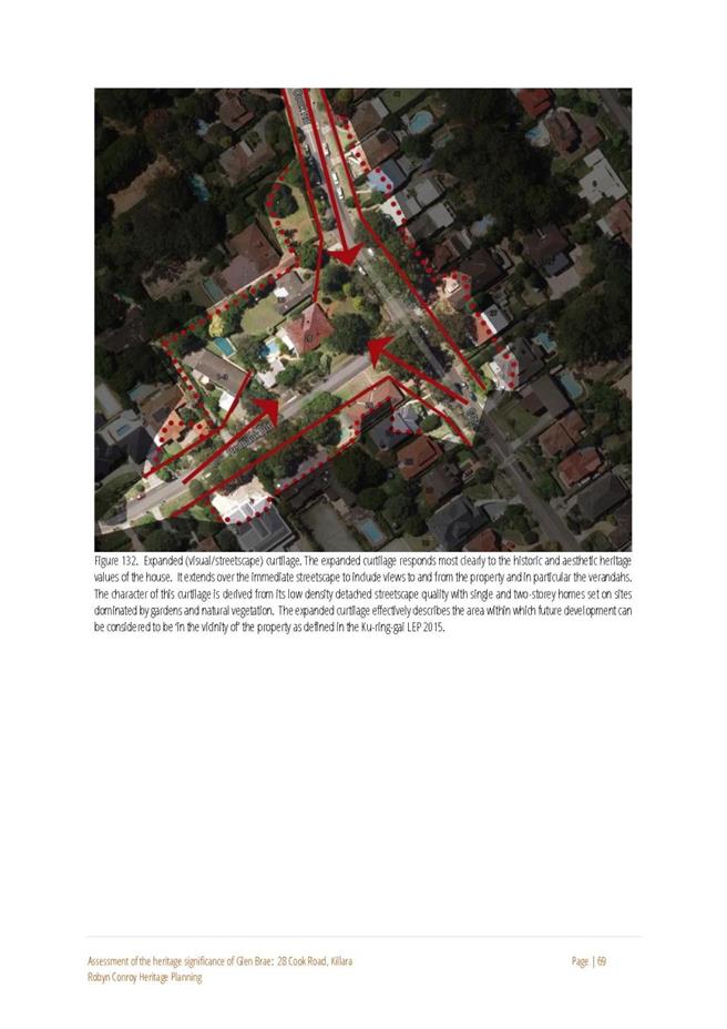


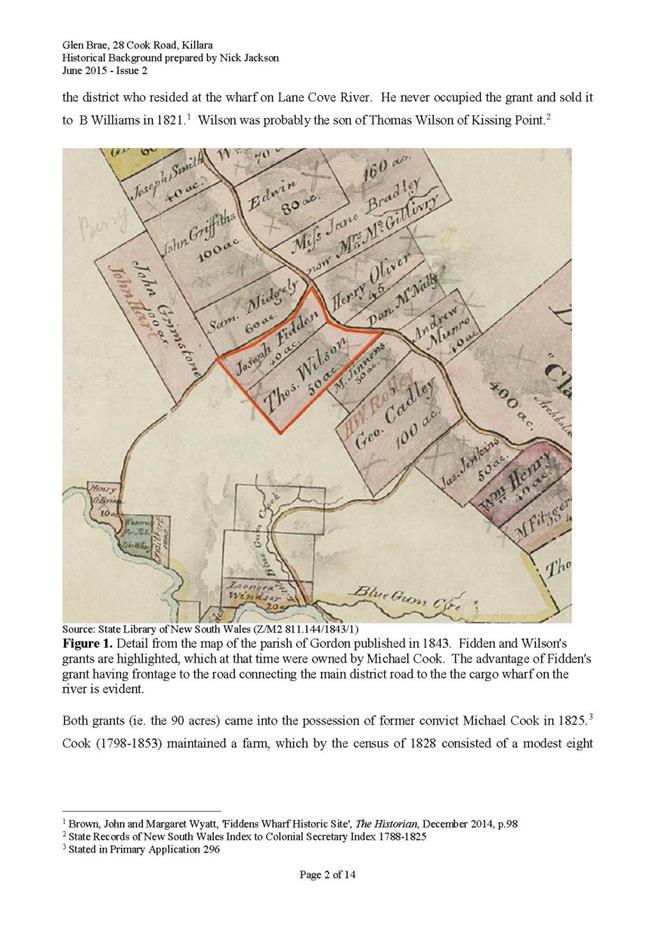
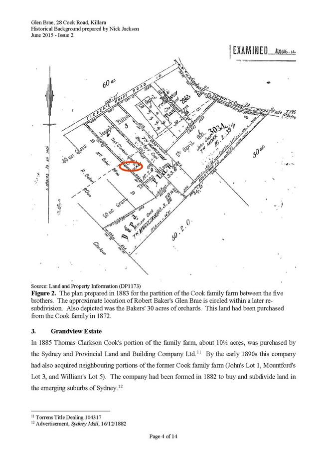
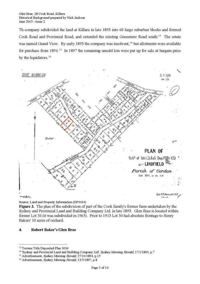
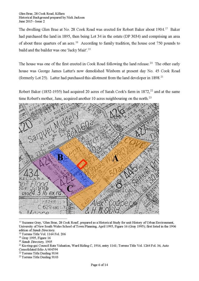
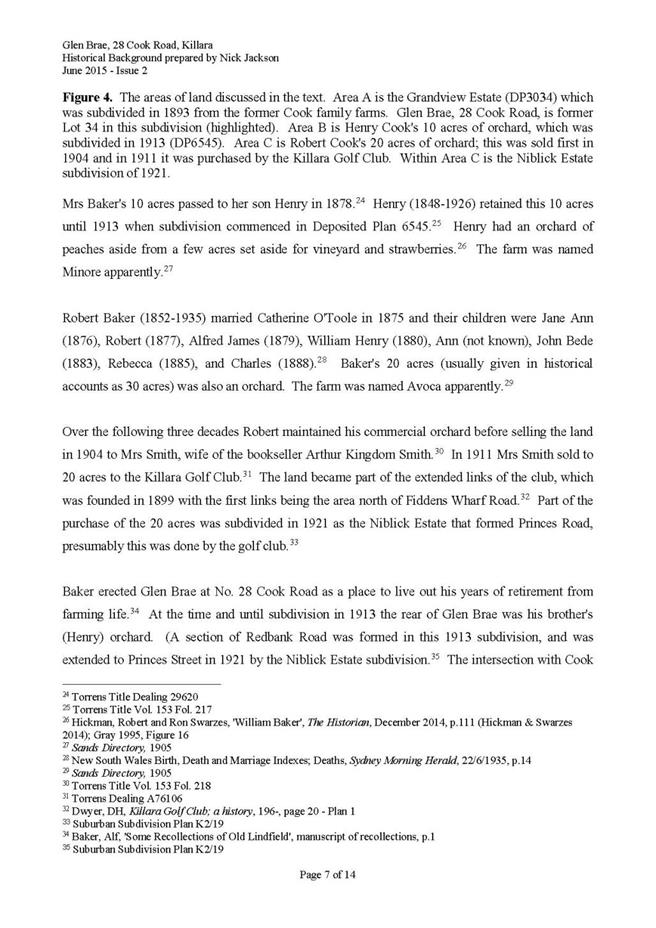
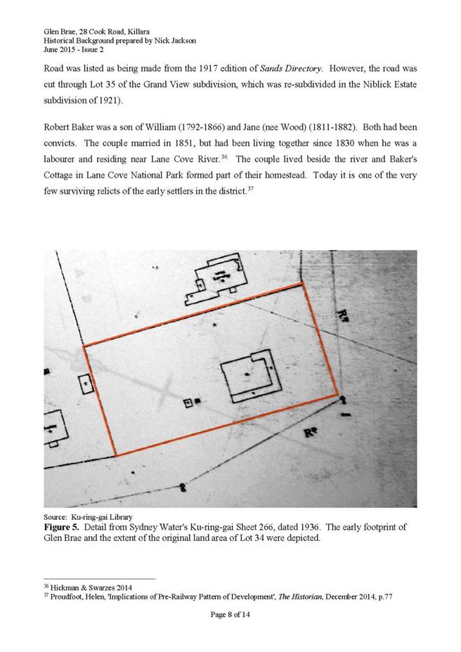
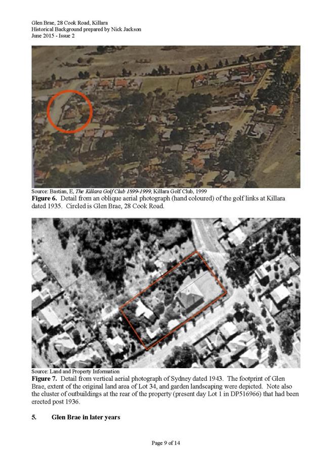
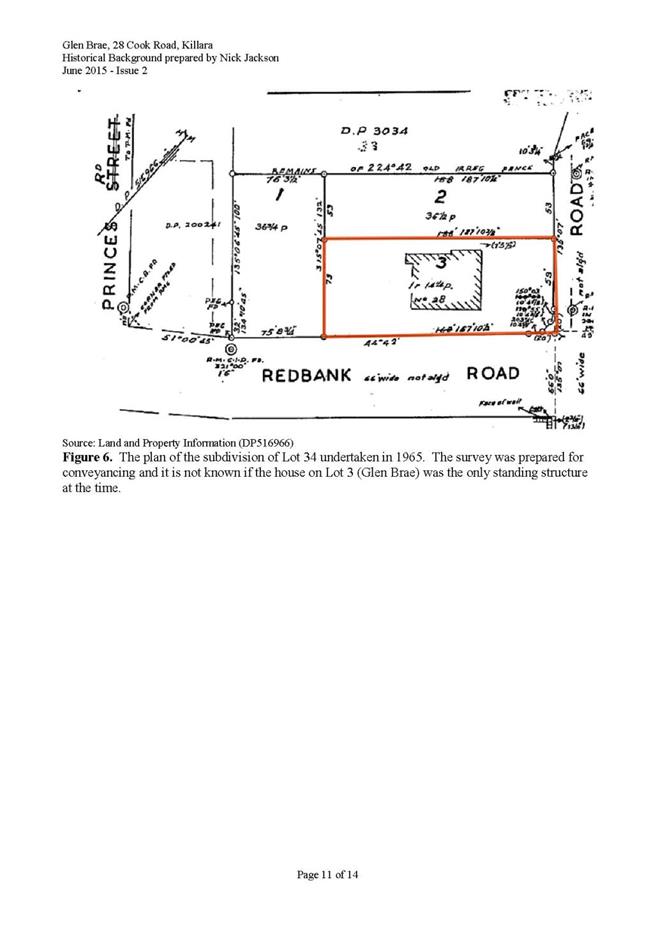
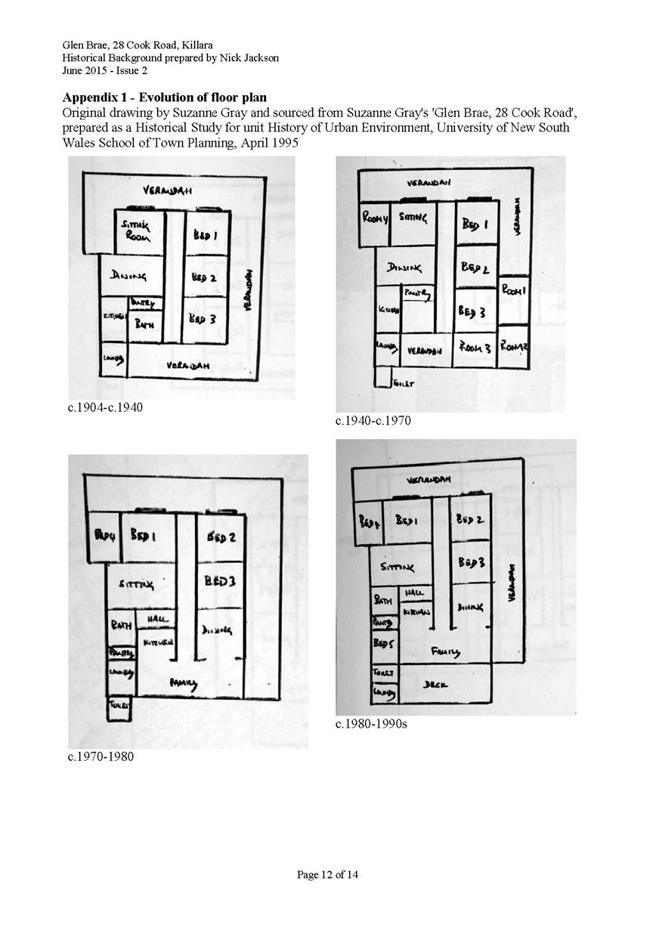
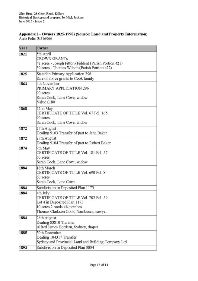
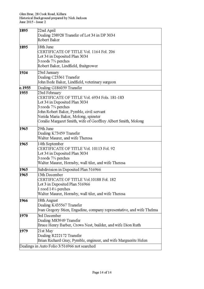
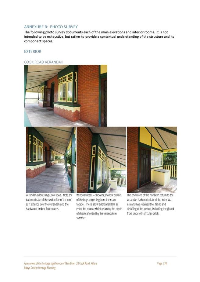
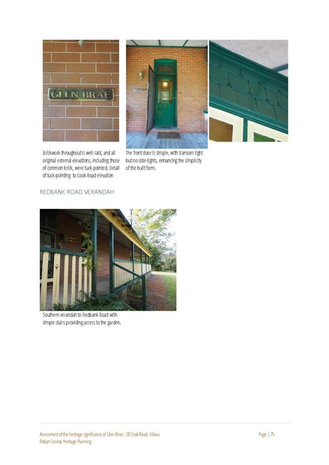

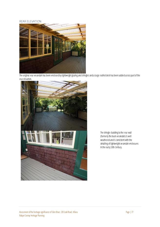
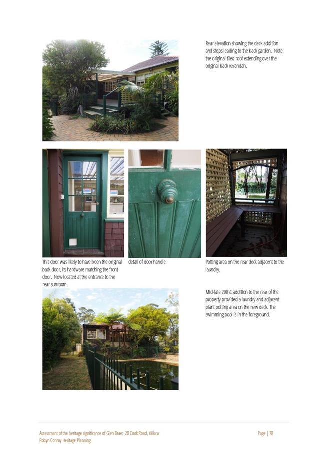
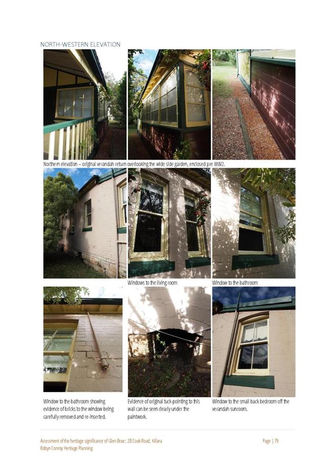
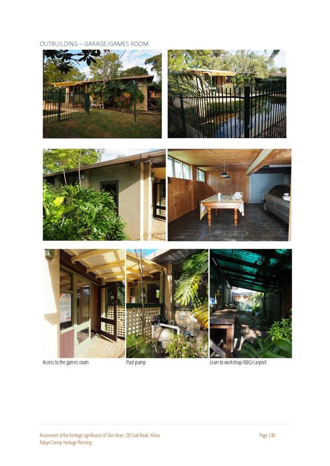
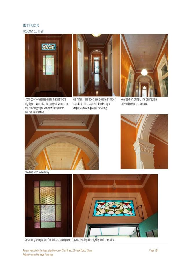
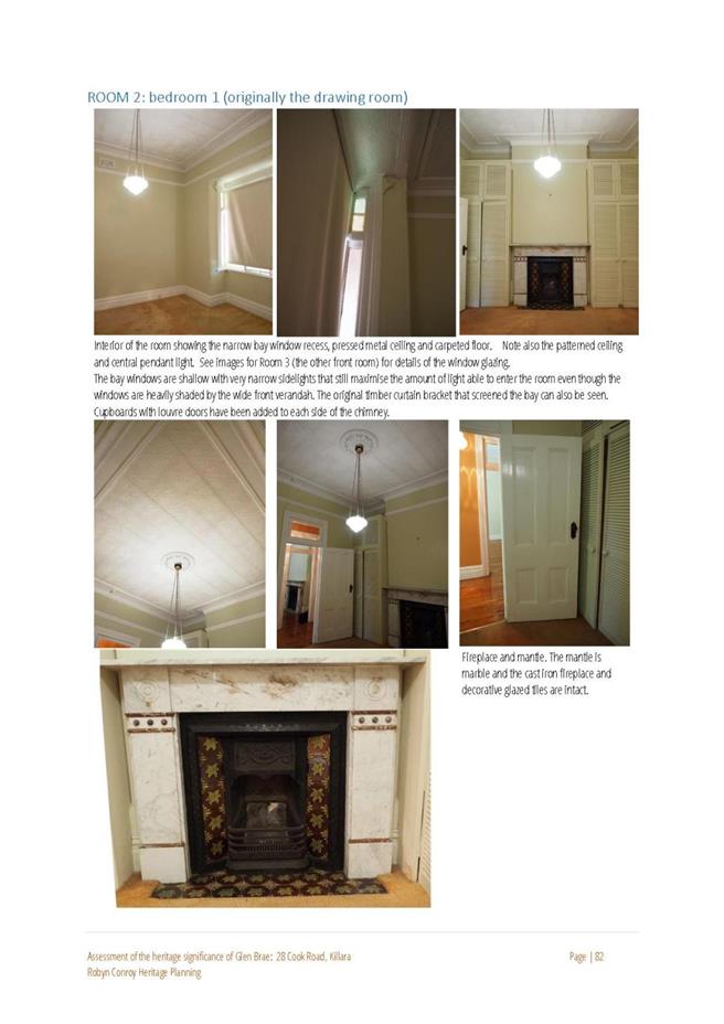
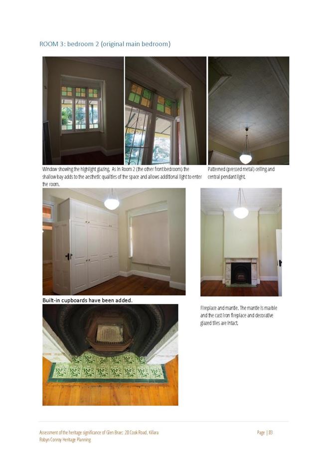
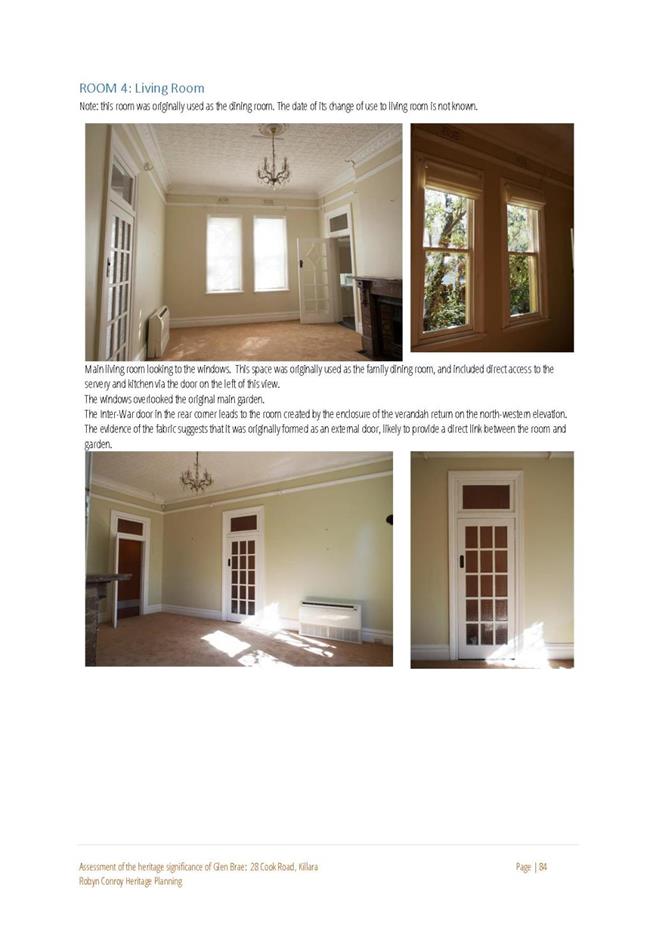
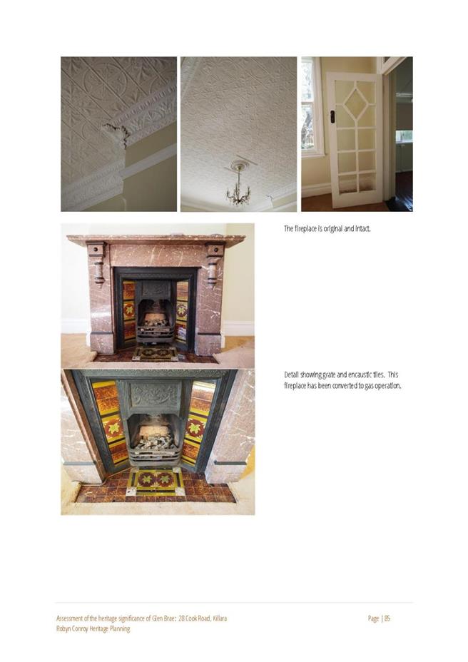
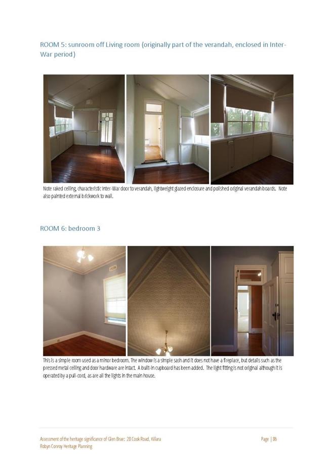
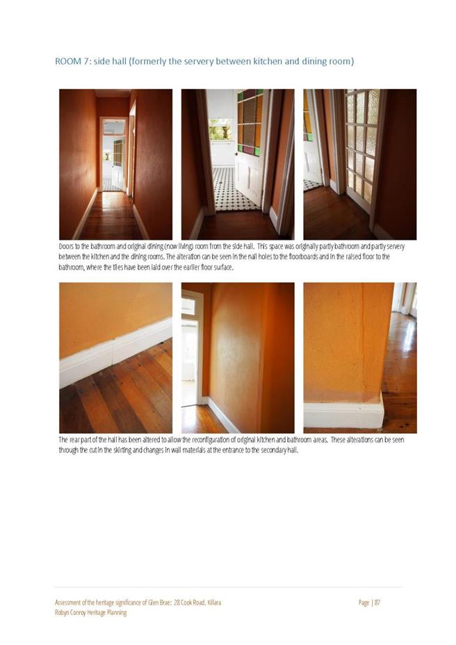
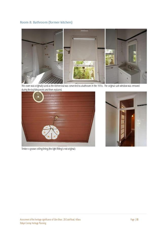
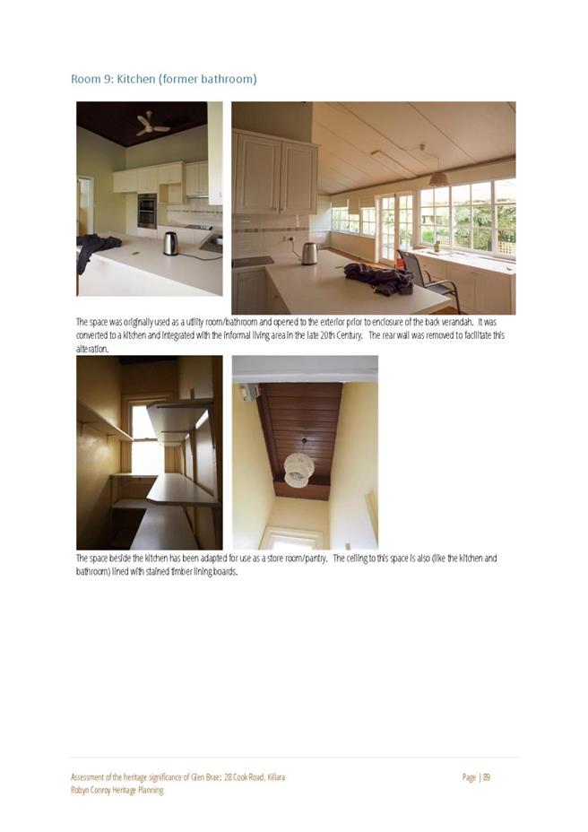
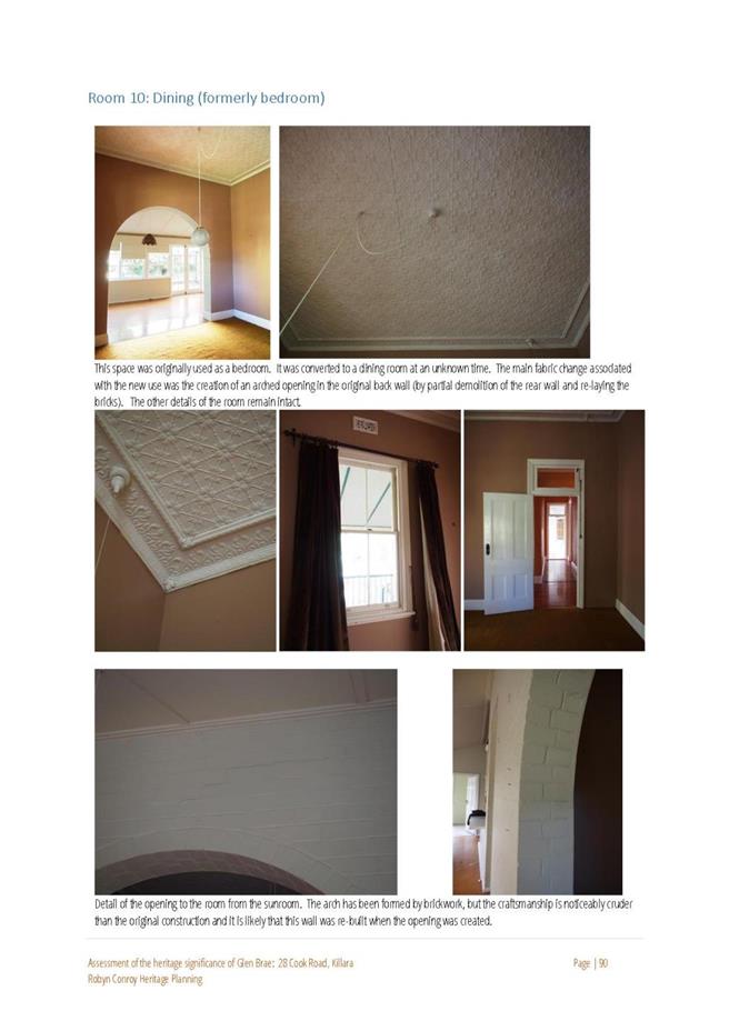
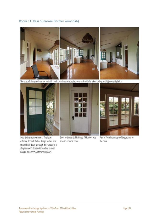
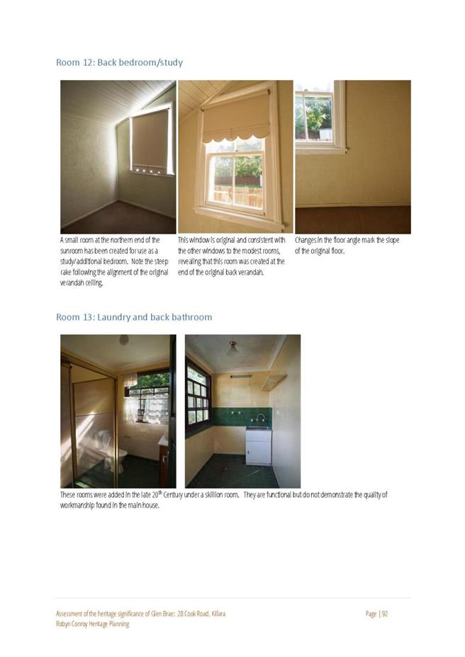
|
APPENDIX No: 2 - State
Heritage Inventory form - 28 Cook Road Killara
|
|
Item No: GB.10
|
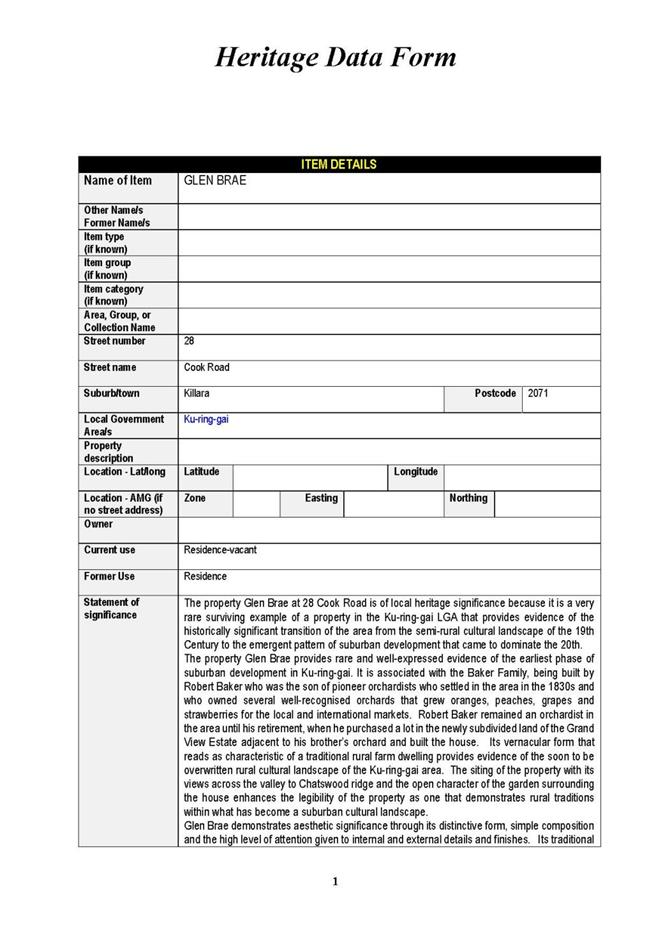
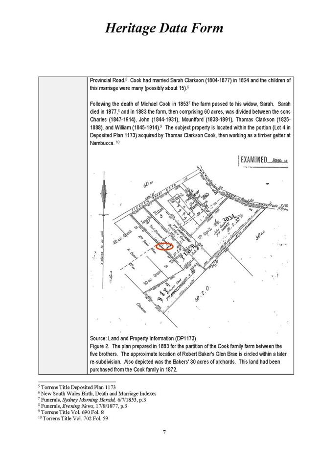
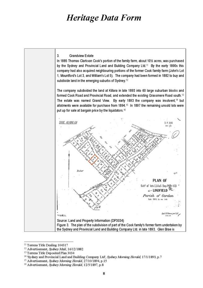
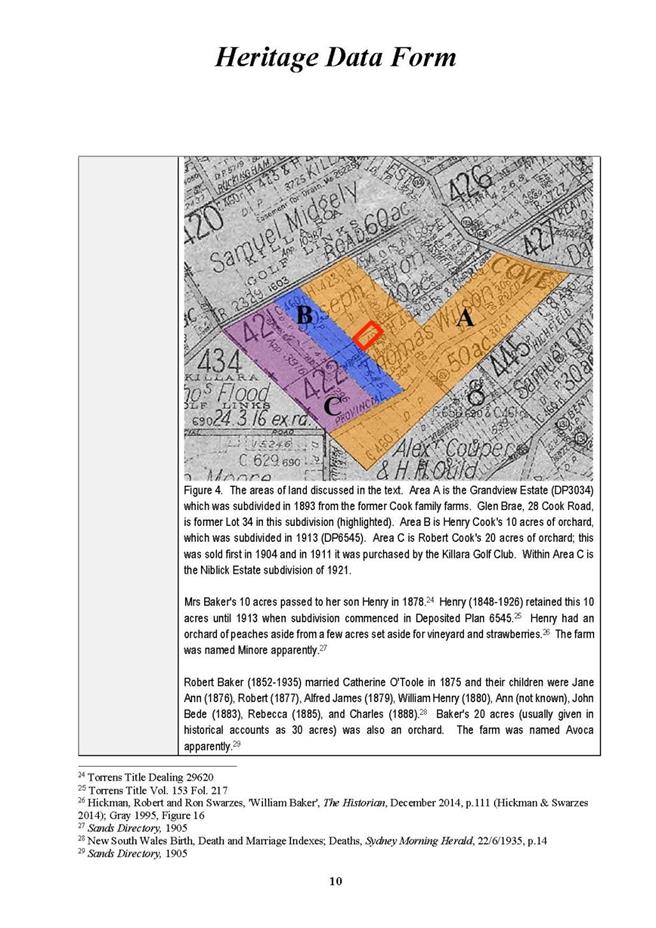
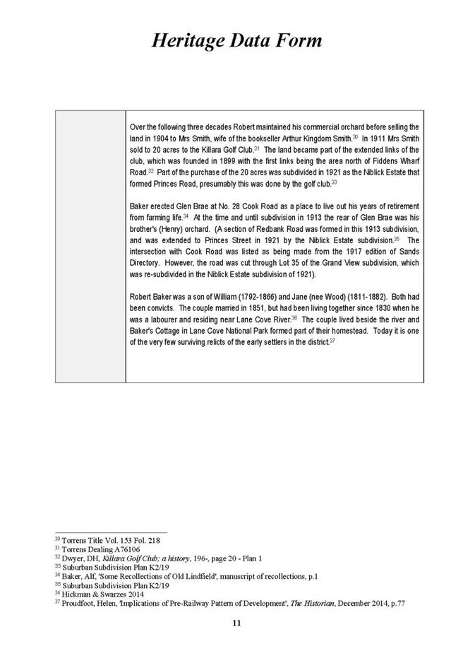
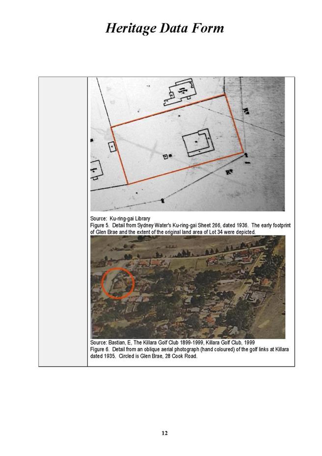
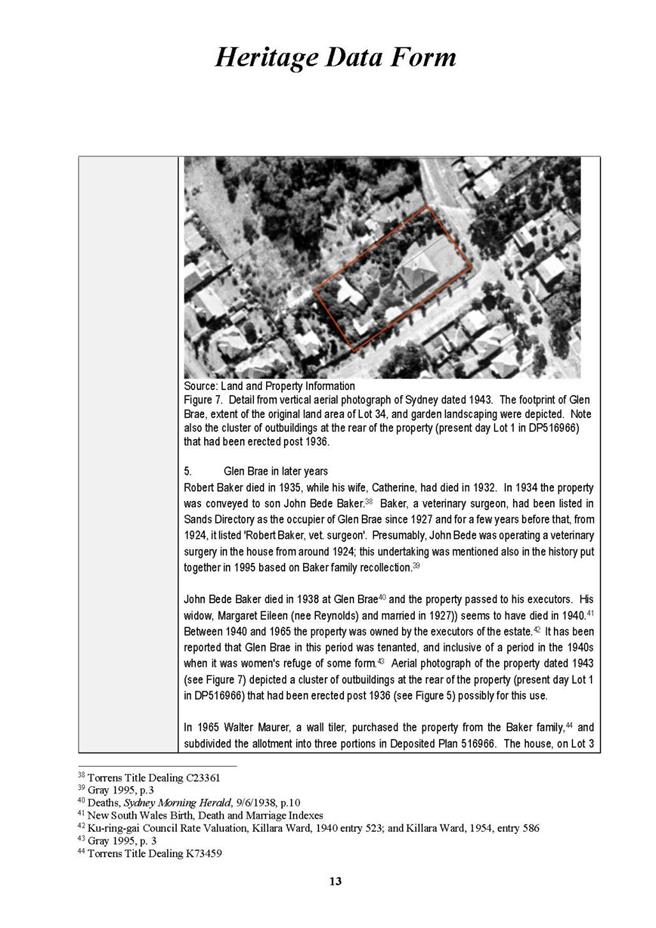
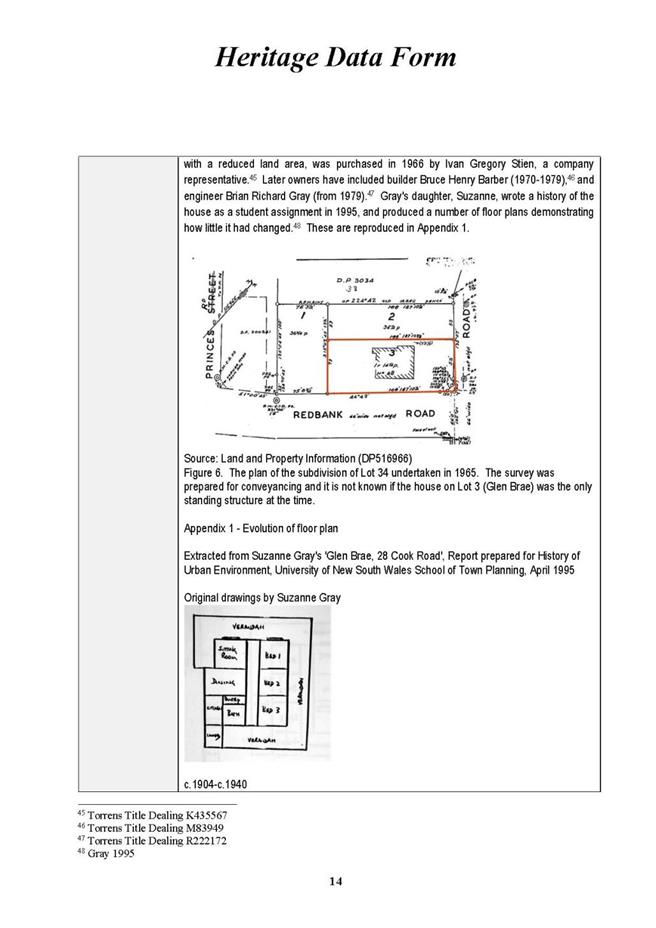

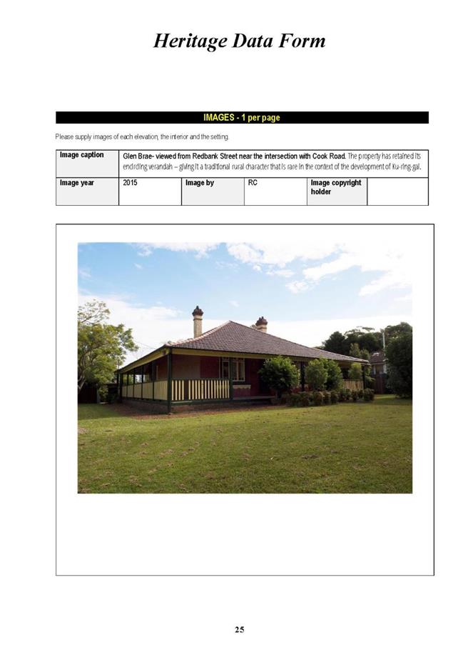
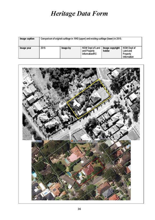
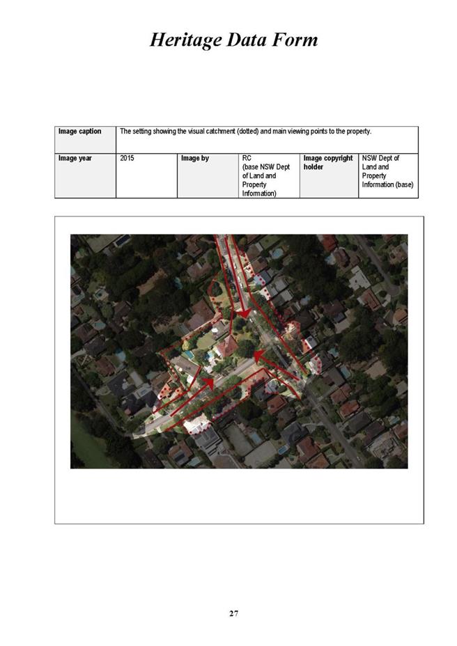
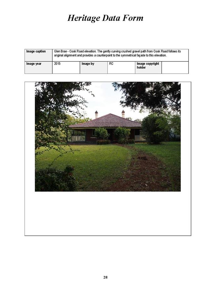
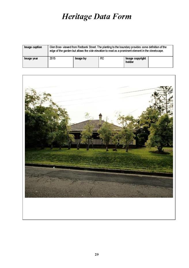
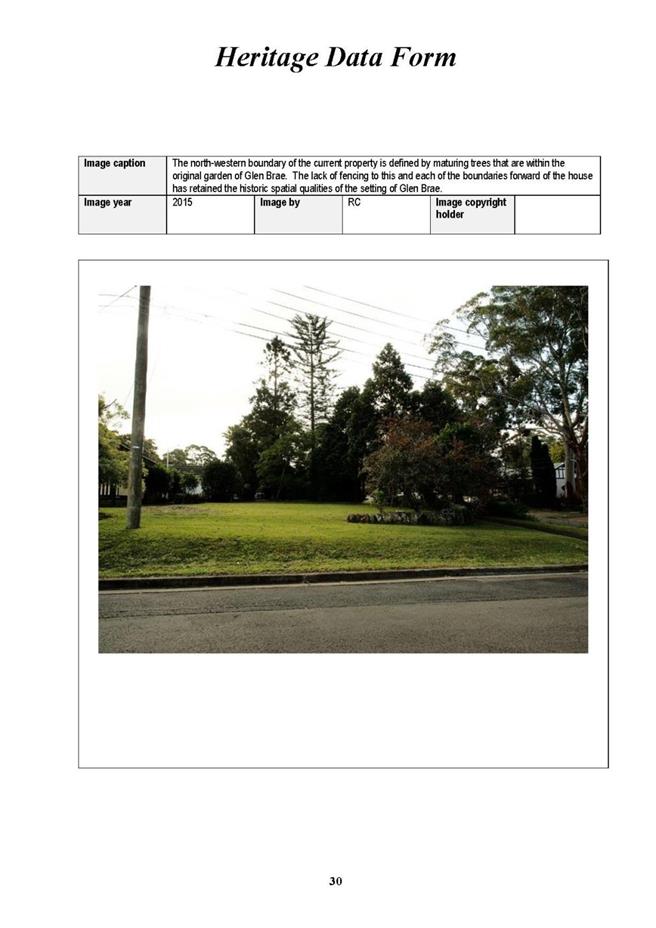
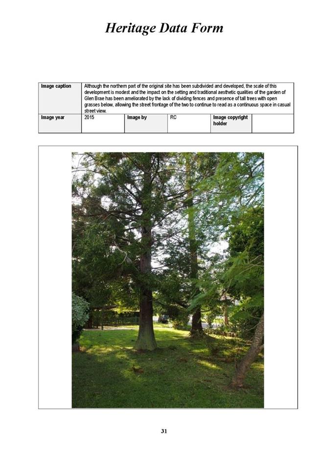
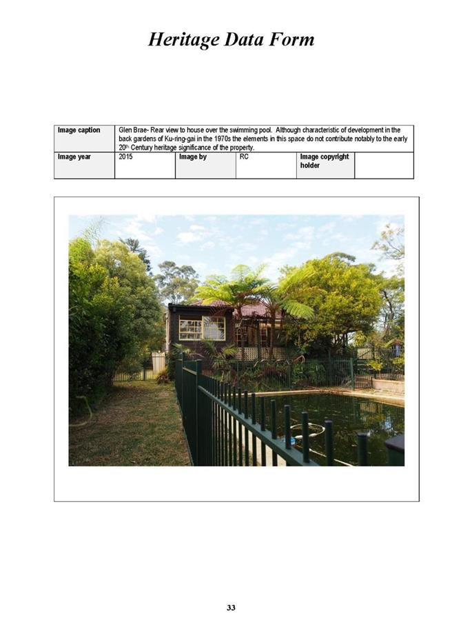
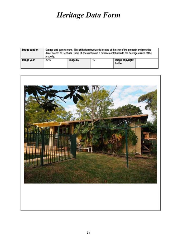
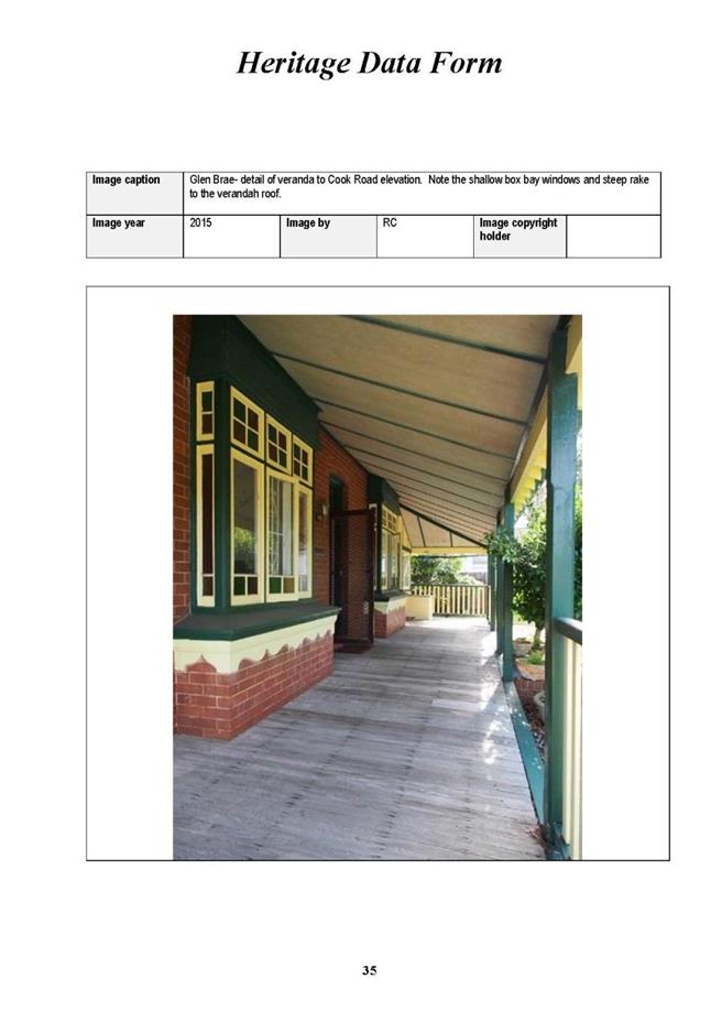
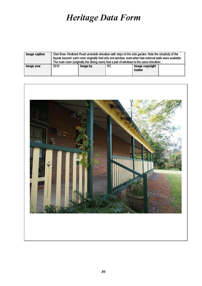

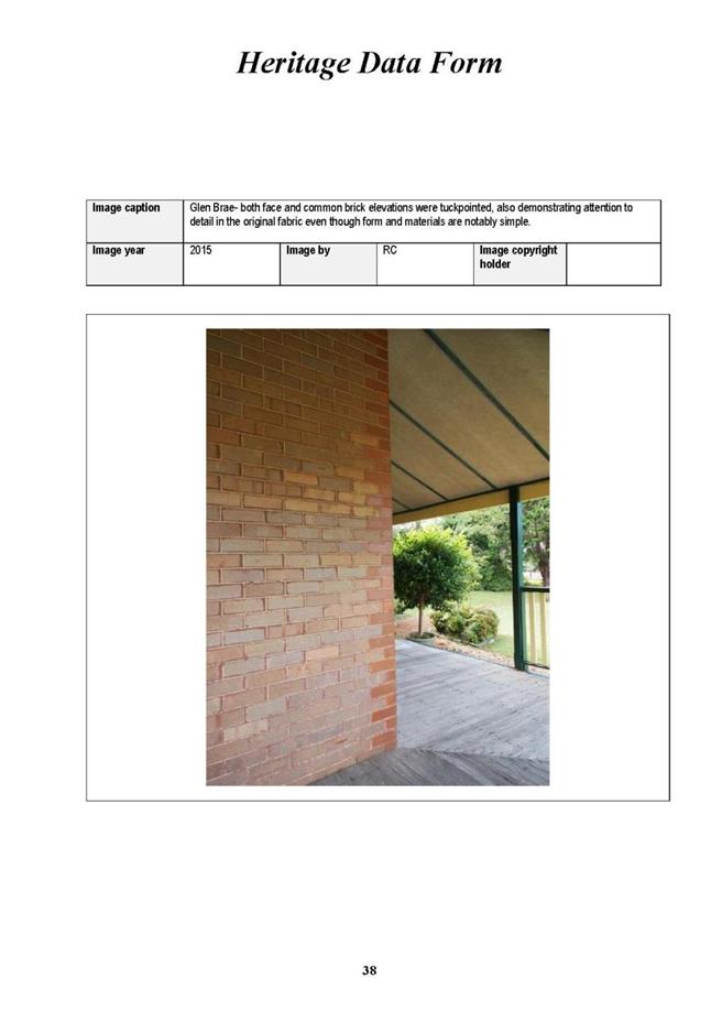
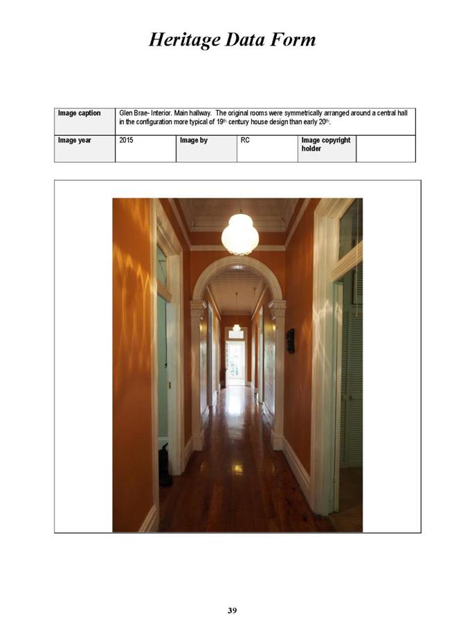
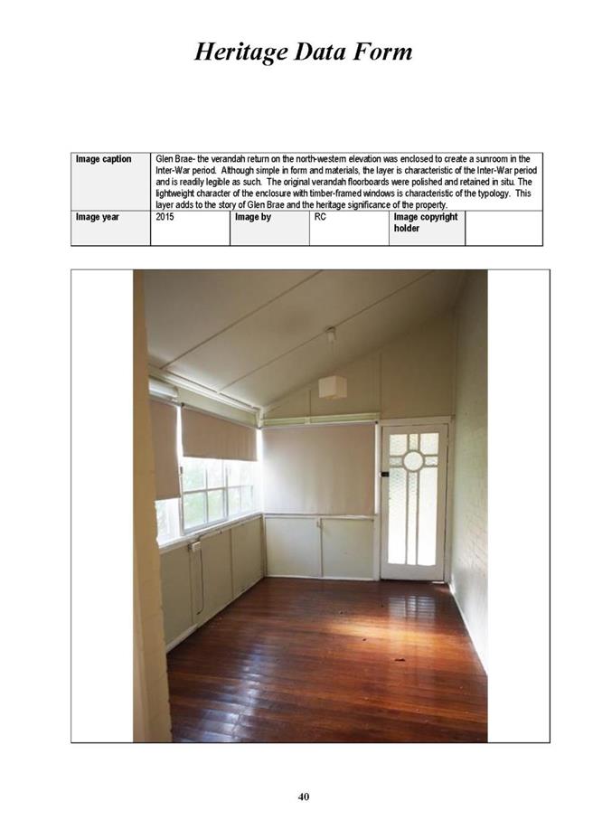
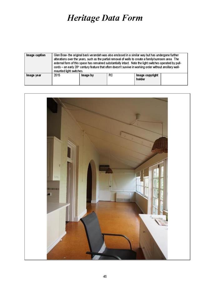
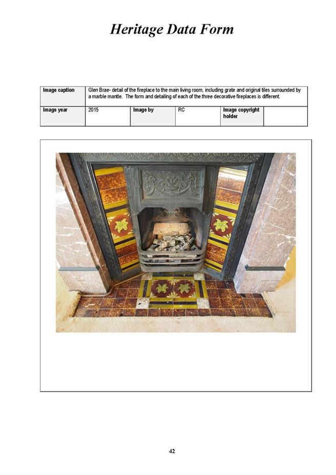
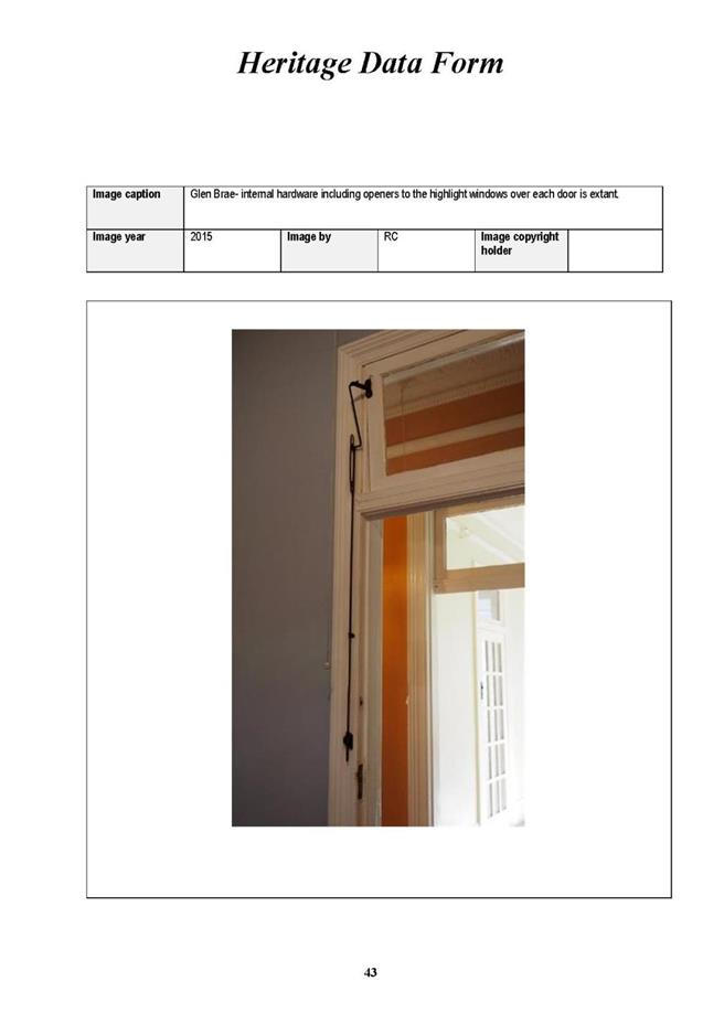
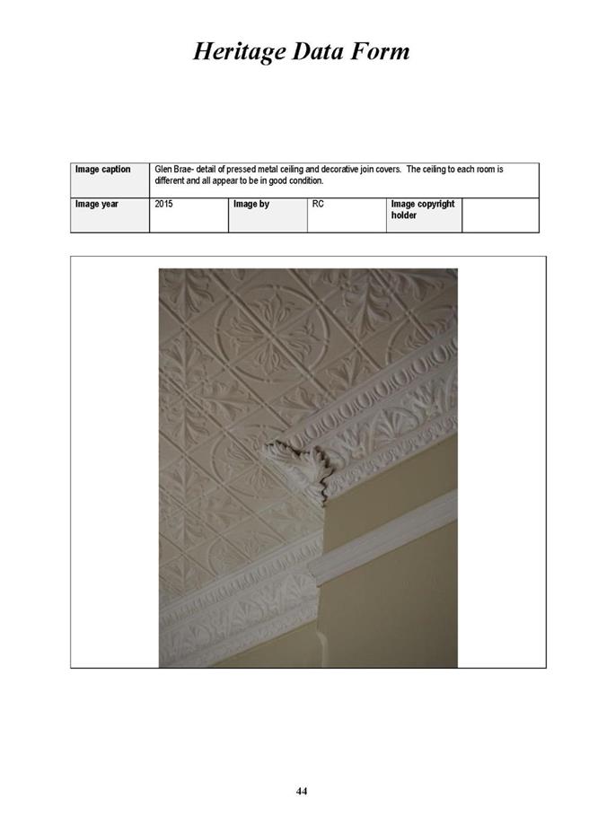
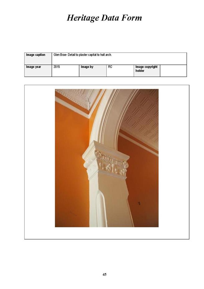

|
Ordinary
Meeting of Council - 8 September 2015
|
GB.11 / 884
|
|
|
|
|
Item
GB.11
|
S10453
|
|
|
24 August 2015
|
Consideration of Submissions on the
Planning Proposal to heritage list 6 Caithness Street, Killara and 51 Warrangi
Street, Turramurra
EXECUTIVE
SUMMARY
|
purpose of report:
|
For Council to consider the submissions received
during the public exhibition of the planning proposal to heritage list 6
Caithness Street, Killara and 5 Warrangi Street, Turramurra.
|
|
|
|
|
background:
|
On 14 July 2015 Council considered a report on submissions
to a planning proposal to amend KLEP 2015 and heritage list 5 properties. Two
properties:
· 6
Caithness Street, Killara and
· 51
Warrangi Street, Turramurra
were deferred from that decision for a Councillor
briefing.
The planning proposal was placed on public exhibition
between 24 April 2015 and 22 May 2015.
|
|
|
|
|
comments:
|
A total of 8 submissions were received during the
public exhibition of the planning proposal with regards to 6 Caithness
Street and 51 Warrangi Street. A councillor briefing was held on 17 August
2015.
|
|
|
|
|
recommendation:
|
That Council take no further action on the heritage
listing for 6 Caithness Street, Killara and 51 Warrangi Street, Turramurra.
|
Purpose of Report
For Council to consider the submissions received during the
public exhibition of the planning proposal to heritage list 6 Caithness Street,
Killara and 5 Warrangi Street, Turramurra.
Background
Council at its meeting held on 26 November 2013 resolved to
remove a number of potential heritage items from the Heritage Map and Schedule
5 of the then draft KLEP 2013, and defer them for further investigation and
re-exhibition.
Council engaged the services of a Heritage Consultant, Clive
Lucas Stapleton and Partners Pty Ltd, to conduct an independent detailed
assessment of the heritage significance of 14 of the deferred properties. The
heritage report is included at Attachment A2. The report by Clive Lucas Stapleton and Partners Pty
Ltd recommended the listing of 6 Caithness Street and 51 Warrangi Street.
Council at its meeting held on 25 November 2014 considered a
report on the heritage assessment by Clive Lucas Stapleton and Partners on 14
of the deferred properties and resolved the following:
A. That a planning
proposal be prepared , in accordance with Section 55 of the Environmental
Planning and Assessment Act 1979 to amend the Draft Ku-ring-gai Local
Environmental Plan 2014 to include the following properties on Schedule 5 and
on the Heritage Map as heritage items of local significance:
i. 51
Warrangi Street, Turramurra (Lot 1 DP580008)
ii. 4-6
Neringah Avenue South, Wahroonga (Lot 55 and 56 DP2666)
iii. 88 Fox
Valley Road, Wahroonga (Lot 15 DP568694)
iv. 12 Bobbin
Head Road, Pymble (Lot 1 DP200728)
v. 6
Caithness Street, Killara (Lot 6 DP14824)
B. That the
planning proposal be submitted to the Department of Planning and Infrastructure
for a Gateway Determination in accordance with Section 56 of the Environmental
Planning and Assessment Act 1979.
C. That in
order to facilitate a more timely Gateway Determination, the NSW Heritage
Office be consulted prior to submitting the planning proposal to the Department
of Planning and Environment. Should comments not be received within 21 days,
the planning proposal is to be submitted regardless.
D. That
Council request the plan-making delegation under Section 23 of the EP&A Act
for this planning proposal.
E. That upon
receipt of a Gateway Determination, the exhibition and consultation process is
carried out in accordance with the requirements of the Environmental Planning
and Assessment Act 1979 and with the Gateway Determination requirements.
F. That a
report be brought back to Council at the conclusion of the exhibition period.
G. That
Council take no further action on the heritage listing for the following
properties:
i. 59
Warrangi Street, Turramurra (Lot 1 DP215730)
ii. 6
Munderah Street, Wahroonga (Lot 2 DP552850)
iii. 10
Munderah Street, Wahroonga (Lot 1 DP216542)
iv. 66
Pentecost Avenue, Pymble (Lot B DP103589)
v. 60-62
Pentecost Avenue, Pymble (Lot 1 and 2 Sec DP13451)
vi. 33
Grandview Street, Pymble (Lot 2 DP228015)
vii. 8
Braeside, Wahroonga (Lot 2 DP52186)
viii. 8-10
Neringah Avenue South, Wahroonga (Lot 54 DP2666 and Lot 2 DP585805)
ix. 35 Springdale
Road, East Killara
Council at its meeting of 2 February 2015 resolved to place
an Interim Heritage Order under Section 25 of the NSW Heritage Act 1977 on 6
Caithness Street, Killara. The Interim Heritage Order was published in the NSW
Government Gazette on 6 February 2015.
On 3 February 2015, the planning proposal was referred to
the Heritage Division of the NSW Office and Environment and Heritage (OEH) for
comment prior to submitting to the NSW Department of Planning and Environment
for a Gateway Determination. The OEH submission outlined that there were no
objections to the listing of the proposed 5 items. A copy of the planning
proposal and appendices is included as Attachments A1 – A7.
The NSW Department of Planning and Environment issued a Gateway
Determination under Section 56 of the Environmental Planning and
Assessment Act 1979 on 10 April 2015 (Attachment A8).
The planning proposal was placed on public exhibition in
accordance with the requirements of the Gateway Determination from Friday 24
April 2015 to Friday 22 May 2015.
Council at its meeting of 14 July 2015 resolved to make the
Plan under delegated authority to include 12 Bobbin Head Road, Pymble and 88
Fox Valley Road, Wahroonga in Schedule 5 and on the Heritage Map of KLEP 2015.
At the Council meeting of 28 July 2015, Council resolved;
E. That Council defers any decision in regards to 6 Caithness Street
and 51 Warrangi Street for a Council briefing
from a Heritage expert.
Comments
On 17 August 2015 a briefing was held with Councillors to
brief them on this matter.
A heritage item is a place, which may include built
structures, landscapes, moveable objects and relics, that has recognised
cultural significance. In NSW, heritage items of local significance are
assessed against 7 criteria:
a) Historical
significance – an item is important in the course, or pattern, of the
cultural or natural history of the local area;
b) Historical
association significance – an item has strong or special association with
the life or works of a person, or group of persons, of importance to the local
area’s cultural or natural history;
c) Aesthetic
significance – an item is important in demonstrating aesthetic
characteristics and/or a high degree of creative or technical achievement in
the local area;
d) Social
significance – an item has a strong or special association with a
particular community or cultural group in the local area, for social, cultural
or spiritual reasons;
e) Technical/research
significance – an item has potential to yield information that will
contribute to an understanding of the local area scientific, cultural or
natural history;
f) Rarity
– an item possesses uncommon, rare or endangered aspects of the local area’s
cultural or natural history; and
g) Representativeness
- an item is important in demonstrating the principal characteristics of a
class of the local area’s cultural or natural places; or cultural or natural
environments.
Items are not excluded from the heritage schedule solely
because they share similar characteristics to items already represented. Items
do not need to be significant in all of these criteria, many have significance
in only 1 or 2 of the criteria.
As a result of the public exhibition of the planning
proposal, a total of 8 submissions were received with regards to 6 Caithness
Street and 51 Warrangi Street:
|
Property
|
Submissions received in support of heritage listing
|
Submissions received not in support of heritage listing
|
|
6 Caithness Street, Killara
|
5
|
2
|
|
51 Warrangi Street, Turramurra
|
0
|
1
|
A summary of the public submissions along with a detailed
comment and assessment is included at Attachment A9.
The purpose of the public exhibition is to facilitate public
participation in the planning process. The submissions along with the original
assessment were analysed to form this report’s recommendation. The key findings
of the analysis of the submissions against the original assessment is provided
below.
6 Caithness Street, Killara
The Inter-war bungalow at 6 Caithness Street, Killara was
assessed at having significance for its aesthetic contribution and its
historical association with the architect Donald Esplin and a former president
of the Killara Golf Club, T.K. Smith.
The Architect Esplin designed some 400 buildings. 3 of his
buildings are recognized as heritage places under Ku-ring-gai Council’s LEPs:
· 9 Yarabah Avenue, Gordon;
· 22 Hastings Road, Warrawee; and
· 26 Billyard Avenue Warrawee.
Submissions were received both in support and against the
heritage listing. Those in support of the listing commented on the aesthetic
value and historical association significance. Those against the listing
highlighted the loss of aesthetic significance and the unsympathetic changes
that occurred to the property. This was supported by an independent heritage
assessment by NBRS + Partners which challenged the assessment of aesthetic
significance.
It should be noted that recent changes to the house, being
those in the last 12 months, are considered to be reversible. Consistent with
the principles of the Burra Charter, there is extensive knowledge of the form,
nature and appearance of the original elements that were changed such that it
would be appropriate to replace the new aluminium window and glass balustrade
with appropriate replicas to those found in historic house photos. These recent
changes are not the reason for not pursuing the heritage listing of 6 Caithness
Street Killara.
The proposed listing and submissions have been further
reviewed and it is recommended the listing not proceed for the following
reasons:
1. While
Esplin was a significant architect this is not a remarkable example of his work
nor is it a particularly remarkable example of the Inter-war bungalow style:
This view was supported by Council’s heritage advisor and
the report by NBRS + Partners. Other fine examples of Esplin’s bungalow work
include the famed ‘Esplin Bungalow’ located at 11 Cranbrook Avenue,
Cremorne. This house is cited in numerous architectural texts and by the AIA as
an early and highly accomplished Californian bungalow. Another fine example of
his more modest bungalow work is 44-46 Lang Road , known as Forster and
Braelin. Constructed for politician and timber merchant, Sir Allen Taylor and
his wife Lady Adele Taylor, the dwelling is a substantial, though conservative,
early Inter-war Californian bungalow style house whose design intent has not been
compromised by rendering or changes to the garden setting.
Additionally, according to the description of 6 Caithness
Street contained within the book Donald Thomas Esplin, Sydney Architect, His
Life and Work (Irving and Irving 2008) “the verandah supports are conceived
as a three-bay ensemble of Tuscan columns ….in a classical design motif
typically favoured more by Mould than by Esplin”. The inference being the
aesthetic is more that of Mould than Esplin. Based on the association with
Esplin it is not recommended to list 6 Caithness Street, Killara.
2. While
T.K. Smith was a valued member of Killara Golf Club his short mid-term
presidency was unremarkable with no significant events or changes occurring at
the club over this short presidency. An adequate comparison with the six
earlier presidents has not been provided. The historical association
with T.K. Smith is not considered significant
The assessment by Clive Lucas Stapleton and Partners Pty Ltd
described T.K. Smith as an early president when in fact his presidency was not
until 1946, nearly 50 years since the club began. The Clive Lucas Stapleton and
Partners Pty Ltd assessment failed to undertake a comparison between T.K. Smith
and the other presidents to obtain an understanding of what being a significant
president of the club may entail. The following is a comparison of the terms
and significant events for the preceding presidents, and the immediately
following president to T.K. Smith:
|
Charles Danvers
|
1899-1901
First president (Lindfield)
|
|
|
|
|
|
|
|
|
|
|
|
J George Edwards
|
1902-1910
Moved course to Killara – known as the father of
Killara
|
|
|
|
|
|
Henry Braddon
|
1911
|
|
|
|
|
|
|
|
|
|
|
|
|
|
Charles E Graham
|
1912-1928
War years, expansion
|
|
William Maschwitz
|
1929-1935
New clubhouse
|
|
|
|
|
|
|
|
Frederick Greaves
|
1936-1945
War years
|
|
|
|
|
T. Keith Smith
|
1946-1947
|
|
|
|
|
|
|
|
|
|
|
|
|
John F. Fenwick
|
1948-1951
|
|
|
|
|
|
|
|
|
|
|
The historical association with T.K. Smith is not considered
a convincing reason for including 6 Caithness Street as a heritage item.
3. The
dramatic and significant change in setting from single dwellings to 5 storey
apartments has resulted in a loss of amenity to the residents of 2, 4 and 6
Caithness Street and a loss of setting to any potential heritage item:
The properties at 2, 4 and 6 Caithness Street were conceived
as bungalows surrounded by single dwellings with established gardens in a
suburban setting. The reality on the ground today is these houses are wedged
between 5 storey apartments directly to their north and to the west. There is
no longer any private open space in the backyards of these properties. More
specifically relating to the garden setting of 6 Caithness Street, the garden
no longer has a central path to the front door originating from a small garden
gate on the street as depicted in early photos and on the 1943 aerial. The gate
is long gone, so to the northern portion of the front fence. The central path
has also been diverted, with the current path to the front door sweeping from
the driveway. The sense of arrival and the symmetrical layout of the garden in
response to the symmetrical house has been altered.
It is recommended that 6 Caithness Street, Killara not
proceed as a heritage item.
51 Warrangi Street, Turramurra
The house at 51 Warrangi Street, Turramurra, known as
Andover, was recommended for listing as a representative example of the
Georgian Revival style designed by prominent architect William Rae Laurie.
The one submission for this property argued against the
listing based upon the unsubstantiated evidence that the house was designed by
William Rae Laurie. This argument is not supported as historical evidence
supports Laurie’s association with the design project. The independent heritage
assessment attached to the submission argued the house has undergone both
significant and unsympathetic change and was not significant.
The 1936 building application describes the house as a two
storey brick dwelling of 7 rooms with a garage. The built Andover was a two
storey house with strong Georgian Revival overtones. It was a face brick
structure set under a high pitched roof with a small attached hipped roof
projection containing maid’s accommodation. Today, the face brick is painted.
The front (south) and western façade exhibit regular and repetitive
fenestration. All elevations with the exception of the east façade have
multi-paned windows, with the upper level windows of the west and south façade
and some lower windows of the north facade having louvered shutters.
The house front does not address the street nor is it easily
visible from Warrangi Street. The primary façade faces 49 Warrangi Street
(neighbour to the south). Extensions have been made to the east and west of
this primary façade. The list of changes are as follows:
· Single storey two car
garage to western frontage visible from street.
· Skillion addition to
eastern frontage spanning width of house.
· Modification of ground
floor loggia on north elevation with later enclosed verandah addition.
· Enclosure of first floor
loggia and division into separate rooms.
· Internal modifications to
planning including changed door locations, and division and use of rooms.
· Blanking off of original
windows and doors due to additions including ground floor windows that were on
the Warrangi Street elevation.
· New bathroom fitout.
Kitchen has been relocated from the original house into a more recent wing
extension.
· Painting of original face
brickwork.
· Re-roofing with concrete
tiles
It is recommended the listing not proceed due to the
considerable change that has occurred to the building since its original design
and construction. The simple and restrained architecture that
characterises the Inter-war Georgian Revival style seems absent following the
accretion of unsympathetic extensions that has occurred over the years. The
original form is still legible but the additions have obscured some important
architectural features such as some original windows and doors.
The alteration of the interior is substantial with only some
fabric retained such as the fireplace in the front lounge and based upon 2009
real estate photos, the original staircase appears to also still be in place.
An aesthetically pleasing and key architectural feature that has been retained
is the brick detailed, arched main entrance. This doorway is evidence of the
high level of architectural thought, design detail and craftsmanship that would
have gone into Andover when it was originally built.
It is the high quality of some of the remaining
architectural detailing, such as the feature entrance, which make the decision
as to whether Andover retains its design integrity a difficult one. The recent
unsympathetic works such as the enclosing of loggias and verandahs, building in
exterior doors and windows, building a two car garage on the street frontage,
relocating the kitchen and repurposing several rooms all contribute to
compromising the design integrity. Andover was conceived and originally built
as a well resolved and commodiously designed two-storey Inter-war Georgian Revival
style home of only 7 rooms. It is the cumulative impact of small changes and
the accretion of additions that has eroded the significance of Andover as a
house representative of the Georgian Revival style.
Under the NSW Guidelines, a reason for exclusion under
Criterion C is the loss of “design or technical integrity”. Therefore it is
recommended that 51 Warrangi Street, Turramurra not proceed as a heritage item.
integrated planning and reporting
Theme 3: Places, Spaces and Infrastructure
|
Community Strategic Plan Long Term Objective
|
Delivery Program
Term Achievement
|
Operational Plan
Task
|
|
P5.1 Ku-ring-gai’s heritage is protected, promoted and
responsibly managed
|
P5.1.1 Strategies, plans and processes are in place to
effectively protect and preserve Ku-ring-gai’s heritage assets
|
Identifying gaps in existing strategies and plans
|
Governance Matters
The process for the preparation and implementation of
planning proposals is set out in provisions of the Environmental Planning
and Assessment Act 1979 and the Local Government Act 1993 (where
relevant).
Risk Management
There is a community expectation that places of heritage
significance within Ku-ring-gai Council local government area will be
identified and protected. There is a strategic risk of damaging the reputation
of Council if these culturally significant places are not identified and
considered for protection.
Financial Considerations
The costs associated with this matter are covered by the
Strategy and Environment Department, Urban Planning and Heritage Planning
budget.
Social Considerations
The identification and protection of Ku-ring-gai’s heritage
places contributes to the ongoing conservation of Ku-ring-gai’s community
valued historic landscape and garden suburbs.
Environmental Considerations
Council is responsible for the identification and management
of Ku-ring-gai’s local environmental heritage. Consideration of this matter
will assist Council in meeting this requirement.
Community Consultation
Community consultation for the planning proposal is
consistent with the prescribed consultation guidelines in the NSW Department of
Planning and Environment’s document “A guide to preparing Local
Environmental Plans” (April 2013).
Community consultation was conducted as per the requirements
outlined in the Gateway Determination issued by the Department of Planning and
Environment.
The public exhibition of the planning proposal included the
following:
· Notification in the North Shore Times;
· Notification on Council’s website;
· Notification in writing to the affected
and adjoining land owners.
During the exhibition period, the following material was
available for inspection:
· Planning proposal;
· Gateway Determination;
· Heritage report by Clive Lucas
Stapleton and Partners;
· Council resolution of 25 November 2014;
· Proposed heritage maps;
· Heritage inventory sheets;
· Submission from Heritage Division,
Office of Environment and Heritage;
· Interim Heritage Order 6 Caithness
Street, Killara.
Internal Consultation
As part of the assessment of submissions the relevant
internal sections of Council have been consulted, including Urban Planning and
Heritage and Development and Regulation, including Council’s heritage advisor.
Councillors were given a briefing on the 17 August 2015 by
Council’s heritage staff for 6 Caithness Street, Killara and 51 Warrangi
Street, Turramurra.
Summary
On 10 April 2015 the Department of Planning and Environment
issued a Gateway Determination under Section 56 of the Environmental
Planning and Assessment Act 1979 for the planning proposal to heritage list
5 properties in Turramurra, Wahroonga, Pymble and Killara.
The planning proposal was placed on public exhibition
between 24 April 2015 and 22 May 2015. 16 submissions were received during the
public exhibition of the planning proposal.
Council at its meeting of 14 July 2015 resolved to make the
Plan under delegated authority to include 12 Bobbin Head Road, Pymble and 88
Fox Valley Road, Wahroonga in Schedule 5 and on the Heritage Map of KLEP 2015.
At the Council meeting of 28 July 2015 the minute was amended to defer any
decision in regards to 6 Caithness Street and 51 Warrangi Street to allow for a
Councillor briefing from a heritage expert.
A Councillor briefing was held on 17 August 2015 for 6
Caithness Street, Killara and 51 Warrangi Street, Turramurra.
It is recommended that Council not proceed with the heritage
listing of 6 Caithness Street, Killara and 51 Warrangi Street, Turramurra.
|
Recommendation:
A. That
Council not proceed with the Plan to include 6 Caithness Street Killara and
51 Warrangi Street, Turramurra in Schedule 5 and on the Heritage map of KLEP
2015.
B. That
those who made a submission be notified of Council’s resolution.
|
|
Alexandra Plumb
Urban Planner
|
Andreana Kennedy
Heritage Specialist Planner
|
|
Craige Wyse
Team Leader Urban Planning
|
Antony Fabbro
Acting Director Strategy and Environment
|
|
Attachments:
|
A1View
|
Planning
Proposal - Amend KLEP 2015 to include 5 heritage items in Turramurra,
Wahroonga, Pymble and Killara
|
|
2015/090449
|
|
|
A2View
|
Planning
Proposal - Appendix A - Review of 14 Draft and Potential Heritage Items by
Clive Lucas Stapleton and Partners 2014
|
|
2014/319496
|
|
|
A3View
|
Planning
Proposal - Appendix B- Council Resolution 25 November 2014
|
|
2014/319433
|
|
|
A4View
|
Planning
Proposal - Appendix C - Heritage Map Sheets
|
|
2015/098351
|
|
|
A5View
|
Planning
Proposal - Appendix D - Heritage Inventory Sheets
|
|
2014/313507
|
|
|
A6View
|
Planning
Proposal - Appendix E - Office of Environment and Heritage comments regarding
planning proposal to amend KLEP 2015 to include additional heritage items
|
|
2015/053548
|
|
|
A7View
|
Planning
Proposal - Appendix F - Interim Heritage Order 6 Caithness Street, Killara
|
|
2015/042719
|
|
|
A8View
|
Gateway
Determination - Planning Proposal to Heritage List 5 Properties
|
|
2015/088817
|
|
|
A9View
|
Summary
of submssions
|
|
2015/229818
|
|
APPENDIX
No: 1 - Planning
Proposal - Amend KLEP 2015 to include 5 heritage items in Turramurra,
Wahroonga, Pymble and Killara
|
|
Item No: GB.11
|
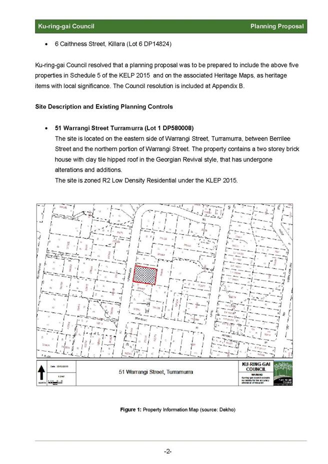
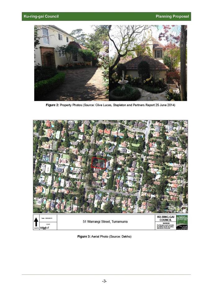
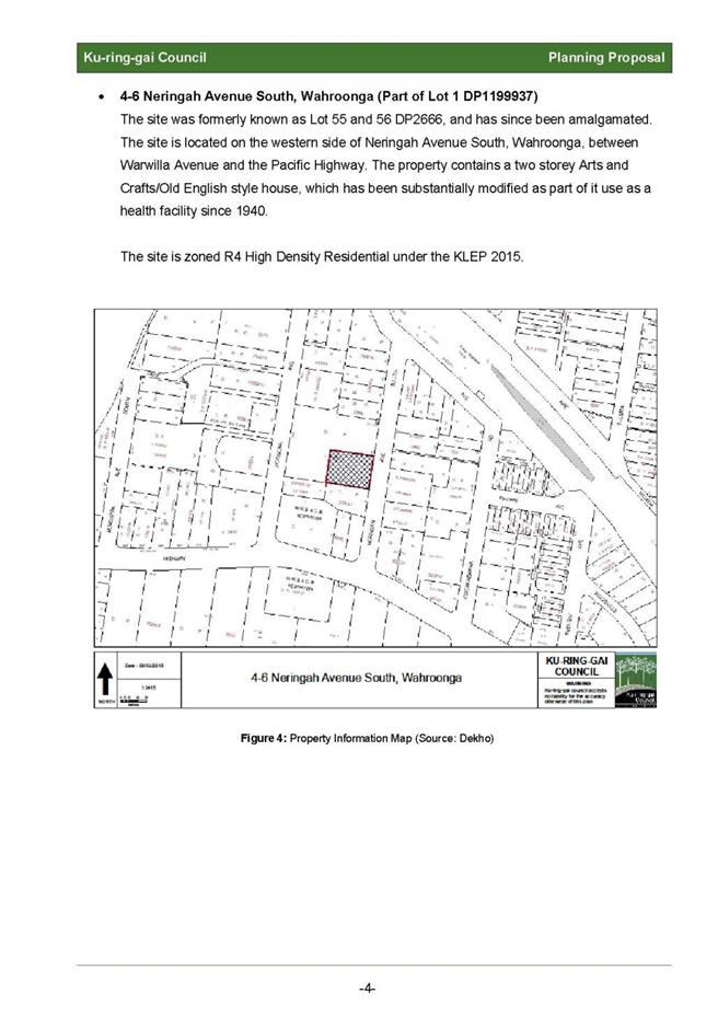
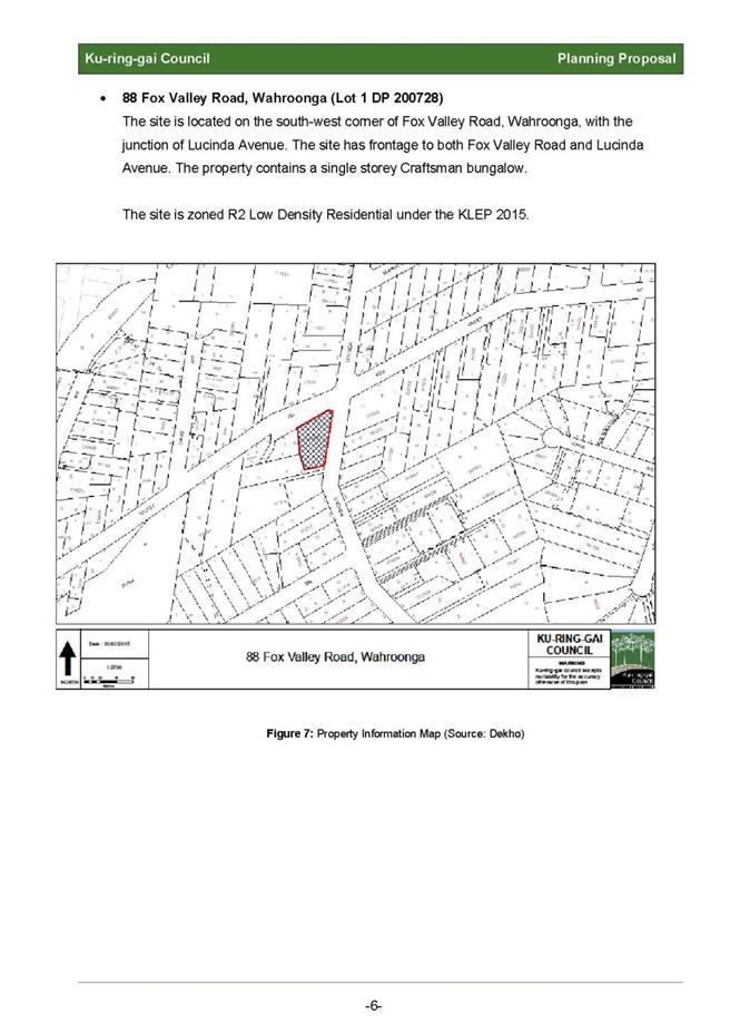
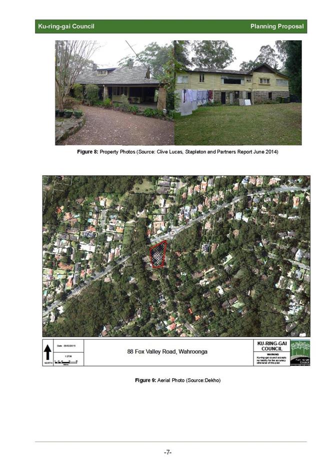
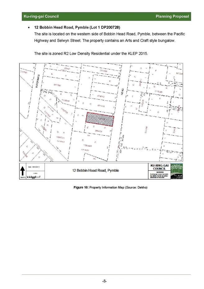
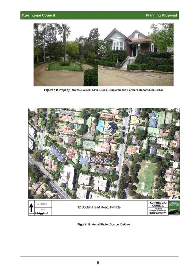
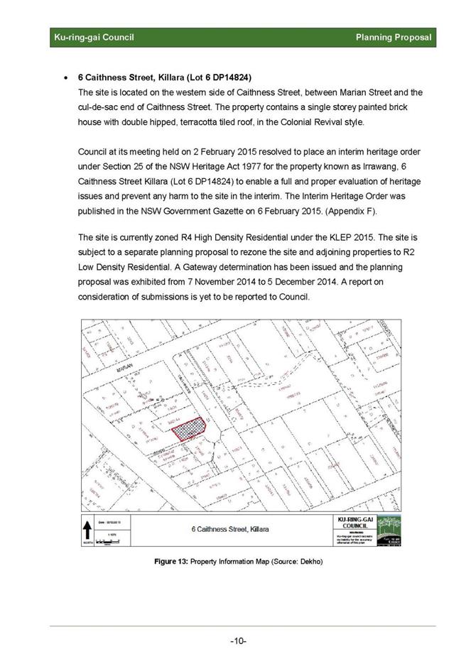
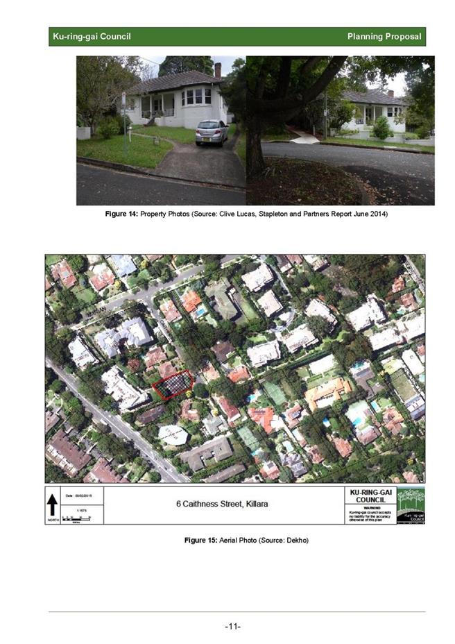
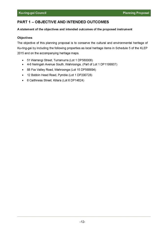


|
APPENDIX No: 2 - Planning
Proposal - Appendix A - Review of 14 Draft and Potential Heritage Items by
Clive Lucas Stapleton and Partners 2014
|
|
Item No: GB.11
|
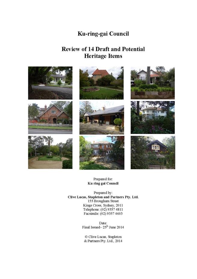

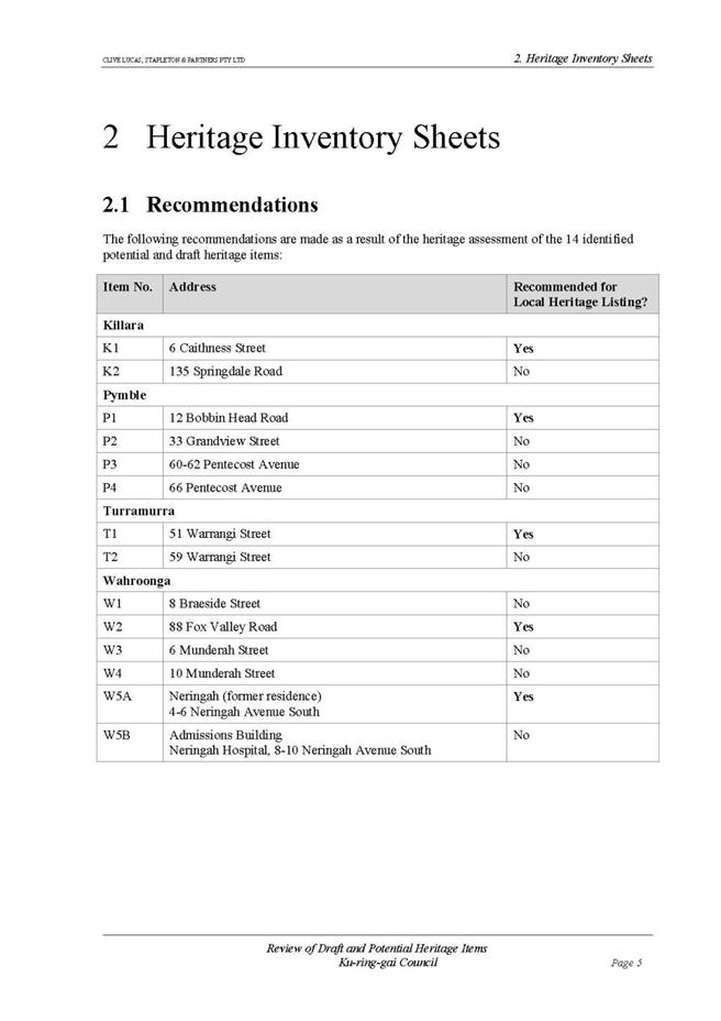

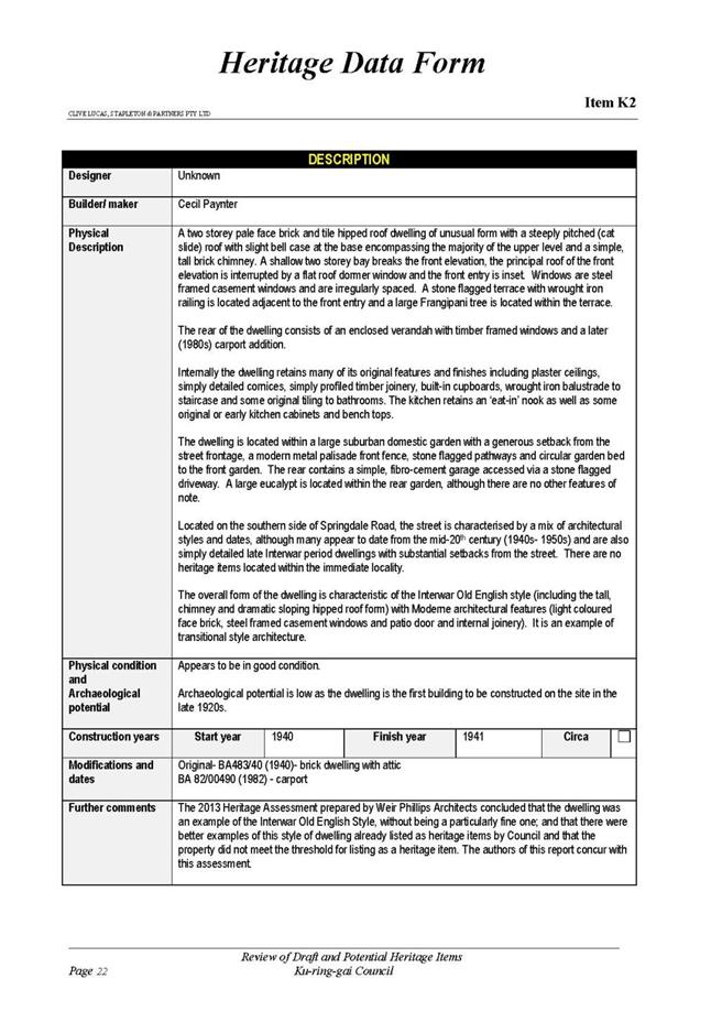
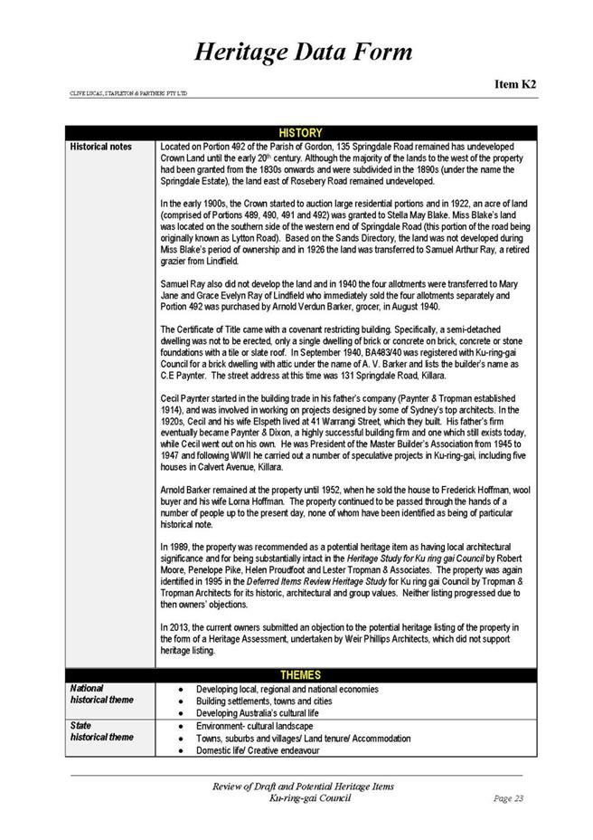
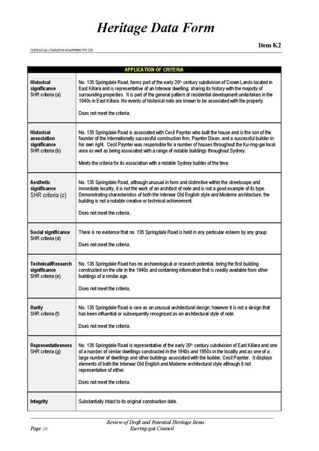
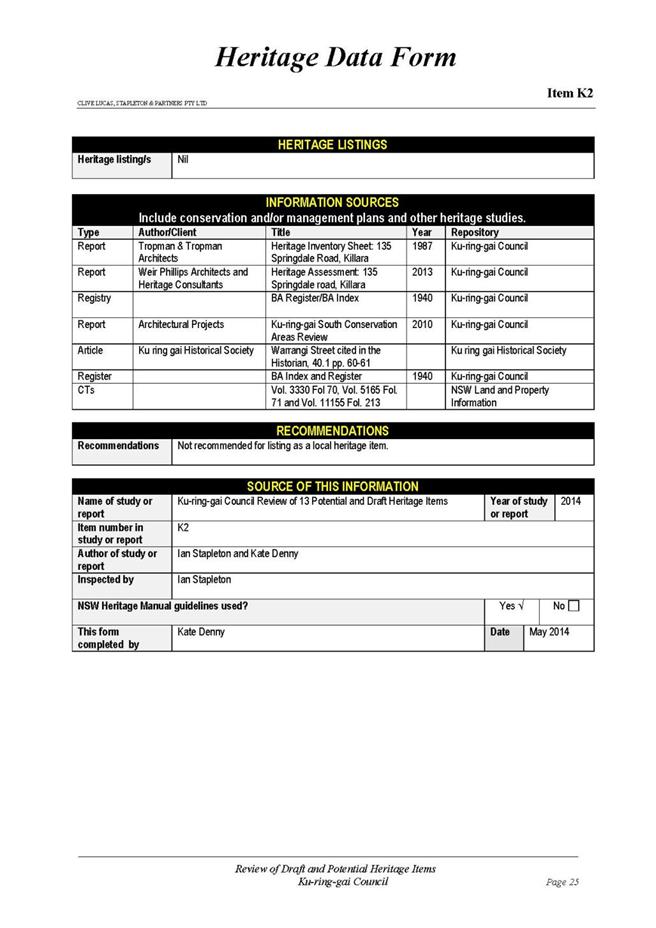
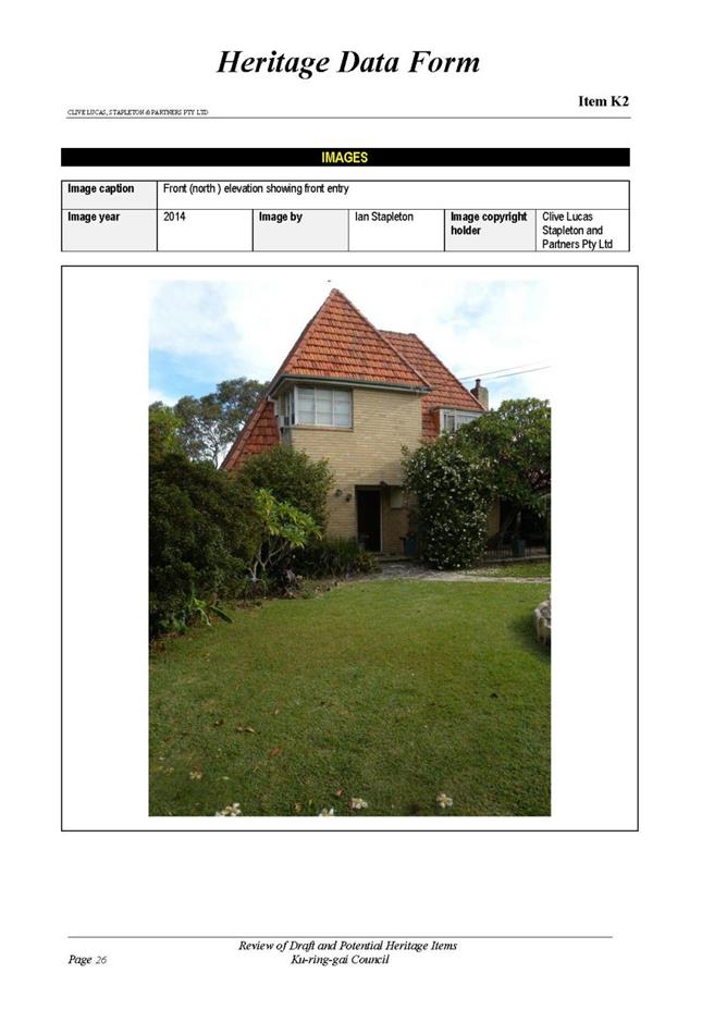
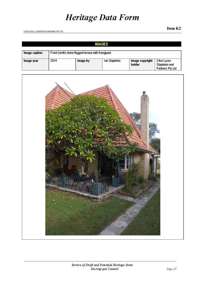
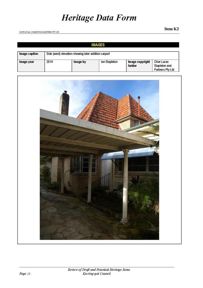

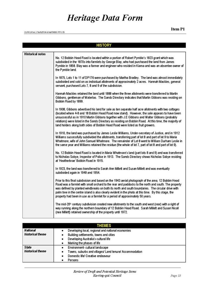
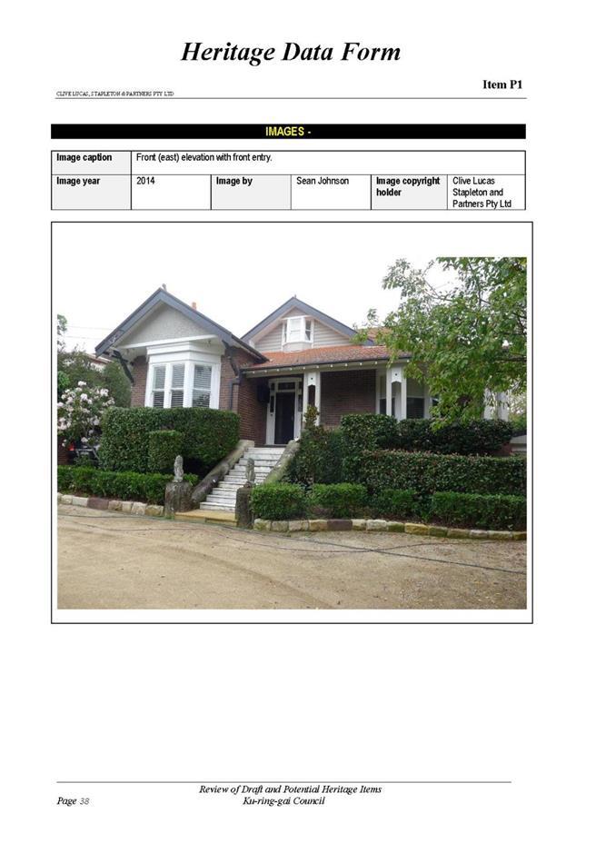
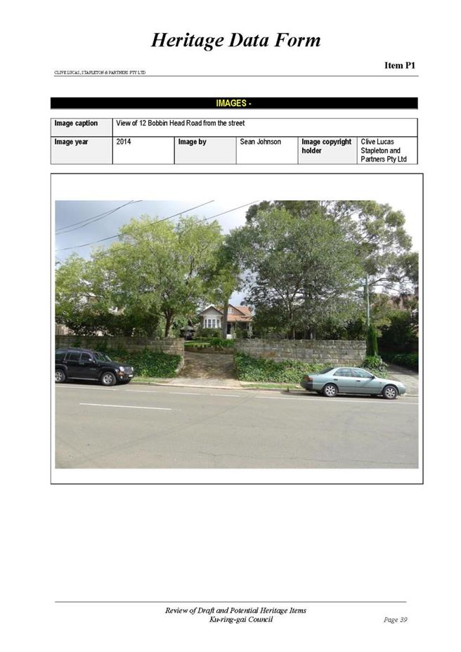
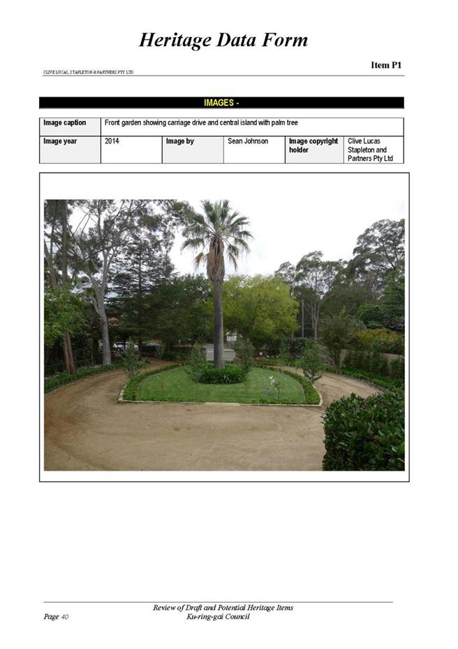
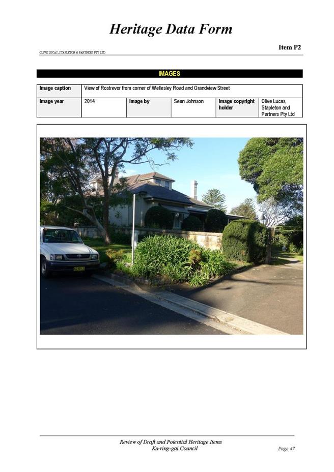
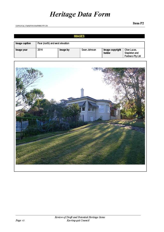
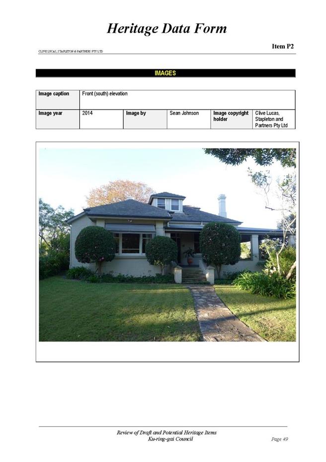
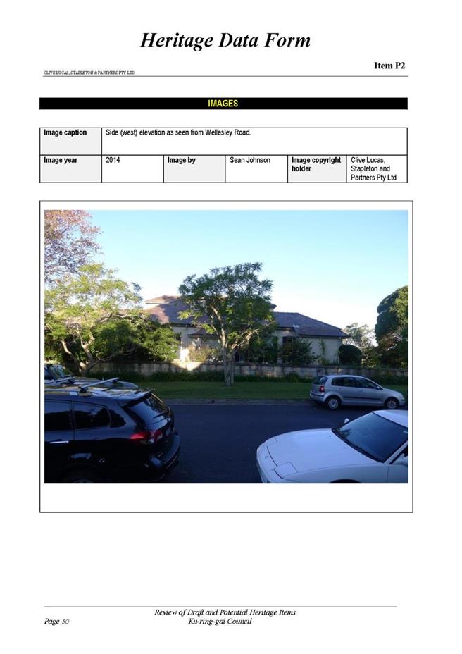
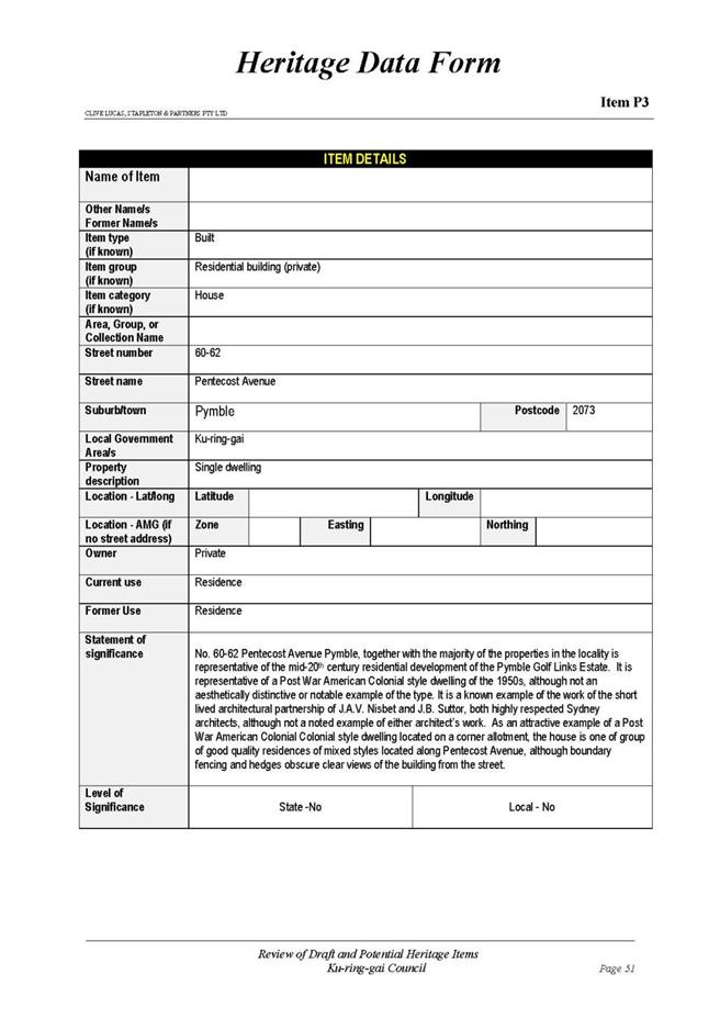
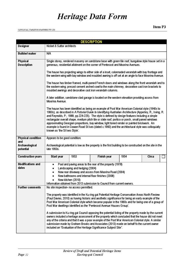
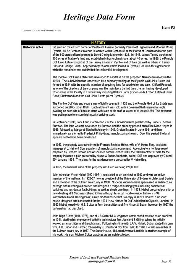
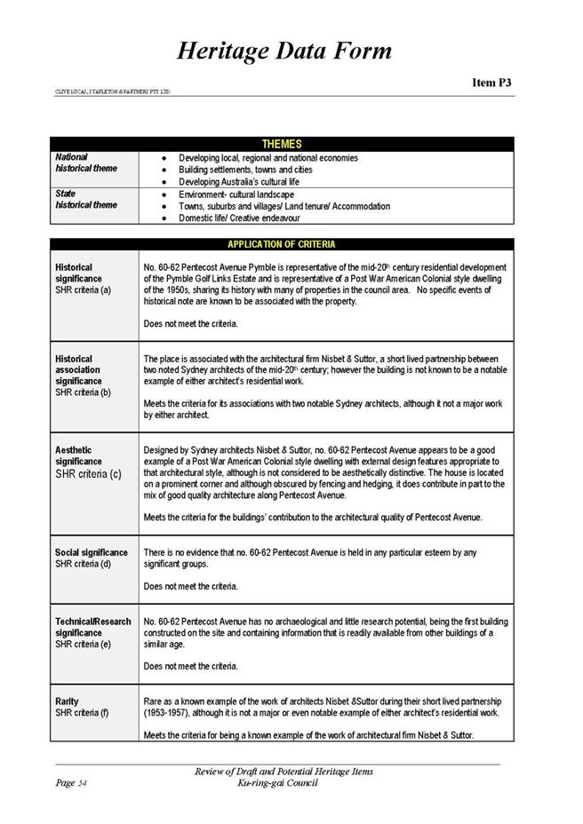
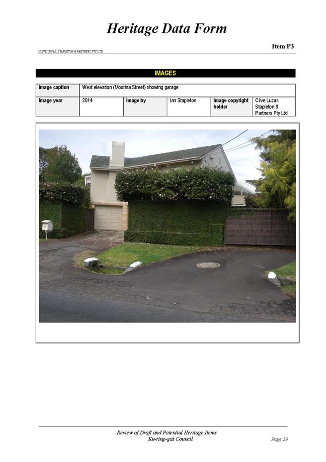


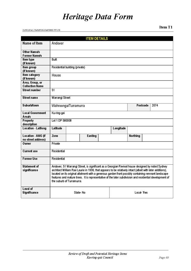
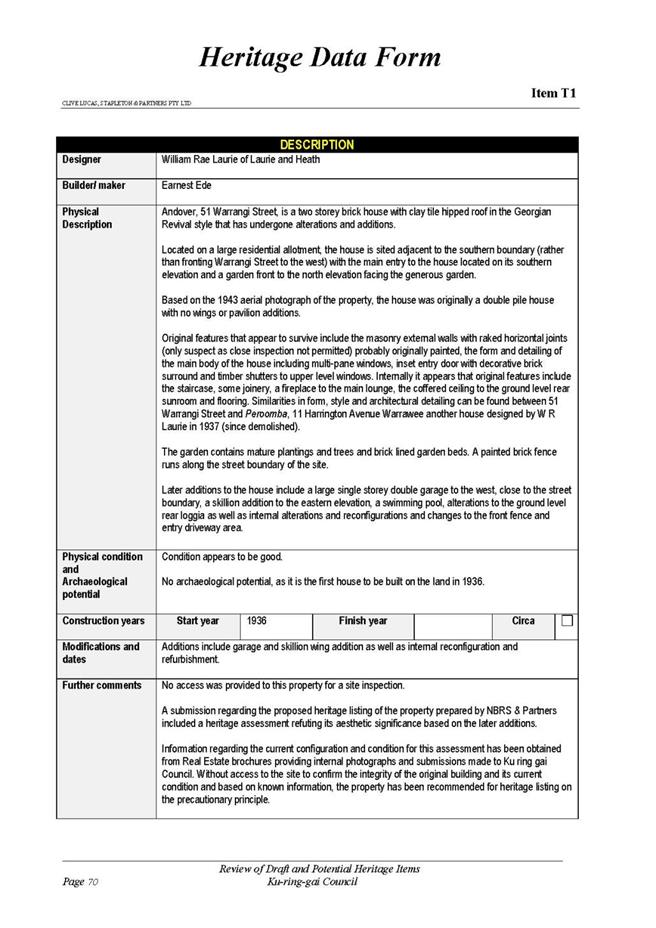
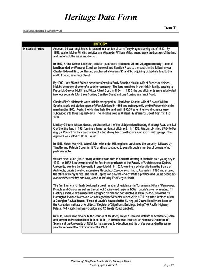
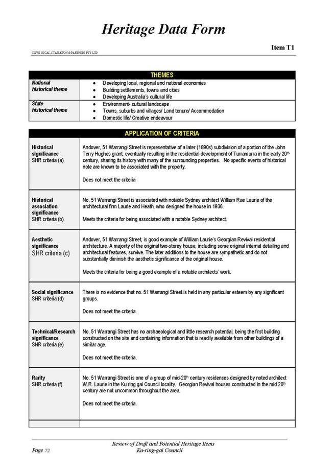
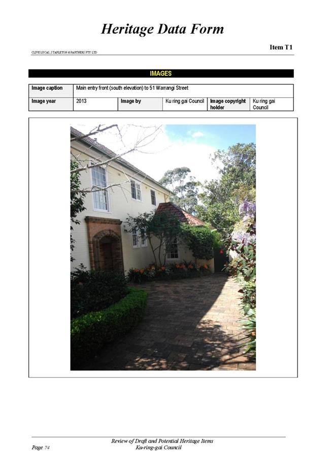
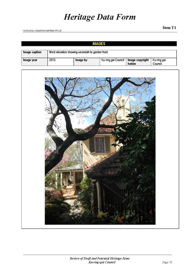
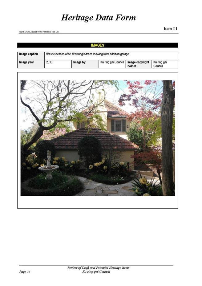
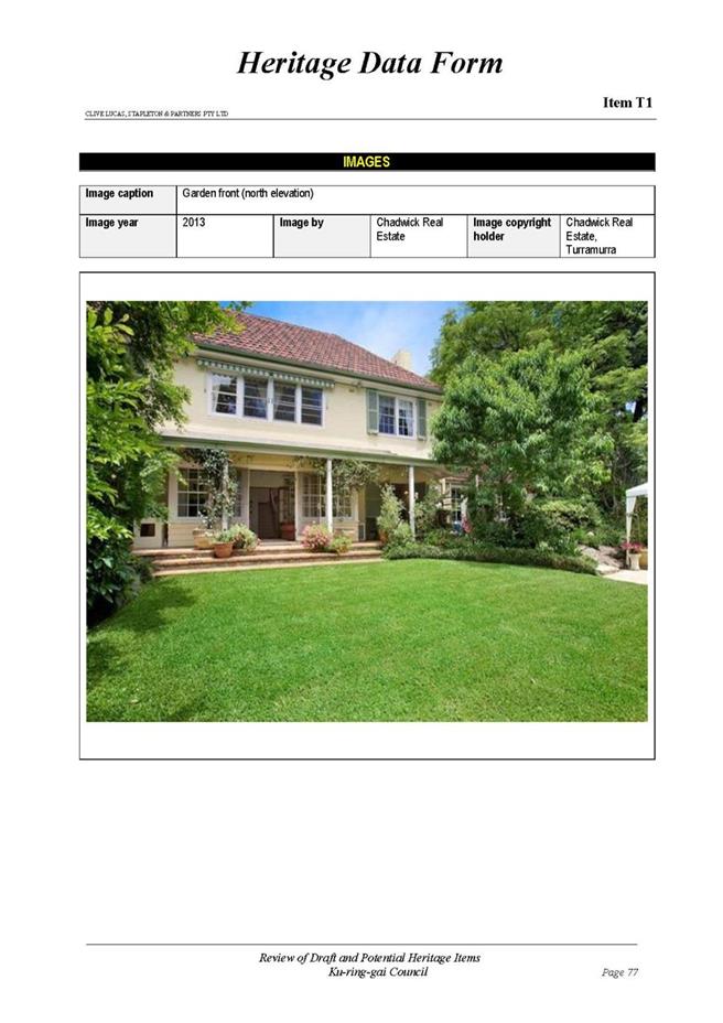

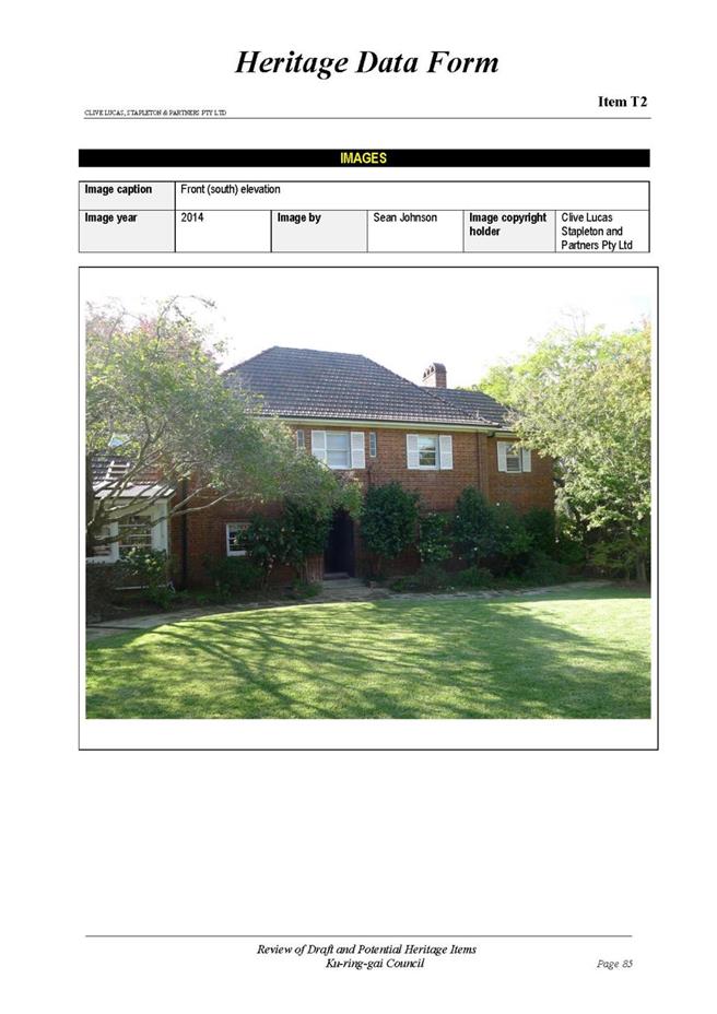

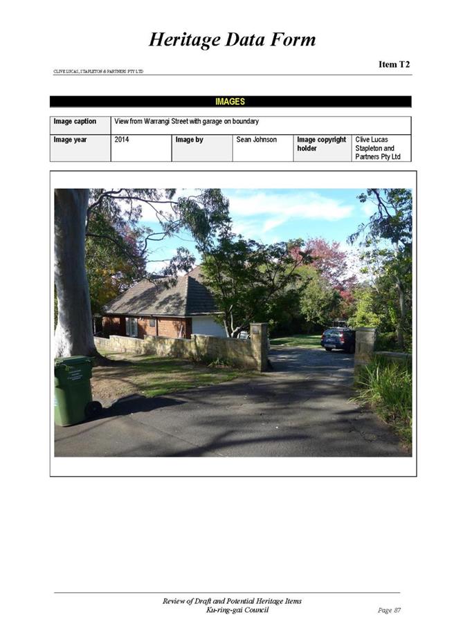
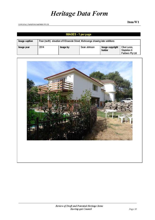
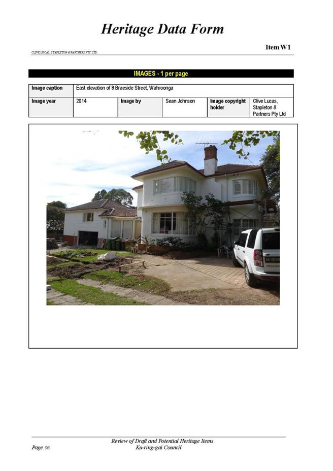
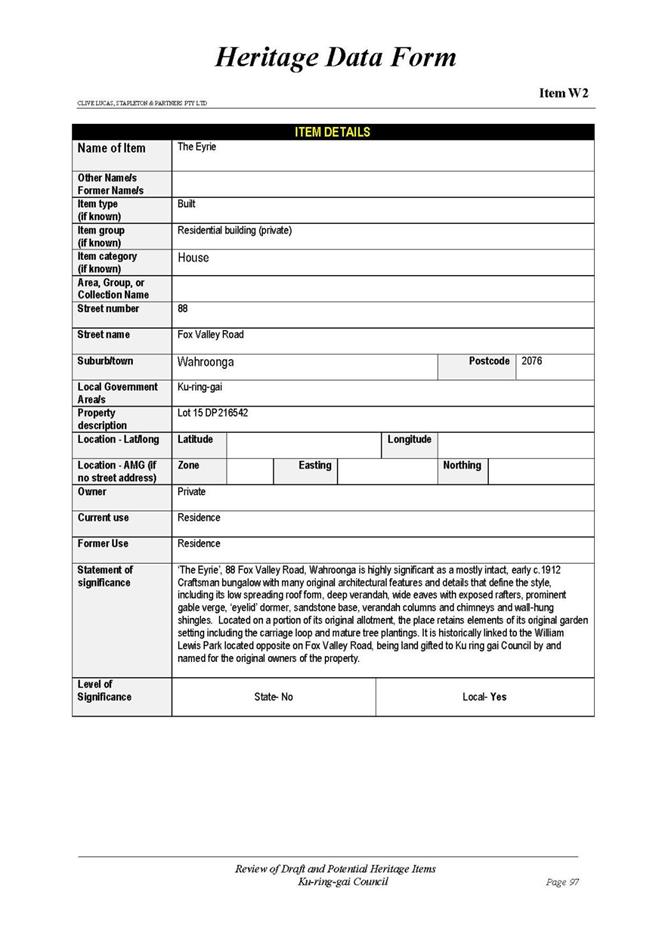
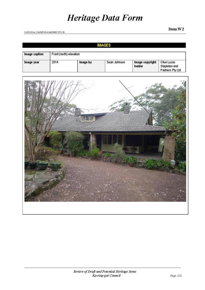
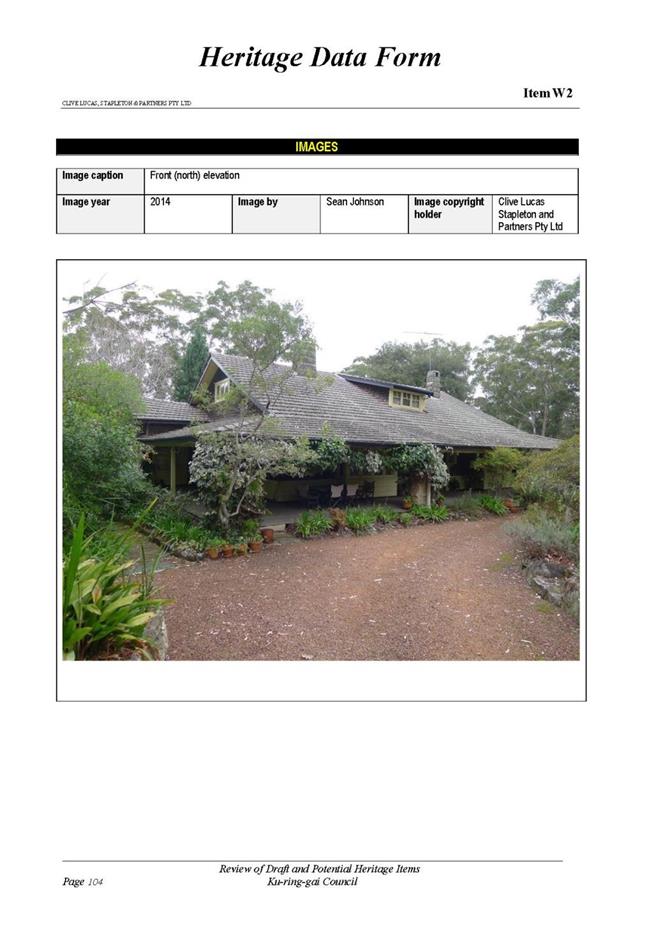
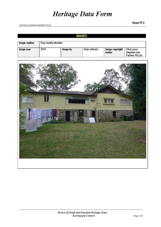

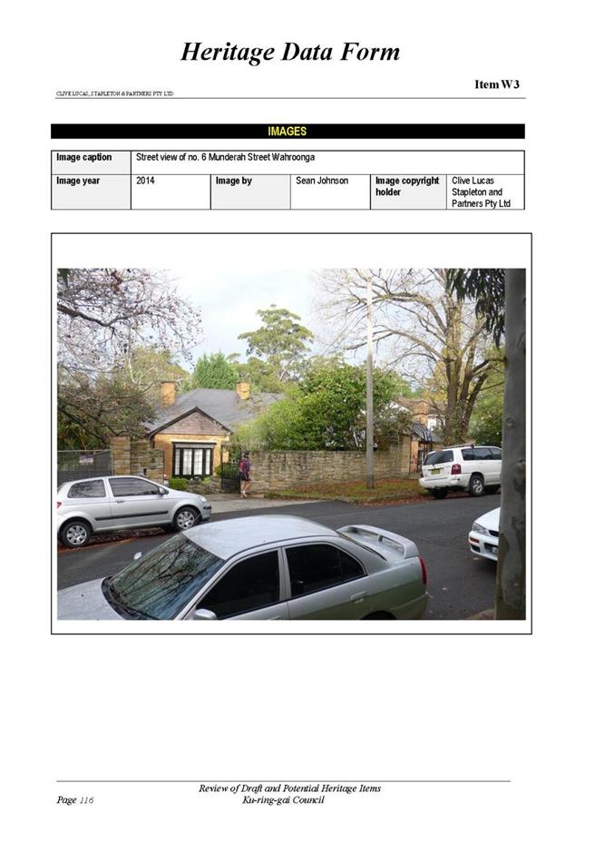

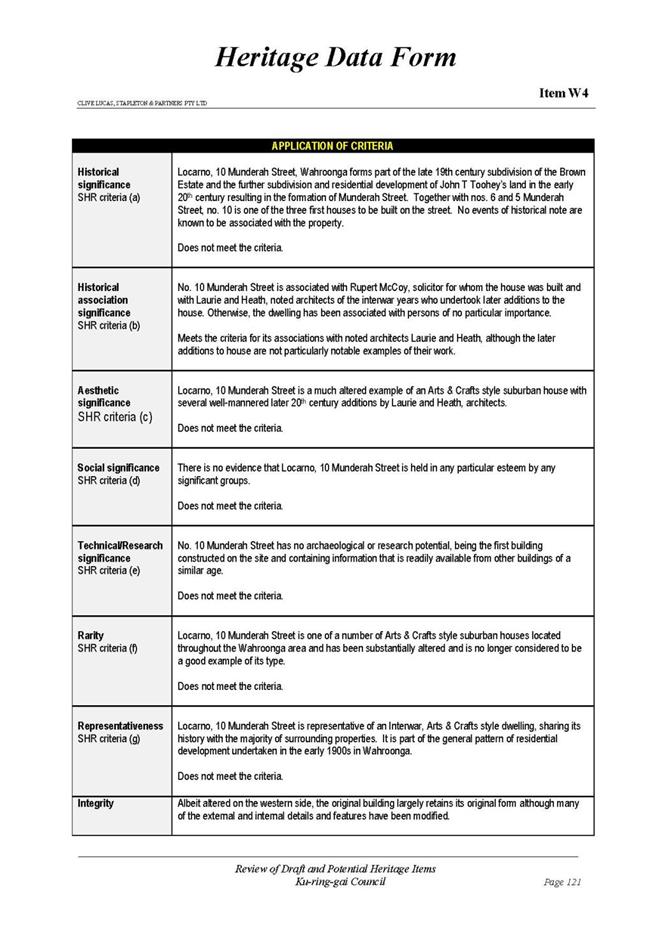
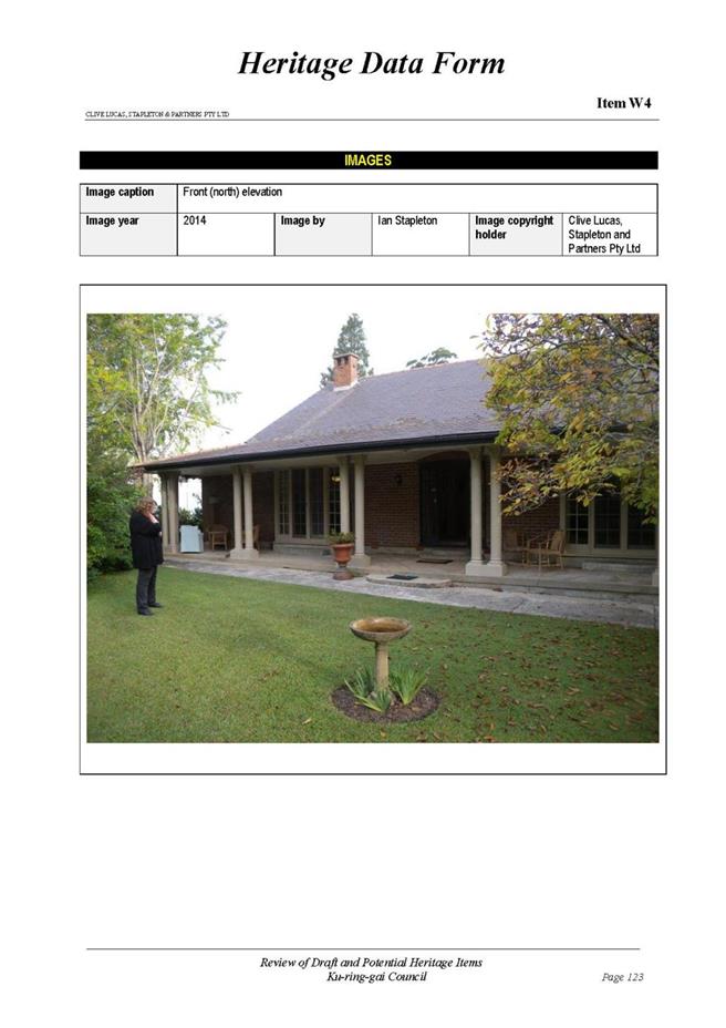
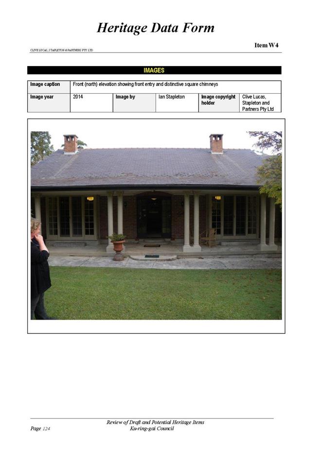
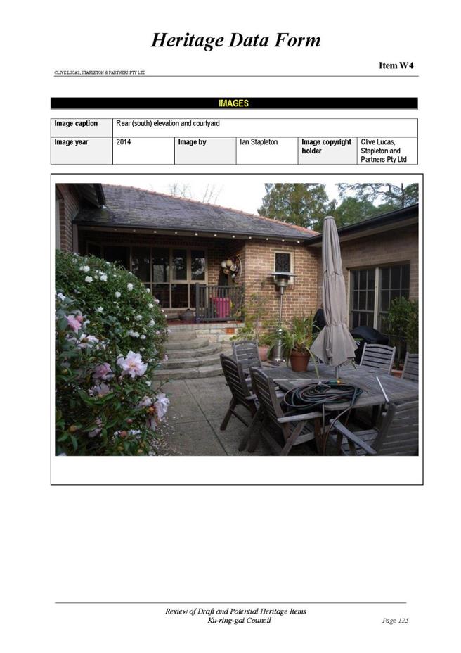

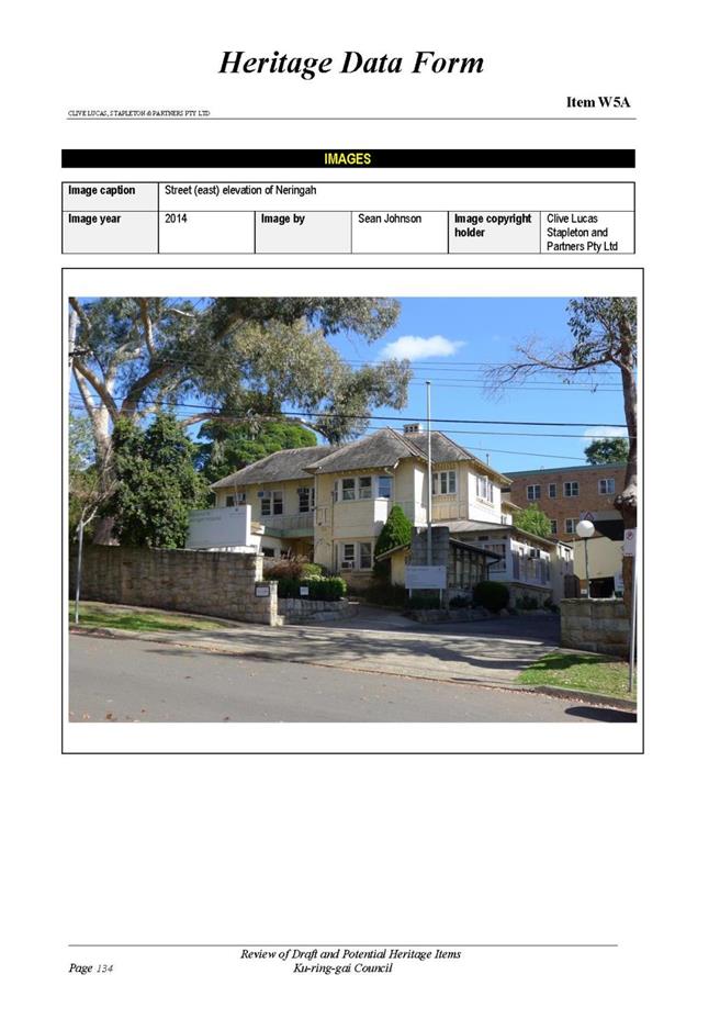
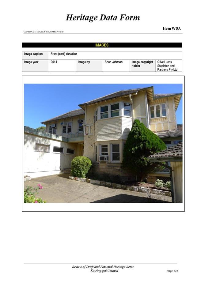
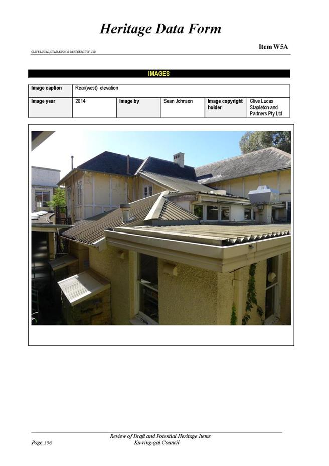
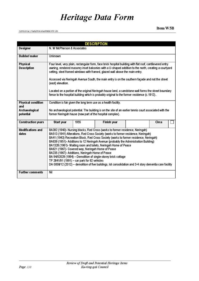
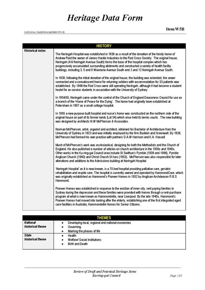
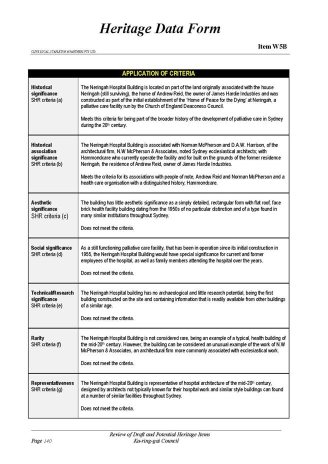
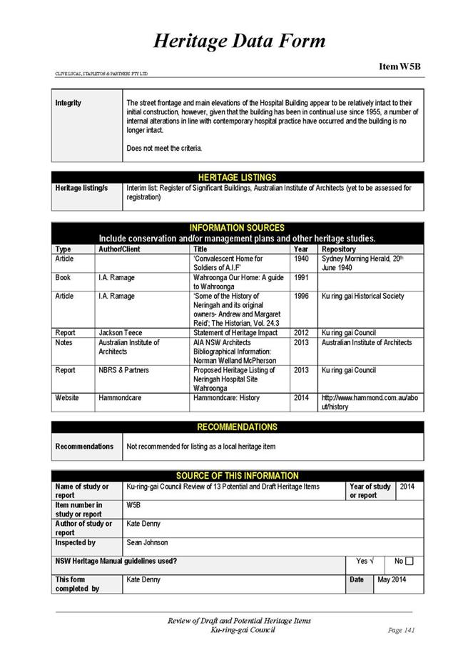
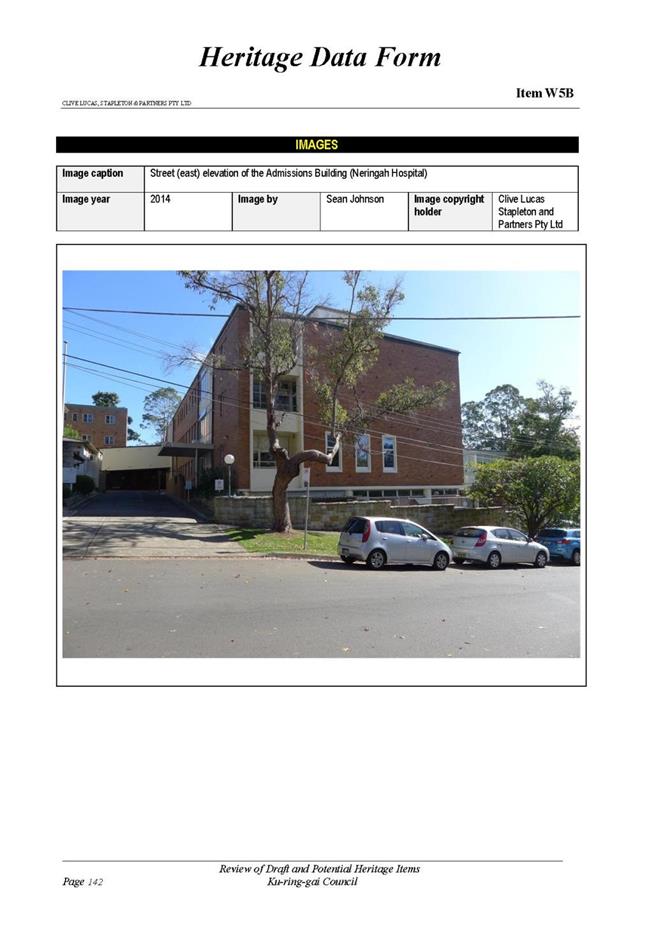
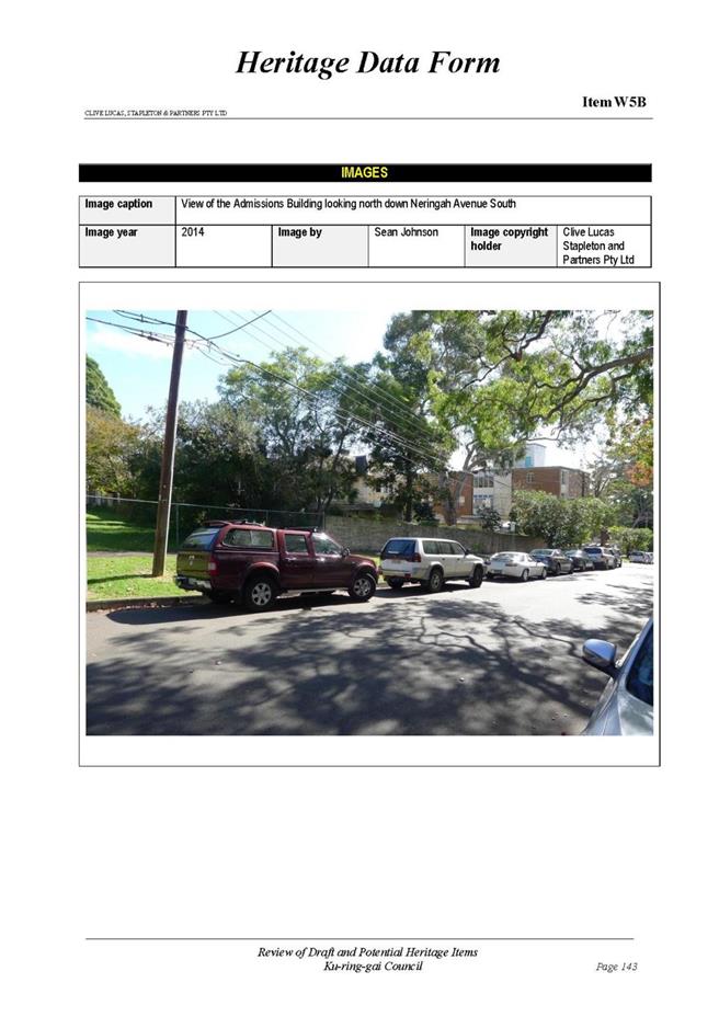
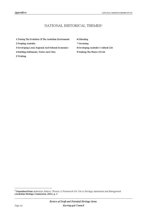
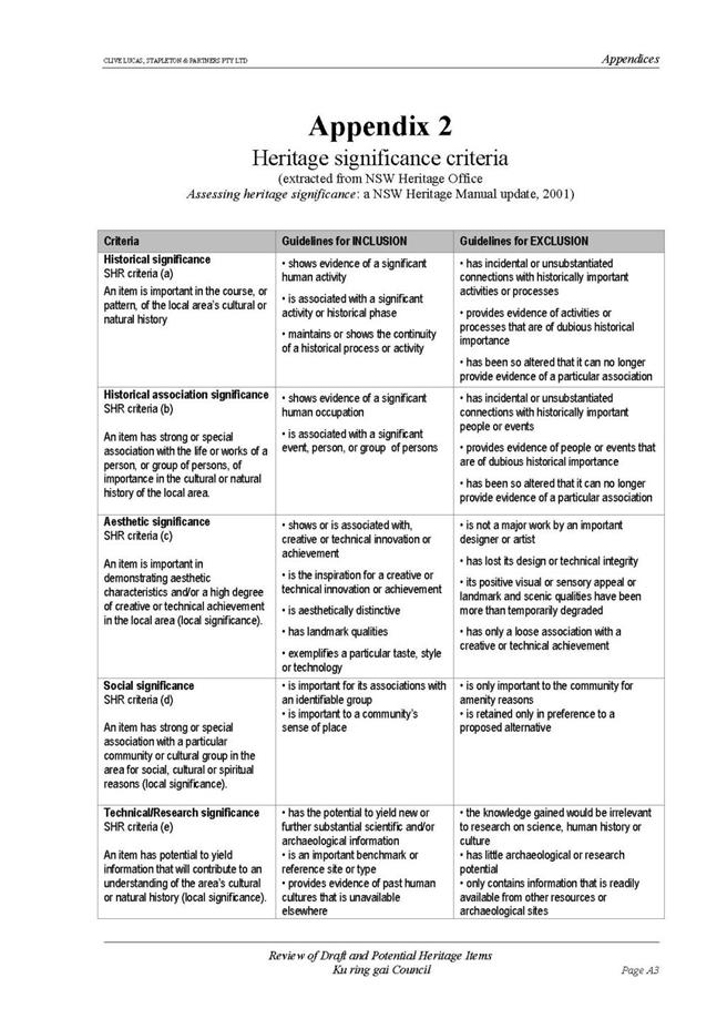
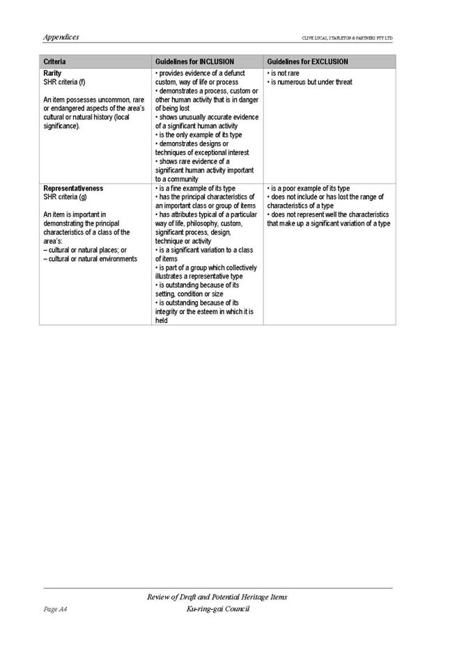
|
APPENDIX No: 3 - Planning
Proposal - Appendix B- Council Resolution 25 November 2014
|
|
Item No: GB.11
|
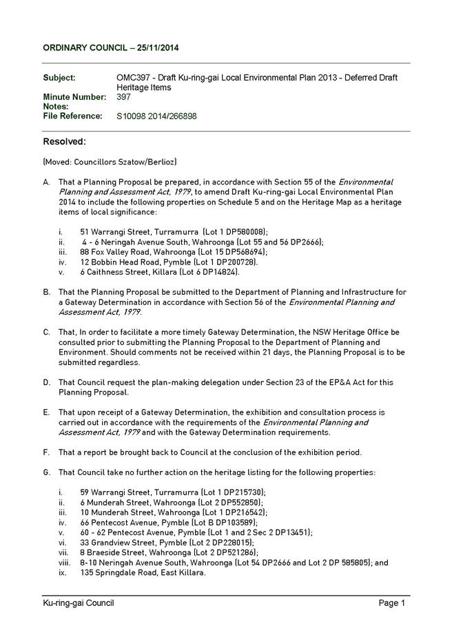

|
APPENDIX No: 4 - Planning
Proposal - Appendix C - Heritage Map Sheets
|
|
Item No: GB.11
|
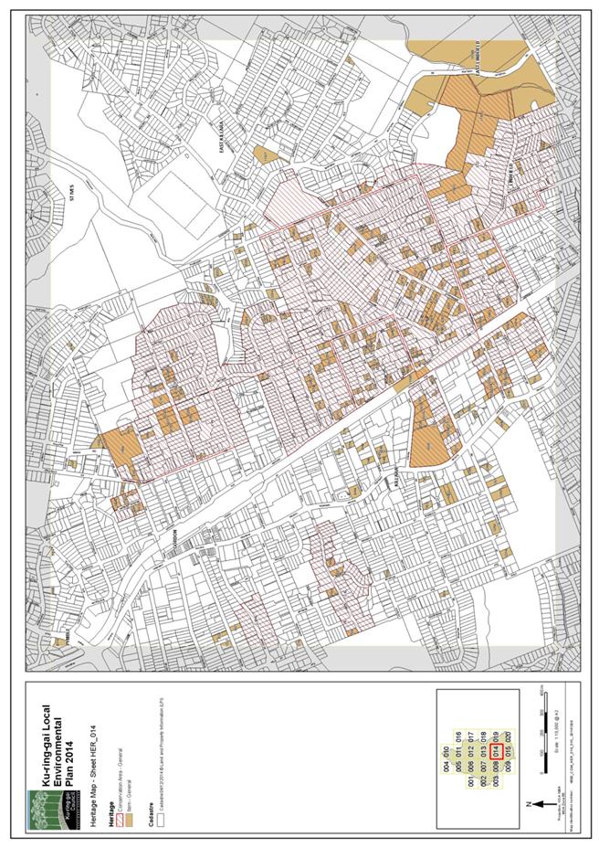
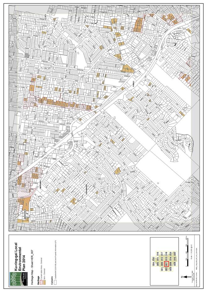
|
APPENDIX No: 5 - Planning
Proposal - Appendix D - Heritage Inventory Sheets
|
|
Item No: GB.11
|


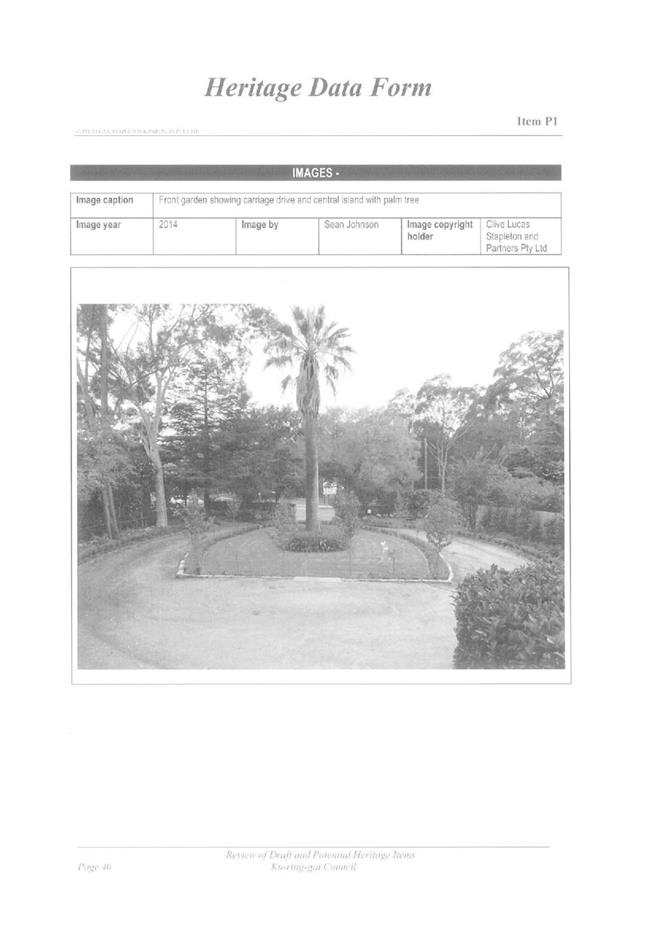
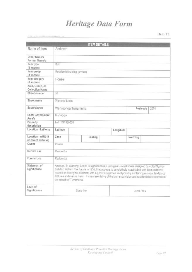
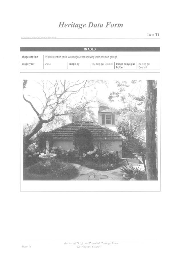
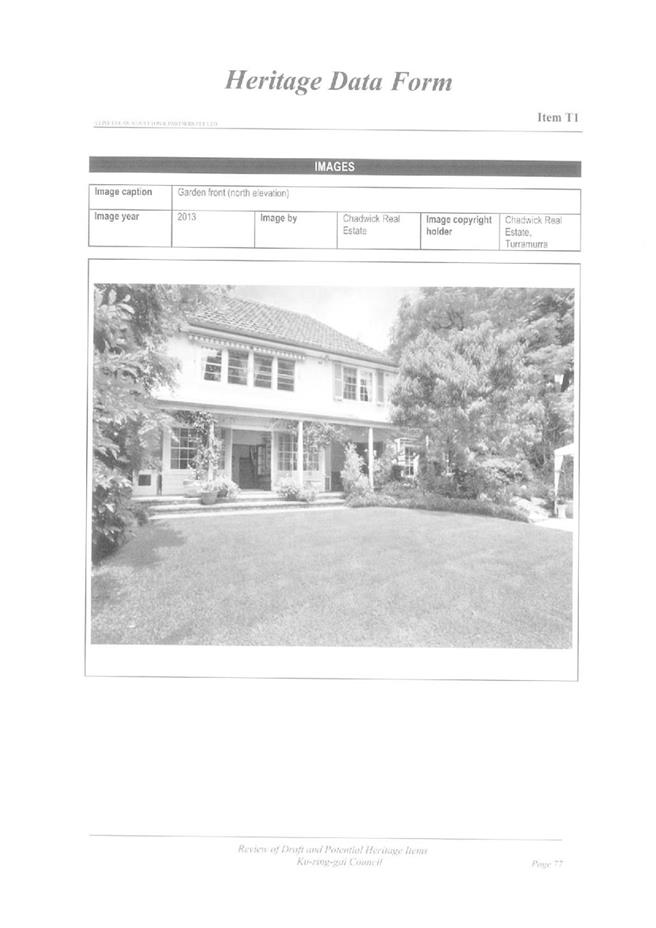
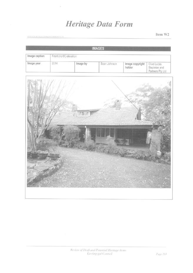
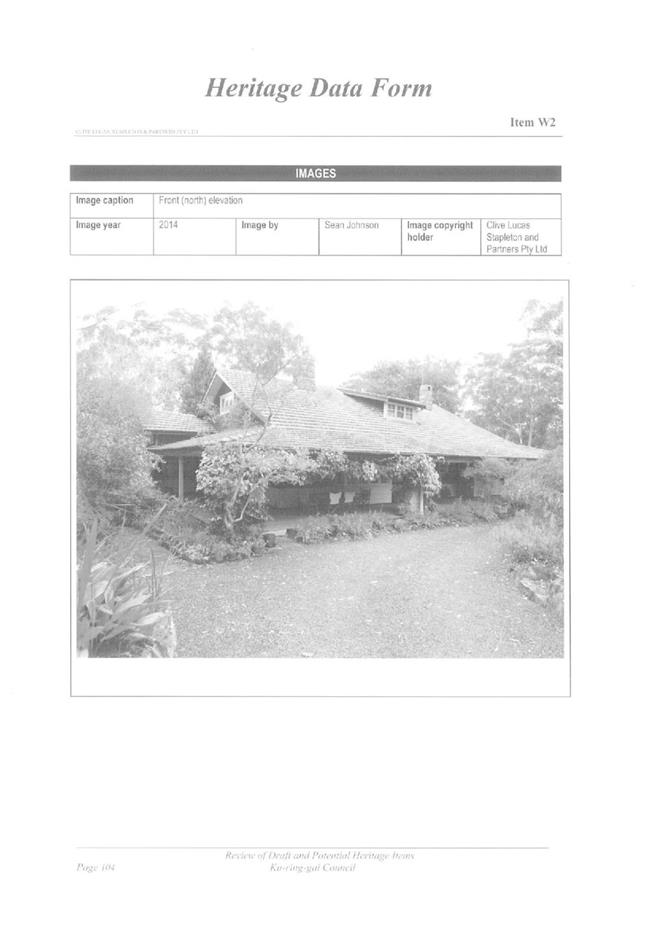
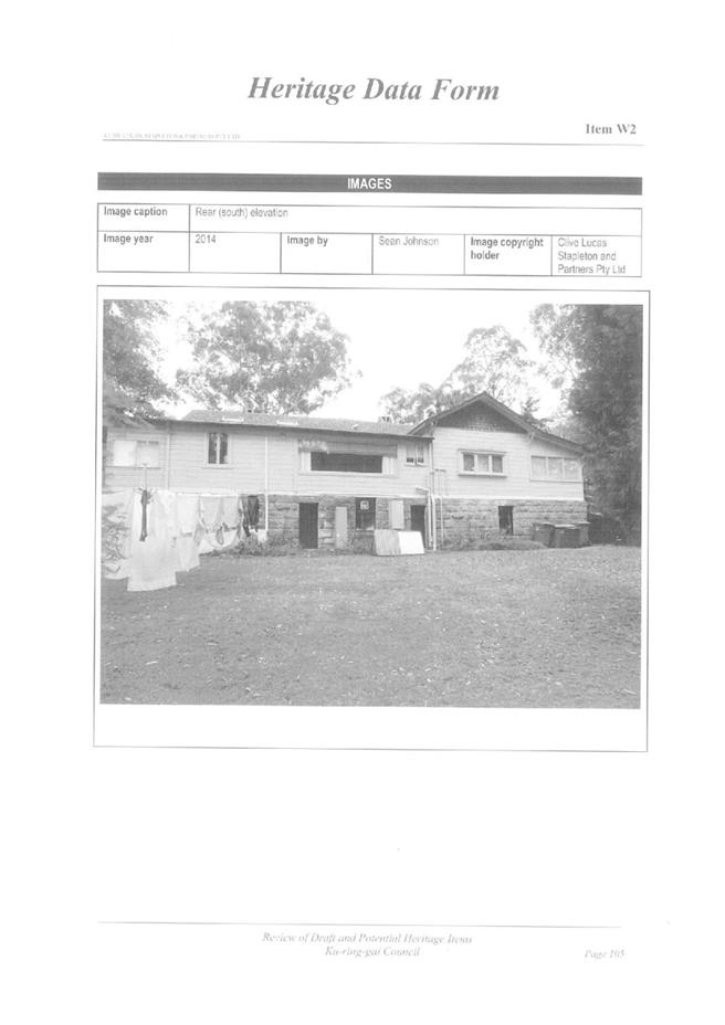
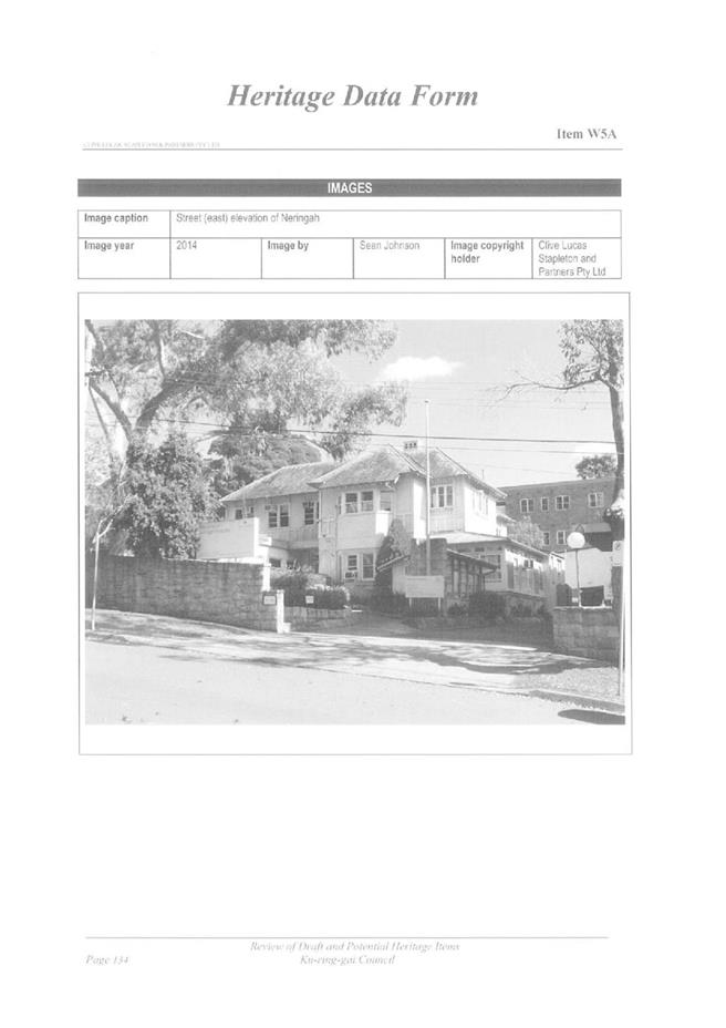
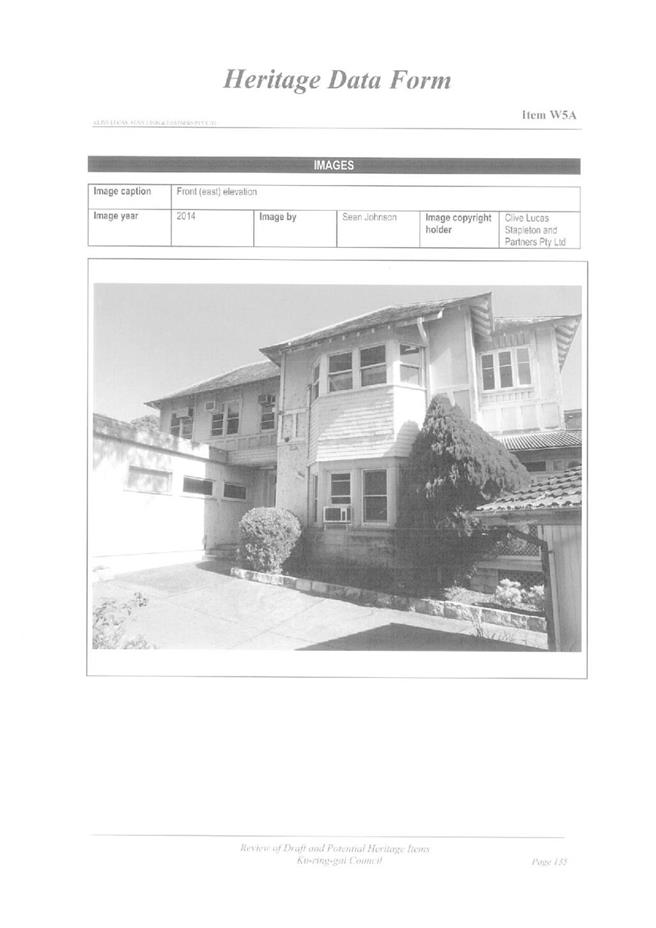
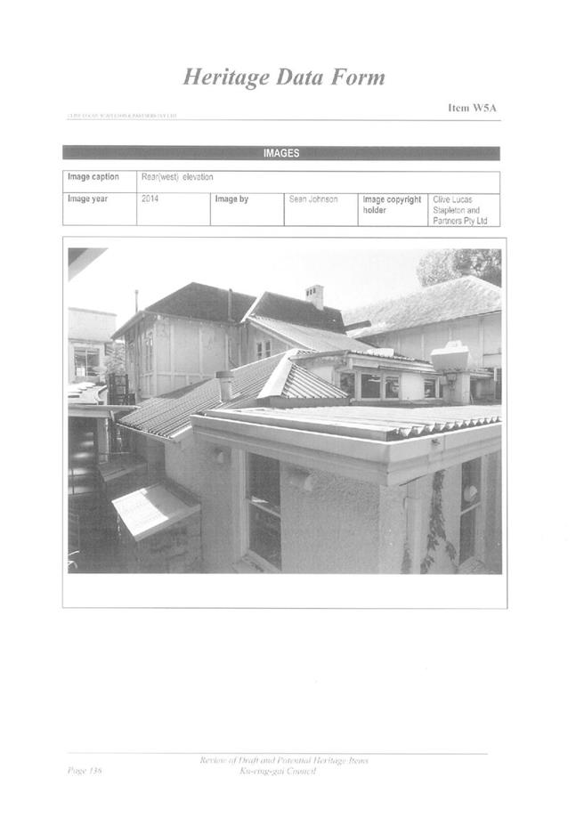
|
APPENDIX No: 6 - Planning
Proposal - Appendix E - Office of Environment and Heritage comments regarding
planning proposal to amend KLEP 2015 to include additional heritage items
|
|
Item No: GB.11
|
|
APPENDIX No: 7 - Planning
Proposal - Appendix F - Interim Heritage Order 6 Caithness Street, Killara
|
|
Item No: GB.11
|
|
APPENDIX No: 8 - Gateway
Determination - Planning Proposal to Heritage List 5 Properties
|
|
Item No: GB.11
|

|
APPENDIX No: 9 - Summary
of submssions
|
|
Item No: GB.11
|
|
Ordinary
Meeting of Council - 8 September 2015
|
GB.12 / 1161
|
|
|
|
|
Item
GB.12
|
S03552/14
|
|
|
23 July 2015
|
Adshel Infrastructure Technology Upgrade
proposal
EXECUTIVE
SUMMARY
|
purpose of report:
|
To consider and endorse support for the Adshel
Technology upgrade proposal.
|
|
|
|
|
background:
|
In November 2004, Council entered a 15 year contract
with Adshel to install advertising and non-advertising bus shelters in the
Ku-ring-gai LGA.
Since 2004, the media sector has experienced a change
in this environment by the introduction of digital format.
Adshel has approached Council with a request to
upgrade the technology used in current advertising bus shelter light boxes
with selected sites for digital and scrolling format.
|
|
|
|
|
comments:
|
In the rollout of Advertising Structures in 2004-2006, a
DA was not required under the relevant SEPP, as road reserves were
unzoned under the Ku-ring-gai Planning Scheme Ordinance
(KPSO).
The KPSO was replaced by the KLEP 2015
which came into effect on 2 April 2015. SEPP
64 would apply to this signage as the change in format is a significant
change and would be deemed to be new signage.
Under Part 3 of SEPP 64, a DA would be required with
Council as the consent authority.
|
|
|
|
|
recommendation:
|
That Council support the proposal to upgrade
advertising at various locations on bus shelter light boxes with digital and
scrolling format and provide owner’s consent to the submission of a
Development Application on the terms set out in this report.
|
Purpose of Report
To consider and endorse support for the Adshel Technology
upgrade proposal.
Background
In November 2004, Council entered into a 15 year contract with
Adshel to install advertising and non-advertising bus shelters in the
Ku-ring-gai LGA.
Under the contract, Council granted Adshel the exclusive right
to procure advertising attached to bus shelter infrastructure. In return for
this license, Adshel designed, supplied and installed bus shelters in the
Ku-ring-gai LGA. Adshel provided ongoing cleaning and maintenance services of
the infrastructure, with a guarantee net revenue payment to Council. Council
has since purchased additional shelters, and utilises Adshel’s maintenance
contractors by Agreement to optimise expenses for cleaning and maintenance.
Since 2004, the out-of-home media sector has experienced a
change in this environment by the introduction of a digital format. This format
has been launched across transport and retail sectors, and is now being
extended to the traditional (poster) roadside market.
This traditional (poster) roadside market is static which is
placing pressure on the advertiser funded street furniture model that Council
benefits from. To protect future investment in community infrastructure and
income streams for its partners, Adshel has utilised its parent company to
launch its digital network roadside strategy for Australia and has invited
Ku-ring-gai Council to be a launch partner.
As a launch partner, Adshel has approached Council with a
request to upgrade the technology used in current advertising bus shelter light
boxes with digital and scrolling format at selected sites.
Comments
The Ku-ring-gai Planning Scheme Ordinance
(KPSO) was replaced by the Ku-ring-gai LEP 2015 which came into
effect on 2 April 2015. The process for approval has changed and locations of
this technology format are limited by zoning changes. In the rollout of
Advertising Structures in 2004-2006, a Development Application (DA) was not
required under SEPP 64, as road reserves were unzoned under the KPSO.
Advice from Council’s Strategy and Environment
Department indicate:
· SEPP 64 would apply to this signage as the change in format from
posters to electronic illuminated advertising signage is a significant change
and would be deemed to be new signage.
· Under Part 3 of
SEPP 64, a DA would be required for the new electronic signage, with Council as
the consent authority. There are no provisions under SEPP 64, ISEPP,
Codes SEPP or the KLEP that would deem it exempt development.
· Under clause 10
of SEPP 64 the advertisements would be permissible on the roads that are in a business
zone or zoned SP2. However they are prohibited on land that is in an Heritage
Conservation Area (HCA), open space or zoned residential.
· For existing advertising shelters in a HCA, before the zoning, the
prohibition would not apply and would only apply for the change to electronic
advertisements.
Transport
Corridor Outdoor Advertising and Signage Guidelines
The NSW
Department of Planning and Environment has worked closely with Transport for
NSW (TfNSW), the Road and Maritime Services (RMS) and Outdoor Media Association
(OMA), of which Adshel is a member, on amendments to the Transport Corridor
Outdoor Advertising and Signage Guidelines, assessing Development Applications
under SEPP 64, July 2007 to include criteria for the use of new technology
in electronic signs.
The Department
has approved roadside digital signage installations in NSW based on the draft
guidelines and has formally communicated to the OMA that this will continue as
the document waits gazetting. A copy of the guidelines from NSW Department of
Planning and Environment is attached as Attachment A1.
Details from Adshel of the launch roll-out; unit technology,
proposed upgrade sites and benefits are attached and are Confidential Attachment
A2 which is a document prepared by Adshel.
The current contract only permits static advertising
although the contract did provide scope for the introduction of new technology
and change is subject to Council’s approval. Council officers consider that
varying the existing contract to allow scrolling and digital advertising
represents an enhancement of the current commercial rights conferred onto
Adshel pursuant to the contract. On Council’s part, there is a responsibility
to consider commercial propositions of this manner in a transparent, fair, and
proper manner. The most objective manner for Council to ensure that this occurs
is to obtain an independent valuation assessment of the proposal and to conduct
negotiations strictly in accordance with the expert valuation advice provided.
The valuation will address the entirety of the proposal including the level of
investment proposed by Adshel and the corresponding commercial benefit.
This report seeks Council’s approval to progress the
application process and endorse the General Manager as the delegated authority
to conclude future negotiations with Adshel in relation to securing a fair
market return for the variation of the contract. Any commercial outcome will be
based on the valuation advice Council receives from its expert independent
valuer.
Adshel is seeking Council’s concurrence to this proposal in
order to lodge a Development Application and enable a roll out of the digital
advertising in the metropolitan area by December 2015.
It is not intended to engage a valuer if Council does not
provide owner’s consent to the submission of a Development Application.
integrated planning and reporting
Theme - Places, Spaces and Infrastructure
|
Community Strategic Plan Long Term Objective
|
Delivery Program
Term Achievement
|
Operational Plan
Task
|
|
Standards are developed to improve the condition and
functionality of existing and new assets.
|
A prioritised program of improvements to facilities is
being implemented
|
Implement an improvement program for the maintenance,
renewal and upgrade of Council's buildings and report on progress
|
Theme – Leadership and Governance - L2 Financial
capacity and sustainability
|
Community Strategic Plan Long Term Objective
|
Delivery Program
Term Achievement
|
Operational Plan
Task
|
|
Council rigorously manages its financial resources and
assets to maximise service delivery
|
Council maintains and improves its long term financial
position and performance
|
Continue to analyse opportunities to expand the revenue
base of Council
|
Governance Matters
Under Section 18 of the Shelter Specification within the
Contract, introduction of new technology solutions to replace static
advertising panels at suitable locations was permitted subject to Council’s
approval.
Confidential attachments to this report are considered to
confidential in accordance with Section 10A (2) (ii) of The Local Government
Act 1993 as they are considered to contain commercial in confidence
information.
The independent valuation process proposed by Council will
also ensure appropriate probity and transparency considerations are addressed.
Risk Management
There is no financial risk associated with the upgrade as
Adshel will fully fund the upgrade and is independent of the guaranteed net
payment under the contract.
Adshel will adhere to the requirements of the RMS key
criteria as specified for digital roadside that have been established in the draft
Transport Corridor Outdoor Advertising and Signage Guidelines to mitigate risk
to drivers. Of importance, the criteria includes, that the creative must not
otherwise unreasonably dazzle or distract drivers and be within luminance
levels, dwell time limits, while animation and sequential messaging is not
permitted.
Subject to Council resolution, the appropriate legal
documentation to vary and revise the contract will be undertaken by Council’s
solicitors.
Financial Considerations
If endorsed, and subject to Development Application
approval, Adshel will fully fund the upgrade. Additional financial
considerations and benefits are considered in the Confidential Attachment
A2.
The independent valuation advice will also guide Council on
the revised commercial terms that should apply pursuant the contract.
Social Considerations
There are no external changes required to the shelter to
facilitate a digital and scrolling format, only internal changes to the light
box, therefore there is no loss in shelter space for commuters. Works will be
undertaken by Adshel as part of business-as-usual activity which ensures no
disruption to commuters during the roll-out.
Environmental Considerations
Adshel’s chosen supplier is an industry leader in the
provision of LCD units for outdoor use. There patented software self-monitors
to optimise luminance and cooling based on environmental conditions, working to
reduce power consumption.
Community Consultation
Community consultation is not required as the proposal seeks
to upgrade the technology used in the current illuminated advertising bus
shelter light boxes that exist and permits introduction of new technology
solutions to replace static advertising panels under the contract.
Community notification will be included as part of the
process required for Development Applications.
Internal Consultation
Operations has consulted with Development and Regulation as
well as Strategy & Environment Departments to obtain advice on the changes
relating to the approval process and zoning changes resulting from the KLEP
2015 coming into effect in April 2015, as well as the protocol and policy for
dealing with commercial propositions entailing the variation of existing
contractual terms.
Summary
In November 2004, Council entered into a 15 year contract with
Adshel to install advertising and non-advertising bus shelters in the
Ku-ring-gai LGA.
Adshel has approached Council with a request to upgrade the
technology used in current advertising bus shelter light boxes with digital and
scrolling format at selected sites.
This proposal is a means to protect future investment in
community infrastructure and income streams that fund the street furniture,
including their cleaning and maintenance.
The Ku-ring-gai LEP 2015 came into effect on 2
April 2015, require a DA Under Part 3 of SEPP 64, for the new electronic
signage, with Council as the consent authority. While under clause 10 of SEPP
64 the advertisements would be permissible on the roads that are in a business
zone or zoned SP2. They are prohibited on land in an HCA, open space or zoned
residential.
The NSW Department of Planning and Environment Department
has approved roadside digital signage installations in NSW based on the draft
Transport Corridor Outdoor Advertising and Signage guidelines and has formally
communicated to the Outdoor Media Association, of which Adshel is a member,
that this will continue as the document waits gazetting
Adshel will adhere to the requirements of the RMS key
criteria as specified for digital roadside advertising that have been established
in the draft Transport Corridor Outdoor Advertising and Signage Guidelines.
This format has been launched across transport and retail
sectors, and is now being extended to the traditional (poster) roadside market
Implementation results in negligible social, environmental
or financial impacts, to the commuters and Council. Adshel have offered an
additional benefit to Council as outlined in the confidential attachment.
Council’s approval is sought to progress the application
process and endorse the General Manager as the delegated authority to conclude
commercial negotiations with Adshel in relation to securing a market return for
varying the contract. Any negotiations reached will be based on the valuation
advice that Council receives from an independent valuer.
|
Recommendation:
A. That
Council support the proposal to upgrade advertising at various locations on
bus shelter light boxes with digital and scrolling format and provide owner’s
consent to the submission of a Development Application.
B. That
the General Manager or his delegate be authorised to negotiate Council’s
requirements in relation to the contract including the revised commercial
terms recommended in the independent valuation.
C. That
Council authorises the Mayor and General Manager to execute all associated
documentation in respect of the contract.
|
|
Greg Piconi
Director Operations
|
Ian Taylor
Manager Engineering Operations
|
|
Attachments:
|
A1View
|
NSW
Department of Planning and Environment - Advice - Signage Guidelines
|
|
2015/191660
|
|
|
A2
|
Adshel
Infrastructure Development Proposal
|
|
Confidential
|
|
APPENDIX
No: 1 - NSW
Department of Planning and Environment - Advice - Signage Guidelines
|
|
Item No: GB.12
|
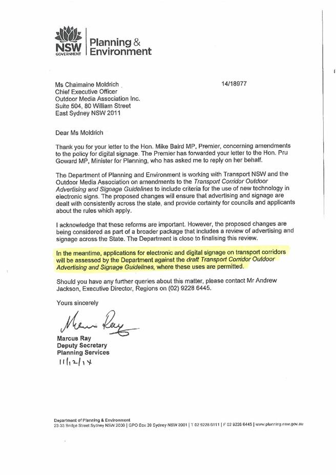
|
Ordinary
Meeting of Council - 8 September 2015
|
GB.13 / 1168
|
|
|
|
|
Item
GB.13
|
S10628
|
|
|
27 August 2015
|
Tender NSROC - Road Surfacing, Patching,
and associated Works - 2015 to 2017
EXECUTIVE
SUMMARY
|
purpose of report:
|
To seek Council's approval to accept the Northern
Sydney Regional Organisation of Councils (NSROC) tender for the schedule of
rates for supply; supply and delivery; and supply, delivery and laying of
asphaltic concrete, including associated road profiling and heavy patching
and other work items for the period 2015/2016 and 2016/2017.
|
|
|
|
|
background:
|
Tenders for the supply, supply and delivery and
supply, delivery and laying of asphaltic concrete were called by NSROC on
behalf of all member Councils. Submissions for these services for 2015/2016
and 2016/2017 closed on 4 June 2015.
|
|
|
|
|
comments:
|
Tender documents were received from twelve (12)
companies. Significant delay was encountered due to clarification of
information requested and provided.
|
|
|
|
|
recommendation:
|
That Council accepts the tenderers identified in
Confidential Attachment A1 to supply; supply and delivery; and supply,
delivery and laying of asphaltic concrete, including associated road
profiling and heavy patching and other work items for the period 2015/2016
and 2016/2017.
|
Purpose of Report
To seek Council's approval to accept the Northern Sydney
Regional Organisation of Councils (NSROC) tender for the schedule of rates for
supply; supply and delivery; and supply, delivery and laying of asphaltic
concrete, including associated road profiling and heavy patching and other work
items for the period 2015/2016 and 2016/2017.
Background
Tenders for the supply, supply and
delivery; and supply, delivery and laying of asphaltic concrete including the
associated road profiling and heavy patching works were called by the Northern
Sydney Regional Organisation of Councils (NSROC) for the periods 2015/2016 and
2016/2017. The tender closed 4 June 2015.
Although the tender was called by
NSROC, each Council will enter into individual contracts with the successful
tenderer(s).
Tenders, in no particular order,
were received from the following twelve (12) companies:
Bitpuave (Boral Asphalt) Pty Ltd
Downer Edi Works Pty Ltd;
Kizan Pty Ltd (t/as A J Paving);
Stateline Asphalt Pty Ltd
CW Concrete Pty Ltd
SRS (Sami) Road Services Pty Ltd;
Roadworx Pty Ltd;
Ozpave (Aust) Pty Ltd;
Bernipave Pty Ltd
D&M Excavations &
Asphalting;
J & M Schembri Pty Ltd;
State Asphalt Pty Ltd
It should be noted that the order of the above list of
tenderers does not necessarily correspond to the order of the list of tenderers
named from A to L in the confidential attachment (for the purposes of
identifying the recommended tenderers).
Comments
Confidential Attachment A1 provides comments on the
following tender components to:
· supply,
supply and delivery;
· supply,
delivery and laying of asphaltic concrete including the associated road
profiling
· thin wearing
or intermediate surfacing
· bitumen crack
sealing of road pavement
Governance Matters
Tenders were called in accordance with Section 55 of the Local
Government Act and Tendering Regulations.
The
attachments are considered to be confidential in accordance with Section 10A
(2)(d)(ii) of The Local Government Act 1993 as they are
considered to contain commercial in confidence information.
In accordance with Paragraph 3.18 of the Division of Local
Government Tendering Guidelines, NSW State Government Memorandum
2007-1 Public Disclosure of Information Arising from NSW Government Tenders and
Contracts, and Part 3 Division 5 of the Government Information (Public
Access Act) 2009 (“GIPA”), once the contract is effective the name of the
successful tenderers and other relevant information will be published on
Council’s website in the Contract Register. In addition, in accordance with
Clause 179 of the Local Government (General) Regulation 2005, unsuccessful
tenderers will also be notified once the contract is effective.
The confidential attachments
to this report also include:
· Tender Evaluation Panel’s minutes (Attachment
A2),
· Evaluation of comparison and supply
(Attachment A3)
Risk Management
Risks relate to supply of poor quality material and this is
covered by the specification. As such, recovery methods are included in the
contract if a supplier is not able to comply in accordance with the
specification. The tender process has been reviewed by members of Northern
Sydney Regional Organisation of Councils (NSROC).
Financial Considerations
The rates submitted will be
utilised to undertake the majority of works under the 2015/2016 and 2016/2017
Road Pavement Program for local and regional roads which has been adopted by
Council.
Social Considerations
Not applicable.
Environmental Considerations
Environmental measures are included in the contract
specification.
Community Consultation
Consultation has taken place with
other Council members of Northern Sydney Regional Organisation of Councils (NSROC) for the preparation of the tender.
Internal Consultation
Consultation has taken place with
staff from the Corporate Department.
Summary
Tenders for the supply, supply and
delivery; and supply, delivery and laying of asphaltic concrete including the
associated road profiling and heavy patching works were called by the Northern
Sydney Regional Organisation of Councils (NSROC) for the periods 2015/2016 and
2016/2017. The tender closed 4 June 2015.
A total of twelve (12) submissions
applicable to Ku-ring-gai council were received and assessed by the Tender
Evaluation Panel.
|
Recommendation:
A. That
the tender rates submitted by Tenderer A, Tenderer B and Tenderer L be
accepted as the preferred contractors for the Supply, and Supply and Delivery
of asphaltic concrete for 2015/2016 and 2016/2017.
B. That
the tender rates submitted by Tenderer A and Tenderer B be accepted as the
preferred contractors for Profiling and Supply, Delivery and Laying of
asphalt for 2015/2016 and 2016/2017.
C. That
the tender rates submitted by nine (9) Tenderer’s (B, C, D, G, H, I, J, K and
L) be accepted as the preferred contractors for heavy patching for 2015/2016
and 2016/2017.
D. That
tender rates submitted for thin wearing or intermediate surfacing for 2015/2016
and 2016/2017 be rejected, and gain quotes if and when this work is required.
E. That
the tender rates submitted for bituminous crack sealing of road pavement 2015/2016
and 2016/2017 be rejected, and gain quotes if and when this work is required.
F. That
the tender rates submitted by five (5) Tenderer’s (C, D, E, G and H) be
accepted as the preferred contractors for shoulder construction works for 2015/2016
and 2016/2017.
G. That
authority be given to the Mayor and General Manager to affix the Common Seal
of Council to the instrument for the Contract for the for supply; supply and
delivery; and supply, delivery and laying of asphaltic concrete, including
associated road profiling and heavy patching and other work items for the
period 2015/2016 and 2016/2017.
|
|
Stephen Wandel
Asset and Pavement Engineer
|
Ian Taylor
Manager Engineering Operations
|
|
|
Greg Piconi
Director Operations
|
|
|
|
|
|
|
|
Attachments:
|
A1
|
Report
evaluation comments and recommendations
|
|
Confidential
|
|
|
A2
|
Tender
Evaluation Committee - Minutes
|
|
Confidential
|
|
|
A3
|
Comparison
of Supply and Delivery
|
|
Confidential
|
|
Ordinary
Meeting of Council - 8 September 2015
|
NM.1 / 1172
|
|
|
|
|
Item
NM.1
|
TM1/07
|
|
|
31 August 2015
|
Clearway
St Ives
Notice of Motion from Councillor
Berlioz dated 31 August 2015
RMS is proposing a clearway
through St Ives 7 days a week. A net 52 public car spaces will be lost. The
clearway hours proposed will severely impact on the survival of the retail
strip shops located between Stanley Street and Rosedale Road.
The St Ives small businesses
on the southern side of Mona Vale Road provide the only retail and commercial
businesses choice to the St Ives community, services to the local and wider
community and they rely heavily on passing trade. A vital part of their
business depends on weekend trade.
In the last 12 months three
of these retailers have invested heavily in opening new businesses or
expanding. Other long-standing businesses of 40 years prove their valued
contribution to the community.
The RMS proposal for St Ives
is for clearways to operate Monday to Friday 6am to 10am and 3pm to 7pm in both
directions.
Saturday and Sunday 9am to
6pm both directions with the exception of Stanley Street to Porter’s
Lane which will operate from 2pm to 6pm.
In contrast, clearways on
roads with similar or heavier traffic volumes (RMS 2012) Pacific Highway
through Ku-ring-gai, Boundary Road through French’s Forest and Roseville Chase,
Warringah Road through Beacon Hill, Penshurst Street through Chatswood only
apply on one side either morning or evening and they do not apply on weekends.
A weekend clearway has
recently been put in place for Victoria Road Rozelle. However, Victoria Road
carries 30% more vehicles than Mona Vale Road. Further, in the case of
Victoria Road Rozelle which loses 44 cars due to the clearway, RMS is spending
$1.267M for to make up for the loss of car parking.
The traffic volumes and
speeds on Mona Vale Road St Ives do not warrant a weekend clearway through the
shopping strip between Stanley Street and Porter’s Lane.
I move that council write
urgently to RMS including a copy of this Notice of Motion and that council:
· Request withdrawal of any weekend clearway on Mona
Vale Road from Stanley Street to Porter’s Lane.
· Send copy of the letter to MP for Davidson Jonathan
O’Dea and the Minister for Roads, Maritime and
Freight, Duncan Gay
|
Recommendation:
That the above Notice of Motion as printed be adopted.
|
|
Councillor Christiane Berlioz
Councillor for St Ives Ward
|
|